EP1580707A1 - Intelligentes verkehrssystem - Google Patents
Intelligentes verkehrssystem Download PDFInfo
- Publication number
- EP1580707A1 EP1580707A1 EP03811329A EP03811329A EP1580707A1 EP 1580707 A1 EP1580707 A1 EP 1580707A1 EP 03811329 A EP03811329 A EP 03811329A EP 03811329 A EP03811329 A EP 03811329A EP 1580707 A1 EP1580707 A1 EP 1580707A1
- Authority
- EP
- European Patent Office
- Prior art keywords
- vehicle
- information
- traffic
- control center
- traffic control
- Prior art date
- Legal status (The legal status is an assumption and is not a legal conclusion. Google has not performed a legal analysis and makes no representation as to the accuracy of the status listed.)
- Withdrawn
Links
Images



Classifications
-
- G—PHYSICS
- G07—CHECKING-DEVICES
- G07B—TICKET-ISSUING APPARATUS; FARE-REGISTERING APPARATUS; FRANKING APPARATUS
- G07B15/00—Arrangements or apparatus for collecting fares, tolls or entrance fees at one or more control points
- G07B15/06—Arrangements for road pricing or congestion charging of vehicles or vehicle users, e.g. automatic toll systems
- G07B15/063—Arrangements for road pricing or congestion charging of vehicles or vehicle users, e.g. automatic toll systems using wireless information transmission between the vehicle and a fixed station
-
- G—PHYSICS
- G08—SIGNALLING
- G08G—TRAFFIC CONTROL SYSTEMS
- G08G1/00—Traffic control systems for road vehicles
- G08G1/09—Arrangements for giving variable traffic instructions
- G08G1/0962—Arrangements for giving variable traffic instructions having an indicator mounted inside the vehicle, e.g. giving voice messages
- G08G1/0967—Systems involving transmission of highway information, e.g. weather, speed limits
- G08G1/096708—Systems involving transmission of highway information, e.g. weather, speed limits where the received information might be used to generate an automatic action on the vehicle control
- G08G1/096716—Systems involving transmission of highway information, e.g. weather, speed limits where the received information might be used to generate an automatic action on the vehicle control where the received information does not generate an automatic action on the vehicle control
-
- G—PHYSICS
- G08—SIGNALLING
- G08G—TRAFFIC CONTROL SYSTEMS
- G08G1/00—Traffic control systems for road vehicles
- G08G1/09—Arrangements for giving variable traffic instructions
- G08G1/0962—Arrangements for giving variable traffic instructions having an indicator mounted inside the vehicle, e.g. giving voice messages
- G08G1/0967—Systems involving transmission of highway information, e.g. weather, speed limits
- G08G1/096733—Systems involving transmission of highway information, e.g. weather, speed limits where a selection of the information might take place
- G08G1/096741—Systems involving transmission of highway information, e.g. weather, speed limits where a selection of the information might take place where the source of the transmitted information selects which information to transmit to each vehicle
-
- G—PHYSICS
- G08—SIGNALLING
- G08G—TRAFFIC CONTROL SYSTEMS
- G08G1/00—Traffic control systems for road vehicles
- G08G1/09—Arrangements for giving variable traffic instructions
- G08G1/0962—Arrangements for giving variable traffic instructions having an indicator mounted inside the vehicle, e.g. giving voice messages
- G08G1/0967—Systems involving transmission of highway information, e.g. weather, speed limits
- G08G1/096766—Systems involving transmission of highway information, e.g. weather, speed limits where the system is characterised by the origin of the information transmission
- G08G1/096775—Systems involving transmission of highway information, e.g. weather, speed limits where the system is characterised by the origin of the information transmission where the origin of the information is a central station
-
- G—PHYSICS
- G08—SIGNALLING
- G08G—TRAFFIC CONTROL SYSTEMS
- G08G1/00—Traffic control systems for road vehicles
- G08G1/09—Arrangements for giving variable traffic instructions
- G08G1/0962—Arrangements for giving variable traffic instructions having an indicator mounted inside the vehicle, e.g. giving voice messages
- G08G1/0968—Systems involving transmission of navigation instructions to the vehicle
- G08G1/096805—Systems involving transmission of navigation instructions to the vehicle where the transmitted instructions are used to compute a route
- G08G1/096811—Systems involving transmission of navigation instructions to the vehicle where the transmitted instructions are used to compute a route where the route is computed offboard
-
- G—PHYSICS
- G08—SIGNALLING
- G08G—TRAFFIC CONTROL SYSTEMS
- G08G1/00—Traffic control systems for road vehicles
- G08G1/09—Arrangements for giving variable traffic instructions
- G08G1/0962—Arrangements for giving variable traffic instructions having an indicator mounted inside the vehicle, e.g. giving voice messages
- G08G1/0968—Systems involving transmission of navigation instructions to the vehicle
- G08G1/096805—Systems involving transmission of navigation instructions to the vehicle where the transmitted instructions are used to compute a route
- G08G1/096811—Systems involving transmission of navigation instructions to the vehicle where the transmitted instructions are used to compute a route where the route is computed offboard
- G08G1/096822—Systems involving transmission of navigation instructions to the vehicle where the transmitted instructions are used to compute a route where the route is computed offboard where the segments of the route are transmitted to the vehicle at different locations and times
-
- G—PHYSICS
- G08—SIGNALLING
- G08G—TRAFFIC CONTROL SYSTEMS
- G08G1/00—Traffic control systems for road vehicles
- G08G1/09—Arrangements for giving variable traffic instructions
- G08G1/0962—Arrangements for giving variable traffic instructions having an indicator mounted inside the vehicle, e.g. giving voice messages
- G08G1/0968—Systems involving transmission of navigation instructions to the vehicle
- G08G1/096833—Systems involving transmission of navigation instructions to the vehicle where different aspects are considered when computing the route
- G08G1/096844—Systems involving transmission of navigation instructions to the vehicle where different aspects are considered when computing the route where the complete route is dynamically recomputed based on new data
-
- G—PHYSICS
- G08—SIGNALLING
- G08G—TRAFFIC CONTROL SYSTEMS
- G08G1/00—Traffic control systems for road vehicles
- G08G1/09—Arrangements for giving variable traffic instructions
- G08G1/0962—Arrangements for giving variable traffic instructions having an indicator mounted inside the vehicle, e.g. giving voice messages
- G08G1/0968—Systems involving transmission of navigation instructions to the vehicle
- G08G1/096855—Systems involving transmission of navigation instructions to the vehicle where the output is provided in a suitable form to the driver
- G08G1/096861—Systems involving transmission of navigation instructions to the vehicle where the output is provided in a suitable form to the driver where the immediate route instructions are output to the driver, e.g. arrow signs for next turn
-
- G—PHYSICS
- G08—SIGNALLING
- G08G—TRAFFIC CONTROL SYSTEMS
- G08G1/00—Traffic control systems for road vehicles
- G08G1/09—Arrangements for giving variable traffic instructions
- G08G1/0962—Arrangements for giving variable traffic instructions having an indicator mounted inside the vehicle, e.g. giving voice messages
- G08G1/0968—Systems involving transmission of navigation instructions to the vehicle
- G08G1/096855—Systems involving transmission of navigation instructions to the vehicle where the output is provided in a suitable form to the driver
- G08G1/096872—Systems involving transmission of navigation instructions to the vehicle where the output is provided in a suitable form to the driver where instructions are given per voice
Definitions
- the present invention relates to an intelligent traffic system (ITS), more particularly, to a vehicle intelligent traffic system that is constructed on the basis of a commercial cellular mobile communication system, and has brand-new information acquisition and information service means.
- ITS intelligent traffic system
- the Chinese patent application No. 97195528.X entitled “Vehicle Navigation System” discloses an automatic toll collection and lane selection prompting system installed near a toll station. This system can prompt the payment ability of the payment account of a driver for the toll at the toll station ahead, and provide the driver with the selection prompting information for driving toward an automatic toll collection lane or a manual toll collection lane, at an area near the toll station, to eliminate the jam near an open toll station.
- the core of an intelligent traffic system includes information acquisition, information processing, information supplying, information utilization and toll collection without vehicle stopping.
- the functions such as information acquisition, information supplying, toll collection without vehicle stopping and toll collection management, are implemented on different technical platforms, which results in a complicated system structure, high construction cost and restricted means and ability of information acquisition.
- information acquisition is a part of the intelligent traffic system that has the highest cost and the biggest difference between performance and expectation; therefore the price/performance ratio of the whole system is aggravated.
- One object of the present invention is to provide an intelligent traffic system, which can utilize an existing cellular mobile communication system network, be constructed on the single technical platform of cellular mobile communication system, and is a solution to implement the main functions of ITS by brand-new means of information acquisition and information service based on the characteristics of cellular communication technology.
- the intelligent traffic system at least comprises a road system and an in-vehicle system, in which the road system at least comprises a traffic control center, a cellular mobile communication system, and the in-vehicle system comprises at least an in-vehicle terminal, characterized in that the communication between the road system and the in-vehicle terminal is established by means of the cellular mobile communication system, information acquisition and information services for vehicles are implemented in the manner of information points and information areas, and tolls are collected without vehicle stopping, the information acquisition and information services in the manner of information points and information areas being a form of information acquisition and information services in which only when the position passed by a vehicle or the area where the vehicle is situated is located at a position or an area specified by the traffic control center, the in-vehicle terminal of the vehicle executes the instructions corresponding to the position or the area issued by the traffic control center.
- the present invention further provides an in-vehicle terminal used in the intelligent traffic system.
- the in-vehicle terminal at least comprises: a central processing unit, a parameter input module, a communication module, a memory, a prompting unit, in which the parameter input module, the communication module, the memory and the input/output unit are connected to the central processing unit, and the parameter input module at least comprises a GPS module, the communication module at least comprises a cellular communication module, the input/output unit at least comprises a speech synthesis unit, characterized in that the GPS module at least receives positioning signals from a satellite, the cellular communication module is used to establish the communication between the in-vehicle terminal and the road system, the central processing unit can at least process position parameters of the present vehicle from the parameter input module, and when the position parameters indicate that the present vehicle is situated at the position and area specified by an instruction, extracts the information specified by the instruction from the memory and outputs it via the communication module or the input/output unit according to the requirements of the instruction.
- the characteristics of the present invention consist in that the whole intelligent traffic system is constructed on a single technical platform of a cellular mobile communication system, entirely utilizing existing techniques in technical combination to realize the functions such as traffic information acquisition, traffic information services, toll collection without vehicle stopping, vehicle identification, vehicle navigation with road condition information, reservation of and ushering within parking lots, commercial and emergency vehicle assistance, and road-vehicle communication, etc., which simplifies the acknowledged ITS architecture greatly.
- the advantages of the present invention consist in centralization of system hardware devices, rapid system construction, convenient maintenance and updating, reducing greatly or avoid the heavy system construction and use cost, and shortening the system construction time. Also the in-vehicle terminal platform is open and hence many applications can be accessed.
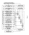
- the system of the present invention comprises an in-vehicle system and a road system, the in-vehicle system comprising an in-vehicle terminal (1), and the road system comprising a traffic control center (2), a traffic information service center (3), a cellular mobile communication system (4), a vehicle traveling assistance system (5), a vehicle management system (6), and a road toll collection system (7).
- the traffic control center (2), the traffic information service center (3), the cellular mobile communication system (4), the vehicle traveling assistance system (5), the vehicle management system (6) and the road toll collection system (7) are interconnected via wired remote digital communication lines.
- the traffic control center (2), the traffic information service center (3), the cellular mobile communication system (4), the vehicle traveling assistance system (5), the vehicle management system (6) and the road toll collection system (7) are connected with the in-vehicle terminal (1) in the manner of wireless digital communication via the cellular mobile communication system (4)
- the traffic control center (2) comprises a computer system with powerful computational processing capability, intelligent traffic system application software and a network storage device.
- the intelligent traffic system application software is supported by powerful database software.
- a GIS road network map system (23) mapping a real road network system is an important tool and operation interface by which the traffic control center (2) maintains traffic order of the district with computer systems.
- a road traffic control system (211) can revise the control rules of any crossing's traffic signal and so on in time via a road signal control system (213), based on the result of the information acquisition for the road conditions of the whole district road network by a traffic information acquisition system (212) and with reference to the data about the navigation service subscription by the user from a vehicle road navigation system (311) and the information provided by the vehicle assistance system (5) and the road toll collection system (7), and then download the revised control rules to road traffic signal control devices via a traffic signal device control network (24).
- it can issue temporary control measures concerning some road crossings or sections, and broadcast the temporary control measures to the vehicles in the associated areas by means of setting information points and via a road condition information supply system (312).
- the road traffic control system (211) is the enforcement system for road network traffic rules, also the formulation system for the road traffic temporary control measures and the database storing the placement positions, the content settings, modifications and temporary changes of every traffic signs in the whole road network system. If the traffic facilities or control rules of any road crossing or section vary, the road traffic control system (211) will record the variation before it is approved to be implemented, and the road condition information supply system (312) will make all the participants of the road traffic know the variation of the facilities or rules at the first time.
- the road traffic control system (211) is further equipped with a high-precision GIS road network map system and route computation software, to undertake the task of the computation of coordinate conversion and traveling path from the traffic information service center (3), the vehicle management system (6), the road toll collection system (7) and the vehicle assistance system (5).
- the traffic information acquisition system (212) collects the traffic road condition information of the whole road network by means of area acquisition method and information point acquisition method.
- the information acquisition can be the data acquisition for the parameters such as road passing traffic volume and vehicle speeds for real-time requirements, and also can be the acquisition of the overall information of the traffic distribution of the whole road network system.
- the acquisition content of traffic information mainly is the acquisition of the present vehicle dynamic information (132), and together with the present vehicle property information (131) if necessary.
- the extracting time in the present vehicle dynamic information (132) is the time when a central processing unit (10) extracts the position coordinates from a GPS module (11).
- the traffic information acquisition system (212) can extract the GPS coordinate precision-adjusted values of the same time from a DGPS unit (214) so as to adjust the position coordinates in the present vehicle dynamic information (132).
- the adjustment precision can be within 1 meter, so as to provide the technical guarantee for the virtual display of the traffic conditions of road crossings or sections very well.
- the center similarly has powerful computation capability, powerful database software and network storage device (34), and also has a call center system interface (35) and interfaces (32), (33), (36) used to communicate with other closely related systems.
- the traffic information service center (3) obtains road condition information and road traffic control information needed by user from the traffic control center (2) and road toll standards from the road toll collection system (7).
- a call center system (313) subordinate to the traffic information service center (3) receives service requests from divers and records these requests into the system, to be processed by the computer system of the traffic information service center (3).
- Traffic information service application software (31) comprises a vehicle road navigation system (311), a road condition information supply system (312) and a call center system (313). It is not necessary to provide route computation software and the GIS road network map system in the traffic information service center (3). This is because the country has strict regulations with regard to the management of high precision electronic maps, so it is necessary to restrict electronic maps with the national defense security level needed by the system to the traffic control center (2). When other related systems request for this kind of data, they can send requests to the computer system of the traffic control center (2).
- the call center system (313) is a service entity for receiving navigation subscription requests in the form of speech or data information from users.
- the navigation subscription requests from users which may be in the form of short message etc., can be submitted to the traffic information service center (3) via the cellular mobile communication system (4).
- the traffic information service center (3) can broadcast the content of the information services in the form of data via the cellular mobile communication system (4) and the additional channel of a traffic broadcast station.
- a mobile switching center (40) will send the information concerning all the information points having been set in the base station service area into which it entered to the in-vehicle terminal (1).
- the information of these information points will be managed in the form of version number.
- the information version number obtained by the present vehicle is sent together with the signaling sent to the base station by the in-vehicle terminal (1) of the vehicle, so as to reduce the repeated transmissions of the information of the information points due to the vehicle repeatedly going in and out of the base station.
- the mobile switching center (40) can issue the information of these information points in the manner of broadcasting the information of the information points to all the vehicles in the present service area immediately or broadcasting to the vehicles entering thereafter according to the instructions of the traffic control center (2).
- Each vehicle is provided with an in-vehicle terminal (1), and has a unique identification number belonging to the cellular mobile communication system (4) as an electronic license plate.
- the present preferred embodiment takes the cellular mobile user number (422) as the electronic license plate of a vehicle.
- the cellular mobile user number (422) also has a payment account in the cellular mobile communication system (4).
- This account can be used to settle charges such as vehicle road tolls, breach penalties and so on in the manner of advance payment or in the manner of monthly settlement as used by common mobile telephone user.
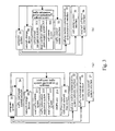
- Fig. 4 is a block diagram showing the structure of the vehicle traveling assistance system (5).
- the vehicle traveling assistance system (5) has similar functions with the traffic information service center (3), and is an entity for providing traffic information services especially for specialized or commercial vehicles.
- the vehicle traveling assistance system (5) comprises a commercial vehicle assistance system (51), an emergency vehicle assistance system (52) and an official vehicle assistance system (53). These systems cover a taxicab assistance system, a freight vehicle assistance system, an ambulance assistance system, and assistance systems for official vehicles, military vehicles and police vehicles.
- Various industries can establish their own industry vehicle assistance systems according to the characteristics of the industries, on the basis of the abundant information resources provided by the traffic control center (2) and the traffic information service center (3) and by means of the tools that can be made public or authorized by the system, and can establish information connection with the traffic control center (2), and invoke system resources under certain privilege with payment or free under the authorization of the traffic control center (2) and the vehicle management system.
- the vehicle traveling assistance system (5) also can invoke the information resources in the system of the traffic information service center (3).
- Fig. 4(b) is a block diagram showing the structure of the vehicle management system (6).
- the vehicle management system (6) is constructed on the basis of an existing vehicle management system (6).
- the system provides vehicle registration information for other systems, and provides the service of query of the relationship between the physical license plate and electronic license plate of a vehicle for the toll collection system (7) etc. under system authorization, and it is also the pursuit execution entity for pursuing vehicles evading fees (taxes and fees such road tolls, road maintenance fees and vehicle and ship taxes, etc.).
- the vehicle management system (6) can manage vehicles and parking lots on the same level, and the key difference between them is the way of naming. Examples of the numbers of vehicles and parking lots in the vehicle management system (6) are as follows: Vehicle Parking lot Physical license plate BJ AE5XXX 1234-JEN Electronic license plate 91012345678 90110123456 Mobile communication user number 91012345678 90110123456 Cellular mobile communication system 5350017370296xx 5350017370296yy
- the computer system identifies the nature of each traffic object based on this kind of difference.
- the computer system determines the object to be a parking lot or other traffic facilities, the content of the property information and dynamic information format common with vehicles will be processed differently.
- the vehicle will be traveling in a concealed state, so that the information of information points that should be downloaded may not be downloaded normally, which will cause toll evasions by the vehicle at road toll stations and information acquisition inaccuracy of the traffic information acquisition system (212). Therefore it must be ensured that electronic license plates of vehicles have the legal management as strict as that of physical license plates.
- the punishment to a vehicle that conceals the electronic license plate is as serious in nature as the punishment to a vehicle that conceals the physical license plate.
- the vehicle management system (6) can monitor the online condition of the electronic license plate of any vehicle by means of the mobile terminal login identification function of the cellular mobile communication system (4). If the in-vehicle terminal (1) of a vehicle is powered off or its cellular communication module (12) fails, the mobile communication system (4) will inform the vehicle management system (6) immediately by means of the function of checking that the user's mobile phone is shut down or out of the service area. When the in-vehicle terminal (1) of the vehicle resumes communication, the mobile communication system (4) will also inform the vehicle management system (6) immediately. As a result, the vehicle management system (6) can know the amount of vehicles in the whole road network in real time and frighten against the behavior of concealing the electronic license plate.
- Fig. 5 is a block diagram showing the structure of the road toll collection system (7).
- the road toll collection system (7) is located in a central station and road toll collection settlement system (701) software is running in its road toll collection computer and software system (70).
- the other parts of the system comprise a wired data communication network special for toll stations (71) connected to the computer system (72) of every toll station, the toll station computer system (72) located in every toll station and the interfaces to other systems (74), (75) and (76).
- the toll stations belonging to different owners have their own toll station computer systems (72), toll station image recognition system devices (721) and toll station image recognition software (722).
- Each toll station captures the pictures of passing vehicles with its self-provided toll station image recognition video camera (723), identifies the physical license plates of the vehicles, and then includes them into an intraday settlement report made by the toll station computer system (72) together with the vehicle passing times, and transmits this report to the road toll collection computer and software system (70) via the wired data communication network special for toll stations (71).
- the road toll collection settlement system (701) is located in the central station.
- the settlement operation can also be entrusted to the cellular mobile communication system (4) to be implemented by its existing user telephone fee settlement system.
- the road toll collection computer and software system (70) store the legal toll standards of all the toll stations.
- the system is an independent financial settlement unit, in charge of inspecting and checking the toll confirmation information sent back by the vehicle when it is passing a toll station and the settlement report sent by the toll station computer system (72). If the toll confirmation information of a vehicle is received and the license plate number and the passing time of the vehicle are also included in the settlement report, the road toll collection computer and software system (70) will send the toll confirmation corresponding to the vehicle to a road toll collection settlement system (701) to perform toll settlement.
- the toll confirmation information sent by a vehicle comprises the current GPS coordinates, the electronic license plate, the traveling direction and the passing time of the vehicle and the code number of the toll station.
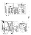
- Fig. 2 is a block diagram showing the structure of an in-vehicle terminal (1) of the present invention.
- Fig. 2(a) shows the complete structure of the in-vehicle terminal (1).
- An in-vehicle terminal (1) with complete structure comprises a central processing unit (10), a GPS module (11), a DGPS module (111), a cellular communication module (12), a FM broadcasting additional channel receiver module (121), a memory (13), a digital-analog speech module (147), an input/output unit (14), a speaker (141), a microphone (142), a display screen (143), a sound/light signal unit (144), a number and function keyboard (145) and an external interface (146).
- a central processing unit (10) a GPS module (11), a DGPS module (111), a cellular communication module (12), a FM broadcasting additional channel receiver module (121), a memory (13), a digital-analog speech module (147), an input/output unit (14),
- Fig. 2(b) shows a simplified in-vehicle terminal (1) of low cost.
- the GPS module (11) receives satellite positioning signals, provides parameters such as position coordinates, traveling speed, and traveling direction and so on, to the present vehicle and creates dynamic information of the present vehicle. After generating the position coordinates, the GPS module (11) outputs them to the central processing unit (10). The coordinates are compared with the sequence of coordinate values and the corresponding effective ranges related to the information of a series of information points in the memory (13) by the central processing unit (10). When the straight line distance between the coordinates of the present vehicle and certain coordinates is less than the value of the effective range, the central processing unit (10) extracts the prompting information of the information point corresponding to these coordinates from the memory (13) and transmits this information to the input/output unit (14) according to its properties.
- the prompting information corresponding to the coordinates is speech information in the form of text
- the prompting information will be played as speech by a speaker (141) after converted by a digital/analog speech module (147); if the prompting information corresponding to the coordinates is of the nature of image, the information will be transmitted to a display screen (143) directly and displayed; and if the prompting information corresponding to the coordinates is of the nature of sound or light signals, the information will be transmitted to a sound/light signal unit (144) and presented.
- the sound/light signal unit (144) gives simple prompting information to drivers in the form of simple sound signals and light flickering in place of speech.
- the external interface (146) can connect with the mobile phone carried by the driver, and also can connect with an external storage or load new data into the memory (13).
- the external interface (146) even can connect with the turning rod of the direction indicator lamps of the vehicle for monitoring the wrong veering operation of the driver and alarming in advance.
- the presupposition is that the vehicle must be traveling under the guidance of navigation road signs.
- All the contents that can be downloaded via the cellular communication module (12) and the FM broadcasting additional channel digital receiver module (121) can be loaded by connecting an external storage to the external interface (146), which can be a way of information initialization of the in-vehicle terminal (1).
- a mobile phone connected via the external interface (146) has the same functions as the number and function keyboard (145). If there is no number and function keyboard (145) equipped on the in-vehicle terminal (1), a mobile phone connected to the in-vehicle terminal (1) can serve as a number and function keyboard (145). But in this case, the driver can set information on the mobile phone and then transmit it into the memory (13) via the external interface (146), hence enabling the driver to set traveling routes by himself.
- the central processing unit (10) When the in-vehicle terminal (1) receives the instruction to return the GPS coordinates of the present vehicle from the traffic control center (2) via the cellular communication module (12), the central processing unit (10) will extract the present vehicle dynamic information (132) according to the time required by the instruction and then create immediately the information frame to be returned to the traffic control center (2) and store it into the memory (13). The in-vehicle terminal (1) will send this information frame back to the traffic control center (2) via the cellular communication module (12) at the first time when it can be sent.
- the in-vehicle terminal (1) further comprises an alarm/alarm clear button.
- the button at least has the function of raising an alarm to the traffic control center (2) and an emergency hospital. Pressing the button again will clear the alarm.
- the alarm is sent together with the information of the GPS coordinates, the physical license plate and the body color of the present vehicle, by which the alarm receiving entity can find the vehicle.
- the signal source for the DGPS (111) can be the digital information broadcasting embedded in the FM broadcasting additional channel.
- the digital information broadcasting can insert the DGPS adjusted coordinate information between the common broadcastings of traffic road condition information.
- the number is one form of the electronic license plate of a vehicle, and is managed and used the same as the physical license plate by the vehicle management system (6).
- the property information (131) and the dynamic information (132) for the present vehicle are stored in the memory (13).
- the present vehicle property information (131) comprises:
- the present vehicle dynamic information (132) comprises:
- the two kinds of information mentioned above compose a five-section information format.
- This format can be used as a standard information format in the road-vehicle communication.
- the traffic control center (2) also can perform unidirectional or bi-directional speech communication directly with the in-vehicle terminal (1) by means of the speaker (141) and the microphone (142) via the cellular communication module (12) and the input/output module (14) under the intervention of the central processing unit (10) and based on instructions.
- the in-vehicle terminal (1) with the anti-robbery feature enabled also allows bi-directional speech communication with the driver registered with the system, monitoring and shouting to stop illegal activities.
- the in-vehicle terminal (1) is equipped with a FM broadcasting additional channel digital receiver module (121), which is used to receive the digital broadcasting information carried on the sideband of the public broadcasting frequency of the local traffic information specialized broadcasting station.
- a FM broadcasting additional channel digital receiver module (121) which is used to receive the digital broadcasting information carried on the sideband of the public broadcasting frequency of the local traffic information specialized broadcasting station.
- the traffic information acquisition of the present invention can be carried out by the area acquisition method and the information point acquisition method.
- the area acquisition method is an instruction for one-off collecting, which is mainly used to acquire the local or overall traffic volume distribution information.
- the area acquisition method mainly includes the double position precision and three stage screening method and its improved methods.
- the double position precision and three stage screening method can be used in an information acquisition area to calculate statistics of the information of the vehicles in the area. And this method is comparatively suitable to be used in the temporary traffic jam investigation and so on.
- the traffic information acquisition system (212) also can adopt an improved double precision and three stage screening method.
- An area of arbitrary shape in which the information acquisition need to be performed is determined in a GIS map mapping a real road network system and is represented in a mathematical form. Then the area represented by the mathematical form is sent to all the vehicles in the service area of the base station and the in-vehicle terminals (1) which have received the mathematical expression of the area are commanded to judge whether the present vehicles are in the area based on the GPS values of the present vehicles. If the present vehicles are in the area, the information of the present vehicles will be sent back, otherwise they will keep silence.
- a rectangular area can be represented by A (x1, y1, z), B (x2, y2, z), C (x3, y3, z), D (x4, y3, z) and the parameters of the expression are linear, the information acquisition area will be reproduced by connecting the four points with straight lines in the above order according to this mathematical expression.
- the direct area method has the advantages of the least feedback vehicles in the cellular service area and the least latter processing. But it has the complicated mathematical expression issued for designating an area and the longest word length of the downloaded information frame.
- the simple direct area method is another improved direct area method, and has more similarities with the information point information acquisition method.
- the acquisition instruction can be stored in the memory (13) permanently and still effective after the vehicle responses only once in a specified time interval. But in the simple direct area method and the above-mentioned area acquisition method, the acquisition instruction need not be stored in the memory (13) and are used only once.
- a pre-selected area with the simplest mathematical form that includes the specified area, such as a pre-selected area of a circular shape that covers the specified area, can be issued in the base station service area covering the target area.
- the definition method of the mathematical expression of the area is the same as that of an information point.
- the pre-selected area should cover the specified area completely.
- the in-vehicle terminals (1) in the pre-selected area send back the present vehicles information, and then the traffic information acquisition system (212) determines which vehicles are in the specified area and further performs processing and statistics for the vehicles in the specified area. That is to say, the specified area is the real information acquisition area required by the system.
- the improved direct area method has the advantages of simple description content of the area issued, less information to send back and less processing in the late stages.
- the information point acquisition method is a kind of acquisition instruction which can be repeated for many times, and is mainly used to monitor the information such as the traveling speed and so on of vehicles passing any crossing or section.
- An information point is a position described by coordinates and their effective range.
- the information point information is an information combination of an information point and the operation of the information point. It is an executive instruction for an in-vehicle terminal (1).
- the central processing unit (10) triggers the operation corresponding to this information point.
- the information point information includes, for example:
- a road sign is a form of information point.
- a series of information points arranged in sequence are needed when the information points are used for vehicle navigation. Therefore the information points used for navigation are called road signs.
- the information content of each road sign is the guidance information for traveling to the next road sign.
- a road sign sequence corresponding to the traveling route is generated. It is directly referred to as a traveling route when used in the GIS application and can be subscribed and downloaded from the traffic information service center (3) by a driver.
- the information content of an information point can be in one of the following exemplary forms:
- the coordinates of all the information points are entered into a data stack, and arranged in the order of the distance between each information point and the vehicle.
- the central processing unit (10) will update the arrangement order of the information point coordinates in the stack periodically.
- the present vehicle is closest to the information point whose coordinates are pointed to by the stack pointer.
- a traffic control person specifies an outline of the crossing or the section with a width of road width and a specified length according to the direction of the curb of the crossing or the section on the interface displaying the GIS road network map, so as to form a closed line figure represented as the top view of the outline of the crossing or the section.
- This closed line figure is the specified information acquisition area.
- an instruction associated with information acquisition is sent out via the base station whose service area covers the real crossing or section, and received by the in-vehicle terminals (1) of all the vehicles in the service area of the base station.
- a piece of time information can be included in the instruction to request the in-vehicle terminals (1) of all the vehicles which have received the instruction to extract the present vehicles information at the time specified by the instruction and send it back to the traffic control center (2).
- the instruction format for the direct area method can be exemplified as follows (the area is presented by a hollow cross-shaped line figure of a crossing):
- This mode is very suitable for grasping the jam condition or evaluating the influence of emergencies on the traffic before traffic policemen arrive.
- the traffic control center (2) will process the returned information mentioned above as follows:
- Another way of traffic information acquisition is to set an information acquisition point at a traffic information sensitive position at the specified crossing or section on the GIS road network map.
- An information acquisition point is also a form of application of information points.
- a vehicle When a vehicle is passing an area with a radius of no less than half of the road width and a circle center coordinates of (xxxx, yyyy), the information operation at the point downloaded to the in-vehicle terminal (1) in advance is triggered.
- the central processing unit (10) of the in-vehicle terminal (1) creates return information and sends it back to the traffic control center (2) according to the operation content of the information point immediately.
- the format of the information acquisition point can be exemplified as follows:
- the traffic control center (2) can know the passing speed of the vehicles at a specified position at the crossing or the section after receiving the information frame. In a similar way, all the information that can be provided by an in-vehicle terminal (1) can be acquired.
- the positions of the information acquisition points can be changed arbitrarily without any additional construction cost incurred by means of the base station facilities of the cellular mobile communication system (4), and many types of information can be collected. Any information that can be provided by an in-vehicle terminal (1) may be collected by means of the present method and the area acquisition method.
- the traffic information acquisition system (212) can send in advance the request to acquire all the road condition information of the whole road network at several specified acquisition times in a day to the memory (13) of each in-vehicle terminal (1).
- the in-vehicle terminal (1) extracts the present vehicle information at a specified time, makes the information into an information frame and pre-stores it into the memory (13).
- the communication service of the cellular mobile communication system (4) is in idleness, the information returning process of all the information frames pre-stored in all the in-vehicle terminals (1) is activated by the traffic control center (2).
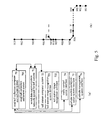
- Fig. 6 is a schematic diagram showing a specific application of the present invention.
- Fig. 6 shows a part of a road network system, wherein the driver of a vehicle (V) uses a mobile phone carried by him to report the information of subscribing navigation service by the present vehicle to the vehicle road navigation system (311) of the traffic information service center (3), and the information includes:
- the traffic information service center (3) selects several calculated routes as pre-selected routes according to the report of the driver and performs information retrieval about the crossings or sections related to each pre-selected route. The results of the information retrievals are attached to the pre-selected routes as route properties and downloaded to the in-vehicle terminal (1). The driver then determines one of the pre-selected routes as an executive traveling route according to the route properties, and the in-vehicle terminal (1) sends the number of the executive traveling route back to the vehicle road navigation system (311).
- This traveling route consists of a series of road signs. These road signs will be displayed on a display screen with text format as follows: Crossing Direction C1 turn left C2 turn right ... ... C5 Go straight C6 Go straight
- the whole property of this route can be described as: 4 Km, 18 min; effective period of time 16:23-15:00; six crossings, one turning left, one turning right;
- a jam occurs at the crossing (C6) due to a traffic accident after the vehicle (V) sets out according to the selected traveling route.
- the traffic control center (2) then broadcasts this road condition information to the circumjacent base stations including the base station (453) of the service area (414) of the base station (454) in which the crossing lies. Since the boundary (443) is so close to the crossing (C6), the base station (452) is also included in the downloading scope.
- the broadcasting content corresponding to the road condition information of the crossing (C6) issued by the traffic control center (2) is stored at the entry of the base station (452) in the mobile switching center (40) in advance. After the vehicle (V) logging in the base station (452), the mobile switching center (40) will download the road condition information to the in-vehicle terminal (1) of the vehicle (V) via the base station (452).
- the vehicle road navigation system (311) retrieves the issued navigation routes via a wired communication line connected with the traffic control center (2) immediately after receiving the road condition information associated with the crossing (C6).
- the navigation routes that contain the crossing (6) are selected and the mobile communication system user numbers (422) of the in-vehicle terminals (1) that have subscribed these navigation routes are extracted at the same time.
- the road condition information is sent to the in-vehicle terminals (1) represented by these mobile communication system user numbers (422), so that the drivers are informed with speech, and a suggestion for changing the traveling routes can be provided to the vehicles (v).
- the suggested detour route that is downloaded can be as follows: Number of road sign Effective range Prompting information 914 16 meters turn right at the crossing 40 meters ahead 915 12 meters turn right at the present crossing 916 12 meters finish turning ... ... ...
- the new traveling route will be inserted following the road sign (908), so as to guide the vehicle (V) along the new route from a duplex crossing to the destination (E). If the driver agrees to the detour solution, he/she can press the key of "#" on the number and function keyboard (145) of the in-vehicle terminal (1), the detour route then will be inserted into the original traveling route and the road signs after the road sign (909) are invalidated.
- the effective range of the road sign (905) is 16 meters, and is represented by the scope of a fine line circle.
- the in-vehicle terminal (1) will believe that the vehicle (V) has got to the road sign (905) and output the prompting information of the road sign 905 immediately.
- a coach has a rear-end collision with a car ahead at the crossing (C6).
- the in-vehicle terminals (1) of both vehicles send alarms within 10 seconds to the drivers respectively, and store the information such as the traveling coordinates and speed during the 15 seconds before the alarm at the same time. Simultaneously, the in-vehicle terminals (1) prompt the drivers to confirm whether or not to clear the alarms to the traffic control center (2) and an emergency hospital. If the drivers themselves are not wounded in the accident, only the handling by the traffic control center (2) is needed without that of the emergency hospital, so the drivers can merely clear the alarm to the emergency hospital respectively and wait for the handling of the traffic control center (2).
- the traffic control center (2) will start the communication with the in-vehicle terminal of the front vehicle immediately after receiving the alarms of the two vehicles, and have a talk with the driver of the front vehicle via the microphone (142) to confirm the occurrence of the accident. Then the traffic control center (2) immediately informs traffic policemen nearby to go to handle it.
- the traffic control center (2) also invokes the information of the in-vehicles terminals (1) of the two vehicles stored before the alarm as evidences for handling the accident later, and displays the top view of the models and the position relationship of the two vehicles on a large screen according to the coordinates returned by the vehicles after adjustment by the DGPS unit (214), finding a partial overlapping between the front end and the rear end of the vehicle outlines. Then it will confirm whether the undercarriage and the engine of the rear vehicle is in the overlapping and whether the engine of the front vehicle is rear positioned based on the overlapping degree and the model data further invoked, in order to judge whether the front and rear vehicles can leave the accident location by themselves, and then determine whether or not to dispatch a tractor after talking with the drivers for confirmation. Subsequently, the traffic control center (2) will set the simple area acquisition method at the crossing (C6) to evaluate the jam scale due to the accident.
- a coordinate (81) is set at the center of the crossing (C6) to define a scope for information acquisition with a radius of 500 meters.
- the vehicles within this area will send the property information (131) and the dynamic information (132) of them to the traffic control center (2) immediately.
- the traffic control center (2) selects all the vehicles at the crossing (C6) road surface according to the real plane shape of the crossing (C6) and the coordinates of each vehicle after adjustment by the DGPS unit (214), invokes the model of each vehicle based on the present vehicle property information (131) and displays the virtual three-dimensional image of the crossing (C6) in the large screen of the traffic control center (2).
- An information point (83) with an effective range of 50 meters is set at the crossing (C3) by the traffic control center (2), as shown in Fig. 6.
- the set content of the information point is for investigation of the traffic flow volume of a road section, which is: 1. X83, Y83, #; coordinates of information point 2. 15 (meter) effective range of information point 3.
- B (returning information) triggered operation action type of information point 4.
- the vehicles (V1), (V2) return the respective vehicle dynamic information according to the requirement of the information point, which is: Vehicle (VI): 1. Xv1, Yv1 position 2. 60(km/h) traveling speed 3. 179.5° direction 4. 10:00:00/04/13/2008 time 5.
- Vehicle (VI) 1. Xv1, Yv1 position 2. 60(km/h) traveling speed 3. 179.5° direction 4. 10:00:00/04/13/2008 time 5.
- VSVW03 Volkswagen 03) model code
- Vehicle (V2) 1. Xv2, Yv2 position 2. 57(km/h) traveling speed 3. 180.5° direction 4. 10:00:01/04/13/2008 time 5.
- VSAD02 (Audi 02) model code
- the set content of the information point (83) has been downloaded into the in-vehicle terminals (1) of the passing vehicles via the base station (452) and the adjacent base stations (453) and (451) in advance.
- a rectangle traffic information acquisition area (D) is set on the unidirectional carriageway between the crossing (C4) and the crossing (C5).
- the information of the vehicles possibly traveling to the crossing (C6) can be extracted by the double position precision and three stage screening method, and an emergency advance warning can be sent to these vehicles according to the extracted electronic license plates of the vehicles.
- the traffic control center (2) further sets an information acquisition area D0 using a complicated form of the direct area method at the crossing (C1).
- the mathematical description of the information acquisition area is downloaded into the in-vehicle terminal (1) of the vehicle (3) as an information acquisition instruction via the base station (451) or (452).
- the present vehicle property information (131) and the dynamic information of the vehicle (V3) are transmitted to the traffic control center (2). Because of the laws and regulations for privacy protection, the traffic control center (2) does not extract the physical license plate of the vehicle.
- the traffic control center (2) finds that the vehicle (V3) is a heavy truck forbidden to travel in this area at this period of time from the vehicle model code within the present vehicle property information (131) of the vehicle (3), and then reports it to the vehicle management system (6) according to its electronic license plate. Then the vehicle management system (6) queries for the physical license plate of the vehicle and records the event into the breach record of the vehicle.
- the vehicle (V4) shown in Fig. 6 is also a heavy truck. It has downloaded the traffic sign information group of the area from the base station (453) when it entered the service area (413) of the base station (453). When the vehicle (V4) reaches the crossing (C4), it has passed the information point (82), which has an effective range with a radius of 10 meters.
- the in-vehicle terminal (1) prompts "No right-turn at this crossing for heavy vehicles", so as to remind the driver of the vehicle (V4) to avoid the breach of regulation.
- the passing vehicles can be prompted to abide the regulations for temporary traffic control by means of the information point information.
- the information point information triggered by the vehicle (V4) is in the form as follows:
- the format of the information point information can be as follows: 1. X82, Y82, 282 coordinates of information point; 2. 10 (meter) effective range of information point; 3. Ii triggered operation type of information point; 4. "No right-turn at this crossing for heavy vehicles" information content of information point; 5. (heavy truck) parameter content of Ii instruction.
- Ii is an individualized information service instruction with a parameter specifically referring to heavy trucks. As a result, the information will not be triggered when a car is passing.
- the central processing unit (10) extracts the electronic license plate of the present vehicle and compares it with that in the instruction parameter according to the instruction, so as to determine whether or not to play the information content of the information point.
- the traffic control center (2) can download in advance the content specified by the overall information acquisition method in the form of instruction to the in-vehicle terminals (1) of all the vehicles registered with the vehicle management system (6).
- the form of the instruction can use the format of the information point information.
- the format of the instruction can be exemplified as follows: 1. blank coordinates of information point; 2. blank effective range of information point; 3. BS triggered operation type of information point; 4. D information content of information point; 5. 8,9,10 operation time of content of information point.
- the coordinates and the effective range of the information point are blank, suggesting to the in-vehicle terminals (1) that the instruction may belong to the overall information acquisition.
- the type of the triggered operation further points out that the returning information belongs to the form of "storage return (represented by BS) of the overall information acquisition.
- the time of information acquisition is specified to be at 8 o'clock, 9 o'clock and 10 o'clock of the day. Once the acquisition time comes, the in-vehicle terminal (1) extracts the specified present vehicle dynamic information (132) and stores it into the memory (13).
- a virtual reality scene of the part of road shown in Fig. 6 can be displayed in a large-scale screen after processed by the traffic control center (2). It will be the situation shown in Fig. 7, if the traffic road condition information is extracted at 10 o'clock.
- Fig. 8 shows the process of toll collection without vehicle stopping implemented by a toll station adopting the present preferred embodiment.
- An open highway toll station (S) is located in the service area of the base station (45).
- the antenna of the base station is located on the building near the gate of the toll station.
- the service area of the base station has a radius of 1 km, so it will take 25 seconds for a vehicle with a speed of 140 km/h to travel from the edge of the service area to the toll station midline (73).
- the vehicle flow volume of the toll station is assumed to be 8 vehicles per second for one direction, and in case of four lanes, the average distance between two adjacent vehicles is 39 meters, the time interval between two adjacent vehicles is one second.
- the vehicle (V5) has downloaded the information associated with the toll station when it is passing the boundary (44) between the service areas of the base station (45) and the adjacent base station.
- the information associated with the toll station includes information acquisition areas (D1) and (D2) located on either side of the toll station respectively on a unidirectional lane, information point information for prompting (8) and information on the toll standard of the toll station.
- the shapes of the information acquisition area before toll station (D1) and the information acquisition area after toll station (D2) are corresponding to the plane shape of the highway on either side of the toll station respectively, and are spread on one side of the highway midline and on either side of the toll station midline (73) respectively.
- the central processing unit (10) starts the process of toll collection and records the time when the vehicle (V5) reached the area (D1).
- the time when the vehicle reaches the information acquisition area after toll station (D2) is at least one second later than the time when it passed the area (D1).
- the in-vehicle terminal (1) will record the time when the vehicle passed the area (D2) and can display the prompting information "confirm a toll of 15 yuan" on selection.
- the in-vehicle terminal thereby determines the current position of the vehicle (V5) has passed the toll station midline (73), and sends out a short message for toll confirmation to the road toll collection settlement system (701).
- the toll station image recognition system device (721) located in the toll station captures the images of the front and the rear of the vehicle (V5) and identifies the license plate of the vehicle in one second.
- the toll station computer system (72) creates a toll report based on the information on the vehicle license plate and transmits it to the road toll collection settlement system (701) via the wired data communication line special for the toll station (71).
- the road toll collection settlement system (701) retrieves the physical license plate of the vehicle in the vehicle management system (6) based on the mobile communication system user number (422) of the cellular communication module (12) of the vehicle via the wired data communication line (466), and checks the information for the physical license plate of the vehicle in the toll report, and then records the toll of 15 yuan in the mobile communication system user payment account of the vehicle.
- the user of the vehicle can pay the road toll in the manner of advance payment or monthly settlement.
Landscapes
- Physics & Mathematics (AREA)
- General Physics & Mathematics (AREA)
- Engineering & Computer Science (AREA)
- Radar, Positioning & Navigation (AREA)
- Remote Sensing (AREA)
- Atmospheric Sciences (AREA)
- Life Sciences & Earth Sciences (AREA)
- Mathematical Physics (AREA)
- Computer Networks & Wireless Communication (AREA)
- Business, Economics & Management (AREA)
- Finance (AREA)
- Traffic Control Systems (AREA)
- Devices For Checking Fares Or Tickets At Control Points (AREA)
- Navigation (AREA)
- Mobile Radio Communication Systems (AREA)
Applications Claiming Priority (3)
| Application Number | Priority Date | Filing Date | Title |
|---|---|---|---|
| CN02148610A CN1417755A (zh) | 2002-11-18 | 2002-11-18 | 功能完善且架构简易的智能交通系统体系 |
| CN02148610 | 2002-11-18 | ||
| PCT/CN2003/000978 WO2004047044A1 (en) | 2002-11-18 | 2003-11-18 | Intelligent traffic system |
Publications (2)
| Publication Number | Publication Date |
|---|---|
| EP1580707A1 true EP1580707A1 (de) | 2005-09-28 |
| EP1580707A4 EP1580707A4 (de) | 2006-07-26 |
Family
ID=4751502
Family Applications (1)
| Application Number | Title | Priority Date | Filing Date |
|---|---|---|---|
| EP03811329A Withdrawn EP1580707A4 (de) | 2002-11-18 | 2003-11-18 | Intelligentes verkehrssystem |
Country Status (6)
| Country | Link |
|---|---|
| US (1) | US20060142933A1 (de) |
| EP (1) | EP1580707A4 (de) |
| JP (1) | JP2006506715A (de) |
| CN (5) | CN1417755A (de) |
| AU (1) | AU2003302051A1 (de) |
| WO (1) | WO2004047044A1 (de) |
Cited By (4)
| Publication number | Priority date | Publication date | Assignee | Title |
|---|---|---|---|---|
| CN102610122A (zh) * | 2012-02-28 | 2012-07-25 | 惠州Tcl移动通信有限公司 | 一种车位发布系统 |
| US8456274B2 (en) | 2006-10-05 | 2013-06-04 | Andrea Modiano | Systems and methods for automated wireless authorization for entry into a geographic area |
| TWI502558B (zh) * | 2013-09-25 | 2015-10-01 | Chunghwa Telecom Co Ltd | Traffic Accident Monitoring and Tracking System |
| EP3093828A1 (de) * | 2015-05-12 | 2016-11-16 | HERE Global B.V. | Dynamische mehrspurenkapazitätsoptimierung in einer gemischten fahrzeugumgebung |
Families Citing this family (139)
| Publication number | Priority date | Publication date | Assignee | Title |
|---|---|---|---|---|
| CN100385468C (zh) * | 2004-02-18 | 2008-04-30 | 中华电信股份有限公司 | 智能型交通运输管理系统及其管理方法 |
| JP3809171B2 (ja) * | 2004-04-22 | 2006-08-16 | 松下電器産業株式会社 | 道路交通情報通信システム及び道路交通情報通信方法 |
| US20050288827A1 (en) * | 2004-06-24 | 2005-12-29 | General Motors Corporation | Method and system for providing customer configuration of upload data sets in telematics systems |
| US20060038812A1 (en) * | 2004-08-03 | 2006-02-23 | Warn David R | System and method for controlling a three dimensional morphable model |
| US9178940B2 (en) | 2005-04-12 | 2015-11-03 | Tiversa Ip, Inc. | System and method for detecting peer-to-peer network software |
| TWI258719B (en) * | 2005-05-02 | 2006-07-21 | Mitac Int Corp | Driving route planning system and method |
| CA2636507C (en) | 2006-01-09 | 2015-03-03 | Benjamin P. Robinson | Billing a rented third party transport including an on-board unit |
| US7831379B2 (en) * | 2006-02-17 | 2010-11-09 | Lear Corporation | Roadside signage control from vehicle operating data |
| CN100461228C (zh) * | 2006-09-20 | 2009-02-11 | 烟台麦特电子有限公司 | 一种基于gprs的交通路况采集发布方法 |
| CN101197077B (zh) * | 2006-12-07 | 2010-05-12 | 厦门雅迅网络股份有限公司 | 一种汽车行驶路线分析、统计方法 |
| CN101210958B (zh) * | 2006-12-29 | 2011-11-02 | 环旭电子股份有限公司 | 无线导航测试方法 |
| GB0708720D0 (en) | 2007-05-04 | 2007-06-13 | Nxp Bv | Road toll system likning on baord unit with vehicle |
| US7447588B1 (en) * | 2007-07-16 | 2008-11-04 | Wenshine Technology Ltd. | Method and system for partitioning a continental roadway network for an intelligent vehicle highway system |
| CN101398972B (zh) * | 2007-09-30 | 2011-11-23 | 厦门雅迅网络股份有限公司 | 一种使用gps技术进行汽车班次管理的方法 |
| US20090093952A1 (en) * | 2007-10-03 | 2009-04-09 | Lassiter Sr James C | National Radio Network for Ground Vehicle Traffic Management |
| KR20090071077A (ko) * | 2007-12-27 | 2009-07-01 | 엘지전자 주식회사 | 네비게이션 장치 및 이의 턴 지점 정보 제공방법 |
| CN101520946B (zh) * | 2008-02-29 | 2010-10-13 | 厦门雅迅网络股份有限公司 | 城市公交动态线路规划方法 |
| CN105445754A (zh) * | 2008-03-07 | 2016-03-30 | 沈玮仑 | 与gps设备进行通讯的设备与方法 |
| US20090325539A1 (en) * | 2008-06-25 | 2009-12-31 | Ajay Malik | Cell Phone Sensor Applications |
| CN101324438B (zh) * | 2008-07-01 | 2011-01-26 | 深圳市凯立德计算机系统技术有限公司 | 停车位置记录装置、导航系统及其使用的停车位置记录方法 |
| CN101751700B (zh) * | 2008-12-10 | 2012-11-14 | 中兴通讯股份有限公司 | 一种并行交易的电子收费系统及方法 |
| US8269652B2 (en) * | 2009-04-02 | 2012-09-18 | GM Global Technology Operations LLC | Vehicle-to-vehicle communicator on full-windshield head-up display |
| US10706373B2 (en) * | 2011-06-03 | 2020-07-07 | Apple Inc. | Performing actions associated with task items that represent tasks to perform |
| CN101697251B (zh) * | 2009-10-12 | 2012-05-23 | 骆勇强 | 全国性机动车智能动态管理网络系统 |
| US8666643B2 (en) | 2010-02-01 | 2014-03-04 | Miovision Technologies Incorporated | System and method for modeling and optimizing the performance of transportation networks |
| US8570189B1 (en) | 2010-05-10 | 2013-10-29 | Eric Casebolt | Multifunction traffic control and information system |
| US11568772B2 (en) * | 2010-05-27 | 2023-01-31 | Neville Boston | Method and system for rendering content on the exterior of a vehicle |
| US9663028B2 (en) | 2010-05-27 | 2017-05-30 | Frederick Hayle Parkes | Method and system for rendering content on the exterior of a vehicle |
| US9007193B2 (en) | 2010-05-27 | 2015-04-14 | Revivermx, Inc. | Method and system for rendering content on the exterior of a vehicle |
| WO2012009620A1 (en) * | 2010-07-16 | 2012-01-19 | Carnegie Mellon University | Methods and systems for coordinating vehicular traffic using in-vehicle virtual traffic control signals enabled by vehicle-to-vehicle communications |
| JP5083388B2 (ja) * | 2010-07-29 | 2012-11-28 | トヨタ自動車株式会社 | 交通制御システムおよび交通管制システム |
| US9014911B2 (en) | 2011-11-16 | 2015-04-21 | Flextronics Ap, Llc | Street side sensors |
| KR101283126B1 (ko) * | 2010-11-22 | 2013-07-17 | 현대자동차주식회사 | 통행요금정보 통신 및 경로 안내 시스템, 및 이를 이용한 통행요금정보 통신 및 경로 안내 방법 |
| CN102592324A (zh) * | 2011-02-23 | 2012-07-18 | 陈伟明 | 一种车辆智能管理系统和管理方法 |
| AU2012225135C1 (en) * | 2011-03-07 | 2016-06-16 | Intelligent Imaging Systems, Inc. | Vehicle traffic and vehicle related transaction control system |
| CN102157063A (zh) * | 2011-05-17 | 2011-08-17 | 北京工业大学 | 基于车载gps的泛在化交通检测系统及方法 |
| US10057736B2 (en) | 2011-06-03 | 2018-08-21 | Apple Inc. | Active transport based notifications |
| US12431023B2 (en) | 2011-06-29 | 2025-09-30 | Revivermx, Inc. | System and method for rendering content on a vehicle |
| US8996226B1 (en) * | 2011-07-12 | 2015-03-31 | Google Inc. | Intersection completer |
| CN102426802B (zh) * | 2011-08-30 | 2013-12-04 | 浙江工业大学 | 一种基于车联网环境下公交车在公交站点安全预警方法 |
| CN102509365A (zh) * | 2011-11-17 | 2012-06-20 | 中国联合网络通信集团有限公司 | 车辆拥堵收费方法、装置和系统 |
| NZ605569A (en) | 2012-02-02 | 2013-04-26 | Kapsch Trafficcom Ag | Factor VIII Formulations |
| US9058703B2 (en) * | 2012-03-14 | 2015-06-16 | Flextronics Ap, Llc | Shared navigational information between vehicles |
| CN102645221B (zh) * | 2012-03-26 | 2015-09-16 | 北京华虎兄弟科技有限公司 | 定位装置及其使用方法 |
| WO2013153890A1 (ja) * | 2012-04-12 | 2013-10-17 | オムロン株式会社 | デバイス管理装置及びデバイス検索方法 |
| US8933776B2 (en) * | 2012-07-20 | 2015-01-13 | Qualcomm Incorporated | Relative positioning applications in wireless devices |
| US9576486B2 (en) | 2012-09-11 | 2017-02-21 | Telefonaktiebolaget Lm Ericsson (Publ) | Virtual parking management |
| CN102881153A (zh) * | 2012-09-24 | 2013-01-16 | 青岛海信网络科技股份有限公司 | 稽查非法运营车辆的方法和系统 |
| CN103050013B (zh) * | 2012-11-29 | 2015-10-14 | 江苏鸿信系统集成有限公司 | 基于车联网技术的车辆分级限速监控方法及其装置 |
| KR101409851B1 (ko) | 2012-12-27 | 2014-06-19 | 전자부품연구원 | 카메라를 이용한 도로 정보 제공 장치 및 방법 |
| ES2491990B1 (es) * | 2013-03-07 | 2015-06-22 | Enrique URRUTIA PELETIER | Sistema de control y gestión basado en el tránsito de dispositivos electrónicos (GPS, etc) en recintos georreferenciados que representan espacios. Aplicaciones varias |
| US10679429B2 (en) | 2013-03-11 | 2020-06-09 | Aetolls, Llc | Toll payment collection with communication device |
| US9536427B2 (en) | 2013-03-15 | 2017-01-03 | Carnegie Mellon University | Methods and software for managing vehicle priority in a self-organizing traffic control system |
| CN104077331A (zh) * | 2013-03-29 | 2014-10-01 | 上海城际互通通信有限公司 | 一种基于移动通信网络的交通分析系统及其实现方法 |
| CN104428826B (zh) * | 2013-04-15 | 2017-05-17 | 自动连接控股有限责任公司 | 用于车辆交通的自动化控制的中央网络 |
| CN103426204A (zh) * | 2013-07-31 | 2013-12-04 | 常柏灵 | 世界通用的公路或桥梁或隧道不停车自动收费技术方法 |
| CN103500508B (zh) * | 2013-10-12 | 2016-05-11 | 大连联达科技有限公司 | 一种智能交通系统 |
| TWI536330B (zh) * | 2013-11-14 | 2016-06-01 | 動聯國際股份有限公司 | 停車管理系統與燈源裝置 |
| CN103745612A (zh) * | 2014-01-13 | 2014-04-23 | 浙江宇视科技有限公司 | 一种车载终端及与之实时交互的智能交通管理装置 |
| CN104851137B (zh) * | 2014-02-17 | 2017-08-15 | 中国电信股份有限公司 | 道路关卡电子管理方法与系统 |
| CN103956069B (zh) * | 2014-04-29 | 2016-09-14 | 张崎 | 一种车载交通信息自主采集服务系统 |
| CN104269053A (zh) * | 2014-08-29 | 2015-01-07 | 陈业军 | 一种智能交通系统、方法及智能汽车 |
| US9558666B2 (en) * | 2014-12-02 | 2017-01-31 | Robert Bosch Gmbh | Collision avoidance in traffic crossings using radar sensors |
| US20160189067A1 (en) * | 2014-12-31 | 2016-06-30 | The City And County Of San Francisco | Application-based commercial ground transportation management system |
| US9928741B2 (en) * | 2015-02-04 | 2018-03-27 | Here Global B.V. | Traffic adjustment for variable network state |
| JP6062473B2 (ja) * | 2015-03-17 | 2017-01-18 | 本田技研工業株式会社 | 道路標識判断装置及び道路標識判断方法 |
| WO2016203506A1 (ja) * | 2015-06-15 | 2016-12-22 | 三菱電機株式会社 | 経路案内装置及び経路案内方法 |
| CN105139463B (zh) * | 2015-09-01 | 2016-09-28 | 罗毅青 | 一种大数据城市道路定价方法及系统 |
| CN105070072A (zh) * | 2015-09-07 | 2015-11-18 | 吴江智远信息科技发展有限公司 | 一种基于机器视觉的智能交通灯控制系统 |
| CN105245847A (zh) * | 2015-10-14 | 2016-01-13 | 周兴波 | 监控和服务方法及站台服务器和站台终端 |
| US10692126B2 (en) | 2015-11-17 | 2020-06-23 | Nio Usa, Inc. | Network-based system for selling and servicing cars |
| CN105390027B (zh) * | 2015-11-19 | 2019-01-15 | 浙江宇视科技有限公司 | 一种道路安全监控预警设备及方法 |
| CN105405300B (zh) * | 2015-12-18 | 2018-01-16 | 深圳市航盛电子股份有限公司 | 一种智能路况系统及其方法 |
| CN105469610A (zh) * | 2015-12-31 | 2016-04-06 | 清华大学苏州汽车研究院(吴江) | 一种基于实时数据交互的高速公路智能obu装置 |
| CN105717939B (zh) * | 2016-01-20 | 2018-10-02 | 李万鸿 | 一种支持汽车无人自动驾驶的道路路面的信息化和网络化实施方法 |
| JP6525904B2 (ja) * | 2016-03-09 | 2019-06-05 | 三菱電機株式会社 | 車両捜索システム |
| CN106012886A (zh) * | 2016-06-08 | 2016-10-12 | 程德龙 | 一种行使车辆可识别的地标线及其交通安全智能监管系统 |
| US20180012197A1 (en) | 2016-07-07 | 2018-01-11 | NextEv USA, Inc. | Battery exchange licensing program based on state of charge of battery pack |
| FR3053948B1 (fr) * | 2016-07-12 | 2018-07-20 | Peugeot Citroen Automobiles Sa | Procede d'assistance d'un conducteur d'un vehicule en fonction d'informations fournies par un vehicule pilote, et dispositif associe |
| US9928734B2 (en) | 2016-08-02 | 2018-03-27 | Nio Usa, Inc. | Vehicle-to-pedestrian communication systems |
| CN106384512B (zh) * | 2016-08-30 | 2018-02-02 | 盯盯拍(深圳)技术股份有限公司 | 车辆违章信息查询方法以及系统 |
| US11024160B2 (en) | 2016-11-07 | 2021-06-01 | Nio Usa, Inc. | Feedback performance control and tracking |
| US10694357B2 (en) | 2016-11-11 | 2020-06-23 | Nio Usa, Inc. | Using vehicle sensor data to monitor pedestrian health |
| US10410064B2 (en) | 2016-11-11 | 2019-09-10 | Nio Usa, Inc. | System for tracking and identifying vehicles and pedestrians |
| US10708547B2 (en) | 2016-11-11 | 2020-07-07 | Nio Usa, Inc. | Using vehicle sensor data to monitor environmental and geologic conditions |
| US10699305B2 (en) | 2016-11-21 | 2020-06-30 | Nio Usa, Inc. | Smart refill assistant for electric vehicles |
| US10249104B2 (en) | 2016-12-06 | 2019-04-02 | Nio Usa, Inc. | Lease observation and event recording |
| CA3049246A1 (en) | 2017-01-05 | 2018-07-12 | Revivermx, Inc. | Thermal control system for a digital license plate |
| EP3565745A4 (de) | 2017-01-05 | 2020-12-30 | Revivermx, Inc. | Leistungs- und kommunikationsmodi für digitales kennzeichenschild |
| JP6968891B2 (ja) | 2017-01-05 | 2021-11-17 | リバイバーエムエックス, インク.Revivermx, Inc. | 盗難防止システムを有するデジタルナンバープレートシステム |
| US10380886B2 (en) | 2017-05-17 | 2019-08-13 | Cavh Llc | Connected automated vehicle highway systems and methods |
| US10252717B2 (en) | 2017-01-10 | 2019-04-09 | Toyota Jidosha Kabushiki Kaisha | Vehicular mitigation system based on wireless vehicle data |
| US10074223B2 (en) | 2017-01-13 | 2018-09-11 | Nio Usa, Inc. | Secured vehicle for user use only |
| US9984572B1 (en) | 2017-01-16 | 2018-05-29 | Nio Usa, Inc. | Method and system for sharing parking space availability among autonomous vehicles |
| US10471829B2 (en) | 2017-01-16 | 2019-11-12 | Nio Usa, Inc. | Self-destruct zone and autonomous vehicle navigation |
| US10031521B1 (en) | 2017-01-16 | 2018-07-24 | Nio Usa, Inc. | Method and system for using weather information in operation of autonomous vehicles |
| US10286915B2 (en) | 2017-01-17 | 2019-05-14 | Nio Usa, Inc. | Machine learning for personalized driving |
| US10464530B2 (en) | 2017-01-17 | 2019-11-05 | Nio Usa, Inc. | Voice biometric pre-purchase enrollment for autonomous vehicles |
| US10897469B2 (en) | 2017-02-02 | 2021-01-19 | Nio Usa, Inc. | System and method for firewalls between vehicle networks |
| CN106781589A (zh) * | 2017-03-02 | 2017-05-31 | 西安培华学院 | 一种机动车十字路口交通信息播报装置与方法 |
| US10692365B2 (en) | 2017-06-20 | 2020-06-23 | Cavh Llc | Intelligent road infrastructure system (IRIS): systems and methods |
| US11735035B2 (en) | 2017-05-17 | 2023-08-22 | Cavh Llc | Autonomous vehicle and cloud control (AVCC) system with roadside unit (RSU) network |
| CN107154157A (zh) * | 2017-06-14 | 2017-09-12 | 泉州市联控自动化科技有限公司 | 一种交通要道路口智能分流疏导系统 |
| CN107134037A (zh) * | 2017-06-22 | 2017-09-05 | 内江亿橙网络科技有限公司 | 一种移动智能生活车位锁云服务控制系统 |
| US10234302B2 (en) | 2017-06-27 | 2019-03-19 | Nio Usa, Inc. | Adaptive route and motion planning based on learned external and internal vehicle environment |
| US10710633B2 (en) | 2017-07-14 | 2020-07-14 | Nio Usa, Inc. | Control of complex parking maneuvers and autonomous fuel replenishment of driverless vehicles |
| US10369974B2 (en) | 2017-07-14 | 2019-08-06 | Nio Usa, Inc. | Control and coordination of driverless fuel replenishment for autonomous vehicles |
| US10837790B2 (en) | 2017-08-01 | 2020-11-17 | Nio Usa, Inc. | Productive and accident-free driving modes for a vehicle |
| CN107393297A (zh) * | 2017-08-17 | 2017-11-24 | 烟台市公路管理局 | 基于即时通讯工具的道路救援系统及方法 |
| US10635109B2 (en) | 2017-10-17 | 2020-04-28 | Nio Usa, Inc. | Vehicle path-planner monitor and controller |
| US10935978B2 (en) | 2017-10-30 | 2021-03-02 | Nio Usa, Inc. | Vehicle self-localization using particle filters and visual odometry |
| KR102429497B1 (ko) * | 2017-10-30 | 2022-08-05 | 현대자동차주식회사 | 모바일 기기 연동 기반 차량 경로 제공 장치, 그를 포함한 시스템 및 그 방법 |
| US10606274B2 (en) | 2017-10-30 | 2020-03-31 | Nio Usa, Inc. | Visual place recognition based self-localization for autonomous vehicles |
| US10717412B2 (en) | 2017-11-13 | 2020-07-21 | Nio Usa, Inc. | System and method for controlling a vehicle using secondary access methods |
| CN107993442A (zh) * | 2018-01-04 | 2018-05-04 | 山东华夏高科信息股份有限公司 | 一种gis路况疏堵研判调度系统 |
| CN108806259B (zh) * | 2018-01-15 | 2021-02-12 | 江苏壹鼎崮机电科技有限公司 | 基于bim的交通管制模型构建及标注方法 |
| US10867512B2 (en) | 2018-02-06 | 2020-12-15 | Cavh Llc | Intelligent road infrastructure system (IRIS): systems and methods |
| CN108597213B (zh) * | 2018-03-14 | 2021-08-31 | 斑马网络技术有限公司 | 用于车辆的交通标识立体显示方法及其系统 |
| CN108876945A (zh) * | 2018-04-27 | 2018-11-23 | 武汉光谷智能交通科技有限公司 | 基于自由流不停车收费支付系统的交易清分方法及装置 |
| EP3794421A4 (de) | 2018-05-09 | 2022-12-21 | Cavh Llc | Systeme und verfahren zur fahrintelligenzzuweisung zwischen fahrzeugen und autobahnen |
| US10369966B1 (en) | 2018-05-23 | 2019-08-06 | Nio Usa, Inc. | Controlling access to a vehicle using wireless access devices |
| US11842642B2 (en) | 2018-06-20 | 2023-12-12 | Cavh Llc | Connected automated vehicle highway systems and methods related to heavy vehicles |
| US12057011B2 (en) | 2018-06-28 | 2024-08-06 | Cavh Llc | Cloud-based technology for connected and automated vehicle highway systems |
| US12219445B2 (en) | 2018-07-10 | 2025-02-04 | Cavh Llc | Vehicle on-board unit for connected and automated vehicle systems |
| US11373122B2 (en) | 2018-07-10 | 2022-06-28 | Cavh Llc | Fixed-route service system for CAVH systems |
| WO2020014227A1 (en) | 2018-07-10 | 2020-01-16 | Cavh Llc | Route-specific services for connected automated vehicle highway systems |
| CN109005177B (zh) * | 2018-08-08 | 2021-01-29 | 珠海沃德尔软件科技有限公司 | 一种应对紧急事件的授权方法和系统 |
| CN110874931B (zh) * | 2018-08-29 | 2021-06-15 | 北京万集科技股份有限公司 | 识别车辆车牌的方法、系统及装置 |
| CN109360393B (zh) * | 2018-11-28 | 2020-07-17 | 王娜 | 医用简易病房呼叫报警器 |
| CN109671268A (zh) * | 2018-12-07 | 2019-04-23 | 黑匣子(杭州)车联网科技有限公司 | 一种通过车载终端解决交通拥堵的方法 |
| JP7099338B2 (ja) * | 2019-01-18 | 2022-07-12 | トヨタ自動車株式会社 | サーバ、サーバ制御方法、サーバ制御プログラム、車両、車両制御方法、及び車両制御プログラム |
| US10600319B1 (en) * | 2019-03-27 | 2020-03-24 | Greg Douglas Shuff | Adaptive traffic signal |
| CN111815950A (zh) * | 2020-06-19 | 2020-10-23 | 安徽超清科技股份有限公司 | 一种用于道路车辆监控的视频结构化平台 |
| CN112614366A (zh) * | 2020-12-11 | 2021-04-06 | 国汽(北京)智能网联汽车研究院有限公司 | 汽车协同决策方法、装置、电子设备及计算机存储介质 |
| US12195043B2 (en) * | 2021-01-14 | 2025-01-14 | Cavh Llc | Intelligent information conversion for automatic driving |
| CN113838283B (zh) * | 2021-09-03 | 2022-10-04 | 北京中交兴路信息科技有限公司 | 一种车辆的位置状态标记方法、装置、存储介质及终端 |
| CN114863711B (zh) * | 2021-12-13 | 2023-09-29 | 广东电网有限责任公司 | 一种车联网车辆定位方法及系统 |
| CN114519933B (zh) * | 2022-01-29 | 2023-11-21 | 邱惠崧 | 基于无过饱和状态的约定出行管控方法、装置及存储介质 |
| CN117953600A (zh) * | 2023-12-29 | 2024-04-30 | 长春汽车检测中心有限责任公司 | 车载收费电子单元检测系统 |
Family Cites Families (15)
| Publication number | Priority date | Publication date | Assignee | Title |
|---|---|---|---|---|
| FR2656450B1 (fr) * | 1989-12-27 | 1992-04-17 | Bernard Alain | Systeme de transport urbain. |
| US5488360A (en) * | 1994-08-29 | 1996-01-30 | Ray; Jimmy C. | Vehicle detection and identification system |
| JP3045713B1 (ja) * | 1998-12-09 | 2000-05-29 | 富士通株式会社 | 車載型車両誘導装置及び通信サーバシステム並びに代替車両誘導システム |
| DE50010469D1 (de) * | 1999-08-04 | 2005-07-07 | Vodafone Holding Gmbh | Mautsystem zur zentralen erhebung von nutzungsgebühren von fahrzeugen in einem gebührenpflichtigen wegstreckennetz |
| JP2001076012A (ja) * | 1999-08-31 | 2001-03-23 | Hitachi Ltd | 車両情報収集方法および装置 |
| WO2001039131A1 (en) * | 1999-11-25 | 2001-05-31 | Fujitsu Limited | Portable terminal |
| US6526335B1 (en) * | 2000-01-24 | 2003-02-25 | G. Victor Treyz | Automobile personal computer systems |
| US7003289B1 (en) * | 2000-04-24 | 2006-02-21 | Usa Technologies, Inc. | Communication interface device for managing wireless data transmission between a vehicle and the internet |
| JP2001338317A (ja) * | 2000-05-30 | 2001-12-07 | Nec Corp | ノンストップ料金課金システム及び方法 |
| CN1338403A (zh) * | 2000-08-17 | 2002-03-06 | 广东粤京安移动资讯有限公司 | 全球通导航定位公众服务系统及网上浏览方法 |
| JP2002236954A (ja) * | 2001-02-13 | 2002-08-23 | Mitsubishi Electric Corp | Etc用車載器 |
| US6463382B1 (en) * | 2001-02-26 | 2002-10-08 | Motorola, Inc. | Method of optimizing traffic content |
| JP3487346B2 (ja) * | 2001-03-30 | 2004-01-19 | 独立行政法人通信総合研究所 | 道路交通監視システム |
| JP3980868B2 (ja) * | 2001-11-02 | 2007-09-26 | パイオニア株式会社 | 車両自動誘導システム、車両自動誘導システムにおける制御装置、車両自動誘導方法および自動誘導処理プログラム。 |
| US6988034B1 (en) * | 2002-09-04 | 2006-01-17 | Harman International Industries, Incorporated | Navigation radio for fleet car usage |
-
2002
- 2002-11-18 CN CN02148610A patent/CN1417755A/zh active Pending
-
2003
- 2003-04-16 CN CNA031097537A patent/CN1501329A/zh active Pending
- 2003-11-18 JP JP2004552354A patent/JP2006506715A/ja active Pending
- 2003-11-18 US US10/535,392 patent/US20060142933A1/en not_active Abandoned
- 2003-11-18 AU AU2003302051A patent/AU2003302051A1/en not_active Abandoned
- 2003-11-18 CN CN201310240015.0A patent/CN103345837B/zh not_active Expired - Fee Related
- 2003-11-18 WO PCT/CN2003/000978 patent/WO2004047044A1/zh not_active Ceased
- 2003-11-18 CN CN2013102400146A patent/CN103354038A/zh active Pending
- 2003-11-18 CN CN2003801084536A patent/CN1735912B/zh not_active Expired - Fee Related
- 2003-11-18 EP EP03811329A patent/EP1580707A4/de not_active Withdrawn
Cited By (7)
| Publication number | Priority date | Publication date | Assignee | Title |
|---|---|---|---|---|
| US8456274B2 (en) | 2006-10-05 | 2013-06-04 | Andrea Modiano | Systems and methods for automated wireless authorization for entry into a geographic area |
| CN102610122A (zh) * | 2012-02-28 | 2012-07-25 | 惠州Tcl移动通信有限公司 | 一种车位发布系统 |
| CN102610122B (zh) * | 2012-02-28 | 2015-09-09 | 惠州Tcl移动通信有限公司 | 一种车位发布系统 |
| TWI502558B (zh) * | 2013-09-25 | 2015-10-01 | Chunghwa Telecom Co Ltd | Traffic Accident Monitoring and Tracking System |
| EP3093828A1 (de) * | 2015-05-12 | 2016-11-16 | HERE Global B.V. | Dynamische mehrspurenkapazitätsoptimierung in einer gemischten fahrzeugumgebung |
| US9672737B2 (en) | 2015-05-12 | 2017-06-06 | Here Global B.V. | Dynamic multi-lane capacity optimization in a mixed vehicle environment |
| US9959755B2 (en) | 2015-05-12 | 2018-05-01 | Here Global B.V. | Dynamic multi-lane capacity optimization in a mixed vehicle environment |
Also Published As
| Publication number | Publication date |
|---|---|
| CN103345837A (zh) | 2013-10-09 |
| CN103345837B (zh) | 2016-07-27 |
| CN1735912B (zh) | 2013-07-17 |
| AU2003302051A1 (en) | 2004-06-15 |
| US20060142933A1 (en) | 2006-06-29 |
| CN1417755A (zh) | 2003-05-14 |
| CN103354038A (zh) | 2013-10-16 |
| EP1580707A4 (de) | 2006-07-26 |
| CN1735912A (zh) | 2006-02-15 |
| CN1501329A (zh) | 2004-06-02 |
| WO2004047044A1 (en) | 2004-06-03 |
| JP2006506715A (ja) | 2006-02-23 |
Similar Documents
| Publication | Publication Date | Title |
|---|---|---|
| US20060142933A1 (en) | Intelligent traffic system | |
| CN100533504C (zh) | 高智能实时交通管理的装置及方法 | |
| US6807464B2 (en) | Systems and methods for distributing information to an operator of a vehicle | |
| KR100548830B1 (ko) | 차량간 메시지 전달 방법 및 그 방법을 응용한 장치 | |
| Rillings et al. | Advanced driver information systems | |
| CN201163788Y (zh) | 拼车网络系统 | |
| US20150127191A1 (en) | Vehicular network | |
| US20150126222A1 (en) | Roadway travel data exchange network | |
| CN104054118A (zh) | 带有三维惯性传感器的远程信息处理系统 | |
| CN106327894A (zh) | 汽车间交流及车载广告综合系统 | |
| CN104992572A (zh) | 一种汽车限行警示智能管理系统 | |
| WO2005055170A1 (ja) | 経路案内用データ作成装置、経路案内用データ作成方法および経路案内配信装置 | |
| JP3445115B2 (ja) | 情報提供システム | |
| Xu | Development of transport telematics in Europe | |
| KR20060071142A (ko) | 아이티에스 통합 단말기 | |
| Balke et al. | Advanced Technologies for Communicating with Motorists: A Synthesis of Human Factors and Traffic Management Issues | |
| US20070080829A1 (en) | Method and apparatus in a vehicle for producing and wirelessly transmitting messages to other vehicles | |
| KR20080082868A (ko) | 교통 정보 통신용 차량 탑재 단말기 | |
| JP2001082974A (ja) | ナビゲーション方法およびそのためのinサーバ | |
| EP1647154B1 (de) | Verfahren zum erhalten von verkehrsinformationen unter verwendung von gebühreninformationen eines mobilen endgeräts | |
| CN113890924A (zh) | 一种带etc+v2x+高精度定位功能的手机支架式车载装置 | |
| Zijderhand et al. | Functions and applications of SOCRATES: a dynamic in-car navigation system with cellular-radio based bi-directional communication facility | |
| AT502156A1 (de) | Universales verkehrsgebühren-, maut-, warn- und informationssystem | |
| JPH01300400A (ja) | 車載用ビデオテックス装置 | |
| CN112887916A (zh) | 一种定位方法、装置以及便携式定位器 |
Legal Events
| Date | Code | Title | Description |
|---|---|---|---|
| PUAI | Public reference made under article 153(3) epc to a published international application that has entered the european phase |
Free format text: ORIGINAL CODE: 0009012 |
|
| 17P | Request for examination filed |
Effective date: 20050620 |
|
| AK | Designated contracting states |
Kind code of ref document: A1 Designated state(s): AT BE BG CH CY CZ DE DK EE ES FI FR GB GR HU IE IT LI LU MC NL PT RO SE SI SK TR |
|
| AX | Request for extension of the european patent |
Extension state: AL LT LV MK |
|
| DAX | Request for extension of the european patent (deleted) | ||
| RIC1 | Information provided on ipc code assigned before grant |
Ipc: G07C 5/00 20060101ALI20060329BHEP Ipc: G08G 1/017 20060101ALI20060329BHEP Ipc: G08G 1/0968 20060101AFI20060329BHEP |
|
| A4 | Supplementary search report drawn up and despatched |
Effective date: 20060623 |
|
| 17Q | First examination report despatched |
Effective date: 20061128 |
|
| STAA | Information on the status of an ep patent application or granted ep patent |
Free format text: STATUS: THE APPLICATION IS DEEMED TO BE WITHDRAWN |
|
| 18D | Application deemed to be withdrawn |
Effective date: 20070411 |