EP0943896B1 - Fahrzeugnavigationsvorrichtung - Google Patents
Fahrzeugnavigationsvorrichtung Download PDFInfo
- Publication number
- EP0943896B1 EP0943896B1 EP99301938A EP99301938A EP0943896B1 EP 0943896 B1 EP0943896 B1 EP 0943896B1 EP 99301938 A EP99301938 A EP 99301938A EP 99301938 A EP99301938 A EP 99301938A EP 0943896 B1 EP0943896 B1 EP 0943896B1
- Authority
- EP
- European Patent Office
- Prior art keywords
- route
- vehicle
- navigation system
- vehicle navigation
- detour
- Prior art date
- Legal status (The legal status is an assumption and is not a legal conclusion. Google has not performed a legal analysis and makes no representation as to the accuracy of the status listed.)
- Expired - Lifetime
Links
- 230000000007 visual effect Effects 0.000 claims description 7
- 238000000034 method Methods 0.000 claims description 4
- 230000001419 dependent effect Effects 0.000 claims 2
- 238000012913 prioritisation Methods 0.000 claims 1
- 230000007704 transition Effects 0.000 description 6
- 230000008901 benefit Effects 0.000 description 4
- 230000001413 cellular effect Effects 0.000 description 4
- 238000011084 recovery Methods 0.000 description 3
- 230000006870 function Effects 0.000 description 2
- 230000008569 process Effects 0.000 description 2
- 238000012545 processing Methods 0.000 description 2
- 230000004044 response Effects 0.000 description 2
- 238000005096 rolling process Methods 0.000 description 2
- 238000013459 approach Methods 0.000 description 1
- 230000003190 augmentative effect Effects 0.000 description 1
- 230000006399 behavior Effects 0.000 description 1
- 238000004422 calculation algorithm Methods 0.000 description 1
- 238000004364 calculation method Methods 0.000 description 1
- 230000008859 change Effects 0.000 description 1
- 238000004891 communication Methods 0.000 description 1
- 238000010586 diagram Methods 0.000 description 1
- 230000005055 memory storage Effects 0.000 description 1
- 238000012986 modification Methods 0.000 description 1
- 230000004048 modification Effects 0.000 description 1
- 238000005457 optimization Methods 0.000 description 1
- 238000005381 potential energy Methods 0.000 description 1
- 230000001960 triggered effect Effects 0.000 description 1
Images

Classifications
-
- G—PHYSICS
- G08—SIGNALLING
- G08G—TRAFFIC CONTROL SYSTEMS
- G08G1/00—Traffic control systems for road vehicles
- G08G1/09—Arrangements for giving variable traffic instructions
- G08G1/0962—Arrangements for giving variable traffic instructions having an indicator mounted inside the vehicle, e.g. giving voice messages
- G08G1/0968—Systems involving transmission of navigation instructions to the vehicle
- G08G1/096805—Systems involving transmission of navigation instructions to the vehicle where the transmitted instructions are used to compute a route
- G08G1/096811—Systems involving transmission of navigation instructions to the vehicle where the transmitted instructions are used to compute a route where the route is computed offboard
-
- G—PHYSICS
- G01—MEASURING; TESTING
- G01C—MEASURING DISTANCES, LEVELS OR BEARINGS; SURVEYING; NAVIGATION; GYROSCOPIC INSTRUMENTS; PHOTOGRAMMETRY OR VIDEOGRAMMETRY
- G01C21/00—Navigation; Navigational instruments not provided for in groups G01C1/00 - G01C19/00
- G01C21/26—Navigation; Navigational instruments not provided for in groups G01C1/00 - G01C19/00 specially adapted for navigation in a road network
- G01C21/34—Route searching; Route guidance
- G01C21/3407—Route searching; Route guidance specially adapted for specific applications
- G01C21/3415—Dynamic re-routing, e.g. recalculating the route when the user deviates from calculated route or after detecting real-time traffic data or accidents
-
- G—PHYSICS
- G01—MEASURING; TESTING
- G01S—RADIO DIRECTION-FINDING; RADIO NAVIGATION; DETERMINING DISTANCE OR VELOCITY BY USE OF RADIO WAVES; LOCATING OR PRESENCE-DETECTING BY USE OF THE REFLECTION OR RERADIATION OF RADIO WAVES; ANALOGOUS ARRANGEMENTS USING OTHER WAVES
- G01S19/00—Satellite radio beacon positioning systems; Determining position, velocity or attitude using signals transmitted by such systems
- G01S19/01—Satellite radio beacon positioning systems transmitting time-stamped messages, e.g. GPS [Global Positioning System], GLONASS [Global Orbiting Navigation Satellite System] or GALILEO
- G01S19/13—Receivers
- G01S19/14—Receivers specially adapted for specific applications
-
- G—PHYSICS
- G08—SIGNALLING
- G08G—TRAFFIC CONTROL SYSTEMS
- G08G1/00—Traffic control systems for road vehicles
- G08G1/09—Arrangements for giving variable traffic instructions
- G08G1/0962—Arrangements for giving variable traffic instructions having an indicator mounted inside the vehicle, e.g. giving voice messages
- G08G1/0968—Systems involving transmission of navigation instructions to the vehicle
- G08G1/096805—Systems involving transmission of navigation instructions to the vehicle where the transmitted instructions are used to compute a route
- G08G1/096827—Systems involving transmission of navigation instructions to the vehicle where the transmitted instructions are used to compute a route where the route is computed onboard
-
- G—PHYSICS
- G08—SIGNALLING
- G08G—TRAFFIC CONTROL SYSTEMS
- G08G1/00—Traffic control systems for road vehicles
- G08G1/09—Arrangements for giving variable traffic instructions
- G08G1/0962—Arrangements for giving variable traffic instructions having an indicator mounted inside the vehicle, e.g. giving voice messages
- G08G1/0968—Systems involving transmission of navigation instructions to the vehicle
- G08G1/096833—Systems involving transmission of navigation instructions to the vehicle where different aspects are considered when computing the route
- G08G1/096844—Systems involving transmission of navigation instructions to the vehicle where different aspects are considered when computing the route where the complete route is dynamically recomputed based on new data
-
- G—PHYSICS
- G08—SIGNALLING
- G08G—TRAFFIC CONTROL SYSTEMS
- G08G1/00—Traffic control systems for road vehicles
- G08G1/09—Arrangements for giving variable traffic instructions
- G08G1/0962—Arrangements for giving variable traffic instructions having an indicator mounted inside the vehicle, e.g. giving voice messages
- G08G1/0968—Systems involving transmission of navigation instructions to the vehicle
- G08G1/096855—Systems involving transmission of navigation instructions to the vehicle where the output is provided in a suitable form to the driver
- G08G1/096866—Systems involving transmission of navigation instructions to the vehicle where the output is provided in a suitable form to the driver where the complete route is shown to the driver
-
- G—PHYSICS
- G08—SIGNALLING
- G08G—TRAFFIC CONTROL SYSTEMS
- G08G1/00—Traffic control systems for road vehicles
- G08G1/09—Arrangements for giving variable traffic instructions
- G08G1/0962—Arrangements for giving variable traffic instructions having an indicator mounted inside the vehicle, e.g. giving voice messages
- G08G1/0968—Systems involving transmission of navigation instructions to the vehicle
- G08G1/096855—Systems involving transmission of navigation instructions to the vehicle where the output is provided in a suitable form to the driver
- G08G1/096872—Systems involving transmission of navigation instructions to the vehicle where the output is provided in a suitable form to the driver where instructions are given per voice
Definitions
- the invention relates to vehicle navigation apparatus.
- Vehicle navigation systems can be divided into two types, one that holds route information locally in the vehicle, and another in which the vehicle accesses a remote data base providing route information.
- the second type of system has advantages. Whereas locally held information will become out of date and need to be up dated by each user at the respective local station, a central data base can be continually updated. A user will, accordingly have up-to-date information whenever it is required. Additionally a system in which route information is held locally must store all the information a user is likely to require. This is expensive in terms of memory and also route calculation time. In central information system, the user needs only send start and endpoint information and receive a suggested route from the central database. This requires less memory storage capacity, and is more versatile as route information can be kept current on a daily, hourly, or on a more frequent basis.
- CDRG Centrally determined route guidance
- US 5,243,528 discloses a land vehicle navigation apparatus.
- the apparatus provides a visual display of a calculated navigation route with a visual indication of the direction of desired travel along the navigation route.
- the navigation route is calculated in a navigation computer which is located in the vehicle.
- An off route map display portion is provided which has the visual navigation route display in one colour and, in a second contrasting colour, a visual display of the actual vehicle travel.
- Off route recovery means are provided such that the vehicle operator can implement visually displayed recovery options.
- a vehicle navigation system comprising: a route calculator, located remote from a vehicle, for providing a route for the vehicle between journey start and end points, and for calculating, for selected positions in a detour region bordering the route, respective detour routes for returning the vehicle to the route; means for determining the selected position within the detour region closest to the vehicle; and means responsive to the means for determining for providing detour route guidance instructions for returning the vehicle to the route.
- Embodiments of the invention provide an advantage in that the memory required to hold data for an individual journey is relatively small, and that by providing information to return to a suggested journey at selected positions, the requirement for detailed information on all areas along the journey route is reduced.
- means are provided for loading the route and detour routes into a processor travelling with the vehicle.
- This allows a centrally held data base to supply the route information. This has advantages in terms of relevance of information. It is easier for a single centrally located database to be kept updated.
- the vehicle navigation system preferably provides a plurality of detour route choices for each selected position. This allows the user to select the most appropriate return route for the prevailing circumstances. Individual ones of the plurality of detour routes from a selected position can be given a priority or weighting based upon predetermined or user selectable criteria. This provides the option to select a detour route that provides for example, the quickest, shortest in distance or least congested return to the suggested route.
- the individual detour routes may be prioritized on the basis of their costs.
- the route guidance instructions may be provided for a detour route having the lowest cost.
- the costs may be calculated remote from the vehicle.
- the vehicle navigation system may provide the route guidance instructions aurally or visually.
- the vehicle navigation system could operate in response to user input information in order to determine the selected position closest to the vehicle. This could, however, be achieved automatically with an appropriate position sensing device. Such a device could use existing GPS information to locate specific points. This information could be supplemented with direction information from a direction sensor to provide information allowing the closest selected position in the direction of travel to be selected. In an automated system, the driver may be prompted to return to the route. These instructions could be given without the driver needing to be aware of a departure from the route. It may, however be advantageous to indicate to the driver that an error has been made in order to prompt more careful adherence to the instructions for the future.
- the selected positions are preferably regularly spread throughout a defined detour region, ideally each road intersection would be provided as a selected position.
- a new route and selected position detour information is preferably calculated if the vehicle moves outside the detour region.
- a method for vehicle navigation comprising: calculating, remotely from a vehicle, a route for the vehicle between journey start and end points; calculating, remotely from the vehicle, for selected positions in a detour region bordering the route respective detour routes for returning the vehicle to the route, determining the selected position within the detour region closest to the vehicle; and providing detour route guidance instructions for returning the vehicle to the route.
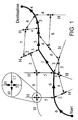
- the concept of local route alternatives without an extensive terminal-based database and related routing software uses the optimal path from a starting point to a destination an "attractor" for less optimal, but feasible route alternatives: during the path planning process at the service provider an attractor region around the optimal path is defined. In this region all relevant detours from this path are labelled with guidance commands which lead back to the optimal path. The extent of this attractor region can be adjusted by the user. A larger region makes navigation more tolerant to driving errors, but requires more terminal memory and due to the higher planning effort at the service provider will probably be more expensive for the user.
- CDRG Code Division Multiple Access
- GPS precise positioning system like
- inertial car sensors which allow a resolution to distinguish between adjacent streets and to determine the driving direction.
- a cellular data link for communication with a service provider is required.
- the user For route planning the user enters a starting location (most likely the current position which can be retrieved from the GPS receiver) and the destination.
- the driver can add preferences for the street category he/she would like to use (e.g. highways as much as possible) and define the extent of a 'attractor region' around the optimal path to the destination. If the driver leaves the optimal path, but remains in the attractor region, the navigational terminal will be able to give a detour back to the optimal path. The larger the extent of the attractor region (perhaps measured in km around the optimal path) the greater is the complexity of the CDGR and thus very likely the price for the service.
- every route is described in a graph structure with nodes and transitions linking two nodes.
- Each node represents a GPS position on the route and each transition contains two pieces of information, the driving direction in absolute angular co-ordinates and the total costs to return to from the current node to the optimal path.
- the term 'cost' is meant as an internal measure for the driving efforts, not as a fiscal amount.
- Each transition between two nodes means driving and therefore is associated with a certain partial cost.
- the total cost is the sum of all partial costs on the way back from the current node to a node on the optimal path.
- the optimal path is the path of a ball which is found in the valley and is rolling downwards. If the ball accidentally leaves the optimal path it takes a detour which leads up a hill. The ball will attempt to come back to a state of minimum potential energy by rolling down into the direction of the negative height gradient ie in the direction of steepest descent. Of course it could end in a local valley, a local minimum where it gets stuck and can proceed no further.
- a negative ramp from the starting point to the destination is added to the surface, So at every point the absolute value of the slope is greater than the maximum slope of the underlying surface. So at every point the absolute value of the gradient is greater than zero. The ball will always come back to the optimal path in the valley.
- the service provider returns a list of GPS nodes on the optimal path and in the attractor region.
- every possible driving direction i.e. every transition is specified in the absolute angular co-ordinates and by its total costs.
- the costs for driving on the optimal path are the smallest possible, every detour has higher costs.
- the GPS receiver and the other car sensors provide position and driving direction the appropriate GPS node can be triggered and the system yields the driving command with the smallest total costs.
- the command can be presented as an acoustical message (e.g. 'turn to the left at the next crossing'), as graphical information (e.g. left arrow on a display) or could simply be no system output meaning that the user simply has to continue as before.
- the level of detail for these driving commands can be set by the user.
- the system could only be active at highway exits or also react if smaller street crossings are reached.
- the extent of the attractor region also determines the number of GPS nodes to be transferred from the service provider.
- the cost of a transition between two nodes can be measured by a variety of criteria:
- the criteria to be taken into account could be set, or prioritized by the user.
- a more complex cost function which is a weighted average of the individual cost criteria.
- the optimization criterion can be selected by the user. At a street crossing a complete 180° turn could be the shortest way back to the optimal path. If the user approaches such a crossing, the cost for driving in this reversed direction could be augmented by a 'punishment' cost component in order to discourage such driving behaviour. If a possible driving direction means leaving the attractor region, the total cost must be set very high. Then the system can detect that a new route planning process at the service provider needs to be initiated.
- the navigation terminal has to store a complete and connected graph. It is sufficient that every GPS node and its different transitions are stored separately since the system does not check whether two nodes are connected. It is important to note that the system only proposes driving directions on the resolution level chosen by the user. If the user only selects route guidance on highways, the system would be blind for accidentally leaving the highway and could not offer alternatives. On the other hand this offers the opportunity to direct the user only through the larger streets where it is easier to navigate.
- the complete path planning including computation of partial costs for all path segments and total costs for the cheapest path back to the optimal path are handled at the service provider.
- the only processing required at the terminal is to detect GPS positions and driving directions and a simple decision for selecting the appropriate driving command with least total costs. Even if the user ignores the driving advice, the system will offer a new driving command at the next GPS position where it has information for the user.
- the system provides a balance between pure autonomous local route planning and pure CDRG in order to offer route alternatives to the user instantaneously (without new central route planning), but with a limited regional extent.
- the implementation can be done efficiently without using too many system resources like memory or processing time.
- the vehicle navigation system comprises a Micro Controller Unit (MCU) 15.
- the MCU 15 receives commands from an input unit 18.
- the input unit 18 might comprise a keyboard and switches for controlling functions of the navigation system. This manually controlled devices can be located in the dashboard, the middle console of the car or on the steering wheel.
- the input unit 18 might further comprise a microphone and a speech recognition unit.
- the input unit 18 can be used to enter start and destination of the route.
- the MCU 15 is connected to an output unit 17 with a display for visual and a loudspeaker for aural route guidance instructions to the user.
- the display can be used to display the route with the optimal path and the attractor region of Figure 1.
- the MCU 15 is further connected to a memory 16.
- Memory 16 is used to store the route with the optimal path and the attractor region which was received through the cellular telephone 19.
- the navigation system further comprises a positioning receiver 20 which receives satellite signal from the Global Positioning System (GPS).
- GPS Global Positioning System
- a dead reckoning unit 21 which can be connected to wheel sensors, speedometer and a gyro sensor for indicating the driving direction, is connected to MCU 15.
- the GPS positioning unit 20 can only provide a useful positioning signal if three or more GPS satellite signals are received. If, for example, no or not enough satellite signals are received while the vehicle is in a tunnel, the dead reckoning unit 21 provides the signals to follow up the position of the vehicle.
- MCU 15 indicates through the output unit 17 visual and/or aural to the driver that the optimal path is left when a comparison of the actual position, determined by the positioning devices 20 or 21 and the optimal path indicates that the optimal path has been left.
- the MCU After the driver has entered the start and destination points the MCU establishes a connection via the cellular telephone 19 through a base station 12 and a Mobile Switching Center (MSC) 13 to the service provider 14. Based on the start and destination information a route with the optimal path and the attractor region is calculated by the service provider 14. The service provider 14 transmitts the determined information through the cellular network to the navigation system 10 where the information is stored in memory 16.
- MSC Mobile Switching Center
- the present invention includes any novel feature or combination of features disclosed herein either explicitly or any generalisation thereof irrespective of whether or not it relates to the claimed invention or mitigates any or all of the problems addressed, without departing from the wording of the claims.
Landscapes
- Engineering & Computer Science (AREA)
- Radar, Positioning & Navigation (AREA)
- Remote Sensing (AREA)
- Physics & Mathematics (AREA)
- General Physics & Mathematics (AREA)
- Computer Networks & Wireless Communication (AREA)
- Mathematical Physics (AREA)
- Automation & Control Theory (AREA)
- Navigation (AREA)
- Position Fixing By Use Of Radio Waves (AREA)
- Traffic Control Systems (AREA)
- Instructional Devices (AREA)
- Crystals, And After-Treatments Of Crystals (AREA)
Claims (26)
- Fahrzeugnavigationssystem (10), umfassend :eine Routenberechnungseinrichtung (14), die sich fern von einem Fahrzeug befindet, zum Bereitstellen einer Route für das Fahrzeug zwischen Reiseanfangs- und - Endpunkt, und zum Berechnen von entsprechenden Umleitungsrouten für ausgewählte Positionen in einem Umleitungsbereich, der an die Route angrenzt, um das Fahrzeug zurück auf die Route zu bringen;Mittel (20, 21) zum Ermitteln der ausgewählten Position in dem Umleitungsbereich, der dem Fahrzeug am nächsten liegt; undMittel (17), die auf das Mittel (20, 21) zum Ermitteln ansprechen, zum Bereitstellen von Umleitungsroutenführungsanweisungen, um das Fahrzeug zurück auf die Route zu bringen.
- Fahrzeugnavigationssystem (10) nach Anspruch 1, wobei Mittel (19) bereitgestellt sind, um die Route und Umleitungsrouten in einen Prozessor (15) zu laden, der sich mit dem Fahrzeug mitbewegt.
- Fahrzeugnavigationssystem (10) nach irgendeinem der vorhergehenden Ansprüche, wobei eine Vielzahl von Umleitungsrouten für jede gewählte Position bereitgestellt werden.
- Fahrzeugnavigationssystem (10) nach Anspruch 3, wobei die einzelnen aus der Vielzahl von Umleitungsrouten von einer gewählten Position priorisiert werden.
- Fahrzeugnavigationssystem (10) nach Anspruch 4, wobei die einzelnen Umleitungsrouten auf der Grundlage vorbestimmter Kriterien priorisiert werden.
- Fahrzeugnavigationssystem (10) nach Anspruch 5, wobei die vorbestimmten Kriterien von einem Benutzer wählbar sind.
- Fahrzeugnavigationssystem (10) nach irgendeinem der Ansprüche 4 bis 6, wobei die Routenführungsanweisungen für die Umleitungsroute mit der höchsten Priorisierung bereitgestellt werden.
- Fahrzeugnavigationssystem (10) nach irgendeinem der Ansprüche 4 bis 7, wobei die einzelnen Umleitungsrouten auf der Grundlage ihrer Kosten priorisiert werden.
- Fahrzeugnavigationssystem (10) nach Anspruch 8, wobei die Routenführungsanweisungen für eine Umleitungsroute mit den niedrigsten Kosten bereitgestellt werden.
- Fahrzeugnavigationssystem (10) nach irgendeinem der Ansprüche 8 oder 9, wobei die Gesamtkosten fern von dem Fahrzeug berechnet werden.
- Fahrzeugnavigationssystem (10) nach irgendeinem der vorherigen Ansprüche, wobei die Routenführungsanweisungen hörbar sind.
- Fahrzeugnavigationssystem (10) nach irgendeinem der vorhergehenden Ansprüche, wobei die Routenführungsanweisungen sichtbar sind.
- Fahrzeugnavigationssystem (10) nach irgendeinem der vorhergehenden Ansprüche, wobei das Mittel (20, 21) zum Ermitteln der gewählten Position auf Benutzereingabe anspricht.
- Fahrzeugnavigationssystem (10) nach irgendeinem der Ansprüche 1 bis 12, wobei das Mittel (20, 21) zum Ermitteln der gewählten Position innerhalb des Umleitungsbereichs Positionserfassungsausrüstung (20, 21) umfasst.
- Fahrzeugnavigationssystem (10) nach Anspruch 14, wobei die Positionserfassungsausrüstung (20, 21) auf GPS-Signale anspricht, um die nächstgelegene gewählte Position zu ermitteln.
- Fahrzeugsnavigationssystem (10) nach Anspruch 15, wobei die Erfassungsausrüstung (20, 21) weiter auf eine Eingabe von einem Richtungssensor (21) anspricht, der die Bewegungsrichtung des Fahrzeugs anzeigt.
- Fahrzeugnavigationssystem (10) nach Anspruch 16, wobei der Prozessor (15) angepasst ist, um die nächstgelegene gewählte Position in der Bewegungsrichtung zu ermitteln und um Routenführungsanweisungen von dieser gewählten Position bereitzustellen.
- Fahrzeugnavigationssystem (10) nach irgendeinem der Ansprüche 14 bis 17, wobei der Prozessor (15) angepasst ist, um dem Fahrer anzuzeigen, dass die Route verlassen wurde.
- Fahrzeugnavigationssystem (10) nach irgendeinem der vorhergehenden Ansprüche, wobei weitere Informationen von der entfernten Routenberechnungseinrichtung (14) gesendet werden können, wenn sich das Fahrzeug über den Umleitungsbereich hinaus bewegt.
- Fahrzeugnavigationssystem (10) nach irgendeinem der vorhergehenden Ansprüche, wobei der Umfang des Umleitungsbereichs von dem Benutzer gewählt werden kann.
- Fahrzeugnavigationssystem (10) nach irgendeinem der vorhergehenden Ansprüche, wobei der bevorzugte Routentyp für die Route angegeben werden kann.
- Fahrzeugnavigationssystem (10) nach irgendeinem der vorhergehenden Ansprüche, wobei der Umfang des Umleitungsbereichs von dem angegebenen Routentyp abhängig sein kann.
- Fahrzeugnavigationssystem (10) nach Anspruch 4 und jedem davon abhängigen Anspruch, wobei die gewählten Positionen sich in dem festgelegten Umleitungsbereich befinden.
- Fahrzeugnavigationssystem (10) nach Anspruch 23, wobei die gewählten Positionen Straßenkreuzungen sind.
- Fahrzeugnavigationssystem (10) nach irgendeinem der vorhergehenden Ansprüche, wobei eine neue Route von einer zentralen Datenbank angefordert wird, wenn der Wagen den Umleitungsbereich verlässt.
- Verfahren zur Fahrzeugnavigation, umfassend:Berechnen, fern von einem Fahrzeug, einer Route für das Fahrzeug zwischen Reiseanfangs- und -endpunkt,Berechnen, fern von dem Fahrzeug, von entsprechenden Umleitungsrouten für gewählte Positionen in einem Umleitungsbereich, der an die Route angrenzt, um das Fahrzeug zurück auf die Route zu bringen,Ermitteln der gewählten Position innerhalb des Umleitungsbereichs, die dem Fahrzeug am nächsten liegt; undBereitstellen von Umleitungsroutenführungsanweisungen, um das Fahrzeug auf die Route zurückzubringen.
Applications Claiming Priority (2)
| Application Number | Priority Date | Filing Date | Title |
|---|---|---|---|
| GB9805795A GB2335492B (en) | 1998-03-18 | 1998-03-18 | Local navigation alternatives |
| GB9805795 | 1998-03-18 |
Publications (3)
| Publication Number | Publication Date |
|---|---|
| EP0943896A2 EP0943896A2 (de) | 1999-09-22 |
| EP0943896A3 EP0943896A3 (de) | 2003-01-08 |
| EP0943896B1 true EP0943896B1 (de) | 2006-06-07 |
Family
ID=10828813
Family Applications (1)
| Application Number | Title | Priority Date | Filing Date |
|---|---|---|---|
| EP99301938A Expired - Lifetime EP0943896B1 (de) | 1998-03-18 | 1999-03-15 | Fahrzeugnavigationsvorrichtung |
Country Status (7)
| Country | Link |
|---|---|
| US (1) | US6298304B1 (de) |
| EP (1) | EP0943896B1 (de) |
| JP (2) | JP3981216B2 (de) |
| AT (1) | ATE329229T1 (de) |
| DE (1) | DE69931683T2 (de) |
| ES (1) | ES2264820T3 (de) |
| GB (1) | GB2335492B (de) |
Families Citing this family (64)
| Publication number | Priority date | Publication date | Assignee | Title |
|---|---|---|---|---|
| DE19906863A1 (de) * | 1999-02-18 | 2000-10-19 | Nokia Mobile Phones Ltd | Verfahren zur Navigation eines Objekts |
| GB2352292A (en) * | 1999-06-11 | 2001-01-24 | John Richard Miles Turner | Navigation system and method |
| US7194681B1 (en) | 1999-07-30 | 2007-03-20 | Microsoft Corporation | Method for automatically assigning priorities to documents and messages |
| US6714967B1 (en) | 1999-07-30 | 2004-03-30 | Microsoft Corporation | Integration of a computer-based message priority system with mobile electronic devices |
| US6405128B1 (en) * | 1999-12-20 | 2002-06-11 | Navigation Technologies Corp. | Method and system for providing an electronic horizon in an advanced driver assistance system architecture |
| JP2001227965A (ja) * | 2000-02-14 | 2001-08-24 | Fujitsu Ten Ltd | ナビゲーション装置 |
| GB2360588B (en) * | 2000-03-23 | 2004-04-07 | Yeoman Group Plc | Navigation system |
| DE10021171A1 (de) * | 2000-04-29 | 2001-11-15 | Bosch Gmbh Robert | Navigationsverfahren und -vorrichtung |
| GB0011797D0 (en) | 2000-05-16 | 2000-07-05 | Yeoman Group Plc | Improved vehicle routeing |
| DE10029198A1 (de) * | 2000-06-19 | 2001-12-20 | Bosch Gmbh Robert | Verfahren zur Auswahl von Karteninformationen und Navigationsvorrichtung |
| DE10044396A1 (de) * | 2000-09-08 | 2002-03-21 | Bosch Gmbh Robert | Verfahren und Vorrichtung zur Übermittlung von Navigationsinformationen von einer Datenzentrale an ein fahrzeugbasiertes Navigationssystem |
| JP4643031B2 (ja) * | 2001-01-31 | 2011-03-02 | クラリオン株式会社 | 経路探索装置 |
| DE10106502A1 (de) * | 2001-02-13 | 2002-08-29 | Bosch Gmbh Robert | Verfahren zum Übertragen von Routendaten |
| US6892133B2 (en) * | 2001-02-26 | 2005-05-10 | Alk Technologies, Inc. | Thin-client navigation and route guidance system |
| DE10122448A1 (de) * | 2001-05-09 | 2002-11-14 | Bosch Gmbh Robert | Verfahren zum Betrieb eines Navigationssystems für ein Fahrzeug, insbesondere ein Kraftfahrzeug, und Navigationssystem |
| US7110525B1 (en) | 2001-06-25 | 2006-09-19 | Toby Heller | Agent training sensitive call routing system |
| EP1310930A1 (de) * | 2001-11-09 | 2003-05-14 | 3M Innovative Properties Company | System und Verfahren zur Verkehrsorganisation mit einem Anreizprogramm |
| DE10162359B4 (de) * | 2001-12-18 | 2012-10-31 | Robert Bosch Gmbh | Verfahren zur Bereitstellung von Routendaten für ein Navigationsgerät |
| FI114187B (fi) * | 2001-12-21 | 2004-08-31 | Nokia Corp | Opastuspalvelun järjestäminen langattoman päätelaitteen avulla |
| US20030217098A1 (en) | 2002-05-15 | 2003-11-20 | Microsoft Corporation | Method and system for supporting the communication of presence information regarding one or more telephony devices |
| US20030217142A1 (en) | 2002-05-15 | 2003-11-20 | Microsoft Corporation | Method and system for supporting the communication of presence information regarding one or more telephony devices |
| US20050043886A1 (en) * | 2002-06-06 | 2005-02-24 | John Stevens | Delivery system and method for low visibilty conditions |
| US9818136B1 (en) | 2003-02-05 | 2017-11-14 | Steven M. Hoffberg | System and method for determining contingent relevance |
| WO2004072798A2 (en) * | 2003-02-10 | 2004-08-26 | Internap Network Services Corporation | Methods and systems for providing dynamic domain name system for inbound route control |
| JP3928962B2 (ja) * | 2003-08-21 | 2007-06-13 | 株式会社日立製作所 | 通信型車両ナビゲーションシステムのサーバ装置及び車載端末装置 |
| US7671764B2 (en) * | 2004-04-06 | 2010-03-02 | Honda Motor Co., Ltd. | Method and system for using traffic flow data to navigate a vehicle to a destination |
| US7680594B2 (en) | 2004-04-06 | 2010-03-16 | Honda Motor Co., Ltd. | Display method and system for a vehicle navigation system |
| US7680596B2 (en) | 2004-04-06 | 2010-03-16 | Honda Motor Co., Ltd. | Route calculation method for a vehicle navigation system |
| TWI318386B (en) * | 2005-08-29 | 2009-12-11 | Inventec Appliances Corp | Method and system for discovery path |
| US8909465B2 (en) * | 2005-12-29 | 2014-12-09 | Mapquest, Inc. | User-controlled alternative routing |
| KR20070099726A (ko) * | 2006-04-05 | 2007-10-10 | 주식회사 현대오토넷 | 네비게이션 시스템의 경로 탐색 방법 |
| US20080004926A1 (en) * | 2006-06-30 | 2008-01-03 | Microsoft Corporation | Methods and architectures for context-sensitive reminders and service facilitation |
| WO2008035489A1 (fr) * | 2006-09-22 | 2008-03-27 | Mitsubishi Electric Corporation | système de navigation et procédé d'affichage de guidage de fonctionnement pour le système |
| US20080154761A1 (en) * | 2006-12-20 | 2008-06-26 | Microsoft Corporation | Commoditization of products and product market |
| US20080154719A1 (en) * | 2006-12-20 | 2008-06-26 | Microsoft Corporation | Market sharing incentives |
| US20080154698A1 (en) * | 2006-12-20 | 2008-06-26 | Microsoft Corporation | Dyanmic product classification for opinion aggregation |
| US8271310B2 (en) * | 2006-12-20 | 2012-09-18 | Microsoft Corporation | Virtualizing consumer behavior as a financial instrument |
| US8799077B2 (en) * | 2006-12-20 | 2014-08-05 | Microsoft Corporation | Ad integration and extensible themes for operating systems |
| US8112770B2 (en) | 2006-12-20 | 2012-02-07 | Microsoft Corporation | Providing alternative content in a windowed environment |
| US20080154915A1 (en) * | 2006-12-20 | 2008-06-26 | Microsoft Corporation | Network-based recommendations |
| DE102007017240A1 (de) * | 2007-04-12 | 2008-10-16 | Robert Bosch Gmbh | Verfahren und Zielführungseinrichtung zur Ermittlung einer Fahrtroute |
| US20080319660A1 (en) * | 2007-06-25 | 2008-12-25 | Microsoft Corporation | Landmark-based routing |
| US7912637B2 (en) * | 2007-06-25 | 2011-03-22 | Microsoft Corporation | Landmark-based routing |
| US20080319658A1 (en) * | 2007-06-25 | 2008-12-25 | Microsoft Corporation | Landmark-based routing |
| DE102007061706A1 (de) * | 2007-12-19 | 2009-07-02 | Navigon Ag | Verfahren zum Betrieb eines Navigationssystems in einem Fahrzeug |
| ES2459440T3 (es) * | 2008-07-11 | 2014-05-09 | Tomtom Global Content B.V. | Aparato y método para presentar una vista de cruce |
| WO2010072258A1 (en) * | 2008-12-23 | 2010-07-01 | Tomtom International B.V. | Navigation devices and methods for pre-calculating an alternate route |
| CN101881819A (zh) * | 2009-05-08 | 2010-11-10 | 刘伯安 | 一种无线电导航方法和(或)网络及应用 |
| US20110184642A1 (en) * | 2009-12-18 | 2011-07-28 | Daimler Trucks North America Llc | Fuel efficient routing system and method |
| BR112012027134B1 (pt) * | 2010-04-23 | 2020-02-04 | Central Co Ltd | dispositivo de navegação |
| US8467951B2 (en) * | 2010-05-06 | 2013-06-18 | Telenav, Inc. | Navigation system with alternative route determination mechanism and method of operation thereof |
| US9589254B2 (en) | 2010-12-08 | 2017-03-07 | Microsoft Technology Licensing, Llc | Using e-mail message characteristics for prioritization |
| US9134137B2 (en) | 2010-12-17 | 2015-09-15 | Microsoft Technology Licensing, Llc | Mobile search based on predicted location |
| US9163952B2 (en) | 2011-04-15 | 2015-10-20 | Microsoft Technology Licensing, Llc | Suggestive mapping |
| JP5892004B2 (ja) * | 2012-08-29 | 2016-03-23 | アイシン・エィ・ダブリュ株式会社 | 経路探索システム、経路探索装置、経路探索方法及びコンピュータプログラム |
| US9915546B2 (en) * | 2013-05-17 | 2018-03-13 | Telenav, Inc. | Navigation system with route correction mechanism and method of operation thereof |
| US9435660B2 (en) | 2013-10-16 | 2016-09-06 | Mapquest, Inc. | Systems and methods for initiating mapping exit routines and rating highway exits |
| US9631933B1 (en) | 2014-05-23 | 2017-04-25 | Google Inc. | Specifying unavailable locations for autonomous vehicles |
| US9436182B2 (en) | 2014-05-23 | 2016-09-06 | Google Inc. | Autonomous vehicles |
| WO2016062732A1 (en) | 2014-10-20 | 2016-04-28 | Tomtom Navigation B.V. | Alternative routes |
| US9733096B2 (en) | 2015-06-22 | 2017-08-15 | Waymo Llc | Determining pickup and destination locations for autonomous vehicles |
| CN105698796B (zh) * | 2016-01-15 | 2018-05-25 | 哈尔滨工大服务机器人有限公司 | 一种多机器人调度系统的路径搜索方法 |
| CN105741557B (zh) * | 2016-05-10 | 2018-01-30 | 招商局重庆交通科研设计院有限公司 | 一种浮动车交通信息提取、轨迹跟踪及查询方法 |
| US10739150B2 (en) | 2018-08-21 | 2020-08-11 | GM Global Technology Operations LLC | Interactive routing information between users |
Family Cites Families (18)
| Publication number | Priority date | Publication date | Assignee | Title |
|---|---|---|---|---|
| JPH01173824A (ja) * | 1987-12-28 | 1989-07-10 | Aisin Aw Co Ltd | ヘルプ機能を備えた車両用ナビゲーション装置 |
| US5243528A (en) * | 1990-09-12 | 1993-09-07 | Motorola, Inc. | Land vehicle navigation apparatus with visual display |
| DE69223243T2 (de) * | 1991-06-05 | 1998-06-10 | Toshio Kanagawa Tsuyuki | Navigationsvorrichtung und navigationsverfahren |
| US5608635A (en) * | 1992-04-14 | 1997-03-04 | Zexel Corporation | Navigation system for a vehicle with route recalculation between multiple locations |
| JP2673403B2 (ja) * | 1992-06-23 | 1997-11-05 | 本田技研工業株式会社 | 経路探索装置 |
| EP1058222B1 (de) * | 1992-08-19 | 2005-12-07 | Aisin Aw Co., Ltd. | Fahrzeugnavigationssystem |
| JP3488969B2 (ja) * | 1994-03-09 | 2004-01-19 | 本田技研工業株式会社 | 車両誘導装置 |
| US5638280A (en) * | 1994-03-30 | 1997-06-10 | Sumitomo Electric Industries, Ltd. | Vehicle navigation apparatus and method |
| JP3399643B2 (ja) * | 1994-07-12 | 2003-04-21 | 本田技研工業株式会社 | 車両誘導装置 |
| US5757289A (en) * | 1994-09-14 | 1998-05-26 | Aisin Aw Co., Ltd. | Vehicular navigation system |
| US5610821A (en) * | 1994-11-18 | 1997-03-11 | Ibm Corporation | Optimal and stable route planning system |
| WO1996021193A1 (en) * | 1995-01-03 | 1996-07-11 | Motorola Inc. | Route guidance with off-route detection |
| JP2836525B2 (ja) * | 1995-04-04 | 1998-12-14 | 住友電気工業株式会社 | 経路誘導装置 |
| JPH0914984A (ja) * | 1995-06-28 | 1997-01-17 | Aisin Aw Co Ltd | 車両用ナビゲーション装置 |
| JP3097513B2 (ja) * | 1995-09-27 | 2000-10-10 | アイシン・エィ・ダブリュ株式会社 | 車両用ナビゲーション装置 |
| JP3413318B2 (ja) * | 1995-12-25 | 2003-06-03 | トヨタ自動車株式会社 | 経路情報提供方法及び経路情報提供システム |
| JP3410271B2 (ja) * | 1995-12-28 | 2003-05-26 | アルパイン株式会社 | ナビゲーション装置 |
| FI111309B (fi) | 1996-01-03 | 2003-06-30 | Nokia Corp | Tietoliikenneverkkoon radioteitse liitettävä päätelaite |
-
1998
- 1998-03-18 GB GB9805795A patent/GB2335492B/en not_active Expired - Lifetime
-
1999
- 1999-03-15 US US09/268,580 patent/US6298304B1/en not_active Expired - Lifetime
- 1999-03-15 DE DE69931683T patent/DE69931683T2/de not_active Expired - Lifetime
- 1999-03-15 ES ES99301938T patent/ES2264820T3/es not_active Expired - Lifetime
- 1999-03-15 EP EP99301938A patent/EP0943896B1/de not_active Expired - Lifetime
- 1999-03-15 AT AT99301938T patent/ATE329229T1/de not_active IP Right Cessation
- 1999-03-17 JP JP07142799A patent/JP3981216B2/ja not_active Expired - Fee Related
-
2007
- 2007-01-31 JP JP2007020638A patent/JP2007163508A/ja active Pending
Also Published As
| Publication number | Publication date |
|---|---|
| ATE329229T1 (de) | 2006-06-15 |
| DE69931683T2 (de) | 2007-05-31 |
| US6298304B1 (en) | 2001-10-02 |
| GB2335492A (en) | 1999-09-22 |
| JPH11325950A (ja) | 1999-11-26 |
| DE69931683D1 (de) | 2006-07-20 |
| ES2264820T3 (es) | 2007-01-16 |
| GB9805795D0 (en) | 1998-05-13 |
| EP0943896A2 (de) | 1999-09-22 |
| JP2007163508A (ja) | 2007-06-28 |
| EP0943896A3 (de) | 2003-01-08 |
| GB2335492B (en) | 2002-02-27 |
| JP3981216B2 (ja) | 2007-09-26 |
Similar Documents
| Publication | Publication Date | Title |
|---|---|---|
| US6298304B1 (en) | Local navigation alternatives | |
| US7333889B2 (en) | Car navigation system | |
| US6859720B2 (en) | Traffic-information distribution method on-vehicle navigation apparatus | |
| US5878368A (en) | Navigation system with user definable cost values | |
| US6064941A (en) | Vehicle navigation apparatus and storage medium | |
| JP4290428B2 (ja) | 車両走行案内装置及び車両走行案内方法 | |
| CN100402982C (zh) | 导航系统,导航设备,以及服务器设备 | |
| EP1635141B1 (de) | Navigationsvorrichtung und -Verfahren | |
| US6941221B2 (en) | Method for selecting map information, and navigation device | |
| JPWO2003040654A1 (ja) | 車両用ナビゲーション装置及びプログラム | |
| US7457704B2 (en) | Navigation apparatus for vehicle | |
| US6240363B1 (en) | Navigation method, in particular for vehicles | |
| JP6478864B2 (ja) | 電子装置、経路案内プログラムおよび経路案内システム | |
| JP2002533688A (ja) | 移動手段のためのナビゲーション方法およびナビゲーションシステム | |
| JP2001349740A (ja) | 駐車場案内方法およびナビゲーション装置 | |
| US7630831B2 (en) | Navigation system | |
| EP2259025B1 (de) | Navigationssystem, Verfahren zur Führung entlang einer Führungsbahn und Bahnführungsprogramm | |
| JP3560239B2 (ja) | 駐車場位置学習装置及び駐車場位置案内方法 | |
| JPH10132591A (ja) | ナビゲーション装置 | |
| JP2004144537A (ja) | 経路選択システム | |
| WO1999014701A1 (en) | Navigation system with user definable cost values | |
| EP1914513B1 (de) | Verfahren zur Erzeugung von Kartendaten, Verfahren zur Bestimmung einer Führungsroute und Bordnavigationsgerät für ein Fahrzeug | |
| JP2001050769A (ja) | ナビゲーション装置 | |
| JP2002156238A (ja) | ナビゲーション装置 | |
| JP3879861B2 (ja) | ナビゲーション装置及びナビゲーション方法 |
Legal Events
| Date | Code | Title | Description |
|---|---|---|---|
| PUAI | Public reference made under article 153(3) epc to a published international application that has entered the european phase |
Free format text: ORIGINAL CODE: 0009012 |
|
| AK | Designated contracting states |
Kind code of ref document: A2 Designated state(s): AT BE CH CY DE DK ES FI FR GB GR IE IT LI LU MC NL PT SE |
|
| AX | Request for extension of the european patent |
Free format text: AL;LT;LV;MK;RO;SI |
|
| RAP1 | Party data changed (applicant data changed or rights of an application transferred) |
Owner name: NOKIA CORPORATION |
|
| PUAL | Search report despatched |
Free format text: ORIGINAL CODE: 0009013 |
|
| AK | Designated contracting states |
Kind code of ref document: A3 Designated state(s): AT BE CH CY DE DK ES FI FR GB GR IE IT LI LU MC NL PT SE |
|
| AX | Request for extension of the european patent |
Free format text: AL;LT;LV;MK;RO;SI |
|
| 17P | Request for examination filed |
Effective date: 20030708 |
|
| AKX | Designation fees paid |
Designated state(s): AT DE ES FR IT NL SE |
|
| AXX | Extension fees paid |
Extension state: SI Payment date: 20030708 Extension state: RO Payment date: 20030708 Extension state: MK Payment date: 20030708 Extension state: LV Payment date: 20030708 Extension state: LT Payment date: 20030708 Extension state: AL Payment date: 20030708 |
|
| 17Q | First examination report despatched |
Effective date: 20031008 |
|
| GRAP | Despatch of communication of intention to grant a patent |
Free format text: ORIGINAL CODE: EPIDOSNIGR1 |
|
| GRAS | Grant fee paid |
Free format text: ORIGINAL CODE: EPIDOSNIGR3 |
|
| GRAA | (expected) grant |
Free format text: ORIGINAL CODE: 0009210 |
|
| AK | Designated contracting states |
Kind code of ref document: B1 Designated state(s): AT DE ES FR IT NL SE |
|
| AX | Request for extension of the european patent |
Extension state: AL LT LV MK RO SI |
|
| PG25 | Lapsed in a contracting state [announced via postgrant information from national office to epo] |
Ref country code: IT Free format text: LAPSE BECAUSE OF FAILURE TO SUBMIT A TRANSLATION OF THE DESCRIPTION OR TO PAY THE FEE WITHIN THE PRESCRIBED TIME-LIMIT;WARNING: LAPSES OF ITALIAN PATENTS WITH EFFECTIVE DATE BEFORE 2007 MAY HAVE OCCURRED AT ANY TIME BEFORE 2007. THE CORRECT EFFECTIVE DATE MAY BE DIFFERENT FROM THE ONE RECORDED. Effective date: 20060607 Ref country code: AT Free format text: LAPSE BECAUSE OF FAILURE TO SUBMIT A TRANSLATION OF THE DESCRIPTION OR TO PAY THE FEE WITHIN THE PRESCRIBED TIME-LIMIT Effective date: 20060607 |
|
| REF | Corresponds to: |
Ref document number: 69931683 Country of ref document: DE Date of ref document: 20060720 Kind code of ref document: P |
|
| REG | Reference to a national code |
Ref country code: SE Ref legal event code: TRGR |
|
| LTIE | Lt: invalidation of european patent or patent extension |
Effective date: 20060607 |
|
| ET | Fr: translation filed | ||
| REG | Reference to a national code |
Ref country code: ES Ref legal event code: FG2A Ref document number: 2264820 Country of ref document: ES Kind code of ref document: T3 |
|
| PLBE | No opposition filed within time limit |
Free format text: ORIGINAL CODE: 0009261 |
|
| STAA | Information on the status of an ep patent application or granted ep patent |
Free format text: STATUS: NO OPPOSITION FILED WITHIN TIME LIMIT |
|
| 26N | No opposition filed |
Effective date: 20070308 |
|
| PGFP | Annual fee paid to national office [announced via postgrant information from national office to epo] |
Ref country code: SE Payment date: 20080306 Year of fee payment: 10 Ref country code: NL Payment date: 20080303 Year of fee payment: 10 Ref country code: IT Payment date: 20080327 Year of fee payment: 10 |
|
| REG | Reference to a national code |
Ref country code: FR Ref legal event code: TP |
|
| EUG | Se: european patent has lapsed | ||
| NLV4 | Nl: lapsed or anulled due to non-payment of the annual fee |
Effective date: 20091001 |
|
| PG25 | Lapsed in a contracting state [announced via postgrant information from national office to epo] |
Ref country code: NL Free format text: LAPSE BECAUSE OF NON-PAYMENT OF DUE FEES Effective date: 20091001 |
|
| PGFP | Annual fee paid to national office [announced via postgrant information from national office to epo] |
Ref country code: ES Payment date: 20100324 Year of fee payment: 12 |
|
| PG25 | Lapsed in a contracting state [announced via postgrant information from national office to epo] |
Ref country code: IT Free format text: LAPSE BECAUSE OF NON-PAYMENT OF DUE FEES Effective date: 20090315 |
|
| PG25 | Lapsed in a contracting state [announced via postgrant information from national office to epo] |
Ref country code: SE Free format text: LAPSE BECAUSE OF NON-PAYMENT OF DUE FEES Effective date: 20090316 |
|
| REG | Reference to a national code |
Ref country code: ES Ref legal event code: FD2A Effective date: 20120424 |
|
| PG25 | Lapsed in a contracting state [announced via postgrant information from national office to epo] |
Ref country code: ES Free format text: LAPSE BECAUSE OF NON-PAYMENT OF DUE FEES Effective date: 20110316 |
|
| REG | Reference to a national code |
Ref country code: DE Ref legal event code: R082 Ref document number: 69931683 Country of ref document: DE Representative=s name: VON ROHR PATENTANWAELTE PARTNERSCHAFT MBB, DE |
|
| REG | Reference to a national code |
Ref country code: FR Ref legal event code: PLFP Year of fee payment: 18 |
|
| REG | Reference to a national code |
Ref country code: FR Ref legal event code: PLFP Year of fee payment: 19 |
|
| PGFP | Annual fee paid to national office [announced via postgrant information from national office to epo] |
Ref country code: FR Payment date: 20170225 Year of fee payment: 19 Ref country code: DE Payment date: 20170307 Year of fee payment: 19 |
|
| REG | Reference to a national code |
Ref country code: DE Ref legal event code: R119 Ref document number: 69931683 Country of ref document: DE |
|
| PG25 | Lapsed in a contracting state [announced via postgrant information from national office to epo] |
Ref country code: DE Free format text: LAPSE BECAUSE OF NON-PAYMENT OF DUE FEES Effective date: 20181002 |
|
| PG25 | Lapsed in a contracting state [announced via postgrant information from national office to epo] |
Ref country code: FR Free format text: LAPSE BECAUSE OF NON-PAYMENT OF DUE FEES Effective date: 20180331 |