WO2020121558A1 - ナビゲーション制御装置、ナビゲーション方法およびプログラム - Google Patents
ナビゲーション制御装置、ナビゲーション方法およびプログラム Download PDFInfo
- Publication number
- WO2020121558A1 WO2020121558A1 PCT/JP2019/023037 JP2019023037W WO2020121558A1 WO 2020121558 A1 WO2020121558 A1 WO 2020121558A1 JP 2019023037 W JP2019023037 W JP 2019023037W WO 2020121558 A1 WO2020121558 A1 WO 2020121558A1
- Authority
- WO
- WIPO (PCT)
- Prior art keywords
- unit
- position information
- route guidance
- image data
- control device
- Prior art date
- Legal status (The legal status is an assumption and is not a legal conclusion. Google has not performed a legal analysis and makes no representation as to the accuracy of the status listed.)
- Ceased
Links
Images




Classifications
-
- G—PHYSICS
- G01—MEASURING; TESTING
- G01C—MEASURING DISTANCES, LEVELS OR BEARINGS; SURVEYING; NAVIGATION; GYROSCOPIC INSTRUMENTS; PHOTOGRAMMETRY OR VIDEOGRAMMETRY
- G01C21/00—Navigation; Navigational instruments not provided for in groups G01C1/00 - G01C19/00
- G01C21/26—Navigation; Navigational instruments not provided for in groups G01C1/00 - G01C19/00 specially adapted for navigation in a road network
- G01C21/34—Route searching; Route guidance
- G01C21/36—Input/output arrangements for on-board computers
- G01C21/3605—Destination input or retrieval
- G01C21/3623—Destination input or retrieval using a camera or code reader, e.g. for optical or magnetic codes
-
- G—PHYSICS
- G01—MEASURING; TESTING
- G01C—MEASURING DISTANCES, LEVELS OR BEARINGS; SURVEYING; NAVIGATION; GYROSCOPIC INSTRUMENTS; PHOTOGRAMMETRY OR VIDEOGRAMMETRY
- G01C21/00—Navigation; Navigational instruments not provided for in groups G01C1/00 - G01C19/00
- G01C21/26—Navigation; Navigational instruments not provided for in groups G01C1/00 - G01C19/00 specially adapted for navigation in a road network
- G01C21/34—Route searching; Route guidance
- G01C21/36—Input/output arrangements for on-board computers
- G01C21/3605—Destination input or retrieval
- G01C21/362—Destination input or retrieval received from an external device or application, e.g. PDA, mobile phone or calendar application
-
- G—PHYSICS
- G06—COMPUTING OR CALCULATING; COUNTING
- G06F—ELECTRIC DIGITAL DATA PROCESSING
- G06F18/00—Pattern recognition
- G06F18/20—Analysing
- G06F18/22—Matching criteria, e.g. proximity measures
-
- G—PHYSICS
- G06—COMPUTING OR CALCULATING; COUNTING
- G06T—IMAGE DATA PROCESSING OR GENERATION, IN GENERAL
- G06T7/00—Image analysis
- G06T7/70—Determining position or orientation of objects or cameras
-
- G—PHYSICS
- G06—COMPUTING OR CALCULATING; COUNTING
- G06V—IMAGE OR VIDEO RECOGNITION OR UNDERSTANDING
- G06V20/00—Scenes; Scene-specific elements
- G06V20/10—Terrestrial scenes
-
- G—PHYSICS
- G06—COMPUTING OR CALCULATING; COUNTING
- G06V—IMAGE OR VIDEO RECOGNITION OR UNDERSTANDING
- G06V20/00—Scenes; Scene-specific elements
- G06V20/20—Scenes; Scene-specific elements in augmented reality scenes
-
- G—PHYSICS
- G06—COMPUTING OR CALCULATING; COUNTING
- G06V—IMAGE OR VIDEO RECOGNITION OR UNDERSTANDING
- G06V20/00—Scenes; Scene-specific elements
- G06V20/30—Scenes; Scene-specific elements in albums, collections or shared content, e.g. social network photos or video
-
- G—PHYSICS
- G09—EDUCATION; CRYPTOGRAPHY; DISPLAY; ADVERTISING; SEALS
- G09B—EDUCATIONAL OR DEMONSTRATION APPLIANCES; APPLIANCES FOR TEACHING, OR COMMUNICATING WITH, THE BLIND, DEAF OR MUTE; MODELS; PLANETARIA; GLOBES; MAPS; DIAGRAMS
- G09B29/00—Maps; Plans; Charts; Diagrams, e.g. route diagram
-
- G—PHYSICS
- G09—EDUCATION; CRYPTOGRAPHY; DISPLAY; ADVERTISING; SEALS
- G09B—EDUCATIONAL OR DEMONSTRATION APPLIANCES; APPLIANCES FOR TEACHING, OR COMMUNICATING WITH, THE BLIND, DEAF OR MUTE; MODELS; PLANETARIA; GLOBES; MAPS; DIAGRAMS
- G09B29/00—Maps; Plans; Charts; Diagrams, e.g. route diagram
- G09B29/10—Map spot or coordinate position indicators; Map reading aids
Definitions
- the present invention relates to a navigation control device, a navigation method, and a program.
- the location of public facilities, sightseeing spots, famous spots, historic sites, accommodation facilities, restaurants, gas stations is used as a bar code-like symbol for location information, and is described on information magazines, information terminal screens, etc.
- a technique for performing route guidance to the ground is known (for example, see Patent Document 1).
- the present invention has been made in view of the above, and an object of the present invention is to provide a navigation control device, a navigation method, and a program capable of easily providing route guidance from an image.
- a navigation control device includes an image data acquisition unit that acquires image data, and the image data acquired by the image data acquisition unit.
- An object specifying unit that recognizes an object and specifies the object
- an object position information acquiring unit that acquires position information corresponding to the object specified by the object specifying unit
- the object position information is acquired by the object specifying unit.
- a route guidance unit which sets position information corresponding to the target object specified by the acquisition unit as a destination and performs route guidance.
- a navigation method includes an image data acquisition step of acquiring image data, and an object identification for recognizing an object shown in the image data acquired by the image data acquisition step and specifying the object. Step, a target object position information acquisition step of acquiring position information corresponding to the target object specified by the target object specifying step, and position information corresponding to the target object specified by the target object position information acquisition step.
- a route guidance step of setting the location as a ground and performing route guidance.
- a program includes an image data acquisition step of acquiring image data, an object identification step of recognizing an object shown in the image data acquired by the image data acquisition step, and specifying the object. And an object position information acquisition step of acquiring position information corresponding to the object specified by the object specification step, and position information corresponding to the object specified by the object position information acquisition step as a destination. And a route guidance step of performing route guidance, which is set as a.
- the present invention it is possible to provide a navigation control device, a navigation method, and a program that can easily provide route guidance from an image.
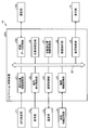
- FIG. 1 is a block diagram showing an outline of a navigation control device according to the first embodiment.
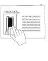
- FIG. 2 is a diagram showing a state in which the user touches an image on the WEB browser.
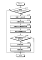
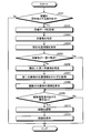
- FIG. 3 is a flowchart showing the flow of processing in the navigation control device according to the first embodiment.
- FIG. 4 is a block diagram showing an outline of the navigation control device according to the second embodiment.
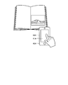
- FIG. 5 is a diagram showing a state in which the user is taking a photograph published in a magazine by the photographing unit.
- FIG. 6 is a diagram showing a display unit on which a plurality of candidate objects are displayed.
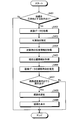
- FIG. 7 is a flowchart showing the flow of processing in the navigation control device according to the third embodiment.
- FIG. 1 is a block diagram showing an outline of a navigation control device according to the first embodiment.
- FIG. 2 is a diagram showing a state in which the user touches an image on the WEB browser.
- FIG. 3 is a flowchart showing the flow of processing in
- FIG. 8 is a diagram showing a display unit on which a plurality of candidate objects are displayed.
- FIG. 9 is a flowchart showing the flow of processing in the navigation control device according to the fourth embodiment.
- FIG. 10 is a block diagram showing the outline of the navigation control device according to the fifth embodiment.
- FIG. 11 is a diagram showing a state in which the user is taking a photograph published in a magazine by the photographing unit.
- FIG. 12 is a flowchart showing the flow of processing in the navigation control device according to the fifth embodiment.
- FIG. 1 is a block diagram showing an outline of a navigation control device according to the first embodiment.
- the navigation system 1 recognizes and specifies an object imaged in an image by image processing, and provides route guidance in which position information corresponding to the object is set as a destination.
- the navigation system 1 may be installed in the vehicle or may be portable and brought into the vehicle.
- the navigation system 1 includes a GPS (Global Positioning System) reception unit 11, an operation unit 12, a communication unit 13, a map information storage unit 14, a display unit 15, and a navigation control device 20.
- GPS Global Positioning System
- the navigation system 1 may be composed of a portable terminal, a device installed in a vehicle, or a combination of several devices.
- the target object is, for example, a scenic spot, a tourist spot, a building, a cityscape, a landscape of nature, the inside of a structure such as the interior of a store with a feature, an article with a feature, a food/beverage with a feature, an organism with a feature, Alternatively, it includes a plant having characteristics. Having a characteristic means being able to identify an object and being distinguishable from other objects.
- the GPS receiver 11 receives radio waves from a GPS satellite (not shown).
- the GPS reception unit 11 outputs the received radio wave signal to the current position information acquisition unit 21 of the navigation control device 20.
- the operation unit 12 can accept various operations on the navigation control device 20.
- the operation unit 12 is configured by, for example, a physical operation unit for the navigation control device 20 or a touch panel arranged on the display unit 15.
- the operation unit 12 can accept an operation of inputting a destination.
- the operation unit 12 can accept an operation to start route guidance from the current position to the destination.
- the operation unit 12 outputs the operation information to the operation reception control unit 22 of the navigation control device 20.
- the communication unit 13 is a communication unit.
- the communication unit 13 may communicate by any method such as the Internet or a mobile phone line.
- the map information storage unit 14 stores map information.
- the map information is, for example, a road map including intersections.
- the map information storage unit 14 outputs the stored map information to the map information acquisition unit 24 of the navigation control device 20.
- the map information storage unit 14 may be a storage device such as an external server that acquires map information via the communication function of the communication control unit 23 and the communication unit 13.
- the display unit 15 is, for example, a display device unique to the navigation system 1 or a display device shared with another system including a car audio.
- the display unit 15 is a display including a liquid crystal display (LCD: Liquid Crystal Display) or an organic EL (Organic Electro-Luminescence) display, for example.
- the display unit 15 is a touch panel type display.
- the display unit 15 functions as the operation unit 12 and can input various operations.
- the display unit 15 When the navigation system 1 is installed in a vehicle, the display unit 15 is arranged on the dashboard, instrument panel, center console, etc. in front of the driver of the vehicle.
- the display unit 15 displays a route guidance image based on the image signal output from the display control unit 29 of the navigation control device 20.
- the display unit 15 displays a WEB browser.
- the user touches an image when he wants to go to a place corresponding to the image displayed on the WEB browser.
- the touched image is output to the image data acquisition unit 25.
- the navigation control device 20 may be installed as one of the functions of a vehicle navigation system.
- the navigation control device 20 is installed as a function of a navigation system installed in a vehicle.
- the navigation control device 20 is, for example, an arithmetic processing device including a CPU (Central Processing Unit) and the like.
- the navigation control device 20 executes a command included in a program stored in a storage unit (not shown).
- the navigation control device 20 recognizes and specifies the target object imaged in the image data, and performs route guidance in which the position information corresponding to the target object is set as the destination.
- the navigation control device 20 is connected to the bus 30, and is connected to a current position information acquisition unit 21, an operation reception control unit 22, a communication control unit 23, a map information acquisition unit 24, an image data acquisition unit 25, and an object.
- the identification unit 26, the target object position information acquisition unit 27, the route guidance unit 28, and the display control unit 29 are included.
- the current position information acquisition unit 21 acquires current position information indicating the current position of the vehicle.
- the current position information acquisition unit 21 acquires the current position information of the vehicle based on the radio wave signal acquired by the GPS reception unit 11.
- the current position information acquisition unit 21 outputs the acquired current position information to the route guidance unit 28.
- the operation reception control unit 22 acquires the operation information of the operation received by the operation unit 12. For example, the operation reception control unit 22 acquires the destination input operation information indicating the input operation of the destination and outputs the control signal. For example, the operation reception control unit 22 acquires guidance start operation information indicating an operation for starting route guidance and outputs a control signal.
- the communication control unit 23 controls communication in the communication unit 13.
- the map information acquisition unit 24 acquires map information from the map information storage unit 14. More specifically, the map information acquisition unit 24 stores map information about the current position of the vehicle to the destination based on the current position of the vehicle and the position information of the destination acquired by the current position information acquisition unit 21. Obtained from the part 14.
- the image data acquisition unit 25 acquires the image data for which the user is urged to go to the place.
- the image data acquisition unit 25 acquires the image data displayed on the display unit 15.
- FIG. 2 is a diagram showing a state in which the user touches an image on the WEB browser.
- the image data acquisition unit 25 displays, for example, a message image “Do you want this photo as a destination?” and a button image for selecting “Yes” or “No”. And are displayed on the display unit 15 as a pop-up, and voice guidance is output from the speaker.
- the control signal indicating that the user has performed the touch operation of selecting the “Yes” button image is output via the operation reception control unit 22, the image data acquisition unit 25 acquires the image data of the touch operation. ..
- the control signal indicating that the user has performed the touch operation of selecting the “No” button image is output via the operation reception control unit 22, the image data acquisition unit 25 ends the process.
- the image data acquisition method by the image data acquisition unit 25 is not limited to the above method, and various methods can be applied.
- the navigation control device 20 may acquire an image specified by the WEB browser of another terminal, an image stored in another terminal, or the like via a communication line or the like.
- the target object specifying unit 26 recognizes the target object included in the image data acquired by the image data acquiring unit 25 and specifies the target object. More specifically, the object specifying unit 26 performs image processing on the image data, performs pattern matching with a recognition dictionary stored in advance, and recognizes the object shown in the image data. The object specifying unit 26 performs the process of specifying the object from the image data via the communication unit 13 under the control of the communication control unit 23, and transmits the image data to an external server (not shown) to specify the specified object. Information such as the name of an object may be acquired.
- a known method can be used as the method for specifying the target, and is not limited.
- Uniquely identifying an object means acquiring information from the map information storage unit 14 that enables acquisition of position information.
- To uniquely specify an object means, for example, a proper noun, a telephone number, or an address.
- the object is specified by the proper noun “A tower”.
- the object specifying unit 26 may specify the object to be photographed in the center of the image as the object.
- the object specifying unit 26 may specify the object that occupies the largest area in the image as the object.
- the object specifying unit 26 may specify the object to be photographed, which is the closest in the image, as an object.
- the object specifying unit 26 may specify an object to be photographed that is clearly captured in the image as an object.
- the object specifying unit 26 includes, for example, well-known scenic spots, tourist spots, buildings, cityscapes, natural scenery, interiors of buildings such as interiors of stores, articles, among the objects to be photographed in the image.
- a well-known object to be photographed such as food and drink, living things, or plants may be specified as the target.
- Well-known means, for example, that it has been repeatedly published in printed matter such as books with a large number of copies, or has been published on WEB sites with a large number of accesses.
- the object specifying unit 26 may specify the object to be photographed including the touched part as the object. Thereby, for example, when a plurality of buildings, articles, etc. are shown in the image data, it is possible to appropriately specify the object to be photographed which the user wants to set as the destination.
- the target object position information acquisition unit 27 acquires position information corresponding to the target object specified by the target object specification unit 26. More specifically, the target object position information acquisition unit 27 acquires the position information corresponding to the specified target object from the map information storage unit 14 via the map information acquisition unit 24. For example, when the specified target object is a scenic spot, a tourist spot, a building, a cityscape, or a natural landscape, the target object position information acquisition unit 27 acquires the position information of the location of the target object. For example, the target object position information acquisition unit 27 acquires the position information of the location of the building when the specified target object is inside the building such as the interior of the store.
- the target object position information acquisition unit 27 acquires the position information of the location of the store that handles the target object.
- the positional information on the location of the store being dealt with is acquired in plural, the positional information of the store closest to the current position is acquired.
- the target object positional information acquiring unit 27 acquires the position information of the location of the zoo, the aquarium, or the botanical garden where the living thing or the plant can be seen.
- the route guidance unit 28 sets the position information corresponding to the object identified by the object position information acquisition unit 27 as a destination and provides route guidance. More specifically, the route guidance unit 28 searches for a route based on the current position information of the vehicle and the position information of the destination. As a method for searching for a route, a known route search method can be used and is not limited. The route guidance unit 28 provides route guidance along the searched route. A known route guidance method can be used as a method for guiding the route, and is not limited.
- the display control unit 29 causes the display unit 15 to display an image of route guidance along the route searched by the route guidance unit 28.
- FIG. 3 is a flowchart showing the flow of processing in the navigation control device according to the first embodiment.
- the user refers to, for example, information about a tourist spot on the display unit 15 of the navigation system 1 via the WEB browser.
- the user wants to go to the location of the image displayed on the WEB browser, the user touches the image as shown in FIG.
- a message image "Do you want to take this photo as a destination?"
- a button image for selecting "Yes” or “No” are popup-displayed on the display unit 15, or voice guidance is output from the speaker. It will be done.
- the user touches the “Yes” button image when setting the destination, and touches the “No” button image when not setting the destination.
- the navigation control device 20 determines whether an operation with an image as a destination has been performed (step S101). More specifically, the navigation control device 20, when the operation reception control unit 22 obtains the operation information indicating that the “Yes” button is touch-operated, determines that the operation with the image as the destination is performed. (Yes in step S101), the process proceeds to step S102. When the operation acceptance control unit 22 does not acquire the operation information indicating that the “Yes” button is touch-operated, the navigation control device 20 determines that the operation with the image as the destination is not performed ( If No in step S101), the process ends.
- the navigation control device 20 acquires image data (step S102). More specifically, the navigation control device 20 uses the image data acquisition unit 25 to acquire the image data touched by the user. The navigation control device 20 proceeds to step S103.
- the navigation control device 20 identifies the object from the image data acquired in step S102 (step S103). More specifically, the navigation control device 20 performs image processing on the image data by the object specifying unit 26, performs pattern matching with the recognition dictionary, and recognizes and specifies the object shown in the image data. .. In the example of FIG. 2, when the user has selected the photograph showing “A tower”, the object identifying unit 26 identifies the object as “A tower”. The navigation control device 20 proceeds to step S104.
- the navigation control device 20 acquires the position information of the target object specified in step S103 (step S104). More specifically, the navigation control device 20 causes the target object position information acquisition unit 27 to acquire the position information corresponding to the specified target object from the map information storage unit 14 via the map information acquisition unit 24. In the example of FIG. 2, the position information of the object “A tower” is acquired. The navigation control device 20 proceeds to step S105.
- the navigation control device 20 acquires the current position information (step S105).
- the navigation control device 20 constantly updates and acquires the current position information.
- step S105 the current position information as the starting point of the route guidance for the position information of the target object acquired in step S104 is acquired.
- the current position information acquisition unit 21 acquires the current position information of the vehicle. The navigation control device 20 proceeds to step S106.
- the navigation control device 20 determines whether there is an operation for performing route guidance (step S106). More specifically, the navigation control device 20 uses the route guidance unit 28 to identify the name of the identified object based on the position information of the object acquired by the object position information acquisition unit 27 and the current position information of the vehicle. , Location, and distance from current location to the user. Then, the navigation control device 20 uses the route guidance unit 28 to confirm with the user whether route guidance should be performed. The navigation control device 20 proceeds to step S107 when the user performs an operation for performing route guidance (Yes in step S106). The navigation control device 20 ends the process when the user has not performed the operation of performing route guidance (No in step S106).
- step S106 the navigation control unit 20 causes the route guidance unit 28 to say, "This picture is of Tower A, located in C city of prefecture B. The distance from here is 23 km. Do you want to set it as the destination?" Is displayed, and a button image for selecting “Yes” or “No” is displayed in a pop-up and voice guidance is output. Then, when the user performs a touch operation of selecting the “Yes” button image by the route guidance unit 28 (Yes in step S106), the navigation control device 20 proceeds to step S107 to start the route guidance process. When the user performs a touch operation for selecting the “No” button image (No in step S106), the route guidance unit 28 ends the process without performing the route guidance process.
- the navigation control device 20 searches for a route (step S107). More specifically, the navigation control device 20 causes the route guidance unit 28 to search for a route based on the current position information of the vehicle and the position information of the destination. The navigation control device 20 proceeds to step S108.
- the navigation control device 20 displays the route (step S108). More specifically, the navigation control device 20 causes the display control unit 29 to display the guidance image of the searched route on the display unit 15. The navigation control device 20 ends the process.
- the navigation system 1 recognizes and specifies the object included in the image by image processing, and guides the route from the current position to the object. To do.
- the object included in the image is recognized and specified by the image processing, and the object from the current position to the object is identified.
- Route guidance can be provided.
- route guidance can be easily performed from an image published on the Internet.
- FIG. 4 is a block diagram showing an outline of the navigation control device according to the second embodiment.
- FIG. 5 is a diagram showing a state in which the user is taking a photograph published in a magazine by the photographing unit.
- the navigation system 1A according to the present embodiment has the same basic configuration as the navigation system 1 of the first embodiment. In the following description, the same components as those of the navigation system 1 are designated by the same or corresponding symbols, and detailed description thereof will be omitted.
- the navigation system 1A of the present embodiment is different from the navigation system 1 of the first embodiment in that it has a photographing unit 16A and a navigation control device 20A.
- the image capturing unit 16A is a camera capable of capturing images posted on printed materials such as magazines.
- the imaging unit 16A may be an electronic device connected to the navigation control device 20A by short-range wireless communication.
- the imaging unit 16A is a camera that is integrally provided in the portable electronic device 40A that functions as the navigation system 1A.
- the image capturing unit 16A can output the captured image data to the image data acquisition unit 25A.
- a case where an image is captured by the image capturing unit 16A will be described with reference to FIG.
- the image captured by the image capturing unit 16A is displayed on the display unit 41A of the portable electronic device 40A.
- a message image "Do you want to take this photo as a destination?"
- a button image for selecting "Yes” or “No” may be popup-displayed on the display unit 41A, or voice guidance may be output from the speaker. ..
- the portable electronic device 40A When the control signal indicating that the user has performed the touch operation of selecting the “Yes” button image is output, the portable electronic device 40A outputs the image data of the touch operation to the image data acquisition unit 25A.
- the image data acquisition unit 25A acquires the image data captured by the image capturing unit 16A.
- the portable electronic device 40A that functions as the navigation system 1 recognizes and specifies the target object included in the image by image processing, and determines from the current position. Provides route guidance to the object.
- the object included in the image is recognized and specified by the image processing, and the route guidance from the current position to the object is performed. It can be performed. As described above, according to the present embodiment, it is possible to easily perform route guidance from the image printed on the printed matter.
- FIG. 6 is a diagram showing a display unit on which a plurality of candidate objects are displayed.
- FIG. 7 is a flowchart showing the flow of processing in the navigation control device according to the third embodiment.
- the navigation system 1 of the present embodiment is different from the navigation system 1 of the first embodiment in the processing in the object specifying unit 26, the object position information acquisition unit 27, and the route guidance unit 28.
- the object specifying unit 26 specifies a similar object.
- “Unable to uniquely identify” means, for example, when the index indicating the degree of matching when performing pattern matching with the recognition dictionary is lower than a predetermined value. For example, the index indicating the degree of coincidence is set to "100" when all the feature points coincide. For example, when the index indicating the degree of coincidence is lower than “80”, it is determined that it cannot be uniquely specified.
- the target object specifying unit 26 specifies a target object having more matching features and a high index indicating the matching degree as the second target object. If the target object is a building, the target object specifying unit 26 matches more features such as how many floors, what shape it is, and what color the outer wall is, and the index indicating the degree of matching. An object with a high value is specified as the second object. For example, if the object is a natural scenery, the object specifying unit 26 matches more features such as what kind of scenery, what shape, and what color, and an index indicating the degree of matching. An object with a high value is specified as the second object.
- a plurality of target objects having a high degree of coincidence are specified.
- the plurality of objects having a high degree of coincidence are the second pair of objects which are similar to each other in addition to the objects having a high degree of coincidence.
- the object identifying process by the object identifying unit 26 will be described in more detail with reference to FIG.
- the object specifying unit 26 specifies that the image data shown in FIG. 5 is most likely to be “D coast E rock”. When the index indicating the degree of coincidence between the recognized object and the “D coast E rock” included in the recognition dictionary is lower than “80”, the object identifying unit 26 is similar to the “D coast E rock” in addition to the “D coast E rock”. Identify other reefs as secondary objects.
- the target specifying unit 26 specifies a reef that is similar to the “D coast E rock” and has an index indicating the degree of coincidence of “60” or more as the second target.
- the target object position information acquisition unit 27 respectively acquires position information corresponding to the plurality of target objects specified by the target object specifying unit 26.
- the route guidance unit 28 sets the position information corresponding to the target object selected by the user among the plurality of target objects acquired by the target object position information acquisition unit 27 as a destination and provides route guidance. More specifically, the route guidance unit 28 displays an image in which the position information of the plurality of objects acquired by the object position information acquisition unit 27 is superimposed on the map. The route guidance unit 28 allows the user to select an object to be set as a destination on the map. The route guidance unit 28 sets position information corresponding to the target object selected by the user as a destination and provides route guidance.
- the route guidance unit 28 displays, for example, on the display unit 15 a message image such as “This photo is highly likely to be the sea in F prefecture G city, but there are other similar candidates.” The guidance is output from the speaker.
- the selected object is set as the destination by the user's touch operation on the object desired as the destination.
- the route guidance unit 28 selects an object closest to the current position from the plurality of objects acquired by the object position information acquisition unit 27, and sets position information corresponding to the selected object as a destination. Route guidance may be provided.
- steps S201 to S203, step S204, and step S211 of the flowchart shown in FIG. 7 are the same as steps S101 to S103, step S105, and step S108 of the flowchart shown in FIG.
- the navigation control device 20 determines whether the target object is uniquely specified (step S205). When the navigation control device 20 determines that the object is uniquely specified by the object specifying unit 26 (Yes in step S205), the process proceeds to step S209. When the navigation control device 20 determines that the object is not uniquely specified by the object specifying unit 26 (No in step S205), the process proceeds to step S206.
- the navigation control device 20 uses the target object specifying unit 26 to specify a similar second target object (step S205). S206). More specifically, when the recognized object cannot be uniquely specified by the object specifying unit 26, the navigation control device 20 specifies an object with a high degree of coincidence. The navigation control device 20 proceeds to step S207.
- the navigation control device 20 causes the object position information acquisition unit 27 to acquire position information corresponding to the second object specified by the object specifying unit 26 (step S207). The navigation control device 20 proceeds to step S208.
- the navigation control device 20 displays a plurality of objects (step S208). More specifically, the navigation control device 20 causes the route guidance unit 28 to display an image in which the plurality of target objects acquired by the target object position information acquisition unit 27 in steps S204 and S207 are superimposed on the map. The navigation control device 20 proceeds to step S209.
- the navigation control device 20 determines whether or not an operation for performing route search guidance has been performed (step S209). More specifically, the navigation control device 20 determines that a route search guidance operation has been performed when the user selects a target target object on the map on which a plurality of target objects are displayed (step S209). Yes), and proceeds to step S210. When the user does not select the target object as the destination on the map, the navigation control device 20 determines that the operation for performing the route search guidance is not performed (No in step S209), and ends the process.
- the navigation control device 20 causes the route guidance unit 28 to set the position information corresponding to the target object selected by the user as the destination and search for the route. Yes (step S210).
- the recognized target object cannot be uniquely specified, a similar target object is specified, and the user is allowed to select the target target object to easily perform route guidance. You can
- FIG. 8 is a diagram showing a display unit on which a plurality of candidate objects are displayed.
- FIG. 9 is a flowchart showing the flow of processing in the navigation control device according to the fourth embodiment.
- the navigation system 1 according to the present embodiment is different from the navigation system 1 according to the first embodiment in the processing in the object specifying unit 26.
- the target object specifying unit 26 specifies a similar target object when the distance from the current position to the recognized target object is a predetermined distance or more.
- the object specifying unit 26 uniquely specifies that the recognized object is the “D coast E rock”.
- the distance from the current position of Kumamoto Prefecture to the target object, "D Coast E Rock” is a predetermined distance or more. Therefore, the target is specified by using a reef that is within a predetermined distance from the current position and is similar to the “D coast E rock” as a substitute candidate.
- the predetermined distance may be 100 km, for example.
- the predetermined distance may be, for example, a distance in which the estimated required time from the current position to the destination is 4 hours or less.
- the predetermined distance may be, for example, a distance that allows a day trip.
- the route guidance unit 28 displays the second target object as an alternative target object
- the current position P2, the first alternative candidate Q4, and the second alternative candidate Q5 are displayed.
- the route guidance unit 28 displays, for example, on the display unit 15 a message image such as “This photo is highly likely to be the sea in F prefecture G city, but there are similar candidates nearby.” Is output from the speaker.
- the selected object is set as the destination by the user's touch operation on the object desired as the destination.
- steps S301 to S305 and S312 of the flowchart shown in FIG. 9 are the same as those of steps S101 to S105 and S108 of the flowchart shown in FIG.
- steps S310 and S311 are the same as steps S209 and S210 of the flowchart shown in FIG.
- the navigation control device 20 After acquiring the position information of the target object in step S304, the navigation control device 20 determines whether the distance from the current position to the target object is a predetermined distance or more (step S306). When the distance to the object specified by the object specifying unit 26 is equal to or greater than the predetermined distance (Yes in step S306), the navigation control device 20 proceeds to step S307. When the distance to the object specified by the object specifying unit 26 is not equal to or more than the predetermined distance (No in step S306), the navigation control device 20 proceeds to step S310.
- the navigation control device 20 uses the object specifying unit 26 to specify a similar second object located within a predetermined distance range from the current position (step S307).
- the navigation control device 20 proceeds to step S308.
- the second target object specified in step S307 may be a single object or a plurality of objects.
- the navigation control device 20 respectively acquires the position information corresponding to the second object located within the predetermined distance range from the current position, which is specified by the object specifying unit 26, by the object position information acquiring unit 27 (step S308). ). The navigation control device 20 proceeds to step S309.
- the navigation control device 20 displays the object specified by the object specifying unit 26 and the second object as an alternative candidate site located within a predetermined distance range from the current position (step S309). More specifically, the navigation control device 20 causes the route guidance unit 28 to display an image in which the object identified by the object identification unit 26 and the alternative candidate located within the predetermined distance range from the current position are superimposed on the map. .. The navigation control device 20 proceeds to step S310.
- the navigation system 1 identifies a similar second target object when the distance from the current position to the recognized target object is a predetermined distance or more.
- the similar second target object within the predetermined distance from the current position is specified to easily perform the route guidance.
- FIG. 10 is a block diagram showing the outline of the navigation control device according to the fifth embodiment.
- FIG. 11 is a diagram showing a state in which the user is taking a photograph published in a magazine by the photographing unit.
- FIG. 12 is a flowchart showing the flow of processing in the navigation control device according to the fifth embodiment.
- the navigation system 1B of the present embodiment is different from the navigation system 1 of the first embodiment in that the navigation control device 20B includes a time estimation unit 31B and the processing in the route guidance unit 28B.
- the time estimation unit 31B estimates the time when the image data was captured. More specifically, the time estimation unit 31B performs image processing on the image data, performs pattern matching with the recognition dictionary, and specifies the shooting time. For example, the time estimation unit 31B may estimate the shooting time as daytime when the sun is recognized. For example, the time estimation unit 31B may estimate the shooting time as night when the moon or the star is recognized. For example, when the sunrise is recognized, the time estimation unit 31B may estimate the shooting time to be before and after the sunrise time. For example, when the sunset is recognized, the time estimation unit 31B may estimate the shooting time to be before or after the sunset time.
- the time estimation unit 31B may perform image processing on the image data and estimate the shooting time according to the hue, color, and brightness of the image data. For example, when the area occupied by blue color in the image data is large, the time estimation unit 31B may estimate that the blue sky is captured and the captured time is daytime. For example, when the area occupied by black in the image data is large, the time estimation unit 31B may estimate that the night sky is captured and the captured time is night. For example, when the area occupied by bright yellow, orange, or white is large in the image data, the time estimation unit 31B may estimate that the sunrise is captured and the captured time is around the sunrise time. For example, when the area occupied by bright or dark, red, or orange is large in the image data, the time estimation unit 31B may estimate that the sunset is captured and the captured time is before or after the sunset time.
- the shooting time estimation processing performed by the time estimation unit 31B will be described in more detail with reference to FIG.
- the time estimation unit 31B recognizes the sunset from the image data shown in FIG. 11, and since the area occupied by the dark red and orange is large, the time estimation unit 31B estimates that the shooting time is before the sunset.
- the route guidance unit 28B sets position information corresponding to a target object for route guidance as a destination, and provides route guidance so that the destination arrives at the time estimated by the time estimation unit 31B. For example, when a plurality of routes can be guided, the route guidance unit 28B performs route guidance along the route that arrives at the destination at the estimated time. For example, the route guidance unit 28B performs route detour by setting a waypoint so that the destination is reached at the estimated time.
- the route guidance unit 28B may perform route guidance in which the guidance start time is set so that the vehicle arrives at the destination at the time estimated by the time estimation unit 31B. For example, when the time required to reach the destination is 2 hours and the estimated time is 5 hours later, the route guidance unit 28B may set the guidance start time 3 hours later and perform route guidance. The route guidance unit 28B may set either the target object selected by the user or the second target object described in the first to fourth embodiments as the route guidance target.
- steps S401 to S405, S407, and S409 of the flowchart shown in FIG. 12 are the same as steps S101 to S105, S106, and S108 of the flowchart shown in FIG.
- the navigation control device 20B After acquiring the position information of the target object in step S405, the navigation control device 20B estimates the shooting time of the image data by the time estimation unit 31B (step S406). The navigation control device 20B proceeds to step S407.
- the navigation control device 20B searches for a route (step S408). More specifically, the navigation control device 20B sets the position information corresponding to the target object for route guidance as the destination by the route guidance unit 28B, and arrives at the destination at the time estimated by the time estimation unit 31B. Route guidance to do. The navigation control device 20 proceeds to step S409.
- step S403 the object specifying unit 26 specifies the object shown in the image data shown in FIG. 11 as “H park” where the Ferris wheel is located.
- step S406 the time estimation unit 31B estimates that the time when the image data shown in FIG. 11 was captured is before the sunset time.
- step S407 the route guidance unit 28B displays, for example, on the display unit 15 a message image such as "This photo is likely to be park H. Do you want to set it as a destination?" Output from the speaker.
- the route guidance unit 28B searches for a route in step S408. Then, the route guidance unit 28B displays a message image "It seems that the shooting time is in the evening. Today's sunset time is 18:32, so it's better to leave at around 16:00.”
- a button image for selecting "departure” or “departure later” is displayed in a pop-up on the display unit 15, or voice guidance is output from a speaker.
- the route guidance unit 28B proceeds to step S409 to start route guidance from the current position.
- the route guidance unit 28B starts the route guidance in step S409 from a predetermined time.
- step S407 the route guidance unit 28B displays, for example, on the display unit 15 a message image such as "This photo is likely to be park H. Do you want to set it as a destination?" Output from the speaker.
- the route guidance unit 28B searches for a route in step S408. Then, the route guidance unit 28B displays a message image saying, "The shooting time seems to be in the evening. Today's sunset time is 18:32, so you can set the route to arrive around 18:00.”
- a button image for selecting "Immediately depart”, “Immediately depart after arrival time”, or “Depart later” is displayed on the display unit 15 in a pop-up manner, or voice guidance is output from the speaker.
- the route guidance unit 28B proceeds to step S409 to start route guidance for the detour route in which the arrival time from the current position to the object is adjusted. To do.
- the navigation system 1 estimates the time when the image was taken and provides route guidance so that the user arrives at the destination at the estimated time.
- route guidance may be performed in which the guidance start time is set so that the vehicle arrives at the destination at the estimated time.
- route guidance may be performed in which a waypoint is set so as to reach the destination at the estimated time.
- the present embodiment it is possible to estimate the time when the image was captured and provide route guidance so that the user arrives at the destination at the estimated time.
- the present embodiment can provide route guidance in which the guidance start time is set so that the vehicle arrives at the destination at the estimated time.
- the present embodiment can provide route guidance in which waypoints are set so that the destination is reached at the estimated time.
- the user can see a situation close to the situation introduced by the image inviting the request that the user wants to visit.
- Each component of the illustrated navigation system 1 is functionally conceptual, and does not necessarily have to be physically configured as illustrated. That is, the specific form of each device is not limited to the one shown in the figure, and all or part of the device may be functionally or physically dispersed or integrated in arbitrary units according to the processing load and usage of each device. May be.
- the configuration of the navigation system 1 is realized, for example, as software by a program loaded in a memory.
- the functional blocks are described as the functional blocks realized by the cooperation of these hardware or software. That is, these functional blocks can be realized in various forms by only hardware, only software, or a combination thereof.
- the image capturing unit 16A has been described as capturing an image on a printed matter, but the image capturing unit 16A is not limited to this.
- the image capturing unit 16A displays the inside of a building, such as a scenic spot, a tourist spot, a building, a cityscape, a landscape of nature, and the interior of a store with a characteristic, an article having the characteristic, or a characteristic in front of the user.
- You may photograph the food and drink which it has, the creature which has a characteristic, or the plant which has a characteristic.
- route guidance to a shop selling the cake is performed.
- route guidance to a nearby object similar to the cityscape is performed. In this way, the user can easily provide route guidance even from an image of the object in front of him.
Landscapes
- Engineering & Computer Science (AREA)
- Physics & Mathematics (AREA)
- General Physics & Mathematics (AREA)
- Theoretical Computer Science (AREA)
- Radar, Positioning & Navigation (AREA)
- Remote Sensing (AREA)
- Multimedia (AREA)
- Automation & Control Theory (AREA)
- Computer Vision & Pattern Recognition (AREA)
- Data Mining & Analysis (AREA)
- Educational Technology (AREA)
- Educational Administration (AREA)
- Business, Economics & Management (AREA)
- Mathematical Physics (AREA)
- Life Sciences & Earth Sciences (AREA)
- General Engineering & Computer Science (AREA)
- Evolutionary Computation (AREA)
- Evolutionary Biology (AREA)
- Bioinformatics & Computational Biology (AREA)
- Bioinformatics & Cheminformatics (AREA)
- Artificial Intelligence (AREA)
- Navigation (AREA)
- Traffic Control Systems (AREA)
- Instructional Devices (AREA)
Abstract
画像データを取得する画像データ取得部25と、画像データ取得部25が取得した画像データに写されている対象物を認識し、対象物を特定する対象物特定部26と、対象物特定部26が特定した対象物に対応する位置情報を取得する対象物位置情報取得部27と、対象物位置情報取得部27が特定した対象物に対応する位置情報を目的地として設定して経路案内を行う経路案内部28と、を備える。
Description
本発明は、ナビゲーション制御装置、ナビゲーション方法およびプログラムに関する。
公共施設、観光地、名所、史跡、宿泊施設、飲食店、ガソリンスタンドの場所を位置情報としてバーコードのような記号にして情報雑誌、情報端末画面などに記載し、記号を読み取ることによって、目的地までの経路案内を行う技術が知られている(例えば、特許文献1参照)。
ユーザがインターネット上に公開された画像、または、雑誌やパンフレットなどの印刷物に掲載された画像を参照することによって、その場所に行きたくなる要求が喚起されることがある。特許文献1に記載の技術では、画像に位置情報を示す記号が付加されていない場合、ユーザは、画像が示す対象物の名称や位置を調べる必要がある。インターネット上に公開された画像、印刷物に掲載された画像、または、ユーザが撮影した画像から、容易に経路案内をすることが望まれる。
本発明は、上記に鑑みてなされたものであって、画像から容易に経路案内をすることが可能なナビゲーション制御装置、ナビゲーション方法およびプログラムを提供することを目的とする。
上述した課題を解決し、目的を達成するために、本発明に係るナビゲーション制御装置は、画像データを取得する画像データ取得部と、前記画像データ取得部が取得した前記画像データに写されている対象物を認識し、前記対象物を特定する対象物特定部と、前記対象物特定部が特定した前記対象物に対応する位置情報を取得する対象物位置情報取得部と、前記対象物位置情報取得部が特定した前記対象物に対応する位置情報を目的地として設定して経路案内を行う経路案内部と、を備えることを特徴とする。
本発明に係るナビゲーション方法は、画像データを取得する画像データ取得ステップと、前記画像データ取得ステップによって取得した前記画像データに写されている対象物を認識し、前記対象物を特定する対象物特定ステップと、前記対象物特定ステップによって特定した前記対象物に対応する位置情報を取得する対象物位置情報取得ステップと、前記対象物位置情報取得ステップによって特定した前記対象物に対応する位置情報を目的地として設定して経路案内を行う経路案内ステップと、を含む。
本発明に係るプログラムは、画像データを取得する画像データ取得ステップと、前記画像データ取得ステップによって取得した前記画像データに写されている対象物を認識し、前記対象物を特定する対象物特定ステップと、前記対象物特定ステップによって特定した前記対象物に対応する位置情報を取得する対象物位置情報取得ステップと、前記対象物位置情報取得ステップによって特定した前記対象物に対応する位置情報を目的地として設定して経路案内を行う経路案内ステップと、をナビゲーション制御装置として動作するコンピュータに実行させる。
本発明によれば、画像から容易に経路案内をすることが可能なナビゲーション制御装置、ナビゲーション方法およびプログラムを提供することができるという効果を奏する。
以下に添付図面を参照して、本発明に係るナビゲーション制御装置、ナビゲーション方法およびプログラムの実施形態を詳細に説明する。なお、以下の実施形態により本発明が限定されるものではない。
[第一実施形態]
図1は、第一実施形態に係るナビゲーション制御装置の概略を示すブロック図である。ナビゲーションシステム1は、画像に写された対象物を画像処理で認識して特定し、対象物に対応する位置情報を目的地として設定した経路案内を行う。ナビゲーションシステム1は、車両に搭載されていてもよいし、可搬型で車両に持ち込んでもよい。ナビゲーションシステム1は、GPS(Global Positioning System)受信部11と、操作部12と、通信部13と、地図情報記憶部14と、表示部15と、ナビゲーション制御装置20とを備える。
図1は、第一実施形態に係るナビゲーション制御装置の概略を示すブロック図である。ナビゲーションシステム1は、画像に写された対象物を画像処理で認識して特定し、対象物に対応する位置情報を目的地として設定した経路案内を行う。ナビゲーションシステム1は、車両に搭載されていてもよいし、可搬型で車両に持ち込んでもよい。ナビゲーションシステム1は、GPS(Global Positioning System)受信部11と、操作部12と、通信部13と、地図情報記憶部14と、表示部15と、ナビゲーション制御装置20とを備える。
ナビゲーションシステム1は、携帯型の端末、車両に設置された装置、またはいくつかの装置の組み合わせで構成されてもよい。
対象物は、例えば、名勝、観光地、建造物、街並み、自然の景色、特徴のある店舗の内装のような建造物の内部、特徴を有する物品、特徴を有する飲食物、特徴を有する生物、または、特徴を有する植物を含む。特徴を有するとは、対象物を特定可能なことであり、他のものと識別可能であることをいう。
GPS受信部11は、図示しないGPS衛星から電波を受信する。GPS受信部11は、受信した電波の信号をナビゲーション制御装置20の現在位置情報取得部21へ出力する。
操作部12は、ナビゲーション制御装置20に対する各種操作を受付可能である。操作部12は、例えば、ナビゲーション制御装置20に対する物理的な操作手段、または、表示部15に配置されたタッチパネルなどによって構成される。例えば、操作部12は、目的地を入力する操作を受付可能である。例えば、操作部12は、現在位置から目的地までの経路案内を開始する操作を受付可能である。操作部12は、操作情報をナビゲーション制御装置20の操作受付制御部22へ出力する。
通信部13は、通信ユニットである。通信部13は、インターネットまたは携帯電話回線などいずれの方法で通信を行ってもよい。
地図情報記憶部14は、地図情報を記憶する。地図情報は、例えば、交差点を含む道路地図である。地図情報記憶部14は、記憶している地図情報をナビゲーション制御装置20の地図情報取得部24へ出力する。地図情報記憶部14は、通信制御部23および通信部13などによる通信機能を介して地図情報を取得する外部サーバ等の記憶装置であってもよい。
表示部15は、一例としては、ナビゲーションシステム1に固有の表示装置、または、カーオーディオを含む他のシステムと共用した表示装置などである。表示部15は、例えば、液晶ディスプレイ(LCD:Liquid Crystal Display)または有機EL(Organic Electro-Luminescence)ディスプレイなどを含むディスプレイである。本実施形態では、表示部15は、タッチパネル式ディスプレイである。言い換えると、表示部15は、操作部12として機能し、各種操作を入力可能である。ナビゲーションシステム1が、車両に設置されている場合、表示部15は、車両の運転者前方の、ダッシュボード、インストルメントパネル、センターコンソールなどに配置されている。表示部15は、ナビゲーション制御装置20の表示制御部29から出力された映像信号に基づいて、経路案内の映像を表示する。
本実施形態では、表示部15は、WEBブラウザを表示する。ユーザは、WEBブラウザに表示された画像に対応する場所へ行きたいとき、画像をタッチ操作する。画像に対するタッチ操作が行われると、タッチ操作された画像が画像データ取得部25へ出力される。
ナビゲーション制御装置20は、車両用のナビゲーションシステムの機能の一つとして実装されていてもよい。本実施形態では、ナビゲーション制御装置20は、車両に搭載されたナビゲーションシステムの機能として実装されている。ナビゲーション制御装置20は、例えば、CPU(Central Processing Unit)などで構成された演算処理装置である。ナビゲーション制御装置20は、図示しない記憶部に記憶されているプログラムに含まれる命令を実行する。ナビゲーション制御装置20は、画像データに写された対象物を認識して特定し、対象物に対応する位置情報を目的地として設定した経路案内を行う。ナビゲーション制御装置20は、バス30に接続された、現在位置情報取得部21と、操作受付制御部22と、通信制御部23と、地図情報取得部24と、画像データ取得部25と、対象物特定部26と、対象物位置情報取得部27と、経路案内部28と、表示制御部29とを有する。
現在位置情報取得部21は、車両の現在位置を示す現在位置情報を取得する。本実施形態では、現在位置情報取得部21は、GPS受信部11が取得した電波の信号に基づいて、車両の現在位置情報を取得する。現在位置情報取得部21は、取得した現在位置情報を経路案内部28へ出力する。
操作受付制御部22は、操作部12が受け付けた操作の操作情報を取得する。例えば、操作受付制御部22は、目的地の入力操作を示す目的地入力操作情報を取得して制御信号を出力する。例えば、操作受付制御部22は、経路案内を開始する操作を示す案内開始操作情報を取得して制御信号を出力する。
通信制御部23は、通信部13における通信を制御する。
地図情報取得部24は、地図情報記憶部14から地図情報を取得する。より詳しくは、地図情報取得部24は、現在位置情報取得部21が取得した車両の現在位置と目的地の位置情報とに基づいて、車両の現在位置から目的地までに関する地図情報を地図情報記憶部14から取得する。
画像データ取得部25は、ユーザがその場所に行きたくなる要求を喚起された画像データを取得する。本実施形態では、画像データ取得部25は、表示部15に表示された画像データを取得する。
図2を用いて、画像データ取得部25による画像データの取得処理についてより詳しく説明する。図2は、ユーザがWEBブラウザで画像をタッチ操作している状態を示す図である。ユーザがWEBブラウザに表示された画像をタッチ操作すると、画像データ取得部25は、例えば、「この写真を目的地としますか?」というメッセージ画像と、「Yes」、「No」を選択するボタン画像とを表示部15にポップアップ表示したり、音声案内をスピーカから出力したりする。画像データ取得部25は、操作受付制御部22を介して、ユーザが「Yes」ボタン画像を選択するタッチ操作を行ったことを示す制御信号が出力されると、タッチ操作した画像データを取得する。画像データ取得部25は、操作受付制御部22を介して、ユーザが「No」ボタン画像を選択するタッチ操作を行ったことを示す制御信号が出力されると、処理を終了する。
画像データ取得部25による画像データの取得方法は、上述した方法に限らず様々な方法が適用可能である。例えば、他の端末のWEBブラウザ特定した画像や、他の端末に保存されている画像などを、通信回線等を介してナビゲーション制御装置20が取得するようにしてもよい。
対象物特定部26は、画像データ取得部25が取得した画像データに写されている対象物を認識し、対象物を特定する。より詳しくは、対象物特定部26は、画像データに画像処理を行って、あらかじめ記憶した認識辞書とパターンマッチングを行って、画像データに写されている対象物を認識する。対象物特定部26は、通信制御部23の制御によって通信部13を介して、画像データから対象物を特定する処理を行う、図示しない外部サーバに画像データを送信することで、特定された対象物の名称等の情報を取得してもよい。対象物特定部26または対象物の特定を行う外部サーバは、WEBに掲載された写真など多くの写真を機械学習し、画像データに写されている対象物との類似度の高い対象物を一意に特定する。対象物を特定する方法は、公知の方法を使用可能であり、限定されない。
対象物を一意に特定するとは、地図情報記憶部14から位置情報を取得可能な情報を取得することである。対象物を一意に特定するとは、例えば、固有名詞、電話番号、または、住所で特定することである。例えば、図2に示す画像データの場合、対象物を「Aタワー」という固有名詞で特定する。
対象物特定部26は、画像の中央に写された被撮影物を対象物として特定してもよい。対象物特定部26は、画像において最も大きい面積を占める被撮影物を対象物として特定してもよい。対象物特定部26は、画像において最も手前に写された被撮影物を対象物として特定してもよい。対象物特定部26は、画像において鮮明に写された被撮影物を対象物として特定してもよい。対象物特定部26は、画像中の被撮影物のうち、例えば、よく知られた、名勝、観光地、建造物、街並み、自然の景色、店舗の内装のような建造物の内部、物品、飲食物、生物、または、植物のような、よく知られた被撮影物を対象物として特定してもよい。よく知られたとは、例えば、発行部数が多い書籍などの印刷物に繰り返し掲載されたり、アクセス数が多いWEBサイトに掲載されたりしていることをいう。
対象物特定部26は、ユーザが画像をタッチ操作した際に、タッチした部分を含む被撮影物を対象物として特定してもよい。これにより、例えば、画像データに複数の建造物、物品などが写されている際に、ユーザが目的地としたい被撮影物を適切に特定可能である。
対象物位置情報取得部27は、対象物特定部26が特定した対象物に対応する位置情報を取得する。より詳しくは、対象物位置情報取得部27は、地図情報取得部24を介して地図情報記憶部14から、特定した対象物に対応する位置情報を取得する。例えば、対象物位置情報取得部27は、特定した対象物が、名勝、観光地、建造物、街並み、自然の景色である場合、対象物の所在地の位置情報を取得する。例えば、対象物位置情報取得部27は、特定した対象物が、店舗の内装のような建造物の内部である場合、建造物の所在地の位置情報を取得する。例えば、対象物位置情報取得部27は、特定した対象物が、物品または飲食物である場合、取り扱っている店舗の所在地の位置情報を取得する。なお、取り扱っている店舗の所在地の位置情報が複数取得される場合、現在位置から最も近い店舗の位置情報を取得する。例えば、対象物位置情報取得部27は、特定した対象物が、生物または植物である場合、生物または植物を見ることができる、動物園、水族館または植物園の所在地の位置情報を取得する。
経路案内部28は、対象物位置情報取得部27が特定した対象物に対応する位置情報を目的地として設定して経路案内を行う。より詳しくは、経路案内部28は、車両の現在位置情報と目的地の位置情報とに基づいて、ルートを検索する。ルートを検索する方法は、公知のルート検索方法を使用可能であり、限定されない。経路案内部28は、検索されたルートに沿った経路案内を行う。ルートを案内する方法は、公知のルート案内方法を使用可能であり、限定されない。
表示制御部29は、経路案内部28が検索したルートに沿った経路案内の映像を表示部15に表示させる。
次に、図3を用いて、ナビゲーションシステム1における情報処理について説明する。図3は、第一実施形態に係るナビゲーション制御装置における処理の流れを示すフローチャートである。
ユーザは、ナビゲーションシステム1の表示部15において、WEBブラウザを介して、例えば、観光地に関する情報を参照する。ユーザは、WEBブラウザに表示された画像の場所に行きたいと思うと、図2に示すように、画像をタッチ操作する。WEBブラウザには、例えば、「この写真を目的地としますか?」というメッセージ画像と、「Yes」、「No」を選択するボタン画像が表示部15にポップアップ表示されたり、音声案内がスピーカから出力されたりする。ユーザは、目的地に設定する場合、「Yes」ボタン画像をタッチ操作し、目的地に設定しない場合、「No」ボタン画像をタッチ操作する。
ナビゲーション制御装置20は、画像を目的地とする操作がされたかを判定する(ステップS101)。より詳しくは、ナビゲーション制御装置20は、操作受付制御部22によって、「Yes」ボタンがタッチ操作されたことを示す操作情報が取得された場合、画像を目的地とする操作がされたと判定して(ステップS101でYes)、ステップS102に進む。ナビゲーション制御装置20は、操作受付制御部22によって、「Yes」ボタンがタッチ操作されたことを示す操作情報が取得されなかった場合、画像を目的地とする操作がされていないと判定して(ステップS101でNo)、処理を終了する。
画像を目的地とする操作がされた場合(ステップS101でYes)、ナビゲーション制御装置20は、画像データを取得する(ステップS102)。より詳しくは、ナビゲーション制御装置20は、画像データ取得部25によって、ユーザがタッチ操作した画像データを取得する。ナビゲーション制御装置20は、ステップS103に進む。
次に、ナビゲーション制御装置20は、ステップS102で取得した画像データから対象物を特定する(ステップS103)。より詳しくは、ナビゲーション制御装置20は、対象物特定部26によって、画像データに画像処理を行って、認識辞書とパターンマッチングを行って、画像データに写されている対象物を認識して特定する。図2の例において、ユーザが「Aタワー」を示す写真を選択している場合、対象物特定部26は、対象物を「Aタワー」と特定する。ナビゲーション制御装置20は、ステップS104に進む。
次に、ナビゲーション制御装置20は、ステップS103で特定した対象物の位置情報を取得する(ステップS104)。より詳しくは、ナビゲーション制御装置20は、対象物位置情報取得部27によって、地図情報取得部24を介して地図情報記憶部14から、特定した対象物に対応する位置情報を取得する。図2の例においては、対象物である「Aタワー」の位置情報が取得される。ナビゲーション制御装置20は、ステップS105に進む。
また、ナビゲーション制御装置20は、現在位置情報を取得する(ステップS105)。ナビゲーション制御装置20は、現在位置情報を常時更新して取得している。ステップS105においては、ステップS104で取得した対象物の位置情報に対する経路案内の起点としての現在位置情報を取得する。ナビゲーション制御装置20が車両に設置されている場合は、現在位置情報取得部21によって、車両の現在位置情報を取得する。ナビゲーション制御装置20は、ステップS106に進む。
次に、ナビゲーション制御装置20は、経路案内を行う操作があるかを判定する(ステップS106)。より詳しくは、ナビゲーション制御装置20は、経路案内部28によって、対象物位置情報取得部27が取得した対象物の位置情報と、車両の現在位置情報とに基づいて、特定した対象物の名称と、所在地、現在位置からの距離とをユーザに案内する。そして、ナビゲーション制御装置20は、経路案内部28によって、経路案内を行うかをユーザに確認する。ナビゲーション制御装置20は、ユーザが経路案内を行う操作を実行した場合(ステップS106でYes)、ステップS107に進む。ナビゲーション制御装置20は、ユーザが経路案内を行う操作を実行しなかった場合(ステップS106でNo)、処理を終了する。
ステップS106において、例えば、ナビゲーション制御装置20は、経路案内部28によって、「この写真はAタワーで、B県C市にあります。ここからの距離は23kmです。目的地に設定しますか?」というメッセージ画像と、「Yes」、「No」を選択するボタン画像をポップアップ表示させるとともに、音声案内を出力させる。そして、ナビゲーション制御装置20は、経路案内部28によって、ユーザが「Yes」ボタン画像を選択するタッチ操作を行うと(ステップS106でYes)、ステップS107に進んで経路案内処理を開始する。経路案内部28は、ユーザが「No」ボタン画像を選択するタッチ操作を行うと(ステップS106でNo)、経路案内処理を行わずに処理を終了する。
ユーザが経路案内を行う操作を行った場合(ステップS106でYes)、ナビゲーション制御装置20は、経路を探索する(ステップS107)。より詳しくは、ナビゲーション制御装置20は、経路案内部28によって、車両の現在位置情報と目的地の位置情報とに基づいて、ルートを検索する。ナビゲーション制御装置20は、ステップS108に進む。
ナビゲーション制御装置20は、経路を表示する(ステップS108)。より詳しくは、ナビゲーション制御装置20は、表示制御部29によって、探索された経路の案内画像を表示部15に表示させる。ナビゲーション制御装置20は、処理を終了する。
このようにして、WEBブラウザに表示された画像をユーザが選択すると、ナビゲーションシステム1は、画像処理によって、画像に含まれる対象物を認識して特定し、現在位置から対象物までの経路案内を行う。
上述したように、本実施形態によれば、WEBブラウザに表示された画像をユーザがタッチ操作すると、画像処理によって、画像に含まれる対象物を認識して特定し、現在位置から対象物までの経路案内を行うことができる。本実施形態は、画像を見て、その場所に行きたくなる要求が喚起された際に、ユーザが画像に写された対象物を特定して、対象物の位置または名称などを調べることを要しない。このように、本実施形態は、インターネット上に公開された画像から、容易に経路案内をすることができる。
[第二実施形態]
図4、図5を参照しながら、本実施形態に係るナビゲーションシステム1Aについて説明する。図4は、第二実施形態に係るナビゲーション制御装置の概略を示すブロック図である。図5は、ユーザが雑誌に掲載された写真を撮影部で撮影している状態を示す図である。本実施形態に係るナビゲーションシステム1Aは、基本的な構成は第一実施形態のナビゲーションシステム1と同様である。以下の説明においては、ナビゲーションシステム1と同様の構成要素には、同一の符号または対応する符号を付し、その詳細な説明は省略する。本実施形態のナビゲーションシステム1Aは、撮影部16Aを有する点と、ナビゲーション制御装置20Aとが、第一実施形態のナビゲーションシステム1と異なる。
図4、図5を参照しながら、本実施形態に係るナビゲーションシステム1Aについて説明する。図4は、第二実施形態に係るナビゲーション制御装置の概略を示すブロック図である。図5は、ユーザが雑誌に掲載された写真を撮影部で撮影している状態を示す図である。本実施形態に係るナビゲーションシステム1Aは、基本的な構成は第一実施形態のナビゲーションシステム1と同様である。以下の説明においては、ナビゲーションシステム1と同様の構成要素には、同一の符号または対応する符号を付し、その詳細な説明は省略する。本実施形態のナビゲーションシステム1Aは、撮影部16Aを有する点と、ナビゲーション制御装置20Aとが、第一実施形態のナビゲーションシステム1と異なる。
撮影部16Aは、雑誌などの印刷物に掲載された画像を撮影可能なカメラである。撮影部16Aは、ナビゲーション制御装置20Aと近距離無線通信によって接続された電子機器であってもよい。本実施形態では、撮影部16Aは、ナビゲーションシステム1Aとして機能する携帯用電子機器40Aに一体的に備えられたカメラである。撮影部16Aは、撮影した画像データを画像データ取得部25Aへ出力可能である。
図5を用いて、撮影部16Aによって画像を撮影した場合について説明する。撮影部16Aによって撮影された画像は、携帯用電子機器40Aの表示部41Aに表示される。また、例えば、「この写真を目的地としますか?」というメッセージ画像と、「Yes」、「No」を選択するボタン画像が表示部41Aにポップアップ表示されたり、音声案内がスピーカから出力されたりする。ユーザが「Yes」ボタン画像を選択するタッチ操作を行ったことを示す制御信号が出力されると、携帯用電子機器40Aは、タッチ操作した画像データを画像データ取得部25Aへ出力する。
画像データ取得部25Aは、撮影部16Aが撮影した画像データを取得する。
このようにして、印刷物に掲載された画像をユーザが撮影すると、ナビゲーションシステム1として機能する携帯用電子機器40Aは、画像処理によって、画像に含まれる対象物を認識して特定し、現在位置から対象物までの経路案内を行う。
上述したように、本実施形態によれば、印刷物に掲載された画像をユーザが撮影すると、画像処理によって、画像に含まれる対象物を認識して特定し、現在位置から対象物までの経路案内を行うことができる。このように、本実施形態は、印刷物に掲載された画像から、容易に経路案内をすることができる。
[第三実施形態]
図6、図7を参照しながら、本実施形態に係るナビゲーションシステム1について説明する。図6は、複数の候補の対象物が表示された表示部を示す図である。図7は、第三実施形態に係るナビゲーション制御装置における処理の流れを示すフローチャートである。本実施形態のナビゲーションシステム1は、対象物特定部26と、対象物位置情報取得部27と、経路案内部28とにおける処理が、第一実施形態のナビゲーションシステム1と異なる。
図6、図7を参照しながら、本実施形態に係るナビゲーションシステム1について説明する。図6は、複数の候補の対象物が表示された表示部を示す図である。図7は、第三実施形態に係るナビゲーション制御装置における処理の流れを示すフローチャートである。本実施形態のナビゲーションシステム1は、対象物特定部26と、対象物位置情報取得部27と、経路案内部28とにおける処理が、第一実施形態のナビゲーションシステム1と異なる。
対象物特定部26は、認識した対象物を一意に特定できない場合、類似した対象物を特定する。
一意に特定できないとは、例えば、認識辞書とパターンマッチングを行った際の一致度を示す指数が所定値より低い場合のことをいう。例えば、一致度を示す指数は、特徴点がすべて一致する場合を「100」とする。例えば、一致度を示す指数が「80」より低い場合、一意に特定できないと判断する。
対象物特定部26は、認識した対象物を一意に特定できない場合、特徴がより多く一致し、一致度を示す指数が高い対象物を第二対象物として特定する。対象物特定部26は、例えば、対象物が建造物であれば、何階建か、どのような形状か、外壁は何色か、というような特徴がより多く一致し、一致度を示す指数が高い対象物を第二対象物として特定する。対象物特定部26は、例えば、対象物が自然の景色であれば、どのような景色か、どのような形状か、何色か、というような特徴がより多く一致し、一致度を示す指数が高い対象物を第二対象物として特定する。本実施形態では、認識した対象物を一意に特定できない場合、一致度が高い対象物を複数特定する。一致度が高い複数の対象物とは、一致度が高い対象物に加えて、類似した第二対対象物である。
図5を用いて、対象物特定部26による対象物の特定処理についてより詳しく説明する。対象物特定部26は、図5に示す画像データは、「D海岸E岩」である可能性が最も高いとして特定する。対象物特定部26は、認識した対象物と認識辞書に含まれる「D海岸E岩」との一致度を示す指数が「80」より低い場合、「D海岸E岩」に加えて、類似する他の岩礁を第二対象物として特定する。例えば、対象物特定部26は、「D海岸E岩」に類似する岩礁であって、一致度を示す指数が「60」以上の岩礁を第二対象物として特定する。
対象物位置情報取得部27は、対象物特定部26が特定した複数の対象物に対応する位置情報をそれぞれ取得する。
経路案内部28は、対象物位置情報取得部27が取得した複数の対象物のうち、ユーザによって選択された対象物に対応する位置情報を目的地として設定して経路案内を行う。より詳しくは、経路案内部28は、対象物位置情報取得部27が取得した複数の対象物の位置情報を地図上に重ね合わせた画像を表示する。経路案内部28は、地図上において、目的地として設定する対象物をユーザに選択させる。経路案内部28は、ユーザによって選択された対象物に対応する位置情報を目的地として設定して経路案内を行う。
図6を用いて、経路案内部28によって複数の対象物を表示する場合について説明する。本実施形態では、現在位置P1とともに、複数の対象物である第1候補Q1と、第2候補Q2と、第3候補Q3とが表示される。なお、第1候補Q1が「D海岸E岩」であり、第2候補Q2と第3候補Q3とは、第1候補Q1に類似した形状の第二対象物としての岩礁である。経路案内部28は、例えば、「この写真はF県G市の海の可能性が高いですが、他にも類似した候補があります。」とのメッセージ画像を表示部15に表示したり、音声案内をスピーカから出力したりする。ユーザが目的地としたい対象物をタッチ操作することによって、選択された対象物が目的地に設定される。
経路案内部28は、対象物位置情報取得部27が取得した複数の対象物のうち、現在位置に最も近い対象物を選択し、選択された対象物に対応する位置情報を目的地として設定して経路案内を行ってもよい。
次に、図7を用いて、ナビゲーションシステム1における情報処理について説明する。図7に示すフローチャートのステップS201ないしステップS203、ステップS204、ステップS211の処理は、図3に示すフローチャートのステップS101ないしステップS103、ステップS105、ステップS108と同様の処理を行う。
ステップS204において対象物の位置情報を取得することと前後して、ナビゲーション制御装置20は、対象物が一意に特定されたかを判定する(ステップS205)。ナビゲーション制御装置20は、対象物特定部26によって対象物が一意に特定されたと判定する場合(ステップS205でYes)、ステップS209に進む。ナビゲーション制御装置20は、対象物特定部26によって対象物が一意に特定されていないと判定する場合(ステップS205でNo)、ステップS206に進む。
対象物特定部26によって対象物が一意に特定されていないと判定する場合(ステップS205でNo)、ナビゲーション制御装置20は、対象物特定部26によって、類似した第二対象物を特定する(ステップS206)。より詳しくは、ナビゲーション制御装置20は、対象物特定部26によって、認識した対象物を一意に特定できない場合、一致度が高い対象物を特定する。ナビゲーション制御装置20は、ステップS207に進む。
ナビゲーション制御装置20は、対象物位置情報取得部27によって、対象物特定部26が特定した第二対象物に対応する位置情報をそれぞれ取得する(ステップS207)。ナビゲーション制御装置20は、ステップS208に進む。
ナビゲーション制御装置20は、複数の対象物を表示する(ステップS208)。より詳しくは、ナビゲーション制御装置20は、経路案内部28によって、対象物位置情報取得部27がステップS204およびステップS207で取得した複数の対象物を地図上に重ね合わせた画像を表示する。ナビゲーション制御装置20は、ステップS209に進む。
ナビゲーション制御装置20は、経路探索案内を行う操作がされたかを判定する(ステップS209)。より詳しくは、ナビゲーション制御装置20は、複数の対象物が表示された地図上において、ユーザが目的地とする対象物を選択した場合、経路探索案内を行う操作がされたと判定して(ステップS209でYes)、ステップS210に進む。ナビゲーション制御装置20は、地図上において、ユーザが目的地とする対象物を選択しない場合、経路探索案内を行う操作がされないと判定して(ステップS209でNo)、処理を終了する。
経路探索案内を行う操作がされた場合(ステップS209でYes)、ナビゲーション制御装置20は、経路案内部28によって、ユーザが選択した対象物に対応する位置情報を目的地として設定して経路を探索する(ステップS210)。
このようにして、ナビゲーションシステム1は、認識した対象物を一意に特定できない場合、類似した対象物を特定する。
上述したように、本実施形態は、認識した対象物を一意に特定できない場合、類似した対象物を特定して、ユーザに目的地とする対象物を選択させて、容易に経路案内をすることができる。
[第四実施形態]
図8、図9を参照しながら、本実施形態に係るナビゲーションシステム1について説明する。図8は、複数の候補の対象物が表示された表示部を示す図である。図9は、第四実施形態に係るナビゲーション制御装置における処理の流れを示すフローチャートである。本実施形態のナビゲーションシステム1は、対象物特定部26における処理が、第一実施形態のナビゲーションシステム1と異なる。
図8、図9を参照しながら、本実施形態に係るナビゲーションシステム1について説明する。図8は、複数の候補の対象物が表示された表示部を示す図である。図9は、第四実施形態に係るナビゲーション制御装置における処理の流れを示すフローチャートである。本実施形態のナビゲーションシステム1は、対象物特定部26における処理が、第一実施形態のナビゲーションシステム1と異なる。
対象物特定部26は、現在位置から認識した対象物までの距離が所定距離以上である場合、類似した対象物を特定する。本実施形態では、対象物特定部26は、認識した対象物が、「D海岸E岩」であると一意に特定する。ところが、現在位置である熊本県から対象物である「D海岸E岩」までの距離が所定距離以上である。そこで、現在位置から所定距離以内にある、「D海岸E岩」に類似する岩礁を代替候補として対象物を特定する。
所定距離とは、例えば、100kmとしてもよい。所定距離とは、例えば、現在位置から目的地までの予想所要時間が4時間以下の距離としてもよい。所定距離とは、例えば、日帰りが可能な距離としてもよい。
図8を用いて、経路案内部28によって代替の対象物としての第二対象物を表示する場合について説明する。本実施形態では、現在位置P2と、第1代替候補Q4と、第2代替候補Q5とが表示される。経路案内部28は、例えば、「この写真はF県G市の海の可能性が高いですが、近くに類似した候補があります。」とのメッセージ画像を表示部15に表示したり、音声案内をスピーカから出力したりする。ユーザが目的地としたい対象物をタッチ操作することによって、選択された対象物が目的地に設定される。
次に、図9を用いて、ナビゲーションシステム1における情報処理について説明する。図9に示すフローチャートのステップS301ないしステップS305、ステップS312の処理は、図3に示すフローチャートのステップS101ないしステップS105、ステップS108と同様の処理を行う。ステップS310、ステップS311の処理は、図7に示すフローチャートのステップS209、ステップS210と同様の処理を行う。
ステップS304において対象物の位置情報を取得した後、ナビゲーション制御装置20は、現在位置から対象物までの距離が所定距離以上であるかを判定する(ステップS306)。ナビゲーション制御装置20は、対象物特定部26が特定した対象物までの距離が所定距離以上である場合(ステップS306でYes)、ステップS307に進む。ナビゲーション制御装置20は、対象物特定部26が特定した対象物までの距離が所定距離以上ではない場合(ステップS306でNo)、ステップS310に進む。
ナビゲーション制御装置20は、対象物特定部26によって、現在位置から所定距離範囲内に位置する、類似した第二対象物を特定する(ステップS307)。ナビゲーション制御装置20は、ステップS308に進む。ステップS307で特定する第二対象物は、単数であっても複数であってもよい。
ナビゲーション制御装置20は、対象物位置情報取得部27によって、対象物特定部26が特定した、現在位置から所定距離範囲内に位置する第二対象物に対応する位置情報をそれぞれ取得する(ステップS308)。ナビゲーション制御装置20は、ステップS309に進む。
ナビゲーション制御装置20は、対象物特定部26が特定した対象物と、現在位置から所定距離範囲内に位置する代替候補地として第二対象物を表示する(ステップS309)。より詳しくは、ナビゲーション制御装置20は、経路案内部28によって、対象物特定部26が特定した対象物と現在位置から所定距離範囲内に位置する代替候補を地図上に重ね合わせた画像を表示する。ナビゲーション制御装置20は、ステップS310に進む。
このようにして、ナビゲーションシステム1は、現在位置から認識した対象物までの距離が所定距離以上である場合、類似した第二対象物を特定する。
上述したように、本実施形態は、現在位置から認識した対象物までの距離が所定距離以上である場合、現在位置から所定距離以内の類似した第二対象物を特定して、容易に経路案内をすることができる。このように、本実施形態によれば、ユーザが行きたくなる要求を喚起された画像に対応する場所が遠方であったとき、現在位置から近くに位置する、類似する代替候補を提示することができる。
[第五実施形態]
図10ないし図12を参照しながら、本実施形態に係るナビゲーションシステム1Bについて説明する。図10は、第五実施形態に係るナビゲーション制御装置の概略を示すブロック図である。図11は、ユーザが雑誌に掲載された写真を撮影部で撮影している状態を示す図である。図12は、第五実施形態に係るナビゲーション制御装置における処理の流れを示すフローチャートである。本実施形態のナビゲーションシステム1Bは、ナビゲーション制御装置20Bが時刻推定部31Bを備える点と、経路案内部28Bにおける処理が、第一実施形態のナビゲーションシステム1と異なる。
図10ないし図12を参照しながら、本実施形態に係るナビゲーションシステム1Bについて説明する。図10は、第五実施形態に係るナビゲーション制御装置の概略を示すブロック図である。図11は、ユーザが雑誌に掲載された写真を撮影部で撮影している状態を示す図である。図12は、第五実施形態に係るナビゲーション制御装置における処理の流れを示すフローチャートである。本実施形態のナビゲーションシステム1Bは、ナビゲーション制御装置20Bが時刻推定部31Bを備える点と、経路案内部28Bにおける処理が、第一実施形態のナビゲーションシステム1と異なる。
時刻推定部31Bは、画像データが撮影された時刻を推定する。より詳しくは、時刻推定部31Bは、画像データに画像処理を行って、認識辞書とパターンマッチングを行って、撮影された時刻を特定する。例えば、時刻推定部31Bは、太陽を認識した場合、撮影時刻を昼間と推定してもよい。例えば、時刻推定部31Bは、月または星を認識した場合、撮影時刻を、夜間と推定してもよい。例えば、時刻推定部31Bは、日の出を認識した場合、撮影時刻を日の出時刻前後と推定してもよい。例えば、時刻推定部31Bは、夕焼けを認識した場合、撮影時刻を日の入り時刻前後と推定してもよい。
時刻推定部31Bは、画像データに画像処理を行って、画像データの色相と色彩と明度とに応じて、撮影された時刻を推定してもよい。例えば、時刻推定部31Bは、画像データにおいて青色の占める面積が大きい場合、青空が撮影されていて、撮影された時刻は昼間であると推定してもよい。例えば、時刻推定部31Bは、画像データにおいて黒色の占める面積が大きい場合、夜空が撮影されていて、撮影された時刻は夜間であると推定してもよい。例えば、時刻推定部31Bは、画像データにおいて明るい黄色、橙色、または、白色の占める面積が大きい場合、日の出が撮影されていて、撮影された時刻は日の出時刻前後であると推定してもよい。例えば、時刻推定部31Bは、画像データにおいて明るいまたは暗い、赤色または橙色の占める面積が大きい場合、夕日が撮影されていて、撮影された時刻は日の入り時刻前後であると推定してもよい。
図11を用いて、時刻推定部31Bによる撮影時刻の推定処理についてより詳しく説明する。時刻推定部31Bは、図11に示す画像データから、夕焼けを認識し、かつ、暗い赤色と橙色の占める面積が大きいので、撮影された時刻は日の入り前であると推測する。
経路案内部28Bは、経路案内の対象となる対象物に対応する位置情報を目的地として設定して、時刻推定部31Bが推定した時刻に目的地に到着するように経路案内を行う。例えば、経路案内部28Bは、複数の経路が案内可能である場合、推定した時刻に目的地に到着する経路に沿って経路案内を行う。例えば、経路案内部28Bは、推定した時刻に目的地に到着するように経由地点を設定して迂回した経路案内を行う。
経路案内部28Bは、時刻推定部31Bが推定した時刻に目的地に到着するように案内開始時刻を設定した経路案内を行ってもよい。例えば、経路案内部28Bは、目的地までの所要時間が2時間で、推定した時刻が5時間後である場合、案内開始時刻を3時間後に設定して経路案内を行ってもよい。経路案内部28Bは、第一実施形態から第四実施形態において説明した、ユーザによって選択された対象物または第二対象物のいずれを経路案内対象としてもよい。
次に、図12を用いて、ナビゲーションシステム1Bにおける情報処理について説明する。図12に示すフローチャートのステップS401ないしステップS405、ステップS407、ステップS409の処理は、図3に示すフローチャートのステップS101ないしステップS105、ステップS106、ステップS108と同様の処理を行う。
ステップS405において対象物の位置情報を取得した後、ナビゲーション制御装置20Bは、時刻推定部31Bによって、画像データの撮影時刻を推定する(ステップS406)。ナビゲーション制御装置20Bは、ステップS407に進む。
ナビゲーション制御装置20Bは、経路を探索する(ステップS408)。より詳しくは、ナビゲーション制御装置20Bは、経路案内部28Bによって、経路案内の対象となる対象物に対応する位置情報を目的地として設定して、時刻推定部31Bが推定した時刻に目的地に到着するように経路案内を行う。ナビゲーション制御装置20は、ステップS409に進む。
ステップS403において、対象物特定部26は、図11に示す画像データに写されている対象物を、観覧車がある「H公園」と特定する。
ステップS406において、時刻推定部31Bは、図11に示す画像データが撮影された時刻は日の入り時刻前であると推定する。
ステップS407において、経路案内部28Bは、例えば、「この写真はH公園の可能性が高いです。目的地に設定しますか?」とのメッセージ画像を表示部15に表示したり、音声案内をスピーカから出力したりする。ユーザが「Yes」ボタン画像を選択するタッチ操作を行うと(ステップS407でYes)、ステップS408において、経路案内部28Bは、経路を探索する。そして、経路案内部28Bは、「撮影時刻は夕方と思われます。本日の日没時刻は18:32ですので、16:00くらいに出発するとよいでしょう。」というメッセージ画像と、「すぐに出発」、「あとで出発」を選択するボタン画像を表示部15にポップアップ表示したり、音声案内をスピーカから出力したりする。ユーザが「すぐに出発」ボタン画像をタッチ操作すると、経路案内部28Bは、ステップS409に進んで、現在位置から経路案内を開始する。ユーザが「あとで出発」ボタン画像をタッチ操作すると、経路案内部28Bは、ステップS409の経路案内を所定時刻から開始する。
ステップS407において、経路案内部28Bは、例えば、「この写真はH公園の可能性が高いです。目的地に設定しますか?」とのメッセージ画像を表示部15に表示したり、音声案内をスピーカから出力したりする。ユーザが「Yes」ボタン画像を選択するタッチ操作を行うと(ステップS407でYes)、ステップS408において、経路案内部28Bは、経路を探索する。そして、経路案内部28Bは、「撮影時刻は夕方と思われます。本日の日没時刻は18:32ですので、18:00くらいに到着するルートを設定できます。」というメッセージ画像と、「すぐに出発」、「到着時刻を合わせてすぐに出発」、「あとで出発」を選択するボタン画像を表示部15にポップアップ表示したり、音声案内をスピーカから出力したりする。ユーザが「到着時刻を合わせてすぐに出発」ボタン画像をタッチ操作すると、経路案内部28Bは、ステップS409に進んで、現在位置から対象物までの到着時刻を合せた迂回ルートの経路案内を開始する。
このようにして、ナビゲーションシステム1は、画像が撮影された時刻を推定して、推定した時刻に目的地に到着するように経路案内を行う。または、推定した時刻に目的地に到着するように案内開始時刻を設定した経路案内を行ってもよい。さらに、推定した時刻に目的地に到着するように経由地点を設定した経路案内を行ってもよい。
上述したように、本実施形態は、画像が撮影された時刻を推定して、推定した時刻に目的地に到着するように経路案内を行うことができる。または、本実施形態は、推定した時刻に目的地に到着するように案内開始時刻を設定した経路案内を行うことができる。さらに、本実施形態は、推定した時刻に目的地に到着するように経由地点を設定した経路案内を行うことができる。このように、本実施形態によれば、ユーザが行きたくなる要求を喚起された画像によって紹介された状況に近い状況をユーザが見ることができる。
図示したナビゲーションシステム1の各構成要素は、機能概念的なものであり、必ずしも物理的に図示の如く構成されていなくてもよい。すなわち、各装置の具体的形態は、図示のものに限られず、各装置の処理負担や使用状況などに応じて、その全部または一部を任意の単位で機能的または物理的に分散または統合してもよい。
ナビゲーションシステム1の構成は、例えば、ソフトウェアとして、メモリにロードされたプログラムなどによって実現される。上記実施形態では、これらのハードウェアまたはソフトウェアの連携によって実現される機能ブロックとして説明した。すなわち、これらの機能ブロックについては、ハードウェアのみ、ソフトウェアのみ、または、それらの組み合わせによって種々の形で実現できる。
上記に記載した構成要素には、当業者が容易に想定できるもの、実質的に同一のものを含む。さらに、上記に記載した構成は適宜組み合わせが可能である。また、本発明の要旨を逸脱しない範囲において構成の種々の省略、置換または変更が可能である。
上記では、撮影部16Aは、印刷物に掲載された画像を撮影するものとして説明したが、これに限定されない。撮影部16Aは、ユーザの目の前にある、例えば、名勝、観光地、建造物、街並み、自然の景色、特徴のある店舗の内装のような建造物の内部、特徴を有する物品、特徴を有する飲食物、特徴を有する生物、または、特徴を有する植物を撮影してもよい。例えば、ユーザが目の前に置かれた特徴のあるケーキを撮影して目的地に設定すると、そのケーキを販売している店舗までの経路案内が行われる。例えば、ユーザが目の前にある特徴のある街並みを撮影して目的地に設定すると、その街並みに類似する近くの対象物までの経路案内が行われる。このようにして、ユーザが目の前にあるものを撮影した画像からも、容易に経路案内をすることができる。
1 ナビゲーションシステム
11 GPS受信部
12 操作部
13 通信部
14 地図情報記憶部
15 表示部
20 ナビゲーション制御装置
21 現在位置情報取得部
22 操作受付制御部
23 通信制御部
24 地図情報取得部
25 画像データ取得部
26 対象物特定部
27 対象物位置情報取得部
28 経路案内部
29 表示制御部
11 GPS受信部
12 操作部
13 通信部
14 地図情報記憶部
15 表示部
20 ナビゲーション制御装置
21 現在位置情報取得部
22 操作受付制御部
23 通信制御部
24 地図情報取得部
25 画像データ取得部
26 対象物特定部
27 対象物位置情報取得部
28 経路案内部
29 表示制御部
Claims (10)
- 画像データを取得する画像データ取得部と、
前記画像データ取得部が取得した前記画像データに写されている対象物を認識し、前記対象物を特定する対象物特定部と、
前記対象物特定部が特定した前記対象物に対応する位置情報を取得する対象物位置情報取得部と、
前記対象物位置情報取得部が特定した前記対象物に対応する位置情報を目的地として設定して経路案内を行う経路案内部と、
を備えることを特徴とするナビゲーション制御装置。 - 前記対象物特定部は、認識した対象物を一意に特定できない場合、前記対象物に加えて、前記対象物に類似した第二対象物を特定し、
前記対象物位置情報取得部は、前記対象物特定部が特定した前記第二対象物に対応する位置情報を取得し、
前記経路案内部は、前記対象物位置情報取得部が特定した前記第二対象物が目的地として設定された場合、前記第二対象物に対応する位置情報を目的地として設定して経路案内を行う、
請求項1に記載のナビゲーション制御装置。 - 前記対象物特定部は、現在位置から認識した対象物までの距離が所定距離以上である場合、前記対象物に加えて、前記対象物に類似した第二対象物を特定し、
前記対象物位置情報取得部は、前記対象物特定部が特定した前記第二対象物に対応する位置情報を取得し、
前記経路案内部は、前記対象物位置情報取得部が特定した前記第二対象物が目的地として設定された場合、前記第二対象物に対応する位置情報を目的地として設定して経路案内を行う、
請求項1に記載のナビゲーション制御装置。 - 前記対象物特定部は、前記対象物に類似した第二対象物を複数特定し、
前記対象物位置情報取得部は、前記対象物特定部が特定した複数の第二対象物に対応する位置情報をそれぞれ取得し、
前記経路案内部は、前記対象物位置情報取得部が取得した複数の第二対象物のうち、選択された第二対象物に対応する位置情報を目的地として設定して経路案内を行う、
請求項2または3に記載のナビゲーション制御装置。 - 前記経路案内部は、前記対象物位置情報取得部が取得した複数の第二対象物のうち、現在位置に最も近い第二対象物を選択し、選択された第二対象物に対応する位置情報を目的地として設定して経路案内を行う、
請求項4に記載のナビゲーション制御装置。 - 前記画像データが撮影された時刻を推定する時刻推定部、
をさらに備え、
前記経路案内部は、経路案内の対象となる対象物または第二対象物に対応する位置情報を目的地として設定して、前記時刻推定部が推定した時刻に目的地に到着するように経路案内を行う、
請求項1から5のいずれか一項に記載のナビゲーション制御装置。 - 前記経路案内部は、前記時刻推定部が推定した時刻に目的地に到着するように案内開始時刻を設定した経路案内を行う、
請求項6に記載のナビゲーション制御装置。 - 前記経路案内部は、前記時刻推定部が推定した時刻に目的地に到着するように経由地点を設定した経路案内を行う、
請求項6に記載のナビゲーション制御装置。 - 画像データを取得する画像データ取得ステップと、
前記画像データ取得ステップによって取得した前記画像データに写されている対象物を認識し、前記対象物を特定する対象物特定ステップと、
前記対象物特定ステップによって特定した前記対象物に対応する位置情報を取得する対象物位置情報取得ステップと、
前記対象物位置情報取得ステップによって特定した前記対象物に対応する位置情報を目的地として設定して経路案内を行う経路案内ステップと、
を含む、ナビゲーション方法。 - 画像データを取得する画像データ取得ステップと、
前記画像データ取得ステップによって取得した前記画像データに写されている対象物を認識し、前記対象物を特定する対象物特定ステップと、
前記対象物特定ステップによって特定した前記対象物に対応する位置情報を取得する対象物位置情報取得ステップと、
前記対象物位置情報取得ステップによって特定した前記対象物に対応する位置情報を目的地として設定して経路案内を行う経路案内ステップと、
をナビゲーション制御装置として動作するコンピュータに実行させるためのプログラム。
Priority Applications (1)
| Application Number | Priority Date | Filing Date | Title |
|---|---|---|---|
| US17/333,054 US12146760B2 (en) | 2018-12-10 | 2021-05-28 | Navigation control device, navigation method and non-transitory computer-readable recording medium |
Applications Claiming Priority (2)
| Application Number | Priority Date | Filing Date | Title |
|---|---|---|---|
| JP2018-230742 | 2018-12-10 | ||
| JP2018230742A JP7081468B2 (ja) | 2018-12-10 | 2018-12-10 | ナビゲーション制御装置、ナビゲーション方法およびプログラム |
Related Child Applications (1)
| Application Number | Title | Priority Date | Filing Date |
|---|---|---|---|
| US17/333,054 Continuation US12146760B2 (en) | 2018-12-10 | 2021-05-28 | Navigation control device, navigation method and non-transitory computer-readable recording medium |
Publications (1)
| Publication Number | Publication Date |
|---|---|
| WO2020121558A1 true WO2020121558A1 (ja) | 2020-06-18 |
Family
ID=71075526
Family Applications (1)
| Application Number | Title | Priority Date | Filing Date |
|---|---|---|---|
| PCT/JP2019/023037 Ceased WO2020121558A1 (ja) | 2018-12-10 | 2019-06-11 | ナビゲーション制御装置、ナビゲーション方法およびプログラム |
Country Status (3)
| Country | Link |
|---|---|
| US (1) | US12146760B2 (ja) |
| JP (1) | JP7081468B2 (ja) |
| WO (1) | WO2020121558A1 (ja) |
Families Citing this family (3)
| Publication number | Priority date | Publication date | Assignee | Title |
|---|---|---|---|---|
| CN113901257B (zh) * | 2021-10-28 | 2023-10-27 | 北京百度网讯科技有限公司 | 地图信息的处理方法、装置、设备和存储介质 |
| WO2024042683A1 (ja) * | 2022-08-25 | 2024-02-29 | 株式会社 ミックウェア | 情報処理装置、移動端末、情報処理方法、およびプログラム |
| US20250093164A1 (en) * | 2023-09-15 | 2025-03-20 | Google Llc | Foundational Models for Semantic Routing |
Citations (8)
| Publication number | Priority date | Publication date | Assignee | Title |
|---|---|---|---|---|
| JP2002297611A (ja) * | 2001-03-29 | 2002-10-11 | Toshiba Corp | 地図情報取得方法および位置情報取得方法および地図情報取得装置およびクライアント装置および地図情報蓄積装置およびプログラム |
| JP2005100276A (ja) * | 2003-09-26 | 2005-04-14 | Mazda Motor Corp | 情報処理システム、情報処理装置、情報処理方法及びプログラム |
| JP2008180624A (ja) * | 2007-01-25 | 2008-08-07 | Victor Co Of Japan Ltd | ナビゲーション装置及びナビゲーション方法 |
| JP2012032339A (ja) * | 2010-08-02 | 2012-02-16 | Mega Chips Corp | デジタルカメラ |
| JP2012122778A (ja) * | 2010-12-06 | 2012-06-28 | Fujitsu Ten Ltd | ナビゲーション装置 |
| JP2013108777A (ja) * | 2011-11-18 | 2013-06-06 | Masayoshi Mizuguchi | 車、携帯、及び、スマートフォンなどを利用した新しいナビゲーションの方法 |
| WO2013168382A1 (ja) * | 2012-05-07 | 2013-11-14 | 株式会社デンソー | 画像表示システム、移動端末、サーバ、持続的有形コンピュータ読み取り媒体 |
| JP2017096635A (ja) * | 2015-11-18 | 2017-06-01 | アイシン・エィ・ダブリュ株式会社 | 目的地設定システム、方法およびプログラム |
Family Cites Families (2)
| Publication number | Priority date | Publication date | Assignee | Title |
|---|---|---|---|---|
| US8606516B2 (en) * | 2004-11-30 | 2013-12-10 | Dash Navigation, Inc. | User interface system and method for a vehicle navigation device |
| US8131118B1 (en) * | 2008-01-31 | 2012-03-06 | Google Inc. | Inferring locations from an image |
-
2018
- 2018-12-10 JP JP2018230742A patent/JP7081468B2/ja active Active
-
2019
- 2019-06-11 WO PCT/JP2019/023037 patent/WO2020121558A1/ja not_active Ceased
-
2021
- 2021-05-28 US US17/333,054 patent/US12146760B2/en active Active
Patent Citations (8)
| Publication number | Priority date | Publication date | Assignee | Title |
|---|---|---|---|---|
| JP2002297611A (ja) * | 2001-03-29 | 2002-10-11 | Toshiba Corp | 地図情報取得方法および位置情報取得方法および地図情報取得装置およびクライアント装置および地図情報蓄積装置およびプログラム |
| JP2005100276A (ja) * | 2003-09-26 | 2005-04-14 | Mazda Motor Corp | 情報処理システム、情報処理装置、情報処理方法及びプログラム |
| JP2008180624A (ja) * | 2007-01-25 | 2008-08-07 | Victor Co Of Japan Ltd | ナビゲーション装置及びナビゲーション方法 |
| JP2012032339A (ja) * | 2010-08-02 | 2012-02-16 | Mega Chips Corp | デジタルカメラ |
| JP2012122778A (ja) * | 2010-12-06 | 2012-06-28 | Fujitsu Ten Ltd | ナビゲーション装置 |
| JP2013108777A (ja) * | 2011-11-18 | 2013-06-06 | Masayoshi Mizuguchi | 車、携帯、及び、スマートフォンなどを利用した新しいナビゲーションの方法 |
| WO2013168382A1 (ja) * | 2012-05-07 | 2013-11-14 | 株式会社デンソー | 画像表示システム、移動端末、サーバ、持続的有形コンピュータ読み取り媒体 |
| JP2017096635A (ja) * | 2015-11-18 | 2017-06-01 | アイシン・エィ・ダブリュ株式会社 | 目的地設定システム、方法およびプログラム |
Also Published As
| Publication number | Publication date |
|---|---|
| US20210285785A1 (en) | 2021-09-16 |
| JP2020094815A (ja) | 2020-06-18 |
| JP7081468B2 (ja) | 2022-06-07 |
| US12146760B2 (en) | 2024-11-19 |
Similar Documents
| Publication | Publication Date | Title |
|---|---|---|
| JP2024127917A (ja) | 自動運転支援装置、制御方法、プログラム及び記憶媒体 | |
| US20110013014A1 (en) | Methods and arrangements for ascertaining a target position | |
| US9726512B2 (en) | Method for operating a navigation system, navigation system and motor vehicle | |
| US20100029293A1 (en) | Navigation system using camera | |
| JP2007108043A (ja) | 位置測位装置、および位置測位方法 | |
| JP2001124568A (ja) | 地図表示装置及び地図表示方法 | |
| CN104897165A (zh) | 基于拍摄景物的导航方法及其系统 | |
| CN102915310A (zh) | 一种电子地图的生成方法、导航方法及装置 | |
| JP4994028B2 (ja) | ガソリン価格情報収集システム、ガソリン価格情報収集方法およびナビゲーション装置 | |
| US12146760B2 (en) | Navigation control device, navigation method and non-transitory computer-readable recording medium | |
| JP6165422B2 (ja) | 情報処理システム、情報処理装置、サーバ、端末装置、情報処理方法、及びプログラム | |
| JP6345411B2 (ja) | ナビゲーション装置の写真地図表示方法及びナビゲーション装置 | |
| CN102032914B (zh) | 导航系统 | |
| JP2015129696A (ja) | 経路案内システム、方法、プログラム及びそのデータ構造 | |
| JP2010164492A (ja) | ナビゲーション装置およびナビゲーションシステム | |
| JP2005140636A (ja) | ナビゲーション装置、方法及びプログラム | |
| JP2002303530A (ja) | ナビゲーション装置 | |
| JP2010134881A (ja) | 撮影画像表示システムおよび撮影画像表示方法 | |
| JPH097088A (ja) | 交通手段表示装置 | |
| JP6902524B2 (ja) | 施設情報提供プログラム | |
| JP2005114424A (ja) | ナビゲーション装置、方法及びプログラム | |
| JP4483454B2 (ja) | カーナビゲーション装置 | |
| JP2006038557A (ja) | カーナビゲーション装置 | |
| KR20110002517A (ko) | 이동통신단말기를 이용한 내비게이션 방법, 이 기능을 수행하는 프로그램을 기록한 컴퓨터로 읽을 수 있는 기록매체, 및 이 기록매체를 탑재한 이동통신단말기 | |
| JP6564190B2 (ja) | 端末装置、情報処理方法、およびプログラム |
Legal Events
| Date | Code | Title | Description |
|---|---|---|---|
| 121 | Ep: the epo has been informed by wipo that ep was designated in this application |
Ref document number: 19897468 Country of ref document: EP Kind code of ref document: A1 |
|
| NENP | Non-entry into the national phase |
Ref country code: DE |
|
| 122 | Ep: pct application non-entry in european phase |
Ref document number: 19897468 Country of ref document: EP Kind code of ref document: A1 |