WO2012172675A1 - ナビゲーション装置、ナビゲーション方法 - Google Patents
ナビゲーション装置、ナビゲーション方法 Download PDFInfo
- Publication number
- WO2012172675A1 WO2012172675A1 PCT/JP2011/063841 JP2011063841W WO2012172675A1 WO 2012172675 A1 WO2012172675 A1 WO 2012172675A1 JP 2011063841 W JP2011063841 W JP 2011063841W WO 2012172675 A1 WO2012172675 A1 WO 2012172675A1
- Authority
- WO
- WIPO (PCT)
- Prior art keywords
- guidance
- difference
- traffic rule
- information
- traffic
- Prior art date
- Legal status (The legal status is an assumption and is not a legal conclusion. Google has not performed a legal analysis and makes no representation as to the accuracy of the status listed.)
- Ceased
Links
Images


Classifications
-
- G—PHYSICS
- G01—MEASURING; TESTING
- G01C—MEASURING DISTANCES, LEVELS OR BEARINGS; SURVEYING; NAVIGATION; GYROSCOPIC INSTRUMENTS; PHOTOGRAMMETRY OR VIDEOGRAMMETRY
- G01C21/00—Navigation; Navigational instruments not provided for in groups G01C1/00 - G01C19/00
- G01C21/26—Navigation; Navigational instruments not provided for in groups G01C1/00 - G01C19/00 specially adapted for navigation in a road network
- G01C21/34—Route searching; Route guidance
- G01C21/36—Input/output arrangements for on-board computers
- G01C21/3626—Details of the output of route guidance instructions
- G01C21/3641—Personalized guidance, e.g. limited guidance on previously travelled routes
Definitions
- the present invention relates to a navigation device and a navigation method.
- Patent Document 1 a navigation device capable of performing voice guidance in a local dialect where the vehicle is located or in other languages.
- the traffic rules regarding vehicle driving vary from region to region such as country and state. For this reason, when the driver drives the vehicle in a region other than his / her own residential area, there may be inconveniences such as unintentionally committing a traffic violation due to a difference in traffic rules with the residential area.
- the conventional navigation device described in Patent Document 1 simply provides voice guidance in dialects or other languages, it is not possible to provide appropriate guidance considering such differences in traffic rules for each region. .
- the navigation device corresponds to a traffic rule and a current position in a user's residence area based on a current position detection unit that detects a current position and a current position detected by the current position detection unit.
- a determination unit that determines whether or not to perform guidance according to a difference from a traffic rule in a region, and a guidance unit that performs guidance when the determination unit determines to perform guidance.
- the navigation device of the first aspect stores the traffic rule difference information relating to the difference between the traffic rule in the user's residence area and the traffic rule in the area corresponding to the current position. It is preferable to further include a part.
- the guidance unit can perform guidance based on the traffic rule difference information stored in the storage unit.
- the navigation device of the second aspect may further include a guidance target specifying unit that specifies a guidance target to be a guidance target.
- the traffic rule difference information includes difference table information for each item indicating whether or not there is a difference between the traffic rule in the user's residence area and the traffic rule in the area corresponding to the current position, and the difference for each item. It is preferable that the corresponding guidance information is included.
- a guidance part judges the presence or absence of a difference from difference table information about the item corresponding to the guidance object specified by the guidance object specific
- a guidance part judges the presence or absence of a difference from difference table information about the item corresponding to the guidance object specified by the guidance object specific
- a traffic rule difference information acquisition unit that acquires the traffic rule difference information by reading the traffic rule difference information from the recorded recording medium using the information reading unit, and further acquired by the traffic rule difference information acquisition unit
- the traffic rule difference information may be stored in the storage unit.
- the navigation device is connected to the server device, receives the information transmitted from the server device, and records the traffic rule difference information.
- a traffic rule difference information acquisition unit that acquires the traffic rule difference information by receiving the traffic rule difference information from the server device using the communication unit, and the traffic acquired by the traffic rule difference information acquisition unit The rule difference information may be stored in the storage unit.
- the determination unit determines whether or not the area corresponding to the current position matches the pre-designated residence area of the user. By determining, it is preferable to determine whether or not guidance should be performed.
- the navigation device according to any one of the first to seventh aspects includes a route search unit that searches for a recommended route from the departure point to the destination, and the recommended route searched by the route search unit. And a map display unit that displays a map for indicating, and a guidance target specifying unit that specifies a guidance target to be a guidance target on the recommended route.
- the guidance unit performs guidance by indicating the position of the guidance target on a map.
- the guidance can be turned right or left when the signal in the facing direction instructs to stop at the front intersection. It may be for informing the user of at least one of a certain thing, that there is no need to make a temporary stop before a railroad crossing, a traveling method of a roundabout, and a lane in which the vehicle can travel.
- the navigation method detects the current position, and performs guidance according to the difference between the traffic rule in the user's residence area and the traffic rule in the area corresponding to the current position based on the current position. It is determined whether or not, and guidance is provided when it is determined that guidance is to be performed.
- the traffic rule difference information relating to the difference between the traffic rule in the user's residence area and the traffic rule in the area corresponding to the current position is stored, It is preferable to provide guidance based on the traffic rule difference information.
- the traffic rule difference information indicates whether or not there is a difference between the traffic rule in the user's residence area and the traffic rule in the area corresponding to the current position. It is preferable that difference table information represented for each item and guidance information corresponding to the difference for each item are included. Moreover, it is preferable to specify a guidance target to be a guidance target, determine whether or not there is a difference between items corresponding to the guidance target from the difference table information, and perform guidance based on the determination result and the guidance information.
- the traffic rule difference information is obtained by reading the traffic rule difference information from the recording medium on which the traffic rule difference information is recorded. Can be acquired.
- the traffic rule difference information is received by receiving the traffic rule difference information from the server device on which the traffic rule difference information is recorded. May be obtained.
- the sixteenth aspect of the present invention in the navigation method according to any one of the tenth to fifteenth aspects, by determining whether or not the area corresponding to the current position matches the pre-designated residence area of the user. It is preferable to determine whether or not guidance should be performed.
- a recommended route from the starting point to the destination is searched, a map for indicating the recommended route is displayed, and guidance
- the guidance target to be targeted can be specified on the recommended route, and the guidance target position can be shown on the map for guidance.
- the guidance in the navigation method according to any one of the tenth to seventeenth aspects, can be turned right or left when a facing signal indicates a stop at a front intersection. It may be for informing the user of at least one of a certain thing, that there is no need to make a temporary stop before a railroad crossing, a traveling method of a roundabout, and a lane in which the vehicle can travel.
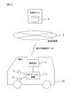
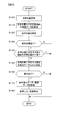
- FIG. 1 is a configuration diagram of a navigation system according to an embodiment of the present invention. It is a block diagram which shows the structure of a navigation apparatus. It is a figure which shows the example of traffic rule difference data. It is a flowchart of the process which updates traffic rule difference data. It is a flowchart of the process during vehicle travel.
- FIG. 1 shows the configuration of a navigation system according to an embodiment of the present invention.
- This system includes a navigation device 1 and a communication terminal 2 mounted on a vehicle 100, a communication network 3, and a distribution server 4.
- the navigation device 1 and the communication terminal 2 are connected by wired or wireless connection.
- Navigation device 1 detects the current position of vehicle 100, displays a map, and shows the detected current position of vehicle 100 on the map.
- the destination of the vehicle 100 is set for the user who is the driver of the vehicle 100
- the recommended route to the destination is searched, and the vehicle 100 is guided to the destination according to the searched recommended route.
- the navigation device 1 stores map data used for executing such processing.
- the navigation device 1 guides the vehicle 100 in consideration of the difference in traffic rules between that country and the user's country of residence.
- Data for performing vehicle guidance in consideration of the difference in traffic rules for each country is called traffic rule difference data. The details of the traffic rule difference data will be described later in detail.
- the traffic rule difference data can be distributed from the distribution server 4 to the navigation device 1 via the communication terminal 2 and the communication line network 3 in accordance with a user operation.
- the traffic rule difference data downloaded in advance from the distribution server 4 to the information terminal such as a personal computer may be recorded in the memory card 5 or the USB (Universal Serial ⁇ ⁇ ⁇ Bus) memory 6 and read by the navigation device 1.
- the navigation device 1 can perform vehicle guidance in consideration of the difference in traffic rules for each country, using the traffic rule difference data acquired as described above.
- the traffic rule difference data necessary for the navigation device 1 may be stored in advance without distributing the traffic rule difference data from the distribution server 4 to the navigation device 1.
- the communication terminal 2 performs wireless connection with the communication line network 3 as necessary under the control of the navigation device 1.
- a distribution server 4 is connected to the communication line network 3. That is, the navigation device 1 is connected to the distribution server 4 via the communication terminal 2 and the communication line network 3.
- a radio base station (not shown) included in the communication line network 3 is used.
- the wireless base stations can wirelessly communicate with the communication terminals 2 in a predetermined communication area around the wireless base stations, and are scattered throughout the country.
- the communication terminal 2 is a mobile phone, for example.
- the communication network 3 is constructed by, for example, a mobile phone network or the Internet.
- the distribution server 4 is a device for distributing traffic rule difference data.
- the navigation device 1 When the navigation device 1 is used in a country other than the user's country of residence, the user designates his / her country of residence with respect to the navigation device 1 and performs a predetermined operation, whereby the navigation device 1 performs the distribution server 4. It is possible to request distribution of traffic rule difference data.
- the distribution server 4 prepares traffic rule difference data for the two countries between the target country and the country of residence specified by the user, with the country corresponding to the current position of the navigation device 1 as the target country. As described above, the data is distributed to the navigation device 1 via the communication terminal 2 and the communication line network 3.
- the distribution server 4 prepares traffic rule difference data for the two countries of the destination country designated by the user and the country of residence designated by the user, and makes a distribution request. Delivered to the information terminal.
- the distribution server 4 stores bilateral traffic rule difference data for various combinations of countries.
- the traffic rule difference data corresponding to the combination is extracted in the distribution server 4 and distributed to the request source.
- Traffic rule difference data is created in the distribution server 4 and distributed to the request source.
- the memory card 5 and the USB memory 6 are recording media for recording the traffic rule difference data downloaded in advance from the distribution server 4 as described above.
- the navigation device 1 uses the traffic rule difference data. Can be read.
- other types of recording media for example, various CDs and DVDs capable of writing data may be used. Any recording medium may be used as long as it can write the traffic rule difference data downloaded in an information terminal such as a personal computer and the navigation device 1 can read the traffic rule difference data. .
- FIG. 2 is a block diagram showing the configuration of the navigation device 1.
- the navigation device 1 includes a control unit 10, a vibration gyro 11, a vehicle speed sensor 12, a hard disk drive (HDD) 13, a memory card reader 14, a USB interface 15, a GPS (Global Positioning System) receiving unit 16, A display monitor 17, a speaker 18, and an input device 19 are provided.
- a control unit 10 a vibration gyro 11, a vehicle speed sensor 12, a hard disk drive (HDD) 13, a memory card reader 14, a USB interface 15, a GPS (Global Positioning System) receiving unit 16,
- a display monitor 17, a speaker 18, and an input device 19 are provided.
- the control unit 10 includes a microprocessor, various peripheral circuits, a RAM, a ROM, and the like, and executes various processes based on a control program and map data recorded in the HDD 13.
- Various processes for guiding the host vehicle that is, the vehicle 100 to the destination are executed by the control unit 10. For example, a destination search process when setting the destination, a recommended route search process to the set destination, a current position detection process of the vehicle 100, various image display processes, a voice output process, and the like are executed.
- the communication terminal 2 is connected to the control unit 10, and the control unit 10 controls the communication terminal 2 so that the navigation device 1 sends a distribution request for traffic rule difference data to the distribution server 4 in FIG. 1. It can also be done.
- the traffic rule difference data distributed from the distribution server 4 in response to the distribution request is output to the control unit 10 via the communication terminal 2.
- the vibration gyro 11 is a sensor for detecting the angular velocity of the vehicle 100.
- the vehicle speed sensor 12 is a sensor for detecting the vehicle speed of the vehicle 100. Based on the detection results of these sensors, the control unit 10 calculates the movement state of the vehicle 100 at predetermined time intervals, thereby obtaining the amount of movement of the vehicle 100, thereby detecting the current position of the vehicle 100.
- the HDD 13 is a non-volatile recording medium that can rewrite recorded information.
- information such as a control program for executing the processing as described above in the control unit 10, map data, and the traffic rule difference data described above is recorded.
- map data recorded in the HDD 13 the map is represented by being divided into a plurality of sections in a predetermined distance unit. Each of these compartments is called a mesh. That is, in the navigation device 1, map data is managed in units of meshes.
- each road is divided into predetermined road sections. Each of these road sections is called a link. That is, in the map data, each road is composed of a plurality of links. Each of the links is set with a value called a link cost related to the time required for the vehicle to pass. The point connecting the links is called a node. Each of the nodes has position information expressed using map coordinates. Based on the position information of this node, the position and shape of each road represented on the map are determined.
- the map data is recorded on the HDD 13 in the navigation device 1.
- the map data may be recorded on something other than the HDD.
- a flash memory or the like may be used instead of the HDD.
- the memory card reader 14 is a part for reading the traffic rule difference data recorded on the memory card 5.
- the traffic card difference data recorded in the memory card 5 is read out by the memory card reader 14 under the control of the control unit 10.
- the data is output to the HDD 13.
- the traffic rule difference data is read from the memory card 5 in the navigation device 1 and recorded in the HDD 13.
- the USB interface 15 has a slot portion for loading the USB memory 6.
- the traffic rule difference data recorded in the USB memory 6 is read out by the USB interface 15 under the control of the control part 10 and a predetermined interface process is performed. Are output to the HDD 13.
- the traffic rule difference data is read from the USB memory 6 in the navigation device 1 and recorded in the HDD 13.
- the GPS receiver 16 receives a GPS signal transmitted from a GPS satellite and outputs it to the controller 10.
- the GPS signal includes information on the position and transmission time of the GPS satellite that transmitted the GPS signal as information for obtaining the position of the vehicle 100 and the current time. Therefore, by receiving GPS signals from a predetermined number or more of GPS satellites, the current position and current time of the vehicle 100 can be calculated based on these pieces of information. Based on the current position of the vehicle 100 calculated based on the GPS signal received by the GPS receiver 16 and the current position of the vehicle 100 calculated based on the detection results of the vibration gyro 11 and the vehicle speed sensor 12 described above. Thus, the final current position of the vehicle 100 is obtained.
- the display monitor 17 is a device for displaying various screens in the navigation device 1 and is configured using a liquid crystal display or the like.
- the display monitor 17 displays a map screen.
- the contents of the screen displayed on the display monitor 17 are determined by screen display control performed by the control unit 10.
- the display monitor 17 is installed at a position where the user can easily see, for example, on the dashboard of the vehicle 100 or in the instrument panel.
- the speaker 18 outputs various audio information related to the traveling of the vehicle under the control of the control unit 10. For example, route guidance voice for guiding the vehicle to the destination according to the recommended route, various warning sounds, and the like are output.
- the input device 19 is a device for a user to perform various input operations for operating the navigation device 1, and has various input switches.
- the user operates the input device 19 to input, for example, the name of a facility or point desired to be set as a destination, select a destination from registered locations registered in advance, or display a map in an arbitrary direction. Or scroll.
- the input device 19 can be realized by an operation panel, a remote controller, or the like. Alternatively, the input device 19 may be realized by a touch panel integrated with the display monitor 17.
- the navigation device 1 searches for a route to the destination where the total of the link costs is minimum, for example, based on the link cost set in the map data.
- the route is set as a recommended route.
- the recommended route set in this way is displayed on the map in a display form distinguishable from other roads. Thereafter, the navigation device 1 displays a map around the current location, and guides the vehicle 100 to the destination according to the set recommended route.
- the navigation device 1 can perform vehicle guidance considering the difference in traffic rules for each country. That is, when the vehicle 100 is traveling in a country different from the country of residence of the user, the user is informed of the difference between the traffic rules in the country of residence of the user and the traffic rules in the country of travel of the vehicle 100 as necessary. To alert the user. This avoids inconveniences such as unintentionally committing a traffic violation and allows the user to drive the vehicle 100 with peace of mind even in a country different from his / her country of residence.
- FIG. 3 is a diagram showing an example of traffic rule difference data used in the navigation device 1.
- the traffic rule difference data is composed of, for example, a difference table shown in FIG. 3A, guidance voice data shown in FIG. 3B, and image data shown in FIG.
- the difference table in FIG. 3A classifies whether or not there is a difference between the traffic rules in the home country, that is, the user's country of residence, and the traffic rules in the country corresponding to the travel destination, that is, the current position of the vehicle 100, for each item. It is the data expressed.
- signs 21, 22, and 23 indicate whether or not there is a difference in traffic rules between the home country and the destination country for each item of a right turn at an intersection without a signal, a right turn at an intersection with a signal, and a level crossing.
- Each column is shown in the difference table.
- the column 21 indicates “ ⁇ ” meaning a blank. This means that there is no difference in traffic rules between the two countries for a right turn at an intersection where there is no signal, and there is no corresponding guidance voice data and image data.
- the column 22 indicates “guidance voice data 1” and “image data 1”. This indicates that there is a difference in traffic rules between the two countries for a right turn at an intersection where a signal is present, and a reference destination of guidance voice data and image data for guiding the difference to the user.
- “guidance voice data 2” is shown. This indicates that there is a difference in traffic rules between the two countries regarding the passage of a railroad crossing, and the reference destination of the guidance voice data for guiding the difference to the user.
- the guidance voice data in FIG. 3 (b) is vehicle guidance data representing voice to be output from the speaker 18 when there is a difference in traffic rules between the home country and the destination country, and the difference in FIG. 3 (a). It is classified for each corresponding item in the table. For example, “guidance voice data 1” indicated by reference numeral 31 corresponds to the difference in the traffic rules for the right turn at the intersection 22 where the signal is present in the difference table of FIG. “Guidance voice data 2” indicated by reference numeral 32 corresponds to the difference in the traffic rule for the passage 23 in the difference table of FIG.
- the image data in FIG. 3C is vehicle guidance data representing an image to be displayed on the display monitor 17 when there is a difference in traffic rules between the home country and the destination country, and the guidance in FIG. Similar to the audio data, the items are classified for each corresponding item in the difference table of FIG. For example, “image data 1” indicated by reference numeral 33 corresponds to the difference in traffic rules for a right turn at an intersection with a signal in the column 22 in the difference table of FIG.
- the navigation device 1 When the vehicle 100 is traveling in a country different from the user's country of residence, the navigation device 1 performs vehicle guidance considering the difference in traffic rules for each country based on the traffic rule difference data as described above. . Specifically, based on the difference table illustrated in FIG. 3A, the difference between the traffic rules in the home country, that is, the user's country of residence, and the traffic rules in the country corresponding to the destination, that is, the current position of the vehicle 100. Is determined for each item of the difference table. Then, for the item determined to have a difference, the guidance voice data and / or image data corresponding to the item is specified from the guidance voice data of FIG. 3B and / or the image data of FIG. To do. Vehicle guidance is performed by outputting sound based on the guidance voice data thus identified from the speaker 18 or displaying an image based on the image data on the display monitor 17.
- the navigation device 1 faces the vehicle 100 at the intersection in front of the vehicle 100 based on “guidance voice data 1” of reference numeral 31 and “image data 1” of reference numeral 33, for example.
- the user can be notified that a right turn is possible when the direction signal indicates a stop.
- the user can be notified that there is no need to pause before the crossing when the vehicle 100 passes the crossing.
- the traffic rule difference data shown in FIG. 3 is merely an example, and the content of the traffic rule difference data is not limited to this.
- the difference table may indicate whether or not there is a difference in traffic rules between the user's country of residence and the country corresponding to the current position of the vehicle 100. it can.
- various information such as an address number indicating the data storage destination can be used as information for referring to the corresponding guidance voice data and image data from the difference table.
- data in a format other than the guidance voice data and image data for example, program data for causing the navigation device 1 to execute a specific operation is included in the traffic rule difference data, and guidance is performed using this data. Also good.
- the traffic rule difference data having various contents can be used in the navigation device 1.
- FIG. 4 shows a flowchart of processing for updating the traffic rule difference data recorded in the HDD 13 in the navigation device 1.
- the processing of this flowchart is performed when the traffic rule difference data is downloaded from the distribution server 4 according to the user's operation, or when the previously downloaded traffic rule difference data is read from the memory card 5 or the USB memory 6. 10 is executed.
- step S10 the control unit 10 acquires residence country data indicating the residence country designated by the user and traffic rule difference data.
- the traffic rule difference data is transmitted from the distribution server 4 to the communication terminal 2 via the communication network 3 in response to the traffic rule difference data distribution request as described above. Is sent.
- the country of residence data corresponding to the country of residence designated by the user is also transmitted.
- the communication terminal 2 receives the residence country data and the traffic rule difference data.
- the navigation device 1 obtains the residence country data and the traffic rule difference data. Is done.
- step S20 the control unit 10 determines whether or not the residence country data and the traffic rule difference data acquired in step S10 have been stored in the HDD 13. If the data has already been recorded in the HDD 13, the control unit 10 determines that the data has been saved, and ends the processing shown in the flowchart of FIG. In this case, the traffic rule difference data is not updated. On the other hand, if the data is not recorded in the HDD 13, the control unit 10 determines that the data has not been saved and proceeds to step S30.
- step S30 the control unit 10 records the residence country data and the traffic rule difference data acquired in step S10 in the HDD 13, and stores these data. At this time, if other traffic rule difference data has already been recorded, the traffic rule difference data obtained by deleting it may be overwritten and saved, or the traffic rule difference data obtained without leaving it may be stored. It may be newly saved.
- step S30 the control part 10 will complete
- the traffic rule difference data recorded in the HDD 13 is updated, and the acquired residence country data and traffic rule difference data are newly stored in the navigation device 1.
- FIG. 5 shows a flowchart of processing executed in the navigation device 1 when the vehicle 100 is traveling. The process of this flowchart is executed by the control unit 10 every predetermined processing cycle whenever the navigation device 1 is operating.
- step S100 the control unit 10 updates the own vehicle position, that is, the position of the vehicle 100, based on the current position of the vehicle 100 obtained as described above.
- the process for detecting the current position of the vehicle 100 is executed in parallel with the process of FIG. By updating the vehicle position based on the latest current position obtained by this process, the process of step S100 is executed.
- step S110 the control unit 10 acquires map data within a predetermined range from the vehicle position updated in step S100 from the HDD 13.
- map data included in a predetermined range centered on the vehicle position for example, a range within 10 km from the vehicle position
- the road on which the vehicle 100 is traveling may be specified, and map data within a predetermined range may be acquired along the road.
- the recommended route from the departure point to the destination is searched and the vehicle 100 is guided to the destination according to the recommended route, the recommended route is within a predetermined range along the recommended route ahead of the vehicle position. You may make it acquire map data.
- an arbitrary range determined based on the vehicle position can be set as a map data acquisition target range.
- step S120 the control unit 10 specifies a guidance target to be a target of vehicle guidance based on the map data acquired in step S110.
- various road elements designated in advance as candidates for guidance include roads that have traffic restrictions such as intersections, railroad crossings, junctions, junctions, interchanges, one-way traffic, and lanes on which only specific vehicles can travel
- An object to be guided is specified by selecting the map data that is closest to the vehicle position from among roads and the like. At this time, a plurality of road elements may be targeted for guidance.
- the selection range of the road element is determined as the guidance target in consideration of the recommended route and the traveling direction of the vehicle 100. Further, when the recommended route is not set, a future route is estimated from the road on which the vehicle 100 is currently traveling and the traveling direction of the vehicle 100, and the estimation result is reflected to determine the road element as the guidance target.
- the selection range may be determined.
- step S130 the control unit 10 determines whether or not the guidance target is specified in step S120. If the guidance target is specified by selecting at least one road element satisfying the above conditions from among the road elements included in the map data acquired in step S110, the process proceeds to step S140. On the other hand, if there is no road element that satisfies the above conditions in the map data acquired in step S110, and the guidance target is not specified for that purpose, the control unit 10 ends the process shown in the flowchart of FIG. To do. In this case, the vehicle guidance considering the difference in traffic rules between the country corresponding to the vehicle position and the user's country of residence is not performed.
- step S140 the control unit 10 determines whether the country corresponding to the vehicle position updated in step S100 matches the country of residence of the user who is the driver. This determination is made based on the country of residence data recorded in the HDD 13 in step S30 of FIG. That is, it is determined which country the vehicle position corresponds to based on the map data, and it is determined whether or not the country and the user's country of residence represented by the country of residence data match. As a result, if the country corresponding to the vehicle position is different from the country where the user resides, the control unit 10 determines that the vehicle guidance should be performed in consideration of the difference in traffic rules in these countries, and the process proceeds to step S150. On the other hand, when the country corresponding to the vehicle position matches the country where the user resides, the control unit 10 determines that the vehicle guidance is unnecessary, and ends the process illustrated in the flowchart of FIG.
- step S150 the control unit 10 searches the difference table included in the traffic rule difference data recorded in the HDD 13 in step S30 of FIG. 4 for an item corresponding to the guidance target specified in step S120.
- step S160 the control unit 10 determines whether there is a difference in the traffic rules regarding the guidance target between the country corresponding to the vehicle position and the country of residence of the user, based on the difference table search result in step S150. Determine. For example, as shown in columns 22 and 23 in FIG. 3A, the reference field of the guidance voice data and image data is shown in the item column of the difference table corresponding to the guidance target, and there is a difference in the traffic rules. , The control unit 10 determines that there is a difference and proceeds to step S160.
- step S170 based on the difference table search result in step S150, the control unit 10 acquires guidance voice data and / or image data corresponding to the difference in traffic rules for the guidance target.
- the guidance voice data and the image data included in the traffic rule difference data recorded in the HDD 13 in step S30 of FIG. 4 the guidance voice data and the image referred to by the item column of the difference table corresponding to the guidance target. Get the data.
- “guidance voice data 1” indicated by reference numeral 31 in FIG.” “Image data 1” indicated by reference numeral 33 in (c) is acquired.
- “guidance voice data 2” indicated by reference numeral 32 in FIG. 3B is acquired by referring to the column 23 in FIG.
- step S180 the control unit 10 performs voice output and / or image display based on the guidance voice data and / or image data acquired in step S170. That is, when the guidance voice data is acquired in step S170, the voice based on the guidance voice data is output from the speaker 18. When image data is acquired in step S170, an image based on the image data is displayed on the display monitor 17. By performing voice output and image display in this way, vehicle guidance that takes into account the difference in traffic rules between the country corresponding to the vehicle position and the country of residence of the user is performed for the guidance target.
- the vehicle guidance according to the present invention by voice output and image display as described above has a distance from the vehicle 100 to the guidance object, for example, as in the conventional vehicle guidance performed for guiding the vehicle 100 to the destination. This can be done when the value falls within a predetermined value.
- the tone of the voice output at this time is preferably different from the tone of the conventional vehicle guidance voice.
- a map is displayed on the display monitor 17, and a part or all of the recommended route is shown on the map and the position of the guidance target is indicated.
- the vehicle guidance of the present invention may be performed.
- the position of the guidance target and the contents of the difference in traffic rules for the guidance target are displayed on the map in an easy-to-understand manner using icons or the like.
- the difference in traffic rules between the country corresponding to the vehicle position and the user's country of residence for the guidance target is explained in an easy-to-understand manner using video or voice. Also good.
- step S180 the control part 10 will complete
- road elements to be guided are sequentially identified according to the vehicle position.
- vehicle guidance is performed as necessary according to the difference in traffic rules between the country corresponding to the vehicle position and the user's country of residence for the guidance target.
- the navigation device 1 detects the current position of the vehicle 100 based on the GPS signal received by the GPS receiver 16 and the detection results of the vibration gyro 11 and the vehicle speed sensor 12 by the processing of the controller 10.
- the own vehicle position is updated (step S100). Based on the current location, it is determined whether or not to perform vehicle guidance according to the difference between the traffic rules in the user's country of residence and the traffic rules in the country corresponding to the current location (step S140), and performs vehicle guidance. If it is determined that it should be, vehicle guidance is performed (step S180). Since it did in this way, the appropriate vehicle guidance which considered the difference of the traffic rule for every country with respect to the user who is the driver
- the navigation device 1 stores in the HDD 13 traffic rule difference data relating to the difference between the traffic rule in the country of residence of the user and the traffic rule in the country corresponding to the current position, and the vehicle is based on the traffic rule difference data. Guided. Thereby, suitable vehicle guidance can be performed according to the difference of the traffic rule between a user's residence country and the country corresponding to the present position.
- the navigation device 1 specifies a guidance target to be a target of vehicle guidance by the processing of the control unit 10 (step S120). Further, there are a difference table for each item indicating whether or not there is a difference between the traffic rule in the user's country of residence and the traffic rule in the country corresponding to the current position, and data for vehicle guidance according to the difference for each item.
- the traffic rule difference data including the guidance voice data and the image data is stored in the HDD 13. Then, by the processing of the control unit 10, for the item corresponding to the guidance target specified in step S 120, the HDD 13 determines whether there is a difference between the traffic rule in the country where the user resides and the traffic rule in the country corresponding to the current position.
- step S160 Is determined from the difference table included in the traffic rule difference data stored in (step S160), and based on the determination result and the guidance voice data and / or image data included in the traffic rule difference data stored in the HDD 13
- step S180 vehicle guidance is performed.
- the vehicle guidance which considered the difference of the traffic rule for every country about the guidance object which should be made into the object of vehicle guidance can be performed exactly.
- step S180 If the control unit 10 determines that there is a difference in the item corresponding to the guidance target according to the determination result in step S160, the control unit 10 performs vehicle guidance in step S180, but determines that there is no difference.
- the vehicle guidance is not performed without executing step S180. Thereby, it is possible to prevent the unnecessary vehicle guidance from being performed by performing the vehicle guidance considering the difference in the traffic rules for each country only when necessary for the guidance target.
- the navigation device 1 reads the traffic rule difference data from the memory card 5 or the USB memory 6 in which the traffic rule difference data is recorded by using the memory card reader 14 or the USB interface 15 by the process of the control unit 10.
- traffic rule difference data is acquired (step S10).
- the traffic rule difference data is acquired by receiving the traffic rule difference data using the communication terminal 2 from the distribution server 4 in which the traffic rule difference data is recorded (step S10).
- the traffic rule difference data thus obtained is stored in the HDD 13 (step S30), so that the traffic rule difference data is stored in the HDD 13.
- the optimal traffic rule difference data can be easily and surely acquired according to the traffic rule difference between the user's country of residence and the country corresponding to the current position, and can be stored in the HDD 13.
- step S140 the control unit 10 determines whether or not the country corresponding to the current position matches the user's country of residence specified in advance, thereby determining the traffic rules and the current position in the user's country of residence. Judgment is made as to whether or not to perform vehicle guidance according to the difference with the traffic rules in the corresponding country. Thereby, it can be reliably determined whether or not to perform vehicle guidance.
- the navigation device 1 can search for a recommended route from the departure point to the destination by the processing of the control unit 10.
- step S180 a map for showing the recommended route is displayed on the display monitor 17, and the position of the guidance target specified on the recommended route by the process of step S120 is shown on the map for vehicle guidance. In this way, it is possible to provide easy-to-understand vehicle guidance for various guidance targets on the recommended route before the vehicle 100 approaches the guidance target.
- the example in which vehicle guidance is performed in consideration of the difference in traffic rules for each country regarding the right turn or crossing at a crossing where a signal is present has been described.
- the vehicle guidance by can be performed.
- a country such as Japan where the vehicle passes on the left side of the road
- the vehicle guidance is provided for a left turn at an intersection with a signal. It is preferable to carry out.
- a traveling method of a roundabout such as a roundabout that is not so common in Japan may be described.
- vehicle guidance may be performed to notify the user of that.
- the navigation apparatus 1 can provide vehicle guidance for notifying the user of various things in consideration of differences in traffic rules between countries.
- the traffic rule difference data acquired in step S10 of FIG. 4 includes a difference table that indicates whether or not there is a difference in traffic rules between the user's residential area and the area corresponding to the current position of the vehicle 100. . By searching this difference table in step S150 of FIG.
- step S180 it is determined whether or not there is a difference in the traffic rules for the guidance target between the area corresponding to the vehicle position and the user's residence area. If there is, the vehicle guidance according to the difference is performed in step S180. If it does in this way, suitable vehicle guidance which considered the difference in the traffic rule for every area can be performed to the user who is the driver of vehicles 100.
- the navigation apparatus 1 mounted on the vehicle 100 has been described as an example, but the present invention is not limited to this.
- the present invention can be applied to a portable navigation device that can be carried by a user.
- the navigation application provided as an application that can be executed in an information terminal such as a personal computer, a mobile phone, and a smartphone, and an information terminal that functions as a navigation device by executing the application are also within the scope of the present invention. is there.
- various types of navigation devices can be included in the scope of the present invention.
Landscapes
- Engineering & Computer Science (AREA)
- Radar, Positioning & Navigation (AREA)
- Remote Sensing (AREA)
- Automation & Control Theory (AREA)
- Physics & Mathematics (AREA)
- General Physics & Mathematics (AREA)
- Navigation (AREA)
Abstract
ナビゲーション装置は、現在位置を検出する現在位置検出部と、現在位置検出部により検出された現在位置に基づいて、ユーザの居住地域における交通規則と現在位置に対応する地域における交通規則との違いに応じた案内を行うべきか否かを判定する判定部と、判定部が案内を行うべきと判定した場合に案内を行う案内部とを備える。
Description
本発明は、ナビゲーション装置およびナビゲーション方法に関する。
従来、車両が位置する地方の方言や他国語による音声案内を行うことができるナビゲーション装置が知られている(特許文献1)。
車両の走行に関する交通規則は、国や州などの地域ごとに異なる。そのため、運転者が自身の居住地域以外の地域で車両を運転すると、居住地域との交通規則の違いにより、意図せずに交通違反を犯してしまう等の不都合を生じることがある。しかし、特許文献1に記載されている従来のナビゲーション装置は、単に方言や他国語による音声案内を行うものであるため、こうした地域ごとの交通規則の違いを考慮した適切な案内を行うことはできない。
本発明の第1の態様によるナビゲーション装置は、現在位置を検出する現在位置検出部と、現在位置検出部により検出された現在位置に基づいて、ユーザの居住地域における交通規則と現在位置に対応する地域における交通規則との違いに応じた案内を行うべきか否かを判定する判定部と、判定部が案内を行うべきと判定した場合に案内を行う案内部とを備える。
本発明の第2の態様によると、第1の態様のナビゲーション装置は、ユーザの居住地域における交通規則と現在位置に対応する地域における交通規則との間の差分に関する交通規則差分情報を記憶する記憶部をさらに備えることが好ましい。このナビゲーション装置において、案内部は、記憶部により記憶された交通規則差分情報に基づいて案内を行うことができる。
本発明の第3の態様によると、第2の態様のナビゲーション装置は、案内の対象とすべき案内対象を特定する案内対象特定部をさらに備えてもよい。このナビゲーション装置において、交通規則差分情報は、ユーザの居住地域における交通規則と現在位置に対応する地域における交通規則との間の差分の有無を項目ごとに表す差分テーブル情報と、項目ごとの差分に応じた案内情報とを含むことが好ましい。また、案内部は、案内対象特定部により特定された案内対象に対応する項目について差分の有無を差分テーブル情報から判断し、その判断結果と案内情報とに基づいて案内を行うことが好ましい。
本発明の第4の態様によると、第3の態様のナビゲーション装置において、案内部は、案内対象に対応する項目について差分があると判断した場合は案内を行い、差分がないと判断した場合は案内を行わないことが好ましい。
本発明の第5の態様によると、第2~第4いずれかの態様のナビゲーション装置は、記録媒体と接続され、記録媒体に記録されている情報を読み出す情報読み出し部と、交通規則差分情報が記録されている記録媒体から情報読み出し部を用いて交通規則差分情報を読み出すことにより、交通規則差分情報を取得する交通規則差分情報取得部とをさらに備え、交通規則差分情報取得部により取得された交通規則差分情報が記憶部に記憶されることとしてよい。
本発明の第6の態様によると、第2~第4いずれかの態様のナビゲーション装置は、サーバ装置と接続され、サーバ装置から送信される情報を受信する通信部と、交通規則差分情報が記録されているサーバ装置から通信部を用いて交通規則差分情報を受信することにより、交通規則差分情報を取得する交通規則差分情報取得部とをさらに備え、交通規則差分情報取得部により取得された交通規則差分情報が記憶部に記憶されることとしてもよい。
本発明の第7の態様によると、第1~第6いずれかの態様のナビゲーション装置において、判定部は、現在位置に対応する地域が予め指定されたユーザの居住地域と一致するか否かを判定することにより、案内を行うべきか否かを判定することが好ましい。
本発明の第8の態様によると、第1~第7いずれかの態様のナビゲーション装置は、出発地から目的地までの推奨経路を探索する経路探索部と、経路探索部により探索された推奨経路を示すための地図を表示する地図表示部と、案内の対象とすべき案内対象を推奨経路上で特定する案内対象特定部とを備えてもよい。このナビゲーション装置において、案内部は、案内対象の位置を地図上に示して案内を行うことが好ましい。
本発明の第9の態様によると、第1~第8いずれかの態様のナビゲーション装置において、案内は、前方の交差点で対面方向の信号が停止を指示しているときに右折または左折が可能であること、踏切の手前で一時停止をする必要がないこと、環状交差点の走行方法、および走行可能な車線のいずれか少なくとも一つをユーザに知らせるためのものとすることができる。
本発明の第10の態様によるナビゲーション方法は、現在位置を検出し、現在位置に基づいて、ユーザの居住地域における交通規則と現在位置に対応する地域における交通規則との違いに応じた案内を行うべきか否かを判定し、案内を行うべきと判定した場合に案内を行う。
本発明の第11の態様によると、第10の態様のナビゲーション方法において、ユーザの居住地域における交通規則と現在位置に対応する地域における交通規則との間の差分に関する交通規則差分情報を記憶し、交通規則差分情報に基づいて案内を行うことが好ましい。
本発明の第12の態様によると、第11の態様のナビゲーション方法において、交通規則差分情報は、ユーザの居住地域における交通規則と現在位置に対応する地域における交通規則との間の差分の有無を項目ごとに表す差分テーブル情報と、項目ごとの差分に応じた案内情報とを含むことが好ましい。また、案内の対象とすべき案内対象を特定し、案内対象に対応する項目について差分の有無を差分テーブル情報から判断し、その判断結果と案内情報とに基づいて案内を行うことが好ましい。
本発明の第13の態様によると、第12の態様のナビゲーション方法において、案内対象に対応する項目について差分があると判断した場合は案内を行い、差分がないと判断した場合は案内を行わないことが好ましい。
本発明の第14の態様によると、第11~第13いずれかの態様のナビゲーション方法において、交通規則差分情報が記録されている記録媒体から交通規則差分情報を読み出すことにより、交通規則差分情報を取得することができる。
本発明の第15の態様によると、第11~第13いずれかの態様のナビゲーション方法において、交通規則差分情報が記録されているサーバ装置から交通規則差分情報を受信することにより、交通規則差分情報を取得してもよい。
本発明の第16の態様によると、第10~第15いずれかの態様のナビゲーション方法において、現在位置に対応する地域が予め指定されたユーザの居住地域と一致するか否かを判定することにより、案内を行うべきか否かを判定することが好ましい。
本発明の第17の態様によると、第10~第16いずれかの態様のナビゲーション方法において、出発地から目的地までの推奨経路を探索し、推奨経路を示すための地図を表示し、案内の対象とすべき案内対象を推奨経路上で特定し、案内対象の位置を地図上に示して案内を行うことができる。
本発明の第18の態様によると、第10~第17いずれかの態様のナビゲーション方法において、案内は、前方の交差点で対面方向の信号が停止を指示しているときに右折または左折が可能であること、踏切の手前で一時停止をする必要がないこと、環状交差点の走行方法、および走行可能な車線のいずれか少なくとも一つをユーザに知らせるためのものとすることができる。
本発明の第2の態様によると、第1の態様のナビゲーション装置は、ユーザの居住地域における交通規則と現在位置に対応する地域における交通規則との間の差分に関する交通規則差分情報を記憶する記憶部をさらに備えることが好ましい。このナビゲーション装置において、案内部は、記憶部により記憶された交通規則差分情報に基づいて案内を行うことができる。
本発明の第3の態様によると、第2の態様のナビゲーション装置は、案内の対象とすべき案内対象を特定する案内対象特定部をさらに備えてもよい。このナビゲーション装置において、交通規則差分情報は、ユーザの居住地域における交通規則と現在位置に対応する地域における交通規則との間の差分の有無を項目ごとに表す差分テーブル情報と、項目ごとの差分に応じた案内情報とを含むことが好ましい。また、案内部は、案内対象特定部により特定された案内対象に対応する項目について差分の有無を差分テーブル情報から判断し、その判断結果と案内情報とに基づいて案内を行うことが好ましい。
本発明の第4の態様によると、第3の態様のナビゲーション装置において、案内部は、案内対象に対応する項目について差分があると判断した場合は案内を行い、差分がないと判断した場合は案内を行わないことが好ましい。
本発明の第5の態様によると、第2~第4いずれかの態様のナビゲーション装置は、記録媒体と接続され、記録媒体に記録されている情報を読み出す情報読み出し部と、交通規則差分情報が記録されている記録媒体から情報読み出し部を用いて交通規則差分情報を読み出すことにより、交通規則差分情報を取得する交通規則差分情報取得部とをさらに備え、交通規則差分情報取得部により取得された交通規則差分情報が記憶部に記憶されることとしてよい。
本発明の第6の態様によると、第2~第4いずれかの態様のナビゲーション装置は、サーバ装置と接続され、サーバ装置から送信される情報を受信する通信部と、交通規則差分情報が記録されているサーバ装置から通信部を用いて交通規則差分情報を受信することにより、交通規則差分情報を取得する交通規則差分情報取得部とをさらに備え、交通規則差分情報取得部により取得された交通規則差分情報が記憶部に記憶されることとしてもよい。
本発明の第7の態様によると、第1~第6いずれかの態様のナビゲーション装置において、判定部は、現在位置に対応する地域が予め指定されたユーザの居住地域と一致するか否かを判定することにより、案内を行うべきか否かを判定することが好ましい。
本発明の第8の態様によると、第1~第7いずれかの態様のナビゲーション装置は、出発地から目的地までの推奨経路を探索する経路探索部と、経路探索部により探索された推奨経路を示すための地図を表示する地図表示部と、案内の対象とすべき案内対象を推奨経路上で特定する案内対象特定部とを備えてもよい。このナビゲーション装置において、案内部は、案内対象の位置を地図上に示して案内を行うことが好ましい。
本発明の第9の態様によると、第1~第8いずれかの態様のナビゲーション装置において、案内は、前方の交差点で対面方向の信号が停止を指示しているときに右折または左折が可能であること、踏切の手前で一時停止をする必要がないこと、環状交差点の走行方法、および走行可能な車線のいずれか少なくとも一つをユーザに知らせるためのものとすることができる。
本発明の第10の態様によるナビゲーション方法は、現在位置を検出し、現在位置に基づいて、ユーザの居住地域における交通規則と現在位置に対応する地域における交通規則との違いに応じた案内を行うべきか否かを判定し、案内を行うべきと判定した場合に案内を行う。
本発明の第11の態様によると、第10の態様のナビゲーション方法において、ユーザの居住地域における交通規則と現在位置に対応する地域における交通規則との間の差分に関する交通規則差分情報を記憶し、交通規則差分情報に基づいて案内を行うことが好ましい。
本発明の第12の態様によると、第11の態様のナビゲーション方法において、交通規則差分情報は、ユーザの居住地域における交通規則と現在位置に対応する地域における交通規則との間の差分の有無を項目ごとに表す差分テーブル情報と、項目ごとの差分に応じた案内情報とを含むことが好ましい。また、案内の対象とすべき案内対象を特定し、案内対象に対応する項目について差分の有無を差分テーブル情報から判断し、その判断結果と案内情報とに基づいて案内を行うことが好ましい。
本発明の第13の態様によると、第12の態様のナビゲーション方法において、案内対象に対応する項目について差分があると判断した場合は案内を行い、差分がないと判断した場合は案内を行わないことが好ましい。
本発明の第14の態様によると、第11~第13いずれかの態様のナビゲーション方法において、交通規則差分情報が記録されている記録媒体から交通規則差分情報を読み出すことにより、交通規則差分情報を取得することができる。
本発明の第15の態様によると、第11~第13いずれかの態様のナビゲーション方法において、交通規則差分情報が記録されているサーバ装置から交通規則差分情報を受信することにより、交通規則差分情報を取得してもよい。
本発明の第16の態様によると、第10~第15いずれかの態様のナビゲーション方法において、現在位置に対応する地域が予め指定されたユーザの居住地域と一致するか否かを判定することにより、案内を行うべきか否かを判定することが好ましい。
本発明の第17の態様によると、第10~第16いずれかの態様のナビゲーション方法において、出発地から目的地までの推奨経路を探索し、推奨経路を示すための地図を表示し、案内の対象とすべき案内対象を推奨経路上で特定し、案内対象の位置を地図上に示して案内を行うことができる。
本発明の第18の態様によると、第10~第17いずれかの態様のナビゲーション方法において、案内は、前方の交差点で対面方向の信号が停止を指示しているときに右折または左折が可能であること、踏切の手前で一時停止をする必要がないこと、環状交差点の走行方法、および走行可能な車線のいずれか少なくとも一つをユーザに知らせるためのものとすることができる。
本発明によれば、車両の運転者に対して、地域ごとの交通規則の違いを考慮した適切な案内を行うことができる。
本発明の一実施の形態によるナビゲーションシステムの構成を図1に示す。このシステムは、車両100に搭載されているナビゲーション装置1および通信端末2と、通信回線網3と、配信サーバ4とによって構成される。なお、ナビゲーション装置1と通信端末2は、有線あるいは無線接続によって接続されている。
ナビゲーション装置1は、車両100の現在位置を検出し、地図を表示して検出した車両100の現在位置をその地図上に示す。そして、車両100の運転者であるユーザに車両100の目的地が設定されると、その目的地までの推奨経路を探索し、探索した推奨経路に従って車両100を目的地まで案内する。ナビゲーション装置1には、このような処理を実行するために用いる地図データが記憶されている。
またナビゲーション装置1は、車両100が現在走行している国がユーザの居住国と異なる場合、その国とユーザの居住国との間における交通規則の違いを考慮して車両100の案内を行う。こうした国ごとの交通規則の違いを考慮した車両案内を行うためのデータは、交通規則差分データと呼ばれている。なお、交通規則差分データの詳細については、後で詳しく説明する。
交通規則差分データは、ユーザの操作に応じて、通信端末2および通信回線網3を介して配信サーバ4からナビゲーション装置1に配信することができる。あるいは、配信サーバ4からパーソナルコンピュータ等の情報端末に予めダウンロードされた交通規則差分データをメモリカード5やUSB(Universal Serial Bus)メモリ6に記録しておき、これをナビゲーション装置1において読み込むこととしてもよい。ナビゲーション装置1は、上記のようにして取得した交通規則差分データを用いて、国ごとの交通規則の違いを考慮した車両案内を行うことができる。なお、配信サーバ4からナビゲーション装置1に交通規則差分データを配信せず、ナビゲーション装置1において必要な交通規則差分データを予め記憶しておいてもよい。
通信端末2は、ナビゲーション装置1の制御により、必要に応じて通信回線網3と無線接続を行う。通信回線網3には、配信サーバ4が接続されている。すなわちナビゲーション装置1は、通信端末2と通信回線網3を介して配信サーバ4に接続する。通信端末2と通信回線網3が無線接続する際には、通信回線網3が有する不図示の無線基地局が用いられる。この無線基地局は、その周囲の所定の通信エリア内にある通信端末2と無線通信することが可能であり、全国各地に散在している。なお、通信端末2は、たとえば携帯電話などである。また、通信回線網3は、たとえば携帯電話回線網やインターネットなどにより構築される。
配信サーバ4は、交通規則差分データを配信するための装置である。ユーザの居住国以外の国でナビゲーション装置1を利用する場合、ユーザはナビゲーション装置1に対して自身の居住国を指定して所定の操作を行うことにより、ナビゲーション装置1から配信サーバ4に対して交通規則差分データの配信要求を行うことができる。この配信要求に応じて配信サーバ4は、ナビゲーション装置1の現在位置に対応する国を対象国として、当該対象国とユーザが指定した居住国との二国間について交通規則差分データを用意し、前述のように通信端末2および通信回線網3を介してナビゲーション装置1へ配信する。または、ユーザが居住国以外の国へ渡航する前に、パーソナルコンピュータ等の情報端末を用いて、自身の居住国と渡航先の国を指定して交通規則差分データを配信サーバ4から予めダウンロードしておき、前述のようにメモリカード5やUSBメモリ6に記録しておくこともできる。その場合、配信サーバ4は、ユーザから指定された渡航先の国を対象国として、当該対象国とユーザが指定した居住国との二国間について交通規則差分データを用意し、配信要求が行われた情報端末へ配信する。
なお、配信サーバ4には、様々な国同士の組合せについて二国間の交通規則差分データがそれぞれ記憶されている。ナビゲーション装置1や情報端末からの配信要求により対象国およびユーザの居住国が特定されると、その組合せに対応する交通規則差分データが配信サーバ4において抽出され、要求元へと配信される。あるいは、様々な二国間の交通規則差分データを記憶する代わりに、国ごとの交通規則に関するデータを配信サーバ4に記憶しておくようにしてもよい。この場合、ナビゲーション装置1や情報端末から交通規則差分データの配信要求があると、配信サーバ4に記憶されている国ごとの交通規則に関するデータに基づいて、対象国とユーザの居住国に対応する交通規則差分データが配信サーバ4において作成され、要求元へと配信される。
メモリカード5およびUSBメモリ6は、前述のように配信サーバ4から予めダウンロードされた交通規則差分データを記録するための記録媒体である。ナビゲーション装置1は、パーソナルコンピュータ等の情報端末を用いて配信サーバ4からダウンロードした交通規則差分データが記録されているメモリカード5またはUSBメモリ6がユーザによってセットされると、そこから交通規則差分データを読み込むことができる。なお、メモリカード5やUSBメモリ6の代わりに、他の種類の記録媒体、たとえばデータ書き込み可能な各種のCD、DVDなどを用いてもよい。パーソナルコンピュータ等の情報端末においてダウンロードした交通規則差分データを書き込むことができると共に、その交通規則差分データをナビゲーション装置1において読み出すことができるものである限り、どのような記録媒体を利用してもよい。
次にナビゲーション装置1の構成について説明する。図2は、ナビゲーション装置1の構成を示すブロック図である。図2に示すように、ナビゲーション装置1は、制御部10、振動ジャイロ11、車速センサ12、ハードディスクドライブ(HDD)13、メモリカードリーダ14、USBインタフェース15、GPS(Global Positioning System)受信部16、表示モニタ17、スピーカ18および入力装置19を備えている。
制御部10は、マイクロプロセッサや各種周辺回路、RAM、ROM等によって構成されており、HDD13に記録されている制御プログラムや地図データに基づいて、各種の処理を実行する。この制御部10により、自車両すなわち車両100を目的地まで案内するための様々な処理が実行される。たとえば、目的地を設定する際の目的地の探索処理、設定された目的地までの推奨経路の探索処理、車両100の現在位置の検出処理、各種の画像表示処理、音声出力処理などが実行される。また、制御部10には通信端末2が接続されており、制御部10によって通信端末2を制御することで、ナビゲーション装置1から図1の配信サーバ4に対して交通規則差分データの配信要求を行うこともできる。この配信要求に応じて配信サーバ4から配信された交通規則差分データは、通信端末2を経由して制御部10へ出力される。
振動ジャイロ11は、車両100の角速度を検出するためのセンサである。車速センサ12は、車両100の車速を検出するためのセンサである。これらのセンサの検出結果に基づいて、制御部10において車両100の運動状態を所定の時間間隔ごとに算出することにより、車両100の移動量が求められ、それによって車両100の現在位置が検出される。
HDD13は、記録されている情報を書き換え可能な不揮発性の記録媒体である。このHDD13には、制御部10において上記のような処理を実行するための制御プログラムや、地図データ、前述の交通規則差分データなどの情報が記録されている。HDD13に記録されている地図データでは、地図が所定の距離単位で複数の区画に分割されて表されている。この区画のそれぞれはメッシュと呼ばれる。すなわち、ナビゲーション装置1において、地図データはメッシュ単位で管理されている。
HDD13に記録されている地図データにおいて、各道路は所定の道路区間ごとに分割されて表されている。この道路区間のそれぞれは、リンクと呼ばれる。すなわち、地図データにおいて、各道路は複数のリンクにより構成されている。このリンクのそれぞれには、車両が通過するときの所要時間に関するリンクコストと呼ばれる値が設定されている。リンク同士を接続している点はノードと呼ばれる。ノードのそれぞれは、地図の座標を用いて表現された位置情報を有している。このノードの位置情報に基づいて、地図上に表される各道路の位置や形状が決定される。
なお、上記ではナビゲーション装置1において地図データがHDD13に記録されている例を説明したが、HDD以外のものに地図データを記録してもよい。たとえば、HDDの代わりにフラッシュメモリなどを用いてもよい。
メモリカードリーダ14は、メモリカード5に記録されている交通規則差分データを読み出すための部分である。メモリカードリーダ14に設けられている挿入口にメモリカード5がセットされると、制御部10の制御により、メモリカード5に記録されている交通規則差分データがメモリカードリーダ14によって読み出され、HDD13に出力される。これにより、ナビゲーション装置1においてメモリカード5から交通規則差分データが読み込まれ、HDD13に記録される。
USBインタフェース15は、USBメモリ6を装填するためのスロット部を有している。このスロット部にUSBメモリ6が装填されると、制御部10の制御により、USBメモリ6に記録されている交通規則差分データがUSBインタフェース15によって読み出され、所定のインタフェース処理が行われた後、HDD13に出力される。これにより、ナビゲーション装置1においてUSBメモリ6から交通規則差分データが読み込まれ、HDD13に記録される。
GPS受信部16は、GPS衛星から送信されるGPS信号を受信して制御部10へ出力する。GPS信号には、車両100の位置と現在時刻を求めるための情報として、そのGPS信号を送信したGPS衛星の位置と送信時刻に関する情報が含まれている。したがって、所定数以上のGPS衛星からGPS信号を受信することにより、これらの情報に基づいて車両100の現在位置と現在時刻を算出することができる。このGPS受信部16によって受信されたGPS信号に基づいて算出された車両100の現在位置と、前述の振動ジャイロ11および車速センサ12の検出結果に基づいて算出された車両100の現在位置とに基づいて、最終的な車両100の現在位置が求められる。
表示モニタ17は、ナビゲーション装置1において様々な画面表示を行うための装置であり、液晶ディスプレイ等を用いて構成される。この表示モニタ17により、地図画面の表示などが行われる。表示モニタ17に表示される画面の内容は、制御部10が行う画面表示制御によって決定される。表示モニタ17は、たとえば車両100のダッシュボード上やインストルメントパネル内など、ユーザが見やすいような位置に設置されている。
スピーカ18は、制御部10の制御により、車両の走行に関する様々な音声情報を出力する。たとえば、推奨経路に従って自車両を目的地まで案内するための経路案内用の音声や、各種の警告音などが出力される。
入力装置19は、ナビゲーション装置1を動作させるための様々な入力操作をユーザが行うための装置であり、各種の入力スイッチ類を有している。ユーザは入力装置19を操作することにより、たとえば、目的地に設定したい施設や地点の名称等を入力したり、予め登録された登録地の中から目的地を選択したり、地図を任意の方向にスクロールしたりすることができる。この入力装置19は、操作パネルやリモコンなどによって実現することができる。あるいは、表示モニタ17と一体化されたタッチパネルにより入力装置19を実現してもよい。
ユーザが入力装置19を操作して目的地を設定すると、ナビゲーション装置1は、地図データにおいて設定された前述のリンクコストに基づいて、たとえばリンクコストの合計が最小となる目的地までの経路を探索し、その経路を推奨経路として設定する。こうして設定された推奨経路は、他の道路と区別可能な表示形態により地図上に示される。その後ナビゲーション装置1は、現在地周辺の地図を表示し、設定された推奨経路に従って車両100を目的地まで案内する。
次に、ナビゲーション装置1において行われる国ごとの交通規則の違いを考慮した車両案内について説明する。前述のように、ナビゲーション装置1は、配信サーバ4からダウンロードされた交通規則差分データを用いることにより、国ごとの交通規則の違いを考慮した車両案内を行うことができる。すなわち、ユーザの居住国とは異なる国を車両100が走行している場合、ユーザの居住国における交通規則と車両100が走行中の国における交通規則との違いを必要に応じてユーザに知らせることで、ユーザの注意を喚起する。これにより、ユーザが意図せずに交通違反を犯してしまうなどの不都合を回避し、自身の居住国とは異なる国でもユーザが安心して車両100を運転できるようにする。
図3は、ナビゲーション装置1において用いられる交通規則差分データの例を示す図である。交通規則差分データは、たとえば図3(a)に示す差分テーブル、図3(b)に示す誘導音声データ、および図3(c)に示す画像データにより構成される。
図3(a)の差分テーブルは、自国すなわちユーザの居住国における交通規則と、渡航先すなわち車両100の現在位置に対応する国における交通規則との間の差分の有無を、項目ごとに分類して表したデータである。本例では、信号がない交差点での右折、信号がある交差点での右折、および踏切の各項目について、自国と渡航先の国における交通規則の差分の有無を、符合21、22および23に示す差分テーブルの各欄にそれぞれ示している。
図3(a)の差分テーブルにおいて、欄21には空欄を意味する「-」が示されている。これは、信号がない交差点での右折について当該二国間で交通規則に違いがなく、これに対応する誘導音声データおよび画像データがいずれも存在しないことを表している。一方、欄22には「誘導音声データ1」および「画像データ1」と示されている。これは、信号がある交差点での右折について当該二国間で交通規則に違いがあり、その違いをユーザに案内するための誘導音声データおよび画像データの参照先を表している。また、欄23には「誘導音声データ2」と示されている。これは、踏切の通過について当該二国間で交通規則に違いがあり、その違いをユーザに案内するための誘導音声データの参照先を表している。
図3(b)の誘導音声データは、自国と渡航先の国において交通規則に違いがある場合にスピーカ18から出力すべき音声を表す車両案内用のデータであり、図3(a)の差分テーブルで対応する項目ごとに分類されている。たとえば、符号31に示す「誘導音声データ1」は、図3(a)の差分テーブルのうち欄22、すなわち信号がある交差点での右折に対する交通規則の差分に対応している。また、符号32に示す「誘導音声データ2」は、図3(a)の差分テーブルのうち欄23、すなわち踏切の通過に対する交通規則の差分に対応している。
図3(c)の画像データは、自国と渡航先の国において交通規則に違いがある場合に表示モニタ17に表示すべき画像を表す車両案内用のデータであり、図3(b)の誘導音声データと同様に、図3(a)の差分テーブルで対応する項目ごとに分類されている。たとえば、符号33に示す「画像データ1」は、図3(a)の差分テーブルのうち欄22、すなわち信号がある交差点での右折に対する交通規則の差分に対応している。
ユーザの居住国とは異なる国を車両100が走行している場合、ナビゲーション装置1は、以上説明したような交通規則差分データに基づいて、国ごとの交通規則の違いを考慮した車両案内を行う。具体的には、図3(a)に例示した差分テーブルに基づいて、自国すなわちユーザの居住国における交通規則と、渡航先すなわち車両100の現在位置に対応する国における交通規則との間の差分の有無を、差分テーブルの項目ごとに判断する。そして、差分があると判断した項目については、当該項目に対応する誘導音声データおよび/または画像データを図3(b)の誘導音声データおよび/または図3(c)の画像データの中から特定する。こうして特定した誘導音声データに基づく音声をスピーカ18から出力したり、画像データに基づく画像を表示モニタ17に表示したりすることで、車両案内を行う。
図3に例示した交通規則差分データを用いることで、ナビゲーション装置1は、たとえば符号31の「誘導音声データ1」および符号33の「画像データ1」に基づいて、車両100の前方の交差点において対面方向の信号が停止を指示しているときに右折が可能であることをユーザに通知することができる。また、符号32の「誘導音声データ2」に基づいて、車両100が踏切を通過する際に踏切の手前で一時停止をする必要がないことをユーザに通知することができる。
なお、図3に示した交通規則差分データはあくまで一例であり、交通規則差分データの内容はこれに限定されるものではない。たとえば、図3(a)に例示された以外の様々な項目についても、ユーザの居住国と車両100の現在位置に対応する国との間における交通規則の差分の有無を差分テーブルにおいて表すことができる。また、差分テーブルから対応する誘導音声データや画像データを参照するための情報としては、データのファイル名以外にも、たとえばデータの格納先を表すアドレス番号などの様々な情報を用いることができる。さらに、誘導音声データや画像データ以外の形式のデータ、たとえばナビゲーション装置1に特定の動作を実行させるためのプログラムデータなどを交通規則差分データの中に含めるようにし、これを用いて案内を行ってもよい。これ以外にも、様々な内容の交通規則差分データをナビゲーション装置1において利用することができる。
図4は、ナビゲーション装置1においてHDD13に記録されている交通規則差分データを更新する処理のフローチャートを示している。このフローチャートの処理は、ユーザの操作に応じて配信サーバ4から交通規則差分データをダウンロードしたり、予めダウンロードされた交通規則差分データをメモリカード5またはUSBメモリ6から読み出したりするときに、制御部10において実行される。
ステップS10において、制御部10は、ユーザに指定された居住国を表す居住国データと、交通規則差分データとを取得する。なお、配信サーバ4から交通規則差分データをダウンロードする場合は、前述のような交通規則差分データの配信要求に応じて、配信サーバ4から通信回線網3を介して通信端末2へ交通規則差分データが送信される。このときユーザが指定した居住国に対応する居住国データも合わせて送信される。こうして配信サーバ4から送信された居住国データおよび交通規則差分データを通信端末2において受信することにより、ナビゲーション装置1において居住国データおよび交通規則差分データが取得される。一方、メモリカード5またはUSBメモリ6から交通規則差分データを読み出す場合は、配信サーバ4から予めダウンロードされた居住国データおよび交通規則差分データがメモリカード5またはUSBメモリ6において記録されている。このようなメモリカード5またはUSBメモリ6から、メモリカードリーダ14またはUSBインタフェース15を用いて居住国データおよび交通規則差分データを読み出すことにより、ナビゲーション装置1において居住国データおよび交通規則差分データが取得される。
ステップS20において、制御部10は、ステップS10で取得した居住国データおよび交通規則差分データがHDD13において保存済みであるか否かを判定する。当該データがHDD13において既に記録されている場合、制御部10は保存済みであると判定して図4のフローチャートに示す処理を終了する。この場合、交通規則差分データの更新は行われない。一方、当該データがHDD13に記録されていない場合、制御部10は保存済みではないと判定してステップS30へ進む。
ステップS30において、制御部10は、ステップS10で取得した居住国データおよび交通規則差分データをHDD13に記録し、これらのデータを保存する。このとき、既に他の交通規則差分データが記録されている場合は、それを削除して取得した交通規則差分データを上書き保存してもよいし、それを残したままで取得した交通規則差分データを新たに保存してもよい。
ステップS30を実行したら、制御部10は図4のフローチャートに示す処理を終了する。以上説明したような処理が行われることにより、HDD13に記録されている交通規則差分データが更新され、取得した居住国データおよび交通規則差分データがナビゲーション装置1において新たに記憶される。
図5は、車両100が走行中のときにナビゲーション装置1において実行される処理のフローチャートを示している。このフローチャートの処理は、ナビゲーション装置1が動作中であるときには常に、制御部10において所定の処理周期ごとに実行される。
ステップS100において、制御部10は、前述のようにして求められた車両100の現在位置に基づいて、自車位置すなわち車両100の位置を更新する。なお、車両100の現在位置を検出するための処理は、制御部10において図5の処理と並行して実行されている。この処理により求められた最新の現在位置に基づいて自車位置を更新することにより、ステップS100の処理が実行される。
ステップS110において、制御部10は、ステップS100で更新された自車位置から所定範囲内の地図データをHDD13から取得する。ここでは、自車位置を中心とする所定範囲内、たとえば自車位置から10km以内の範囲内に含まれる地図データをHDD13から取得する。あるいは、車両100が走行している道路を特定し、その道路に沿って所定範囲内の地図データを取得してもよい。さらに、出発地から目的地までの推奨経路が探索されており、その推奨経路に従って車両100を目的地まで案内している場合は、自車位置よりも前方の推奨経路に沿って所定範囲内の地図データを取得するようにしてもよい。これ以外にも、自車位置に基づいて決定される任意の範囲を地図データの取得対象範囲とすることができる。
ステップS120において、制御部10は、ステップS110で取得した地図データに基づいて、車両案内の対象とすべき案内対象を特定する。ここでは、案内対象の候補として予め指定された各種の道路要素、たとえば交差点、踏切、分岐点、合流点、インターチェンジ、一方通行等の通行規制がある道路、特定の車両のみ走行可能な車線を含む道路などの中から、自車位置に最も近いものを取得した地図データにおいて選択することにより、案内対象を特定する。このとき複数の道路要素を案内対象としてもよい。なお、出発地から目的地までの推奨経路が設定されている場合、その推奨経路および車両100の進行方向を考慮して、案内対象としての道路要素の選択範囲を決定することが好ましい。また、推奨経路が設定されていない場合は、車両100が現在走行している道路および車両100の進行方向から今後の経路を推定し、その推定結果を反映して、案内対象としての道路要素の選択範囲を決定してもよい。
ステップS130において、制御部10は、ステップS120において案内対象が特定されたか否かを判定する。ステップS110で取得した地図データに含まれる道路要素のうち、上記のような条件を満たす少なくともいずれか1つの道路要素が選択されることで案内対象が特定された場合は、ステップS140へ進む。一方、ステップS110で取得した地図データの中に上記のような条件を満たす道路要素が存在せず、そのために案内対象が特定されなかった場合、制御部10は図5のフローチャートに示す処理を終了する。この場合、自車位置に対応する国とユーザの居住国との間における交通規則の違いを考慮した車両案内は不要であるとして行われない。
ステップS140において、制御部10は、ステップS100で更新された自車位置に対応する国と運転者であるユーザの居住国とが一致するか否かを判定する。この判定は、図4のステップS30でHDD13に記録された居住国データに基づいて行われる。すなわち、地図データに基づいて自車位置がどの国に対応するかを判断し、その国と居住国データが表すユーザの居住国とが一致するか否かを判定する。その結果、自車位置に対応する国とユーザの居住国とが異なる場合、制御部10はこれらの国における交通規則の違いを考慮した車両案内を行うべきと判定してステップS150へ進む。一方、自車位置に対応する国とユーザの居住国とが一致した場合、制御部10は車両案内が不要であると判定し、図5のフローチャートに示す処理を終了する。
ステップS150において、制御部10は、図4のステップS30でHDD13に記録された交通規則差分データに含まれる差分テーブルから、ステップS120で特定された案内対象に対応する項目を検索する。続くステップS160において、制御部10は、ステップS150の差分テーブル検索結果に基づいて、自車位置に対応する国とユーザの居住国との間で案内対象についての交通規則に差分があるか否かを判定する。たとえば図3(a)において欄22および23に示したように、案内対象に対応する差分テーブルの項目欄において誘導音声データや画像データの参照先が示されており、交通規則に差分があることを表している場合、制御部10は差分ありと判定してステップS160へ進む。一方、図3(a)において欄21に示したように、案内対象に対応する差分テーブルの項目欄が空欄であり、交通規則に差分がないことを表している場合、制御部10は差分なしと判定して図5のフローチャートに示す処理を終了する。この場合にも、自車位置に対応する国とユーザの居住国との間における交通規則の違いを考慮した車両案内は不要であるとして行われない。
ステップS170において、制御部10は、ステップS150の差分テーブル検索結果に基づいて、案内対象に対する交通規則の差分に応じた誘導音声データおよび/または画像データを取得する。ここでは、図4のステップS30でHDD13に記録された交通規則差分データに含まれる誘導音声データおよび画像データの中から、案内対象に対応する差分テーブルの項目欄により参照される誘導音声データや画像データを取得する。たとえば、信号がある交差点での右折に対する交通規則の差分について、図3(a)の欄22を参照することにより、図3(b)の符号31に示す「誘導音声データ1」と、図3(c)の符号33に示す「画像データ1」とを取得する。また、踏切の通過に対する交通規則の差分について、図3(a)の欄23を参照することにより、図3(b)の符号32に示す「誘導音声データ2」を取得する。
ステップS180において、制御部10は、ステップS170で取得した誘導音声データおよび/または画像データに基づいて、音声出力および/または画像表示を行う。すなわち、ステップS170で誘導音声データを取得した場合は、その誘導音声データに基づく音声をスピーカ18から出力する。また、ステップS170で画像データを取得した場合は、その画像データに基づく画像を表示モニタ17に表示する。こうして音声出力や画像表示を行うことにより、自車位置に対応する国とユーザの居住国との間における交通規則の違いを考慮した車両案内を案内対象について行う。
なお、以上説明したような音声出力や画像表示による本発明の車両案内は、車両100を目的地まで案内するために行われる従来の車両案内と同様に、たとえば車両100から案内対象までの距離が所定値以内となったときに行うことができる。このとき出力する音声のトーンは、従来の車両案内の音声のトーンとは異なることが好ましい。さらに、出発地から目的地までの推奨経路が設定されている場合においては、表示モニタ17に地図を表示し、その地図上に推奨経路の一部または全体を示すと共に案内対象の位置を示すことで、本発明の車両案内を行ってもよい。この場合、案内対象の位置とその案内対象に対する交通規則の差分の内容とをアイコン等により地図上に分かりやすく表示することが好ましい。また、ユーザがいずれかの案内対象を選択すると、その案内対象について自車位置に対応する国とユーザの居住国との間における交通規則の違いを動画や音声などを用いて分かりやすく説明してもよい。
ステップS180を実行したら、制御部10は図5のフローチャートに示す処理を終了する。以上説明したような処理が所定の処理周期ごとに繰り返し実行されることにより、車両100が走行して自車位置が変化すると、その自車位置に応じて案内対象とすべき道路要素が逐次特定され、その案内対象について自車位置に対応する国とユーザの居住国との間における交通規則の違いを考慮した車両案内が必要に応じて行われる。
以上説明した実施の形態によれば、次のような作用効果を奏する。
(1)ナビゲーション装置1は、制御部10の処理により、GPS受信部16によって受信されたGPS信号と、振動ジャイロ11および車速センサ12の検出結果とに基づいて、車両100の現在位置を検出し、自車位置を更新する(ステップS100)。この現在位置に基づいて、ユーザの居住国における交通規則と現在位置に対応する国における交通規則との違いに応じた車両案内を行うべきか否かを判定し(ステップS140)、車両案内を行うべきと判定した場合に車両案内を行う(ステップS180)。このようにしたので、車両100の運転者であるユーザに対して、国ごとの交通規則の違いを考慮した適切な車両案内を行うことができる。
(2)ナビゲーション装置1は、ユーザの居住国における交通規則と現在位置に対応する国における交通規則との間の差分に関する交通規則差分データをHDD13に記憶し、この交通規則差分データに基づいて車両案内を行うようにした。これにより、ユーザの居住国と現在位置に対応する国との間における交通規則の差分に応じて、適切な車両案内を行うことができる。
(3)ナビゲーション装置1は、制御部10の処理により、車両案内の対象とすべき案内対象を特定する(ステップS120)。また、ユーザの居住国における交通規則と現在位置に対応する国における交通規則との間の差分の有無を項目ごとに表す差分テーブルと、その項目ごとの差分に応じた車両案内用のデータである誘導音声データおよび画像データとを含む交通規則差分データをHDD13において記憶する。そして、制御部10の処理により、ステップS120で特定された案内対象に対応する項目について、ユーザの居住国における交通規則と現在位置に対応する国における交通規則との間の差分の有無を、HDD13に記憶された交通規則差分データに含まれる差分テーブルから判断し(ステップS160)、その判断結果と、HDD13に記憶された交通規則差分データに含まれる誘導音声データおよび/または画像データとに基づいて、ステップS180において車両案内を行うようにした。これにより、車両案内の対象とすべき案内対象について、国ごとの交通規則の違いを考慮した車両案内を的確に行うことができる。
(4)制御部10は、ステップS160の判断結果に応じて、案内対象に対応する項目について差分があると判断した場合はステップS180において車両案内を行う一方で、差分がないと判断した場合はステップS180を実行せずに車両案内を行わないようにした。これにより、案内対象について必要な場合にのみ国ごとの交通規則の違いを考慮した車両案内を行うようにして、不要な車両案内が行われるのを防止することができる。
(5)ナビゲーション装置1は、制御部10の処理により、交通規則差分データが記録されているメモリカード5またはUSBメモリ6からメモリカードリーダ14またはUSBインタフェース15を用いて交通規則差分データを読み出すことにより、交通規則差分データを取得する(ステップS10)。または、交通規則差分データが記録されている配信サーバ4から通信端末2を用いて交通規則差分データを受信することにより、交通規則差分データを取得する(ステップS10)。こうして取得した交通規則差分データをHDD13に保存する(ステップS30)ことにより、交通規則差分データがHDD13に記憶されるようにした。これにより、ユーザの居住国と現在位置に対応する国との間における交通規則の差分に応じて最適な交通規則差分データを容易かつ確実に取得して、それをHDD13に記憶することができる。
(6)制御部10は、ステップS140において、現在位置に対応する国が予め指定されたユーザの居住国と一致するか否かを判定することにより、ユーザの居住国における交通規則と現在位置に対応する国における交通規則との違いに応じた車両案内を行うべきか否かを判定するようにした。これにより、車両案内を行うべきか否かの判定を確実に行うことができる。
(7)ナビゲーション装置1は、制御部10の処理により、出発地から目的地までの推奨経路を探索することができる。ステップS180では、この推奨経路を示すための地図を表示モニタ17において表示し、ステップS120の処理によって推奨経路上で特定された案内対象の位置を地図上に示して車両案内を行うことができる。このようにすれば、推奨経路上の様々な案内対象について、その案内対象に車両100が近づくよりも前に分かりやすく車両案内を行うことができる。
なお、以上説明した実施の形態では、信号がある交差点での右折や踏切の通過について国ごとの交通規則の違いを考慮した車両案内を行う例を説明したが、これ以外についても同様に本発明による車両案内を行うことができる。たとえば、車両が道路の左側を通行する日本等の国において、これとは反対の右側通行の国に居住するユーザが車両100を運転する場合などは、信号がある交差点での左折などについて車両案内を行うことが好ましい。また、たとえば日本を居住国とするユーザが他の国へ渡航した場合に、日本ではあまり一般的でないラウンドアバウト等の環状交差点の走行方法などを説明してもよい。さらに、特定の車両のみが走行可能な車線を含む道路を車両100が走行するときに、そのことをユーザに知らせるための車両案内を行ってもよい。以上説明したような各種の例の他にも、国ごとの交通規則の違いを考慮して、様々なことをユーザに知らせるための車両案内をナビゲーション装置1において行うことができる。
また、以上説明した実施の形態では、国ごとの交通規則の違いを考慮した車両案内を行う例を説明したが、本発明を国以外の地域について適用してもよい。たとえば、同じ国内であっても地域ごとに交通規則が異なる場合や、複数の国によって構成される地域ごとに交通規則が異なる場合は、その地域ごとの交通規則の違いを考慮した車両案内を行うために本発明を適用することができる。その場合、図4のステップS10で取得される交通規則差分データには、ユーザの居住地域と車両100の現在位置に対応する地域との間における交通規則の差分の有無を表す差分テーブルが含まれる。この差分テーブルを図5のステップS150において検索することにより、自車位置に対応する地域とユーザの居住地域との間で案内対象についての交通規則に差分があるか否かが判定され、差分がある場合はその差分に応じた車両案内がステップS180において行われる。このようにすれば、車両100の運転者であるユーザに対して、地域ごとの交通規則の違いを考慮した適切な車両案内を行うことができる。
上記実施の形態では車両100に搭載されるナビゲーション装置1を例として説明したが、本発明はこれに限定されない。たとえば、ユーザが持ち運び可能な携帯型のナビゲーション装置においても本発明を適用可能である。また、パーソナルコンピュータ、携帯電話、スマートフォン等の情報端末において実行可能なアプリケーションとして提供されるナビゲーション用のアプリケーションや、これを実行することによりナビゲーション装置として機能する情報端末についても、本発明の適用範囲である。これ以外にも、様々な形態のナビゲーション装置を本発明の適用範囲に含めることができる。
実施形態と変形例の一つ、もしくは複数を組み合わせることも可能である。変形例同士をどのように組み合わせることも可能である。
上記では、種々の実施の形態および変形例を説明したが、本発明はこれらの内容に限定されるものではない。本発明の技術的思想の範囲内で考えられるその他の態様も本発明の範囲内に含まれる。
Claims (18)
- 現在位置を検出する現在位置検出部と、
前記現在位置検出部により検出された現在位置に基づいて、ユーザの居住地域における交通規則と前記現在位置に対応する地域における交通規則との違いに応じた案内を行うべきか否かを判定する判定部と、
前記判定部が前記案内を行うべきと判定した場合に前記案内を行う案内部とを備えるナビゲーション装置。 - 請求項1に記載のナビゲーション装置において、
前記ユーザの居住地域における交通規則と前記現在位置に対応する地域における交通規則との間の差分に関する交通規則差分情報を記憶する記憶部をさらに備え、
前記案内部は、前記記憶部により記憶された前記交通規則差分情報に基づいて前記案内を行うナビゲーション装置。 - 請求項2に記載のナビゲーション装置において、
前記案内の対象とすべき案内対象を特定する案内対象特定部をさらに備え、
前記交通規則差分情報は、前記ユーザの居住地域における交通規則と前記現在位置に対応する地域における交通規則との間の差分の有無を項目ごとに表す差分テーブル情報と、前記項目ごとの差分に応じた案内情報とを含み、
前記案内部は、前記案内対象特定部により特定された案内対象に対応する項目について前記差分の有無を前記差分テーブル情報から判断し、その判断結果と前記案内情報とに基づいて前記案内を行うナビゲーション装置。 - 請求項3に記載のナビゲーション装置において、
前記案内部は、前記案内対象に対応する項目について前記差分があると判断した場合は前記案内を行い、前記差分がないと判断した場合は前記案内を行わないナビゲーション装置。 - 請求項2~4いずれか一項に記載のナビゲーション装置において、
記録媒体と接続され、前記記録媒体に記録されている情報を読み出す情報読み出し部と、
前記交通規則差分情報が記録されている記録媒体から前記情報読み出し部を用いて前記交通規則差分情報を読み出すことにより、前記交通規則差分情報を取得する交通規則差分情報取得部とをさらに備え、
前記交通規則差分情報取得部により取得された交通規則差分情報が前記記憶部に記憶されるナビゲーション装置。 - 請求項2~4いずれか一項に記載のナビゲーション装置において、
サーバ装置と接続され、前記サーバ装置から送信される情報を受信する通信部と、
前記交通規則差分情報が記録されているサーバ装置から前記通信部を用いて前記交通規則差分情報を受信することにより、前記交通規則差分情報を取得する交通規則差分情報取得部とをさらに備え、
前記交通規則差分情報取得部により取得された交通規則差分情報が前記記憶部に記憶されるナビゲーション装置。 - 請求項1~6いずれか一項に記載のナビゲーション装置において、
前記判定部は、前記現在位置に対応する地域が予め指定されたユーザの居住地域と一致するか否かを判定することにより、前記案内を行うべきか否かを判定するナビゲーション装置。 - 請求項1~7いずれか一項に記載のナビゲーション装置において、
出発地から目的地までの推奨経路を探索する経路探索部と、
前記経路探索部により探索された推奨経路を示すための地図を表示する地図表示部と、
前記案内の対象とすべき案内対象を前記推奨経路上で特定する案内対象特定部とを備え、
前記案内部は、前記案内対象の位置を前記地図上に示して前記案内を行うナビゲーション装置。 - 請求項1~8いずれか一項に記載のナビゲーション装置において、
前記案内は、前方の交差点で対面方向の信号が停止を指示しているときに右折または左折が可能であること、踏切の手前で一時停止をする必要がないこと、環状交差点の走行方法、および走行可能な車線のいずれか少なくとも一つを前記ユーザに知らせるためのものであるナビゲーション装置。 - 現在位置を検出し、
前記現在位置に基づいて、ユーザの居住地域における交通規則と前記現在位置に対応する地域における交通規則との違いに応じた案内を行うべきか否かを判定し、
前記案内を行うべきと判定した場合に前記案内を行うナビゲーション方法。 - 請求項10に記載のナビゲーション方法において、
前記ユーザの居住地域における交通規則と前記現在位置に対応する地域における交通規則との間の差分に関する交通規則差分情報を記憶し、
前記交通規則差分情報に基づいて前記案内を行うナビゲーション方法。 - 請求項11に記載のナビゲーション方法において、
前記交通規則差分情報は、前記ユーザの居住地域における交通規則と前記現在位置に対応する地域における交通規則との間の差分の有無を項目ごとに表す差分テーブル情報と、前記項目ごとの差分に応じた案内情報とを含み、
前記案内の対象とすべき案内対象を特定し、
前記案内対象に対応する項目について前記差分の有無を前記差分テーブル情報から判断し、その判断結果と前記案内情報とに基づいて前記案内を行うナビゲーション方法。 - 請求項12に記載のナビゲーション方法において、
前記案内対象に対応する項目について前記差分があると判断した場合は前記案内を行い、前記差分がないと判断した場合は前記案内を行わないナビゲーション方法。 - 請求項11~13いずれか一項に記載のナビゲーション方法において、
前記交通規則差分情報が記録されている記録媒体から前記交通規則差分情報を読み出すことにより、前記交通規則差分情報を取得するナビゲーション方法。 - 請求項11~13いずれか一項に記載のナビゲーション方法において、
前記交通規則差分情報が記録されているサーバ装置から前記交通規則差分情報を受信することにより、前記交通規則差分情報を取得するナビゲーション方法。 - 請求項10~15いずれか一項に記載のナビゲーション方法において、
前記現在位置に対応する地域が予め指定されたユーザの居住地域と一致するか否かを判定することにより、前記案内を行うべきか否かを判定するナビゲーション方法。 - 請求項10~16いずれか一項に記載のナビゲーション方法において、
出発地から目的地までの推奨経路を探索し、
前記推奨経路を示すための地図を表示し、
前記案内の対象とすべき案内対象を前記推奨経路上で特定し、
前記案内対象の位置を前記地図上に示して前記案内を行うナビゲーション方法。 - 請求項10~17いずれか一項に記載のナビゲーション方法において、
前記案内は、前方の交差点で対面方向の信号が停止を指示しているときに右折または左折が可能であること、踏切の手前で一時停止をする必要がないこと、環状交差点の走行方法、および走行可能な車線のいずれか少なくとも一つを前記ユーザに知らせるためのものであるナビゲーション方法。
Priority Applications (1)
| Application Number | Priority Date | Filing Date | Title |
|---|---|---|---|
| PCT/JP2011/063841 WO2012172675A1 (ja) | 2011-06-16 | 2011-06-16 | ナビゲーション装置、ナビゲーション方法 |
Applications Claiming Priority (1)
| Application Number | Priority Date | Filing Date | Title |
|---|---|---|---|
| PCT/JP2011/063841 WO2012172675A1 (ja) | 2011-06-16 | 2011-06-16 | ナビゲーション装置、ナビゲーション方法 |
Publications (1)
| Publication Number | Publication Date |
|---|---|
| WO2012172675A1 true WO2012172675A1 (ja) | 2012-12-20 |
Family
ID=47356701
Family Applications (1)
| Application Number | Title | Priority Date | Filing Date |
|---|---|---|---|
| PCT/JP2011/063841 Ceased WO2012172675A1 (ja) | 2011-06-16 | 2011-06-16 | ナビゲーション装置、ナビゲーション方法 |
Country Status (1)
| Country | Link |
|---|---|
| WO (1) | WO2012172675A1 (ja) |
Cited By (4)
| Publication number | Priority date | Publication date | Assignee | Title |
|---|---|---|---|---|
| JP2017157131A (ja) * | 2016-03-04 | 2017-09-07 | 株式会社デンソー | 推定装置 |
| CN110530380A (zh) * | 2018-05-23 | 2019-12-03 | 上海擎感智能科技有限公司 | 一种基于车载终端的城际驾驶交规差别的提醒方法、系统及车载终端 |
| CN111221448A (zh) * | 2018-11-16 | 2020-06-02 | 本田技研工业株式会社 | 信息提供方法、存储介质及信息提供系统 |
| WO2025238697A1 (ja) * | 2024-05-14 | 2025-11-20 | 日産自動車株式会社 | ソフトウェア管理方法およびソフトウェア管理システム |
Citations (3)
| Publication number | Priority date | Publication date | Assignee | Title |
|---|---|---|---|---|
| JP2005241267A (ja) * | 2004-02-24 | 2005-09-08 | Victor Co Of Japan Ltd | 車載用経路案内誘導装置 |
| WO2006077967A1 (ja) * | 2005-01-20 | 2006-07-27 | Pioneer Corporation | ナビゲーション装置、ナビゲーション方法、およびナビゲーションプログラム |
| JP2008122281A (ja) * | 2006-11-14 | 2008-05-29 | Denso Corp | カーナビゲーション装置 |
-
2011
- 2011-06-16 WO PCT/JP2011/063841 patent/WO2012172675A1/ja not_active Ceased
Patent Citations (3)
| Publication number | Priority date | Publication date | Assignee | Title |
|---|---|---|---|---|
| JP2005241267A (ja) * | 2004-02-24 | 2005-09-08 | Victor Co Of Japan Ltd | 車載用経路案内誘導装置 |
| WO2006077967A1 (ja) * | 2005-01-20 | 2006-07-27 | Pioneer Corporation | ナビゲーション装置、ナビゲーション方法、およびナビゲーションプログラム |
| JP2008122281A (ja) * | 2006-11-14 | 2008-05-29 | Denso Corp | カーナビゲーション装置 |
Cited By (4)
| Publication number | Priority date | Publication date | Assignee | Title |
|---|---|---|---|---|
| JP2017157131A (ja) * | 2016-03-04 | 2017-09-07 | 株式会社デンソー | 推定装置 |
| CN110530380A (zh) * | 2018-05-23 | 2019-12-03 | 上海擎感智能科技有限公司 | 一种基于车载终端的城际驾驶交规差别的提醒方法、系统及车载终端 |
| CN111221448A (zh) * | 2018-11-16 | 2020-06-02 | 本田技研工业株式会社 | 信息提供方法、存储介质及信息提供系统 |
| WO2025238697A1 (ja) * | 2024-05-14 | 2025-11-20 | 日産自動車株式会社 | ソフトウェア管理方法およびソフトウェア管理システム |
Similar Documents
| Publication | Publication Date | Title |
|---|---|---|
| JP3842799B2 (ja) | 地図データ提供装置 | |
| JP3942987B2 (ja) | ナビゲーションシステム、地図差分データの配信装置、及び車載用ナビゲーション装置 | |
| JP2015017944A (ja) | 自動運転支援装置 | |
| JP7013512B2 (ja) | 情報処理装置、経路案内装置、プログラム、及び、情報処理方法 | |
| CN108225347B (zh) | 通信终端、移动引导系统以及移动引导方法 | |
| JPWO2008075492A1 (ja) | 地図表示装置 | |
| JP4402047B2 (ja) | 移動体位置表示装置および方法 | |
| JP5901319B2 (ja) | ナビゲーション装置 | |
| WO2012172675A1 (ja) | ナビゲーション装置、ナビゲーション方法 | |
| JP2011047662A (ja) | ナビゲーション装置 | |
| JP2009210517A (ja) | 車両用ナビゲーション装置 | |
| JP2009092559A (ja) | ナビゲーション装置 | |
| JP2007010598A (ja) | 地図情報更新方法及びナビゲーション装置 | |
| JP2012149957A (ja) | 車載地図表示装置 | |
| JP6598858B2 (ja) | 経路案内装置 | |
| JP2012225751A (ja) | 車載情報端末 | |
| JP2008002950A (ja) | ナビゲーション装置 | |
| JP5416916B2 (ja) | ナビゲーション装置 | |
| JP2009092502A (ja) | ナビゲーション装置、配信装置 | |
| JP5255893B2 (ja) | ナビゲーション装置 | |
| JP2007093291A (ja) | ナビゲーション装置、方法及びプログラム | |
| JP5145107B2 (ja) | ナビゲーション装置、地図配信システム | |
| JP6161446B2 (ja) | 車載装置 | |
| JP6398646B2 (ja) | 案内システム、案内方法、及び案内プログラム | |
| JP4903592B2 (ja) | ナビゲーション装置 |
Legal Events
| Date | Code | Title | Description |
|---|---|---|---|
| 121 | Ep: the epo has been informed by wipo that ep was designated in this application |
Ref document number: 11867585 Country of ref document: EP Kind code of ref document: A1 |
|
| NENP | Non-entry into the national phase |
Ref country code: DE |
|
| 122 | Ep: pct application non-entry in european phase |
Ref document number: 11867585 Country of ref document: EP Kind code of ref document: A1 |
|
| NENP | Non-entry into the national phase |
Ref country code: JP |