WO2017216920A1 - 情報提供システム - Google Patents
情報提供システム Download PDFInfo
- Publication number
- WO2017216920A1 WO2017216920A1 PCT/JP2016/067912 JP2016067912W WO2017216920A1 WO 2017216920 A1 WO2017216920 A1 WO 2017216920A1 JP 2016067912 W JP2016067912 W JP 2016067912W WO 2017216920 A1 WO2017216920 A1 WO 2017216920A1
- Authority
- WO
- WIPO (PCT)
- Prior art keywords
- information
- unit
- providing system
- status information
- user terminal
- Prior art date
- Legal status (The legal status is an assumption and is not a legal conclusion. Google has not performed a legal analysis and makes no representation as to the accuracy of the status listed.)
- Ceased
Links
Images








Classifications
-
- G—PHYSICS
- G06—COMPUTING OR CALCULATING; COUNTING
- G06V—IMAGE OR VIDEO RECOGNITION OR UNDERSTANDING
- G06V20/00—Scenes; Scene-specific elements
- G06V20/50—Context or environment of the image
- G06V20/52—Surveillance or monitoring of activities, e.g. for recognising suspicious objects
-
- G—PHYSICS
- G01—MEASURING; TESTING
- G01W—METEOROLOGY
- G01W1/00—Meteorology
- G01W1/10—Devices for predicting weather conditions
-
- G—PHYSICS
- G01—MEASURING; TESTING
- G01W—METEOROLOGY
- G01W1/00—Meteorology
- G01W1/14—Rainfall or precipitation gauges
-
- G—PHYSICS
- G06—COMPUTING OR CALCULATING; COUNTING
- G06F—ELECTRIC DIGITAL DATA PROCESSING
- G06F17/00—Digital computing or data processing equipment or methods, specially adapted for specific functions
- G06F17/10—Complex mathematical operations
- G06F17/18—Complex mathematical operations for evaluating statistical data, e.g. average values, frequency distributions, probability functions, regression analysis
-
- G—PHYSICS
- G06—COMPUTING OR CALCULATING; COUNTING
- G06Q—INFORMATION AND COMMUNICATION TECHNOLOGY [ICT] SPECIALLY ADAPTED FOR ADMINISTRATIVE, COMMERCIAL, FINANCIAL, MANAGERIAL OR SUPERVISORY PURPOSES; SYSTEMS OR METHODS SPECIALLY ADAPTED FOR ADMINISTRATIVE, COMMERCIAL, FINANCIAL, MANAGERIAL OR SUPERVISORY PURPOSES, NOT OTHERWISE PROVIDED FOR
- G06Q50/00—Information and communication technology [ICT] specially adapted for implementation of business processes of specific business sectors, e.g. utilities or tourism
- G06Q50/10—Services
-
- G—PHYSICS
- G01—MEASURING; TESTING
- G01W—METEOROLOGY
- G01W1/00—Meteorology
- G01W2001/006—Main server receiving weather information from several sub-stations
-
- G—PHYSICS
- G01—MEASURING; TESTING
- G01W—METEOROLOGY
- G01W2203/00—Real-time site-specific personalized weather information, e.g. nowcasting
-
- G—PHYSICS
- G06—COMPUTING OR CALCULATING; COUNTING
- G06V—IMAGE OR VIDEO RECOGNITION OR UNDERSTANDING
- G06V40/00—Recognition of biometric, human-related or animal-related patterns in image or video data
- G06V40/10—Human or animal bodies, e.g. vehicle occupants or pedestrians; Body parts, e.g. hands
- G06V40/103—Static body considered as a whole, e.g. static pedestrian or occupant recognition
-
- Y—GENERAL TAGGING OF NEW TECHNOLOGICAL DEVELOPMENTS; GENERAL TAGGING OF CROSS-SECTIONAL TECHNOLOGIES SPANNING OVER SEVERAL SECTIONS OF THE IPC; TECHNICAL SUBJECTS COVERED BY FORMER USPC CROSS-REFERENCE ART COLLECTIONS [XRACs] AND DIGESTS
- Y02—TECHNOLOGIES OR APPLICATIONS FOR MITIGATION OR ADAPTATION AGAINST CLIMATE CHANGE
- Y02A—TECHNOLOGIES FOR ADAPTATION TO CLIMATE CHANGE
- Y02A90/00—Technologies having an indirect contribution to adaptation to climate change
- Y02A90/10—Information and communication technologies [ICT] supporting adaptation to climate change, e.g. for weather forecasting or climate simulation
Definitions
- the present invention relates to a technique for providing information related to the weather to a user.
- Patent Document 1 There is a system in which a server collects weather information measured at a plurality of locations via a network and provides weather information corresponding to the user's position to a terminal device.
- the weather information is acquired in order to determine an action according to the weather (whether or not rain gear should be carried). For example, if a person who cannot confirm the outdoor situation, such as indoors, obtains weather information that the area where he / she is located is heavy rain, it is determined that he / she should go out with an umbrella.
- the user may feel that as a result, an appropriate action cannot be taken. For example, when you get information that it is raining, some users have decided that an umbrella is necessary because it is raining. However, when you actually go outside with an umbrella, it will be a little rain like drizzle. If you regret having brought an umbrella.
- An object of this invention is to assist a user in determining whether rain gear should be prepared.
- the present invention provides an acquisition unit that acquires an image captured by an imaging unit via a network, and the imaged person possesses rain gear by analyzing the image.
- An information providing system includes at least an analysis unit that generates status information to be shown and a display control unit that displays the status information on a user terminal.
- the user determines whether to prepare rain gear.
- FIG. The figure which shows the example of the information memorize
- FIG. 1 shows an outline of the information providing system 10.
- the information providing system 10 includes a camera 100, a server 200, a user terminal 300, and a weather database 400.
- the camera 100, the server 200, and the weather database 400 are connected via a network 901.
- User terminal 300 is connected to server 200 via relay device 902 and network 901.
- the network 901 is, for example, the Internet.
- the relay device 902 is, for example, a base station or a wireless router.
- the camera 100 includes a camera 100-1, a camera 100-2, and a camera 100-3, and each camera 100 is a plurality of network cameras provided at different locations, and relays a shooting position and a shot image.
- the installation location is, for example, a station, a commercial facility, a road, or a public facility.
- the number of cameras 100 shown in the figure is an example.
- each camera 100 may be the same or different in usage (security purpose, fixed point observation purpose, public, commercial), function, and performance (image quality, zoom function, pan function, data transfer capability, etc.). May be.
- the camera 100 does not need to be fixed and may be a mobile terminal.
- the user terminal 300 is a device with a camera function, the user terminal 300 may have the function of the camera 100.
- the shooting and transmission of image data are preferably executed at regular time intervals or at preset timings.
- a predetermined event for example, a request from the server 200 is detected or a sensor included in the camera 100 detects predetermined information
- shooting and / or transfer of image data may be executed. .
- the weather database 400 is a database that is operated by a private company, a country, or a local government, accumulates weather information as needed, and provides it on demand.
- Meteorological information refers to current or future weather, and is represented by, for example, rainfall, air temperature, sea surface temperature, wind direction, wind speed, humidity, atmospheric pressure, wave height, solar radiation, ultraviolet radiation, air pollution, pollen scattering, etc. Information.
- FIG. 2 is a functional block diagram of the server 200.
- the server 200 is an information processing apparatus, and includes a first acquisition unit 210, an analysis unit 220, a storage unit 230, a transmission unit 240, and a second acquisition unit 250.
- the storage unit 230 is a storage device such as a program, a semiconductor memory, or a hard disk, and stores a program that is executed by the analysis unit 220 to realize the function of the server 200.
- the first acquisition unit 210 is implemented as a communication interface, and acquires an image captured by each camera 100 via the network 901. For example, the first acquisition unit 210 may acquire a plurality of images obtained by capturing the same spot from the same camera 100 within a predetermined period. The acquired image is stored in the storage unit 230. Note that an image that has passed a certain period after storage may be deleted.
- the analysis unit 220 is realized by one or more processors such as a general-purpose processor such as a CPU or a processor for image processing, and determines whether at least a person is included by analyzing an image according to a predetermined algorithm. It is determined whether or not the person has rain gear, and status information indicating at least that the photographed person has rain gear is generated. For example, the analysis unit 220 registers the feature amount of the opened umbrella shape and the feature amount of the closed umbrella shape, and performs matching with the feature amount extracted from the image.
- processors such as a general-purpose processor such as a CPU or a processor for image processing
- the rain gear is a tool carried by the user according to the weather (for example, a rain umbrella (long umbrella, folding umbrella)) or a thing to be worn (rain coat, poncho, rain boot, hat, etc.). . That is, the rain gear is not only for protecting against rain, but also for preparing for various weather phenomena such as snow, hail and hail.
- the analysis unit 220 detects the possession and use state of a parasol that protects itself from solar radiation, not a parasol.
- the status information is represented by numerical values, texts, images, and the like, and includes, for example, information indicating the percentage of people who have an umbrella among a plurality of photographed people.
- the situation information may include information indicating whether a person who owns the umbrella is using the umbrella.
- the situation information may include an acquired image or an image obtained by processing the image.
- the status information may include the state of the rain gear being used (such as the angle of the umbrella, the degree of bending, whether the raincoat is being blown, or the raincoat is flying in the wind).
- the analysis unit 220 may select one or more cameras 100 corresponding to the location specified by the user terminal 300 and generate the situation information based on the images acquired from the selected cameras 100. Further, the analysis unit 220 may generate status information about points on the route including a plurality of positions designated from the user terminal 300. The analysis unit 220 may generate rainfall information indicating the degree of rainfall by analyzing the acquired image. The degree of rainfall is determined, for example, by determining the wetness of the ground by image analysis. Further, the analysis unit 220 generates a plurality of situation information at the same shooting point by analyzing a plurality of images shot at the same point. In addition, when the status information is generated at a plurality of points, the server 200 may perform statistical processing on the generated status information.
- the second acquisition unit 250 is implemented as a communication interface, and acquires information on the weather from the weather database 400 via the relay device 902.
- the transmission unit 240 is implemented as a communication interface, and transmits the situation information generated by the analysis unit 220 and the weather information acquired by the second acquisition unit 250 to the user terminal 300.
- FIG. 3 shows an example of information stored in the storage unit 230.
- All the image data stored in the storage unit 230 is associated with the camera ID, the installation location, and the installation shooting time.
- the camera ID is information that uniquely identifies each camera.
- the installation location may be expressed by a latitude / longitude or a nearby landmark, and may represent an area to which the position belongs (range of position coordinates) and a route (a set of a plurality of position coordinates).
- a hierarchical relationship for example, Kanto> Tokyo> Shinjuku Ward may be registered.
- the image data may be a still image or a moving image.
- the analysis result is information that can be used to generate status information that is analyzed by the analysis unit 220 and provided to the user terminal 300.
- analysis has already been performed on “iamge013.jpeg” acquired from the camera 100 with ID “001” installed at station A, and “the number of people using umbrellas is 10 people, half of them. It is recognized that five people are using umbrellas (“Umbrella usage rate is 50%”). “Iamge012.jpeg” has not been analyzed.
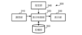
- FIG. 4 is a functional block diagram of the user terminal 300.
- the user terminal 300 is a general-purpose information processing terminal such as a smartphone, a mobile phone, a tablet mobile terminal, a fixed terminal, or a PC.
- User terminal 300 includes communication unit 310, display control unit 320, display unit 330, designation unit 340, and storage unit 350.
- the communication unit 310 is an interface for performing wireless communication according to 3G, WiFi, Bluetooth (registered trademark), or the like. Note that the communication unit 310 may have a function of connecting to the relay device 902 via a wired line such as a LAN.
- the display unit 330 is a display device such as a liquid crystal display or a touch panel, and displays status information under the control of the display control unit 320.
- the storage unit 350 is a storage device such as a semiconductor memory or a hard disk, and is executed in cooperation with the application program as necessary in addition to an application program that displays a screen based on information provided from the server 200. Stores a map display application program, a moving image reproduction application program, and the like. These programs are executed by the display control unit 320. In addition, the storage unit 350 stores user information (age, gender, other user attributes, current location information, contact information of other users, etc.).
- the designation unit 340 is a touch panel, a mouse, a keyboard, and an input device that accepts designation of a position from the user.
- the display control unit 320 is implemented as one or more processors such as a CPU, a general-purpose processor, and an image processing processor, executes one or more application programs stored in the storage unit 350, and is based on status information acquired from the server 200. Data is generated and supplied to the display unit 330. For example, the display control unit 320 displays a map corresponding to one or more positions (points, regions, or routes) designated by the designation unit 340, and displays the situation information on the map. Further, when the situation information acquired from the server 200 includes rain information, the display control unit 320 may display the rain information together. In addition to the situation information, information about the weather acquired from the weather database 400 may be displayed on the user terminal.
- processors such as a CPU, a general-purpose processor, and an image processing processor
- the display control unit 320 may edit the situation information acquired from the server 200 based on the user information stored in the storage unit 350 or the information input by the designation unit 340.
- the one or more application programs are downloaded via the network 901 and installed in the user terminal 300, for example.
- FIG. 5 shows an operation example of the information providing system 10.
- Each camera 100 transmits an image captured at a preset timing to the server 200 at a preset timing (S501).
- the server 200 sequentially accumulates the acquired images (502).
- the user of the user terminal 300 starts an application program, performs a predetermined operation such as inputting a position, and requests status information from the server 200 (S503).
- the user terminal 300 automatically designates the position based on the GPS function (not shown) provided in the user terminal 300 or based on the information regarding the position included in the schedule data stored in the storage unit 350. It may be generated.
- the server 200 accepts the request from the user terminal 300, the server 200 generates at least status information indicating that the photographed person has rain gear by analyzing the stored image (S504).
- the generated status information is transmitted from the server 200 to the user terminal 300 (S505), drawing data is generated based on the status information acquired by the display control unit 320, and an image based on the drawing data is displayed on the display unit 330. It is displayed (S506).
- the reliability of the situation information improves as more people appear.
- the clothes and actions of others are shown as objective numerical values, the user's judgment is supported.
- it may lead to the user's decision not to have an umbrella because it is a rain amount that can be endured physically, even if there is a person who does not have an umbrella even if they have an umbrella. it can.
- the future of users such as whether to prepare rain gear by providing users with information analyzed from images and images More accurate judgment can be made when deciding on behavior.
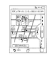
- FIG. 7 shows another example of information displayed on the display unit 330.
- a request including landmark information “A station” or position coordinates of A station is transmitted to the server 200.
- the analysis unit 220 performs image analysis on each image acquired from the camera 100 associated with the designated position, and generates status information.
- the display control unit 320 receives the status information from the server 200, the display control unit 320 displays the object OB30 representing the position (C1, C2, C3, C4) of the camera 100 on the map, and the analysis unit for each camera 100.
- the status information generated in 220 (in this case, the usage rate of the umbrella) is displayed on the map as an object OB40.
- a detailed status information object OB50 of C3 (an image taken by C3 in the example in the figure) is displayed. According to this example, the user can easily understand the difference in weather depending on the location.
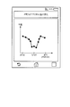
- the analysis unit 220 analyzes each of a plurality of images with different shooting time points, or when the server 200 acquires weather information about a plurality of time points from the weather database 400, the object OB51 in FIG. 7 is tapped. Then, the display control unit 320 may display information acquired from the server 200 in time series. In the example shown in FIG. 8, the transition of rainfall at a point corresponding to one camera 100 provided in the vicinity of station A is displayed. In this case, the designation unit 340 may accept designation of a desired period in addition to the position. According to this example, the user can predict future weather from past information.
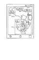
- FIG. 9 shows another example of information displayed on the display unit 330. It is assumed that the user designates two points (P1, P2) as the starting point and the destination in the map application program or the like.
- the analysis unit 220 identifies the route from the user terminal 300 to P1 to P2, displays this as the object OB60, and transmits location information (a set of location information) representing the route to the server 200.
- the analysis unit 220 identifies a plurality of cameras 100 in the vicinity of the route, analyzes the images acquired from the identified cameras 100, and generates status information. Furthermore, the analysis unit 220 performs statistical processing on the generated plurality of situation information. For example, when the situation information includes numerical values, the average value thereof is calculated.
- the display control unit 320 acquires the situation information including the situation information statistically processed from the server 200, in addition to displaying the situation information at a position corresponding to each camera 100, a message based on the result of the statistical process (this example) Then, the fact that the usage rate of umbrellas on the route is 22.5% on the average is displayed. According to this example, information according to the user's future action content is provided.
- FIG. 10 shows another example of information displayed on the display unit 330.
- the user designates the area “Tokyo” in the map application program or the like.
- the analysis unit 220 selects a predetermined number (three in the figure) of the cameras 100 associated with the “Tokyo” area, generates situation information from the images of the selected cameras 100, and transmits the situation information to the user terminal 300.
- the object OB41 indicating each acquired situation information is displayed so as to overlap the object OB70.
- the designation is transmitted to the server 200, and the situation information is obtained from the image photographed at the position related to “eastern part” of Tokyo by the analysis unit 220. Is generated and transmitted to the user terminal 300.
- the user terminal 300 displays the situation information received from the server 200 on the eastern enlarged map (object OB71). According to this example, it is possible to appropriately change (zoom in) the range of situation information desired by the user.
- FIG. 11 shows another example of an image displayed on the display unit 330.
- the object OB80 based on the weather acquired by the server 200 from the weather database 400 is displayed superimposed on the image.
- FIG. 12 shows an example (part 7) of information displayed on the display unit 330.
- the analysis unit 220 may analyze the movement (behavior such as running or walking) instead of the static or instantaneous information of the person and reflect it in the situation information. For example, when a person who is holding an umbrella and a person who is running without an umbrella are detected in one image, a message that “it seems to be fine to run” is generated. By referring to the actions of others, the action content corresponding to the weather can be examined more realistically.
- FIG. 13 shows another example of information displayed on the display unit 330.
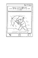
- the analysis unit 220 analyzes the usage condition of the rain gear (such as how the umbrella is tilted, bent, blown, or deformed), it is determined that the wind is strong due to the tilt of the umbrella as shown in FIG. And generate a message telling the possibility that the umbrella is useless.
- the content of the message may be determined by further taking into account the posture and movement of the person (for example, the state of tension and the state of hair movement).
- FIG. 14 shows another example of information displayed on the display unit 330.
- the display unit 330 edits the situation information according to the user information stored in the storage unit 350. For example, when the attribute information “female” is stored, the display unit 330 analyzes the image data to determine the gender of each person, performs image processing for cutting out only the female, and also includes a message that mentions “female”. Is displayed.
- a message corresponding to the age is generated. For example, even if the situation information is the same, for example, users who are in their 60s or older should carry an umbrella such as “It is better to bring an umbrella because there are people who are holding the umbrella.” On the other hand, a message that suggests the possibility that an umbrella is unnecessary is generated for a teenage user, such as “It seems to be okay if there is no umbrella for now”. According to this example, provided information is customized according to a user's attribute.
- the timing at which the server 200 acquires an image from the camera 100 and the timing at which the server 200 performs image analysis are arbitrary. For example, each camera 100 does not voluntarily transmit image data to the server 200, and the server 200 may request image data from the camera 100 in response to a request from the user terminal 300.
- the analysis unit 220 may perform image analysis according to a predetermined schedule regardless of the timing of the request from the user. Acquisition of captured images, analysis of images, and generation of status information may be performed by a plurality of nodes, or may be performed by one node.
- the server 200 may be omitted from 10, and the user terminal 300 may have the function of the server 200.
- the person who has taken the image has a rain gear by acquiring the image captured by the imaging device via the network and analyzing the acquired image. It is only necessary to execute a step of generating status information indicating that the information is being displayed and a display step of displaying the generated status information on the user terminal.
Landscapes
- Engineering & Computer Science (AREA)
- Physics & Mathematics (AREA)
- General Physics & Mathematics (AREA)
- Life Sciences & Earth Sciences (AREA)
- Environmental & Geological Engineering (AREA)
- Theoretical Computer Science (AREA)
- Data Mining & Analysis (AREA)
- Atmospheric Sciences (AREA)
- Biodiversity & Conservation Biology (AREA)
- Ecology (AREA)
- Environmental Sciences (AREA)
- Business, Economics & Management (AREA)
- Multimedia (AREA)
- Pure & Applied Mathematics (AREA)
- Mathematical Physics (AREA)
- Mathematical Optimization (AREA)
- Mathematical Analysis (AREA)
- Computational Mathematics (AREA)
- Tourism & Hospitality (AREA)
- Hydrology & Water Resources (AREA)
- Databases & Information Systems (AREA)
- Probability & Statistics with Applications (AREA)
- Bioinformatics & Computational Biology (AREA)
- General Engineering & Computer Science (AREA)
- Software Systems (AREA)
- Evolutionary Biology (AREA)
- Bioinformatics & Cheminformatics (AREA)
- Algebra (AREA)
- Operations Research (AREA)
- Strategic Management (AREA)
- Economics (AREA)
- Primary Health Care (AREA)
- Marketing (AREA)
- General Business, Economics & Management (AREA)
- Health & Medical Sciences (AREA)
- Human Resources & Organizations (AREA)
- General Health & Medical Sciences (AREA)
- Human Computer Interaction (AREA)
- Traffic Control Systems (AREA)
- Management, Administration, Business Operations System, And Electronic Commerce (AREA)
Abstract
Description
ここで、気象情報のみに基づく判断では、結果的に適切な行動をとれなかったとユーザが感じる場合がある。例えば、小雨が降っているという情報を得た場合、ユーザによっては、雨なので傘が必要であると判断したが、傘を持って実際に外に出てみると霧雨程度のわずかな雨であり、傘を持ってきたことを後悔する場合である。逆に、ユーザによっては、小雨程度であれば傘を差さずに外出しても問題ないと判断したが、実際に外に出てみるとそのユーザの想像以上の量の雨が振っていて、傘を持たないで外出したことを後悔する場合も考えられる。
本発明は、ユーザが雨具を用意すべきかを判断することを支援することを目的とする。
記憶部230は、プログラム、半導体メモリ、ハードディスク等の記憶装置であって、解析部220で実行されてサーバ200の機能を実現するためのプログラムを記憶する。
第1取得部210は、通信インタフェースとして実装され、各カメラ100にて撮像された画像を、ネットワーク901を介して取得する。例えば、第1取得部210は、同一のカメラ100から所定の期間内に同一の地点を撮影した複数の画像を取得してもよい。取得した画像は記憶部230に記憶される。なお、記憶後一定期間過ぎた画像については削除してもよい。
表示部330は、液晶ディスプレイ、タッチパネル等の表示装置であり、表示制御部320の制御の下、状況情報を表示する。
表示制御部320は、サーバ200から統計処理された状況情報を含む状況情報を取得すると、各カメラ100に対応する位置に状況情報を表示するのに加え、統計処理の結果に基づくメッセージ(この例では、経路上における傘の使用率が平均で22.5%である旨)が表示される。この例によれば、ユーザの将来の行動内容に応じた情報が提供される。
サーバ200がカメラ100から画像を取得するタイミングやサーバ200にて画像解析を実行するタイミングは、任意である。例えば、各カメラ100は自発的に画像データをサーバ200に送信することはせず、サーバ200はユーザ端末300からの要求に応じてカメラ100に画像データを要求してもよい。あるいは、解析部220はユーザからの要求のタイミングとは関係なく、予め定められたスケジュールに従って画像解析を実行してもよい。
撮影された画像の取得、画像の解析、状況情報の生成は、複数のノードで行ってもよいし、一つのノードにて実行されてもよい。例えば、10からサーバ200を省略し、ユーザ端末300がサーバ200の機能を有してもよい。
Claims (14)
- 撮像部にて撮像された画像を、ネットワークを介して取得する取得部(210)と、
前記画像を解析することにより、撮影された人が雨具を所持していることを少なくとも示す状況情報を生成する解析部(220)と、
前記状況情報をユーザ端末に表示する表示制御部(220、240、320、330)と
を備える情報提供システム。 - 前記雨具は雨傘を含む
請求項1に記載の情報提供システム。 - 前記情報提供システムは、前記ユーザ端末から位置の指定を受付ける指定部(340)をさらに備え、
前記撮像部(100)は、各々異なる場所に設けられた複数の撮像装置を含み、
前記状況情報は、該指定された場所に対応する1以上の撮像装置にて撮影された画像に基づいて生成される
ことを特徴とする請求項1に記載の情報提供システム。 - 前記指定部(340)は、複数の位置の指定を受付け、
前記解析部(220)は、該指定された複数の位置を含む経路上の地点についての状況情報を生成する
ことを特徴とする請求項3に記載の情報提供システム。 - 前記指定部(340)は領域の指定を受付け、
前記表示制御部は、前記領域を構成する各領域についての状況情報を表示する
ことを特徴とする請求項3に記載の情報提供システム。 - 前記状況情報には、撮影された複数の人のなかで前記雨具を所持している人の割合を示す情報が含まれる
ことを特徴とする請求項1に記載の情報提供システム。 - 前記状況情報には、前記雨具を保有している人が当該雨具を使用しているか否かを示す情報が含まれる
ことを特徴とする請求項1に記載の情報提供システム。 - 前記解析部(220)は、該取得された画像を解析して降雨の程度を示す降雨情報をさらに生成し、
前記表示制御部は前記降雨情報を前記ユーザ端末に表示する
ことを特徴とする請求項1に記載の情報提供システム。 - 前記降雨の程度は、地面の濡れ具合に基づいて決定される
ことを特徴とする請求項8に記載の情報提供システム。 - 前記取得部は、所定の期間内に同一の地点を撮影した複数の画像を取得し、
前記解析部は、複数の時点における状況情報を生成する
請求項1に記載の情報提供システム。 - 前記取得部は、ネットワークを介して天候情報を取得し、
前記表示制御部は、前記状況情報に加えて該取得された天候の情報を前記ユーザ端末に表示する
ことを特徴とする請求項1に記載の情報提供システム。 - 前記ユーザ端末は、ユーザ情報を記憶する記憶部を備え、
前記表示制御部は、前記ユーザ情報に基づいて編集された状況情報を表示する
請求項1に記載の情報提供システム。 - 撮像装置にて撮像された画像を、ネットワークを介して取得するステップ(502)と、
該取得された画像を解析することにより、少なくとも、撮影された人が雨具を所持していることを示す状況情報を生成するステップ(504)と、
該生成された状況情報をユーザ端末に表示する表示ステップ(506)と
を備える情報提供方法。 - コンピュータに、
撮像装置にて撮像された画像を、ネットワークを介して取得するステップ(502)と、
該取得された画像を解析することにより、少なくとも、撮影された人が雨具を所持していることを示す状況情報を生成するステップ(504)と、
該生成された状況情報をユーザ端末に表示する表示ステップ(506)と
を実行させるためのプログラム。
Priority Applications (3)
| Application Number | Priority Date | Filing Date | Title |
|---|---|---|---|
| US15/567,745 US10423836B2 (en) | 2016-06-16 | 2016-06-16 | Information providing system |
| JP2016563214A JP6126759B1 (ja) | 2016-06-16 | 2016-06-16 | 情報提供システム |
| PCT/JP2016/067912 WO2017216920A1 (ja) | 2016-06-16 | 2016-06-16 | 情報提供システム |
Applications Claiming Priority (1)
| Application Number | Priority Date | Filing Date | Title |
|---|---|---|---|
| PCT/JP2016/067912 WO2017216920A1 (ja) | 2016-06-16 | 2016-06-16 | 情報提供システム |
Publications (1)
| Publication Number | Publication Date |
|---|---|
| WO2017216920A1 true WO2017216920A1 (ja) | 2017-12-21 |
Family
ID=58704793
Family Applications (1)
| Application Number | Title | Priority Date | Filing Date |
|---|---|---|---|
| PCT/JP2016/067912 Ceased WO2017216920A1 (ja) | 2016-06-16 | 2016-06-16 | 情報提供システム |
Country Status (3)
| Country | Link |
|---|---|
| US (1) | US10423836B2 (ja) |
| JP (1) | JP6126759B1 (ja) |
| WO (1) | WO2017216920A1 (ja) |
Cited By (4)
| Publication number | Priority date | Publication date | Assignee | Title |
|---|---|---|---|---|
| JP2019158433A (ja) * | 2018-03-09 | 2019-09-19 | パナソニック株式会社 | 天候推定装置および天候推定方法 |
| CN111242342A (zh) * | 2018-11-29 | 2020-06-05 | 丰田自动车株式会社 | 信息处理系统、信息处理方法和程序 |
| WO2021117457A1 (ja) * | 2019-12-10 | 2021-06-17 | Necソリューションイノベータ株式会社 | 計測方法 |
| JP2022090491A (ja) * | 2020-12-07 | 2022-06-17 | キヤノン株式会社 | 画像処理装置、画像処理方法、及びプログラム |
Families Citing this family (6)
| Publication number | Priority date | Publication date | Assignee | Title |
|---|---|---|---|---|
| WO2017216919A1 (ja) * | 2016-06-16 | 2017-12-21 | 株式会社オプティム | 服装情報提供システム、服装情報提供方法、およびプログラム |
| CN107220434B (zh) | 2017-05-25 | 2020-12-18 | 北京小米移动软件有限公司 | 降水趋势的描述信息确定方法、装置及可读存储介质 |
| JP2019079475A (ja) * | 2017-10-27 | 2019-05-23 | 大日本印刷株式会社 | 画像再生システム及び画像再生方法 |
| WO2021133163A1 (en) * | 2019-12-24 | 2021-07-01 | Mimos Berhad | Monitoring of attributes in an environment and notifying change in status of attributes to a user device |
| US20230061238A1 (en) * | 2020-02-26 | 2023-03-02 | Sony Group Corporation | A camera system and a method for determining a weather situation |
| CN111709340B (zh) * | 2020-06-09 | 2023-05-30 | 杭州云视通互联网科技有限公司 | 伞具使用行为的检测方法与系统 |
Citations (3)
| Publication number | Priority date | Publication date | Assignee | Title |
|---|---|---|---|---|
| JP2005345293A (ja) * | 2004-06-03 | 2005-12-15 | Denso Corp | 車載用報知装置 |
| JP2014192910A (ja) * | 2013-03-26 | 2014-10-06 | Mitsubishi Electric Corp | 電力需要予測装置及び方法 |
| JP2016038703A (ja) * | 2014-08-07 | 2016-03-22 | エヌ・ティ・ティ・コミュニケーションズ株式会社 | センサ制御装置、センサ制御方法およびセンサ制御プログラム |
Family Cites Families (12)
| Publication number | Priority date | Publication date | Assignee | Title |
|---|---|---|---|---|
| US5729471A (en) * | 1995-03-31 | 1998-03-17 | The Regents Of The University Of California | Machine dynamic selection of one video camera/image of a scene from multiple video cameras/images of the scene in accordance with a particular perspective on the scene, an object in the scene, or an event in the scene |
| JP2001118081A (ja) * | 1999-10-15 | 2001-04-27 | Sony Corp | 情報処理装置および方法、並びにプログラム格納媒体 |
| JP2002148061A (ja) * | 2000-08-31 | 2002-05-22 | Casio Comput Co Ltd | 情報端末、気象予測情報サービスシステム、気象予測情報サービス方法及び天気情報付きカーナビゲーションシステム |
| JP3934119B2 (ja) * | 2004-06-14 | 2007-06-20 | 本田技研工業株式会社 | 車両周辺監視装置 |
| JP2007085864A (ja) * | 2005-09-21 | 2007-04-05 | Denso Corp | 車載表示装置 |
| JP5110356B2 (ja) * | 2007-07-10 | 2012-12-26 | オムロン株式会社 | 検出装置および方法、並びに、プログラム |
| US8436902B2 (en) * | 2007-08-30 | 2013-05-07 | Valeo Schalter And Sensoren Gmbh | Method and system for weather condition detection with image-based road characterization |
| JP2011076142A (ja) | 2009-09-29 | 2011-04-14 | Obic Co Ltd | 天気情報管理システム |
| JP5720627B2 (ja) * | 2012-06-11 | 2015-05-20 | 株式会社デンソー | 人検出装置 |
| US9445057B2 (en) * | 2013-02-20 | 2016-09-13 | Magna Electronics Inc. | Vehicle vision system with dirt detection |
| US9465987B1 (en) * | 2015-03-17 | 2016-10-11 | Exelis, Inc. | Monitoring and detecting weather conditions based on images acquired from image sensor aboard mobile platforms |
| US9972191B2 (en) * | 2016-06-01 | 2018-05-15 | Tile, Inc. | User intervention based on learned behavior in a tracking device environment |
-
2016
- 2016-06-16 US US15/567,745 patent/US10423836B2/en active Active
- 2016-06-16 JP JP2016563214A patent/JP6126759B1/ja active Active
- 2016-06-16 WO PCT/JP2016/067912 patent/WO2017216920A1/ja not_active Ceased
Patent Citations (3)
| Publication number | Priority date | Publication date | Assignee | Title |
|---|---|---|---|---|
| JP2005345293A (ja) * | 2004-06-03 | 2005-12-15 | Denso Corp | 車載用報知装置 |
| JP2014192910A (ja) * | 2013-03-26 | 2014-10-06 | Mitsubishi Electric Corp | 電力需要予測装置及び方法 |
| JP2016038703A (ja) * | 2014-08-07 | 2016-03-22 | エヌ・ティ・ティ・コミュニケーションズ株式会社 | センサ制御装置、センサ制御方法およびセンサ制御プログラム |
Cited By (9)
| Publication number | Priority date | Publication date | Assignee | Title |
|---|---|---|---|---|
| JP2019158433A (ja) * | 2018-03-09 | 2019-09-19 | パナソニック株式会社 | 天候推定装置および天候推定方法 |
| JP7094120B2 (ja) | 2018-03-09 | 2022-07-01 | パナソニックホールディングス株式会社 | 天候推定装置および天候推定方法 |
| CN111242342A (zh) * | 2018-11-29 | 2020-06-05 | 丰田自动车株式会社 | 信息处理系统、信息处理方法和程序 |
| WO2021117457A1 (ja) * | 2019-12-10 | 2021-06-17 | Necソリューションイノベータ株式会社 | 計測方法 |
| JPWO2021117457A1 (ja) * | 2019-12-10 | 2021-06-17 | ||
| JP7287712B2 (ja) | 2019-12-10 | 2023-06-06 | Necソリューションイノベータ株式会社 | 計測方法 |
| US12260647B2 (en) | 2019-12-10 | 2025-03-25 | Nec Solution Innovators, Ltd. | Measurement method |
| JP2022090491A (ja) * | 2020-12-07 | 2022-06-17 | キヤノン株式会社 | 画像処理装置、画像処理方法、及びプログラム |
| JP7608136B2 (ja) | 2020-12-07 | 2025-01-06 | キヤノン株式会社 | 画像処理装置、画像処理方法、及びプログラム |
Also Published As
| Publication number | Publication date |
|---|---|
| US10423836B2 (en) | 2019-09-24 |
| US20190130195A1 (en) | 2019-05-02 |
| JPWO2017216920A1 (ja) | 2018-06-28 |
| JP6126759B1 (ja) | 2017-05-10 |
Similar Documents
| Publication | Publication Date | Title |
|---|---|---|
| JP6126759B1 (ja) | 情報提供システム | |
| US10592551B2 (en) | Clothing information providing system, clothing information providing method, and program | |
| US8339419B1 (en) | Systems and methods for collecting and providing map images | |
| US10127734B2 (en) | Augmented reality personalization | |
| US20170153113A1 (en) | Information processing apparatus, information processing method, and program | |
| KR101724260B1 (ko) | 재난안전 통합 상황관리를 위한 위치기반 실시간 시나리오 설정방법 | |
| CN112565552A (zh) | 摄影装置、信息取得系统及程序 | |
| WO2015026755A2 (en) | Realtime activity suggestion from social and event data | |
| JP7383470B2 (ja) | 情報処理装置、情報処理方法およびプログラム | |
| KR102420379B1 (ko) | 기상 환경 기반의 메타버스 서비스 제공 방법 | |
| KR20210086834A (ko) | 스마트 글래스를 활용한 증강현실 기반의 관광 정보 제공 시스템 및 그 방법 | |
| JP2014038051A (ja) | 気象情報生成装置、プログラム及び通信システム | |
| Safranoglou et al. | Augmented reality for real-time decision-making in flood emergencies | |
| KR102667877B1 (ko) | 광각 영상 처리 방법 및 이를 위한 장치 | |
| WO2016002284A1 (ja) | 情報処理装置、情報処理方法およびプログラム | |
| JP6376654B2 (ja) | ルート提示装置、移動端末、ルート提示方法、ルート表示方法、ルート提示プログラム及びルート表示プログラム | |
| JP6435640B2 (ja) | 混雑度推定システム | |
| JP2009205504A (ja) | 案内システム、サーバシステム、案内方法及びプログラム | |
| CN108763414B (zh) | 一种实景显示方法、装置、终端设备和存储介质 | |
| US20230333809A1 (en) | Immersive Audio Tours | |
| CN117609633A (zh) | 利用导览标签进行景区全域导览的方法 | |
| TWM542190U (zh) | 擴增實境雲端智能查找服務系統 | |
| JP2019023939A (ja) | ウェアラブル端末 | |
| CN107040586B (zh) | 一种户内外行为习惯分析及互动方法及系统 | |
| CN117057870A (zh) | 服装搭配推荐方法、计算机设备和可读存储介质 |
Legal Events
| Date | Code | Title | Description |
|---|---|---|---|
| ENP | Entry into the national phase |
Ref document number: 2016563214 Country of ref document: JP Kind code of ref document: A |
|
| 121 | Ep: the epo has been informed by wipo that ep was designated in this application |
Ref document number: 16905475 Country of ref document: EP Kind code of ref document: A1 |
|
| NENP | Non-entry into the national phase |
Ref country code: DE |
|
| 32PN | Ep: public notification in the ep bulletin as address of the adressee cannot be established |
Free format text: NOTING OF LOSS OF RIGHTS PURSUANT TO RULE 112(1) EPC (EPO FORM 1205A DATED 27.03.2019) |
|
| 122 | Ep: pct application non-entry in european phase |
Ref document number: 16905475 Country of ref document: EP Kind code of ref document: A1 |