EP1543294B1 - Fahrzeugnavigationssystem mit geländenavigation - Google Patents
Fahrzeugnavigationssystem mit geländenavigation Download PDFInfo
- Publication number
- EP1543294B1 EP1543294B1 EP02807874A EP02807874A EP1543294B1 EP 1543294 B1 EP1543294 B1 EP 1543294B1 EP 02807874 A EP02807874 A EP 02807874A EP 02807874 A EP02807874 A EP 02807874A EP 1543294 B1 EP1543294 B1 EP 1543294B1
- Authority
- EP
- European Patent Office
- Prior art keywords
- vehicle
- waypoint
- road
- path
- waypoints
- Prior art date
- Legal status (The legal status is an assumption and is not a legal conclusion. Google has not performed a legal analysis and makes no representation as to the accuracy of the status listed.)
- Expired - Lifetime
Links
Images



Classifications
-
- G—PHYSICS
- G01—MEASURING; TESTING
- G01C—MEASURING DISTANCES, LEVELS OR BEARINGS; SURVEYING; NAVIGATION; GYROSCOPIC INSTRUMENTS; PHOTOGRAMMETRY OR VIDEOGRAMMETRY
- G01C21/00—Navigation; Navigational instruments not provided for in groups G01C1/00 - G01C19/00
- G01C21/26—Navigation; Navigational instruments not provided for in groups G01C1/00 - G01C19/00 specially adapted for navigation in a road network
- G01C21/34—Route searching; Route guidance
- G01C21/36—Input/output arrangements for on-board computers
- G01C21/3605—Destination input or retrieval
- G01C21/3617—Destination input or retrieval using user history, behaviour, conditions or preferences, e.g. predicted or inferred from previous use or current movement
-
- G—PHYSICS
- G01—MEASURING; TESTING
- G01C—MEASURING DISTANCES, LEVELS OR BEARINGS; SURVEYING; NAVIGATION; GYROSCOPIC INSTRUMENTS; PHOTOGRAMMETRY OR VIDEOGRAMMETRY
- G01C21/00—Navigation; Navigational instruments not provided for in groups G01C1/00 - G01C19/00
- G01C21/20—Instruments for performing navigational calculations
-
- G—PHYSICS
- G01—MEASURING; TESTING
- G01C—MEASURING DISTANCES, LEVELS OR BEARINGS; SURVEYING; NAVIGATION; GYROSCOPIC INSTRUMENTS; PHOTOGRAMMETRY OR VIDEOGRAMMETRY
- G01C21/00—Navigation; Navigational instruments not provided for in groups G01C1/00 - G01C19/00
- G01C21/26—Navigation; Navigational instruments not provided for in groups G01C1/00 - G01C19/00 specially adapted for navigation in a road network
- G01C21/34—Route searching; Route guidance
- G01C21/36—Input/output arrangements for on-board computers
-
- G—PHYSICS
- G01—MEASURING; TESTING
- G01C—MEASURING DISTANCES, LEVELS OR BEARINGS; SURVEYING; NAVIGATION; GYROSCOPIC INSTRUMENTS; PHOTOGRAMMETRY OR VIDEOGRAMMETRY
- G01C21/00—Navigation; Navigational instruments not provided for in groups G01C1/00 - G01C19/00
- G01C21/26—Navigation; Navigational instruments not provided for in groups G01C1/00 - G01C19/00 specially adapted for navigation in a road network
- G01C21/34—Route searching; Route guidance
- G01C21/36—Input/output arrangements for on-board computers
- G01C21/3626—Details of the output of route guidance instructions
- G01C21/3632—Guidance using simplified or iconic instructions, e.g. using arrows
-
- G—PHYSICS
- G09—EDUCATION; CRYPTOGRAPHY; DISPLAY; ADVERTISING; SEALS
- G09B—EDUCATIONAL OR DEMONSTRATION APPLIANCES; APPLIANCES FOR TEACHING, OR COMMUNICATING WITH, THE BLIND, DEAF OR MUTE; MODELS; PLANETARIA; GLOBES; MAPS; DIAGRAMS
- G09B29/00—Maps; Plans; Charts; Diagrams, e.g. route diagram
- G09B29/10—Map spot or coordinate position indicators; Map reading aids
Definitions
- This invention relates to vehicle navigation systems and, more specifically, to map images appearing on a navigation system video screen of a display device.
- Vehicle navigation systems typically include a display device with a video display that provides a graphical interface for the user.
- a main function of the video display is to depict the desired map area and route on which the user's vehicle is travelling.
- several navigational modes may be provided. For example, an on-highway guidance mode may be provided in which directional arrows, highlighted routes, and/or voice instructions are given to the driver to guide the driver to a preselected destination.
- An off-highway navigational mode has been provided to drivers when traveling off of the road network provided by the storage device or other media. Once the vehicle is driven to an location without any nearby roads or other reference points it becomes more difficult to convey directions to the driver on how to get to the next destination.
- waypoints have been used, which represent a location such as latitude and longitude. The waypoints may be linked together to form a route by which the navigation system may direct the driver to follow.
- providing direction to the driver may result in driver confusion. Therefore, what is needed is a navigation system that clearly conveys directions to a waypoint.
- directing a driver from one waypoint directly to the next may be an inefficient manner in which to travel along a route. For example, a route which has sharp turn from one waypoint to the next will require the driver to arrive at the waypoint and then turn around and travel in a similar direction to reach the next waypoint. Therefore, what is needed is a navigation system that more efficiently guides a driver along a route.
- the present invention provides a method according to claim 1.
- the present invention also includes an apparatus according to claim 8. Further embodiments are defined by the dependent claims.
- the above invention provides a navigation system that more efficiently guides a driver along a route.
- Publication XP00222781 Microsoft FLIGHT SIMULATOR PILOTENHANDBUCH discloses a flight simulator system for airplanes where a path to be followed is determined through waypoints.
- US 5528248 shows a personal digital assistant having a GPS system which may be used for aerial navigation with waypoints or for land vehicle navigation with road maps.
- EP 0763714 shows a navigation system for aircrafts.
- DE10058492 shows a mobile telephone having the feature of an arrow for indicating a desired direction to be followed.
- WO 89 05019 shows an aerial navigation system using a single mode system with waypoints and a cursor indicating drift of the plane caused by lateral wind.
- the navigation system 20 of the present invention is shown schematically in Figure 1 .
- the navigation system 20 includes a unit 30 having a CPU 22 (Central Processing Unit) connected to a display device 24 and a directional input device 26 attached to the vehicle interior by a bracket 27, or the like.
- the navigation system 20 further includes a database 28 connected to the CPU 22.
- the database 28 is a mass media storage device, such as a CD-ROM, hard drive, DVD, RAM, ROM or the like which includes a map of the road system in the area to be traveled by the user.
- Each road in the database is divided into road segments, each having an associated set of cost values, which indicate the "cost" of traveling that road segment.
- the cost values may include the length of the road segment, the estimated time to travel the road segment, and the type of road (i.e., highway, secondary road, toll road, one way, etc.).
- the road segment may be part of the vehicle route or may be a road segment outside the vehicle route.
- the navigation system 20 can, but need not, be installed in a vehicle 21.
- the navigation system can be used in conjunction with position determining devices, such as a GPS receiver 38 and a multi-axis accelerometer 40.
- Navigation system 20 could alternatively or additionally include a gyroscope 42, a compass 44, and a wheel speed sensor 46, all connected to the CPU 32 (connections not shown for simplicity).
- a combination of these position determining devices is utilized to assure accurate location.
- the display device 22 may include a speaker 26.
- Figure 2 is a perspective view of the display device 24 and directional input device 28, preferably designed as an integral unit attached to the CPU by connection 25.
- the display device 24 includes a video display 50, or screen, such as a high resolution LCD or flat panel display.
- the directional input device 28 includes a multiple of input buttons 78 including, preferably, an eight-way button shown generally at 80 and a selection key 86 such as an "Enter" key. Although an eight-way button is shown, it will be realized that other input devices, such as a joystick, mouse or roller ball can be employed.
- the eight-way button 80 and is capable of moving in the direction of any one of the directional arrows 84. Movement of the button 80 in the direction of one of the directional arrows 84 transmits a directional signal.
- on-road guidance mode the vehicle route 52 is highlighted in a bright color, such as magenta, and arrows 54 overlay the route for easy identification by the user.
- On-road guidance mode is typically used when the user selects a particular destination. The navigation system then selects and highlights the route 52 based upon certain user selected parameters, such as shortest distance or shortest time. In on-road mode, the user has selected no particular destination. In this mode more detail may be desired than in on-road guidance mode because the user has not necessarily decided upon a particular route.
- off-road mode the navigation system has determined that the vehicle is no longer on any known road and that the vehicle is travelling off the road. To navigate, the driver may set waypoints that represent a precise location on a map.
- Waypoints may be linked to one another to form a complex route by which the driver may navigate from one destination to the next.
- wave points may be used to represent such locations as telephone polls. This information may be used by utility companies to set a route from a location on-road to the location of the telephone poll off-road. Of course good, wave points may be applied to other such similar applications.
- Figure 3 is a video display of the display unit depicting a configuration options menu 64. From this menu, the user may select an "Off-Road Navigation" menu by which the user may manipulate waypoint and route information.
- Figure 4 depicts an off-road selection menu 66 having menu selection options "Mark by Position”, “Select Route/Waypoint”, “Next Waypoint”, and "Reverse Route”.
- a map location may be saved as a waypoint by utilizing a cursor 68, as shown in Figure 5 .
- the user may pan, or move, the cursor 68 in a map area 69 to a desired location, which may be other than the present vehicle location (indicated by the vehicle icon 70).
- the latitude 72 and longitude 73 of the cursor 68 is displayed to the user.
- the distance of the cursor 68 to the vehicle 70 is indicated above the cursor 68 at 75.
- the waypoint may be saved be pressing the "Enter" key 86, after which a waypoint entry screen 74, shown in Figure 6 , will be displayed prompting the user to enter information regarding the waypoint. Regardless of the mode of entry of a new waypoint, the user is prompted to enter descriptive information about the waypoint.
- the latitude and longitude of the waypoint is displayed.
- a default label 77 of "Way001" is displayed unless the user enters a new 6-character alphanumeric description of the waypoint in the label field 77.
- a default label of "Way002", and so on, would be displayed for subsequent waypoints.
- the waypoint is represented by an icon in the map area once the waypoint has been saved.
- One default icon that may be used is a flag 90.
- the default icon may be changed and selected from a group of icons to more meaningfully correspond the waypoint to the user.
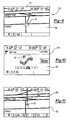
- Figure 7 depicts a map area with first 92 and second 94 waypoints in a map area 69.
- the waypoints 92 and 94 define a route depicted by path 96, which is a straight line between the waypoints 92 and 94.
- the direction and distance from the vehicle 70 to the next waypoint, which is first waypoint 92, is indicated at 97 and 98, respectively.
- the next waypoint, first waypoint 92 is highlighted to stand out to the user.
- An option "More" 99 may be temporarily displayed to the user, to enable the user to readily manipulation waypoint and route information.
- a first directional screen 100 may be used, as shown in Figure 8 .
- a simple horizon 102 is displayed with a three dimensional directional arrow 104 pointing the direction to next waypoint.
- the next waypoint, or waypoint to which the vehicle is traveling is indicated at 103.
- the first directional screen 100 includes a lane indicia 106 to further assist the user in navigating to the next waypoint.
- a pointer 107 pointing at the center 108 of the lane indicia 106 corresponds to the vehicle following the route path.
- the ends 109 of the lane indicia 106 correspond to a user selected offset from the path. For example, the ends 109 may correspond to an offset of 500 feet from the path. Total time remaining and total remaining distance of the route may also be displayed.
- the pointer 107 is on center 108, the user is driving the vehicle along the path. As the vehicle wanders from the path, the pointer 107 will move along the lane indicia 106 to provide the user feed back of the degree to which the vehicle has strayed from the path.
- a second direction screen 110 is shown in Figure 9 in off-road guidance mode.
- a highlighted path 112 from the vehicle 70 to a waypoint (not shown) is displayed in the map area 69.
- a two dimensional arrow 114 is overlaid on the path 112.
- the two dimensional arrow 114 is converted to a three dimensional arrow 118 on the simple horizon similar to the first directional screen 100 shown in Figure 8 .
- a new path 120 will be displayed from the present vehicle location to the next waypoint (not shown).
- the new path 120 may be a highlighted dashed line.
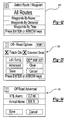
- Waypoint and route information may be further manipulated by selecting "Select Route/Waypoints" from the off-road selection menu 66.
- Figure 12 depicts a waypoint selection menu 122 having "All Routes", “Waypoints by Name”, “Waypoints by Distance”, and “Waypoints by Time” options.
- “All Routes” displays all of the routes alphabetically when selected.
- “Waypoints by Name” displays all of the waypoints alphabetically.
- “Waypoints by Distance” displays all of the waypoints in order of closest to the present vehicle location to farthest from the present vehicle location.
- “Waypoints by Time” displays the waypoints in order of time of creation. In this manner, the waypoint and route information may be manipulated quickly in several different ways.
- More advanced information relating the waypoints and routes may be manipulated using an off-road options menu 124, shown in Figure 13 .
- Routes and waypoints may be deleted using the "Clear" option.
- the offset from a path may be set by the user, as described above, using the "Advanced" option under the off-road options menu 124, which will display the advanced off-road options menu 126, shown in Figure 14 .
- the offset from the path may set by the user by selecting the "XTE Alarm" option. As shown in Figure 14 , the offset is set at 0.2 miles.
- the offset sets the ends 109 of the lane indicia 106.
- An audible alarm through speaker 26 may be used when the vehicle reaches one of the offsets from the path.
- the lane indicia 106 and how it relates with the waypoints 92, 94 and path 96 is graphically illustrated in Figure 15 .
- Each of the ends 109 correspond to an offset 130, which is shown as dashed lines parallel to the path 96.
- the dashed lines are not displayed, but are only used to illustrate the operation of the offset.
- the arrow 107 will point at one of the ends 109 corresponding to the side of the offset, shown by dashed arrows 132.
- An audible alarm may sound, or voice instructions may be activated, indicating to the driver that the vehicle has veered off the path by the selected offset distance.
- An waypoint arrival option may also be set using the "Arrival Alarm" option under the advanced off-road menu 126.
- Figure 16 is a schematic representation of a radial waypoint proximity option.
- the radial waypoint proximity option may be used to simplify navigation along the route by directing the user to travel to the next waypoint once the vehicle is sufficiently proximate to the target waypoint.
- the route contains a path 96a from a first waypoint (not shown) to a second waypoint 94 and a path 96b from the second waypoint 94 to a third waypoint 134.
- the arrival alarm may be set to any radial distance, such as 250 feet indicated at 136 and 500 feet indicated at 138. Of course metric distances may be used.
- the dashed lines corresponding to the radial distance preferably is not displayed. If the radial distance is set to 500 feet, when the vehicle 70 reaches the radius 138, the user will be directed to travel to the third waypoint 134 and a new path 140 will be generated. In this manner, the user may more efficiently travel along the route instead of needlessly traveling directing to each waypoint, which may add a significant distance to the distance traveled.
- An audible alarm, or voice instructions may be activated when the vehicle reaches the radial distance. For example, the voice instructions may direct the vehicle operator to "proceed 30 degrees left".
Landscapes
- Engineering & Computer Science (AREA)
- Remote Sensing (AREA)
- Radar, Positioning & Navigation (AREA)
- Physics & Mathematics (AREA)
- General Physics & Mathematics (AREA)
- Automation & Control Theory (AREA)
- Theoretical Computer Science (AREA)
- Business, Economics & Management (AREA)
- Health & Medical Sciences (AREA)
- General Health & Medical Sciences (AREA)
- Social Psychology (AREA)
- Educational Technology (AREA)
- Educational Administration (AREA)
- Mathematical Physics (AREA)
- Navigation (AREA)
- Traffic Control Systems (AREA)
Claims (12)
- Navigationsverfahren für ein Fahrzeug, umfassend einen Straßenführungsmodus zur Anwendung, wenn die Position des Fahrzeugs auf einem Straßensegment einer Straßendatenbank ist, wobei eine Fahrzeugroute mit Straßensegmenten aus der Straßendatenbank berechnet und angezeigt wird, und einen Geländeführungsmodus, der vom Anwender zur Anwendung ausgewählt werden kann, wenn das Fahrzeug sich nicht auf einem Straßensegment befindet, dadurch gekennzeichnet, dass im Geländemodus zwei Wegpunkte vom Anwender ausgewählt werden können, um einen Pfad zu definieren, der eine gerade Linie zwischen den zwei Wegpunkten ist, und eine Fahrspurmarkierung mit einem Zeiger angezeigt wird, wobei die Position des Zeigers entlang der Fahrspurmarkierung den Grad darstellt, um den das Fahrzeug von dem Pfad abweicht.
- Verfahren nach Anspruch 1, dadurch gekennzeichnet, dass der angezeigte Zeiger an einem Zentrum der Fahrspurmarkierung liegt, wenn die aktuelle Fahrzeugposition auf dem Pfad ist.
- Verfahren nach einem der Ansprüche 1 und 2, dadurch gekennzeichnet, dass ein hörbarer Alarm aktiviert wird, wenn das Fahrzeug einen vorbestimmten Abstand vom Pfad erreicht.
- Verfahren nach einem der Ansprüche 1 bis 3, dadurch gekennzeichnet, dass es ein Berechnen eines Radius um einen Wegpunkt am Ende des Pfades und ein Berechnen und Anzeigen eines neuen Pfads des Fahrzeugs zu einem nächsten Wegpunkt, wenn die aktuelle Fahrzeugposition den Radius erreicht, umfasst.
- Verfahren nach Anspruch 4, dadurch gekennzeichnet, dass ein hörbarer Alarm aktiviert wird, wenn die aktuelle Fahrzeugposition den Radius erreicht.
- Verfahren nach einem der Ansprüche 1 bis 5, dadurch gekennzeichnet, dass ein Icon, ausgewählt aus einer Gruppe von Icons, mit einem der Wegpunkte in Verbindung steht.
- Verfahren nach einem der Ansprüche 1 bis 6, dadurch gekennzeichnet, dass es einen Schritt des Überspringens eines ausgewählten Wegpunkts und ein Berechnen eines Pfads zu einem nächsten Wegpunkt unter Vermeidung des übersprungenen Wegpunkts umfasst.
- Vorrichtung für ein Navigationssystem für ein Fahrzeug, umfassend eine Anzeigevorrichtung und mit einem Straßenführungsmodus zur Anwendung, wenn die Position des Fahrzeugs auf einem Straßensegment einer Straßendatenbank ist, wobei eine Fahrzeugroute mit Straßensegmenten aus der Straßendatenbank berechnet und auf einer Anzeigevorrichtung angezeigt wird, und mit einem Geländeführungsmodus, der vom Anwender zur Anwendung ausgewählt werden kann, wenn das Fahrzeug sich nicht auf einem Straßensegment befindet, dadurch gekennzeichnet, dass es eine Einrichtung umfasst, die im Geländemodus betätigbar ist, um eine Auswahl von zwei Wegpunkten durch den Anwender zu ermöglichen, um einen Pfad zu definieren, der eine gerade Line zwischen den zwei Wegpunkten ist, und um eine Fahrspurmarkierung mit einem Zeiger anzuzeigen, wobei die Position des Zeigers entlang der Fahrspurmarkierung den Grad darstellt, um den das Fahrzeug von dem Pfad abweicht.
- Vorrichtung nach Anspruch 8, dadurch gekennzeichnet, dass die Anzeigevorrichtung den Zeiger an einem Zentrum der Fahrspurmarkierung anzeigt, wenn die Position des Fahrzeugs auf dem Pfad ist.
- Vorrichtung nach einem der Ansprüche 8 und 9, dadurch gekennzeichnet, dass sie ferner einen Lautsprecher umfasst, der einen hörbaren Alarm ausgibt, wenn das Fahrzeug einen vorbestimmten Abstand vom Pfad erreicht.
- Vorrichtung nach einem der Ansprüche 8 bis 10, dadurch gekennzeichnet, dass sie ferner eine Einrichtung zum Anzeigen eines Radius um einen Wegpunkt am Ende des Pfades und zum Berechnen und Anzeigen eines neuen Pfads des Fahrzeugs zu einem nächsten Wegpunkt, wenn die aktuelle Fahrzeugposition den Radius erreicht, umfasst.
- Vorrichtung nach Anspruch 11, dadurch gekennzeichnet, dass sie einen Lautsprecher umfasst, der einen hörbaren Alarm ausgibt, wenn die aktuelle Fahrzeugposition den Radius erreicht.
Applications Claiming Priority (3)
| Application Number | Priority Date | Filing Date | Title |
|---|---|---|---|
| US32530001P | 2001-09-27 | 2001-09-27 | |
| PCT/US2002/030563 WO2004029551A1 (en) | 2001-09-27 | 2002-09-27 | Vehicle navigation system with off-road navigation |
| US325300P | 2002-09-27 |
Publications (2)
| Publication Number | Publication Date |
|---|---|
| EP1543294A1 EP1543294A1 (de) | 2005-06-22 |
| EP1543294B1 true EP1543294B1 (de) | 2010-04-07 |
Family
ID=32043047
Family Applications (1)
| Application Number | Title | Priority Date | Filing Date |
|---|---|---|---|
| EP02807874A Expired - Lifetime EP1543294B1 (de) | 2001-09-27 | 2002-09-27 | Fahrzeugnavigationssystem mit geländenavigation |
Country Status (5)
| Country | Link |
|---|---|
| US (1) | US6836725B2 (de) |
| EP (1) | EP1543294B1 (de) |
| AU (1) | AU2002334682A1 (de) |
| DE (1) | DE60235925D1 (de) |
| WO (1) | WO2004029551A1 (de) |
Families Citing this family (64)
| Publication number | Priority date | Publication date | Assignee | Title |
|---|---|---|---|---|
| US5910854A (en) | 1993-02-26 | 1999-06-08 | Donnelly Corporation | Electrochromic polymeric solid films, manufacturing electrochromic devices using such solid films, and processes for making such solid films and devices |
| US5668663A (en) | 1994-05-05 | 1997-09-16 | Donnelly Corporation | Electrochromic mirrors and devices |
| US6891563B2 (en) | 1996-05-22 | 2005-05-10 | Donnelly Corporation | Vehicular vision system |
| US6172613B1 (en) | 1998-02-18 | 2001-01-09 | Donnelly Corporation | Rearview mirror assembly incorporating vehicle information display |
| US6326613B1 (en) | 1998-01-07 | 2001-12-04 | Donnelly Corporation | Vehicle interior mirror assembly adapted for containing a rain sensor |
| US6124886A (en) | 1997-08-25 | 2000-09-26 | Donnelly Corporation | Modular rearview mirror assembly |
| US8294975B2 (en) | 1997-08-25 | 2012-10-23 | Donnelly Corporation | Automotive rearview mirror assembly |
| US8288711B2 (en) | 1998-01-07 | 2012-10-16 | Donnelly Corporation | Interior rearview mirror system with forwardly-viewing camera and a control |
| US6445287B1 (en) | 2000-02-28 | 2002-09-03 | Donnelly Corporation | Tire inflation assistance monitoring system |
| US6553308B1 (en) | 1999-04-29 | 2003-04-22 | Donnelly Corporation | Vehicle-based navigation system with smart map filtering, portable unit home-base registration and multiple navigation system preferential use |
| US6693517B2 (en) | 2000-04-21 | 2004-02-17 | Donnelly Corporation | Vehicle mirror assembly communicating wirelessly with vehicle accessories and occupants |
| US6477464B2 (en) * | 2000-03-09 | 2002-11-05 | Donnelly Corporation | Complete mirror-based global-positioning system (GPS) navigation solution |
| US6329925B1 (en) | 1999-11-24 | 2001-12-11 | Donnelly Corporation | Rearview mirror assembly with added feature modular display |
| US7370983B2 (en) | 2000-03-02 | 2008-05-13 | Donnelly Corporation | Interior mirror assembly with display |
| WO2001064481A2 (en) | 2000-03-02 | 2001-09-07 | Donnelly Corporation | Video mirror systems incorporating an accessory module |
| US7167796B2 (en) | 2000-03-09 | 2007-01-23 | Donnelly Corporation | Vehicle navigation system for use with a telematics system |
| US7581859B2 (en) | 2005-09-14 | 2009-09-01 | Donnelly Corp. | Display device for exterior rearview mirror |
| US7255451B2 (en) | 2002-09-20 | 2007-08-14 | Donnelly Corporation | Electro-optic mirror cell |
| WO2006124682A2 (en) | 2005-05-16 | 2006-11-23 | Donnelly Corporation | Vehicle mirror assembly with indicia at reflective element |
| EP1363810B1 (de) | 2001-01-23 | 2007-05-30 | Donnelly Corporation | Verbessertes fahrzeugbeleuchtungssystem |
| US7206695B2 (en) * | 2001-12-26 | 2007-04-17 | Nippon Seiki Co., Ltd. | Navigation apparatus |
| US6918674B2 (en) | 2002-05-03 | 2005-07-19 | Donnelly Corporation | Vehicle rearview mirror system |
| AU2003237424A1 (en) | 2002-06-06 | 2003-12-22 | Donnelly Corporation | Interior rearview mirror system with compass |
| US7329013B2 (en) | 2002-06-06 | 2008-02-12 | Donnelly Corporation | Interior rearview mirror system with compass |
| US7310177B2 (en) | 2002-09-20 | 2007-12-18 | Donnelly Corporation | Electro-optic reflective element assembly |
| EP1543358A2 (de) | 2002-09-20 | 2005-06-22 | Donnelly Corporation | Spiegelreflexionselementbaugruppe |
| JP4062158B2 (ja) * | 2003-04-18 | 2008-03-19 | 株式会社デンソー | 装置 |
| TW200424963A (en) * | 2003-05-02 | 2004-11-16 | Sin Etke Technology Co Ltd | Cross country navigation system |
| EP1477770B1 (de) * | 2003-05-12 | 2015-04-15 | Harman Becker Automotive Systems GmbH | Verfahren zur Unterstützung der Offroad-Navigation und entsprechendes Navigationssystem |
| KR20050026811A (ko) * | 2003-09-09 | 2005-03-16 | 삼성전자주식회사 | 오프라인 경로안내 방법 |
| US7446924B2 (en) | 2003-10-02 | 2008-11-04 | Donnelly Corporation | Mirror reflective element assembly including electronic component |
| US7308341B2 (en) | 2003-10-14 | 2007-12-11 | Donnelly Corporation | Vehicle communication system |
| CA2559726C (en) * | 2004-03-24 | 2015-10-20 | A9.Com, Inc. | System and method for displaying images in an online directory |
| FR2870516B1 (fr) | 2004-05-18 | 2006-07-28 | Airbus France Sas | Procede et dispositif pour fournir une trajectoire de vol a un aeronef |
| FR2873989B1 (fr) * | 2004-08-09 | 2006-11-17 | Airbus France Sas | Dispositif d'affichage de secours d'un aeronef |
| US7908080B2 (en) | 2004-12-31 | 2011-03-15 | Google Inc. | Transportation routing |
| DE102005018082A1 (de) * | 2005-04-19 | 2006-10-26 | Robert Bosch Gmbh | Verfahren zur dreidimensionalen Darstellung einer digitalen Straßenkarte |
| US20070084172A1 (en) * | 2005-10-17 | 2007-04-19 | Richman Kevin S | Guidance indicator system for a cotton harvesting machine |
| EP1949666B1 (de) | 2005-11-01 | 2013-07-17 | Magna Mirrors of America, Inc. | Innen-rückspiegel mit display |
| JP4530184B2 (ja) * | 2006-07-03 | 2010-08-25 | パイオニア株式会社 | ナビゲーション装置及び方法、ナビゲーションプログラム、並びに記憶媒体 |
| GB2452458B (en) * | 2006-07-05 | 2011-12-28 | Primordial Inc | Method and system for providing off-road guidance |
| JP2008191055A (ja) * | 2007-02-06 | 2008-08-21 | Denso Corp | ナビゲーション装置 |
| US8855856B2 (en) * | 2007-05-08 | 2014-10-07 | GM Global Technology Operations LLC | Vehicle roll control method using controllable friction force of MR dampers |
| US20090254274A1 (en) * | 2007-07-27 | 2009-10-08 | Kulik Victor | Navigation system for providing celestial and terrestrial information |
| JP4609473B2 (ja) * | 2007-10-09 | 2011-01-12 | 株式会社デンソー | 経路探索装置 |
| US8154418B2 (en) | 2008-03-31 | 2012-04-10 | Magna Mirrors Of America, Inc. | Interior rearview mirror system |
| WO2010005424A1 (en) | 2008-07-07 | 2010-01-14 | Primordial, Inc. | System and method for generating tactical routes |
| US9487144B2 (en) | 2008-10-16 | 2016-11-08 | Magna Mirrors Of America, Inc. | Interior mirror assembly with display |
| KR101104551B1 (ko) * | 2008-10-30 | 2012-01-11 | 한국전력공사 | 전력설비 네비게이션 시스템 |
| US8682575B2 (en) * | 2009-06-25 | 2014-03-25 | Denso International America, Inc. | Off road navigation system |
| RU2010124265A (ru) * | 2010-06-16 | 2011-12-27 | Алексей Владиславович Жданов (RU) | Способ и устройство определения направления начала движения |
| US8977488B2 (en) * | 2012-06-27 | 2015-03-10 | Toyota Motor Engineering & Manufacturing North America, Inc. | Systems, methods and vehicles for providing route guidance |
| WO2014008641A1 (en) * | 2012-07-11 | 2014-01-16 | Harman International Industries, Incorporated | Navigation system and method thereof |
| US9530314B2 (en) | 2013-08-08 | 2016-12-27 | Accenture Global Services Limited | Dynamic ETA and STA transportation system |
| US9691237B2 (en) * | 2013-08-21 | 2017-06-27 | Raven Industries, Inc. | Non-visual navigation feedback system and method |
| US20150241240A1 (en) * | 2014-02-26 | 2015-08-27 | Honda Motor Co., Ltd. | Navigation device having a zoom in and zoom out feature based on a number of waypoints to be viewed |
| CN104236575B (zh) * | 2014-09-16 | 2018-08-07 | 百度在线网络技术(北京)有限公司 | 出行路径记录方法和装置、导航方法和装置 |
| US10309797B2 (en) * | 2014-12-19 | 2019-06-04 | Here Global B.V. | User interface for displaying navigation information in a small display |
| KR20180044993A (ko) * | 2015-09-30 | 2018-05-03 | 닛산 지도우샤 가부시키가이샤 | 차량용 표시 장치 |
| US10111033B2 (en) * | 2016-03-31 | 2018-10-23 | Hitachi Ltd. | GIS based compression and reconstruction of GPS data for transmission from a vehicular edge platform to the cloud |
| US11385058B2 (en) * | 2019-11-26 | 2022-07-12 | Toyota Motor Engineering & Manufacturing North America, Inc. | Systems, vehicles, and methods for detecting and mapping off-road obstacles |
| US11124070B2 (en) | 2020-01-27 | 2021-09-21 | Toyota Motor Engineering & Manufacturing North America, Inc. | Configurable dashboard for an off-road vehicle |
| US20210239485A1 (en) * | 2020-02-05 | 2021-08-05 | GM Global Technology Operations LLC | System and method for vehicle navigation using terrain text recognition |
| US12441238B2 (en) * | 2023-10-26 | 2025-10-14 | Adeia Guides Inc. | Contextual vehicle horn |
Family Cites Families (12)
| Publication number | Priority date | Publication date | Assignee | Title |
|---|---|---|---|---|
| FR2477740A1 (fr) | 1980-03-06 | 1981-09-11 | Bernard Patrice | Systeme de localisation d'un vehicule |
| WO1989005019A1 (fr) * | 1987-11-23 | 1989-06-01 | Teldix Gmbh | Lecteur de cartes |
| US5435790A (en) | 1991-11-18 | 1995-07-25 | Aeromover Systems Corporation | Plural output differential drive with coaxial shafts |
| WO1995018432A1 (en) | 1993-12-30 | 1995-07-06 | Concord, Inc. | Field navigation system |
| US5802492A (en) | 1994-06-24 | 1998-09-01 | Delorme Publishing Company, Inc. | Computer aided routing and positioning system |
| US5948040A (en) | 1994-06-24 | 1999-09-07 | Delorme Publishing Co. | Travel reservation information and planning system |
| US5528248A (en) * | 1994-08-19 | 1996-06-18 | Trimble Navigation, Ltd. | Personal digital location assistant including a memory cartridge, a GPS smart antenna and a personal computing device |
| US5471205A (en) | 1994-08-31 | 1995-11-28 | Izawa; Michio | Map displaying method |
| US5715163A (en) * | 1995-08-22 | 1998-02-03 | The Boeing Company | Cursor controlled navigation system for aircraft |
| US6115669A (en) * | 1996-02-01 | 2000-09-05 | Aisin Aw Co., Ltd. | Navigation system for vehicles and waypoint entering and storage method |
| JPH09257496A (ja) | 1996-03-21 | 1997-10-03 | Yazaki Corp | 車載ナビゲーション装置 |
| DE10058492A1 (de) * | 2000-11-24 | 2001-08-30 | Horst Neuser | Zielsuchsystem für Mobiltelefon |
-
2002
- 2002-09-06 US US10/236,350 patent/US6836725B2/en not_active Expired - Lifetime
- 2002-09-27 AU AU2002334682A patent/AU2002334682A1/en not_active Abandoned
- 2002-09-27 WO PCT/US2002/030563 patent/WO2004029551A1/en not_active Ceased
- 2002-09-27 EP EP02807874A patent/EP1543294B1/de not_active Expired - Lifetime
- 2002-09-27 DE DE60235925T patent/DE60235925D1/de not_active Expired - Lifetime
Also Published As
| Publication number | Publication date |
|---|---|
| US6836725B2 (en) | 2004-12-28 |
| AU2002334682A1 (en) | 2004-04-19 |
| US20030060971A1 (en) | 2003-03-27 |
| EP1543294A1 (de) | 2005-06-22 |
| WO2004029551A1 (en) | 2004-04-08 |
| DE60235925D1 (de) | 2010-05-20 |
Similar Documents
| Publication | Publication Date | Title |
|---|---|---|
| US6836725B2 (en) | Vehicle navigation system with off-road navigation | |
| US6397145B1 (en) | Navigation system with complex maneuver instruction | |
| EP1250566B1 (de) | Navigationssystem mit wegweisern | |
| US6175801B1 (en) | Navigation system map panning directional indicator | |
| EP1078222B1 (de) | Verfahren zur anzeige einer aktuellen fahrzeugposition durch navigationssystem | |
| US7925438B2 (en) | Method and apparatus for displaying route guidance list for navigation system | |
| US6574551B1 (en) | Autoscaling of recommended route | |
| US8095308B2 (en) | Navigation apparatus | |
| US20080177471A1 (en) | Navigation device and method for displaying traffic information | |
| EP2003423B1 (de) | Navigationsvorrichtung mit Kamerainformation | |
| EP1146315A2 (de) | Fahrspurführungsanzeigeverfahren und Navigationsvorrichtung sowie Speichermedium zum Realisieren des Verfahrens | |
| WO2000023767A9 (en) | Street identification for a map zoom of a navigation system | |
| JP2011220781A (ja) | 車載用ナビゲーション装置及び周辺施設検索表示方法 | |
| JP3798489B2 (ja) | 車載用ナビゲーション装置 | |
| JP4622676B2 (ja) | 車載ナビゲーション装置 | |
| JP2006053109A (ja) | 車両用ナビゲーション装置及び車両用ナビゲーション装置の経路案内方法 | |
| JP4405449B2 (ja) | ナビゲーションシステム、地図表示装置および地図表示方法 | |
| JP3557698B2 (ja) | 現在位置表示装置 | |
| JP4785636B2 (ja) | ナビゲーション装置 | |
| EP1302748B1 (de) | Methode zur anzeige der benutzerführung in einem fahrzeug-navigationssystem | |
| EP1090273B1 (de) | Richtungsanzeiger zum Scrollen einer Karte für ein Navigationssystem | |
| WO2003056278A1 (en) | Navigation apparatus | |
| KR20060083748A (ko) | 네비게이션 장치에서의 주행 상황 표시 방법 | |
| JP2011158289A (ja) | ナビゲーション装置 | |
| JP2005114556A (ja) | 車載用ナビゲーション装置及びその交通情報表示方法 |
Legal Events
| Date | Code | Title | Description |
|---|---|---|---|
| PUAI | Public reference made under article 153(3) epc to a published international application that has entered the european phase |
Free format text: ORIGINAL CODE: 0009012 |
|
| 17P | Request for examination filed |
Effective date: 20040420 |
|
| AK | Designated contracting states |
Kind code of ref document: A1 Designated state(s): AT BE BG CH CY CZ DE DK EE ES FI FR GB GR IE IT LI LU MC NL PT SE SK TR |
|
| AX | Request for extension of the european patent |
Extension state: AL LT LV MK RO SI |
|
| DAX | Request for extension of the european patent (deleted) | ||
| RBV | Designated contracting states (corrected) |
Designated state(s): DE FR |
|
| RIN1 | Information on inventor provided before grant (corrected) |
Inventor name: PAPROCKI, RHONDA, MARIE Inventor name: SLOMINSKI, ANTHONY, ALBERT Inventor name: PALANISAMY, CHANDIRAN Inventor name: MILLINGTON, JEFFREY, ALAN |
|
| 17Q | First examination report despatched |
Effective date: 20061227 |
|
| RAP1 | Party data changed (applicant data changed or rights of an application transferred) |
Owner name: MAGELLAN NAVIGATION, INC. |
|
| RAP1 | Party data changed (applicant data changed or rights of an application transferred) |
Owner name: MITAC INTERNATIONAL CORPORATION |
|
| GRAP | Despatch of communication of intention to grant a patent |
Free format text: ORIGINAL CODE: EPIDOSNIGR1 |
|
| GRAS | Grant fee paid |
Free format text: ORIGINAL CODE: EPIDOSNIGR3 |
|
| GRAA | (expected) grant |
Free format text: ORIGINAL CODE: 0009210 |
|
| AK | Designated contracting states |
Kind code of ref document: B1 Designated state(s): DE FR |
|
| REF | Corresponds to: |
Ref document number: 60235925 Country of ref document: DE Date of ref document: 20100520 Kind code of ref document: P |
|
| PLBE | No opposition filed within time limit |
Free format text: ORIGINAL CODE: 0009261 |
|
| STAA | Information on the status of an ep patent application or granted ep patent |
Free format text: STATUS: NO OPPOSITION FILED WITHIN TIME LIMIT |
|
| 26N | No opposition filed |
Effective date: 20110110 |
|
| REG | Reference to a national code |
Ref country code: FR Ref legal event code: PLFP Year of fee payment: 15 |
|
| REG | Reference to a national code |
Ref country code: FR Ref legal event code: PLFP Year of fee payment: 16 |
|
| REG | Reference to a national code |
Ref country code: FR Ref legal event code: PLFP Year of fee payment: 17 |
|
| PGFP | Annual fee paid to national office [announced via postgrant information from national office to epo] |
Ref country code: FR Payment date: 20210804 Year of fee payment: 20 |
|
| PGFP | Annual fee paid to national office [announced via postgrant information from national office to epo] |
Ref country code: DE Payment date: 20210730 Year of fee payment: 20 |
|
| REG | Reference to a national code |
Ref country code: DE Ref legal event code: R071 Ref document number: 60235925 Country of ref document: DE |