WO2021065480A1 - 基地局、交通通信システム及び交通通信方法 - Google Patents
基地局、交通通信システム及び交通通信方法 Download PDFInfo
- Publication number
- WO2021065480A1 WO2021065480A1 PCT/JP2020/034896 JP2020034896W WO2021065480A1 WO 2021065480 A1 WO2021065480 A1 WO 2021065480A1 JP 2020034896 W JP2020034896 W JP 2020034896W WO 2021065480 A1 WO2021065480 A1 WO 2021065480A1
- Authority
- WO
- WIPO (PCT)
- Prior art keywords
- road
- risk
- vehicle
- control unit
- base station
- Prior art date
- Legal status (The legal status is an assumption and is not a legal conclusion. Google has not performed a legal analysis and makes no representation as to the accuracy of the status listed.)
- Ceased
Links
Images


Classifications
-
- G—PHYSICS
- G08—SIGNALLING
- G08G—TRAFFIC CONTROL SYSTEMS
- G08G1/00—Traffic control systems for road vehicles
- G08G1/09—Arrangements for giving variable traffic instructions
- G08G1/0962—Arrangements for giving variable traffic instructions having an indicator mounted inside the vehicle, e.g. giving voice messages
- G08G1/0967—Systems involving transmission of highway information, e.g. weather, speed limits
-
- G—PHYSICS
- G08—SIGNALLING
- G08G—TRAFFIC CONTROL SYSTEMS
- G08G1/00—Traffic control systems for road vehicles
- G08G1/09—Arrangements for giving variable traffic instructions
- G08G1/0962—Arrangements for giving variable traffic instructions having an indicator mounted inside the vehicle, e.g. giving voice messages
- G08G1/0967—Systems involving transmission of highway information, e.g. weather, speed limits
- G08G1/096766—Systems involving transmission of highway information, e.g. weather, speed limits where the system is characterised by the origin of the information transmission
- G08G1/096783—Systems involving transmission of highway information, e.g. weather, speed limits where the system is characterised by the origin of the information transmission where the origin of the information is a roadside individual element
-
- G—PHYSICS
- G08—SIGNALLING
- G08G—TRAFFIC CONTROL SYSTEMS
- G08G1/00—Traffic control systems for road vehicles
- G08G1/01—Detecting movement of traffic to be counted or controlled
- G08G1/0104—Measuring and analyzing of parameters relative to traffic conditions
- G08G1/0108—Measuring and analyzing of parameters relative to traffic conditions based on the source of data
- G08G1/0116—Measuring and analyzing of parameters relative to traffic conditions based on the source of data from roadside infrastructure, e.g. beacons
-
- G—PHYSICS
- G08—SIGNALLING
- G08G—TRAFFIC CONTROL SYSTEMS
- G08G1/00—Traffic control systems for road vehicles
- G08G1/09—Arrangements for giving variable traffic instructions
- G08G1/0962—Arrangements for giving variable traffic instructions having an indicator mounted inside the vehicle, e.g. giving voice messages
- G08G1/0967—Systems involving transmission of highway information, e.g. weather, speed limits
- G08G1/096708—Systems involving transmission of highway information, e.g. weather, speed limits where the received information might be used to generate an automatic action on the vehicle control
-
- G—PHYSICS
- G08—SIGNALLING
- G08G—TRAFFIC CONTROL SYSTEMS
- G08G1/00—Traffic control systems for road vehicles
- G08G1/09—Arrangements for giving variable traffic instructions
- G08G1/0962—Arrangements for giving variable traffic instructions having an indicator mounted inside the vehicle, e.g. giving voice messages
- G08G1/0967—Systems involving transmission of highway information, e.g. weather, speed limits
- G08G1/096708—Systems involving transmission of highway information, e.g. weather, speed limits where the received information might be used to generate an automatic action on the vehicle control
- G08G1/096725—Systems involving transmission of highway information, e.g. weather, speed limits where the received information might be used to generate an automatic action on the vehicle control where the received information generates an automatic action on the vehicle control
Definitions
- This disclosure relates to base stations, traffic communication systems and traffic communication methods.
- ITS intelligent transportation systems
- a roadside machine which is a base station provided around the road, is used.
- Patent Document 1 when the risk level indicating the probability of occurrence of a traffic accident in the road section is estimated based on the traffic condition index of the road section and it is determined that the estimated risk level is equal to or higher than a predetermined reference value, the case concerned.
- a device for transmitting alert information to at least one of an on-board unit mounted on a vehicle located in a road section and a mobile terminal carried by a pedestrian is described.
- the traffic condition index includes the traffic volume, the traffic density, and the average speed.
- the base station is installed around the road.
- the base station includes a control unit and a communication unit.
- the control unit acquires weather condition information indicating the weather conditions on the road, and estimates the risk of a traffic accident on the road based on the weather condition information.
- the communication unit transmits a warning message including information based on the estimated risk level to the vehicle on the road.
- the transportation communication system includes a vehicle and a base station according to the first aspect.
- the traffic communication method is a traffic communication method used by a base station installed around a road.
- the traffic communication method obtains weather condition information indicating the weather conditions on the road, estimates the risk of a traffic accident on the road based on the weather condition information, and estimates the risk.
- a warning message containing information based on the above is to be transmitted to the vehicle on the road.
- the purpose of this disclosure is to make it possible to provide a safe and secure intelligent transportation system.
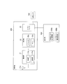
- FIG. 1 is a diagram showing a configuration of a transportation communication system 1 according to an embodiment.
- the traffic communication system 1 includes a vehicle 100 passing through a road and a roadside machine 200 which is a base station installed on the roadside around the road.
- vehicles 100A and 100B are illustrated as the vehicle 100
- roadside machines 200A and 200B are illustrated as the roadside machine 200.
- the vehicle 100 is an example of an automobile such as an ordinary automobile or a light automobile, it may be a vehicle that passes through a road, and may be, for example, a motorcycle.
- Each vehicle 100 is equipped with an in-vehicle device 150 that performs wireless communication.
- the on-board unit 150 performs road-to-vehicle communication with the roadside unit 200.
- the roadside machine 200 is installed around the road.
- the roadside machine 200 may be installed at each intersection on a general road or on the roadside of an expressway, but the case where the roadside machine 200 is installed around an intersection will be mainly described below.
- the roadside machine 200 may be installed around the road at a place different from the intersection.
- the roadside unit 200A is installed on the traffic signal (traffic signal lamp) 300 or its support, and operates in cooperation with the traffic signal 300.
- the roadside unit 200A transmits a radio signal including signal information regarding the traffic signal 300 to the vehicle 100 (vehicle-mounted unit 150).
- wireless communication by broadcasting to an unspecified number of destinations may be used.
- wireless communication by multicast with a specific majority as a destination may be used, or wireless communication by unicast with a specific singular as a destination may be used.
- Each roadside unit 200 is connected to the central device 400 via a communication line.
- Centralized traffic control 400 manages road features such as road position, road elevation, and road slope.
- FIG. 2 is a diagram showing a configuration of a roadside machine 200 according to an embodiment.
- the roadside unit 200 has a communication unit 21, a control unit 22, and an interface 23.
- the communication unit 21 has an antenna 21a, a reception unit 21b, and a transmission unit 21c, and performs wireless communication via the antenna 21a.
- the communication unit 21 performs road-to-vehicle communication with the vehicle 100 (vehicle-mounted device 150). As mentioned above, road-to-vehicle communication is unicast, broadcast, or multicast.
- the antenna 21a may be an omnidirectional antenna or a directional antenna having directivity.
- the antenna 21a may be an adaptive array antenna whose directivity can be dynamically changed.
- the communication unit 21 has a reception unit 21b that converts the radio signal received by the antenna 21a into received data and outputs the radio signal to the control unit 22. Further, the communication unit 21 has a transmission unit 21c that converts the transmission data output by the control unit 22 into a wireless signal and transmits the transmission data from the antenna 21a.
- the wireless communication method of the communication unit 21 is a method compliant with the T109 standard of ARIB (Association of Radio Industries and Businesses) and a V2X (Vehicle-to-e) compliant system of 3GPP (Third Generation Partnership Project).
- ARIB Association of Radio Industries and Businesses
- V2X Vehicle-to-e
- 3GPP Third Generation Partnership Project
- a method conforming to a wireless LAN (Local Area Network) standard such as the IEEE (Institute of Electrical and Electronics Engineers) 802.11 series may be used.
- the communication unit 21 may be configured to support all of these communication standards.
- the control unit 22 controls various functions of the roadside machine 200.
- the control unit 22 has at least one memory 22b and at least one processor 22a electrically connected to the memory 22b.
- the memory 22b includes a volatile memory and a non-volatile memory, and stores information used for processing in the processor 22a and a program executed by the processor 22a.
- the processor 22a performs various processes by executing the program stored in the memory 22b.
- the interface 23 is connected to the detection unit 500 by wire or wirelessly.
- the detection unit 500 detects a moving object on the road, particularly a pedestrian.
- the detection unit 500 includes a plurality of detection units. Each detector may be any as long as it can detect a moving object on the road, but at least one of an image sensor (roadside camera), a millimeter wave sensor, an ultrasonic sensor, and an infrared sensor. It may be.
- each detection unit is a roadside camera installed on the roadside.
- FIG. 2 shows an example in which the detection unit 500 has a plurality of roadside cameras (visible light camera 500a and infrared camera 500b).
- the roadside camera captures the road.
- the roadside camera outputs the captured image to the control unit 22 via the interface 23.
- FIG. 2 shows an example in which the roadside camera is configured separately from the roadside machine 200, the roadside camera may be integrally configured with the roadside machine 200.
- the roadside camera may include a visible light camera 500a and an infrared camera 500b.
- the roadside camera may include only the visible light camera 500a.
- An infrared camera is a camera that captures infrared rays emitted from an image to be imaged.
- a known infrared camera is adopted for the infrared camera 500b.
- the interface 23 may be connected to the weather sensor 700.
- the meteorological sensor 700 may be any sensor for detecting meteorological conditions.
- the meteorological sensor 700 includes at least one of a solar radiation sensor, a rainfall sensor, a fog sensor, and an air pollution sensor.
- the solar radiation sensor may be provided for each direction.
- the interface 23 may be connected to the central device 400. Further, the interface 23 may be connected to the Internet.
- the control unit 22 uses the weather sensor 700 to acquire weather condition information indicating the weather conditions on the road.
- the control unit 22 may acquire the weather condition information from a means other than the weather sensor 700.
- the control unit 22 estimates the risk of a traffic accident on the road at least based on the weather condition information.
- the control unit 22 may acquire other information for estimating the degree of danger (vehicle moving direction information, intersection information, and / or pedestrian information, etc., which will be described later). Good.
- the control unit 22 may estimate the degree of danger based on the weather condition information and other information.
- the communication unit 21 transmits a warning message including information based on the risk level estimated in step S13.
- FIG. 3 is a diagram showing a configuration of a vehicle 100 according to an embodiment.
- the vehicle 100 includes a communication unit 11, a GNSS (Global Navigation Satellite System) receiver 12, a notification unit 13, at least one camera 14, a drive control unit 15, and a control unit 16.
- GNSS Global Navigation Satellite System
- the communication unit 11 has an antenna 11a, a reception unit 11b, and a transmission unit 11c, and performs wireless communication via the antenna 11a.
- the communication unit 11 performs road-to-vehicle communication with the roadside unit 200. As mentioned above, road-to-vehicle communication is unicast, broadcast, or multicast.
- the communication unit 11 has a reception unit 11b that converts the radio signal received by the antenna 11a into received data and outputs the radio signal to the control unit 16. Further, the communication unit 11 has a transmission unit 11c that converts the transmission data output by the control unit 16 into a wireless signal and transmits the transmission data from the antenna 11a.
- the wireless communication method of the communication unit 11 may be a method compliant with the T109 standard of ARIB, a method compliant with the V2X standard of 3GPP, and / or a method compliant with a wireless LAN standard such as the IEEE802.11 series.
- the communication unit 11 may be configured to be compatible with all of these communication standards.
- the GNSS receiver 12 performs positioning based on the GNSS satellite signal, and outputs GNSS position information indicating the current geographical position (latitude / longitude) of the vehicle 100 to the control unit 16.
- the notification unit 13 notifies the driver of the vehicle 100 of the information under the control of the control unit 16.
- the notification unit 13 has a display 13a for displaying information and a speaker 13b for outputting information by voice.
- the camera 14 is a camera installed in the vehicle 100.
- the camera 14 may include a front camera that captures the front of the vehicle.
- the camera 14 outputs the captured image to the control unit 16.
- the vehicle 100 does not have to have the camera 14.
- the drive control unit 15 controls an engine or motor as a power source, a power transmission mechanism, a brake, and the like.
- the drive control unit 15 may control the drive of the vehicle 100 in cooperation with the control unit 16.
- the control unit 16 controls various functions in the vehicle 100 (vehicle-mounted device 150).
- the control unit 16 has at least one memory 16b and at least one processor 16a electrically connected to the memory 16b.
- the memory 16b includes a volatile memory and a non-volatile memory, and stores information used for processing in the processor 16a and a program executed by the processor 16a.
- the processor 16a performs various processes by executing the program stored in the memory 16b.
- the control unit 16 performs automatic driving control (for example, deceleration) of the vehicle 100 based on the warning message.
- the driver may be notified.
- the probability of a traffic accident changes not only with traffic volume, traffic density, and average speed, but also with weather conditions. For example, even if the traffic volume is low, the traffic density is low, and the average speed is low, the probability of a traffic accident occurs when the sun is shining or fog is occurring. Is expected to be higher. Therefore, there is room for improvement in the conventional technique in terms of improving the estimation accuracy of the probability of occurrence of a traffic accident.
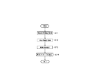
- FIG. 4 is a diagram showing the operation of the roadside machine 200 according to the embodiment.
- Step S11 As shown in FIG. 4, in step S11, the control unit 22 acquires the weather condition information indicating the weather condition on the road.
- the meteorological condition information may include weather phenomenon information indicating the state of the weather phenomenon on the road and solar radiation direction information indicating the direction of solar radiation to a vehicle on the road (hereinafter, simply referred to as "solar radiation direction"). ..
- Weather phenomena include rain, fog, and air pollution. Air pollution includes photochemical smog, fine particulate matter (so-called PM2.5), and the like.
- the weather phenomenon information may include fog information indicating the concentration of fog, rain information indicating the amount of rain precipitation, and air pollutant information indicating the concentration of air pollutants.
- the control unit 22 may acquire the weather phenomenon information from the weather sensor 700. The control unit 22 may acquire weather phenomenon information via the Internet. The control unit 22 may recognize the weather phenomenon by an image recognition method based on the captured image obtained by the roadside camera, and may acquire the weather phenomenon information.
- the control unit 22 may specify the solar radiation direction by using the solar radiation sensor, or may estimate the solar radiation direction by using the information for estimating the solar radiation direction without using the solar radiation sensor. In the former case, the control unit 22 acquires the solar radiation direction information from the solar radiation sensor. In the latter case, the control unit 22 acquires information indicating the estimated solar radiation direction as the solar radiation direction information.
- the information for estimating the direction of solar radiation includes information indicating the current time and road position information indicating the position of the road (for example, the longitude and latitude of the representative point of the road).
- the control unit 22 may acquire information indicating the current time from a clock provided on the roadside unit 200, or may acquire information indicating the current time via the Internet.
- the control unit 22 may acquire the road position information from the central device 400, or may acquire the road position information stored in the memory 22b when the roadside unit 200 is initially installed.
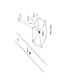
- FIG. 5 is a diagram showing an example of a method of estimating the solar radiation direction based on the information for estimating the solar radiation direction according to the embodiment.
- the control unit 22 identifies the position of the road (longitude and latitude of the representative point A on the road) from the acquired road position information, and the current time (M month D day H hour M in Y year) from the clock. Minutes) are specified, and a known calculation method is applied to specify the altitude h of the sun and the azimuth ⁇ of the sun corresponding to the position of the road (representative point A). Then, the control unit 22 sets the direction specified by the altitude h of the sun and the azimuth angle ⁇ of the sun (the direction pointed to by the straight line drawn from the sun B toward the representative point A in FIG. 5) as the direction of solar radiation.
- the information for estimating the solar radiation direction may further include information indicating the altitude of the road and information indicating the slope of the road.
- the control unit 22 corrects the direction specified by the altitude of the sun corresponding to the position of the road and the azimuth angle of the sun based on the altitude of the road and the slope of the road, and specifies the corrected direction as the direction of solar radiation. You may. This makes it possible to specify a more accurate direction of solar radiation.
- the information indicating the altitude of the road and the information indicating the slope of the road may be stored in advance in the memory 22b when the roadside unit 200 is initially installed.
- the control unit 22 may acquire information indicating the altitude of the road and information indicating the slope of the road from the central device 400.
- step S12 the control unit 22 acquires other information for estimating the degree of danger (vehicle moving direction information, intersection information, pedestrian information, etc., which will be described later).
- the vehicle moving direction information is information indicating the moving direction of the vehicle 100.
- the control unit 22 specifies the moving direction of the vehicle 100 by receiving a notification message from the vehicle 100 by the communication unit 21.
- the notification message may include information indicating the moving direction of the vehicle 100, or may include information indicating the position (longitude, latitude) of the vehicle 100.
- the control unit 22 may specify the moving direction of the vehicle 100 by periodically receiving information indicating the position (longitude, latitude) of the vehicle 100. Further, the control unit 22 may specify the moving direction of the vehicle 100 without using the notification message. For example, when the road is a one-way road, the direction in which the road is facing may be specified as the moving direction of the vehicle 100 on the road.
- the control unit 22 acquires intersection information indicating whether or not the roadside machine 200 is installed around the intersection.
- the intersection information may be stored in the memory 22b in advance when the roadside machine 200 is initially installed.
- the control unit 22 may acquire intersection information from the central device 400.
- the control unit 22 acquires the captured image obtained by the detection unit 500, and acquires pedestrian information from the captured image.
- Pedestrian information includes information indicating the number of pedestrians, information indicating whether or not the pedestrian is included in a child or an elderly person, and whether the pedestrian is included in a person operating a mobile device (smartphone, etc.). Includes information indicating whether or not.
- the control unit 22 extracts at least one of the characteristic contour, color, and brightness of the imaged object based on the captured image obtained by the roadside camera, and identifies the imaged object based on the extracted information. be able to. As this identification method, any known method may be adopted.
- the control unit 22 identifies a pedestrian from the captured image, identifies the number of identified pedestrians, determines whether or not the pedestrian is a child or an elderly person, and the pedestrian Determine if you are operating a mobile device. Then, the control unit 22 operates the information indicating the number of pedestrians, the information indicating whether or not the pedestrian is included in the child or the elderly, and the portable device for the pedestrian by such identification and determination processing. Get information that indicates whether or not it is included in the person who is.
- the control unit 22 basically acquires pedestrian information from the captured image obtained by the visible light camera 500a, but based on the weather condition information, the infrared camera 500b is selected from the visible light camera 500a and the infrared camera 500b. You may select and acquire pedestrian information from the captured image obtained by the infrared camera 500b. For example, when the fog density is equal to or higher than a predetermined value, the infrared camera 500b is selected.
- “fog concentration” may be read as either "rain precipitation” or "air pollutant concentration”.
- the fog density is high, the visible light from the image subject is blocked by the fog, the amount that can enter the visible light camera 500a is reduced, and the image quality of the captured image obtained by the visible light camera 500a is deteriorated.
- the control unit 22 may acquire pedestrian information by image recognition based on both the captured image obtained by the visible light camera 500a and the captured image obtained by the infrared camera 500b.
- step S13 the control unit 22 estimates the risk of a traffic accident on the road based on each item specified by the weather condition information, the vehicle moving direction information, the intersection information, and the pedestrian information.
- Such items include fog concentration, air pollutant concentration, rain precipitation, relationship between solar radiation direction and vehicle movement direction, whether or not the roadside machine 200 is installed around the intersection, the number of pedestrians, and walking. Includes whether a person includes a child or an elderly person, and whether a pedestrian includes a person operating a portable device.
- the control unit 22 may estimate the risk level for each item and estimate the overall risk level based on the risk level for each item.
- the degree of risk may be a value. If the value is large, the risk may be high, and if the value is small, the risk may be low.
- control unit 22 estimates the risk value as follows.
- the control unit 22 largely estimates the value of the degree of danger according to the direction of solar radiation.
- the control unit 22 associates the fog concentration with the risk level, and estimates the risk level value as the fog concentration increases.
- the control unit 22 associates the concentration of air pollutants with the degree of danger, and estimates the value of the degree of danger as the concentration of air pollutants increases.
- the control unit 22 associates the amount of rain precipitation with the degree of danger, and estimates the value of the degree of danger as the amount of rainfall in the rain increases.
- the control unit 22 has a higher risk value when the moving direction of the vehicle 100 and the direction of solar radiation are opposite to each other than when the moving direction of the vehicle 100 and the direction of solar radiation are not opposite to each other.
- a higher risk is estimated when the moving direction of the vehicle 100 and the direction of solar radiation are opposite to each other than when the moving direction of the vehicle 100 and the direction of solar radiation are not opposite to each other.
- the risk level estimated when the moving direction of the vehicle and the direction of solar radiation are not opposite to each other is set as the first risk level
- the risk level estimated when the moving direction and the direction of solar radiation are opposite to each other is defined as the first risk level.
- the second risk is higher than the first risk.
- the control unit 22 estimates a higher risk value when the roadside machine 200 is installed around the intersection than when the roadside machine 200 is not installed around the intersection.
- the risk level estimated when the roadside machine 200 is not installed around the intersection is defined as the third risk level
- the risk level estimated when the roadside machine 200 is installed around the intersection is the third risk level.
- the fourth risk is higher than the degree.
- the control unit 22 estimates the risk value as the number of pedestrians increases.
- the control unit 22 estimates a higher risk value when the pedestrian includes the child or the elderly than when the pedestrian does not include the child or the elderly.
- the control unit 22 estimates a higher risk value when the pedestrian includes a person who operates the mobile device than when the pedestrian does not include the person who operates the mobile device.
- the control unit 22 estimates the overall risk level based on the risk level of each item described above.
- the control unit 22 may estimate the total risk level by adding the risk levels for each item.
- the control unit 22 may estimate the total risk level by weighting the risk levels for each item and then adding them together.
- step S14 the communication unit 21 transmits a warning message including information based on the risk level estimated in step S13.
- the warning message may include a numerical value indicating the estimated risk level itself. It may include information to the effect of alerting generated based on the estimated risk.
- the communication unit 21 may determine whether or not to transmit the warning message based on the comparison result between the estimated risk level and the threshold value. For example, the communication unit 21 may determine that the warning message is not transmitted when the estimated risk level is equal to or less than the threshold value. As a result, it is possible to avoid frequent occurrence of warning messages due to low risk.
- warning message does not necessarily mean a message to be notified when a warning is given, but may be used as a message for notifying information at any time.
- the communication unit 21 transmits a warning message to the vehicle 100 by unicast, broadcast, or multicast.
- the communication unit 21 When estimating the risk level for each item corresponding to the direction of solar radiation, the communication unit 21 corresponds to the moving direction of the vehicle 100 used for estimating the risk level for each item.
- a warning message may be sent to the vehicle 100.
- the notification message that identifies the moving direction of the vehicle includes information that identifies the source of the notification message, and the communication unit 21 transmits a warning message to the source that is identified based on the notification message. ..
- the vehicle-mounted device 150 may perform automatic driving control (for example, deceleration or stop) of the vehicle 100 or notify the driver according to the received warning message.
- automatic driving control for example, deceleration or stop
- the vehicle-mounted device 150 may control the speed of the vehicle 100 according to the received warning message.
- the vehicle-mounted device 150 may change the speed according to the value of the degree of danger of the warning message. For example, the speed corresponding to the value of the degree of danger is determined, and the vehicle-mounted device 150 controls the speed corresponding to the value of the degree of danger via the drive control unit 15.
- the roadside unit 200 Before the roadside unit 200 transmits the warning message, the roadside unit 200 includes the speed information corresponding to the risk value in the warning message, and when the on-board unit 150 receives the warning message, it is included in the warning message.
- the speed may be changed according to the speed information. With this configuration, the speed of the vehicle 100 is controlled according to the degree of danger detected by the roadside machine 200, so that a safe and secure intelligent transportation system can be provided.
- a program may be provided that causes the computer to execute each process performed by the on-board unit 150 or the roadside unit 200.
- the program may be recorded on a computer-readable medium.
- Computer-readable media can be used to install programs on a computer.
- the computer-readable medium on which the program is recorded may be a non-transient recording medium.
- the non-transient recording medium is not particularly limited, but may be, for example, a recording medium such as a CD-ROM or a DVD-ROM.
- a circuit for executing each process performed by the on-board unit 150 or the roadside unit 200 may be integrated, and at least a part of the on-board unit 150 or the roadside unit 200 may be configured as a semiconductor integrated circuit (chipset, SoC).
Landscapes
- Physics & Mathematics (AREA)
- General Physics & Mathematics (AREA)
- Life Sciences & Earth Sciences (AREA)
- Atmospheric Sciences (AREA)
- Traffic Control Systems (AREA)
- Analytical Chemistry (AREA)
- Chemical & Material Sciences (AREA)
- Engineering & Computer Science (AREA)
- Computer Networks & Wireless Communication (AREA)
- Signal Processing (AREA)
- Business, Economics & Management (AREA)
- Health & Medical Sciences (AREA)
- Emergency Management (AREA)
- Environmental & Geological Engineering (AREA)
- Public Health (AREA)
Abstract
基地局200は、道路の周辺に設置される。前記基地局200は、制御部22と、通信部21とを備える。前記制御部22は、前記道路における気象条件を示す気象条件情報を取得し、前記気象条件情報に基づいて前記道路における交通事故発生の危険度を推定する。前記通信部21は、前記推定された危険度に基づく情報を含む警告メッセージを、前記道路上の車両100に対して送信する。
Description
本開示は、基地局、交通通信システム及び交通通信方法に関する。
近年、交通事故の危険を抑制可能な技術として、高度道路交通システム(ITS:Intelligent Transport System)が注目されている。このような高度道路交通システムには、道路の周辺に設けられる基地局である路側機が用いられる。
特許文献1には、道路区間の交通状況指標に基づいて、当該道路区間における交通事故の発生確率を示す危険度を推定し、推定した危険度が所定の基準値以上となると判断した場合、当該道路区間に位置する車両に搭載された車載器及び歩行者が携帯する携帯端末の少なくとも一方へアラート情報を送信する装置が記載されている。ここで、交通状況指標には、交通量、交通密度、及び平均速度が含まれている。
第1の態様に係る基地局は、道路の周辺に設置される。前記基地局は、制御部と、通信部とを備える。前記制御部は、前記道路における気象条件を示す気象条件情報を取得し、前記気象条件情報に基づいて前記道路における交通事故発生の危険度を推定する。前記通信部は、前記推定された危険度に基づく情報を含む警告メッセージを、前記道路上の車両に対して送信する。
第2の態様に係る交通通信システムは、車両と、第1の態様に係る基地局とを有する。
第3の態様に係る交通通信方法は、道路の周辺に設置される基地局で用いる交通通信方法である。前記交通通信方法は、前記道路における気象条件を示す気象条件情報を取得することと、前記気象条件情報に基づいて前記道路における交通事故発生の危険度を推定することと、前記推定された危険度に基づく情報を含む警告メッセージを、前記道路上の車両に対して送信することと、を有する。
特許文献1に記載の方法でも、改善の余地が依然としてある。
そこで、本開示は、安全安心な高度道路交通システムを提供することが可能とすることを目的とする。
一実施形態に係る交通通信システムについて図面を参照しながら説明する。なお、以下の図面の記載において、同一又は類似の部分には、同一又は類似の符号を付している。
(交通通信システムの構成)
まず、一実施形態に係る交通通信システムの構成について説明する。図1は、一実施形態に係る交通通信システム1の構成を示す図である。
まず、一実施形態に係る交通通信システムの構成について説明する。図1は、一実施形態に係る交通通信システム1の構成を示す図である。
図1に示すように、交通通信システム1は、道路を通る車両100と、道路の周辺である路側に設置される基地局である路側機200とを有する。図1において、車両100として車両100A及び100Bを例示し、路側機200として路側機200A及び200Bを例示している。なお、車両100としては普通自動車や軽自動車等の自動車を例示しているが、道路を通る車両であればよく、例えば自動二輪車(オートバイ)等であってもよい。
各車両100には、無線通信を行う車載機150が搭載されている。車載機150は、路側機200との路車間通信を行う。
路側機200は、道路周辺に設置されている。路側機200は、一般道路における交差点ごとに設置されてもよいし、高速道路の路側に設置されてもよいが、以下においては路側機200が交差点周辺に設置されるケースについて主として説明する。なお、路側機200は、交差点とは異なる場所の道路の周辺に設置されてもよい。
図1に示す例おいて、路側機200Aは、交通信号機(交通信号灯器)300又はその支柱に設置されており、交通信号機300と連携して動作する。例えば、路側機200Aは、交通信号機300に関する信号情報を含む無線信号を車両100(車載機150)に送信する。
このような路車間通信には、不特定多数を宛先とするブロードキャストによる無線通信が用いられてもよい。或いは、路車間通信には、特定多数を宛先とするマルチキャストによる無線通信が用いられてもよいし、特定単数を宛先とするユニキャストによる無線通信が用いられてもよい。
各路側機200は、通信回線を介して中央装置400に接続される。中央装置400は、道路の位置、道路の海抜、道路の勾配などの道路特徴を管理する。
(路側機の構成)
次に、一実施形態に係る路側機200の構成について説明する。図2は、一実施形態に係る路側機200の構成を示す図である。
次に、一実施形態に係る路側機200の構成について説明する。図2は、一実施形態に係る路側機200の構成を示す図である。
図2に示すように、路側機200は、通信部21と、制御部22と、インターフェイス23とを有する。
通信部21は、アンテナ21aと、受信部21bと、送信部21cとを有し、アンテナ21aを介して無線通信を行う。通信部21は、車両100(車載機150)との路車間通信を行う。上述したように、路車間通信は、ユニキャスト、ブロードキャスト、又はマルチキャストで行われる。
アンテナ21aは、無指向性アンテナであってもよいし、指向性を有する指向性アンテナであってもよい。アンテナ21aは、指向性を動的に変更可能なアダプティブアレイアンテナであってもよい。
通信部21は、アンテナ21aが受信する無線信号を受信データに変換して制御部22に出力する受信部21bを有する。また、通信部21は、制御部22が出力する送信データを無線信号に変換してアンテナ21aから送信する送信部21cを有する。
通信部21の無線通信方式は、ARIB(Association of Radio Industries and Businesses)のT109規格に準拠した方式、3GPP(Third Generation Partnership Project)のV2X(Vehicle-to-everything)規格に準拠した方式、及び/又はIEEE(Institute of Electrical and Electronics Engineers)802.11シリーズ等の無線LAN(Local Area Network)規格に準拠した方式であってもよい。通信部21は、これらの通信規格の全てに対応可能に構成されていてもよい。
制御部22は、路側機200における各種の機能を制御する。制御部22は、少なくとも1つのメモリ22bと、メモリ22bと電気的に接続された少なくとも1つのプロセッサ22aとを有する。メモリ22bは、揮発性メモリ及び不揮発性メモリを含み、プロセッサ22aにおける処理に用いる情報及びプロセッサ22aにより実行されるプログラムを記憶する。プロセッサ22aは、メモリ22bに記憶されたプログラムを実行することにより各種の処理を行う。
インターフェイス23は、有線又は無線で検知部500と接続される。検知部500は、道路上の移動体、特に、歩行者を検知する。一実施形態において、検知部500は、複数の検知部を含む。各検知部は、道路上の移動体を検知可能であればどのようなものであってもよいが、画像センサ(路側カメラ)、ミリ波センサ、超音波センサ、及び赤外線センサのうち少なくとも1つであってもよい。
例えば、各検知部は、路側に設置される路側カメラである。図2において、検知部500が、複数の路側カメラ(可視光カメラ500a及び赤外線カメラ500b)を有する一例を示している。路側カメラは、道路を撮像する。路側カメラは、インターフェイス23を介して撮像画像を制御部22に出力する。
図2において、路側カメラが路側機200と別体に構成される一例を図示しているが、路側カメラが路側機200と一体に構成されてもよい。
路側カメラは、可視光カメラ500a及び赤外線カメラ500bを含んでもよい。路側カメラは、可視光カメラ500aのみを含んでもよい。赤外線カメラとは、被撮像から放射される赤外線を撮るカメラである。赤外線カメラ500bについて、公知の赤外線カメラを採用する。
インターフェイス23は、気象センサ700と接続されてもよい。気象センサ700は、気象条件を検知するためのセンサであればどのようなものであってもよい。例えば、気象センサ700は、日射センサ、降雨センサ、霧センサ、及び大気汚染センサのうち少なくとも1つを含む。日射センサは、方角別に設けられていてもよい。
また、インターフェイス23は、中央装置400と接続されてもよい。さらに、インターフェイス23は、インターネットに接続されてもよい。
このように構成された路側機200において、制御部22は、気象センサ700を用いて、道路における気象条件を示す気象条件情報を取得する。制御部22は、気象センサ700以外の手段から気象条件情報を取得してもよい。制御部22は、少なくとも気象条件情報に基づいて道路における交通事故発生の危険度を推定する。ここで、危険度を推定するために、制御部22は、危険度を推定するための他の情報(後述の車両移動方向情報、交差点情報、及び/又は歩行者情報など)を取得してもよい。この場合、制御部22は、気象条件情報と他の情報とに基づいて危険度を推定してもよい。そして、通信部21は、ステップS13において推定された危険度に基づく情報を含む警告メッセージを送信する。
このように、気象条件情報に基づいて道路における交通事故発生の危険度を推定することにより、交通事故の発生確率(危険度)の推定精度を高めることができる。
(車両の構成)
次に、一実施形態に係る車両100の構成について説明する。図3は、一実施形態に係る車両100の構成を示す図である。
次に、一実施形態に係る車両100の構成について説明する。図3は、一実施形態に係る車両100の構成を示す図である。
図3に示すように、車両100は、通信部11と、GNSS(Global Navigation Satellite System)受信機12と、通知部13と、少なくとも1つのカメラ14と、駆動制御部15と、制御部16とを有する。
通信部11は、アンテナ11aと、受信部11bと、送信部11cとを有し、アンテナ11aを介して無線通信を行う。通信部11は、路側機200との路車間通信を行う。上述したように、路車間通信は、ユニキャスト、ブロードキャスト、又はマルチキャストで行われる。
通信部11は、アンテナ11aが受信する無線信号を受信データに変換して制御部16に出力する受信部11bを有する。また、通信部11は、制御部16が出力する送信データを無線信号に変換してアンテナ11aから送信する送信部11cを有する。
通信部11の無線通信方式は、ARIBのT109規格に準拠した方式、3GPPのV2X規格に準拠した方式、及び/又はIEEE802.11シリーズ等の無線LAN規格に準拠した方式であってもよい。通信部11は、これらの通信規格の全てに対応可能に構成されていてもよい。
GNSS受信機12は、GNSS衛星信号に基づいて測位を行い、車両100の現在の地理的な位置(緯度・経度)を示すGNSS位置情報を制御部16に出力する。
通知部13は、制御部16の制御下で、車両100の運転者に対する情報の通知を行う。通知部13は、情報を表示するディスプレイ13aと、情報を音声出力するスピーカ13bとを有する。
カメラ14は、車両100に設置されるカメラである。カメラ14は、車両の前方を撮像するフロントカメラを含んでもよい。カメラ14は、撮像画像を制御部16に出力する。車両100は、カメラ14を有していなくてもよい。
駆動制御部15は、動力源としてのエンジン又はモータ、動力伝達機構、及びブレーキ等を制御する。車両100が自動運転車両である場合、駆動制御部15は、制御部16と連携して車両100の駆動を制御してもよい。
制御部16は、車両100(車載機150)における各種の機能を制御する。制御部16は、少なくとも1つのメモリ16bと、メモリ16bと電気的に接続された少なくとも1つのプロセッサ16aとを有する。メモリ16bは、揮発性メモリ及び不揮発性メモリを含み、プロセッサ16aにおける処理に用いる情報及びプロセッサ16aにより実行されるプログラムを記憶する。プロセッサ16aは、メモリ16bに記憶されたプログラムを実行することにより各種の処理を行う。
このように構成された車両100において、制御部16は、通信部11が路側機200から警告メッセージを受信すると、この警告メッセージに基づいて、車両100の自動運転制御(例えば、減速)を行ってもよいし、運転者への通知を行ってもよい。
ところで、交通事故の発生確率(危険度)は、交通量、交通密度、及び平均速度だけではなく、気象条件によっても変化する。例えば、交通量が少なく、交通密度が低く、及び平均速度が低い場合であっても、西日が射している場合や、霧が発生しているような場合には、交通事故の発生確率は高くなると考えられる。よって、従来の技術では、交通事故の発生確率の推定精度を高める点において改善の余地がある。
(路側機の動作)
次に、一実施形態に係る路側機200の動作について説明する。図4は、一実施形態に係る路側機200の動作を示す図である。
次に、一実施形態に係る路側機200の動作について説明する。図4は、一実施形態に係る路側機200の動作を示す図である。
(1.ステップS11)
図4に示すように、ステップS11において、制御部22は、道路における気象条件を示す気象条件情報を取得する。気象条件情報は、道路における天気現象の状況を示す天気現象情報と、道路上の車両に対する日射の方向(以下、単に「日射方向」と呼ぶ。)を示す日射方向情報とを含んでいてもよい。
図4に示すように、ステップS11において、制御部22は、道路における気象条件を示す気象条件情報を取得する。気象条件情報は、道路における天気現象の状況を示す天気現象情報と、道路上の車両に対する日射の方向(以下、単に「日射方向」と呼ぶ。)を示す日射方向情報とを含んでいてもよい。
(1.1.天気現象情報の取得)
天気現象は、雨、霧、大気汚染などを含む。大気汚染は、光化学スモッグ、微小粒子状物質(いわゆるPM2.5)などを含む。天気現象情報は、霧の濃度を示す霧情報と、雨の降水量を示す雨情報と、大気汚染物の濃度を示す大気汚染物情報とを含んでもよい。制御部22は、天気現象情報を気象センサ700から取得してもよい。制御部22は、インターネット経由で天気現象情報を取得してもよい。制御部22は、路側カメラにより得られる撮像画像に基づいて、画像認識手法により天気現象を認識し、天気現象情報を取得してもよい。
天気現象は、雨、霧、大気汚染などを含む。大気汚染は、光化学スモッグ、微小粒子状物質(いわゆるPM2.5)などを含む。天気現象情報は、霧の濃度を示す霧情報と、雨の降水量を示す雨情報と、大気汚染物の濃度を示す大気汚染物情報とを含んでもよい。制御部22は、天気現象情報を気象センサ700から取得してもよい。制御部22は、インターネット経由で天気現象情報を取得してもよい。制御部22は、路側カメラにより得られる撮像画像に基づいて、画像認識手法により天気現象を認識し、天気現象情報を取得してもよい。
(1.2.日射方向情報の取得)
制御部22は、日射センサを使用して日射方向を特定してもよいし、日射センサを使用せずに日射方向推定用情報を使用して日射方向を推定してもよい。前者の場合、制御部22は、日射方向情報を日射センサから取得する。後者の場合、制御部22は、推定した日射方向を示す情報を日射方向情報として取得する。
制御部22は、日射センサを使用して日射方向を特定してもよいし、日射センサを使用せずに日射方向推定用情報を使用して日射方向を推定してもよい。前者の場合、制御部22は、日射方向情報を日射センサから取得する。後者の場合、制御部22は、推定した日射方向を示す情報を日射方向情報として取得する。
日射方向推定用情報は、現在時刻を示す情報と、道路の位置(例えば、道路の代表地点の経度及び緯度)を示す道路位置情報とを含む。制御部22は、路側機200に設けられる時計から現在時刻を示す情報を取得してもよいし、インターネット経由で現在時刻を示す情報を取得してもよい。制御部22は、中央装置400はから道路位置情報を取得してもよいし、路側機200を初期設置した際にメモリ22bに記憶された道路位置情報を取得してもよい。
図5は、一実施形態に係る日射方向推定用情報に基づいて日射方向を推定する方法の一例を示す図である。図5に示すように、制御部22は、取得した道路位置情報から道路の位置(道路における代表地点Aの経度及び緯度)を特定し、時計から現在時刻(Y年M月D日H時M分)を特定し、公知の計算方法を適用して、道路の位置(代表地点A)に対応する太陽の高度hと太陽の方位角αとを特定する。そして、制御部22は、太陽の高度hと太陽の方位角αによって特定した方向(図5における太陽Bから代表地点Aに向いて引いた直線が指す方向)を日射の方向とする。
日射方向推定用情報は、道路の海抜を示す情報と、道路の勾配を示す情報とを更に含んでもよい。制御部22は、道路の位置に対応する太陽の高度と太陽の方位角とによって特定した方向を、道路の海抜と道路の勾配とに基づいて補正し、補正した方向を日射の方向として特定してもよい。これにより、より精確な日射の方向を特定できる。道路の海抜を示す情報と、道路の勾配を示す情報とは、路側機200を初期設置した際にメモリ22bに予め記憶されてもよい。制御部22は、中央装置400から道路の海抜を示す情報と、道路の勾配を示す情報とを取得してもよい。
(2.ステップS12)
ステップS12において、制御部22は、危険度を推定するための他の情報(後述の車両移動方向情報、交差点情報、歩行者情報など)を取得する。
ステップS12において、制御部22は、危険度を推定するための他の情報(後述の車両移動方向情報、交差点情報、歩行者情報など)を取得する。
車両移動方向情報は、車両100の移動方向を示す情報である。制御部22は、通信部21により車両100から通知メッセージを受信することによって車両100の移動方向を特定する。通知メッセージは、車両100の移動方向を示す情報を含んでもよいし、車両100の位置(経度、緯度)を示す情報を含んでもよい。制御部22は、車両100の位置(経度、緯度)を示す情報を周期的に受信することによって、車両100の移動方向を特定してもよい。また、制御部22は、通知メッセージを使用せずに車両100の移動方向を特定してもよい。例えば、道路が一方通行の道路である場合、道路が向いている方向を道路上の車両100の移動方向として特定してもよい。
制御部22は、路側機200が交差点の周辺に設置されているか否かを示す交差点情報を取得する。交差点情報は、路側機200を初期設置した際にメモリ22bに予め記憶されてもよい。制御部22は、中央装置400から交差点情報を取得してもよい。
制御部22は、検知部500により得られる撮像画像を取得し、撮像画像から歩行者情報を取得する。歩行者情報は、歩行者の数を示す情報と、歩行者に子供又は老人に含まれるか否かを示す情報と、歩行者に携帯機器(スマートフォンなど)を操作している人に含まれるか否かを示す情報とを含む。例えば、制御部22は、路側カメラにより得られる撮像画像に基づいて、被撮像物の特徴的な輪郭と色と輝度の少なくともいずれかを抽出し、抽出した情報に基づいて被撮像物を識別することができる。この識別手法としては公知の任意の手法を採用すればよい。このような識別手法によって、制御部22は、撮像画像から歩行者を識別し、識別された歩行者の数を特定し、歩行者が子供又は老人であるか否かを判断し、歩行者が携帯機器を操作しているか否かを判断する。そして、制御部22は、このような識別及び判断処理によって、歩行者の数を示す情報と、歩行者に子供又は老人に含まれるか否かを示す情報と、歩行者に携帯機器を操作している人に含まれるか否かを示す情報とを取得する。
制御部22は、基本的には、可視光カメラ500aにより得られる撮像画像から歩行者情報を取得するが、気象条件情報に基づいて、可視光カメラ500aと赤外線カメラ500bのうち、赤外線カメラ500bを選択し、赤外線カメラ500bにより得られる撮像画像から歩行者情報を取得してもよい。例えば、霧の濃度が所定値以上の場合、赤外線カメラ500bを選択する。ここで、「霧の濃度」を、「雨の降水量」と「大気汚染物の濃度」とのいずれか1つに読み替えてもよい。霧の濃度が高くなる場合、被撮像体からの可視光が霧によって遮られ、可視光カメラ500aに進入できる量が少なくなり、可視光カメラ500aにより得られる撮像画像の画質が悪くなるため、歩行者を識別できない虞がある。一方、赤外線は霧などに対して透過性が良いので、霧の濃度が高くなっても、赤外線カメラ500bにより得られる撮像画像の画質が悪くならないため、歩行者を識別できる。さらに、携帯機器は操作中において発熱するため、歩行者に携帯機器を操作している人に含まれるか否かを判定する際に、赤外線カメラ500bにより得られる撮像画像を使用したほうがより正確に判断できる。
制御部22は、可視光カメラ500aにより得られる撮像画像と、赤外線カメラ500bにより得られる撮像画像との両方に基づいて、画像認識により歩行者情報を取得してもよい。
(3.ステップS13)
ステップS13において、制御部22は、気象条件情報と、車両移動方向情報と、交差点情報と、歩行者情報とによって特定された各項目に基づいて道路における交通事故発生の危険度を推定する。かかる項目は、霧の濃度、大気汚染物の濃度、雨の降水量、日射方向と車両移動方向との関係、路側機200が交差点の周辺に設置されるか否か、歩行者の数、歩行者が子供又は老人を含まるか否か、及び歩行者が携帯機器を操作している人を含むか否かを含む。
ステップS13において、制御部22は、気象条件情報と、車両移動方向情報と、交差点情報と、歩行者情報とによって特定された各項目に基づいて道路における交通事故発生の危険度を推定する。かかる項目は、霧の濃度、大気汚染物の濃度、雨の降水量、日射方向と車両移動方向との関係、路側機200が交差点の周辺に設置されるか否か、歩行者の数、歩行者が子供又は老人を含まるか否か、及び歩行者が携帯機器を操作している人を含むか否かを含む。
制御部22は、複数の項目の情報が利用可能の場合、項目別の危険度を推定し、各項目の項目別の危険度に基づいて、総合的な危険度を推定してもよい。危険度は、値でもよい。値が大きければ、危険度が高く、値が小さければ、危険度が低いとしてもよい。
(3.1.項目別の危険度の推定方法)
例えば、制御部22は、次のように、危険度の値を推定する。
例えば、制御部22は、次のように、危険度の値を推定する。
制御部22は、日射方向に応じて危険度の値を大きく推定する。
制御部22は、霧の濃度を危険度に対応させ、霧の濃度が高いほど危険度の値を大きく推定する。
制御部22は、大気汚染物の濃度を危険度に対応させ、大気汚染物の濃度が大きいほど危険度の値を大きく推定する。
制御部22は、雨の降水量を危険度に対応させ、雨の降水量が多いほど危険度の値を大きく推定する。
制御部22は、車両100の移動方向と日射の方向とが互いに逆方向でない場合よりも、車両100の移動方向と日射の方向とが互いに逆方向である場合のほうが、より大きい危険度の値を推定する。車両100の移動方向と日射の方向とが互いに逆方向である場合、日の光が車両100のフロントガラスから車両100の運転者の目に当たるため、運転者が道路上の障害物や移動体などを見えない可能性がある。よって、車両100の移動方向と日射の方向とが互いに逆方向でない場合よりも、車両100の移動方向と日射の方向とが互いに逆方向である場合のほうが、より高い危険度を推定する。ここで、車両の移動方向と日射の方向とが互いに逆方向でない場合において推定した危険度を第1危険度とし、移動方向と日射の方向とが互いに逆方向である場合において推定した危険度を第1危険度よりも高い第2危険度とする。
制御部22は、路側機200が交差点の周辺に設置されていない場合よりも、路側機200が交差点の周辺に設置されている場合のほうが、より大きい危険度の値を推定する。ここで、路側機200が交差点の周辺に設置されていない場合において推定した危険度を第3危険度とし、路側機200が交差点の周辺に設置されている場合において推定した危険度を第3危険度よりも高い第4危険度とする。
制御部22は、歩行者の数が多いほど危険度の値を大きく推定する。
制御部22は、歩行者に子供又は老人を含まない場合よりも、歩行者に子供又は老人を含む場合のほうが、より大きい危険度の値を推定する。
制御部22は、歩行者に携帯機器を操作している人を含まない場合よりも、歩行者に携帯機器を操作している人を含む場合のほうが、より大きい危険度の値を推定する。
(3.2.総合的な危険度の推定方法)
制御部22は、上述の各項目の項目別の危険度に基づいて、総合的な危険度を推定する。
制御部22は、上述の各項目の項目別の危険度に基づいて、総合的な危険度を推定する。
制御部22は、各項目別の危険度を足し算することで総合危険度を推定してもよい。制御部22は、各項目別の危険度に重み付け処理をした上で足し算することで総合危険度を推定してもよい。
(4.ステップS14)
ステップS14において、通信部21は、ステップS13において推定された危険度に基づく情報を含む警告メッセージを送信する。
ステップS14において、通信部21は、ステップS13において推定された危険度に基づく情報を含む警告メッセージを送信する。
警告メッセージは、推定された危険度そのものを示す数値を含んでもよい。推定された危険度に基づいて生成した注意喚起の旨の情報を含んでもよい。
通信部21は、推定された危険度と閾値との比較結果に基づいて警告メッセージを送信するか否かを判断してもよい。例えば、通信部21は、推定された危険度が閾値以下の場合、警告メッセージを送信しないと判断してもよい。これによって、低い危険度による警告メッセージの頻発を回避できる。
また、警告メッセージは、必ずしも警告を行う場合に通知されるメッセージという意味ではなく、随時、情報を通知するためのメッセージとして使用されてもよい。
通信部21は、ユニキャスト、ブロードキャスト、又はマルチキャストにて警告メッセージを車両100に送信する。
通信部21は、危険度を推定する際に、日射の方向に対応する項目別の危険度を推定した場合、当該項目別の危険度を推定する際に使用した車両100の移動方向に対応する車両100に対して警告メッセージを送信してもよい。例えば、車両の移動方向を特定する通知メッセージには、当該通知メッセージの送信元を識別する情報が含まれ、通信部21は、通知メッセージに基づいて識別する送信元を宛先として警告メッセージを送信する。
車載機150は、受信した警告メッセージに応じて、車両100の自動運転制御(例えば、減速または停止)を行ってもよいし、運転者への通知を行ってもよい。
車載機150は、受信した警告メッセージに応じて車両100の速度を制御してもよい。車載機150は、警告メッセージの危険度の値に応じて速度を変更してもよい。例えば、危険度の値に対応した速度が決められていて、車載機150は、駆動制御部15を介して、危険度の値に対応した速度になるように制御する。路側機200が警告メッセージを送信する前に、路側機200が危険度の値に対応した速度の情報を警告メッセージに含め、車載機150は、その警告メッセージを受信したとき、警告メッセージに含まれる速度の情報に従って速度を変更してもよい。このように構成すれば、路側機200が検知した危険度に応じて車両100の速度が制御されるため、安全安心な高度道路交通システムを提供することができる。
(その他の実施形態)
車載機150又は路側機200が行う各処理をコンピュータに実行させるプログラムが提供されてもよい。プログラムは、コンピュータ読取り可能媒体に記録されていてもよい。コンピュータ読取り可能媒体を用いれば、コンピュータにプログラムをインストールすることが可能である。ここで、プログラムが記録されたコンピュータ読取り可能媒体は、非一過性の記録媒体であってもよい。非一過性の記録媒体は、特に限定されるものではないが、例えば、CD-ROMやDVD-ROM等の記録媒体であってもよい。
車載機150又は路側機200が行う各処理をコンピュータに実行させるプログラムが提供されてもよい。プログラムは、コンピュータ読取り可能媒体に記録されていてもよい。コンピュータ読取り可能媒体を用いれば、コンピュータにプログラムをインストールすることが可能である。ここで、プログラムが記録されたコンピュータ読取り可能媒体は、非一過性の記録媒体であってもよい。非一過性の記録媒体は、特に限定されるものではないが、例えば、CD-ROMやDVD-ROM等の記録媒体であってもよい。
また、車載機150又は路側機200が行う各処理を実行する回路を集積化し、車載機150又は路側機200の少なくとも一部を半導体集積回路(チップセット、SoC)として構成してもよい。
以上、図面を参照して実施形態について詳しく説明したが、具体的な構成は上述のものに限られることはなく、要旨を逸脱しない範囲内において様々な設計変更等をすることが可能である。
本願は、日本国特許出願第2019-178697号(2019年9月30日出願)の優先権を主張し、その内容の全てが本願明細書に組み込まれている。
Claims (10)
- 道路の周辺に設置される基地局であって、
前記道路における気象条件を示す気象条件情報を取得し、前記気象条件情報に基づいて前記道路における交通事故発生の危険度を推定する制御部と、
前記推定された危険度に基づく情報を含む警告メッセージを、前記道路上の車両に対して送信する通信部と、を備える
基地局。 - 前記気象条件情報は、前記道路における天気現象の状況を示す天気現象情報を含み、
前記制御部は、前記天気現象情報に基づいて前記危険度を推定し、
前記天気現象は、雨、霧、及び大気汚染の少なくとも1つを含む
請求項1に記載の基地局。 - 前記気象条件情報は、前記道路上の車両に対する日射の方向を示す日射方向情報を含み、
前記制御部は、前記日射方向情報に基づいて前記危険度を推定する
請求項1に記載の基地局。 - 前記通信部は、前記道路上の車両から通知メッセージを受信し、
前記制御部は、
前記通知メッセージに基づいて特定される前記道路上の車両の移動方向と、前記日射の方向とが互いに逆方向でない場合、前記危険度として第1危険度を推定し、
前記移動方向と、前記日射の方向とが互いに逆方向である場合、前記危険度として前記第1危険度よりも高い第2危険度を推定する
請求項3に記載の基地局。 - 前記制御部は、自基地局が交差点の周辺に設置されているか否かを示す交差点情報にさらに基づいて、前記危険度を推定する
請求項1乃至4のいずれか1項に記載の基地局。 - 前記制御部は、
前記自基地局が前記交差点の周辺に設置されていない場合、前記危険度として第3危険度を推定し、
前記自基地局が前記交差点の周辺に設置されている場合、前記危険度として前記第3危険度よりも高い第4危険度を推定する
請求項5に記載の基地局。 - 前記道路上の移動体を検知するための複数の検知部と接続されるインターフェイスをさらに備え、
前記複数の検知部は、赤外線カメラを含み、
前記制御部は、
前記気象条件情報に基づいて、前記複数の検知部の中から前記赤外線カメラを選択し、
前記赤外線カメラにより得られる撮像画像にさらに基づいて、前記危険度を推定する
請求項1乃至6のいずれか1項に記載の基地局。 - 車両と、
請求項1乃至7のいずれか1項に記載の基地局と、を備える
交通通信システム。 - 道路の周辺に設置される基地局で用いる交通通信方法であって、
前記道路における気象条件を示す気象条件情報を取得することと、
前記気象条件情報に基づいて前記道路における交通事故発生の危険度を推定することと、
前記推定された危険度に基づく情報を含む警告メッセージを、前記道路上の車両に対して送信することと、を有する
交通通信方法。 - 車両に搭載された車載機であって、
道路の周辺に設置される基地局が、前記道路における交通事故発生の危険度を推定することにより得られた危険度に基づく情報を含む警告メッセージを送信したときに、
前記警告メッセージを受信する通信部と、
前記警告メッセージに応じて前記車両の速度を制御する制御部とを備えた
車載機。
Priority Applications (2)
| Application Number | Priority Date | Filing Date | Title |
|---|---|---|---|
| JP2021550572A JP7245923B2 (ja) | 2019-09-30 | 2020-09-15 | 基地局、交通通信システム及び交通通信方法 |
| US17/707,407 US12112627B2 (en) | 2019-09-30 | 2022-03-29 | Base station, traffic communication system, and traffic communication method |
Applications Claiming Priority (2)
| Application Number | Priority Date | Filing Date | Title |
|---|---|---|---|
| JP2019178697 | 2019-09-30 | ||
| JP2019-178697 | 2019-09-30 |
Related Child Applications (1)
| Application Number | Title | Priority Date | Filing Date |
|---|---|---|---|
| US17/707,407 Continuation US12112627B2 (en) | 2019-09-30 | 2022-03-29 | Base station, traffic communication system, and traffic communication method |
Publications (1)
| Publication Number | Publication Date |
|---|---|
| WO2021065480A1 true WO2021065480A1 (ja) | 2021-04-08 |
Family
ID=75337934
Family Applications (1)
| Application Number | Title | Priority Date | Filing Date |
|---|---|---|---|
| PCT/JP2020/034896 Ceased WO2021065480A1 (ja) | 2019-09-30 | 2020-09-15 | 基地局、交通通信システム及び交通通信方法 |
Country Status (3)
| Country | Link |
|---|---|
| US (1) | US12112627B2 (ja) |
| JP (1) | JP7245923B2 (ja) |
| WO (1) | WO2021065480A1 (ja) |
Families Citing this family (2)
| Publication number | Priority date | Publication date | Assignee | Title |
|---|---|---|---|---|
| WO2024203957A1 (ja) * | 2023-03-29 | 2024-10-03 | 株式会社村上開明堂 | 車室内監視システム及びプログラム |
| JP7571259B1 (ja) | 2023-11-16 | 2024-10-22 | 株式会社コロプラ | プログラムおよび情報処理システム |
Citations (2)
| Publication number | Priority date | Publication date | Assignee | Title |
|---|---|---|---|---|
| JP2019096280A (ja) * | 2017-11-24 | 2019-06-20 | 株式会社東芝 | 情報提供システム、方法及びプログラム |
| JP2019114100A (ja) * | 2017-12-25 | 2019-07-11 | 株式会社東芝 | 交通管制装置および車載器 |
Family Cites Families (6)
| Publication number | Priority date | Publication date | Assignee | Title |
|---|---|---|---|---|
| US7486199B2 (en) * | 2005-11-17 | 2009-02-03 | Nissan Technical Center North America, Inc. | Forward vehicle brake warning system |
| JP6593882B2 (ja) | 2016-07-26 | 2019-10-23 | 三菱重工業株式会社 | 危険通知装置、危険通知システム、危険通知方法及びプログラム |
| CN108230752B (zh) * | 2018-01-26 | 2019-10-25 | 山东省交通规划设计院 | 智能交通安全预警方法、云服务器、随车终端及系统 |
| RU2700319C1 (ru) * | 2018-06-07 | 2019-09-16 | Лещинский Владислав Вадимович | Способ и система предотвращения дорожных аварий |
| CN110349422A (zh) * | 2019-08-19 | 2019-10-18 | 深圳成谷科技有限公司 | 一种道路天气预警的方法、装置及设备 |
| CN111114317B (zh) * | 2019-12-30 | 2022-04-22 | 上海移为通信技术股份有限公司 | 车速控制方法、装置和设备 |
-
2020
- 2020-09-15 WO PCT/JP2020/034896 patent/WO2021065480A1/ja not_active Ceased
- 2020-09-15 JP JP2021550572A patent/JP7245923B2/ja active Active
-
2022
- 2022-03-29 US US17/707,407 patent/US12112627B2/en active Active
Patent Citations (2)
| Publication number | Priority date | Publication date | Assignee | Title |
|---|---|---|---|---|
| JP2019096280A (ja) * | 2017-11-24 | 2019-06-20 | 株式会社東芝 | 情報提供システム、方法及びプログラム |
| JP2019114100A (ja) * | 2017-12-25 | 2019-07-11 | 株式会社東芝 | 交通管制装置および車載器 |
Non-Patent Citations (1)
| Title |
|---|
| MINATO, SHIN-NOSUKE: "The 2016 Spring National Conference of Operations Research Society of Japan", THE 37TH CORPORATE CASE EXCHANGE MEETING, 11 April 2016 (2016-04-11), pages 313 - 314 * |
Also Published As
| Publication number | Publication date |
|---|---|
| JPWO2021065480A1 (ja) | 2021-04-08 |
| US12112627B2 (en) | 2024-10-08 |
| US20220225071A1 (en) | 2022-07-14 |
| JP7245923B2 (ja) | 2023-03-24 |
Similar Documents
| Publication | Publication Date | Title |
|---|---|---|
| JP7635229B2 (ja) | センサー支援を伴うv2x通信のための方法、v2xデバイス、およびコンピュータ可読記憶媒体 | |
| US11670172B2 (en) | Planning and control framework with communication messaging | |
| KR102740857B1 (ko) | 수광 장치 및 측거 장치 | |
| US11293758B2 (en) | Systems and methods for increasing the accuracy of vehicle positioning | |
| US11682300B2 (en) | Techniques for utilizing a mobile device as a proxy for a vehicle | |
| WO2019165737A1 (zh) | 一种车辆安全通行系统及方法 | |
| CN111200796A (zh) | 用于评估车辆的环境感测系统的操作的系统及方法 | |
| US20150348412A1 (en) | Vehicle to vehicle wireless communication apparatus with potential crash warning | |
| CN113661531A (zh) | 现实世界交通模型 | |
| EP3350794A1 (en) | System and method for generation of a preventive alert | |
| WO2019013948A1 (en) | METHOD FOR ADAPTING THE POWER OF AN ENVIRONMENTAL PERCEPTION SYSTEM | |
| US20220130237A1 (en) | Base station, roadside device, traffic communication system, traffic management method, and training data generation method | |
| US12112627B2 (en) | Base station, traffic communication system, and traffic communication method | |
| CN112840183A (zh) | 光检测装置、光检测装置的控制方法和测距装置 | |
| US10568188B2 (en) | On-demand street lighting for a connected vehicle | |
| JP7401217B2 (ja) | 基地局、交通通信システム、及び交通管理方法 | |
| WO2021039772A1 (ja) | 基地局、交通通信システム、及び交通通信方法 | |
| JPWO2021065480A5 (ja) | ||
| JP7367043B2 (ja) | 交通通信システム、路側機、サーバ、及び交通通信方法 | |
| JP2021022866A (ja) | 交通通信システム、基地局、移動局、及び車両 | |
| JP7296305B2 (ja) | 交通通信システム、路側機、及び教師データ生成方法 | |
| JP7462076B2 (ja) | 無線路側機、交通通信システム、及び制御方法 | |
| JP7563579B2 (ja) | 路側通信装置、路側通信方法及びプログラム | |
| JP2005267579A (ja) | 車両情報収集装置および車両情報収集方法 | |
| CN108263276A (zh) | 一种低能见度条件下车用安全警示系统 |
Legal Events
| Date | Code | Title | Description |
|---|---|---|---|
| 121 | Ep: the epo has been informed by wipo that ep was designated in this application |
Ref document number: 20872935 Country of ref document: EP Kind code of ref document: A1 |
|
| ENP | Entry into the national phase |
Ref document number: 2021550572 Country of ref document: JP Kind code of ref document: A |
|
| NENP | Non-entry into the national phase |
Ref country code: DE |
|
| 122 | Ep: pct application non-entry in european phase |
Ref document number: 20872935 Country of ref document: EP Kind code of ref document: A1 |