WO2020217364A1 - 情報処理装置、情報処理方法、及び情報処理プログラム - Google Patents
情報処理装置、情報処理方法、及び情報処理プログラム Download PDFInfo
- Publication number
- WO2020217364A1 WO2020217364A1 PCT/JP2019/017521 JP2019017521W WO2020217364A1 WO 2020217364 A1 WO2020217364 A1 WO 2020217364A1 JP 2019017521 W JP2019017521 W JP 2019017521W WO 2020217364 A1 WO2020217364 A1 WO 2020217364A1
- Authority
- WO
- WIPO (PCT)
- Prior art keywords
- tool
- position information
- terminal
- information
- mobile terminal
- Prior art date
- Legal status (The legal status is an assumption and is not a legal conclusion. Google has not performed a legal analysis and makes no representation as to the accuracy of the status listed.)
- Ceased
Links
Images




Classifications
-
- G—PHYSICS
- G06—COMPUTING OR CALCULATING; COUNTING
- G06Q—INFORMATION AND COMMUNICATION TECHNOLOGY [ICT] SPECIALLY ADAPTED FOR ADMINISTRATIVE, COMMERCIAL, FINANCIAL, MANAGERIAL OR SUPERVISORY PURPOSES; SYSTEMS OR METHODS SPECIALLY ADAPTED FOR ADMINISTRATIVE, COMMERCIAL, FINANCIAL, MANAGERIAL OR SUPERVISORY PURPOSES, NOT OTHERWISE PROVIDED FOR
- G06Q10/00—Administration; Management
- G06Q10/06—Resources, workflows, human or project management; Enterprise or organisation planning; Enterprise or organisation modelling
-
- G—PHYSICS
- G06—COMPUTING OR CALCULATING; COUNTING
- G06Q—INFORMATION AND COMMUNICATION TECHNOLOGY [ICT] SPECIALLY ADAPTED FOR ADMINISTRATIVE, COMMERCIAL, FINANCIAL, MANAGERIAL OR SUPERVISORY PURPOSES; SYSTEMS OR METHODS SPECIALLY ADAPTED FOR ADMINISTRATIVE, COMMERCIAL, FINANCIAL, MANAGERIAL OR SUPERVISORY PURPOSES, NOT OTHERWISE PROVIDED FOR
- G06Q50/00—Information and communication technology [ICT] specially adapted for implementation of business processes of specific business sectors, e.g. utilities or tourism
- G06Q50/04—Manufacturing
-
- Y—GENERAL TAGGING OF NEW TECHNOLOGICAL DEVELOPMENTS; GENERAL TAGGING OF CROSS-SECTIONAL TECHNOLOGIES SPANNING OVER SEVERAL SECTIONS OF THE IPC; TECHNICAL SUBJECTS COVERED BY FORMER USPC CROSS-REFERENCE ART COLLECTIONS [XRACs] AND DIGESTS
- Y02—TECHNOLOGIES OR APPLICATIONS FOR MITIGATION OR ADAPTATION AGAINST CLIMATE CHANGE
- Y02P—CLIMATE CHANGE MITIGATION TECHNOLOGIES IN THE PRODUCTION OR PROCESSING OF GOODS
- Y02P90/00—Enabling technologies with a potential contribution to greenhouse gas [GHG] emissions mitigation
- Y02P90/30—Computing systems specially adapted for manufacturing
Definitions
- This disclosure relates to an information processing device, an information processing method, and an information processing program.
- Patent Document 1 describes a tool system including a tool and a mobile terminal.
- work information about the work contents performed by the tool is transmitted from the tool to the mobile terminal, and the mobile terminal receives the position information obtained by the satellite positioning system (GNSS: Global Navigation Satellite System) receiver of the mobile terminal. It is stored in association with the work information from the tool.
- GNSS Global Navigation Satellite System
- the information processing device includes at least one processor and is a device for managing the position of a tool.
- the at least one processor is obtained by correcting the tool position information obtained by positioning the position of the tool, the terminal position information obtained by positioning the position of the mobile terminal, and the terminal position information.
- the acquisition process of acquiring the correction terminal position information and the position correction process of correcting the tool position information so as to reflect the error of the terminal position information with respect to the correction terminal position information are executed.
- the information processing method is a method for managing the position of the tool.
- the information processing method includes tool position information obtained by positioning the position of the tool, terminal position information obtained by positioning the position of a mobile terminal, and correction obtained by correcting the terminal position information. It includes acquiring the terminal position information and correcting the tool position information so as to reflect the error of the terminal position information with respect to the correction terminal position information.
- the information processing program is obtained by positioning the tool position information obtained by positioning the position of the tool and the position of the mobile terminal on the information processing device for managing the position of the tool.
- the tool position information is obtained so as to acquire the terminal position information and the corrected terminal position information obtained by correcting the terminal position information, and to reflect the error of the terminal position information with respect to the corrected terminal position information. Make corrections and do.
- the position information obtained by the GNSS receiver is affected by the propagation environment such as weather conditions, so the accuracy of GNSS positioning may be low.
- high-precision positioning can be applied by combining a positioning function using a cellular base station, a wireless LAN access point, etc. with GNSS positioning, but the processing capacity of the tool is low. , It is difficult to apply such high-precision positioning to tools.
- the information processing device includes at least one processor and is a device for managing the position of a tool.
- the at least one processor includes tool position information obtained by positioning the position of the tool by a satellite positioning system, terminal position information obtained by positioning the position of a mobile terminal by a satellite positioning system, and the terminal position.
- An acquisition process for acquiring the corrected terminal position information obtained by correcting the information and a position correction process for correcting the tool position information so as to reflect the error of the terminal position information with respect to the corrected terminal position information are executed. To do. As a result, the position of the tool can be grasped with high accuracy.
- the information processing device is provided in the tool management server, which is a server that communicates with the tool, which will be mainly described, but the information processing device may be provided in the mobile terminal. ..
- FIG. 1 is a system configuration diagram showing a configuration of a tool management system 1 according to an embodiment.
- the tool management system 1 includes a tool 100, a tool management server 300, and a mobile terminal 400.
- the tool 100 may be a binding machine (for example, a reinforcing bar binding machine) which is a kind of electric tool.
- the tool 100 may be an electric tool other than the binding machine, for example, an electric drill, an electric screwdriver, an electric saw, a grinder, a polishing machine, or the like.
- the tool 100 may be a tool that uses pneumatic power as power (for example, a pneumatic tool) such as a manual tool, or a tool that uses hydraulic pressure as power (for example, a hydraulic tool).
- the tool 100 is a cordless power tool and is driven by electric power supplied from the drive battery 110.
- the drive battery 110 is a battery pack that can be attached to and detached from the tool 100.
- the drive battery 110 may be any type of battery as long as it is a secondary battery, and is, for example, a lithium ion battery.
- the drive battery 110 is charged by a charger (not shown) in a state where it is removed from the tool 100.
- the tool 100 has a binding portion 11, a main body portion 12, and a grip portion 13.
- the binding portion 11 has an arm that sandwiches the reinforcing bar, and binds the reinforcing bar by winding a wire supplied from the main body portion 12 around the reinforcing bar sandwiched between the arms.
- the main body 12 accommodates a reel around which a wire is wound.
- the wire is an example of a consumable item that is consumed every time the tool 100 is used.
- the consumables may be consumables other than wires, such as nails or staplers.
- the main body 12 incorporates a motor 140 (see FIG. 2).
- the motor 140 supplies the wire to the binding portion 11 and generates a driving force for winding the wire around the reinforcing bar.
- the main body 12 is provided with a power switch 15 for turning on / off the power of the tool 100.
- the grip portion 13 is a member that extends downward from the main body portion 12 and is gripped by the tool user.
- a trigger 14 is provided at the upper end of the grip portion 13. When the trigger 14 is pushed down, the binding portion 11 and the main body portion 12 perform a binding operation.
- a trigger lock 16 that locks (fixes) the trigger 14 may be provided. When the trigger lock 16 is set to the locked state, the trigger 14 is locked so as not to be pushed down.
- a latch mechanism for attaching / detaching the drive battery 110 is provided at the lower end portion of the grip portion 13.
- the tool 100 performs wireless communication with the base station 210 included in the communication network 200.
- the tool 100 has a wireless communication function using LPWA (Low Power Wide Area) technology.
- LPWA Low Power Wide Area
- the tool 100 communicates with the tool management server 300 via the communication network 200.
- the tool 100 transmits a message including detection information and position information to the tool management server 300.
- the detection information consists of parameter values indicating a state related to the work using the tool 100.
- the types of parameter values include, for example, operation count information, operation state information, and drive battery remaining amount information.
- the operation count information is information indicating the number of times the tool 100 has been operated (that is, the number of times the binding operation has been performed).
- the operating state information is information indicating the operating state of the tool 100, for example, an error state and a power on / off state.
- the error state may be a state in which the reinforcing bar sandwiched by the arm of the binding portion 11 is larger than the threshold value, or a state in which the temperature of the tool 100 is higher than the threshold value.
- the drive battery remaining amount information is information indicating the remaining amount of the drive battery 110.
- the battery level may be expressed as the ratio (percentage) of the current battery level to the capacity.
- the position information is information indicating the position of the tool 100, and includes latitude / longitude information obtained by using GNSS (Global Navigation Satellite System) such as GPS (Global Positioning System).
- GNSS Global Navigation Satellite System
- GPS Global Positioning System
- the location information may further include altitude information.
- the communication network 200 has a base station 210 that performs wireless communication. Further, the communication network 200 includes at least one of a narrow area communication network (LAN: Local Area Network), a high area communication network (WAN: Wide Area Network), and the Internet.
- LAN Local Area Network
- WAN Wide Area Network
- the tool management server 300 is connected to the communication network 200.
- the tool management server 300 manages the tool 100.
- FIG. 1 shows an example in which the tool management server 300 manages one tool 100, the tool management server 300 may manage a plurality of tools 100.
- the tool management server 300 receives a message from the tool 100 via the communication network 200, acquires the information included in the received message, and manages it. For example, the tool management server 300 manages the progress of work based on the detection information and the position information. The tool management server 300 may grasp the position of the tool 100 when the tool 100 is lost or stolen based on the position information.
- the mobile terminal 400 is a terminal such as a smartphone, a tablet terminal, a notebook PC, or a wearable terminal.
- the mobile terminal 400 performs wireless communication with the base station 210 included in the communication network 200.
- the mobile terminal 400 has a cellular communication function.
- the mobile terminal 400 may be possessed by the user or management of the tool 100.
- the mobile terminal 400 performs high-precision positioning (so-called hybrid measurement) by combining a positioning function using a cellular base station, a wireless LAN access point, or the like with GNSS positioning. Specifically, the mobile terminal 400 performs hybrid measurement by communicating with the terminal management server 600 via the communication network 200.
- the terminal management server 600 is a server that provides a positioning service by hybrid positioning.
- the terminal management server 600 manages the association between the identifier and the position of the wireless LAN access point and the association between the identifier and the position of the cellular base station (cell).
- the terminal management server 600 acquires an identifier included in the wireless signal received by the mobile terminal 400 from the cellular base station or the wireless LAN access point, and corrects the GNSS position information of the mobile terminal 400 based on the acquired identifier.
- the tool 100 does not have a hybrid measurement function.
- the position information obtained by the GNSS receiver 520 (see FIG. 2) of the tool 100 is affected by the propagation environment such as weather conditions, so that the accuracy of GNSS positioning may be low.
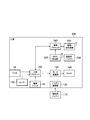
- FIG. 2 is a block diagram showing the configuration of the tool 100 according to the embodiment.
- the tool 100 wirelessly transmits and receives the battery connection unit 120, the motor drive unit 130, the motor 140, the sensor 150, the tool processor 160, and the tool processor 160. It has a machine 510, a GNSS receiver 520, a communication battery 530, and a communication processor 540.
- the battery connection unit 120 is a connector that is electrically connected to the drive battery 110.
- the motor drive unit 130 drives the motor 140 by converting the electric power supplied from the drive battery 110 and supplying the drive power to the motor 140.
- the sensor 150 includes a plurality of sensors.
- the sensor 150 detects, for example, the number of operations indicating the number of times the bundling operation has been performed, the operating state of the tool 100, and the remaining battery level of the drive battery 110, and sets each parameter value indicating the detection result to the tool processor 160. Output.
- the tool processor 160 controls the operation of the tool 100.
- the tool processor 160 includes at least one processor (CPU: Central Processing Unit).
- the tool processor 160 controls the motor drive unit 130 so as to drive the motor 140 when the trigger 14 is pushed down in the power-on state of the tool 100 (that is, the power switch 15 is set to on). To do.
- the motor 140 is driven by the motor drive unit 130, and the binding unit 11 performs a binding operation.
- the wireless transmitter / receiver 510 performs wireless communication using, for example, LPWA technology under the control of the communication processor 540.
- the wireless transmitter / receiver 510 converts the transmission information input from the communication processor 540 into a wireless signal, and transmits the wireless signal to the base station 210. Further, the wireless transmitter / receiver 510 receives a wireless signal from the base station 210, converts the received wireless signal into received information, and outputs the received information to the communication processor 540.
- the GNSS receiver 520 acquires the position information indicating the current position under the control of the communication processor 540, and outputs the acquired position information to the communication processor 540.
- the GNSS receiver 520 includes, for example, GPS, GLONASS (Global Navigation Satellite System), IRNSS (Indian Regional Navigation Satellite System), COMPASS, and Galileo.
- the communication battery 530 stores electric power for driving the wireless transmitter / receiver 510, the GNSS receiver 520, and the communication processor 540.
- a secondary battery may be used as the communication battery 530, and for example, a lithium ion battery can be used.
- the communication processor 540 controls the wireless transmitter / receiver 510.
- the communication processor 540 is configured to include at least one processor (CPU).
- the communication processor 540 transmits / receives information to / from the tool management server 300 via the wireless transmitter / receiver 510.
- the communication processor 540 acquires detection information consisting of various parameter values from the tool processor 160, and transmits the acquired detection information to the tool management server 300. Further, the communication processor 540 transmits the position information (hereinafter, referred to as “tool position information”) positioned by the GNSS receiver 520 to the tool management server 300. The transmission of the tool position information is performed not only when the tool 100 is in use but also when the tool 100 is not in use (for example, in a power-off state).
- FIG. 3 is a diagram showing a configuration of a mobile terminal 400 according to an embodiment.
- the mobile terminal 400 includes a wireless LAN transmitter / receiver 410, a cellular transmitter / receiver 420, a display unit 440, an operation unit 450, a power management unit 460, a storage unit 470, and a processor 480.
- a wireless LAN transmitter / receiver 410 the mobile terminal 400 includes a wireless LAN transmitter / receiver 410, a cellular transmitter / receiver 420, a display unit 440, an operation unit 450, a power management unit 460, a storage unit 470, and a processor 480.
- the wireless LAN transmitter / receiver 410 performs amplification processing, filtering processing, etc. on the wireless signal (wireless LAN signal) received from the wireless LAN access point, converts the wireless signal into a baseband signal, and outputs the wireless signal to the processor 480.
- the wireless LAN signal received by the wireless LAN transmitter / receiver 410 from the wireless LAN access point includes an identifier of the wireless LAN access point, for example, an SSID (Service Set Identity). Further, the wireless LAN transmitter / receiver 410 converts the baseband signal output from the processor 480 into a wireless signal, performs amplification processing and the like, and transmits the signal.
- SSID Service Set Identity
- the cellular transmitter / receiver 420 performs amplification processing, filtering processing, etc. on the radio signal (cellular radio signal) received from the cellular base station, converts the radio signal into a baseband signal, and uses the processor 480. Output.
- the cellular radio signal received by the cellular transmitter / receiver 420 from the cellular base station includes an identifier of the cellular base station, for example, a base station ID (cell ID). Further, the cellular transmitter / receiver 420 converts the baseband signal output from the processor 480 into a wireless signal, performs amplification processing and the like, and transmits the signal.
- the GNSS receiver 430 acquires the position information indicating the current position (hereinafter referred to as "terminal position information"), and outputs the acquired position information to the processor 480.
- the GNSS receiver 520 is configured to include, for example, at least one of GPS, GLONASS, IRNSS, COMPASS, and Galileo.
- the GNSS method of the GNSS receiver 520 may be the same as the GNSS method of the GNSS receiver 520 of the tool 100.
- the display unit 440 displays an image based on the image signal output from the processor 480.
- the operation unit 450 receives the user operation and outputs a signal according to the operation content to the processor 480.
- the operation unit 450 may be integrated with the display unit 440 as a touch panel display.
- the power management unit 460 includes a battery and its peripheral circuits.
- the power management unit 460 supplies the driving power of the mobile terminal 400.
- the power management unit 460 may be configured by a circuit that converts the power supplied from the outside.
- the storage unit 470 includes a volatile memory and a non-volatile memory.
- the storage unit 470 stores a program executed by the processor 480 and information used for processing by the processor 480.
- the processor 480 performs various processes and controls on the mobile terminal 400.
- the processor may include a baseband processor and a CPU.
- the baseband processor modulates / demodulates and encodes / decodes the baseband signal.
- the CPU executes the program stored in the storage unit 470 to execute various processes.
- the processor 480 cooperates with the terminal management server 600 based on the terminal position information obtained by the GNSS receiver 520, the wireless LAN signal received by the wireless LAN transmitter / receiver 410, and the cellular wireless signal received by the cellular transmitter / receiver 420. While doing hybrid positioning. Specifically, the processor 480 obtains the corrected terminal position information by correcting the terminal position information obtained by the GNSS receiver 520 based on the wireless LAN signal and the cellular wireless signal.
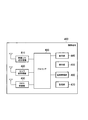
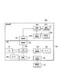
- FIG. 4 is a diagram showing a configuration of the tool management server 300 according to the embodiment.
- the tool management server 300 has a communication interface 310, a storage unit 320, and a processor 330.
- the communication interface 310 communicates with the tool 100 via the communication network 200 under the control of the processor 330.
- the communication interface 310 sends and receives messages by wired communication (or wireless communication).
- the communication interface 310 may communicate with the terminal management server 600 via the communication network 200 under the control of the processor 330.
- the storage unit 320 stores various types of information used for control and processing by the processor 330.
- the storage unit 320 includes an auxiliary storage device such as a hard disk and a flash memory.
- the processor 330 performs various processes and controls on the tool management server 300.
- the processor 330 corresponds to an information processing device for managing the position of the tool 100.
- the processor 330 constitutes the acquisition unit 331, the determination unit 332, the position correction unit 333, the work management unit 334, and the display control unit 335 by executing the program.
- the acquisition unit 331 contains the tool position information obtained by positioning the position of the tool 100 by GNSS via the communication interface 310, the terminal position information obtained by positioning the position of the mobile terminal 400 by GNSS, and the terminal.
- the corrected terminal position information obtained by correcting the position information is acquired.
- the corrected terminal position information is the terminal position information corrected by the hybrid positioning. Specifically, the correction terminal position information corrects the terminal position information based on at least one of the cellular radio signal received by the mobile terminal 400 from the cellular base station and the wireless LAN signal received by the mobile terminal 400 from the wireless LAN access point. It is the position information obtained by.
- the tool position information and the terminal position information are position information that has not been corrected by hybrid positioning.
- the tool position information and the terminal position information include a positioning error of about several tens of meters due to the influence of the propagation environment such as weather conditions. Assuming that the tool position information and the terminal position information are affected by the same propagation environment, the positioning errors included in the tool position information and the terminal position information are equivalent.
- the acquisition unit 331 acquires the tool position information from the tool 100.
- the acquisition unit 331 acquires the terminal position information from the mobile terminal 400 or the terminal management server 600.
- the acquisition unit 331 acquires the correction terminal position information from the mobile terminal 400 or the terminal management server 600.
- the determination unit 332 determines whether or not to correct the tool position information.
- the determination unit 332 may determine that the tool position information is corrected when the distance between the position of the tool 100 indicated by the tool position information and the position of the mobile terminal 400 indicated by the terminal position information is less than the threshold value. As a result, the tool position information can be corrected when the influence of the propagation environment on the tool position information and the terminal position information can be regarded as equivalent.
- the determination unit 332 may determine that the tool position information is corrected. As a result, the tool position information can be corrected when it is necessary to manage the work using the tool 100.
- Information on the geographical area of the work site where the tool 100 is used is stored in advance in the storage unit 320.
- the determination unit 332 may take a boundary margin at the time of determining the inside / outside of the area of the work site in consideration of the positioning error.
- the position correction unit 333 executes a position correction process for correcting the tool position information so as to reflect the error of the terminal position information with respect to the correction terminal position information (that is, the GNSS positioning error). Since the tool position information and the terminal position information have the same positioning error, the error of the terminal position information with respect to the corrected terminal position information can be applied to the correction of the tool position information, and the tool position information can be obtained with high accuracy.
- the tool position information is corrected by the following formula (1).
- each position of A to D consists of a set of longitude and latitude.
- the position correction unit 333 may correct the tool position information by the following formula (2).
- the acquisition unit 331 further acquires the detection information obtained by detecting the state or operation of the tool 100 from the tool 100.
- the work management unit 334 generates work management information in which the tool position information after the position correction process is associated with the detection information, and stores the work management information in the storage unit 320. As a result, progress management of work using the tool 100 can be facilitated.
- the display control unit 335 executes a display control process for displaying the mark indicating the position of the tool 100 on the map image and displaying it on the mobile terminal 400 based on the tool position information after the position correction process.
- the map image may be acquired by the acquisition unit 331 or may be acquired by the mobile terminal 400.
- FIG. 5 is a diagram showing an example of a display screen by the display control process according to the embodiment.
- the display unit 440 of the mobile terminal 400 displays the mark M indicating the position of the tool 100 on the map image.
- the map image may be an illustration image of a map or an aerial photograph image.
- the display control unit 335 may include a process of displaying the mark M on the mobile terminal 400 in a manner that can identify that the position correction process has been performed. For example, the display control unit 335 changes the color or shape of the mark M when the position correction process is performed. As a result, the user can recognize that the highly accurate position where the position correction processing has been performed is displayed.
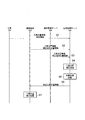
- FIG. 6 is a sequence diagram showing the operation of the tool management system 1 according to the embodiment.
- step S1 the communication processor 540 of the tool 100 manages the tool position information obtained by the GNSS receiver 520 of the tool 100 and the detection information obtained by the sensor 150 of the tool 100. Send to server 300.
- step S2 the processor 480 of the mobile terminal 400 transfers the terminal position information obtained by the GNSS receiver 430 of the mobile terminal 400 and the corrected terminal position information obtained by correcting the terminal position information to the tool management server 300. Send.
- the terminal management server 600 may transmit the terminal position information and the correction terminal position information to the tool management server 300.
- the processor 330 (acquisition unit 331) of the tool management server 300 can obtain the tool position information obtained by positioning the position of the tool 100 by GNSS and the position of the mobile terminal 400 by positioning by GNSS.
- the terminal position information and the corrected terminal position information obtained by correcting the terminal position information are acquired.
- the processor 330 (acquisition unit 331) of the tool management server 300 acquires the detection information obtained by detecting the state or operation of the tool 100.
- step S4 the processor 330 (position correction unit 333) of the tool management server 300 corrects the tool position information so as to reflect the error of the terminal position information with respect to the correction terminal position information (that is, the GNSS positioning error). To execute.
- step S5 the processor 330 (work management unit 334) of the tool management server 300 generates work management information in which the tool position information after the position correction process is associated with the detection information, and the work management information is generated by the tool management server 300. It is stored in the storage unit 320 of.
- step S6 the processor 330 (display control unit 335) of the tool management server 300 causes the mobile terminal 400 to display the mark indicating the position of the tool 100 on the map image based on the tool position information after the position correction process. Execute display control processing.
- the processor 330 (display control unit 335) of the tool management server 300 displays the mark M on the mobile terminal 400 in a manner capable of identifying that the position correction process has been performed. It may be (see FIG. 5).
- step S7 the processor 480 of the mobile terminal 400 superimposes the mark M indicating the position of the tool 100 on the map image and displays it on the display unit 440 of the mobile terminal 400 under the control of the tool management server 300.
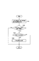
- FIG. 7 is a flow chart showing an operation flow related to the tool position correction process (step S4 in FIG. 6) according to the embodiment.
- step S41 the processor 330 (acquisition unit 331) of the tool management server 300 positions the position of the tool 100 by GNSS and obtains the tool position information and the position of the mobile terminal 400 by GNSS.
- the terminal position information obtained by positioning with the above method and the corrected terminal position information obtained by correcting the terminal position information are acquired.
- step S42 the processor 330 (determination unit 332) of the tool management server 300 determines whether or not the distance between the position of the tool 100 indicated by the tool position information and the position of the mobile terminal 400 indicated by the terminal position information is below the threshold value. To judge. If "NO" in step S42, this flow ends.
- step S43 the processor 330 (determination unit 332) of the tool management server 300 sets the position of the tool 100 indicated by the tool position information to the geographical area of the work site where the tool 100 is used. Determine if it belongs or not. If "NO" in step S43, this flow ends.
- step S44 the processor 330 (position correction unit 333) of the tool management server 300 reflects the error of the terminal position information with respect to the correction terminal position information (that is, the GNSS positioning error). Execute the position correction process that corrects the tool position information.
- steps S42 and S43 may be omitted.
- the processor 330 of the tool management server 300 includes tool position information obtained by positioning the position of the tool 100 by GNSS and terminal position information obtained by positioning the position of the mobile terminal 400 by GNSS. , Execution of acquisition processing to acquire the corrected terminal position information obtained by correcting the terminal position information, and position correction processing to correct the tool position information so as to reflect the error of the terminal position information with respect to the correction terminal position information. To do. As a result, the position of the tool 100 can be grasped with high accuracy.
- the mobile terminal 400 may execute at least a part of the processing performed by the tool management server 300 in the above-described embodiment.
- the acquisition unit 331, the determination unit 332, the position correction unit 333, the work management unit 334, and the display control unit 335 may be provided in the processor 480 of the mobile terminal 400.
- the processor 480 of the mobile terminal 400 corresponds to an information processing device for managing the position of the tool 100.
- the tool 100 and the mobile terminal 400 are capable of direct wireless communication, for example, by Bluetooth (registered trademark).
- FIG. 8 is a sequence diagram showing the operation of the tool management system 1 according to this modified example.
- step S11 the communication processor 540 of the tool 100 transmits the tool position information obtained by the GNSS receiver 520 of the tool 100 and the detection information obtained by the sensor 150 of the tool 100 into a mobile terminal. Send to 400.
- step S12 the processor 330 of the tool management server 300 transmits the tool position information and the detection information to the mobile terminal 400.
- the processor 480 of the mobile terminal 400 acquires the terminal position information obtained by the GNSS receiver 430 of the mobile terminal 400 and the corrected terminal position information obtained by correcting the terminal position information.
- the terminal management server 600 may transmit the correction terminal position information to the mobile terminal 400 (step S13).
- the processor 480 of the mobile terminal 400 contains the tool position information obtained by positioning the position of the tool 100 by GNSS, and the terminal position information obtained by positioning the position of the mobile terminal 400 by GNSS.
- the corrected terminal position information obtained by correcting the terminal position information is acquired.
- the processor 480 of the mobile terminal 400 acquires the detection information obtained by detecting the state or operation of the tool 100.
- step S14 the processor 480 of the mobile terminal 400 executes a position correction process for correcting the tool position information so as to reflect the error of the terminal position information with respect to the correction terminal position information (that is, the GNSS positioning error).
- step S15 the processor 480 of the mobile terminal 400 generates work management information in which the tool position information after the position correction processing is associated with the detection information, and stores the work management information in the storage unit 470 of the mobile terminal 400.
- step S16 the processor 480 of the mobile terminal 400 superimposes a mark indicating the position of the tool 100 on the map image and displays it on the display unit 440 of the mobile terminal 400 based on the tool position information after the position correction process.
- the processor 480 of the mobile terminal 400 may display the mark M on the display unit 440 of the mobile terminal 400 in a manner capable of identifying that the position correction process has been performed. (See FIG. 5).
- a communication device that can be attached to and detached from the tool 100 may be provided.
- a communication function can be added to the tool 100 by attaching the communication device to the tool 100 that does not have the communication function.
- FIG. 9 is a block diagram showing the configurations of the tool 100 and the communication device 500 according to this modified example.
- the communication device 500 attached to the tool 100 includes a wireless transmitter / receiver 510, a GNSS receiver 520, a communication battery 530, and a communication processor 540.
- the tool 100 has a connecting portion 18a
- the communication device 500 has a connecting portion 18b.
- the connection unit 18a is an interface that is electrically connected to the connection unit 18b of the communication device 500.
- the connection unit 18a may be an interface conforming to a standard such as USB (Universal Serial Bus) or UART (Universal Synchronous Receiver / Transmitter), or an interface conforming to an original standard.
- the tool processor 160 communicates with the communication device 500 via the connection unit 18a.
- connection portion 18b is an interface that is electrically connected to the connection portion 18a of the tool 100.
- the connection unit 18b may be an interface conforming to a standard such as USB or UART, or may be an interface conforming to a proprietary standard.
- the communication processor 540 communicates with the tool 100 via the connection unit 18b.
- the connecting portion 18b may be electrically connected to the connecting portion 18a of the tool 100 via a cable.
- a program that causes a computer to execute each process according to the above-described embodiment may be provided.
- the program may be recorded on a computer-readable medium.
- Computer-readable media can be used to install programs on a computer.
- the computer-readable medium on which the program is recorded may be a non-transient recording medium.
- the non-transient recording medium is not particularly limited, but may be, for example, a recording medium such as a CD-ROM or a DVD-ROM.
Landscapes
- Business, Economics & Management (AREA)
- Engineering & Computer Science (AREA)
- Economics (AREA)
- Human Resources & Organizations (AREA)
- Strategic Management (AREA)
- General Business, Economics & Management (AREA)
- Entrepreneurship & Innovation (AREA)
- Theoretical Computer Science (AREA)
- Marketing (AREA)
- General Physics & Mathematics (AREA)
- Tourism & Hospitality (AREA)
- Physics & Mathematics (AREA)
- General Health & Medical Sciences (AREA)
- Primary Health Care (AREA)
- Health & Medical Sciences (AREA)
- Development Economics (AREA)
- Educational Administration (AREA)
- Manufacturing & Machinery (AREA)
- Game Theory and Decision Science (AREA)
- Operations Research (AREA)
- Quality & Reliability (AREA)
- Position Fixing By Use Of Radio Waves (AREA)
Abstract
一実施形態に係る情報処理装置は、少なくとも1つのプロセッサを備えており、工具の位置管理を行うための装置である。前記少なくとも1つのプロセッサは、前記工具の位置を衛星測位システムにより測位して得られた工具位置情報と、携帯端末の位置を衛星測位システムにより測位して得られた端末位置情報と、前記端末位置情報を補正して得られた補正端末位置情報とを取得する取得処理と、前記補正端末位置情報に対する前記端末位置情報の誤差を反映するように前記工具位置情報を補正する位置補正処理とを実行する。
Description
本開示は、情報処理装置、情報処理方法、及び情報処理プログラムに関する。
特許文献1には、工具と携帯端末とを備える工具システムが記載されている。この工具システムにおいては、工具が行った作業内容に関する作業情報を工具から携帯端末に送信し、携帯端末が、携帯端末の衛星測位システム(GNSS:Global Navigation Satellite System)受信機により得られる位置情報を工具からの作業情報と対応付けて記憶する。
第1の態様に係る情報処理装置は、少なくとも1つのプロセッサを備えており、工具の位置管理を行うための装置である。前記少なくとも1つのプロセッサは、前記工具の位置を測位して得られた工具位置情報と、携帯端末の位置を測位して得られた端末位置情報と、前記端末位置情報を補正して得られた補正端末位置情報とを取得する取得処理と、前記補正端末位置情報に対する前記端末位置情報の誤差を反映するように前記工具位置情報を補正する位置補正処理とを実行する。
第2の態様に係る情報処理方法は、工具の位置管理を行うための方法である。前記情報処理方法は、前記工具の位置を測位して得られた工具位置情報と、携帯端末の位置を測位して得られた端末位置情報と、前記端末位置情報を補正して得られた補正端末位置情報とを取得することと、前記補正端末位置情報に対する前記端末位置情報の誤差を反映するように前記工具位置情報を補正することとを備える。
第3の態様に係る情報処理プログラムは、工具の位置管理を行うための情報処理装置に、前記工具の位置を測位して得られた工具位置情報と、携帯端末の位置を測位して得られた端末位置情報と、前記端末位置情報を補正して得られた補正端末位置情報とを取得することと、前記補正端末位置情報に対する前記端末位置情報の誤差を反映するように前記工具位置情報を補正することとを実行させる。
図面を参照して、一実施形態に係る工具管理システムについて説明する。図面の記載において、同一又は類似の部分には同一又は類似の符号を付している。
(実施形態の概要)
工具の紛失時又は盗難時において工具の位置を把握したり、工具を用いて行われる作業状況を把握したりするために、工具にGNSS受信機を設けることが考えられる。
工具の紛失時又は盗難時において工具の位置を把握したり、工具を用いて行われる作業状況を把握したりするために、工具にGNSS受信機を設けることが考えられる。
しかしながら、GNSS受信機により得られる位置情報は、気象条件等の伝搬環境の影響を受けるため、GNSS測位の精度が低くなる場合がある。
ここで、スマートフォン等の携帯端末であれば、セルラ基地局や無線LANアクセスポイント等を利用した測位機能をGNSS測位と組み合わせた高精度な測位を適用可能であるが、工具の処理能力は低いため、そのような高精度な測位を工具に適用することは困難である。
以下の実施形態において、工具の位置を精度良く把握する情報処理装置、情報処理方法、及び情報処理プログラムについて説明する。
一実施形態に係る情報処理装置は、少なくとも1つのプロセッサを備えており、工具の位置管理を行うための装置である。前記少なくとも1つのプロセッサは、前記工具の位置を衛星測位システムにより測位して得られた工具位置情報と、携帯端末の位置を衛星測位システムにより測位して得られた端末位置情報と、前記端末位置情報を補正して得られた補正端末位置情報とを取得する取得処理と、前記補正端末位置情報に対する前記端末位置情報の誤差を反映するように前記工具位置情報を補正する位置補正処理とを実行する。これにより、工具の位置を精度良く把握できる。
以下の実施形態において、前記情報処理装置が、前記工具との通信を行うサーバである工具管理サーバに設けられる一例について主として説明するが、前記情報処理装置は、前記携帯端末に設けられてもよい。
(システム構成例)
まず、一実施形態に係る工具管理システムの構成について説明する。図1は、一実施形態に係る工具管理システム1の構成を示すシステム構成図である。
まず、一実施形態に係る工具管理システムの構成について説明する。図1は、一実施形態に係る工具管理システム1の構成を示すシステム構成図である。
図1に示すように、工具管理システム1は、工具100と、工具管理サーバ300と、携帯端末400とを有する。
工具100は、電動工具の一種である結束機(例えば、鉄筋結束機)であってもよい。工具100は、結束機以外の電動工具、例えば、電動ドリル、電動ドライバー、電動のこぎり、研削機、又は研磨機等であってもよい。工具100は、手動工具等、空圧を動力として用いる工具(例えば、空圧工具)、又は油圧を動力として用いる工具(例えば、油圧工具)であってもよい。
一実施形態において、工具100は、コードレス型の電動工具であり、駆動用バッテリ110から供給される電力によって駆動される。駆動用バッテリ110は、工具100に着脱可能に構成されるバッテリパックである。駆動用バッテリ110は、二次電池であればどのような種別のバッテリであってもよいが、例えばリチウムイオンバッテリである。駆動用バッテリ110は、工具100から取り外された状態において、図示を省略する充電器により充電される。
工具100は、結束部11と、本体部12と、グリップ部13とを有する。結束部11は、鉄筋を挟むアームを有し、アームに挟まれた鉄筋に対して本体部12から供給されるワイヤを巻き付けることにより、鉄筋の結束を行う。
本体部12は、ワイヤが巻き付けられたリールを収容する。ワイヤは、工具100の使用の度に消費される消耗品の一例である。但し、消耗品は、ワイヤ以外の消耗品、例えば釘又はステープラ等であってもよい。
本体部12は、モータ140(図2参照)を内蔵する。モータ140は、ワイヤを結束部11に供給するとともにワイヤを鉄筋に巻き付けるための駆動力を発生させる。本体部12には、工具100の電源オン/オフを行うための電源スイッチ15が設けられる。
グリップ部13は、本体部12から下方に向けて延び、工具使用者によって把持される部材である。グリップ部13の上端部分には、トリガ14が設けられる。トリガ14が押し下げられることにより、結束部11及び本体部12が結束動作を行う。トリガ14をロック(固定)するトリガロック16が設けられてもよい。トリガロック16がロック状態に設定される場合、トリガ14が押し下げられないようにロックされる。グリップ部13の下端部分には、駆動用バッテリ110を着脱するためのラッチ機構が設けられる。
工具100は、通信ネットワーク200に含まれる基地局210との無線通信を行う。例えば、工具100は、LPWA(Low Power Wide Area)技術を用いた無線通信機能を有する。
工具100は、通信ネットワーク200を介して工具管理サーバ300との通信を行う。例えば、工具100は、検出情報と位置情報とを含むメッセージを工具管理サーバ300に送信する。ここで、検出情報は、工具100を使用する作業に関連する状態を示すパラメータ値からなる。パラメータ値の種別には、例えば、作動回数情報、動作状態情報、及び駆動用バッテリ残量情報が含まれる。
作動回数情報は、工具100が作動した回数(すなわち、結束動作を行った回数)を示す情報である。
動作状態情報は、工具100の動作状態、例えばエラー状態及び電源オン/オフ状態を示す情報である。エラー状態は、結束部11のアームによって挟まれる鉄筋が閾値よりも大きい状態であってもよいし、工具100の温度が閾値よりも高い状態であってもよい。
駆動用バッテリ残量情報は、駆動用バッテリ110の残量を示す情報である。バッテリ残量は、容量に対する現在の残量の割合(パーセンテージ)で表されてもよい。
位置情報は、工具100の位置を示す情報であって、例えばGPS(Global Positioning System)等のGNSS(Global Navigation Satellite System)を用いて得られる緯度経度情報を含む。位置情報は、高度情報をさらに含んでいてもよい。
通信ネットワーク200は、無線通信を行う基地局210を有する。また、通信ネットワーク200は、狭域通信網(LAN:Local Area Network)、高域通信網(WAN:Wide Area Network)、及びインターネットのうち少なくとも1つを含む。
工具管理サーバ300は、通信ネットワーク200に接続されている。工具管理サーバ300は、工具100を管理する。図1において、工具管理サーバ300が1つの工具100を管理する一例を示しているが、工具管理サーバ300は複数の工具100を管理していてもよい。
工具管理サーバ300は、通信ネットワーク200を介して工具100からメッセージを受信し、受信したメッセージに含まれる情報を取得して管理する。例えば、工具管理サーバ300は、検出情報及び位置情報に基づいて作業の進捗管理を行う。工具管理サーバ300は、位置情報に基づいて、工具100の紛失時又は盗難時等における工具100の位置把握を行ってもよい。
携帯端末400は、スマートフォン、タブレット端末、ノートPC、ウェアラブル端末等の端末である。携帯端末400は、通信ネットワーク200に含まれる基地局210との無線通信を行う。例えば、携帯端末400は、セルラ通信機能を有する。携帯端末400は、工具100のユーザ又は管理により所持されてもよい。
携帯端末400は、セルラ基地局や無線LANアクセスポイント等を利用した測位機能をGNSS測位と組み合わせた高精度な測位(いわゆる、ハイブリッド測定)を行う。具体的には、携帯端末400は、通信ネットワーク200を介して端末管理サーバ600との通信を行うことによりハイブリッド測定を行う。
端末管理サーバ600は、ハイブリッド測位による測位サービスを提供するサーバである。端末管理サーバ600は、無線LANアクセスポイントの識別子と位置との対応付けと、セルラ基地局(セル)の識別子と位置との対応付けとを管理している。端末管理サーバ600は、携帯端末400がセルラ基地局や無線LANアクセスポイントから受信する無線信号に含まれる識別子を取得し、取得した識別子に基づいて携帯端末400のGNSS位置情報を補正する。
一方、工具100は、ハイブリッド測定の機能を有していない。工具100のGNSS受信機520(図2参照)により得られる位置情報は、気象条件等の伝搬環境の影響を受けるため、GNSS測位の精度が低くなる場合がある。
(工具の構成例)
次に、一実施形態に係る工具100の構成について説明する。図2は、一実施形態に係る工具100の構成を示すブロック図である。
次に、一実施形態に係る工具100の構成について説明する。図2は、一実施形態に係る工具100の構成を示すブロック図である。
図2に示すように、工具100は、上述したトリガ14及び電源スイッチ15に加えて、バッテリ接続部120と、モータ駆動部130と、モータ140と、センサ150と、工具プロセッサ160と、無線送受信機510と、GNSS受信機520と、通信用バッテリ530と、通信プロセッサ540とを有する。
バッテリ接続部120は、駆動用バッテリ110と電気的に接続されるコネクタである。
モータ駆動部130は、工具プロセッサ160の制御下で、駆動用バッテリ110から供給される電力を変換してモータ140に駆動電力を供給することにより、モータ140を駆動する。
センサ150は、複数のセンサを含む。センサ150は、例えば、結束動作を行った回数を示す作動回数と、工具100の動作状態と、駆動用バッテリ110のバッテリ残量とを検出し、検出結果を示す各パラメータ値を工具プロセッサ160に出力する。
工具プロセッサ160は、工具100の動作を制御する。工具プロセッサ160は、少なくとも1つのプロセッサ(CPU:Central Processing Unit)を含んで構成される。工具プロセッサ160は、工具100の電源オン状態(すなわち、電源スイッチ15がオンに設定されている状態)において、トリガ14が押し下げられた際に、モータ140を駆動させるようにモータ駆動部130を制御する。その結果、モータ140がモータ駆動部130により駆動され、結束部11が結束動作を行う。
無線送受信機510は、通信プロセッサ540の制御下で、例えばLPWA技術を用いた無線通信を行う。無線送受信機510は、通信プロセッサ540から入力される送信情報を無線信号に変換し、無線信号を基地局210に送信する。また、無線送受信機510は、基地局210から無線信号を受信し、受信した無線信号を受信情報に変換し、受信情報を通信プロセッサ540に出力する。
GNSS受信機520は、通信プロセッサ540の制御下で、現在位置を示す位置情報を取得し、取得した位置情報を通信プロセッサ540に出力する。GNSS受信機520は、例えば、GPS、GLONASS(Global Navigation Satellite System)、IRNSS(Indian Regional Navigational Satellite System)、COMPASS、Galileoのうち少なくとも1つを含んで構成される。
通信用バッテリ530は、無線送受信機510、GNSS受信機520、及び通信プロセッサ540を駆動するための電力を蓄える。通信用バッテリ530としては二次電池を用いればよく、例えばリチウムイオンバッテリを用いることができる。
通信プロセッサ540は、無線送受信機510を制御する。通信プロセッサ540は、少なくとも1つのプロセッサ(CPU)を含んで構成される。通信プロセッサ540は、無線送受信機510を介して情報を工具管理サーバ300と送受信する。
例えば、工具100の使用中において、通信プロセッサ540は、各種パラメータ値からなる検出情報を工具プロセッサ160から取得し、取得した検出情報を工具管理サーバ300に送信する。また、通信プロセッサ540は、GNSS受信機520により測位された位置情報(以下、「工具位置情報」と呼ぶ)を工具管理サーバ300に送信する。工具位置情報の送信は、工具100の使用中に限らず、工具100が使用されていない状態(例えば、電源オフ状態)においても行われる。
(携帯端末の構成例)
次に、一実施形態に係る携帯端末400の構成について説明する。図3は、一実施形態に係る携帯端末400の構成を示す図である。
次に、一実施形態に係る携帯端末400の構成について説明する。図3は、一実施形態に係る携帯端末400の構成を示す図である。
図3に示すように、携帯端末400は、無線LAN送受信機410と、セルラ送受信機420と、表示部440と、操作部450と、電源管理部460と、記憶部470と、プロセッサ480とを有する。
無線LAN送受信機410は、無線LANアクセスポイントから受信した無線信号(無線LAN信号)に対して増幅処理及びフィルタ処理等を行い、無線信号をベースバンド信号に変換してプロセッサ480に出力する。無線LAN送受信機410が無線LANアクセスポイントから受信する無線LAN信号には、この無線LANアクセスポイントの識別子、例えば、SSID(Service Set Identifier)が含まれている。また、無線LAN送受信機410は、プロセッサ480から出力されたベースバンド信号を無線信号に変換し、増幅処理等を行って送信する。
セルラ送受信機420は、セルラ送受信機420は、セルラ基地局から受信した無線信号(セルラ無線信号)に対して増幅処理及びフィルタ処理等を行い、無線信号をベースバンド信号に変換してプロセッサ480に出力する。セルラ送受信機420がセルラ基地局から受信するセルラ無線信号には、このセルラ基地局の識別子、例えば、基地局ID(セルID)が含まれている。また、セルラ送受信機420は、プロセッサ480から出力されたベースバンド信号を無線信号に変換し、増幅処理等を行って送信する。
GNSS受信機430は、プロセッサ480の制御下で、現在位置を示す位置情報(以下、「端末位置情報」と呼ぶ)を取得し、取得した位置情報をプロセッサ480に出力する。GNSS受信機520は、例えば、GPS、GLONASS、IRNSS、COMPASS、Galileoのうち少なくとも1つを含んで構成される。GNSS受信機520のGNSS方式は、工具100のGNSS受信機520のGNSS方式と同じであってもよい。
表示部440は、プロセッサ480から出力された画像信号に基づいて画像を表示する。
操作部450は、ユーザ操作を受け付けて、操作内容に応じた信号をプロセッサ480に出力する。操作部450は、タッチパネル式ディスプレイとして表示部440と一体化されていてもよい。
電源管理部460は、バッテリ及びその周辺回路を含む。電源管理部460は、携帯端末400の駆動電力を供給する。なお、携帯端末400が外部からの給電を受ける場合、電源管理部460は、外部から供給される電力を変換する回路により構成されてもよい。
記憶部470は、揮発性メモリ及び不揮発性メモリを含む。記憶部470は、プロセッサ480により実行されるプログラム、及びプロセッサ480による処理に用いられる情報を記憶する。
プロセッサ480は、携帯端末400における各種の処理及び制御を行う。プロセッサは、ベースバンドプロセッサと、CPUとを含んでもよい。ベースバンドプロセッサは、ベースバンド信号の変調・復調及び符号化・復号等を行う。CPUは、記憶部470に記憶されたプログラムを実行して各種の処理を実行する。
プロセッサ480は、GNSS受信機520により得られる端末位置情報と、無線LAN送受信機410が受信する無線LAN信号と、セルラ送受信機420が受信するセルラ無線信号とに基づいて、端末管理サーバ600と連携しながらハイブリッド測位を行う。具体的には、プロセッサ480は、GNSS受信機520により得られる端末位置情報を、無線LAN信号及びセルラ無線信号に基づいて補正することにより補正端末位置情報を得る。
(工具管理サーバの構成例)
次に、一実施形態に係る工具管理サーバ300の構成について説明する。図4は、一実施形態に係る工具管理サーバ300の構成を示す図である。
次に、一実施形態に係る工具管理サーバ300の構成について説明する。図4は、一実施形態に係る工具管理サーバ300の構成を示す図である。
図4に示すように、工具管理サーバ300は、通信インターフェイス310と、記憶部320と、プロセッサ330とを有する。
通信インターフェイス310は、プロセッサ330の制御下で、通信ネットワーク200を介して工具100との通信を行う。通信インターフェイス310は、有線通信(又は無線通信)によりメッセージを送受信する。通信インターフェイス310は、プロセッサ330の制御下で、通信ネットワーク200を介して端末管理サーバ600との通信を行ってもよい。
記憶部320は、プロセッサ330による制御及び処理に用いられる各種の情報を記憶する。記憶部320は、ハードディスクやフラッシュメモリ等の補助記憶装置を含んで構成される。
プロセッサ330は、工具管理サーバ300における各種の処理及び制御を行う。一実施形態において、プロセッサ330は、工具100の位置を管理するための情報処理装置に相当する。
プロセッサ330は、プログラムを実行することにより、取得部331と、判定部332と、位置補正部333と、作業管理部334と、表示制御部335とを構成する。
取得部331は、通信インターフェイス310を介して、工具100の位置をGNSSにより測位して得られた工具位置情報と、携帯端末400の位置をGNSSにより測位して得られた端末位置情報と、端末位置情報を補正して得られた補正端末位置情報とを取得する。
ここで、補正端末位置情報は、ハイブリッド測位により補正された端末位置情報である。具体的には、補正端末位置情報は、携帯端末400がセルラ基地局から受信するセルラ無線信号及び携帯端末400が無線LANアクセスポイントから受信する無線LAN信号の少なくとも一方に基づいて端末位置情報を補正して得られた位置情報である。
これに対し、工具位置情報及び端末位置情報は、ハイブリッド測位により補正されていない位置情報である。工具位置情報及び端末位置情報には、気象条件等の伝搬環境の影響により数10メートル程度の測位誤差が含まれる。工具位置情報及び端末位置情報が同等な伝搬環境の影響を受けると仮定すると、工具位置情報及び端末位置情報に含まれる測位誤差は同等である。
一実施形態において、取得部331は、工具位置情報を工具100から取得する。取得部331は、端末位置情報を携帯端末400又は端末管理サーバ600から取得する。取得部331は、補正端末位置情報を携帯端末400又は端末管理サーバ600から取得する。
判定部332は、工具位置情報を補正するか否かを判定する。判定部332は、工具位置情報が示す工具100の位置と端末位置情報が示す携帯端末400の位置との間の距離が閾値を下回る場合、工具位置情報を補正すると判定してもよい。これにより、工具位置情報及び端末位置情報が受ける伝搬環境の影響が同等であるとみなすことができるときに工具位置情報を補正できる。
判定部332は、工具位置情報が示す工具100の位置が、工具100が用いられる作業現場の地理的領域に属する場合、工具位置情報を補正すると判定してもよい。これにより、工具100を用いた作業の管理を行う必要があるときに工具位置情報を補正できる。なお、工具100が用いられる作業現場の地理的領域の情報は、記憶部320に予め記憶されている。判定部332は、測位誤差を考慮し、作業現場の領域内外判定時に境界のマージンをとってもよい。
位置補正部333は、補正端末位置情報に対する端末位置情報の誤差(すなわち、GNSS測位誤差)を反映するように工具位置情報を補正する位置補正処理を実行する。工具位置情報及び端末位置情報が同等な測位誤差を有するため、補正端末位置情報に対する端末位置情報の誤差を工具位置情報の補正に適用し、高精度な工具位置情報を得ることができる。
例えば、位置補正部333は、工具位置情報が示す位置をA、端末位置情報が示す位置をB、補正端末位置情報が示す位置をC、補正後の工具位置情報が示す位置をDとしたとき、下記の式(1)により工具位置情報を補正する。
D=A+(C-B) ・・・(1)
但し、A乃至Dの各位置は、経度及び緯度のセットからなる。
但し、A乃至Dの各位置は、経度及び緯度のセットからなる。
或いは、位置補正部333は、下記の式(2)により工具位置情報を補正してもよい。
D=C+(A-B) ・・・(2)
取得部331は、工具100の状態又は動作を検出して得られた検出情報を工具100からさらに取得する。作業管理部334は、位置補正処理後の工具位置情報を検出情報と対応付けた作業管理情報を生成し、作業管理情報を記憶部320に記憶させる。これにより、工具100を用いた作業の進捗管理を円滑化できる。
表示制御部335は、位置補正処理後の工具位置情報に基づいて、工具100の位置を示すマークを地図画像に重ねて携帯端末400に表示させる表示制御処理を実行する。ここで、地図画像は、取得部331が取得してもよいし、携帯端末400が取得してもよい。
図5は、一実施形態に係る表示制御処理による表示画面例を示す図である。図5に示すように、携帯端末400の表示部440は、工具100の位置を示すマークMを地図画像に重ねて表示する。地図画像は、地図のイラスト画像であってもよいし、航空写真による画像であってもよい。これにより、携帯端末400を所持するユーザが工具100の現在位置を表示画面に基づいて把握できる。
表示制御部335は、位置補正処理により工具位置情報を補正した場合、位置補正処理が行われたことを識別可能な態様でマークMを携帯端末400に表示させる処理を含んでもよい。例えば、表示制御部335は、位置補正処理が行われた場合、マークMの色又は形状を変化させる。これにより、位置補正処理が行われた高精度な位置が表示されていることをユーザが認識できる。
(動作例)
次に、一実施形態に係る工具管理システム1の動作について説明する。図6は、一実施形態に係る工具管理システム1の動作を示すシーケンス図である。
次に、一実施形態に係る工具管理システム1の動作について説明する。図6は、一実施形態に係る工具管理システム1の動作を示すシーケンス図である。
図6に示すように、ステップS1において、工具100の通信プロセッサ540は、工具100のGNSS受信機520により得られた工具位置情報と、工具100のセンサ150により得られた検出情報とを工具管理サーバ300に送信する。
ステップS2において、携帯端末400のプロセッサ480は、携帯端末400のGNSS受信機430により得られた端末位置情報と、端末位置情報を補正して得られた補正端末位置情報とを工具管理サーバ300に送信する。或いは、ステップS3において、端末管理サーバ600は、端末位置情報と補正端末位置情報とを工具管理サーバ300に送信してもよい。
このようにして、工具管理サーバ300のプロセッサ330(取得部331)は、工具100の位置をGNSSにより測位して得られた工具位置情報と、携帯端末400の位置をGNSSにより測位して得られた端末位置情報と、端末位置情報を補正して得られた補正端末位置情報とを取得する。また、工具管理サーバ300のプロセッサ330(取得部331)は、工具100の状態又は動作を検出して得られた検出情報を取得する。
ステップS4において、工具管理サーバ300のプロセッサ330(位置補正部333)は、補正端末位置情報に対する端末位置情報の誤差(すなわち、GNSS測位誤差)を反映するように工具位置情報を補正する位置補正処理を実行する。
ステップS5において、工具管理サーバ300のプロセッサ330(作業管理部334)は、位置補正処理後の工具位置情報を、検出情報と対応付けた作業管理情報を生成し、作業管理情報を工具管理サーバ300の記憶部320に記憶させる。
ステップS6において、工具管理サーバ300のプロセッサ330(表示制御部335)は、位置補正処理後の工具位置情報に基づいて、工具100の位置を示すマークを地図画像に重ねて携帯端末400に表示させる表示制御処理を実行する。工具管理サーバ300のプロセッサ330(表示制御部335)は、位置補正処理により工具位置情報を補正した場合、位置補正処理が行われたことを識別可能な態様でマークMを携帯端末400に表示させてもよい(図5参照)。
ステップS7において、携帯端末400のプロセッサ480は、工具管理サーバ300の制御下で、工具100の位置を示すマークMを地図画像に重ねて携帯端末400の表示部440に表示させる。
図7は、一実施形態に係る工具位置補正処理(図6のステップS4)に関する動作フローを示すフロー図である。
図7に示すように、ステップS41において、工具管理サーバ300のプロセッサ330(取得部331)は、工具100の位置をGNSSにより測位して得られた工具位置情報と、携帯端末400の位置をGNSSにより測位して得られた端末位置情報と、端末位置情報を補正して得られた補正端末位置情報とを取得する。
ステップS42において、工具管理サーバ300のプロセッサ330(判定部332)は、工具位置情報が示す工具100の位置と端末位置情報が示す携帯端末400の位置との間の距離が閾値を下回るか否かを判定する。ステップS42において「NO」の場合、本フローが終了する。
ステップS42において「YES」の場合、ステップS43において、工具管理サーバ300のプロセッサ330(判定部332)は、工具位置情報が示す工具100の位置が、工具100が用いられる作業現場の地理的領域に属するか否かを判定する。ステップS43において「NO」の場合、本フローが終了する。
ステップS43において「YES」の場合、ステップS44において、工具管理サーバ300のプロセッサ330(位置補正部333)は、補正端末位置情報に対する端末位置情報の誤差(すなわち、GNSS測位誤差)を反映するように工具位置情報を補正する位置補正処理を実行する。
なお、上記のフローにおいて、ステップS42及びS43のうち一方を省略してもよい。
(実施形態のまとめ)
一実施形態に係る工具管理サーバ300のプロセッサ330は、工具100の位置をGNSSにより測位して得られた工具位置情報と、携帯端末400の位置をGNSSにより測位して得られた端末位置情報と、端末位置情報を補正して得られた補正端末位置情報とを取得する取得処理と、補正端末位置情報に対する端末位置情報の誤差を反映するように工具位置情報を補正する位置補正処理とを実行する。これにより、工具100の位置を精度良く把握できる。
一実施形態に係る工具管理サーバ300のプロセッサ330は、工具100の位置をGNSSにより測位して得られた工具位置情報と、携帯端末400の位置をGNSSにより測位して得られた端末位置情報と、端末位置情報を補正して得られた補正端末位置情報とを取得する取得処理と、補正端末位置情報に対する端末位置情報の誤差を反映するように工具位置情報を補正する位置補正処理とを実行する。これにより、工具100の位置を精度良く把握できる。
(変更例1)
上述した実施形態において工具管理サーバ300が行っていた処理の少なくとも一部を携帯端末400が実行してもよい。
上述した実施形態において工具管理サーバ300が行っていた処理の少なくとも一部を携帯端末400が実行してもよい。
言い換えると、取得部331、判定部332、位置補正部333、作業管理部334、及び表示制御部335のうち少なくとも1つを携帯端末400のプロセッサ480に設けてもよい。本変更例において、携帯端末400のプロセッサ480は、工具100の位置を管理するための情報処理装置に相当する。
本変更例において、工具100及び携帯端末400が、例えばBluetooth(登録商標)による直接的な無線通信が可能であると仮定する。
本変更例に係る工具管理システム1の動作について説明する。図8は、本変更例に係る工具管理システム1の動作を示すシーケンス図である。
図8に示すように、ステップS11において、工具100の通信プロセッサ540は、工具100のGNSS受信機520により得られた工具位置情報と、工具100のセンサ150により得られた検出情報とを携帯端末400に送信する。或いは、ステップS12において、工具管理サーバ300のプロセッサ330は、工具位置情報と検出情報とを携帯端末400に送信する。
携帯端末400のプロセッサ480は、携帯端末400のGNSS受信機430により得られた端末位置情報と、端末位置情報を補正して得られた補正端末位置情報とを取得する。ここで、端末管理サーバ600は、補正端末位置情報を携帯端末400に送信してもよい(ステップS13)。
このようにして、携帯端末400のプロセッサ480は、工具100の位置をGNSSにより測位して得られた工具位置情報と、携帯端末400の位置をGNSSにより測位して得られた端末位置情報と、端末位置情報を補正して得られた補正端末位置情報とを取得する。また、携帯端末400のプロセッサ480は、工具100の状態又は動作を検出して得られた検出情報を取得する。
ステップS14において、携帯端末400のプロセッサ480は、補正端末位置情報に対する端末位置情報の誤差(すなわち、GNSS測位誤差)を反映するように工具位置情報を補正する位置補正処理を実行する。
ステップS15において、携帯端末400のプロセッサ480は、位置補正処理後の工具位置情報を、検出情報と対応付けた作業管理情報を生成し、作業管理情報を携帯端末400の記憶部470に記憶させる。
ステップS16において、携帯端末400のプロセッサ480は、位置補正処理後の工具位置情報に基づいて、工具100の位置を示すマークを地図画像に重ねて携帯端末400の表示部440に表示させる表示制御処理を実行する。携帯端末400のプロセッサ480は、位置補正処理により工具位置情報を補正した場合、位置補正処理が行われたことを識別可能な態様でマークMを携帯端末400の表示部440に表示させてもよい(図5参照)。
(変更例2)
工具100に着脱可能な通信装置が提供されてもよい。通信機能を有しない工具100に通信装置を取り付けることにより、工具100に通信機能を付加できる。
工具100に着脱可能な通信装置が提供されてもよい。通信機能を有しない工具100に通信装置を取り付けることにより、工具100に通信機能を付加できる。
図9は、本変更例に係る工具100及び通信装置500の構成を示すブロック図である。図9に示すように、工具100に取り付けられる通信装置500は、無線送受信機510と、GNSS受信機520と、通信用バッテリ530と、通信プロセッサ540とを有する。
本変更例において、工具100は接続部18aを有し、通信装置500は接続部18bを有する。接続部18aは、通信装置500の接続部18bと電気的に接続されるインターフェイスである。接続部18aは、USB(Universal Serial Bus)又はUART(Universal Asynchronous Receiver/Transmitter)等の規格に準拠したインターフェイスであってもよいし、独自規格に準拠したインターフェイスであってもよい。工具プロセッサ160は、接続部18aを介して通信装置500との通信を行う。
接続部18bは、工具100の接続部18aと電気的に接続されるインターフェイスである。接続部18bは、USB又はUART等の規格に準拠したインターフェイスであってもよいし、独自規格に準拠したインターフェイスであってもよい。通信プロセッサ540は、接続部18bを介して工具100との通信を行う。なお、接続部18bは、ケーブルを介して、工具100の接続部18aと電気的に接続されてもよい。
(その他の実施形態)
上述した実施形態に係る各処理をコンピュータに実行させるプログラムが提供されてもよい。プログラムは、コンピュータ読取り可能媒体に記録されていてもよい。コンピュータ読取り可能媒体を用いれば、コンピュータにプログラムをインストールすることが可能である。ここで、プログラムが記録されたコンピュータ読取り可能媒体は、非一過性の記録媒体であってもよい。非一過性の記録媒体は、特に限定されるものではないが、例えば、CD-ROMやDVD-ROM等の記録媒体であってもよい。
上述した実施形態に係る各処理をコンピュータに実行させるプログラムが提供されてもよい。プログラムは、コンピュータ読取り可能媒体に記録されていてもよい。コンピュータ読取り可能媒体を用いれば、コンピュータにプログラムをインストールすることが可能である。ここで、プログラムが記録されたコンピュータ読取り可能媒体は、非一過性の記録媒体であってもよい。非一過性の記録媒体は、特に限定されるものではないが、例えば、CD-ROMやDVD-ROM等の記録媒体であってもよい。
以上、図面を参照して一実施形態について詳しく説明したが、具体的な構成は上述のものに限られることはなく、要旨を逸脱しない範囲内において様々な設計変更等をすることが可能である。
Claims (11)
- 少なくとも1つのプロセッサを備えており、工具の位置管理を行うための情報処理装置であって、
前記少なくとも1つのプロセッサは、
前記工具の位置を衛星測位システムにより測位して得られた工具位置情報と、携帯端末の位置を衛星測位システムにより測位して得られた端末位置情報と、前記端末位置情報を補正して得られた補正端末位置情報とを取得する取得処理と、
前記補正端末位置情報に対する前記端末位置情報の誤差を反映するように前記工具位置情報を補正する位置補正処理と、を実行する
情報処理装置。 - 前記補正端末位置情報は、前記携帯端末がセルラ基地局から受信するセルラ無線信号及び前記携帯端末が無線LANアクセスポイントから受信する無線LAN信号の少なくとも一方に基づいて前記端末位置情報を補正して得られた位置情報である
請求項1に記載の情報処理装置。 - 前記少なくとも1つのプロセッサは、前記工具位置情報が示す前記工具の位置と前記端末位置情報が示す前記携帯端末の位置との間の距離が閾値を下回る場合、前記位置補正処理を実行する
請求項1又は2に記載の情報処理装置。 - 前記少なくとも1つのプロセッサは、前記工具位置情報が示す前記工具の位置が、前記工具が用いられる作業現場の地理的領域に属する場合、前記位置補正処理を実行する
請求項1又は2に記載の情報処理装置。 - 前記取得処理は、前記工具の状態又は動作を検出して得られた検出情報を取得する処理を含み、
前記少なくとも1つのプロセッサは、前記位置補正処理後の前記工具位置情報を前記検出情報と対応付けた作業管理情報を生成する処理をさらに実行する
請求項1乃至4のいずれか1項に記載の情報処理装置。 - 前記少なくとも1つのプロセッサは、前記位置補正処理後の前記工具位置情報に基づいて、前記工具の位置を示すマークを地図画像に重ねて前記携帯端末に表示させる表示制御処理をさらに実行する
請求項1乃至5のいずれか1項に記載の情報処理装置。 - 前記表示制御処理は、前記位置補正処理により前記工具位置情報を補正した場合、前記位置補正処理が行われたことを識別可能な態様で前記マークを前記携帯端末に表示させる処理を含む
請求項6に記載の情報処理装置。 - 前記情報処理装置は、通信ネットワークを介して前記工具との通信を行うサーバに設けられる
請求項1乃至7のいずれか1項に記載の情報処理装置。 - 前記情報処理装置は、前記携帯端末に設けられる
請求項1乃至7のいずれか1項に記載の情報処理装置。 - 工具の位置管理を行うための情報処理方法であって、
前記工具の位置を衛星測位システムにより測位して得られた工具位置情報と、携帯端末の位置を衛星測位システムにより測位して得られた端末位置情報と、前記端末位置情報を補正して得られた補正端末位置情報とを取得することと、
前記補正端末位置情報に対する前記端末位置情報の誤差を反映するように前記工具位置情報を補正することと、を備える
情報処理方法。 - 工具の位置管理を行うための情報処理装置に、
前記工具の位置を衛星測位システムにより測位して得られた工具位置情報と、携帯端末の位置を衛星測位システムにより測位して得られた端末位置情報と、前記端末位置情報を補正して得られた補正端末位置情報とを取得することと、
前記補正端末位置情報に対する前記端末位置情報の誤差を反映するように前記工具位置情報を補正することと、を実行させる
情報処理プログラム。
Priority Applications (1)
| Application Number | Priority Date | Filing Date | Title |
|---|---|---|---|
| PCT/JP2019/017521 WO2020217364A1 (ja) | 2019-04-24 | 2019-04-24 | 情報処理装置、情報処理方法、及び情報処理プログラム |
Applications Claiming Priority (1)
| Application Number | Priority Date | Filing Date | Title |
|---|---|---|---|
| PCT/JP2019/017521 WO2020217364A1 (ja) | 2019-04-24 | 2019-04-24 | 情報処理装置、情報処理方法、及び情報処理プログラム |
Publications (1)
| Publication Number | Publication Date |
|---|---|
| WO2020217364A1 true WO2020217364A1 (ja) | 2020-10-29 |
Family
ID=72941151
Family Applications (1)
| Application Number | Title | Priority Date | Filing Date |
|---|---|---|---|
| PCT/JP2019/017521 Ceased WO2020217364A1 (ja) | 2019-04-24 | 2019-04-24 | 情報処理装置、情報処理方法、及び情報処理プログラム |
Country Status (1)
| Country | Link |
|---|---|
| WO (1) | WO2020217364A1 (ja) |
Citations (4)
| Publication number | Priority date | Publication date | Assignee | Title |
|---|---|---|---|---|
| JPH1037459A (ja) * | 1996-07-25 | 1998-02-10 | Mitsubishi Heavy Ind Ltd | 工事工程管理システム |
| JP2009121885A (ja) * | 2007-11-13 | 2009-06-04 | Fujitsu Ten Ltd | 測位システムおよび車載装置 |
| US20140240125A1 (en) * | 2013-02-22 | 2014-08-28 | Milwaukee Electric Tool Corporation | Wireless tracking of power tools and related devices |
| US10022853B1 (en) * | 2017-07-05 | 2018-07-17 | Orazio Mollica | Power tools having integral GPS-based locating means |
-
2019
- 2019-04-24 WO PCT/JP2019/017521 patent/WO2020217364A1/ja not_active Ceased
Patent Citations (4)
| Publication number | Priority date | Publication date | Assignee | Title |
|---|---|---|---|---|
| JPH1037459A (ja) * | 1996-07-25 | 1998-02-10 | Mitsubishi Heavy Ind Ltd | 工事工程管理システム |
| JP2009121885A (ja) * | 2007-11-13 | 2009-06-04 | Fujitsu Ten Ltd | 測位システムおよび車載装置 |
| US20140240125A1 (en) * | 2013-02-22 | 2014-08-28 | Milwaukee Electric Tool Corporation | Wireless tracking of power tools and related devices |
| US10022853B1 (en) * | 2017-07-05 | 2018-07-17 | Orazio Mollica | Power tools having integral GPS-based locating means |
Similar Documents
| Publication | Publication Date | Title |
|---|---|---|
| JP5760625B2 (ja) | センターサーバー及びこれを含む充電施設登録システム | |
| US8825086B2 (en) | Direction display device and direction display system | |
| CN105678474B (zh) | 具有显示功能的移动作业终端系统 | |
| US20160313135A1 (en) | Method, portable terminal, in-vehicle terminal and system for vehicle positioning | |
| JP2020023026A (ja) | 工具、通信装置、工具システム及び通信方法 | |
| WO2020217493A1 (ja) | 情報処理装置、情報処理方法、及び情報処理プログラム | |
| JP5120033B2 (ja) | 充電管理装置 | |
| JP4825064B2 (ja) | 位置測定システム及び位置測定方法 | |
| JP7117005B2 (ja) | ホール位置検出システム | |
| WO2020070823A1 (ja) | 工具管理装置、工具管理システム、工具管理方法、及び工具 | |
| WO2020031395A1 (ja) | 工具及び通信装置 | |
| WO2020217364A1 (ja) | 情報処理装置、情報処理方法、及び情報処理プログラム | |
| WO2020075231A1 (ja) | 工具管理装置、工具管理システム、工具管理方法、及び工具 | |
| JP2020015125A (ja) | 電動工具及び通信装置 | |
| EP2764672B1 (en) | Radio protocol for communication with meter devices | |
| WO2020217496A1 (ja) | 情報処理装置、情報処理方法、及び情報処理プログラム | |
| JP6744663B2 (ja) | ゴルフピン位置検出装置 | |
| JP4331883B2 (ja) | 電子杭 | |
| JP2012098077A (ja) | 位置情報提供装置、位置情報提供システム、及び位置情報提供方法 | |
| WO2020129139A1 (ja) | 工具、通信装置、及び方法 | |
| CN101883382B (zh) | 一种测量定位方法和终端 | |
| WO2021009812A1 (ja) | 工具 | |
| WO2020194487A1 (ja) | 工具及び通信装置 | |
| WO2020217378A1 (ja) | 通信装置、制御方法、及び制御プログラム | |
| JP5711601B2 (ja) | 使用量測定システム |
Legal Events
| Date | Code | Title | Description |
|---|---|---|---|
| 121 | Ep: the epo has been informed by wipo that ep was designated in this application |
Ref document number: 19926262 Country of ref document: EP Kind code of ref document: A1 |
|
| NENP | Non-entry into the national phase |
Ref country code: DE |
|
| 122 | Ep: pct application non-entry in european phase |
Ref document number: 19926262 Country of ref document: EP Kind code of ref document: A1 |
|
| NENP | Non-entry into the national phase |
Ref country code: JP |