WO2010013327A1 - 経路探索装置、経路探索方法、経路探索プログラム、および記録媒体 - Google Patents
経路探索装置、経路探索方法、経路探索プログラム、および記録媒体 Download PDFInfo
- Publication number
- WO2010013327A1 WO2010013327A1 PCT/JP2008/063685 JP2008063685W WO2010013327A1 WO 2010013327 A1 WO2010013327 A1 WO 2010013327A1 JP 2008063685 W JP2008063685 W JP 2008063685W WO 2010013327 A1 WO2010013327 A1 WO 2010013327A1
- Authority
- WO
- WIPO (PCT)
- Prior art keywords
- area
- route
- departure
- destination
- data
- Prior art date
- Legal status (The legal status is an assumption and is not a legal conclusion. Google has not performed a legal analysis and makes no representation as to the accuracy of the status listed.)
- Ceased
Links
Images






Classifications
-
- G—PHYSICS
- G01—MEASURING; TESTING
- G01C—MEASURING DISTANCES, LEVELS OR BEARINGS; SURVEYING; NAVIGATION; GYROSCOPIC INSTRUMENTS; PHOTOGRAMMETRY OR VIDEOGRAMMETRY
- G01C21/00—Navigation; Navigational instruments not provided for in groups G01C1/00 - G01C19/00
- G01C21/26—Navigation; Navigational instruments not provided for in groups G01C1/00 - G01C19/00 specially adapted for navigation in a road network
- G01C21/34—Route searching; Route guidance
- G01C21/3446—Details of route searching algorithms, e.g. Dijkstra, A*, arc-flags or using precalculated routes
Definitions
- the present invention relates to a route search device, a route search method, a route search program, and a recording medium.
- a mobile device such as a vehicle is equipped with a navigation device that guides a route to the destination point by setting the destination point.
- This type of navigation device has a route search function for searching for a route to a destination point.
- the navigation device In order to perform a route search, the navigation device normally stores route calculation data having a hierarchical structure.
- route calculation data having a hierarchical structure.
- the number of candidate roads is large, and it takes time to calculate the route.
- the starting point area and the destination point area are A method is adopted in which data of links necessary for route calculation between the combinations and between them are recorded.
- FIG. 10 is an explanatory diagram showing an example of a combination of conventional long-distance route calculation data.
- combination data 1000 indicates a combination of the area of the departure point and the area of the destination point.
- Link data necessary for route calculation is recorded for each combination of areas.
- link data in a combination of the South Kanto area and the Kinki area indicated by reference numeral 1001 will be described below with reference to FIG.
- the link data of the area indicated by the halftone dots will be described later.
- FIG. 11 is an explanatory diagram showing link data for each combination of areas in conventional long-distance route calculation data.
- link data 1100 indicates data used for route calculation between the South Kanto area and the Kinki area. For example, as a route from the South Kanto area with Tokyo Station 1101 as the departure point to the Kinki area with Osaka Station 1102 as the destination point, a route through the Tokai region (south side) or a route through the Koshinetsu region (north side) Many routes are recorded in advance.
- the route search process is performed with the Tokyo station 1101 as the departure point and the Osaka station 1102 as the destination point, the route is determined by narrowing down the optimum route that matches the search conditions and the like.
- each area on the map is divided into multiple sections, and main roads such as expressways in each section
- main roads such as expressways in each section
- the main road is identified from the section including the start point and the section including the end point, and the section including the start point and the end point are included.
- the route search method includes a table in which a combination of a departure area and a destination area and a sequence of transit areas that pass between the departure area and the destination area are associated with each combination.
- a route search method of a route search device having a recording unit that records route data in an area connecting boundary nodes located at the boundary of the area in an area, and accepting input of a departure point and a destination point Based on the combination of the process and the area to which the departure point belongs and the area to which the destination point belongs, a column of transit areas that pass between the area to which the departure point belongs and the area to which the destination point belongs is extracted from the table.
- the route from the departure point to the destination point is Characterized in that it comprises a search step of cord, a.
- a route search program according to claim 7 causes a computer to execute the route search method according to claim 6.
- the recording medium according to claim 8 is characterized in that the route search program according to claim 7 is recorded in a computer-readable manner.
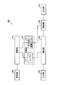
- FIG. 1 is a block diagram illustrating an example of a functional configuration of the route search apparatus according to the present embodiment.
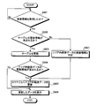
- FIG. 2 is a flowchart showing an example of a route search processing procedure of the route search device according to this exemplary embodiment.
- FIG. 3 is a block diagram illustrating an example of a hardware configuration of the navigation device according to the present embodiment.
- FIG. 4 is an explanatory diagram illustrating an example of a long-distance route.
- FIG. 5 is an explanatory diagram showing an example of long-distance path calculation data recorded on the magnetic disk.
- FIG. 6 is an explanatory diagram showing an example of intra-area route data.
- FIG. 7 is an explanatory diagram showing an example of intra-area route data when the area is subdivided.
- FIG. 1 is a block diagram illustrating an example of a functional configuration of the route search apparatus according to the present embodiment.
- FIG. 2 is a flowchart showing an example of a route search processing procedure of the route search device according to this
- the recording unit 110 records the table 111 and the in-area route data 112.
- the target data is, for example, the long-distance route calculation data of the highest hierarchy or the hierarchy equivalent to it among the route calculation data having a hierarchical structure.
- the departure area is an area including the departure point.
- the departure point is a point arbitrarily selected by the user, a current point when a destination point is input, or the like.
- the destination area is an area including the destination point.
- the intra-area route data 112 is data connecting boundary nodes located at the boundary of the area in each area.
- the in-area route data 112 is data including only links used for routes connecting boundary nodes.
- the intra-area route data 112 may be different data depending on the combination of adjacent areas, or may be the same data by providing a flag for use / non-use for each combination of adjacent areas on each link.
- the intra-area route data 112 connects a boundary node located at the boundary with the South Kanto area and a boundary node located at the boundary with the Kinki area. Data of a plurality of link strings.
- the input unit 120 accepts input of a departure point and a destination point. Examples of a method for receiving input by the input unit 120 include operation input and voice input.
- the extraction unit 130 Based on the combination of the area to which the departure point belongs and the area to which the destination point belongs, the extraction unit 130 extracts, from the table 111, a series of transit areas that pass between the area to which the departure point belongs and the area to which the destination point belongs. . Specifically, the extraction unit 130 determines an area to which the departure point belongs, determines an area to which the destination point belongs, and extracts a sequence of transit areas based on a combination of the areas.
- the search unit 140 searches for a route from the departure point to the destination point using the in-area route data 112 of the via area. Specifically, the search unit 140 searches for a route from the departure point to the destination point by calculating a route between the boundary nodes for each via area included in the via area column extracted by the extracting unit 130. To do. In addition, the search unit 140 may search for a plurality of routes. The search unit 140 may calculate the route in order for each area, or may simultaneously read the necessary areas and calculate the route collectively.
- the output unit 150 outputs information on the route searched by the search unit 140.
- the output unit 150 outputs the searched route to a display unit (not shown), a voice output unit, or the like for the user to select, and also outputs the route guidance data to a RAM or the like.
- the table 111 may be a table in which a combination of a plurality of transit areas is associated with one combination of the departure area and the destination area.
- the table 111 is, for example, for a combination of the South Kanto area as the departure area and the China area as the destination area, a sequence of via areas via the Tokai area and Kinki area, Yamanashi, Nagano, etc.
- a plurality of transit area columns are associated with each other, such as a transit area sequence via the Koshinetsu area and the Kinki area.
- the extraction unit 130 extracts a sequence of one transit area based on the area to which the departure point belongs and the area to which the destination point belongs. Specifically, the extraction unit 130 selects and extracts a link string according to, for example, a departure point in the departure area, a position of the destination point in the destination area, a search condition described later, and the like.
- the recording unit 110 may record the table 111 for each search condition.
- the input unit 120 receives an input of search conditions together with the departure point and the destination point.
- the extraction unit 130 extracts a sequence of transit areas corresponding to the search condition received by the input unit 120 from the table 111.
- the search unit 140 searches for a route from the departure point to the destination point that satisfies the search condition, using the in-area route data 112 of the transit area.
- the table 111 is distinguished for each search condition, it is also possible to use the same in-area route data 112 regardless of the search condition.
- a flag may be set for each link for each search condition. That is, it is only necessary to set the flag of each link in the in-area route data 112 to on or off according to each search condition such as time priority or distance priority so that a route search corresponding to the search condition can be performed.
- the in-area route data 112 may be recorded as different data for each search condition.
- the acquisition unit 160 and the update unit 170 are arbitrary components.
- the acquisition unit 160 acquires update information of the table 111.
- the update information of the table 111 is, for example, text data such as area IDs enumerated in order of passing areas for each combination.
- the update unit 170 updates the table 111 recorded in the recording unit 110 based on the update information of the table 111 acquired by the acquisition unit 160. Specifically, when the update information indicates text data for rewriting the table, the update unit 170 only needs to rewrite the text data in the table 111. Note that the updating unit 170 may update the table 111 for each combination of the departure area and the destination area.
- the acquisition unit 160 may acquire update information of the in-area route data 112.
- the update unit 170 updates the intra-area route data 112 recorded in the recording unit 110 for each area based on the update information of the intra-area route data 112. That is, the updating unit 170 may replace only the updated in-area route data 112. It should be noted that the update for each table 111 and the update for each in-area route data 112 can also be updated together.
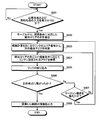
- FIG. 2 is a flowchart illustrating an example of a route search processing procedure of the route search device 100 according to the present embodiment.
- the route search device 100 determines whether or not the input unit 120 has received an input of a departure point and a destination point (step S201).
- the input unit 120 is in a standby state until it receives the input of the departure point and the destination point (step S201: No loop).
- the extraction unit 130 determines the area to which the departure point belongs and Based on the combination of areas to which the destination points belong, a sequence of transit areas that pass between the area to which the departure point belongs and the area to which the destination point belongs is extracted from the table 111 (step S202).
- the search unit 140 searches for a route from the departure point to the destination point using the in-area route data 112 of the transit area (step S203). Thereafter, the output unit 150 outputs route information (step S204), and the series of processing ends.
- the table 111 is obtained by associating a plurality of via area columns with one combination of the departure area and the destination area, and extracts a via area column from the table 111. By doing so, it is possible to present an optimum route from a plurality of routes while reducing the data capacity of the long-distance route calculation data.
- the table 111 for each search condition is recorded, a sequence of transit areas corresponding to the search condition received from the user is extracted from the table 111, and the purpose is determined from the departure point satisfying the search condition. If the route to the point is searched, it is possible to present an optimum route according to the search condition desired by the user while reducing the data capacity of the long-distance route calculation data.
- update information of the table 111 is acquired and the table 111 is updated based on the update information, for example, the amount of data to be updated by rewriting only text data Can be reduced. Therefore, the cost required for updating can be suppressed.
- the update information of the intra-area route data 112 is acquired and the intra-area route data 112 is updated for each area based on the update information, the update is performed on an area basis. This can be done and the amount of data to be updated can be reduced. Therefore, the cost required for updating can be suppressed.
- FIG. 3 is a block diagram illustrating an example of a hardware configuration of the navigation device according to the present embodiment.
- a navigation device 300 includes a CPU 301, a ROM 302, a RAM 303, a magnetic disk drive 304, a magnetic disk 305, an optical disk drive 306, an optical disk 307, an audio I / F (interface) 308, and a speaker 309.
- the respective components 301 to 315 are connected by a bus 320, respectively.
- the current location calculation program calculates the current location of the vehicle (the current location of the navigation device 300) based on output information from the GPS unit 314 described later.
- the route search program uses the map data and route calculation data recorded on the magnetic disk 305 to search for the optimum route from the departure point to the destination point.
- the optimum route is a shortest (or fastest) route to the destination point or a route that best matches a condition specified by the user. Further, not only the destination point but also a route to a stop point or a rest point may be searched.
- the searched guidance route is output to the audio I / F 308 and the video I / F 311 via the CPU 301.
- the route search program is a program for searching a route from the departure point to the destination point using a later-described table and area route data recorded on the magnetic disk 305 in long-distance route calculation. Specifically, based on the combination of the area to which the departure point belongs and the area to which the destination point belongs, a column of transit areas that pass between the area to which the departure point belongs and the area to which the destination point belongs is extracted from the table. This program searches for a route from a departure point to a destination point using in-area route data.
- the route guidance program includes guidance route information searched by executing the route search program, vehicle current location information calculated by executing the current location calculation program, and map data read from the magnetic disk 305. Based on this, real-time route guidance information is generated. The generated route guidance information is output to the audio I / F 308 and the video I / F 311 via the CPU 301.
- the update program is a program for updating the table or intra-area route data recorded on the magnetic disk 305 based on the update information of the table or intra-area route data acquired by the communication I / F 313.
- the magnetic disk drive 304 controls the reading / writing of the data with respect to the magnetic disk 305 according to control of CPU301.
- the magnetic disk 305 records data written under the control of the magnetic disk drive 304.
- an HD hard disk
- FD flexible disk
- Map data and route calculation data are recorded on the magnetic disk 305.
- the magnetic disk drive 304 may be detachable.
- the update information may be read by connecting the removable magnetic disk drive 304 to a PC (Personal Computer) (not shown) in which updated path calculation data is recorded.
- PC Personal Computer
- the optical disc drive 306 controls reading / writing of data with respect to the optical disc 307 according to the control of the CPU 301.
- the optical disk 307 is a detachable recording medium from which data is read according to the control of the optical disk drive 306.
- a writable recording medium can be used as the optical disc 307.
- the removable recording medium may be an MO, a memory card, or the like.
- the optical disc drive 306 reads the updated route calculation data (update information) recorded on the optical disc 307 when an optical disc 307 recorded with updated route calculation data is inserted.
- the update information is acquired by the communication I / F 313.
- the audio I / F 308 is connected to the speaker 309. Audio information is output from the speaker 309.
- Examples of the input device 310 include a remote controller having a plurality of keys for inputting characters, numerical values, and various instructions, a keyboard, a mouse, and a touch panel.
- the input device 310 may be realized by any one of a remote controller, a keyboard, a mouse, and a touch panel, or may be realized by a plurality of forms.
- the input device 310 receives input of a departure point and a destination point.
- the input unit 120 illustrated in FIG. 1 is realized by the input device 310.
- the video I / F 311 is connected to the display 312.
- the video I / F 311 includes, for example, a graphic controller that controls the entire display 312, a buffer memory such as a VRAM (Video RAM) that temporarily records image information that can be displayed immediately, and a graphic controller Based on the output image data, the display 312 is configured by a control IC or the like.
- the display 312 displays icons, cursors, menus, windows, or various data such as characters and images.
- this display 312 for example, a CRT, a TFT liquid crystal display, a plasma display, or the like can be adopted.
- the output unit 150 illustrated in FIG. 1 is realized by the display 312.
- the communication I / F 313 is connected to a communication network such as the Internet via wireless and functions as an interface between the communication network and the CPU 301.
- the communication I / F 313 has a function of receiving updated route calculation data (update information) from an external server (not shown).
- the GPS unit 314 receives radio waves from GPS satellites and outputs information indicating the current location of the vehicle.
- the output information of the GPS unit 314 is used when the CPU 301 calculates the current location of the vehicle.
- the information indicating the current location is information for specifying one point on the map data, such as latitude / longitude and altitude.
- the various sensors 315 output information such as a vehicle speed sensor, an acceleration sensor, and an angular velocity sensor that can determine the position and behavior of the vehicle.
- the output values of the various sensors 315 are used for the calculation of the current location of the vehicle by the CPU 301 and the measurement of the change in speed and direction.
- the recording unit 110, the input unit 120, the extraction unit 130, the search unit 140, the output unit 150, the acquisition unit 160, and the update unit 170 provided in the route search apparatus 100 according to the present embodiment illustrated in FIG. Means that the CPU 301 uses a program or data recorded in a rewritable non-volatile memory such as the ROM 302 or flash ROM in the navigation device 300 shown in FIG. 3, the RAM 303, the magnetic disk 305, the optical disk 307, etc. And the function is realized by controlling each part in the navigation device 300.
- a rewritable non-volatile memory such as the ROM 302 or flash ROM in the navigation device 300 shown in FIG. 3, the RAM 303, the magnetic disk 305, the optical disk 307, etc.
- the function is realized by controlling each part in the navigation device 300.
- the navigation device 300 is configured such that the CPU 301 executes a route search program recorded in a rewritable non-volatile memory such as a ROM 302 or a flash ROM as a recording medium in the navigation device 300, and thus, FIG.
- the functions of the route search device 100 shown can be executed by the route search processing procedure shown in FIG.
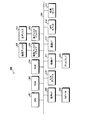
- FIG. 4 is an explanatory diagram illustrating an example of a long-distance route.
- an area 400 indicates a section for each prefecture.
- the long-distance route 401 indicates a route when the Tokyo area 400a is a departure point and the Osaka area 400b is a destination point. The same applies to the reverse route with the Osaka area 400b as the departure point and the Tokyo area 400a as the destination point.
- the long distance route 401a is a route that reaches the Osaka area via the Kanagawa area, the Shizuoka area, the Aichi area, the Gifu area, the Shiga area, and the Kyoto area.
- the long distance route 401b is a route that reaches the Osaka area via the Kanagawa area, the Yamanashi area, the Nagano area, the Aichi area, the Gifu area, the Shiga area, and the Kyoto area.
- only two long-distance paths 401 are illustrated here, but there are actually many long-distance paths 401. How to hold the data of such a long distance path 401 will be described below.
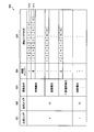
- FIG. 5 is an explanatory diagram showing an example of long-distance path calculation data recorded on the magnetic disk 305.
- long-distance route calculation data includes a table 500.
- the table 500 includes a departure area 501, a destination area 502, a search condition 503, a route number 504, and a via area column 505.
- the departure area 501 is an area to which the departure point belongs.
- the destination area 502 is an area to which the destination point belongs.
- the search condition 503 indicates the condition at the time of search. Specifically, the time priority giving priority to the required time to the destination point, the distance priority giving priority to the shortest distance to the destination point, and detouring the expressway. There is general road priority.
- the via area column 505 lists the via areas set corresponding to the combination of the departure area and the destination area in the order of the area numbers that are text data. The numbers shown in this table 500 indicate the area numbers of the area 400 shown in FIG.
- the number 1 shown in the departure area 501 indicates the Tokyo area
- the number 12 shown in the destination area 502 indicates the Osaka area.
- the route indicated by reference numeral 510 indicates the long-distance route 401a shown in FIG. 4, that is, 2: Kanagawa area, 4: Shizuoka area, 5: Aichi area, 7: The route reaches the 12: Osaka area via the Gifu area, 9: Shiga area, 11: Kyoto area.
- a via area column 505 corresponding to the search condition 503 can be extracted.
- the case where the area is divided into prefectural units is taken as an example.
- the present invention is not limited to this.
- the subdivision of the prefectural unit the local unit such as the Kanto region or the Kinki region. In regions with borders, it is also possible to use national units.
- FIG. 7 is an explanatory diagram showing an example of intra-area route data when the area is subdivided.
- each area is divided into prefectures, and each prefecture is divided into north and south.
- the route from the Gifu Kita area to the Kyoto Kita area is the route indicated by the bold line in the figure. That is, when searching for a route, a route from Gifu Kita to Kyoto South and a route from Gifu South to Kyoto North or Kyoto South are excluded from the route search targets. Therefore, it is possible to efficiently narrow down the intra-area route data 600, and it is possible to perform a quick route search process.
- FIG. 8 is a flowchart showing an example of route search processing performed by the navigation device 300.
- step S801 it is in a standby state until the input of the departure point and the destination point is accepted (step S801: No loop).
- step S801: Yes the search condition is determined from the table 500 shown in FIG.
- the sequence of the via area corresponding to is extracted (step S802). For example, if the departure point is Tokyo Station and the destination point is Osaka Station, in step S802, a series of transit areas between the Tokyo area to which Tokyo Station belongs and the Osaka area to which Osaka Station belongs (for example, FIG. 5), a sequence of areas via the Tokai region indicated by reference numeral 510 of FIG.
- step S805 the links are narrowed down. That is, an optimal link is selected from a plurality of links in the area. Thereafter, the link is connected, and it is determined whether or not the destination point has been reached (step S806). If it is determined that it is not connected to the destination point (step S806: No), it is determined whether or not the region boundary is exceeded (step S807). If it is determined that the region boundary has not been exceeded (step S807: NO), the process proceeds to step S804, and the links are narrowed down with reference to the flag set for the link.
- step S807 If it is determined that the region boundary has been crossed (step S807: Yes), the process proceeds to step S803, and the next via area is specified. In other words, when performing route calculation within the Kanagawa area across Tokyo, the Shizuoka area, which is the next transit area, is specified.
- step S801 If a plurality of routes are to be output, it is only necessary to go to step S801 again and execute route search processing. In this case, it is only necessary to search for a route that avoids the route that has already been output. For example, in the route search between the Tokyo area and the Osaka area, the route that goes through the Tokai region is searched as the first route. In this case, a route that passes through the Koshinetsu region may be searched for as the next route. Specifically, the route may be searched by extracting a column of areas via the Koshinetsu region indicated by reference numeral 511 in FIG. If no search condition is input in advance, the route search may be performed by changing the search condition for the route to be searched next from the previously searched route.
- the route search from the departure point side to the destination point side has been described. However, even when the route search from the destination point side to the departure point side is performed, the route search can be performed by the same processing. it can. It is also possible to perform a route search from the destination point side to the departure point side simultaneously with a route search from the departure point side to the destination point side. As described above, when a route search is performed from both the departure point side and the destination point side, the route search ends when the routes from both sides are connected at a certain point. When a plurality of routes are output, route calculation is performed simultaneously from both the departure point side and the destination point side, and after the routes are connected, route calculation is performed again from both sides.
- a sequence of transit areas that pass between the area to which the departure point belongs and the area to which the destination location belongs is extracted from the table 500, and the route data in the area of the transit area is used to depart. Since the route from the point to the destination point is searched, it is possible to reduce the data capacity of the long-distance route calculation data while enabling a quick route search process.
- data corresponding to the number of combinations of the departure area / target area is required.
- the intra-area route requires only the data amount of the number of combinations of areas adjacent to the area. The amount can be greatly reduced.
- a combination of a plurality of transit areas is associated with one combination of a departure area and a destination area, and a sequence of one transit area is extracted from the table 500. It is possible to present an optimum route from a plurality of routes while reducing the data capacity of the route calculation data for distance.
- a table 500 for each search condition is recorded, a route area column corresponding to the search condition received from the user is extracted from the table 500, and a route from the departure point to the destination point that satisfies the search condition is searched.
- the CPU 301 of the navigation device 300 determines whether or not route calculation data update information has been acquired (step S901).
- the determination as to whether or not update information has been acquired is specifically a determination as to whether or not the communication I / F 313 has received update information from an external server, for example.
- step S901 it is in a standby state until update information is acquired (step S901: No loop).
- update information is acquired (step S901: Yes)
- Judgment is made (step S902).
- the table 500 is updated (step S903). That is, the text data in the table 500 is rewritten. In this case, the table 500 may be updated for each combination of the departure area and the destination area.
- step S904 it is determined whether or not the update information includes the update information of the intra-area route data. If it is determined that the update information of the intra-area route data is included (step S904: Yes), the intra-area route data is updated for each area (step S905). That is, the intra-area route data is replaced on an area basis. Thereafter, the updated data is stored (step S906), and the series of processes is terminated.
- step S902 when it is determined in step S902 that the update information of the table 500 is not included (step S902: No), the update information is determined as the update information of the intra-area route data (step S907), and the update process in step S905 is performed. Do it. If it is determined in step S904 that the update information of the in-area route data is not included (step S904: No), the data is stored in step S906.
- the intra-area route data 112 is updated for each area based on the update information of the intra-area route data 112, the amount of data to be updated can be reduced. Thus, since it can update in area unit, the cost which update requires can be held down.
Landscapes
- Engineering & Computer Science (AREA)
- Radar, Positioning & Navigation (AREA)
- Remote Sensing (AREA)
- Automation & Control Theory (AREA)
- Physics & Mathematics (AREA)
- General Physics & Mathematics (AREA)
- Navigation (AREA)
- Traffic Control Systems (AREA)
Abstract
経路探索装置(100)は、記録部(110)と、入力部(120)と、抽出部(130)と、探索部(140)とを備える。記録部(110)は、テーブル(111)とエリア内経路データ(112)とを有する。テーブル(111)は、出発エリアおよび目的エリアの組合せと当該組合せごとにそれぞれ出発エリアから目的エリアまでの間に経由する経由エリアの列とが対応付けられたものである。エリア内経路データ(112)は、各エリア内にてエリアの境界に位置する境界ノード同士を結んだデータを含む。入力部(120)は、出発地点および目的地点の入力を受け付ける。抽出部(130)は、出発エリアおよび目的エリアの組合せに基づき、出発エリアから目的エリアまでの間に経由する経由エリアの列をテーブル(111)から抽出する。探索部(140)は、経由エリアのエリア内経路データ(112)を用いて、出発地点から目的地点までの経路を探索する。
Description
この発明は、経路探索装置、経路探索方法、経路探索プログラム、および記録媒体に関する。
近年、車両などの移動体には、目的地点を設定することにより、当該目的地点までの経路を誘導するナビゲーション装置が搭載されている。この種のナビゲーション装置は、目的地点までの経路を探索する経路探索機能を有している。
経路探索をおこなうために、通常、ナビゲーション装置には、階層構造をなす経路計算用データが格納されている。遠距離の経路計算をおこなう場合、候補となる道路数が多く、経路計算に時間を要するため、遠距離用の上位階層の経路計算用データには、出発地点のエリアと目的地点のエリアとを組合せ、その間の経路計算に必要なリンクのデータを記録するようにした手法が採られている。
図10および図11を用いて、従来の一般的な遠距離計算用のデータの詳細について説明しておく。図10は、従来の遠距離用経路計算データの組合せの一例を示した説明図である。図10において、組合せデータ1000は、出発地点のエリアと目的地点のエリアの組合せを示したものである。各エリアの組合せごとに、それぞれ、経路計算に必要なリンクデータが記録されている。具体例として、符号1001に示す南関東エリアと近畿エリアとの組合せにおけるリンクデータについて、図11を用いて以下に説明する。なお、組合せデータのうち、網点に示す領域のリンクデータについては後述する。
図11は、従来の遠距離用経路計算データにおける、各エリアの組合せごとのリンクデータを示した説明図である。図11において、リンクデータ1100は、南関東エリアと近畿エリアとの間の経路計算に用いられるデータを示したものである。たとえば、東京駅1101を出発地点とした南関東エリアから、大阪駅1102を目的地点とした近畿エリアまでの経路として、東海地方(南側)を通るルートや甲信越地方(北側)を通るルートなど、候補となるルートが予め多数記録されている。東京駅1101を出発地点とし、大阪駅1102を目的地点とした経路探索処理を実行する場合は、この中から、探索条件等に合致する最適なルートを絞り込むことにより、経路が決定される。
また、このような遠距離計算用のデータをもつ技術として、遠距離の計算を迅速化させるために、地図上の各地域を複数の区画に分割し、各区画内の高速道路などの主要道路、およびインターチェンジなどの当該主要道路への接続点を予め記録しておき、経路探索時には、始点を含む区画および終点を含む区画から主要道路を特定するとともに、始点を含む区画および終点を含む区画の各区画内の各地点からそれぞれ主要道路の接続点までの経路を特定するようにした技術が提案されている(たとえば、下記特許文献1参照。)。
しかしながら、上述した従来技術では、経路計算用データのデータ量が膨大であるといった問題が一例として挙げられる。特に、更新時におけるデータ量が多いため、更新に時間がかかるといった問題もある。
なお、ここで、図10を用いて、更新時に更新するデータについて補足しておく。たとえば、南関東のエリアに属する厚木から、北関東のエリアに属する久喜までの間に新たに高速道路が開通したと想定した場合、図10の網点に示す組合せのリンクデータを全て更新することになる。つまり、北陸エリア以西のエリア同士の組合せや、東北エリア以北のエリア同士の組合せを除き、南関東エリアと北関東エリアとを結ぶ経路をもつ各エリアの組合せについては、それぞれリンクデータを更新する必要がある。
すなわち、南関東から北関東を跨ぐ主要道路が1本追加されただけで、組合せデータ1000のうち、半分以上の組合せについて更新しなければならないという問題がある。したがって、利用者が特定のエリアのみの更新を所望する場合であっても、当該エリアのみを更新することができず、更新時におけるデータ量が膨大になるといった問題がある。
上述した課題を解決し、目的を達成するため、請求項1の発明にかかる経路探索装置は、出発エリアおよび目的エリアの組合せと当該組合せごとにそれぞれ出発エリアから目的エリアまでの間に経由する経由エリアの列とが対応付けられたテーブルおよび各エリア内にて当該エリアの境界に位置する境界ノード同士を結んだエリア内経路データを記録する記録手段と、出発地点および目的地点の入力を受け付ける入力手段と、前記出発地点が属するエリアおよび前記目的地点が属するエリアの組合せに基づき、当該出発地点が属するエリアから当該目的地点が属するエリアまでの間に経由する経由エリアの列を前記テーブルから抽出する抽出手段と、前記経由エリアのエリア内経路データを用いて、前記出発地点から前記目的地点までの経路を探索する探索手段と、を備えることを特徴とする。
また、請求項6に記載の経路探索方法は、出発エリアおよび目的エリアの組合せと当該組合せごとにそれぞれ出発エリアから目的エリアまでの間に経由する経由エリアの列とが対応付けられたテーブルおよび各エリア内にて当該エリアの境界に位置する境界ノード同士を結んだエリア内経路データを記録する記録部を備えた経路探索装置の経路探索方法であって、出発地点および目的地点の入力を受け付ける入力工程と、前記出発地点が属するエリアおよび前記目的地点が属するエリアの組合せに基づき、当該出発地点が属するエリアから当該目的地点が属するエリアまでの間に経由する経由エリアの列を前記テーブルから抽出する抽出工程と、前記経由エリアのエリア内経路データを用いて、前記出発地点から前記目的地点までの経路を探索する探索工程と、を含むことを特徴とする。
また、請求項7に記載の経路探索プログラムは、請求項6に記載の経路探索方法をコンピュータに実行させることを特徴とする。
また、請求項8に記載の記録媒体は、請求項7に記載の経路探索プログラムをコンピュータに読み取り可能に記録したことを特徴とする。
100 経路探索装置
110 記録部
111 テーブル
112 エリア内経路データ
120 入力部
130 抽出部
140 探索部
150 出力部
160 取得部
170 更新部
300 ナビゲーション装置
110 記録部
111 テーブル
112 エリア内経路データ
120 入力部
130 抽出部
140 探索部
150 出力部
160 取得部
170 更新部
300 ナビゲーション装置
以下に添付図面を参照して、この発明にかかる経路探索装置、経路探索方法、経路探索プログラム、および記録媒体の好適な実施の形態を詳細に説明する。
(実施の形態)
(経路探索装置の機能的構成)
この発明の実施の形態にかかる経路探索装置の機能的構成について説明する。図1は、本実施の形態にかかる経路探索装置の機能的構成の一例を示すブロック図である。図1において、経路探索装置100は、記録部110と、入力部120と、抽出部130と、探索部140と、出力部150と、取得部160と、更新部170とを備えて構成される。
(経路探索装置の機能的構成)
この発明の実施の形態にかかる経路探索装置の機能的構成について説明する。図1は、本実施の形態にかかる経路探索装置の機能的構成の一例を示すブロック図である。図1において、経路探索装置100は、記録部110と、入力部120と、抽出部130と、探索部140と、出力部150と、取得部160と、更新部170とを備えて構成される。
記録部110は、テーブル111とエリア内経路データ112とを記録する。なお、本実施の形態において、対象とするデータは、階層構造をなす経路計算用データのうち、たとえば、最上位の階層、またはそれに準ずる階層の遠距離用経路計算データである。出発エリアとは、出発地点が含まれるエリアである。なお、出発地点は、ユーザが任意に選択した地点や、目的地点を入力した際の現在地点などである。目的エリアは、目的地点が含まれるエリアである。
テーブル111は、出発エリアおよび目的エリアの組合せと、当該組合せごとにそれぞれ出発エリアから目的エリアまでの間に経由する経由エリアの列とが対応付けられたものである。テーブル111は、具体的には、たとえば、南関東エリアを出発エリアとし、中国エリアを目的エリアとした組合せに対して、静岡や愛知などの東海エリアと近畿エリアを経由する経由エリアの列を対応付けたものである。このテーブル111は、各エリアに付されたエリアIDなどのテキストデータを、各組合せごとに経由エリア順に列挙したものである。
エリア内経路データ112は、各エリア内にて当該エリアの境界に位置する境界ノード同士を結んだデータである。具体的には、エリア内経路データ112は、境界ノード同士を結ぶ経路に使用されるリンクのみを含むデータである。また、エリア内経路データ112は、隣接エリアの組合せに応じて異なるデータとしてもよいし、各リンクに隣接エリアの組合せごとに、使用する/しないのフラグを設け、同一のデータとしてもよい。たとえば、東海エリアのエリア内経路データ112を例に挙げると、エリア内経路データ112は、南関東エリアとの境界に位置する境界ノードと、近畿エリアとの境界に位置する境界ノードとを結んだ複数のリンク列のデータである。
入力部120は、出発地点および目的地点の入力を受け付ける。入力部120による入力を受け付ける手法は、操作入力や音声入力などが挙げられる。
抽出部130は、出発地点が属するエリアおよび目的地点が属するエリアの組合せに基づき、当該出発地点が属するエリアから当該目的地点が属するエリアまでの間に経由する経由エリアの列をテーブル111から抽出する。具体的には、抽出部130は、出発地点が属するエリアを決定するとともに、目的地点が属するエリアを決定し、各エリアの組合せに基づいて、経由エリアの列を抽出する。
探索部140は、経由エリアのエリア内経路データ112を用いて、出発地点から目的地点までの経路を探索する。具体的には、探索部140は、抽出部130によって抽出された経由エリアの列に含まれる各経由エリアごとに、境界ノード間の経路を計算することにより出発地点から目的地点までの経路を探索する。また、探索部140は、複数の経路を探索してもよい。探索部140は、エリアごとに順番に経路を計算してもよいし、必要なエリアを同時に読み込んで、まとめて経路を計算してもよい。
出力部150は、探索部140によって探索された経路の情報を出力する。出力部150は、探索された経路を、ユーザに選択させるために不図示の表示部や音声出力部などに出力するほか、経路誘導用のデータとしてRAMなどに出力する。
また、本実施の形態において、テーブル111は、出発エリアおよび目的エリアの一の組合せに対して複数の経由エリアの列を対応付けたものとしてもよい。具体的には、テーブル111は、たとえば、南関東エリアを出発エリアとし、中国エリアを目的エリアとした組合せに対して、東海エリアと近畿エリアを経由する経由エリアの列や、山梨や長野などの甲信越エリアと近畿エリアを経由する経由エリアの列など、複数の経由エリアの列を対応付けたものである。
この場合、抽出部130は、出発地点が属するエリアおよび目的地点が属するエリアに基づいて、一の経由エリアの列を抽出する。具体的には、抽出部130は、たとえば、出発エリア内の出発地点や目的エリア内の目的地点の位置や、後述する探索条件などに応じてリンク列を選択して抽出する。
また、本実施の形態において、記録部110は、探索条件ごとのテーブル111を記録してもよい。この場合、入力部120は、出発地点および目的地点とともに探索条件の入力を受け付ける。抽出部130は、入力部120が受け付けた探索条件に対応した経由エリアの列をテーブル111から抽出する。また、探索部140は、経由エリアのエリア内経路データ112を用いて、探索条件を充足する出発地点から目的地点までの経路を探索する。
このようにテーブル111を探索条件ごとに区別していれば、エリア内経路データ112を、探索条件にかかわらず、共通のものを用いることも可能である。なお、この場合、探索条件ごとに、各リンクにフラグを設定すればよい。すなわち、時間優先や距離優先などの各探索条件に応じて、エリア内経路データ112内の各リンクのフラグをオンまたはオフに設定し、探索条件に対応した経路探索をおこなえるようにすればよい。なお、エリア内経路データ112を、探索条件ごとに異なるデータとして記録しておくようにしてもよい。
また、本実施の形態において、取得部160と、更新部170とは、任意の構成要素である。取得部160は、テーブル111の更新情報を取得する。テーブル111の更新情報は、具体的には、たとえば、各組合せごとに経由エリア順に列挙したエリアIDなどのテキストデータである。
更新部170は、取得部160によって取得されたテーブル111の更新情報に基づいて、記録部110に記録されているテーブル111を更新する。具体的には、更新情報がテーブルを書き換えるためのテキストデータを示すものである場合、更新部170はテーブル111のテキストデータのみを書き換えればよい。なお、更新部170は、出発エリアおよび目的エリアの組合せごとにテーブル111を更新してもよい。
また、本実施の形態において、取得部160は、エリア内経路データ112の更新情報を取得してもよい。この場合、更新部170は、エリア内経路データ112の更新情報に基づいて、記録部110に記録されているエリア内経路データ112をエリアごとに更新する。すなわち、更新部170は、更新のあったエリア内経路データ112のみを差し替えればよい。なお、テーブル111ごとの更新、およびエリア内経路データ112ごとの更新をまとめて更新することも可能である。
(経路探索装置の経路探索処理手順)
つぎに、図2を用いて、経路探索装置100の経路探索処理手順について説明する。図2は、本実施の形態にかかる経路探索装置100の経路探索処理手順の一例を示すフローチャートである。
つぎに、図2を用いて、経路探索装置100の経路探索処理手順について説明する。図2は、本実施の形態にかかる経路探索装置100の経路探索処理手順の一例を示すフローチャートである。
図2のフローチャートにおいて、経路探索装置100は、入力部120が出発地点および目的地点の入力を受け付けたか否かを判断する(ステップS201)。入力部120が出発地点および目的地点の入力を受け付けるまで待機状態にあり(ステップS201:Noのループ)、当該入力を受け付けると(ステップS201:Yes)、抽出部130により、出発地点が属するエリアおよび目的地点が属するエリアの組合せに基づき、当該出発地点が属するエリアから当該目的地点が属するエリアまでの間に経由する経由エリアの列をテーブル111から抽出する(ステップS202)。
そして、探索部140が経由エリアのエリア内経路データ112を用いて、出発地点から目的地点までの経路を探索する(ステップS203)。このあと、出力部150が経路の情報を出力し(ステップS204)、一連の処理を終了する。
以上説明したように、本実施の形態にかかる経路探索装置100によれば、出発地点が属するエリアから目的地点が属するエリアまでの間に経由する経由エリアの列をテーブル111から抽出し、経由エリアのエリア内経路データを用いて、出発地点から目的地点までの経路を探索するようにしたので、迅速な経路探索処理を可能としながら、遠距離用経路計算データのデータ容量を削減することができる。
また、本実施の形態において、テーブル111を、出発エリアおよび目的エリアの一の組合せに対して複数の経由エリアの列を対応付けたものとし、当該テーブル111から一の経由エリアの列を抽出するようにすれば、遠距離用経路計算データのデータ容量を削減しながら、複数の経路の中から最適な経路を提示することができる。
また、本実施の形態において、探索条件ごとのテーブル111を記録しておき、利用者から受け付けた探索条件に対応した経由エリアの列をテーブル111から抽出し、探索条件を充足する出発地点から目的地点までの経路を探索するようにすれば、遠距離用経路計算データのデータ容量を削減しながら、利用者の所望する探索条件に応じた最適な経路を提示することができる。
また、本実施の形態において、テーブル111の更新情報を取得するようにし、当該更新情報に基づいて、テーブル111を更新するようにすれば、たとえば、テキストデータのみを書き換えることにより、更新するデータ量を削減することができる。したがって、更新に要するコストを抑えることができる。
また、本実施の形態において、エリア内経路データ112の更新情報を取得するようにし、当該更新情報に基づいて、エリア内経路データ112をエリアごとに更新するようにすれば、エリア単位で更新をおこなうことができ、更新するデータ量を削減することができる。したがって、更新に要するコストを抑えることができる。
以下に、本発明の実施例について説明する。本実施例では、車両に搭載されるナビゲーション装置によって、本発明の経路探索装置100を実施した場合の一例について説明する。
(ナビゲーション装置のハードウェア構成)
図3を用いて、本実施例にかかるナビゲーション装置のハードウェア構成について説明する。図3は、本実施例にかかるナビゲーション装置のハードウェア構成の一例を示すブロック図である。
図3を用いて、本実施例にかかるナビゲーション装置のハードウェア構成について説明する。図3は、本実施例にかかるナビゲーション装置のハードウェア構成の一例を示すブロック図である。
図3において、ナビゲーション装置300は、CPU301と、ROM302と、RAM303と、磁気ディスクドライブ304と、磁気ディスク305と、光ディスクドライブ306と、光ディスク307と、音声I/F(インターフェース)308と、スピーカ309と、入力デバイス310と、映像I/F311と、ディスプレイ312と、通信I/F313と、GPSユニット314と、各種センサ315とを備えている。また、各構成部301~315はバス320によってそれぞれ接続されている。
CPU301は、ナビゲーション装置300の全体の制御を司る。ROM302やフラッシュROM等の書換え可能な不揮発性メモリは、ブートプログラム、現在地点算出プログラム、経路探索プログラム、経路誘導プログラム、更新プログラム、などの各種プログラムを記録している。また、RAM303は、CPU301のワークエリアとして使用される。
現在地点算出プログラムは、たとえば、後述するGPSユニット314の出力情報に基づいて、車両の現在地点(ナビゲーション装置300の現在地点)を算出させる。
経路探索プログラムは、磁気ディスク305に記録されている地図データや経路計算データなどを利用して、出発地点から目的地点までの最適な経路を探索させる。ここで、最適な経路とは、目的地点までの最短(または最速)経路やユーザが指定した条件に最も合致する経路などである。また、目的地点のみならず、立ち寄り地点や休憩地点までの経路を探索してもよい。探索された誘導経路は、CPU301を介して音声I/F308や映像I/F311へ出力される。
また、経路探索プログラムは、遠距離の経路計算においては、磁気ディスク305に記録されている後述するテーブルやエリア内経路データを用いて、出発地点から目的地点までの経路を探索するプログラムである。具体的には、出発地点が属するエリアおよび目的地点が属するエリアの組合せに基づき、出発地点が属するエリアから目的地点が属するエリアまでの間に経由する経由エリアの列をテーブルから抽出して、各エリア内経路データを用いて、出発地点から目的地点までの経路を探索するプログラムである。
経路誘導プログラムは、経路探索プログラムを実行することによって探索された誘導経路情報、現在地点算出プログラムを実行することによって算出された車両の現在地点の情報、磁気ディスク305から読み出された地図データに基づいて、リアルタイムな経路誘導情報を生成させる。生成された経路誘導情報は、CPU301を介して音声I/F308や映像I/F311へ出力される。
更新プログラムは、通信I/F313により取得されたテーブルまたはエリア内経路データの更新情報に基づいて、磁気ディスク305に記録されているテーブルまたはエリア内経路データを更新するプログラムである。
図1に示した、抽出部130と、探索部140と、更新部170とは、CPU301によって実現される。すなわち、CPU301が経路探索プログラムを実行することによって、抽出部130と探索部140の機能を実現する。また、CPU301が更新プログラムを実行することにより更新部170の機能を実現する。
磁気ディスクドライブ304は、CPU301の制御にしたがって磁気ディスク305に対するデータの読み取り/書き込みを制御する。磁気ディスク305は、磁気ディスクドライブ304の制御で書き込まれたデータを記録する。磁気ディスク305としては、たとえば、HD(ハードディスク)やFD(フレキシブルディスク)を用いることができる。磁気ディスク305には、地図データや経路計算データが記録される。
経路計算データは、階層構造をなしており、上位階層に遠距離用のデータを有し、下位階層になるほど近距離用のデータを有している。この遠距離用の経路計算データは、出発エリアおよび目的エリアの組合せと当該組合せごとにそれぞれ出発エリアから目的エリアまでの間に経由する一または複数の経由エリアの列とが対応付けられたテーブルを有している。このテーブルには、探索条件ごとに経由エリアの列が記録されている。また、遠距離用経路計算データは、エリアごとに、各エリア内にて当該エリアの境界に位置する境界ノード同士を結んだエリア内経路データを有している。
また、磁気ディスクドライブ304を着脱自在な構成としてもよい。この場合、着脱可能な磁気ディスクドライブ304を、更新された経路計算データが記録されている図示しないPC(Personal Computer)などに接続することにより、更新情報を読み込むようにしてもよい。
光ディスクドライブ306は、CPU301の制御にしたがって光ディスク307に対するデータの読み取り/書き込みを制御する。光ディスク307は、光ディスクドライブ306の制御にしたがってデータの読み出される着脱自在な記録媒体である。光ディスク307は、書き込み可能な記録媒体を利用することもできる。また、この着脱自在な記録媒体として、光ディスク307のほか、MO、メモリカードなどであってもよい。
光ディスクドライブ306は、光ディスク307として、更新された経路計算データを記録したものが挿入されると、当該光ディスク307に記録されている更新された経路計算データ(更新情報)の読み込みをおこなう。なお、本実施例においては、更新情報は通信I/F313によって取得されるものとする。
音声I/F308は、スピーカ309に接続される。スピーカ309からは、音声情報が出力される。入力デバイス310は、文字、数値、各種指示などの入力のための複数のキーを備えたリモコン、キーボード、マウス、タッチパネルなどが挙げられる。入力デバイス310は、リモコン、キーボード、マウス、タッチパネルのうち、いずれか一つの形態によって実現されてもよいし、複数の形態によって実現されてもよい。入力デバイス310は、出発地点および目的地点の入力を受け付ける。図1に示した、入力部120は、入力デバイス310によって実現される。
映像I/F311は、ディスプレイ312と接続される。映像I/F311は、具体的には、たとえば、ディスプレイ312全体の制御をおこなうグラフィックコントローラと、即時表示可能な画像情報を一時的に記録するVRAM(Video RAM)などのバッファメモリと、グラフィックコントローラから出力される画像データに基づいて、ディスプレイ312を表示制御する制御ICなどによって構成される。
ディスプレイ312には、アイコン、カーソル、メニュー、ウインドウ、あるいは文字や画像などの各種データが表示される。このディスプレイ312は、たとえば、CRT、TFT液晶ディスプレイ、プラズマディスプレイなどを採用することができる。上述したナビゲーションプログラムを実行することにより、ディスプレイ312からは、探索された経路の情報が表示される。なお、図1に示した出力部150は、ディスプレイ312によって実現される。
通信I/F313は、無線を介してインターネットなどの通信網に接続され、この通信網とCPU301とのインターフェースとして機能する。また、通信I/F313は、図示せぬ外部サーバから、更新された経路計算データ(更新情報)を受信する機能を有する。
GPSユニット314は、GPS衛星からの電波を受信し、車両の現在地点を示す情報を出力する。GPSユニット314の出力情報は、CPU301による車両の現在地点の算出に際して利用される。現在地点を示す情報は、たとえば緯度・経度、高度などの、地図データ上の1点を特定する情報である。
各種センサ315は、車速センサ、加速度センサ、角速度センサなどの、車両の位置や挙動を判断することが可能な情報を出力する。各種センサ315の出力値は、CPU301による車両の現在地点の算出や、速度や方位の変化量の測定などに用いられる。
図1に示した本実施の形態における経路探索装置100が備える、記録部110と、入力部120と、抽出部130と、探索部140と、出力部150と、取得部160と、更新部170とは、図3に示したナビゲーション装置300におけるROM302やフラッシュROM等の書換え可能な不揮発性メモリ、RAM303、磁気ディスク305、光ディスク307などに記録されたプログラムやデータを用いて、CPU301が所定のプログラムを実行し、ナビゲーション装置300における各部を制御することによってその機能を実現する。
すなわち、本実施例のナビゲーション装置300は、ナビゲーション装置300における記録媒体としてのROM302やフラッシュROM等の書換え可能な不揮発性メモリに記録されている経路探索プログラムをCPU301が実行することにより、図1に示した経路探索装置100が備える機能を、図2に示した経路探索処理手順で実行することができる。
(遠距離経路の一例)
つぎに、図4を用いて、遠距離経路の一例について説明する。図4は、遠距離経路の一例を示す説明図である。図4において、エリア400は、都道府県ごとの区画を示している。遠距離経路401は、東京エリア400aを出発地点とし、大阪エリア400bを目的地点とした場合の経路を示したものである。なお、大阪エリア400bを出発地点とし、東京エリア400aを目的地点とした逆の経路の場合についても同様である。
つぎに、図4を用いて、遠距離経路の一例について説明する。図4は、遠距離経路の一例を示す説明図である。図4において、エリア400は、都道府県ごとの区画を示している。遠距離経路401は、東京エリア400aを出発地点とし、大阪エリア400bを目的地点とした場合の経路を示したものである。なお、大阪エリア400bを出発地点とし、東京エリア400aを目的地点とした逆の経路の場合についても同様である。
遠距離経路401aは、神奈川エリア、静岡エリア、愛知エリア、岐阜エリア、滋賀エリア、京都エリア、を経由して大阪エリアに到達する経路である。遠距離経路401bは、神奈川エリア、山梨エリア、長野エリア、愛知エリア、岐阜エリア、滋賀エリア、京都エリア、を経由して大阪エリアに到達する経路である。なお、遠距離経路401は、ここでは2つのみを例示しているが、実際には多数存在する。このような遠距離経路401のデータの持ち方について、以下に説明する。
(磁気ディスクに記録されている遠距離用経路計算データの一例)
つぎに、図5および図6を用いて、磁気ディスク305に記録されている遠距離用経路計算データの一例について説明する。図5は、磁気ディスク305に記録されている遠距離用経路計算データの一例を示す説明図である。
つぎに、図5および図6を用いて、磁気ディスク305に記録されている遠距離用経路計算データの一例について説明する。図5は、磁気ディスク305に記録されている遠距離用経路計算データの一例を示す説明図である。
図5において、遠距離用経路計算データは、テーブル500からなる。テーブル500は、出発エリア501と、目的エリア502と、探索条件503と、経路ナンバー504と、経由エリアの列505とを有している。出発エリア501は、出発地点が属するエリアである。目的エリア502は、目的地点が属するエリアである。
探索条件503は、探索時における条件を示したものであり、具体的には、目的地点までの所要時間を優先する時間優先、目的地点までの最短距離を優先する距離優先、高速道路を迂回する一般道優先などがある。経由エリアの列505は、出発エリアおよび目的エリアの組合せに対応して設定される経由エリアを、テキストデータであるエリアの番号の順に列挙したものである。なお、このテーブル500内に示す番号は、図4に示したエリア400の各エリア番号を示したものである。
すなわち、テーブル500のうち、出発エリア501に示す番号1は東京エリアを示し、目的エリア502に示す番号12は、大阪エリアを示している。また、経由エリアの列505のうち、符号510に示す経路は、図4に示した遠距離経路401aを示しており、すなわち、2:神奈川エリア、4:静岡エリア、5:愛知エリア、7:岐阜エリア、9:滋賀エリア、11:京都エリア、を経由して12:大阪エリアに到達する経路である。
また、経由エリアの列505のうち、符号511に示す経路は、図4に示した遠距離経路401bを示しており、すなわち、2:神奈川エリア、3:山梨エリア、6:長野エリア、5:愛知エリア、7:岐阜エリア、9:滋賀エリア、11:京都エリア、を経由して12:大阪エリアに到達する経路である。
このようなテーブル500を用いて、出発エリア501と目的エリア502とが決定されると、探索条件503に応じた経由エリアの列505を抽出することが可能になっている。なお、ここでは、都道府県単位にエリアを区切った場合を例に挙げたが、これに限られるものではなく、たとえば、都道府県をさらに細分化した地区単位、関東地方や近畿地方などの地方単位、国境のある地域においては国単位、などとすることも可能である。
図6は、エリア内経路データの一例を示した説明図である。図6において、エリア内経路データ600は、たとえば、滋賀エリアのデータを示している。境界ノード601は、エリアの境界に位置するノードを示している。リンク列602は、一方の境界ノード601aから他方の境界ノード601bまでを結ぶリンクの繋がりを示したものである。このように、岐阜エリアから、滋賀エリアを経由した京都エリアまでの経路は、複数通りある。各リンクは、探索条件に応じて使用するリンクにオン/オフのフラグが設定されるようになっており、探索条件に応じた経路探索が可能になっている。
なお、ここでは、各エリアを都道府県単位としているが、各エリアをさらに細分化することにより、エリア内経路データ600の絞り込みを効率的におこなうことも可能である。以下に、各エリアを細分化した場合のエリア内経路データについて補足しておく。
図7は、エリアを細分化した場合のエリア内経路データの一例を示した説明図である。図7において、各エリアは、都道府県単位に区画され、さらに、各都道府県を南北に分けたものである。たとえば、岐阜北エリアから、京都北エリアまでの経路は、図中太線で示した経路となる。すなわち、経路探索時において、岐阜北から京都南までの経路や、岐阜南から京都北または京都南までの経路は、経路探索の対象から除外される。したがって、エリア内経路データ600の絞り込みを効率的におこなうことが可能になり、迅速な経路探索処理をおこなうことが可能になる。
(ナビゲーション装置がおこなう経路探索処理の一例)
つぎに、図8を用いて、ナビゲーション装置300がおこなう経路探索処理の一例について説明する。図8は、ナビゲーション装置300がおこなう経路探索処理の一例を示したフローチャートである。
つぎに、図8を用いて、ナビゲーション装置300がおこなう経路探索処理の一例について説明する。図8は、ナビゲーション装置300がおこなう経路探索処理の一例を示したフローチャートである。
図8において、ナビゲーション装置300のCPU301は、利用者により、入力デバイス310から出発地点および目的地点の入力を受け付けたか否かを判断する(ステップS801)。なお、通常、利用者が出発地点を特に指定しない限り、出発地点は現在地点となる。
ステップS801において、出発地点および目的地点の入力を受け付けるまで待機状態にあり(ステップS801:Noのループ)、当該入力を受け付けると(ステップS801:Yes)、図5に示したテーブル500から、探索条件に対応した経由エリアの列を抽出する(ステップS802)。なお、たとえば、出発地点を東京駅とし、目的地点を大阪駅とすると、ステップS802においては、東京駅が属する東京エリアと、大阪駅が属する大阪エリアとの間の経由エリアの列(たとえば、図5の符号510に示した東海地方経由のエリアの列)を抽出する。
このあと、経路計算をおこなうリンクのエリア番号から、次の経由エリアを特定する(ステップS803)。具体的には、たとえば、出発地点のエリア番号(1:東京エリア)から、次の経由エリア(2:神奈川エリア)を特定する。そして、経由エリアの列ごとに探索条件に応じてリンクに設定されるフラグを参照する(ステップS804)。具体的には、東京エリアから神奈川エリアまでのリンクに設定されるフラグを参照する。
そして、リンクの絞り込みをおこなう(ステップS805)。すなわち、エリア内の複数のリンクのうち、最適なリンクを選択する。このあと、リンクを接続していき、目的地点に繋がったか否かを判断する(ステップS806)。目的地点に繋がっていないと判断した場合(ステップS806:No)、リージョン境界を越えたか否かを判断する(ステップS807)。リージョン境界を越えていないと判断した場合(ステップS807:No)、ステップS804に移行し、引き続き、リンクに設定されるフラグを参照し、リンクの絞り込みをおこなう。
リージョン境界を越えたと判断した場合(ステップS807:Yes)、ステップS803に移行し、次の経由エリアの特定をおこなう。すなわち、東京を越え、神奈川のエリア内の経路計算をおこなう場合、次の経由エリアである静岡エリアの特定をおこなう。
一方、ステップS806において、目的地点に繋がったと判断した場合(ステップS806:Yes)、ディスプレイ312などから探索した経路の情報を出力し(ステップS808)、一連の処理を終了する。
なお、複数の経路を出力する場合、再度、ステップS801に移行し、経路探索処理を実行すればよい。この場合、既に出力した経路をなるべく通らないようにした経路を探索すればよく、たとえば、東京エリアと大阪エリアとの間の経路探索においては、最初の経路として東海地方を経由する経路を探索した場合、次の経路として甲信越地方を経由する経路を探索すればよい。すなわち、具体的には、図5の符号511に示した甲信越地方経由のエリアの列を抽出して、経路を探索すればよい。また、予め探索条件の入力がない場合には、次に探索する経路を、前に探索した経路と探索条件を異ならせて、経路探索をおこなってもよい。
また、上述した処理では、出発地点側から目的地点側への経路探索として説明したが、目的地点側から出発地点側への経路探索とした場合も、同様の処理にて経路探索をおこなうことができる。また、出発地点側から目的地点側への経路探索と同時に、目的地点側から出発地点側への経路探索をおこなうことも可能である。このように、出発地点側からと目的地点側の双方から経路探索をおこなう場合、ある地点で双方からの経路が繋がった場合に経路探索が終了となる。なお、複数の経路を出力する場合、出発地点側および目的地点側の双方から同時に経路計算をおこない、経路が繋がった後に、再度双方から経路計算をおこなえばよい。
図8に示した処理によれば、出発地点が属するエリアから目的地点が属するエリアまでの間に経由する経由エリアの列をテーブル500から抽出し、経由エリアのエリア内経路データを用いて、出発地点から目的地点までの経路を探索するようにしたので、迅速な経路探索処理を可能としながら、遠距離用経路計算データのデータ容量を削減することができる。特に、従来では、出発エリア/目的エリアの組合せ数分のデータが必要であったが、本実施例では、エリア内経路はそのエリアに隣接するエリアの組合せ数のみのデータ量で済むため、データ量を大幅に削減することができる。
また、テーブル500を、出発エリアおよび目的エリアの一の組合せに対して複数の経由エリアの列を対応付けたものとし、当該テーブル500から一の経由エリアの列を抽出するようにしたので、遠距離用経路計算データのデータ容量を削減しながら、複数の経路の中から最適な経路を提示することができる。
また、探索条件ごとのテーブル500を記録しておき、利用者から受け付けた探索条件に対応した経由エリアの列をテーブル500から抽出し、探索条件を充足する出発地点から目的地点までの経路を探索するようにしたので、遠距離用経路計算データのデータ容量を削減しながら、利用者の所望する探索条件に応じた最適な経路を提示することができる。
(ナビゲーション装置がおこなうデータ更新処理の一例)
つぎに、図9を用いて、ナビゲーション装置300がおこなうデータ更新処理の一例について説明する。図9は、ナビゲーション装置300がおこなうデータ更新処理を示すフローチャートである。
つぎに、図9を用いて、ナビゲーション装置300がおこなうデータ更新処理の一例について説明する。図9は、ナビゲーション装置300がおこなうデータ更新処理を示すフローチャートである。
図9において、ナビゲーション装置300のCPU301は、経路計算データの更新情報を取得したか否かを判断する(ステップS901)。なお、更新情報を取得したか否かの判断は、具体的には、たとえば、通信I/F313が外部のサーバから更新情報を受信したか否かの判断である。
ステップS901において、更新情報を取得するまで待機状態にあり(ステップS901:Noのループ)、更新情報を取得すると(ステップS901:Yes)、更新情報にテーブル500の更新情報が含まれるか否かを判断する(ステップS902)。テーブル500の更新情報が含まれると判断した場合(ステップS902:Yes)、テーブル500を更新する(ステップS903)。すなわち、テーブル500のテキストデータを書き換える。なお、この場合、出発エリアおよび目的エリアの組合せごとにテーブル500を更新してもよい。
このあと、更新情報にエリア内経路データの更新情報が含まれるか否かを判断する(ステップS904)。エリア内経路データの更新情報が含まれると判断した場合(ステップS904:Yes)、エリアごとにエリア内経路データを更新する(ステップS905)。すなわち、エリア単位でエリア内経路データを差し替える。このあと、更新したデータを保存し(ステップS906)、一連の処理を終了する。
一方、ステップS902において、テーブル500の更新情報が含まれないと判断した場合(ステップS902:No)、更新情報をエリア内経路データの更新情報と判定し(ステップS907)、ステップS905における更新処理をおこなう。また、ステップS904において、エリア内経路データの更新情報が含まれないと判断した場合(ステップS904:No)、ステップS906におけるデータの保存をおこなう。
上述した処理によれば、テーブル500の更新情報に基づいて、テーブル500を更新するようにしたので、従来のように、たとえば、関東から北関東を跨ぐ主要道路が1本追加されただけで、組合せデータ1000(図10参照)のうち、半分以上のリンクデータを更新しなければならないといった不具合を防止することができる。また、テーブル500のテキストデータのみを書き換えることが可能となり、更新するデータ量を削減することができ、更新に要するコストを抑えることができる。
また、エリア内経路データ112の更新情報に基づいて、エリア内経路データ112をエリアごとに更新するようにしたので、更新するデータ量を削減することができる。このように、エリア単位で更新することができるので、更新に要するコストを抑えることができる。
以上のように、本発明の経路探索装置、経路探索方法、経路探索プログラム、および記録媒体によれば、迅速な経路探索処理を可能としながら、遠距離用経路計算データのデータ容量を削減することができる。
なお、本実施例で説明した経路探索方法は、予め用意されたプログラムをパーソナル・コンピュータやワークステーションなどのコンピュータで実行することにより実現することができる。このプログラムは、ハードディスク、フレキシブルディスク、CD-ROM、MO、DVDなどのコンピュータで読み取り可能な記録媒体に記録され、コンピュータによって記録媒体から読み出されることによって実行される。またこのプログラムは、インターネットなどのネットワークを介して配布することが可能な伝送媒体であってもよい。
Claims (8)
- 出発エリアおよび目的エリアの組合せと当該組合せごとにそれぞれ出発エリアから目的エリアまでの間に経由する経由エリアの列とが対応付けられたテーブルおよび各エリア内にて当該エリアの境界に位置する境界ノード同士を結んだエリア内経路データを記録する記録手段と、
出発地点および目的地点の入力を受け付ける入力手段と、
前記出発地点が属するエリアおよび前記目的地点が属するエリアの組合せに基づき、当該出発地点が属するエリアから当該目的地点が属するエリアまでの間に経由する経由エリアの列を前記テーブルから抽出する抽出手段と、
前記経由エリアのエリア内経路データを用いて、前記出発地点から前記目的地点までの経路を探索する探索手段と、
を備えることを特徴とする経路探索装置。 - 前記テーブルは、出発エリアおよび目的エリアの一の組合せに対して複数の経由エリアの列が対応付けられており、
前記抽出手段は、前記出発地点が属するエリアおよび前記目的地点が属するエリアに基づいて、一の経由エリアの列を抽出することを特徴とする請求項1に記載の経路探索装置。 - 前記記録手段は、探索条件ごとの前記テーブルを記録し、
前記入力手段は、前記出発地点および前記目的地点とともに探索条件の入力を受け付け、
前記抽出手段は、前記入力手段が受け付けた前記探索条件に対応した前記経由エリアの列を前記テーブルから抽出し、
前記探索手段は、前記経由エリアのエリア内経路データを用いて、前記探索条件を充足する前記出発地点から前記目的地点までの経路を探索することを特徴とする請求項1または2に記載の経路探索装置。 - 前記テーブルの更新情報を取得する取得手段と、
前記更新情報に基づいて、前記記録手段に記録されている前記テーブルを更新する更新手段と、
を備えることを特徴とする請求項1~3のいずれか一つに記載の経路探索装置。 - 前記エリア内経路データの更新情報を取得する取得手段と、
前記更新情報に基づいて、前記記録手段に記録されている前記エリア内経路データをエリアごとに更新する更新手段と、
を備えることを特徴とする請求項1~4のいずれか一つに記載の経路探索装置。 - 出発エリアおよび目的エリアの組合せと当該組合せごとにそれぞれ出発エリアから目的エリアまでの間に経由する経由エリアの列とが対応付けられたテーブルおよび各エリア内にて当該エリアの境界に位置する境界ノード同士を結んだエリア内経路データを記録する記録部を備えた経路探索装置の経路探索方法であって、
出発地点および目的地点の入力を受け付ける入力工程と、
前記出発地点が属するエリアおよび前記目的地点が属するエリアの組合せに基づき、当該出発地点が属するエリアから当該目的地点が属するエリアまでの間に経由する経由エリアの列を前記テーブルから抽出する抽出工程と、
前記経由エリアのエリア内経路データを用いて、前記出発地点から前記目的地点までの経路を探索する探索工程と、
を含むことを特徴とする経路探索方法。 - 請求項6に記載の経路探索方法をコンピュータに実行させることを特徴とする経路探索プログラム。
- 請求項7に記載の経路探索プログラムを記録したことを特徴とするコンピュータに読み取り可能な記録媒体。
Priority Applications (2)
| Application Number | Priority Date | Filing Date | Title |
|---|---|---|---|
| PCT/JP2008/063685 WO2010013327A1 (ja) | 2008-07-30 | 2008-07-30 | 経路探索装置、経路探索方法、経路探索プログラム、および記録媒体 |
| JP2010522560A JP5144759B2 (ja) | 2008-07-30 | 2008-07-30 | 経路探索装置、経路探索方法、経路探索プログラム、および記録媒体 |
Applications Claiming Priority (1)
| Application Number | Priority Date | Filing Date | Title |
|---|---|---|---|
| PCT/JP2008/063685 WO2010013327A1 (ja) | 2008-07-30 | 2008-07-30 | 経路探索装置、経路探索方法、経路探索プログラム、および記録媒体 |
Publications (1)
| Publication Number | Publication Date |
|---|---|
| WO2010013327A1 true WO2010013327A1 (ja) | 2010-02-04 |
Family
ID=41610051
Family Applications (1)
| Application Number | Title | Priority Date | Filing Date |
|---|---|---|---|
| PCT/JP2008/063685 Ceased WO2010013327A1 (ja) | 2008-07-30 | 2008-07-30 | 経路探索装置、経路探索方法、経路探索プログラム、および記録媒体 |
Country Status (2)
| Country | Link |
|---|---|
| JP (1) | JP5144759B2 (ja) |
| WO (1) | WO2010013327A1 (ja) |
Cited By (4)
| Publication number | Priority date | Publication date | Assignee | Title |
|---|---|---|---|---|
| WO2012105554A1 (ja) * | 2011-02-01 | 2012-08-09 | クラリオン株式会社 | 経路演算装置 |
| JP2016114388A (ja) * | 2014-12-11 | 2016-06-23 | キャンバスマップル株式会社 | ナビゲーション装置、およびナビゲーションプログラム |
| EP3409716A1 (de) | 2013-08-22 | 2018-12-05 | Basf Se | Acrylamid-polymere und verfahren zur tertiären erdölförderung unter verwendung dieser polymere |
| EP3587533A1 (en) | 2018-06-22 | 2020-01-01 | Basf Se | Self-protecting polymers for enhanced oil recovery |
Families Citing this family (1)
| Publication number | Priority date | Publication date | Assignee | Title |
|---|---|---|---|---|
| JP5950206B2 (ja) * | 2012-07-30 | 2016-07-13 | アイシン・エィ・ダブリュ株式会社 | ナビゲーション装置及びナビゲーションプログラム |
Citations (9)
| Publication number | Priority date | Publication date | Assignee | Title |
|---|---|---|---|---|
| JPH04204482A (ja) * | 1990-11-29 | 1992-07-24 | Mitsubishi Electric Corp | 車両用経路案内装置 |
| JPH0843116A (ja) * | 1994-08-03 | 1996-02-16 | Nissan Motor Co Ltd | 車両用経路誘導装置 |
| JPH09218047A (ja) * | 1996-02-08 | 1997-08-19 | Mitsubishi Electric Corp | 車両経路算出装置 |
| JP2002310709A (ja) * | 2001-04-13 | 2002-10-23 | Aisin Aw Co Ltd | ナビゲーション装置、及び乗降インターチェンジ設定方法のプログラム |
| JP2003337034A (ja) * | 2002-05-17 | 2003-11-28 | Alpine Electronics Inc | ナビゲーション装置 |
| JP2005069751A (ja) * | 2003-08-21 | 2005-03-17 | Hitachi Ltd | 通信型車両ナビゲーションシステムのサーバ装置、車載端末装置及びそのプログラム |
| JP2007199575A (ja) * | 2006-01-30 | 2007-08-09 | Alpine Electronics Inc | 地図データ作成方法及び経路探索方法並びに装置 |
| JP2008122266A (ja) * | 2006-11-14 | 2008-05-29 | Pioneer Electronic Corp | 経路探索装置、経路探索方法、経路探索プログラム及び記憶媒体 |
| JP2008145193A (ja) * | 2006-12-07 | 2008-06-26 | Pioneer Electronic Corp | 経路探索装置、経路探索方法、経路探索プログラム及び記憶媒体 |
Family Cites Families (1)
| Publication number | Priority date | Publication date | Assignee | Title |
|---|---|---|---|---|
| JP3332225B2 (ja) * | 1998-11-24 | 2002-10-07 | 松下電器産業株式会社 | 地図提供システム |
-
2008
- 2008-07-30 JP JP2010522560A patent/JP5144759B2/ja active Active
- 2008-07-30 WO PCT/JP2008/063685 patent/WO2010013327A1/ja not_active Ceased
Patent Citations (9)
| Publication number | Priority date | Publication date | Assignee | Title |
|---|---|---|---|---|
| JPH04204482A (ja) * | 1990-11-29 | 1992-07-24 | Mitsubishi Electric Corp | 車両用経路案内装置 |
| JPH0843116A (ja) * | 1994-08-03 | 1996-02-16 | Nissan Motor Co Ltd | 車両用経路誘導装置 |
| JPH09218047A (ja) * | 1996-02-08 | 1997-08-19 | Mitsubishi Electric Corp | 車両経路算出装置 |
| JP2002310709A (ja) * | 2001-04-13 | 2002-10-23 | Aisin Aw Co Ltd | ナビゲーション装置、及び乗降インターチェンジ設定方法のプログラム |
| JP2003337034A (ja) * | 2002-05-17 | 2003-11-28 | Alpine Electronics Inc | ナビゲーション装置 |
| JP2005069751A (ja) * | 2003-08-21 | 2005-03-17 | Hitachi Ltd | 通信型車両ナビゲーションシステムのサーバ装置、車載端末装置及びそのプログラム |
| JP2007199575A (ja) * | 2006-01-30 | 2007-08-09 | Alpine Electronics Inc | 地図データ作成方法及び経路探索方法並びに装置 |
| JP2008122266A (ja) * | 2006-11-14 | 2008-05-29 | Pioneer Electronic Corp | 経路探索装置、経路探索方法、経路探索プログラム及び記憶媒体 |
| JP2008145193A (ja) * | 2006-12-07 | 2008-06-26 | Pioneer Electronic Corp | 経路探索装置、経路探索方法、経路探索プログラム及び記憶媒体 |
Cited By (5)
| Publication number | Priority date | Publication date | Assignee | Title |
|---|---|---|---|---|
| WO2012105554A1 (ja) * | 2011-02-01 | 2012-08-09 | クラリオン株式会社 | 経路演算装置 |
| JP2012159433A (ja) * | 2011-02-01 | 2012-08-23 | Clarion Co Ltd | 経路演算装置 |
| EP3409716A1 (de) | 2013-08-22 | 2018-12-05 | Basf Se | Acrylamid-polymere und verfahren zur tertiären erdölförderung unter verwendung dieser polymere |
| JP2016114388A (ja) * | 2014-12-11 | 2016-06-23 | キャンバスマップル株式会社 | ナビゲーション装置、およびナビゲーションプログラム |
| EP3587533A1 (en) | 2018-06-22 | 2020-01-01 | Basf Se | Self-protecting polymers for enhanced oil recovery |
Also Published As
| Publication number | Publication date |
|---|---|
| JP5144759B2 (ja) | 2013-02-13 |
| JPWO2010013327A1 (ja) | 2012-01-05 |
Similar Documents
| Publication | Publication Date | Title |
|---|---|---|
| US20070179708A1 (en) | Method And Apparatus For Creating Map Data And Method And Apparatus For Route Search | |
| JP5590950B2 (ja) | ナビゲーション装置および誘導経路探索方法 | |
| JP4503061B2 (ja) | ナビゲーション装置 | |
| CN102460072B (zh) | 路径搜索装置和路径搜索方法 | |
| JP5393195B2 (ja) | ナビゲーション装置および経路探索方法 | |
| CN104457772A (zh) | 用于对数字化地图数据进行修正的技术 | |
| JP2014044182A (ja) | 経路探索システム、経路探索装置、経路探索方法及びコンピュータプログラム | |
| JP4789827B2 (ja) | ナビゲーション装置およびフリーウェイ検索方法 | |
| JP5144759B2 (ja) | 経路探索装置、経路探索方法、経路探索プログラム、および記録媒体 | |
| CN101619977A (zh) | 导航装置、车辆以及导航程序 | |
| JP2010281770A (ja) | ナビゲーション装置およびアイコン表示方法 | |
| JP4786212B2 (ja) | ナビゲーション装置、その制御方法及び制御プログラム | |
| JP2009300405A (ja) | 地図データ更新装置、地図データ更新方法、地図データ更新プログラム、および記録媒体 | |
| JP2009080079A (ja) | 車載用ナビゲーション装置、地図データの更新方法及び経路探索方法 | |
| JP2005292145A (ja) | ナビゲーション装置 | |
| JP2012163382A (ja) | 情報提供システムおよびサーバ | |
| KR101061362B1 (ko) | 경로 요약정보 제공 장치 및 그 방법 | |
| JP4763526B2 (ja) | 地図表示装置 | |
| JP2013152500A (ja) | ナビゲーションシステム、情報処理装置、情報処理サーバ、ナビゲーション方法、及びナビゲーションプログラム | |
| JP4455173B2 (ja) | ナビゲーション装置 | |
| JP2007212836A (ja) | 情報取得装置、情報表示装置及び情報取得方法等 | |
| JP4472641B2 (ja) | ナビゲーション装置及び誘導経路更新方法 | |
| JP2012154754A (ja) | ナビゲーション装置、ナビゲーション方法及びナビゲーションプログラム | |
| JP2013238410A (ja) | ナビゲーション装置およびpoiアイコン表示方法 | |
| JP5045201B2 (ja) | ナビゲーション装置 |
Legal Events
| Date | Code | Title | Description |
|---|---|---|---|
| 121 | Ep: the epo has been informed by wipo that ep was designated in this application |
Ref document number: 08791916 Country of ref document: EP Kind code of ref document: A1 |
|
| WWE | Wipo information: entry into national phase |
Ref document number: 2010522560 Country of ref document: JP |
|
| NENP | Non-entry into the national phase |
Ref country code: DE |
|
| 122 | Ep: pct application non-entry in european phase |
Ref document number: 08791916 Country of ref document: EP Kind code of ref document: A1 |