EP2770481A2 - Verfahren zur Verwendung virtueller Kranbrücken zur Optimierung der Ladeleistung für fahrzeuginterne Parksysteme - Google Patents
Verfahren zur Verwendung virtueller Kranbrücken zur Optimierung der Ladeleistung für fahrzeuginterne Parksysteme Download PDFInfo
- Publication number
- EP2770481A2 EP2770481A2 EP14156200.9A EP14156200A EP2770481A2 EP 2770481 A2 EP2770481 A2 EP 2770481A2 EP 14156200 A EP14156200 A EP 14156200A EP 2770481 A2 EP2770481 A2 EP 2770481A2
- Authority
- EP
- European Patent Office
- Prior art keywords
- vehicle
- parking
- parking facility
- facility
- virtual
- Prior art date
- Legal status (The legal status is an assumption and is not a legal conclusion. Google has not performed a legal analysis and makes no representation as to the accuracy of the status listed.)
- Granted
Links
Images


Classifications
-
- G—PHYSICS
- G07—CHECKING-DEVICES
- G07B—TICKET-ISSUING APPARATUS; FARE-REGISTERING APPARATUS; FRANKING APPARATUS
- G07B15/00—Arrangements or apparatus for collecting fares, tolls or entrance fees at one or more control points
- G07B15/02—Arrangements or apparatus for collecting fares, tolls or entrance fees at one or more control points taking into account a variable factor such as distance or time, e.g. for passenger transport, parking systems or car rental systems
-
- G—PHYSICS
- G07—CHECKING-DEVICES
- G07B—TICKET-ISSUING APPARATUS; FARE-REGISTERING APPARATUS; FRANKING APPARATUS
- G07B15/00—Arrangements or apparatus for collecting fares, tolls or entrance fees at one or more control points
-
- G—PHYSICS
- G06—COMPUTING OR CALCULATING; COUNTING
- G06Q—INFORMATION AND COMMUNICATION TECHNOLOGY [ICT] SPECIALLY ADAPTED FOR ADMINISTRATIVE, COMMERCIAL, FINANCIAL, MANAGERIAL OR SUPERVISORY PURPOSES; SYSTEMS OR METHODS SPECIALLY ADAPTED FOR ADMINISTRATIVE, COMMERCIAL, FINANCIAL, MANAGERIAL OR SUPERVISORY PURPOSES, NOT OTHERWISE PROVIDED FOR
- G06Q20/00—Payment architectures, schemes or protocols
- G06Q20/30—Payment architectures, schemes or protocols characterised by the use of specific devices or networks
- G06Q20/32—Payment architectures, schemes or protocols characterised by the use of specific devices or networks using wireless devices
- G06Q20/322—Aspects of commerce using mobile devices [M-devices]
- G06Q20/3224—Transactions dependent on location of M-devices
Definitions
- the invention relates to charging methods and systems for vehicle parking.
- US Patent No. 7,215,255 details a method and apparatus that comprises appropriate databases, wireless communication, and autonomous metering methods, combined with private, in-vehicle data services to provide a digital, location-based in-car meter intended to address these kinds of issues.
- the '255 Patent outlines the basis of a system enabled to gather and manage detailed geographic information for parking spots, parking garage entrances and related rate information in an electronic database associated with a location-aware, in-car telemetrics system in order to enable an intelligent, autonomous parking meter that operates without human intervention identifying payable parking events for automated payment and associated service offerings.
- the present method and system are directed to determining geographic location of a vehicle to enable an in-vehicle parking meter.
- the method and system aim to improve charging performance by addressing certain wireless positioning errors which may occur for any positioning technology such as GNSS, Cell-tower or WiFi or equivalent, particularly within urban environments or other forms of harsh signal terrain that is antithetical to reliable location determination using radio technologies.
- a method for charging a user for parking a vehicle in a chargeable parking facility Signals are received from at least one signal source at a receiver disposed relative to the vehicle.
- the receiver may be disposed relative to the vehicle by being within, attached to or integrated into the vehicle.
- the nature of the received signals will depend on the receiver, but can include the use of any information from any source derived from location signals, acceleration data, gyroscopic sensors, speed data, inertial calculations, or any other heading calculations on any or all three of the X, Y and Z axis.
- an approximate path of travel of the vehicle is identified and it is determined whether the vehicle's approximate path of travel crosses a geofence associated with at least one boundary region of the chargeable parking facility. If the vehicle's approximate path of travel crosses the geofence, it is determined, with a degree of certainty, whether a park point approximating a location where the vehicle has come to rest lies inside the chargeable parking facility. If the park point is determined to lie inside the chargeable parking facility, the park point is associated with a charge, and the charge is assessed to the user.
- the geofence may be:
- the geofence may additionally (or in the alternative) be:
- a discrimination algorithm is employed. For example, a discrimination algorithm may be used to arbitrate between two (or more) candidate parking facilities, each with separate charges or charging regimes.
- the discrimination algorithm may comprise referring the received signals, the vehicle's approximate path of travel and the determination of any geofence crossed to a secondary system or human operator for determination of the park point before proceeding.
- human operator this may be the driver of the vehicle or a third-party viewing the park point and data leading to the park point.
- the discrimination algorithm may comprise weighing a probability that the park point lies inside the chargeable parking facility, having regard to at least one factor selected from the group consisting of:
- the step of determining if the vehicle's approximate path of travel crosses a geofence may comprise reviewing at least one factor selected from the group consisting of:
- the bounding polygon may be approximated with a bounding rectangle.
- the at least one signal source is a satellite positioning system.
- the receiver may be a portable device or a device fixed in or on the vehicle.
- the signal source (or at least part of its functionality) may be provided by a mobile device.
- the signal source (or at least part of its functionality) may be provided by an in-dash positioning system.
- the signal source has receiving and transmitting components in separate physical devices that are in communication with each other.
- the method includes detecting at least one of (i) the time of day at which the vehicle came to rest at the park point and (ii) the duration of time the vehicle remained at the park point.
- Associating the park point with the charge may comprise selecting or calculating the charge associated with the chargeable parking facility from a database according to the time of day or the duration.
- a surface lot 101 might be positioned adjacent to a block-face of street parking spots 104, where adjacent might mean separated only by a sidewalk 105 of 1.5 to two meters in width in an environment where 5m or 10m positioning errors are common. This can contribute to an erroneous billing assignment.
- two adjacent parking garages 111 it is possible for two adjacent parking garages 111 to have entranceways 112 situated in close proximity such that positioning errors might give rise to poor charging performance.
- garage entrances might be adjacent to surface lot entrances or might be adjacent to block-faces with street parking. All of these situations can give rise to missed charges, erroneous charges, or incorrectly assigned payments when using fully autonomous, wireless location systems.
- a method is provided using a programmed system for identifying when a vehicle has entered a chargeable parking facility, in which the vehicle's location is trackable to an approximate location by a geo-positioning system, such as but not limited to GPS, and in which chargeable parking facilities are delimited by geofences.
- the method comprises getting the vehicle's approximate location, and detecting when the vehicle has crossed through one geofence, called a virtual gantry, at an entrance to a parking facility which is itself bounded by a second geofence, called a Bounding Polygon, as determined by a path of travel of the vehicle toward and across that Virtual Gantry, wherein the Virtual Gantry has predefined boundaries that are capable of discriminating against other geofenced areas and non-geofenced areas.
- the charging method exists within a larger system of geofences, which are preferably established, maintained and improved for best performance.
- geofence optimization stages will be described (first in simple terms, then in more detail) in support of the present charging method:
- stages are not necessarily consecutive in time, but may overlap or occur simultaneously or in a different order.
- the preparation stage establishes and scales adjustable earth-referenced geometric objects or geofences for pinpointing parking locations along streets, within surface lots, on rooftop lots and for reliable identification of entrances into covered parking facilities.
- Two types of constraining geofences are defined, one for entering a parking facility ("Virtual Gantry”), and one for occupying a parking facility once a vehicle is parked (“Bounding Polygon”). These two types of geofences are positioned and sized with respect to expected subsequent vehicle positioning errors and temporal variation in those errors. These types of geofences are used to minimize false alarms and misses.
- these definitions preferably include:
- the Virtual Gantries are positionable as entry gates to parking facilities and are preferably dynamically resizable.
- the Bounding Polygons are positionable as inclusion boundaries for street parking, surface parking lots, and rooftop parking lots and are preferably dynamically resizable.
- the resizing of perimeters of geofences can preferably be used to optimize for variations in GNSS integration, an increase or decrease in local WiFi sources or cell towers, local noise levels, changes in telemetry technology, variations among radio positioning systems, local variation in building density, and manual error correction.
- the adjustable geofence objects are managed and deployed. Pattern recognition and decision automation processes are used for automatic determination of a parking location and its correct payment assessment for parking fee calculation.
- the geofence objects, established in the preparation stage, can be used to decide whether a candidate is a payable location and in some cases to decide among two or more likely candidates. A decision can be made among candidates in proximate, adjacent or overlapping geofence scenarios. Although the method is automated, in some circumstances of low certainty, decisioning may be deferred to a human or human-assisted decision.
- Human corrective or adjusting input may be provided by the vehicle driver or may be similar in purpose to, but different in realization from, the human-assisted techniques used in the processing of low certainty or failed optical character recognition (OCR) decisions in automated license plate recognition (ALPR) systems used for highway tolling and red-light camera systems.
- OCR optical character recognition
- APR automated license plate recognition
- Dynamically adjustable virtual gantries can be used to distinguish between adjacent parking facilities such as between parking lots and garages and between a lot or garage and adjacent street parking.
- a vehicle's position track through or past one or more adjustable Virtual Gantries or one or more adjustable Bounding Polygons just prior to parking can be used to distinguish between proximate and possibly overlapping Virtual Gantries or Bounding Polygons.
- the failure is recognized, whereupon the decisioning can be passed to a manual (human) process for resolution.
- the decisioning can be passed to a manual (human) process for resolution or for validation of the automated method's tentative result.
- ongoing improvement is preferably provided to allow the system to improve its discriminant functions used for automated adjudication of the correct identification of a parking facility.
- machine-learning techniques can be used for automated decision improvement based on prior failures of autonomous decisions, said failures having previously required manual intervention for an assured determination of a correct parking fee.
- results of human correction of autonomous decision failures can preferably be observed and weighed in order to adjust virtual gantries, bounding polygons, and inter-gantry decision boundaries in order to improve subsequent autonomous decisions.
- the preparation stage involves identifying geographic and decision criteria that will guide automatic vehicle location assignment decisions in a subsequent parking payment processing component. For every parking facility, whether garage, surface lot, roof lot, or street segment, we require a way to determine the likelihood that a vehicle is occupying the facility and is liable for payment to park there. This requires a minimum of two decisions: a geographic decision that the vehicle entered and occupied the said facility and a database look-up and calculation determination that the time and duration of the occupation is subject to a particular charge.
- the present disclosure is focused on facilitation of automatic, autonomous, geographic, database decisions regarding correct determination of entry and occupation of a parking facility. Less attention will be directed to the related matters of determining the time and duration of occupation.
- Two types of geofence objects used in the present invention are [1] Virtual Gantries (entry gantries) for parking garages and for surface lots, and [2] Bounding Polygons for street parking, surface lots, and rooftop parking perimeters. Grid-aligned rectangles bounding these geofence objects and which may be used for rapid searches for Bounding Polygons and Virtual Gantries are understood by persons skilled in the art.
- Virtual Gantries are used to detect entry into parking garages and surface parking lots.
- a Virtual Gantry 121 can be used to detect entry into garage 122.
- a Virtual Gantry 131 can be used to detect entry into a surface lot 132.
- a Virtual Gantry is a digitized rectangle aligned with the specific, generally off-cardinal, orientation of the entry to the subject facility.
- the minimum width of a Virtual Gantry matches the width of the entrance ramp to the subject facility and preferably the length of the gantry extends from the front edge of the entrance of the subject facility, across the sidewalk 123 133 or other space between the entrance and the roadway proximate to the facility entrance to the opposite edge, or equivalent distance of said roadway 124 134.
- Virtual Gantries 121 131 can be used to determine whether a vehicle has entered the associated facility 122 132.
- Virtual Gantries may be manually drawn in a geographical information system (GIS), or may be calculated automatically in the case of the availability of adequate GIS and engineering plan data.
- GIS geographical information system
- a facility that has multiple entrances can have multiple Virtual Gantries, one for each entrance. Therefore, references in the present disclosure to a virtual gantry in the singular should be understood to apply with equal relevance to a facility with multiple virtual gantries.
- Bounding Polygons can be used to determine whether a vehicle is occupying, or has occupied, a specific facility. In three typical instances, Bounding Polygons can be used as geofences in surface lot, street parking or rooftop parking scenarios.
- Bounding Polygon for a garage without rooftop parking that may be used when indoor positioning, such as indoor GNSS, WiFi or inertial navigation, is available.
- This form of Bounding Polygon can be used in the same manner as that for surface lots, preferably including the primary direction(s) (heading(s)) of travel on entrance and until the allowable parking surface is reached, as this is useful in distinguishing between entering two or more closely proximate parking garages.
- the Bounding Polygon for a garage without rooftop parking can be identical to its Virtual Gantry in the case of a garage with one Virtual Gantry or to a geofence inclusive of all of its Virtual Gantries in the case of a garage with multiple Virtual Gantries. An example of the latter could be a simple bounding rectangle.
- Bounding Polygons may be manually digitized in a geographical information system (GIS), or may be calculated automatically in the case of the availability of adequate GIS and structural engineering information. Bounding Polygons are preferably defined to match the perimeter of the allowable parking area; hence these are preferably drawn with a sufficiently high degree of accuracy.
- GIS geographical information system
- Bounding rectangles may be used to enable rapid search for both Virtual Gantries and Bounding Polygons as would be understood by persons skilled in the art.
- Bounding rectangles can be computed rather than manually digitized, and are preferably rectilinear with the cardinal directions of the mapping coordinate system used for the Virtual Gantries and Bounding Polygons.
- any associated bounding rectangle used to speed searches should preferably enclose all Virtual Gantries associated with a particular facility, as well as the associated Bounding Polygon in cases that use a Bounding Polygon. It will be appreciated that this is not critical for charging performance for parking use in the most basic sense. However, the use of bounding rectangles is described as a preferred embodiment for the benefit of ease of use and system scalability.
- Bounding rectangles may be used, for example, in the following cases as illustrated:
- the next step in this embodiment is to determine candidate facilities that said Park Point may be occupying. From there, Virtual Gantries and Bounding Polygons are examined closely for the final candidate facility decision.
- geofence objects can preferably be expanded to allow for variations in signal error or digitization error.
- Such expansion may be a simple, uniform increase in size of Virtual Gantry or a Bounding Polygon around the centroid of said geofences or, can, in one example embodiment, be biased orthogonal to the direction of travel since this predicts the orientation of urban canyons and related error biases.
- This can be considered to add a "buffer area", "safety zone”, or as an "expansion" of the bounding constraints relative to whether a facility may be considered as a candidate for a particular Park Point.
- the aim of this is solely to reduce misses by ensuring that all nearby facilities are considered as candidates for closer likelihood-based decision computation.
- an appropriate degree of expansion can be determined dynamically as a function of several parameters such as, but not limited to, local building height and density, integration of multiple GNSS, types of sensors used in on-board telemetrics, quality of the position-velocity-time (PVT) algorithms used, etc.
- in-car apparatuses within that system may differ in capability with one type using different satellites, PVT algorithms or sensors than another might be using. In such circumstances, it may also be preferred to use a different degree of geofence expansion even for different in-car telemetry subsystems.
- the geofences for a surface lot to be detected by GNSS in open sky might be expanded very little compared to a similar lot among buildings in a city with tall buildings that might be expanded by an additional few tens of meters. Moreover, that same lot in the city might be expanded by only a few meters if two or more GNSS systems, such as GPS, GLONASS and Galileo were integrated by the telemetry system that is generating Park Points. This embodiment also helps to future-proof the database of geofences.
- geofence expansion can be used as a control mechanism to manage optimization and charging performance relative to satellite system(s) in use, local building configurations, and the properties of the in-car system(s) in use.
- This embodiment of the management of systemic expansion of these charging objects provides broad system flexibility permitting the use of error-prone GNSS signals in a financial application such as parking payment.
- the Virtual Gantries, and Bounding Polygons for all parking facilities participating in the telemetry for Park Points are preferably gathered and stored in an appropriate database in conjunction with facility ID and location information and their related rate-tables (charging schedules).
- Such a database and its management follow known geographic information system (GIS) techniques arranged for this application and are understood by persons skilled in the art.
- GIS geographic information system
- Each Bounding Polygon and Virtual Gantry is associated with a specific type of parking facility.
- the process of the trip trajectory into or through for each type of Virtual Gantry or Bounding Polygon differs from that of the other types:
- the determination of gantry-edge crossing can take advantage of any available external or supplementary vehicle alignment information in order to prevent false detection and to prevent gantry straddling due to positioning noise and errors.
- inertially aided navigation solutions help overcome undetermined GNSS heading at low speed.
- the present invention is not limited to this single example.
- any point-in-polygon algorithm can be used. Point-in-polygon algorithms are understood by persons skilled in the art.
- Tests for inclusion in a parking facility will preferably pass one of the above four critical tests.
- the thresholds, and likelihood measurements and criteria for an automated decision process vs deferral to a human-mediated process may include a range of methods comprising various decision algorithms, said algorithms assess likelihood, and where possible apply a decision automatically to maximize correct assignment.
- the process of likelihood determination can be calculated in a variety of ways. The choice of calculation while potentially influencing the outcome of the process is not germane to its invention.
- this calculation should be designed to maximize both correct charging, and correct non-charging, while minimizing missed recognition, and false positives. In all cases where likelihood calculations do not exceed decision thresholds set by the telemetrics operator, the case should be forwarded to a human-mediated process.
- this embodiment provides a computation and decision architecture so that a parking telemetrics operator may apply the standard criteria for charging performance as set out in ISO / TS 17444-1.
- a Park Point may appear to be within the expanded geofences of multiple (N) candidate facilities.
- Likelihood determination techniques using any form of temporal, geometric, proximate, weighted or other discriminant function known to persons skilled in the art can be described to handle this for each of 10 pairwise cases.
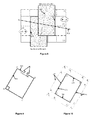
- One technique, among a set of techniques, for the case of discriminating between two Virtual Gantries is to construct a default boundary between the two facilities as the perpendicular bisector of the line connecting the midpoints of the gantry edges leading into the facilities.
- Lines 168 and 178 are natural default boundaries between the respective gantry pairs.
- decisions can be set up so that in comparing any pair of candidates, an automated decision can be taken when one of the pair passes all likelihood thresholds and the other passes none. In less certain circumstances, the decision could be mediated by a human.
- a Park Point may appear to be within the geofence of a single candidate facility, when in fact the associated vehicle did not park in said facility. For this reason, single-candidate cases, should still be processed using all likelihood calculations, testing the hypothesis that the said vehicle did not park in said facility. This would be done to avoid a false positive. In such cases, where there is any reasonable doubt, a human should mediate.
- any new entry of geofenced objects for a parking facility may not be perfectly placed or perfectly expanded for full optimization. It is possible to use information captured during a manual/visual decision to improve geofence object positioning, geofence object expansion, decision boundaries ( Figure 7 and Figure 8 ) or other thresholds relating to gantry crossing(s), NSV, and any other metric used in the likelihood analysis.
- one embodiment permits machine learning to improve the performance of this invention by nudging decision thresholds and parameters in the direction(s) indicated by human visual and manual intervention. This learning process will tend to settle on system threshold and parameter settings that will yield the best automated performance overall.
- the key to such training is to reduce the probability of sending an incomplete decision to a manual process without lowering charging performance - i.e., while retaining or improving the maximization of correct charging, and correct non-charging, and the minimization of missed recognition, and false positives.
- a Virtual Gantry has been described in this disclosure as a specially placed and manipulated rectangle.
- a Virtual Gantry can also be considered equivalently in terms of its four sides or edges.
- This invention includes both ways of describing and using Virtual Gantries - as a rectangle and as a set of four independent lines or gantry primitives that happen to form a rectangle.
- the rectangle may be collapsed to a single line placed along the entrance to a parking facility and the tests to determine crossing of the Virtual Gantry suitably simplified.
- one edge specifically represents the entrance to a parking facility and the two sides adjacent to that edge represent line gantries such that a vehicle would ideally cross one but not the other as it enters the related parking facility.
- the edge opposite the entrance edge is often not involved, however there are many facility entrance configurations, for example at the end of a street or long entrance ramp at an airport, such that a straight-in entry would ideally cross neither adjacent side of the rectangular Virtual Gantry, hence the gantry edge opposite the facility entrance edge can become an important primitive in such cases in particular.
- a Virtual Gantry as a closed rectangle defining an area, i.e., at least the width of the facility entrance multiplied by the distance from facility entrance to the sidewalk opposite (or a similar distance should there be no sidewalk)
- the reason for this is that the GPS signal process can make GPS positioning errors cause a vehicle to appear to jump from outside the gantry into a facility without appearing within the gantry.
- One way to resolve that is to widen the sides of the gantry adjacent to the entrance edge, or expand the entire rectangle.
- the sides of the Virtual Gantry can be considered line gantries (as described, e.g., in DE102006027676 and US20120265430 A1 , the disclosures of which are incorporated herein by reference) and can be employed to determine whether one or the other of the four lines have been crossed.
- this approach to defining Virtual Gantries permits subsequent calculations to determine whether a vehicle has entered a parking facility to proceed in either equivalent embodiment of the geometric expression of a Virtual Gantry.
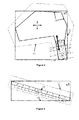
- a graphic-mapping tool can place a rectangle ABCD 181 and orient it such that its leading edge AB 182 is parallel to or coincident with the entrance edge of a parking facility.
- the length of AB would match closely the length of the entrance to the facility. From this single "super-primitive", a specifically oriented rectangle, it is possible to derive all virtual geo-form parking primitives except bounding polygons.
- AB 191 is the threshold of the entry gate to the facility.
- DC 192 is parallel to AB 191 and roughly at the sidewalk (or equivalent distance) on the opposite side of the street to the facility.
- ABCD 193 can be constructed inexpensively, for example but not only, on Google Maps or Google Earth with 3 clicks: A, B and anywhere on the line DC 192. From these three points and the right-angle constraint of a rectangle, the rectangular virtual gantry ABCD, as well as two virtual line gantries AD 194 and BC 195 are automatically established. The entire ABCD gantry 193 can be expanded as needed and the two line gantries can be moved to A 1 D 1 and B 1 C 1 or A 2 D 2 and B 2 C 2 or A 3 D 3 and B 3 C 3 : (1) automatically according to local urban canyon needs; (2) on the basis of automated feedback loops from training/correction procedures; and (3) manually, under special circumstances.
- the fundamental, regular ABCD construction can be used to derive all other virtual gantry primitives.
Landscapes
- Business, Economics & Management (AREA)
- Physics & Mathematics (AREA)
- General Physics & Mathematics (AREA)
- Finance (AREA)
- Engineering & Computer Science (AREA)
- Computer Networks & Wireless Communication (AREA)
- Accounting & Taxation (AREA)
- Strategic Management (AREA)
- General Business, Economics & Management (AREA)
- Theoretical Computer Science (AREA)
- Navigation (AREA)
Applications Claiming Priority (1)
| Application Number | Priority Date | Filing Date | Title |
|---|---|---|---|
| US201361767425P | 2013-02-21 | 2013-02-21 |
Publications (3)
| Publication Number | Publication Date |
|---|---|
| EP2770481A2 true EP2770481A2 (de) | 2014-08-27 |
| EP2770481A3 EP2770481A3 (de) | 2018-01-10 |
| EP2770481B1 EP2770481B1 (de) | 2020-11-18 |
Family
ID=50156608
Family Applications (1)
| Application Number | Title | Priority Date | Filing Date |
|---|---|---|---|
| EP14156200.9A Not-in-force EP2770481B1 (de) | 2013-02-21 | 2014-02-21 | Verfahren zur Verwendung virtueller Kranbrücken zur Optimierung der Ladeleistung für fahrzeuginterne Parksysteme |
Country Status (3)
| Country | Link |
|---|---|
| US (1) | US20140236686A1 (de) |
| EP (1) | EP2770481B1 (de) |
| CA (1) | CA2843287C (de) |
Families Citing this family (23)
| Publication number | Priority date | Publication date | Assignee | Title |
|---|---|---|---|---|
| US10068386B2 (en) | 2012-04-23 | 2018-09-04 | Transparent Wireless Systems, Llc | Methods and systems for electronic payment for parking in gated garages |
| US10096172B2 (en) | 2012-04-23 | 2018-10-09 | Transparent Wireless Systems, Llc | Methods and systems for electronic payment for on-street parking |
| US9123034B2 (en) | 2012-04-23 | 2015-09-01 | Transparent Wireless Systems, Llc | Methods and systems for electronic payment for parking using autonomous position sensing |
| NO336505B1 (no) * | 2013-12-20 | 2015-09-14 | Q Free Asa | Sonedeteksjon i et GNSS-system |
| US9922561B2 (en) * | 2014-02-20 | 2018-03-20 | MyPark, Corp. | Intelligent parking system |
| WO2016046831A1 (en) * | 2014-09-26 | 2016-03-31 | Natan Tomer | Methods and systems of managing parking space occupancy |
| JP6354542B2 (ja) * | 2014-11-26 | 2018-07-11 | 株式会社デンソー | 車両自動運転システム |
| US10621795B2 (en) | 2015-01-15 | 2020-04-14 | Applied Telemetrics Holdings Inc. | Method of autonomous lane identification for a multilane vehicle roadway |
| US10621794B2 (en) * | 2017-10-25 | 2020-04-14 | Pied Parker, Inc. | Systems and methods for wireless media device detection |
| DE102015209190A1 (de) * | 2015-05-20 | 2016-11-24 | Volkswagen Aktiengesellschaft | Verfahren zur nutzerdefinierten Bereitstellung eines Fahrzeugs |
| US10783506B2 (en) | 2015-08-28 | 2020-09-22 | Transparent Wireless Systems, Llc | Methods and systems for access control to secure facilities |
| JP6692209B2 (ja) * | 2016-05-11 | 2020-05-13 | 株式会社日立製作所 | 駐車管理システム及びその制御方法 |
| JP6589840B2 (ja) * | 2016-12-07 | 2019-10-16 | トヨタ自動車株式会社 | 運転支援装置 |
| DE102017220070A1 (de) * | 2017-11-10 | 2019-06-06 | Continental Teves Ag & Co. Ohg | Verfahren zur geographischen Zuordnung der Position eines Objekts zu einem virtuell festgelegten Bereich und Fahrzeugsystem |
| EP3815399B1 (de) * | 2018-06-29 | 2025-06-04 | Sensire Oy | Verfolgungssensoranordnung zur detektion einer verfolgungseinheit und vorrichtung und verfahren dafür |
| US10575134B2 (en) | 2018-07-20 | 2020-02-25 | Verizon Patent And Licensing Inc. | Dynamic virtual boundary methods and systems |
| US10847027B1 (en) * | 2018-10-31 | 2020-11-24 | United Services Automobile Association (Usaa) | Method and system for detecting use of garage |
| US11328596B2 (en) * | 2019-07-11 | 2022-05-10 | GM Global Technology Operations LLC | Parking prediction |
| US11430337B2 (en) | 2019-10-10 | 2022-08-30 | Caterpillar Inc. | Positioning system for paving machines |
| US11639168B2 (en) | 2019-11-27 | 2023-05-02 | Toyota Motor North America, Inc. | Systems and methods for automatic vehicle loading and unloading on vehicle transports |
| CN113507688A (zh) * | 2021-07-21 | 2021-10-15 | 广西盖德科技有限公司 | 定位数据与地理围栏构建的动态虚拟停车场方法及系统 |
| US12106666B2 (en) | 2021-11-23 | 2024-10-01 | Toyota Motor Engineering & Manufacturing North America, Inc. | Communicating information about parking space availability |
| US20250061440A1 (en) * | 2023-08-16 | 2025-02-20 | Aisin Corporation | In-vehicle payment system and method |
Citations (3)
| Publication number | Priority date | Publication date | Assignee | Title |
|---|---|---|---|---|
| US7215255B2 (en) | 2003-01-21 | 2007-05-08 | Bernard Grush | Method and apparatus for a satellite positioning-based metering system for use in transport-related applications |
| DE102006027676A1 (de) | 2006-06-14 | 2007-12-20 | Siemens Ag | Verfahren zur Fahrstreckenerkennung in einem Mautsystem |
| US20120265430A1 (en) | 2011-04-15 | 2012-10-18 | Kapsch Trafficcom Ag | Method for detecting a boundary crossing |
Family Cites Families (5)
| Publication number | Priority date | Publication date | Assignee | Title |
|---|---|---|---|---|
| KR20010034333A (ko) * | 1998-01-23 | 2001-04-25 | 와다 아끼히로 | 과금처리장치, 과금처리시스템, 및 과금처리용 카드 |
| GB9818745D0 (en) * | 1998-08-27 | 1998-10-21 | Northern Telecom Ltd | A cell radius estimation method |
| ES2399827T3 (es) * | 1998-10-09 | 2013-04-03 | Toyota Jidosha Kabushiki Kaisha | Dispositivo para el cargo de tarifas |
| CN101449306B (zh) * | 2006-03-21 | 2011-11-02 | 天米公司 | 隐私的和可审计的车辆定位系统及用于该系统的机载设备 |
| US9286733B2 (en) * | 2010-04-13 | 2016-03-15 | Locomobi Inc. | Location based systems for entry and exit |
-
2014
- 2014-02-19 CA CA2843287A patent/CA2843287C/en active Active
- 2014-02-21 EP EP14156200.9A patent/EP2770481B1/de not_active Not-in-force
- 2014-02-21 US US14/187,067 patent/US20140236686A1/en not_active Abandoned
Patent Citations (3)
| Publication number | Priority date | Publication date | Assignee | Title |
|---|---|---|---|---|
| US7215255B2 (en) | 2003-01-21 | 2007-05-08 | Bernard Grush | Method and apparatus for a satellite positioning-based metering system for use in transport-related applications |
| DE102006027676A1 (de) | 2006-06-14 | 2007-12-20 | Siemens Ag | Verfahren zur Fahrstreckenerkennung in einem Mautsystem |
| US20120265430A1 (en) | 2011-04-15 | 2012-10-18 | Kapsch Trafficcom Ag | Method for detecting a boundary crossing |
Non-Patent Citations (1)
| Title |
|---|
| "ISOITS 17444-1", 2012, article "Electronic fee collection - Charging performance - Part 1: Metrics" |
Also Published As
| Publication number | Publication date |
|---|---|
| CA2843287A1 (en) | 2014-08-21 |
| EP2770481A3 (de) | 2018-01-10 |
| CA2843287C (en) | 2021-02-23 |
| EP2770481B1 (de) | 2020-11-18 |
| US20140236686A1 (en) | 2014-08-21 |
Similar Documents
| Publication | Publication Date | Title |
|---|---|---|
| EP2770481B1 (de) | Verfahren zur Verwendung virtueller Kranbrücken zur Optimierung der Ladeleistung für fahrzeuginterne Parksysteme | |
| US20160209219A1 (en) | Method of autonomous lane identification for a multilane vehicle roadway | |
| KR101060320B1 (ko) | 사설, 감사가능 차량 위치결정 시스템 및 그를 위한 온-보드 유닛 | |
| US10621795B2 (en) | Method of autonomous lane identification for a multilane vehicle roadway | |
| US8587454B1 (en) | System and method for providing electronic toll collection to users of wireless mobile devices | |
| US7215255B2 (en) | Method and apparatus for a satellite positioning-based metering system for use in transport-related applications | |
| US9460429B2 (en) | GPS-based toll collection system and method | |
| US20090157566A1 (en) | Method and process to ensure that a vehicular travel path recording that includes positional errors can be used to determine a reliable and repeatable road user charge | |
| US20090312946A1 (en) | Travel history editing device | |
| US20190385449A1 (en) | System and method for providing automatic on-street parking control and unoccupied parking spot availability detection | |
| KR102073661B1 (ko) | 차량 분산 주차를 위한 주차안내 시스템 | |
| US20220020229A1 (en) | System and method for mobile toll calculation and payment | |
| KR20150065127A (ko) | 스마트폰 앱을 이용한 주차장 안내 시스템 및 방법 | |
| US20220349715A1 (en) | Vehicle location analysis method and navigation device | |
| Kumarage | Use of crowdsourced travel time data in traffic engineering applications | |
| CN117133145A (zh) | 基于lstm网络的泊车引导和反向寻车的系统及方法 | |
| CN101998383A (zh) | 无线网络讯号搜集与验证系统 | |
| WO2011158038A1 (en) | Tracking method | |
| US20230267516A1 (en) | System and method for providing customized toll pricing | |
| US20240142638A1 (en) | Vehicle location analysis method and navigation device | |
| EP2887326B1 (de) | Zonendetektion in einem GNSS-System | |
| KR20210035500A (ko) | 주차장 자동결제장치 및 그 장치의 구동방법 | |
| CN116450956B (zh) | 一种车辆出行轨迹获取方法、装置及电子设备 | |
| CN116092305A (zh) | 站点信息播报方法、服务器、车辆、路侧设备及系统 | |
| US9666001B2 (en) | Virtual gantry detection in a GNSS system |
Legal Events
| Date | Code | Title | Description |
|---|---|---|---|
| PUAI | Public reference made under article 153(3) epc to a published international application that has entered the european phase |
Free format text: ORIGINAL CODE: 0009012 |
|
| 17P | Request for examination filed |
Effective date: 20140221 |
|
| AK | Designated contracting states |
Kind code of ref document: A2 Designated state(s): AL AT BE BG CH CY CZ DE DK EE ES FI FR GB GR HR HU IE IS IT LI LT LU LV MC MK MT NL NO PL PT RO RS SE SI SK SM TR |
|
| AX | Request for extension of the european patent |
Extension state: BA ME |
|
| R17P | Request for examination filed (corrected) |
Effective date: 20150220 |
|
| RBV | Designated contracting states (corrected) |
Designated state(s): AL AT BE BG CH CY CZ DE DK EE ES FI FR GB GR HR HU IE IS IT LI LT LU LV MC MK MT NL NO PL PT RO RS SE SI SK SM TR |
|
| PUAL | Search report despatched |
Free format text: ORIGINAL CODE: 0009013 |
|
| AK | Designated contracting states |
Kind code of ref document: A3 Designated state(s): AL AT BE BG CH CY CZ DE DK EE ES FI FR GB GR HR HU IE IS IT LI LT LU LV MC MK MT NL NO PL PT RO RS SE SI SK SM TR |
|
| AX | Request for extension of the european patent |
Extension state: BA ME |
|
| RIC1 | Information provided on ipc code assigned before grant |
Ipc: G07B 15/02 20110101AFI20171204BHEP |
|
| GRAP | Despatch of communication of intention to grant a patent |
Free format text: ORIGINAL CODE: EPIDOSNIGR1 |
|
| STAA | Information on the status of an ep patent application or granted ep patent |
Free format text: STATUS: GRANT OF PATENT IS INTENDED |
|
| INTG | Intention to grant announced |
Effective date: 20200612 |
|
| GRAS | Grant fee paid |
Free format text: ORIGINAL CODE: EPIDOSNIGR3 |
|
| GRAA | (expected) grant |
Free format text: ORIGINAL CODE: 0009210 |
|
| STAA | Information on the status of an ep patent application or granted ep patent |
Free format text: STATUS: THE PATENT HAS BEEN GRANTED |
|
| AK | Designated contracting states |
Kind code of ref document: B1 Designated state(s): AL AT BE BG CH CY CZ DE DK EE ES FI FR GB GR HR HU IE IS IT LI LT LU LV MC MK MT NL NO PL PT RO RS SE SI SK SM TR |
|
| REG | Reference to a national code |
Ref country code: GB Ref legal event code: FG4D |
|
| REG | Reference to a national code |
Ref country code: CH Ref legal event code: EP |
|
| REG | Reference to a national code |
Ref country code: DE Ref legal event code: R096 Ref document number: 602014072410 Country of ref document: DE |
|
| REG | Reference to a national code |
Ref country code: IE Ref legal event code: FG4D |
|
| REG | Reference to a national code |
Ref country code: AT Ref legal event code: REF Ref document number: 1336608 Country of ref document: AT Kind code of ref document: T Effective date: 20201215 |
|
| REG | Reference to a national code |
Ref country code: AT Ref legal event code: MK05 Ref document number: 1336608 Country of ref document: AT Kind code of ref document: T Effective date: 20201118 |
|
| REG | Reference to a national code |
Ref country code: NL Ref legal event code: MP Effective date: 20201118 |
|
| PG25 | Lapsed in a contracting state [announced via postgrant information from national office to epo] |
Ref country code: RS Free format text: LAPSE BECAUSE OF FAILURE TO SUBMIT A TRANSLATION OF THE DESCRIPTION OR TO PAY THE FEE WITHIN THE PRESCRIBED TIME-LIMIT Effective date: 20201118 Ref country code: FI Free format text: LAPSE BECAUSE OF FAILURE TO SUBMIT A TRANSLATION OF THE DESCRIPTION OR TO PAY THE FEE WITHIN THE PRESCRIBED TIME-LIMIT Effective date: 20201118 Ref country code: PT Free format text: LAPSE BECAUSE OF FAILURE TO SUBMIT A TRANSLATION OF THE DESCRIPTION OR TO PAY THE FEE WITHIN THE PRESCRIBED TIME-LIMIT Effective date: 20210318 Ref country code: NO Free format text: LAPSE BECAUSE OF FAILURE TO SUBMIT A TRANSLATION OF THE DESCRIPTION OR TO PAY THE FEE WITHIN THE PRESCRIBED TIME-LIMIT Effective date: 20210218 Ref country code: GR Free format text: LAPSE BECAUSE OF FAILURE TO SUBMIT A TRANSLATION OF THE DESCRIPTION OR TO PAY THE FEE WITHIN THE PRESCRIBED TIME-LIMIT Effective date: 20210219 |
|
| PG25 | Lapsed in a contracting state [announced via postgrant information from national office to epo] |
Ref country code: IS Free format text: LAPSE BECAUSE OF FAILURE TO SUBMIT A TRANSLATION OF THE DESCRIPTION OR TO PAY THE FEE WITHIN THE PRESCRIBED TIME-LIMIT Effective date: 20210318 Ref country code: SE Free format text: LAPSE BECAUSE OF FAILURE TO SUBMIT A TRANSLATION OF THE DESCRIPTION OR TO PAY THE FEE WITHIN THE PRESCRIBED TIME-LIMIT Effective date: 20201118 Ref country code: LV Free format text: LAPSE BECAUSE OF FAILURE TO SUBMIT A TRANSLATION OF THE DESCRIPTION OR TO PAY THE FEE WITHIN THE PRESCRIBED TIME-LIMIT Effective date: 20201118 Ref country code: PL Free format text: LAPSE BECAUSE OF FAILURE TO SUBMIT A TRANSLATION OF THE DESCRIPTION OR TO PAY THE FEE WITHIN THE PRESCRIBED TIME-LIMIT Effective date: 20201118 Ref country code: AT Free format text: LAPSE BECAUSE OF FAILURE TO SUBMIT A TRANSLATION OF THE DESCRIPTION OR TO PAY THE FEE WITHIN THE PRESCRIBED TIME-LIMIT Effective date: 20201118 Ref country code: BG Free format text: LAPSE BECAUSE OF FAILURE TO SUBMIT A TRANSLATION OF THE DESCRIPTION OR TO PAY THE FEE WITHIN THE PRESCRIBED TIME-LIMIT Effective date: 20210218 |
|
| REG | Reference to a national code |
Ref country code: LT Ref legal event code: MG9D |
|
| PG25 | Lapsed in a contracting state [announced via postgrant information from national office to epo] |
Ref country code: HR Free format text: LAPSE BECAUSE OF FAILURE TO SUBMIT A TRANSLATION OF THE DESCRIPTION OR TO PAY THE FEE WITHIN THE PRESCRIBED TIME-LIMIT Effective date: 20201118 |
|
| PG25 | Lapsed in a contracting state [announced via postgrant information from national office to epo] |
Ref country code: RO Free format text: LAPSE BECAUSE OF FAILURE TO SUBMIT A TRANSLATION OF THE DESCRIPTION OR TO PAY THE FEE WITHIN THE PRESCRIBED TIME-LIMIT Effective date: 20201118 Ref country code: SK Free format text: LAPSE BECAUSE OF FAILURE TO SUBMIT A TRANSLATION OF THE DESCRIPTION OR TO PAY THE FEE WITHIN THE PRESCRIBED TIME-LIMIT Effective date: 20201118 Ref country code: LT Free format text: LAPSE BECAUSE OF FAILURE TO SUBMIT A TRANSLATION OF THE DESCRIPTION OR TO PAY THE FEE WITHIN THE PRESCRIBED TIME-LIMIT Effective date: 20201118 Ref country code: SM Free format text: LAPSE BECAUSE OF FAILURE TO SUBMIT A TRANSLATION OF THE DESCRIPTION OR TO PAY THE FEE WITHIN THE PRESCRIBED TIME-LIMIT Effective date: 20201118 Ref country code: CZ Free format text: LAPSE BECAUSE OF FAILURE TO SUBMIT A TRANSLATION OF THE DESCRIPTION OR TO PAY THE FEE WITHIN THE PRESCRIBED TIME-LIMIT Effective date: 20201118 Ref country code: EE Free format text: LAPSE BECAUSE OF FAILURE TO SUBMIT A TRANSLATION OF THE DESCRIPTION OR TO PAY THE FEE WITHIN THE PRESCRIBED TIME-LIMIT Effective date: 20201118 |
|
| REG | Reference to a national code |
Ref country code: DE Ref legal event code: R097 Ref document number: 602014072410 Country of ref document: DE |
|
| PG25 | Lapsed in a contracting state [announced via postgrant information from national office to epo] |
Ref country code: DK Free format text: LAPSE BECAUSE OF FAILURE TO SUBMIT A TRANSLATION OF THE DESCRIPTION OR TO PAY THE FEE WITHIN THE PRESCRIBED TIME-LIMIT Effective date: 20201118 |
|
| PLBE | No opposition filed within time limit |
Free format text: ORIGINAL CODE: 0009261 |
|
| STAA | Information on the status of an ep patent application or granted ep patent |
Free format text: STATUS: NO OPPOSITION FILED WITHIN TIME LIMIT |
|
| PG25 | Lapsed in a contracting state [announced via postgrant information from national office to epo] |
Ref country code: MC Free format text: LAPSE BECAUSE OF FAILURE TO SUBMIT A TRANSLATION OF THE DESCRIPTION OR TO PAY THE FEE WITHIN THE PRESCRIBED TIME-LIMIT Effective date: 20201118 |
|
| 26N | No opposition filed |
Effective date: 20210819 |
|
| REG | Reference to a national code |
Ref country code: BE Ref legal event code: MM Effective date: 20210228 |
|
| PG25 | Lapsed in a contracting state [announced via postgrant information from national office to epo] |
Ref country code: IT Free format text: LAPSE BECAUSE OF FAILURE TO SUBMIT A TRANSLATION OF THE DESCRIPTION OR TO PAY THE FEE WITHIN THE PRESCRIBED TIME-LIMIT Effective date: 20201118 Ref country code: LU Free format text: LAPSE BECAUSE OF NON-PAYMENT OF DUE FEES Effective date: 20210221 Ref country code: NL Free format text: LAPSE BECAUSE OF FAILURE TO SUBMIT A TRANSLATION OF THE DESCRIPTION OR TO PAY THE FEE WITHIN THE PRESCRIBED TIME-LIMIT Effective date: 20201118 Ref country code: LI Free format text: LAPSE BECAUSE OF NON-PAYMENT OF DUE FEES Effective date: 20210228 Ref country code: CH Free format text: LAPSE BECAUSE OF NON-PAYMENT OF DUE FEES Effective date: 20210228 Ref country code: AL Free format text: LAPSE BECAUSE OF FAILURE TO SUBMIT A TRANSLATION OF THE DESCRIPTION OR TO PAY THE FEE WITHIN THE PRESCRIBED TIME-LIMIT Effective date: 20201118 |
|
| PG25 | Lapsed in a contracting state [announced via postgrant information from national office to epo] |
Ref country code: ES Free format text: LAPSE BECAUSE OF FAILURE TO SUBMIT A TRANSLATION OF THE DESCRIPTION OR TO PAY THE FEE WITHIN THE PRESCRIBED TIME-LIMIT Effective date: 20201118 Ref country code: SI Free format text: LAPSE BECAUSE OF FAILURE TO SUBMIT A TRANSLATION OF THE DESCRIPTION OR TO PAY THE FEE WITHIN THE PRESCRIBED TIME-LIMIT Effective date: 20201118 |
|
| PG25 | Lapsed in a contracting state [announced via postgrant information from national office to epo] |
Ref country code: IE Free format text: LAPSE BECAUSE OF NON-PAYMENT OF DUE FEES Effective date: 20210221 |
|
| PG25 | Lapsed in a contracting state [announced via postgrant information from national office to epo] |
Ref country code: IS Free format text: LAPSE BECAUSE OF FAILURE TO SUBMIT A TRANSLATION OF THE DESCRIPTION OR TO PAY THE FEE WITHIN THE PRESCRIBED TIME-LIMIT Effective date: 20210318 |
|
| PG25 | Lapsed in a contracting state [announced via postgrant information from national office to epo] |
Ref country code: BE Free format text: LAPSE BECAUSE OF NON-PAYMENT OF DUE FEES Effective date: 20210228 |
|
| PGFP | Annual fee paid to national office [announced via postgrant information from national office to epo] |
Ref country code: FR Payment date: 20230131 Year of fee payment: 10 |
|
| PG25 | Lapsed in a contracting state [announced via postgrant information from national office to epo] |
Ref country code: HU Free format text: LAPSE BECAUSE OF FAILURE TO SUBMIT A TRANSLATION OF THE DESCRIPTION OR TO PAY THE FEE WITHIN THE PRESCRIBED TIME-LIMIT; INVALID AB INITIO Effective date: 20140221 |
|
| PGFP | Annual fee paid to national office [announced via postgrant information from national office to epo] |
Ref country code: GB Payment date: 20230130 Year of fee payment: 10 Ref country code: DE Payment date: 20230201 Year of fee payment: 10 |
|
| PG25 | Lapsed in a contracting state [announced via postgrant information from national office to epo] |
Ref country code: CY Free format text: LAPSE BECAUSE OF FAILURE TO SUBMIT A TRANSLATION OF THE DESCRIPTION OR TO PAY THE FEE WITHIN THE PRESCRIBED TIME-LIMIT Effective date: 20201118 |
|
| PG25 | Lapsed in a contracting state [announced via postgrant information from national office to epo] |
Ref country code: MK Free format text: LAPSE BECAUSE OF FAILURE TO SUBMIT A TRANSLATION OF THE DESCRIPTION OR TO PAY THE FEE WITHIN THE PRESCRIBED TIME-LIMIT Effective date: 20201118 |
|
| PG25 | Lapsed in a contracting state [announced via postgrant information from national office to epo] |
Ref country code: TR Free format text: LAPSE BECAUSE OF FAILURE TO SUBMIT A TRANSLATION OF THE DESCRIPTION OR TO PAY THE FEE WITHIN THE PRESCRIBED TIME-LIMIT Effective date: 20201118 |
|
| REG | Reference to a national code |
Ref country code: DE Ref legal event code: R119 Ref document number: 602014072410 Country of ref document: DE |
|
| PG25 | Lapsed in a contracting state [announced via postgrant information from national office to epo] |
Ref country code: MT Free format text: LAPSE BECAUSE OF FAILURE TO SUBMIT A TRANSLATION OF THE DESCRIPTION OR TO PAY THE FEE WITHIN THE PRESCRIBED TIME-LIMIT Effective date: 20201118 |
|
| GBPC | Gb: european patent ceased through non-payment of renewal fee |
Effective date: 20240221 |
|
| PG25 | Lapsed in a contracting state [announced via postgrant information from national office to epo] |
Ref country code: DE Free format text: LAPSE BECAUSE OF NON-PAYMENT OF DUE FEES Effective date: 20240903 |
|
| PG25 | Lapsed in a contracting state [announced via postgrant information from national office to epo] |
Ref country code: GB Free format text: LAPSE BECAUSE OF NON-PAYMENT OF DUE FEES Effective date: 20240221 |
|
| PG25 | Lapsed in a contracting state [announced via postgrant information from national office to epo] |
Ref country code: FR Free format text: LAPSE BECAUSE OF NON-PAYMENT OF DUE FEES Effective date: 20240229 |
|
| PG25 | Lapsed in a contracting state [announced via postgrant information from national office to epo] |
Ref country code: GB Free format text: LAPSE BECAUSE OF NON-PAYMENT OF DUE FEES Effective date: 20240221 Ref country code: FR Free format text: LAPSE BECAUSE OF NON-PAYMENT OF DUE FEES Effective date: 20240229 Ref country code: DE Free format text: LAPSE BECAUSE OF NON-PAYMENT OF DUE FEES Effective date: 20240903 |