EP2551640A1 - Dispositif et procédé pour obtenir des informations d'itinéraire, programme et support d'enregistrement d'information - Google Patents
Dispositif et procédé pour obtenir des informations d'itinéraire, programme et support d'enregistrement d'information Download PDFInfo
- Publication number
- EP2551640A1 EP2551640A1 EP11856882A EP11856882A EP2551640A1 EP 2551640 A1 EP2551640 A1 EP 2551640A1 EP 11856882 A EP11856882 A EP 11856882A EP 11856882 A EP11856882 A EP 11856882A EP 2551640 A1 EP2551640 A1 EP 2551640A1
- Authority
- EP
- European Patent Office
- Prior art keywords
- route
- user
- information
- routes
- undulation
- Prior art date
- Legal status (The legal status is an assumption and is not a legal conclusion. Google has not performed a legal analysis and makes no representation as to the accuracy of the status listed.)
- Granted
Links
- 238000000034 method Methods 0.000 title claims description 15
- 238000012876 topography Methods 0.000 claims abstract description 25
- 238000004364 calculation method Methods 0.000 description 25
- 238000010586 diagram Methods 0.000 description 18
- 230000006870 function Effects 0.000 description 9
- 238000013500 data storage Methods 0.000 description 8
- 230000007613 environmental effect Effects 0.000 description 7
- 230000001174 ascending effect Effects 0.000 description 3
- 238000004891 communication Methods 0.000 description 3
- 230000004044 response Effects 0.000 description 3
- 230000005540 biological transmission Effects 0.000 description 2
- 235000014510 cooky Nutrition 0.000 description 2
- 230000007423 decrease Effects 0.000 description 2
- 230000037396 body weight Effects 0.000 description 1
- 230000000994 depressogenic effect Effects 0.000 description 1
- 230000000694 effects Effects 0.000 description 1
- 239000004973 liquid crystal related substance Substances 0.000 description 1
- 230000003287 optical effect Effects 0.000 description 1
Images


Classifications
-
- G—PHYSICS
- G01—MEASURING; TESTING
- G01C—MEASURING DISTANCES, LEVELS OR BEARINGS; SURVEYING; NAVIGATION; GYROSCOPIC INSTRUMENTS; PHOTOGRAMMETRY OR VIDEOGRAMMETRY
- G01C21/00—Navigation; Navigational instruments not provided for in groups G01C1/00 - G01C19/00
- G01C21/26—Navigation; Navigational instruments not provided for in groups G01C1/00 - G01C19/00 specially adapted for navigation in a road network
- G01C21/34—Route searching; Route guidance
- G01C21/3453—Special cost functions, i.e. other than distance or default speed limit of road segments
- G01C21/3484—Personalized, e.g. from learned user behaviour or user-defined profiles
-
- G—PHYSICS
- G01—MEASURING; TESTING
- G01C—MEASURING DISTANCES, LEVELS OR BEARINGS; SURVEYING; NAVIGATION; GYROSCOPIC INSTRUMENTS; PHOTOGRAMMETRY OR VIDEOGRAMMETRY
- G01C21/00—Navigation; Navigational instruments not provided for in groups G01C1/00 - G01C19/00
- G01C21/26—Navigation; Navigational instruments not provided for in groups G01C1/00 - G01C19/00 specially adapted for navigation in a road network
- G01C21/34—Route searching; Route guidance
- G01C21/36—Input/output arrangements for on-board computers
- G01C21/3667—Display of a road map
- G01C21/3676—Overview of the route on the road map
-
- G—PHYSICS
- G01—MEASURING; TESTING
- G01C—MEASURING DISTANCES, LEVELS OR BEARINGS; SURVEYING; NAVIGATION; GYROSCOPIC INSTRUMENTS; PHOTOGRAMMETRY OR VIDEOGRAMMETRY
- G01C21/00—Navigation; Navigational instruments not provided for in groups G01C1/00 - G01C19/00
- G01C21/38—Electronic maps specially adapted for navigation; Updating thereof
- G01C21/3885—Transmission of map data to client devices; Reception of map data by client devices
- G01C21/3896—Transmission of map data from central databases
-
- G—PHYSICS
- G08—SIGNALLING
- G08G—TRAFFIC CONTROL SYSTEMS
- G08G1/00—Traffic control systems for road vehicles
- G08G1/005—Traffic control systems for road vehicles including pedestrian guidance indicator
-
- G—PHYSICS
- G08—SIGNALLING
- G08G—TRAFFIC CONTROL SYSTEMS
- G08G1/00—Traffic control systems for road vehicles
- G08G1/09—Arrangements for giving variable traffic instructions
- G08G1/0962—Arrangements for giving variable traffic instructions having an indicator mounted inside the vehicle, e.g. giving voice messages
- G08G1/0968—Systems involving transmission of navigation instructions to the vehicle
- G08G1/096805—Systems involving transmission of navigation instructions to the vehicle where the transmitted instructions are used to compute a route
- G08G1/096811—Systems involving transmission of navigation instructions to the vehicle where the transmitted instructions are used to compute a route where the route is computed offboard
- G08G1/096816—Systems involving transmission of navigation instructions to the vehicle where the transmitted instructions are used to compute a route where the route is computed offboard where the complete route is transmitted to the vehicle at once
-
- G—PHYSICS
- G08—SIGNALLING
- G08G—TRAFFIC CONTROL SYSTEMS
- G08G1/00—Traffic control systems for road vehicles
- G08G1/09—Arrangements for giving variable traffic instructions
- G08G1/0962—Arrangements for giving variable traffic instructions having an indicator mounted inside the vehicle, e.g. giving voice messages
- G08G1/0968—Systems involving transmission of navigation instructions to the vehicle
- G08G1/096833—Systems involving transmission of navigation instructions to the vehicle where different aspects are considered when computing the route
- G08G1/096838—Systems involving transmission of navigation instructions to the vehicle where different aspects are considered when computing the route where the user preferences are taken into account or the user selects one route out of a plurality
Definitions
- the present invention relates to a route information providing device, a route information providing method, a program, and an information recording medium.
- the present invention has been made in view of the above-mentioned problem and has an object to provide a route information providing device, a route information providing method, a program, and an information recording medium, which enable a user to intuitively recognize labor of traveling on a route.
- a route information providing device including: means for storing map data including an undulation of an actual topography; means for storing information on first routes each containing one or more routes from a point, as a start point, corresponding to information on a user in the map data, to apluralityof predetermined points in a region containing the point corresponding to the information on the user in the map data, in association with identification information on the user; determination means for determining a second route from a start point to an end point specified based on a request from the user; comparison means for directly or indirectly comparing a length of the second route and an undulation on the second route, and a length of each of the first routes and an undulation on each of the first routes with each other in the map data; and information providing means for providing the user with information on a comparison result by the comparison means.
- a route information providing device including: means for storing map data including an undulation of an actual topography; acquisition means for acquiring information on first routes each containing one or more routes from a point, as a start point, corresponding to information on a user in the map data, to a plurality of predetermined points in a region containing the point corresponding to the information on the user in the map data; determination means for determining a second route from a start point to an end point specified based on a request from the user; comparison means for directly or indirectly comparing a length of the second route and an undulation on the second route, and a length of each of the first routes and an undulation on each of the first routes with each other in the map data; and information providing means for providing the user with information on a comparison result by the comparison means.
- the acquisition means acquires information on the first routes within a predetermined range with the point corresponding to the information on the user being the start point and the length of the second route being a reference.
- the comparison means performs any comparison selected from a comparison between travel difficulties each determined based on a length of a route and an undulation on the route with each other, a comparison between lengths each obtained by correcting the length of the route based on the undulation on the route with each other, and a comparison between travel difficulties each determined based on a length obtained by correcting the length of the route based on the undulation on the route and the undulation on the route with each other.
- the route information providing device further includes selection means for selecting, as a reference route, a first route closest to the second route in travel difficulty when the comparison means compares travel difficulties each determined based on a length of a route and an undulation on the route with each other, or travel difficulties each determined based on a length obtained by correcting the length of the route based on the undulation on the route and the undulation on the route with each other, or in length when the comparison means compares lengths each obtained by correcting the length of the route based on the undulation on the route with each other, and the information providing means provides the user with information on the reference route selected by the selectionmeans as the information based on the comparison result by the comparison means.
- the selection means selects, as the reference route, a route closest in topography, out of the plurality of first routes, when the comparison means compares the travel difficulties each obtained based on the length of the route and the undulation on the route with each other, or the travel difficulties each obtained based on the length obtained by correcting the length of the route based on the undulation on the route and the undulation on the route with each other.
- the respective travel difficulties of the first route and the second route are calculated with the length of each of the first route and the second route, the undulation of each of the first route and the second route, and a load corresponding to an object contained in each of the first route and the second route being considered as parameters.
- the travel difficulty of the second route is calculated so as to have a larger value when it is determined that an environment of the second route is not an environment usually experienced by the user than a value calculated when it is determined that the environment of the second route is the environment usually experienced by the user.
- the one or more routes contained in the plurality of first routes respectively contain one or more via points
- the comparison means is capable of setting a via point contained in each of the first routes as an end point of the first route thereby forming a new first route.
- the comparison means determines a correlation between curves respectively representing the first route and the second route when the comparison means directly compares the first route and the second route, and compares characteristic quantities based on topographies of the first route and the second route when the comparison means indirectly compares the first route and the second route.
- a route information providing method for a route information providing device including: means for storing map data including an undulation of an actual topography; and means for storing information on first routes each containing one or more routes from a point, as a start point, corresponding to information on a user in the map data, to a plurality of predetermined points in a region containing the point corresponding to the information on the user in the map data, in association with identification information on the user, the route information providing method including: a determination step of determining a second route from a start point to an end point specified based on a request from the user; a comparison step of directly or indirectly comparing a length of the second route and an undulation on the second route, and a length of each of the first routes and an undulation on each of the first routes with each other in the map data; and an information providing step of providing the user with information on a comparison result of the comparison step.
- a route information providing method for a route information providing device including means for storing map data including an undulation of an actual topography
- the route information providing method including: an acquisition step of acquiring information on first routes each containing one or more routes from a point, as a start point, corresponding to information on a user in the map data, to a plurality of predetermined points in a region containing the point corresponding to the information on the user in the map data; a determination step of determining a second route from a start point to an endpoint specifiedbased on a request from the user; a comparison step of directly or indirectly comparing a length of the second route and an undulation on the second route, and a length of each of the first routes and an undulation on each of the first routes with each other in the map data; and an information providing step for providing the user with information on a comparison result of the comparison step.
- a program for controlling a computer including: means for storing map data including an undulation of an actual topography; and means for storing information on first routes each containing one or more routes from a point, as a start point, corresponding to information on a user in the map data, to a plurality of predetermined points in a region containing the point corresponding to the information on the user in the map data, in association with identification information on the user, the program controlling the computer to function as: determination means for determining a second route from a start point to an end point specified based on a request from the user; comparison means for directly or indirectly comparing a length of the second route and an undulation on the second route, and a length of each of the first routes and an undulation on each of the first routes with each other in the map data; and information providing means for providing the user with information on a comparison result by the comparison means.
- a program for controlling a computer including means for storing map data including an undulation of an actual topography
- the program controlling the computer to function as: acquisition means for acquiring information on first routes each containing one or more routes from a point, as a start point, corresponding to information on a user, to a plurality of predetermined points in a region containing the point corresponding to the information on the user in the map data; determination means for determining a second route from a start point to an end point specified based on a request from the user; comparisonmeans for directly or indirectly comparing a length of the second route and an undulation on the second route, and a length of each of the first routes and an undulation on each of the first routes with each other in the map data; and information providing means for providing the user with information on a comparison result of the comparison means.
- an information recording medium having a program for controlling a computer recorded thereon, the computer including: means for storing map data including an undulation of an actual topography; and means for storing information on first routes each containing one or more routes from a point, as a start point, corresponding to information on a user in the map data, to a plurality of predetermined points in a region containing the point corresponding to the information on the user in the map data, in association with identification information on the user, the program controlling the computer to function as: determination means for determining a second route from a start point to an end point specified based on a request from the user; comparison means for directly or indirectly comparing a length of the second route and an undulation on the second route, and a length of each of the first routes and an undulation on each of the first routes with each other in the map data; and information providing means for providing the user with information on a comparison result by the comparison means.
- an information recording medium having a program for controlling a computer recorded thereon, the computer including means for storing map data including an undulation of an actual topography, the program controlling the computer to function as: acquisition means for acquiring information on first routes each containing one or more routes from a point, as a start point, corresponding to information on a user, to a plurality of predetermined points in a region containing the point corresponding to the information on the user in the map data; determination means for determining a second route from a start point to an end point specified based on a request from the user; comparison means for directly or indirectly comparing a length of the second route and an undulation on the second route, and a length of each of the first routes and an undulation on each of the first routes with each other in the map data; and information providing means for providing the user with information on a comparison result of the comparison means.
- the user may be made to intuitively recognize labor of traveling on a route.
- FIG. 1 illustrates a system configuration diagram of a map information providing system 1 according to this embodiment.
- the map information providing system 1 includes a user terminal 20 and a map information providing server 10, and the user terminal 20 and the map information providing server 10 are connected to each other via a network 5 such as the Internet so as to be able to mutually communicating data.
- a network 5 such as the Internet
- the user terminal 20 is a computer operated by a user such as a personal computer and a mobile terminal.
- the user terminal 20 makes an access to the map information providing server 10 in accordance with a program such as a Web browser in response to an operation of the user, and receives map information from the accessed map information providing server 10. Then, the user terminal 20 displays the received map information on a display device such as a liquid crystal display.
- the map information providing server 10 is a computer for generating map information containing route information connecting a point and another point with each other on a map in response to the request from the user terminal 20, and then providing the user terminal 20 with the map information.
- FIG. 2 is a functional block diagram illustrating an example of functions provided for the map information providing server 10 according to this embodiment.
- the map information providing server 10 includes a user information storage module 100, an authentication module 102, a map data storage module 104, a user route data reception module 106, a route determination module 108, a travel difficulty calculation module 110, a user route data storage module 112, a subject route data reception module 114, a reference user route selection module 116, a route comparison module 118, a route display data generation module 120, and a route display data transmission module 122.
- a function of each of the above-mentioned modules provided for the map information providing server 10 may be realized by a computer, which includes hardware such as control means such as a CPU, storage means such as a memory, and communication means such as a communication interface for transmitting/receiving data to/from external devices, reading a program stored in a computer-readable information storage medium and executing the program.
- the program may be supplied to the map information providing server 10 via an information storage medium such as an optical disc, a magnetic disk, a magneto-optical disk, a flash memory, or supplied to the map information providing server 10 via a data communication network such as the Internet.
- the user information storage module 100 stores authentication information and various types of attribute information on each of the users.
- the authentication information may be a combination of a user ID for identifying a user, and a password
- the attribute information may include various types of information such as an address, a name, and a date of birth of the user.
- the authentication module 102 carries out user authentication based on the authentication information received from the user terminal 20. For example, the authentication module 102 may carry out the authentication based on whether or not a combination of a user ID and a password received from the user terminal 20 coincides with a combination of the user ID and the password stored in the user information storage module 100.
- the map information providing server 10 may provide an authenticated user terminal 20 with a cookie representing a successful authentication, and may carry out subsequent authentication based on the cookie received from the user terminal 20.
- the map data storage module 104 stores map data containing undulations of actual topographies.
- the map data may contain information representing a location of a specific point or region in a predetermined space, and information associated with this information.
- a location indicated on the map data may include information on a latitude, a longitude, and an elevation (or information corresponding thereto).
- the map data may contain location information and attribute information on each map object such as a road, a traffic light, a building, a park, a store, a residence, and a station.
- the attribute information may contain information on a type, a name, an address, and the like of the map object.
- the user route data reception module 106 receives route specification data specifying a route to be registered from the user terminal 20 operated by the user authenticated by the authentication module 102 while the route specification data is associated with the user.
- the route specification data received by the user route data receptionmodule 106 maybe information on a start point and an end point on a map, may contain information on a start point, an end point, and via points which are passed therebetween, or may be information on a route specified on the map by the user by means of an input device such as a pointing device.
- each point of the start point, the end point, and the via points may be an arbitrary point on a map, or an obj ect identified by an address, a name, or the like.
- the user route data reception module 106 may receive a search query such as "from AAA (name of a start point) to BBB (name of an end point) as the route specification data.
- the route determination module 108 searches for and determines a route connecting the specified plurality of points on the map. For example, the route determination module 108 searches for, based on the route data received by the user route data reception module 106, a route on the map connecting the start point and the end point (as well as the via points) represented by the route data.
- the route search may be carried out by searching for a route satisfying predetermined conditions out of routes from the start point to the end point.
- the predetermined conditions may include one or a plurality of combined various conditions such as a condition that a length of a route is minimum, a condition that a travel time of traveling on a route is minimum, and a condition that a travel difficulty (travel difficulty is described later) of a route is minimum.
- the travel difficulty calculation module 110 calculates a travel difficulty representing a difficulty for traveling from a start point to a given point (such as an end point) on a route.
- the travel difficulty may be a numerical value calculated based on the length of the route and an undulation on the route in the map data, or may be a level determined corresponding to the calculated numerical value.
- a range of belonging numerical values may be determined in advance for each of the levels.
- the travel difficulty relating to a route is calculated, in addition to the undulation on the route and the length of the route, parameters such as a season, weather, an atmospheric temperature, a humidity, presence/absence of objects existing on the route such as a stairs, a railroad crossing, a traffic light, an underground passage, and an overpass, and a road surface state may be used, for example.
- the undulation of a route may be represented by an inclination (angle) or a difference in elevation between arbitrary two points contained in the route.
- the length of a route is a length of the route in a space, namely, a length determined by correcting the length of the route based on the undulation on the route, but a route length represented on a flat map may be used as the length of a route.
- the travel difficulty calculation module 110 may also calculate a travel difficulty up to a via point which is passed between the start point and the end point of a specified route. A description is now given of a specific example of the travel difficulty calculated by the travel difficulty calculation module 110.
- the travel difficulty calculation module 110 may calculate the travel difficulty of a route, for example, based on a quantity of physical work required for traveling on the route from the start point to the end point. For example, the travel difficulty calculation module 110 may divide the route into a plurality of portions, may calculate a partial travel difficulty for each of the portions, and may calculate the travel difficulty by summing the calculated partial travel difficulties. The division of the route may be carried out at least at locations of via points set on the route, and if the number of divisions of the portions is infinite, the travel difficulty of the route theoretically coincides with the physical work required for traveling on the route. A description is now given of an example of the calculation of the partial travel difficulty.
- FIG. 3 is a diagram for describing a calculation example of the partial travel difficulty.
- two points extracted from a certain route are a point A and a point B, and coordinates of the respective points in a Cartesian coordinate system are represented as the point A(X1,Y1,H1) and the point B(X2,Y2,H2).
- F denotes a force
- d denotes a travel distance
- F( ⁇ ) may be determined corresponding to an angle ⁇ from the point A to the point B.
- FIG. 4 is a table showing an example of values of F corresponding to the angle ⁇ .
- a value of F may be set in advance for each of the ranges of the angle ⁇ , and a positive ⁇ corresponds to an ascending slope, a zero ⁇ corresponds to a flat road, and a negative ⁇ corresponds to a descending slope.
- F when the angle ⁇ is within a range of 0 to 1 degree, F may be minimum, and F may increase as the angle ⁇ increases or decreases from the range of 0 to 1 degree.
- an increase rate to be used when F increases as the angle ⁇ increases from the range of 0 to 1 degree may be higher than an increase rate to be used when F increases as the angle ⁇ decreases from the range of 0 to 1 degree.
- the user route data storage module 112 stores information on a route (first route) determined based on the route specification data received from the user route data reception module 106 for each of the users. According to this embodiment, the user route data storage module 112 stores the route data while the route data is associated with the user ID, and the route data contains information on the start point, the via points, and the end point, and the travel difficulties required for traveling up to the respective points calculated by the travel difficulty calculation module 110.
- FIG. 5 shows an example of a user route table stored in the user route data storage module 112.
- the user route table stores route data containing route IDs identifying routes, and start points, via points, and end points of the routes, which are associated with user IDs.
- route data containing route IDs identifying routes, and start points, via points, and end points of the routes, which are associated with user IDs.
- information on the start points, via points, and end points contains coordinates of each of the points, a travel difficulty up to each of the points, and attribute information (type of the point and the like) on each of the points.
- the subject route data reception module 114 receives subject route specification data from the user terminal 20 operated by the user authenticated by the authentication module 102.
- the route specification data received by the subject route data reception module 114 may be information on a start point and an end point on a map, may contain information on a start point, an end point, and via points which are passed therebetween, or may be information on a route specified on the map by the user by means of an input device such as a pointing device.
- each point of the start point, the end point, and the via points may be an arbitrary point on a map, or an object identified by an address, a name, or the like.
- the subject route data reception module 114 may receive a search query such as "from AAA (name of a start point) to BBB (name of an endpoint) " as the route specification data.
- the route determination module 108 searches for, based on the route specification data received by the subj ect route data reception module 114, a route (subject route) on the map connecting the start point and the end point (as well as the via points) represented by the route specification data.
- the travel difficulty calculation module 110 calculates the travel difficulty representing a difficulty in traveling from the start point to the end point on the subject route (second route) determined by the route determination module108.
- a specific example of the calculation method for the travel difficulty is as described above.
- the reference user route selection module 116 directly or indirectly compares the length of the subj ect route and the undulation on the subject route, and the length of each of the user routes and the undulation on each of the user routes with each other in the map data, and selects a user route considered as a reference (reference user route) from the user routes based on the comparison result.
- the direct comparison between the subject route and the user route means direct comparison between respective topographies themselves of the subject route and user route, and, for example, the reference user route selection module 116 may calculate a correlation value between curves representing the subject route and the user route, which is determined when the start points of the subject route and the user route are matched with each other, and may select a user route having the maximum correlation value as the reference user route.
- the reference user route selection module 116 generates the curves representing the respective routes of the subj ect route and the user route by including recesses and protrusions corresponding to the type and the location of each of objects such as stairs, a traffic light, or a railroad crossing, and a frequency component corresponding to a state of a road surface (such as presence/absence of pavement) (for example, by superimposing a high-frequency noise in a case of an unpaved road, and without superimposing a noise component in a case of a paved road).
- the indirect comparison between the subject route and the user route means a comparison between numerical values and levels representing respective routes calculated from characteristic quantities relating to the respective topographies of the subject route and the user route, and, for example, the reference user route selection module 116 may compare the travel difficulties calculated respectively for the subject route and the user route, and may select a user route having the closest travel difficulty as the reference user route.
- the reference user route selection module 116 selects the user route to be used as the reference (reference user route) out of the user route group based on the travel difficulty calculated for the subject route determined based on the data received from the user and the travel difficulties calculated for the respective user routes which are contained in the user route group and are registered while the travel difficulties are associated with the user.
- the user route group may be the route data stored in the user route data storage module 112 while the route data is associated with the user ID for identifying the user relating to the subject route data received by the subject route data reception module 114.
- a description is now given of an example of selecting the reference user route by the reference user route selection module 116.
- the reference user route selection module 116 may select a user route closest in the travel difficulty to the subject route as the reference user route out of the user routes contained in the user route group. Pieces of data both calculated by using the same parameter may be used for the travel difficulty of the user route and the travel difficulty of the subject route to be used for selecting the reference user route. Moreover, the reference user route may be selected from user routes, the travel difficulty of which is equal to or more than the travel difficulty of the subject route, out of the user routes contained in the user route group.
- a user route closest in an index representing the topography of the route such as the average value or variance value of a gradient to the subject route may be selected as the reference user route.
- the reference user route selection module 116 may select a user route, the travel difficulty of which is an integer multiple of the travel difficulty of the subject route, as the reference user route out of the user routes contained in the user route group.
- the reference user route selection module 116 may select a user route closest in a travel difficulty up to an intermediate via point to the subject route as the reference user route out of the user routes contained in the user route group. Specifically, the reference user route selection module 116 may search the user route table stored in the user route data storage module 112 using the travel difficulty of the subject route as a key, thereby identifying a via point storing a travel difficulty closest to the travel difficulty of the subj ect route, and may select a user route containing the identified via point as the reference user route.
- the route may be selected based on a priority corresponding to an attribute of each of the via points.
- attributes of the respective via points are a tourist spot, a station, a park, a store, and a traffic light
- the priority is defined as tourist spot>station>park>store> traffic light
- a user route containing the via point the attribute of which is a tourist spot may be selected as the reference user route.
- the priority of the respective attributes may be specified by a user, or may be determined in advance based on search history of the user.
- a user route containing this via point may be selected in priority as the reference user route.
- the route comparison module 118 compares the subject route and the reference user route selected by the reference user route selection module 116. Specifically, the route comparison module 118 may determine a ratio between the travel difficulty of the reference user route and the travel difficulty of the subj ect route, or may identify a via point on the reference user route which approximately coincides with the subject route in the travel difficulty based on the ratio.
- the route display data generation module 120 generates display data for displaying information based on a comparison result between the subject route and the reference user route. For example, the route display data generation module 120 may generate route display data for displaying information on the subject route displayed on a map determined by the route determination module 108, and information on the comparison result between the subject route and the reference user route by the route comparison module 118. Note that, the subj ect route and the comparison result between the subj ect route and the reference user route may be displayed on the same screen or may be displayed respectively on different screens.
- Examples of the display screen based on the route display data are illustrated in FIGS. 6 to 8 .
- map information on the subject route, the subject route, and text information an itinerary to the destination is approximately the same as an itinerary from home to a post office
- displaying the comparison result between the subj ect route and the corresponding reference user route are displayed on the display screen.
- the map information on the subject route (left side), text information representing a comparison result between the subject route and the reference user route, and map information on the reference user route (right side) are displayed on the display screen.
- the travel difficulty of the subject route is approximately the same as the travel difficulty up to a via point on the reference user route, as illustrated in FIG.
- the map information on the subject route (left side), the map information on the reference user route (right side), and information on a corresponding portion on the reference user route may be displayed on the display screen.
- the route display data transmission module 122 transmits the route display data generated by the route display data generation module 120 to the user terminal 20 from which the route data is received by the subject route data reception module 114.
- the user terminal 20 transmits authentication data containing the user ID, the password, and the like to the map information providing server 10 (S1001), and the map information providing server 10 carries out the authentication processing based on the authentication data received from the user terminal 20 (S1002).
- the description continues assuming that the user authentication is successful.
- the map information providing server 10 When the map information providing server 10 receives a setting request for user routes from the user terminal 20 (S1003), the map information providing server 10 transmits display data for displaying a setting screen for the user routes to the user terminal 20 (S1004).
- FIG. 10 illustrates an example of the setting screen for the user routes.
- route specification data containing information on the start point and the end point is transmitted to the map information providing server 10 (S1005).
- the map information providing server 10 searches for a route based on the route specification data received from the user terminal 20 (S1006), and transmits display data for displaying a retrieved route to the user terminal 20 (S1007).
- FIG. 11 illustrates an example of the display screen displaying the retrieved route.
- a registration request is transmitted to the map information providing server 10 (S1008), and the retrieved user route associated with the user is stored (S1009).
- the map information providing server 10 may calculate a travel difficulty for the user route to be registered, and information on the calculated travel difficulty associated with the user route may be stored.
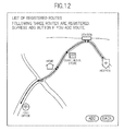
- FIG. 12 illustrates an example of a list of the registered user routes.
- the user route may contain a plurality of routes different in start point such as a route having the home of the user as a start point, and a route having a station as a start point.
- the user terminal 20 requests the map information providing server 10 to search for a route to be searched for (subject route) (S1011) .
- the user terminal 20 may request a search for the subject route by transmitting data specifying a start point and an end point on the map to the map information providing server 10.
- FIG. 13 illustrates an example of a specification screen for the subject route.
- the start point and the end point are to be specified for the route, but the specification of the route is not limited to this example, and the route may be specified by means of a search query such as "from a point A to a point B".
- a search query such as "from a point A to a point B”.
- the map information providing server 10 When the map information providing server 10 receives the search request for the subject route, the map information providing server 10 searches for the subject route based on the route specification data contained in the search request (S1012), and calculates the travel difficulty of the retrieved subject route (S1013). Then, the map information providing server 10 compares the travel difficulty of the subject route, and the travel difficulty of each of the user routes contained in the user route group, and selects a reference user route to be used as the reference out of the user route group (S1014). The selection processing for the reference user route is described in detail above.
- the map information providing server 10 compares the subject route and the reference user route, and generates display data for displaying both a comparison result thereof and the subject route (S1015). Then, the map information providing server 10 transmits the generated display data to the user terminal 20 (S1016), and the user terminal 20 displays a screen based on the display data received from the map information providing server 10 (S1017). Note that, examples of the screens to be displayed on the user terminal 20 are as illustrated in FIGS. 6 to 8 .
- the map information providing server 10 adds a result of the comparison made to a route selected as a reference from routes registered in advance by a user to the information on a subject route provided for the user, and the user can thus intuitively recognize labor required for traveling on the subject route based on the known route.
- the provision of the labor traveling on the subject route for the user by means of the comparison with the known route is extremely useful because it is difficult to intuitively recognize the labor required for the travel to which actual undulations on the route are reflected from contour lines or the like drawnona two-dimensional map displayed on the screen.
- the travel difficulty of a route can be formed as an index close to labor actually felt by the user by calculating the travel difficulty based on undulations on the route and the length of the route compared with a case where a travel difficulty is simply calculated based on the distance on the map.
- the user can recognize the labor required for traveling on the subject route approximated by that of a known route by selecting a user route approximately the same in travel difficulty as the subject road, and providing the information on the comparison of the selected user route to the subject route.
- a user route having a characteristic closer to the subject route can be selected by narrowing down the user routes to a user route to be used as the reference based on another index of the travel difficulty.
- a comparison result to the subject road can be provided by searching for a user route, the travel difficulty up to a via point of the user route of which is approximately the same as that of the subject route, and by using the retrieved user route as the reference.
- the present invention is not limited to the above-mentioned embodiment.
- an example in which user routes registered for each user are specified by the user is described, but the user routes may be registered as described below.
- an address of a user stored in the user information storage module 100 may be acquired, and routes, the start point of which is this address and each of the end points of which is a predetermined point retrieved in a region containing this address of the user, may be registered as user routes.
- the predetermined points searched for in this case may be various map objects such as a tourist spot, a station, a park, and a public institution contained in the region, and which map objects are to be searched for may be determined in advance, or may be set for each user. In this way, the labor required for a user to register user routes can be reduced by registering the user routes based on the address of the user.
- the map information providing server 10 may set user routes after the reception of the specification of the subject route.
- the map information providing server 10 may acquire the address of the user stored in the user information storage module 100, may set routes, the start point of which is the address of the user and each of the end points of which is the predetermined point retrieved from the region containing the address of the user, as user routes, and may select a user route closest in travel difficulty to the subject route out of the set user routes as a reference user route.
- the map information providing server 10 may determine a range on the map, a base point of which is the address of the user (a range of N kilometers from the address of the user, for example), based on the travel difficulty of the subject route, and may extract a point as the end point in this range. In this way, the processing load can be reduced by narrowing down user routes corresponding to the travel difficulty of the subject route. Moreover, as described above, a required storage capacity can be reduced compared with the case where user routes are registered in advance by setting user routes after the map information providing server 10 receives the specification of the subject route.
- the example of the travel difficulty calculated for a route is not limited to the travel difficulty employed in the above-mentioned embodiment.
- the travel difficulty of a route can be calculated as described below.
- the travel difficulty calculation module 110 may calculate the travel difficulty of the route as a value corresponding to a travel time required for traveling on the route. On this occasion, the travel difficulty calculation module 110 may divide the route into a plurality of portions, may calculate a partial travel difficulty for each of the portions, and may calculate the travel difficulty by summing the calculated partial travel difficulties.
- ⁇ is a gradient (angle) from the point A to the point B
- t( ⁇ ) is a travel time per unit distance
- d is a travel distance.
- FIG. 14 is a table showing an example of values of t corresponding to the angle ⁇ .
- the travel difficulty calculation module 110 may calculate the travel difficulty of a route as a value corresponding to a calorie to be required for traveling on the route. On this occasion, the travel difficulty calculation module 110 may divide the route into a plurality of portions, may calculate a calorie for traveling on each of the portions, and may calculate the travel difficulty by summing the calculated calories.
- M is a body weight
- METS( ⁇ ) is a coefficient representing an intensity of motion
- a is a coefficient of a predetermined value (1.05)
- ⁇ is a gradient (angle) from the point A to the point B
- t( ⁇ ) is a travel time per unit distance
- d is a travel distance.
- the travel difficulty of a route is calculated based on the undulation of the route (and further the length of the route), but the travel difficulty may be calculated based on data such as the season, the weather, the atmospheric temperature, the humidity, presence/absence of objects existing on the route such as stairs, a railroad crossing, and a traffic light, a state of the road surface, and the like, in addition to the undulation of the route (and further the length of the route).
- data such as the season, the weather, the atmospheric temperature, and the humidity
- weather information on a region in which the subject route is located is acquired from a weather information providing server (not shown), and the values of F, t, and METS in the tables shown in FIGS. 4 , 14 , and 15 may be changed depending on the acquired weather information.
- the travel difficulty of a route is calculated based on the data such as the season, the weather, the atmospheric temperature, the humidity, presence/absence of objects existing on the route such as stairs, a railroad crossing, and a traffic light, a state of the road surface, and the like, in addition to the length and the undulation of the route.
- ⁇ the travel difficulty Z from the point A to the point B
- the travel difficulty of a route is calculated considering positions at which obj ects are disposed on the route, but the positions at which objects are disposed on the route may not be considered.
- the travel difficulty of the route may be calculated by adding or multiplying a correction value based on a load corresponding to the object or a constant load independent of the obj ect, to or by a travel difficulty of the route calculated without considering an influence of the object.
- environmental information serving as a reference for a user is set based on a region in which the user lives (or the nationality of the user) or a region to which a reference user route belongs.
- the reference environmental information may contain information such as ranges of the atmospheric temperature and the humidity the user usually experiences, presence/absence of snowfall, and a road surface state (paved road or unpaved road (such as mountain road)).
- a correction value ( ⁇ 2>0) may be added to ⁇ , and when it is determined that the subject environmental information corresponds to the environment usually experienced, a correction value may not be added to ⁇ .
- a calculation method for the travel difficulty Z from the point A to the point B using the correction coefficient ⁇ may be similar to the above-mentioned method.
- the user route when there is not a user route higher in travel difficulty than a subject route in user routes stored for a user, the user route may be extended, and the extended user route may be used as a reference user route.
- a user route highest in travel difficulty may be selected out of the user routes, a difference in travel difficulty between the selected user route (user route to be subjected to extension) and the subj ect route may be calculated, a point located at a position which corresponds to the calculated difference in the travel difficulty from the end point of the user route to be subjected to extension may be searched for, and the user route to be subjected to extension may be extended to the retrieved point. Then, the user route to be subjected to extension extended in this way may be used as the reference user route, and may be used to compare to the subject route.
- the present invention can be applied to a stand-alone computer.
- the stand-alone computer is a mobile terminal provided with a touch panel and the global positioning system (GPS) receiver
- the start point (departure point) on a map may be set based on location information acquired by means of the GPS
- the end point (destination) on the map may be set based on a position tapped by the user on the map displayed on the touch panel.
- the start point can be automatically set based on the current position
- the end point can be set by the intuitive operation by the user, and labor required for the user to set the subject route from the present position to the destination can thus be reduced.
- the data specifying user routes is received in advance, and the user routes are registered before the subject route is determined, but the data specifying the subject route, and the data specifying the user routes may be received in the same timing, or the data specifying the user routes may be received after the data specifying the subj ect road is received.
- a travel method for use when the user travels on a route may be walking (including running), riding on a bicycle, or the like, and is not specifically limited.
- data for calculating travel difficulties for the respective travel methods may be held, respective travel difficulties of the subj ect route and the user route may be calculated for a travel method specified by the user, and a result of comparison between the subject route and the user route based on the calculated travel difficulties may be presented to the user.
Landscapes
- Engineering & Computer Science (AREA)
- Radar, Positioning & Navigation (AREA)
- Remote Sensing (AREA)
- Physics & Mathematics (AREA)
- General Physics & Mathematics (AREA)
- Automation & Control Theory (AREA)
- Mathematical Physics (AREA)
- Databases & Information Systems (AREA)
- Health & Medical Sciences (AREA)
- General Health & Medical Sciences (AREA)
- Social Psychology (AREA)
- Navigation (AREA)
- Traffic Control Systems (AREA)
Applications Claiming Priority (2)
| Application Number | Priority Date | Filing Date | Title |
|---|---|---|---|
| JP2011016633 | 2011-01-28 | ||
| PCT/JP2011/075625 WO2012101887A1 (fr) | 2011-01-28 | 2011-11-07 | Dispositif et procédé pour obtenir des informations d'itinéraire, programme et support d'enregistrement d'information |
Publications (3)
| Publication Number | Publication Date |
|---|---|
| EP2551640A1 true EP2551640A1 (fr) | 2013-01-30 |
| EP2551640A4 EP2551640A4 (fr) | 2014-04-02 |
| EP2551640B1 EP2551640B1 (fr) | 2016-07-06 |
Family
ID=46580473
Family Applications (1)
| Application Number | Title | Priority Date | Filing Date |
|---|---|---|---|
| EP11856882.3A Active EP2551640B1 (fr) | 2011-01-28 | 2011-11-07 | Dispositif et procédé pour obtenir des informations d'itinéraire, programme et support d'enregistrement d'information |
Country Status (6)
| Country | Link |
|---|---|
| US (1) | US9057611B2 (fr) |
| EP (1) | EP2551640B1 (fr) |
| JP (1) | JP4994521B1 (fr) |
| CN (1) | CN102869953B (fr) |
| ES (1) | ES2589463T3 (fr) |
| WO (1) | WO2012101887A1 (fr) |
Cited By (1)
| Publication number | Priority date | Publication date | Assignee | Title |
|---|---|---|---|---|
| CN114136308A (zh) * | 2022-01-27 | 2022-03-04 | 荣耀终端有限公司 | 导航方法、电子设备及存储介质 |
Families Citing this family (8)
| Publication number | Priority date | Publication date | Assignee | Title |
|---|---|---|---|---|
| CN105890608B (zh) * | 2016-03-31 | 2020-08-21 | 百度在线网络技术(北京)有限公司 | 导航参考点确定方法和装置、导航方法和装置 |
| JP6692262B2 (ja) * | 2016-09-01 | 2020-05-13 | アイシン・エィ・ダブリュ株式会社 | 経路探索システムおよび経路探索プログラム |
| US10317241B2 (en) * | 2017-01-23 | 2019-06-11 | Bayerische Motoren Werke Aktiengesellschaft | Systems and methods for recognizing and measuring hard-to-reach destinations |
| JP6833575B2 (ja) * | 2017-03-15 | 2021-02-24 | 本田技研工業株式会社 | 歩行支援装置、歩行支援方法、及びプログラム |
| JP6759473B2 (ja) * | 2017-06-30 | 2020-09-23 | シグニファイ ホールディング ビー ヴィSignify Holding B.V. | 交通経路変更機能を有する照明システム |
| JP7136717B2 (ja) * | 2019-02-12 | 2022-09-13 | トヨタ自動車株式会社 | 情報処理装置、情報処理方法、及びプログラム |
| US10794715B1 (en) * | 2019-07-16 | 2020-10-06 | Capital One Services, Llc | Systems and methods for route mapping with familiar routes |
| JP7047830B2 (ja) | 2019-12-05 | 2022-04-05 | オムロン株式会社 | 自律走行システム、自律走行方法、及び自律走行プログラム |
Citations (3)
| Publication number | Priority date | Publication date | Assignee | Title |
|---|---|---|---|---|
| US5787233A (en) * | 1995-03-28 | 1998-07-28 | Mitsubishi Denki Kabushiki Kaisha | Route generating device |
| EP0967460A1 (fr) * | 1998-06-25 | 1999-12-29 | Visteon Technologies, LLC | Système de navigation pour véhicule |
| DE10203097A1 (de) * | 2002-01-25 | 2003-08-14 | Ages Arbeitsgemeinschaft Gebue | Verfahren zum Bestimmen einer Fahrtstrecke in einem Streckennetz und zum Bestimmen von für die Streckenbenutzung zu entrichtenden Gebühren |
Family Cites Families (21)
| Publication number | Priority date | Publication date | Assignee | Title |
|---|---|---|---|---|
| WO1990015307A1 (fr) * | 1989-06-08 | 1990-12-13 | Robert Bosch Gmbh | Systeme de navigation pour vehicules |
| JPH09101160A (ja) | 1995-10-05 | 1997-04-15 | Matsushita Electric Ind Co Ltd | 走行位置表示装置 |
| JPH11271081A (ja) * | 1998-03-24 | 1999-10-05 | Fujitsu Ten Ltd | ナビゲーション装置 |
| JP4547826B2 (ja) * | 2001-04-10 | 2010-09-22 | アイシン・エィ・ダブリュ株式会社 | ナビゲーション装置及びナビゲーションプログラム |
| JP4096180B2 (ja) * | 2003-02-10 | 2008-06-04 | アイシン・エィ・ダブリュ株式会社 | ナビゲーション装置並びに該装置用プログラム及び記録媒体 |
| US7463972B2 (en) * | 2003-09-26 | 2008-12-09 | Aisin Aw Co., Ltd. | Navigation apparatus and method |
| US20050159889A1 (en) * | 2004-01-20 | 2005-07-21 | Isaac Emad S. | Adaptive route guidance |
| US7158876B2 (en) * | 2004-08-13 | 2007-01-02 | Hubert W. Crook Computer Consultants, Inc. | Automated vehicle routing based on physical vehicle criteria |
| GB0420097D0 (en) * | 2004-09-10 | 2004-10-13 | Cotares Ltd | Apparatus for and method of providing data to an external application |
| DE102005015693A1 (de) * | 2005-04-05 | 2006-10-12 | T-Mobile International Ag & Co. Kg | Verfahren und Vorrichtung zur automatisierten Fahrstreckeneinbuchung |
| JP4578526B2 (ja) * | 2005-05-26 | 2010-11-10 | パイオニア株式会社 | 経路情報表示装置、経路情報表示方法、経路情報表示プログラムおよびコンピュータに読み取り可能な記録媒体 |
| CN101322011A (zh) * | 2005-11-21 | 2008-12-10 | 福特汽车公司 | 车辆导航系统 |
| US7778769B2 (en) * | 2006-11-27 | 2010-08-17 | International Business Machines Corporation | Method and system for calculating least-cost routes based on historical fuel efficiency, street mapping and location based services |
| US20080195313A1 (en) * | 2007-02-14 | 2008-08-14 | Navico Inc. | Method, Computer Program Product and Apparatus for Parameter Optimization Via Logged Data Visualization |
| JP2009025178A (ja) * | 2007-07-20 | 2009-02-05 | Aisin Aw Co Ltd | ナビゲーション装置、及びナビゲーション用プログラム |
| ATE539320T1 (de) * | 2007-09-11 | 2012-01-15 | Harman Becker Automotive Sys | Routensuchverfahren und fahrzeugnavigationssystem |
| US8374781B2 (en) * | 2008-07-09 | 2013-02-12 | Chrysler Group Llc | Method for vehicle route planning |
| US9409052B2 (en) * | 2008-10-03 | 2016-08-09 | Adidas Ag | Program products, methods, and systems for providing location-aware fitness monitoring services |
| JP5027777B2 (ja) * | 2008-10-31 | 2012-09-19 | クラリオン株式会社 | カーナビゲーション装置およびカーナビゲーション方法 |
| JP4884458B2 (ja) | 2008-12-02 | 2012-02-29 | ヤフー株式会社 | 比較物で面積表示する地図表示装置及び方法 |
| JP4885287B2 (ja) | 2010-04-02 | 2012-02-29 | 三菱電機株式会社 | ナビゲーション装置 |
-
2011
- 2011-11-07 ES ES11856882.3T patent/ES2589463T3/es active Active
- 2011-11-07 EP EP11856882.3A patent/EP2551640B1/fr active Active
- 2011-11-07 CN CN201180022029.4A patent/CN102869953B/zh active Active
- 2011-11-07 US US13/634,982 patent/US9057611B2/en active Active
- 2011-11-07 WO PCT/JP2011/075625 patent/WO2012101887A1/fr active Application Filing
- 2011-11-07 JP JP2012503568A patent/JP4994521B1/ja active Active
Patent Citations (3)
| Publication number | Priority date | Publication date | Assignee | Title |
|---|---|---|---|---|
| US5787233A (en) * | 1995-03-28 | 1998-07-28 | Mitsubishi Denki Kabushiki Kaisha | Route generating device |
| EP0967460A1 (fr) * | 1998-06-25 | 1999-12-29 | Visteon Technologies, LLC | Système de navigation pour véhicule |
| DE10203097A1 (de) * | 2002-01-25 | 2003-08-14 | Ages Arbeitsgemeinschaft Gebue | Verfahren zum Bestimmen einer Fahrtstrecke in einem Streckennetz und zum Bestimmen von für die Streckenbenutzung zu entrichtenden Gebühren |
Non-Patent Citations (1)
| Title |
|---|
| See also references of WO2012101887A1 * |
Cited By (2)
| Publication number | Priority date | Publication date | Assignee | Title |
|---|---|---|---|---|
| CN114136308A (zh) * | 2022-01-27 | 2022-03-04 | 荣耀终端有限公司 | 导航方法、电子设备及存储介质 |
| CN114136308B (zh) * | 2022-01-27 | 2022-06-07 | 荣耀终端有限公司 | 导航方法、电子设备及存储介质 |
Also Published As
| Publication number | Publication date |
|---|---|
| EP2551640B1 (fr) | 2016-07-06 |
| WO2012101887A1 (fr) | 2012-08-02 |
| JP4994521B1 (ja) | 2012-08-08 |
| CN102869953B (zh) | 2014-07-02 |
| CN102869953A (zh) | 2013-01-09 |
| US9057611B2 (en) | 2015-06-16 |
| US20130103311A1 (en) | 2013-04-25 |
| JPWO2012101887A1 (ja) | 2014-06-30 |
| ES2589463T3 (es) | 2016-11-14 |
| EP2551640A4 (fr) | 2014-04-02 |
Similar Documents
| Publication | Publication Date | Title |
|---|---|---|
| EP2551640B1 (fr) | Dispositif et procédé pour obtenir des informations d'itinéraire, programme et support d'enregistrement d'information | |
| US9239246B2 (en) | Method, system, and computer program product for visual disambiguation for directions queries | |
| EP1792141B1 (fr) | Affichage d'une carte renfermant un emplacement proche connu | |
| US6477526B2 (en) | System for and method of providing map information | |
| US8010227B2 (en) | Navigation system with downloadable map data | |
| US8050948B2 (en) | Method and apparatus for an itinerary planner | |
| JP3719313B2 (ja) | 移動通信端末向け情報検索配信装置および移動通信端末 | |
| US20050102101A1 (en) | System and method for calculating a navigation route based on non-contiguous cartographic map databases | |
| US20130013620A1 (en) | Method of operating a navigation system to provide geographic location information | |
| US9250075B2 (en) | Generating travel time data | |
| US8116974B2 (en) | Conducting localized searches in a wireless client-server navigation system | |
| WO2003063521A2 (fr) | Environnement-cadre d'etablissement d'itineraires | |
| JP2003090735A (ja) | 分散型計算アーキテクチャによるナビゲーション・システム | |
| US9086296B2 (en) | Path information providing server, method of providing path information, and terminal | |
| JP3980844B2 (ja) | 案内情報リクエスト装置および案内情報提供装置 | |
| KR100574652B1 (ko) | 지도 검색 서비스 제공 방법 및 시스템 | |
| WO2005013234A1 (fr) | Procede et systeme fournissant des informations d'acheminement par des vehicules de transport public heterogenes | |
| JP3578255B2 (ja) | 地図情報案内方法及び地図情報案内装置 | |
| JP7051668B2 (ja) | 情報処理装置、端末装置、プログラム、勾配テーブル作成方法 | |
| JP2006526159A (ja) | 移動通信端末機に地図情報を提供する方法およびシステム | |
| JP4098638B2 (ja) | ナビゲーション装置 | |
| KR20110104804A (ko) | 다중 경로 탐색 모드를 지원하는 자동항법장치 및 그 자동항법장치에서의 길안내 서비스 제공 방법 | |
| KR100485868B1 (ko) | 경로 정보 생성 방법 및 이를 이용한 경로 정보 제공 시스템 | |
| KR101937567B1 (ko) | 대중교통수단분담률과 내부통행거리비율의 관계 분석 기반의 정보를 제공하기 위한 장치, 이를 위한 방법 및 이 방법을 수행하기 위한 프로그램이 기록된 컴퓨터 판독 가능한 기록매체 | |
| US9037409B2 (en) | Navigator database search methods |
Legal Events
| Date | Code | Title | Description |
|---|---|---|---|
| PUAI | Public reference made under article 153(3) epc to a published international application that has entered the european phase |
Free format text: ORIGINAL CODE: 0009012 |
|
| 17P | Request for examination filed |
Effective date: 20121024 |
|
| AK | Designated contracting states |
Kind code of ref document: A1 Designated state(s): AL AT BE BG CH CY CZ DE DK EE ES FI FR GB GR HR HU IE IS IT LI LT LU LV MC MK MT NL NO PL PT RO RS SE SI SK SM TR |
|
| RIN1 | Information on inventor provided before grant (corrected) |
Inventor name: YANASE, NAOHIRO |
|
| A4 | Supplementary search report drawn up and despatched |
Effective date: 20140304 |
|
| RIC1 | Information provided on ipc code assigned before grant |
Ipc: G01C 21/36 20060101ALI20140226BHEP Ipc: G01C 21/00 20060101ALI20140226BHEP Ipc: G08G 1/005 20060101ALI20140226BHEP Ipc: G01C 21/34 20060101AFI20140226BHEP |
|
| DAX | Request for extension of the european patent (deleted) | ||
| 17Q | First examination report despatched |
Effective date: 20150216 |
|
| RAP1 | Party data changed (applicant data changed or rights of an application transferred) |
Owner name: RAKUTEN, INC. |
|
| GRAP | Despatch of communication of intention to grant a patent |
Free format text: ORIGINAL CODE: EPIDOSNIGR1 |
|
| INTG | Intention to grant announced |
Effective date: 20160212 |
|
| GRAS | Grant fee paid |
Free format text: ORIGINAL CODE: EPIDOSNIGR3 |
|
| GRAA | (expected) grant |
Free format text: ORIGINAL CODE: 0009210 |
|
| AK | Designated contracting states |
Kind code of ref document: B1 Designated state(s): AL AT BE BG CH CY CZ DE DK EE ES FI FR GB GR HR HU IE IS IT LI LT LU LV MC MK MT NL NO PL PT RO RS SE SI SK SM TR |
|
| REG | Reference to a national code |
Ref country code: GB Ref legal event code: FG4D |
|
| REG | Reference to a national code |
Ref country code: AT Ref legal event code: REF Ref document number: 811041 Country of ref document: AT Kind code of ref document: T Effective date: 20160715 Ref country code: CH Ref legal event code: EP |
|
| REG | Reference to a national code |
Ref country code: IE Ref legal event code: FG4D |
|
| REG | Reference to a national code |
Ref country code: DE Ref legal event code: R096 Ref document number: 602011028015 Country of ref document: DE |
|
| REG | Reference to a national code |
Ref country code: NL Ref legal event code: MP Effective date: 20160706 |
|
| REG | Reference to a national code |
Ref country code: LT Ref legal event code: MG4D |
|
| REG | Reference to a national code |
Ref country code: ES Ref legal event code: FG2A Ref document number: 2589463 Country of ref document: ES Kind code of ref document: T3 Effective date: 20161114 |
|
| REG | Reference to a national code |
Ref country code: FR Ref legal event code: PLFP Year of fee payment: 6 |
|
| PG25 | Lapsed in a contracting state [announced via postgrant information from national office to epo] |
Ref country code: NL Free format text: LAPSE BECAUSE OF FAILURE TO SUBMIT A TRANSLATION OF THE DESCRIPTION OR TO PAY THE FEE WITHIN THE PRESCRIBED TIME-LIMIT Effective date: 20160706 Ref country code: HR Free format text: LAPSE BECAUSE OF FAILURE TO SUBMIT A TRANSLATION OF THE DESCRIPTION OR TO PAY THE FEE WITHIN THE PRESCRIBED TIME-LIMIT Effective date: 20160706 Ref country code: FI Free format text: LAPSE BECAUSE OF FAILURE TO SUBMIT A TRANSLATION OF THE DESCRIPTION OR TO PAY THE FEE WITHIN THE PRESCRIBED TIME-LIMIT Effective date: 20160706 Ref country code: RS Free format text: LAPSE BECAUSE OF FAILURE TO SUBMIT A TRANSLATION OF THE DESCRIPTION OR TO PAY THE FEE WITHIN THE PRESCRIBED TIME-LIMIT Effective date: 20160706 Ref country code: IS Free format text: LAPSE BECAUSE OF FAILURE TO SUBMIT A TRANSLATION OF THE DESCRIPTION OR TO PAY THE FEE WITHIN THE PRESCRIBED TIME-LIMIT Effective date: 20161106 Ref country code: LT Free format text: LAPSE BECAUSE OF FAILURE TO SUBMIT A TRANSLATION OF THE DESCRIPTION OR TO PAY THE FEE WITHIN THE PRESCRIBED TIME-LIMIT Effective date: 20160706 Ref country code: IT Free format text: LAPSE BECAUSE OF FAILURE TO SUBMIT A TRANSLATION OF THE DESCRIPTION OR TO PAY THE FEE WITHIN THE PRESCRIBED TIME-LIMIT Effective date: 20160706 Ref country code: NO Free format text: LAPSE BECAUSE OF FAILURE TO SUBMIT A TRANSLATION OF THE DESCRIPTION OR TO PAY THE FEE WITHIN THE PRESCRIBED TIME-LIMIT Effective date: 20161006 |
|
| PG25 | Lapsed in a contracting state [announced via postgrant information from national office to epo] |
Ref country code: PL Free format text: LAPSE BECAUSE OF FAILURE TO SUBMIT A TRANSLATION OF THE DESCRIPTION OR TO PAY THE FEE WITHIN THE PRESCRIBED TIME-LIMIT Effective date: 20160706 Ref country code: GR Free format text: LAPSE BECAUSE OF FAILURE TO SUBMIT A TRANSLATION OF THE DESCRIPTION OR TO PAY THE FEE WITHIN THE PRESCRIBED TIME-LIMIT Effective date: 20161007 Ref country code: SE Free format text: LAPSE BECAUSE OF FAILURE TO SUBMIT A TRANSLATION OF THE DESCRIPTION OR TO PAY THE FEE WITHIN THE PRESCRIBED TIME-LIMIT Effective date: 20160706 Ref country code: PT Free format text: LAPSE BECAUSE OF FAILURE TO SUBMIT A TRANSLATION OF THE DESCRIPTION OR TO PAY THE FEE WITHIN THE PRESCRIBED TIME-LIMIT Effective date: 20161107 Ref country code: BE Free format text: LAPSE BECAUSE OF NON-PAYMENT OF DUE FEES Effective date: 20160706 Ref country code: LV Free format text: LAPSE BECAUSE OF FAILURE TO SUBMIT A TRANSLATION OF THE DESCRIPTION OR TO PAY THE FEE WITHIN THE PRESCRIBED TIME-LIMIT Effective date: 20160706 |
|
| REG | Reference to a national code |
Ref country code: DE Ref legal event code: R097 Ref document number: 602011028015 Country of ref document: DE |
|
| PG25 | Lapsed in a contracting state [announced via postgrant information from national office to epo] |
Ref country code: RO Free format text: LAPSE BECAUSE OF FAILURE TO SUBMIT A TRANSLATION OF THE DESCRIPTION OR TO PAY THE FEE WITHIN THE PRESCRIBED TIME-LIMIT Effective date: 20160706 Ref country code: EE Free format text: LAPSE BECAUSE OF FAILURE TO SUBMIT A TRANSLATION OF THE DESCRIPTION OR TO PAY THE FEE WITHIN THE PRESCRIBED TIME-LIMIT Effective date: 20160706 |
|
| PLBE | No opposition filed within time limit |
Free format text: ORIGINAL CODE: 0009261 |
|
| STAA | Information on the status of an ep patent application or granted ep patent |
Free format text: STATUS: NO OPPOSITION FILED WITHIN TIME LIMIT |
|
| PG25 | Lapsed in a contracting state [announced via postgrant information from national office to epo] |
Ref country code: BG Free format text: LAPSE BECAUSE OF FAILURE TO SUBMIT A TRANSLATION OF THE DESCRIPTION OR TO PAY THE FEE WITHIN THE PRESCRIBED TIME-LIMIT Effective date: 20161006 Ref country code: CZ Free format text: LAPSE BECAUSE OF FAILURE TO SUBMIT A TRANSLATION OF THE DESCRIPTION OR TO PAY THE FEE WITHIN THE PRESCRIBED TIME-LIMIT Effective date: 20160706 Ref country code: SK Free format text: LAPSE BECAUSE OF FAILURE TO SUBMIT A TRANSLATION OF THE DESCRIPTION OR TO PAY THE FEE WITHIN THE PRESCRIBED TIME-LIMIT Effective date: 20160706 Ref country code: DK Free format text: LAPSE BECAUSE OF FAILURE TO SUBMIT A TRANSLATION OF THE DESCRIPTION OR TO PAY THE FEE WITHIN THE PRESCRIBED TIME-LIMIT Effective date: 20160706 Ref country code: SM Free format text: LAPSE BECAUSE OF FAILURE TO SUBMIT A TRANSLATION OF THE DESCRIPTION OR TO PAY THE FEE WITHIN THE PRESCRIBED TIME-LIMIT Effective date: 20160706 |
|
| 26N | No opposition filed |
Effective date: 20170407 |
|
| REG | Reference to a national code |
Ref country code: CH Ref legal event code: PL |
|
| PG25 | Lapsed in a contracting state [announced via postgrant information from national office to epo] |
Ref country code: CH Free format text: LAPSE BECAUSE OF NON-PAYMENT OF DUE FEES Effective date: 20161130 Ref country code: LI Free format text: LAPSE BECAUSE OF NON-PAYMENT OF DUE FEES Effective date: 20161130 |
|
| REG | Reference to a national code |
Ref country code: IE Ref legal event code: MM4A |
|
| PG25 | Lapsed in a contracting state [announced via postgrant information from national office to epo] |
Ref country code: SI Free format text: LAPSE BECAUSE OF FAILURE TO SUBMIT A TRANSLATION OF THE DESCRIPTION OR TO PAY THE FEE WITHIN THE PRESCRIBED TIME-LIMIT Effective date: 20160706 |
|
| PG25 | Lapsed in a contracting state [announced via postgrant information from national office to epo] |
Ref country code: LU Free format text: LAPSE BECAUSE OF NON-PAYMENT OF DUE FEES Effective date: 20161130 |
|
| REG | Reference to a national code |
Ref country code: FR Ref legal event code: PLFP Year of fee payment: 7 |
|
| PG25 | Lapsed in a contracting state [announced via postgrant information from national office to epo] |
Ref country code: IE Free format text: LAPSE BECAUSE OF NON-PAYMENT OF DUE FEES Effective date: 20161107 |
|
| PG25 | Lapsed in a contracting state [announced via postgrant information from national office to epo] |
Ref country code: HU Free format text: LAPSE BECAUSE OF FAILURE TO SUBMIT A TRANSLATION OF THE DESCRIPTION OR TO PAY THE FEE WITHIN THE PRESCRIBED TIME-LIMIT; INVALID AB INITIO Effective date: 20111107 Ref country code: CY Free format text: LAPSE BECAUSE OF FAILURE TO SUBMIT A TRANSLATION OF THE DESCRIPTION OR TO PAY THE FEE WITHIN THE PRESCRIBED TIME-LIMIT Effective date: 20160706 |
|
| PG25 | Lapsed in a contracting state [announced via postgrant information from national office to epo] |
Ref country code: MK Free format text: LAPSE BECAUSE OF FAILURE TO SUBMIT A TRANSLATION OF THE DESCRIPTION OR TO PAY THE FEE WITHIN THE PRESCRIBED TIME-LIMIT Effective date: 20160706 Ref country code: TR Free format text: LAPSE BECAUSE OF FAILURE TO SUBMIT A TRANSLATION OF THE DESCRIPTION OR TO PAY THE FEE WITHIN THE PRESCRIBED TIME-LIMIT Effective date: 20160706 Ref country code: MC Free format text: LAPSE BECAUSE OF FAILURE TO SUBMIT A TRANSLATION OF THE DESCRIPTION OR TO PAY THE FEE WITHIN THE PRESCRIBED TIME-LIMIT Effective date: 20160706 |
|
| PG25 | Lapsed in a contracting state [announced via postgrant information from national office to epo] |
Ref country code: MT Free format text: LAPSE BECAUSE OF NON-PAYMENT OF DUE FEES Effective date: 20161107 |
|
| PG25 | Lapsed in a contracting state [announced via postgrant information from national office to epo] |
Ref country code: AL Free format text: LAPSE BECAUSE OF FAILURE TO SUBMIT A TRANSLATION OF THE DESCRIPTION OR TO PAY THE FEE WITHIN THE PRESCRIBED TIME-LIMIT Effective date: 20160706 |
|
| REG | Reference to a national code |
Ref country code: AT Ref legal event code: UEP Ref document number: 811041 Country of ref document: AT Kind code of ref document: T Effective date: 20160706 |
|
| REG | Reference to a national code |
Ref country code: DE Ref legal event code: R081 Ref document number: 602011028015 Country of ref document: DE Owner name: RAKUTEN GROUP, INC., JP Free format text: FORMER OWNER: RAKUTEN, INC, TOKYO, JP Ref country code: DE Ref legal event code: R082 Ref document number: 602011028015 Country of ref document: DE Representative=s name: DENNEMEYER & ASSOCIATES S.A., DE |
|
| REG | Reference to a national code |
Ref country code: ES Ref legal event code: PC2A Owner name: RAKUTEN GROUP, INC. Effective date: 20220121 |
|
| REG | Reference to a national code |
Ref country code: AT Ref legal event code: HC Ref document number: 811041 Country of ref document: AT Kind code of ref document: T Owner name: RAKUTEN GROUP, INC., JP Effective date: 20220719 |
|
| PGFP | Annual fee paid to national office [announced via postgrant information from national office to epo] |
Ref country code: GB Payment date: 20231019 Year of fee payment: 13 |
|
| PGFP | Annual fee paid to national office [announced via postgrant information from national office to epo] |
Ref country code: ES Payment date: 20231201 Year of fee payment: 13 |
|
| PGFP | Annual fee paid to national office [announced via postgrant information from national office to epo] |
Ref country code: FR Payment date: 20231019 Year of fee payment: 13 Ref country code: DE Payment date: 20231019 Year of fee payment: 13 Ref country code: AT Payment date: 20231023 Year of fee payment: 13 |