EP3081904B1 - Verfahren und vorrichtung zur navigation an einen zielort - Google Patents
Verfahren und vorrichtung zur navigation an einen zielort Download PDFInfo
- Publication number
- EP3081904B1 EP3081904B1 EP15194310.7A EP15194310A EP3081904B1 EP 3081904 B1 EP3081904 B1 EP 3081904B1 EP 15194310 A EP15194310 A EP 15194310A EP 3081904 B1 EP3081904 B1 EP 3081904B1
- Authority
- EP
- European Patent Office
- Prior art keywords
- destination
- guidance information
- representation
- output
- dimensional map
- Prior art date
- Legal status (The legal status is an assumption and is not a legal conclusion. Google has not performed a legal analysis and makes no representation as to the accuracy of the status listed.)
- Active
Links
Images



Classifications
-
- G—PHYSICS
- G01—MEASURING; TESTING
- G01C—MEASURING DISTANCES, LEVELS OR BEARINGS; SURVEYING; NAVIGATION; GYROSCOPIC INSTRUMENTS; PHOTOGRAMMETRY OR VIDEOGRAMMETRY
- G01C21/00—Navigation; Navigational instruments not provided for in groups G01C1/00 - G01C19/00
- G01C21/26—Navigation; Navigational instruments not provided for in groups G01C1/00 - G01C19/00 specially adapted for navigation in a road network
- G01C21/34—Route searching; Route guidance
- G01C21/36—Input/output arrangements for on-board computers
- G01C21/3667—Display of a road map
- G01C21/367—Details, e.g. road map scale, orientation, zooming, illumination, level of detail, scrolling of road map or positioning of current position marker
-
- G—PHYSICS
- G01—MEASURING; TESTING
- G01C—MEASURING DISTANCES, LEVELS OR BEARINGS; SURVEYING; NAVIGATION; GYROSCOPIC INSTRUMENTS; PHOTOGRAMMETRY OR VIDEOGRAMMETRY
- G01C21/00—Navigation; Navigational instruments not provided for in groups G01C1/00 - G01C19/00
- G01C21/26—Navigation; Navigational instruments not provided for in groups G01C1/00 - G01C19/00 specially adapted for navigation in a road network
- G01C21/34—Route searching; Route guidance
- G01C21/36—Input/output arrangements for on-board computers
- G01C21/3605—Destination input or retrieval
- G01C21/362—Destination input or retrieval received from an external device or application, e.g. PDA, mobile phone or calendar application
-
- G—PHYSICS
- G01—MEASURING; TESTING
- G01C—MEASURING DISTANCES, LEVELS OR BEARINGS; SURVEYING; NAVIGATION; GYROSCOPIC INSTRUMENTS; PHOTOGRAMMETRY OR VIDEOGRAMMETRY
- G01C21/00—Navigation; Navigational instruments not provided for in groups G01C1/00 - G01C19/00
- G01C21/26—Navigation; Navigational instruments not provided for in groups G01C1/00 - G01C19/00 specially adapted for navigation in a road network
- G01C21/34—Route searching; Route guidance
- G01C21/36—Input/output arrangements for on-board computers
- G01C21/3626—Details of the output of route guidance instructions
- G01C21/3635—Guidance using 3D or perspective road maps
- G01C21/3638—Guidance using 3D or perspective road maps including 3D objects and buildings
Definitions
- the present invention relates to a method for navigation to a destination, in which, depending on the current position and the destination, route guidance information is output on a display in a mapless representation. It also relates to a device, in particular in a vehicle, for navigating to a destination with a display, a position determining device and a controller. The controller is set up to display route guidance information on the display in a map-free representation depending on the current position and the destination.
- the increasing spread of navigation systems for example in mobile phones and similar mobile user devices, as well as in vehicles, goes hand in hand with increasing demands on the range of functions, ease of use and quality of the services provided. Navigation systems are primarily used to determine a route to a defined destination based on a current or defined position.
- This route determination is based in particular on data on an available route network, for example on a digital map of a system of roads that can be driven on by a vehicle.
- a large amount of information can be output to the user, for example about geographical conditions or infrastructure facilities, and an integration of other services, such as an electronic diary, can expand the range of functions.
- the one in the DE 10 2012 207 412 A1 The described system for automatic guidance is arranged within a building, such as colored lights.
- the actuators on the way are brought into a certain state, for example lights in a certain color. The visitor can now follow the actuators and reaches the goal.
- the described route planning method is carried out by means of a remote data processing system.
- Calendar entries can be taken into account, such as the location and time of an appointment.
- the EP 1 422 501 A1 discloses the display of route guidance information on a display in a 2-dimensional map display in connection with the display of an electronic calendar, wherein route guidance information is output based on data from the electronic calendar.
- the Die US 2014/0053083 A1 discloses the representation of a 3-dimensional map in the vicinity of a destination point of an appointment.
- the EP 2 772 726 A1 discloses the representation of a 2-dimensional map which merges into a 3-dimensional map in the vicinity of a destination.
- the US 2012/0226439 A1 also discloses the transition from a 2-dimensional map display to a 3-dimensional map display, for example depending on the distance to a destination.
- the last route guidance information is automatically output in a 3-dimensional map representation before the destination.
- the current position and the destination are recorded in particular, for example by methods of geographic position determination known per se or user input, as is customary in navigation systems.
- a route can now be generated and the route guidance information is generated based on this route. So the system determines one Path to the destination and generates an output through which the user is guided along this path.
- route guidance information can be output acoustically perceptible.
- the last route guidance information is output in a special way, the level of detail of the information being increased.
- the "last route guidance" in the sense of the invention can be defined in various ways: for example, it can include all route guidance from the point in time at which the current position is at a certain distance from the destination. In addition, a certain number of last route guidance instructions can be defined. In addition, it can be provided that after a certain user input, all of the following route guidance instructions are treated as "last route guidance instructions".
- the special role of the last route guidance is made clear by the fact that they are displayed in a different way than the other route guidance. According to the invention, this is done by changing from a cardless display to a 3-dimensional map display. In particular, this allows the display of a greater density of information for the last route guidance information, while the preceding route guidance information can easily present a larger overview.
- a two-dimensional map representation not belonging to the claimed invention is understood to indicate that a plan view of a map, in particular a route network, is displayed. Topographical conditions can be taken into account and additional information can be displayed, such as names with a geographical reference, traffic regulations or traffic reports. In the 2-dimensional map representation, this representation is carried out in particular by a projection into a plane.
- the display area can be used to display an electronic calendar and possibly other different information, such as data on a radio or media system or other data.
- the 3-dimensional map display includes a graphical representation of three-dimensional objects, such as buildings, topographical features of the site or symbols displayed in three dimensions.
- the objects can be displayed in perspective on the 2-dimensional display area.
- the 3-dimensional map representation can include a representation of a route network.
- 2-dimensional and 3-dimensional map representations can be related to one another in such a way that the 2-dimensional representation is essentially based on a projection of the 3-dimensional representation into one plane.
- further route guidance information is output in the 3-dimensional map display when the destination is displayed in the 3-dimensional map display.
- additional ones Information in particular detailed information about the surroundings of the destination and the destination itself are output.
- the "further route guidance" is information that goes beyond conventional route guidance.
- information is output here that does not relate to the travel of a vehicle to the destination, but the footpath from a parking lot to the target building or a path within the building to a meeting room.
- the additional route guidance information can also be output acoustically.
- the further route guidance notes relate to one or more features from the following list: building, floor, elevator, room, stairs, hallway, entrance. This advantageously provides the user with precise information on how to reach the destination when it is in a building. In particular, he can find out which route to take before arriving at the destination.
- the further route guidance is based on data from an electronic calendar.
- the navigation can thereby advantageously be aligned with the data of the calendar, whereby the purpose of the trip, for example the arrival to an appointment or information on a room number, can be taken into account.
- the data of the electronic calendar comprise at least one appointment.
- At least one graphic object is generated and output that relates to the appointment.
- the user can advantageously be given information about an appointment, in particular about the appointment at which the user is currently on the way. This can further support navigation by displaying all relevant information to the user.
- the data of the electronic calendar are recorded by a mobile user device and / or by an external server.
- the user can advantageously use an electronic calendar application in which the calendar is accessed, for example, via a network connection, so that multiple devices can simultaneously call up and, if necessary, manage appointments and other calendar data.
- This also allows a modular operation of a navigation system in which individual components can be easily removed, added and exchanged.
- the last route guidance information is output when the current position is within a specific environment of the destination.
- the user advantageously receives the changed, more detailed representation when he approaches the destination.
- the surroundings of the destination can be determined, for example, using a radius around the destination. Further geographical units can also be defined as surroundings, such as a street and its neighboring streets, a district or a town.
- the display changes to the 3-dimensional map display and the further route guidance information is output.
- the 3-dimensional map representation comprises at least one representation of a building.
- a representation of the building for example, can be displayed in perspective, which is the destination of the navigation, for example identifiable by street name and house number, or in which the actual destination is located, for example a specific meeting room.
- Properties of the building can also be displayed, such as the external dimensions such as height and width, absolute or relative to the surrounding buildings, the number of floors or the position of the entrances.
- the representation of the building comprises at least one graphic highlighting or marking. This advantageously allows the output of information which makes it easier for the user to navigate within the building, for example when it is shown to which floor he has to move, which entrance to use, in which direction the desired space is located relative to the entrance or whether the building has an elevator.
- the last route guidance information is recorded by an external server.
- This advantageously allows the provision of current and detailed data without a large data volume having to be stored internally by the navigation device. For example, if the user is on the way to a destination, which is specified by appointment data in an electronic calendar, a more precise description of the building at the destination and its surroundings can be recorded. This can allow the display of a view of the building from which the user can easily recognize all the details relevant to him and can compare them with the actual view of the building.
- detailed information about the surroundings of the destination can be recorded, for example, information about routes within a conference center can be provided and recorded by an external server, so that information that is as up-to-date as possible is available at the time of issue.
- the device comprises a display, a position determining device and a control.
- the control system is set up to display route guidance information on the display in a map-free representation depending on the current position and the destination.
- the device is characterized in that the controller is set up to automatically output the last route guidance information in front of the destination in a 3-dimensional map display.
- the device according to the invention is in particular designed to implement the method according to the invention described above. It therefore has the same advantages as the method according to the invention.
- the device according to the invention is arranged in particular in a vehicle.
- the controller is set up to output further route guidance information in the 3-dimensional map display if the destination is displayed in the 3-dimensional map display.
- the other route guidance can thus be supplemented in a meaningful way and the user can be provided with particularly good navigation.
- the further route guidance notes relate to one or more features from the following list: building, floor, elevator, room, stairs, hallway, entrance. In this way, they supplement the other route guidance information in a particularly suitable form with details about buildings and structures in or in which the user has to navigate on the way to the destination.
- the further route guidance is based on data from an electronic calendar.
- the navigation can advantageously be adapted to the purpose of staying at a specific location, for example a meeting in a specific room.
- a connection can be established at least temporarily to a mobile user device and / or to an external server, the data of the electronic calendar being able to be recorded by the mobile user device or by the external server. In this way, data from external systems can advantageously be recorded and taken into account during navigation.
- the vehicle 10 comprises a controller 3, to which a display 1, which comprises a display area 1 a, a position determining device 2 and an input device 6 are coupled.
- the controller 3 is connected in terms of data technology to an external server 4 and a mobile user device 6.
- This connection exists at least temporarily and can be made via a connection by cable or radio, for example WLAN, Bluetooth or a mobile radio network.
- the data connection can be established via a network, such as the Internet
- FIG Figure 2A On the basis of the current position detected by the position determining device 2 and the designation of the destination entered by the user by means of the input device 6, the example in FIG Figure 2A 2-dimensional map representation shown generated and displayed on the display surface 1a.
- the illustration includes a route network 20 in which the current position 21 and the destination 22 are shown.
- the controller 3 also generates a route 23, which is also shown.
- the overlay of the route network 20 and the route 23 serves as a route guidance note for the user, who can find the way to the destination 22 on the basis of this illustration.
- additional information for example in the form of arrow representations that prompt the user to turn, can be displayed or acoustic information can be output.
- the map section and / or the scale of the map display can be enlarged or reduced in a manner known per se in order to adapt the display to the size of the display surface 1a of the display 1 and to the needs of the user.
- appointment objects 24 represent individual appointments in chronological order from left to right, the next relevant appointment being displayed in the center and represented by an enlarged appointment object 24.
- the display here also includes a representation of the time 25.
- data from other devices of the vehicle 10 are displayed, for example menus for setting a radio or an air conditioning system.
- the data of the calendar is acquired on the basis of the connection to the mobile user device 5, which is, for example, a mobile phone of the user.
- the user's calendar is stored on this and the data are transmitted to the controller 3 via a wireless connection.
- calendar data are recorded by the external server 4, which allows central storage and management of appointments, so that different devices can access the same data.
- the display area 1 a does not fill the maximum area, but only represents a part of the area that is available in the display 1.
- the representation can take place in a manner known per se in a window or in a region of the display area 1 a which is not strictly delimited.
- the system switches to the 3-dimensional map display when the current position of the vehicle 10 falls below a certain air line distance from the destination or when a corresponding input by the user is detected by the input device 6.
- this phase of the navigation in addition to the last route guidance information, which relates, for example, to the route to be traveled to the destination, further route guidance information is output, which relates, for example, to a room in a building at the destination.
- these notices are generated on the basis of data from the external server 4, the external server 4 in particular comprising a database from which detailed information on individual buildings or building complexes can be called up if required.
- the 3-dimensional map representation fills the display area 1a while in Figure 3B in the above related to Figure 2B explained representation of a calendar function is integrated.
- the appointment objects 24 are therefore displayed in the right area of the display area 1a, while the 3-dimensional map display is shown in the left area.
- the 3-dimensional representation comprises the surroundings of the destination, which in the case shown is located on a specific destination floor 27 of the destination building 26a. Also shown are the surrounding buildings 26, the street 30 running in front of the buildings 26 and 26a, a parking lot 31 and a traffic light 32.
- the arrangement and size of the objects shown, in particular the respective height of the buildings 26 and 26a shown, are generated in this way that the user can easily compare the presentation with reality.
- the target floor 27 is marked in the target building 26a.
- the marking can take place in particular by means of a color design deviating from the surroundings, a special brightness, hatching, blinking and / or further highlighting that can be represented graphically. The user can thus see from the display where the destination is located.
- Figure 3B shows the surroundings of the destination in a three-dimensional perspective, although information from another device of the vehicle, in this example a calendar function, is shown here at the same time.
- the display area 1 a is therefore not completely filled with the 3-dimensional map representation, but in the right area appointment objects 24 are displayed, in particular appointment objects 24 that are relevant to the destination.
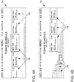
- Figure 4A shows an analog to Figure 2B generated cardless display, in which the information of a calendar of the user is displayed.
- the representation includes appointment objects 24, which are arranged chronologically horizontally.
- the currently current appointment object 24 is shown in the center and enlarged. Further information is also shown on the display surface 1a, here at the upper edge of the display surface 1a.
- a 3-dimensional map is displayed.
- the switch to this form of ad begins as in Figure 4B with the disappearance of the no longer relevant appointment objects 24, which relate to the past, while at the same time 3-dimensional representations of buildings 26 are built up in the left area of the display area 1a.
- an animation can be shown in which the buildings 26 seem to grow from the ground.
- Figure 4C shows the fully constructed 3-dimensional representation of the surroundings of the destination. In particular, this is generated so that it roughly corresponds to the driver's view of his real environment. Furthermore, the appointment objects 24 are displayed, and their representation can be changed such that their space requirement is adapted to the space requirement for the 3-dimensional map representation.
- FIG. 4D The example shown is determined based on the data of the appointment to which the user is on the way is. This includes information about the floor of the meeting room.
- the external server 3 collects data about the destination and its surroundings and it is displayed in a detailed view of the destination building 26a at the destination, which includes information about where the entrance 29 is located, whether there is an elevator 28 and on which destination floor 27 the meeting room is located. To make these details easier to see, the target building 26a is shown at the destination from a perspective just before it.
Landscapes
- Engineering & Computer Science (AREA)
- Radar, Positioning & Navigation (AREA)
- Remote Sensing (AREA)
- Automation & Control Theory (AREA)
- Physics & Mathematics (AREA)
- General Physics & Mathematics (AREA)
- Navigation (AREA)
Description
- Die vorliegende Erfindung betrifft ein Verfahren zur Navigation an einen Zielort, bei dem in Abhängigkeit von der aktuellen Position und dem Zielort Zielführungshinweise auf einem Display in einer kartenlosen Darstellung ausgegeben werden. Sie betrifft ferner eine Vorrichtung, insbesondere in einem Fahrzeug, zur Navigation an einen Zielort mit einem Display, einer Positionsbestimmungseinrichtung und einer Steuerung. Dabei ist die Steuerung eingerichtet, in Abhängigkeit von der aktuellen Position und dem Zielort Zielführungshinweise auf dem Display in einer kartenlosen Darstellung auszugeben. Die zunehmende Verbreitung von Navigationssystemen, etwa in Mobiltelefonen und ähnlichen mobilen Nutzergeräten, sowie in Fahrzeugen, geht einher mit steigenden Ansprüchen an den Funktionsumfang, den Bedienkomfort und die Qualität der bereitgestellten Dienste. Navigationssysteme dienen dabei in erster Linie dazu, ausgehend von einer aktuellen oder definierten Position eine Route zu einem definierten Ziel zu bestimmen. Diese Routenbestimmung basiert insbesondere auf Daten zu einem verfügbaren Wegenetz, etwa auf einer digitalen Karte eines Systems von Straßen, die durch ein Fahrzeug befahrbar sind. Dem Nutzer kann dabei eine Vielzahl von Informationen ausgegeben werden, etwa zu geographischen Gegebenheiten oder Infrastruktureinrichtungen, und eine Integration weiterer Dienste, etwa eines elektronischen Terminkalenders, kann den Funktionsumfang erweitern.
- Bei einer umfassenden Routenplanung, insbesondere für ein Fahrzeug, ist zudem zu berücksichtigen, dass die Fahrt oft nicht direkt auf einer Straße des Wegenetzes beginnt und nicht direkt bei einem Zielpunkt des Wegenetzes endet. Insbesondere wird in vielen Situationen eine Parkgelegenheit genutzt und ein Stück des Weges bis zum eigentlichen Ziel nicht mit dem Fahrzeug zurückgelegt.
- Bei dem in der
DE 10 2012 207 412 A1 beschriebenen System zur selbsttätigen Wegweisung sind innerhalb eines Gebäudes Aktoren angeordnet, etwa Farbleuchten. Um einem Besucher den Weg zu einem Ziel zu weisen, werden die auf dem Weg befindlichen Aktoren in einen bestimmten Zustand gebracht, beispielsweise Leuchten in einer bestimmten Farbe. Der Besucher kann nun den Aktoren folgen und erreicht das Ziel. - Das in der
DE 10 2011 089 416 A1 beschriebene Verfahren zur Routenplanung wird mittels eines entfernten Datenverarbeitungssystems durchgeführt. Dabei können Kalendereinträge berücksichtigt werden, etwa Ort und Zeitpunkt eines Termins. - Die
EP 1 422 501 A1 offenbart die Darstellung von Zielführungshinweisen auf einem Display in einer 2-dimensionalen Kartendarstellung in Verbindung mit der Darstellung eines elektronischen Kalenders, wobei Zielführungshinweise ausgegeben werden, die auf Daten des elektronischen Kalenders beruhen. - Die Die
US 2014/0053083 A1 offenbart die Darstellung einer 3-dimensionalen Karte in der Umgebung eines Zielpunkts einer Verabredung. - Die
EP 2 772 726 A1 offenbart die Darstellung einer 2-dimensionalen Karte, welche in einer Umgebung eines Zielorts in eine 3-dimensionalen Karte übergeht. - Die
US 2012/0226439 A1 offenbart ebenfalls den Übergang von einer 2-dimensionalen Kartendarstellung zu einer 3-dimensionalen Kartendarstellung, beispielsweise in Abhängigkeit von der Entfernung zu einem Zielort. - Es ist die Aufgabe der vorliegenden Erfindung, ein Verfahren und eine Vorrichtung zur Navigation an einen Zielort bereitzustellen, mit deren Hilfe einem Nutzer Zielführungshinweise besonders einfach und leicht erfassbar dargestellt werden können.
- Diese Aufgabe wird durch ein Verfahren mit den Merkmalen des Anspruchs 1 und eine Vorrichtung mit den Merkmalen des Anspruchs 8 gelöst. Vorteilhafte Ausgestaltungen und Weiterbildungen ergeben sich aus den abhängigen Ansprüchen.
- Bei dem erfindungsgemäßen Verfahren der oben genannten Art werden letzte Zielführungshinweise vor dem Zielort automatisch in einer 3-dimensionalen Kartendarstellung ausgegeben.
- Dadurch wird vorteilhafterweise eine besonders gute Übersicht über die Umgebung des Zielorts erreicht und der Nutzer kann sein Ziel leicht finden, selbst wenn er etwa sein Fahrzeug mit dem Navigationssystem an einem Parkplatz zurücklässt.
- Bei dem Verfahren werden insbesondere die aktuelle Position und der Zielort erfasst, etwa durch an sich bekannte Verfahren der geographischen Positionsbestimmung beziehungsweise eine Nutzereingabe, wie sie in Navigationssystemen üblich ist. In Abhängigkeit von der aktuellen Position und dem Zielort kann nun eine Route erzeugt werden und die Zielführungshinweise werden anhand dieser Route erzeugt. Das System ermittelt also einen Weg zum Zielort und erzeugt eine Ausgabe, durch die der Nutzer entlang dieses Weges geführt wird. Dabei können ferner Zielführungshinweise akustisch wahrnehmbar ausgegeben werden.
- Gemäß der Erfindung werden die letzten Zielführungshinweise in besonderer Weise ausgegeben, wobei der Detailgehalt der Hinweise erhöht wird. Die "letzten Zielführungshinweise" im Sinne der Erfindung können dabei auf verschiedene Weisen definiert sein: Beispielsweise können sie alle Zielführungshinweise ab dem Zeitpunkt umfassen, zu dem sich die aktuelle Position in einer bestimmten Entfernung des Zielorts befindet. Ferner kann eine bestimmte Anzahl letzter Zielführungshinweise definiert werden. Zudem kann vorgesehen sein, dass nach einer bestimmten Nutzereingabe alle folgenden Zielführungshinweise als "letzte Zielführungshinweise" behandelt werden.
- Die besondere Rolle der letzten Zielführungshinweise wird dadurch deutlich gemacht, dass sie in anderer Weise als die übrigen Zielführungshinweise angezeigt werden. Erfindungsgemäß geschieht dies durch einen Wechsel von einer kartenlosen Darstellung zu einer 3-dimensionalen Kartendarstellung. Insbesondere erlaubt dies die Darstellung einer größeren Informationsdichte für die letzten Zielführungshinweise, während die vorangehenden Zielführungshinweise einen größeren Überblick leicht erfassbar darstellen können.
- Eine nicht zu der beanspruchten Erfindung gehörende 2-dimensionale Kartendarstellung wird so verstanden, dass eine Draufsicht auf eine Karte, insbesondere ein Wegenetz, angezeigt wird. Dabei können topographische Gegebenheiten berücksichtigt werden und zusätzliche Informationen angezeigt werden, wie zum Beispiel Bezeichnungen mit geographischem Bezug, Verkehrsregelungen oder Verkehrsmeldungen. Diese Darstellung erfolgt in der 2-dimensionalen Kartendarstellung insbesondere durch eine Projektion in eine Ebene.
- Erfindungsgemäß erfolgt eine kartenlose Darstellung, bei der Richtungsanweisungen ausgegeben werden, ohne dass sie in Beziehung zu einer Kartendarstellung, etwa mit einem kartographierten Wegenetz, stehen. Dadurch kann die Anzeigefläche zur Anzeige eines elektronischen Kalenders und gegebenenfalls weiterer verschiedener Informationen genutzt werden, etwa Daten zu einem Radio oder Mediensystem oder andere Daten.
- Dagegen umfasst die 3-dimensionale Kartendarstellung eine graphische Darstellung dreidimensionaler Objekte, etwa von Gebäuden, topographischen Besonderheiten des Geländes oder dreidimensional dargestellten Symbolen. Die Objekte können dabei zum Beispiel perspektivisch auf der 2-dimensionalen Anzeigefläche dargestellt werden. Ferner kann die 3-dimensionale Kartendarstellung eine Darstellung eines Wegenetzes umfassen. Insbesondere können 2- und 3-dimensionale Kartendarstellung miteinander so in Beziehung stehen, dass die 2-dimensionale Darstellung im Wesentlichen auf einer Projektion der 3-dimensionalen Darstellung in eine Ebene beruht.
- Gemäß der Erfindung werden weitere Zielführungshinweise in der 3-dimensionalen Kartendarstellung ausgegeben, wenn der Zielort in der 3-dimensionalen Kartendarstellung angezeigt wird. Dadurch können dem Nutzer vorteilhafterweise zusätzliche Informationen, insbesondere Detailinformationen zur Umgebung des Zielorts und zum Zielort selbst ausgegeben werden. Die "weiteren Zielführungshinweise" sind solche Informationen, die über die herkömmliche Routenführung hinausgehen.
- Zum Beispiel werden hier Informationen ausgegeben, die nicht die Fahrt eines Fahrzeugs zum Zielort betreffen, sondern den Fußweg von einem Parkplatz zum Zielgebäude oder einen Weg innerhalb des Gebäudes zu einem Besprechungsraum. Die Ausgabe der weiteren Zielführungshinweise kann zusätzlich akustisch erfolgen.
- In einer Weiterbildung betreffen die weiteren Zielführungshinweise ein oder mehrere Merkmale aus folgender Liste: Gebäude, Stockwerk, Fahrstuhl, Raum, Treppe, Flur, Eingang. Der Nutzer erhält dadurch in vorteilhafter Weise genaue Angaben darüber, wie er den Zielort erreicht, wenn sich dieser in einem Gebäude befindet. Insbesondere kann er sich bereits vor der Ankunft am Zielort schon darüber orientieren, welchen Weg er nehmen muss.
- Erfindungsgemäß beruhen die weiteren Zielführungshinweise auf Daten eines elektronischen Kalenders. Die Navigation kann dadurch vorteilhafterweise auf die Daten des Kalenders ausgerichtet werden, wobei der Zweck der Reise, etwa die Anreise zu einem Termin oder Informationen zu einer Raumnummer, berücksichtigt werden kann.
- Bei einer Weiterbildung umfassen die Daten des elektronischen Kalenders zumindest einen Termin. Es wird zumindest ein graphisches Objekt erzeugt und ausgegeben, welches den Termin betrifft. So können dem Nutzer in vorteilhafter Weise Informationen zu einem Termin ausgegeben werden, insbesondere über den Termin, zu dem der Nutzer gerade auf dem Weg ist. Dies kann die Navigation weiter dadurch unterstützen, dass dem Nutzer alle relevanten Informationen angezeigt werden.
- Bei einer Ausbildung des erfindungsgemäßen Verfahrens werden die Daten des elektronischen Kalenders von einem mobilen Nutzergerät und/oder von einem externen Server erfasst.
- Der Nutzer kann dadurch vorteilhafterweise eine elektronische Kalenderanwendung nutzen, bei der beispielsweise über eine Netzwerkverbindung auf den Kalender zugegriffen wird, sodass mehrere Geräte gleichzeitig Termine und andere Kalenderdaten abrufen und gegebenenfalls verwalten können. Dies erlaubt ferner einen modularen Betrieb eines Navigationssystems, bei dem einzelne Komponenten einfach entfernt, hinzugefügt und ausgetauscht werden können.
- Gemäß der Erfindung werden die letzten Zielführungshinweise ausgegeben, wenn sich die aktuelle Position innerhalb einer bestimmten Umgebung des Zielorts befindet. Der Nutzer erhält dadurch vorteilhafterweise die veränderte, detailliertere Darstellung, wenn er sich dem Zielort annähert.
- Die Umgebung des Zielorts kann etwa anhand eines Radius um den Zielort bestimmt werden. Ferner können weitere geographische Einheiten als Umgebung definiert werden, etwa eine Straße und ihre Nachbarstraßen, ein Stadtviertel oder eine Ortschaft. Beim Eintritt in diese Umgebung wird der Wechsel der Anzeige zur 3-dimensionalen Kartendarstellung vollzogen und die weiteren Zielführungshinweise werden ausgegeben.
- Bei einer weiteren Ausbildung umfasst die 3-dimensionale Kartendarstellung zumindest eine Darstellung eines Gebäudes. Dies ermöglicht vorteilhafterweise eine detaillierte Darstellung eines Ortes. Dabei kann insbesondere eine Darstellung des Gebäudes zum Beispiel perspektivisch angezeigt werden, welches das Ziel der Navigation ist, etwa durch Straßennamen und Hausnummer identifizierbar, oder in dem sich der eigentliche Zielort befindet, etwa ein bestimmter Besprechungsraum. Ferner können Eigenschaften des Gebäudes dargestellt werden, etwa die äußeren Abmessungen wie Höhe und Breite, absolut oder relativ zu den umgebenden Gebäuden, die Zahl der Stockwerke oder die Position der Eingänge. Bei einer Weiterbildung umfasst die Darstellung des Gebäudes zumindest eine graphische Hervorhebung oder Markierung. Dies erlaubt vorteilhafterweise die Ausgabe von Informationen, die dem Nutzer eine Navigation innerhalb des Gebäudes erleichtern, etwa wenn ihm angezeigt wird, in welches Stockwerk er sich bewegen muss, welchen Eingang er benutzen soll, in welche Richtung der gewünschte Raum relativ zum Eingang gelegen ist oder ob das Gebäude über einen Aufzug verfügt.
- Bei einer Weiterbildung werden die letzten Zielführungshinweise von einem externen Server erfasst. Dies erlaubt vorteilhafterweise die Bereitstellung aktueller und detaillierter Daten, ohne dass ein großes Datenvolumen von dem Navigationsgerät intern gespeichert werden muss. Beispielsweise kann, wenn sich der Nutzer auf dem Weg zu einem Zielort befindet, der durch Termindaten in einem elektronischen Kalender vorgegeben ist, eine genauere Beschreibung des Gebäudes am Zielort und seiner Umgebung erfasst werden. Dies kann die Darstellung einer Ansicht des Gebäudes erlauben, aus welcher der Nutzer leicht alle für ihn relevanten Details erkennen und sie mit der wirklichen Ansicht des Gebäudes abgleichen kann. Zudem können etwa Detailinformationen zu der Umgebung des Zielorts bei Bedarf erfasst werden, beispielsweise können Informationen über Wege innerhalb eines Tagungszentrums von einem externen Server bereitgestellt und erfasst werden, sodass jeweils zum Zeitpunkt der Ausgabe möglichst aktuelle Informationen zur Verfügung stehen.
- Die erfindungsgemäße Vorrichtung der oben genannten Art umfasst ein Display, eine Positionsbestimmungseinrichtung und eine Steuerung. Die Steuerung ist eingerichtet, in Abhängigkeit von der aktuellen Position und dem Zielort Zielführungshinweise auf dem Display in einer kartenlosen Darstellung auszugeben. Die Vorrichtung ist gemäß der Erfindung dadurch gekennzeichnet, dass die Steuerung eingerichtet ist, die letzten Zielführungshinweise vor dem Zielort automatisch in einer 3-dimensionalen Kartendarstellung auszugeben.
- Die erfindungsgemäße Vorrichtung ist insbesondere ausgebildet, das vorstehend beschriebene erfindungsgemäße Verfahren zu implementieren. Sie weist somit dieselben Vorteile auf wie das erfindungsgemäße Verfahren. Die erfindungsgemäße Vorrichtung ist insbesondere in einem Fahrzeug angeordnet.
- Bei einer Weiterbildung der erfindungsgemäßen Vorrichtung ist die Steuerung eingerichtet, weitere Zielführungshinweise in der 3-dimensionalen Kartendarstellung auszugeben, wenn der Zielort in der 3-dimensionalen Kartendarstellung angezeigt wird. Die übrigen Zielführungshinweise können somit sinnvoll ergänzt werden und dem Nutzer kann eine besonders gute Navigation zur Verfügung gestellt werden.
- Bei einer weiteren Ausbildung betreffen die weiteren Zielführungshinweise ein oder mehrere Merkmale aus folgender Liste: Gebäude, Stockwerk, Fahrstuhl, Raum, Treppe, Flur, Eingang. Sie ergänzen damit die übrigen Zielführungshinweise in besonders geeigneter Form um Detail über Gebäude und Bauwerke, bei oder in denen der Nutzer auf dem Weg zum Zielort navigieren muss.
- Erfindungsgemäß beruhen die weiteren Zielführungshinweise auf Daten eines elektronischen Kalenders. Die Navigation kann dadurch vorteilhafterweise an den Zweck des Aufenthalts an einem bestimmten Ort, etwa eine Besprechung in einem bestimmten Raum, angepasst werden. Bei einer Weiterbildung ist zumindest zeitweise eine Verbindung herstellbar zu einem mobilen Nutzergerät und/oder zu einem externen Server, wobei die Daten des elektronischen Kalenders von dem mobilen Nutzergerät oder von dem externen Server erfassbar sind. Es können damit in vorteilhafter Weise Daten von externen Systemen erfasst und bei der Navigation berücksichtigt werden.
- Die Erfindung wird nun anhand von Ausführungsbeispielen mit Bezug zu den Zeichnungen erläutert.
- Figur 1
- zeigt ein Ausführungsbeispiel der erfindungsgemäßen Vorrichtung in einem Fahrzeug,
- Figuren 2A und 2B
- zeigen Beispiele 2-dimensionaler Darstellungen,
- Figuren 3A und 3B
- zeigen Beispiele erfindungsgemäß erzeugter 3-dimensionaler Darstellungen und
- Figuren 4A bis 4D
- zeigen ein Ausführungsbeispiel des Übergangs zwischen erfindungsgemäß erzeugten Darstellungen.
- Mit Bezug zu
Figur 1 wird ein Ausführungsbeispiel der erfindungsgemäßen Vorrichtung in einem Fahrzeug 10 erläutert. - Das Fahrzeug 10 umfasst eine Steuerung 3, mit der ein Display 1, welches eine Anzeigefläche 1a umfasst, eine Positionsbestimmungseinrichtung 2 und eine Eingabeeinrichtung 6 gekoppelt sind.
- Ferner ist die Steuerung 3 datentechnisch mit einem externen Server 4 und einem mobilen Nutzergerät 6 verbunden. Diese Verbindung besteht wenigstens zeitweise und kann über eine Verbindung durch Kabel oder Funk, beispielsweise WLAN, Bluetooth oder ein Mobilfunknetz, erfolgen. Ferner kann die datentechnische Verbindung über ein Netzwerk, etwa das Internet, hergestellt werden
- Mit Bezug zu den
Figuren 2A und 2B werden Beispiele 2-dimensionaler Darstellungen erläutert, wobei nur die kartenlose Darstellung gemäßFigur 2B Teil der Erfindung ist. - Anhand der von der Positionsbestimmungseinrichtung 2 erfassten aktuellen Position und der mittels der Eingabeeinrichtung 6 vom Nutzer eingegebenen Bezeichnung des Zielorts wird in einem nicht zur Erfindung gehörenden Beispiel die in
Figur 2A dargestellte 2-dimensionale Kartendarstellung erzeugt und auf der Anzeigefläche 1a angezeigt. Dabei umfasst die Darstellung ein Wegenetz 20, in dem die aktuelle Position 21 und der Zielort 22 eingezeichnet sind. Ferner erzeugt die Steuerung 3 eine Route 23, die ebenfalls dargestellt wird. - Im dargestellten Fall dient die Überlagerung des Wegenetzes 20 und der Route 23 als Zielführungshinweis für den Nutzer, der anhand dieser Darstellung den Weg zum Zielort 22 finden kann. Ferner können zusätzliche Hinweise, etwa in Form von Pfeildarstellungen, die den Nutzer zum Abbiegen auffordern, angezeigt werden oder es können akustische Hinweise ausgegeben werden. Der Kartenausschnitt und/oder der Maßstab der Kartendarstellung kann auf an sich bekannte Weise vergrößert oder verkleinert werden, um die Darstellung an die Größe der Anzeigefläche 1a des Displays 1 und an die Bedürfnisse des Nutzers anzupassen.
- Dagegen zeigt
Figur 2B eine kartenlose Darstellung, in diesem Fall mit der Darstellung von Daten eines Kalenders: Terminobjekte 24 stellen einzelne Termine von links nach rechts chronologisch geordnet dar, wobei der nächste relevante Termin mittig angezeigt und durch ein vergrößertes Terminobjekt 24 dargestellt ist. Die Anzeige umfasst hier ferner eine Darstellung der Uhrzeit 25. In weiteren Ausführungsbeispielen werden Daten anderer Einrichtungen des Fahrzeugs 10 angezeigt, etwa Menüs zum Einstellen eines Radios oder einer Klimaanlage. - Die Erfassung der Daten des Kalenders erfolgt im vorliegenden Beispiel anhand der Verbindung zum mobilen Nutzergerät 5, das etwa ein Mobiltelefon des Nutzers ist. Auf diesem ist der Kalender des Nutzers gespeichert und die Daten werden über eine drahtlose Verbindung an die Steuerung 3 übertragen. Ferner werden Kalenderdaten von dem externen Server 4 erfasst, der eine zentrale Speicherung und Verwaltung von Terminen erlaubt, sodass verschiedene Geräte auf die gleichen Daten zugreifen können.
- In einem weiteren Ausführungsbeispiel füllt die Anzeigefläche 1a nicht die maximale Fläche, sondern repräsentiert lediglich einen Teil der Fläche, die bei dem Display 1 zur Verfügung steht. Insbesondere kann die Darstellung auf an sich bekannte Weise in einem Fenster oder in einem nicht streng abgegrenzten Bereich der Anzeigefläche 1a erfolgen.
- Mit Bezug zu den
Figuren 3A und 3B werden Beispiele 3-dimensionaler Darstellungen erläutert, die durch ein Ausführungsbeispiel des erfindungsgemäßen Verfahrens erzeugt wurden. Dabei wird das Verfahren mittels des inFigur 1 dargestellten und oben erläuterten Ausführungsbeispiels einer erfindungsgemäßen Vorrichtung ausgeführt. - Im Vergleich zu den in den
Figuren 2A und 2B dargestellten Fällen ist hierbei die Navigation zum Zielort bereits so weit zurückgelegt, dass nun letzte Zielführungshinweise ausgegeben werden. Dafür wird zu einer 3-dimensionalen Kartendarstellung gewechselt, die in diesem Fall eine perspektivische Darstellung von Objekten ist. - Insbesondere wird im dargestellten Fall erkannt, dass die letzten Zielführungshinweise ausgegeben werden sollen, weil das Fahrzeug 10 die Straße erreicht hat, in der sich der Zielort befindet. In weiteren Ausführungsbeispielen wird zu der 3-dimensionalen Kartendarstellung gewechselt, wenn die aktuelle Position des Fahrzeugs 10 einen bestimmten Luftlinienabstand zum Zielort unterschreitet oder wenn eine entsprechende Eingabe des Nutzers durch die Eingabeeinrichtung 6 erfasst wird.
- In dieser Phase der Navigation werden zusätzlichen zu den letzten Zielführungshinweisen, die etwa die zum Zielort zu fahrende Route betreffen, noch weitere Zielführungshinweise ausgegeben, die etwa den Weg zu einem Raum in einem Gebäude am Zielort betreffen. Diese Hinweise werden im vorliegenden Fall anhand von Daten des externen Servers 4 erzeugt, wobei der externe Server 4 insbesondere eine Datenbank umfasst, von der bei Bedarf detaillierte Angaben zu einzelnen Gebäuden oder Gebäudekomplexen abgerufen werden können.
- Bei der in
Figur 3A gezeigten Darstellung füllt die 3-dimensionale Kartendarstellung die Anzeigefläche 1a, während sie inFigur 3B in die oben mit Bezug zuFigur 2B erläuterte Darstellung einer Kalenderfunktion integriert ist. Es werden daher im rechten Bereich der Anzeigefläche 1a die Terminobjekte 24 angezeigt, während im linken Bereich die 3-dimensionale Kartendarstellung angezeigt wird. - Zunächst wird der in
Figur 3A dargestellte Fall erläutert. Hier umfasst die 3-dimensionale Darstellung die Umgebung des Zielorts, der sich im dargestellten Fall in einer bestimmten Zieletage 27 des Zielgebäudes 26a befindet. Dargestellt sind ferner umgebende Gebäude 26, die vor den Gebäuden 26 und 26a verlaufende Straße 30, ein Parkplatz 31 und eine Ampel 32. Dabei wird insbesondere die Anordnung und Größe der dargestellten Objekte, etwa die jeweilige Höhe der dargestellten Gebäude 26 und 26a, so erzeugt, dass der Nutzer die Darstellung möglichst einfach mit der Wirklichkeit abgleichen kann. - Ferner ist bei dem Zielgebäude 26a die Zieletage 27 markiert. Die Markierung kann insbesondere durch eine von der Umgebung abweichende farbliche Gestaltung, eine besondere Helligkeit, eine Schraffur, Blinken und/oder weitere graphisch darstellbare Hervorhebungen erfolgen. Der Nutzer kann der Darstellung somit entnehmen, wo sich der Zielort befindet.
- Analog zu
Figur 3A stellt auchFigur 3B die Umgebung des Zielorts 3-dimensional perspektivisch dar, wobei hier allerdings gleichzeitig Informationen einer anderen Einrichtung des Fahrzeugs, in diesem Beispiel eine Kalenderfunktion, dargestellt werden. Die Anzeigefläche 1a ist daher nicht vollständig mit der 3-dimensionalen Kartendarstellung ausgefüllt, sondern im rechten Bereich werden Terminobjekte 24 angezeigt, insbesondere solche Terminobjekte 24, die für den Zielort relevant sind. - Mit Bezug zu den
Figuren 4A bis 4D wird ein Ausführungsbeispiel des Übergangs zwischen Darstellungen erläutert, die durch ein Ausführungsbeispiel des erfindungsgemäßen Verfahrens erzeugt wurden. Dabei wird das Verfahren mittels des inFigur 1 dargestellten und oben erläuterten Ausführungsbeispiels einer erfindungsgemäßen Vorrichtung ausgeführt. -
Figur 4A zeigt eine analog zuFigur 2B erzeugte kartenlose Darstellung, bei der die Informationen eines Kalenders des Nutzers angezeigt werden. Die Darstellung umfasst Terminobjekte 24, die chronologisch horizontal angeordnet sind. Das derzeit aktuelle Terminobjekt 24 ist mittig und vergrößert dargestellt. Auf der Anzeigefläche 1a sind ferner weitere Informationen dargestellt, hier am oberen Rand der Anzeigefläche 1a. - Unterschreitet nun die von der Positionsbestimmungseinrichtung 2 erfasste aktuelle Position einen bestimmten Abstand zum Zielort, so wird eine 3-dimensionale Kartendarstellung angezeigt. Der Wechsel zu dieser Form der Anzeige beginnt, wie in
Figur 4B dargestellt, mit dem Verschwinden der nicht mehr relevanten, da auf die Vergangenheit bezogenen Terminobjekte 24, während gleichzeitig im linken Bereich der Anzeigefläche 1a 3-dimensionale Darstellungen von Gebäuden 26 aufgebaut werden. Dabei kann insbesondere eine Animation dargestellt werden, bei der die Gebäude 26 aus dem Boden zu wachsen scheinen. -
Figur 4C zeigt die vollständig aufgebaute 3-dimensionale Darstellung der Umgebung des Zielorts. Diese wird insbesondere so erzeugt, dass sie in etwa der Sicht des Fahrers auf seine reale Umgebung entspricht. Weiterhin werden die Terminobjekte 24 angezeigt, wobei deren Darstellung so verändert werden kann, dass ihr Platzbedarf an den Platzbedarf für die 3-dimensionale Kartendarstellung angepasst wird. - Nähert sich der Nutzer weiter an den Zielort an oder stellt er beispielsweise das Fahrzeug 10 auf einem Parkplatz ab, so werden weitere Zielführungshinweise ausgegeben, die eine bessere Navigation zum präzisen Zielort erlauben. Dieser präzise Zielort wird in dem in
Figur 4D dargestellten Beispiel anhand der Daten des Termins ermittelt, zu dem der Nutzer auf dem Weg ist. Dieser umfasst Informationen darüber, in welchem Stockwerk sich der Besprechungsraum befindet. Von dem externen Server 3 werden Daten über den Zielort und seine Umgebung erfasst und es wird in einer Detailansicht des Zielgebäudes 26a am Ziel angezeigt, die Informationen darüber umfasst, wo sich der Eingang 29 befindet, ob ein Fahrstuhl 28 vorhanden ist und in welcher Zieletage 27 sich der Besprechungsraum befindet. Zur besseren Erkennbarkeit dieser Details wird das Zielgebäude 26a am Zielort aus einer kurz davor befindlichen Perspektive dargestellt. -
- 1
- Display
- 1a
- Anzeigefläche
- 2
- Positionsbestimmungseinrichtung
- 3
- Steuerung
- 4
- Externer Server
- 5
- Mobiles Nutzergerät
- 6
- Eingabeeinrichtung
- 10
- Fahrzeug
- 20
- Wegenetz
- 21
- Aktuelle Position (graphische Repräsentation)
- 22
- Zielort (graphische Repräsentation)
- 23
- Route (graphische Repräsentation)
- 24
- Terminobjekt
- 25
- Uhrzeit
- 26
- Gebäude (graphische Repräsentation)
- 26a
- Zielgebäude
- 27
- Zieletage (graphische Repräsentation)
- 28
- Fahrstuhl (graphische Repräsentation)
- 29
- Gebäudeeingang (graphische Repräsentation)
- 30
- Straße (graphische Repräsentation)
- 31
- Parkplatz (graphische Repräsentation)
- 32
- Ampel (graphische Repräsentation)
Claims (10)
- Verfahren zur Navigation an einen Zielort, bei demin Abhängigkeit von der aktuellen Position und dem Zielort Zielführungshinweise auf einem Display (1) in einer kartenlosen Darstellung mit der Darstellung eines elektronischen Kalenders ausgegeben werden, bei der Richtungsanweisungen ausgegeben werden, ohne dass sie in Beziehung zu einer Kartendarstellung stehen,
wobei, wenn sich die aktuelle Position innerhalb einer bestimmten Umgebung des Zielorts befindet, letzte Zielführungshinweise vor dem Zielort automatisch in einer 3-dimensionalen Kartendarstellung ausgegeben werden, wobei beim Eintritt in die Umgebung ein Wechsel zur 3-dimensionalen Kartendarstellung vollzogen wird, wobei die letzten Zielführungshinweise einen höheren Detailgehalt aufweisen als die Zielführungshinweise, undweitere Zielführungshinweise in der 3-dimensionalen Kartendarstellung ausgegeben werden, wenn der Zielort in der 3-dimensionalen Kartendarstellung angezeigt wird, wobei die weiteren Zielführungshinweise auf Daten des elektronischen Kalenders beruhen. - Verfahren nach Anspruch 1,
dadurch gekennzeichnet, dass
die weiteren Zielführungshinweise ein oder mehrere Merkmale aus folgender Liste betreffen: Gebäude (26, 26a), Stockwerk (27), Fahrstuhl (28), Raum, Treppe, Flur, Eingang (29). - Verfahren nach Anspruch 1,
dadurch gekennzeichnet, dass
die Daten des elektronischen Kalenders zumindest einen Termin umfassen und dass zumindest ein graphisches Objekt (24) erzeugt und ausgegeben wird, welches den Termin betrifft. - Verfahren nach Anspruch 1 oder 3,
dadurch gekennzeichnet, dass
die Daten des elektronischen Kalenders von einem mobilen Nutzergerät (5) und/oder von einem externen Server (4) erfasst werden. - Verfahren nach einem der vorhergehenden Ansprüche,
dadurch gekennzeichnet, dass
die 3-dimensionale Kartendarstellung zumindest eine Darstellung eines Gebäudes (26, 26a) umfasst. - Verfahren nach Anspruch 5,
dadurch gekennzeichnet, dass
die Darstellung des Gebäudes (26, 26a) zumindest eine graphische Hervorhebung oder Markierung umfasst. - Verfahren nach einem der vorhergehenden Ansprüche,
dadurch gekennzeichnet, dass
die letzten Zielführungshinweise von einem externen Server (4) erfasst werden. - Vorrichtung zur Navigation an einen Zielort miteinem Display (1),einer Positionsbestimmungseinrichtung (2) undeiner Steuerung (3), die eingerichtet ist, in Abhängigkeit von der aktuellen Position und dem Zielort Zielführungshinweise auf dem Display (1) auszugeben,dadurch gekennzeichnet, dass
die Steuerung (3) eingerichtet ist,die Zielführungshinweise in einer kartenlosen Darstellung mit der Darstellung eines elektronischen Kalenders auszugeben, bei der Richtungsanweisungen ausgegeben werden, ohne dass sie in Beziehung zu einer Kartendarstellung stehen,letzte Zielführungshinweise vor dem Zielort automatisch in einer 3-dimensionalen Kartendarstellung auszugeben, wenn sich die aktuelle Position innerhalb einer bestimmten Umgebung des Zielorts befindet, wobei beim Eintritt in die Umgebung ein Wechsel zur 3-dimensionalen Kartendarstellung vollzogen wird, wobei die letzten Zielführungshinweise einen höheren Detailgehalt aufweisen als die Zielführungshinweise, undweitere Zielführungshinweise in der 3-dimensionalen Kartendarstellung auszugeben, wenn der Zielort in der 3-dimensionalen Kartendarstellung angezeigt wird, wobei die weiteren Zielführungshinweise auf Daten des elektronischen Kalenders beruhen. - Vorrichtung nach Anspruch 8,
dadurch gekennzeichnet, dass
die weiteren Zielführungshinweise ein oder mehrere Merkmale aus folgender Liste betreffen: Gebäude (26, 26a), Stockwerk (27), Fahrstuhl (28), Raum, Treppe, Flur, Eingang (29). - Vorrichtung nach Anspruch 9,
dadurch gekennzeichnet, dass
zumindest zeitweise eine Verbindung herstellbar ist zu einem mobilen Nutzergerät (5) und/oder zu einem externen Server (24) und dass die Daten des elektronischen Kalenders von dem mobilen Nutzergerät (5) oder von dem externen Server (4) erfassbar sind.
Applications Claiming Priority (1)
| Application Number | Priority Date | Filing Date | Title |
|---|---|---|---|
| DE102015206979 | 2015-04-17 |
Publications (3)
| Publication Number | Publication Date |
|---|---|
| EP3081904A2 EP3081904A2 (de) | 2016-10-19 |
| EP3081904A3 EP3081904A3 (de) | 2017-03-01 |
| EP3081904B1 true EP3081904B1 (de) | 2020-01-08 |
Family
ID=54540974
Family Applications (1)
| Application Number | Title | Priority Date | Filing Date |
|---|---|---|---|
| EP15194310.7A Active EP3081904B1 (de) | 2015-04-17 | 2015-11-12 | Verfahren und vorrichtung zur navigation an einen zielort |
Country Status (1)
| Country | Link |
|---|---|
| EP (1) | EP3081904B1 (de) |
Families Citing this family (2)
| Publication number | Priority date | Publication date | Assignee | Title |
|---|---|---|---|---|
| CN110906938A (zh) * | 2018-09-14 | 2020-03-24 | 上海擎感智能科技有限公司 | 地图导航查询方法、系统、介质及设备 |
| US12281911B2 (en) * | 2020-09-04 | 2025-04-22 | Uber Technologies, Inc. | End of route navigation system |
Citations (1)
| Publication number | Priority date | Publication date | Assignee | Title |
|---|---|---|---|---|
| US20120226439A1 (en) * | 2011-03-04 | 2012-09-06 | Hon Hai Precision Industry Co., Ltd. | Navigation device and navigation mode switch method |
Family Cites Families (8)
| Publication number | Priority date | Publication date | Assignee | Title |
|---|---|---|---|---|
| JP4486175B2 (ja) * | 1999-01-29 | 2010-06-23 | 株式会社日立製作所 | 立体地図表示装置および方法 |
| CN1507553A (zh) * | 2001-08-31 | 2004-06-23 | ����Aw��ʽ���� | 信息显示系统 |
| EP2409288A1 (de) * | 2009-03-16 | 2012-01-25 | Tom Tom Polska SP. Z.O.O. | Verfahren zum aktualisieren von digitalen karten unter verwendung von höheninformationen |
| DE102011089416A1 (de) | 2011-12-21 | 2013-06-27 | Bayerische Motoren Werke Aktiengesellschaft | Verfahren und Vorrichtung zum automatisierten Ermitteln einer Routenplanung |
| DE102012207412A1 (de) | 2012-05-04 | 2013-08-22 | Siemens Ag | System zur selbsttätigen Wegweisung in einem Objekt, insbesondere einem Gebäude |
| US9392038B2 (en) * | 2012-08-14 | 2016-07-12 | David R. Robinson | Application program and related techniques for organizing a meeting between people |
| DE102013000879A1 (de) * | 2013-01-10 | 2014-07-24 | Volkswagen Aktiengesellschaft | Navigationsvorrichtung für ein bewegliches Objekt und Verfahren zur Erzeugung eines Anzeigesignals für eine Navigationsvorrichtung für ein bewegliches Objekt |
| EP2772726B1 (de) * | 2013-02-28 | 2019-04-10 | BlackBerry Limited | Neu positionierbarer graphischer standortanzeiger |
-
2015
- 2015-11-12 EP EP15194310.7A patent/EP3081904B1/de active Active
Patent Citations (1)
| Publication number | Priority date | Publication date | Assignee | Title |
|---|---|---|---|---|
| US20120226439A1 (en) * | 2011-03-04 | 2012-09-06 | Hon Hai Precision Industry Co., Ltd. | Navigation device and navigation mode switch method |
Also Published As
| Publication number | Publication date |
|---|---|
| EP3081904A2 (de) | 2016-10-19 |
| EP3081904A3 (de) | 2017-03-01 |
Similar Documents
| Publication | Publication Date | Title |
|---|---|---|
| DE102017120613B4 (de) | Verfahren zum Bewegen einer Last mit einem Kran | |
| DE102015213743B4 (de) | Verfahren und System zur automatischen Steuerung zumindest eines Folgefahrzeugs mit einem Scout-Fahrzeug | |
| DE102006015719A1 (de) | Navigationssystem und Programm | |
| DE102007036627A1 (de) | Verfahren zum Betrieb eines Navigationssystems | |
| DE102010045974A1 (de) | Anzeige- und Bedienvorrichtung in einem Kraftfahrzeug | |
| DE102015205133A1 (de) | Verfahren und Vorrichtung zum Ermitteln einer Bewegungsplanung für ein zumindest teilweise automatisiertes Fahren eines Fahrzeugs | |
| DE10023160A1 (de) | Kartenanzeigevorrichtung | |
| DE102018218436A1 (de) | Fahrzeugparkassistenz | |
| DE3429882C2 (de) | ||
| EP2842117A2 (de) | Verfahren zur darstellung einer fahrzeugumgebung | |
| EP3655726A1 (de) | Verfahren zum ermitteln eines von einem bestimmungsort verschiedenen zielortes, system und damit ausgerüstetes kraftfahrzeug | |
| WO2014108387A2 (de) | Navigationsvorrichtung für ein fahrzeug und verfahren zur erzeugung eines anzeigesignals für eine navigationsvorrichtung für ein fahrzeug | |
| EP1508780B1 (de) | Navigationsvorrichtung | |
| WO2008125162A1 (de) | Routenfindungssystem und verfahren mit routenoption zur vermeidung gefährlicher abbiegevorgänge | |
| EP2795257B1 (de) | Speichereinrichtung und navigationssystem | |
| DE102016219764A1 (de) | Verfahren zum Steuern einer Benutzerführung, Navigationsgerät und Kraftfahrzeug mit einem Navigationsgerät | |
| DE102018112156A1 (de) | Informationsanzeigevorrichtung für fahrzeuge | |
| EP3081904A2 (de) | Verfahren und vorrichtung zur navigation an einen zielort | |
| EP2622307A1 (de) | Verfahren und vorrichtung zur ermittlung zumindest einer austrittswahrscheinlichkeit aus einem, in einer digitalen karte als offenes gelände erkennbaren geländegebiet | |
| DE102021117448A1 (de) | Steuerverfahren für ein teleoperiertes kraftfahrzeug | |
| DE102007030229A1 (de) | Verfahren und Vorrichtung zur verdeckungsarmen Darstellung dicht benachbarter topografischer Objekte in stilisierter Form | |
| DE60005489T2 (de) | Verfahren zur verfügung von navigationsdaten in einem fahrzeug und navigationssystem | |
| DE102012219233A1 (de) | Verfahren und/oder Vorrichtung zur Erfassung und Darstellung einer Fahrzeugplatzauslastung | |
| DE102010042996A1 (de) | Verfahren zur Erstellung und Verwaltung von Orten von Interesse für ein Navigationsgerät | |
| DE102012014455B4 (de) | Verfahren zum Betreiben eines Parkleitsystems und Parkleitsystem |
Legal Events
| Date | Code | Title | Description |
|---|---|---|---|
| PUAI | Public reference made under article 153(3) epc to a published international application that has entered the european phase |
Free format text: ORIGINAL CODE: 0009012 |
|
| AK | Designated contracting states |
Kind code of ref document: A2 Designated state(s): AL AT BE BG CH CY CZ DE DK EE ES FI FR GB GR HR HU IE IS IT LI LT LU LV MC MK MT NL NO PL PT RO RS SE SI SK SM TR |
|
| AX | Request for extension of the european patent |
Extension state: BA ME |
|
| PUAL | Search report despatched |
Free format text: ORIGINAL CODE: 0009013 |
|
| AK | Designated contracting states |
Kind code of ref document: A3 Designated state(s): AL AT BE BG CH CY CZ DE DK EE ES FI FR GB GR HR HU IE IS IT LI LT LU LV MC MK MT NL NO PL PT RO RS SE SI SK SM TR |
|
| AX | Request for extension of the european patent |
Extension state: BA ME |
|
| RIC1 | Information provided on ipc code assigned before grant |
Ipc: G01C 21/36 20060101AFI20170126BHEP |
|
| STAA | Information on the status of an ep patent application or granted ep patent |
Free format text: STATUS: REQUEST FOR EXAMINATION WAS MADE |
|
| 17P | Request for examination filed |
Effective date: 20170901 |
|
| RBV | Designated contracting states (corrected) |
Designated state(s): AL AT BE BG CH CY CZ DE DK EE ES FI FR GB GR HR HU IE IS IT LI LT LU LV MC MK MT NL NO PL PT RO RS SE SI SK SM TR |
|
| STAA | Information on the status of an ep patent application or granted ep patent |
Free format text: STATUS: EXAMINATION IS IN PROGRESS |
|
| 17Q | First examination report despatched |
Effective date: 20180829 |
|
| GRAP | Despatch of communication of intention to grant a patent |
Free format text: ORIGINAL CODE: EPIDOSNIGR1 |
|
| STAA | Information on the status of an ep patent application or granted ep patent |
Free format text: STATUS: GRANT OF PATENT IS INTENDED |
|
| INTG | Intention to grant announced |
Effective date: 20190829 |
|
| GRAS | Grant fee paid |
Free format text: ORIGINAL CODE: EPIDOSNIGR3 |
|
| GRAA | (expected) grant |
Free format text: ORIGINAL CODE: 0009210 |
|
| STAA | Information on the status of an ep patent application or granted ep patent |
Free format text: STATUS: THE PATENT HAS BEEN GRANTED |
|
| AK | Designated contracting states |
Kind code of ref document: B1 Designated state(s): AL AT BE BG CH CY CZ DE DK EE ES FI FR GB GR HR HU IE IS IT LI LT LU LV MC MK MT NL NO PL PT RO RS SE SI SK SM TR |
|
| REG | Reference to a national code |
Ref country code: GB Ref legal event code: FG4D Free format text: NOT ENGLISH |
|
| REG | Reference to a national code |
Ref country code: CH Ref legal event code: EP |
|
| REG | Reference to a national code |
Ref country code: DE Ref legal event code: R096 Ref document number: 502015011447 Country of ref document: DE |
|
| REG | Reference to a national code |
Ref country code: IE Ref legal event code: FG4D Free format text: LANGUAGE OF EP DOCUMENT: GERMAN |
|
| REG | Reference to a national code |
Ref country code: AT Ref legal event code: REF Ref document number: 1223250 Country of ref document: AT Kind code of ref document: T Effective date: 20200215 |
|
| REG | Reference to a national code |
Ref country code: NL Ref legal event code: MP Effective date: 20200108 |
|
| REG | Reference to a national code |
Ref country code: LT Ref legal event code: MG4D |
|
| PG25 | Lapsed in a contracting state [announced via postgrant information from national office to epo] |
Ref country code: FI Free format text: LAPSE BECAUSE OF FAILURE TO SUBMIT A TRANSLATION OF THE DESCRIPTION OR TO PAY THE FEE WITHIN THE PRESCRIBED TIME-LIMIT Effective date: 20200108 Ref country code: NO Free format text: LAPSE BECAUSE OF FAILURE TO SUBMIT A TRANSLATION OF THE DESCRIPTION OR TO PAY THE FEE WITHIN THE PRESCRIBED TIME-LIMIT Effective date: 20200408 Ref country code: NL Free format text: LAPSE BECAUSE OF FAILURE TO SUBMIT A TRANSLATION OF THE DESCRIPTION OR TO PAY THE FEE WITHIN THE PRESCRIBED TIME-LIMIT Effective date: 20200108 Ref country code: LT Free format text: LAPSE BECAUSE OF FAILURE TO SUBMIT A TRANSLATION OF THE DESCRIPTION OR TO PAY THE FEE WITHIN THE PRESCRIBED TIME-LIMIT Effective date: 20200108 Ref country code: RS Free format text: LAPSE BECAUSE OF FAILURE TO SUBMIT A TRANSLATION OF THE DESCRIPTION OR TO PAY THE FEE WITHIN THE PRESCRIBED TIME-LIMIT Effective date: 20200108 Ref country code: PT Free format text: LAPSE BECAUSE OF FAILURE TO SUBMIT A TRANSLATION OF THE DESCRIPTION OR TO PAY THE FEE WITHIN THE PRESCRIBED TIME-LIMIT Effective date: 20200531 |
|
| PG25 | Lapsed in a contracting state [announced via postgrant information from national office to epo] |
Ref country code: BG Free format text: LAPSE BECAUSE OF FAILURE TO SUBMIT A TRANSLATION OF THE DESCRIPTION OR TO PAY THE FEE WITHIN THE PRESCRIBED TIME-LIMIT Effective date: 20200408 Ref country code: HR Free format text: LAPSE BECAUSE OF FAILURE TO SUBMIT A TRANSLATION OF THE DESCRIPTION OR TO PAY THE FEE WITHIN THE PRESCRIBED TIME-LIMIT Effective date: 20200108 Ref country code: GR Free format text: LAPSE BECAUSE OF FAILURE TO SUBMIT A TRANSLATION OF THE DESCRIPTION OR TO PAY THE FEE WITHIN THE PRESCRIBED TIME-LIMIT Effective date: 20200409 Ref country code: IS Free format text: LAPSE BECAUSE OF FAILURE TO SUBMIT A TRANSLATION OF THE DESCRIPTION OR TO PAY THE FEE WITHIN THE PRESCRIBED TIME-LIMIT Effective date: 20200508 Ref country code: LV Free format text: LAPSE BECAUSE OF FAILURE TO SUBMIT A TRANSLATION OF THE DESCRIPTION OR TO PAY THE FEE WITHIN THE PRESCRIBED TIME-LIMIT Effective date: 20200108 Ref country code: SE Free format text: LAPSE BECAUSE OF FAILURE TO SUBMIT A TRANSLATION OF THE DESCRIPTION OR TO PAY THE FEE WITHIN THE PRESCRIBED TIME-LIMIT Effective date: 20200108 |
|
| REG | Reference to a national code |
Ref country code: DE Ref legal event code: R097 Ref document number: 502015011447 Country of ref document: DE |
|
| PG25 | Lapsed in a contracting state [announced via postgrant information from national office to epo] |
Ref country code: ES Free format text: LAPSE BECAUSE OF FAILURE TO SUBMIT A TRANSLATION OF THE DESCRIPTION OR TO PAY THE FEE WITHIN THE PRESCRIBED TIME-LIMIT Effective date: 20200108 Ref country code: CZ Free format text: LAPSE BECAUSE OF FAILURE TO SUBMIT A TRANSLATION OF THE DESCRIPTION OR TO PAY THE FEE WITHIN THE PRESCRIBED TIME-LIMIT Effective date: 20200108 Ref country code: RO Free format text: LAPSE BECAUSE OF FAILURE TO SUBMIT A TRANSLATION OF THE DESCRIPTION OR TO PAY THE FEE WITHIN THE PRESCRIBED TIME-LIMIT Effective date: 20200108 Ref country code: SK Free format text: LAPSE BECAUSE OF FAILURE TO SUBMIT A TRANSLATION OF THE DESCRIPTION OR TO PAY THE FEE WITHIN THE PRESCRIBED TIME-LIMIT Effective date: 20200108 Ref country code: EE Free format text: LAPSE BECAUSE OF FAILURE TO SUBMIT A TRANSLATION OF THE DESCRIPTION OR TO PAY THE FEE WITHIN THE PRESCRIBED TIME-LIMIT Effective date: 20200108 Ref country code: SM Free format text: LAPSE BECAUSE OF FAILURE TO SUBMIT A TRANSLATION OF THE DESCRIPTION OR TO PAY THE FEE WITHIN THE PRESCRIBED TIME-LIMIT Effective date: 20200108 Ref country code: DK Free format text: LAPSE BECAUSE OF FAILURE TO SUBMIT A TRANSLATION OF THE DESCRIPTION OR TO PAY THE FEE WITHIN THE PRESCRIBED TIME-LIMIT Effective date: 20200108 |
|
| PLBE | No opposition filed within time limit |
Free format text: ORIGINAL CODE: 0009261 |
|
| STAA | Information on the status of an ep patent application or granted ep patent |
Free format text: STATUS: NO OPPOSITION FILED WITHIN TIME LIMIT |
|
| 26N | No opposition filed |
Effective date: 20201009 |
|
| PG25 | Lapsed in a contracting state [announced via postgrant information from national office to epo] |
Ref country code: IT Free format text: LAPSE BECAUSE OF FAILURE TO SUBMIT A TRANSLATION OF THE DESCRIPTION OR TO PAY THE FEE WITHIN THE PRESCRIBED TIME-LIMIT Effective date: 20200108 |
|
| PG25 | Lapsed in a contracting state [announced via postgrant information from national office to epo] |
Ref country code: SI Free format text: LAPSE BECAUSE OF FAILURE TO SUBMIT A TRANSLATION OF THE DESCRIPTION OR TO PAY THE FEE WITHIN THE PRESCRIBED TIME-LIMIT Effective date: 20200108 Ref country code: PL Free format text: LAPSE BECAUSE OF FAILURE TO SUBMIT A TRANSLATION OF THE DESCRIPTION OR TO PAY THE FEE WITHIN THE PRESCRIBED TIME-LIMIT Effective date: 20200108 |
|
| PG25 | Lapsed in a contracting state [announced via postgrant information from national office to epo] |
Ref country code: MC Free format text: LAPSE BECAUSE OF FAILURE TO SUBMIT A TRANSLATION OF THE DESCRIPTION OR TO PAY THE FEE WITHIN THE PRESCRIBED TIME-LIMIT Effective date: 20200108 |
|
| REG | Reference to a national code |
Ref country code: CH Ref legal event code: PL |
|
| PG25 | Lapsed in a contracting state [announced via postgrant information from national office to epo] |
Ref country code: LU Free format text: LAPSE BECAUSE OF NON-PAYMENT OF DUE FEES Effective date: 20201112 |
|
| REG | Reference to a national code |
Ref country code: BE Ref legal event code: MM Effective date: 20201130 |
|
| PG25 | Lapsed in a contracting state [announced via postgrant information from national office to epo] |
Ref country code: LI Free format text: LAPSE BECAUSE OF NON-PAYMENT OF DUE FEES Effective date: 20201130 Ref country code: CH Free format text: LAPSE BECAUSE OF NON-PAYMENT OF DUE FEES Effective date: 20201130 |
|
| PG25 | Lapsed in a contracting state [announced via postgrant information from national office to epo] |
Ref country code: IE Free format text: LAPSE BECAUSE OF NON-PAYMENT OF DUE FEES Effective date: 20201112 |
|
| REG | Reference to a national code |
Ref country code: AT Ref legal event code: MM01 Ref document number: 1223250 Country of ref document: AT Kind code of ref document: T Effective date: 20201112 |
|
| PG25 | Lapsed in a contracting state [announced via postgrant information from national office to epo] |
Ref country code: AT Free format text: LAPSE BECAUSE OF NON-PAYMENT OF DUE FEES Effective date: 20201112 |
|
| PG25 | Lapsed in a contracting state [announced via postgrant information from national office to epo] |
Ref country code: TR Free format text: LAPSE BECAUSE OF FAILURE TO SUBMIT A TRANSLATION OF THE DESCRIPTION OR TO PAY THE FEE WITHIN THE PRESCRIBED TIME-LIMIT Effective date: 20200108 Ref country code: MT Free format text: LAPSE BECAUSE OF FAILURE TO SUBMIT A TRANSLATION OF THE DESCRIPTION OR TO PAY THE FEE WITHIN THE PRESCRIBED TIME-LIMIT Effective date: 20200108 Ref country code: CY Free format text: LAPSE BECAUSE OF FAILURE TO SUBMIT A TRANSLATION OF THE DESCRIPTION OR TO PAY THE FEE WITHIN THE PRESCRIBED TIME-LIMIT Effective date: 20200108 |
|
| PG25 | Lapsed in a contracting state [announced via postgrant information from national office to epo] |
Ref country code: MK Free format text: LAPSE BECAUSE OF FAILURE TO SUBMIT A TRANSLATION OF THE DESCRIPTION OR TO PAY THE FEE WITHIN THE PRESCRIBED TIME-LIMIT Effective date: 20200108 Ref country code: AL Free format text: LAPSE BECAUSE OF FAILURE TO SUBMIT A TRANSLATION OF THE DESCRIPTION OR TO PAY THE FEE WITHIN THE PRESCRIBED TIME-LIMIT Effective date: 20200108 |
|
| PG25 | Lapsed in a contracting state [announced via postgrant information from national office to epo] |
Ref country code: BE Free format text: LAPSE BECAUSE OF NON-PAYMENT OF DUE FEES Effective date: 20201130 |
|
| P01 | Opt-out of the competence of the unified patent court (upc) registered |
Effective date: 20230523 |
|
| PGFP | Annual fee paid to national office [announced via postgrant information from national office to epo] |
Ref country code: DE Payment date: 20251130 Year of fee payment: 11 |
|
| PGFP | Annual fee paid to national office [announced via postgrant information from national office to epo] |
Ref country code: GB Payment date: 20251125 Year of fee payment: 11 |
|
| PGFP | Annual fee paid to national office [announced via postgrant information from national office to epo] |
Ref country code: FR Payment date: 20251124 Year of fee payment: 11 |