US9208499B2 - Dynamically mapping images on objects in a navigation system - Google Patents
Dynamically mapping images on objects in a navigation system Download PDFInfo
- Publication number
- US9208499B2 US9208499B2 US12/736,877 US73687708A US9208499B2 US 9208499 B2 US9208499 B2 US 9208499B2 US 73687708 A US73687708 A US 73687708A US 9208499 B2 US9208499 B2 US 9208499B2
- Authority
- US
- United States
- Prior art keywords
- advertisement space
- data
- message
- display
- processor
- Prior art date
- Legal status (The legal status is an assumption and is not a legal conclusion. Google has not performed a legal analysis and makes no representation as to the accuracy of the status listed.)
- Active, expires
Links
Images



Classifications
-
- G—PHYSICS
- G06—COMPUTING OR CALCULATING; COUNTING
- G06Q—INFORMATION AND COMMUNICATION TECHNOLOGY [ICT] SPECIALLY ADAPTED FOR ADMINISTRATIVE, COMMERCIAL, FINANCIAL, MANAGERIAL OR SUPERVISORY PURPOSES; SYSTEMS OR METHODS SPECIALLY ADAPTED FOR ADMINISTRATIVE, COMMERCIAL, FINANCIAL, MANAGERIAL OR SUPERVISORY PURPOSES, NOT OTHERWISE PROVIDED FOR
- G06Q30/00—Commerce
- G06Q30/02—Marketing; Price estimation or determination; Fundraising
-
- G—PHYSICS
- G06—COMPUTING OR CALCULATING; COUNTING
- G06Q—INFORMATION AND COMMUNICATION TECHNOLOGY [ICT] SPECIALLY ADAPTED FOR ADMINISTRATIVE, COMMERCIAL, FINANCIAL, MANAGERIAL OR SUPERVISORY PURPOSES; SYSTEMS OR METHODS SPECIALLY ADAPTED FOR ADMINISTRATIVE, COMMERCIAL, FINANCIAL, MANAGERIAL OR SUPERVISORY PURPOSES, NOT OTHERWISE PROVIDED FOR
- G06Q50/00—Information and communication technology [ICT] specially adapted for implementation of business processes of specific business sectors, e.g. utilities or tourism
- G06Q50/10—Services
-
- G—PHYSICS
- G01—MEASURING; TESTING
- G01C—MEASURING DISTANCES, LEVELS OR BEARINGS; SURVEYING; NAVIGATION; GYROSCOPIC INSTRUMENTS; PHOTOGRAMMETRY OR VIDEOGRAMMETRY
- G01C21/00—Navigation; Navigational instruments not provided for in groups G01C1/00 - G01C19/00
- G01C21/26—Navigation; Navigational instruments not provided for in groups G01C1/00 - G01C19/00 specially adapted for navigation in a road network
- G01C21/34—Route searching; Route guidance
- G01C21/36—Input/output arrangements for on-board computers
- G01C21/3626—Details of the output of route guidance instructions
- G01C21/3635—Guidance using 3D or perspective road maps
- G01C21/3638—Guidance using 3D or perspective road maps including 3D objects and buildings
-
- G—PHYSICS
- G06—COMPUTING OR CALCULATING; COUNTING
- G06F—ELECTRIC DIGITAL DATA PROCESSING
- G06F16/00—Information retrieval; Database structures therefor; File system structures therefor
- G06F16/40—Information retrieval; Database structures therefor; File system structures therefor of multimedia data, e.g. slideshows comprising image and additional audio data
- G06F16/43—Querying
- G06F16/438—Presentation of query results
- G06F16/4387—Presentation of query results by the use of playlists
- G06F16/4393—Multimedia presentations, e.g. slide shows, multimedia albums
-
- G—PHYSICS
- G06—COMPUTING OR CALCULATING; COUNTING
- G06F—ELECTRIC DIGITAL DATA PROCESSING
- G06F16/00—Information retrieval; Database structures therefor; File system structures therefor
- G06F16/50—Information retrieval; Database structures therefor; File system structures therefor of still image data
- G06F16/58—Retrieval characterised by using metadata, e.g. metadata not derived from the content or metadata generated manually
-
- G—PHYSICS
- G06—COMPUTING OR CALCULATING; COUNTING
- G06F—ELECTRIC DIGITAL DATA PROCESSING
- G06F16/00—Information retrieval; Database structures therefor; File system structures therefor
- G06F16/50—Information retrieval; Database structures therefor; File system structures therefor of still image data
- G06F16/58—Retrieval characterised by using metadata, e.g. metadata not derived from the content or metadata generated manually
- G06F16/587—Retrieval characterised by using metadata, e.g. metadata not derived from the content or metadata generated manually using geographical or spatial information, e.g. location
-
- G06F17/30056—
-
- G06F17/30265—
-
- G—PHYSICS
- G06—COMPUTING OR CALCULATING; COUNTING
- G06Q—INFORMATION AND COMMUNICATION TECHNOLOGY [ICT] SPECIALLY ADAPTED FOR ADMINISTRATIVE, COMMERCIAL, FINANCIAL, MANAGERIAL OR SUPERVISORY PURPOSES; SYSTEMS OR METHODS SPECIALLY ADAPTED FOR ADMINISTRATIVE, COMMERCIAL, FINANCIAL, MANAGERIAL OR SUPERVISORY PURPOSES, NOT OTHERWISE PROVIDED FOR
- G06Q30/00—Commerce
- G06Q30/02—Marketing; Price estimation or determination; Fundraising
- G06Q30/0207—Discounts or incentives, e.g. coupons or rebates
- G06Q30/0215—Including financial accounts
-
- G—PHYSICS
- G06—COMPUTING OR CALCULATING; COUNTING
- G06Q—INFORMATION AND COMMUNICATION TECHNOLOGY [ICT] SPECIALLY ADAPTED FOR ADMINISTRATIVE, COMMERCIAL, FINANCIAL, MANAGERIAL OR SUPERVISORY PURPOSES; SYSTEMS OR METHODS SPECIALLY ADAPTED FOR ADMINISTRATIVE, COMMERCIAL, FINANCIAL, MANAGERIAL OR SUPERVISORY PURPOSES, NOT OTHERWISE PROVIDED FOR
- G06Q30/00—Commerce
- G06Q30/02—Marketing; Price estimation or determination; Fundraising
- G06Q30/0241—Advertisements
-
- G—PHYSICS
- G06—COMPUTING OR CALCULATING; COUNTING
- G06Q—INFORMATION AND COMMUNICATION TECHNOLOGY [ICT] SPECIALLY ADAPTED FOR ADMINISTRATIVE, COMMERCIAL, FINANCIAL, MANAGERIAL OR SUPERVISORY PURPOSES; SYSTEMS OR METHODS SPECIALLY ADAPTED FOR ADMINISTRATIVE, COMMERCIAL, FINANCIAL, MANAGERIAL OR SUPERVISORY PURPOSES, NOT OTHERWISE PROVIDED FOR
- G06Q30/00—Commerce
- G06Q30/02—Marketing; Price estimation or determination; Fundraising
- G06Q30/0241—Advertisements
- G06Q30/0277—Online advertisement
-
- G—PHYSICS
- G06—COMPUTING OR CALCULATING; COUNTING
- G06T—IMAGE DATA PROCESSING OR GENERATION, IN GENERAL
- G06T17/00—Three-dimensional [3D] modelling for computer graphics
-
- G—PHYSICS
- G08—SIGNALLING
- G08G—TRAFFIC CONTROL SYSTEMS
- G08G1/00—Traffic control systems for road vehicles
- G08G1/09—Arrangements for giving variable traffic instructions
- G08G1/0962—Arrangements for giving variable traffic instructions having an indicator mounted inside the vehicle, e.g. giving voice messages
- G08G1/0968—Systems involving transmission of navigation instructions to the vehicle
Definitions
- U.S. Pat. No. 7,089,264 discloses a “virtual billboard” showing an advertisement to an user of a navigation device if he passes a predetermined “virtual billboard” location along a road.
- the specification is not very specific as to what is “shown” to the user.
- FIG. 9 seems to suggest that the advertisement is an audio message to the user.
- U.S. Pat. No. 6,285,317 discloses a navigation system with a three-dimensional display of a scene on a display of a navigation system on board a vehicle.
- the three-dimensional display shows an image of an area as also visible through the windscreen of the vehicle driven by a driver.
- the navigation system is programmed to calculate a route to be driven by the driver from a starting location to a destination location.
- the navigation system generates an image of an arrow having a direction in accordance with a next manoeuvre necessary to be performed by the driver in accordance with the calculated route.
- the navigation system is also programmed to process the image and the arrow such that the arrow is overlaid over the image on the display such that it indicates the road segment in the image to be taken by the driver.
- U.S. Pat. No. 7,451,041 discloses a network-based navigation system.
- the system has a user interface and a computer server that can access a map database, an actual imagery database and an advertisement database.
- the map database comprises geographic map data.
- the actual imagery database comprises a plurality of images of roadways taken by a camera from a driver's perspective. Such a camera may be mounted on a special data acquisition vehicle used to drive along the routes before the images are used in the navigation system. Together, the images correspond to a 360 degree field of view.
- the advertisement database comprises advertisement data. The user can request the system to provide visual route guidance information for display on a display.
- the system may guide the user to a destination along the route by continually recreating a view along a virtual road as the vehicle virtually travels down the road. Traveling along the virtual road as shown on the display is generated by showing to the user via the display a sequence of the images as taken by the camera earlier in time, thus creating a virtual “drive-thru”.
- the system also replaces a polygon region in the actual imagery with an advertisement from the advertisement database and, in this way, shows the advertisement to the user of the navigation system as if it is present on the polygon region in the actual imagery.
- the field addressed by the present invention relates to showing messages like advertisements on 3D objects in a 3D environment as shown on a display of a navigation system, which navigation system may be a “virtual” navigation system.
- Virtual navigation systems may be defined as systems with which a user can virtually move, for instance with an animated vehicle, through a 3D world as, for instance, supported by suitable software on a computer system or by a suitably programmed website.
- avigation system reference is made to both physical and virtual navigation systems.
- messages for instance relating to advertisements, are displayed by the system on surfaces of 3D objects that are present in the real world too.
- object surfaces may be portions of building facades or advertisement panels like billboards.
- these objects are 3D objects stored as such in a database.
- These 3D objects are stored as parts of a 3D model which defines the physical structures of the objects as well as the exact locations of its constituting parts on the earth's surface. This is a vector based data model although some imagery may be used too.
- the present invention provides the system with the possibility to show a real video-like view on these objects and their advertisements as seen from different viewer's positions instead of a jerky concatenation of images when the viewer moves through reality.
- the present invention will appear natural in a virtual pass through the data even at altitudes above the normal elevation of a vehicle. This is because the prior art of using images will not look complete as the view position can see the edges of the image space. In contrast, the 3D object model can be realistically viewed from all angles.
- the present invention is better integrated into a real navigation system in an embodiment where the location of roads is shown along with attributes such as street names, turn restrictions and the like.
- the invention relates to a method of displaying messages on a display in a system as claimed in a further independent claim.
- Other independent claims relate to a computer program product allowing such a method to be performed on a system and a data carrier having such a computer program product, as well as a communication system comprising such a system and a server that allows downloading such messages to the system on the fly.
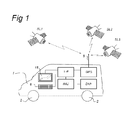
- FIG. 1 shows a vehicle with a navigation system
- FIG. 2 shows a computer arrangement that can be used as the microprocessor of the navigation system of FIG. 1 ,
- FIG. 3 shows an example of a picture on a display of the navigation system
- FIG. 4 shows the example of FIG. 3 , however, having a message overlaid on an advertisement space on a surface of an object in the picture.
- the present invention is applicable in all kinds of navigation systems: handheld devices, PDAs, and mobile telephones with navigation software and in-car navigation systems built in a vehicle.
- the invention can be implemented in any type of standard navigation system nowadays available on the market.
- the application in one possible in-car navigation system will be further explained in detail.
- this does not exclude any other type of implementation, for instance, a handheld device or navigation system in an aircraft.
- the invention is also applicable in virtual navigation systems where one virtually moves through an animation of reality, as indicated in the introduction of the present specification.
- FIG. 1 shows a vehicle provided with a navigation system.
- the vehicle 1 is provided with a plurality of wheels 2 .
- the vehicle 1 is provided with a navigation system.
- the navigation system may comprise the following components:
- the position determination system may comprise a DMI (Distance Measurement Instrument).
- This instrument is, for instance, an odometer that measures a distance traveled by the vehicle 1 by sensing the number of rotations of one or more of the wheels 2 .
- the DMI may operate with a sampling frequency of 10 or more Hz.
- the DMI is also connected to the microprocessor ⁇ P to allow the microprocessor ⁇ P to take the distance as measured by the DMI into account while processing the output signals from the GPS unit.
- DMIs are not yet widely applied in in-car navigation systems but they may well be in the (near) future.
- the position determination system may comprise an IMU (Inertial Measurement Unit).
- IMU Inertial Measurement Unit
- Such an IMU can be implemented as three gyro units arranged to measure rotational accelerations and three accelerometers arranged to measure translational accelerations along three orthogonal directions.
- the IMU/gyros and accelerometers may operate with a sampling frequency of 200 Hz.
- the IMU is also connected to the microprocessor ⁇ P to allow the microprocessor ⁇ P to take the measurements by the IMU into account while processing the output signals from the GPS unit.
- DMIs IMUs are not yet widely applied in in-car navigation systems but they may well be in the (near) future.
- the system may, in an embodiment, also include components for receiving broadcasted messages (RDS TMC, TPEG, . . . ) or point to point connections such as GPRS.
- RDS TMC broadcasted messages
- TPEG transport-layer encoding
- GPRS point to point connections
- a trusted element like a SIM-card with a unique ID, could be integrated allowing the navigation system to be recognised uniquely in communications with third party devices.
- the navigation system may have an integrated mobile telephone functionality allowing the user to have a hands free telephone call with a third party. Additionally or alternatively, the system may comprise a communication device arranged to communicate with a mobile telephone of a user via a wired or wireless connection, e.g., via a Bluetooth or infrared connection such as to allow the user of the mobile telephone to use a microphone and loudspeakers of the system during a hands free telephone call.
- a communication device arranged to communicate with a mobile telephone of a user via a wired or wireless connection, e.g., via a Bluetooth or infrared connection such as to allow the user of the mobile telephone to use a microphone and loudspeakers of the system during a hands free telephone call.
- microprocessor ⁇ P that can be used in accordance with the invention.
- the microprocessor ⁇ P comprises a processor 11 for carrying out arithmetic operations.
- the processor 11 is connected to a plurality of memory components, including a hard disk 12 , Read Only Memory (ROM) 13 , Electrically Erasable Programmable Read Only Memory (EEPROM) 14 , and Random Access Memory (RAM) 15 . Not all of these memory types need necessarily be provided.
- ROM Read Only Memory
- EEPROM Electrically Erasable Programmable Read Only Memory
- RAM Random Access Memory
- the processor 11 is also connected to means for inputting instructions, data etc. by a user, like a keyboard 16 , a touch screen and/or a voice converter.
- a reading unit 19 connected to the processor 11 is provided.
- the reading unit 19 is arranged to read data from and possibly write data on a physical data carrier like a floppy disk 20 or a CDROM 21 .
- Other data carriers may be tapes, DVD, CD-R. DVD-R, memory sticks etc. as is known to persons skilled in the art.
- the processor 11 is connected to display 18 , for instance, a monitor or LCD (Liquid Crystal Display) screen, or any other type of display known to persons skilled in the art.
- the processor 11 is also connected to speaker 29 .
- the processor 11 is connected to a communication network 27 via a wireless connection, for instance, the Public Switched Telephone Network (PSTN), a Local Area Network (LAN), a Wide Area Network (WAN), the Internet etc. by means of I/O means 25 .
- the processor 11 is arranged to communicate with other communication arrangements through the network 27 .
- the physical data carrier 20 , 21 may comprise a computer program product in the form of data and instructions arranged to provide the processor with the capacity to perform a method in accordance with the invention.
- computer program product may, alternatively, be downloaded via the telecommunication network 27 .
- the processor 11 may be implemented as stand alone system, or as a plurality of parallel operating processors each arranged to carry out subtasks of a larger computer program, or as one or more main processors with several sub-processors.
- the microprocessor ⁇ P in the navigation system is programmed to show a graphical display of the scene on the display 18 which scene is associated with the scene as visible to the driver of the vehicle through the windscreen of his vehicle. As the position of the navigation changes and thus the point of view the graphical display of the scene changes too.
- FIG. 3 schematically shows an example of such a scene.
- the scene as shown comprises one or more road segments 30 of a road network, one or more buildings 32 and a billboard 34 .
- the buildings 32 may have one or more doors 42 and one or more windows 44 .
- the buildings have surfaces 36 , 38 not occupied by doors 42 or windows 44 and that are suitable to display overlaid images, like advertisements.
- the billboard 34 has a surface 40 suitable to display such overlaid images.
- the picture (possibly including text) or animated image is stored in a memory which may be a memory of the microprocessor ⁇ P within the vehicle itself or a memory of the remote computer arrangement of the service provider. In the latter case, the microprocessor ⁇ P is programmed to download such pictures or animated images on the fly from the server of the service provider.
- downloading may be allowed only from such a server within the context of a subscription. Then, to make this work the server should have stored an ID of the navigation system of the user who has subscribed to the service.
- the navigation system may have a SIM card provided with a SIM card ID that is sent to the server any time the navigation system connects to the server to download one or more messages.
- Such a subscription may be personalized.
- the user of the navigation system may be requested by the server when subscribing to the service to complete a questionnaire. Based on answers given on the questionnaire each subscriber may be classified in a certain predetermined subscriber profile. Each subscriber profile may be assigned a different service profile. Criteria may e.g. be the income range, personal interests like cars, sports, culture, types of holidays, etc. Based on this, the navigation system may be sent different messages. For instance, a BMW driver may receive other messages than a Suzuki driver.
- navigation systems may be offered for free provided the “buyer” accepts receiving advertisements as determined by a provider.
- one or more surfaces of the 3D objects should be marked as being a location where a message, like an advertisement, can be overlaid. To that effect the following method can be used.
- Preparation of a 3D model with 3D objects is performed by an off-line computer arrangement that may be set up in a similar way as the computer arrangement shown in FIG. 2 .
- a 3D model is a vector based data model.
- this vector based model may be extended by some imagery, for instance, in the 3D object texture.
- Such a computer arrangement stores a suitable software program to produce and store such a 3D model. To that end, such a software program may instruct the processor of the computer arrangement to perform the following actions:
- advertisement space Such advertisement spaces need not necessarily be two-dimensional. Alternatively, such advertisement space may have a 3D shape like a building or a 3D billboard.
- Each advertisement space has a dimension and shape and is stored against a “basic advertisement value”, for instance, based on other surrounding and other related map features, like importance of the road where the area is located in reality (e.g. located in a rural or city area), size of the advertisement space, etc. So, each advertisement space can be sold as point, line, horizontal 2D area, vertical 2D area, 3D area on a “reality” advertisement space.
- One application is the dynamic advertisement linked to advertisement spaces on POI's (point of interest) since messages could be directly linked to the location, type and activity of the POI.
- Attributes of the advertisement space as stored in memory of the server of the service provider may be:
- the navigation system itself stores data as to the 3D objects based on the 3D model in its memory 12 , 13 , 14 , 15 , such as the one shown in FIG. 3 .
- 3D objects like buildings may have walls provided with texture elements like windows and doors. To that effect, the walls may be provided with texture elements selected from sets of reference texture elements. By using references to such reference texture elements memory space can be saved, as is explained in more detail in PCT/NL2006/050265.
- Data as to the 3D model may be updated on-the-fly by the navigation system by downloading updated data from the 3D model from the server of the service provider. This updated data will include updated data as to surfaces on the objects where new advertisement spaces have become available, e.g., new billboards along the road traveled by the user.
- the navigation system will receive content of a message, e.g. an advertisement, to be overlaid over an advertisement space in the picture or animated image shown on display 18 , as well as the coordinates indicating where the message should be located from the server of the service provider.
- a message e.g. an advertisement
- both the server of the service provider and the navigation system may be provided with so-called map independent location referencing technology software.
- One example of such software is used in Agora-C coders and decoders which are arranged to automatically provide an Agora-C Code to a geospatial related advertisement, in order to allow the navigation system to position the advertisement on the correct spot on display 18 . Details as to such Agora-C coders and decoders can be found in ISO Standard 17572-3. Such systems can be extended to define the coordinates of 3D objects if needed to be extended.
- processor 11 maps the coordinates of the received message to the coordinates of the advertisement space as shown on display 18 and, thus, shows the message on top of the area of the texture of the 3D model where the advertisement space was originally calculated from.
- the processor 11 is still able to visualize the message in the advertisement space as an icon or as an image with the original dimension.
- FIG. 4 shows an example of how an advertisement 46 can be shown to a user on display 18 .
- the advertisement is overlaid on advertisement space 36 on building 32 .
- an advertisement 48 can be shown in advertisement space 40 on billboard 34 .
- an audio message can be played by the navigation system as schematically indicated with reference 49 in FIG. 4 .
- the audio message may, for instance, be a well known tune of a brand name relating to the advertisement shown on billboard 34 .
- the navigation system When the user, for instance the driver of a vehicle accommodating the navigation system, approaches the advertisement space, the navigation system will change the dimensions and viewing angle of the scene such as to correspond with the current position. Thus when approaching billboard 34 , the system will show billboard 34 and the advertisement 48 on an increasing format. Since the 3D object on which the advertisement space is located is stored as part of a 3D model the processor of the navigation system can easily calculate the way the 3D object should be displayed on the display of the navigation system in dependence on the position of the navigation system relative to the corresponding 3D object as present in reality.
- the navigation system may perform at least one of the following actions:
- the display 18 is a touch screen allowing the user to touch the advertisement space with, for instance a finger or a pen or the like.
- the touch screen will send a signal to that effect to the processor 11 which is arranged to interpret this signal as if the user operated a hyperlink to a website of the advertiser.
- the processor 11 then establishes a link to this website and shows the content of the website on display 18 to the user.
- the website image may comprise further buttons that can be operated by touching the display 18 in order to allow the user to find some specific information.
- the navigation system may be provided with an other input device, like a mouse pad operable by a users finger, allowing the user to navigate a cursor across the website and search information from other webpages of the advertiser by selecting certain buttons on the display 18 .
- an other input device like a mouse pad operable by a users finger, allowing the user to navigate a cursor across the website and search information from other webpages of the advertiser by selecting certain buttons on the display 18 .
- one such button relates to a telephone number of the advertiser.
- the navigation system calls the advertiser and establishes a telephone link between the advertiser and a mobile phone of the user.
- a mobile phone may be a built-in telephone in the navigation system in the vehicle allowing the user to have a hands free conversation with the advertiser.
- the navigation system may alternatively be arranged to use its I/O device 25 to make a wireless connection to a separate mobile of the user, e.g. via a bluetooth connection.
- the speed of the vehicle accommodating the navigation system may influence the content of the message shown on the display 18 .
- the speed of the vehicle can be calculated, as is evident to a person skilled in the art, by the navigation system from satellite signals received by the GPS (or GNSS) unit or by signals from the DMI if present.
- a speed signal received from a speed measurement device as present in any vehicle can be used by the microprocessor ⁇ P.
- Options for such speed dependent showing of messages are as follows:
- the advertisement relates to an announcement that one can buy or acquire something at special conditions, e.g. at a very low prize and the navigation system shows a button on the display with a text like “nearest place to buy”. If one operates that button the processor 11 will respond by calculating a route from that location to the nearest sales point of the advertised good/service while using LBS related information to the advertisement as received from the server of the service provider. Alternatively or additionally, while displaying the advertisement the processor 11 is also arranged to display a further message like “for sale 2 miles down the road—at Mel's Sporting Goods Store” on a suitable place on the display 18 .
- non-geographically related e.g. goods like mobile phones
- geographically related e.g. a shop or a restaurant
- an advertiser concerned can decide to advertise his advertisement as non-geographical advertisement, i.e. the advertisement will be displayed on advertisement places not directly related to the advertisement, or as geographical advertisement, i.e. the advertisement will be displayed on advertisement places directly related to the advertisement.
- the advertiser may even specify to advertise it on the position of one or all shops in a specific area where that specific good is offered.
- Agora-C coders could be used to position the advertisement as an area or 3D object.
- system as described above allows to dynamically upload, update, visualize and manage non-geographically related advertisements, as well as geographically related advertisements on fixed or mobile devices, both in GIS and navigation applications.
- the system can be used by service providers offering mobile navigation applications using server based stored content managed by the service operator.
- the service provider may offer internet map applications.
- the navigation system is programmed to allow the user to switch the advertisement feature on and off.
- the construction of the 3D display is different than in video based systems of the prior art.
- the 3D model can be manipulated in all 3 dimensions there is no video but rather a constant re-rendering of scenes at perhaps a new viewing point because the input indicated that the viewer has moved.
- This is flexible and allows the computer arrangement to really take into account where a driver of a vehicle with a navigation system has moved to or where an internet flyer in a virtual environment has navigated his viewing position.
- graphical display can be shown fast.
- they provide for great deal of flexibility. For instance, map attributes data of a navigation map database can be seamlessly added into the 3D scene which is not easy to do in a 2D image construction as known from the prior art.
Landscapes
- Engineering & Computer Science (AREA)
- Business, Economics & Management (AREA)
- Theoretical Computer Science (AREA)
- Accounting & Taxation (AREA)
- Finance (AREA)
- Physics & Mathematics (AREA)
- Strategic Management (AREA)
- General Physics & Mathematics (AREA)
- Development Economics (AREA)
- Marketing (AREA)
- Economics (AREA)
- General Business, Economics & Management (AREA)
- Entrepreneurship & Innovation (AREA)
- Game Theory and Decision Science (AREA)
- Radar, Positioning & Navigation (AREA)
- Remote Sensing (AREA)
- General Engineering & Computer Science (AREA)
- Databases & Information Systems (AREA)
- Data Mining & Analysis (AREA)
- Automation & Control Theory (AREA)
- Multimedia (AREA)
- Library & Information Science (AREA)
- Tourism & Hospitality (AREA)
- Health & Medical Sciences (AREA)
- General Health & Medical Sciences (AREA)
- Human Resources & Organizations (AREA)
- Primary Health Care (AREA)
- Computer Graphics (AREA)
- Geometry (AREA)
- Software Systems (AREA)
- Navigation (AREA)
- Instructional Devices (AREA)
- Processing Or Creating Images (AREA)
- Digital Computer Display Output (AREA)
Applications Claiming Priority (1)
| Application Number | Priority Date | Filing Date | Title |
|---|---|---|---|
| PCT/EP2008/068091 WO2010069406A1 (en) | 2008-12-19 | 2008-12-19 | Dynamically mapping images on objects in a navigation system |
Publications (2)
| Publication Number | Publication Date |
|---|---|
| US20110106595A1 US20110106595A1 (en) | 2011-05-05 |
| US9208499B2 true US9208499B2 (en) | 2015-12-08 |
Family
ID=40940460
Family Applications (1)
| Application Number | Title | Priority Date | Filing Date |
|---|---|---|---|
| US12/736,877 Active 2029-07-06 US9208499B2 (en) | 2008-12-19 | 2008-12-19 | Dynamically mapping images on objects in a navigation system |
Country Status (11)
| Country | Link |
|---|---|
| US (1) | US9208499B2 (pt) |
| EP (1) | EP2359325A1 (pt) |
| JP (1) | JP2012512399A (pt) |
| KR (1) | KR20110102873A (pt) |
| CN (1) | CN102037483A (pt) |
| AU (1) | AU2008365415A1 (pt) |
| BR (1) | BRPI0822656A2 (pt) |
| CA (1) | CA2725564A1 (pt) |
| RU (1) | RU2011129827A (pt) |
| SG (1) | SG171700A1 (pt) |
| WO (1) | WO2010069406A1 (pt) |
Cited By (1)
| Publication number | Priority date | Publication date | Assignee | Title |
|---|---|---|---|---|
| US11118930B2 (en) * | 2017-07-14 | 2021-09-14 | Lyft, Inc. | Providing information to users of a transportation system using augmented reality elements |
Families Citing this family (46)
| Publication number | Priority date | Publication date | Assignee | Title |
|---|---|---|---|---|
| US8239132B2 (en) * | 2008-01-22 | 2012-08-07 | Maran Ma | Systems, apparatus and methods for delivery of location-oriented information |
| KR101229078B1 (ko) * | 2009-12-21 | 2013-02-04 | 한국전자통신연구원 | 실내외 상황인식 기반의 모바일 혼합현실 콘텐츠 운용 장치 및 방법 |
| US8941685B1 (en) * | 2011-03-08 | 2015-01-27 | Google Inc. | Showing geo-located information in a 3D geographical space |
| JP5821307B2 (ja) | 2011-06-13 | 2015-11-24 | ソニー株式会社 | 情報処理装置、情報処理方法及びプログラム |
| DE102012200133A1 (de) * | 2012-01-05 | 2013-07-11 | Robert Bosch Gmbh | Verfahren und Vorrichtung zur Fahrerinformation |
| US9791290B2 (en) * | 2012-02-29 | 2017-10-17 | Here Global B.V. | Manipulation of user attention with respect to a simulated field of view for geographic navigation via constrained focus on, perspective attraction to, and/or correction and dynamic adjustment of, points of interest |
| US9111293B2 (en) * | 2012-03-18 | 2015-08-18 | Piyush Gupta | Mobile location and time sensitive messaging platform |
| US9007380B1 (en) * | 2012-05-01 | 2015-04-14 | Google Inc. | Animated 3D buildings in virtual 3D environments |
| US8849509B2 (en) * | 2012-05-17 | 2014-09-30 | Ford Global Technologies, Llc | Method and apparatus for interactive vehicular advertising |
| US9146125B2 (en) | 2012-06-05 | 2015-09-29 | Apple Inc. | Navigation application with adaptive display of graphical directional indicators |
| US9997069B2 (en) | 2012-06-05 | 2018-06-12 | Apple Inc. | Context-aware voice guidance |
| US20130321400A1 (en) | 2012-06-05 | 2013-12-05 | Apple Inc. | 3D Map Views for 3D Maps |
| US9482296B2 (en) | 2012-06-05 | 2016-11-01 | Apple Inc. | Rendering road signs during navigation |
| US9182243B2 (en) * | 2012-06-05 | 2015-11-10 | Apple Inc. | Navigation application |
| US10176633B2 (en) | 2012-06-05 | 2019-01-08 | Apple Inc. | Integrated mapping and navigation application |
| US9886794B2 (en) | 2012-06-05 | 2018-02-06 | Apple Inc. | Problem reporting in maps |
| US9418672B2 (en) | 2012-06-05 | 2016-08-16 | Apple Inc. | Navigation application with adaptive instruction text |
| US8965696B2 (en) | 2012-06-05 | 2015-02-24 | Apple Inc. | Providing navigation instructions while operating navigation application in background |
| US10156455B2 (en) | 2012-06-05 | 2018-12-18 | Apple Inc. | Context-aware voice guidance |
| US8880336B2 (en) | 2012-06-05 | 2014-11-04 | Apple Inc. | 3D navigation |
| US9395875B2 (en) * | 2012-06-27 | 2016-07-19 | Ebay, Inc. | Systems, methods, and computer program products for navigating through a virtual/augmented reality |
| US10592916B1 (en) | 2012-09-12 | 2020-03-17 | Delorean, Llc | Vehicle-mounted, motion-controlled sign |
| US10957227B2 (en) | 2012-09-12 | 2021-03-23 | Delorean, Llc | Vehicle-mounted, location-controlled sign |
| US9972230B1 (en) * | 2012-09-12 | 2018-05-15 | Delorean, Llc | Traffic display with viewing distance control |
| US11798444B2 (en) | 2012-09-12 | 2023-10-24 | Delorean, Llc | Controlling display of variable content sign |
| US10762809B1 (en) | 2012-09-12 | 2020-09-01 | Delorean, Llc | Vehicle-mounted, motion-controlled sign |
| US9607510B1 (en) * | 2012-09-12 | 2017-03-28 | Delorean, Llc | Traffic display with viewing distance control |
| US9245497B2 (en) | 2012-11-01 | 2016-01-26 | Google Technology Holdings LLC | Systems and methods for configuring the display resolution of an electronic device based on distance and user presbyopia |
| US9214043B2 (en) | 2013-03-04 | 2015-12-15 | Here Global B.V. | Gesture based map annotation |
| US9699373B2 (en) | 2013-04-28 | 2017-07-04 | Tencnt Technology (Shenzhen) Company Limited | Providing navigation information to a point of interest on real-time street views using a mobile device |
| CN110120072B (zh) | 2013-12-19 | 2023-05-09 | 苹果公司 | 用于跟踪移动设备的方法和系统 |
| US20170140457A1 (en) * | 2014-03-24 | 2017-05-18 | Pioneer Corporation | Display control device, control method, program and storage medium |
| US9827714B1 (en) | 2014-05-16 | 2017-11-28 | Google Llc | Method and system for 3-D printing of 3-D object models in interactive content items |
| US9528845B2 (en) * | 2014-08-27 | 2016-12-27 | Robert Bosch Gmbh | Occlusion-reduced 3D routing for 3D city maps |
| WO2016132295A1 (en) * | 2015-02-19 | 2016-08-25 | Francesco Ricci | Guidance system and automatic control for vehicles |
| US10818084B2 (en) * | 2015-04-07 | 2020-10-27 | Geopogo, Inc. | Dynamically customized three dimensional geospatial visualization |
| CN105224179A (zh) * | 2015-09-30 | 2016-01-06 | 北京恒华伟业科技股份有限公司 | 信息显示方法及装置 |
| WO2018021707A1 (ko) * | 2016-07-29 | 2018-02-01 | 황문상 | Vr영상광고 시스템 및 vr광고제작시스템 |
| US10332292B1 (en) * | 2017-01-17 | 2019-06-25 | Zoox, Inc. | Vision augmentation for supplementing a person's view |
| DE102017217923A1 (de) * | 2017-10-09 | 2019-04-11 | Audi Ag | Verfahren zum Betrieb einer Anzeigeeinrichtung in einem Kraftfahrzeug |
| CN108182650B (zh) * | 2017-12-22 | 2021-02-02 | 王金刚 | 一种城市空间北斗网格标识与仿真可视化系统 |
| JP2021511729A (ja) * | 2018-01-18 | 2021-05-06 | ガムガム インコーポレイテッドGumgum, Inc. | 画像、又はビデオデータにおいて検出された領域の拡張 |
| US10783714B2 (en) * | 2019-01-29 | 2020-09-22 | Verizon Patent And Licensing Inc. | Methods and systems for automatically tailoring a form of an extended reality overlay object |
| CN112686998B (zh) * | 2021-01-07 | 2022-08-26 | 腾讯科技(深圳)有限公司 | 一种信息展示方法、装置、设备及计算机可读存储介质 |
| WO2022192033A1 (en) * | 2021-03-08 | 2022-09-15 | Drive Your Art, Llc | Billboard simulation and assessment system |
| CN114943044A (zh) * | 2022-04-27 | 2022-08-26 | 北京百度网讯科技有限公司 | 内容展示方法、装置、设备和存储介质 |
Citations (11)
| Publication number | Priority date | Publication date | Assignee | Title |
|---|---|---|---|---|
| DE19957550A1 (de) | 1999-11-30 | 2001-06-07 | Bosch Gmbh Robert | Navigationsgerät |
| US6285317B1 (en) | 1998-05-01 | 2001-09-04 | Lucent Technologies Inc. | Navigation system with three-dimensional display |
| US6360167B1 (en) * | 1999-01-29 | 2002-03-19 | Magellan Dis, Inc. | Vehicle navigation system with location-based multi-media annotation |
| EP1271458A2 (en) | 2001-06-22 | 2003-01-02 | Navigation Technologies Corporation | Geographic database organization that facilitates location-based advertising |
| US20040128070A1 (en) | 2002-12-31 | 2004-07-01 | Hauke Schmidt | System and method for advanced 3D visualization for mobile navigation units |
| US20050256766A1 (en) * | 2002-05-31 | 2005-11-17 | Garcia Johann S | Method and system for targeted internet search engine |
| US20060170693A1 (en) * | 2005-01-18 | 2006-08-03 | Christopher Bethune | System and method for processig map data |
| US20070124157A1 (en) * | 2005-05-06 | 2007-05-31 | Laumeyer Robert A | Network-based navigation system having virtual drive-thru advertisements integrated with actual imagery from along a physical route |
| WO2008044914A1 (en) | 2006-10-13 | 2008-04-17 | Tele Atlas B.V. | System for and method of processing laser scan samples and digital photographic images relating to building facades |
| US20090037273A1 (en) * | 2007-07-31 | 2009-02-05 | Jian Zhu | Systems and methods for displaying advertisement information |
| US7689355B2 (en) * | 2006-05-04 | 2010-03-30 | International Business Machines Corporation | Method and process for enabling advertising via landmark based directions |
-
2008
- 2008-12-19 JP JP2011541111A patent/JP2012512399A/ja not_active Withdrawn
- 2008-12-19 SG SG2010092112A patent/SG171700A1/en unknown
- 2008-12-19 EP EP08875507A patent/EP2359325A1/en not_active Withdrawn
- 2008-12-19 BR BRPI0822656-3A patent/BRPI0822656A2/pt not_active IP Right Cessation
- 2008-12-19 KR KR1020117008715A patent/KR20110102873A/ko not_active Withdrawn
- 2008-12-19 CN CN2008801293286A patent/CN102037483A/zh active Pending
- 2008-12-19 RU RU2011129827/08A patent/RU2011129827A/ru unknown
- 2008-12-19 AU AU2008365415A patent/AU2008365415A1/en not_active Abandoned
- 2008-12-19 CA CA2725564A patent/CA2725564A1/en not_active Abandoned
- 2008-12-19 WO PCT/EP2008/068091 patent/WO2010069406A1/en not_active Ceased
- 2008-12-19 US US12/736,877 patent/US9208499B2/en active Active
Patent Citations (15)
| Publication number | Priority date | Publication date | Assignee | Title |
|---|---|---|---|---|
| US6285317B1 (en) | 1998-05-01 | 2001-09-04 | Lucent Technologies Inc. | Navigation system with three-dimensional display |
| US6360167B1 (en) * | 1999-01-29 | 2002-03-19 | Magellan Dis, Inc. | Vehicle navigation system with location-based multi-media annotation |
| US6714860B1 (en) * | 1999-11-30 | 2004-03-30 | Robert Bosch Gmbh | Navigation device with means for displaying advertisements |
| DE19957550A1 (de) | 1999-11-30 | 2001-06-07 | Bosch Gmbh Robert | Navigationsgerät |
| US20060253481A1 (en) | 2001-06-22 | 2006-11-09 | Guido Matthew A | Geographic database organization that facilitates location-based advertising |
| US7089264B1 (en) | 2001-06-22 | 2006-08-08 | Navteq North America, Llc | Geographic database organization that facilitates location-based advertising |
| EP1271458A2 (en) | 2001-06-22 | 2003-01-02 | Navigation Technologies Corporation | Geographic database organization that facilitates location-based advertising |
| US20050256766A1 (en) * | 2002-05-31 | 2005-11-17 | Garcia Johann S | Method and system for targeted internet search engine |
| US20040128070A1 (en) | 2002-12-31 | 2004-07-01 | Hauke Schmidt | System and method for advanced 3D visualization for mobile navigation units |
| US20060170693A1 (en) * | 2005-01-18 | 2006-08-03 | Christopher Bethune | System and method for processig map data |
| US20070124157A1 (en) * | 2005-05-06 | 2007-05-31 | Laumeyer Robert A | Network-based navigation system having virtual drive-thru advertisements integrated with actual imagery from along a physical route |
| US7451041B2 (en) | 2005-05-06 | 2008-11-11 | Facet Technology Corporation | Network-based navigation system having virtual drive-thru advertisements integrated with actual imagery from along a physical route |
| US7689355B2 (en) * | 2006-05-04 | 2010-03-30 | International Business Machines Corporation | Method and process for enabling advertising via landmark based directions |
| WO2008044914A1 (en) | 2006-10-13 | 2008-04-17 | Tele Atlas B.V. | System for and method of processing laser scan samples and digital photographic images relating to building facades |
| US20090037273A1 (en) * | 2007-07-31 | 2009-02-05 | Jian Zhu | Systems and methods for displaying advertisement information |
Non-Patent Citations (1)
| Title |
|---|
| Cornelis et al, Fast Compact City Modeling for Navigation Pre-Visualization,Computer Society Conference. Jun. 2006. |
Cited By (5)
| Publication number | Priority date | Publication date | Assignee | Title |
|---|---|---|---|---|
| US11118930B2 (en) * | 2017-07-14 | 2021-09-14 | Lyft, Inc. | Providing information to users of a transportation system using augmented reality elements |
| US20210396539A1 (en) * | 2017-07-14 | 2021-12-23 | Lyft, Inc. | Providing information to users of a transportation system using augmented reality elements |
| US11927455B2 (en) * | 2017-07-14 | 2024-03-12 | Lyft, Inc. | Providing information to users of a transportation system using augmented reality elements |
| US20240200963A1 (en) * | 2017-07-14 | 2024-06-20 | Lyft, Inc. | Providing information to users of a transportation system using augmented reality elements |
| US12339134B2 (en) * | 2017-07-14 | 2025-06-24 | Lyft, Inc. | Providing information to users of a transportation system using augmented reality elements |
Also Published As
| Publication number | Publication date |
|---|---|
| KR20110102873A (ko) | 2011-09-19 |
| SG171700A1 (en) | 2011-07-28 |
| RU2011129827A (ru) | 2013-01-27 |
| CN102037483A (zh) | 2011-04-27 |
| US20110106595A1 (en) | 2011-05-05 |
| JP2012512399A (ja) | 2012-05-31 |
| CA2725564A1 (en) | 2010-06-24 |
| BRPI0822656A2 (pt) | 2015-06-30 |
| WO2010069406A1 (en) | 2010-06-24 |
| EP2359325A1 (en) | 2011-08-24 |
| AU2008365415A1 (en) | 2010-06-24 |
Similar Documents
| Publication | Publication Date | Title |
|---|---|---|
| US9208499B2 (en) | Dynamically mapping images on objects in a navigation system | |
| US9146126B2 (en) | Interactive geographic feature | |
| US8700302B2 (en) | Mobile computing devices, architecture and user interfaces based on dynamic direction information | |
| US9400591B2 (en) | Personal wireless navigation system | |
| US10057724B2 (en) | Predictive services for devices supporting dynamic direction information | |
| US9052211B2 (en) | Navigation system and method | |
| US20100009662A1 (en) | Delaying interaction with points of interest discovered based on directional device information | |
| US20100332324A1 (en) | Portal services based on interactions with points of interest discovered via directional device information | |
| US8532924B2 (en) | Method and apparatus for displaying three-dimensional terrain and route guidance | |
| CN101600938A (zh) | 用于移动地图绘制的虚拟位置标记 | |
| CN107131884A (zh) | 基于设备的方向信息的设备交易模型和服务 | |
| US9354076B2 (en) | Guiding server, guiding method and recording medium recording guiding program | |
| US20120092326A1 (en) | Branded Location Referencing | |
| JP2007025362A (ja) | 画像処理装置、遠景画像表示方法および遠景画像表示プログラム | |
| WO2012072116A1 (en) | Methods and systems for formatting maps | |
| TW201024676A (en) | Dynamically mapping images on objects in a navigation system | |
| HK1151608A (en) | Dynamically mapping images on objects in a navigation system | |
| JP2007212836A (ja) | 情報取得装置、情報表示装置及び情報取得方法等 | |
| KR102105775B1 (ko) | 전자 지도 서비스 방법 및 시스템 | |
| WO2012072117A1 (en) | Methods and systems for obtaining location information |
Legal Events
| Date | Code | Title | Description |
|---|---|---|---|
| AS | Assignment |
Owner name: TELE ATLAS DATA GENT N.V., BELGIUM Free format text: ASSIGNMENT OF ASSIGNORS INTEREST;ASSIGNOR:VELDE, LINDE VANDE;REEL/FRAME:025642/0372 Effective date: 20110107 |
|
| AS | Assignment |
Owner name: TOMTOM BELGIUM N.V., BELGIUM Free format text: CHANGE OF NAME;ASSIGNOR:TELE ATLAS DATA GENT N.V.;REEL/FRAME:031796/0875 Effective date: 20101230 |
|
| STCF | Information on status: patent grant |
Free format text: PATENTED CASE |
|
| AS | Assignment |
Owner name: TOMTOM GLOBAL CONTENT B.V., NETHERLANDS Free format text: SERVICE AGREEMENT;ASSIGNOR:TOMTOM BELGIUM N.V.;REEL/FRAME:042206/0121 Effective date: 20020101 Owner name: TOMTOM NAVIGATION B.V., NETHERLANDS Free format text: DEED OF DEMERGER AND INCORPORATION;ASSIGNOR:TOMTOM GLOBAL CONTENT B.V.;REEL/FRAME:042206/0424 Effective date: 20150602 |
|
| MAFP | Maintenance fee payment |
Free format text: PAYMENT OF MAINTENANCE FEE, 4TH YEAR, LARGE ENTITY (ORIGINAL EVENT CODE: M1551); ENTITY STATUS OF PATENT OWNER: LARGE ENTITY Year of fee payment: 4 |
|
| MAFP | Maintenance fee payment |
Free format text: PAYMENT OF MAINTENANCE FEE, 8TH YEAR, LARGE ENTITY (ORIGINAL EVENT CODE: M1552); ENTITY STATUS OF PATENT OWNER: LARGE ENTITY Year of fee payment: 8 |