JP2010101668A - Navigation system, route search server, and candidate route display method - Google Patents
Navigation system, route search server, and candidate route display method Download PDFInfo
- Publication number
- JP2010101668A JP2010101668A JP2008271570A JP2008271570A JP2010101668A JP 2010101668 A JP2010101668 A JP 2010101668A JP 2008271570 A JP2008271570 A JP 2008271570A JP 2008271570 A JP2008271570 A JP 2008271570A JP 2010101668 A JP2010101668 A JP 2010101668A
- Authority
- JP
- Japan
- Prior art keywords
- route
- route search
- candidate
- destination
- nearest station
- Prior art date
- Legal status (The legal status is an assumption and is not a legal conclusion. Google has not performed a legal analysis and makes no representation as to the accuracy of the status listed.)
- Pending
Links
Images


Abstract
Description
本発明は出発地から目的地に至る候補経路を探索してユーザに提示するナビゲーションシステムに関するものであり、特に、交通機関を利用した複数の候補経路を提示する際、同一交通路線上の異なる最寄駅に基づく候補経路が規定数を超えて提示されないようにしたナビゲーションシステムに関する。 The present invention relates to a navigation system that searches a candidate route from a departure point to a destination and presents it to a user. In particular, when presenting a plurality of candidate routes using transportation facilities, the present invention relates to different navigation systems on the same traffic route. The present invention relates to a navigation system in which candidate routes based on stop stations are not presented beyond a specified number.
従来から、地図データ、道路データを用いて、所望の出発地から目的地までの経路を探索して候補経路をユーザに提示するナビゲーション装置、ナビゲーションシステムが知られている。例えば、候補経路の提示のみならず、自動車に搭載して運転者を目的地まで誘導案内するカーナビゲーション装置や、携帯端末を利用して経路探索サーバに経路探索要求を送り、その結果を受信して目的地に至るまでの誘導案内を受ける通信型のナビゲーションシステムなどがすでに実用化されている。 2. Description of the Related Art Conventionally, navigation devices and navigation systems that search for a route from a desired departure point to a destination by using map data and road data and present candidate routes to a user are known. For example, not only the candidate route is presented, but also a car navigation device that is installed in a car and guides the driver to the destination, or a mobile terminal is used to send a route search request to the route search server and receive the result Communication-type navigation systems that receive guidance to reach the destination have already been put into practical use.
特に、通信型のナビゲーションシステムとしては、携帯電話やPDA等を携帯端末として利用することにより歩行者用のナビゲーションシステムとしたものが広く知られている。近年では、この歩行者用のナビゲーションシステムにあっては、交通機関を含めた候補経路の提示が要求されることから、経路探索サーバに交通機関の交通路線データや運行時刻データを蓄積して所望の出発駅から所望の目的駅までの交通機関経路を、徒歩経路を含めて探索する機能を有するナビゲーションシステムが多数提案されている。 In particular, as a communication type navigation system, a navigation system for pedestrians by using a mobile phone, a PDA or the like as a mobile terminal is widely known. In recent years, since this navigation system for pedestrians requires presentation of candidate routes including transportation facilities, it is desirable to accumulate transportation route data and operation time data of transportation facilities in a route search server. Many navigation systems having a function of searching for a transportation route from a departure station to a desired destination station including a walking route have been proposed.
一般的なナビゲーション装置、ナビゲーションシステムに使用される経路探索装置、経路探索方法としては、例えば、下記の特許文献1(特開2001−165681号公報)に開示されているものが知られている。このナビゲーションシステムは、携帯ナビゲーション端末から出発地と目的地の情報を含む検索条件を情報配信サーバに送り、情報配信サーバで道路網や交通網のデータから経路探索条件に合致した経路を探索するように構成されている。経路探索条件としては、出発地から目的地までの移動手段、例えば、徒歩、自動車、鉄道、バス、及びこれらの併用などがあり、これを経路探索条件の1つとして経路探索を行う。 As a general navigation device, a route search device and a route search method used in the navigation system, for example, those disclosed in the following Patent Document 1 (Japanese Patent Laid-Open No. 2001-165681) are known. In this navigation system, a search condition including information on a departure place and a destination is sent from the portable navigation terminal to the information distribution server, and the information distribution server searches for a route that matches the route search condition from data of the road network and the traffic network. It is configured. As route search conditions, there are means for moving from the departure point to the destination, for example, walking, automobiles, railroads, buses, and combinations thereof, and route search is performed using these as one of the route search conditions.
情報配信サーバは、地図データの道路(経路)をその結節点、屈曲点の位置をノードとし、各ノードを結ぶ経路をリンクとし、全てのリンクのコスト情報(距離や所要時間)をデータベースとして備えている。そして、情報配信サーバは、データベースを参照して、出発地のノードから目的地のノードに至るリンクを順次探索し、リンクのコスト情報が最小となるノード、リンクをたどって案内経路とすることによって最短の経路を携帯ナビゲーション端末に案内することができる。このような経路探索の手法としてはラベル確定法あるいはダイクストラ法と言われる手法が用いられる。上記特許文献1には、このダイクストラ法を用いた経路探索方法も開示されている。 The information distribution server has roads (routes) of map data as nodes and nodes as the positions of inflection points, links connecting the nodes as links, and cost information (distance and required time) of all links as a database. ing. Then, the information distribution server sequentially searches for a link from the departure node to the destination node with reference to the database, and traces the node and link with the smallest cost information of the link as a guide route. The shortest route can be guided to the portable navigation terminal. As such a route search method, a method called label determination method or Dijkstra method is used. Patent Document 1 also discloses a route search method using this Dijkstra method.
交通機関を利用する経路を探索する経路探索システムは、徒歩経路や自動車による移動経路を探索するための道路ネットワークデータに加え、各交通機関の運行時刻データをデータベース化した運行時刻データベースとこれに基づいて交通ネットワークをデータベース化した交通ネットワークデータを備えている。経路探索システムは、ユーザが指定する出発日時、出発地、目的地、到着時刻等の経路探索条件に基づいて、これらのデータベースを参照して、乗り継ぎ(乗換え)を含めて出発地と目的地を結ぶ利用可能な各交通手段(個々の電車や交通路線バス)を経路として順次たどり、経路探索条件に合致する案内経路(出発地駅、目的地駅、交通路線、列車などの交通手段)の候補を1つまたは複数提示するように構成される。経路探索条件としては更に、所要時間、乗り継ぎ回数、運賃などを指定できるようにされているのが一般的である。 In addition to road network data for searching for walking routes and moving routes by car, the route search system that searches for routes that use transportation facilities is based on an operation time database that is a database of operation time data for each transportation facility. Transportation network data that is a database of transportation networks. The route search system refers to these databases based on the route search conditions specified by the user, such as departure date and time, departure location, destination, arrival time, etc., and determines the departure location and destination including transit (transfer). Follow each available means of transportation (individual trains and route buses) as a route, and guide route candidates (departure stations, destination stations, transportation routes, trains, etc.) that match the route search conditions Are configured to present one or more. As route search conditions, it is generally possible to specify a required time, the number of connections, a fare, and the like.
ところで、交通機関を利用した経路を探索するナビゲーションシステムにあっては、より多くの候補経路をユーザに提示して利用価値を高めるという趣旨に鑑み、交通機関利用の始点となる乗車起点駅や終点となる最終降車駅(最寄駅)は複数提示されるのが好ましいとされる。かかる観点から、例えば特許文献2に示されるナビゲーションシステムにおいては、出発地から一定範囲内に存在する乗車起点駅(最寄駅)が複数提示される構成が採用されている。
By the way, in a navigation system that searches for routes using transportation facilities, in view of the purpose of increasing the utility value by presenting more candidate routes to the user, the boarding start station and the end point that are the starting points for transportation use It is said that it is preferable to present a plurality of final exit stations (nearest stations). From this point of view, for example, the navigation system disclosed in
しかしながら、このような構成を採用すると、出発地や目的地から一定範囲内に同一交通路線上の駅が多数存在するような場合には、それらを最寄駅とする候補経路がユーザにすべからく提示されるケースが生じ得る。かかる現象は、たとえば東京や大阪等の交通機関が密集した地域では特に顕著となる。 However, when such a configuration is adopted, if there are many stations on the same traffic route within a certain range from the starting point or destination, the user is presented with all candidate routes that are closest to them. Cases may occur. Such a phenomenon becomes particularly prominent in an area where transportation facilities are dense such as Tokyo and Osaka.
とりわけ交通機関の密集する地域では、同一路線上の複数駅が最寄駅として提示されることは、この種のユーザのニーズに合致したものであるものの、この場合、以下の問題が生じることが知見されている。
(1)候補経路の端末装置への表示数が制限されるナビゲーションシステムの場合、最寄駅が異なるだけで実質的には同一経路を利用した多数の候補経路が優先的に表示されてしまう場合があり、他の交通路線を利用した候補経路が提示されなくなってしまう。
(2)候補経路の表示数が制限されていない場合でも、実質的に同一経路を利用した多数の候補経路が表示されてしまうことにより、候補経路全体の一見把握、比較参照が困難となり、所望の候補経路の選別に時間がかかってしまう等の不具合が生じる。
Especially in areas where transportation is crowded, the fact that multiple stations on the same route are presented as the nearest station meets the needs of this type of user, but in this case, the following problems may arise: It has been found.
(1) In the case of a navigation system in which the number of candidate routes displayed on the terminal device is limited, a large number of candidate routes using the same route are preferentially displayed only when the nearest station is different. And candidate routes using other traffic routes will not be presented.
(2) Even if the number of display of candidate routes is not limited, a large number of candidate routes using substantially the same route are displayed, which makes it difficult to grasp the entire candidate route at a glance and compare and reference it. Such as it takes time to select candidate routes.
一方で、この種のナビゲーションシステムを利用するユーザは、一般に、交通機関を利用した候補経路を選別するに際しては、異なる交通路線(鉄道、バス等)を利用した経路を比較した上で最適なものを選別することを所望するものであるから、上述のように、最寄駅こそ異なるものの実質的には同一の路線を利用する候補経路の過剰提示は一般には不要と考えられる。 On the other hand, users who use this type of navigation system are generally the best ones when comparing candidate routes using different transportation routes (railways, buses, etc.) when selecting candidate routes using transportation. Therefore, it is generally considered unnecessary to over-present candidate routes that use substantially the same route, although the nearest station is different, as described above.
この発明は、上記の問題点およびユーザのニーズに着目してなされたものであり、同一交通路線上の異なる最寄駅に基づく候補経路が過剰にユーザに提示されることを回避することで、ユーザによる候補経路選択の迅速性及び利便性の向上を図ったナビゲーションシステムを提供することを目的とするものである。 This invention has been made paying attention to the above problems and user needs, and by avoiding excessive presentation of candidate routes based on different nearest stations on the same traffic route to the user, It is an object of the present invention to provide a navigation system that improves the speed and convenience of selecting a candidate route by a user.
前記課題を解決するために、本願の請求項1にかかる発明は、
出発地と目的地とを含む経路探索要求に基づいて、経路探索用のネットワークデータを参照して交通機関を利用した区間を含む候補経路を探索する経路探索手段を有する経路探索サーバと、前記候補経路を表示する表示手段を有する端末装置と、を備えたナビゲーションシステムであって、
交通機関を利用する場合に選出される出発地付近又は目的地付近の最寄駅が、同一交通路線上に規定数を超えて選出されたときには、当該選出されたものの中から、規定数の有効最寄駅を特定する有効最寄駅特定手段を備え、
それにより、同一交通路線上の異なる最寄駅に基づく候補経路が規定数を超えて表示されることを制限するようにしたナビゲーションシステムである。
In order to solve the above-mentioned problem, the invention according to claim 1 of the present application is
A route search server having route search means for searching for a candidate route including a section using a transportation facility by referring to network data for route search based on a route search request including a starting point and a destination; A navigation system comprising a terminal device having display means for displaying a route,
When the nearest station near the departure point or destination selected when using transportation is selected more than the specified number on the same traffic route, the specified number is valid from the selected items. Equipped with effective nearest station identification means to identify the nearest station,
Accordingly, the navigation system is configured to limit the display of candidate routes based on different nearest stations on the same traffic route beyond a specified number.
また、本願の請求項2にかかる発明は、請求項1にかかる発明において有効最寄駅特定手段により特定される有効最寄駅の規定数が、経路探索要求毎に決定される、ことを特徴とする。
The invention according to
また、本願の請求項3にかかる発明は、請求項1または2にかかるナビゲーションシステムにおいて、有効最寄駅特定手段より特定される有効最寄駅の規定数が、出発地、目的地または利用交通路線のいずれかの属性に基づいて決定されることを特徴とする。
Further, the invention according to
また、本願の請求項4にかかる発明は、請求項3にかかるナビゲーションシステムにおいて、出発地又は目的地の属性が、あらかじめ定められた地域属性であることを特徴とする。
The invention according to
また、本願の請求項5にかかる発明は、請求項1ないし4のいずれかにかかるナビゲーションシステムにおいて、経路探索手段は、有効最寄駅の特定後に、当該有効最寄駅を交通機関の始点又は終点とする候補経路の探索処理を行うことを特徴とすることを特徴とする。 Further, the invention according to claim 5 of the present application is the navigation system according to any one of claims 1 to 4, wherein the route search means specifies the effective nearest station after the effective nearest station is specified or the starting point of the transportation facility. It is characterized in that a candidate route search process as an end point is performed.
また、本願の請求項6にかかる発明は、
出発地から目的地に至る候補経路を探索して提示するナビゲーションシステムにおける経路探索サーバであって、
出発地と目的地とを含む経路探索要求に基づいて、経路探索用のネットワークデータを参照して交通機関を利用した区間を含む候補経路を探索する経路探索手段と、
交通機関を利用する場合に選出される出発地付近又は目的地付近の最寄駅が、同一交通路線上に規定数を超えて選出されたときには、当該選出されたものの中から、規定数の有効最寄駅を特定する有効最寄駅特定手段と、を備え、
それにより、同一交通路線上の異なる最寄駅に基づく候補経路が規定数を超えてユーザに提示されることを制限するようにしたことを特徴とするナビゲーションシステムにおける経路探索サーバである。
The invention according to claim 6 of the present application is
A route search server in a navigation system for searching and presenting candidate routes from a starting point to a destination,
Based on a route search request including a starting point and a destination, route search means for searching for candidate routes including sections using transportation facilities with reference to network data for route search;
When the nearest station near the departure point or destination selected when using transportation is selected more than the specified number on the same traffic route, the specified number is valid from the selected items. An effective nearest station identifying means for identifying the nearest station,
Accordingly, the route search server in the navigation system is characterized in that the candidate routes based on different nearest stations on the same traffic route are restricted from being presented to the user beyond the prescribed number.
また、請求項7にかかる発明は、請求項6にかかる経路探索サーバにおいて、有効最寄駅特定手段により特定される有効最寄駅の規定数が、経路探索要求毎に決定されることを特徴とする。
The invention according to
また、請求項8にかかる発明は、請求項6または7にかかる経路探索サーバにおいて、有効最寄駅特定手段により特定される有効最寄駅の規定数が、出発地、目的地または利用交通路線のいずれかの属性に基づいて決定される ことを特徴とする。
The invention according to
また、請求項9にかかる発明は、請求項8にかかる経路探索サーバにおいて、出発地又は目的地の属性が、あらかじめ定められた地域属性であることを特徴とする。
The invention according to claim 9 is characterized in that, in the route search server according to
また、請求項10にかかる発明は、請求項6ないし9のいずれかの経路探索サーバにおいて、経路探索手段は、有効最寄駅の決定後に、当該有効最寄駅を交通機関の始点とする候補経路の探索処理を行うことを特徴とする。 According to a tenth aspect of the present invention, in the route search server according to any one of the sixth to ninth aspects, after the effective nearest station is determined, the route search means is a candidate having the effective nearest station as a starting point of transportation. A route searching process is performed.
また、請求項11にかかる発明は、
経路探索要求に応じた出発地から目的地に至る候補経路を探索して提示するナビゲーションシステムにおける候補経路表示方法であって、
出発地付近又は目的地付近の最寄駅を選出するステップと、
同一交通路線上に規定数を超えて最寄駅が選出されたときには、当該選出されたものの中から、規定数の有効最寄駅を特定するステップと、
決定された有効最寄駅に基づいて候補経路を探索するステップと、
探索された候補経路を提示するステップと、
を有することを特徴とする候補経路表示方法である。
The invention according to claim 11 is
A candidate route display method in a navigation system for searching and presenting a candidate route from a starting point to a destination according to a route search request,
Selecting the nearest station near the departure or destination,
When the nearest station is selected exceeding the specified number on the same traffic route, the step of identifying the specified number of effective nearest stations from the selected ones;
Searching for a candidate route based on the determined effective nearest station;
Presenting the searched candidate route;
A candidate route display method characterized by comprising:
また、請求項12にかかる発明は、請求項11にかかる候補経路表示方法において、規定数の有効最寄駅を特定するステップには、経路探索要求毎に適宜の規定数を決定する処理が含まれることを特徴とする。 According to a twelfth aspect of the present invention, in the candidate route display method according to the eleventh aspect, the step of specifying the prescribed number of effective nearest stations includes a process of determining an appropriate prescribed number for each route search request. It is characterized by that.
また、請求項13にかかる発明は、請求項11または12に記載の候補経路表示方法において、規定数の有効最寄駅を特定するステップには、出発地、目的地または利用交通路線のいずれかの属性に基づいて規定数を決定する処理が含まれることを特徴とする。 According to a thirteenth aspect of the present invention, in the candidate route display method according to the eleventh or twelfth aspect, the step of identifying the specified number of effective nearest stations is any of a departure point, a destination, or a used traffic route. And a process for determining the prescribed number based on the attribute of.
また、請求項14にかかる発明は、請求項13にかかる候補経路表示方法において、出発地又は目的地の属性が、あらかじめ定められた地域属性であることを特徴とする。
The invention according to claim 14 is the candidate route display method according to
請求項1にかかる発明によれば、交通機関を利用する場合に選出される出発地付近又は目的地付近の最寄駅が、同一交通路線上に規定数を超えて選出されたときには、当該選出されたものの中から、規定数の有効最寄駅が特定されるから、それにより、同一交通路線上の異なる最寄駅に基づく候補経路が規定数を超えて表示されることを制限することができる。その結果、
(1)候補経路の端末装置への表示数が制限されるナビゲーションシステムの場合、
最寄駅が異なるだけで実質的には同一経路を利用した多数の候補経路が優先的に表示されてしまうことにより、他の交通路線を利用した候補経路が提示されなくなってしまう、という不具合を解消することができる。
(2)また、候補経路の表示数が制限されていない場合でも、実質的には同一経路を利用した多数の候補経路が表示されてしまうことにより、候補経路の一見把握、比較参照が困難となって所望の候補経路の選別に時間がかかってしまう等の不具合を解消することができる。
According to the first aspect of the present invention, when the nearest station near the departure point or the destination selected when using transportation is selected more than the specified number on the same traffic route, the selection is made. Since a specified number of effective nearest stations are identified from among those that have been made, this may limit the display of candidate routes based on different nearest stations on the same traffic route beyond the specified number. it can. as a result,
(1) In the case of a navigation system in which the number of candidate routes displayed on the terminal device is limited,
There is a problem that candidate routes using other traffic routes will not be presented because a number of candidate routes using the same route will be displayed preferentially only when the nearest station is different. Can be resolved.
(2) Even when the display number of candidate routes is not limited, it is difficult to grasp the candidate routes at a glance and compare and reference them by displaying a large number of candidate routes using the same route. Thus, it is possible to solve problems such as taking a long time to select a desired candidate route.
請求項2にかかる発明によれば、有効最寄駅特定手段により特定される有効最寄駅の規定数を経路探索要求毎に決定することができる。その結果、例えば経路探索要求ごとのユーザからの任意指定に基づいて当該規定数を都度変更可能にするなど、経路探索要求に応じた柔軟な表示制限を行うことができる。 According to the second aspect of the present invention, the specified number of effective nearest stations specified by the effective nearest station specifying means can be determined for each route search request. As a result, for example, it is possible to perform flexible display restrictions according to the route search request, such as making it possible to change the specified number each time based on an arbitrary designation from the user for each route search request.
請求項3にかかる発明よれば、有効最寄駅特定手段により特定される有効最寄駅の規定数を、出発地、目的地または利用交通路線のいずれかの属性(これらの組み合わせを含む)に基づいて決定することができる。したがって、出発地、目的地または交通路線によりあらかじめ定められた規定数を自動的に設定することが可能となる。このため、ユーザに規定数選択の意義を解説したり、当該選択の負担を負わせるといった煩雑さを省略でき、出発地、目的地や利用交通路線の個別事情等に対応した柔軟な表示制限をすることが可能となる。
According to the invention of
請求項4にかかる発明によれば、出発地又は目的地で特定される地域属性に基づいて、有効最寄駅数を自動的に決定することができる。したがって、例えば、鉄道交通路線が密集していて候補経路が比較的多数選ばれることが予想される地域とそうでない地域とで、規定数に差別化を図る等、地域実情を考慮したよりユーザフレンドリーな表示制限を行うことが可能となる。 According to the fourth aspect of the present invention, the effective nearest station number can be automatically determined based on the regional attribute specified by the departure place or the destination. Therefore, for example, it is more user-friendly in consideration of local conditions, such as differentiating the prescribed number between regions where railway traffic routes are dense and a relatively large number of candidate routes are expected to be selected, and regions where such routes are not. Display restrictions can be made.
請求項5にかかる発明によれば、有効最寄駅の決定後に、当該有効最寄駅を交通機関の始点又は終点とする候補経路の探索が行われる。したがって、ダイクストラ法等により候補経路を算出するのに先んじて最寄駅が特定され、有効とされない最寄駅に基づく候補経路の算出が不要となり、経路探索時間が削減される。 According to the fifth aspect of the present invention, after the effective nearest station is determined, a search for a candidate route having the effective nearest station as the start point or the end point of the transportation is performed. Therefore, prior to calculating the candidate route by the Dijkstra method or the like, the nearest station is identified, calculation of a candidate route based on the nearest station that is not valid becomes unnecessary, and route search time is reduced.
請求項6ないし請求項10にかかる発明によれば、それぞれ請求項1ないし5にかかるナビゲーションシステムを構成する経路探索サーバを提供することができ、請求項11ないし14の発明よれば、それぞれ請求項1ないし4にかかるナビゲーションシステムにおける経路表示方法を提供することができるようになる According to the inventions according to claims 6 to 10, it is possible to provide route search servers constituting the navigation systems according to claims 1 to 5, respectively, and according to the inventions of claims 11 to 14, respectively, A route display method in the navigation system according to 1 to 4 can be provided.
以下、本発明の具体例を実施例及び図面を用いて詳細に説明する。但し、以下に示す実施例は、本発明の技術的思想を具体化するためのナビゲーションシステムを例示するものであって、本発明をこのナビゲーションシステムに特定することを意図するものではなく、特許請求の範囲に含まれるその他のナビゲーションシステムにも等しく適用し得るものである。尚、本発明は、出発地付近の乗車起点駅に基づく候補経路の制限的提示のみならず、最終降車駅に基づく候補経路の制限的提示にも同様に適用できるものであるが、いずれの場合も同様の技術的思想を用いて具現化されるものであるから、重複説明を回避するため、以下の説明では制限表示対象の最寄駅として乗車起点駅のみを適用したものを例示する。 Hereinafter, specific examples of the present invention will be described in detail with reference to examples and drawings. However, the following embodiment is illustrative of a navigation system for embodying the technical idea of the present invention, and is not intended to specify the present invention for this navigation system. The present invention can be equally applied to other navigation systems included in the scope. The present invention can be applied not only to the limited presentation of candidate routes based on the boarding origin station near the departure point, but also to the limited presentation of candidate routes based on the final departure station. Since it is embodied using the same technical idea, in order to avoid redundant description, the following description exemplifies a case where only the boarding origin station is applied as a nearest display target station.
図1は、本発明の実施例にかかるナビゲーションシステムの構成を示す図である。本実施例にかかるナビゲーションシステム10は、図1に示すように、携帯電話やPDA、ミュージックプレーヤーなどの携帯機器を採用した端末装置20と経路探索サーバ30とがインターネットなどのネットワーク12を介して接続される構成になっている。経路探索サーバ30は、経路探索のための道路ネットワークのデータを蓄積したデータベース(DB1)、時刻表データに基づく交通ネットワークのデータを交通ネットワークデータとして蓄積したデータベース(DB2)、交通機関の各電車等の運行ダイヤに基づく時刻表や運賃を蓄積した時刻表・運賃データのデータベース(DB3)、誘導案内に際しての表示用の地図データなどを蓄積したデータベース(DB4)を備えている。尚、この例では、時刻表・運賃データは、ネットワーク上に配置された情報配信サーバ50から定期的に取得するようにされている。
FIG. 1 is a diagram showing a configuration of a navigation system according to an embodiment of the present invention. As shown in FIG. 1, the navigation system 10 according to the present embodiment connects a
更に、本実施例では、本発明の要部となる最寄駅ノード採用制限用データを蓄積したデータベース(DB5)を備えている。このデータベースには、誘導案内に先立って実行される経路探索の際に同一交通路線上の乗車起点駅(最寄駅ノード)が複数選出された場合に、それら各最寄駅ノードに基づく複数の候補経路が一定数を越えて表示されないように制限するために必要とされるデータが格納されている。詳細内容については図9を用いて後述する。 Furthermore, in this embodiment, a database (DB5) is provided that stores data for restricting use of the nearest station node, which is a main part of the present invention. In this database, when a plurality of boarding origin stations (nearest station nodes) on the same traffic line are selected during a route search performed prior to the guidance guidance, a plurality of these based on the nearest station nodes are selected. Data necessary for restricting the candidate routes from being displayed beyond a certain number is stored. Details will be described later with reference to FIG.
尚、本発明にかかるナビゲーションシステム10は、上記の構成に限られるものではなく、経路探索サーバ30には、ナビゲーションサービス機能とともにPOI(Point of Interest(レジャー施設、飲食店、イベント会場当の種々の興味対象場所)、以下同様)の所在場所の地図を配信する地図配信サーバの機能を具備させることが可能である。この場合にも、端末装置20には、携帯電話やPDAや音楽プレイヤーや携帯ゲーム機などの携帯機器を採用することができる。
The navigation system 10 according to the present invention is not limited to the above-described configuration. The
図2は、図1に示すナビゲーションシステム10の詳細構成を示すブロック図である。経路探索サーバ30は、制御手段31、誘導案内データ編集手段32、経路探索手段33、通信手段34、道路ネットワークデータ35、交通ネットワークデータ36、地図データ37、最寄駅ノード採用制限用データ38などを備えて構成されている。制御手段31は、図示してはいないがRAM、ROM、プロセッサを有する所謂マイクロプロセッサであり、ROMに格納された制御プログラムにより各構成要素32〜38の動作を制御する。そして、この制御プログラムには、上述の最寄駅採用制限用データを参照して、同一交通路線上の各最寄駅ノードに基づく複数の候補経路が一定数を越えて表示されないように制限するための専用プログラムが含まれる。すなわち、この専用プログラムが格納された制御手段31と最寄駅採用制限用データ38とにより、本発明にかかる有効最寄駅特定手段が実現されることとなる。詳細内容については図8のフローチャートを参照しつつ後述する。尚、通信手段34はネットワーク12を介して端末装置20等と通信データを送受信するための通信インターフェースを示している。
FIG. 2 is a block diagram showing a detailed configuration of the navigation system 10 shown in FIG. The
尚、誘導案内データ編集手段32は、本発明の要部となる候補経路の提示と、続くユーザによる一の経路の選択後に開始される誘導案内を実行する際、端末装置20に現在地付近の地図データ等を付加して誘導案内情報を表示するための誘導案内データを編集するものである。
The guide guidance
一方、端末装置20は、制御手段21、通信手段22、位置検出手段23、経路探索サーバ30から受信した誘導案内データを記憶する経路記憶手段24、表示手段25、表示制御手段26、誘導案内が実行される際に経路探索サーバから受信した地図データなどのダウンロードデータを一時記憶する一時記憶手段27、操作入力手段28等を備えて構成されている。
On the other hand, the
端末装置20において、制御手段21は、図示してはいないがRAM、ROM、プロセッサを有する所謂マイクロプロセッサであり、ROMに格納された制御プログラムにより各構成要素22〜28の動作を制御する。通信手段22はネットワーク12を介して経路探索サーバ30等と通信データを送受信するための通信インターフェースである。位置検出手段23は、GPS受信手段などから構成され、GPS衛星信号を受信して現在位置および現在時刻を算出する。
In the
尚、位置検出手段23は、もっぱら誘導案内に際して現在地を特定するために使用される。地下鉄などGPS衛星信号を受信できない交通機関に乗車中にも現在位置確認が可能となるように、停車駅における携帯電話基地局との通信あるいは加速度センサ等による発・停車検出や速度検出、路線情報等を介して現在位置を特定できるように構成することが可能である。 Note that the position detection means 23 is used exclusively for specifying the current location for guidance. Communication with mobile phone base stations at stop stations, detection of departure / stop using acceleration sensors, speed detection, route information, etc. so that the current position can be confirmed even when getting on transportation such as a subway that cannot receive GPS satellite signals It is possible to configure so that the current position can be specified via the above.
次に、本実施例にかかるナビゲーションシステムの使用態様について、端末装置20に表示される画面内容の一例を示しつつその概略を説明する。尚、上述までの説明からも明らかなように、本実施例のナビゲーションシステムは、候補経路の探索のみならず、ユーザを目的地まで誘導案内する機能を有するものであるが、本発明の要旨は、誘導案内に先立って実行される候補経路探索にかかるものであるから、誘導案内についての詳細説明は省略するものとする。
Next, an outline of the usage mode of the navigation system according to the present embodiment will be described while showing an example of the screen content displayed on the
図3は、端末装置20の表示手段25に表示される経路探索条件設定のためのメニュー画面の一例を示す図である。同図に示される経路探索条件設定画面310には、出発地入力欄302、目的地入力欄303、時刻条件入力欄304、候補経路ソート条件を設定するためのソート条件入力欄305、探索開始ボタン308が設けられている。
FIG. 3 is a diagram illustrating an example of a menu screen for setting a route search condition displayed on the
出発地と目的地の設定は、出発地入力欄302、目的地入力欄303に住所や電話番号あるいは駅名称、ビル名称などの地点名称、緯度・経度などを入力して設定する。この入力欄は、原則としてフリーワード入力が可能であるが、住所、電話番号、POI(Point of interest)の名称などで設定することできる。また、プルダウンボタンを操作して、過去に端末装置20に入力した経路探索履歴や登録地点を呼び出して設定することもできる。
時刻条件入力欄304には出発日時や目的地到着日時などの時刻条件を入力する。時刻条件の設定が必要ない場合には設定を省略することができる。図3には、出発地として「##ビル」が、目的地として「**ホテル」が設定され、時刻条件として目的地到着時刻「15:35」が設定された例が示されている。
The starting point and destination are set by inputting an address, a telephone number, a station name, a station name such as a building name, a latitude / longitude, or the like in the starting point input field 302 and the destination input field 303. In this input field, a free word can be input in principle, but can be set by an address, a telephone number, a POI (Point of interest) name, or the like. It is also possible to call and set a route search history or a registered point previously input to the
In the time condition input field 304, time conditions such as departure date and time and destination arrival date and time are entered. If it is not necessary to set the time condition, the setting can be omitted. FIG. 3 shows an example in which “## building” is set as the departure point, “** hotel” is set as the destination, and destination arrival time “15:35” is set as the time condition.
ソート条件入力欄305は、複数の候補経路の探索処理を要求する場合に使用される。このソート条件入力欄305には、探索された複数の候補経路を端末装置20に優先順位をつけて表示する際の条件を入力する。この例では、『乗換え回数の少ない順』、『総所要時間が短い順』、『交通運賃の安い順』、『最寄駅までの距離が近い順』等の項目がプルダウンメニューとして予め用意されており、これらの中から任意のものを適宜選択入力する。図3には、当該ソート条件として『総所要時間が短い順』が選択された例が示されている。尚、本実施例では、候補経路のソート条件を指定しないことも可能であり、この場合にはいわゆる最適経路(所要時間の最も短い経路)の探索要求となり、経路探索サーバ30においては、1の候補経路の探索のみが実行されることとなる。
The sort condition input field 305 is used when requesting a search process for a plurality of candidate routes. In this sort condition input field 305, conditions for displaying the plurality of searched candidate routes with priority on the
これらの必要な条件設定を終え、探索開始ボタン308を操作すると、端末装置20から経路探索サーバ30に経路探索条件データが送信され、これにより経路探索サーバ30において経路探索要求が受け付けられることとなる。
When these necessary condition settings are completed and the search start button 308 is operated, route search condition data is transmitted from the
経路探索サーバ30は、端末装置20からの経路探索条件データを受信すると、経路探索手段33が道路ネットワークデータ35、交通ネットワークデータ36、最寄駅ノード採用制限用データ38を参照して現在位置から目的地までの候補経路を探索し、当該候補経路を端末装置20に一覧表示するための候補経路データを作成する。
When the
候補経路データは経路探索サーバ30から通信手段34を介して端末装置20に送信される。端末装置20は、候補経路データに基づいて、候補経路一覧を表示手段25に表示する。
Candidate route data is transmitted from the
候補経路一覧画面の内容の概略を図4に示す。同図に示される例は、図3に示した経路探索条件設定メニュー画面において、出発地としてGPS機能を介して特定される『現在地』、目的地として『AAタワー』、時刻条件として『出発時刻12:00』、候補経路ソート条件として『総所要時間が短い順』が設定された場合のものである。 An outline of the contents of the candidate route list screen is shown in FIG. In the example shown in the figure, in the route search condition setting menu screen shown in FIG. 3, “present location” specified through the GPS function as the departure location, “AA tower” as the destination, and “departure time” as the time condition 12:00 ”, and“ in order of short total required time ”is set as the candidate route sorting condition.
同図に示されるように、本実施例では、ユーザにより指定された経路探索条件を満たす複数の候補経路が特定された後、それらが候補経路ソート条件に従って順番に表示される。なお、この例では候補経路が3つ(経路1〜3)しか図示されていないが、本実施例では候補経路が上限5個(あくまでデフォルト値であり、設定変更可能)まで端末装置20に表示されるように構成されており、画面をスクロールすることにより、第4経路以下の経路を表示参照することができる。
As shown in the figure, in this embodiment, after a plurality of candidate routes satisfying the route search condition specified by the user are specified, they are displayed in order according to the candidate route sorting condition. In this example, only three candidate routes (routes 1 to 3) are shown, but in the present embodiment, up to five candidate routes (up to default values, settings can be changed) are displayed on the
また、同図に示される『経路1』と『経路2』の内容から明らかであるように、本実施例では、最初に利用する交通機関が同一路線(鉄道X)であっても、複数の最寄駅(a駅、b駅)が探索される状況下にあっては、各々の駅を乗車起点とする候補経路が探索され提示されるようになっている。
Further, as is clear from the contents of “Route 1” and “
尚、図4では省略されているが、この候補経路一覧には、さらに出発地から最寄駅(乗車起点駅)までの徒歩経路情報(所要時間等)、目的地の最寄駅(最終降車駅)から目的地までの徒歩経路情報(所要時間等)と、出発地の最寄駅から目的地の最寄駅までに利用する電車やバスなどの交通手段の時刻、乗換駅が含まれる場合には乗換えにかかる所要時間、乗換駅で乗換えるべき電車やバスなどの交通手段の詳細な情報等が表示されるように構成されている。 Although not shown in FIG. 4, this candidate route list further includes walking route information (time required, etc.) from the departure point to the nearest station (boarding station), and the nearest destination station (last departure). If the route information (travel time, etc.) from the station to the destination, the time of transportation such as trains and buses from the nearest station to the destination, and the transfer station are included. Is configured to display time required for transfer, detailed information on transportation such as trains and buses to be transferred at the transfer station, and the like.
上述のように、本実施例のナビゲーションシステムでは、原則として複数の候補経路が提示される。さらには、最初に利用する交通機関が同一路線(鉄道X)であっても、複数の最寄駅(a駅、b駅)がある場合には、それらを乗車起点とする候補経路がそれぞれ探索され提示されるため、ユーザは、最寄駅の選択も含め、提示される複数の候補経路を比較参照して所望の1の候補経路を選択可能に構成されている。 As described above, in the navigation system of the present embodiment, a plurality of candidate routes are presented in principle. Furthermore, even if the first transportation is the same route (railway X), if there are a plurality of nearest stations (stations a and b), candidate routes starting from them are searched for, respectively. Therefore, the user is configured to be able to select one desired candidate route by comparing and referring to a plurality of presented candidate routes including the selection of the nearest station.
そして、上記候補経路一覧の中からユーザが所望の1の経路を選択すると、経路探索サーバ30から地図画像等を含む誘導案内情報が適宜送信され、出発地から目的地までの誘導案内が実行されることとなる。誘導案内情報は一時記憶手段27に記憶され、必要に応じて読み出され、表示手段25に表示される。
When the user selects one desired route from the candidate route list, guidance information including a map image and the like is appropriately transmitted from the
次に、経路探索サーバ30における経路探索の概念について図5を参照しつつ説明する。経路探索用のネットワークデータとしては、図2に示したように徒歩や自動車による移動経路を探索するための道路ネットワークデータ35と公共交通機関を利用した移動経路を探索するための交通ネットワークデータ36が蓄積されている。経路探索手段33は、この経路探索用ネットワークデータを参照して、徒歩や自動車による経路あるいは徒歩と交通機関を併用した経路を探索する。
Next, the concept of route search in the
道路ネットワークデータ35は、以下のように構成されている。例えば、道路が、図5に示すように道路A、B、Cからなる場合、道路A、B、Cの端点、交差点、屈曲点などをノードとし、各ノード間を結ぶ道路を有向性のリンクで表し、ノードデータ(ノードの緯度・経度)、リンクデータ(リンク番号)と各リンクのリンクコスト(リンクの距離またはリンクを走行するのに必要な所要時間)をデータとしたリンクコストデータとで構成される。
The
図5において、Nn(○印)、Nm(◎印)がノードを示し、Nm(◎印)は道路の交差点を示している。また、各ノード間を結ぶ有向性のリンクは矢印線(実線、点線、2点鎖線)で示されている。実際には、道路の上り、下りそれぞれの方向を向いた矢印で示されるリンクが存在するが、図6では図示を簡略化するため一方向のみの矢印として図示している。 In FIG. 5, Nn (◯ mark) and Nm (◎ mark) indicate nodes, and Nm (◎ mark) indicates a road intersection. In addition, the directional link connecting each node is indicated by an arrow line (solid line, dotted line, two-dot chain line). Actually, there are links indicated by arrows pointing in the directions of going up and down the road, but in FIG. 6, the links are shown as arrows in only one direction for the sake of simplicity.
このような道路ネットワークのデータを経路探索用のデータベースとして経路探索を行う場合、出発地のノードから目的地のノードまで連結されたリンクをたどりそのリンクコストを累積し、累積リンクコストが最少になる経路を探索する。すなわち、図5において出発地をノードAX、目的地をノードCYとして経路探索を行う場合、ノードAXから道路Aを走行して、ノードNm、Nnを経て2つ目の交差点ノードNmで右折して道路Cに入り、ノードNnを通過してノードCYにいたるリンクを順次たどり、各リンクコストを累積し、リンクコストの累積値が最少になる経路を探索する。 When route search is performed using such road network data as a route search database, links linked from the starting node to the destination node are traced, and the link cost is accumulated to minimize the accumulated link cost. Search for a route. That is, in FIG. 5, when performing a route search with the departure point as the node AX and the destination as the node CY, travel on the road A from the node AX and turn right at the second intersection node Nm via the nodes Nm and Nn. A link that enters the road C, passes through the node Nn, and sequentially follows the link to the node CY, accumulates each link cost, and searches for a route that minimizes the accumulated value of the link cost.
図5ではノードAXからノードCYに至る経路が1通りしか図示されていないが、実際にはそのような経路が他にも存在するため、ノードAXからノードCYに至ることが可能な複数の経路を同様にして探索し、それらの経路のうちリンクコストが最少になる経路を最適経路として決定するものである。この手法は、例えば、ダイクストラ法と呼ばれる周知の手法によって行われる。もっとも、本実施例では、候補経路を複数探索するため、提示されるのは必ずしも最適経路のみではないことは、先に説明した通りである。 Although only one path from the node AX to the node CY is shown in FIG. 5, in reality, there are other such paths, and therefore, a plurality of paths that can reach the node CY from the node AX. Are searched in the same manner, and the route with the lowest link cost is determined as the optimum route. This method is performed by, for example, a known method called the Dijkstra method. However, in this embodiment, since a plurality of candidate routes are searched, it is not necessarily the only optimum route that is presented, as described above.
これに対して、交通機関の経路探索のための交通ネットワークデータ36は以下のように構成されている。例えば、図6に示すように交通路線A(実線)、B(破線)、C(点線)が存在する場合、各交通路線A、B、Cに設けられた各駅(航空機の交通路線においては各空港)をノードとし、各ノード間を結ぶ区間を有向性のリンクで表し、ノードデータ(緯度・経度)、リンクデータ(リンク番号)をネットワークデータとしている。図6において、Nn(○印)、Nm(◎印)はノードを示し、更にNm(◎印)は交通路線の乗り継ぎ点(乗換え駅など)を示し、矢印線(実線、点線、2点鎖線)は各ノード間を結ぶ有向性のリンクをそれぞれ示している。リンク(矢印線)には、交通路線の上り、下りそれぞれの方向を同時に示すものが存在するが、図6では図示を簡略化するため一方向のリンクのみを図示している。 On the other hand, the traffic network data 36 for route search of the transportation system is configured as follows. For example, as shown in FIG. 6, when there is a traffic route A (solid line), B (dashed line), C (dotted line), each station provided on each traffic route A, B, C (in the traffic route of an aircraft, each The section connecting the nodes is represented by a directional link, and node data (latitude / longitude) and link data (link number) are network data. In FIG. 6, Nn (◯ mark) and Nm (◎ mark) indicate nodes, and Nm (◎ mark) indicates a transit point (transfer station, etc.) of a traffic route, and an arrow line (solid line, dotted line, two-dot chain line) ) Indicates each directed link connecting the nodes. There are links (arrow lines) that simultaneously indicate the directions of up and down traffic routes. In FIG. 6, only links in one direction are shown in order to simplify the illustration.
ところで、交通ネットワークは道路ネットワークと比べリンクコストに対する取り扱いが若干異なる。すなわち、道路ネットワークではリンクコストは固定的、静的なものであるのに対し、交通ネットワークでは、図6に示すように交通路線を運行する列車や航空機(以下個々の列車や航空機などの各経路を交通手段と称する)が複数あるうえに、交通手段毎にノードを出発する時刻と次のノードに到着する時刻(時刻表データ、運行データで規定される)とが定まっており、かつ、個々の経路が必ずしも隣接するノードに直接リンクしないため、リンクコストが動的なものとなりやすい。例えば、同一路線上に急行と各駅停車とが運行されているような場合には同じ交通路線上に異なる複数のリンクが存在することになり、ノード間の所要時間も異なることとなる。 By the way, the traffic network is slightly different from the road network in handling the link cost. That is, in the road network, the link cost is fixed and static, whereas in the traffic network, as shown in FIG. 6, a train or an aircraft (hereinafter referred to as each route such as an individual train or an aircraft) that operates a traffic route. And the time of departure from the node and the time of arrival at the next node (specified by timetable data and operation data) for each means of transportation. Link is not necessarily directly linked to an adjacent node, and the link cost tends to be dynamic. For example, when an express and each station stop are operated on the same route, a plurality of different links exist on the same traffic route, and the required time between nodes also differs.
図7に例示する交通ネットワークにおいては、交通路線Aの同じリンクに複数の交通手段(経路)Aa〜Ac・・・、交通路線Cに複数の交通手段(経路)Ca〜Cc・・・が存在する。従って、交通機関の運行ネットワークは、比較的単純な道路ネットワークと異なり、ノード、リンク、リンクコストの各データは交通手段(個々の航空機や列車などの経路)の総数に比例したデータ量になる。 In the transportation network illustrated in FIG. 7, a plurality of transportation means (routes) Aa to Ac... Exist on the same link of the transportation route A, and a plurality of transportation means (routes) Ca to Cc. To do. Therefore, unlike a relatively simple road network, the transportation network of a transportation facility has a data amount proportional to the total number of transportation means (routes such as individual aircraft and trains).
このような交通ネットワークデータ36を用いて、ある出発地からある目的地までの経路を探索するためには、出発地から目的地まで到達する際に利用できる全ての交通手段を探索して経路探索条件に合致する交通手段を特定する必要がある。 In order to search for a route from a certain departure point to a certain destination by using such traffic network data 36, all the means of transportation that can be used when arriving from the departure point to the destination are searched for a route search. It is necessary to identify the means of transportation that meets the conditions.
例えば、図7において、出発地を交通路線AのノードAXとしてある特定の出発時刻を指定して、交通路線CのノードCYを目的地とする経路探索を行う場合、交通路線A上を運行する交通手段Aa〜Ac・・・のうちの出発時刻以降の全ての交通手段を順次出発時の経路として選出する。そして交通路線Cへの乗り継ぎノードへの到着時刻に基づいて、交通路線C上を運行する各交通手段Ca〜Cc・・・のうち、乗り継ぎノードにおいて乗車可能な時刻以降の交通手段の全ての組み合わせを網羅した上で各経路の所要時間や乗り換え回数などを累計して候補経路を探索することになる。 For example, in FIG. 7, when performing a route search with the departure point as a node AX of the traffic route A and specifying a certain departure time and using the node CY of the traffic route C as the destination, the route operates on the traffic route A. All the transportation means after the departure time among the transportation means Aa to Ac... Are sequentially selected as routes at the time of departure. Based on the arrival time at the transit node on the transit route C, among all the transit means Ca to Cc... Operating on the transit route C, all combinations of transit means after the time that can be boarded at the transit node. The candidate time is searched by accumulating the required time of each route and the number of transfers.
経路探索サーバ30は、上述のようにして経路探索条件に合致する複数の候補経路を探索し、その結果を候補経路データとして端末装置20に送信する。この際、経路探索条件として出発地の出発時刻が指定されている場合には目的地への到着時刻が、また、目的地への到着時刻が指定されている場合には、目的地に指定時刻に到着するための出発地の出発時刻が候補経路データに含まれ、端末装置20にはこれらを表示手段25に経路の詳細が表示される。さらに、経路に乗換駅が含まれる場合には、当該乗換駅での乗り換え所要時間等も表示される。
The
移動の手段として徒歩と交通機関を用いる場合の経路探索においては、道路ネットワークデータ35と交通ネットワークデータ36とを結合して総合的なネットワークデータを編集し経路探索を行う。徒歩経路の特定には道路ネットワークデータ35が参照され、交通機関を用いる経路の特定には交通ネットワークデータ36が参照される。尚、本実施例では、原則としてトータルコストが低いものから順に上位5に入る経路が候補経路としてユーザに提示される。したがって、徒歩経路区間が最小にならない経路が優先的に提示されることもあるが、これらは、デフォルト値を変更することで、例えば乗換え回数が少ない候補経路を優先的に提示したり、交通機関を利用した経路区間の運賃が小さいものを優先的に提示するように構成することもできる。これらの設定は、この種の交通機関を用いたナビゲーションシステムにおいては一般的なものである。
In route search when walking and transportation are used as means of movement,
図7は端末装置20における動作手順を示すフローチャートである。まず、ステップ101において操作入力手段29がユーザからの経路探索条件(出発地・目的地等(図3参照))の入力が受け付けられる。次いで現在時刻、現在位置が取得される(ステップ102)。尚、現在時刻・現在位置の取得は、位置検出手段23が有するGPS受信機を用いて行うことができる。もちろん、端末装置20が備える時計手段などにより現在時刻を取得してもよいし、もしくは、経路探索サーバ装置30側で現在時刻の取得を行うことも可能である。同様に、現在位置についても、端末装置20の中継基地局等との通信を介して、サーバ装置30の側で行うように構成することも可能である。
FIG. 7 is a flowchart showing an operation procedure in the
ステップ103の処理では、ステップ101で受け付けた経路探索条件データと、ステップ102で取得した時刻データと、現在位置データとが、通信手段22を介して経路探索サーバ30へ送信される。これにより、経路探索サーバ30において、これら経路探索条件に合致する候補経路の探索が行われ、その結果として経路探索サーバ30から候補経路データが受信され(ステップ104)、候補経路探索結果として一時記憶手段27に格納する(ステップ105)。
In step 103, the route search condition data received in
次いで、一時記憶手段27に格納した候補経路データの情報が読み出されて表示手段25に表示される(ステップ106(図3参照))。そして、ユーザによる複数候補経路からの一の所望経路の所定の選択入力や、利用終了相当の操作入力があるまでは一時待機状態となり(ステップ108)、それら入力処理が受け付けられることにより処理は一端終了される。尚、一の所望経路の選択があった場合には、引き続き当該経路に基づく所謂誘導案内のための処理が実行されるのであるが、本発明の要部とは直接関連しないため、説明は省略する。 Next, the information on the candidate route data stored in the temporary storage means 27 is read and displayed on the display means 25 (step 106 (see FIG. 3)). Then, until a predetermined selection input of one desired route from a plurality of candidate routes or an operation input corresponding to the end of use is made by the user (step 108), the processing is temporarily completed by accepting these input processing. Is terminated. If one desired route is selected, a process for so-called guidance guidance based on the route is continued, but the description is omitted because it is not directly related to the main part of the present invention. To do.
一方、本発明の要部となる経路探索サーバ30において実行される候補経路探索のための動作手順を図9のフローチャートに示す。
経路探索サーバ30は、通信手段34を介して端末装置20から経路探索条件データを受信すると(ステップ201)、経路探索処理の実行にあたって、まず、最寄駅ノードの選出を行う(ステップ202)。ここでは、GPS機能を介して特定される現在位置データや経路探索条件として指定された出発地データにより出発地点の位置情報を取得した後、当該出発地点からの直線距離が一定範囲内(例えば1km以内等)にある駅(バス停を含む)を、最寄駅ノードとしてすべて選出する。
On the other hand, an operation procedure for candidate route search executed in the
When the
次いで、これら選出された最寄駅ノードの中に同一路線上の2以上の最寄駅ノードが選出されているか否かが判別され(ステップ203)、2以上選出された路線がないときには(ステップ203NO)、ステップ202において選出されたすべての最寄駅ノードに基づいて、経路探索手段33を通じて経路探索条件に合致した最適経路を含む候補経路の探索処理を行い(ステップ208)、トータルコストが低いものから順に上位5に入る経路についての候補経路データを作成して端末装置20に送信して(ステップ209)、処理は一端終了する。 Next, it is determined whether or not two or more nearest station nodes on the same route are selected among these selected nearest station nodes (step 203). When there are no two or more selected routes (step 203). 203NO), based on all the nearest station nodes selected in step 202, the route search means 33 performs a search process of candidate routes including the optimum route that matches the route search condition (step 208), and the total cost is low. Candidate route data for the route that enters the top five in order from the one is created and transmitted to the terminal device 20 (step 209), and the processing is terminated once.
一方、同一路線上に2以上の最寄駅ノードが選出されていると判定されたときには(ステップ203YES)、同一路線上の複数の最寄駅ノードのうち有効とすべき最寄駅ノードの個数(同一路線有効最寄駅ノード)を確認する(ステップ204)。この処理は、最寄駅ノード採用制限用データ38(図2参照)を参照して、出発地が、予め定められた域属性のいずれに属するかの判定を通じて実行される。 On the other hand, when it is determined that two or more nearest station nodes are selected on the same route (step 203 YES), the number of nearest station nodes that should be valid among a plurality of nearest station nodes on the same route. (Same route effective nearest station node) is confirmed (step 204). This process is executed by referring to the nearest station node employment restriction data 38 (see FIG. 2) through determination of which of the predetermined area attributes the departure place belongs to.
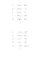
最寄駅ノード採用制限用データの内容の概略を図9に示す。同図に示されるように、本実施例では、同一路線有効最寄駅ノード数は、地域属性(地域A、地域B、地域C…)に基づいて一意に定められる規定数とされており、最寄駅ノード採用制限用データには、この地域属性毎に予め定められた規定数が、鉄道とバスのそれぞれについて書き込まれている。尚、図9中、『−』であらわされる表示は、その地域属性については規定数が設定されていないこと(制限がないこと)を意味している。 An outline of the content of the nearest station node employment restriction data is shown in FIG. As shown in the figure, in the present embodiment, the same route effective nearest station node number is a prescribed number uniquely determined based on regional attributes (region A, region B, region C...) In the nearest station node employment restriction data, a predetermined number predetermined for each regional attribute is written for each of the railway and the bus. In FIG. 9, the display represented by “−” means that the specified number is not set (no restriction) for the area attribute.
図8に戻り、ステップ204において有効最寄駅ノードの規定数が、鉄道、バスのいずれにも設定されていないことが確認された場合には(ステップ205NO)、ステップ202において選出されたすべての最寄駅ノードに基づいて、経路探索手段33を通じて経路探索条件に合致した最適経路を含む候補経路の探索処理を行い(ステップ208)、トータルコストが低いものから順に上位5に入る候補経路についての候補経路データを作成して端末装置20に送信して(ステップ209)、処理は一端終了する。 Returning to FIG. 8, if it is confirmed in step 204 that the specified number of effective nearest station nodes is not set to either rail or bus (step 205 NO), all the nodes selected in step 202 are selected. Based on the nearest station node, the route search means 33 performs a search process for candidate routes including the optimum route that matches the route search condition (step 208). Candidate route data is created and transmitted to the terminal device 20 (step 209), and the process is temporarily terminated.
一方、最寄駅ノード採用制限用データに規定数が設定されている場合には(ステップ205YES)、2以上の最寄駅ノードが選出された路線毎に、出発地からの直線距離が近い順に規定数内の同一路線有効最寄駅ノードとして特定し、これに、他の路線(1の最寄駅ノードのみ取得された路線)の最寄駅ノードを加えたものを有効最寄駅ノードとして取得する(ステップ206)。尚、ステップ204で特定された規定数が、同一路線上に選出された最寄駅ノードの数を超える場合には、それら同一路線上の最寄駅はすべて有効最寄駅ノードとなる。 On the other hand, when the prescribed number is set in the nearest station node adoption restriction data (step 205 YES), the straight line distance from the departure place is the closest to each route where two or more nearest station nodes are selected. The effective nearest station node of the same route within the specified number is specified, and the nearest station node of another route (the route obtained only for the nearest station node of 1) is added as the effective nearest station node. Obtain (step 206). If the specified number specified in step 204 exceeds the number of nearest station nodes selected on the same route, all the nearest stations on the same route become effective nearest station nodes.
次いで、ステップ206で取得された有効最寄駅ノードに基づいて、経路探索手段33を通じて経路探索条件に合致した最適経路を含む候補経路の探索処理を行い(ステップ208)、トータルコストが低いものから順に上位5位に入る候補経路についての候補経路データを作成して端末装置20に送信して(ステップ209)、処理は一端終了する。 Next, based on the effective nearest station node acquired in step 206, candidate route including the optimum route that matches the route search condition is searched through the route search means 33 (step 208), and the total cost is low. Candidate route data for candidate routes that enter the top five in order is created and transmitted to the terminal device 20 (step 209), and the process is temporarily terminated.
次に、図8のフローチャート中、ステップ202に示した最寄駅ノード選出の基本概念について図10に基づいて説明する。 Next, the basic concept of selecting the nearest station node shown in step 202 in the flowchart of FIG. 8 will be described based on FIG.
同図は、出発地近辺の交通機関(鉄道路線、バス路線)および各交通機関の乗車駅を示すものであり、同図中、実線は鉄道路線Xを、一点鎖線は鉄道路線Yを、二点鎖線はバス路線Zを、a〜jは各交通機関の乗車駅(バス停を含む)を、点線は出発地から乗車駅までの直線距離をそれぞれ示している。また、各点線に付された符号(R1〜R10)は、出発地からの直線距離の短い順番(最短:R1〜最長R10)を示しており、すべての乗車駅a〜jが直線距離にして500m以内にあるものとする。 This figure shows the transportation facilities (railways, bus routes) near the departure point and the boarding stations of each transportation. In this figure, the solid line represents the railway line X, the alternate long and short dash line represents the railway line Y, The dotted line indicates the bus route Z, a to j indicate the boarding stations (including bus stops) of each transportation facility, and the dotted line indicates the straight line distance from the departure point to the boarding station. Moreover, the code | symbol (R1-R10) attached | subjected to each dotted line has shown the short order (shortest: R1-longest R10) of the straight line distance from a departure place, and all boarding stations aj set it as a straight line distance. It shall be within 500m.
図10に示されるような交通機関がある環境下においては、図8中ステップ202で示される最寄駅ノード選出では、図11に示すように、直線距離の近いものから順(番号(1)〜(10))にすべての最寄駅ノードが選出される。具体的には、鉄道路線Xについては最寄駅ノードとして4個(図11中、番号(1),(2),(5),(6)で示される)が、鉄道路線Yについては最寄駅ノードとして4個(同図番号(3),(4),(7),(8))が、バス路線Zについては最寄駅ノードとして2個(同図番号(9),(10))がそれぞれ選出される。 In an environment where there is a transportation system as shown in FIG. 10, in the nearest station node selection shown at step 202 in FIG. 8, as shown in FIG. All the nearest station nodes are elected in (10)). Specifically, for railway line X, there are four nearest station nodes (indicated by numbers (1), (2), (5), (6) in FIG. 11). Four station nodes (numbers (3), (4), (7), (8) in the figure)) and two bus stations Z (numbers (9), (10 in the figure) )) Is selected.
このような場合、図8中ステップ203〜207で示したような同一路線有効最寄駅ノード特定の概念を採用しなかった従来のナビゲーションシステムであれば、これら選出されたすべての最寄駅ノードに基づいて候補経路の探索処理が実行され、トータルコストの低いものから順に上位5位に入る候補経路がユーザに提示されることとなる。このような場合にユーザに提示される候補経路についての乗車起点駅の例を図12(a)に示す。この例は、鉄道路線Xのa駅、b駅、c駅と鉄道路線e駅とf駅とを乗車起点駅とした候補経路がトータルコストの低い上位5位と算出された場合に提示される候補経路(図12(a)中、1.〜5.)の乗車起点駅を例示したものである。 In such a case, in the case of a conventional navigation system that does not adopt the concept of specifying the same route effective nearest station node as shown in steps 203 to 207 in FIG. 8, all these nearest station nodes selected are selected. The candidate route search process is executed based on the above, and the candidate routes that are ranked in the top five in order from the lowest total cost are presented to the user. FIG. 12A shows an example of the boarding start station for the candidate route presented to the user in such a case. This example is presented in the case where the candidate route having the railway line a station, b station, c station, railway line e station, and f station as boarding origin stations is calculated as the top five low total cost. The boarding origin station of a candidate route (1-5 in FIG. 12 (a)) is illustrated.
一方、同一路線有効最寄駅ノード特定の概念を採用した本実施例のナビゲーションシステムにおいては、同様の条件下にあっても、図12(b)に示されるような乗車起点駅が提示されることとなる。すなわち、この例では、図示は省略するが、出発地の地域属性で特定される規定数が鉄道について『2』とされていることから、同一路線上の最寄駅ノードは2個までしか有効とされない。その結果、直線距離が鉄道路線Xについて3番目に該当するC駅についての最寄駅ノードは無効となっており、このC駅を乗車起点駅とする候補経路の探索およびユーザへの提示は行われておらず、代わって、従来であれば候補経路として提示されなかったバス路線Zのi停留所を乗車起点とする候補経路(図12(b)中、10.)が提示されている。 On the other hand, in the navigation system of the present embodiment adopting the concept of specifying the same route effective nearest station node, the boarding origin station as shown in FIG. 12B is presented even under similar conditions. It will be. That is, in this example, although illustration is omitted, since the specified number specified by the regional attribute of the departure point is “2” for the railway, only two nearest station nodes on the same route are valid. And not. As a result, the nearest station node for the C station where the straight line distance is the third corresponding to the railway line X is invalid, and search for candidate routes with this C station as the boarding origin station and presentation to the user are not performed. Instead, a candidate route (10 in FIG. 12B) is presented starting from the i stop on bus route Z, which was not presented as a candidate route in the past.
上述の図12(a)、(b)の比較から明らかなように、本実施例のナビゲーションシステムによれば、候補経路の端末装置20への表示数が5個と制限されていることから、乗車起点駅(a駅、b駅、c駅)が異なるだけで、実質的には同一経路(鉄道路線X)を利用した3つもの候補経路が優先的に表示されてしまうことにより他の交通機関(バス路線Z)を利用した候補経路が提示されなくなってしまうといった不具合を解消することができる。
As is clear from the comparison of FIGS. 12A and 12B described above, according to the navigation system of this embodiment, the number of candidate routes displayed on the
また、本実施例では候補経路の端末装置20への表示数が制限したが、このような制限がない場合にも、本発明の技術的思想を採用すれば、実質的には同一経路を利用した多数の候補経路が提示されてしまうことにより候補経路の一見把握、比較参照が困難となって所望の候補経路の選別に時間がかかってしまう等の不具合を解消することができる。
In this embodiment, the number of candidate routes displayed on the
尚、上述の実施例においては、この種のナビゲーションシステムにおいては既に一般的となっている誘導案内機能が付加されたものを示したが、本発明の要部は、交通機関を利用した候補経路の探索およびその提示に関するものであるから、誘導案内を行わずに候補経路の提示のみを行うナビゲーションシステムにも適用できることは言うまでもない。 In the above-described embodiment, the navigation system of this type is provided with a general guidance guide function. However, the main part of the present invention is a candidate route using a transportation facility. Needless to say, the present invention is also applicable to a navigation system that presents only candidate routes without performing guidance guidance.
また、上述の実施例においては、最寄駅ノード採用制限用データに同一路線有効最寄駅ノードの規定数を予め設定するものとしたが、当該規定数は例えば経路探索要求ごとのユーザからの任意指定に基づいて当該規定数を都度変更可能にして経路探索要求に応じた柔軟な表示制限を行うようにすることができる。 Further, in the above-described embodiment, the prescribed number of the same route effective nearest station nodes is set in advance in the nearest station node adoption restriction data, but the prescribed number is, for example, from the user for each route search request Based on the arbitrary designation, the specified number can be changed each time, and the flexible display restriction according to the route search request can be performed.
また、上述の実施例においては地域属性に対応して規定数を予め設定するものとしたが、利用交通路線の属性に基づいて決定すれば、利用交通路線の個別事情等に対応した柔軟な表示制限をすることも可能である。 Further, in the above-described embodiment, the prescribed number is set in advance corresponding to the regional attribute. However, if it is determined based on the attribute of the used traffic route, a flexible display corresponding to the individual circumstances of the used traffic route, etc. It is also possible to limit.
上記説明では、最寄駅として乗車起点駅のみを示したが、本発明は最終降車駅の制限的提示、或いは乗車起点駅と最終降車駅の双方の制限的提示にも等しく適用できるものである。このような場合のナビゲーションシステムの構成は、上記実施例を参照することで当業者であれば容易に実施することが可能であるから、ここでの説明は省略する。 In the above description, only the boarding start station is shown as the nearest station, but the present invention is equally applicable to restrictive presentation of the final departure station, or limited presentation of both the boarding origin station and the final departure station. . The configuration of the navigation system in such a case can be easily implemented by those skilled in the art by referring to the above-described embodiment, and thus the description thereof is omitted here.
本発明は、携帯端末を用いた通信型のナビゲーションシステムに限ることなく、パーソナルコンピュータを端末装置としたナビゲーションシステム、交通路線情報(経路情報)提供システムにも適用可能である。 The present invention is not limited to a communication navigation system using a mobile terminal, but can also be applied to a navigation system using a personal computer as a terminal device and a traffic route information (route information) providing system.
10・・・・ナビゲーションシステム
12・・・・ネットワーク
20・・・・端末装置
21・・・・制御手段
22・・・・通信手段
23・・・・位置検出手段
24・・・・経路記憶手段
25・・・・表示手段
26・・・・表示制御手段
27・・・・一時記憶手段
28・・・・操作入力手段
30・・・・経路探索サーバ
31・・・・制御手段
32・・・・誘導案内データ編集手段
33・・・・経路探索手段
34・・・・通信手段
35・・・・道路ネットワークデータ
36・・・・交通ネットワークデータ
37・・・・地図データ
38・・・・最寄駅ノード採用制限用データ
50・・・・情報配信サーバ
DESCRIPTION OF SYMBOLS 10 ... Navigation system 12 ...
Claims (14)
交通機関を利用する場合に選出される出発地付近又は目的地付近の最寄駅が、同一交通路線上に規定数を超えて選出されたときには、当該選出されたものの中から、規定数の有効最寄駅を特定する有効最寄駅特定手段を備え、
それにより、同一交通路線上の異なる最寄駅に基づく候補経路が規定数を超えて表示されることを制限するようにした、
ことを特徴とするナビゲーションシステム。 A route search server having route search means for searching for a candidate route including a section using a transportation facility by referring to network data for route search based on a route search request including a starting point and a destination; A navigation system comprising a terminal device having display means for displaying a route,
When the nearest station near the departure point or destination selected when using transportation is selected more than the specified number on the same traffic route, the specified number is valid from the selected items. Equipped with effective nearest station identification means to identify the nearest station,
As a result, the candidate routes based on different nearest stations on the same route are restricted from being displayed beyond the specified number.
A navigation system characterized by that.
出発地と目的地とを含む経路探索要求に基づいて、経路探索用のネットワークデータを参照して交通機関を利用した区間を含む候補経路を探索する経路探索手段と、
交通機関を利用する場合に選出される出発地付近又は目的地付近の最寄駅が、同一交通路線上に規定数を超えて選出されたときには、当該選出されたものの中から、規定数の有効最寄駅を特定する有効最寄駅特定手段と、を備え、
それにより、同一交通路線上の異なる最寄駅に基づく候補経路が規定数を超えてユーザに提示されることを制限するようにした、
ことを特徴とするナビゲーションシステムにおける経路探索サーバ。 A route search server in a navigation system for searching and presenting candidate routes from a starting point to a destination,
Based on a route search request including a starting point and a destination, route search means for searching for candidate routes including sections using transportation facilities with reference to network data for route search;
When the nearest station near the departure point or destination selected when using transportation is selected more than the specified number on the same traffic route, the specified number is valid from the selected items. An effective nearest station identifying means for identifying the nearest station,
As a result, the candidate routes based on different nearest stations on the same traffic route are restricted from being presented to the user beyond the specified number.
A route search server in a navigation system.
出発地付近又は目的地付近の最寄駅を選出するステップと、
同一交通路線上に規定数を超えて最寄駅が選出されたときには、当該選出されたものの中から、規定数の有効最寄駅を特定するステップと、
決定された有効最寄駅に基づいて候補経路を探索するステップと、
探索された候補経路を提示するステップと、
を有することを特徴とする候補経路表示方法。 A candidate route display method in a navigation system for searching and presenting a candidate route from a starting point to a destination according to a route search request,
Selecting the nearest station near the departure or destination,
When the nearest station is selected exceeding the specified number on the same traffic route, the step of identifying the specified number of effective nearest stations from the selected ones;
Searching for a candidate route based on the determined effective nearest station;
Presenting the searched candidate route;
A candidate route display method characterized by comprising:
Priority Applications (1)
| Application Number | Priority Date | Filing Date | Title |
|---|---|---|---|
| JP2008271570A JP2010101668A (en) | 2008-10-22 | 2008-10-22 | Navigation system, route search server, and candidate route display method |
Applications Claiming Priority (1)
| Application Number | Priority Date | Filing Date | Title |
|---|---|---|---|
| JP2008271570A JP2010101668A (en) | 2008-10-22 | 2008-10-22 | Navigation system, route search server, and candidate route display method |
Publications (2)
| Publication Number | Publication Date |
|---|---|
| JP2010101668A true JP2010101668A (en) | 2010-05-06 |
| JP2010101668A5 JP2010101668A5 (en) | 2011-05-19 |
Family
ID=42292443
Family Applications (1)
| Application Number | Title | Priority Date | Filing Date |
|---|---|---|---|
| JP2008271570A Pending JP2010101668A (en) | 2008-10-22 | 2008-10-22 | Navigation system, route search server, and candidate route display method |
Country Status (1)
| Country | Link |
|---|---|
| JP (1) | JP2010101668A (en) |
Cited By (4)
| Publication number | Priority date | Publication date | Assignee | Title |
|---|---|---|---|---|
| JP2012220475A (en) * | 2011-04-14 | 2012-11-12 | Navitime Japan Co Ltd | Navigation device, navigation system, navigation server, terminal apparatus, navigation method, and program |
| JP2017044707A (en) * | 2016-11-22 | 2017-03-02 | 株式会社ナビタイムジャパン | Information processing system, information processing method, and information processing program |
| CN106643771A (en) * | 2016-12-30 | 2017-05-10 | 上海博泰悦臻网络技术服务有限公司 | Navigation route selection method and system |
| CN107092986A (en) * | 2017-04-13 | 2017-08-25 | 上海理工大学 | The bus passenger travel route choice method based on website and collinearly run |
Citations (11)
| Publication number | Priority date | Publication date | Assignee | Title |
|---|---|---|---|---|
| JPH0972751A (en) * | 1995-06-26 | 1997-03-18 | Matsushita Electric Ind Co Ltd | Navigation system and method for retrieving registered point |
| JP2001199341A (en) * | 1999-11-12 | 2001-07-24 | Sony Corp | Information processor and method and program storage medium |
| JP2001343892A (en) * | 2000-06-02 | 2001-12-14 | E-Map:Kk | System and method for providing map information |
| JP2003021531A (en) * | 2001-07-05 | 2003-01-24 | Denso Corp | Mobile communication terminal and program |
| JP2003315076A (en) * | 2002-04-25 | 2003-11-06 | Matsushita Electric Ind Co Ltd | General route guidance apparatus |
| JP2005241574A (en) * | 2004-02-27 | 2005-09-08 | Dowango:Kk | System, communication terminal, program and method for guiding route of transportation facility |
| JP2006017528A (en) * | 2004-06-30 | 2006-01-19 | Denso Corp | Facility searching device, facility search result reporting device, and program |
| JP2006099674A (en) * | 2004-09-30 | 2006-04-13 | Nikko Business Systems Co Ltd | Commuting route calculation system and method |
| JP2008180527A (en) * | 2007-01-23 | 2008-08-07 | Nec Corp | Method and system for stop notification system, web server, portable terminal apparatus, program, and record medium |
| JP2008207666A (en) * | 2007-02-26 | 2008-09-11 | Navitime Japan Co Ltd | Route chart display device, route chart display system, route chart display method, and route information delivery server |
| JP2008224343A (en) * | 2007-03-12 | 2008-09-25 | Aisin Aw Co Ltd | Navigation device |
-
2008
- 2008-10-22 JP JP2008271570A patent/JP2010101668A/en active Pending
Patent Citations (11)
| Publication number | Priority date | Publication date | Assignee | Title |
|---|---|---|---|---|
| JPH0972751A (en) * | 1995-06-26 | 1997-03-18 | Matsushita Electric Ind Co Ltd | Navigation system and method for retrieving registered point |
| JP2001199341A (en) * | 1999-11-12 | 2001-07-24 | Sony Corp | Information processor and method and program storage medium |
| JP2001343892A (en) * | 2000-06-02 | 2001-12-14 | E-Map:Kk | System and method for providing map information |
| JP2003021531A (en) * | 2001-07-05 | 2003-01-24 | Denso Corp | Mobile communication terminal and program |
| JP2003315076A (en) * | 2002-04-25 | 2003-11-06 | Matsushita Electric Ind Co Ltd | General route guidance apparatus |
| JP2005241574A (en) * | 2004-02-27 | 2005-09-08 | Dowango:Kk | System, communication terminal, program and method for guiding route of transportation facility |
| JP2006017528A (en) * | 2004-06-30 | 2006-01-19 | Denso Corp | Facility searching device, facility search result reporting device, and program |
| JP2006099674A (en) * | 2004-09-30 | 2006-04-13 | Nikko Business Systems Co Ltd | Commuting route calculation system and method |
| JP2008180527A (en) * | 2007-01-23 | 2008-08-07 | Nec Corp | Method and system for stop notification system, web server, portable terminal apparatus, program, and record medium |
| JP2008207666A (en) * | 2007-02-26 | 2008-09-11 | Navitime Japan Co Ltd | Route chart display device, route chart display system, route chart display method, and route information delivery server |
| JP2008224343A (en) * | 2007-03-12 | 2008-09-25 | Aisin Aw Co Ltd | Navigation device |
Cited By (4)
| Publication number | Priority date | Publication date | Assignee | Title |
|---|---|---|---|---|
| JP2012220475A (en) * | 2011-04-14 | 2012-11-12 | Navitime Japan Co Ltd | Navigation device, navigation system, navigation server, terminal apparatus, navigation method, and program |
| JP2017044707A (en) * | 2016-11-22 | 2017-03-02 | 株式会社ナビタイムジャパン | Information processing system, information processing method, and information processing program |
| CN106643771A (en) * | 2016-12-30 | 2017-05-10 | 上海博泰悦臻网络技术服务有限公司 | Navigation route selection method and system |
| CN107092986A (en) * | 2017-04-13 | 2017-08-25 | 上海理工大学 | The bus passenger travel route choice method based on website and collinearly run |
Similar Documents
| Publication | Publication Date | Title |
|---|---|---|
| JP5053370B2 (en) | Navigation system, route search server, portable terminal device, and route guidance method | |
| JP3987073B2 (en) | Navigation system, route search server, route search method and program | |
| JP4297513B1 (en) | Route search system, route search server, and route search method | |
| JP5047920B2 (en) | Route information distribution system, route information guidance server, terminal device, and route information distribution method | |
| JP2008209164A (en) | Route chart display device, route chart display system, route chart display method, and route information distribution server | |
| JP4708323B2 (en) | Navigation system, route search server, route search method, and terminal device | |
| JP5007152B2 (en) | Navigation system, route search server, route search method, and terminal device | |
| JP4550697B2 (en) | Navigation system, route search server, and portable terminal device | |
| JP4460613B2 (en) | Navigation system, terminal device, and route guidance method | |
| JP4163741B1 (en) | Navigation system, route search server, portable terminal device, and route search method | |
| JP5114254B2 (en) | Map display system, route search server, route search method, and terminal device | |
| JP2009103657A (en) | Navigation system, server and method for route search, and terminal device | |
| JP2010101668A (en) | Navigation system, route search server, and candidate route display method | |
| JP4755612B2 (en) | Navigation system, route search server, route search method, and terminal device | |
| JP5373035B2 (en) | Route map display device, route map display system, route map display method, and route information distribution server | |
| JP5599620B2 (en) | Navigation device | |
| JP4604055B2 (en) | Navigation system, route search server, route search method, and terminal device | |
| JP2010204115A (en) | Information providing system, server device, terminal device, information providing method and program | |
| JP5822364B2 (en) | Route guidance system, route guidance server, route guidance method, and route guidance program | |
| JP4571120B2 (en) | Navigation system, route search server, route search method, and terminal device | |
| JP4885761B2 (en) | Route map display device, route map display system, route map display method, and route information distribution server | |
| JP2010256159A (en) | Route search system, route search server, and route search method | |
| JP2011112387A (en) | Navigation system, route search server, terminal, method of navigation, and navigation device | |
| JP5520651B2 (en) | Route guidance system, route search server, terminal device, route guidance method, and navigation device | |
| JP2005083791A (en) | Navigation system and route guide method |
Legal Events
| Date | Code | Title | Description |
|---|---|---|---|
| A621 | Written request for application examination |
Free format text: JAPANESE INTERMEDIATE CODE: A621 Effective date: 20100709 |
|
| A521 | Written amendment |
Free format text: JAPANESE INTERMEDIATE CODE: A523 Effective date: 20110404 |
|
| A977 | Report on retrieval |
Free format text: JAPANESE INTERMEDIATE CODE: A971007 Effective date: 20111026 |
|
| A131 | Notification of reasons for refusal |
Free format text: JAPANESE INTERMEDIATE CODE: A131 Effective date: 20111101 |
|
| A521 | Written amendment |
Free format text: JAPANESE INTERMEDIATE CODE: A523 Effective date: 20111228 |
|
| RD02 | Notification of acceptance of power of attorney |
Free format text: JAPANESE INTERMEDIATE CODE: A7422 Effective date: 20120213 |
|
| A02 | Decision of refusal |
Free format text: JAPANESE INTERMEDIATE CODE: A02 Effective date: 20120927 |