EP4024328B1 - Verfahren und gerät zur kartenfusion, server und speichermedium - Google Patents
Verfahren und gerät zur kartenfusion, server und speichermedium Download PDFInfo
- Publication number
- EP4024328B1 EP4024328B1 EP21791231.0A EP21791231A EP4024328B1 EP 4024328 B1 EP4024328 B1 EP 4024328B1 EP 21791231 A EP21791231 A EP 21791231A EP 4024328 B1 EP4024328 B1 EP 4024328B1
- Authority
- EP
- European Patent Office
- Prior art keywords
- information
- relative
- map data
- dimensional
- dimensional map
- Prior art date
- Legal status (The legal status is an assumption and is not a legal conclusion. Google has not performed a legal analysis and makes no representation as to the accuracy of the status listed.)
- Active
Links
Images


Classifications
-
- G—PHYSICS
- G06—COMPUTING OR CALCULATING; COUNTING
- G06T—IMAGE DATA PROCESSING OR GENERATION, IN GENERAL
- G06T3/00—Geometric image transformations in the plane of the image
- G06T3/40—Scaling of whole images or parts thereof, e.g. expanding or contracting
- G06T3/4038—Image mosaicing, e.g. composing plane images from plane sub-images
-
- G—PHYSICS
- G06—COMPUTING OR CALCULATING; COUNTING
- G06T—IMAGE DATA PROCESSING OR GENERATION, IN GENERAL
- G06T5/00—Image enhancement or restoration
- G06T5/50—Image enhancement or restoration using two or more images, e.g. averaging or subtraction
-
- G—PHYSICS
- G06—COMPUTING OR CALCULATING; COUNTING
- G06F—ELECTRIC DIGITAL DATA PROCESSING
- G06F18/00—Pattern recognition
- G06F18/20—Analysing
- G06F18/22—Matching criteria, e.g. proximity measures
-
- G—PHYSICS
- G06—COMPUTING OR CALCULATING; COUNTING
- G06T—IMAGE DATA PROCESSING OR GENERATION, IN GENERAL
- G06T7/00—Image analysis
- G06T7/10—Segmentation; Edge detection
- G06T7/11—Region-based segmentation
-
- G—PHYSICS
- G06—COMPUTING OR CALCULATING; COUNTING
- G06V—IMAGE OR VIDEO RECOGNITION OR UNDERSTANDING
- G06V10/00—Arrangements for image or video recognition or understanding
- G06V10/40—Extraction of image or video features
- G06V10/44—Local feature extraction by analysis of parts of the pattern, e.g. by detecting edges, contours, loops, corners, strokes or intersections; Connectivity analysis, e.g. of connected components
-
- G—PHYSICS
- G06—COMPUTING OR CALCULATING; COUNTING
- G06T—IMAGE DATA PROCESSING OR GENERATION, IN GENERAL
- G06T2207/00—Indexing scheme for image analysis or image enhancement
- G06T2207/20—Special algorithmic details
- G06T2207/20212—Image combination
- G06T2207/20221—Image fusion; Image merging
Definitions
- the present disclosure relates to the field of map technology, and more particularly, to a map fusion method, a map fusion apparatus, a server, and a storage medium.
- AVP-SLAM Semantic Visual Mapping and Localization for Autonomous Vehicles in the Parking Lot
- ARXIV.ORG 8 July 2020 (2020-07-08 ) proposes a semantic-feature-based mapping and localization system, which enables vehicles to automatically navigate in parking lots.
- a computer-implemented map fusion method for overcoming the above problems or at least partially solve the above problems.
- the -A- map fusion method includes: obtaining first three-dimensional map data and second three-dimensional map data; determining, for at least two first semantic elements in the first three-dimensional map data, at least two second semantic elements in the second three-dimensional map data that match the at least two first semantic elements; determining first relative information between the at least two first semantic elements, and determining second relative information between the at least two second semantic elements; optimizing the first three-dimensional map data and the second three-dimensional map data based on the first relative information and the second relative information; and performing a map fusion on the optimized first three-dimensional map data and the optimized second three-dimensional map data.
- Said optimizing the first three-dimensional map data and the second three-dimensional map data based on the first relative information and the second relative information includes: determining target information of the at least two first semantic elements and the at least two second semantic elements based on the first relative information and the second relative information; and optimizing the first three-dimensional map data and the second three-dimensional map data based on the target information of the at least two first semantic elements and the at least two second semantic elements, where wherein the first relative information includes first two-dimensional relative information and first three-dimensional relative information, the second relative information includes second two-dimensional relative information and second three-dimensional relative information, and the target information includes target two-dimensional information and target three-dimensional information.
- the first two-dimensional relative information includes first relative pose information
- the second two-dimensional relative information includes second relative pose information
- the target two-dimensional information is target pose information
- said determining the target information of the at least two first semantic elements and the at least two second semantic elements based on the first relative information and the second relative information includes: determining a pose error value based on the first relative pose information and the second relative pose information; determining, based on the pose error value, an association between pose information of the at least two first semantic elements and the at least two second semantic elements and a relative pose error; and determining the target pose information of the at least two first semantic elements and the at least two second semantic elements under a premise of a minimum relative pose error.
- the first three-dimensional relative information includes first relative height information
- the second three-dimensional relative information includes second relative height information
- the target three-dimensional information is target height information
- said determining the target information of the at least two first semantic elements and the at least two second semantic elements based on the first relative information and the second relative information includes: determining a height error value based on the first relative height information and the second relative height information; determining, based on the height error value, an association between height information of the at least two first semantic elements and the at least two second semantic elements and a relative height error; and determining target height information of the at least two first semantic elements and the at least two second semantic elements under a premise of a minimum relative height error.
- the method further includes: determining a first conversion matrix for the first three-dimensional map data and a second conversion matrix for the second three-dimensional map data based on the at least two first semantic elements and the at least two second semantic elements; and adjusting the first three-dimensional map data by using the first conversion matrix, and adjusting the second three-dimensional map data by using the second conversion matrix.
- the method further includes: determining a third semantic element in the first three-dimensional map data, where no matching semantic element in the second three-dimensional map data matches the third semantic element; and adding the third semantic element to the map-fused second three-dimensional map data.
- the first three-dimensional map data and the second three-dimensional map data are map data for a parking lot.
- a map fusion apparatus includes a three-dimensional map data obtaining module configured to obtain first three-dimensional map data and second three-dimensional map data; a semantic element determining module configured to determine, for at least two first semantic elements in the first three-dimensional map data, at least two second semantic elements in the second three-dimensional map data that match the at least two first semantic elements; a relative information determining module configured to determine first relative information between the at least two first semantic elements, and determine second relative information between the at least two second semantic elements; an optimization module configured to optimize the first three-dimensional map data and the second three-dimensional map data based on the first relative information and the second relative information; and a fusion module configured to perform a map fusion on the optimized first three-dimensional map data and the optimized second three-dimensional map data.
- the optimization module includes: a target information determining sub-module configured to determine target information of the at least two first semantic elements and the at least two second semantic elements based on the first relative information and the second relative information; and a three-dimensional map data optimization sub-module configured to optimize the first three-dimensional map data and the second three-dimensional map data based on the target information of the at least two first semantic elements and the at least two second semantic elements, where the first relative information includes first two-dimensional relative information and first three-dimensional relative information, the second relative information includes second two-dimensional relative information and second three-dimensional relative information, and the target information includes target two-dimensional information and target three-dimensional information.
- the first two-dimensional relative information includes first relative pose information
- the second two-dimensional relative information includes second relative pose information
- the target two-dimensional information is target pose information
- the target information determining sub-module includes: a pose error determining unit configured to determine a pose error value based on the first relative pose information and the second relative pose information; a relative pose error association determining unit configured to determine, based on the pose error value, an association between pose information of the at least two first semantic elements and the at least two second semantic elements and a relative pose error; and a target pose information determining unit configured to determine the target pose information of the at least two first semantic elements and the at least two second semantic elements under a premise of a minimum relative pose error.
- a server includes a processor, a memory, and a computer program stored on the memory and capable of running on the processor.
- the computer program when executed by the processor, causes the processor to implement the map fusion method as described above.
- a computer-readable storage medium having a computer program stored thereon.
- the computer program when executed by a processor, causes the processor to implement the map fusion method as described above.
- the first three-dimensional map data and the second three-dimensional map data by obtaining the first three-dimensional map data and the second three-dimensional map data, for at least two first semantic elements in the first three-dimensional map data, at least two second semantic elements that match the at least two first semantic elements are determined in the second three-dimensional map data; the first relative information between the at least two first semantic elements is determined, and the second relative information between the at least two second semantic elements is determined; the first three-dimensional map data and the second three-dimensional map data are optimized based on the first relative information and the second relative information; and the map fusion is performed on the optimized first three-dimensional map data and the optimized second three-dimensional map data.
- the three-dimensional map data can be optimized, the process of map fusion is simplified, the amount of calculation is reduced, and the accuracy and efficiency of map fusion are improved.
- FIG. 1 is a flowchart illustrating steps of a map fusion method according to an embodiment of the present disclosure. Referring the FIG. 1 , the method specifically includes the following steps.
- step 101 first three-dimensional map data and second three-dimensional map data are obtained.
- the three-dimensional map data may be three-dimensional semantic map data containing multiple semantic elements, and the semantic element may be one of parking space information, speed bump information, roadblock information, lane line information, etc.
- the first three-dimensional map data and the second three-dimensional map data may be map data for a parking lot.
- At least two pieces of three-dimensional map data preset in the vehicle for a target area may be acquired, at least two pieces of three-dimensional map data for a target area may also be acquired from a server; at least one piece of three-dimensional map data preset in the vehicle for a target area may also be acquired, and at least one piece of three-dimensional map data for a target area may also be acquired from the server. That is, the first three-dimensional map data and the second three-dimensional map data are acquired.
- a real-time map fusion can be performed in the in-vehicle computer, or a large number of map fusions can be performed in the server.
- step 102 for at least two first semantic elements in the first three-dimensional map data, at least two second semantic elements that match the at least two first semantic elements are determined in the second three-dimensional map data.
- At least two first semantic elements in any one piece of three-dimensional map data can be determined. For example, parking space information a and lane line information b in the first three-dimensional map data can be determined.
- the second semantic elements that match the first semantic elements can be determined in another piece of three-dimensional map data. For example, based on the parking space information a and the lane line information b in the first three-dimensional map data, parking space information A matching the parking space information a and the lane line information B matching the lane line information b are determined among the multiple semantic elements of the second three-dimensional map data.
- step 103 first relative information between the at least two first semantic elements is determined, and second relative information between the at least two second semantic elements is determined.
- Relative information may be two-dimensional or three-dimensional relative information between two semantic elements.
- the two-dimensional information and three-dimensional information of a semantic element can be determined.
- a three-dimensional coordinate system in any piece of three-dimensional map data can be determined, such that coordinate information of the semantic element in the three-dimensional map data can be determined based on the coordinate system, and the two-dimensional information and three-dimensional information of the semantic element can be determined based on the coordinate information.
- the two-dimensional relative information and the three-dimensional relative information of two semantic elements can be determined based on the two-dimensional information and the three-dimensional information of each of the two semantic elements, so as to obtain the first relative information of the first semantic element and the second relative information of the second semantic element.
- the two-dimensional information and the three-dimensional information of the parking space information a can be determined, and the two-dimensional information and the three-dimensional information of the lane line information b can be determined, such that the two-dimensional relative information and the three-dimensional relative information of the parking space information a and the lane line information b, i.e., the first relative information, can be determined.
- step 104 the first three-dimensional map data and the second three-dimensional map data are optimized based on the first relative information and the second relative information;
- the relative relationship between the first semantic elements and the relative relationship between the second semantic elements can be determined, and errors between the first semantic elements and the second semantic elements can be determined, for example, an error between the two-dimensional information of the parking space information a and the two-dimensional information of the parking space information A, or an error between the two-dimensional relative information of the parking space information a and the lane line information b and the two-dimensional relative information of the parking space information A and the lane line information B.
- the two-dimensional information and the three-dimensional information of the semantic element can be optimized and adjusted based on the relative relationship and the errors.
- step 105 a map fusion is performed on the optimized first three-dimensional map data and the optimized second three-dimensional map data.
- the number of fusions of different three-dimensional map data can be determined, and thus at least two piece of three-dimensional map data can be weighted and fused according to the different number of fusions.
- the three-dimensional map data can be weighted and fused according to the difficulty, thereby improving the accuracy of the three-dimensional map fusion, and allowing the fused map to be more accurate.
- the first three-dimensional map data and the second three-dimensional map data by obtaining the first three-dimensional map data and the second three-dimensional map data, for at least two first semantic elements in the first three-dimensional map data, at least two second semantic elements that match the at least two first semantic elements are determined in the second three-dimensional map data; the first relative information between the at least two first semantic elements is determined, and the second relative information between the at least two second semantic elements is determined; the first three-dimensional map data and the second three-dimensional map data are optimized based on the first relative information and the second relative information; and the map fusion is performed on the optimized first three-dimensional map data and the optimized second three-dimensional map data.
- the three-dimensional map data can be optimized, the process of map fusion is simplified, the amount of calculation is reduced, and the accuracy and efficiency of map fusion are improved.
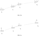
- FIG. 2a is a flowchart illustrating steps of another map fusion method according to an embodiment of the present disclosure. Referring to FIG. 2a , the map fusion method specifically includes the following steps.
- step 201 first three-dimensional map data and second three-dimensional map data are obtained.
- step 202 for at least two first semantic elements in the first three-dimensional map data, at least two second semantic elements that match the at least two first semantic elements are determined in the second three-dimensional map data.
- step 103 first relative information between the at least two first semantic elements is determined, and second relative information between the at least two second semantic elements is determined.
- the first relative information may include first two-dimensional relative information and first three-dimensional relative information
- the second relative information may include second two-dimensional relative information and second three-dimensional relative information
- the two-dimensional information of the semantic element such as pose information
- the three-dimensional information of the semantic element such as height information
- a three-dimensional coordinate system in any piece of three-dimensional map data can be determined, such that coordinate information of the semantic element in the three-dimensional map data can be determined based on the coordinate system, and the pose information and height information of the semantic element can be determined based on the coordinate information.
- rotation information relative to x-axis and rotation information relative to y-axis of the semantic element can also be determined, and the rotation of the semantic element can be optimized based on the rotation information relative to x-axis and the rotation information relative to y-axis.
- the optimization of the rotation information will not bring greater improvements to the quality of map fusion.
- the optimization of the rotation information has a large amount of calculation, complex processing methods, and high hardware requirements. Therefore, by only optimizing the height information of the semantic element, the optimization process is simplified, the amount of calculation is reduced, and the accuracy of height optimization can be improved by determining information such as the relative height information, height error value, etc.
- the two-dimensional relative information between the two semantic elements can be determined based on the pose information of each of the two semantic elements, and the three-dimensional relative information between the two semantic elements can be determined based on the height information of each of the two semantic elements.
- the matrix (1) can be expressed as a pose used to transform a semantic element i in the three-dimensional map data
- the matrix (2) can be expressed as a pose used to transform a semantic element j in the three-dimensional map data
- the semantic element i and the semantic element j can be the matching semantic elements in at least two pieces of three-dimensional map data
- the height information of the semantic element 1 to the semantic element n may be as illustrated in FIG. 2c , and the height information of the semantic element may be determined based on the coordinate information, where z 1 may be expressed as height information of the semantic element 1.
- step 204 target information of the at least two first semantic elements and the at least two second semantic elements is determined based on the first relative information and the second relative information.
- the target information may include target two-dimensional information and target three-dimensional information.
- the relative relationship between the first semantic elements and the relative relationship between the second semantic elements can be determined, and errors between the first semantic elements and the second semantic elements can be determined, for example, an error between the two-dimensional information of the parking space information a and the two-dimensional information of the parking space information A, and an error between the two-dimensional relative information of the parking space information a and the lane line information b and the two-dimensional relative information of the parking space information A and the lane line information B.
- the target two-dimensional information and the target three-dimensional information of the first semantic element can be determined, and the target two-dimensional information and the target three-dimensional information of the second semantic element can be determined.
- the first two-dimensional relative information may include first relative pose information
- the second two-dimensional relative information may include second relative pose information
- the target two-dimensional information may be target pose information.
- Step 204 may include the following sub-steps:
- a pose error value is determined based on the first relative pose information and the second relative pose information.
- the pose error value may be a value of a relative pose error between the first relative pose information and the second relative pose information.
- the relative pose information between two semantic elements can be determined based on the pose information of each of the two semantic elements.
- T ⁇ ij _ 1 can be an inverse matrix of T ij
- R T ( ⁇ ij ) can be a transposed matrix of a conversion matrix of the relative angle information of the two semantic elements
- R T ( ⁇ i ) can be a transposed matrix of a conversion matrix
- e ij when the semantic element i and the semantic element j are any two semantic elements in the same three-dimensional map data, e ij can also be expressed as a pose error value of the first relative pose information or the second relative pose information.
- sub-step 12 based on the pose error value, an association between pose information of the at least two first semantic elements and the at least two second semantic elements and a relative pose error.
- the relative pose error and the pose information may be independent variables in the association, or the relative pose error may be a dependent variable in the association, and the pose error value is a known value of the relative pose error.
- the association between the relative pose error and the pose information of the first semantic elements and/or the second semantic elements is determined.
- sub-step 13 under a premise of a minimum relative pose error, the target pose information of the at least two first semantic elements and the at least two second semantic elements is determined.
- the association formula between the relative pose error and the pose information is determined, since the association formula can be expressed as the association between the relative pose error and the pose information, under a premise of a minimum relative pose error, the target pose information corresponding to the minimum relative pose error is determined.
- the association formula when the association formula is the smallest, i.e., when the value of f is the smallest, the corresponding first relative pose information and/or second relative pose information can be calculated, and thus the corresponding position information and angle information can be determined.
- the first three-dimensional relative information may include first relative height information
- the second three-dimensional relative information may include second relative height information
- the target three-dimensional information may be target height information.
- Step 204 may include the following sub-steps.
- a height error value is determined based on the first relative height information and the second relative height information.
- the height error value may be an error value between the first relative height information and the second relative height information.
- any two semantic elements in one piece of the three-dimensional map data can be determined as a semantic element group, and the relative height information of any semantic element group can be determined based on the height information of the semantic elements.
- the relative height information of any semantic element group in another piece of three-dimensional map data can also be determined, and the height error value can be determined based on the relative height information in different pieces of three-dimensional map data.
- the association between the relative height error and the height information of the first semantic elements and the second semantic elements is determined.
- e z 1_12 may be expressed as the height error value of the first semantic element group in the first semantic elements and the first semantic element group in the second semantic elements, and the first semantic elements may include a semantic element 1 and a semantic element 2, i.e., the semantic element 1 and the semantic element 2 in the first semantic elements, and the semantic element 1 and the semantic element 2 in the second semantic elements.
- the target height information of the at least two first semantic elements and the at least two second semantic elements is determined under a premise of a minimum relative height error.
- the association formula can be expressed as an association between the relative height error and the height information, under a premise of a minimum relative height error, the corresponding first relative height information and second relative height information can be calculated when the association formula between the relative height error and the height information is the smallest, i.e., when the value of f z is the smallest, and thus the corresponding target height information can be determined.
- a minimum value of f z may be obtained by determining a gradient of the correlation formula, for example, when the gradient is 0, the value of f z is the smallest, and thus the target height information can be determined.
- K z b
- z can be the target height information
- b can be a situation represented by - ⁇ f
- z 0
- K ⁇ ⁇ ⁇ ⁇ z
- ⁇ f can be the gradient
- ⁇ ⁇ ⁇ ⁇ z can be a partial derivative for the height information in the gradient
- ⁇ ⁇ ⁇ z 1 can be a partial derivative of the height information of semantic element 1 in the association formula for relative height error and height information
- subscripts of z, i.e., 1 to n can be expressed as the height information of semantic element 1 to semantic element n
- e k T can be e zk_ij T
- K ⁇ ⁇ ⁇ ⁇ z
- step 205 the first three-dimensional map data and the second three-dimensional map data are optimized based on the target information of the at least two first semantic elements and the at least two second semantic elements.
- the pose information and height information of the semantic element can be optimized and adjusted based on the target information.
- step 206 a map fusion is performed on the optimized first three-dimensional map data and the optimized second three-dimensional map data.
- the first three-dimensional map data and the second three-dimensional map data by obtaining the first three-dimensional map data and the second three-dimensional map data, for at least two first semantic elements in the first three-dimensional map data, at least two second semantic elements that match the at least two first semantic elements are determined in the second three-dimensional map data; the first relative information between the at least two first semantic elements is determined, and the second relative information between the at least two second semantic elements is determined; the target information of the at least two first semantic elements and the at least two second semantic elements is determined based on the first relative information and the second relative information; the first three-dimensional map data and the second three-dimensional map data are optimized based on the target information of the at least two first semantic elements and the at least two second semantic elements, where the first relative information includes the first two-dimensional relative information and the first three-dimensional relative information, the second relative information includes the second two-dimensional relative information and the second three-dimensional relative information, and the target information includes the target two-dimensional information and the target three-dimensional information; and the map fusion is performed on the optimized first
- FIG. 3 is a flowchart illustrating steps of yet another map fusion method according to an embodiment of the present disclosure.
- the map fusion method specifically includes the following steps.
- step 301 first three-dimensional map data and second three-dimensional map data are obtained;
- step 302 for at least two first semantic elements in the first three-dimensional map data, at least two second semantic elements that match the at least two first semantic elements are determined in the second three-dimensional map data;
- a first conversion matrix for the first three-dimensional map data and a second conversion matrix for the second three-dimensional map data are determined based on the at least two first semantic elements and the at least two second semantic elements.
- the conversion matrix may be a matrix used for overall adjustment of the semantic elements in the three-dimensional map data.
- the position information of the matching semantic elements can be determined in different pieces of three-dimensional map data, such that the overall position information of the semantic elements in any piece of three-dimensional map data can be determined based on the position information of all the matching semantic elements in this piece of three-dimensional map data.
- another overall position information can be determined in another piece of three-dimensional map data, and the conversion matrixes for different pieces of three-dimensional map data can be generated based on the different overall position information.
- step 304 the first three-dimensional map data is adjusted by using the first conversion matrix, and the second three-dimensional map data is adjusted by using the second conversion matrix.
- the corresponding conversion matrix may be used to perform an overall weight adjustment on the different pieces of three-dimensional map data, such as the adjustment of overall position information.
- the overall weight adjustment may include an adjustment of the position information of the matching semantic elements and an adjustment of the position information of other unmatching semantic elements.
- At least two pieces of three-dimensional map data can be directly used for fusion to generate a topological three-dimensional map with multiple layers, and the three-dimensional map data of different layers can be adjusted based on the corresponding conversion matrixes, so as to obtain three-dimensional maps that overlap as much as possible.
- step 305 first relative information between the at least two first semantic elements is determined, and second relative information between the at least two second semantic elements is determined.
- step 306 the first three-dimensional map data and the second three-dimensional map data are optimized based on the first relative information and the second relative information.
- step 307 a map fusion is performed on the optimized first three-dimensional map data and the optimized second three-dimensional map data.
- step 308 a third semantic element in the first three-dimensional map data is determined, where no semantic element in the second three-dimensional map data matches the third semantic element.
- any one piece of the three-dimensional map data is used as a reference, and another piece of three-dimensional map data is fused into this piece of three-dimensional map data.
- the three-dimensional map data B can be determined as a reference, and the three-dimensional map data A is fused into the three-dimensional map data B.
- the semantic element in the other piece of three-dimensional map data that fails to match the semantic element in this piece of three-dimensional map data can be determined.
- the semantic element in the three-dimensional map data A that fails to match the semantic element in the three-dimensional map data B can be determined.
- step 309 the third semantic element is added to the map-fused second three-dimensional map data.
- the third semantic element is determined, since the third semantic element is a semantic element that fails to match the semantic element in the second three-dimensional map data, the third semantic element can be added to the second three-dimensional map data.
- the unmatching semantic element can be added to the three-dimensional map data B.
- the first three-dimensional map data and the second three-dimensional map data for at least two first semantic elements in the first three-dimensional map data, at least two second semantic elements that match the at least two first semantic elements are determined in the second three-dimensional map data; the first conversion matrix for the first three-dimensional map data and the second conversion matrix for the second three-dimensional map data are determined based on the at least two first semantic elements and the at least two second semantic elements; the first three-dimensional map data is adjusted by using the first conversion matrix, and the second three-dimensional map data is adjusted by using the second conversion matrix; the first relative information between the at least two first semantic elements is determined, and the second relative information between the at least two second semantic elements is determined; the first three-dimensional map data and the second three-dimensional map data are optimized based on the first relative information and the second relative information; the map fusion is performed on the optimized first three-dimensional map data and the optimized second three-dimensional map data; the third semantic element in the first three-dimensional map data is determined, where no semantic element in
- FIG. 5 is a schematic diagram illustrating a structure of a map fusion apparatus according to an embodiment of the present disclosure.
- the map fusion apparatus specifically includes: a three-dimensional map data obtaining module 501, a semantic element determining module 502, a relative information determining module 503, an optimization module 504, and a fusion module 505.
- the three-dimensional map data obtaining module 501 is configured to obtain first three-dimensional map data and second three-dimensional map data.
- the semantic element determining module 502 is configured to determine, for at least two first semantic elements in the first three-dimensional map data, at least two second semantic elements that match the at least two first semantic elements in the second three-dimensional map data.
- the relative information determining module 503 is configured to determine first relative information between the at least two first semantic elements, and determine second relative information between the at least two second semantic elements;
- the optimization module 504 is configured to optimize the first three-dimensional map data and the second three-dimensional map data based on the first relative information and the second relative information.
- the fusion module 505 is configured to perform a map fusion on the optimized first three-dimensional map data and the optimized second three-dimensional map data.
- the optimization module 504 includes: a target information determining sub-module configured to determine target information of the at least two first semantic elements and the at least two second semantic elements based on the first relative information and the second relative information; and a three-dimensional map data optimization sub-module configured to optimize the first three-dimensional map data and the second three-dimensional map data based on the target information of the at least two first semantic elements and the at least two second semantic elements, where the first relative information includes first two-dimensional relative information and first three-dimensional relative information, the second relative information includes second two-dimensional relative information and second three-dimensional relative information, and the target information includes target two-dimensional information and target three-dimensional information.
- the first two-dimensional relative information includes first relative pose information
- the second two-dimensional relative information includes second relative pose information
- the target two-dimensional information is target pose information
- the target information determining sub-module includes: a pose error determining unit configured to determine a pose error value based on the first relative pose information and the second relative pose information; a relative pose error association determining unit configured to determine, based on the pose error value, an association between pose information of the at least two first semantic elements and the at least two second semantic elements and a relative pose error; and a target pose information determining unit configured to determine the target pose information of the at least two first semantic elements and the at least two second semantic elements under a premise of a minimum relative pose error.
- the first two-dimensional relative information includes first relative height information
- the second two-dimensional relative information includes second relative height information
- the target two-dimensional information is target height information
- the target information determining sub-module includes: a height error determining unit configured to determine a height error value based on the first relative height information and the second relative height information; a relative height error association determining unit configured to determine, based on the height error value, an association between height information of the at least two first semantic elements and the at least two second semantic elements and a relative height error; and a target height information determining unit configured to determine the target height information of the at least two first semantic elements and the at least two second semantic elements under a premise of a minimum relative height error.
- the apparatus further includes a conversion matrix determining module configured to determine a first conversion matrix for the first three-dimensional map data and a second conversion matrix for the second three-dimensional map data based on the at least two first semantic elements and the at least two second semantic elements; and a three-dimensional map data adjustment module configured to adjust the first three-dimensional map data by using the first conversion matrix, and adjust the second three-dimensional map data by using the second conversion matrix.
- a conversion matrix determining module configured to determine a first conversion matrix for the first three-dimensional map data and a second conversion matrix for the second three-dimensional map data based on the at least two first semantic elements and the at least two second semantic elements
- a three-dimensional map data adjustment module configured to adjust the first three-dimensional map data by using the first conversion matrix, and adjust the second three-dimensional map data by using the second conversion matrix.
- the apparatus further includes a third semantic element determining module configured to determine a third semantic element in the first three-dimensional map data, where no matching semantic element in the second three-dimensional map data matches the third semantic element; and a third semantic element fusing module configured to add the third semantic element to the map-fused second three-dimensional map data.
- the first three-dimensional map data and the second three-dimensional map data for at least two first semantic elements in the first three-dimensional map data, at least two second semantic elements that match the at least two first semantic elements are determined in the second three-dimensional map data; the first conversion matrix for the first three-dimensional map data and the second conversion matrix for the second three-dimensional map data are determined based on the at least two first semantic elements and the at least two second semantic elements; the first three-dimensional map data is adjusted by using the first conversion matrix, and the second three-dimensional map data is adjusted by using the second conversion matrix; the first relative information between the at least two first semantic elements is determined, and the second relative information between the at least two second semantic elements is determined; based on the first relative information and the second relative information, the target information of the at least two first semantic elements and the at least two second semantic elements is determined; based on the target information of the at least two first semantic elements and the at least two second semantic elements, the first three-dimensional map data and the second three-dimensional map data are optimized
- An embodiment of the present disclosure further provides a server, which may include a processor, a memory, and a computer program stored on the memory and executable on the processor.
- the computer program when executed by the processor, implements the map fusion method as described above.
- An embodiment of the present disclosure further provides a computer-readable storage medium having a computer program stored thereon.
- the computer program when executed by the processor, implements the map fusion method as described above.
- the description of the apparatus embodiments is relatively simple. For related description, reference may be made to a corresponding part of the description of the method embodiments.
- the embodiments of the present disclosure can be provided as a method, an apparatus, or a computer program product. Accordingly, the embodiments of the present disclosure may adopt a form of a complete hardware embodiment, a complete software embodiment, or an embodiment combining software and hardware. In addition, the embodiments of the present disclosure may adopt a form of computer program products implemented on one or more computer-usable storage media (including but not limited to disk storage, Compact Disc Read-Only Memory (CD-ROM), optical storage, etc.) including computer-usable program codes.
- CD-ROM Compact Disc Read-Only Memory
- These computer program instructions can be provided to a processor of a general-purpose computer, a special-purpose computer, an embedded processor, or other programmable data processing terminal devices to generate a machine, such that instructions executed by the processor of the computer or other programmable data processing terminal devices generate an apparatus for implementing functions specified in one or more processes in the flowchart and/or one or more blocks in the block diagram.
- These computer program instructions can also be stored in a computer-readable memory that can guide a computer or other programmable data processing terminal device to work in a specific manner, such that the instructions stored in the computer-readable memory produce an article of manufacture including an instruction device.
- the instruction device implements functions specified in one or more processes in the flowchart and/or one or more blocks in the block diagram.
- These computer program instructions can also be loaded on a computer or other programmable data processing terminal devices, so that a series of operation steps are executed on the computer or other programmable terminal devices to generate computer-implemented processing.
- the instructions executed on the computer or other programmable terminal devices provide steps for implementing functions specified in one or more processes in the flowchart and/or one or more blocks in the block diagram.
- map fusion method The map fusion method, the map fusion apparatus, the server, and the storage medium provided above are described in detail above. Specific examples are used herein to illustrate the principles and implementations of the present disclosure.
Landscapes
- Engineering & Computer Science (AREA)
- Theoretical Computer Science (AREA)
- General Physics & Mathematics (AREA)
- Physics & Mathematics (AREA)
- Computer Vision & Pattern Recognition (AREA)
- Data Mining & Analysis (AREA)
- Bioinformatics & Cheminformatics (AREA)
- Evolutionary Biology (AREA)
- Evolutionary Computation (AREA)
- Bioinformatics & Computational Biology (AREA)
- General Engineering & Computer Science (AREA)
- Artificial Intelligence (AREA)
- Life Sciences & Earth Sciences (AREA)
- Multimedia (AREA)
- Image Analysis (AREA)
- Processing Or Creating Images (AREA)
Claims (11)
- Computer-implementiertes Kartenfusionsverfahren, das Folgendes beinhaltet:Gewinnen (S101) von ersten dreidimensionalen Kartendaten und zweiten dreidimensionalen Kartendaten;Bestimmen (S102), für mindestens zwei erste semantische Elemente in den ersten dreidimensionalen Kartendaten, von mindestens zwei zweiten semantischen Elementen in den zweiten dreidimensionalen Kartendaten, die mit den mindestens zwei ersten semantischen Elementen übereinstimmen;Bestimmen (S103) erster relativer Informationen zwischen den mindestens zwei ersten semantischen Elementen, und Bestimmen (S103) zweiter relativer Informationen zwischen den mindestens zwei zweiten semantischen Elementen;Optimieren (S104) der ersten dreidimensionalen Kartendaten und der zweiten dreidimensionalen Kartendaten auf der Basis der ersten relativen Informationen und der zweiten relativen Informationen; undDurchführen (S105) einer Kartenfusion an den optimierten ersten dreidimensionalen Kartendaten und den optimierten zweiten dreidimensionalen Kartendaten,wobei das genannte Optimieren (S104) der ersten dreidimensionalen Kartendaten und der zweiten dreidimensionalen Kartendaten auf der Basis der ersten relativen Informationen und der zweiten relativen Informationen Folgendes beinhaltet:Bestimmen (S204) von Zielinformationen der mindestens zwei ersten semantischen Elemente und der mindestens zwei zweiten semantischen Elemente auf der Basis der ersten relativen Informationen und der zweiten relativen Informationen; undOptimieren (S205) der ersten dreidimensionalen Kartendaten und der zweiten dreidimensionalen Kartendaten auf der Basis der Zielinformationen der mindestens zwei ersten semantischen Elemente und der mindestens zwei zweiten semantischen Elemente,wobei die ersten relativen Informationen erste zweidimensionale relative Informationen und erste dreidimensionale relative Informationen umfassen, die zweiten relativen Informationen zweite zweidimensionale relative Informationen und zweite dreidimensionale relative Informationen umfassen und die Zielinformationen zweidimensionale Zielinformationen und dreidimensionale Zielinformationen umfassen,dadurch gekennzeichnet, dass die ersten zweidimensionalen relativen Informationen erste relative Lageinformationen umfassen, die zweiten zweidimensionalen relativen Informationen zweite relative Lageinformationen umfassen und die zweidimensionalen Zielinformationen Ziellageinformationen sind, undwobei das genannte Bestimmen (S204) der Zielinformationen der mindestens zwei ersten semantischen Elemente und der mindestens zwei zweiten semantischen Elemente auf der Basis der ersten relativen Informationen und der zweiten relativen Informationen Folgendes beinhaltet:Bestimmen eines Lagefehlerwertes auf der Basis der ersten relativen Lageinformationen und der zweiten relativen Lageinformationen;Bestimmen, auf der Basis des Lagefehlerwertes, einer Assoziation zwischen Lageinformationen der mindestens zwei ersten semantischen Elemente und der mindestens zwei zweiten semantischen Elemente und einem relativen Lagefehler; undBestimmen der Ziellageinformationen der mindestens zwei ersten semantischen Elemente und der mindestens zwei zweiten semantischen Elemente unter einer Prämisse eines minimalen relativen Lagefehlers.
- Verfahren nach Anspruch 1, wobei die ersten dreidimensionalen relativen Informationen erste relative Höheninformationen umfassen, die zweiten dreidimensionalen relativen Informationen zweite relative Höheninformationen umfassen und die dreidimensionalen Zielinformationen Zielhöheninformationen sind; und
wobei das genannte Bestimmen (S204) der Zielinformationen der mindestens zwei ersten semantischen Elemente und der mindestens zwei zweiten semantischen Elemente auf der Basis der ersten relativen Informationen und der zweiten relativen Informationen Folgendes beinhaltet:Bestimmen eines Höhenfehlerwertes auf der Basis der ersten relativen Höheninformationen und der zweiten relativen Höheninformationen;Bestimmen, auf der Basis des Höhenfehlerwertes, einer Assoziation zwischen Höheninformationen der mindestens zwei ersten semantischen Elemente und der mindestens zwei zweiten semantischen Elemente und einem relativen Höhenfehler; undBestimmen von Zielhöheninformationen der mindestens zwei ersten semantischen Elemente und der mindestens zwei zweiten semantischen Elemente unter einer Prämisse eines minimalen relativen Höhenfehlers. - Verfahren nach Anspruch 1, das ferner, vor dem genanten Bestimmen (S103) erster relativer Informationen zwischen den mindestens zwei ersten semantischen Elementen und dem genannten Bestimmen (S103) zweiter relativer Informationen zwischen den mindestens zwei zweiten semantischen Elementen, Folgendes beinhaltet:Bestimmen (S303) einer ersten Konvertierungsmatrix für die ersten dreidimensionalen Kartendaten und einer zweiten Konvertierungsmatrix für die zweiten dreidimensionalen Kartendaten auf der Basis der mindestens zwei ersten semantischen Elemente und der mindestens zwei zweiten semantischen Elemente; undJustieren (S304) der ersten dreidimensionalen Kartendaten anhand der ersten Konvertierungsmatrix, und Justieren der zweiten dreidimensionalen Kartendaten anhand der zweiten Konvertierungsmatrix.
- Verfahren nach Anspruch 1, das ferner Folgendes beinhaltet:Bestimmen (S308) eines dritten semantischen Elements in den ersten dreidimensionalen Kartendaten, wobei kein semantisches Element in den zweiten dreidimensionalen Kartendaten mit dem dritten semantischen Element übereinstimmt; undHinzufügen (S309) des dritten semantischen Elements zu den kartenfusionierten zweiten dreidimensionalen Kartendaten.
- Verfahren nach Anspruch 1, wobei die ersten dreidimensionalen Kartendaten und die zweiten dreidimensionalen Kartendaten Kartendaten für einen Parkplatz sind.
- Kartenfusionsvorrichtung, die Folgendes umfasst:ein Dreidimensionale-Kartendaten-Gewinnungsmodul (501), das zum Gewinnen von ersten dreidimensionalen Kartendaten und von zweiten dreidimensionalen Kartendaten konfiguriert ist;ein Semantisches-Element-Bestimmungsmodul (502), das zum Bestimmen, für mindestens zwei erste semantische Elemente in den ersten dreidimensionalen Kartendaten, von mindestens zwei zweiten semantischen Elementen in den zweiten dreidimensionalen Kartendaten konfiguriert ist, die mit den mindestens zwei ersten semantischen Elementen übereinstimmen;ein Relative-Informationen-Bestimmungsmodul (503), das zum Bestimmen erster relativer Informationen zwischen den mindestens zwei ersten semantischen Elementen und zum Bestimmen zweiter relativer Informationen zwischen den mindestens zwei zweiten semantischen Elementen konfiguriert ist;ein Optimierungsmodul (504), das zum Optimieren der ersten dreidimensionalen Kartendaten und der zweiten dreidimensionalen Kartendaten auf der Basis der ersten relativen Informationen und der zweiten relativen Informationen konfiguriert ist; undein Fusionsmodul (505), das zum Durchführen einer Kartenfusion an den optimierten ersten dreidimensionalen Kartendaten und den optimierten zweiten dreidimensionalen Kartendaten konfiguriert ist,wobei das Optimierungsmodul (504) Folgendes umfasst:ein Zielinformationsbestimmungs-Submodul, das zum Bestimmen von Zielinformationen der mindestens zwei ersten semantischen Elemente und der mindestens zwei zweiten semantischen Elemente auf der Basis der ersten relativen Informationen und der zweiten relativen Informationen konfiguriert ist; undein Dreidimensionale-Kartendaten-Optimierungssubmodul, das zum Optimieren der ersten dreidimensionalen Kartendaten und der zweiten dreidimensionalen Kartendaten auf der Basis der Zielinformationen der mindestens zwei ersten semantischen Elemente und der mindestens zwei zweiten semantischen Elemente konfiguriert ist,wobei die ersten relativen Informationen erste zweidimensionale relative Informationen und erste dreidimensionale relative Informationen umfassen, die zweiten relativen Informationen zweite zweidimensionale relative Informationen und zweite dreidimensionale relative Informationen umfassen und die Zielinformationen zweidimensionale Zielinformationen und dreidimensionale Zielinformationen umfassen, dadurch gekennzeichnet, dass die ersten zweidimensionalen relativen Informationen erste relative Lageinformationen umfassen, die zweiten zweidimensionalen relativen Informationen zweite relative Lageinformationen umfassen und die zweidimensionalen Zielinformationen Ziellageinformationen sind, undwobei das Zielinformationsbestimmungs-Submodul Folgendes umfasst:eine Lagefehler-Bestimmungseinheit, die zum Bestimmen eines Lagefehlerwertes auf der Basis der ersten relativen Lageinformationen und der zweiten relativen Lageinformationen konfiguriert ist;eine Relative-Lagefehlerassoziations-Bestimmungseinheit, die zum Bestimmen, auf der Basis des Lagefehlerwertes, einer Assoziation zwischen Lageinformationen der mindestens zwei ersten semantischen Elemente und der mindestens zwei zweiten semantischen Elemente und einem relativen Lagefehler konfiguriert ist; undeine Ziellageinformations-Bestimmungseinheit, die zum Bestimmen der Ziellageinformationen der mindestens zwei ersten semantischen Elemente und der mindestens zwei zweiten semantischen Elemente unter einer Prämisse eines minimalen relativen Lagefehlers konfiguriert ist.
- Vorrichtung nach Anspruch 6, wobei die ersten dreidimensionalen relativen Informationen erste relative Höheninformationen umfassen, die zweiten dreidimensionalen relativen Informationen zweite relative Höheninformationen umfassen und die dreidimensionalen Zielinformationen Zielhöheninformationen sind; und
wobei das Zielinformationsbestimmungs-Submodul Folgendes umfasst:eine Höhenfehler-Bestimmungseinheit, die zum Bestimmen eines Höhenfehlerwertes auf der Basis der ersten relativen Höheninformationen und der zweiten relativen Höheninformationen konfiguriert ist;eine Relative-Höhenfehlerassoziations-Bestimmungseinheit, die zum Bestimmen, auf der Basis des Höhenfehlerwertes, einer Assoziation zwischen Höheninformationen der mindestens zwei ersten semantischen Elemente und der mindestens zwei zweiten semantischen Elemente und einem relativen Höhenfehler konfiguriert ist; undeine Zielhöheninformations-Bestimmungseinheit, die zum Bestimmen von Zielhöheninformationen der mindestens zwei ersten semantischen Elemente und der mindestens zwei zweiten semantischen Elemente unter einer Prämisse eines minimalen relativen Höhenfehlers konfiguriert ist. - Vorrichtung nach Anspruch 6, die ferner Folgendes umfasst:ein Konvertierungsmatrix-Bestimmungsmodul, das zum Bestimmen einer ersten Konvertierungsmatrix für die ersten dreidimensionalen Kartendaten und einer zweiten Konvertierungsmatrix für die zweiten dreidimensionalen Kartendaten auf der Basis der mindestens zwei ersten semantischen Elemente und der mindestens zwei zweiten semantischen Elemente konfiguriert ist; undein Dreidimensionale-Kartendaten-Justiermodul, das zum Justieren der ersten dreidimensionalen Kartendaten anhand der ersten Konvertierungsmatrix und Justieren der zweiten dreidimensionalen Kartendaten anhand der zweiten Konvertierungsmatrix konfiguriert ist.
- Vorrichtung nach Anspruch 6, die ferner Folgendes umfasst:ein Drittes-Semantisches-Element-Bestimmungsmodul, das zum Bestimmen eines dritten semantischen Elements in den ersten dreidimensionalen Kartendaten konfiguriert ist, wobei kein semantisches Element in den zweiten dreidimensionalen Kartendaten mit dem dritten semantischen Element übereinstimmt; undein Drittes-Semantisches-Element-Fusionierungsmodul, das zum Hinzufügen des dritten semantischen Elements zu den kartenfusionierten zweiten dreidimensionalen Kartendaten konfiguriert ist.
- Server, der einen Prozessor, einen Speicher und ein Computerprogramm umfasst, das in dem Speicher gespeichert und auf dem Prozessor ausführbar ist, dadurch gekennzeichnet, dass das Computerprogramm bei Ausführung durch den Prozessor den Prozessor veranlasst, das Kartenfusionsverfahren nach einem der Ansprüche 1 bis 5 zu implementieren.
- Computerlesbares Speichermedium, auf dem ein Computerprogramm gespeichert ist, dadurch gekennzeichnet, dass das Computerprogramm bei Ausführung durch einen Prozessor den Prozessor veranlasst, das Kartenfusionsverfahren nach einem der Ansprüche 1 bis 5 zu implementieren.
Applications Claiming Priority (2)
| Application Number | Priority Date | Filing Date | Title |
|---|---|---|---|
| CN202011224448.3A CN112308810B (zh) | 2020-11-05 | 2020-11-05 | 一种地图融合的方法及装置、服务器、存储介质 |
| PCT/CN2021/102343 WO2022095473A1 (zh) | 2020-11-05 | 2021-06-25 | 一种地图融合的方法及装置、服务器、存储介质 |
Publications (4)
| Publication Number | Publication Date |
|---|---|
| EP4024328A1 EP4024328A1 (de) | 2022-07-06 |
| EP4024328A4 EP4024328A4 (de) | 2022-07-27 |
| EP4024328C0 EP4024328C0 (de) | 2023-07-12 |
| EP4024328B1 true EP4024328B1 (de) | 2023-07-12 |
Family
ID=74325147
Family Applications (1)
| Application Number | Title | Priority Date | Filing Date |
|---|---|---|---|
| EP21791231.0A Active EP4024328B1 (de) | 2020-11-05 | 2021-06-25 | Verfahren und gerät zur kartenfusion, server und speichermedium |
Country Status (3)
| Country | Link |
|---|---|
| EP (1) | EP4024328B1 (de) |
| CN (1) | CN112308810B (de) |
| WO (1) | WO2022095473A1 (de) |
Families Citing this family (7)
| Publication number | Priority date | Publication date | Assignee | Title |
|---|---|---|---|---|
| CN112308810B (zh) * | 2020-11-05 | 2022-05-13 | 广州小鹏自动驾驶科技有限公司 | 一种地图融合的方法及装置、服务器、存储介质 |
| CN112836003A (zh) * | 2021-02-04 | 2021-05-25 | 广州小鹏自动驾驶科技有限公司 | 一种地图处理方法和装置 |
| CN113656525B (zh) * | 2021-08-19 | 2024-04-16 | 广州小鹏自动驾驶科技有限公司 | 一种地图处理的方法和装置 |
| CN114061564B (zh) * | 2021-11-01 | 2022-12-13 | 广州小鹏自动驾驶科技有限公司 | 一种地图数据的处理方法和装置 |
| CN114088082B (zh) * | 2021-11-01 | 2024-04-16 | 广州小鹏自动驾驶科技有限公司 | 一种地图数据的处理方法和装置 |
| CN116202538B (zh) * | 2023-05-05 | 2023-08-29 | 广州小鹏自动驾驶科技有限公司 | 地图匹配融合方法、装置、设备及存储介质 |
| CN119323646B (zh) * | 2024-12-19 | 2025-04-01 | 烟台大学 | 一种融合上下文语义信息的三维车道线生成方法、系统 |
Family Cites Families (14)
| Publication number | Priority date | Publication date | Assignee | Title |
|---|---|---|---|---|
| US8983774B2 (en) * | 2013-07-09 | 2015-03-17 | Qualcomm Incorporated | Intelligent map combination for venues enabling indoor positioning |
| CN107145578B (zh) * | 2017-05-08 | 2020-04-10 | 深圳地平线机器人科技有限公司 | 地图构建方法、装置、设备和系统 |
| CN107144285B (zh) * | 2017-05-08 | 2020-06-26 | 深圳地平线机器人科技有限公司 | 位姿信息确定方法、装置和可移动设备 |
| US10812711B2 (en) * | 2018-05-18 | 2020-10-20 | Samsung Electronics Co., Ltd. | Semantic mapping for low-power augmented reality using dynamic vision sensor |
| US10991156B2 (en) * | 2018-12-05 | 2021-04-27 | Sri International | Multi-modal data fusion for enhanced 3D perception for platforms |
| CN109920055A (zh) * | 2019-03-08 | 2019-06-21 | 视辰信息科技(上海)有限公司 | 三维视觉地图的构建方法、装置与电子设备 |
| CN110163963B (zh) * | 2019-04-12 | 2023-06-20 | 南京华捷艾米软件科技有限公司 | 一种基于slam的建图装置和建图方法 |
| CN110288710B (zh) * | 2019-06-26 | 2023-04-07 | Oppo广东移动通信有限公司 | 一种三维地图的处理方法、处理装置及终端设备 |
| CN111060117B (zh) * | 2019-12-17 | 2022-02-08 | 苏州智加科技有限公司 | 局部地图构建方法、装置、计算机设备以及存储介质 |
| CN111174799B (zh) * | 2019-12-24 | 2023-02-17 | Oppo广东移动通信有限公司 | 地图构建方法及装置、计算机可读介质、终端设备 |
| CN111797187B (zh) * | 2020-06-22 | 2023-09-26 | 北京百度网讯科技有限公司 | 地图数据的更新方法、装置、电子设备和存储介质 |
| CN111831771B (zh) * | 2020-07-09 | 2024-03-12 | 广州小鹏自动驾驶科技有限公司 | 一种地图融合的方法和车辆 |
| CN111831776B (zh) * | 2020-07-16 | 2022-03-11 | 广州小鹏自动驾驶科技有限公司 | 一种地图融合的方法及车辆、电子设备、存储介质 |
| CN112308810B (zh) * | 2020-11-05 | 2022-05-13 | 广州小鹏自动驾驶科技有限公司 | 一种地图融合的方法及装置、服务器、存储介质 |
-
2020
- 2020-11-05 CN CN202011224448.3A patent/CN112308810B/zh active Active
-
2021
- 2021-06-25 EP EP21791231.0A patent/EP4024328B1/de active Active
- 2021-06-25 WO PCT/CN2021/102343 patent/WO2022095473A1/zh not_active Ceased
Also Published As
| Publication number | Publication date |
|---|---|
| EP4024328C0 (de) | 2023-07-12 |
| EP4024328A1 (de) | 2022-07-06 |
| EP4024328A4 (de) | 2022-07-27 |
| CN112308810B (zh) | 2022-05-13 |
| WO2022095473A1 (zh) | 2022-05-12 |
| CN112308810A (zh) | 2021-02-02 |
Similar Documents
| Publication | Publication Date | Title |
|---|---|---|
| EP4024328B1 (de) | Verfahren und gerät zur kartenfusion, server und speichermedium | |
| EP3109842B1 (de) | Verfahren und vorrichtung zum kartenzentrischen kartenabgleich | |
| EP3543650B1 (de) | Ortungsverfahren, endgerät und server | |
| CN114677663B (zh) | 车辆定位方法、装置及电子设备、计算机可读存储介质 | |
| CN113343875B (zh) | 一种用于机器人的可行驶区域感知方法 | |
| CN110189366B (zh) | 一种激光粗配准方法、装置、移动终端及存储介质 | |
| JP2019144538A (ja) | 電子地図を更新する方法、装置、およびコンピュータ読み取り可能な記憶媒体 | |
| EP4170581A1 (de) | Verfahren, vorrichtung und system zur gemeinsamen konstruktion einer punktwolkenkarte | |
| CN109901138A (zh) | 激光雷达标定方法、装置、设备和存储介质 | |
| Birem et al. | Visual odometry based on the Fourier transform using a monocular ground-facing camera | |
| EP4184119A1 (de) | Verfahren zur bestimmung des fahrbaren bereichs, intelligentes antriebssystem und intelligentes fahrzeug | |
| CN115046542A (zh) | 地图生成方法、装置、终端设备及存储介质 | |
| CN117541910A (zh) | 城市道路多雷视数据的融合方法及装置 | |
| EP4459232A1 (de) | Kartenabgleichs- und -zusammenführungsverfahren, vorrichtung, einrichtung und speichermedium | |
| EP3968177A1 (de) | Kartenfusionsverfahren und fahrzeug, elektronische vorrichtung und speichermedium | |
| CN107831496A (zh) | 一种智能汽车自动获取前车速度的方法及系统 | |
| CN114283397B (zh) | 全局重定位方法、装置、设备及存储介质 | |
| CN112415524A (zh) | 机器人及其定位导航方法和装置 | |
| CN111238524B (zh) | 视觉定位方法以及装置 | |
| CN118424256A (zh) | 一种分布式多分辨率地图融合的建图定位方法及装置 | |
| CN117268371A (zh) | 一种驾校自动驾驶示教轨迹的处理方法、装置及处理设备 | |
| CN115482262A (zh) | 基于多智能强化学习的自然图像的几何配准方法及模型 | |
| CN117128976B (zh) | 道路中心线的获取方法、装置、车辆和存储介质 | |
| CN116863169B (zh) | 一种基于混合mlp结构的实时图像匹配方法 | |
| CN117330097B (zh) | 车辆定位优化方法、装置、设备及存储介质 |
Legal Events
| Date | Code | Title | Description |
|---|---|---|---|
| STAA | Information on the status of an ep patent application or granted ep patent |
Free format text: STATUS: UNKNOWN |
|
| STAA | Information on the status of an ep patent application or granted ep patent |
Free format text: STATUS: THE INTERNATIONAL PUBLICATION HAS BEEN MADE |
|
| PUAI | Public reference made under article 153(3) epc to a published international application that has entered the european phase |
Free format text: ORIGINAL CODE: 0009012 |
|
| STAA | Information on the status of an ep patent application or granted ep patent |
Free format text: STATUS: REQUEST FOR EXAMINATION WAS MADE |
|
| 17P | Request for examination filed |
Effective date: 20211029 |
|
| AK | Designated contracting states |
Kind code of ref document: A1 Designated state(s): AL AT BE BG CH CY CZ DE DK EE ES FI FR GB GR HR HU IE IS IT LI LT LU LV MC MK MT NL NO PL PT RO RS SE SI SK SM TR |
|
| A4 | Supplementary search report drawn up and despatched |
Effective date: 20220627 |
|
| RIC1 | Information provided on ipc code assigned before grant |
Ipc: G06T 3/40 20060101AFI20220621BHEP |
|
| REG | Reference to a national code |
Ref country code: DE Ref legal event code: R079 Free format text: PREVIOUS MAIN CLASS: G06T0005500000 Ipc: G06T0003400000 Ref country code: DE Ref legal event code: R079 Ref document number: 602021003480 Country of ref document: DE Free format text: PREVIOUS MAIN CLASS: G06T0005500000 Ipc: G06T0003400000 |
|
| GRAP | Despatch of communication of intention to grant a patent |
Free format text: ORIGINAL CODE: EPIDOSNIGR1 |
|
| STAA | Information on the status of an ep patent application or granted ep patent |
Free format text: STATUS: GRANT OF PATENT IS INTENDED |
|
| RIC1 | Information provided on ipc code assigned before grant |
Ipc: G06T 3/40 19950101AFI20230111BHEP |
|
| INTG | Intention to grant announced |
Effective date: 20230126 |
|
| GRAS | Grant fee paid |
Free format text: ORIGINAL CODE: EPIDOSNIGR3 |
|
| GRAA | (expected) grant |
Free format text: ORIGINAL CODE: 0009210 |
|
| STAA | Information on the status of an ep patent application or granted ep patent |
Free format text: STATUS: THE PATENT HAS BEEN GRANTED |
|
| AK | Designated contracting states |
Kind code of ref document: B1 Designated state(s): AL AT BE BG CH CY CZ DE DK EE ES FI FR GB GR HR HU IE IS IT LI LT LU LV MC MK MT NL NO PL PT RO RS SE SI SK SM TR |
|
| DAV | Request for validation of the european patent (deleted) | ||
| DAX | Request for extension of the european patent (deleted) | ||
| REG | Reference to a national code |
Ref country code: CH Ref legal event code: EP |
|
| REG | Reference to a national code |
Ref country code: IE Ref legal event code: FG4D |
|
| REG | Reference to a national code |
Ref country code: DE Ref legal event code: R096 Ref document number: 602021003480 Country of ref document: DE |
|
| U01 | Request for unitary effect filed |
Effective date: 20230810 |
|
| U07 | Unitary effect registered |
Designated state(s): AT BE BG DE DK EE FI FR IT LT LU LV MT NL PT SE SI Effective date: 20230818 |
|
| REG | Reference to a national code |
Ref country code: LT Ref legal event code: MG9D |
|
| PG25 | Lapsed in a contracting state [announced via postgrant information from national office to epo] |
Ref country code: GR Free format text: LAPSE BECAUSE OF FAILURE TO SUBMIT A TRANSLATION OF THE DESCRIPTION OR TO PAY THE FEE WITHIN THE PRESCRIBED TIME-LIMIT Effective date: 20231013 |
|
| PG25 | Lapsed in a contracting state [announced via postgrant information from national office to epo] |
Ref country code: ES Free format text: LAPSE BECAUSE OF FAILURE TO SUBMIT A TRANSLATION OF THE DESCRIPTION OR TO PAY THE FEE WITHIN THE PRESCRIBED TIME-LIMIT Effective date: 20230712 |
|
| PG25 | Lapsed in a contracting state [announced via postgrant information from national office to epo] |
Ref country code: IS Free format text: LAPSE BECAUSE OF FAILURE TO SUBMIT A TRANSLATION OF THE DESCRIPTION OR TO PAY THE FEE WITHIN THE PRESCRIBED TIME-LIMIT Effective date: 20231112 |
|
| PG25 | Lapsed in a contracting state [announced via postgrant information from national office to epo] |
Ref country code: RS Free format text: LAPSE BECAUSE OF FAILURE TO SUBMIT A TRANSLATION OF THE DESCRIPTION OR TO PAY THE FEE WITHIN THE PRESCRIBED TIME-LIMIT Effective date: 20230712 Ref country code: NO Free format text: LAPSE BECAUSE OF FAILURE TO SUBMIT A TRANSLATION OF THE DESCRIPTION OR TO PAY THE FEE WITHIN THE PRESCRIBED TIME-LIMIT Effective date: 20231012 Ref country code: IS Free format text: LAPSE BECAUSE OF FAILURE TO SUBMIT A TRANSLATION OF THE DESCRIPTION OR TO PAY THE FEE WITHIN THE PRESCRIBED TIME-LIMIT Effective date: 20231112 Ref country code: HR Free format text: LAPSE BECAUSE OF FAILURE TO SUBMIT A TRANSLATION OF THE DESCRIPTION OR TO PAY THE FEE WITHIN THE PRESCRIBED TIME-LIMIT Effective date: 20230712 Ref country code: GR Free format text: LAPSE BECAUSE OF FAILURE TO SUBMIT A TRANSLATION OF THE DESCRIPTION OR TO PAY THE FEE WITHIN THE PRESCRIBED TIME-LIMIT Effective date: 20231013 Ref country code: ES Free format text: LAPSE BECAUSE OF FAILURE TO SUBMIT A TRANSLATION OF THE DESCRIPTION OR TO PAY THE FEE WITHIN THE PRESCRIBED TIME-LIMIT Effective date: 20230712 |
|
| PG25 | Lapsed in a contracting state [announced via postgrant information from national office to epo] |
Ref country code: PL Free format text: LAPSE BECAUSE OF FAILURE TO SUBMIT A TRANSLATION OF THE DESCRIPTION OR TO PAY THE FEE WITHIN THE PRESCRIBED TIME-LIMIT Effective date: 20230712 |
|
| REG | Reference to a national code |
Ref country code: DE Ref legal event code: R097 Ref document number: 602021003480 Country of ref document: DE |
|
| PG25 | Lapsed in a contracting state [announced via postgrant information from national office to epo] |
Ref country code: SM Free format text: LAPSE BECAUSE OF FAILURE TO SUBMIT A TRANSLATION OF THE DESCRIPTION OR TO PAY THE FEE WITHIN THE PRESCRIBED TIME-LIMIT Effective date: 20230712 Ref country code: RO Free format text: LAPSE BECAUSE OF FAILURE TO SUBMIT A TRANSLATION OF THE DESCRIPTION OR TO PAY THE FEE WITHIN THE PRESCRIBED TIME-LIMIT Effective date: 20230712 Ref country code: CZ Free format text: LAPSE BECAUSE OF FAILURE TO SUBMIT A TRANSLATION OF THE DESCRIPTION OR TO PAY THE FEE WITHIN THE PRESCRIBED TIME-LIMIT Effective date: 20230712 Ref country code: SK Free format text: LAPSE BECAUSE OF FAILURE TO SUBMIT A TRANSLATION OF THE DESCRIPTION OR TO PAY THE FEE WITHIN THE PRESCRIBED TIME-LIMIT Effective date: 20230712 |
|
| PLBE | No opposition filed within time limit |
Free format text: ORIGINAL CODE: 0009261 |
|
| STAA | Information on the status of an ep patent application or granted ep patent |
Free format text: STATUS: NO OPPOSITION FILED WITHIN TIME LIMIT |
|
| 26N | No opposition filed |
Effective date: 20240415 |
|
| U20 | Renewal fee for the european patent with unitary effect paid |
Year of fee payment: 4 Effective date: 20240603 |
|
| PG25 | Lapsed in a contracting state [announced via postgrant information from national office to epo] |
Ref country code: MC Free format text: LAPSE BECAUSE OF FAILURE TO SUBMIT A TRANSLATION OF THE DESCRIPTION OR TO PAY THE FEE WITHIN THE PRESCRIBED TIME-LIMIT Effective date: 20230712 |
|
| REG | Reference to a national code |
Ref country code: CH Ref legal event code: PL |
|
| PG25 | Lapsed in a contracting state [announced via postgrant information from national office to epo] |
Ref country code: IE Free format text: LAPSE BECAUSE OF NON-PAYMENT OF DUE FEES Effective date: 20240625 |
|
| PG25 | Lapsed in a contracting state [announced via postgrant information from national office to epo] |
Ref country code: CH Free format text: LAPSE BECAUSE OF NON-PAYMENT OF DUE FEES Effective date: 20240630 |
|
| U20 | Renewal fee for the european patent with unitary effect paid |
Year of fee payment: 5 Effective date: 20250629 |
|
| PG25 | Lapsed in a contracting state [announced via postgrant information from national office to epo] |
Ref country code: CY Free format text: LAPSE BECAUSE OF FAILURE TO SUBMIT A TRANSLATION OF THE DESCRIPTION OR TO PAY THE FEE WITHIN THE PRESCRIBED TIME-LIMIT; INVALID AB INITIO Effective date: 20210625 |