EP3477342B1 - Kollaborative datenverarbeitung - Google Patents
Kollaborative datenverarbeitung Download PDFInfo
- Publication number
- EP3477342B1 EP3477342B1 EP18198073.1A EP18198073A EP3477342B1 EP 3477342 B1 EP3477342 B1 EP 3477342B1 EP 18198073 A EP18198073 A EP 18198073A EP 3477342 B1 EP3477342 B1 EP 3477342B1
- Authority
- EP
- European Patent Office
- Prior art keywords
- vehicle
- data
- group
- computing system
- map
- Prior art date
- Legal status (The legal status is an assumption and is not a legal conclusion. Google has not performed a legal analysis and makes no representation as to the accuracy of the status listed.)
- Active
Links
Images




Classifications
-
- G—PHYSICS
- G01—MEASURING; TESTING
- G01S—RADIO DIRECTION-FINDING; RADIO NAVIGATION; DETERMINING DISTANCE OR VELOCITY BY USE OF RADIO WAVES; LOCATING OR PRESENCE-DETECTING BY USE OF THE REFLECTION OR RERADIATION OF RADIO WAVES; ANALOGOUS ARRANGEMENTS USING OTHER WAVES
- G01S17/00—Systems using the reflection or reradiation of electromagnetic waves other than radio waves, e.g. lidar systems
- G01S17/88—Lidar systems specially adapted for specific applications
- G01S17/93—Lidar systems specially adapted for specific applications for anti-collision purposes
- G01S17/931—Lidar systems specially adapted for specific applications for anti-collision purposes of land vehicles
-
- G—PHYSICS
- G01—MEASURING; TESTING
- G01S—RADIO DIRECTION-FINDING; RADIO NAVIGATION; DETERMINING DISTANCE OR VELOCITY BY USE OF RADIO WAVES; LOCATING OR PRESENCE-DETECTING BY USE OF THE REFLECTION OR RERADIATION OF RADIO WAVES; ANALOGOUS ARRANGEMENTS USING OTHER WAVES
- G01S17/00—Systems using the reflection or reradiation of electromagnetic waves other than radio waves, e.g. lidar systems
- G01S17/88—Lidar systems specially adapted for specific applications
- G01S17/89—Lidar systems specially adapted for specific applications for mapping or imaging
-
- G—PHYSICS
- G01—MEASURING; TESTING
- G01C—MEASURING DISTANCES, LEVELS OR BEARINGS; SURVEYING; NAVIGATION; GYROSCOPIC INSTRUMENTS; PHOTOGRAMMETRY OR VIDEOGRAMMETRY
- G01C21/00—Navigation; Navigational instruments not provided for in groups G01C1/00 - G01C19/00
- G01C21/38—Electronic maps specially adapted for navigation; Updating thereof
- G01C21/3804—Creation or updating of map data
- G01C21/3807—Creation or updating of map data characterised by the type of data
- G01C21/3815—Road data
- G01C21/3819—Road shape data, e.g. outline of a route
-
- G—PHYSICS
- G01—MEASURING; TESTING
- G01C—MEASURING DISTANCES, LEVELS OR BEARINGS; SURVEYING; NAVIGATION; GYROSCOPIC INSTRUMENTS; PHOTOGRAMMETRY OR VIDEOGRAMMETRY
- G01C21/00—Navigation; Navigational instruments not provided for in groups G01C1/00 - G01C19/00
- G01C21/38—Electronic maps specially adapted for navigation; Updating thereof
- G01C21/3885—Transmission of map data to client devices; Reception of map data by client devices
-
- G—PHYSICS
- G01—MEASURING; TESTING
- G01S—RADIO DIRECTION-FINDING; RADIO NAVIGATION; DETERMINING DISTANCE OR VELOCITY BY USE OF RADIO WAVES; LOCATING OR PRESENCE-DETECTING BY USE OF THE REFLECTION OR RERADIATION OF RADIO WAVES; ANALOGOUS ARRANGEMENTS USING OTHER WAVES
- G01S17/00—Systems using the reflection or reradiation of electromagnetic waves other than radio waves, e.g. lidar systems
- G01S17/02—Systems using the reflection of electromagnetic waves other than radio waves
- G01S17/06—Systems determining position data of a target
- G01S17/08—Systems determining position data of a target for measuring distance only
-
- G—PHYSICS
- G01—MEASURING; TESTING
- G01S—RADIO DIRECTION-FINDING; RADIO NAVIGATION; DETERMINING DISTANCE OR VELOCITY BY USE OF RADIO WAVES; LOCATING OR PRESENCE-DETECTING BY USE OF THE REFLECTION OR RERADIATION OF RADIO WAVES; ANALOGOUS ARRANGEMENTS USING OTHER WAVES
- G01S17/00—Systems using the reflection or reradiation of electromagnetic waves other than radio waves, e.g. lidar systems
- G01S17/86—Combinations of lidar systems with systems other than lidar, radar or sonar, e.g. with direction finders
-
- G—PHYSICS
- G01—MEASURING; TESTING
- G01S—RADIO DIRECTION-FINDING; RADIO NAVIGATION; DETERMINING DISTANCE OR VELOCITY BY USE OF RADIO WAVES; LOCATING OR PRESENCE-DETECTING BY USE OF THE REFLECTION OR RERADIATION OF RADIO WAVES; ANALOGOUS ARRANGEMENTS USING OTHER WAVES
- G01S17/00—Systems using the reflection or reradiation of electromagnetic waves other than radio waves, e.g. lidar systems
- G01S17/87—Combinations of systems using electromagnetic waves other than radio waves
-
- G—PHYSICS
- G01—MEASURING; TESTING
- G01S—RADIO DIRECTION-FINDING; RADIO NAVIGATION; DETERMINING DISTANCE OR VELOCITY BY USE OF RADIO WAVES; LOCATING OR PRESENCE-DETECTING BY USE OF THE REFLECTION OR RERADIATION OF RADIO WAVES; ANALOGOUS ARRANGEMENTS USING OTHER WAVES
- G01S7/00—Details of systems according to groups G01S13/00, G01S15/00, G01S17/00
- G01S7/48—Details of systems according to groups G01S13/00, G01S15/00, G01S17/00 of systems according to group G01S17/00
- G01S7/481—Constructional features, e.g. arrangements of optical elements
- G01S7/4817—Constructional features, e.g. arrangements of optical elements relating to scanning
-
- G—PHYSICS
- G01—MEASURING; TESTING
- G01S—RADIO DIRECTION-FINDING; RADIO NAVIGATION; DETERMINING DISTANCE OR VELOCITY BY USE OF RADIO WAVES; LOCATING OR PRESENCE-DETECTING BY USE OF THE REFLECTION OR RERADIATION OF RADIO WAVES; ANALOGOUS ARRANGEMENTS USING OTHER WAVES
- G01S7/00—Details of systems according to groups G01S13/00, G01S15/00, G01S17/00
- G01S7/48—Details of systems according to groups G01S13/00, G01S15/00, G01S17/00 of systems according to group G01S17/00
- G01S7/51—Display arrangements
-
- G—PHYSICS
- G08—SIGNALLING
- G08G—TRAFFIC CONTROL SYSTEMS
- G08G1/00—Traffic control systems for road vehicles
- G08G1/01—Detecting movement of traffic to be counted or controlled
- G08G1/0104—Measuring and analyzing of parameters relative to traffic conditions
- G08G1/0108—Measuring and analyzing of parameters relative to traffic conditions based on the source of data
- G08G1/0112—Measuring and analyzing of parameters relative to traffic conditions based on the source of data from the vehicle, e.g. floating car data [FCD]
-
- G—PHYSICS
- G08—SIGNALLING
- G08G—TRAFFIC CONTROL SYSTEMS
- G08G1/00—Traffic control systems for road vehicles
- G08G1/09—Arrangements for giving variable traffic instructions
- G08G1/0962—Arrangements for giving variable traffic instructions having an indicator mounted inside the vehicle, e.g. giving voice messages
- G08G1/0967—Systems involving transmission of highway information, e.g. weather, speed limits
- G08G1/096766—Systems involving transmission of highway information, e.g. weather, speed limits where the system is characterised by the origin of the information transmission
- G08G1/096791—Systems involving transmission of highway information, e.g. weather, speed limits where the system is characterised by the origin of the information transmission where the origin of the information is another vehicle
-
- G—PHYSICS
- G08—SIGNALLING
- G08G—TRAFFIC CONTROL SYSTEMS
- G08G1/00—Traffic control systems for road vehicles
- G08G1/20—Monitoring the location of vehicles belonging to a group, e.g. fleet of vehicles, countable or determined number of vehicles
-
- B—PERFORMING OPERATIONS; TRANSPORTING
- B60—VEHICLES IN GENERAL
- B60W—CONJOINT CONTROL OF VEHICLE SUB-UNITS OF DIFFERENT TYPE OR DIFFERENT FUNCTION; CONTROL SYSTEMS SPECIALLY ADAPTED FOR HYBRID VEHICLES; ROAD VEHICLE DRIVE CONTROL SYSTEMS FOR PURPOSES NOT RELATED TO THE CONTROL OF A PARTICULAR SUB-UNIT
- B60W2556/00—Input parameters relating to data
- B60W2556/45—External transmission of data to or from the vehicle
- B60W2556/65—Data transmitted between vehicles
-
- G—PHYSICS
- G01—MEASURING; TESTING
- G01S—RADIO DIRECTION-FINDING; RADIO NAVIGATION; DETERMINING DISTANCE OR VELOCITY BY USE OF RADIO WAVES; LOCATING OR PRESENCE-DETECTING BY USE OF THE REFLECTION OR RERADIATION OF RADIO WAVES; ANALOGOUS ARRANGEMENTS USING OTHER WAVES
- G01S13/00—Systems using the reflection or reradiation of radio waves, e.g. radar systems; Analogous systems using reflection or reradiation of waves whose nature or wavelength is irrelevant or unspecified
- G01S13/88—Radar or analogous systems specially adapted for specific applications
- G01S13/93—Radar or analogous systems specially adapted for specific applications for anti-collision purposes
- G01S13/931—Radar or analogous systems specially adapted for specific applications for anti-collision purposes of land vehicles
- G01S2013/9316—Radar or analogous systems specially adapted for specific applications for anti-collision purposes of land vehicles combined with communication equipment with other vehicles or with base stations
Definitions
- the disclosure relates to processing data collaboratively between multiple vehicles.
- the collaboratively processed data includes Light Detection and Ranging (LiDAR) data for generating a digital map of an environment and/or tracking moving objects.
- LiDAR Light Detection and Ranging
- the disclosure relates to an in-vehicle computing system and to a method for performing a collaborative scanning operation at a first vehicle.
- Vehicles may be equipped with cameras or other sensing devices to detect surroundings of the vehicles.
- a vehicle may include a plurality of cameras or other sensors around a perimeter of the vehicle (e.g., on different sides of the vehicle, on a front of the vehicle, on a rear of the vehicle, etc.) to capture a view of a road on which the vehicle is traveling, neighboring vehicles, and/or other objects near the vehicle.
- LiDAR Light Detection and Ranging
- a laser light source carried on a vehicle continuously scans surroundings of the vehicle (e.g., 360 degrees of the surroundings). Reflected light from objects in the vehicle surroundings is acquired, indicating a distance from the object.
- data received from a LiDAR sensor system may include a three-dimensional image of a vehicle surrounding with depth information.
- a LiDAR dataset may be large (e.g., a 16 beam laser may be used, resulting in the gathering of information regarding reflections from each of the 16 beams), and thereby challenging to process. Since a vehicle may move through an environment quickly, the timeliness of processing data from a LiDAR sensor system may present additional challenges.
- Publication US 2017/162057 A1 discloses an autonomous vehicle in communication with a number of proximate autonomous vehicles.
- the vehicle has a database comprising a plurality of sub-maps of a given region previously recorded by another vehicle.
- the sub-maps comprise ground-based, three-dimensional environment data along various routes throughout the given region.
- Publication US 2009/079839 A1 discloses a convoy of vehicles communicating with each other and each scanning the environment using LiDAR sensors. Based on the data received by multiple vehicles, a composite image of the environment can be created.
- the disclosure provides a different approach for handling large amounts of scanning data from sensing systems such as LiDAR systems in vehicles.
- the disclosure provides for near-range collaborated LiDAR fusion, in which vehicles equipped with LiDAR scanning systems are grouped together and negotiate with each other to break down the LiDAR scanning and processing workload.
- An in-vehicle computing system includes a sensor subsystem as defined in claim 1.
- a method for performing group-based LiDAR scanning includes steps as described in claim 12.
- the disclosure provides a collaborated scanning (e.g., LiDAR) data processing solution for vehicles including embedded scanning systems (e.g., for use with Advanced Driver-Assistance Systems [ADAS] or auto-driving systems).
- a collaborated scanning e.g., LiDAR
- embedded scanning systems e.g., for use with Advanced Driver-Assistance Systems [ADAS] or auto-driving systems.
- vehicles equipped with LiDAR or other scanning systems negotiates with one another to break down the scanning and processing workload, take different scanning and processing tasks at different angles, and share data with one another to produce a larger range view than that achieved by a single vehicle processing LiDAR data in the same amount of time.
- the vehicles also share computing resources and speed up data processing in a manner similar to temporary micro parallel computing systems.
- the disclosure refers to LiDAR scanning as an example of a scanning operation that generates a large amount of data and is made more efficient by applying the disclosed collaborative scanning methods and systems.
- the efficiency of the disclosed collaborative scanning methods and systems also benefits other types of scanning operations. Accordingly, description herein that is directed toward LiDAR scanning and associated data likewise is applied to any other type of scanning operation (e.g., using two- or three-dimensional cameras, radar, sonar, and/or other sensors adapted to detect objects in an environment) and associated data without departing from the scope of the disclosure.
- FIG. 1 illustrates a scanning environment 100 for a group of vehicles that performs coordinated LiDAR scanning.
- Environment 100 includes a portion of a roadway 102, on which vehicles 104a, 104b, 104c, and 104d are travelling in a first direction, and on which vehicle 104e is travelling in a second, opposite direction.
- Closely driving vehicles 104b, 104c, and 104d having the same driving direction e.g., meaning that the vehicles will not likely be far away from one another shortly/within a threshold amount of time
- the same driving direction e.g., meaning that the vehicles will not likely be far away from one another shortly/within a threshold amount of time
- Vehicle 104a is be grouped with vehicles 104b, 104c, and 104d because the distance between vehicle 104a and any one of the vehicles of the group is greater than a threshold distance, or because the vehicles are grouped according to a "three nearest neighbors" vehicle grouping parameter (in which a vehicle groups with the two nearest neighbors to the vehicle to form the three nearest neighbors group) and vehicle 104a is not one of the three nearest neighbors (e.g., each of the vehicles in the group are closer to each other vehicle in the group than to vehicle 104a).
- Vehicle 104e is not grouped with vehicles 104b, 104c, and 104d because vehicle 104e is travelling in an opposite direction from the grouped vehicles (e.g., meaning that vehicle 104e will likely be far away from the grouped vehicles shortly/within a threshold amount of time).
- Each vehicle in the group is communicatively connected to each other member of the group, via individual direct communication links, as illustrated in FIG. 1 , and/or via another ad-hoc communication network.
- the combined scanning processes of the vehicles cover a viewing range 106 representing a 360 degree area around the group of vehicles that is processed for display as a three-dimensional map of the environment of the vehicles.
- the scanning and processing tasks are distributed such that vehicle 104b is responsible for scanning and processing LiDAR data in area 106a, vehicle 104c is responsible for scanning and processing LiDAR data in area 106b, and vehicle 104d is responsible for scanning and processing LiDAR data in area 106c.
- areas 106a-c cover the full viewing range 106. In this way, the processing routines of multiple vehicles are coordinated to provide 3D map data for a larger region than a single vehicle would be capable of producing in the same amount of time.
- FIG. 2 shows a processing flow 200 for performing a coordinated scanning operation in a selected vehicle of a group of vehicles.
- the processing flow begins at a discovery phase 202.
- Each vehicle sets associated vehicle information as being discoverable in order to ensure that the vehicles are identified to one another when data sharing is to be performed.
- the identification includes LiDAR status, vehicle position, driving direction, and communication protocols that are supported by the vehicle. Accordingly, in the discovery phase, vehicles receives and broadcast the above-described discovery information and/or send out/respond to requests for the above-described discovery information in order to identify surrounding vehicles.
- vehicles After the discovery phase, vehicles enters a grouping phase 204.
- the grouping phase vehicles evaluate information acquired during the discovery phase in order to determine a grouping of nearby vehicles.
- One way for grouping to be performed is to determine a group of k nearest neighbors, where k is a non-zero positive integer.
- each vehicle is assigned to process a certain range (e.g., in degrees) of LiDAR data (e.g., a region within a threshold distance of the vehicle and/or within a threshold angle around the vehicle).
- Each vehicle is assigned a different region of the collaborative scanning area to scan and process, and two or more of the different regions may be partially overlapping.
- scanned/processed data in the overlapping region is used to align data received from other vehicles to one another and/or to locally processed data. In instances where there are differences between processed data in overlapping regions, these differences are resolved by averaging the data from the different sources and/or selecting the data from one source (e.g., locally processed data or the data from a master vehicle).
- the selection of the master vehicle is performed based on predetermined criteria (e.g., location-based criteria, such as a center-most vehicle within the group/scanning region of the group, capability-based criteria, such as the vehicle with the most processing power of the group, etc.) or is negotiated during the grouping phase.
- predetermined criteria e.g., location-based criteria, such as a center-most vehicle within the group/scanning region of the group, capability-based criteria, such as the vehicle with the most processing power of the group, etc.
- the task distribution may be assigned via a remote system such as a cloud-based computing system in communication with one or more of the vehicles of the group.
- each vehicle may scan a local environment of the vehicle (e.g., a region around the vehicle as determined during the task break-down phase 206) and extract features based on collected point-cloud data (e.g., using local processing resource, without sending data to any cloud-based or other computing system for processing).
- a local environment of the vehicle e.g., a region around the vehicle as determined during the task break-down phase 206
- extract features based on collected point-cloud data e.g., using local processing resource, without sending data to any cloud-based or other computing system for processing.
- Example processing that may occur during the scanning and feature extraction phase is discussed below with respect to FIG. 5 .
- the processing flow continues to the data sharing phase 210.
- the processed and/or any unprocessed LiDAR data from the scanning and feature extraction phase are shared amongst all vehicles in the group.
- the data is transmitted sequentially or in parallel via direct vehicle-to-vehicle communication.
- a communication protocol such as peer-to-peer/point-to-point (P2P) sharing, is utilized to coordinate communications between the vehicles.
- P2P peer-to-peer/point-to-point
- each vehicle Upon receiving LiDAR (e.g., processed LiDAR) data from each other vehicle in the group, the vehicles enter a data integration phase 212.
- each vehicle integrates the data collected and processed locally with the data collected and processed by the other vehicles in the group.
- the integration process is streamlined since the task break-down (as determined in the task break-down phase 206) is known to each vehicle (e.g., such that scanned data from a particular vehicle is associated with the scanning region/task for that vehicle).
- FIG. 3 is a flow chart of a method 300 according to the invention for performing a collaborative scanning operation using multiple vehicles.
- Method 300 is performed by one of the grouped vehicles (e.g., vehicle 104b, 104c, or 104d) in FIG. 1 using processing resources (e.g., an in-vehicle computing system and associated processors) and sensing elements (e.g., a LiDAR sensor system) of the vehicle.
- processing resources e.g., an in-vehicle computing system and associated processors
- sensing elements e.g., a LiDAR sensor system
- the method includes exchanging discovery information with surrounding vehicles.
- one or more of the vehicles and/or an external service e.g., a cloud-based computing system
- Vehicles are grouped according to proximity (e.g., x nearest neighbors), capabilities (e.g., processing power, sensor systems, communication protocols compatibility, security protocols, etc.),
- the grouping of vehicles is dynamically adjusted and/or created in an ad hoc manner.
- vehicles move out of proximity of other vehicles in the group e.g., move to beyond a threshold distance from at least one member of the group
- those vehicles are removed from the group.
- vehicles move into proximity of other vehicles in the group e.g., move to within a threshold distance from at least one member of the group and/or displace a member of the group by becoming nearer to other members of the group than the displaced member
- those vehicles are added to the group.
- the grouping is continuously adjusted to maintain the x nearest neighbors as vehicles change relative distances from one another.
- a static number of vehicles are maintained in the grouping, such that the adding of a new member results in the removal of another existing member, and a member is only removed if another new member is able to be added (e.g., a vehicle that moves outside a threshold distance of other vehicles is kept in the group if no other non-grouped vehicles are nearer the group members than that vehicle).
- adding a new member does not necessarily result in removing an existing member (unless the existing member moves outside of the threshold distance from the other vehicles), or any number up to a maximum number of vehicles is included in a group, such that adding a new member only results in removing an existing member if the maximum number of group members has already been reached.
- the threshold distance between vehicles of the group is based on static or dynamic parameters.
- the threshold distance is based on a distance between one or more pairs of vehicles (e.g., twice the distance between the closest or furthest members of the group) and/or a size of the roadway (e.g., where the threshold distance increases as the roadway size/number of lanes decreases).
- Vehicles to be grouped negotiate the parameters of grouping, such that a single vehicle is selected to determine the parameters, or a compromise (e.g., averaging requested thresholds) is reached between vehicles to be grouped.
- the method includes negotiating communication parameters, protocols, and/or designation of a master vehicle. Selection of the above-described features is performed by a single vehicle (e.g., a master vehicle, randomly selected or selected based on capabilities/statuses of the vehicles, such as the first to initiate discovery, the vehicle with the most processing power/largest sensing system, newest vehicle, vehicle with the strongest wireless signal, etc.) and/or is decided through coordinated agreements between each vehicle of the group.
- a remote device e.g., a cloud-connected computing system coupled to at least one of or each member of the group
- the method includes determining whether a master vehicle is handling task distribution. If a master vehicle is not handling task distribution (e.g., "NO” at 308), the method proceeds to 310 to receive task assignment (e.g., from a cloud computing device or other entity). If a master vehicle is handling task distribution (e.g., "YES” at 308), the method proceeds to 312 to determine whether the subject vehicle (the vehicle performing the method) is designated as the master vehicle. If the subject vehicle is not designated as the master vehicle (e.g., "NO” at 312), the method proceeds to 310 to receive task assignment (this time from the master vehicle). If the subject vehicle is designated as the master vehicle (e.g., "YES” at 312), the method proceeds to 314 to determine and distribute task assignments for each vehicle of the group.
- a master vehicle is not handling task distribution (e.g., "NO” at 308)
- the method proceeds to 310 to receive task assignment (e.g., from a cloud computing device or other entity). If a master vehicle
- the method includes scanning the assigned region at 316.
- the vehicle utilizes LiDAR sensors and/or other sensor systems to gather sensor data regarding the assigned region (e.g., a region around the vehicle).
- the method includes processing the scanned data to build a three-dimensional map of the assigned region.
- the scanned data indicates the location of objects, terrain, and/or other elements in the region, which is rendered for display on a three-dimensional map of the region.
- the method includes sending the processed data for the assigned region to the other vehicles in the group.
- the processed data is sent as a broadcast to other vehicles in the group, directed to other vehicles in the group via addressing determined in the discovery phase, and/or sent via a daisy chain or other networking scheme.
- Data is transmitted based on a vehicle-to-vehicle (V2V) protocol in which encryption is already defined (e.g., the data may be encrypted or the data may include a digital signature).
- V2V vehicle-to-vehicle
- Each vehicle sends data to each other vehicle in messages that include or are appended with a group identification code uniquely identifying the group in which the vehicle belongs.
- the method includes receiving processed data for other regions from other vehicles in the group.
- the data received at 322 is the same type of data that the vehicle sent out at 320, but is designated for a different region of the three-dimensional map of the collaborative scanning area.
- Each vehicle performs the same processing/scanning tasks, but for a different region of the collaborated scanning area.
- the processed data is sent and received with identifying information indicating the region with which the data is associated.
- the method includes building and displaying (e.g., at a local display of the vehicle performing the method) a three-dimensional map of all regions of the collaborative scanning area using the processed data from each vehicle of the group (including the local processed data sent at 320).
- the three-dimensional map includes data processed locally at the vehicle and additional data that is not scanned at the vehicle, is not based on data scanned at the vehicle, and is not processed at the vehicle (or is less processed than the data locally processed at the vehicle, e.g., only processed to integrate the data with locally processed data to build the three-dimensional map).
- FIG. 4 shows an example communication diagram 400 for operations performed between three grouped vehicles to provide a collaborative scan of a region around the group of vehicles.
- the group includes vehicle 1, vehicle 2 (designated as a master vehicle), and vehicle 3 in the illustrated example, however groups having fewer or more vehicles also perform similar communications and associated operations without departing from the scope of this disclosure.
- each of the vehicles participates in a discovery phase, in which the vehicles exchange discovery information identifying each vehicle and/or providing other information regarding each vehicle (e.g., capabilities of the vehicle, preferences of the vehicle, location of the vehicle, etc.). Since vehicle 2 is the master vehicle, assignments of scanning tasks are sent from vehicle 2 to each of vehicles 1 and 3.
- vehicle 2 sends to vehicle 1 an assignment to scan region 1 (e.g., a first portion of a collaborative scanning area around the group of vehicles), and at 406, vehicle 2 sends to vehicle 3 an assignment to scan region 3 (e.g., a third portion of the collaborative scanning area around the group of vehicles).
- vehicle 2 assigns itself (vehicle 2) to scan region 2 (e.g., a second portion of the collaborative scanning area around the group of vehicles).
- regions 1, 2, and 3 form the full collaborative scanning area around the group of vehicles.
- 410 illustrates a 3D map including an initial state of a representation of the collaborative scanning area before any scanning/processing/map building is completed. Although shown only for vehicle 1 to reduce clutter in the communication diagram 400, it is to be understood that each vehicle 1, 2, and 3 include the same or a similar representation of the collaborative scanning area.
- each vehicle performs scanning and processing of scan data for the associated assigned region (e.g., vehicle 1 scans/processes data for region 1, vehicle 2 scans/processes data for region 2, and vehicle 3 scans/processes data for region 3).
- each of the vehicles performs the scans/data processing in parallel with one another and/or simultaneously with one another in order to speed up the process relative to a single vehicle sequentially scanning/processing each region.
- a representation of the result of the scanning/processing performed at 412 for vehicle 1 is shown.
- a first portion of the 3D map (the upper left portion, corresponding to region 1) is shaded, representing the built status of that portion of the map.
- a representation of the result of the scanning/processing performed at 414 for vehicle 2 is shown.
- a second portion of the 3D map (the upper right portion, corresponding to region 2) is shaded, representing the built status of that portion of the map.
- a representation of the result of the scanning/processing performed at 416 for vehicle 3 is shown.
- a third portion of the 3D map (the bottom portion, corresponding to region 3) is shaded, representing the built status of that portion of the map.
- vehicle 1 sends the region 1 processed data to vehicle 2 and vehicle 3.
- vehicle 2 sends the region 2 processed data to vehicle 1 and vehicle 3.
- vehicle 1 fills in the corresponding portion of the 3D map, as shown at 428.
- vehicle 3 sends region 3 processed data to vehicle 1 and vehicle 2.
- vehicle 1 fills in the corresponding portion of the 3D map, as shown at 432, thereby resulting in a 3D map for the full collaborative scanning area that is built using data from all of the vehicles of the group.
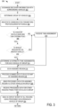
- FIG. 5 is a flow chart of an example method 500 for processing scanned data in a vehicle.
- Method 500 is performed during the scanning and feature extraction phase 208 of FIG. 2 and/or at 318 of method 300 of FIG. 3 in order to further reduce processing time and resource usage by only processing data that has changed from a prior scan. Accordingly, method 500 is performed by an in-vehicle computing system or other vehicle-based processing device in coordination with a scanning system (e.g., a LiDAR scanning system) of a vehicle that scans an environment around the vehicle.
- a scanning system e.g., a LiDAR scanning system
- the method includes obtaining scanned point-cloud data (e.g., from a scanning system that scans an environment around a vehicle).
- the point-cloud data may be raw LiDAR data from a given vehicle of a collaborative scanning process.
- the method includes converting the scanned point-cloud data to a range image.
- the range image includes a two-dimensional image, where each data point has depth information.
- the range image has a smaller size than the point-cloud data.
- the method includes partitioning the range image for classifying individual portions of the range image.
- the range image is partitioned using a mesh (e.g., a square or other shape, such as triangle) to divide the range image into different regions.
- a mesh e.g., a square or other shape, such as triangle
- the mesh size depends on the size of a predetermined minimal object on the road (e.g., a road reflector, a road sign, a rock, etc.).
- the method includes extracting structural features of the range image. Edge detection or other object mapping algorithms are used to determine features present in the range image (e.g., objects in the environment).
- the method includes obtaining a three-dimensional road map.
- the three-dimensional road map has been built during a previous iteration of a scanning/processing method (e.g., at an immediately prior iteration) and/or is obtained from another source (e.g., a navigation database using a current location of the vehicle). Accordingly, the obtained road map includes at least a portion of the environment for which scanned point-cloud data is obtained at 502.
- the method includes extracting structural features of the road map. Edge detection or other object mapping algorithms are used to determine features present in the road map (e.g., objects in the environment). The same algorithms used to extract structural features of the range image is used to extract structural features of the road map.
- the road map is obtained and the structural features of the road map are extracted at any time prior to performing the following operations of method 500 (e.g., the operation at 514, described below).
- the method includes registering the range image to the road map using the extracted structural features.
- the range image is aligned to the road map by identifying structural features present in both the range image and the road map.
- the method includes selecting a partition of the range image (e.g., one of the partitions created at 506). Partitions is selected in a particular order based on the position of the partition in the image (e.g., scanning left to right across the image from a top row of the mesh to a bottom row of the mesh).
- the method includes determining if all of the vertices of the selected partition are present on the surface of the road map.
- Data at each vertex of each grid is compared with a known 3D map. If all vertices are not present on the surface of the road map (e.g., "NO" at 518), the method proceeds to 520, to identify the selected partition as dynamic (e.g., indicating that content has changed, or has a difference from the 3D map that is larger than a threshold, in that portion of the range image from the time that the 3D map was generated).
- the method proceeds to 522 to identify that selected partition as static (e.g., indicating that content has not changed in that portion of the range image from a last iteration of the method).
- the method includes determining if all partitions of the range image have been examined. If all partitions of the range image have not been examined (e.g., "NO" at 524), the method proceeds to 526 to select a next partition (which has not been evaluated to determine whether the partition is static or dynamic) and returns to 518 to examine the next partition. If all partitions of the range image have been examined (e.g., "YES” at 524), the method proceeds to 528 to subtract the partitions located on the surface of the 3D map (e.g., the static partitions). In this way, objects on the road from the LiDAR data, such as people, vehicles, etc. that are not included in the 3D road map are extracted for processing.
- the partitions located on the surface of the 3D map e.g., the static partitions
- the method includes processing the non-subtracted data (e.g., the dynamic partitions) to build a 3D map of the scanned area.
- the 3D map includes the non-subtracted data as processed at 530 (e.g., the processed dynamic partitions) integrated with prior-processed data (processed during a prior iteration of the method) for the static partitions (e.g., associated with the subtracted data). In this way, only the changed data is processed to build a 3D map of the scanned area.
- the subtracted range images are matched to the raw LiDAR data to obtain a subtracted point cloud for efficient processing.
- the following provides pseudo code for the above method: Obtain range image r_img_t at time t.
- the disclosed methods and systems collaboratively build three-dimensional maps of an area around a group of vehicles by designating each vehicle of the group to scan and process a different portion of the area.
- a technical effect of the above methods and systems is that the delay in performing complex scanning and data processing (e.g., LiDAR scanning and processing of LiDAR data) is reduced by leveraging the resources of other vehicles in a collaborative manner. Further resource savings are achieved by determining static and dynamic elements of a scanned region and only processing the dynamic regions.
- FIG. 6 shows an example partial view of one type of environment for a collaborative sensor processing device: an interior of a cabin 600 of a vehicle 602, in which a driver and/or one or more passengers are seated.
- FIG. 6 is an example of one or more of vehicles 104a-104e of FIG. 1 .
- an instrument panel 606 includes various displays and controls accessible to a driver (also referred to as the user) of vehicle 602.
- Instrument panel 606 includes a touch screen 608 of an in-vehicle computing system 609 (e.g., an infotainment system), an audio system control panel, and an instrument cluster 610.
- an in-vehicle computing system 609 e.g., an infotainment system
- an audio system control panel e.g., an audio system control panel
- an instrument cluster 610 e.g., an audio system control panel
- the head unit is fixedly or removably attached in instrument panel 606.
- the cabin 600 includes one or more sensors for monitoring the vehicle, the user, and/or the environment.
- Sensors for scanning the environment includes one or more cameras, LiDAR arrays, and/or other optical sensors for detecting features of the environment surrounding the vehicle. It is to be understood that the above-described sensors and/or one or more additional or alternative sensors are positioned in suitable locations of the vehicle.
- Information regarding ambient conditions of the vehicle, vehicle status, or vehicle driver is received from sensors external to/separate from the vehicle (that is, not part of the vehicle system), such as sensors coupled to external devices 650 and/or mobile device 628.
- Cabin 600 also includes one or more user objects, such as mobile device 628, that are stored in the vehicle before, during, and/or after travelling.
- the mobile device 628 includes a smart phone, a tablet, a laptop computer, a portable media player, and/or any suitable mobile computing device.
- the mobile device 628 is connected to the in-vehicle computing system via communication link 630.
- the communication link 630 is wired (e.g., via Universal Serial Bus [USB], Mobile High-Definition Link [MHL], High-Definition Multimedia Interface [HDMI], Ethernet, etc.) or wireless (e.g., via BLUETOOTH, WIFI, WIFI direct Near-Field Communication [NFC], cellular connectivity, etc.) and configured to provide two-way communication between the mobile device and the in-vehicle computing system.
- the mobile device 628 includes one or more wireless communication interfaces for connecting to one or more communication links.
- In-vehicle computing system 609 is also communicatively coupled to additional devices operated and/or accessed by the user but located external to vehicle 602, such as one or more external devices 650.
- the external devices include a server computing system, personal computing system, portable electronic device, electronic wrist band, electronic head band, portable music player, electronic activity tracking device, pedometer, smart-watch, GPS system, etc.
- External devices 650 are connected to the in-vehicle computing system via communication link 636 which is wired or wireless, as discussed with reference to communication link 630, and configured to provide two-way communication between the external devices and the in-vehicle computing system.
- External devices 650 include one or more sensors and communication link 636 transmits sensor output from external devices 650 to in-vehicle computing system 609 and touch screen 608.
- In-vehicle computing system 609 is configured to analyze the input received from external devices 650, mobile device 628, and/or other input sources and provide output via touch screen 608 and/or speakers 612, communicate with mobile device 628 and/or external devices 650, and/or perform other actions based on the assessment. All or a portion of the assessment is performed by the mobile device 628 and/or the external devices 650.
- the external devices 650 includes in-vehicle computing devices of another vehicle (e.g., another vehicle grouped with vehicle 602).
- FIG. 7 shows a block diagram of an in-vehicle computing system 700 configured and/or integrated inside vehicle 701.
- In-vehicle computing system 700 may be an example of in-vehicle computing system 609 of FIG. 6 and/or perform one or more of the methods described herein in some embodiments.
- the in-vehicle computing system is a vehicle infotainment system configured to provide information-based media content (audio and/or visual media content, including entertainment content, navigational services, map data, etc.) to a vehicle user to enhance the operator's in-vehicle experience.
- information-based media content audio and/or visual media content, including entertainment content, navigational services, map data, etc.
- the vehicle infotainment system includes, or is coupled to, various vehicle systems, sub-systems, hardware components, as well as software applications and systems that are integrated in, or integratable into, vehicle 701 in order to enhance an in-vehicle experience for a driver and/or a passenger.
- In-vehicle computing system 700 includes one or more processors including an operating system processor 714 and an interface processor 720.
- Operating system processor 714 executes an operating system on the in-vehicle computing system, and control input/output, display, playback, and other operations of the in-vehicle computing system.
- Interface processor 720 interfaces with a vehicle control system 730 via an intra-vehicle communication module 722.
- Intra-vehicle communication module 722 outputs data to other vehicle systems 731 and vehicle control elements 761, while also receiving data input from other vehicle components and systems 731, 761, e.g. by way of vehicle control system 730.
- intra-vehicle communication module 722 provides a signal via a bus corresponding to any status of the vehicle, the vehicle surroundings (e.g., as measured by one or more microphones, cameras, LiDAR systems, or other sensors mounted on the vehicle), or the output of any other information source connected to the vehicle.
- Vehicle data outputs includes analog signals (such as current velocity), digital signals provided by individual information sources (such as clocks, thermometers, location sensors such as Global Positioning System [GPS] sensors, etc.), and digital signals propagated through vehicle data networks (such as an engine controller area network [CAN] bus through which engine related information communicated and/or an audio-video bridging [AVB] network through which vehicle information may be communicated).
- analog signals such as current velocity
- digital signals provided by individual information sources such as clocks, thermometers, location sensors such as Global Positioning System [GPS] sensors, etc.
- GPS Global Positioning System
- vehicle data networks such as an engine controller area network [CAN] bus through which engine related information communicated and/or an audio-video bridging [AVB] network through which vehicle information may be communicated.
- CAN engine controller area network
- AVB audio-video bridging
- a non-volatile storage device 708 is included in in-vehicle computing system 700 to store data such as instructions executable by processors 714 and 720 in non-volatile form.
- the storage device 708 stores application data to enable the in-vehicle computing system 700 to perform any of the above-described methods and/or to run an application for connecting to a cloud-based server and/or collecting information for transmission to the cloud-based server. Connection to a cloud-based server is mediated via extra-vehicle communication module 724.
- the application retrieves information gathered by vehicle systems/sensors, input devices (e.g., user interface 718), devices in communication with the in-vehicle computing system, etc.
- In-vehicle computing system 700 further includes a volatile memory 716.
- Volatile memory 716 is random access memory (RAM).
- Non-transitory storage devices such as non-volatile storage device 708 and/or volatile memory 716, store instructions and/or code that, when executed by a processor (e.g., operating system processor 714 and/or interface processor 720), controls the in-vehicle computing system 700 to perform one or more of the actions described in the disclosure.
- a processor e.g., operating system processor 714 and/or interface processor 720
- a microphone 702 is included in the in-vehicle computing system 700 to measure ambient noise in the vehicle, to measure ambient noise outside the vehicle, etc.
- One or more additional sensors are included in and/or communicatively coupled to a sensor subsystem 710 of the in-vehicle computing system 700.
- Sensor subsystem 710 of in-vehicle computing system 700 communicates with and receive inputs from various vehicle sensors and further receives user inputs. While certain vehicle system sensors communicate with sensor subsystem 710 alone, other sensors also communicate with both sensor subsystem 710 and vehicle control system 730, or communicate with sensor subsystem 710 indirectly via vehicle control system 730.
- Sensor subsystem 710 serves as an interface (e.g., a hardware interface) and/or processing unit for receiving and/or processing received signals from one or more of the sensors described in the disclosure.
- a navigation subsystem 711 of in-vehicle computing system 700 generates and/or receive navigation information such as location information (e.g., via a GPS sensor and/or other sensors from sensor subsystem 710), route guidance, traffic information, point-of-interest (POI) identification, and/or provide other navigational services for the driver.
- the navigation subsystem 711 includes an inertial navigation system that may further determine a position, orientation, and velocity of the vehicle via motion and rotation sensor inputs.
- the navigation subsystem 711 communicates with motion and rotation sensors included in the sensor subsystem 710.
- the navigation subsystem 711 Further includes motion and rotation sensors and determine the movement and rotation based on the output of these sensors.
- Navigation subsystem 711 transmits data to, and receives data from a cloud-based server and/or external navigation service via extra-vehicle communication module 724.
- the navigation subsystem 711 provides at least a portion of data to be used during generation of a three-dimensional map of a region around the vehicle.
- External device interface 712 of in-vehicle computing system 700 is coupleable to and/or communicate with one or more external devices 740 located external to vehicle 701. While the external devices are illustrated as being located external to vehicle 701, it is to be understood that the external devices 740 are not integral to vehicle 701.
- the external devices 740 includes a mobile device 742 (e.g., connected via a Bluetooth, NFC, WIFI direct, or other wireless connection) or an alternate Bluetooth-enabled device 752. Other external devices include external services 746.
- External devices 740 communicates with in-vehicle computing system 700 either wirelessly or via connectors without departing from the scope of this disclosure.
- One or more applications 744 is operable on mobile device 742.
- Mobile device application 744 is operated to monitor an environment of the vehicle (e.g., collect audio and/or visual data of an environment of the vehicle) and/or to process audio and/or visual data received from vehicle sensors. The collected/processed data is transferred by application 744 to external device interface 712 over network 760.
- applications 748 are operable on external services 746. External services applications 748 are operated to aggregate and/or analyze data from multiple data sources.
- Vehicle control system 730 includes controls for controlling aspects of various vehicle systems 731 involved in different in-vehicle functions. Vehicle control system 730 also includes controls for adjusting the settings of various vehicle controls 761 (or vehicle system control elements) related to the engine and/or auxiliary elements within a cabin of the vehicle.
- In-vehicle computing system 700 further includes an antenna(s) 706, which is/are communicatively coupled to external device interface 712 and/or extra-vehicle-communication module 724.
- the in-vehicle computing system receives positioning signals such as GPS signals and/or wireless commands via antenna(s) 706 or via infrared or other mechanisms through appropriate receiving devices.
- User interface 718 includes a graphical user interface presented on a touch screen, such as touch screen 608 of FIG. 6 , and/or user-actuated buttons, switches, knobs, dials, sliders, etc.
- a user also interacts with one or more applications of the in-vehicle computing system 700 and mobile device 742 via user interface 718. Notifications and other messages (e.g., alerts), as well as navigational assistance (e.g., 3D maps), are displayed to the user on a display of the user interface.
- Notifications and other messages e.g., alerts
- navigational assistance e.g., 3D maps
- the disclosure provides for an in-vehicle computing system of a vehicle, the in-vehicle computing system including a display device, a sensor subsystem in communication with an optical sensor, a processor, and memory storing instructions executable by the processor to form a group with at least one other vehicle, instruct the optical sensor to scan an assigned region around the vehicle, each vehicle of the group being assigned, from a master vehicle of the group or a remote device, a different region of a collaborative scanning area, wherein two or more of the plurality of assigned regions at least partially overlap, receive, from the optical sensor, locally scanned data corresponding to the assigned region, process the locally scanned data to build a first portion of a three-dimensional map of an environment of the vehicle, transmit the processed scanned data to at least one other vehicle, receive additional map data from the at least one other vehicle, build a second, different portion of the three-dimensional map using the received additional map data, and display the three-dimensional map via the display device, the three-dimensional map corresponding to the collaborative scanning area.
- the optical sensor includes a Light Detection and Ranging (LiDAR) sensor system and the locally scanned data includes point-cloud data corresponding to the assigned region.
- LiDAR Light Detection and Ranging
- a second example of the in-vehicle computing system includes the first example, wherein the vehicle forms a group with the at least one other vehicle based on a proximity of the at least one other vehicle.
- a third example of the in-vehicle computing system includes one or both of the first example and the second example, wherein the instructions are further executable to receive an assignment to scan the assigned region from another vehicle of the group, each vehicle of the group being assigned a different region of a collaborative scanning area around the group, the three-dimensional map corresponding to the collaborative scanning area.
- a fourth example of the in-vehicle computing system includes one or more of the first through the third examples, wherein the group is formed on an ad hoc basis to include only a selected number of neighboring vehicles, each of the vehicles in the group being separated from one another by less than a threshold distance.
- a fifth example of the in-vehicle computing system includes one or more of the first through the fourth examples, wherein the processed scanned data is transmitted to the at least one other vehicle along with a group identification associated with the group.
- a sixth example of the in-vehicle computing system includes one or more of the first through the fifth examples, wherein the received additional map data is received from the at least one other vehicle along with the group identification associated with the group.
- a seventh example of the in-vehicle computing system includes one or more of the first through the sixth examples, wherein the instructions are further executable to process the locally scanned data by converting the locally scanned data to a range image, obtaining a previously generated three-dimensional road map associated with the environment of the vehicle, subtracting static portions of the range image determined to be located on a surface of the three-dimensional road map, and processing only the non-subtracted portions of the range image to build the first portion of the three-dimensional map.
- An eighth example of the in-vehicle computing system includes one or more of the first through the seventh examples, wherein subtracting the static portions of the range image includes partitioning the range image using a mesh, registering the range image to the three-dimensional road map, and determining, for each partition of the range image, whether all vertices of the partition are included on the surface of the three-dimensional road map.
- a ninth example of the in-vehicle computing system includes one or more of the first through the eighth examples, wherein the assigned region includes an assigned range in degrees around the vehicle, and wherein the vehicle communicates with the at least one other vehicle according to a vehicle-to-vehicle communication protocol.
- a tenth example of the in-vehicle computing system includes one or more of the first through the ninth examples, and further includes the in-vehicle computing system, wherein the vehicle-to-vehicle communication protocol defines an encryption protocol to be used for transmissions between the vehicle and the at least one other vehicle, and wherein the instructions are further executable to encrypt the processed scanned data according to the determined encryption protocol.
- An eleventh example of the in-vehicle computing system includes one or more of the first through the tenth examples, wherein the received additional map data is encrypted according to the determined encryption protocol.
- the disclosure further provides for a method for performing a collaborative scanning operation at a first vehicle, the method including forming a group with at least one other vehicle, receiving, from a selected vehicle of the group, an assignment of a first assigned region of a collaborative scanning area, each vehicle of the group being assigned a different region of the plurality of assigned regions in the collaborative scanning area, wherein two or more of the plurality of assigned regions at least partially overlap, building a three-dimensional map of a collaborative scanning area using both locally scanned and processed data and additional map data, the additional map data being scanned and processed by at least one other vehicle and received from the at least one other vehicle via vehicle-to-vehicle communication, and the locally scanned and processed data corresponding to the first assigned region.
- the additional map data is not based on data that is scanned at the first vehicle.
- a second example of the method includes the first example, wherein the locally scanned and processed data includes point-cloud data that is processed by converting the point-cloud data to a range image, registering the range image to a previously-generated road map, and subtracting data from the range image that is located on a surface of the road map.
- a third example of the method includes one or both of the first example and the second example, wherein the at least one other vehicle is grouped with the first vehicle based on a proximity of the at least one other vehicle to the first vehicle.
- one or more of the described methods are performed by a suitable device and/or combination of devices, such as the in-vehicle computing system 609 of FIG. 6 and/or the sensor subsystem 710 of FIG. 7 .
- the methods are performed by executing stored instructions with one or more logic devices (e.g., processors) in combination with one or more additional hardware elements, such as storage devices, sensors, memory, hardware network interfaces/antennas, switches, actuators, clock circuits, etc.
Landscapes
- Engineering & Computer Science (AREA)
- Physics & Mathematics (AREA)
- Radar, Positioning & Navigation (AREA)
- Remote Sensing (AREA)
- General Physics & Mathematics (AREA)
- Computer Networks & Wireless Communication (AREA)
- Electromagnetism (AREA)
- Automation & Control Theory (AREA)
- Chemical & Material Sciences (AREA)
- Analytical Chemistry (AREA)
- Life Sciences & Earth Sciences (AREA)
- Atmospheric Sciences (AREA)
- Traffic Control Systems (AREA)
- Optical Radar Systems And Details Thereof (AREA)
Claims (15)
- Fahrzeuginternes Rechensystem (609; 700) eines Fahrzeugs (104b; 602; 701), wobei das fahrzeuginterne Rechensystem (609; 700) umfasst:eine Anzeigevorrichtung;ein Sensor-Subsystem (710) in Kommunikation mit einem optischen Sensor;einen Prozessor (714; 720); undSpeicher, der Anweisungen speichert, die durch den Prozessor (714; 720) zu Folgendem ausführbar sind:Bilden einer Gruppe mit mindestens einem anderen Fahrzeug (104c, 104d) ;Anweisen des optischen Sensors, eine zugewiesene Region (106a) um das Fahrzeug herum (104b) abzutasten (316), wobei jedem Fahrzeug der Gruppe von einem Hauptfahrzeug der Gruppe oder einer entfernten Vorrichtung eine andere Region eines gemeinsamen Abtastbereichs zugewiesen wird, wobei sich zwei oder mehr der Vielzahl von zugewiesenen Regionen mindestens teilweise überlappen;Empfangen von lokal abgetasteten Daten, die der zugewiesenen Region (106a) entsprechen, von dem optischen Sensor;Verarbeiten (318) der lokal abgetasteten Daten, um einen ersten Abschnitt einer dreidimensionalen Karte der Umgebung des Fahrzeugs zu erstellen;Übertragen (320) der verarbeiteten abgetasteten Daten an mindestens ein anderes Fahrzeug (104c, 104d);Empfangen von zusätzlichen Kartendaten von dem mindestens einen anderen Fahrzeug (104c, 104d);Erstellen eines zweiten, anderen Abschnitts (106b, 106c) der dreidimensionalen Karte unter Verwendung der empfangenen zusätzlichen Kartendaten; undAnzeigen (324) der dreidimensionalen Karte über die Anzeigevorrichtung, wobei die dreidimensionale Karte dem gemeinsamen Abtastbereich (106) entspricht.
- Fahrzeuginternes Rechensystem (609; 700) nach Anspruch 1, wobei der optische Sensor ein Light Detection and Ranging (LiDAR)-Sensorsystem beinhaltet, und wobei die lokal abgetasteten Daten Punktwolkendaten beinhalten, die der zugewiesenen Region (106a) entsprechen.
- Fahrzeuginternes Rechensystem (609; 700) nach Anspruch 1, wobei das Fahrzeug (104b) die Gruppe mit dem mindestens einen anderen Fahrzeug (104c, 104d) auf Grundlage einer Nähe des mindestens einen anderen Fahrzeugs (104c, 104d) bildet.
- Fahrzeuginternes Rechensystem (609; 700) nach Anspruch 3, wobei die Anweisungen ferner ausführbar sind, um eine Zuweisung (310) zum Abtasten der zugewiesenen Region (106a) von einem anderen Fahrzeug (104c, 104d) der Gruppe zu empfangen.
- Fahrzeuginternes Rechnersystem (609; 700) nach Anspruch 3, wobei die Gruppe ad hoc gebildet wird, um nur eine ausgewählte Anzahl benachbarter Fahrzeuge zu beinhalten, wobei jedes der Fahrzeuge in der Gruppe durch weniger als einen Schwellenabstand voneinander getrennt ist.
- Fahrzeuginternes Rechensystem (609; 700) nach Anspruch 3, wobei die verarbeiteten abgetasteten Daten zusammen mit einer der Gruppe zugeordneten Gruppenidentifikation an das mindestens eine andere Fahrzeug (104c, 104d) übertragen werden.
- Fahrzeuginternes Rechensystem (609; 700) nach Anspruch 6, wobei die empfangenen zusätzlichen Kartendaten von dem mindestens einen anderen Fahrzeug (104c, 104d) zusammen mit der mit der Gruppe verbundenen Gruppenidentifikation empfangen werden.
- Fahrzeuginternes Rechensystem (609; 700) nach Anspruch 1, wobei die Anweisungen ferner ausführbar sind, um die lokal abgetasteten Daten zu verarbeiten, indem sie die lokal abgetasteten Daten in ein Bereichsbild umwandeln (504), eine zuvor erzeugte dreidimensionale Straßenkarte, die der Umgebung des Fahrzeugs zugeordnet ist, erhalten (510), statische Abschnitte des Bereichsbildes, von denen bestimmt wurde, dass sie sich auf einer Oberfläche der dreidimensionalen Straßenkarte befinden, subtrahieren (528) und nur die nicht-subtrahierten Abschnitte des Bereichsbildes verarbeiten (530), um den ersten Abschnitt der dreidimensionalen Karte zu erstellen.
- Fahrzeuginternes Rechensystem (609; 700) nach Anspruch 8, wobei das Subtrahieren (528) der statischen Abschnitte des Bereichsbildes Partitionieren (506) des Bereichsbildes unter Verwendung eines Gitters, Registrieren (514) des Bereichsbildes auf der dreidimensionalen Straßenkarte und Bestimmen (518) für jede Partition des Bereichsbildes, ob alle Scheitelpunkte der Partition auf der Oberfläche der dreidimensionalen Straßenkarte enthalten sind, umfasst.
- Fahrzeuginternes Rechensystem (609; 700) nach Anspruch 1, wobei die zugewiesene Region (106a) einen zugewiesenen Bereich in Grad um das Fahrzeug (104b) herum beinhaltet, und wobei das Fahrzeug (104b) mit dem mindestens einen anderen Fahrzeug (104c, 104d) gemäß einem Fahrzeug-zu-Fahrzeug-Kommunikationsprotokoll kommuniziert.
- Fahrzeuginternes Computersystem (609; 700) nach Anspruch 10, wobei das Fahrzeug-zu-Fahrzeug-Kommunikationsprotokoll ein Verschlüsselungsprotokoll definiert, das für Übertragungen zwischen dem Fahrzeug (104b) und dem mindestens einen anderen Fahrzeug (104c, 104d) zu verwenden ist, und wobei die Anweisungen ferner ausführbar sind, um die verarbeiteten gescannten Daten gemäß dem bestimmten Verschlüsselungsprotokoll zu verschlüsseln.
- Verfahren zum Durchführen eines gemeinsamen Abtastvorgangs bei einem ersten Fahrzeug (104b), wobei das Verfahren umfasst:Bilden (304) einer Gruppe mit mindestens einem anderen Fahrzeug (104c, 104d);Empfangen (322) einer Zuweisung einer ersten zugewiesenen Region eines gemeinsamen Abtastbereichs von einem ausgewählten Fahrzeug der Gruppe, wobei jedem Fahrzeug der Gruppe eine andere Region aus der Vielzahl der zugewiesenen Regionen in dem gemeinsamen Abtastbereich zugewiesen wird, wobei sich zwei oder mehr der Vielzahl der zugewiesenen Regionen zumindest teilweise überlappen;Erstellen (324) einer dreidimensionalen Karte eines gemeinsamen Abtastbereichs (106) unter Verwendung sowohl lokal abgetasteter und verarbeiteter Daten als auch zusätzlicher Kartendaten, wobei die zusätzliche Karte mindestens einer der Vielzahl von abgetasteten Regionen entspricht, die sich von der ersten zugewiesenen Region unterscheidet, wobei die zusätzlichen Kartendaten von mindestens einem anderen Fahrzeug (104c, 104d) abgetastet und verarbeitet werden und von dem mindestens einen anderen Fahrzeug (104c, 104d) über eine Fahrzeug-zu-Fahrzeug-Kommunikation empfangen werden, und wobei die lokal abgetasteten und verarbeiteten Daten der ersten zugewiesenen Region entsprechen.
- Verfahren nach Anspruch 12, wobei die zusätzlichen Kartendaten nicht auf Daten basieren, die bei dem ersten Fahrzeug (104b) abgetastet werden.
- Verfahren nach Anspruch 12, wobei die lokal abgetasteten und verarbeiteten Daten Punktwolkendaten beinhalten, die verarbeitet werden, indem die Punktwolkendaten in ein Bereichsbild umgewandelt (504) werden, das Bereichsbild auf eine zuvor erzeugte Straßenkarte registriert (514) wird und Daten von dem Bereichsbild subtrahiert (528) werden, die sich auf einer Oberfläche der Straßenkarte befinden.
- Verfahren nach Anspruch 12, wobei das mindestens eine andere Fahrzeug (104c, 104d) mit dem ersten Fahrzeug (104b) auf Grundlage der Nähe des mindestens einen anderen Fahrzeugs zum ersten Fahrzeug (104b) gruppiert wird.
Applications Claiming Priority (1)
| Application Number | Priority Date | Filing Date | Title |
|---|---|---|---|
| US15/792,517 US10324189B2 (en) | 2017-10-24 | 2017-10-24 | Collaborative data processing |
Publications (2)
| Publication Number | Publication Date |
|---|---|
| EP3477342A1 EP3477342A1 (de) | 2019-05-01 |
| EP3477342B1 true EP3477342B1 (de) | 2023-02-22 |
Family
ID=63722163
Family Applications (1)
| Application Number | Title | Priority Date | Filing Date |
|---|---|---|---|
| EP18198073.1A Active EP3477342B1 (de) | 2017-10-24 | 2018-10-02 | Kollaborative datenverarbeitung |
Country Status (3)
| Country | Link |
|---|---|
| US (1) | US10324189B2 (de) |
| EP (1) | EP3477342B1 (de) |
| CN (1) | CN109696692B (de) |
Families Citing this family (36)
| Publication number | Priority date | Publication date | Assignee | Title |
|---|---|---|---|---|
| US10066946B2 (en) | 2016-08-26 | 2018-09-04 | Here Global B.V. | Automatic localization geometry detection |
| KR102295577B1 (ko) * | 2017-02-08 | 2021-08-30 | 현대자동차주식회사 | Ecu, 상기 ecu를 포함하는 무인 자율 주행 차량, 및 이의 주행 차로 판단 방법 |
| JP6541924B1 (ja) * | 2017-11-22 | 2019-07-10 | 三菱電機株式会社 | 地図収集システム、地図サーバ装置、車載装置および地図収集方法 |
| US10587998B2 (en) * | 2017-12-18 | 2020-03-10 | Toyota Jidosha Kabushiki Kaisha | Managed selection of a geographical location for a micro-vehicular cloud |
| CN111727413B (zh) * | 2017-12-27 | 2024-06-11 | 直流电资本有限责任公司 | 用于访问来自其他车辆的补充感知数据的方法 |
| US20190248364A1 (en) * | 2018-02-12 | 2019-08-15 | GM Global Technology Operations LLC | Methods and systems for road hazard detection and localization |
| US10855753B2 (en) * | 2018-02-23 | 2020-12-01 | Standard Cognition, Corp. | Distributed computing of vehicle data by selecting a computation resource of a remote server that satisfies a selection policy for meeting resource requirements according to capability information |
| US10616340B2 (en) | 2018-02-23 | 2020-04-07 | Standard Cognition, Corp. | Distributed computing of large data by selecting a computational resource of a remote server based on selection policies and data information wherein the selections policies are associated with location constraints, time constraints, and data type constraints |
| US11093759B2 (en) * | 2018-03-06 | 2021-08-17 | Here Global B.V. | Automatic identification of roadside objects for localization |
| US10909851B2 (en) * | 2018-06-06 | 2021-02-02 | Motional Ad Llc | Vehicle intent communication system |
| US11050556B2 (en) | 2018-07-13 | 2021-06-29 | Micron Technology, Inc. | Secure vehicular communication |
| US11032370B2 (en) * | 2018-11-14 | 2021-06-08 | Toyota Jidosha Kabushiki Kaisha | Wireless communications in a vehicular macro cloud |
| US10896609B2 (en) * | 2019-06-17 | 2021-01-19 | Toyota Motor North America, Inc. | Cooperative parking space search by a vehicular micro cloud |
| US11335187B2 (en) | 2019-06-20 | 2022-05-17 | Here Global B.V. | Dynamic privacy-sensitive operating modes |
| GB201909556D0 (en) * | 2019-07-03 | 2019-08-14 | Tomtom Traffic Bv | Collecting user-contributed data relating to a navibable network |
| KR20210017897A (ko) * | 2019-08-09 | 2021-02-17 | 엘지전자 주식회사 | 차량용 전자 장치 및 그의 동작 방법 |
| US11150104B2 (en) * | 2019-10-31 | 2021-10-19 | International Business Machines Corporation | Route management utilizing geolocation based clustering |
| EP3819672A1 (de) * | 2019-11-08 | 2021-05-12 | Outsight | Verfahren und system zum teilen von szenenkarten |
| US10999719B1 (en) * | 2019-12-03 | 2021-05-04 | Gm Cruise Holdings Llc | Peer-to-peer autonomous vehicle communication |
| US11172341B2 (en) * | 2019-12-13 | 2021-11-09 | Toyota Motor Engineering & Manufacturing North America, Inc. | Mobility-aware assignment of computational sub-tasks in a vehicular cloud |
| WO2021116899A1 (en) * | 2019-12-13 | 2021-06-17 | Marvell Asia Pte Ltd. | Automotive data processing system with efficient generation and exporting of metadata |
| KR20210080116A (ko) * | 2019-12-20 | 2021-06-30 | 현대자동차주식회사 | 차량 컨텐츠 공유 서비스를 제공하는 서버 및 컨텐츠 공유 방법 |
| EP4306996A4 (de) * | 2021-03-10 | 2025-02-19 | Pioneer Corporation | Messvorrichtung, positionserkennungssystem, messsystem und überwachungssystem |
| CN113419245B (zh) * | 2021-06-23 | 2022-05-31 | 北京易航远智科技有限公司 | 一种基于v2x的实时建图系统及建图方法 |
| US12299080B2 (en) * | 2021-08-24 | 2025-05-13 | Here Global B.V. | Method, apparatus, and system for traffic estimation based on anomaly detection |
| US12018959B2 (en) | 2022-01-06 | 2024-06-25 | Toyota Motor Engineering & Manufacturing North America, Inc. | Systems and methods of cooperative depth completion with sensor data sharing |
| IL315615A (en) * | 2022-03-15 | 2024-11-01 | B G Negev Technologies And Applications Ltd At Ben Gurion Univ | Cloud-based sensing and control using a vehicle radar network |
| US12131531B2 (en) * | 2022-06-23 | 2024-10-29 | Lockheed Martin Corporation | Real time light-detection and ranging point decimation |
| US12165405B2 (en) | 2022-06-23 | 2024-12-10 | Lockheed Martin Corporation | Terrain fusion real-time ray tracing optimization |
| US12488687B2 (en) | 2022-08-03 | 2025-12-02 | Qualcomm Incorporated | Filtering V2X sensor data messages |
| US20240046783A1 (en) * | 2022-08-03 | 2024-02-08 | Qualcomm Incorporated | Filtering v2x sensor data messages |
| CN115230738B (zh) * | 2022-08-12 | 2025-05-02 | 深圳元戎启行科技有限公司 | 运动意图估计方法、装置、计算机设备、存储介质 |
| US12391271B2 (en) * | 2023-03-23 | 2025-08-19 | Torc Robotics, Inc. | Enhanced signage display for autonomous vehicles and passengers |
| US12358520B2 (en) * | 2023-03-23 | 2025-07-15 | Torc Robotics, Inc. | Enhanced map display for autonomous vehicles and passengers |
| US20240420574A1 (en) * | 2023-06-15 | 2024-12-19 | Qualcomm Incorporated | Communication for vehicle safety system |
| CN119992825B (zh) * | 2025-01-15 | 2025-12-26 | 北京中佳瑞通科技有限公司 | 基于大数据的智慧交通信息采集方法、系统、介质及设备 |
Family Cites Families (24)
| Publication number | Priority date | Publication date | Assignee | Title |
|---|---|---|---|---|
| US20030102997A1 (en) * | 2000-02-13 | 2003-06-05 | Hexagon System Engineering Ltd. | Vehicle communication network |
| US6615137B2 (en) * | 2001-06-26 | 2003-09-02 | Medius, Inc. | Method and apparatus for transferring information between vehicles |
| US8947531B2 (en) | 2006-06-19 | 2015-02-03 | Oshkosh Corporation | Vehicle diagnostics based on information communicated between vehicles |
| JP4412337B2 (ja) * | 2007-03-08 | 2010-02-10 | トヨタ自動車株式会社 | 周囲環境推定装置及び周囲環境推定システム |
| US8605947B2 (en) * | 2008-04-24 | 2013-12-10 | GM Global Technology Operations LLC | Method for detecting a clear path of travel for a vehicle enhanced by object detection |
| US8229663B2 (en) * | 2009-02-03 | 2012-07-24 | GM Global Technology Operations LLC | Combined vehicle-to-vehicle communication and object detection sensing |
| US8352112B2 (en) * | 2009-04-06 | 2013-01-08 | GM Global Technology Operations LLC | Autonomous vehicle management |
| US9128185B2 (en) * | 2012-03-15 | 2015-09-08 | GM Global Technology Operations LLC | Methods and apparatus of fusing radar/camera object data and LiDAR scan points |
| US9329269B2 (en) * | 2012-03-15 | 2016-05-03 | GM Global Technology Operations LLC | Method for registration of range images from multiple LiDARS |
| US9261601B2 (en) * | 2013-06-01 | 2016-02-16 | Savari, Inc. | System and method for lane boundary estimation and host vehicle position and orientation |
| US8825260B1 (en) * | 2013-07-23 | 2014-09-02 | Google Inc. | Object and ground segmentation from a sparse one-dimensional range data |
| WO2015019234A1 (en) * | 2013-08-05 | 2015-02-12 | Universidade De Aveiro | Method and apparatus for multi-network communication in vehicular networks |
| DE112014007247T5 (de) * | 2014-12-10 | 2017-10-05 | Harman International Industries, Incorporated | Spurerkennung |
| US10638478B2 (en) * | 2015-04-01 | 2020-04-28 | Huawei Technologies Co., Ltd. | Method and system for distributed resource management in vehicular ad-hoc networks |
| US20160357187A1 (en) * | 2015-06-05 | 2016-12-08 | Arafat M.A. ANSARI | Smart vehicle |
| US9922565B2 (en) * | 2015-07-20 | 2018-03-20 | Dura Operating Llc | Sensor fusion of camera and V2V data for vehicles |
| US10410513B2 (en) * | 2015-07-20 | 2019-09-10 | Dura Operating, Llc | Fusion of non-vehicle-to-vehicle communication equipped vehicles with unknown vulnerable road user |
| US10036642B2 (en) | 2015-12-08 | 2018-07-31 | Uber Technologies, Inc. | Automated vehicle communications system |
| CN205451514U (zh) * | 2016-01-27 | 2016-08-10 | 王德龙 | 汽车导航实时路况超视距雷达及网络警报系统 |
| US10223380B2 (en) * | 2016-03-23 | 2019-03-05 | Here Global B.V. | Map updates from a connected vehicle fleet |
| US10317524B2 (en) * | 2016-04-15 | 2019-06-11 | Huawei Technologies Co., Ltd. | Systems and methods for side-directed radar from a vehicle |
| US10317519B2 (en) * | 2016-04-15 | 2019-06-11 | Huawei Technologies Co., Ltd. | Systems and methods for environment sensing using radar |
| EP4191278A1 (de) * | 2016-09-20 | 2023-06-07 | Innoviz Technologies Ltd. | Lidar-systeme und -verfahren |
| US20180105107A1 (en) * | 2016-10-19 | 2018-04-19 | Novateur Research Solutions LLC | Pedestrian collision warning system for vehicles |
-
2017
- 2017-10-24 US US15/792,517 patent/US10324189B2/en active Active
-
2018
- 2018-10-02 EP EP18198073.1A patent/EP3477342B1/de active Active
- 2018-10-17 CN CN201811207668.8A patent/CN109696692B/zh active Active
Also Published As
| Publication number | Publication date |
|---|---|
| US10324189B2 (en) | 2019-06-18 |
| CN109696692B (zh) | 2024-09-27 |
| EP3477342A1 (de) | 2019-05-01 |
| US20190120964A1 (en) | 2019-04-25 |
| CN109696692A (zh) | 2019-04-30 |
Similar Documents
| Publication | Publication Date | Title |
|---|---|---|
| US10324189B2 (en) | Collaborative data processing | |
| US11503428B2 (en) | Systems and methods for co-localization of multiple devices | |
| US10600251B2 (en) | Method of ground adjustment for in-vehicle augmented reality systems | |
| JP7182895B2 (ja) | 情報処理装置、プログラム、および情報処理方法 | |
| US10229590B2 (en) | System and method for improved obstable awareness in using a V2X communications system | |
| US11427218B2 (en) | Control apparatus, control method, program, and moving body | |
| CN112102647B (zh) | 用于车辆微云的方法和系统 | |
| CN110832553B (zh) | 图像处理装置和图像处理方法 | |
| US20190049992A1 (en) | System and Method for Improved Obstable Awareness in Using a V2x Communications System | |
| US20180129204A1 (en) | Method and system for behavioral sharing in autonomous vehicles | |
| JP2019125361A (ja) | 複数車両の協力による交通イベントの位置特定 | |
| US10306689B2 (en) | Systems and methods for shared mixed reality experiences using digital, physical, temporal or spatial discovery services | |
| JP2018026009A (ja) | 動的地図構成方法、動的地図構成システム及び移動端末 | |
| JP2019200781A (ja) | サラウンドビューシステム、そのシステムを備える車両、サラウンドビュー生成方法、およびその方法を実行するためのプログラム製品 | |
| JP6678609B2 (ja) | 情報処理装置、情報処理方法、情報処理プログラム、および移動体 | |
| Liu et al. | EdgeSharing: Edge assisted real-time localization and object sharing in urban streets | |
| US20240290108A1 (en) | Information processing apparatus, information processing method, learning apparatus, learning method, and computer program | |
| JP2020177289A (ja) | 情報処理装置、情報処理方法及び情報処理プログラム | |
| EP3561774B1 (de) | Verfahren und vorrichtung zur erzeugung eines bildes zur anzeige eines objekts auf der peripherie eines fahrzeugs | |
| JP7128037B2 (ja) | 表示制御装置及びプログラム | |
| CN109906657B (zh) | 资源复用方法、终端和相关设备 | |
| JP7845348B2 (ja) | 情報処理システム、情報処理方法、プログラム、及び、クラスタシステム | |
| Xiao et al. | Enhancing self-driving capabilities: A design architecture leveraging sensor systems and cloud computing | |
| JP2023112656A (ja) | 制御システム、制御方法、及びコンピュータプログラム | |
| CN120071664A (zh) | 用于创建协作感知图的协作感知系统 |
Legal Events
| Date | Code | Title | Description |
|---|---|---|---|
| PUAI | Public reference made under article 153(3) epc to a published international application that has entered the european phase |
Free format text: ORIGINAL CODE: 0009012 |
|
| STAA | Information on the status of an ep patent application or granted ep patent |
Free format text: STATUS: THE APPLICATION HAS BEEN PUBLISHED |
|
| AK | Designated contracting states |
Kind code of ref document: A1 Designated state(s): AL AT BE BG CH CY CZ DE DK EE ES FI FR GB GR HR HU IE IS IT LI LT LU LV MC MK MT NL NO PL PT RO RS SE SI SK SM TR |
|
| AX | Request for extension of the european patent |
Extension state: BA ME |
|
| STAA | Information on the status of an ep patent application or granted ep patent |
Free format text: STATUS: REQUEST FOR EXAMINATION WAS MADE |
|
| 17P | Request for examination filed |
Effective date: 20191023 |
|
| RBV | Designated contracting states (corrected) |
Designated state(s): AL AT BE BG CH CY CZ DE DK EE ES FI FR GB GR HR HU IE IS IT LI LT LU LV MC MK MT NL NO PL PT RO RS SE SI SK SM TR |
|
| STAA | Information on the status of an ep patent application or granted ep patent |
Free format text: STATUS: EXAMINATION IS IN PROGRESS |
|
| 17Q | First examination report despatched |
Effective date: 20200409 |
|
| GRAP | Despatch of communication of intention to grant a patent |
Free format text: ORIGINAL CODE: EPIDOSNIGR1 |
|
| STAA | Information on the status of an ep patent application or granted ep patent |
Free format text: STATUS: GRANT OF PATENT IS INTENDED |
|
| INTG | Intention to grant announced |
Effective date: 20221018 |
|
| GRAS | Grant fee paid |
Free format text: ORIGINAL CODE: EPIDOSNIGR3 |
|
| GRAA | (expected) grant |
Free format text: ORIGINAL CODE: 0009210 |
|
| STAA | Information on the status of an ep patent application or granted ep patent |
Free format text: STATUS: THE PATENT HAS BEEN GRANTED |
|
| AK | Designated contracting states |
Kind code of ref document: B1 Designated state(s): AL AT BE BG CH CY CZ DE DK EE ES FI FR GB GR HR HU IE IS IT LI LT LU LV MC MK MT NL NO PL PT RO RS SE SI SK SM TR |
|
| REG | Reference to a national code |
Ref country code: GB Ref legal event code: FG4D |
|
| REG | Reference to a national code |
Ref country code: CH Ref legal event code: EP |
|
| REG | Reference to a national code |
Ref country code: AT Ref legal event code: REF Ref document number: 1549878 Country of ref document: AT Kind code of ref document: T Effective date: 20230315 Ref country code: IE Ref legal event code: FG4D |
|
| REG | Reference to a national code |
Ref country code: DE Ref legal event code: R096 Ref document number: 602018046365 Country of ref document: DE |
|
| REG | Reference to a national code |
Ref country code: LT Ref legal event code: MG9D |
|
| REG | Reference to a national code |
Ref country code: NL Ref legal event code: MP Effective date: 20230222 |
|
| P01 | Opt-out of the competence of the unified patent court (upc) registered |
Effective date: 20230527 |
|
| REG | Reference to a national code |
Ref country code: AT Ref legal event code: MK05 Ref document number: 1549878 Country of ref document: AT Kind code of ref document: T Effective date: 20230222 |
|
| PG25 | Lapsed in a contracting state [announced via postgrant information from national office to epo] |
Ref country code: RS Free format text: LAPSE BECAUSE OF FAILURE TO SUBMIT A TRANSLATION OF THE DESCRIPTION OR TO PAY THE FEE WITHIN THE PRESCRIBED TIME-LIMIT Effective date: 20230222 Ref country code: PT Free format text: LAPSE BECAUSE OF FAILURE TO SUBMIT A TRANSLATION OF THE DESCRIPTION OR TO PAY THE FEE WITHIN THE PRESCRIBED TIME-LIMIT Effective date: 20230622 Ref country code: NO Free format text: LAPSE BECAUSE OF FAILURE TO SUBMIT A TRANSLATION OF THE DESCRIPTION OR TO PAY THE FEE WITHIN THE PRESCRIBED TIME-LIMIT Effective date: 20230522 Ref country code: NL Free format text: LAPSE BECAUSE OF FAILURE TO SUBMIT A TRANSLATION OF THE DESCRIPTION OR TO PAY THE FEE WITHIN THE PRESCRIBED TIME-LIMIT Effective date: 20230222 Ref country code: LV Free format text: LAPSE BECAUSE OF FAILURE TO SUBMIT A TRANSLATION OF THE DESCRIPTION OR TO PAY THE FEE WITHIN THE PRESCRIBED TIME-LIMIT Effective date: 20230222 Ref country code: LT Free format text: LAPSE BECAUSE OF FAILURE TO SUBMIT A TRANSLATION OF THE DESCRIPTION OR TO PAY THE FEE WITHIN THE PRESCRIBED TIME-LIMIT Effective date: 20230222 Ref country code: HR Free format text: LAPSE BECAUSE OF FAILURE TO SUBMIT A TRANSLATION OF THE DESCRIPTION OR TO PAY THE FEE WITHIN THE PRESCRIBED TIME-LIMIT Effective date: 20230222 Ref country code: ES Free format text: LAPSE BECAUSE OF FAILURE TO SUBMIT A TRANSLATION OF THE DESCRIPTION OR TO PAY THE FEE WITHIN THE PRESCRIBED TIME-LIMIT Effective date: 20230222 Ref country code: AT Free format text: LAPSE BECAUSE OF FAILURE TO SUBMIT A TRANSLATION OF THE DESCRIPTION OR TO PAY THE FEE WITHIN THE PRESCRIBED TIME-LIMIT Effective date: 20230222 |
|
| PG25 | Lapsed in a contracting state [announced via postgrant information from national office to epo] |
Ref country code: SE Free format text: LAPSE BECAUSE OF FAILURE TO SUBMIT A TRANSLATION OF THE DESCRIPTION OR TO PAY THE FEE WITHIN THE PRESCRIBED TIME-LIMIT Effective date: 20230222 Ref country code: PL Free format text: LAPSE BECAUSE OF FAILURE TO SUBMIT A TRANSLATION OF THE DESCRIPTION OR TO PAY THE FEE WITHIN THE PRESCRIBED TIME-LIMIT Effective date: 20230222 Ref country code: IS Free format text: LAPSE BECAUSE OF FAILURE TO SUBMIT A TRANSLATION OF THE DESCRIPTION OR TO PAY THE FEE WITHIN THE PRESCRIBED TIME-LIMIT Effective date: 20230622 Ref country code: GR Free format text: LAPSE BECAUSE OF FAILURE TO SUBMIT A TRANSLATION OF THE DESCRIPTION OR TO PAY THE FEE WITHIN THE PRESCRIBED TIME-LIMIT Effective date: 20230523 Ref country code: FI Free format text: LAPSE BECAUSE OF FAILURE TO SUBMIT A TRANSLATION OF THE DESCRIPTION OR TO PAY THE FEE WITHIN THE PRESCRIBED TIME-LIMIT Effective date: 20230222 |
|
| PG25 | Lapsed in a contracting state [announced via postgrant information from national office to epo] |
Ref country code: SM Free format text: LAPSE BECAUSE OF FAILURE TO SUBMIT A TRANSLATION OF THE DESCRIPTION OR TO PAY THE FEE WITHIN THE PRESCRIBED TIME-LIMIT Effective date: 20230222 Ref country code: RO Free format text: LAPSE BECAUSE OF FAILURE TO SUBMIT A TRANSLATION OF THE DESCRIPTION OR TO PAY THE FEE WITHIN THE PRESCRIBED TIME-LIMIT Effective date: 20230222 Ref country code: EE Free format text: LAPSE BECAUSE OF FAILURE TO SUBMIT A TRANSLATION OF THE DESCRIPTION OR TO PAY THE FEE WITHIN THE PRESCRIBED TIME-LIMIT Effective date: 20230222 Ref country code: DK Free format text: LAPSE BECAUSE OF FAILURE TO SUBMIT A TRANSLATION OF THE DESCRIPTION OR TO PAY THE FEE WITHIN THE PRESCRIBED TIME-LIMIT Effective date: 20230222 Ref country code: CZ Free format text: LAPSE BECAUSE OF FAILURE TO SUBMIT A TRANSLATION OF THE DESCRIPTION OR TO PAY THE FEE WITHIN THE PRESCRIBED TIME-LIMIT Effective date: 20230222 |
|
| REG | Reference to a national code |
Ref country code: DE Ref legal event code: R097 Ref document number: 602018046365 Country of ref document: DE |
|
| PG25 | Lapsed in a contracting state [announced via postgrant information from national office to epo] |
Ref country code: SK Free format text: LAPSE BECAUSE OF FAILURE TO SUBMIT A TRANSLATION OF THE DESCRIPTION OR TO PAY THE FEE WITHIN THE PRESCRIBED TIME-LIMIT Effective date: 20230222 |
|
| PLBE | No opposition filed within time limit |
Free format text: ORIGINAL CODE: 0009261 |
|
| STAA | Information on the status of an ep patent application or granted ep patent |
Free format text: STATUS: NO OPPOSITION FILED WITHIN TIME LIMIT |
|
| 26N | No opposition filed |
Effective date: 20231123 |
|
| PG25 | Lapsed in a contracting state [announced via postgrant information from national office to epo] |
Ref country code: SI Free format text: LAPSE BECAUSE OF FAILURE TO SUBMIT A TRANSLATION OF THE DESCRIPTION OR TO PAY THE FEE WITHIN THE PRESCRIBED TIME-LIMIT Effective date: 20230222 |
|
| PG25 | Lapsed in a contracting state [announced via postgrant information from national office to epo] |
Ref country code: IT Free format text: LAPSE BECAUSE OF FAILURE TO SUBMIT A TRANSLATION OF THE DESCRIPTION OR TO PAY THE FEE WITHIN THE PRESCRIBED TIME-LIMIT Effective date: 20230222 Ref country code: MC Free format text: LAPSE BECAUSE OF FAILURE TO SUBMIT A TRANSLATION OF THE DESCRIPTION OR TO PAY THE FEE WITHIN THE PRESCRIBED TIME-LIMIT Effective date: 20230222 |
|
| REG | Reference to a national code |
Ref country code: CH Ref legal event code: PL |
|
| REG | Reference to a national code |
Ref country code: BE Ref legal event code: MM Effective date: 20231031 |
|
| PG25 | Lapsed in a contracting state [announced via postgrant information from national office to epo] |
Ref country code: LU Free format text: LAPSE BECAUSE OF NON-PAYMENT OF DUE FEES Effective date: 20231002 |
|
| PG25 | Lapsed in a contracting state [announced via postgrant information from national office to epo] |
Ref country code: LU Free format text: LAPSE BECAUSE OF NON-PAYMENT OF DUE FEES Effective date: 20231002 |
|
| PG25 | Lapsed in a contracting state [announced via postgrant information from national office to epo] |
Ref country code: CH Free format text: LAPSE BECAUSE OF NON-PAYMENT OF DUE FEES Effective date: 20231031 |
|
| PG25 | Lapsed in a contracting state [announced via postgrant information from national office to epo] |
Ref country code: FR Free format text: LAPSE BECAUSE OF NON-PAYMENT OF DUE FEES Effective date: 20231031 Ref country code: CH Free format text: LAPSE BECAUSE OF NON-PAYMENT OF DUE FEES Effective date: 20231031 |
|
| PG25 | Lapsed in a contracting state [announced via postgrant information from national office to epo] |
Ref country code: BE Free format text: LAPSE BECAUSE OF NON-PAYMENT OF DUE FEES Effective date: 20231031 |
|
| PG25 | Lapsed in a contracting state [announced via postgrant information from national office to epo] |
Ref country code: IE Free format text: LAPSE BECAUSE OF NON-PAYMENT OF DUE FEES Effective date: 20231002 |
|
| PG25 | Lapsed in a contracting state [announced via postgrant information from national office to epo] |
Ref country code: IE Free format text: LAPSE BECAUSE OF NON-PAYMENT OF DUE FEES Effective date: 20231002 |
|
| PG25 | Lapsed in a contracting state [announced via postgrant information from national office to epo] |
Ref country code: BG Free format text: LAPSE BECAUSE OF FAILURE TO SUBMIT A TRANSLATION OF THE DESCRIPTION OR TO PAY THE FEE WITHIN THE PRESCRIBED TIME-LIMIT Effective date: 20230222 |
|
| PG25 | Lapsed in a contracting state [announced via postgrant information from national office to epo] |
Ref country code: BG Free format text: LAPSE BECAUSE OF FAILURE TO SUBMIT A TRANSLATION OF THE DESCRIPTION OR TO PAY THE FEE WITHIN THE PRESCRIBED TIME-LIMIT Effective date: 20230222 |
|
| PG25 | Lapsed in a contracting state [announced via postgrant information from national office to epo] |
Ref country code: CY Free format text: LAPSE BECAUSE OF FAILURE TO SUBMIT A TRANSLATION OF THE DESCRIPTION OR TO PAY THE FEE WITHIN THE PRESCRIBED TIME-LIMIT; INVALID AB INITIO Effective date: 20181002 |
|
| PG25 | Lapsed in a contracting state [announced via postgrant information from national office to epo] |
Ref country code: HU Free format text: LAPSE BECAUSE OF FAILURE TO SUBMIT A TRANSLATION OF THE DESCRIPTION OR TO PAY THE FEE WITHIN THE PRESCRIBED TIME-LIMIT; INVALID AB INITIO Effective date: 20181002 |
|
| PGFP | Annual fee paid to national office [announced via postgrant information from national office to epo] |
Ref country code: GB Payment date: 20250923 Year of fee payment: 8 |
|
| PG25 | Lapsed in a contracting state [announced via postgrant information from national office to epo] |
Ref country code: TR Free format text: LAPSE BECAUSE OF FAILURE TO SUBMIT A TRANSLATION OF THE DESCRIPTION OR TO PAY THE FEE WITHIN THE PRESCRIBED TIME-LIMIT Effective date: 20230222 |
|
| PGFP | Annual fee paid to national office [announced via postgrant information from national office to epo] |
Ref country code: DE Payment date: 20250923 Year of fee payment: 8 |