EP1085343A2 - Empfangssystem zur GPS-Positionierung unter Verwendung der Azimuth-Distance-Correction (ADCo) - Google Patents
Empfangssystem zur GPS-Positionierung unter Verwendung der Azimuth-Distance-Correction (ADCo) Download PDFInfo
- Publication number
- EP1085343A2 EP1085343A2 EP00115526A EP00115526A EP1085343A2 EP 1085343 A2 EP1085343 A2 EP 1085343A2 EP 00115526 A EP00115526 A EP 00115526A EP 00115526 A EP00115526 A EP 00115526A EP 1085343 A2 EP1085343 A2 EP 1085343A2
- Authority
- EP
- European Patent Office
- Prior art keywords
- correction
- dgps
- module
- reference station
- user
- Prior art date
- Legal status (The legal status is an assumption and is not a legal conclusion. Google has not performed a legal analysis and makes no representation as to the accuracy of the status listed.)
- Granted
Links
Images


Classifications
-
- G—PHYSICS
- G01—MEASURING; TESTING
- G01S—RADIO DIRECTION-FINDING; RADIO NAVIGATION; DETERMINING DISTANCE OR VELOCITY BY USE OF RADIO WAVES; LOCATING OR PRESENCE-DETECTING BY USE OF THE REFLECTION OR RERADIATION OF RADIO WAVES; ANALOGOUS ARRANGEMENTS USING OTHER WAVES
- G01S19/00—Satellite radio beacon positioning systems; Determining position, velocity or attitude using signals transmitted by such systems
- G01S19/38—Determining a navigation solution using signals transmitted by a satellite radio beacon positioning system
- G01S19/39—Determining a navigation solution using signals transmitted by a satellite radio beacon positioning system the satellite radio beacon positioning system transmitting time-stamped messages, e.g. GPS [Global Positioning System], GLONASS [Global Orbiting Navigation Satellite System] or GALILEO
- G01S19/40—Correcting position, velocity or attitude
- G01S19/41—Differential correction, e.g. DGPS [differential GPS]
Definitions
- the invention relates to a receiving system for GPS positioning under Use of Azimuth-Distance-Correction, in which knowledge about Accuracy of DGPS measurements depending on the distance to the Reference station and used by the azimuth.
- DGPS differential GPS global positioning system
- LW long waves
- UW ultra-short waves
- the DGPS correction data is generated on the reference station.
- DGPS correction data receivers adapted to the data transmission path are used for receiving the data. These receivers pass on the DGPS correction data via an interface to the DGPS-compatible GPS receiver of the user. The user's GPS receiver uses this DGPS correction data when calculating the position solution.
- the corrected position is output by the user's GPS receiver.
- the object of the invention is to provide a receiving system of the type mentioned create that on the basis of GPS code solutions with ALF (Accurate Positioning by Low Frequency) measured DGPS positions further improved, and thus reducing the deviations from the setpoint that have occurred.
- ALF Accele Positioning by Low Frequency
- the DGPS correction data are received from a reference station using known devices.
- This data is sent from an electronic receiver module to a known digital processing stage (RTCM module) Radio Technical Commission for Martime Services ”) for standardized transmission of the data to a known DGPS-compatible GPS receiver.
- RTCM module Digital processing stage
- This GPS receiver is additionally fed with satellite data in a known manner and thus determines the location of the user.
- the accuracy of the position value is included 5 m if the user is within a radius of up to 600 km from the reference station, however this value is too imprecise for many areas of application, such as agriculture, geo-information systems (GIS), track detection in rail transport
- GIS geo-information systems
- the position of the user determined in the GPS receiver and output in the NMEA format is read in a NMEA module and forwarded to an ADCo module, in which the read position of the user is now transmitted in this ADCo module subsequently determined more precisely, using an empirically determined correction variable.
- the mean values of the DGPS positions arose from 400 to 600 individual values on the basis of 20 to 30 minute measurements or from significantly more individual values when measuring over several hours These mean values have a systematic storage in the plane to the target point (2D storage).
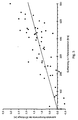
- the correlation coefficient between the azimuthal components of the 2D repositories and the associated distances to the reference station gives a value of approx. +0.75 for a sample size of around 70 measurements. This value of the correlation coefficient entitles to determine the regression line (correction line). between the azimuthal components of the 2D repository and the associated ones Distances to the reference station.
- the correlation coefficient between the corrected locations and the distances Reference station - user position is +0.40, that is, the main component of the Storage is compensated by the azimuth distance correction (ADCo).
- the Residual deviations only exceed about 1.2 m twice.
- This correction can be calculated for each DGPS measurement and attached to the result of this measurement.
- the position calculated in the ADCo module is output either on the display and / or the data interface for further use. It is conceivable and in the sense of the invention that the values for a correction in the vertical direction are determined in the same way.
Landscapes
- Engineering & Computer Science (AREA)
- Radar, Positioning & Navigation (AREA)
- Remote Sensing (AREA)
- Computer Networks & Wireless Communication (AREA)
- Physics & Mathematics (AREA)
- General Physics & Mathematics (AREA)
- Position Fixing By Use Of Radio Waves (AREA)
Abstract
Die vom NMEA-Modul eingelesenen Positionswerte werden in einem ADCo-Modul weiter bearbeitet, wobei eine Korrekturgröße aus einer empirisch bestimmten Korrekturlinie abgelesen und von der eingelesenen Position des Nutzers in Richtung auf die Referenzstation zu abgetragen und dieser Wert an den Nutzer über eine Datenschnittstelle und/oder an ein Display weitergeleitet wird.
Die Erfindung wird vorteilhaft bei allen Positionierungs- und Navigationsvorgängen angewendet, so z.B. in der Landwirtschaft, bei Geo-Informations-Systemen, im Flottenmanagement und bei der Gleiserkennung im Schienenverkehr.
Das Empfangssystem ermöglicht speziell für LW DGPS-Dienste, in unserem Fall der ALF (Accurate Positioning by Low Frequency) DGPS-Dienst der Deutschen Telekom und des Bundesamtes für Kartographie und Geodäsie (BKG), unter Verwendung des Korrekturverfahrens ADCo des BKG eine erhebliche Verbesserung der DGPS - Positionierung im Versorgungsgebiet des Senders (ca. 5 Mill. km2). In Reatime ist es damit möglich, Positionierungen < 1,5 m zu erreichen.
Description

Auf der Referenzstation werden die DGPS-Korrekturdaten erzeugt. Auf der Nutzerseite werden für den Empfang der Daten dem Datenübertragungsweg angepaßte DGPS-Korrekturdatenempfänger verwendet. Diese Empfänger geben die DGPS-Korrekturdaten über eine Schnittstelle an den DGPS-fähigen GPS-Empfänger des Nutzers weiter. Der GPS-Empfänger des Nutzers benutzt diese DGPS-Korrekturdaten bei seiner Berechnung der Positionslösung. Die Ausgabe der korrigierten Position erfolgt durch den GPS-Empfänger des Nutzers.
Es ist denkbar und im Sinne der Erfindung, daß die Ermittlung der Werte für eine Korrektur in vertikaler Richtung in gleicher Weise erfolgt.
Claims (5)
- Empfangssystem zur GPS-Positionierung unter Anwendung der Azimuth-Distance-Correction, wobei das System die von einer DGPS-Referenzstation ausgesendeten DGPS-Korrekturdaten über ein Receiver- und RTCM-Modul an einen GPS-Empfänger zuführt und der GPS-Empfänger mit seinen zusätzlich empfangenen Satellitendaten den Standort des Nutzers bestimmt und diesen Standort über ein NMEA-Modul weiterleitet, dadurch gekennzeichnet, daß die vom NMEA-Modul eingelesenen Positionswerte in einem ADCo-Modul weiterbearbeitet werden, wobei eine Korrekturgröße aus einer empirisch bestimmten Korrekturlinie abgelesen und von der eingelesenen Position des Nutzers in Richtung auf die Referenzstation zu abgetragen und dieser korrigierte Positionswert an den Nutzer über eine Datenschnittstelle und/oder an ein Display weitergeleitet wird.
- Empfangssystem nach Anspruch 1, dadurch gekennzeichnet, daß die Korrekturlinie eine Abhängigkeit zwischen der im ADCo-Modul bestimmten Entfernung zur Referenzstation und der Korrekturgröße widergibt.
- Empfangssystem nach Anspruch 1 und 2, dadurch gekennzeichnet, daß die Korrekturgröße gebildet wird aus der Regression zwischen den azimutalen Komponenten einer 2D-Ablage und den dazugehörigen Entfernungen zur Referenzstation.
- Empfangssystem nach Anspruch 1 bis 3, dadurch gekennzeichnet, daß die Parameter der Korrekturlinie (Regressionsgraden) geringfügig verändert werden.
- Empfangssystem nach Anspruch 1 bis 4, dadurch gekennzeichnet, daß die Werte für eine Korrektur in vertikaler Richtung in gleicher Weise ermittelt werden.
Applications Claiming Priority (2)
| Application Number | Priority Date | Filing Date | Title |
|---|---|---|---|
| DE19946106 | 1999-09-16 | ||
| DE19946106A DE19946106A1 (de) | 1999-09-16 | 1999-09-16 | Empfangssystem zur GPS-Positionierung unter Verwendung der Azimuth-Distance-Correction (ADCo) |
Publications (3)
| Publication Number | Publication Date |
|---|---|
| EP1085343A2 true EP1085343A2 (de) | 2001-03-21 |
| EP1085343A3 EP1085343A3 (de) | 2004-02-04 |
| EP1085343B1 EP1085343B1 (de) | 2006-10-04 |
Family
ID=7923357
Family Applications (1)
| Application Number | Title | Priority Date | Filing Date |
|---|---|---|---|
| EP00115526A Expired - Lifetime EP1085343B1 (de) | 1999-09-16 | 2000-07-19 | Empfangssystem zur GPS-Positionierung unter Verwendung der Azimuth-Distance-Correction (ADCo) |
Country Status (3)
| Country | Link |
|---|---|
| EP (1) | EP1085343B1 (de) |
| AT (1) | ATE341766T1 (de) |
| DE (2) | DE19946106A1 (de) |
Cited By (1)
| Publication number | Priority date | Publication date | Assignee | Title |
|---|---|---|---|---|
| CN106019336A (zh) * | 2015-08-28 | 2016-10-12 | 千寻位置网络有限公司 | 全球导航卫星系统的差分中继方法及其装置 |
Families Citing this family (1)
| Publication number | Priority date | Publication date | Assignee | Title |
|---|---|---|---|---|
| DE10121260A1 (de) * | 2001-04-30 | 2002-11-21 | Siemens Ag | Navigationssystem als Erweiterung bei satellitenunterstützten Navigationsgeräten im "Indoor-Bereich" |
Family Cites Families (14)
| Publication number | Priority date | Publication date | Assignee | Title |
|---|---|---|---|---|
| US5311194A (en) * | 1992-09-15 | 1994-05-10 | Navsys Corporation | GPS precision approach and landing system for aircraft |
| US5477228A (en) * | 1993-04-13 | 1995-12-19 | Differential Corrections Inc. | Differential global positioning system using radio data system |
| US5392052A (en) * | 1993-04-28 | 1995-02-21 | Eberwine; Mark A. | Position reporting emergency location system |
| US5555286A (en) * | 1994-01-31 | 1996-09-10 | Tendler Technologies, Inc. | Cellular phone based automatic emergency vessel/vehicle location system |
| US5589835A (en) * | 1994-12-20 | 1996-12-31 | Trimble Navigation Limited | Differential GPS receiver system linked by infrared signals |
| US5748651A (en) * | 1995-05-05 | 1998-05-05 | Trumble Navigation Limited | Optimum utilization of pseudorange and range rate corrections by SATPS receiver |
| DE19538876A1 (de) * | 1995-09-01 | 1997-03-06 | Westdeutscher Rundfunk | System zur Lagebestimmung von beweglichen Objekten |
| US5587716A (en) * | 1995-09-29 | 1996-12-24 | Trimble Navigation, Ltd. | Gap coverage for GPS signals |
| DE19624719A1 (de) * | 1996-06-21 | 1998-01-02 | Claas Ohg | System zur Positionsbestimmung von mobilen Objekten, insbesondere von Fahrzeugen |
| US5884220A (en) * | 1996-07-16 | 1999-03-16 | Trimble Navigation Limited | Method and apparatus to improve overall performance of a DGPS receiver |
| DE19647769C2 (de) * | 1996-11-07 | 2000-08-10 | Wilhelm Fey | Verfahren zum automatischen Führen eines Fahrten- oder Logbuches und Vorrichtung zur Durchführung des Verfahrens |
| US5877725A (en) * | 1997-03-06 | 1999-03-02 | Trimble Navigation Limited | Wide augmentation system retrofit receiver |
| DE19731109A1 (de) * | 1997-07-19 | 1999-01-21 | Honeywell Ag | Satelliten-Navigationsverfahren |
| DE19746745A1 (de) * | 1997-10-23 | 1999-05-06 | Deutsche Telekom Ag | Digitales Kommunikationssystem sowie mobiles und stationäres Endgerät dafür |
-
1999
- 1999-09-16 DE DE19946106A patent/DE19946106A1/de not_active Withdrawn
-
2000
- 2000-07-19 DE DE50013548T patent/DE50013548D1/de not_active Expired - Lifetime
- 2000-07-19 AT AT00115526T patent/ATE341766T1/de active
- 2000-07-19 EP EP00115526A patent/EP1085343B1/de not_active Expired - Lifetime
Cited By (2)
| Publication number | Priority date | Publication date | Assignee | Title |
|---|---|---|---|---|
| CN106019336A (zh) * | 2015-08-28 | 2016-10-12 | 千寻位置网络有限公司 | 全球导航卫星系统的差分中继方法及其装置 |
| CN106019336B (zh) * | 2015-08-28 | 2019-07-23 | 千寻位置网络有限公司 | 全球导航卫星系统的差分中继方法及其装置 |
Also Published As
| Publication number | Publication date |
|---|---|
| DE50013548D1 (de) | 2006-11-16 |
| EP1085343B1 (de) | 2006-10-04 |
| EP1085343A3 (de) | 2004-02-04 |
| ATE341766T1 (de) | 2006-10-15 |
| DE19946106A1 (de) | 2001-03-22 |
Similar Documents
| Publication | Publication Date | Title |
|---|---|---|
| DE3881557T2 (de) | Landehilfssystem unter verwendung von navigationssatelliten. | |
| EP0565191B1 (de) | Anordnung zur Positionsbestimmung eines Landfahrzeugs | |
| EP3776000B1 (de) | Verfahren zur ermittlung der position eines fahrzeugs | |
| DE69613235T2 (de) | Mobilpositionsbestimmung | |
| EP0814345A2 (de) | System zur Positionsbestimmung von mobilen Objekten, insbesondere von Fahrzeugen | |
| DE102017222912A1 (de) | Verfahren und Vorrichtung zur Ermittlung von Korrekturinformationen für eine Antenne eines Fahrzeugs | |
| EP3367133A1 (de) | Verfahren zum kalibrieren einer gnss-antenne eines fahrzeuges | |
| DE69323014T2 (de) | Verfahren und System zur Positionsbestimmung eines Fahrzeuges | |
| DE102015119308B4 (de) | Verfahren und Vorrichtung zum Bereitstellen von Daten für eine Satellitennavigation-basierte automatische Landung an ein Flugzeug | |
| DE102017217017A1 (de) | Verfahren und Vorrichtung zum Bereitstellen von Korrekturdaten zur Satellitennavigation | |
| WO1993009446A1 (de) | System zur lagebestimmung von beweglichen objekten | |
| EP0982601A1 (de) | Verfahren und Datenempfänger zum Empfang von Korrekturdaten enthaltenden Funksignalen für ein Global Navigation Satellite System | |
| EP3069168A2 (de) | Funk-navigationsvorrichtung und verfahren zum empfangen, auswerten und bearbeiten von fehlerhaften navigationssignalen | |
| WO1999026313A1 (de) | Antennenanlage und verfahren zum betreiben einer antennenanlage | |
| WO2022083935A1 (de) | Verfahren zur bestimmung der relevanz von zu übertragenden datenobjekten zur kooperativen positionsbestimmung | |
| DE19539302B4 (de) | Verfahren zur Positionsbestimmung mittels Differential GPS (DGPS) | |
| DE102019220543A1 (de) | Verfahren zur Integritätsprüfung von GNSS - Korrekturdaten, die ohne zugehörige Integritätsinformationen bereitgestellt werden | |
| EP0998681B1 (de) | Satelliten-navigationsverfahren | |
| EP1085343B1 (de) | Empfangssystem zur GPS-Positionierung unter Verwendung der Azimuth-Distance-Correction (ADCo) | |
| DE69601943T2 (de) | System und verfahren zum messen des totalen elektronengehalts der ionoshpäre | |
| DE4312670A1 (de) | Vorrichtung zur Ortsbestimmung eines beweglichen Objektes | |
| WO2009000732A2 (de) | Verfahren und system zur genauigkeitsverbesserung bei der positionsermittlung | |
| DE102008011824A1 (de) | Verwendung von Phasor Measurement Units für differentielle Globale Satellitennavigationssysteme (GNSS) | |
| DE60301877T2 (de) | Verfahren und einrichtung zur bestimmung der relativen position zweier punkte | |
| DE102005006389B4 (de) | Verfahren zur Positionsbestimmung eines mobilen Objekts, insbesondere einer landwirtschaftlichen Arbeitsmaschine |
Legal Events
| Date | Code | Title | Description |
|---|---|---|---|
| PUAI | Public reference made under article 153(3) epc to a published international application that has entered the european phase |
Free format text: ORIGINAL CODE: 0009012 |
|
| AK | Designated contracting states |
Kind code of ref document: A2 Designated state(s): AT BE CH CY DE DK ES FI FR GB GR IE IT LI LU MC NL PT SE |
|
| AX | Request for extension of the european patent |
Free format text: AL;LT;LV;MK;RO;SI |
|
| PUAL | Search report despatched |
Free format text: ORIGINAL CODE: 0009013 |
|
| RIC1 | Information provided on ipc code assigned before grant |
Ipc: 7G 01S 5/14 A Ipc: 7G 01S 5/00 B |
|
| AK | Designated contracting states |
Kind code of ref document: A3 Designated state(s): AT BE CH CY DE DK ES FI FR GB GR IE IT LI LU MC NL PT SE |
|
| AX | Request for extension of the european patent |
Extension state: AL LT LV MK RO SI |
|
| 17P | Request for examination filed |
Effective date: 20040804 |
|
| 17Q | First examination report despatched |
Effective date: 20040908 |
|
| AKX | Designation fees paid |
Designated state(s): AT BE CH CY DE DK ES FI FR GB GR IE IT LI LU MC NL PT SE |
|
| GRAP | Despatch of communication of intention to grant a patent |
Free format text: ORIGINAL CODE: EPIDOSNIGR1 |
|
| RAP1 | Party data changed (applicant data changed or rights of an application transferred) |
Owner name: DEUTSCHE TELEKOM AG |
|
| GRAS | Grant fee paid |
Free format text: ORIGINAL CODE: EPIDOSNIGR3 |
|
| GRAA | (expected) grant |
Free format text: ORIGINAL CODE: 0009210 |
|
| AK | Designated contracting states |
Kind code of ref document: B1 Designated state(s): AT BE CH CY DE DK ES FI FR GB GR IE IT LI LU MC NL PT SE |
|
| PG25 | Lapsed in a contracting state [announced via postgrant information from national office to epo] |
Ref country code: FI Free format text: LAPSE BECAUSE OF FAILURE TO SUBMIT A TRANSLATION OF THE DESCRIPTION OR TO PAY THE FEE WITHIN THE PRESCRIBED TIME-LIMIT Effective date: 20061004 Ref country code: IE Free format text: LAPSE BECAUSE OF FAILURE TO SUBMIT A TRANSLATION OF THE DESCRIPTION OR TO PAY THE FEE WITHIN THE PRESCRIBED TIME-LIMIT Effective date: 20061004 Ref country code: NL Free format text: LAPSE BECAUSE OF FAILURE TO SUBMIT A TRANSLATION OF THE DESCRIPTION OR TO PAY THE FEE WITHIN THE PRESCRIBED TIME-LIMIT Effective date: 20061004 Ref country code: IT Free format text: LAPSE BECAUSE OF FAILURE TO SUBMIT A TRANSLATION OF THE DESCRIPTION OR TO PAY THE FEE WITHIN THE PRESCRIBED TIME-LIMIT;WARNING: LAPSES OF ITALIAN PATENTS WITH EFFECTIVE DATE BEFORE 2007 MAY HAVE OCCURRED AT ANY TIME BEFORE 2007. THE CORRECT EFFECTIVE DATE MAY BE DIFFERENT FROM THE ONE RECORDED. Effective date: 20061004 |
|
| REG | Reference to a national code |
Ref country code: GB Ref legal event code: FG4D Free format text: NOT ENGLISH |
|
| REG | Reference to a national code |
Ref country code: CH Ref legal event code: EP Ref country code: CH Ref legal event code: NV Representative=s name: ISLER & PEDRAZZINI AG |
|
| REG | Reference to a national code |
Ref country code: IE Ref legal event code: FG4D Free format text: LANGUAGE OF EP DOCUMENT: GERMAN |
|
| REF | Corresponds to: |
Ref document number: 50013548 Country of ref document: DE Date of ref document: 20061116 Kind code of ref document: P |
|
| GBT | Gb: translation of ep patent filed (gb section 77(6)(a)/1977) |
Effective date: 20061213 |
|
| PG25 | Lapsed in a contracting state [announced via postgrant information from national office to epo] |
Ref country code: SE Free format text: LAPSE BECAUSE OF FAILURE TO SUBMIT A TRANSLATION OF THE DESCRIPTION OR TO PAY THE FEE WITHIN THE PRESCRIBED TIME-LIMIT Effective date: 20070104 Ref country code: DK Free format text: LAPSE BECAUSE OF FAILURE TO SUBMIT A TRANSLATION OF THE DESCRIPTION OR TO PAY THE FEE WITHIN THE PRESCRIBED TIME-LIMIT Effective date: 20070104 |
|
| PG25 | Lapsed in a contracting state [announced via postgrant information from national office to epo] |
Ref country code: ES Free format text: LAPSE BECAUSE OF FAILURE TO SUBMIT A TRANSLATION OF THE DESCRIPTION OR TO PAY THE FEE WITHIN THE PRESCRIBED TIME-LIMIT Effective date: 20070115 |
|
| PG25 | Lapsed in a contracting state [announced via postgrant information from national office to epo] |
Ref country code: PT Free format text: LAPSE BECAUSE OF FAILURE TO SUBMIT A TRANSLATION OF THE DESCRIPTION OR TO PAY THE FEE WITHIN THE PRESCRIBED TIME-LIMIT Effective date: 20070316 |
|
| NLV1 | Nl: lapsed or annulled due to failure to fulfill the requirements of art. 29p and 29m of the patents act | ||
| ET | Fr: translation filed | ||
| REG | Reference to a national code |
Ref country code: IE Ref legal event code: FD4D |
|
| PLBE | No opposition filed within time limit |
Free format text: ORIGINAL CODE: 0009261 |
|
| STAA | Information on the status of an ep patent application or granted ep patent |
Free format text: STATUS: NO OPPOSITION FILED WITHIN TIME LIMIT |
|
| 26N | No opposition filed |
Effective date: 20070705 |
|
| REG | Reference to a national code |
Ref country code: CH Ref legal event code: PCAR Free format text: ISLER & PEDRAZZINI AG;POSTFACH 1772;8027 ZUERICH (CH) |
|
| BERE | Be: lapsed |
Owner name: DEUTSCHE TELEKOM A.G. Effective date: 20070731 |
|
| PG25 | Lapsed in a contracting state [announced via postgrant information from national office to epo] |
Ref country code: MC Free format text: LAPSE BECAUSE OF NON-PAYMENT OF DUE FEES Effective date: 20070731 Ref country code: GR Free format text: LAPSE BECAUSE OF FAILURE TO SUBMIT A TRANSLATION OF THE DESCRIPTION OR TO PAY THE FEE WITHIN THE PRESCRIBED TIME-LIMIT Effective date: 20070105 |
|
| PG25 | Lapsed in a contracting state [announced via postgrant information from national office to epo] |
Ref country code: BE Free format text: LAPSE BECAUSE OF NON-PAYMENT OF DUE FEES Effective date: 20070731 |
|
| PG25 | Lapsed in a contracting state [announced via postgrant information from national office to epo] |
Ref country code: LU Free format text: LAPSE BECAUSE OF NON-PAYMENT OF DUE FEES Effective date: 20070719 Ref country code: CY Free format text: LAPSE BECAUSE OF FAILURE TO SUBMIT A TRANSLATION OF THE DESCRIPTION OR TO PAY THE FEE WITHIN THE PRESCRIBED TIME-LIMIT Effective date: 20061004 |
|
| REG | Reference to a national code |
Ref country code: FR Ref legal event code: PLFP Year of fee payment: 17 |
|
| PGFP | Annual fee paid to national office [announced via postgrant information from national office to epo] |
Ref country code: GB Payment date: 20160722 Year of fee payment: 17 Ref country code: CH Payment date: 20160726 Year of fee payment: 17 Ref country code: DE Payment date: 20160721 Year of fee payment: 17 |
|
| PGFP | Annual fee paid to national office [announced via postgrant information from national office to epo] |
Ref country code: FR Payment date: 20160722 Year of fee payment: 17 Ref country code: AT Payment date: 20160720 Year of fee payment: 17 |
|
| REG | Reference to a national code |
Ref country code: DE Ref legal event code: R119 Ref document number: 50013548 Country of ref document: DE |
|
| REG | Reference to a national code |
Ref country code: CH Ref legal event code: PL |
|
| REG | Reference to a national code |
Ref country code: AT Ref legal event code: MM01 Ref document number: 341766 Country of ref document: AT Kind code of ref document: T Effective date: 20170719 |
|
| GBPC | Gb: european patent ceased through non-payment of renewal fee |
Effective date: 20170719 |
|
| REG | Reference to a national code |
Ref country code: FR Ref legal event code: ST Effective date: 20180330 |
|
| PG25 | Lapsed in a contracting state [announced via postgrant information from national office to epo] |
Ref country code: DE Free format text: LAPSE BECAUSE OF NON-PAYMENT OF DUE FEES Effective date: 20180201 Ref country code: LI Free format text: LAPSE BECAUSE OF NON-PAYMENT OF DUE FEES Effective date: 20170731 Ref country code: GB Free format text: LAPSE BECAUSE OF NON-PAYMENT OF DUE FEES Effective date: 20170719 Ref country code: CH Free format text: LAPSE BECAUSE OF NON-PAYMENT OF DUE FEES Effective date: 20170731 |
|
| PG25 | Lapsed in a contracting state [announced via postgrant information from national office to epo] |
Ref country code: FR Free format text: LAPSE BECAUSE OF NON-PAYMENT OF DUE FEES Effective date: 20170731 Ref country code: AT Free format text: LAPSE BECAUSE OF NON-PAYMENT OF DUE FEES Effective date: 20170719 |