WO2018016703A1 - 산사태 모니터링 및 예·경보를 위한 무선 센서 네트워크 계측 시스템 및 계측방법 - Google Patents
산사태 모니터링 및 예·경보를 위한 무선 센서 네트워크 계측 시스템 및 계측방법 Download PDFInfo
- Publication number
- WO2018016703A1 WO2018016703A1 PCT/KR2017/001124 KR2017001124W WO2018016703A1 WO 2018016703 A1 WO2018016703 A1 WO 2018016703A1 KR 2017001124 W KR2017001124 W KR 2017001124W WO 2018016703 A1 WO2018016703 A1 WO 2018016703A1
- Authority
- WO
- WIPO (PCT)
- Prior art keywords
- landslide
- measurement
- information
- warning
- network
- Prior art date
Links
Images


Classifications
-
- G—PHYSICS
- G01—MEASURING; TESTING
- G01D—MEASURING NOT SPECIALLY ADAPTED FOR A SPECIFIC VARIABLE; ARRANGEMENTS FOR MEASURING TWO OR MORE VARIABLES NOT COVERED IN A SINGLE OTHER SUBCLASS; TARIFF METERING APPARATUS; MEASURING OR TESTING NOT OTHERWISE PROVIDED FOR
- G01D21/00—Measuring or testing not otherwise provided for
- G01D21/02—Measuring two or more variables by means not covered by a single other subclass
-
- G—PHYSICS
- G01—MEASURING; TESTING
- G01W—METEOROLOGY
- G01W1/00—Meteorology
- G01W1/14—Rainfall or precipitation gauges
-
- G—PHYSICS
- G08—SIGNALLING
- G08B—SIGNALLING OR CALLING SYSTEMS; ORDER TELEGRAPHS; ALARM SYSTEMS
- G08B21/00—Alarms responsive to a single specified undesired or abnormal condition and not otherwise provided for
- G08B21/02—Alarms for ensuring the safety of persons
- G08B21/10—Alarms for ensuring the safety of persons responsive to calamitous events, e.g. tornados or earthquakes
-
- G—PHYSICS
- G08—SIGNALLING
- G08B—SIGNALLING OR CALLING SYSTEMS; ORDER TELEGRAPHS; ALARM SYSTEMS
- G08B21/00—Alarms responsive to a single specified undesired or abnormal condition and not otherwise provided for
- G08B21/18—Status alarms
-
- G—PHYSICS
- G08—SIGNALLING
- G08B—SIGNALLING OR CALLING SYSTEMS; ORDER TELEGRAPHS; ALARM SYSTEMS
- G08B21/00—Alarms responsive to a single specified undesired or abnormal condition and not otherwise provided for
- G08B21/18—Status alarms
- G08B21/182—Level alarms, e.g. alarms responsive to variables exceeding a threshold
-
- G—PHYSICS
- G08—SIGNALLING
- G08B—SIGNALLING OR CALLING SYSTEMS; ORDER TELEGRAPHS; ALARM SYSTEMS
- G08B31/00—Predictive alarm systems characterised by extrapolation or other computation using updated historic data
-
- G—PHYSICS
- G08—SIGNALLING
- G08C—TRANSMISSION SYSTEMS FOR MEASURED VALUES, CONTROL OR SIMILAR SIGNALS
- G08C17/00—Arrangements for transmitting signals characterised by the use of a wireless electrical link
- G08C17/02—Arrangements for transmitting signals characterised by the use of a wireless electrical link using a radio link
Definitions
- the present invention relates to a landslide example and alarm measurement system and measurement method, and more particularly, to determine the measurement point more rationally, to facilitate the field application of the wireless measurement technique, and to accurately monitor the landslides in real time
- the present invention relates to a wireless sensor network measurement system and a measurement method.
- the wireless sensor network (WSN) technique has recently been actively researched and applied in metropolitan area and slope measurement because it has been proved economical and constructable compared to the existing measurement method.
- WSN wireless sensor network
- the measurement of mountain and slope using WSN is actively researched and applied.
- the rational method for determining the specific configuration of the measurement system and the measurement point constituting the network has not been proposed, it is being made qualitatively.
- This technique clarifies the composition of the measurement system for landslide monitoring and forecasting and warning, and makes the rational measurement of the mountain and slope using the wireless measurement system more efficient by using the automatic mesh generation algorithm.
- Wireless sensor network measurement system and measurement method for landslide monitoring and warning, according to the present invention has the following problems.
- the present invention is a wireless sensor network measurement system for landslide monitoring and forecasting and warning using a wireless sensor network (WSN) technique that has been actively researched and applied since it has been proved economical and constructability compared to the existing measurement methods.
- WSN wireless sensor network
- the present invention provides a method for more rationally determining the specific configuration of the measurement system and the measurement point constituting the network, to facilitate the field application of the wireless measurement technique, and to provide a system and method capable of accurate landslide monitoring in real time To provide.
- a first aspect of the present invention for solving the above problems is a wireless sensor network measurement system for landslide monitoring and warning, the measurement point determination unit for determining the measurement point using a two-dimensional element network automatic generation algorithm;
- a wireless network sensor unit comprising a plurality of sensor nodes interspersed with the determined measurement points of a mountain area, and obtaining landslide measurement information from each sensor node;
- a gateway for collecting measurement information of each sensor node and transmitting measurement information collected to the outside;
- a landslide evaluation unit configured to generate landslide information using a landslide example / alarm algorithm through the measurement information received from the gateway and the determined measurement point.
- the landslide measurement information is preferably at least one of rainfall, rainfall time, water content, capillary absorption and ground slope information
- the wireless network sensor unit is interspersed in a mountainous area, provided with a wireless communication device A plurality of sensor nodes; A measurement sensor connected to each sensor node and measuring landslide measurement information at a peripheral position of the corresponding sensor node; And it is preferable to include a sensor connection board for processing information of the measurement sensor and sensor node.
- the measurement point determination unit using the landslide simulation model to determine the measurement target basin based on rainfall conditions, ground conditions, slope inclination and soil depth information of the mountain area, input the boundary point coordinates from the determined measurement target basin, It is preferable to generate a mesh type mesh by determining a plurality of points in the watershed to be measured using the mesh network algorithm.
- it may further include a database for storing landslide example and warning information, terrain and geological information of the mountainous region, measured landslide measurement information, rainfall information, the measured landslide measurement information using the element network It may further include a display device for visualizing.
- a second aspect of the present invention is a wireless sensor network measurement method for landslide monitoring and warning and warning.
- a measurement point for obtaining landslide information in a mountainous region is determined using a two-dimensional element network automatic generation algorithm. Making; (b) measuring a landslide measurement information in real time with respect to the determined measurement point by a wireless network sensor unit including a plurality of sensor nodes in a mountain area; (c) a gateway for collecting measurement information of each sensor node and transmitting the collected measurement information; And (d) a landslide evaluator generating and evaluating landslide information using a landslide example / alarm algorithm through measurement information received from the gateway and determined measurement points.
- step (a) comprises: (a1) rainfall conditions in mountainous regions, Determining a measurement target basin using a landslide simulation model based on ground conditions, slope slopes, and soil depth information; (a2) inputting boundary point coordinates from the determined watershed to be measured; And (a3) generating a mesh type mesh by determining a plurality of points in the watershed to be measured using the mesh algorithm.
- the landslide measurement information is preferably at least one of rainfall, rainfall time, water content, capillary absorption and ground slope information, the step (d), (d1) the landslide example and warning criteria set in advance and received Determining whether safety is compared with measurement information of the determined measurement point; (d2) if the safety criterion is exceeded, determining from the rainfall data whether the duration of the current rainfall exceeds the reference time; (d3) determining whether the measurement information and the landslide example / alarm standard are exceeded when the reference time is exceeded; And (d4) displaying a landslide forecast or alert if the alert criteria are exceeded.
- step (d2) if the reference time is exceeded, determining whether the measurement information and the landslide example / alarm standard of the adjacent area of the measurement point are exceeded; And displaying a landslide example / alarm information, an estimated damage area information, and evacuation information when exceeding an alarm standard, and includes landslide example / alarm information, mountainous terrain topography and geological information, and measured landslide measurement.
- the method further includes storing information and rainfall information in a database, and further comprising performing a behavior evaluation and upgrading of the landslide warning and warning criteria, and storing and updating the information in the database.
- a third aspect of the invention is characterized by a computer program stored in a computer readable medium, combined with hardware, for executing the above-mentioned landslide monitoring method.
- Wireless sensor network measurement system and measurement method for landslide monitoring and warning, according to the present invention has the following effects.
- the present invention facilitates the construction of a measurement system by applying the concept and configuration of a wireless sensor network measurement system, determination of measurement points using a two-dimensional element network automatic generation algorithm, and visualization techniques using the element network, and measurement accuracy. It provides wireless sensor network measurement system and measuring method for landslide monitoring and warning.
- the present invention provides a measurement system and method for landslide monitoring and warning and warning using a wireless sensor network that can improve accuracy and field in real time.
- FIG. 1 is a block diagram illustrating a wireless sensor network measurement system for landslide monitoring and warning according to an embodiment of the present invention.
- FIG. 2 is a flowchart illustrating a procedure of a wireless sensor network measurement method for landslide monitoring and warning of the present invention.
- FIG. 3 is a schematic diagram comparing a conventional slope measurement technique and a slope measurement technique according to an embodiment of the present invention.
- FIG. 4 is a diagram illustrating an algorithm for landslide example and alarm of the wireless sensor network measurement method for landslide monitoring and example and alarm according to an embodiment of the present invention.
- FIG. 5 is a diagram visualizing measurement results of a wireless sensor network measurement system for landslide monitoring and warning according to an embodiment of the present invention.
- 6 and 7 are step-by-step schematic diagrams of the element network algorithm used to determine the measurement point in the wireless sensor network measurement system and measurement method for landslide monitoring and warning, according to an embodiment of the present invention.
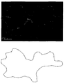
- FIG. 8 is a schematic diagram showing the determination of the measurement point by generating the net in the embodiment of the present invention.
- the present invention provides a wireless sensor network measurement system for landslide monitoring and warning, including: a measurement point determination unit for determining a measurement point using a two-dimensional element network automatic generation algorithm; A wireless network sensor unit comprising a plurality of sensor nodes interspersed with the determined measurement points of a mountain area, and obtaining landslide measurement information from each sensor node; A gateway for collecting measurement information of each sensor node and transmitting measurement information collected to the outside; And a landslide evaluation unit for generating landslide information using a landslide example / alarm algorithm through the measurement information received from the gateway and the determined measurement point.
- ... unit ... unit
- ... module etc. described in the specification may mean a unit for processing at least one function or operation.
- FIG. 1 is a block diagram of a wireless sensor network measurement system for landslide monitoring and warning according to an embodiment of the present invention
- Figure 2 is a wireless sensor network measurement method for landslide monitoring and warning of the present invention. Is a flowchart showing the sequence of.
- the wireless sensor network measurement system for landslide monitoring and warning and warning includes a measurement point determination unit 300 for determining a measurement point using a two-dimensional element network automatic generation algorithm. ); A wireless network sensor unit 100 comprising a plurality of sensor nodes interspersed with the determined measurement points in a mountain area, and obtaining landslide measurement information from each sensor node; A gateway 200 for collecting measurement information of each sensor node and transmitting the collected measurement information to the outside; And a landslide evaluation unit 400 for generating landslide information using a landslide example / alarm algorithm through the measurement information received from the gateway 200 and the determined measurement point.
- the wireless sensor network measurement method for landslide monitoring and warning (a) two-dimensional element network automatic measurement point for the acquisition of landslide information in mountainous region Determining using a generation algorithm; (b) measuring, by the wireless network sensor unit 100 including a plurality of sensor nodes in a mountain area, landslide measurement information in real time with respect to the determined measurement point; (c) a gateway 200 for collecting measurement information of each sensor node and transmitting the collected measurement information; And (d) the landslide evaluator 400 generating and evaluating the landslide information using the landslide example / alarm algorithm through the measurement information received from the gateway 200 and the determined measurement point.
- An embodiment of the present invention is a system and technique for determining a measurement point using a wireless measurement system using a method for constructing a wireless sensor network measurement system for landslide monitoring and warning and warning, and an automatic network generation algorithm of elements. It consists of the concept and composition of the measurement system, the determination of the measurement point using the automatic generation algorithm of the 2D element network, and the visualization technique using the element network.
- the configuration of the wireless sensor network measurement system can monitor the mountains and slopes of the wide area, the measurement can be made appropriate for the landslide example and alarm, and the target area ( Boundary) can be used for constructing a suitable element network to visualize the measurement results and to use them more effectively in landslide forecasts and alarms.
- embodiments of the present invention can be utilized in the wireless sensor network (WSN) technique, which has recently been actively researched and applied because of its economic feasibility and constructability compared to the existing measurement methods in wide area and slope measurement.
- the present invention relates to a measurement system and method for landslide monitoring, forecasting, and warning, and provides a reasonable method and system for determining a specific configuration of a measurement system and a measurement point constituting a network. Provides measurement system and method for landslide monitoring and forecast and alarm using sensor network.
- the wireless sensor network sensor unit includes a plurality of sensor nodes installed in a mountain area, at least one sensor capable of measuring landslide measurement information connected to the sensor nodes, information of the sensor nodes, and It comprises a gateway 200 or a base station that connects information with a server or sensor information processing device or computer.
- the senor is a measurement sensor for acquiring landslide example and alarm information, and is composed of at least one sensor capable of measuring rainfall, rainfall time, water content, maternal absorption force, ground slope information, and the like. That is, it can be configured as a rainfall measurement sensor, maternal absorption force sensor, water content measurement sensor, ground slope measurement sensor, etc.
- the ground slope sensor is preferably composed of an acceleration sensor, a tilt sensor, a gyro sensor and the like.
- the sensors of the wireless sensor network sensor unit can measure, in real time, rainfall, water content, maternal absorption, ground slope, etc., which are changed by rainfall.
- Measurement information by the sensor of each sensor node is transmitted to the gateway 200 through the wireless sensor network, and since the wireless sensor network supports a multi frequency hopping function, a network composed of short-range or long-range wireless communication modules is used. When operated according to the intended use, arbitrary transmission networks can be automatically formed.
- a short range wireless communication module Zigbee
- the module can apply the router (router) function jointly, there is an advantage to configure the network by itself.
- the measurement result of the sensor or the like is transmitted to the gateway 200, and the measurement information is transmitted from the gateway 200 to the landslide evaluator 400 to generate evaluation information for the landslide prediction and warning.
- the measurement point determination unit 300 and the landslide evaluator 400 are composed of one computing device or a server, and may be classified by physical devices, and each device may be interlocked with each other and divided into software. It is also possible.
- the measurement point determination unit 300 determines the measurement target basin using a landslide simulation model based on rainfall conditions, ground conditions, slope inclination, and soil information of a mountain area.
- the mesh point network may be generated by inputting boundary point coordinates from the watershed to be measured and determining a plurality of points in the watershed to be measured using an element network algorithm.
- the embodiment of the present invention may further include a database storing landslide example and warning information, terrain and geological information of the mountainous region, measured landslide measurement information, and rainfall information.
- FIG. 3 is a schematic diagram comparing a conventional slope measurement technique and a slope measurement technique according to an embodiment of the present invention.
- the conventional slope measurement technique is suitable for application to artificial slopes having a small scale and having a clear object of measurement and management.
- the slope measurement method according to the embodiment of the present invention has been actively proved to be economical and constructive in comparison with the existing measurement method in the area measurement and slope measurement in recent years.
- WSN wireless sensor network
- landslides are mostly caused by rainfall infiltration, and landslides caused by rainfall infiltration are closely related to preceding rainfall, cumulative rainfall and time rainfall (Campbell, 1975; Wilson, 1989; Guzzetti et al ,. 2007; Jeong et al., 2014).
- rainfall occurs, water penetrates into the ground to form a wet zone, and when the wet zone reaches a certain depth, it reduces the capillary absorption, which increases the strength of the ground, thereby increasing the water content and unsaturated permeability coefficient and increasing the rainfall penetration rate. Instability increases (Ng and Shi, 1998; Fourie et al., 1999; Cho and Lee, 2000; Jeong et al., 2009).
- an embodiment of the present invention proposes a measurement system and a measurement method capable of landslide monitoring and forecasting / alarming by measuring water content, maternal suction and acceleration based on such a landslide occurrence mechanism.
- Table 1 shows the configuration of the wireless sensor network measurement system applied in the embodiment of the present invention.
- Wireless sensor network measurement system and measurement method for landslide monitoring and forecasting and warning is a technology to determine the appropriate measurement point by using the element network generation algorithm, and to visually display and display the measurement results Suggest.
- the algorithm for landslide example and alarm from the mountain area and slope measurement result using the wireless sensor network measurement system is shown as FIG.
- the wireless sensor network measurement system and measurement method for landslide monitoring and warning and warning is a landslide warning and warning using the configuration and measurement results of the wireless sensor network measurement system suitable for the landslide warning and warning
- the measurement results can be visually shown.
- FIG. 5 is a diagram visualizing measurement results of a wireless sensor network measurement system for landslide monitoring and warning according to an embodiment of the present invention.
- the measurement point is determined using a two-dimensional element network generation algorithm to obtain landslide information of the mountainous region.
- Determination of the measurement point using the mesh generation algorithm includes the process of determining the watershed to be measured, inputting the watershed boundary point coordinates, and generating a mesh type mesh.
- 6 to 7 is a step-by-step schematic diagram of the element network algorithm used for the determination of the measurement point in the wireless sensor network measurement system and measurement method for landslide monitoring and warning, according to an embodiment of the present invention.
- the determination of the target basin for landslide monitoring is Stability Index Mapping (SINMAP; Pack et al., 1998), Transient Rainfall Infiltration and Grid-based Regional Slope-stability Model (TRIGRS; Baum et al., 2008), Shallow Slope Stability Model (SHALSTAB; Montgomery and Dietrich, 1994), GEOtopFS model (Simoni et al., 2008), Shallow landslide Instability Prediction model (SLIP; Montrasio et al., 2011), Triangulated Irregular Networks -based Real-time Integrated Basin Simulator and Vegetation Generator for Interactive Evolution (tRIBS-VEGGIE; Lepore et al., 2013), GIS-based prediction method of landslide susceptibility using a rainfall infiltration-groundwater flow model (YS-slope; Kim et. al., 2014).
- SIMAP Stability Index Mapping
- TRIGRS Transient Rainfall Infiltration and Grid-based Regional Slope-s
- the boundary point coordinates are input from the determined measurement target watershed.
- the density of the mesh should be adjusted appropriately, taking into account the number of measuring points determined in the measurement plan.
- FIG. 8 is a schematic diagram showing the determination of the measurement point by generating the net in the embodiment of the present invention.
- mesh-like mesh generation and determination of measurement points according to an embodiment of the present invention used MATLAB (2016a), which is an engineering programming language, to determine the measurement point by generating the mesh. The mesh was created through the procedure.
- the measurement points were determined as points within the watershed boundary determined by the mesh generation algorithm, so that they could effectively represent the entire watershed and visually represent the measurement results obtained from each measurement point.
- the mesh generation algorithm generates the mesh through the following process.
- 1 Mesh size define (determining the maximum size of the mesh), 2 Checking Geometry (point coordinates, checking the coordinates of the boundary point), 3 Creating local points (Estimating local geometry feature size) 4 Quadtree decomposition: Forming element quadtree, Placing Boundary Nodes, Smoothing Boundaries, 5 Initializing Mesh, 6 Iterative Convergence, 7 Mesh generation
- Step (b) is a step of measuring landslide measurement information in real time using a wireless sensor network.
- the landslide measurement information includes rainfall, rainfall time, water content, maternal absorption and ground slope information.
- step (c) the landslide measurement information gateway 200 transmitted from the sensor node of the determined measurement point is received and transmitted to the landslide evaluation unit 400.
- Step (d) is a landslide information generation and evaluation step, wherein the landslide evaluation unit 400 generates landslide example / alarm information through measurement information received from the gateway 200 and previously determined measurement point information to display the display device. Steps to display through.
- the landslide evaluation unit 400 receives landslide measurement information received from the wireless sensor network system, and terrain and geological data and rainfall data stored in a database, and compares the landslide measurement and warning criteria with safety measures. Judge.
- the landslide measurement information is received from the wireless sensor network in real time or periodically, and the safety judgment process is repeated. If it is determined to be unsafe, rainfall is measured in real time to determine whether the rainfall is temporary or continuous. Through time, it is judged whether the rainfall continues. If it is determined that the rainfall is not continuous, attention information and the like can be displayed and the above-described determination is repeated in real time or periodically.
- the landslide forecasting and warning information is compared again with the measured landslide measurement information and the measured landslide measurement information is exceeded. You may.
- step (d) the landslide evaluator 400 determines safety or not by comparing the predetermined landslide example / alarm criterion with the measurement information of the determined measurement point received. It is determined whether the duration of the current rainfall exceeds the reference time, and if it exceeds the reference time, it is determined whether the measurement information and the landslide example and alarm criteria are exceeded. Will be displayed.
- the landslide evaluation unit 400 determines whether the rainfall continues, if it is determined that the rainfall is continued, the landslide evaluation unit 400 determines the measurement point and compares the landslide measurement information of the neighboring area with a preset landslide example and warning standard. Landslide forecasts, warnings, potential damages and evacuation information can be generated and displayed.
- the wireless sensor network measurement system and measurement method for landslide monitoring and warning and warning may further include storing and updating the database.
- the landslide warning and warning standards are set in advance, but can be set flexibly according to changes in the environment of the measurement area, and the accuracy of measurement and evaluation can be improved by raising the standard by updating the landslide measurement information measured in real time. Because there is.
- it may be a computer program stored in a computer-readable medium in order to execute the three-dimensional displacement measurement method of the structure using a single camera combined with hardware.
- the computer-readable recording medium includes all kinds of recording devices in which data that can be read by a computer system is stored. Examples of the recording medium include ROM, RAM, optical disk, magnetic tape, floppy disk, hard disk, nonvolatile memory, and the like.
- the computer readable recording medium can also be distributed over network coupled computer systems so that the computer readable code is stored and executed in a distributed fashion.
Landscapes
- General Physics & Mathematics (AREA)
- Physics & Mathematics (AREA)
- Environmental & Geological Engineering (AREA)
- Engineering & Computer Science (AREA)
- Business, Economics & Management (AREA)
- Emergency Management (AREA)
- Life Sciences & Earth Sciences (AREA)
- General Life Sciences & Earth Sciences (AREA)
- Computer Networks & Wireless Communication (AREA)
- Geology (AREA)
- Computing Systems (AREA)
- Hydrology & Water Resources (AREA)
- Atmospheric Sciences (AREA)
- Biodiversity & Conservation Biology (AREA)
- Ecology (AREA)
- Environmental Sciences (AREA)
- Testing Or Calibration Of Command Recording Devices (AREA)
- Emergency Alarm Devices (AREA)
Abstract
본 발명은 산사태 모니터링 및 예·경보를 위한 무선 센서 네트워크 계측 시스템 및 계측방법에 관한 것으로, 2차원 요소망 자동생성 알고리즘을 이용하여 계측지점을 결정하는 계측지점 결정부; 산악 지역의 상기 결정된 계측지점에 산재 되어 설치된 다수의 센서노드로 구성되고, 각 센서노드에서 산사태 계측정보를 획득하는 무선 네트워크 센서부; 상기 각 센서노드의 계측정보를 수집하고, 외부로 수집된 계측정보를 전송하는 게이트웨이; 및 상기 게이트웨이로부터 수신받은 계측정보와 결정된 계측지점을 통해 산사태 예/경보 알고리즘을 이용하여 산사태 정보를 생성하는 산사태 평가부를 포함하여 구성된다.
Description
본 발명은 산사태 예·경보 계측 시스템 및 계측방법에 관한 것으로, 보다 상세하게는 계측지점을 보다 합리적으로 결정하고, 무선 계측기법의 현장적용을 수월하게 하며, 실시간으로 정확하게 산사태를 모니터링하고 예·경보가 가능한 무선 센서 네트워크 계측 시스템 및 계측방법에 관한 것이다.
우리나라의 국토는 약 70%가 산지이며, 이를 관리하기 위해 사면안정해석이 수행되고 있으나, 산사태를 예·경보하고 피해를 저감시키기 위해서는 산지·사면의 계측에 의한 실시간 관리가 이루어져야 한다. 무선 센서 네트워크 계측(Wireless sensor network, WSN) 기법은 최근 광역적 산지·사면 계측에 있어서 기존 계측방법에 비해 경제성과 시공성이 입증되어 활발히 연구 및 적용되고 있다. 하지만, 현재 WSN을 이용한 산지·사면의 계측은 활발히 연구 및 적용되고 있으나 계측시스템의 구체적인 구성과 네트워크를 구성하는 계측지점을 결정하기 위한 합리적인 방법이 제시되지 않아 정성적으로 이루어지고 있는 실정이다. 본 기술은 산사태 모니터링 및 예·경보를 위한 계측시스템의 구성을 명확히 하고, 요소망 자동생성 알고리즘을 이용하여 무선계측 시스템을 활용한 산지·사면의 계측이 보다 합리적으로 이뤄지도록 하는 기법이다.
종래의 사면계측기법은 규모가 작고, 계측 및 관리의 대상이 명확한 인공사면 등에 적용하기에는 적절하나, 계측·관리대상이 유역단위의 광역적 규모인 산사태에 적용하기에는 경제성, 시공성 및 사용성이 부족하여 한계가 있다. 또한, WSN을 이용한 산지·사면의 계측은 활발히 연구 및 적용되고 있으나 계측시스템의 구체적인 구성과 네트워크를 구성하는 계측지점을 결정하기 위한 합리적인 방법이 제시되지 않아 정성적으로 이루어지고 있는 실정이다.
또한, 현재 무선 센서 네트워크(WSN)를 이용한 산지·사면의 계측은 활발히 연구 및 적용되고 있으나 계측시스템의 구체적인 구성과 네트워크를 구성하는 계측지점을 결정하기 위한 합리적인 방법이 제시되지 않아 정성적으로 이루어지고 있는 실정이다.
[선행기술문헌]
[특허문헌]
대한민국 공개특허공보 제10-2008-0002092호(공개일자:2008년01월04일)
대한민국 공개특허공보 제10-2014-0076273호(공개일자:2014년06월20일)
본 발명에 따른 산사태 모니터링 및 예·경보를 위한 무선 센서 네트워크 계측 시스템 및 계측방법은 다음과 같은 해결과제를 가진다.
첫째, 본 발명은 기존 계측방법에 비해 경제성과 시공성이 입증되어 활발히 연구 및 적용되고 있는 무선 센서 네트워크 계측(Wireless sensor network, WSN)기법을 적용한 산사태 모니터링 및 예·경보를 위한 무선 센서 네트워크 계측 시스템 및 계측방법을 제공하고자 함이다.
둘째, 본 발명은 계측시스템의 구체적인 구성과 네트워크를 구성하는 계측지점을 보다 합리적으로 결정하는 방법을 제시하여, 무선 계측기법의 현장적용을 수월하게 하고, 실시간으로 정확한 산사태 모니터링이 가능한 시스템 및 방법을 제공하고자 함이다.
본 발명의 해결과제는 이상에서 언급한 것들에 한정되지 않으며, 언급되지 아니한 다른 해결과제들은 아래의 기재로부터 당업자에게 명확하게 이해될 수 있을 것이다.
상술한 과제를 해결하기 위한 본 발명의 제1 특징은, 산사태 모니터링 및 예·경보를 위한 무선 센서 네트워크 계측 시스템으로, 2차원 요소망 자동생성 알고리즘을 이용하여 계측지점을 결정하는 계측지점 결정부; 산악 지역의 상기 결정된 계측지점에 산재 되어 설치된 다수의 센서노드로 구성되고, 각 센서노드에서 산사태 계측정보를 획득하는 무선 네트워크 센서부; 상기 각 센서노드의 계측정보를 수집하고, 외부로 수집된 계측정보를 전송하는 게이트웨이; 및 상기 게이트웨이로부터 수신 받은 계측정보와 결정된 계측지점을 통해 산사태 예/경보 알고리즘을 이용하여 산사태 정보를 생성하는 산사태 평가부를 포함한다.
여기서, 상기 산사태 계측정보는, 강우량, 강우시간, 함수비, 모관흡수력 및 지반 기울기 정보 중 적어도 어느 하나인 것이 바람직하고, 상기 무선 네트워크 센서부는, 산악 지역에 산재 되어 설치되는 것으로, 무선통신장치를 구비하는 다수의 센서 노드; 각 센서 노드와 연결되어 해당 센서 노드의 주변 위치에서 산사태 계측 정보를 측정하는 계측 센서; 및 상기 계측 센서 및 센서 노드의 정보를 처리하는 센서 연결보드를 포함하는 것이 바람직하다.
또한, 상기 계측지점 결정부는, 산악 지역의 강우 조건, 지반 조건, 사면 경사 및 토심 정보를 바탕으로 산사태 시뮬레이션 모델을 이용하여 계측대상유역을 결정하고, 결정된 계측대상유역으로부터 경계 지점 좌표를 입력하고, 요소망 알고리즘을 이용하여 상기 계측대상유역 내의 다수의 지점을 결정하여 메쉬형 요소망을 생성하는 것이 바람직하다.
더하여, 바람직하게는 산사태 예·경보 정보, 산악 지역의 지형 및 지질 정보, 계측된 산사태 계측정보, 강우량 정보를 저장하는 데이터베이스를 더 포함하는 것일 수 있고, 계측된 산사태 계측정보를 요소망을 이용하여 시각화하는 디스플레이장치를 더 포함하는 것일 수 있다.
그리고, 본 발명의 제2 특징은, 산사태 모니터링 및 예·경보를 위한 무선 센서 네트워크 계측방법으로, (a) 산악 지역의 산사태 정보 획득을 위한 계측지점을 2차원 요소망 자동생성 알고리즘을 이용하여 결정하는 단계; (b) 산악 지역에 다수의 센서 노드로 구성된 무선 네트워크 센서부가 상기 결정된 계측지점에 대하여 산사태 계측정보를 실시간으로 계측하는 단계; (c) 각 센서노드의 계측정보를 수집하고, 수집된 계측정보를 전송하는 게이트웨이; 및 (d) 산사태 평가부가 상기 게이트웨이로부터 수신받은 계측정보와 결정된 계측지점을 통해 산사태 예/경보 알고리즘을 이용하여 산사태 정보를 생성하고 평가하는 단계를 포함한다.
여기서, 상기 산사태 평가부가 생성한 산사태 정보 및 평가 정보를 바탕으로, 산사태 예·경보 정보를 표시하는 단계를 더 포함하는 것이 바람직하고, 상기 (a) 단계는, (a1) 산악 지역의 강우 조건, 지반 조건, 사면 경사 및 토심 정보를 바탕으로 산사태 시뮬레이션 모델을 이용하여 계측대상유역을 결정하는 단계; (a2) 결정된 계측대상유역으로부터 경계 지점 좌표를 입력하는 단계; 및 (a3) 요소망 알고리즘을 이용하여 상기 계측대상유역 내의 다수의 지점을 결정하여 메쉬형 요소망을 생성하는 단계를 포함하는 것이 바람직하다.
또한, 상기 산사태 계측정보는, 강우량, 강우시간, 함수비, 모관흡수력 및 지반 기울기 정보 중 적어도 어느 하나인 것이 바람직하고, 상기 (d) 단계는, (d1) 미리 설정된 산사태 예·경보 기준과 수신받은 결정된 계측지점의 계측정보와 비교하여 안전성 여부를 판단하는 단계; (d2) 안전 기준을 초과하는 경우, 강우 데이터로부터 현재 강우의 지속시간이 기준시간을 초과하는지 여부를 판단하는 단계; (d3) 기준시간을 초과하는 경우, 상기 계측정보와 산사태 예·경보 기준을 초과하는지 여부를 판단하는 단계; 및 (d4) 경보 기준을 초과하는 경우 산사태 예보 또는 경보를 표시하는 단계를 포함하는 것이 바람직하다.
더하여, 상기 (d2) 단계 이후, 기준시간을 초과하는 경우, 계측지점의 인접지역의 계측정보와 산사태 예·경보 기준을 초과하는지 여부를 판단하는 단계; 및 경보 기준을 초과하는 경우, 산사태 예·경보 정보, 피해 예상지역 정보 및 대피 정보를 표시하는 단계를 포함하는 것이 바람직하고, 산사태 예·경보 정보, 산악 지역의 지형 및 지질 정보, 계측된 산사태 계측정보, 강우량 정보를 데이터베이스에 저장하는 단계를 더 포함하는 것이 바람직하며, 상기 산사태 예·경보 기준의 거동평가 및 고도화 작업을 수행하고, 상기 데이터베이스에 저장하여 업데이트 하는 단계를 더 포함하는 것이 바람직하다.
그리고, 본 발명의 제3 특징은, 하드웨어와 결합되어, 상술한 산사태 모니터링 방법을 실행시키기 위하여 컴퓨터가 판독 가능한 매체에 저장된 컴퓨터프로그램을 그 특징으로 한다.
본 발명에 따른 산사태 모니터링 및 예·경보를 위한 무선 센서 네트워크 계측 시스템 및 계측방법은 다음과 같은 효과를 가진다.
첫째, 본 발명은 무선 센서 네트워크 계측시스템의 개념 및 구성, 2차원 요소망 자동생성 알고리즘을 이용한 계측지점의 결정 및 요소망을 이용한 시각화 기법을 적용하여 계측 시스템의 구축을 용이하게 하고, 계측 정밀성을 높일 수 있는 산사태 모니터링 및 예·경보를 위한 무선 센서 네트워크 계측 시스템 및 계측방법을 제공한다.
둘째, 본 발명은 실시간으로 정확성 및 현장성을 높일 수 있는 무선 센서 네트워크를 이용한 산사태 모니터링 및 예·경보를 위한 계측 시스템 및 방법을 제공한다.
본 발명의 효과는 이상에서 언급한 것들에 한정되지 않으며, 언급되지 아니한 다른 효과들은 아래의 기재로부터 당업자에게 명확하게 이해될 수 있을 것이다.
도 1은 본 발명의 실시예에 따른 산사태 모니터링 및 예·경보를 위한 무선 센서 네트워크 계측 시스템의 블록 구성을 나타낸 도면이다.
도 2는 본 발명의 산사태 모니터링 및 예·경보를 위한 무선 센서 네트워크 계측방법의 순서를 나타낸 순서도이다.
도 3은 종래의 사면계측기법과 본 발명의 실시예에 따른 사면 계측기법을 비교한 모식도이다.
도 4는 본 발명의 실시예에 따른 산사태 모니터링 및 예·경보를 위한 무선 센서 네트워크 계측방법의 산사태 예·경보를 위한 알고리즘을 나타낸 도면이다.
도 5는 본 발명의 실시예에 따른 산사태 모니터링 및 예·경보를 위한 무선 센서 네트워크 계측 시스템의 계측 결과를 시각화한 도면이다.
도 6 및 도 7은 본 발명의 실시예에 따른 산사태 모니터링 및 예·경보를 위한 무선 센서 네트워크 계측 시스템 및 계측방법에서 계측지점의 결정에 사용되는 요소망 알고리즘의 단계별 모식도이다.
도 8은 본 발명이 실시예에서 요소망 생성을 통한 계측지점의 결정을 나타내는 모식도이다.
본 발명은 산사태 모니터링 및 예·경보를 위한 무선 센서 네트워크 계측 시스템으로서, 2차원 요소망 자동생성 알고리즘을 이용하여 계측지점을 결정하는 계측지점 결정부; 산악 지역의 상기 결정된 계측지점에 산재 되어 설치된 다수의 센서노드로 구성되고, 각 센서노드에서 산사태 계측정보를 획득하는 무선 네트워크 센서부; 상기 각 센서노드의 계측정보를 수집하고, 외부로 수집된 계측정보를 전송하는 게이트웨이; 및 상기 게이트웨이로부터 수신 받은 계측정보와 결정된 계측지점을 통해 산사태 예/경보 알고리즘을 이용하여 산사태 정보를 생성하는 산사태 평가부를 포함하는 것이 바람직하다.
본 발명의 추가적인 목적들, 특징들 및 장점들은 다음의 상세한 설명 및 첨부도면으로부터 보다 명료하게 이해될 수 있다.
본 발명의 상세한 설명에 앞서, 본 발명은 다양한 변경을 도모할 수 있고, 여러 가지 실시 예를 가질 수 있는바, 아래에서 설명되고 도면에 도시된 예시들은 본 발명을 특정한 실시 형태에 대해 한정하려는 것이 아니며, 본 발명의 사상 및 기술 범위에 포함되는 모든 변경, 균등물 내지 대체물을 포함하는 것으로 이해되어야 한다.
어떤 구성요소가 다른 구성요소에 "연결되어" 있다거나 "접속되어" 있다고 언급된 때에는, 그 다른 구성요소에 직접적으로 연결되어 있거나 또는 접속되어 있을 수도 있지만, 중간에 다른 구성요소가 존재할 수도 있다고 이해되어야 할 것이다. 반면에, 어떤 구성요소가 다른 구성요소에 "직접 연결되어" 있다거나 "직접 접속되어" 있다고 언급된 때에는, 중간에 다른 구성요소가 존재하지 않는 것으로 이해되어야 할 것이다.
본 명세서에서 사용한 용어는 단지 특정한 실시 예를 설명하기 위해 사용된 것으로, 본 발명을 한정하려는 의도는 아니다. 단수의 표현은 문맥상 명백하게 다르게 뜻하지 않는 한, 복수의 표현을 포함한다. 본 명세서에서, "포함하다" 또는 "가지다" 등의 용어는 명세서상에 기재된 특징, 숫자, 단계, 동작, 구성요소, 부품 또는 이들을 조합한 것이 존재함을 지정하려는 것이지, 하나 또는 그 이상의 다른 특징들이나 숫자, 단계, 동작, 구성요소, 부품 또는 이들을 조합한 것들의 존재 또는 부가 가능성을 미리 배제하지 않는 것으로 이해되어야 한다.
또한, 명세서에 기재된 "...부", "...유닛", "...모듈" 등의 용어는 적어도 하나의 기능이나 동작을 처리하는 단위를 의미할 수 있다.
또한, 첨부 도면을 참조하여 설명함에 있어, 도면 부호에 관계없이 동일한 구성 요소는 동일한 참조부호를 부여하고 이에 대한 중복되는 설명은 생략하기로 한다. 본 발명을 설명함에 있어서 관련된 공지 기술에 대한 구체적인 설명이 본 발명의 요지를 불필요하게 흐릴 수 있다고 판단되는 경우 그 상세한 설명을 생략한다.
이하에서 본 발명의 바람직한 실시예를 도면을 참조하여 상세히 설명하기로 한다.
도 1은 본 발명의 실시예에 따른 산사태 모니터링 및 예·경보를 위한 무선 센서 네트워크 계측 시스템의 블록 구성을 나타낸 도면이고, 도 2는 본 발명의 산사태 모니터링 및 예·경보를 위한 무선 센서 네트워크 계측방법의 순서를 나타낸 순서도이다.
도 1에 나타낸 바와 같이, 본 발명의 실시예에 따른 산사태 모니터링 및 예·경보를 위한 무선 센서 네트워크 계측 시스템은, 2차원 요소망 자동생성 알고리즘을 이용하여 계측지점을 결정하는 계측지점 결정부(300); 산악 지역의 상기 결정된 계측지점에 산재 되어 설치된 다수의 센서노드로 구성되고, 각 센서노드에서 산사태 계측정보를 획득하는 무선 네트워크 센서부(100); 상기 각 센서노드의 계측정보를 수집하고, 외부로 수집된 계측정보를 전송하는 게이트웨이(200); 및 상기 게이트웨이(200)로부터 수신받은 계측정보와 결정된 계측지점을 통해 산사태 예/경보 알고리즘을 이용하여 산사태 정보를 생성하는 산사태 평가부(400)를 포함하여 구성된다.
그리고, 도 2에 나타낸 바와 같이, 본 발명의 실시예에 따른 산사태 모니터링 및 예·경보를 위한 무선 센서 네트워크 계측방법은, (a) 산악 지역의 산사태 정보 획득을 위한 계측지점을 2차원 요소망 자동생성 알고리즘을 이용하여 결정하는 단계; (b) 산악 지역에 다수의 센서 노드로 구성된 무선 네트워크 센서부(100)가 상기 결정된 계측지점에 대하여 산사태 계측정보를 실시간으로 계측하는 단계; (c) 각 센서노드의 계측정보를 수집하고, 수집된 계측정보를 전송하는 게이트웨이(200); 및 (d) 산사태 평가부(400)가 상기 게이트웨이(200)로부터 수신받은 계측정보와 결정된 계측지점을 통해 산사태 예/경보 알고리즘을 이용하여 산사태 정보를 생성하고 평가하는 단계를 포함하여 구성된다.
본 발명의 실시예는 산사태 모니터링 및 예·경보를 위한 무선 센서 네트워크 계측시스템의 구축방법과 요소망 자동생성 알고리즘을 이용하여 무선계측 시스템을 활용한 계측지점을 결정하는 시스템 및 기법으로, 무선 센서 네트워크 계측시스템의 개념 및 구성, 2차원 요소망 자동생성 알고리즘을 이용한 계측지점의 결정, 요소망을 이용한 시각화 기법으로 구성되어 있다.
이와 같은 본 발명이 실시예에 따른 무선 센서 네트워크 계측시스템의 구성은 광역 지역의 산지·사면을 모니터링 할 수 있고, 산사태 예·경보에 적절한 계측이 이뤄질 수 있으며, 계측지점을 결정하기 위해 대상 구역(Boundary)에 따라 적적할 요소망을 구성하여 계측 결과를 시각화하여 산사태 예·경보에 보다 효율적으로 사용할 수 있다.
즉, 본 발명의 실시예는, 최근 광역적 산지·사면 계측에 있어서 기존 계측방법에 비해 경제성과 시공성이 입증되어 활발히 연구 및 적용되고 있는 무선 센서 네트워크 계측(Wireless sensor network, WSN)기법에 활용하여 산사태 모니터링 및 예·경보를 위한 계측 시스템 및 방법에 관한 것으로, 계측시스템의 구체적인 구성과 네트워크를 구성하는 계측지점을 결정하기 위한 합리적인 방법 및 시스템을 제공하여, 실시간으로 정확성 및 현장성을 높일 수 있는 무선 센서 네트워크를 이용한 산사태 모니터링 및 예·경보를 위한 계측 시스템 및 방법을 제공한다.
보다 구체적으로, 도 1에 나타낸 바와 같이, 무선 센서 네트워크 센서부는 산악 지역에 설치된 다수개의 센서 노드와 센서 노드와 연결된 산사태 계측정보를 측정할 수 있는 적어도 하나의 센서와, 센서 노드의 정보와 외부의 서버 또는 센서 정보 처리장치 또는 컴퓨터와 정보를 연결하는 게이트웨이(200) 또는 베이스 스테이션으로 구성된다.
여기서, 센서는 산사태 예·경보 정보를 획득하기 위한 계측 센서로서, 강우량, 강우시간, 함수비, 모관흡수력 및 지반 기울기 정보 등을 계측할 수 있는 적어도 하나 이상의 센서로 구성된다. 즉, 강우량 측정센서, 모관흡수력 센서, 함수비 측정센서, 지반 기울기 측정센서 등으로 구성할 수 있고, 지반 기울기 센서는 가속도 센서, 기울기 센서, 자이로 센서 등으로 구성되는 것이 바람직하다.
이처럼 본 발명의 실시예에서 무선 센서 네트워크 센서부의 센서들은 강우에 의하여 변화되는 강우량, 함수비, 모관흡수력 및 지반 기울기 등을 실시간으로 측정할 수 있게 된다.
각 센서 노드의 센서에 의한 계측 정보는 무선센서 네트워크를 통해 게이트웨이(200)로 전송되고, 무선센서 네트워크는 다중 주파수 도약(multi frequency hopping) 기능을 지원하고 있으므로 근거리 또는 원거리 무선통신모듈로 구성된 네트워크를 용도에 맞도록 운영하면 임의의 전송망을 자동으로 형성할 수 있다.
특히, 근거리 무선통신모듈(Zigbee)의 경우에는 통신거리가 제한되어 있으므로 먼 거리의 게이트웨이(200)까지 연결하기 위해서는 많은 게이트웨이(200)가 있어야 하지만, 상기 다수 주파수 도약 기능을 이용하면 각각의 무선통신모듈(Zigbee)이 라우터(router) 기능을 공동으로 적용할 수 있으므로 스스로 네트워크를 구성할 수 있는 장점이 있다. 이와 같은 센서 등의 계측 결과값을 게이트웨이(200)로 전송하고, 게이트웨이(200)에서 이 계측 정보를 산사태 평가부(400)로 전송하여 산사태 예·경보를 위한 평가정보를 생성하게 된다.
그리고, 계측지점 결정부(300) 및 산사태 평가부(400)는 하나의 컴퓨팅 장치 또는 서버로 구성되는 것으로, 물리적 장치에 의해 구분되는 것도 가능하고, 각 장치가 서로 연동되어 소프트웨어적으로 구분되는 장치도 가능하다.
여기서 계측지점 결정부(300)는 상기 계측지점 결정부(300)는, 산악 지역의 강우 조건, 지반 조건, 사면 경사 및 토심 정보를 바탕으로 산사태 시뮬레이션 모델을 이용하여 계측대상유역을 결정하고, 결정된 계측대상유역으로부터 경계 지점 좌표를 입력하고, 요소망 알고리즘을 이용하여 상기 계측대상유역 내의 다수의 지점을 결정하여 메쉬형 요소망을 생성할 수 있다.
또한, 본 발명의 실시예에서는 산사태 예·경보 정보, 산악 지역의 지형 및 지질 정보, 계측된 산사태 계측정보, 강우량 정보를 저장하는 데이터베이스를 더 포함하는 것도 가능하다.
이하에서 보다 구체적으로 본 발명의 실시예에 따른 산사태 모니터링 및 예·경보를 위한 무선 센서 네트워크 계측 시스템 및 계측방법에 대하여, 단계적으로 상세히 설명하기로 한다.
도 3은 종래의 사면계측기법과 본 발명의 실시예에 따른 사면 계측기법을 비교한 모식도이다. 도 3의 (a)에 나타낸 바와 같이, 종래의 사면계측기법은 규모가 작고, 계측 및 관리의 대상이 명확한 인공사면 등에 적용하기에는 적절하나, 계측·관리대상이 유역단위의 광역적 규모인 산사태에 적용하기에는 경제성, 시공성 및 사용성이 부족하여 한계가 있다. 이에 본 발명의 실시예에서는 도 3의 (b)에 나타낸 바와 같이, 본 발명의 실시예에 따른 사면 계측기법은 최근 광역적 산지·사면 계측에 있어서 기존 계측방법에 비해 경제성과 시공성이 입증되어 활발히 연구되고 있는 무선 센서 네트워크 계측(Wireless sensor network, WSN)기법에 활용하여, 시공이 용이하고, 저비용의 정확한 계측 네트워크 시스템을 제안한다.
또한, 산사태는 대부분 강우침투에 의해 발생하며, 강우침투에 의한 산사태 발생은 선행강우, 누적강우 및 시간 강우와 밀접한 관련이 있다(Campbell, 1975; Wilson, 1989; Guzzetti et al,. 2007; Jeong et al., 2014). 강우가 발생하면 지반으로 물이 침투하여 습윤대를 형성하고 습윤대가 일정 깊이에 도달하면 지반의 강도를 증가시키는 모관흡수력을 감소시켜 함수비 및 불포화 투수계수가 증가하며 강우 침투속도가 빨라지게 되어 사면의 불안정성이 증가하게 된다(Ng and Shi, 1998; Fourie et al., 1999; Cho and Lee, 2000; Jeong et al., 2009).
이에 본 발명의 실시예에서는 이와 같은 산사태 발생 매커니즘을 바탕으로 함수비, 모관흡수력 및 가속도를 측정하여 산사태 모니터링 및 예·경보가 가능한 계측 시스템 및 계측방법을 제안한다. [표 1]은 본 발명의 실시예에서 적용되는 무선 센서 네트워크 계측시스템의 의 구성을 나타낸다.

본 발명의 실시예에 따른 산사태 모니터링 및 예·경보를 위한 무선 센서 네트워크 계측 시스템 및 계측방법은 요소망 생성 알고리즘을 활용하여 적절한 계측지점을 결정하고 계측결과를 시각적으로 도시화하여 표시할 수 있도록 하는 기술을 제안한다. 또한, 무선 센서 네트워크 계측시스템을 이용한 산지·사면 계측결과로부터 산사태 예·경보를 위한 알고리즘을 도 4과 같이 나타낸다.
즉, 본 발명의 실시예에 따른 산사태 모니터링 및 예·경보를 위한 무선 센서 네트워크 계측 시스템 및 계측방법은 유역단위 산사태 예·경보에 적합한 무선 센서 네트워크 계측시스템의 구성 및 계측 결과를 이용한 산사태 예·경보뿐만 아니라 계측결과를 시각적으로 도시할 수 있게 된다. 도 5는 본 발명의 실시예에 따른 산사태 모니터링 및 예·경보를 위한 무선 센서 네트워크 계측 시스템의 계측 결과를 시각화한 도면이다.
보다 구체적으로, 본 발명의 실시예는 (a) 단계에서, 산악 지역의 산사태 정보 획득을 위해 2차원 요소망 생성 알고리즘을 이용하여 계측지점을 결정하게 된다. 요소망 생성 알고리즘을 이용한 계측지점의 결정은 계측대상유역의 결정 프로세스, 유역 경계지점 좌표 입력 및 메쉬형 요소망 생성 단계를 포함하여 구성된다. 도 6 내지 도 7은 본 발명의 실시예에 따른 산사태 모니터링 및 예·경보를 위한 무선 센서 네트워크 계측 시스템 및 계측방법에서 계측지점의 결정에 사용되는 요소망 알고리즘의 단계별 모식도이다.
계측대상유역 결정
먼저, 도 6에 나타낸 바와 같이, 산사태 모니터링을 위한 계측대상유역의 결정은 Stability Index Mapping (SINMAP; Pack et al., 1998), Transient Rainfall Infiltration and Grid-based Regional Slope-stability Model (TRIGRS; Baum et al., 2008), Shallow Slope Stability Model (SHALSTAB; Montgomery and Dietrich, 1994), GEOtopFS model (Simoni et al., 2008), Shallow landslide Instability Prediction model (SLIP; Montrasio et al., 2011), Triangulated Irregular Networks-based Real-time Integrated Basin Simulator and Vegetation Generator for Interactive Evolution (tRIBS-VEGGIE; Lepore et al., 2013), GIS-based prediction method of landslide susceptibility using a rainfall infiltration-groundwater flow model (YS-slope; Kim et al., 2014) 등과 같은 산사태 시뮬레이션 모델을 이용하여 결정할 수 있다. 산사태 시뮬레이션에서는 강우조건, 지반조건, 사면 경사 및 토심 등을 고려하여 산사태 발생 가능성이 높은 지점을 결정할 수 있으며, 계측 대상유역 결정시 주요 계측지점을 결정하는데 중요한 결과로 사용된다.
유역 경계지점 좌표 입력
유역 경계지점의 좌표입력 단계는, 도 7에 나타낸 바와 같이, 결정된 계측대상유역으로부터 경계 지점(boundary point) 좌표를 입력한다. 경계 지점(Boundary point)를 조밀하게 하면, 요소망이 더 조밀하게 생성되며, 느슨하게 하면 요소망 또한 느슨하게 생성된다. 요소망의 조밀도는 계측 계획 시 결정된 계측지점의 개수를 고려하여 적절하게 조절해야 한다.
메쉬형 요소망 생성 및 계측지점의 결정
도 8은 본 발명이 실시예에서 요소망 생성을 통한 계측지점의 결정을 나타내는 모식도이다. 도 8에 나타낸 바와 같이, 본 발명의 실시예에 따른 메쉬형 요소망 생성 및 계측지점의 결정은 요소망을 생성하여 계측지점을 결정하기 위해 공학용 프로그래밍 언어인 MATLAB(2016a)를 사용했으며, 아래와 같은 절차를 통해 요소망을 생성하였다.
계측지점은 요소망 생성 알고리즘으로부터 결정된 유역경계 (boundary) 내의 지점으로 결정되어 전체 유역을 효율적으로 대표하고, 각 계측지점으로부터 얻어진 계측 결과를 시각적으로 표현할 수 있도록 구성되었다. 요소망 생성 알고리즘은 다음의 과정을 거쳐 요소망(mesh)을 생성하게 된다.
① 메쉬 크기 정의(Mesh size define: 요소망의 최대 크기를 결정), ② 기하 체크(Checking Geometry: 지점 좌표, 경계 지점(Boundary point)의 좌표 확인), ③ 경계 내 지점 생성(Estimating local geometry feature size) ④ 사지 트리 분해(Quadtree decomposition: Forming element quadtree, Placing Boundary Nodes, Smoothing Boundaries), ⑤ 메쉬 초기화(Initializing Mesh), ⑥ 반복 컨버전스(Iteration Convergence), ⑦ 메쉬 생성(Mesh generation)
(b) 단계는 무선 센서 네트워크를 이용하여 산사태 계측정보를 실시간으로 계측하는 단계이다. 여기서, 산사태 계측정보는 강우량, 강우시간, 함수비, 모관흡수력 및 지반 기울기 정보 등을 포함한다. 그리고 (c) 단계는, 결정된 계측지점의 센서노드에서 송신된 산사태 계측정보 게이트웨이(200)가 수신받고, 산사태 평가부(400)로 송신하는 단계이다. 여기서 무선 센서 네트워크(WSN)에서 측정된 정보 신호들은 데이터베이스에 주기적으로 저장하여 업데이트 하는 것이 바람직하다. 이는 강우에 의해 시시각각 변해가는 산악 지역의 정보들을 최신 정보로 업데이트 함으로써, 산악 지역의 사면을 정확하게 평가할 수 있으므로, 시간에 따른 변화정보를 이용하여 산사태 예·경보 정보를 정확하게 생성할 수 있기 때문이다.
(d) 단계는 산사태 정보 생성 및 평가 단계로서, 산사태 평가부(400)가 게이트웨이(200)로부터 수신된 계측정보와, 미리 산출되어 결정된 계측지점 정보를 통해 산사태 예·경보 정보를 생성하여 디스플레이장치를 통해 표시하는 단계이다.
도 4를 참조하면, 무선 센서 네트워크 시스템에서 수신받은 산사태 계측정보와 데이터베이스에 저장된 지형 및 지질 데이터 및 강우 데이터를 산사태 평가부(400)가 수신 받고, 미리 설정된 산사태 예·경보 기준과 비교하여 안전성 여부를 판단한다.
안전하다고 판단된다면, 다시 무선 센서 네트워크로부터 실시간 또는 주기적으로 산사태 계측정보를 수신받고 안전성 판단 프로세스를 반복하게 되고, 안전하지 않다고 판단되면, 강우가 일시적인지 계속적인지를 판단하기 위해, 실시간으로 계측되는 강우시간을 통해 강우의 지속여부를 판단하게 된다. 강우가 지속적이지 않다고 판단되는 경우, 주의 정보 등을 표시할 수 있고 상술한 판단을 실시간 또는 주기적으로 반복하게 된다.
강우가 지속적이다고 판단되는 경우, 다시 미리 설정된 산사태 예·경보 기준과 계측된 산사태 계측정보를 비교하여 기준을 넘어서는 경우 산사태 예·경보 정보를 도식화하여 표시할 수 있고, 기타 알람 또는 진동 등으로 표시할 수도 있다.
즉, 상기 (d) 단계에서 산사태 평가부(400)가 미리 설정된 산사태 예·경보 기준과 수신받은 결정된 계측지점의 계측정보와 비교하여 안전성 여부를 판단하고, 안전 기준을 초과하는 경우, 강우 데이터로부터 현재 강우의 지속시간이 기준시간을 초과하는지 여부를 판단하고, 기준시간을 초과하는 경우, 상기 계측정보와 산사태 예·경보 기준을 초과하는지 여부를 판단하며, 경보 기준을 초과하는 경우 산사태 예보 또는 경보를 표시하게 된다.
그리고, 산사태 평가부(400)는 강우 지속여부를 판단한 후, 강우가 지속되고 있다고 판단되면, 계측지점의 판단과 더불어 그 인접지역의 산사태 계측정보를 미리 설정된 산사태 예·경보 기준과 비교 판단하여, 산사태 예·경보, 피해 예상 지역 및 대피 정보를 생성하여 표시할 수 있다.
또한, 본 발명의 실시예에 따른 산사태 모니터링 및 예·경보를 위한 무선 센서 네트워크 계측 시스템 및 계측방법은, 도 4에 나타낸 바와 같이, 상기 산사태 예·경보 기준의 거동평가 및 고도화 작업을 수행하고, 상기 데이터베이스에 저장하여 업데이트 하는 단계를 더 포함할 수 있다. 이는 산사태 예·경보 기준은 미리 설정되는 것이나, 계측 지역의 환경의 변화에 따라 탄력적으로 설정할 수 있고, 실시간으로 계측되는 산사태 계측정보의 업데이트를 통해 기준을 보다 고도화하여 계측 및 평가의 정밀도를 높일 수 있기 때문이다.
그리고, 본 발명의 또 다른 실시예로서, 하드웨어와 결합되어 상술한 단일 카메라를 이용한 구조물의 3차원 변위 측정방법을 실행시키기 위하여 컴퓨터가 판독 가능한 매체에 저장된 컴퓨터프로그램일 수 있다.
즉, 본 발명의 실시예에 따른 장치로서, 컴퓨터로 읽을 수 있는 기록매체에 컴퓨터가 읽을 수 있는 코드로서 구현하는 것이 가능하다. 컴퓨터가 읽을 수 있는 기록매체는 컴퓨터 시스템에 의하여 읽힐 수 있는 데이터가 저장되는 모든 종류의 기록장치를 포함한다. 기록매체의 예로는 ROM, RAM, 광학 디스크, 자기 테이프, 플로피 디스크, 하드 디스크, 비휘발성 메모리 등을 포함한다. 또한 컴퓨터가 읽을 수 있는 기록매체는 네트워크로 연결된 컴퓨터 시스템에 분산되어 분산방식으로 컴퓨터가 읽을 수 있는 코드가 저장되고 실행될 수 있다.
본 명세서에서 설명되는 실시 예와 첨부된 도면은 본 발명에 포함되는 기술적 사상의 일부를 예시적으로 설명하는 것에 불과하다. 따라서, 본 명세서에 개시된 실시예들은 본 발명의 기술적 사상을 한정하기 위한 것이 아니라 설명하기 위한 것이므로, 이러한 실시 예에 의하여 본 발명의 기술 사상의 범위가 한정되는 것은 아님은 자명하다. 본 발명의 명세서 및 도면에 포함된 기술적 사상의 범위 내에서 당업자가 용이하게 유추할 수 있는 변형 예와 구체적인 실시 예는 모두 본 발명의 권리범위에 포함되는 것으로 해석되어야 할 것이다.
Claims (15)
- 2차원 요소망 자동생성 알고리즘을 이용하여 계측지점을 결정하는 계측지점 결정부;산악 지역의 상기 결정된 계측지점에 산재 되어 설치된 다수의 센서노드로 구성되고, 각 센서노드에서 산사태 계측정보를 획득하는 무선 네트워크 센서부;상기 각 센서노드의 계측정보를 수집하고, 외부로 수집된 계측정보를 전송하는 게이트웨이; 및상기 게이트웨이로부터 수신 받은 계측정보와 결정된 계측지점을 통해 산사태 예/경보 알고리즘을 이용하여 산사태 정보를 생성하는 산사태 평가부를 포함하는 것을 특징으로 하는 산사태 모니터링 및 예·경보를 위한 무선 센서 네트워크 계측 시스템.
- 청구항 1에 있어서,상기 산사태 계측정보는,강우량, 강우시간, 함수비, 모관흡수력 및 지반 기울기 정보 중 적어도 어느 하나인 것을 특징으로 하는 산사태 모니터링 및 예·경보를 위한 무선 센서 네트워크 계측 시스템.
- 청구항 1에 있어서,상기 무선 네트워크 센서부는,산악 지역에 산재 되어 설치되는 것으로, 무선통신장치를 구비하는 다수의 센서 노드;각 센서 노드와 연결되어 해당 센서 노드의 주변 위치에서 산사태 계측 정보를 측정하는 계측 센서; 및상기 계측 센서 및 센서 노드의 정보를 처리하는 센서 연결보드를 포함하는 것을 특징으로 하는 산사태 모니터링 및 예·경보를 위한 무선 센서 네트워크 계측 시스템.
- 청구항 1에 있어서,상기 계측지점 결정부는,산악 지역의 강우 조건, 지반 조건, 사면 경사 및 토심 정보를 바탕으로 산사태 시뮬레이션 모델을 이용하여 계측대상유역을 결정하고,결정된 계측대상유역으로부터 경계 지점 좌표를 입력하고,요소망 알고리즘을 이용하여 상기 계측대상유역 내의 다수의 지점을 결정하여 메쉬형 요소망을 생성하는 것을 특징으로 하는 산사태 모니터링 및 예·경보를 위한 무선 센서 네트워크 계측 시스템.
- 청구항 1에 있어서,산사태 예·경보 정보, 산악 지역의 지형 및 지질 정보, 계측된 산사태 계측정보, 강우량 정보를 저장하는 데이터베이스를 더 포함하는 것을 특징으로 하는 산사태 모니터링 및 예·경보를 위한 무선 센서 네트워크 계측 시스템.
- 청구항 1에 있어서,계측된 산사태 계측정보를 요소망을 이용하여 시각화하는 디스플레이장치를 더 포함하는 것을 특징으로 하는 산사태 모니터링 시스템.
- (a) 산악 지역의 산사태 정보 획득을 위한 계측지점을 2차원 요소망 자동생성 알고리즘을 이용하여 결정하는 단계;(b) 산악 지역에 다수의 센서 노드로 구성된 무선 네트워크 센서부가 상기 결정된 계측지점에 대하여 산사태 계측정보를 실시간으로 계측하는 단계;(c) 각 센서노드의 계측정보를 수집하고, 수집된 계측정보를 전송하는 게이트웨이; 및(d) 산사태 평가부가 상기 게이트웨이로부터 수신받은 계측정보와 결정된 계측지점을 통해 산사태 예/경보 알고리즘을 이용하여 산사태 정보를 생성하고 평가하는 단계를 포함하는 것을 특징으로 하는 산사태 모니터링 및 예·경보를 위한 무선 센서 네트워크 계측방법.
- 청구항 7에 있어서,상기 산사태 평가부가 생성한 산사태 정보 및 평가 정보를 바탕으로, 산사태 예·경보 정보를 표시하는 단계를 더 포함하는 것을 특징으로 하는 산사태 모니터링 및 예·경보를 위한 무선 센서 네트워크 계측방법.
- 청구항 7에 있어서,상기 (a) 단계는,(a1) 산악 지역의 강우 조건, 지반 조건, 사면 경사 및 토심 정보를 바탕으로 산사태 시뮬레이션 모델을 이용하여 계측대상유역을 결정하는 단계;(a2) 결정된 계측대상유역으로부터 경계 지점 좌표를 입력하는 단계; 및(a3) 요소망 알고리즘을 이용하여 상기 계측대상유역 내의 다수의 지점을 결정하여 메쉬형 요소망을 생성하는 단계를 포함하는 것을 특징으로 하는 산사태 모니터링 및 예·경보를 위한 무선 센서 네트워크 계측방법.
- 청구항 7에 있어서,상기 산사태 계측정보는,강우량, 강우시간, 함수비, 모관흡수력 및 지반 기울기 정보 중 적어도 어느 하나인 것을 특징으로 하는 산사태 모니터링 및 예·경보를 위한 무선 센서 네트워크 계측방법.
- 청구항 7에 있어서,상기 (d) 단계는,(d1) 미리 설정된 산사태 예·경보 기준과 수신받은 결정된 계측지점의 계측정보와 비교하여 안전성 여부를 판단하는 단계;(d2) 안전 기준을 초과하는 경우, 강우 데이터로부터 현재 강우의 지속시간이 기준시간을 초과하는지 여부를 판단하는 단계;(d3) 기준시간을 초과하는 경우, 상기 계측정보와 산사태 예·경보 기준을 초과하는지 여부를 판단하는 단계; 및(d4) 경보 기준을 초과하는 경우 산사태 예보 또는 경보를 표시하는 단계를 포함하는 것을 특징으로 하는 산사태 모니터링 및 예·경보를 위한 무선 센서 네트워크 계측방법.
- 청구항 11에 있어서,상기 (d2) 단계 이후, 기준시간을 초과하는 경우, 계측지점의 인접지역의 계측정보와 산사태 예·경보 기준을 초과하는지 여부를 판단하는 단계; 및경보 기준을 초과하는 경우, 산사태 예·경보 정보, 피해 예상지역 정보 및 대피 정보를 표시하는 단계를 포함하는 것을 특징으로 하는 산사태 모니터링 및 예·경보를 위한 무선 센서 네트워크 계측방법.
- 청구항 7에 있어서,산사태 예·경보 정보, 산악 지역의 지형 및 지질 정보, 계측된 산사태 계측정보, 강우량 정보를 데이터베이스에 저장하는 단계를 더 포함하는 것을 특징으로 하는 산사태 모니터링 및 예·경보를 위한 무선 센서 네트워크 계측방법.
- 청구항 13에 있어서,상기 산사태 예·경보 기준의 거동평가 및 고도화 작업을 수행하고, 상기 데이터베이스에 저장하여 업데이트 하는 단계를 더 포함하는 것을 특징으로 하는 산사태 모니터링 및 예·경보를 위한 무선 센서 네트워크 계측방법.
- 하드웨어와 결합되어, 청구항 7의 산사태 모니터링 방법을 실행시키기 위하여 컴퓨터가 판독 가능한 매체에 저장된 컴퓨터프로그램.
Applications Claiming Priority (2)
| Application Number | Priority Date | Filing Date | Title |
|---|---|---|---|
| KR1020160090548A KR101843007B1 (ko) | 2016-07-18 | 2016-07-18 | 산사태 모니터링 및 예·경보를 위한 무선 센서 네트워크 계측 시스템 및 계측방법 |
| KR10-2016-0090548 | 2016-07-18 |
Publications (1)
| Publication Number | Publication Date |
|---|---|
| WO2018016703A1 true WO2018016703A1 (ko) | 2018-01-25 |
Family
ID=60993270
Family Applications (1)
| Application Number | Title | Priority Date | Filing Date |
|---|---|---|---|
| PCT/KR2017/001124 WO2018016703A1 (ko) | 2016-07-18 | 2017-02-02 | 산사태 모니터링 및 예·경보를 위한 무선 센서 네트워크 계측 시스템 및 계측방법 |
Country Status (2)
| Country | Link |
|---|---|
| KR (1) | KR101843007B1 (ko) |
| WO (1) | WO2018016703A1 (ko) |
Cited By (17)
| Publication number | Priority date | Publication date | Assignee | Title |
|---|---|---|---|---|
| CN109001394A (zh) * | 2018-07-03 | 2018-12-14 | 深圳智达机械技术有限公司 | 基于物联网技术的农田灌溉水水质监测系统 |
| CN110415490A (zh) * | 2019-08-06 | 2019-11-05 | 成都雷尼尔科技有限公司 | 基于无线Mesh网络的地质灾害监测系统 |
| CN110766235A (zh) * | 2019-10-31 | 2020-02-07 | 黄淮学院 | 一种山体坍塌预测方法和预测系统 |
| CN111625954A (zh) * | 2020-05-22 | 2020-09-04 | 中国地质大学(武汉) | 一种降雨型滑坡模型trigrs的并行优化方法及系统 |
| CN111784977A (zh) * | 2020-07-13 | 2020-10-16 | 云南大学 | 一种基于日降雨量的高原山地滑坡灾害预警系统 |
| CN112365043A (zh) * | 2020-11-06 | 2021-02-12 | 湖南达道新能源开发有限公司 | 一种基于大数据的野外地质勘查安全监测系统 |
| CN113012396A (zh) * | 2021-01-28 | 2021-06-22 | 深圳市协润科技有限公司 | 一种边坡微形变的监测预警系统和方法 |
| CN113295851A (zh) * | 2021-05-25 | 2021-08-24 | 山东省地质矿产勘查开发局第六地质大队(山东省第六地质矿产勘查院) | 一种矿山地质环境预警装置及其预警方法 |
| CN113324581A (zh) * | 2021-04-26 | 2021-08-31 | 北京中关村智连安全科学研究院有限公司 | 一种高精度的非接触式边坡危岩监测预警方法 |
| CN113362570A (zh) * | 2021-06-22 | 2021-09-07 | 宁夏尚信酬勤科技有限公司 | 自然灾害监控预警系统 |
| CN113418850A (zh) * | 2021-06-11 | 2021-09-21 | 中国地质大学(武汉) | 一种水库滑坡水下地表溢出渗流监测装置及监测方法 |
| CN113643514A (zh) * | 2021-08-20 | 2021-11-12 | 兰州交通大学 | 一种基于监测多指标的滑坡预警装置 |
| CN114299692A (zh) * | 2021-12-29 | 2022-04-08 | 中国电建集团贵阳勘测设计研究院有限公司 | 一种基于信息融合的滑坡位移监测预警系统及方法 |
| CN114428033A (zh) * | 2022-03-31 | 2022-05-03 | 深圳市勘察研究院有限公司 | 一种强降雨地表含水量预警监测装置 |
| CN115116202A (zh) * | 2022-08-29 | 2022-09-27 | 西南交通大学 | 一种滑坡灾害预警方法、装置、设备及可读存储介质 |
| CN115240371A (zh) * | 2022-09-23 | 2022-10-25 | 西北大学 | 一种基于数据分析的山体滑坡实时监测系统 |
| CN115782969A (zh) * | 2023-02-13 | 2023-03-14 | 济南铁路信息技术有限公司 | 一种应用于铁路系统环境监测的数据采集系统 |
Families Citing this family (10)
| Publication number | Priority date | Publication date | Assignee | Title |
|---|---|---|---|---|
| KR102026821B1 (ko) * | 2018-07-12 | 2019-09-30 | 콩테크 주식회사 | 사면 원격 계측 관리 시스템 |
| KR102048027B1 (ko) * | 2018-09-12 | 2019-11-22 | 주식회사 로제타텍 | 무선 지반감지 시스템 |
| KR102016378B1 (ko) * | 2018-10-22 | 2019-08-30 | 주식회사 이에스피 | 센서의 위치 정보를 이용한 사면 붕괴 감지 시스템 및 그 방법 |
| KR102191725B1 (ko) * | 2019-07-23 | 2020-12-16 | 연세대학교 산학협력단 | 현장 추정 습윤대 깊이 및 수치해석된 위험 습윤대 깊이를 이용한 산사태 모니터링 방법 |
| KR102218955B1 (ko) * | 2019-08-29 | 2021-02-23 | 올인올테크 주식회사 | 회전구조체로 구비된 가속도측정부를 이용한 산사태 예경보 방법 및 컴퓨터프로그램 |
| CN110473387B (zh) * | 2019-09-12 | 2023-06-16 | 西南石油大学 | 一种山地管道滑坡地质灾害监测预警系统及方法 |
| KR102239394B1 (ko) * | 2019-11-21 | 2021-04-12 | 대한민국 | 땅밀림 발생지 조사 시스템 및 이의 모니터링 장치 |
| KR102290182B1 (ko) * | 2020-08-25 | 2021-08-17 | 주식회사 이에스피 | 광산 갱내 붕락 감지를 위한 센싱 데이터 통합계측관리 시스템 |
| IT202100016109A1 (it) | 2021-06-21 | 2022-12-21 | Agon Srls | Sistema per il monitoraggio di fenomeni franosi |
| KR102575308B1 (ko) | 2021-09-28 | 2023-09-06 | 이광우 | 강우침투에 의한 지반의 응력변화를 이용한 산사태 예ㆍ경보 시스템 및 예ㆍ경보 방법 |
Citations (5)
| Publication number | Priority date | Publication date | Assignee | Title |
|---|---|---|---|---|
| KR20080002092A (ko) * | 2006-06-30 | 2008-01-04 | 주식회사 케이티 | 무선센서 네트워크에 의한 산사태 감지 모니터링 시스템 |
| KR100866830B1 (ko) * | 2008-02-12 | 2008-11-04 | (주) 지오씨엔아이 | 영상기반 3차원 하천관리 시스템 및 방법 |
| KR20100053830A (ko) * | 2008-11-13 | 2010-05-24 | 주식회사 케이티 | 산사태 및 낙석 조기경보 시스템 및 방법 |
| US20120171998A1 (en) * | 2011-01-03 | 2012-07-05 | Samsung Electronics Co. Ltd. | Method and apparatus for performing lost mode in a mobile device |
| KR101580062B1 (ko) * | 2014-12-05 | 2015-12-28 | 연세대학교 산학협력단 | 실시간 산사태 예경보 방법 및 시스템 |
-
2016
- 2016-07-18 KR KR1020160090548A patent/KR101843007B1/ko active IP Right Grant
-
2017
- 2017-02-02 WO PCT/KR2017/001124 patent/WO2018016703A1/ko active Application Filing
Patent Citations (5)
| Publication number | Priority date | Publication date | Assignee | Title |
|---|---|---|---|---|
| KR20080002092A (ko) * | 2006-06-30 | 2008-01-04 | 주식회사 케이티 | 무선센서 네트워크에 의한 산사태 감지 모니터링 시스템 |
| KR100866830B1 (ko) * | 2008-02-12 | 2008-11-04 | (주) 지오씨엔아이 | 영상기반 3차원 하천관리 시스템 및 방법 |
| KR20100053830A (ko) * | 2008-11-13 | 2010-05-24 | 주식회사 케이티 | 산사태 및 낙석 조기경보 시스템 및 방법 |
| US20120171998A1 (en) * | 2011-01-03 | 2012-07-05 | Samsung Electronics Co. Ltd. | Method and apparatus for performing lost mode in a mobile device |
| KR101580062B1 (ko) * | 2014-12-05 | 2015-12-28 | 연세대학교 산학협력단 | 실시간 산사태 예경보 방법 및 시스템 |
Cited By (20)
| Publication number | Priority date | Publication date | Assignee | Title |
|---|---|---|---|---|
| CN109001394A (zh) * | 2018-07-03 | 2018-12-14 | 深圳智达机械技术有限公司 | 基于物联网技术的农田灌溉水水质监测系统 |
| CN110415490A (zh) * | 2019-08-06 | 2019-11-05 | 成都雷尼尔科技有限公司 | 基于无线Mesh网络的地质灾害监测系统 |
| CN110766235A (zh) * | 2019-10-31 | 2020-02-07 | 黄淮学院 | 一种山体坍塌预测方法和预测系统 |
| CN111625954A (zh) * | 2020-05-22 | 2020-09-04 | 中国地质大学(武汉) | 一种降雨型滑坡模型trigrs的并行优化方法及系统 |
| CN111625954B (zh) * | 2020-05-22 | 2023-10-27 | 中国地质大学(武汉) | 一种降雨型滑坡模型trigrs的并行优化方法及系统 |
| CN111784977A (zh) * | 2020-07-13 | 2020-10-16 | 云南大学 | 一种基于日降雨量的高原山地滑坡灾害预警系统 |
| CN112365043A (zh) * | 2020-11-06 | 2021-02-12 | 湖南达道新能源开发有限公司 | 一种基于大数据的野外地质勘查安全监测系统 |
| CN113012396A (zh) * | 2021-01-28 | 2021-06-22 | 深圳市协润科技有限公司 | 一种边坡微形变的监测预警系统和方法 |
| CN113324581A (zh) * | 2021-04-26 | 2021-08-31 | 北京中关村智连安全科学研究院有限公司 | 一种高精度的非接触式边坡危岩监测预警方法 |
| CN113295851B (zh) * | 2021-05-25 | 2023-04-28 | 山东省地质矿产勘查开发局第六地质大队(山东省第六地质矿产勘查院) | 一种矿山地质环境预警装置及其预警方法 |
| CN113295851A (zh) * | 2021-05-25 | 2021-08-24 | 山东省地质矿产勘查开发局第六地质大队(山东省第六地质矿产勘查院) | 一种矿山地质环境预警装置及其预警方法 |
| CN113418850A (zh) * | 2021-06-11 | 2021-09-21 | 中国地质大学(武汉) | 一种水库滑坡水下地表溢出渗流监测装置及监测方法 |
| CN113362570A (zh) * | 2021-06-22 | 2021-09-07 | 宁夏尚信酬勤科技有限公司 | 自然灾害监控预警系统 |
| CN113643514A (zh) * | 2021-08-20 | 2021-11-12 | 兰州交通大学 | 一种基于监测多指标的滑坡预警装置 |
| CN114299692A (zh) * | 2021-12-29 | 2022-04-08 | 中国电建集团贵阳勘测设计研究院有限公司 | 一种基于信息融合的滑坡位移监测预警系统及方法 |
| CN114428033A (zh) * | 2022-03-31 | 2022-05-03 | 深圳市勘察研究院有限公司 | 一种强降雨地表含水量预警监测装置 |
| CN115116202A (zh) * | 2022-08-29 | 2022-09-27 | 西南交通大学 | 一种滑坡灾害预警方法、装置、设备及可读存储介质 |
| CN115116202B (zh) * | 2022-08-29 | 2022-11-15 | 西南交通大学 | 一种滑坡灾害预警方法、装置、设备及可读存储介质 |
| CN115240371A (zh) * | 2022-09-23 | 2022-10-25 | 西北大学 | 一种基于数据分析的山体滑坡实时监测系统 |
| CN115782969A (zh) * | 2023-02-13 | 2023-03-14 | 济南铁路信息技术有限公司 | 一种应用于铁路系统环境监测的数据采集系统 |
Also Published As
| Publication number | Publication date |
|---|---|
| KR20180009093A (ko) | 2018-01-26 |
| KR101843007B1 (ko) | 2018-03-28 |
Similar Documents
| Publication | Publication Date | Title |
|---|---|---|
| WO2018016703A1 (ko) | 산사태 모니터링 및 예·경보를 위한 무선 센서 네트워크 계측 시스템 및 계측방법 | |
| WO2018119880A1 (zh) | 一种基于降雨量及土壤湿度的降雨型滑坡预警方法及装置 | |
| CN112381309B (zh) | 水库大坝安全监测预警方法、装置、系统及存储介质 | |
| CN107121954A (zh) | 土木工程基坑施工监测系统及监测方法 | |
| CN113051519B (zh) | 一种基于地球物理的地面沉降预警监测系统 | |
| CN110927821A (zh) | 一种基于bim+gis的隧道施工超前地质预报信息系统 | |
| JP2020060078A (ja) | 土砂崩落の発生時刻を推定するシステム | |
| CN114298549A (zh) | 一种基于大数据的水利安全监测系统及方法 | |
| CN116596321B (zh) | 基于神经网络的建筑风险监测与评估方法和系统 | |
| CN109598374A (zh) | 一种关键设施实物保护系统的启发式有效性分析方法 | |
| CN107119657A (zh) | 一种基于视觉测量基坑监测方法 | |
| CN111784976B (zh) | 一种山洪灾害预警方法、装置、系统及存储介质 | |
| CN113538840A (zh) | 智能多因素耦合主动监测预警系统 | |
| CN106453468B (zh) | 一种基于gis技术的煤矿突水预警方法 | |
| CN211403425U (zh) | 洪水预测数据处理系统 | |
| WO2020209704A1 (ko) | 고해상도 해양 데이터를 생성하기 위한 방법 및 이를 이용한 장치 | |
| Dragomir et al. | Monitoring the subsidence phenomenon in Petrosani city using modern methods and technologies | |
| CN116378123A (zh) | 一种基于bim的基坑健康监测系统 | |
| CN108364129A (zh) | 一种基于遥感大数据的区域生态安全预警预报方法 | |
| CN117150632B (zh) | 基于数字孪生技术的机场跑道健康态势感知系统及方法 | |
| CN211123324U (zh) | 一种基于bim+gis的隧道施工超前地质预报信息系统 | |
| CN117408173A (zh) | 一种基于机器学习的水文流量整编智能模型构建方法 | |
| Smarsly et al. | An internet-enabled wireless multi-sensor system for continuous monitoring of landslide processes | |
| CN110702171A (zh) | 建筑废弃物受纳场监测方法、装置及系统 | |
| CN116428007A (zh) | 地下洞室施工安全预警方法、装置及系统 |
Legal Events
| Date | Code | Title | Description |
|---|---|---|---|
| 121 | Ep: the epo has been informed by wipo that ep was designated in this application |
Ref document number: 17831177 Country of ref document: EP Kind code of ref document: A1 |
|
| NENP | Non-entry into the national phase |
Ref country code: DE |
|
| 122 | Ep: pct application non-entry in european phase |
Ref document number: 17831177 Country of ref document: EP Kind code of ref document: A1 |