EP2302322A2 - Method and apparatus for providing location-based services using a sensor and image recognition in a portable terminal - Google Patents
Method and apparatus for providing location-based services using a sensor and image recognition in a portable terminal Download PDFInfo
- Publication number
- EP2302322A2 EP2302322A2 EP10177759A EP10177759A EP2302322A2 EP 2302322 A2 EP2302322 A2 EP 2302322A2 EP 10177759 A EP10177759 A EP 10177759A EP 10177759 A EP10177759 A EP 10177759A EP 2302322 A2 EP2302322 A2 EP 2302322A2
- Authority
- EP
- European Patent Office
- Prior art keywords
- portable terminal
- information
- poi
- image
- controller
- Prior art date
- Legal status (The legal status is an assumption and is not a legal conclusion. Google has not performed a legal analysis and makes no representation as to the accuracy of the status listed.)
- Granted
Links
- 238000000034 method Methods 0.000 title claims abstract description 47
- 230000001133 acceleration Effects 0.000 claims abstract description 31
- 230000002194 synthesizing effect Effects 0.000 claims description 5
- 210000000707 wrist Anatomy 0.000 claims description 4
- 239000000284 extract Substances 0.000 claims description 3
- 238000005259 measurement Methods 0.000 claims description 2
- 230000003190 augmentative effect Effects 0.000 abstract description 5
- 238000004891 communication Methods 0.000 description 7
- 238000012986 modification Methods 0.000 description 2
- 230000004048 modification Effects 0.000 description 2
- 235000019640 taste Nutrition 0.000 description 2
- 230000007812 deficiency Effects 0.000 description 1
- 238000013461 design Methods 0.000 description 1
- 238000005516 engineering process Methods 0.000 description 1
- 230000003287 optical effect Effects 0.000 description 1
Images


Classifications
-
- H—ELECTRICITY
- H04—ELECTRIC COMMUNICATION TECHNIQUE
- H04W—WIRELESS COMMUNICATION NETWORKS
- H04W4/00—Services specially adapted for wireless communication networks; Facilities therefor
- H04W4/02—Services making use of location information
-
- G—PHYSICS
- G01—MEASURING; TESTING
- G01C—MEASURING DISTANCES, LEVELS OR BEARINGS; SURVEYING; NAVIGATION; GYROSCOPIC INSTRUMENTS; PHOTOGRAMMETRY OR VIDEOGRAMMETRY
- G01C21/00—Navigation; Navigational instruments not provided for in groups G01C1/00 - G01C19/00
- G01C21/26—Navigation; Navigational instruments not provided for in groups G01C1/00 - G01C19/00 specially adapted for navigation in a road network
- G01C21/34—Route searching; Route guidance
- G01C21/36—Input/output arrangements for on-board computers
- G01C21/3605—Destination input or retrieval
- G01C21/3623—Destination input or retrieval using a camera or code reader, e.g. for optical or magnetic codes
-
- G—PHYSICS
- G01—MEASURING; TESTING
- G01C—MEASURING DISTANCES, LEVELS OR BEARINGS; SURVEYING; NAVIGATION; GYROSCOPIC INSTRUMENTS; PHOTOGRAMMETRY OR VIDEOGRAMMETRY
- G01C21/00—Navigation; Navigational instruments not provided for in groups G01C1/00 - G01C19/00
- G01C21/20—Instruments for performing navigational calculations
-
- G—PHYSICS
- G01—MEASURING; TESTING
- G01C—MEASURING DISTANCES, LEVELS OR BEARINGS; SURVEYING; NAVIGATION; GYROSCOPIC INSTRUMENTS; PHOTOGRAMMETRY OR VIDEOGRAMMETRY
- G01C21/00—Navigation; Navigational instruments not provided for in groups G01C1/00 - G01C19/00
- G01C21/26—Navigation; Navigational instruments not provided for in groups G01C1/00 - G01C19/00 specially adapted for navigation in a road network
- G01C21/34—Route searching; Route guidance
- G01C21/3446—Details of route searching algorithms, e.g. Dijkstra, A*, arc-flags, using precalculated routes
-
- G—PHYSICS
- G01—MEASURING; TESTING
- G01C—MEASURING DISTANCES, LEVELS OR BEARINGS; SURVEYING; NAVIGATION; GYROSCOPIC INSTRUMENTS; PHOTOGRAMMETRY OR VIDEOGRAMMETRY
- G01C21/00—Navigation; Navigational instruments not provided for in groups G01C1/00 - G01C19/00
- G01C21/26—Navigation; Navigational instruments not provided for in groups G01C1/00 - G01C19/00 specially adapted for navigation in a road network
- G01C21/34—Route searching; Route guidance
- G01C21/3453—Special cost functions, i.e. other than distance or default speed limit of road segments
- G01C21/3492—Special cost functions, i.e. other than distance or default speed limit of road segments employing speed data or traffic data, e.g. real-time or historical
-
- G—PHYSICS
- G01—MEASURING; TESTING
- G01C—MEASURING DISTANCES, LEVELS OR BEARINGS; SURVEYING; NAVIGATION; GYROSCOPIC INSTRUMENTS; PHOTOGRAMMETRY OR VIDEOGRAMMETRY
- G01C21/00—Navigation; Navigational instruments not provided for in groups G01C1/00 - G01C19/00
- G01C21/26—Navigation; Navigational instruments not provided for in groups G01C1/00 - G01C19/00 specially adapted for navigation in a road network
- G01C21/34—Route searching; Route guidance
- G01C21/36—Input/output arrangements for on-board computers
- G01C21/3626—Details of the output of route guidance instructions
- G01C21/3644—Landmark guidance, e.g. using POIs or conspicuous other objects
-
- G—PHYSICS
- G01—MEASURING; TESTING
- G01C—MEASURING DISTANCES, LEVELS OR BEARINGS; SURVEYING; NAVIGATION; GYROSCOPIC INSTRUMENTS; PHOTOGRAMMETRY OR VIDEOGRAMMETRY
- G01C21/00—Navigation; Navigational instruments not provided for in groups G01C1/00 - G01C19/00
- G01C21/26—Navigation; Navigational instruments not provided for in groups G01C1/00 - G01C19/00 specially adapted for navigation in a road network
- G01C21/34—Route searching; Route guidance
- G01C21/36—Input/output arrangements for on-board computers
- G01C21/3679—Retrieval, searching and output of POI information, e.g. hotels, restaurants, shops, filling stations, parking facilities
-
- G—PHYSICS
- G03—PHOTOGRAPHY; CINEMATOGRAPHY; ANALOGOUS TECHNIQUES USING WAVES OTHER THAN OPTICAL WAVES; ELECTROGRAPHY; HOLOGRAPHY
- G03B—APPARATUS OR ARRANGEMENTS FOR TAKING PHOTOGRAPHS OR FOR PROJECTING OR VIEWING THEM; APPARATUS OR ARRANGEMENTS EMPLOYING ANALOGOUS TECHNIQUES USING WAVES OTHER THAN OPTICAL WAVES; ACCESSORIES THEREFOR
- G03B13/00—Viewfinders; Focusing aids for cameras; Means for focusing for cameras; Autofocus systems for cameras
- G03B13/02—Viewfinders
- G03B13/10—Viewfinders adjusting viewfinders field
-
- G—PHYSICS
- G06—COMPUTING; CALCULATING OR COUNTING
- G06F—ELECTRIC DIGITAL DATA PROCESSING
- G06F3/00—Input arrangements for transferring data to be processed into a form capable of being handled by the computer; Output arrangements for transferring data from processing unit to output unit, e.g. interface arrangements
- G06F3/01—Input arrangements or combined input and output arrangements for interaction between user and computer
- G06F3/03—Arrangements for converting the position or the displacement of a member into a coded form
- G06F3/033—Pointing devices displaced or positioned by the user, e.g. mice, trackballs, pens or joysticks; Accessories therefor
- G06F3/0346—Pointing devices displaced or positioned by the user, e.g. mice, trackballs, pens or joysticks; Accessories therefor with detection of the device orientation or free movement in a 3D space, e.g. 3D mice, 6-DOF [six degrees of freedom] pointers using gyroscopes, accelerometers or tilt-sensors
-
- G—PHYSICS
- G06—COMPUTING; CALCULATING OR COUNTING
- G06T—IMAGE DATA PROCESSING OR GENERATION, IN GENERAL
- G06T5/00—Image enhancement or restoration
- G06T5/50—Image enhancement or restoration by the use of more than one image, e.g. averaging, subtraction
-
- G—PHYSICS
- G06—COMPUTING; CALCULATING OR COUNTING
- G06V—IMAGE OR VIDEO RECOGNITION OR UNDERSTANDING
- G06V20/00—Scenes; Scene-specific elements
- G06V20/20—Scenes; Scene-specific elements in augmented reality scenes
-
- G—PHYSICS
- G06—COMPUTING; CALCULATING OR COUNTING
- G06V—IMAGE OR VIDEO RECOGNITION OR UNDERSTANDING
- G06V30/00—Character recognition; Recognising digital ink; Document-oriented image-based pattern recognition
- G06V30/10—Character recognition
- G06V30/14—Image acquisition
- G06V30/142—Image acquisition using hand-held instruments; Constructional details of the instruments
-
- G—PHYSICS
- G06—COMPUTING; CALCULATING OR COUNTING
- G06V—IMAGE OR VIDEO RECOGNITION OR UNDERSTANDING
- G06V40/00—Recognition of biometric, human-related or animal-related patterns in image or video data
- G06V40/10—Human or animal bodies, e.g. vehicle occupants or pedestrians; Body parts, e.g. hands
- G06V40/16—Human faces, e.g. facial parts, sketches or expressions
- G06V40/161—Detection; Localisation; Normalisation
-
- H—ELECTRICITY
- H04—ELECTRIC COMMUNICATION TECHNIQUE
- H04N—PICTORIAL COMMUNICATION, e.g. TELEVISION
- H04N1/00—Scanning, transmission or reproduction of documents or the like, e.g. facsimile transmission; Details thereof
- H04N1/00127—Connection or combination of a still picture apparatus with another apparatus, e.g. for storage, processing or transmission of still picture signals or of information associated with a still picture
- H04N1/00281—Connection or combination of a still picture apparatus with another apparatus, e.g. for storage, processing or transmission of still picture signals or of information associated with a still picture with a telecommunication apparatus, e.g. a switched network of teleprinters for the distribution of text-based information, a selective call terminal
- H04N1/00307—Connection or combination of a still picture apparatus with another apparatus, e.g. for storage, processing or transmission of still picture signals or of information associated with a still picture with a telecommunication apparatus, e.g. a switched network of teleprinters for the distribution of text-based information, a selective call terminal with a mobile telephone apparatus
-
- H—ELECTRICITY
- H04—ELECTRIC COMMUNICATION TECHNIQUE
- H04N—PICTORIAL COMMUNICATION, e.g. TELEVISION
- H04N1/00—Scanning, transmission or reproduction of documents or the like, e.g. facsimile transmission; Details thereof
- H04N1/32—Circuits or arrangements for control or supervision between transmitter and receiver or between image input and image output device, e.g. between a still-image camera and its memory or between a still-image camera and a printer device
- H04N1/32101—Display, printing, storage or transmission of additional information, e.g. ID code, date and time or title
- H04N1/32128—Display, printing, storage or transmission of additional information, e.g. ID code, date and time or title attached to the image data, e.g. file header, transmitted message header, information on the same page or in the same computer file as the image
-
- H—ELECTRICITY
- H04—ELECTRIC COMMUNICATION TECHNIQUE
- H04N—PICTORIAL COMMUNICATION, e.g. TELEVISION
- H04N23/00—Cameras or camera modules comprising electronic image sensors; Control thereof
- H04N23/60—Control of cameras or camera modules
- H04N23/61—Control of cameras or camera modules based on recognised objects
-
- H—ELECTRICITY
- H04—ELECTRIC COMMUNICATION TECHNIQUE
- H04N—PICTORIAL COMMUNICATION, e.g. TELEVISION
- H04N23/00—Cameras or camera modules comprising electronic image sensors; Control thereof
- H04N23/60—Control of cameras or camera modules
- H04N23/63—Control of cameras or camera modules by using electronic viewfinders
- H04N23/631—Graphical user interfaces [GUI] specially adapted for controlling image capture or setting capture parameters
- H04N23/632—Graphical user interfaces [GUI] specially adapted for controlling image capture or setting capture parameters for displaying or modifying preview images prior to image capturing, e.g. variety of image resolutions or capturing parameters
-
- H—ELECTRICITY
- H04—ELECTRIC COMMUNICATION TECHNIQUE
- H04N—PICTORIAL COMMUNICATION, e.g. TELEVISION
- H04N23/00—Cameras or camera modules comprising electronic image sensors; Control thereof
- H04N23/60—Control of cameras or camera modules
- H04N23/63—Control of cameras or camera modules by using electronic viewfinders
- H04N23/633—Control of cameras or camera modules by using electronic viewfinders for displaying additional information relating to control or operation of the camera
- H04N23/635—Region indicators; Field of view indicators
-
- H—ELECTRICITY
- H04—ELECTRIC COMMUNICATION TECHNIQUE
- H04N—PICTORIAL COMMUNICATION, e.g. TELEVISION
- H04N23/00—Cameras or camera modules comprising electronic image sensors; Control thereof
- H04N23/60—Control of cameras or camera modules
- H04N23/69—Control of means for changing angle of the field of view, e.g. optical zoom objectives or electronic zooming
-
- H—ELECTRICITY
- H04—ELECTRIC COMMUNICATION TECHNIQUE
- H04W—WIRELESS COMMUNICATION NETWORKS
- H04W4/00—Services specially adapted for wireless communication networks; Facilities therefor
- H04W4/02—Services making use of location information
- H04W4/029—Location-based management or tracking services
-
- G—PHYSICS
- G06—COMPUTING; CALCULATING OR COUNTING
- G06F—ELECTRIC DIGITAL DATA PROCESSING
- G06F2203/00—Indexing scheme relating to G06F3/00 - G06F3/048
- G06F2203/048—Indexing scheme relating to G06F3/048
- G06F2203/04806—Zoom, i.e. interaction techniques or interactors for controlling the zooming operation
-
- H—ELECTRICITY
- H04—ELECTRIC COMMUNICATION TECHNIQUE
- H04N—PICTORIAL COMMUNICATION, e.g. TELEVISION
- H04N2101/00—Still video cameras
-
- H—ELECTRICITY
- H04—ELECTRIC COMMUNICATION TECHNIQUE
- H04N—PICTORIAL COMMUNICATION, e.g. TELEVISION
- H04N2201/00—Indexing scheme relating to scanning, transmission or reproduction of documents or the like, and to details thereof
- H04N2201/0077—Types of the still picture apparatus
- H04N2201/0084—Digital still camera
-
- H—ELECTRICITY
- H04—ELECTRIC COMMUNICATION TECHNIQUE
- H04N—PICTORIAL COMMUNICATION, e.g. TELEVISION
- H04N2201/00—Indexing scheme relating to scanning, transmission or reproduction of documents or the like, and to details thereof
- H04N2201/32—Circuits or arrangements for control or supervision between transmitter and receiver or between image input and image output device, e.g. between a still-image camera and its memory or between a still-image camera and a printer device
- H04N2201/3201—Display, printing, storage or transmission of additional information, e.g. ID code, date and time or title
- H04N2201/3225—Display, printing, storage or transmission of additional information, e.g. ID code, date and time or title of data relating to an image, a page or a document
- H04N2201/3245—Display, printing, storage or transmission of additional information, e.g. ID code, date and time or title of data relating to an image, a page or a document of image modifying data, e.g. handwritten addenda, highlights or augmented reality information
-
- H—ELECTRICITY
- H04—ELECTRIC COMMUNICATION TECHNIQUE
- H04N—PICTORIAL COMMUNICATION, e.g. TELEVISION
- H04N2201/00—Indexing scheme relating to scanning, transmission or reproduction of documents or the like, and to details thereof
- H04N2201/32—Circuits or arrangements for control or supervision between transmitter and receiver or between image input and image output device, e.g. between a still-image camera and its memory or between a still-image camera and a printer device
- H04N2201/3201—Display, printing, storage or transmission of additional information, e.g. ID code, date and time or title
- H04N2201/3225—Display, printing, storage or transmission of additional information, e.g. ID code, date and time or title of data relating to an image, a page or a document
- H04N2201/3252—Image capture parameters, e.g. resolution, illumination conditions, orientation of the image capture device
-
- H—ELECTRICITY
- H04—ELECTRIC COMMUNICATION TECHNIQUE
- H04N—PICTORIAL COMMUNICATION, e.g. TELEVISION
- H04N2201/00—Indexing scheme relating to scanning, transmission or reproduction of documents or the like, and to details thereof
- H04N2201/32—Circuits or arrangements for control or supervision between transmitter and receiver or between image input and image output device, e.g. between a still-image camera and its memory or between a still-image camera and a printer device
- H04N2201/3201—Display, printing, storage or transmission of additional information, e.g. ID code, date and time or title
- H04N2201/3225—Display, printing, storage or transmission of additional information, e.g. ID code, date and time or title of data relating to an image, a page or a document
- H04N2201/3253—Position information, e.g. geographical position at time of capture, GPS data
-
- H—ELECTRICITY
- H04—ELECTRIC COMMUNICATION TECHNIQUE
- H04N—PICTORIAL COMMUNICATION, e.g. TELEVISION
- H04N2201/00—Indexing scheme relating to scanning, transmission or reproduction of documents or the like, and to details thereof
- H04N2201/32—Circuits or arrangements for control or supervision between transmitter and receiver or between image input and image output device, e.g. between a still-image camera and its memory or between a still-image camera and a printer device
- H04N2201/3201—Display, printing, storage or transmission of additional information, e.g. ID code, date and time or title
- H04N2201/3273—Display
-
- H—ELECTRICITY
- H04—ELECTRIC COMMUNICATION TECHNIQUE
- H04N—PICTORIAL COMMUNICATION, e.g. TELEVISION
- H04N2201/00—Indexing scheme relating to scanning, transmission or reproduction of documents or the like, and to details thereof
- H04N2201/32—Circuits or arrangements for control or supervision between transmitter and receiver or between image input and image output device, e.g. between a still-image camera and its memory or between a still-image camera and a printer device
- H04N2201/3201—Display, printing, storage or transmission of additional information, e.g. ID code, date and time or title
- H04N2201/328—Processing of the additional information
Definitions
- the present invention relates generally to a method and an apparatus for providing a service using a sensor and image recognition in a portable terminal. More particularly, the present invention relates to a method and an apparatus for providing a service using the sensor and the image recognition in the portable terminal that supports Augmented Reality (AR).
- AR Augmented Reality
- portable terminals provide an Augmented Reality (AR) service which overlays a graphical or text-type image describing an object over the object image input through a camera.
- AR Augmented Reality
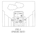
- FIG. 1 illustrates a screen configuration for providing AR service in a portable terminal.
- the portable terminal of FIG. 1 drives the camera, displays the image input from the camera on a screen, collects information of Point Of Interests (POIs) in the input image based on current location information, and then displays the collected information on the screen.
- POIs Point Of Interests
- the user may obtain the information related to the POI information in the vicinity by simply executing the AR application in the portable terminal and photographing the corresponding POI without having to look up the information in a book or to search on the internet.
- Another aspect of the present invention is to provide a method and an apparatus for providing a service using a sensor and image recognition in a portable terminal that supports Augmented Reality (AR).
- AR Augmented Reality
- Another aspect of the present invention is to provide a method and an apparatus for providing map information of a current location by obtaining an attitude angle using an acceleration sensor in a portable terminal that supports AR.
- Another aspect of the present invention is to provide a method and an apparatus for providing constellation information of a current location by obtaining an attitude angle using an acceleration sensor in a portable terminal that supports AR.
- Another aspect of the present invention is to provide a method and an apparatus for providing direction information through a geomagnetic sensor in a portable terminal that supports AR.
- Another aspect of the present invention is to provide a method and an apparatus for adjusting zoom of a camera by detecting motion through an acceleration sensor in a portable terminal that supports AR.
- Another aspect of the present invention is to provide a method and an apparatus for providing travel distance and time information to Point Of Interest (POI) displayed on a screen of a portable terminal that supports AR.
- POI Point Of Interest
- Another aspect of the present invention is to provide a method and an apparatus for providing a web search service using POI information displayed on a screen of a portable terminal that supports AR.
- Another aspect of the present invention is to provide a method and an apparatus for obtaining and tagging an image including POI information to a corresponding POI in a portable terminal that supports AR.
- Another aspect of the present invention is to provide a method and an apparatus for synthesizing POI information by recognizing a person's face when a picture is taken on a portable terminal that supports AR.
- a method for providing a service using a sensor and image recognition in a portable terminal includes determining whether the portable terminal is parallel to ground using an acceleration sensor. And when the portable terminal is parallel to the ground, a map including nearby POI information or constellation information is displayed.
- a method for providing a service using a sensor and image recognition in a portable terminal includes conducting a preview by driving a camera. Whether the portable terminal is moved backward or forward over a threshold distance is determined using an acceleration sensor. And when the portable terminal is moved backward or forward over the threshold distance, a zoom of the camera is adjusted by a preset level according to the traveled distance.
- a method for providing a service using a sensor and image recognition in a portable terminal includes conducting a preview by driving a camera. Current location information is obtained and POI information is displayed in a preview image. When an image is captured, a graphical object indicating the POI information is synthesized over the captured image. And the synthesized image is tagged as an image of a POI corresponding to the POI information.
- an apparatus for providing a service using a sensor and image recognition in a portable terminal includes an acceleration sensor for obtaining an attitude angle of the portable terminal.
- a controller determines whether the portable terminal is parallel to the ground using the attitude angle.
- a display unit displays at least one of a map including nearby POI information and constellation information under control of the controller when the portable terminal is parallel to the ground.
- an apparatus for providing a service using a sensor and image recognition in a portable terminal includes a camera for receiving an image.
- a display unit conducts a preview by displaying the image input from the camera
- An acceleration sensor measures movement of the portable terminal.
- a controller determines whether the portable terminal is moved backward or forward over a threshold distance by using the measurement of the acceleration sensor and, when the portable terminal is moved backward or forward over the threshold distance, adjusts a zoom of the camera by a preset level according to the traveled distance.
- an apparatus for providing a service using image recognition and a sensor in a portable terminal includes a camera for receiving an image.
- a display unit conducts a preview by displaying the image input from the camera.
- a Global Positioning System (GPS) receiver collects current location information.
- a controller obtains POI information using the current location information, synthesizes a graphical object indicating the POI information over the captured image when an image is captured, and tags the synthesized image as an image of a POI corresponding to the POI information.
- GPS Global Positioning System
- FIG. 1 illustrates a screen configuration for providing an AR service in a portable terminal
- FIG. 2 illustrates a portable terminal that supports AR according to an embodiment of the present invention
- FIGS. 3A and 3B illustrate screen configurations for providing map information or constellation information based on an attitude angle in the portable terminal according to an embodiment of the present invention
- FIG. 4 illustrates a process for adjusting the zoom of a camera according to a motion of the portable terminal according to an embodiment of the present invention
- FIG. 5 illustrates a screen configuration for providing travel distance and time information to a specific POI in the portable terminal according to an embodiment of the present invention
- FIGS. 6A to 6C illustrate screen configurations for obtaining and tagging an image that includes POI information for a corresponding POI in the portable terminal according to an embodiment of the present invention.
- FIGS. 7A and 7B illustrate a process for providing the service using image recognition and a sensor in the portable terminal according to an embodiment of the present invention.
- FIGS. 2 through 7 discussed below, and the various embodiments used to describe the principles of the present disclosure in this patent document are by way of illustration only and should not be construed in any way to limit the scope of the disclosure. Those skilled in the art will understand that the principles of the present disclosure may be implemented in any suitably arranged portable terminal.
- Embodiments of the present invention provide a method and an apparatus for providing a service using image recognition and a sensor in a portable terminal that supports Augmented Reality (AR).
- AR Augmented Reality
- FIG. 2 illustrates a portable terminal that supports AR according to an embodiment of the present invention.
- the portable terminal includes a controller 200, a communication module 210, a Global Positioning System (GPS) receiver 212, a geomagnetic sensor 214, an acceleration sensor 216, a camera 218, a display unit 220, an input unit 222, and a storage unit 224.
- Th e controller 200 includes a posture estimator 202, a motion detector 204, a Pedestrian Dead Reckoning (PDR) determiner 206, and an image recognizer 208.
- PDR Pedestrian Dead Reckoning
- the controller 200 controls and processes operations of the portable terminal.
- the controller 200 controls and processes operations to drive the camera 218, to display an image input from the camera 218 on a screen of the display unit 220, to obtain current location information by controlling the GPS receiver 212, to collect information of Point Of Interest (POI) in the image based on the current location information, and to display the information on the screen.
- POI Point Of Interest
- Th e POI information may be attained from the storage unit 224 or an external device via the communication module 210. He rein, the POI information may include name, location (e.g., latitude and longitude), category, area name, address, phone number, details, and related image information of the corresponding POI.
- the controller 200 includes the posture estimator 202, the motion detector 204, the PDR determiner 206, and the image recognizer 208. Hence, when the AR application is executed, the controller 200 controls and processes operations to provide the service using the geomagnetic sensor 214, the acceleration sensor 216, and the camera 218.
- the controller 200 which includes the posture estimator 202, obtains the attitude angle by controlling the acceleration sensor 216 and, based on the attitude angle, determines whether the portable terminal is parallel to the ground. In the parallel state, the controller 200 determines whether the screen of the portable terminal is facing the ground or the sky. B y means of the posture estimator 202, when the portable terminal is substantially parallel with the ground and its screen predominantly faces the sky, the controller 200 determines to operate in a compass mode. When the portable terminal is substantially parallel with the ground and its screen predominantly faces the earth, the controller 200 determines to operate in a constellation mode.
- the controller 200 determines whether to enter the compass mode or the constellation mode, according to the horizontality and the screen orientation of the portable terminal, the controller 200 may also determine whether to enter the compass mode or the constellation mode according to a lens orientation of the camera 218. Also, the controller 200 determines whether the portable terminal is parallel to the ground based on the attitude angle. That is, when the portable terminal and the ground make an angle below a threshold, the controller 200 may determine that the portable terminal is parallel with the ground.
- the controller 200 controls the geomagnetic sensor 214 through the posture estimator 202 to obtain the orientation information of the portable terminal, controls the GPS receiver 212 to obtain the current location information, and displays the map of the current location and the orientation information on the screen of the display unit 220. In so doing, the controller 200 may acquire and provide nearby POI information based on the location information over the map. The controller 200 keeps displaying the image input from the camera 218 on the screen according to the execution of the AR application and displays the map and the orientation information at a certain position on the screen.
- the controller 200 may continue displaying the image input from the camera 218 on the screen and display a compass-type map indicating the orientation of the portable terminal in the center of the screen as illustrated in FIGS. 3A and 3B .
- the compass-type map may indicate the presence of the POI information of the particular POI using an icon, and a distance to the POI such that the user may perceive the distance relation between the current location and the POI.
- the compass-type map may indicate the orientation of the portable terminal by showing a certain angle based on the location of the portable terminal. The angle alters as the orientation of the portable terminal changes.
- the controller 200 controls the GPS receiver 212 through the posture estimator 202 to acquire the current location information, acquires the constellation information based on the current location, and displays the acquired information on the screen of the display unit 220.
- the constellation information displayed on the screen changes in real time according to the location information of the portable terminal.
- the constellation information may be acquired from the storage unit 224 or an external device via the communication module 210.
- the constellation information may include location, name, origin, and detailed information of the constellation. For example, when the user holds the portable terminal substantially parallel with the ground while the screen predominantly faces the ground, the controller 200 may display the constellation based on the current location as shown in FIG. 3B .
- the controller 200 controls the acceleration sensor 216 to detect the motion of the portable terminal caused by the user, and controls and processes to adjust the zoom of the camera 218 according to the motion.
- B y means of the motion detector 204 the controller 200 determines whether the portable terminal moves backward or forward over a threshold distance, bounces, or snaps, using the motion information such as speed or vibration of the portable terminal attained from the acceleration sensor 216.
- the controller 200 controls the camera 218 to zoom in or out according to a preset scheme.
- the controller 200 determines whether the user pushes or pulls the portable terminal over the threshold distance, whether the user bounces the portable terminal, or whether the user snaps the portable terminal with his/her wrist. Ac cording to the determination, the controller 200 zooms in or out. For example, when the user pulls the portable terminal (i.e. away from the direction which the camera faces) over the threshold distance as illustrated in FIG. 4 , the controller 200 controls the camera 218 to zoom in by a certain level. When the user pushes the portable terminal (i.e. towards the direction which the camera faces) over the threshold distance, the controller 200 controls the camera 218 to zoom out by a certain level.
- the zoom in/out degree of the camera 218 may vary depending on the distance of the backward or forward movement, the degree of the bounce or the snap, or the number of the bounces or the snaps of the portable terminal, and may be altered by the user's setting.
- the zoom in/out function of the camera 218, according to the user's motion may be carried out irrespective of the horizontality or the verticality of the portable terminal relative to the ground.
- the controller 200 may zoom in or out.
- the controller 200 may determine whether this movement results from the push or pull of the portable terminal by the user, by determining whether the portable terminal moves toward or in the opposite direction of the screen or the camera of the portable terminal.
- the controller 200 controls the acceleration sensor 216 and the GPS receiver 212 to determine the travel distance and the travel time to the POI in the image displayed on the screen, and displays the determined distance and time in the display unit 220.
- the controller 200 may show the travel time to the building in the image displayed on the screen as illustrated in FIG. 5 .
- the controller 200 computes the distance of the actual path of the user, rather than the straight-line distance from the current location of the portable terminal to the corresponding POI, and accordingly computes the travel time.
- the travel time may be determined using a speed or an average speed of the user during a certain time.
- the average speed indicates the average speed with respect to a plurality of users, and the speed and the average speed of the user may be distinguished based on the current speed and the situation of the user.
- the controller 200 may determine that the user is driving a vehicle and thus uses the speed or the average speed of the user corresponding to the driving.
- the controller 200 may determine that the user is walking and thus uses the speed or the average speed of the user corresponding to the walk.
- the controller 200 may determine the travel time to the corresponding POI using the speeds classified based on the condition of the road such as speed on the uphill road, speed on the downhill road, and speed on the stairs.
- the user speed may be estimated previously or currently, and the average speed may be pre-stored in the design phase of the portable terminal or obtained from an external device via the communication module 210.
- the controller 200 examines whether the current screen is displaying the POI information when the photograph function occurs; that is, when a capture event occurs in the execution of the AR application.
- the controller 200 captures the image including the displayed POI information.
- the controller 200 captures the image including the displayed POI information.
- the portable terminal may attain the image including the POI information as illustrated in FIG. 6B by capturing the screen.
- the controller 200 tags the image including the POI information as the image related to the POI corresponding to the POI information and stores the tagged image in the storage unit 224.
- the controller 200 may display the image including the POI information.
- the controller 200 including the image recognizer 208 captures the image input from the camera 218 and examines whether the captured image includes the user's face.
- the controller 200 collects the POI information corresponding to the captured image through the GPS receiver 212, displays the POI information as a graphical object or a text comment, and controls and processes to synthesize over the captured image.
- Th e controller 200 may recognize the mouth or the teeth in the user face through the image recognizer 208 and synthesize the graphical object or the text comment of the POI information around the mouth or the teeth, to thus make it look like that the user is reciting the POI information.
- the controller 200 controls and processes operations to integrate the POI information and a web search engine.
- the controller 200 controls and processes to search in the web by automatically extracting a search keyword from the particular POI information.
- the controller 200 controls and processes to obtain the name, the category, the area name, or the address information of the corresponding POI from the POI information as the search keyword, and to search the Internet with the obtained information.
- the controller 200 may extract the area name from the address information, and utilize an administrative district of the corresponding location as the area name with the latitude and the longitude.
- the communication module 210 functions to transmit and receive radio signals of data input and output via an antenna (not shown).
- the communication module 210 may obtain the POI information by sending and receiving radio signals to and from the external device under the control of the controller 200.
- the GPS receiver 212 obtains the location information indicating the location of the portable terminal; i.e. location coordinates from a GPS system, and forwards the obtained location information to the controller 200.
- the geomagnetic sensor 214 measures the orientation of the portable terminal under the control of the controller 200 and provides the measured orientation information to the controller 200.
- the acceleration sensor 216 measures and provides the direction, the speed, and the attitude angle of the movement of the portable terminal to the controller 200. While the acceleration sensor 216 is used to measure the motion of the portable terminal in this embodiment, other sensors may be used to measure the motion of the portable terminal.
- the camera 218 converts an analog image signal photographed by a camera sensor to digital data by converting an optical signal detected in the image photographed through the camera sensor to an electrical signal and provides the converted digital data to the image recognizer 208.
- the display unit 220 displays status information of the portable terminal, numbers and characters, videos, and still images.
- the display unit 220 may display the compass-type map indicating the orientation of the portable terminal and the nearby POI information at a certain position of the screen as illustrated in FIG. 3A , and display the constellation information corresponding to the current location as illustrated in FIG. 3B .
- the display unit 220 may also display the distance and the travel time to the particular POI, as illustrated in FIG. 5 , under the control of the controller 200.
- the input unit 222 includes a plurality of function keys, number keys, and character keys, and provides the controller 200 with input data corresponding to the key pressed by the user or a user's touch.
- the storage unit 224 contains various programs and data for the operations of the portable terminal.
- the storage unit 224 includes a POI Database (DB) to store the POI information, e.g., name, location (e.g., latitude, longitude), category, area name, address, phone number, detailed information, and related image information of particular POIs.
- the POI DB may be pre-stored and updated through the network or by an external device.
- the storage unit 224 includes a constellation DB to contain location, name, origin, and details of constellations.
- FIGS. 7A and 7B illustrate a process for providing the service using the image recognition and the sensor in the portable terminal according to an embodiment of the present invention.
- the portable terminal When the AR application is executed in step 701, the portable terminal conducts the preview by driving the camera in step 703, and drives the acceleration sensor and the geomagnetic sensor in step 705.
- the acceleration sensor and the geomagnetic sensor may be driven to determine the horizontality of the terminal and the orientation and the movement direction of the terminal.
- step 707 the portable terminal determines whether it is substantially parallel to the ground.
- the portable terminal may determine whether it is substantially parallel to the ground by obtaining the attitude angle through the acceleration sensor. When the attitude angle with the ground is below the threshold, the portable terminal may determine its horizontality with the ground. In the horizontal state, the portable terminal goes to step 709. In the non-horizontal state, the portable terminal goes to step 719.
- the portable terminal determines the location of the screen, i.e. determines whether the screen is facing the ground or the sky. When the portable terminal is parallel to the ground and its screen faces the sky, it determines to enter the compass mode in step 711 and displays information guiding the orientation of the portable terminal and the nearby POIs. That is, portable terminal displays the compass-type map indicating the POI information in the certain position of the screen using the current location information in step 713. In doing so, the orientation of the portable terminal may be determined through the geomagnetic sensor and represented with an angle in the compass-type map. In an embodiment, the portable terminal may display the map in a certain portion of the screen while sustaining the preview screen. For example, while continuously displaying a, the portable terminal may display the compass-type map indicating the orientation of the portable terminal and the nearby POI information in the center of the screen. N ext, the portable terminal returns to the step 707.
- the portable terminal determines to enter the constellation mode in step 715 and displays the constellation information on the screen using the current location information in step717.
- the constellation information displayed on the screen is changed in real time based on the location information of the portable terminal.
- the constellation information may include the location, the name, the origin, and the detailed information of the constellation. For example, when the user holds the portable terminal in parallel to the ground with the screen facing the ground, the portable terminal may display the constellation based on the current location as illustrated in FIG. 3B . Next, the portable terminal returns to step 707.
- the portable terminal when it is not parallel to the ground in step 707, it obtains the POI information based on the current location information and displays the detailed POI information in the preview screen in step 719.
- step 721 the portable terminal determines whether it is moved backward or forward over the threshold distance, bounced, or snapped. More specifically, through the acceleration sensor 216, the portable terminal determines whether the user pushes or pulls the portable terminal over the threshold distance, whether the user bounces the portable terminal, or whether the user snaps the portable terminal with his/her wrist.
- the portable terminal When the portable terminal is moved backward or forward over the threshold distance, bounced, or snapped, it controls the camera 217 to zoom in or out by the preset level according to the amount of the movement, the amount of the bounce, or the intensity of the snap in step 723.
- the camera 218 zooms in by the certain level.
- the camera 218 zooms out by the certain level.
- the zoom in/out degree of the camera 218 may vary depending on the amount of the backward or forward movement, the amount of the bounce, or the intensity of the snap of the portable terminal, and may also depend on the number of the movements, the number of the bounces, or the number of the snaps.
- the portable terminal moves over a maximum threshold distance, the portable terminal determines the movement according to the walking or the driving of the user and does not adjust the zoom of the camera 218. Next, the portable terminal returns to step 707.
- the portable terminal examines whether one of the POIs displayed on the screen is selected in step 725. When a POI is selected, the portable terminal proceeds to step 727. When no POI is selected, the portable terminal goes to block 737.
- the portable terminal displays details of the selected POI in step 727. In doing so, the portable terminal may determine and display the distance and the travel time to the POI. For example, the portable terminal may represent the travel time to the particular POI in the image displayed on the screen as illustrated in FIG. 5 .
- the travel time may be computed by considering the actual path of the user rather than the straight-line distance from the current location to the corresponding POI. The travel time may be computed using the speed or the average speed of the user during a certain time.
- step 729 the portable terminal determines whether an Internet search function is selected. If the web search function is not selected, the portable terminal goes to step 737. If the Internet search function is selected, the portable terminal conducts the web search with the POI information in step 731. In detail, the portable terminal automatically extracts at least one sea rch keyword from the selected POI information and automatically conducts the Internet search with the extracted search keyword(s).
- the search keyword(s) may be at least one of the name, the category, the area name, and the address information of the corresponding POI in the POI information.
- the portable terminal displays web search results in step 733, and determines whether an event for ending the AR application or an event for returning to the previous state takes place in step 735. When the event for ending the AR application occurs, the portable terminal finishes this process. When the event for returning to the previous state occurs, the portable terminal returns to step 719.
- step 737 the portable terminal determines whether a capture event takes place. When no capture event occurs, the portable terminal returns to step 707. When a capture event takes place, the portable terminal captures the image input from the camera in step 739.
- the portable terminal determines whether the captured image includes the user's face.
- the portable terminal synthesizes and displays the graphical object including the POI information around the user's face in step 743. That is, when the captured image includes the user's face, the portable terminal displays the POI information collected in step 719 as the graphical object or the text comment and synthesizes over the captured image.
- the portable terminal may recognize the mouth or the teeth in the user face and synthesize the graphical object or the text comment of the POI information around the mouth or the teeth, to thus make it appear as though the user is reciting the POI information.
- the portable terminal enters step 747.
- the portable terminal When the captured image includes no user face, the portable terminal synthesizes and displays the POI information over the captured image in step 745.
- the portable terminal may determine whether the POI information displayed when the image capture event takes place, and may capture the displayed the POI information together with the image. For example, the portable terminal obtains and displays the image including the POI information as illustrated in FIG. 6B .
- the portable terminal goes to step 747.
- step 747 the portable terminal examines whether an event for storing the captured image takes place. When the storage event does not occur, the portable terminal returns to step 707. When the storage event takes place, the portable terminal stores the acquired image in step 749 and returns to step 709.
- the portable terminal may tag and store the image including the POI information as the image relating to the POI corresponding to the POI information, and thus display the image including the POI information, as illustrated in FIG. 6C , when the user intends to get the POI information of the corresponding location by executing a related application for guiding the POI.
- the portable terminal supporting the AR provides various information, such as map information of the current location, constellation information, and distance and time information, through the service using the image recognition and the sensor. Therefore, it is possible to meet the high expectation and the diverse tastes of the users.
Abstract
Description
- The present invention relates generally to a method and an apparatus for providing a service using a sensor and image recognition in a portable terminal. More particularly, the present invention relates to a method and an apparatus for providing a service using the sensor and the image recognition in the portable terminal that supports Augmented Reality (AR).
- As communication technologies radically advance, various services are provided to allow users to enjoy a virtual reality and the real world simultaneously. For example, portable terminals provide an Augmented Reality (AR) service which overlays a graphical or text-type image describing an object over the object image input through a camera.
-
FIG. 1 illustrates a screen configuration for providing AR service in a portable terminal. - When a user executes an AR application, the portable terminal of
FIG. 1 drives the camera, displays the image input from the camera on a screen, collects information of Point Of Interests (POIs) in the input image based on current location information, and then displays the collected information on the screen. The user may obtain the information related to the POI information in the vicinity by simply executing the AR application in the portable terminal and photographing the corresponding POI without having to look up the information in a book or to search on the internet. - However, as more portable terminals are used, users' expectation and demands for various service functions of the portable terminal are increasing. In this respect, to satisfy the high expectations and the diverse tastes of the users, it is necessary to provide various functions for the wide usage of the AR service.
- To address the above-discussed deficiencies of the prior art, it is a primary aspect of the present invention to provide a method and an apparatus for providing a service using a sensor and image recognition in a portable terminal.
- Another aspect of the present invention is to provide a method and an apparatus for providing a service using a sensor and image recognition in a portable terminal that supports Augmented Reality (AR).
- Another aspect of the present invention is to provide a method and an apparatus for providing map information of a current location by obtaining an attitude angle using an acceleration sensor in a portable terminal that supports AR.
- Another aspect of the present invention is to provide a method and an apparatus for providing constellation information of a current location by obtaining an attitude angle using an acceleration sensor in a portable terminal that supports AR.
- Another aspect of the present invention is to provide a method and an apparatus for providing direction information through a geomagnetic sensor in a portable terminal that supports AR.
- Another aspect of the present invention is to provide a method and an apparatus for adjusting zoom of a camera by detecting motion through an acceleration sensor in a portable terminal that supports AR.
- Another aspect of the present invention is to provide a method and an apparatus for providing travel distance and time information to Point Of Interest (POI) displayed on a screen of a portable terminal that supports AR.
- Another aspect of the present invention is to provide a method and an apparatus for providing a web search service using POI information displayed on a screen of a portable terminal that supports AR.
- Another aspect of the present invention is to provide a method and an apparatus for obtaining and tagging an image including POI information to a corresponding POI in a portable terminal that supports AR.
- Another aspect of the present invention is to provide a method and an apparatus for synthesizing POI information by recognizing a person's face when a picture is taken on a portable terminal that supports AR.
- According to one aspect of the present invention, a method for providing a service using a sensor and image recognition in a portable terminal includes determining whether the portable terminal is parallel to ground using an acceleration sensor. And when the portable terminal is parallel to the ground, a map including nearby POI information or constellation information is displayed.
- According to another aspect of the present invention, a method for providing a service using a sensor and image recognition in a portable terminal includes conducting a preview by driving a camera. Whether the portable terminal is moved backward or forward over a threshold distance is determined using an acceleration sensor. And when the portable terminal is moved backward or forward over the threshold distance, a zoom of the camera is adjusted by a preset level according to the traveled distance.
- According to another aspect of the present invention, a method for providing a service using a sensor and image recognition in a portable terminal includes conducting a preview by driving a camera. Current location information is obtained and POI information is displayed in a preview image. When an image is captured, a graphical object indicating the POI information is synthesized over the captured image. And the synthesized image is tagged as an image of a POI corresponding to the POI information.
- According to another aspect of the present invention, an apparatus for providing a service using a sensor and image recognition in a portable terminal includes an acceleration sensor for obtaining an attitude angle of the portable terminal. A controller determines whether the portable terminal is parallel to the ground using the attitude angle. And a display unit displays at least one of a map including nearby POI information and constellation information under control of the controller when the portable terminal is parallel to the ground.
- According to another aspect of the present invention, an apparatus for providing a service using a sensor and image recognition in a portable terminal includes a camera for receiving an image. A display unit conducts a preview by displaying the image input from the camera An acceleration sensor measures movement of the portable terminal. And a controller determines whether the portable terminal is moved backward or forward over a threshold distance by using the measurement of the acceleration sensor and, when the portable terminal is moved backward or forward over the threshold distance, adjusts a zoom of the camera by a preset level according to the traveled distance.
- According to yet another aspect of the present invention, an apparatus for providing a service using image recognition and a sensor in a portable terminal includes a camera for receiving an image. A display unit conducts a preview by displaying the image input from the camera. A Global Positioning System (GPS) receiver collects current location information. And a controller obtains POI information using the current location information, synthesizes a graphical object indicating the POI information over the captured image when an image is captured, and tags the synthesized image as an image of a POI corresponding to the POI information.
- Other aspects, advantages, and salient features of the invention will become apparent to those skilled in the art from the following detailed description, which, taken in conjunction with the annexed drawings, discloses embodiments of the invention.
- Before undertaking the DETAILED DESCRIPTION OF THE INVENTION below, it may be advantageous to set forth definitions of certain words and phrases used throughout this patent document: the terms "include" and "comprise," as well as derivatives thereof, mean inclusion without limitation; the term "or," is inclusive, meaning and/or; the phrases "associated with" and "associated therewith," as well as derivatives thereof, may mean to include, be included within, interconnect with, contain, be contained within, connect to or with, couple to or with, be communicable with, cooperate with, interleave, juxtapose, be proximate to, be bound to or with, have, have a property of, or the like. Definitions for certain words and phrases are provided throughout this patent document, those of ordinary skill in the art should understand that in many, if not most instances, such definitions apply to prior, as well as future uses of such defined words and phrases.
- For a more complete understanding of the present disclosure and its advantages, reference is now made to the following description taken in conjunction with the accompanying drawings, in which like reference numerals represent like parts:
-
FIG. 1 illustrates a screen configuration for providing an AR service in a portable terminal; -
FIG. 2 illustrates a portable terminal that supports AR according to an embodiment of the present invention; -
FIGS. 3A and3B illustrate screen configurations for providing map information or constellation information based on an attitude angle in the portable terminal according to an embodiment of the present invention; -
FIG. 4 illustrates a process for adjusting the zoom of a camera according to a motion of the portable terminal according to an embodiment of the present invention; -
FIG. 5 illustrates a screen configuration for providing travel distance and time information to a specific POI in the portable terminal according to an embodiment of the present invention; -
FIGS. 6A to 6C illustrate screen configurations for obtaining and tagging an image that includes POI information for a corresponding POI in the portable terminal according to an embodiment of the present invention; and -
FIGS. 7A and7B illustrate a process for providing the service using image recognition and a sensor in the portable terminal according to an embodiment of the present invention. - Throughout the drawings, like reference numerals will be understood to refer to like parts, components, and structures.
-
FIGS. 2 through 7 , discussed below, and the various embodiments used to describe the principles of the present disclosure in this patent document are by way of illustration only and should not be construed in any way to limit the scope of the disclosure. Those skilled in the art will understand that the principles of the present disclosure may be implemented in any suitably arranged portable terminal. - Embodiments of the present invention provide a method and an apparatus for providing a service using image recognition and a sensor in a portable terminal that supports Augmented Reality (AR).
-
FIG. 2 illustrates a portable terminal that supports AR according to an embodiment of the present invention. - Referring to
FIG. 2 , the portable terminal includes acontroller 200, acommunication module 210, a Global Positioning System (GPS)receiver 212, ageomagnetic sensor 214, anacceleration sensor 216, acamera 218, adisplay unit 220, aninput unit 222, and astorage unit 224.Th e controller 200 includes aposture estimator 202, amotion detector 204, a Pedestrian Dead Reckoning (PDR) determiner 206, and animage recognizer 208. - The
controller 200 controls and processes operations of the portable terminal. When an AR application is executed, thecontroller 200 controls and processes operations to drive thecamera 218, to display an image input from thecamera 218 on a screen of thedisplay unit 220, to obtain current location information by controlling theGPS receiver 212, to collect information of Point Of Interest (POI) in the image based on the current location information, and to display the information on the screen. Th e POI information may be attained from thestorage unit 224 or an external device via thecommunication module 210. He rein, the POI information may include name, location (e.g., latitude and longitude), category, area name, address, phone number, details, and related image information of the corresponding POI. - The
controller 200 includes theposture estimator 202, themotion detector 204, thePDR determiner 206, and theimage recognizer 208. Hence, when the AR application is executed, thecontroller 200 controls and processes operations to provide the service using thegeomagnetic sensor 214, theacceleration sensor 216, and thecamera 218. - The
controller 200, which includes theposture estimator 202, obtains the attitude angle by controlling theacceleration sensor 216 and, based on the attitude angle, determines whether the portable terminal is parallel to the ground. In the parallel state, thecontroller 200 determines whether the screen of the portable terminal is facing the ground or the sky. B y means of theposture estimator 202, when the portable terminal is substantially parallel with the ground and its screen predominantly faces the sky, thecontroller 200 determines to operate in a compass mode. When the portable terminal is substantially parallel with the ground and its screen predominantly faces the earth, thecontroller 200 determines to operate in a constellation mode. While thecontroller 200 determines whether to enter the compass mode or the constellation mode, according to the horizontality and the screen orientation of the portable terminal, thecontroller 200 may also determine whether to enter the compass mode or the constellation mode according to a lens orientation of thecamera 218. Also, thecontroller 200 determines whether the portable terminal is parallel to the ground based on the attitude angle. That is, when the portable terminal and the ground make an angle below a threshold, thecontroller 200 may determine that the portable terminal is parallel with the ground. - When determining to enter the compass mode, the
controller 200 controls thegeomagnetic sensor 214 through theposture estimator 202 to obtain the orientation information of the portable terminal, controls theGPS receiver 212 to obtain the current location information, and displays the map of the current location and the orientation information on the screen of thedisplay unit 220. In so doing, thecontroller 200 may acquire and provide nearby POI information based on the location information over the map. Thecontroller 200 keeps displaying the image input from thecamera 218 on the screen according to the execution of the AR application and displays the map and the orientation information at a certain position on the screen. For example, thecontroller 200 may continue displaying the image input from thecamera 218 on the screen and display a compass-type map indicating the orientation of the portable terminal in the center of the screen as illustrated inFIGS. 3A and3B . At this time, the compass-type map may indicate the presence of the POI information of the particular POI using an icon, and a distance to the POI such that the user may perceive the distance relation between the current location and the POI. The compass-type map may indicate the orientation of the portable terminal by showing a certain angle based on the location of the portable terminal. The angle alters as the orientation of the portable terminal changes. - When in the constellation mode, the
controller 200 controls theGPS receiver 212 through theposture estimator 202 to acquire the current location information, acquires the constellation information based on the current location, and displays the acquired information on the screen of thedisplay unit 220. The constellation information displayed on the screen changes in real time according to the location information of the portable terminal. The constellation information may be acquired from thestorage unit 224 or an external device via thecommunication module 210. The constellation information may include location, name, origin, and detailed information of the constellation. For example, when the user holds the portable terminal substantially parallel with the ground while the screen predominantly faces the ground, thecontroller 200 may display the constellation based on the current location as shown inFIG. 3B . - The
controller 200, including themotion detector 204, controls theacceleration sensor 216 to detect the motion of the portable terminal caused by the user, and controls and processes to adjust the zoom of thecamera 218 according to the motion. B y means of themotion detector 204, thecontroller 200 determines whether the portable terminal moves backward or forward over a threshold distance, bounces, or snaps, using the motion information such as speed or vibration of the portable terminal attained from theacceleration sensor 216. When the portable terminal moves over the threshold distance, bounces, or snaps, thecontroller 200 controls thecamera 218 to zoom in or out according to a preset scheme. In more detail, through theacceleration sensor 216, thecontroller 200 determines whether the user pushes or pulls the portable terminal over the threshold distance, whether the user bounces the portable terminal, or whether the user snaps the portable terminal with his/her wrist. Ac cording to the determination, thecontroller 200 zooms in or out. For example, when the user pulls the portable terminal (i.e. away from the direction which the camera faces) over the threshold distance as illustrated inFIG. 4 , thecontroller 200 controls thecamera 218 to zoom in by a certain level. When the user pushes the portable terminal (i.e. towards the direction which the camera faces) over the threshold distance, thecontroller 200 controls thecamera 218 to zoom out by a certain level. The zoom in/out degree of thecamera 218 may vary depending on the distance of the backward or forward movement, the degree of the bounce or the snap, or the number of the bounces or the snaps of the portable terminal, and may be altered by the user's setting. In an embodiment, the zoom in/out function of thecamera 218, according to the user's motion, may be carried out irrespective of the horizontality or the verticality of the portable terminal relative to the ground. Fo r example, when the user pulls the portable terminal towards the user while the portable terminal is vertical to the ground, thecontroller 200 may zoom in or out. W hen the user pushes the portable terminal towards the ground while the portable terminal is parallel to the ground, thecontroller 200 may zoom in or out. In an embodiment, when the portable terminal is moved backward or forward over the threshold distance while it stands perpendicular to the ground, thecontroller 200 may determine whether this movement results from the push or pull of the portable terminal by the user, by determining whether the portable terminal moves toward or in the opposite direction of the screen or the camera of the portable terminal. - The
controller 200, including thePDR determiner 206, controls theacceleration sensor 216 and theGPS receiver 212 to determine the travel distance and the travel time to the POI in the image displayed on the screen, and displays the determined distance and time in thedisplay unit 220. For example, thecontroller 200 may show the travel time to the building in the image displayed on the screen as illustrated inFIG. 5 . In doing so, thecontroller 200 computes the distance of the actual path of the user, rather than the straight-line distance from the current location of the portable terminal to the corresponding POI, and accordingly computes the travel time. The travel time may be determined using a speed or an average speed of the user during a certain time. The average speed indicates the average speed with respect to a plurality of users, and the speed and the average speed of the user may be distinguished based on the current speed and the situation of the user. In an embodiment, when the current speed exceeds a threshold, thecontroller 200 may determine that the user is driving a vehicle and thus uses the speed or the average speed of the user corresponding to the driving. When the current speed falls below the threshold, thecontroller 200 may determine that the user is walking and thus uses the speed or the average speed of the user corresponding to the walk. Thecontroller 200 may determine the travel time to the corresponding POI using the speeds classified based on the condition of the road such as speed on the uphill road, speed on the downhill road, and speed on the stairs. The user speed may be estimated previously or currently, and the average speed may be pre-stored in the design phase of the portable terminal or obtained from an external device via thecommunication module 210. - The
controller 200, including theimage recognizer 208, examines whether the current screen is displaying the POI information when the photograph function occurs; that is, when a capture event occurs in the execution of the AR application. When the POI information is displayed, thecontroller 200 captures the image including the displayed POI information. For example, when the AR application is executed in the portable terminal, the POI information corresponding to the image displayed on the screen is present, and the user triggers the photograph event with the POI information displayed on the screen as illustrated inFIG. 6A , the portable terminal may attain the image including the POI information as illustrated inFIG. 6B by capturing the screen. A t this time, thecontroller 200 tags the image including the POI information as the image related to the POI corresponding to the POI information and stores the tagged image in thestorage unit 224. When the user executes a guide application related to the POI to obtain the POI information of the corresponding location as illustrated inFIG. 6C , thecontroller 200 may display the image including the POI information. - When the photograph function occurs; that is, when the capture event takes place in the execution of the AR application, the
controller 200 including theimage recognizer 208 captures the image input from thecamera 218 and examines whether the captured image includes the user's face. When the user's face is detected, thecontroller 200 collects the POI information corresponding to the captured image through theGPS receiver 212, displays the POI information as a graphical object or a text comment, and controls and processes to synthesize over the captured image.Th e controller 200 may recognize the mouth or the teeth in the user face through theimage recognizer 208 and synthesize the graphical object or the text comment of the POI information around the mouth or the teeth, to thus make it look like that the user is reciting the POI information. - When the POI information is displayed on the screen, the
controller 200 controls and processes operations to integrate the POI information and a web search engine. In more detail, when the user selects particular POI information and triggers a web search event, thecontroller 200 controls and processes to search in the web by automatically extracting a search keyword from the particular POI information. Thecontroller 200 controls and processes to obtain the name, the category, the area name, or the address information of the corresponding POI from the POI information as the search keyword, and to search the Internet with the obtained information. When there is no area name in the POI information, thecontroller 200 may extract the area name from the address information, and utilize an administrative district of the corresponding location as the area name with the latitude and the longitude. - The
communication module 210 functions to transmit and receive radio signals of data input and output via an antenna (not shown). Thecommunication module 210 may obtain the POI information by sending and receiving radio signals to and from the external device under the control of thecontroller 200. - The
GPS receiver 212 obtains the location information indicating the location of the portable terminal; i.e. location coordinates from a GPS system, and forwards the obtained location information to thecontroller 200. - The
geomagnetic sensor 214 measures the orientation of the portable terminal under the control of thecontroller 200 and provides the measured orientation information to thecontroller 200. - The
acceleration sensor 216 measures and provides the direction, the speed, and the attitude angle of the movement of the portable terminal to thecontroller 200. While theacceleration sensor 216 is used to measure the motion of the portable terminal in this embodiment, other sensors may be used to measure the motion of the portable terminal. - The
camera 218 converts an analog image signal photographed by a camera sensor to digital data by converting an optical signal detected in the image photographed through the camera sensor to an electrical signal and provides the converted digital data to theimage recognizer 208. - The
display unit 220 displays status information of the portable terminal, numbers and characters, videos, and still images. In more detail, under the control of thecontroller 200, thedisplay unit 220 may display the compass-type map indicating the orientation of the portable terminal and the nearby POI information at a certain position of the screen as illustrated inFIG. 3A , and display the constellation information corresponding to the current location as illustrated inFIG. 3B . Thedisplay unit 220 may also display the distance and the travel time to the particular POI, as illustrated inFIG. 5 , under the control of thecontroller 200. - The
input unit 222 includes a plurality of function keys, number keys, and character keys, and provides thecontroller 200 with input data corresponding to the key pressed by the user or a user's touch. - The
storage unit 224 contains various programs and data for the operations of the portable terminal. Thestorage unit 224 includes a POI Database (DB) to store the POI information, e.g., name, location (e.g., latitude, longitude), category, area name, address, phone number, detailed information, and related image information of particular POIs. The POI DB may be pre-stored and updated through the network or by an external device. In this embodiment, thestorage unit 224 includes a constellation DB to contain location, name, origin, and details of constellations. -
FIGS. 7A and7B illustrate a process for providing the service using the image recognition and the sensor in the portable terminal according to an embodiment of the present invention. - When the AR application is executed in
step 701, the portable terminal conducts the preview by driving the camera instep 703, and drives the acceleration sensor and the geomagnetic sensor instep 705. The acceleration sensor and the geomagnetic sensor may be driven to determine the horizontality of the terminal and the orientation and the movement direction of the terminal. - In
step 707, the portable terminal determines whether it is substantially parallel to the ground. The portable terminal may determine whether it is substantially parallel to the ground by obtaining the attitude angle through the acceleration sensor. When the attitude angle with the ground is below the threshold, the portable terminal may determine its horizontality with the ground. In the horizontal state, the portable terminal goes to step 709. In the non-horizontal state, the portable terminal goes to step 719. - In
step 709, the portable terminal determines the location of the screen, i.e. determines whether the screen is facing the ground or the sky. When the portable terminal is parallel to the ground and its screen faces the sky, it determines to enter the compass mode instep 711 and displays information guiding the orientation of the portable terminal and the nearby POIs. That is, portable terminal displays the compass-type map indicating the POI information in the certain position of the screen using the current location information instep 713. In doing so, the orientation of the portable terminal may be determined through the geomagnetic sensor and represented with an angle in the compass-type map. In an embodiment, the portable terminal may display the map in a certain portion of the screen while sustaining the preview screen. For example, while continuously displaying a, the portable terminal may display the compass-type map indicating the orientation of the portable terminal and the nearby POI information in the center of the screen. N ext, the portable terminal returns to thestep 707. - When the portable terminal is parallel to the ground and its screen faces the ground, the portable terminal determines to enter the constellation mode in
step 715 and displays the constellation information on the screen using the current location information in step717. The constellation information displayed on the screen is changed in real time based on the location information of the portable terminal. The constellation information may include the location, the name, the origin, and the detailed information of the constellation. For example, when the user holds the portable terminal in parallel to the ground with the screen facing the ground, the portable terminal may display the constellation based on the current location as illustrated inFIG. 3B . Next, the portable terminal returns to step 707. - Meanwhile, when the portable terminal is not parallel to the ground in
step 707, it obtains the POI information based on the current location information and displays the detailed POI information in the preview screen instep 719. - In
step 721, the portable terminal determines whether it is moved backward or forward over the threshold distance, bounced, or snapped. More specifically, through theacceleration sensor 216, the portable terminal determines whether the user pushes or pulls the portable terminal over the threshold distance, whether the user bounces the portable terminal, or whether the user snaps the portable terminal with his/her wrist. - When the portable terminal is moved backward or forward over the threshold distance, bounced, or snapped, it controls the camera 217 to zoom in or out by the preset level according to the amount of the movement, the amount of the bounce, or the intensity of the snap in
step 723. Fo r example, when the user pulls the portable terminal over the threshold distance as illustrated inFIG. 4 , thecamera 218 zooms in by the certain level. When the user pushes the portable terminal over the threshold distance, thecamera 218 zooms out by the certain level. The zoom in/out degree of thecamera 218 may vary depending on the amount of the backward or forward movement, the amount of the bounce, or the intensity of the snap of the portable terminal, and may also depend on the number of the movements, the number of the bounces, or the number of the snaps. When the portable terminal moves over a maximum threshold distance, the portable terminal determines the movement according to the walking or the driving of the user and does not adjust the zoom of thecamera 218. Next, the portable terminal returns to step 707. - Alternatively, when the portable terminal is not moved backward or forward over the threshold distance, bounced, or snapped, the portable terminal examines whether one of the POIs displayed on the screen is selected in
step 725. When a POI is selected, the portable terminal proceeds to step 727. When no POI is selected, the portable terminal goes to block 737. - When a POI is selected, the portable terminal displays details of the selected POI in step 727. In doing so, the portable terminal may determine and display the distance and the travel time to the POI. For example, the portable terminal may represent the travel time to the particular POI in the image displayed on the screen as illustrated in
FIG. 5 . Herein, the travel time may be computed by considering the actual path of the user rather than the straight-line distance from the current location to the corresponding POI. The travel time may be computed using the speed or the average speed of the user during a certain time. - In
step 729, the portable terminal determines whether an Internet search function is selected. If the web search function is not selected, the portable terminal goes to step 737. If the Internet search function is selected, the portable terminal conducts the web search with the POI information in step 731. In detail, the portable terminal automatically extracts at least one sea rch keyword from the selected POI information and automatically conducts the Internet search with the extracted search keyword(s). The search keyword(s) may be at least one of the name, the category, the area name, and the address information of the corresponding POI in the POI information. - The portable terminal displays web search results in
step 733, and determines whether an event for ending the AR application or an event for returning to the previous state takes place instep 735. When the event for ending the AR application occurs, the portable terminal finishes this process. When the event for returning to the previous state occurs, the portable terminal returns to step 719. - In
step 737, the portable terminal determines whether a capture event takes place. When no capture event occurs, the portable terminal returns to step 707. When a capture event takes place, the portable terminal captures the image input from the camera instep 739. - In
step 741, the portable terminal determines whether the captured image includes the user's face. When the captured image includes the user's face, the portable terminal synthesizes and displays the graphical object including the POI information around the user's face instep 743. That is, when the captured image includes the user's face, the portable terminal displays the POI information collected instep 719 as the graphical object or the text comment and synthesizes over the captured image. In an embodiment, the portable terminal may recognize the mouth or the teeth in the user face and synthesize the graphical object or the text comment of the POI information around the mouth or the teeth, to thus make it appear as though the user is reciting the POI information. Next, the portable terminal entersstep 747. - When the captured image includes no user face, the portable terminal synthesizes and displays the POI information over the captured image in
step 745. Herein, while the portable terminal may synthesize and display the POI information over the captured image, the portable terminal may determine whether the POI information displayed when the image capture event takes place, and may capture the displayed the POI information together with the image. For example, the portable terminal obtains and displays the image including the POI information as illustrated inFIG. 6B . Next, the portable terminal goes to step 747. - In
step 747, the portable terminal examines whether an event for storing the captured image takes place. When the storage event does not occur, the portable terminal returns to step 707. When the storage event takes place, the portable terminal stores the acquired image instep 749 and returns to step 709. In an embodiment, the portable terminal may tag and store the image including the POI information as the image relating to the POI corresponding to the POI information, and thus display the image including the POI information, as illustrated inFIG. 6C , when the user intends to get the POI information of the corresponding location by executing a related application for guiding the POI. - The portable terminal supporting the AR provides various information, such as map information of the current location, constellation information, and distance and time information, through the service using the image recognition and the sensor. Therefore, it is possible to meet the high expectation and the diverse tastes of the users.
- Although the present disclosure has been described with several embodiments, various changes and modifications may be suggested to one skilled in the art. It is intended that the present disclosure encompass such changes and modifications as fall within the scope of the appended claims.
Claims (13)
- A method for providing a service using a sensor and image recognition in a portable terminal, comprising:determining (707) whether the portable terminal is parallel to ground using an acceleration sensor; andwhen the portable terminal is parallel to the ground, displaying at least one of a map (711) comprising nearby Point Of Interest (POI) information and constellation information (715).
- An apparatus for providing a service using a sensor and image recognition in a portable terminal, comprising:an acceleration sensor (216) for obtaining an attitude angle of the portable terminal;a controller (200) for determining whether the portable terminal is parallel to ground using the attitude angle; anda display unit (220) for, when the portable terminal is parallel to the ground, displaying at least one of a map comprising nearby Point Of Interest (POI) information, and constellation information under control of the controller.
- The method of claim 1 and the apparatus of claim 2, respectively, and,
the method further comprises when the portable terminal is parallel to the ground, determining (709) a screen direction of the portable terminal; and when the screen of the portable terminal faces the sky, displaying (713) the map comprising the nearby POI information, and when the screen of the portable terminal faces the ground, displaying (717) the constellation information, wherein the map comprising the nearby POI information indicates an orientation of the portable terminal, and
the apparatus is wherein the controller determines a screen direction of the portable terminal using the attitude angle; the display unit displays the map comprising the nearby POI information when the screen of the portable terminal faces the sky, and displays the constellation information when the screen of the portable terminal faces the ground under the control of the controller, and the map comprising the nearby POI information indicates an orientation of the portable terminal. - The method of claim 1 and the apparatus of claim 2, respectively, and,
the method further comprises when the portable terminal is parallel to the ground, collecting current location information; and obtaining nearby POI information (713) or constellation information (717) corresponding to the current location information from a pre-store database or a network, and
the apparatus further comprises a Global Positioning System (GPS) receiver (212) for collecting current location information; wherein the controller functions to obtains nearby POI information or constellation information corresponding to the current location information from a pre-store database (224) or a network. - A method for providing a service using a sensor and image recognition in a portable terminal, comprising:conducting (719) preview by driving a camera;determining (721) using an acceleration sensor whether the portable terminal is moved backward or forward over a threshold distance; andwhen the portable terminal is moved backward or forward over the threshold distance, adjusting (723) a zoom of the camera by a preset step according to the traveled distance.
- An apparatus for providing a service using a sensor and image recognition in a portable terminal, comprising:a camera (218) for receiving an image;a display unit (220) for conducting preview by displaying the image input from the camera;an acceleration sensor (216) for measuring movement of the portable terminal; anda controller (200) for determining using measurement of the acceleration sensor whether the portable terminal is moved backward or forward over a threshold distance, and when the portable terminal is moved backward or forward over the threshold distance, adjusting a zoom of the camera by a preset step according to the traveled distance.
- The method of claim 5 and the apparatus of claim 6, respectively, and,
the method further comprises determining (721) using the acceleration sensor whether the portable terminal is bounced by a user; and when the portable terminal is bounced, zooming (723) in or out by a preset step according to an amount of the bounce or the number of the bounces, and
the apparatus is wherein the controller determines using the acceleration sensor whether the portable terminal is bounced by a user, and zooms in or out by a preset step according to an amount of the bounce or the number of the bounces. - The method of claim 5 and the apparatus of claim 6, respectively, and,
further comprises determining (721) using the acceleration sensor whether the portable terminal is snapped; and when the portable terminal is snapped, zooming (723) in or out by a preset step according to an intensity of the snap or the number of the snaps, wherein the portable terminal is snapped with a wrist of a user, and
the apparatus is wherein the controller determines using the acceleration sensor whether the portable terminal is snapped, and zooms in or out by a preset step according to an intensity of the snap or the number of the snaps, wherein the portable terminal is snapped with a wrist of a user. - A method for providing a service using a sensor and image recognition in a portable terminal, comprising:conducting (703) a preview by driving a camera;obtaining (719) current location information and displaying Point Of Interest (POI) information in a preview image;when an image is captured, synthesizing (739) a graphical object indicating the POI information over the captured image; andtagging (745) the synthesized image as an image of a POI corresponding to the POI information.
- An apparatus for providing a service using a sensor and image recognition in a portable terminal, comprising:a camera (218) for receiving an image;a display unit (220) for conducting preview by displaying the image input from the camera;a Global Positioning System (GPS) receiver (212) for collecting current location information; anda controller (200) for obtaining Point Of Interest (POI) information using the current location information, when an image is captured, synthesizing a graphical object indicating the POI information over the captured image, and tagging the synthesized image as an image of a POI corresponding to the POI information.
- The method of claim 9 and the apparatus of claim 10, respectively, and,
the method is wherein the synthesizing of the graphical object comprises determining (741) whether the captured image comprises a user face; and when the user face is present, synthesizing (743) the graphical object indicating the POI information around the user face, and
the apparatus is wherein the controller determines whether the captured image comprises a user face, and when the user face is present, the controller synthesizes the graphical object indicating the POI information around the user face. - The method of claim 9 and the apparatus of claim 10, respectively, and,
the method further comprises when a web search function is executed while the POI information is displayed, extracting (731) a search keyword from the POI information; and automatically conducting web search with the searched keyword, and
the apparatus is wherein, when a web search function is executed while the POI information is displayed, the controller extracts a search keyword from the POI information and controls to automatically conduct web search with the searched keyword. - The method of claim 9 and the apparatus of claim 10, respectively, and,
the method is wherein the obtaining of the current location information and the displaying of the POI information in the preview image comprises determining and displaying (727) at least one of a travel distance and a travel time by taking account of an actual path leading to a POI corresponding to the POI information displayed in the preview image, wherein, the travel time is determined using a user travel speed of the portable terminal, or an average speed of a plurality of users over a certain time, and
the apparatus is wherein the controller controls to determine and display at least one of a travel distance and a travel time by taking account of an actual path leading to a POI in the previewed image, and determines the travel time using a user movement speed of the portable terminal or an average speed of a plurality of users over a certain time.
Priority Applications (1)
| Application Number | Priority Date | Filing Date | Title |
|---|---|---|---|
| EP19206727.0A EP3637050A1 (en) | 2009-09-24 | 2010-09-21 | Method and apparatus for providing service using a sensor and image recognition in a portable terminal |
Applications Claiming Priority (1)
| Application Number | Priority Date | Filing Date | Title |
|---|---|---|---|
| KR1020090090427A KR101648339B1 (en) | 2009-09-24 | 2009-09-24 | Apparatus and method for providing service using a sensor and image recognition in portable terminal |
Related Child Applications (2)
| Application Number | Title | Priority Date | Filing Date |
|---|---|---|---|
| EP19206727.0A Division-Into EP3637050A1 (en) | 2009-09-24 | 2010-09-21 | Method and apparatus for providing service using a sensor and image recognition in a portable terminal |
| EP19206727.0A Division EP3637050A1 (en) | 2009-09-24 | 2010-09-21 | Method and apparatus for providing service using a sensor and image recognition in a portable terminal |
Publications (3)
| Publication Number | Publication Date |
|---|---|
| EP2302322A2 true EP2302322A2 (en) | 2011-03-30 |
| EP2302322A3 EP2302322A3 (en) | 2016-12-07 |
| EP2302322B1 EP2302322B1 (en) | 2019-12-18 |
Family
ID=43222011
Family Applications (2)
| Application Number | Title | Priority Date | Filing Date |
|---|---|---|---|
| EP19206727.0A Pending EP3637050A1 (en) | 2009-09-24 | 2010-09-21 | Method and apparatus for providing service using a sensor and image recognition in a portable terminal |
| EP10177759.7A Active EP2302322B1 (en) | 2009-09-24 | 2010-09-21 | Method and apparatus for providing location-based services using a sensor and image recognition in a portable terminal |
Family Applications Before (1)
| Application Number | Title | Priority Date | Filing Date |
|---|---|---|---|
| EP19206727.0A Pending EP3637050A1 (en) | 2009-09-24 | 2010-09-21 | Method and apparatus for providing service using a sensor and image recognition in a portable terminal |
Country Status (3)
| Country | Link |
|---|---|
| US (4) | US9410810B2 (en) |
| EP (2) | EP3637050A1 (en) |
| KR (1) | KR101648339B1 (en) |
Cited By (4)
| Publication number | Priority date | Publication date | Assignee | Title |
|---|---|---|---|---|
| WO2013087352A1 (en) * | 2011-12-13 | 2013-06-20 | Navteq B.V. | Augmented reality personalization |
| CN103197980A (en) * | 2012-01-10 | 2013-07-10 | 华为终端有限公司 | Method, device and system for presenting augmented reality content |
| US10198867B2 (en) | 2011-03-31 | 2019-02-05 | Sony Corporation | Display control device, display control method, and program |
| CN109725717A (en) * | 2018-11-30 | 2019-05-07 | 成都理想境界科技有限公司 | Image processing method and AR equipment applied to AR equipment |
Families Citing this family (42)
| Publication number | Priority date | Publication date | Assignee | Title |
|---|---|---|---|---|
| US9420251B2 (en) | 2010-02-08 | 2016-08-16 | Nikon Corporation | Imaging device and information acquisition system in which an acquired image and associated information are held on a display |
| KR101330805B1 (en) * | 2010-08-18 | 2013-11-18 | 주식회사 팬택 | Apparatus and Method for Providing Augmented Reality |
| KR20120085474A (en) * | 2011-01-24 | 2012-08-01 | 삼성전자주식회사 | A photographing apparatus, a method for controlling the same, and a computer-readable storage medium |
| JP2012155655A (en) * | 2011-01-28 | 2012-08-16 | Sony Corp | Information processing device, notification method, and program |
| US10353566B2 (en) * | 2011-09-09 | 2019-07-16 | Microsoft Technology Licensing, Llc | Semantic zoom animations |
| US9639857B2 (en) * | 2011-09-30 | 2017-05-02 | Nokia Technologies Oy | Method and apparatus for associating commenting information with one or more objects |
| US8930141B2 (en) * | 2011-12-30 | 2015-01-06 | Nokia Corporation | Apparatus, method and computer program for displaying points of interest |
| JP5573859B2 (en) * | 2012-02-09 | 2014-08-20 | コニカミノルタ株式会社 | Air tag information registration device, air tag information registration system and program |
| JP5891843B2 (en) * | 2012-02-24 | 2016-03-23 | ソニー株式会社 | Client terminal, server, and program |
| CN103295023A (en) * | 2012-02-24 | 2013-09-11 | 联想(北京)有限公司 | Method and device for displaying augmented reality information |
| US9325797B2 (en) * | 2012-02-29 | 2016-04-26 | Google Inc. | System and method for requesting an updated user location |
| FR2987921A1 (en) * | 2012-03-07 | 2013-09-13 | Alcatel Lucent | METHOD OF COMMUNICATION AND INFORMATION IN INCREASED REALITY |
| US9077884B2 (en) | 2012-03-21 | 2015-07-07 | Htc Corporation | Electronic devices with motion response and related methods |
| ITPI20120043A1 (en) * | 2012-04-12 | 2013-10-13 | Luciano Marras | WIRELESS SYSTEM FOR INTERACTIVE CONTENT FRUITION INCREASED IN VISITOR ROUTES REALIZED THROUGH MOBILE COMPUTER SUPPORTS |
| KR101356192B1 (en) * | 2012-04-26 | 2014-01-24 | 서울시립대학교 산학협력단 | Method and System for Determining Position and Attitude of Smartphone by Image Matching |
| KR101879857B1 (en) * | 2012-05-04 | 2018-07-18 | 주식회사 케이티 | Method and apparatus for providing of service using virtual tagging gesture |
| US9201974B2 (en) * | 2012-08-31 | 2015-12-01 | Nokia Technologies Oy | Method and apparatus for incorporating media elements from content items in location-based viewing |
| KR101427715B1 (en) * | 2012-12-31 | 2014-08-07 | 아주대학교산학협력단 | Apparatus and method for recognizing quick response code |
| CN103105993B (en) * | 2013-01-25 | 2015-05-20 | 腾讯科技(深圳)有限公司 | Method and system for realizing interaction based on augmented reality technology |
| CN104008744B (en) * | 2013-02-25 | 2016-08-17 | 联想(北京)有限公司 | Display packing and electronic equipment |
| US9596404B2 (en) * | 2013-10-23 | 2017-03-14 | Nokia Technologies Oy | Method and apparatus for generating a media capture request using camera pose information |
| US9693186B1 (en) * | 2014-04-09 | 2017-06-27 | Google Inc. | Storing interactions based on location |
| US9830561B2 (en) | 2014-04-30 | 2017-11-28 | Amadeus S.A.S. | Visual booking system |
| CN104596523B (en) * | 2014-06-05 | 2019-05-07 | 腾讯科技(深圳)有限公司 | A kind of streetscape destination bootstrap technique and equipment |
| US9699610B1 (en) | 2014-12-26 | 2017-07-04 | Groupon, Inc. | Location based discovery of real-time merchant device activity |
| US10080104B2 (en) * | 2015-07-17 | 2018-09-18 | International Business Machines Corporation | Location based services using location and motion information |
| CN105657294A (en) * | 2016-03-09 | 2016-06-08 | 北京奇虎科技有限公司 | Method and device for presenting virtual special effect on mobile terminal |
| KR101806957B1 (en) * | 2016-06-02 | 2017-12-11 | 네이버 주식회사 | Method and system for automatic update of point of interest |
| CN106101574B (en) * | 2016-06-28 | 2019-04-23 | Oppo广东移动通信有限公司 | A kind of control method, device and the mobile terminal of image enhancement reality |
| US10026023B2 (en) * | 2016-08-11 | 2018-07-17 | International Business Machines Corporation | Sentiment based social media comment overlay on image posts |
| US10373358B2 (en) * | 2016-11-09 | 2019-08-06 | Sony Corporation | Edge user interface for augmenting camera viewfinder with information |
| EP3322149B1 (en) * | 2016-11-10 | 2023-09-13 | Tata Consultancy Services Limited | Customized map generation with real time messages and locations from concurrent users |
| CN106773051B (en) * | 2016-12-28 | 2020-05-15 | 北京中投视讯文化传媒股份有限公司 | Augmented reality device and method for displaying virtual nutrition information of AR marker |
| CN107843253B (en) * | 2017-10-30 | 2021-06-01 | Oppo广东移动通信有限公司 | Navigation control method, mobile terminal, and computer-readable storage medium |
| US11194464B1 (en) | 2017-11-30 | 2021-12-07 | Amazon Technologies, Inc. | Display control using objects |
| US10338768B1 (en) * | 2017-12-10 | 2019-07-02 | International Business Machines Corporation | Graphical user interface for finding and depicting individuals |
| US10521961B2 (en) | 2017-12-10 | 2019-12-31 | International Business Machines Corporation | Establishing a region of interest for a graphical user interface for finding and depicting individuals |
| WO2019164514A1 (en) * | 2018-02-23 | 2019-08-29 | Google Llc | Transitioning between map view and augmented reality view |
| KR20200017068A (en) | 2018-08-08 | 2020-02-18 | 삼성전자주식회사 | Electronic device for displaying avatar corresponding to external object according to change in position of external object |
| KR102627612B1 (en) * | 2019-02-19 | 2024-01-22 | 삼성전자주식회사 | Method for displaying nerby information using augmented reality and electonic device therof |
| CN110248165B (en) * | 2019-07-02 | 2021-04-06 | 高新兴科技集团股份有限公司 | Label display method, device, equipment and storage medium |
| US11089439B2 (en) * | 2019-07-02 | 2021-08-10 | Charles Hohman | Systems and methods for real-world networking using augmented reality interface |
Family Cites Families (53)
| Publication number | Priority date | Publication date | Assignee | Title |
|---|---|---|---|---|
| JPS618756A (en) | 1984-06-20 | 1986-01-16 | Sony Corp | Magnetic recording and reproducing device |
| JP3275058B2 (en) * | 1992-07-10 | 2002-04-15 | 三菱電機株式会社 | Video camera |
| DE19852660C2 (en) * | 1998-11-16 | 2001-03-08 | Bosch Gmbh Robert | Device for entering travel destinations in a navigation device |
| EP1205763A1 (en) * | 2000-11-09 | 2002-05-15 | Texas Instruments Incorporated | Wireless location |
| JP3729161B2 (en) * | 2001-08-07 | 2005-12-21 | カシオ計算機株式会社 | Target position search apparatus, target position search method and program |
| EP2463627B1 (en) * | 2002-04-30 | 2017-07-19 | Intel Corporation | Navigation system using corridor maps |
| US6801855B1 (en) * | 2002-06-28 | 2004-10-05 | Garmin Ltd. | Systems and methods with integrated GPS and dead reckoning capabilities |
| JP4113387B2 (en) * | 2002-07-24 | 2008-07-09 | シャープ株式会社 | Portable terminal device, information reading program, and recording medium recording the program |
| US6836723B2 (en) * | 2002-11-29 | 2004-12-28 | Alpine Electronics, Inc | Navigation method and system |
| US6975959B2 (en) * | 2002-12-03 | 2005-12-13 | Robert Bosch Gmbh | Orientation and navigation for a mobile device using inertial sensors |
| JP2004191642A (en) * | 2002-12-11 | 2004-07-08 | Fuji Photo Film Co Ltd | Image display device |
| US7248159B2 (en) * | 2003-03-01 | 2007-07-24 | User-Centric Ip, Lp | User-centric event reporting |
| US7411493B2 (en) * | 2003-03-01 | 2008-08-12 | User-Centric Ip, L.P. | User-centric event reporting |
| JP4144555B2 (en) * | 2003-06-09 | 2008-09-03 | カシオ計算機株式会社 | Electronic device, display control method and program |
| JP4447865B2 (en) * | 2003-08-01 | 2010-04-07 | ソニー株式会社 | Map display system, map data processing device, map display device, and map display method |
| KR100651508B1 (en) * | 2004-01-30 | 2006-11-29 | 삼성전자주식회사 | Method for providing local information by augmented reality and local information service system therefor |
| KR100591275B1 (en) * | 2004-03-11 | 2006-06-19 | 주식회사 파인디지털 | Navigation Operating System with POI Code Number and Method Thereof |
| US7365735B2 (en) * | 2004-03-23 | 2008-04-29 | Fujitsu Limited | Translation controlled cursor |
| JP2008502228A (en) * | 2004-06-01 | 2008-01-24 | エル‐3 コミュニケーションズ コーポレイション | Method and system for performing a video flashlight |
| US7460953B2 (en) * | 2004-06-30 | 2008-12-02 | Navteq North America, Llc | Method of operating a navigation system using images |
| US20060104483A1 (en) * | 2004-11-12 | 2006-05-18 | Eastman Kodak Company | Wireless digital image capture device with biometric readers |
| KR100678110B1 (en) * | 2004-12-22 | 2007-02-02 | 삼성전자주식회사 | Method for photographing to use movement of the wireless terminal |
| EP1848966A1 (en) * | 2005-02-17 | 2007-10-31 | Lumus Ltd | Personal navigation system |
| US8040361B2 (en) * | 2005-04-11 | 2011-10-18 | Systems Technology, Inc. | Systems and methods for combining virtual and real-time physical environments |
| US7728869B2 (en) * | 2005-06-14 | 2010-06-01 | Lg Electronics Inc. | Matching camera-photographed image with map data in portable terminal and travel route guidance method |
| US7933395B1 (en) * | 2005-06-27 | 2011-04-26 | Google Inc. | Virtual tour of user-defined paths in a geographic information system |
| US20070120844A1 (en) * | 2005-11-28 | 2007-05-31 | Baumer Optronic Gmbh | Method and apparatus for the graphical operation of real-time image processing systems |
| KR100667853B1 (en) * | 2006-01-25 | 2007-01-11 | 삼성전자주식회사 | Apparatus and method for scrolling screen in portable device and recording medium storing program for performing the method thereof |
| US7516010B1 (en) * | 2006-01-27 | 2009-04-07 | Navteg North America, Llc | Method of operating a navigation system to provide parking availability information |
| US20070097151A1 (en) * | 2006-04-07 | 2007-05-03 | Outland Research, Llc | Behind-screen zoom for handheld computing devices |
| US20070268246A1 (en) * | 2006-05-17 | 2007-11-22 | Edward Craig Hyatt | Electronic equipment with screen pan and zoom functions using motion |
| US8571580B2 (en) * | 2006-06-01 | 2013-10-29 | Loopt Llc. | Displaying the location of individuals on an interactive map display on a mobile communication device |
| US8989778B2 (en) * | 2006-06-01 | 2015-03-24 | Green Dot Corporation | Secure and private location sharing for location-aware mobile communication devices |
| US20080147730A1 (en) * | 2006-12-18 | 2008-06-19 | Motorola, Inc. | Method and system for providing location-specific image information |
| US8462109B2 (en) * | 2007-01-05 | 2013-06-11 | Invensense, Inc. | Controlling and accessing content using motion processing on mobile devices |
| CN101689244B (en) * | 2007-05-04 | 2015-07-22 | 高通股份有限公司 | Camera-based user input for compact devices |
| US9582937B2 (en) * | 2008-01-02 | 2017-02-28 | Nokia Technologies Oy | Method, apparatus and computer program product for displaying an indication of an object within a current field of view |
| US8254684B2 (en) * | 2008-01-02 | 2012-08-28 | Yahoo! Inc. | Method and system for managing digital photos |
| US8423076B2 (en) * | 2008-02-01 | 2013-04-16 | Lg Electronics Inc. | User interface for a mobile device |
| US8446373B2 (en) * | 2008-02-08 | 2013-05-21 | Synaptics Incorporated | Method and apparatus for extended adjustment based on relative positioning of multiple objects contemporaneously in a sensing region |
| US20090315766A1 (en) * | 2008-06-19 | 2009-12-24 | Microsoft Corporation | Source switching for devices supporting dynamic direction information |
| US20100009662A1 (en) * | 2008-06-20 | 2010-01-14 | Microsoft Corporation | Delaying interaction with points of interest discovered based on directional device information |
| WO2010002921A1 (en) * | 2008-07-01 | 2010-01-07 | Yoostar Entertainment Group, Inc. | Interactive systems and methods for video compositing |
| KR20100055254A (en) * | 2008-11-17 | 2010-05-26 | 엘지전자 주식회사 | Method for providing poi information for mobile terminal and apparatus thereof |
| US8351910B2 (en) * | 2008-12-02 | 2013-01-08 | Qualcomm Incorporated | Method and apparatus for determining a user input from inertial sensors |
| KR101467796B1 (en) * | 2009-01-12 | 2014-12-10 | 엘지전자 주식회사 | Mobile terminal and method for controlling the same |
| US20100182340A1 (en) * | 2009-01-19 | 2010-07-22 | Bachelder Edward N | Systems and methods for combining virtual and real-time physical environments |
| US20110050730A1 (en) * | 2009-08-31 | 2011-03-03 | Paul Ranford | Method of displaying data on a portable electronic device according to detected movement of the portable electronic device |
| US9810533B2 (en) * | 2011-04-27 | 2017-11-07 | Trimble Inc. | Railway track monitoring |
| US9031543B2 (en) * | 2012-06-06 | 2015-05-12 | Qualcomm Incorporated | Visualization of network members based on location and direction |
| KR102114377B1 (en) * | 2013-07-05 | 2020-05-25 | 삼성전자주식회사 | Method for previewing images captured by electronic device and the electronic device therefor |
| CN108027976B (en) * | 2015-09-11 | 2021-10-29 | 富士胶片株式会社 | Travel assist device and travel assist method based on travel assist device |
| GB2545900B (en) * | 2015-12-21 | 2020-08-12 | Canon Kk | Method, device, and computer program for re-identification of objects in images obtained from a plurality of cameras |
-
2009
- 2009-09-24 KR KR1020090090427A patent/KR101648339B1/en active IP Right Grant
-
2010
- 2010-09-21 EP EP19206727.0A patent/EP3637050A1/en active Pending
- 2010-09-21 EP EP10177759.7A patent/EP2302322B1/en active Active
- 2010-09-23 US US12/924,253 patent/US9410810B2/en active Active
-
2016
- 2016-08-08 US US15/231,632 patent/US9915544B2/en active Active
-
2018
- 2018-02-05 US US15/888,551 patent/US10190885B2/en active Active
-
2019
- 2019-01-28 US US16/259,158 patent/US10578452B2/en active Active
Cited By (7)
| Publication number | Priority date | Publication date | Assignee | Title |
|---|---|---|---|---|
| US10198867B2 (en) | 2011-03-31 | 2019-02-05 | Sony Corporation | Display control device, display control method, and program |
| WO2013087352A1 (en) * | 2011-12-13 | 2013-06-20 | Navteq B.V. | Augmented reality personalization |
| US9230367B2 (en) | 2011-12-13 | 2016-01-05 | Here Global B.V. | Augmented reality personalization |
| US9858723B2 (en) | 2011-12-13 | 2018-01-02 | Here Global B.V. | Augmented reality personalization |
| US10127734B2 (en) | 2011-12-13 | 2018-11-13 | Here Global B.V. | Augmented reality personalization |
| CN103197980A (en) * | 2012-01-10 | 2013-07-10 | 华为终端有限公司 | Method, device and system for presenting augmented reality content |
| CN109725717A (en) * | 2018-11-30 | 2019-05-07 | 成都理想境界科技有限公司 | Image processing method and AR equipment applied to AR equipment |
Also Published As
| Publication number | Publication date |
|---|---|
| US10578452B2 (en) | 2020-03-03 |
| KR20110032765A (en) | 2011-03-30 |
| US9915544B2 (en) | 2018-03-13 |
| US20180156628A1 (en) | 2018-06-07 |
| EP2302322B1 (en) | 2019-12-18 |
| US20110071757A1 (en) | 2011-03-24 |
| US9410810B2 (en) | 2016-08-09 |
| EP3637050A1 (en) | 2020-04-15 |
| US20160349071A1 (en) | 2016-12-01 |
| EP2302322A3 (en) | 2016-12-07 |
| US10190885B2 (en) | 2019-01-29 |
| US20190154458A1 (en) | 2019-05-23 |
| KR101648339B1 (en) | 2016-08-17 |
Similar Documents
| Publication | Publication Date | Title |
|---|---|---|
| US10578452B2 (en) | Method and apparatus for providing service using a sensor and image recognition in a portable terminal | |
| US8564710B2 (en) | Photographing apparatus and photographing method for displaying information related to a subject | |
| CN106574841B (en) | Method and system for generating route data | |
| KR101147748B1 (en) | A mobile telecommunication device having a geographic information providing function and the method thereof | |
| KR101423928B1 (en) | Image reproducing apparatus which uses the image files comprised in the electronic map, image reproducing method for the same, and recording medium which records the program for carrying the same method. | |
| EP3734953A1 (en) | Portable information acquisition system | |
| JP5571498B2 (en) | Ambient information search device and ambient information search method | |
| US20160180599A1 (en) | Client terminal, server, and medium for providing a view from an indicated position | |
| KR20100124947A (en) | Ar contents providing system and method providing a portable terminal real-time regional information by using augmented reality technology | |
| KR20120017293A (en) | Apparatus and method for providing augmented reality | |
| JP2006059136A (en) | Viewer apparatus and its program | |
| US8600677B2 (en) | Method for feature recognition in mobile communication terminal | |
| US9635234B2 (en) | Server, client terminal, system, and program | |
| KR101397873B1 (en) | Apparatus and method for providing contents matching related information | |
| US9329050B2 (en) | Electronic device with object indication function and an object indicating method thereof | |
| JP2006285546A (en) | Information providing system, database server, portable communication terminal | |
| JP2006125871A (en) | Navigation apparatus | |
| KR100956114B1 (en) | Image information apparatus and method using image pick up apparatus | |
| JP2005017074A (en) | Device and program for transmitting/receiving information | |
| JP4556096B2 (en) | Information processing apparatus and method, recording medium, and program | |
| JP2006047147A (en) | Information providing system | |
| JP2004077655A (en) | Information processing device and method therefor, navigation device and display method therefor, and program therefor, and recording medium for recording these programs | |
| JP2006350879A (en) | Information providing system | |
| JP2004294283A (en) | Device, system, and method for navigation and navigation program | |
| KR20090074378A (en) | Mobile terminal method for executing navigation function thereof |
Legal Events
| Date | Code | Title | Description |
|---|---|---|---|
| PUAI | Public reference made under article 153(3) epc to a published international application that has entered the european phase |
Free format text: ORIGINAL CODE: 0009012 |
|
| AK | Designated contracting states |
Kind code of ref document: A2 Designated state(s): AL AT BE BG CH CY CZ DE DK EE ES FI FR GB GR HR HU IE IS IT LI LT LU LV MC MK MT NL NO PL PT RO SE SI SK SM TR |
|
| AX | Request for extension of the european patent |
Extension state: BA ME RS |
|
| RAP1 | Party data changed (applicant data changed or rights of an application transferred) |
Owner name: SAMSUNG ELECTRONICS CO., LTD. |
|
| RIC1 | Information provided on ipc code assigned before grant |
Ipc: G06K 9/00 20060101ALI20160601BHEP Ipc: G01C 21/20 20060101AFI20160601BHEP Ipc: H04N 101/00 20060101ALI20160601BHEP Ipc: H04N 1/00 20060101ALI20160601BHEP Ipc: G06K 9/22 20060101ALI20160601BHEP Ipc: G06F 3/048 20060101ALI20160601BHEP Ipc: G03B 13/10 20060101ALI20160601BHEP Ipc: H04N 1/32 20060101ALI20160601BHEP Ipc: H04W 4/02 20090101ALI20160601BHEP |
|
| PUAL | Search report despatched |
Free format text: ORIGINAL CODE: 0009013 |
|
| AK | Designated contracting states |
Kind code of ref document: A3 Designated state(s): AL AT BE BG CH CY CZ DE DK EE ES FI FR GB GR HR HU IE IS IT LI LT LU LV MC MK MT NL NO PL PT RO SE SI SK SM TR |
|
| AX | Request for extension of the european patent |
Extension state: BA ME RS |
|
| RIC1 | Information provided on ipc code assigned before grant |
Ipc: G06K 9/22 20060101ALI20161028BHEP Ipc: G03B 13/10 20060101ALI20161028BHEP Ipc: G01C 21/20 20060101AFI20161028BHEP Ipc: H04W 4/02 20090101ALI20161028BHEP Ipc: G06F 3/048 20060101ALI20161028BHEP Ipc: G06K 9/00 20060101ALI20161028BHEP Ipc: H04N 1/32 20060101ALI20161028BHEP Ipc: H04N 101/00 20060101ALI20161028BHEP Ipc: H04N 1/00 20060101ALI20161028BHEP |
|
| STAA | Information on the status of an ep patent application or granted ep patent |
Free format text: STATUS: REQUEST FOR EXAMINATION WAS MADE |
|
| 17P | Request for examination filed |
Effective date: 20170308 |
|
| RBV | Designated contracting states (corrected) |
Designated state(s): AL AT BE BG CH CY CZ DE DK EE ES FI FR GB GR HR HU IE IS IT LI LT LU LV MC MK MT NL NO PL PT RO SE SI SK SM TR |
|
| STAA | Information on the status of an ep patent application or granted ep patent |
Free format text: STATUS: EXAMINATION IS IN PROGRESS |
|
| 17Q | First examination report despatched |
Effective date: 20171205 |
|
| RIC1 | Information provided on ipc code assigned before grant |
Ipc: G06F 3/0346 20130101ALI20190509BHEP Ipc: G03B 13/10 20060101ALI20190509BHEP Ipc: H04N 1/32 20060101ALI20190509BHEP Ipc: H04N 101/00 20060101ALI20190509BHEP Ipc: G01C 21/20 20060101AFI20190509BHEP Ipc: G06K 9/22 20060101ALI20190509BHEP Ipc: H04N 5/232 20060101ALI20190509BHEP Ipc: H04W 4/02 20180101ALI20190509BHEP Ipc: G01C 21/34 20060101ALI20190509BHEP Ipc: G01C 21/36 20060101ALI20190509BHEP Ipc: H04N 1/00 20060101ALI20190509BHEP Ipc: G06K 9/00 20060101ALI20190509BHEP Ipc: G06F 3/048 20130101ALI20190509BHEP |
|
| GRAP | Despatch of communication of intention to grant a patent |
Free format text: ORIGINAL CODE: EPIDOSNIGR1 |
|
| STAA | Information on the status of an ep patent application or granted ep patent |
Free format text: STATUS: GRANT OF PATENT IS INTENDED |
|
| INTG | Intention to grant announced |
Effective date: 20190722 |
|
| RIN1 | Information on inventor provided before grant (corrected) |
Inventor name: HONG, HYUN-SU Inventor name: JEONG, MI-JIN Inventor name: LEE, JAE-MYEON |
|
| GRAS | Grant fee paid |
Free format text: ORIGINAL CODE: EPIDOSNIGR3 |
|
| GRAA | (expected) grant |
Free format text: ORIGINAL CODE: 0009210 |
|
| STAA | Information on the status of an ep patent application or granted ep patent |
Free format text: STATUS: THE PATENT HAS BEEN GRANTED |
|
| AK | Designated contracting states |
Kind code of ref document: B1 Designated state(s): AL AT BE BG CH CY CZ DE DK EE ES FI FR GB GR HR HU IE IS IT LI LT LU LV MC MK MT NL NO PL PT RO SE SI SK SM TR |
|
| REG | Reference to a national code |
Ref country code: GB Ref legal event code: FG4D |
|
| REG | Reference to a national code |
Ref country code: CH Ref legal event code: EP |
|
| REG | Reference to a national code |
Ref country code: DE Ref legal event code: R096 Ref document number: 602010062402 Country of ref document: DE |
|
| REG | Reference to a national code |
Ref country code: IE Ref legal event code: FG4D |
|
| REG | Reference to a national code |
Ref country code: AT Ref legal event code: REF Ref document number: 1215094 Country of ref document: AT Kind code of ref document: T Effective date: 20200115 |
|
| REG | Reference to a national code |
Ref country code: NL Ref legal event code: MP Effective date: 20191218 |
|
| PG25 | Lapsed in a contracting state [announced via postgrant information from national office to epo] |
Ref country code: LV Free format text: LAPSE BECAUSE OF FAILURE TO SUBMIT A TRANSLATION OF THE DESCRIPTION OR TO PAY THE FEE WITHIN THE PRESCRIBED TIME-LIMIT Effective date: 20191218 Ref country code: SE Free format text: LAPSE BECAUSE OF FAILURE TO SUBMIT A TRANSLATION OF THE DESCRIPTION OR TO PAY THE FEE WITHIN THE PRESCRIBED TIME-LIMIT Effective date: 20191218 Ref country code: FI Free format text: LAPSE BECAUSE OF FAILURE TO SUBMIT A TRANSLATION OF THE DESCRIPTION OR TO PAY THE FEE WITHIN THE PRESCRIBED TIME-LIMIT Effective date: 20191218 Ref country code: BG Free format text: LAPSE BECAUSE OF FAILURE TO SUBMIT A TRANSLATION OF THE DESCRIPTION OR TO PAY THE FEE WITHIN THE PRESCRIBED TIME-LIMIT Effective date: 20200318 Ref country code: LT Free format text: LAPSE BECAUSE OF FAILURE TO SUBMIT A TRANSLATION OF THE DESCRIPTION OR TO PAY THE FEE WITHIN THE PRESCRIBED TIME-LIMIT Effective date: 20191218 Ref country code: NO Free format text: LAPSE BECAUSE OF FAILURE TO SUBMIT A TRANSLATION OF THE DESCRIPTION OR TO PAY THE FEE WITHIN THE PRESCRIBED TIME-LIMIT Effective date: 20200318 Ref country code: GR Free format text: LAPSE BECAUSE OF FAILURE TO SUBMIT A TRANSLATION OF THE DESCRIPTION OR TO PAY THE FEE WITHIN THE PRESCRIBED TIME-LIMIT Effective date: 20200319 |
|
| REG | Reference to a national code |
Ref country code: LT Ref legal event code: MG4D |
|
| PG25 | Lapsed in a contracting state [announced via postgrant information from national office to epo] |
Ref country code: HR Free format text: LAPSE BECAUSE OF FAILURE TO SUBMIT A TRANSLATION OF THE DESCRIPTION OR TO PAY THE FEE WITHIN THE PRESCRIBED TIME-LIMIT Effective date: 20191218 |
|
| PG25 | Lapsed in a contracting state [announced via postgrant information from national office to epo] |
Ref country code: AL Free format text: LAPSE BECAUSE OF FAILURE TO SUBMIT A TRANSLATION OF THE DESCRIPTION OR TO PAY THE FEE WITHIN THE PRESCRIBED TIME-LIMIT Effective date: 20191218 |
|
| PG25 | Lapsed in a contracting state [announced via postgrant information from national office to epo] |
Ref country code: RO Free format text: LAPSE BECAUSE OF FAILURE TO SUBMIT A TRANSLATION OF THE DESCRIPTION OR TO PAY THE FEE WITHIN THE PRESCRIBED TIME-LIMIT Effective date: 20191218 Ref country code: PT Free format text: LAPSE BECAUSE OF FAILURE TO SUBMIT A TRANSLATION OF THE DESCRIPTION OR TO PAY THE FEE WITHIN THE PRESCRIBED TIME-LIMIT Effective date: 20200513 Ref country code: CZ Free format text: LAPSE BECAUSE OF FAILURE TO SUBMIT A TRANSLATION OF THE DESCRIPTION OR TO PAY THE FEE WITHIN THE PRESCRIBED TIME-LIMIT Effective date: 20191218 Ref country code: NL Free format text: LAPSE BECAUSE OF FAILURE TO SUBMIT A TRANSLATION OF THE DESCRIPTION OR TO PAY THE FEE WITHIN THE PRESCRIBED TIME-LIMIT Effective date: 20191218 Ref country code: EE Free format text: LAPSE BECAUSE OF FAILURE TO SUBMIT A TRANSLATION OF THE DESCRIPTION OR TO PAY THE FEE WITHIN THE PRESCRIBED TIME-LIMIT Effective date: 20191218 |
|
| PG25 | Lapsed in a contracting state [announced via postgrant information from national office to epo] |
Ref country code: SK Free format text: LAPSE BECAUSE OF FAILURE TO SUBMIT A TRANSLATION OF THE DESCRIPTION OR TO PAY THE FEE WITHIN THE PRESCRIBED TIME-LIMIT Effective date: 20191218 Ref country code: SM Free format text: LAPSE BECAUSE OF FAILURE TO SUBMIT A TRANSLATION OF THE DESCRIPTION OR TO PAY THE FEE WITHIN THE PRESCRIBED TIME-LIMIT Effective date: 20191218 Ref country code: IS Free format text: LAPSE BECAUSE OF FAILURE TO SUBMIT A TRANSLATION OF THE DESCRIPTION OR TO PAY THE FEE WITHIN THE PRESCRIBED TIME-LIMIT Effective date: 20200418 |
|
| REG | Reference to a national code |
Ref country code: DE Ref legal event code: R097 Ref document number: 602010062402 Country of ref document: DE |
|
| REG | Reference to a national code |
Ref country code: AT Ref legal event code: MK05 Ref document number: 1215094 Country of ref document: AT Kind code of ref document: T Effective date: 20191218 |
|
| PLBE | No opposition filed within time limit |
Free format text: ORIGINAL CODE: 0009261 |
|
| STAA | Information on the status of an ep patent application or granted ep patent |
Free format text: STATUS: NO OPPOSITION FILED WITHIN TIME LIMIT |
|
| PG25 | Lapsed in a contracting state [announced via postgrant information from national office to epo] |
Ref country code: ES Free format text: LAPSE BECAUSE OF FAILURE TO SUBMIT A TRANSLATION OF THE DESCRIPTION OR TO PAY THE FEE WITHIN THE PRESCRIBED TIME-LIMIT Effective date: 20191218 Ref country code: DK Free format text: LAPSE BECAUSE OF FAILURE TO SUBMIT A TRANSLATION OF THE DESCRIPTION OR TO PAY THE FEE WITHIN THE PRESCRIBED TIME-LIMIT Effective date: 20191218 |
|
| 26N | No opposition filed |
Effective date: 20200921 |
|
| PG25 | Lapsed in a contracting state [announced via postgrant information from national office to epo] |
Ref country code: SI Free format text: LAPSE BECAUSE OF FAILURE TO SUBMIT A TRANSLATION OF THE DESCRIPTION OR TO PAY THE FEE WITHIN THE PRESCRIBED TIME-LIMIT Effective date: 20191218 Ref country code: AT Free format text: LAPSE BECAUSE OF FAILURE TO SUBMIT A TRANSLATION OF THE DESCRIPTION OR TO PAY THE FEE WITHIN THE PRESCRIBED TIME-LIMIT Effective date: 20191218 |
|
| PG25 | Lapsed in a contracting state [announced via postgrant information from national office to epo] |
Ref country code: IT Free format text: LAPSE BECAUSE OF FAILURE TO SUBMIT A TRANSLATION OF THE DESCRIPTION OR TO PAY THE FEE WITHIN THE PRESCRIBED TIME-LIMIT Effective date: 20191218 |
|
| PG25 | Lapsed in a contracting state [announced via postgrant information from national office to epo] |
Ref country code: PL Free format text: LAPSE BECAUSE OF FAILURE TO SUBMIT A TRANSLATION OF THE DESCRIPTION OR TO PAY THE FEE WITHIN THE PRESCRIBED TIME-LIMIT Effective date: 20191218 |
|
| PG25 | Lapsed in a contracting state [announced via postgrant information from national office to epo] |
Ref country code: MC Free format text: LAPSE BECAUSE OF FAILURE TO SUBMIT A TRANSLATION OF THE DESCRIPTION OR TO PAY THE FEE WITHIN THE PRESCRIBED TIME-LIMIT Effective date: 20191218 |
|
| REG | Reference to a national code |
Ref country code: CH Ref legal event code: PL |
|
| REG | Reference to a national code |
Ref country code: BE Ref legal event code: MM Effective date: 20200930 |
|
| PG25 | Lapsed in a contracting state [announced via postgrant information from national office to epo] |
Ref country code: LU Free format text: LAPSE BECAUSE OF NON-PAYMENT OF DUE FEES Effective date: 20200921 |
|
| PG25 | Lapsed in a contracting state [announced via postgrant information from national office to epo] |
Ref country code: FR Free format text: LAPSE BECAUSE OF NON-PAYMENT OF DUE FEES Effective date: 20200930 |
|
| PG25 | Lapsed in a contracting state [announced via postgrant information from national office to epo] |
Ref country code: LI Free format text: LAPSE BECAUSE OF NON-PAYMENT OF DUE FEES Effective date: 20200930 Ref country code: IE Free format text: LAPSE BECAUSE OF NON-PAYMENT OF DUE FEES Effective date: 20200921 Ref country code: CH Free format text: LAPSE BECAUSE OF NON-PAYMENT OF DUE FEES Effective date: 20200930 Ref country code: BE Free format text: LAPSE BECAUSE OF NON-PAYMENT OF DUE FEES Effective date: 20200930 |
|
| PG25 | Lapsed in a contracting state [announced via postgrant information from national office to epo] |
Ref country code: TR Free format text: LAPSE BECAUSE OF FAILURE TO SUBMIT A TRANSLATION OF THE DESCRIPTION OR TO PAY THE FEE WITHIN THE PRESCRIBED TIME-LIMIT Effective date: 20191218 Ref country code: MT Free format text: LAPSE BECAUSE OF FAILURE TO SUBMIT A TRANSLATION OF THE DESCRIPTION OR TO PAY THE FEE WITHIN THE PRESCRIBED TIME-LIMIT Effective date: 20191218 Ref country code: CY Free format text: LAPSE BECAUSE OF FAILURE TO SUBMIT A TRANSLATION OF THE DESCRIPTION OR TO PAY THE FEE WITHIN THE PRESCRIBED TIME-LIMIT Effective date: 20191218 |
|
| PG25 | Lapsed in a contracting state [announced via postgrant information from national office to epo] |
Ref country code: MK Free format text: LAPSE BECAUSE OF FAILURE TO SUBMIT A TRANSLATION OF THE DESCRIPTION OR TO PAY THE FEE WITHIN THE PRESCRIBED TIME-LIMIT Effective date: 20191218 |
|
| PGFP | Annual fee paid to national office [announced via postgrant information from national office to epo] |
Ref country code: GB Payment date: 20230821 Year of fee payment: 14 |
|
| PGFP | Annual fee paid to national office [announced via postgrant information from national office to epo] |
Ref country code: DE Payment date: 20230822 Year of fee payment: 14 |