EP2003464A2 - Verfahren und Vorrichtung zur Anwendung einer Dezimierungsverarbeitung auf Fahrzeugpositionsdaten - Google Patents
Verfahren und Vorrichtung zur Anwendung einer Dezimierungsverarbeitung auf Fahrzeugpositionsdaten Download PDFInfo
- Publication number
- EP2003464A2 EP2003464A2 EP08012325A EP08012325A EP2003464A2 EP 2003464 A2 EP2003464 A2 EP 2003464A2 EP 08012325 A EP08012325 A EP 08012325A EP 08012325 A EP08012325 A EP 08012325A EP 2003464 A2 EP2003464 A2 EP 2003464A2
- Authority
- EP
- European Patent Office
- Prior art keywords
- position data
- vehicle
- positions
- section
- data
- Prior art date
- Legal status (The legal status is an assumption and is not a legal conclusion. Google has not performed a legal analysis and makes no representation as to the accuracy of the status listed.)
- Withdrawn
Links
- 238000000034 method Methods 0.000 title abstract description 10
- 230000005540 biological transmission Effects 0.000 claims abstract description 39
- 238000004364 calculation method Methods 0.000 claims description 105
- 230000001186 cumulative effect Effects 0.000 claims description 7
- 230000032258 transport Effects 0.000 claims 1
- 238000010586 diagram Methods 0.000 description 46
- 230000006870 function Effects 0.000 description 11
- 238000012545 processing Methods 0.000 description 10
- 238000000926 separation method Methods 0.000 description 8
- 238000013500 data storage Methods 0.000 description 7
- 238000001514 detection method Methods 0.000 description 6
- 238000012546 transfer Methods 0.000 description 6
- 206010039203 Road traffic accident Diseases 0.000 description 2
- 230000000737 periodic effect Effects 0.000 description 2
- 230000001413 cellular effect Effects 0.000 description 1
- 230000008859 change Effects 0.000 description 1
- 238000004891 communication Methods 0.000 description 1
- 230000003247 decreasing effect Effects 0.000 description 1
- 238000005562 fading Methods 0.000 description 1
- 230000006872 improvement Effects 0.000 description 1
- 230000000977 initiatory effect Effects 0.000 description 1
- 238000005259 measurement Methods 0.000 description 1
- 238000012986 modification Methods 0.000 description 1
- 230000004048 modification Effects 0.000 description 1
- 230000008569 process Effects 0.000 description 1
- 230000009467 reduction Effects 0.000 description 1
- 230000004044 response Effects 0.000 description 1
Images







Classifications
-
- G—PHYSICS
- G01—MEASURING; TESTING
- G01C—MEASURING DISTANCES, LEVELS OR BEARINGS; SURVEYING; NAVIGATION; GYROSCOPIC INSTRUMENTS; PHOTOGRAMMETRY OR VIDEOGRAMMETRY
- G01C21/00—Navigation; Navigational instruments not provided for in groups G01C1/00 - G01C19/00
- G01C21/26—Navigation; Navigational instruments not provided for in groups G01C1/00 - G01C19/00 specially adapted for navigation in a road network
- G01C21/28—Navigation; Navigational instruments not provided for in groups G01C1/00 - G01C19/00 specially adapted for navigation in a road network with correlation of data from several navigational instruments
- G01C21/30—Map- or contour-matching
-
- G—PHYSICS
- G01—MEASURING; TESTING
- G01S—RADIO DIRECTION-FINDING; RADIO NAVIGATION; DETERMINING DISTANCE OR VELOCITY BY USE OF RADIO WAVES; LOCATING OR PRESENCE-DETECTING BY USE OF THE REFLECTION OR RERADIATION OF RADIO WAVES; ANALOGOUS ARRANGEMENTS USING OTHER WAVES
- G01S19/00—Satellite radio beacon positioning systems; Determining position, velocity or attitude using signals transmitted by such systems
- G01S19/38—Determining a navigation solution using signals transmitted by a satellite radio beacon positioning system
- G01S19/39—Determining a navigation solution using signals transmitted by a satellite radio beacon positioning system the satellite radio beacon positioning system transmitting time-stamped messages, e.g. GPS [Global Positioning System], GLONASS [Global Orbiting Navigation Satellite System] or GALILEO
- G01S19/42—Determining position
- G01S19/48—Determining position by combining or switching between position solutions derived from the satellite radio beacon positioning system and position solutions derived from a further system
- G01S19/49—Determining position by combining or switching between position solutions derived from the satellite radio beacon positioning system and position solutions derived from a further system whereby the further system is an inertial position system, e.g. loosely-coupled
-
- G—PHYSICS
- G01—MEASURING; TESTING
- G01S—RADIO DIRECTION-FINDING; RADIO NAVIGATION; DETERMINING DISTANCE OR VELOCITY BY USE OF RADIO WAVES; LOCATING OR PRESENCE-DETECTING BY USE OF THE REFLECTION OR RERADIATION OF RADIO WAVES; ANALOGOUS ARRANGEMENTS USING OTHER WAVES
- G01S19/00—Satellite radio beacon positioning systems; Determining position, velocity or attitude using signals transmitted by such systems
- G01S19/01—Satellite radio beacon positioning systems transmitting time-stamped messages, e.g. GPS [Global Positioning System], GLONASS [Global Orbiting Navigation Satellite System] or GALILEO
- G01S19/13—Receivers
-
- G—PHYSICS
- G01—MEASURING; TESTING
- G01S—RADIO DIRECTION-FINDING; RADIO NAVIGATION; DETERMINING DISTANCE OR VELOCITY BY USE OF RADIO WAVES; LOCATING OR PRESENCE-DETECTING BY USE OF THE REFLECTION OR RERADIATION OF RADIO WAVES; ANALOGOUS ARRANGEMENTS USING OTHER WAVES
- G01S5/00—Position-fixing by co-ordinating two or more direction or position line determinations; Position-fixing by co-ordinating two or more distance determinations
- G01S5/0009—Transmission of position information to remote stations
- G01S5/0018—Transmission from mobile station to base station
- G01S5/0027—Transmission from mobile station to base station of actual mobile position, i.e. position determined on mobile
-
- G—PHYSICS
- G08—SIGNALLING
- G08G—TRAFFIC CONTROL SYSTEMS
- G08G1/00—Traffic control systems for road vehicles
- G08G1/20—Monitoring the location of vehicles belonging to a group, e.g. fleet of vehicles, countable or determined number of vehicles
- G08G1/205—Indicating the location of the monitored vehicles as destination, e.g. accidents, stolen, rental
Definitions
- the present invention relates to an improvement of a mobile body navigation apparatus having a capability for recording and displaying position data representing all or part of a route which has been traversed by a mobile body such as a motor vehicle, or for transmitting position data representing the traversed route and current position by radio in the event of an emergency.
- Prior art types of navigation apparatus for mounting on a mobile body such as a motor vehicle having a traversed route display function for displaying at least a part of the route which has been traversed by the vehicle.
- Successively calculated sets of position data for generating this traversed route display i.e., data expressing successively attained positions of the vehicle, are recorded temporarily in a data storage device, and read out therefrom for use in generating the route display.
- the present invention relates in particular to a hybrid vehicle navigation system, which utilizes a combination of systems for deriving both absolute positions and relative (i.e., dead-reckoning) positions.
- absolute position fixes are periodically obtained, based on information conveyed by radio signals received from a navigation signal source such as the GPS (Global Positioning Satellite) system, so long as satisfactory signal reception continues.
- a navigation signal source such as the GPS (Global Positioning Satellite) system
- relative (dead-reckoning) positions of the vehicle are periodically calculated, based on information provided by relative position sensors of the vehicle such as a speed sensor for detecting amounts of distance traveled by the vehicle since the most recent absolute position fix, and a direction sensor such as a vibration gyroscope for detecting changes in the vehicle heading direction.
- Each position may be specified only as a lateral position (i.e., a pair of longitude and latitude values), or may also specify altitude.
- the amount of data storage capacity required for the route display function of such an apparatus is determined by the maximum length of route which is to be displayed, that is, the number of vehicle positions that must be stored to represent that length of route. It would be desirable to enable that maximum length of displayed route to be increased without a corresponding increase in the data storage capacity requirements and without significant lowering of accuracy of the displayed route.
- types of emergency vehicle dispatch system whereby when an emergency condition such as a traffic accident occurs for a motor vehicle, the dispatch of emergency services vehicles can be facilitated by transmitting data expressing the approximate position of the accident site directly from that vehicle, for example to an emergency services center. This done by using position data derived by a vehicle-mounted navigation system and transmission of the data from the vehicle by radio communication via, for example, a portable telephone equipped for digital data transmission.
- the emergency services center can thereby rapidly dispatch the appropriate emergency service vehicle to the position of the accident.
- the emergency services center staff when the route lies within a town or city, it becomes possible for the emergency services center staff to perform map-matching to accurately determine the accident position, i.e., the shape and orientation of the received route can be compared with the arrangement of streets in a map, to thereby reliably ascertain that the requisite position (the point of termination of the vehicle route) is on a specific street.
- the invention provides two basic methods of achieving these objectives.
- the first basic method is to decimate the data which must be recorded or transmitted (where the term "decimate data” is used herein in the general sense of selectively eliminating part of a series of data sets) by selecting only vehicle position data which are estimated to have a sufficiently high degree of positioning accuracy. That is to say, information (referred to in the appended claims as "indication information”) is derived in conjunction with each calculated vehicle position, which is used as a criterion for estimating the probable degree of accuracy of that position.
- indication information referred to in the appended claims as "indication information”
- indication information is derived in conjunction with each calculated vehicle position, which is used as a criterion for estimating the probable degree of accuracy of that position.
- the second basic method is to vary the precision to which a traversed route is expressed (i.e., the number of obtained positions per unit of distance) in accordance with distance from the current position or the terminating position of the route. This can be done by dividing a traversed route into a plurality of sections, utilizing the data of all of the vehicle positions constituting the most recent section of the route, then utilizing only data of periodically selected ones of the vehicle positions of the next section of the route, and so on.
- the precision to which the route is represented by the vehicle position data is maximized for the part of the route which is closest to the current position of the vehicle, while the total amount of data used to represent the traversed route is reduced.
- the present invention provides a position data decimation apparatus and method for use in a vehicle navigation apparatus having position calculation means for deriving position data expressing successive positions of a vehicle in which the navigation apparatus is mounted, position recording means for recording the position data, whereby the position data decimation apparatus comprises position accuracy calculation means for estimating respective amounts of positioning error in the calculated vehicle positions, and position recording judgement means for determining whether or not each derived vehicle position is to be recorded by the position recording means, with that determination being based on the results obtained by the position accuracy calculation means.
- heading direction accuracy calculation means is used to estimate the accuracy of heading directions corresponding to respective derived positions of the vehicle. If the heading direction that is associated with an obtained vehicle position is judged to be of insufficient accuracy, then the position recording judgement means prevents the corresponding position data from being recorded.
- a third aspect of the invention which is applicable to a vehicle navigation apparatus that obtains absolute vehicle position data based upon information supplied from navigation satellites such as GPS satellites, satellite number calculation means is used to estimate (for each obtained vehicle position) the number of satellites from which information is obtained. If the total number of satellites is judged to be insufficient, then the position recording judgement means prevents the corresponding position data from being recorded.
- a fourth aspect of the invention which is applicable to a vehicle navigation apparatus that obtains absolute vehicle positions data based upon information supplied from navigation satellites such as GPS satellites and relative positions based on information from relative position sensors, only the absolute positions are recorded.
- the invention provides a position data decimation method and apparatus for use in a vehicle navigation apparatus having position calculation means for deriving position data expressing successive positions of a vehicle in which the navigation apparatus is mounted, position recording means for recording the position data, and position transmission means for transmitting the recorded position data by radio, whereby the position data decimation apparatus comprises position accuracy calculation means for estimating respective amounts of positioning error of the vehicle positions, and positioning error receiving means for recording the positioning errors.
- the requisite recorded position data and accompanying positioning error values are read out and supplied to position transmission judgement means for determining whether or not each derived vehicle position is to be transmitted by the position transmission means, with that determination being based on the positioning error values.
- heading direction accuracy calculation means is used to estimate respective amounts of direction error in vehicle heading directions that are obtained together with the vehicle positions and are recorded. If an emergency occurs, the recorded vehicle positions and corresponding heading direction error amounts are read out. If the heading direction that is associated with an obtained vehicle position is judged to be of insufficient accuracy, then the position transmission judgement means prevents the corresponding position data from being transmitted.
- a seventh aspect of the invention which is applicable to a vehicle navigation apparatus that obtains vehicle position data based upon information supplied from navigation satellites such as GPS satellites, satellite number calculation means is used to estimate (for each obtained vehicle position) the number of satellites from which information is obtained, with that number being recorded, and subsequently read out together with the corresponding vehicle position in the event of an emergency. For each of these vehicle positions, if the total number of satellites is judged to be insufficient, then this considered to indicate that the accuracy of the obtained position information is insufficient, and the position transmission judgement means prevents the corresponding position data from being transmitted.
- an eighth aspect of the invention which is applicable to a vehicle navigation apparatus that obtains vehicle position data based upon information supplied from navigation satellites such as GPS satellites, the determination as to whether or not an obtained vehicle position is to be transmitted in the event of an emergency is made on the basis of whether or not the vehicle position is an absolute position, i.e. has been obtained directly based on a source of absolute position information such as GPS information.
- the degree of precision of the route data is increased for a portion of the traversed route which is close to a desired final position, by comparison with portions of the traversed route which are more distant from the desired final position.
- each of the derived vehicle positions is recorded in conjunction with the distance which the vehicle has moved since the preceding position was obtained. If it is subsequently required to transmit a portion of the traversed route, a set of successively obtained positions which extend to a specific cumulative distance from the current position, are each transmitted. A second set of successively obtained positions (extending from the farthest position of the first set), are then selected, and only a proportion of these are transmitted, for example every second position.
- This principal can be extended to one or more other sets of successively obtained positions, with the proportion of the contents of each set that are actually transmitted being reduced in accordance with distance from the final position of the vehicle. In that way, the final portion of the traversed route can be expressed with a high degree of precision by the transmitted data, while ensuring that the total amount of transmitted data can be reduced.
- Fig 1 is a general system block diagram of a first embodiment of the invention
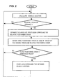
- Fig. 2 is a corresponding flow diagram for use in describing the operation of the first embodiment.
- an apparatus which is mounted in a motor vehicle consists of a vehicle position calculation section 1, a position accuracy calculation section 2, a position data recording judgement section 3 and a position data recording section 4.
- the vehicle position calculation section 1 and the position accuracy calculation section 2 supply respective data to the position data recording judgement section 3, which transfers selected parts of vehicle position data generated by the vehicle position calculation section 1, to be recorded by the position data recording section 4.
- the vehicle position calculation section 1 can be a conventional type of vehicle navigation apparatus, which periodically calculates the current position of the vehicle, e.g., at 1-second intervals, and includes an absolute position sensing section la which periodically calculates an absolute vehicle position based on signals received from GPS satellites, and a relative position sensing section 1b which periodically determines the current position of the vehicle, measured with respect to a previously obtained absolute position, between time points at which absolute positions are obtained.
- an absolute position sensing section la which periodically calculates an absolute vehicle position based on signals received from GPS satellites
- a relative position sensing section 1b which periodically determines the current position of the vehicle, measured with respect to a previously obtained absolute position, between time points at which absolute positions are obtained.
- the amount of positioning error of an absolute vehicle position that is calculated based on GPS information will depend upon various factors, which include the geometric relationships between the GPS satellites and the vehicle. For example, with four satellites being in view, minimum positioning error results when one satellite is directly overhead and the remaining satellites are close to the horizon, spaced at 120-degree intervals.
- the relative position sensing section may for example includes a speed sensor for counting pulses generated at a rate determined by the vehicle speed, for use in determining amounts of distance traversed between successive calculated vehicle positions, in conjunction with a direction sensor for detecting the angular velocity of changes in the heading direction of the vehicle (for example by using a vibration gyroscope).
- the vehicle position calculation section 1 may further be configured to utilize stored digital maps for correcting the obtained vehicle positions, i.e., by utilizing each of successive traversed route portions in map matching against the contents of the digital maps, to thereby determine a street or highway which is currently being traversed by the vehicle and thereby increase the degree of navigation accuracy of the system.
- the system may apply some degree of compensation for the positioning error in the calculated relative positions, by using the absolute positions to estimate the direction and rate of change of the relative positioning error.
- the position accuracy calculation section 2 performs a positioning error calculation operation. Specifically, if the current vehicle position has been calculated as a relative position, the position accuracy calculation section 2 uses predetermined criteria to calculate:
- the position accuracy calculation section 2 obtains the sum of the absolute positioning error and relative positioning error, to obtain a total positioning error, which is then supplied to the position data recording judgement section 3.
- the position data recording judgement section 3 compares the magnitude of that positioning error with a predetermined threshold value.
- the position data recording judgement section 3 selects only the data of those vehicle positions for which the total positioning error is lower than the threshold value to be transferred to the position data recording section 4 and recorded thereby.
- Various types of data storage device might be used to implement the position data recording section 4. Since the storage area of such a device has limited capacity, the respective sets of data expressing vehicle positions which are transferred to the position data recording section 4 from the position data recording judgement section 3 might for example be written into successive addresses of the storage area starting from a first address, with the storage area being successively rewritten (starting from the first address) each time that it becomes filled.
- a display of the most recent portion of the route which has been traversed by the vehicle can be generated by reading out all or part of the stored data of the position data recording section 4 and supplying these to a suitable display apparatus (not shown in the drawings).
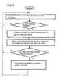
- a second embodiment will be described referring to the general system block diagram of Fig. 3 and the corresponding basic flow diagram of Fig. 4 .
- This embodiment essentially differs from the preceding embodiment in that a navigation satellite number calculation section 6 is utilized in place of the position accuracy calculation section 2 of the first embodiment, while the respective functions of the vehicle position calculation section 1, position data recording judgement section 11 and position data recording section 4 substantially correspond to those of vehicle position calculation section 1, position data recording judgement section 3 and position data recording section 4 of the first embodiment.
- the aforementioned absolute position sensing section of the vehicle position calculation section 1 derives, in conjunction with each absolute position, a corresponding absolute heading direction of the vehicle.
- the aforementioned relative position sensing section of the vehicle position calculation section 1 derives, in conjunction with each relative position, a corresponding relative heading direction of the vehicle.
- the amount of error in an absolute heading direction derived from GPS information can be estimated based on factors such as the current speed of the motor vehicle.
- the amount of error in the relative heading direction can be estimated based on the aforementioned amounts of cumulative error which arise from the sensors used to obtain the relative positions.
- a sensor such as a vibration gyroscope will produce an amount of direction error which increases as time elapses.
- the amount of angular error in the corresponding relative heading direction is estimated by the heading direction accuracy calculation section 5, which also estimates the amount of angular error in the most recently obtained absolute heading direction, and obtains the sum of these angular errors as the total direction error. This supplied to the position data recording judgement section 11.
- This embodiment makes use of the fact that if there is an excessive amount of error in the calculated heading direction, when the vehicle position is calculated by the vehicle position calculation section 1, then there is a high probability that the calculated vehicle position will not be accurate.
- the position data recording judgement section 11 compares the magnitude of that heading direction error with a predetermined threshold value.
- the position data recording judgement section 11 selects, to be transferred to the position data recording section 4 and recorded thereby, only those vehicle positions for which the corresponding heading direction error amount is smaller than the threshold value.
- this embodiment can provide similar advantages to those of the first embodiment, by reducing the amount of data expressing inaccurate vehicle position information that will be recorded by the position data recording section 4.
- a third embodiment will be described referring to the general system block diagram of Fig. 5 and the corresponding basic flow diagram of Fig. 6 .
- This embodiment essentially differs from the first embodiment in that a navigation satellite number calculation section 6 is utilized in place of the position accuracy calculation section 2 of the first embodiment, while the respective functions of the vehicle position calculation section 1, position data recording judgement section 12 and position data recording section 4 substantially correspond to those of the vehicle position calculation section 1, position data recording judgement section 3 and position data recording section 4 of the first embodiment.
- the navigation satellite number calculation section 6 determines the total number of GPS satellites from which signals were received and utilized to obtain the absolute position data. That number is then supplied by the navigation satellite number calculation section 6 to the position data recording judgement section 3, which compares the number to a predetermined threshold value. If the number of satellites is greater than that threshold value, then the position data recording judgement section 12 transfers the corresponding position data to the position data recording section 4 to be recorded thereby, while if the number of satellites is not above the threshold value, the position data are not transferred to the position data recording section 4.
- the satellite number corresponding to that relative position is obtained as the satellite number corresponding to the most recently calculated absolute position.
- the basis for this embodiment is as follows. While successive sets of absolute vehicle position data are being derived by the vehicle position calculation section 1 based on received signals from a plurality of satellites, it is possible that the reception of signals from one or more of these satellites may be temporarily interrupted due to factors such as changes in weather conditions, obstruction of radio waves by tall buildings as the motor vehicle travels past these, multi-path fading of the radio waves, etc. In such a case, the number of satellites from which signals are received may become insufficient to enable accurate vehicle position information to be derived, i.e., the vehicle position data generated by the vehicle position calculation section 1 may contain an excessive amount of positioning error.
- this embodiment can provide similar advantages to those of the first embodiment, by reducing the amount of data expressing inaccurate vehicle position information that will be recorded by the position data recording section 4.
- a fourth embodiment will be described referring to the general system block diagram of Fig. 7 and the corresponding basic flow diagram of Fig. 8 .
- This embodiment essentially differs from the first embodiment in that a calculation status detection section 7 is utilized in place of the position accuracy calculation section 2 of the first embodiment, while the respective functions and operation of the vehicle position calculation section 1, position data recording judgement section 13 and position data recording section 4 substantially correspond to those of the vehicle position calculation section 1, position data recording judgement section 3 and position data recording section 4 of the first embodiment.
- the position calculation status detection section 7 each time that the position of the vehicle is newly calculated by the vehicle position calculation section 1, the position calculation status detection section 7 derives satellite acquisition status information which specifies whether or not GPS information was successfully acquired and used in calculating the position data.
- the satellite acquisition status information is supplied to the position data recording judgement section 13, together with the corresponding position data from the vehicle position calculation section 1.
- the position data recording judgement section 13 transfer only those positions to the position data recording section 4, to be recorded thereby, for which the condition "successful use of GPS information" has occurred, as indicated by the satellite acquisition status information.
- this condition of "successful use of GPS information" will depend upon the type of navigation system. For example, if the vehicle positions are normally obtained as GPS position fixes at periodic intervals, with relative positions being calculated only when GPS signal reception is temporarily blocked, then it might be specified that only the absolute positions (i.e., each obtained directly as a GPS position fix) satisfy the condition "successful use of GPS information". If on the other hand the system normally operates by obtaining GPS position fixes at relatively long periodic intervals, with relative positions being calculated periodically within these long intervals, then those relative positions which are successively calculated after one or more of the regular GPS position fixes has been missed could be considered as not meeting the condition "successful use of GPS information"
- a modified embodiment of the invention which is a combination of the first through fourth embodiments described above.
- such an embodiment would include the position accuracy calculation section 2 of the first embodiment, the heading direction accuracy calculation section 5 of the second embodiment, the navigation satellite number calculation section of the third embodiment and the position calculation status detection section of the fourth embodiment.
- the position data recording judgement section of such a modified embodiment would judge whether or not a calculated vehicle position is to be recorded by the position data recording section 4 based upon a combination of the corresponding positioning error, direction error, satellite number, and satellite acquisition status information.
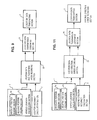
- a fifth embodiment will be described referring to the general system block diagram of Fig. 9 .
- the overall flow of processing that is executed with this embodiment is illustrated in the flow diagram of Fig. 10 .
- the embodiment is formed of a vehicle position calculation section 1, a position accuracy calculation section 2, a position data transmission judgement section 21, a position data and positioning error recording section 23 and a position data transmitting section 9.
- the vehicle position calculation section 1 and position accuracy calculation section 2 respectively operate as described for the vehicle position calculation section 1 and position accuracy calculation section 2 of the first embodiment hereinabove.
- that set of data is supplied to the position data and positioning error recording section 22 together with the corresponding amount of estimated total positioning error supplied from the position accuracy calculation section 2, to be respectively recorded.
- a vehicle position data set and the corresponding total positioning error value will be considered to constitute a single data record.
- data expressing the time at which a vehicle position data set is generated are also supplied to the recording section 22, to be recorded in conjunction with that vehicle position data as part of the corresponding data record.
- the data records which have been stored in the position data and positioning error recording section 22 begin to be successively read out and supplied to the position data transmission judgement section 21. Only the data records which have been recorded during a fixed time interval extending up to the current time point (e.g., the time point of an accident) are read out. In the flow diagram of Fig. 10 that fixed time interval is designated as Tc minutes. In that diagram it is assumed that the data records are sequentially read out starting from the most recently stored data record, back to the record which was stored Tc minutes previously.
- the position data transmission judgement section 21 When a data record is received by the position data transmission judgement section 21, if it is found to have been recorded within the aforementioned time interval Tc, then the total positioning error corresponding to the vehicle position data of that record is compared with a threshold value, in the same manner as described for the position accuracy calculation section 2 of the first embodiment. If the positioning error is lower than the threshold value, then the vehicle position data are transferred to the position data transmitting section 9 to be transmitted thereby. Specifically, the vehicle position data are converted into suitable digital data form for transmission by radio to an emergency services center, and are then transmitted thereto.
- the data can for example be adapted to be transmitted via a portable telephone such as a cellular telephone.
- the corresponding absolute positioning error can be treated as constituting the "total positioning error" for that position.
- the apparatus can simply be configured such that all absolute positions which have been recorded are transmitted by the position data transmitting section 9, without judgement of the corresponding positioning errors being performed by the judgement section 21.
- position data expressing the most recently traversed part of the motor vehicle route i.e., the portion which has been traversed during the aforementioned fixed time interval
- the position data transmission judgement section 21 selects only position data which can be expected to have a sufficient degree of accuracy, to be transmitted by the position data transmitting section 9.
- a sixth embodiment will be described referring to the general system block diagram of Fig. 11 .
- the overall flow of processing that is executed with this embodiment is illustrated in the flow diagram of Fig. 12 .
- the embodiment is formed of a vehicle position calculation section 1, a heading direction accuracy calculation section 5, a position data recording section and direction error recording section 23, a position data transmission judgement section 24 and a position data transmitting section 9.
- the vehicle position calculation section 1 operates as described for the first embodiment.
- the heading direction accuracy calculation section 5 functions as described for the second embodiment to derive an estimated amount of angular error in each calculated vehicle heading direction, i.e., each heading direction that is calculated by the vehicle position calculation section 1 in conjunction with calculation of the vehicle position.
- each data record consists of data specifying the vehicle position, the time at which the position was calculated, and the estimated amount of error in heading direction.
- the position data transmission judgement section 24 When a data record is received by the position data transmission judgement section 24, if it is found to have been recorded within a predetermined fixed time interval extending up to the current time point (as described for the preceding embodiment) then the amount of estimated positioning error corresponding to the vehicle position data of that record is compared with a threshold value, in the same manner as described for the position data recording judgement section 11 of the second embodiment. If the positioning error is lower than the threshold value, then the vehicle position data from that record are transferred by the position data transmission judgement section 24 to the position data transmitting section 9, to be converted to a suitable digital signal format and transmitted thereby by radio to an emergency services center.
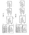
- a seventh embodiment will be described referring to the general system block diagram of Fig. 13 .
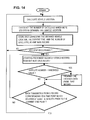
- the overall flow of processing that is executed with this embodiment is illustrated in the flow diagram of Fig. 14 .
- the embodiment is formed of a vehicle position calculation section 1, a navigation satellite number calculation section 6, a position data recording and satellite number recording section 25, a position data transmission judgement section 26, and a position data transmitting section 9.
- the vehicle position calculation section 1, position data transmitting section 9 respectively correspond in function and operation to the correspondingly numbered sections of the first embodiment.
- the navigation satellite number calculation section 6 functions as described for the second embodiment to derive (when a new vehicle position is calculated) the total number of GPS satellites from which signals were received and used in calculating that position.
- each data record consists of data specifying the vehicle position, the time at which the position was calculated, and the number of satellites whose signals were utilized in the process of calculating that vehicle position.
- the data records which have been stored in the position data and satellite number recording section 25 begin to be successively read out and supplied to the position data transmission judgement section 26, e.g., starting from the most recently stored record.
- the position data transmission judgement section 26 if it is found to have been recorded within a predetermined fixed time interval extending up to the current time point then the satellite number corresponding to the vehicle position data of that record is compared with a threshold value, in the same manner as described for the third embodiment. If the number of satellites is greater than the threshold value, then the vehicle position data from that record are transferred by the position data transmission judgement section 26 to the position data transmitting section 9, to be converted to a suitable digital signal format and transmitted thereby by radio to an emergency services center.
- data expressing the most recently traversed portion of the route of the motor vehicle can be more rapidly transmitted, in the event of an emergency, than has been possible in the prior art, since the position data transmission judgement section 26 selects for transfer to the position data transmitting section 9 only position data which can be expected to have a sufficient degree of accuracy, as indicated by the number of satellites from which signals were received for use in calculating the vehicle position data.
- FIG. 16 An eighth embodiment will be described referring to the general system block diagram of Fig. 15 .
- the overall flow of processing that is executed with this embodiment is illustrated in the flow diagram of Fig. 16 .
- the embodiment is formed of a vehicle position calculation section 1, a position calculation status detection section 7, a position data recording section 20, a calculation status recording section 27, a position data transmission judgement section 28, and a position data transmitting section 9.
- the vehicle position calculation section 1 and position calculation status detection section 7 respectively function as described for the fourth embodiment above.
- each data record consists of data specifying the vehicle position, the time at which the position was calculated, and the corresponding satellite acquisition status information.
- the position data transmission judgement section 28 When a data record is received by the position data transmission judgement section 28, if it is found to have been recorded within a predetermined fixed time interval extending up to the current time point and if the corresponding GPS measurement status is found to be satisfactory as indicated by the satellite acquisition status information, then the position data from that record are transferred by the position data transmission judgement section 28 to the position data transmitting section 9, to be converted to a suitable digital signal format and transmitted thereby by radio to an emergency services center.
- data expressing the most recently traversed portion of the route of the motor vehicle can be more rapidly transmitted, in the event of an emergency, than has been possible in the prior art, since the position data transmission judgement section 28 selects for transfer to the position data transmitting section 9 only position data which can be expected to have a sufficient degree of accuracy, as determined by whether or not GPS signals were successfully used in calculating the position.
- a modified embodiment of the invention which is a combination of the fifth through eighth embodiments described above.
- such an embodiment would include the position accuracy calculation section of the fifth embodiment, the heading direction accuracy calculation section of the sixth embodiment, the navigation satellite number calculation section of the seventh embodiment and the position calculation status detection section of the eighth embodiment.
- the position data transmission judgement section of such a modified embodiment would judge whether or not a calculated vehicle position is to be transmitted by the position data transmitting section 4 based upon a combination of the corresponding positioning error, direction error, satellite number, and satellite acquisition status information.
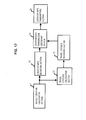
- FIG. 17 A ninth embodiment will be described referring to the general system block diagram of Fig. 17 .
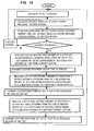
- the overall flow of processing that is executed with this embodiment is illustrated in the flow diagram of Fig. 18
- Fig. 19 is a table showing an example of a sequence of data records which might be read out and transmitted to an emergency services center in the event of an emergency situation.
- the embodiment is formed of a vehicle position calculation section 1, a position data transmitting section 9, a position data recording section 20, a travel distance calculation section 30, a travel distance recording section 31, and a position data transmission judgement section 32.
- the vehicle position calculation section 1, position data recording section 20 and position data transmitting section 9 respectively correspond in function and operation to the correspondingly numbered sections of the preceding embodiments.
- the vehicle position data are also supplied to the travel distance calculation section 30.
- the travel distance calculation section 30 calculates the distance which the vehicle has traveled in the interval between the time at which this set of vehicle position data was calculated and the time at which the immediately preceding set of vehicle position data was calculated. The calculated distance is then supplied to the travel distance recording section 31, to be recorded thereby.
- each newly generated data record consists of data specifying the current vehicle position and current time, and the distance which the vehicle has traveled since the preceding position calculation operation was executed.
- Figs. 18 and 19 it is assumed that these position calculation operations are successively executed by the vehicle position calculation section 1 at 1-second intervals.
- a first set of data records which extend back from the latest record (i.e., the data record corresponding to the time of the emergency situation occurrence) to a record that corresponds to a first fixedly predetermined amount of cumulative travel distance from the current position are selected to be supplied, in their entirety, to the position data transmitting section 9.
- the vehicle positions from an even smaller proportion of the corresponding data records are selected to be supplied to the position data transmitting section 9.
- the triangle symbols indicate those data records whose vehicle position data are supplied to the position data transmitting section 9 to be transmitted by radio. Thereafter, one out of every two successively stored data records is selected to be supplied to the position data transmitting section 9, until the 2 km separation record is encountered. From that point until the 3 km separation record is reached, one out of every four successive ones of the data records from the position data recording section 20 are selected to be supplied to the position data transmitting section 9.
- the degree of precision of specifying the route traversed by the vehicle when transmitting vehicle position data expressing that route by radio, is maximized for the terminating portion of that route, and is successively decreased for portions of the route which are more distant from the termination point of the route.
- the amount of data which must be transmitted by radio e.g., to an emergency services center for the purpose of having assistance dispatched to the scene of an accident, can be substantially reduced while maintaining sufficient accuracy in specifying the final part of the traversed route.
- the time taken to transmit the route data can be substantially reduced by comparison with the prior art.
- the invention is not limited in scope to use with a vehicle navigation system which employs the GPS satellite system, but could be applied to a navigation apparatus which operates from some other satellite navigation system, or which utilizes terrestrial radio signal sources.
- the invention could be applied to a mobile body navigation system which does not derive relative positions, but only absolute positions of a mobile body.
Landscapes
- Engineering & Computer Science (AREA)
- Radar, Positioning & Navigation (AREA)
- Remote Sensing (AREA)
- Physics & Mathematics (AREA)
- General Physics & Mathematics (AREA)
- Computer Networks & Wireless Communication (AREA)
- Automation & Control Theory (AREA)
- Navigation (AREA)
- Position Fixing By Use Of Radio Waves (AREA)
- Traffic Control Systems (AREA)
Applications Claiming Priority (1)
| Application Number | Priority Date | Filing Date | Title |
|---|---|---|---|
| EP01107201A EP1243939B1 (de) | 2001-03-22 | 2001-03-22 | Verfahren und Vorrichtung zur Reduzierung von Positionsdaten eines Fahrzeugs auf der Basis von Datengenauigkeitsschätzung |
Related Parent Applications (1)
| Application Number | Title | Priority Date | Filing Date |
|---|---|---|---|
| EP01107201A Division EP1243939B1 (de) | 2001-03-22 | 2001-03-22 | Verfahren und Vorrichtung zur Reduzierung von Positionsdaten eines Fahrzeugs auf der Basis von Datengenauigkeitsschätzung |
Publications (2)
| Publication Number | Publication Date |
|---|---|
| EP2003464A2 true EP2003464A2 (de) | 2008-12-17 |
| EP2003464A3 EP2003464A3 (de) | 2009-10-07 |
Family
ID=8176905
Family Applications (2)
| Application Number | Title | Priority Date | Filing Date |
|---|---|---|---|
| EP01107201A Expired - Lifetime EP1243939B1 (de) | 2001-03-22 | 2001-03-22 | Verfahren und Vorrichtung zur Reduzierung von Positionsdaten eines Fahrzeugs auf der Basis von Datengenauigkeitsschätzung |
| EP08012325A Withdrawn EP2003464A3 (de) | 2001-03-22 | 2001-03-22 | Verfahren und Vorrichtung zur Anwendung einer Dezimierungsverarbeitung auf Fahrzeugpositionsdaten |
Family Applications Before (1)
| Application Number | Title | Priority Date | Filing Date |
|---|---|---|---|
| EP01107201A Expired - Lifetime EP1243939B1 (de) | 2001-03-22 | 2001-03-22 | Verfahren und Vorrichtung zur Reduzierung von Positionsdaten eines Fahrzeugs auf der Basis von Datengenauigkeitsschätzung |
Country Status (2)
| Country | Link |
|---|---|
| EP (2) | EP1243939B1 (de) |
| DE (1) | DE60141450D1 (de) |
Families Citing this family (5)
| Publication number | Priority date | Publication date | Assignee | Title |
|---|---|---|---|---|
| FI114827B (fi) * | 2003-07-03 | 2004-12-31 | Sandvik Tamrock Oy | Menetelmä ja järjestelmä kaivosajoneuvon sijainnin valvomiseksi |
| FI115414B (fi) | 2003-07-03 | 2005-04-29 | Sandvik Tamrock Oy | Järjestely kaivosajoneuvon sijainnin valvontaan kaivoksessa |
| CN106033122A (zh) * | 2015-03-13 | 2016-10-19 | 北京握奇智能科技有限公司 | 一种obu定位细分推算方法和系统 |
| KR101795381B1 (ko) * | 2015-11-20 | 2017-11-09 | 현대자동차 주식회사 | 차량의 위치정보 공유 시스템과 방법 및 그 방법을 기록한 컴퓨터로 판독 가능한 기록매체 |
| FI127200B (en) * | 2016-12-07 | 2018-01-31 | Pehutec Oy | Apparatus, procedure and computer programs to improve emergency communication |
Family Cites Families (3)
| Publication number | Priority date | Publication date | Assignee | Title |
|---|---|---|---|---|
| JP2536190B2 (ja) * | 1989-10-24 | 1996-09-18 | 三菱電機株式会社 | 移動体用ナビゲ―ション装置 |
| JP2961966B2 (ja) * | 1991-07-15 | 1999-10-12 | 松下電器産業株式会社 | 車両位置方位算出装置 |
| JP3333146B2 (ja) * | 1999-05-24 | 2002-10-07 | 松下電器産業株式会社 | 移動端末と情報サービスセンタ |
-
2001
- 2001-03-22 EP EP01107201A patent/EP1243939B1/de not_active Expired - Lifetime
- 2001-03-22 DE DE60141450T patent/DE60141450D1/de not_active Expired - Lifetime
- 2001-03-22 EP EP08012325A patent/EP2003464A3/de not_active Withdrawn
Non-Patent Citations (1)
| Title |
|---|
| None |
Also Published As
| Publication number | Publication date |
|---|---|
| DE60141450D1 (de) | 2010-04-15 |
| EP2003464A3 (de) | 2009-10-07 |
| EP1243939A1 (de) | 2002-09-25 |
| EP1243939B1 (de) | 2010-03-03 |
Similar Documents
| Publication | Publication Date | Title |
|---|---|---|
| US6480784B2 (en) | Method and apparatus for applying decimation processing to vehicle position data based upon data accuracy estimation | |
| US8326521B2 (en) | Traffic situation determination systems, methods, and programs | |
| US7071843B2 (en) | Navigation system and navigation equipment | |
| EP1818682B1 (de) | Positionsberechnungsgerät | |
| CN101785039B (zh) | 使用gps速度矢量进行导航的方法和系统 | |
| EP0699894B1 (de) | Navigationssystem | |
| EP1178329B1 (de) | Verfahren und Gerät zur Korrektur der Position eines bewegbaren Körpers in einem Navigationssystem | |
| KR100713459B1 (ko) | 네비게이션 시스템 및 네비게이션 시스템에서 이동체의경로 이탈 판단 방법 | |
| US20110307171A1 (en) | GPS Location Refinement Method In Environments With Low Satellite Visibility | |
| US6545638B2 (en) | Correcting a prior dead reckoning determined position measurement using GPS when GPS is later acquired | |
| WO2008145986A2 (en) | Global positioning system error correction, vehicle tracking and object location | |
| US20100057334A1 (en) | Method and system to estimate vehicle traffic conditions | |
| JP6055185B2 (ja) | ナビゲーションデバイスの位置を決定すること | |
| JP3013309B1 (ja) | ハイブリッド走行軌跡取得方法およびハイブリッド走行軌跡取得システム | |
| US6418375B2 (en) | Navigation method using a small volume of data | |
| EP1243939B1 (de) | Verfahren und Vorrichtung zur Reduzierung von Positionsdaten eines Fahrzeugs auf der Basis von Datengenauigkeitsschätzung | |
| JP4652097B2 (ja) | 高度算出装置及びナビゲーション装置 | |
| JP2008249614A (ja) | 車載ナビゲーション装置、ナビゲーションシステム及びコンピュータプログラム | |
| JP2000293784A (ja) | 事故車両表示方式 | |
| JPH0476609B2 (de) | ||
| JPS6326589A (ja) | Gps用見通し情報付き地図デ−タ作成装置 | |
| KR100794137B1 (ko) | 전자 나침반을 이용한 차량 항법/교통 정보 수집 장치 및그 방법 | |
| JPH1073442A (ja) | ナビゲーション装置 | |
| JPH064024A (ja) | 車載ナビゲーション装置 | |
| JP2002181556A (ja) | 位置データ間引き装置 |
Legal Events
| Date | Code | Title | Description |
|---|---|---|---|
| PUAI | Public reference made under article 153(3) epc to a published international application that has entered the european phase |
Free format text: ORIGINAL CODE: 0009012 |
|
| AC | Divisional application: reference to earlier application |
Ref document number: 1243939 Country of ref document: EP Kind code of ref document: P |
|
| AK | Designated contracting states |
Kind code of ref document: A2 Designated state(s): DE FR GB |
|
| PUAL | Search report despatched |
Free format text: ORIGINAL CODE: 0009013 |
|
| AK | Designated contracting states |
Kind code of ref document: A3 Designated state(s): DE FR GB |
|
| 17P | Request for examination filed |
Effective date: 20100316 |
|
| 17Q | First examination report despatched |
Effective date: 20100409 |
|
| AKX | Designation fees paid |
Designated state(s): DE FR GB |
|
| GRAP | Despatch of communication of intention to grant a patent |
Free format text: ORIGINAL CODE: EPIDOSNIGR1 |
|
| GRAC | Information related to communication of intention to grant a patent modified |
Free format text: ORIGINAL CODE: EPIDOSCIGR1 |
|
| RIC1 | Information provided on ipc code assigned before grant |
Ipc: G01C 21/26 20060101AFI20101013BHEP Ipc: G01S 19/13 20100101ALI20101013BHEP Ipc: G01S 19/49 20100101ALI20101013BHEP |
|
| STAA | Information on the status of an ep patent application or granted ep patent |
Free format text: STATUS: THE APPLICATION IS DEEMED TO BE WITHDRAWN |
|
| 18D | Application deemed to be withdrawn |
Effective date: 20110405 |