EP4239288A2 - Verfahren zum verarbeiten einer karte und fahrzeug - Google Patents
Verfahren zum verarbeiten einer karte und fahrzeug Download PDFInfo
- Publication number
- EP4239288A2 EP4239288A2 EP22186625.4A EP22186625A EP4239288A2 EP 4239288 A2 EP4239288 A2 EP 4239288A2 EP 22186625 A EP22186625 A EP 22186625A EP 4239288 A2 EP4239288 A2 EP 4239288A2
- Authority
- EP
- European Patent Office
- Prior art keywords
- map
- vehicle
- target
- elements
- image
- Prior art date
- Legal status (The legal status is an assumption and is not a legal conclusion. Google has not performed a legal analysis and makes no representation as to the accuracy of the status listed.)
- Granted
Links
Images



Classifications
-
- G—PHYSICS
- G01—MEASURING; TESTING
- G01C—MEASURING DISTANCES, LEVELS OR BEARINGS; SURVEYING; NAVIGATION; GYROSCOPIC INSTRUMENTS; PHOTOGRAMMETRY OR VIDEOGRAMMETRY
- G01C21/00—Navigation; Navigational instruments not provided for in groups G01C1/00 - G01C19/00
- G01C21/26—Navigation; Navigational instruments not provided for in groups G01C1/00 - G01C19/00 specially adapted for navigation in a road network
- G01C21/28—Navigation; Navigational instruments not provided for in groups G01C1/00 - G01C19/00 specially adapted for navigation in a road network with correlation of data from several navigational instruments
- G01C21/30—Map- or contour-matching
- G01C21/32—Structuring or formatting of map data
-
- G—PHYSICS
- G01—MEASURING; TESTING
- G01C—MEASURING DISTANCES, LEVELS OR BEARINGS; SURVEYING; NAVIGATION; GYROSCOPIC INSTRUMENTS; PHOTOGRAMMETRY OR VIDEOGRAMMETRY
- G01C21/00—Navigation; Navigational instruments not provided for in groups G01C1/00 - G01C19/00
- G01C21/38—Electronic maps specially adapted for navigation; Updating thereof
- G01C21/3804—Creation or updating of map data
- G01C21/3833—Creation or updating of map data characterised by the source of data
- G01C21/3841—Data obtained from two or more sources, e.g. probe vehicles
-
- G—PHYSICS
- G01—MEASURING; TESTING
- G01C—MEASURING DISTANCES, LEVELS OR BEARINGS; SURVEYING; NAVIGATION; GYROSCOPIC INSTRUMENTS; PHOTOGRAMMETRY OR VIDEOGRAMMETRY
- G01C21/00—Navigation; Navigational instruments not provided for in groups G01C1/00 - G01C19/00
- G01C21/38—Electronic maps specially adapted for navigation; Updating thereof
- G01C21/3804—Creation or updating of map data
- G01C21/3833—Creation or updating of map data characterised by the source of data
- G01C21/3844—Data obtained from position sensors only, e.g. from inertial navigation
-
- G—PHYSICS
- G01—MEASURING; TESTING
- G01C—MEASURING DISTANCES, LEVELS OR BEARINGS; SURVEYING; NAVIGATION; GYROSCOPIC INSTRUMENTS; PHOTOGRAMMETRY OR VIDEOGRAMMETRY
- G01C21/00—Navigation; Navigational instruments not provided for in groups G01C1/00 - G01C19/00
- G01C21/26—Navigation; Navigational instruments not provided for in groups G01C1/00 - G01C19/00 specially adapted for navigation in a road network
- G01C21/34—Route searching; Route guidance
- G01C21/3446—Details of route searching algorithms, e.g. Dijkstra, A*, arc-flags or using precalculated routes
-
- G—PHYSICS
- G01—MEASURING; TESTING
- G01C—MEASURING DISTANCES, LEVELS OR BEARINGS; SURVEYING; NAVIGATION; GYROSCOPIC INSTRUMENTS; PHOTOGRAMMETRY OR VIDEOGRAMMETRY
- G01C21/00—Navigation; Navigational instruments not provided for in groups G01C1/00 - G01C19/00
- G01C21/38—Electronic maps specially adapted for navigation; Updating thereof
- G01C21/3804—Creation or updating of map data
- G01C21/3833—Creation or updating of map data characterised by the source of data
- G01C21/3848—Data obtained from both position sensors and additional sensors
-
- G—PHYSICS
- G01—MEASURING; TESTING
- G01C—MEASURING DISTANCES, LEVELS OR BEARINGS; SURVEYING; NAVIGATION; GYROSCOPIC INSTRUMENTS; PHOTOGRAMMETRY OR VIDEOGRAMMETRY
- G01C21/00—Navigation; Navigational instruments not provided for in groups G01C1/00 - G01C19/00
- G01C21/38—Electronic maps specially adapted for navigation; Updating thereof
- G01C21/3804—Creation or updating of map data
- G01C21/3833—Creation or updating of map data characterised by the source of data
- G01C21/3852—Data derived from aerial or satellite images
-
- G—PHYSICS
- G01—MEASURING; TESTING
- G01C—MEASURING DISTANCES, LEVELS OR BEARINGS; SURVEYING; NAVIGATION; GYROSCOPIC INSTRUMENTS; PHOTOGRAMMETRY OR VIDEOGRAMMETRY
- G01C21/00—Navigation; Navigational instruments not provided for in groups G01C1/00 - G01C19/00
- G01C21/38—Electronic maps specially adapted for navigation; Updating thereof
- G01C21/3863—Structures of map data
- G01C21/387—Organisation of map data, e.g. version management or database structures
-
- G—PHYSICS
- G01—MEASURING; TESTING
- G01C—MEASURING DISTANCES, LEVELS OR BEARINGS; SURVEYING; NAVIGATION; GYROSCOPIC INSTRUMENTS; PHOTOGRAMMETRY OR VIDEOGRAMMETRY
- G01C21/00—Navigation; Navigational instruments not provided for in groups G01C1/00 - G01C19/00
- G01C21/38—Electronic maps specially adapted for navigation; Updating thereof
- G01C21/3885—Transmission of map data to client devices; Reception of map data by client devices
-
- G—PHYSICS
- G06—COMPUTING OR CALCULATING; COUNTING
- G06F—ELECTRIC DIGITAL DATA PROCESSING
- G06F16/00—Information retrieval; Database structures therefor; File system structures therefor
- G06F16/20—Information retrieval; Database structures therefor; File system structures therefor of structured data, e.g. relational data
- G06F16/29—Geographical information databases
-
- G—PHYSICS
- G06—COMPUTING OR CALCULATING; COUNTING
- G06T—IMAGE DATA PROCESSING OR GENERATION, IN GENERAL
- G06T5/00—Image enhancement or restoration
- G06T5/50—Image enhancement or restoration using two or more images, e.g. averaging or subtraction
-
- G—PHYSICS
- G06—COMPUTING OR CALCULATING; COUNTING
- G06T—IMAGE DATA PROCESSING OR GENERATION, IN GENERAL
- G06T2207/00—Indexing scheme for image analysis or image enhancement
- G06T2207/20—Special algorithmic details
- G06T2207/20212—Image combination
- G06T2207/20221—Image fusion; Image merging
Definitions
- the invention relates to the field of automatic driving technology, and more particularly to the field of high-precision maps, in particular to a method and an apparatus for processing a map, an electronic device, a medium and a vehicle.
- a high precision map is an electronic map with high precision, high freshness and high richness whose absolute accuracy and relative accuracy are both within 1 meter, which is irreplaceable in the autonomous driving field.
- the high-precision map needs to provide road information such as road type, curvature, position of a lane line, environmental object information such as roadside infrastructure, obstacles, traffic signs, as well as real-time dynamic information such as traffic flow and status of the traffic light.
- the invention aims to solve one of the technical problems in the related art at least to a certain extent.
- the first objective of the invention is to provide a method for processing a map, which achieves fusion of map elements in a plurality of reference maps based on a first element position of each map element, improves the position accuracy of map elements, reduces the cost of data collection and production and improves the efficiency of map production by processing the reference maps obtained from a plurality of vehicle-mounted devices.
- the second objective of the invention is to provide another method for processing a map.
- the third objective of the invention is to provide an apparatus for processing a map.
- the fourth objective of the invention is to provide another apparatus for processing a map.
- the fifth objective of the invention is to provide an electronic device.
- the sixth objective of the invention is to provide a non-transitory computer readable storage medium.
- the seventh objective of the invention is to provide a computer program product.
- the eighth objective of the invention is to provide a vehicle.
- a method for processing a map includes: obtaining a plurality of reference maps from vehicle-mounted devices; determining map elements included in the plurality of reference maps and a first element position where each map element is located; and obtaining a target map by fusing the map elements in the plurality of reference maps based on the first element position where each map element is located.
- obtaining the target map by fusing the map elements in the plurality of reference maps based on the first element position where each map element is located includes: determining map elements belonging to the same object based on the first element position where each map element is located; obtaining a second element position of the object by performing position fusion based on a first element position of each map element belonging to the same object in each reference map; and marking a target element corresponding to the object at the second element position in the target map.
- obtaining the second element position of the object by performing position fusion based on the first element positions of the map elements belonging to the same object in each reference map includes: determining a number of map elements corresponding to each object; removing map elements corresponding to an object with the number of map elements smaller than a threshold; and for an object with the number of map elements being greater than or equal to the threshold, obtaining a second element position of the object by performing position fusion on a first element position of each map element in each reference map belonging to the object.
- obtaining the second element position of the object by performing position fusion on the first element position of each map element in each reference map belonging to the object includes: obtaining the second element position of the object by performing position fusion based on the first element position of each map element in each reference map belonging to the object with a re-projection error optimization algorithm.
- obtaining the plurality of reference maps from vehicle-mounted devices includes: obtaining positioning data and a corresponding visual detection map from at least one vehicle-mounted device; and generating a reference map corresponding to each vehicle-mounted device based on the positioning data of the vehicle-mounted device and map elements included in the corresponding visual detection map.
- obtaining the plurality of reference maps from vehicle-mounted devices includes: obtaining reference maps established by the plurality of vehicle-mounted devices.
- the plurality of reference maps from vehicle-mounted devices are obtained, it is determined that the map elements included in the plurality of reference maps and the first element positions where the corresponding map elements are located, and the target map is obtained by fusing the map elements in the plurality of reference maps based on the first element position of each map element. Since the map elements in the plurality of reference maps may be fused based on the first element position of each map element, the target map may be obtained, which improves the position accuracy of the map elements and ensures the consistency between the target map and the real world. At the same time, since the plurality of reference maps from vehicle-mounted devices may be obtained for corresponding processing, costs of data collection and production are reduced, the map production efficiency and update frequency may be effectively improved, and the timeliness of the map is enhanced.
- another method for processing a map includes: collecting positioning data and a visual detection map; determining map elements included in the visual detection map by performing object recognition on the visual detection map; generating a reference map based on the positioning data and image positions of the map elements in the visual detection map; and sending the reference map to a server, so that the server obtains a target map by fusing the map elements in a plurality of reference maps based on a first element position of each map element in the reference map.
- the visual detection map includes: a radar point cloud map and a target image collected by an image sensor.
- Generating the reference map based on the positioning data and image positions of the map elements in the visual detection map includes: for a first map element in the radar point cloud image, determining a first candidate position of the first map element based on the positioning data and an image position of the first map element in the radar point cloud image; for a second map element in the target image, determining a second candidate position of the second map element based on the positioning data and an image position of the second map element in the target image; in response to the first map element and the second map element belonging to the same element category, and a difference between the first candidate position and the second candidate position being less than a threshold, merging the first map element and the second map element as a target element in a reference map; and determining a position of the target element in the reference map based on the first candidate position and the second candidate position.
- the positioning data and corresponding visual detection map are collected; object recognition is performed on the visual detection map to determine the map elements included in the visual detection map; the reference map is generated based on the positioning data and image positions of the map elements in the visual detection map; the reference map is sent to the server, so that the server obtains the target map by fusing the map elements in the plurality of reference maps based on the first element position of each map element in the reference map.
- map data collection may be achieved with low cost, single-vehicle collection and crowdsourcing collection may be supported, which may effectively increase the map update frequency and enhance the timeliness of the map.
- an apparatus for processing a map includes: an obtaining module configured to obtain a plurality of reference maps from vehicle-mounted devices; a determination module, configured to determine map elements included in the plurality of reference maps and a first element position where each map element is located; and a fusion module, configured to obtain a target map by fusing the map elements in the plurality of reference maps based on the first element position where each map element is located.
- the fusion module includes: a determination unit, configured to determine map elements belonging to the same object based on the first element position where each map element is located; a fusion unit, configured to obtain a second element position of the object by performing position fusion based on a first element position of each map element belonging to the same object in each reference map; and a marking unit, configured to mark a target element corresponding to the object at the second element position in the target map.
- the fusion unit is configured to: determine a number of map elements corresponding to each object; remove map elements corresponding to an object with the number of map elements smaller than a threshold; and for an object with the number of map elements being greater than or equal to the threshold, obtain a second element position of the object by performing position fusion on a first element position of each map element in each reference map belonging to the object.
- the fusion unit is configured to: obtain the second element position of the object by performing position fusion based on the first element position of each map element in each reference map belonging to the object with a re-projection error optimization algorithm.
- the obtaining module is configured to: obtain positioning data and a corresponding visual detection map from at least one vehicle-mounted device; and generate a reference map corresponding to each vehicle-mounted device based on the positioning data of the vehicle-mounted device and map elements included in the corresponding visual detection map.
- the obtaining module is configured to: obtain reference maps established by the plurality of vehicle-mounted devices.
- the plurality of reference maps from vehicle-mounted devices are obtained, it is determined that the map elements included in the plurality of reference maps and the first element positions where the corresponding map elements are located, and the target map is obtained by fusing the map elements in the plurality of reference maps based on the first element position of each map element. Since the map elements in the plurality of reference maps may be fused based on the first element position of each map element, the target map may be obtained, which improves the position accuracy of the map elements and ensures the consistency between the target map and the real world. At the same time, since the plurality of reference maps from vehicle-mounted devices may be obtained for corresponding processing, costs of data collection and production are reduced, the map production efficiency and update frequency may be effectively improved, and the timeliness of the map is enhanced.
- the apparatus includes: a collection module, configured to collect positioning data and a corresponding visual detection map; a recognition module, configured to determine map elements included in the visual detection map by performing object recognition on the visual detection map; a generation module, configured to generate a reference map based on the positioning data and image positions of the map elements in the visual detection map; and a processing module, configured to send the reference map to a server, so that the server obtains a target map by fusing the map elements in a plurality of reference maps based on a first element position of each map element in the reference map.
- the visual detection map includes: a radar point cloud map and a target image collected by an image sensor.
- the generation module includes: a first determination unit, configured to for a first map element in the radar point cloud image, determine a first candidate position of the first map element based on the positioning data and an image position of the first map element in the radar point cloud image; a second determination unit, configured to for a second map element in the target image, determine a second candidate position of the second map element based on the positioning data and an image position of the second map element in the target image; a merging unit, configured to in response to the first map element and the second map element belonging to the same element category, and a difference between the first candidate position and the second candidate position being less than a threshold, merge the first map element and the second map element as a target element in a reference map; and a third determination unit, configured to determine a position of the target element in the reference map based on the first candidate position and the second candidate position.
- the positioning data and corresponding visual detection map are collected; object recognition is performed on the visual detection map to determine the map elements included in the visual detection map; the reference map is generated based on the positioning data and image positions of the map elements in the visual detection map; the reference map is sent to the server, so that the server obtains the target map by fusing the map elements in the plurality of reference maps based on the first element position of each map element in the reference map.
- map data collection may be achieved with low cost, single-vehicle collection and crowdsourcing collection may be supported, which may effectively increase the map update frequency and enhance the timeliness of the map.
- an electronic device which includes at least one processor and a memory communicatively coupled with the at least one processor and stored with instructions executable by the at least one processor.
- the at least one processor is caused to execute the method as described in the first aspect or the method as described in the second aspect.
- a non-transitory computer-readable storage medium having computer instructions stored thereon is provided.
- the computer instructions are configured to cause a computer to execute the method as described in the first aspect or the method as described in the second aspect.
- a computer program product including a computer program is provided.
- the computer program is executed by a processor, the method as described in the first aspect or the method as described in the second aspect is implemented.
- a vehicle including a vehicle body, a sensor device and a processor.
- the sensor device may be configured to collect positioning data and a visual detection map when the vehicle being driven.
- the processor may be configured to determine map elements included in the visual detection map by performing object recognition on the visual detection map, generate a reference map based on the positioning data and image positions of the map elements in the visual detection map, and send the reference map to a server, so that the server obtains a target map by fusing the map elements in a plurality of reference maps based on a first element position of each map element in the reference map.
- FIG. 1 is a flow diagram of a method for processing a map according to an embodiment of the invention.
- map production is completed by manual data editing and processing.
- the cost of data collection and map production is high and the efficiency is low. Therefore, how to effectively reduce the cost of data collection and map production while ensuring the accurate map, and improve the efficiency of map making has become an urgent problem to be solved.
- the embodiments of the invention provide a method for processing a map, which achieves fusion of map elements in a plurality of reference maps based on a first element position of each map element, improves the position accuracy of map elements, reduces the cost of data collection and production and improves the efficiency of map production and update frequency by processing the reference maps obtained from a plurality of vehicle-mounted devices.
- the method for processing a map includes the following steps at 101-103.
- a plurality of reference maps from vehicle-mounted devices are obtained.
- the vehicle-mounted device may be a sensor device and a computing unit which meets the needs of the embodiment.
- the sensor device is configured to collect sensor data
- the computing unit is configured for automatic mapping.
- the sensor data includes image data, point cloud data of a laser radar, an inertial measurement unit (IMU) data, a global navigation satellite system (GNSS) data, etc., which are not limited in this embodiment.
- IMU inertial measurement unit
- GNSS global navigation satellite system
- a server obtains the plurality of reference maps from vehicle-mounted devices and performs subsequent processing steps.
- the reference map of the vehicle-mounted device may be established by the vehicle-mounted device based on the collected sensor data and sent to the server, so that the server may obtain the reference maps established by a plurality of vehicle-mounted devices.
- the reference map established by the plurality of vehicle-mounted devices may be sent to the server via network transmission or transmitted to the server via a physical copy, which is not limited in this embodiment.
- the computing unit of the vehicle-mounted device may automatically complete production of the reference maps through an automatic recognition and reconstruction algorithm based on the received sensor data when the vehicle-mounted device establishes the reference maps.
- the reference map of the vehicle-mounted device may be established by the server based on the sensor data sent by at least one vehicle-mounted device, so that the server may obtain the plurality of reference maps from vehicle-mounted devices, which is not limited in this embodiment.
- the reference maps are established by vehicle-mounted devices
- the vehicle equipped with a sensor device and a computing unit that meet the needs of this embodiment may be reused, such as a vehicle with automatic driving function, a vehicle with an automobile data recorder, etc.
- the sensor device may be used to collect sensor data during vehicle driving, and automatic map making may be completed by running the automatic mapping algorithm via the computing unit at the vehicle end, the cost of data collection and map production may be effectively reduced, the efficiency of map production and update frequency may be improved, and the timeliness of the map may be enhanced.
- map elements are determined included in the plurality of reference maps and a first element position where a corresponding one of the map elements is located.
- the map elements may be roads, lanes, lane lines, and road auxiliary elements, such as speed limit signs, traffic lights, etc., which are not limited in this embodiment.
- the server may determine the map elements included in the plurality of reference maps and where the corresponding one of the map elements is located.
- the first element position is a position relationship of the map element in the reference map relative to the vehicle. It should be noted that, since the reference map is established based on the data collected by the vehicle-mounted device, the reference map may take the vehicle as a coordinate origin for establishing a coordinate system, so as to obtain the position relationship between the map element included in the reference map and the vehicle.
- the plurality of reference maps should be a result of map establishing on the same road for a plurality of times, so that the same map elements in the plurality of reference maps may be managed by determining the map elements included in the plurality of reference maps and the first element positions corresponding to the map elements, so as to improve the position accuracy of the map elements.
- a first element position where the same map element is located in different reference maps may be different.
- the number of map elements included in different reference maps may also be different. Therefore, in order to ensure the position accuracy of map elements, the first element positions where the map elements included in the plurality of reference maps are located needs to be fused.
- a target map is obtained by fusing the map elements in the plurality of reference maps based on the first element position where each map element is located.
- the map elements in the plurality of reference maps may be fused and reconstructed based on the first element position of each map element in the plurality of reference maps, so as to obtain the target map.
- the same map element in the plurality of reference maps is matched, position fusion is performed on the matched same map element in the plurality of reference maps based on the first element position where the same map element is located in each reference map, to obtain the target map.
- an identical/same map element with lower occurrence times may be filtered out by counting the occurrence times of the same map element in the plurality of reference maps, and fusion reconstruction may be carried out based on the first element positions where the remaining same map elements in each reference map are located, so as to obtain the target map, which is not limited in this embodiment.
- the map elements included in the plurality of reference maps and the first element positions of the corresponding map elements are directly determined based on the reference maps obtained from the plurality of vehicle-mounted devices, and the map elements in the plurality of reference maps are fused based on the first element positions of the corresponding map elements to obtain the target map.
- positions of the map elements included in the target map may be consistent with their physical positions in the real world, which improves the position accuracy of the map elements and ensures the consistency between the target map and the real world.
- the plurality of reference maps from vehicle-mounted devices are obtained, it is determined that the map elements included in the plurality of reference maps and the first element positions where the corresponding map elements are located, and the target map is obtained by fusing the map elements in the plurality of reference maps based on the first element position of each map element. Since the map elements in the plurality of reference maps may be fused based on the first element position of each map element, the target map may be obtained, which improves the position accuracy of the map elements and ensures the consistency between the target map and the real world. At the same time, since the plurality of reference maps from vehicle-mounted devices may be obtained for corresponding processing, costs of data collection and production are reduced, and the efficiency of processing a map may be effectively improved.
- FIG. 2 is a schematic flowchart of another method for processing a map according to the embodiment of the invention.
- the method for processing a map may include the following steps at 201-206.
- positioning data and a corresponding visual detection map are obtained from at least one vehicle-mounted device.
- the vehicle-mounted device may be a sensor device and a computing unit that meet the needs of this embodiment.
- the sensor device is configured to collect sensor data
- the computing unit is configured for automatic mapping.
- the sensor data includes, but is not limited to, the positioning data and corresponding visual detection maps.
- sensor data may be continuously collected by the mounted sensors.
- the positioning data and the corresponding visual detection map may be continuously collected.
- the vehicle-mounted device may send the collected positioning data and the corresponding visual detection map to a server. It should be noted that, the positioning data and the corresponding visual detection map collected by the vehicle-mounted device may be sent to the server through network transmission or through a physical copy, which is not limited in this embodiment.
- the server may obtain the positioning data and the corresponding visual detection map from at least one vehicle-mounted device.
- the positioning data and the corresponding visual detection map should be sensor data collected by different vehicles on the same road, which are equipped with the sensor device and computing unit that meet the needs of this embodiment, so as to ensure that the plurality of reference maps from vehicle-mounted devices that are established by the server based on the positioning data and the corresponding visual inspection detection map are a result of establishing a map on the same road for a plurality of times.
- a reference map corresponding to each vehicle-mounted device is generated based on the positioning data of the vehicle-mounted device and map elements included in the corresponding visual detection map.
- the map elements may be roads, lanes, lane lines, and road auxiliary elements, such as speed limit signs, traffic lights, etc., which are not limited in this embodiment.
- the server may generate the reference map corresponding to each vehicle-mounted device based on the positioning data of the vehicle-mounted device and the map elements included in the corresponding visual detection map.
- the positioning data is used to locate position coordinates of the vehicle in the real world
- the map elements included in the corresponding visual detection map are all vector elements, which may describe a shape and relative position of each map element.
- the server may establish an image coordinate system by taking the vehicle as a coordinate origin, and a reference map corresponding to each vehicle-mounted device may be generated based on the map elements included in the corresponding visual detection map.
- the map elements included in the plurality of reference maps and the first element positions where the corresponding map elements are located are determined.
- map elements belonging to the same object are determined based on the first element positions where each map element is located.
- the server may determine the map elements belonging to the same object based on the first element positions where the map elements included in the plurality of reference maps are located.
- the reference map may be represented in a form of the image coordinate system, so that each map element in the same coordinate area may be determined as one belonging to the same object based on the first element position of each map element.
- the range of the coordinate area may be manually set according to the actual situations.
- the reference map is represented in a form of the image coordinate system, and the first element position where the same map element is located should be in the same coordinate area.
- the map elements belonging to the same object should be the same map element, so as to ensure that the map elements belonging to the same object are the same map element, the range of the manually set coordinate area should not be too large.
- a second element position of the object is obtained by performing position fusion based on a first element position of each map element belonging to the same object in each reference map.
- the server may perform position fusion based on the first element positions of map elements belonging to the same object in each reference map with a re-projection error optimization algorithm, thus obtaining the second element position of the same object.
- the second element position of the object is a position coordinate of the object in the real world, which may be represented by latitude and longitude. Since the server may obtain the positioning data (that is, the position coordinate of the vehicle in the real world), and may obtain the first element positions of the map elements belonging to the same object in each reference map (that is, the position relationships of the map elements belonging to the same object in each reference map relative to the vehicle). Thus, the vehicle may be served as an intermediary to perform coordinate transformation and obtain the second element position of the object (that is, the position coordinate of the object in the real world).
- Bundle Adjustment refers to extracting the optimal 3D (three-dimensional) model and camera parameters from visual reconstruction.
- the camera parameters include internal parameters and external parameters.
- the BA refers to a process that after optimal adjustment for a camera pose and a position of the feature point are performed, bundles of light rays reflected from each feature point are finally converged to the light center.
- the re-projection error optimization algorithm is built using these light beams.
- 3D space points are projected onto an image, which is the first projection, so that these images may be used to triangulate feature points, and geometric information may be used to construct triangles to determine positions of the 3D space points.
- the calculated coordinates of the 3D points and the camera pose are used to perform a second projection, which is a re-projection. It should be noted that, the calculated coordinates of the 3D point and the camera pose are not real.
- the projection of the real 3D space points on the image plane are pixel points on the image, and the re-projection of the real 3D space point on the image plane are the virtual pixel points calculated.
- a target element corresponding to the object is marked at the second element position in the target map.
- the server may generate a target map, and mark the target element corresponding to the object at the second element position in the target map, thus ensuring the consistency between the target map and the real world.
- the target map obtained is a map on a certain road.
- the plurality of reference maps from vehicle-mounted devices are obtained, the map elements included in the plurality of reference maps and the first element positions where the corresponding map elements are located are determined, and the target map is obtained by fusing the map elements in the plurality of reference maps based on the first element positions of each map element. Since the map elements in the plurality of reference maps may be fused based on the first element position of each map element, the target map may be obtained, which improves the position accuracy of the map elements and ensures the consistency between the target map and the real world. At the same time, since the plurality of reference maps from vehicle-mounted devices may be obtained for corresponding processing, the cost of data collection and production is reduced, and the efficiency of processing a map may be effectively improved.
- this embodiment provides a schematic flowchart of obtaining a second element position of an object in a scenario shown in FIG. 3 .
- obtaining a second element position of the object by performing position fusion based on a first element position of each map element belonging to the same object in each reference map may include the following steps 301-303.
- the server may count data of the map elements belonging to the same object, so as to determine the number of map elements corresponding to each object.
- map elements corresponding to an object with the number of map elements smaller than a threshold are removed.
- the threshold may be a value manually set according to the actual situations. It should be noted that, the threshold should be smaller than the number of map elements in the reference map on the same road. As a possible implementation, the threshold may be set to half of the value of the reference map on the same road.
- the server removes the map elements corresponding to an object whose map element number is less than the threshold, and remains the map elements corresponding to an object whose map element number is greater than or equal to the threshold.
- a second element position of the object is obtained by performing position fusion on a first element position of each map element in each reference map belonging to the obj ect.
- the server may obtain the second element position of the object by performing position fusion based on the first element position of each map element in each reference map belonging to the object with a re-projection error optimization algorithm.
- the second element position of the object is a position coordinate of the object in the real world, which may be represented by latitude and longitude.
- the number of map elements corresponding to each object is determined the map elements corresponding to the object with the number of map elements smaller than the threshold are removed, and for an object with the number of map elements being greater than or equal to the threshold, position fusion is performed on a first element position of each map element in each reference map belonging to the object to obtain the second element position of the object, which effectively improves the efficiency of position fusion by the server based on the first element position in each reference map of map elements belonging to the same obj ect.
- FIG. 4 is a flow diagram of yet another method for processing a map according to an embodiment of the invention.
- the vehicle-mounted device may be a sensor device and a computing unit that meet the needs of this embodiment.
- the sensor device is configured to collect sensor data
- the computing unit is configured for automatic mapping.
- the method for processing a map may include the following steps at 401-404.
- positioning data and a corresponding visual detection map are collected.
- the sensor device for collecting sensor data may continuously collect sensor data during the movement of a vehicle equipped with the sensor device and the computing unit that meet the needs of this embodiment, where the sensor data includes but is not limited to the positioning data and the corresponding visual detection map. Then, the sensor device may send the collected positioning data and corresponding visual detection map to the computing unit used for automatic mapping, and the computing unit may perform automatic mapping based on the received positioning data and corresponding visual detection map.
- object recognition is performed on the visual detection map to determine map elements included in the visual detection map.
- the computing unit deployed at the vehicle end may perform object recognition on the visual detection map to determine the map elements included in the visual detection map, so that image positions of the map elements in the visual detection map may be obtained.
- a reference map is generated based on the positioning data and image positions of the map elements in the visual detection map.
- the computing unit may generate the reference map by running an automatic mapping algorithm to automatically complete map making based on the received positioning data and the image positions of the map elements in the visual detection map obtained at 402.
- the reference map is sent to the server, so that the server obtains a target map by fusing the map elements in a plurality of reference maps based on a first element position of each map element in the reference map.
- the computing unit may send the generated reference map to the server, so that the server obtains the target map by fusing the map elements in the plurality of reference maps based on the first element position of each map element in the reference map. It should be noted that, the computing unit may send the reference map to a server through network transmission, or may transmit the reference map to the server through a physical copy, which is not limited in this embodiment.
- the positioning data and corresponding visual detection map are collected; object recognition is performed on the visual detection map to determine the map elements included in the visual detection map; the reference map is generated based on the positioning data and image positions of the map elements in the visual detection map; the reference map is sent to the server, so that the server obtains the target map by fusing the map elements in the plurality of reference maps based on the first element position of each map element in the reference map.
- map data collection may be achieved with low cost, single-vehicle collection and crowdsourcing collection may be supported, which may effectively increase the map update frequency and enhance the timeliness of the map.
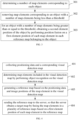
- this embodiment provides a flow diagram of generating a reference map in a scenario.
- generating the reference map based on the positioning data and image positions of the map elements in the visual detection map may include the following steps at 501-504.
- the sensor device may include an image sensor and/or a laser radar sensor
- the visual detection map includes a radar point cloud image and a target image collected by the image sensor, where the radar point cloud image is collected by the laser radar sensor.
- a first candidate position of the first map element is determined based on the positioning data and an image position of the first map element in the radar point cloud image.
- the computing unit may determine the first candidate position of the first map element based on the positioning data and the image position of the first map element in the radar point cloud image.
- a second candidate position of the second map element is determined based on the positioning data and an image position of the second map element in the target image.
- the computing unit may determine the second candidate position of the second map element based on the positioning data and the image position of the second map element in the target image.
- the first map element and the second map element are merged as a target element in a reference map.
- the computing unit may merge the first map element and the second map element as the target element in the reference map.
- the threshold may be a value manually set according to the actual situations.
- a position of the target element in the reference map is determined based on the first candidate position and the second candidate position.
- the computing unit may determine the position of the target element in the reference map based on the first candidate position of the first map element and the second candidate position of the second map element.
- a weighted average of the first candidate position of the first map element and the second candidate position of the second map element may be performed to obtain the position of the target element in the reference map.
- the first candidate position of the first map element is determined based on the positioning data and the image position of the first map element in the radar point cloud image; for a second map element in the target image, the second candidate position of the second map element is determined based on the positioning data and the image position of the second map element in the target image; in response to the first map element and the second map element belonging to the same element category, and the difference between the first candidate position and the second candidate position being less than the threshold, the first map element and the second map element are merged as the target element in the reference map; and a position of the target element in the reference map is determined based on the first candidate position and the second candidate position.
- the target map may be automatically identified and reconstructed, and the map production may be completed automatically without labor cost, thus effectively improving the map production efficiency.
- FIG. 6 is a flow diagram of generating a target map in a scenario.
- the method for processing a map may include the following steps at 601-606.
- sensor data is collected.
- a sensor device and a computing unit for mapping are deployed at the vehicle end, the sensor device continuously collects sensor data during the operation of the vehicle.
- the sensor data may include image data, laser radar point cloud data, IMU data, GNSS data, and the like. It should be noted that the sensor device may send the collected sensor data to the computing unit for automatic mapping, so that the computing unit may perform automatic mapping based on the received sensor data.
- the computing unit at the vehicle end receives the sensor data
- the sensor data includes image data collected by the image sensor
- map elements such as lane lines, speed limit signs, traffic lights, etc. are identified.
- 3D reconstruction of the map elements is performed by using multiple view geometry constrains.
- map elements are also identified and reconstructed for the radar point cloud image.
- the sensor data includes both the image data collected by the image sensor and the radar point cloud image data collected by the laser radar sensor, the two types of reconstruction results are fused.
- the computing may also calculate a motion trajectory of the vehicle by using the GNSS data and IMU the data, as well as the image data and the laser radar data, and multi-frame fusion is performed on the previous reconstruction results by using the motion trajectory to obtain a mapping result for the driving route of the vehicle at this time.
- the mapping result may be sent back to a mapping server in real time through the network, while for a vehicle without the network transmission device, the mapping result needs to be copied to the server by a physical copy.
- a single mapping result may be matched to a road based on a trajectory of the single mapping result and existing road network information of a navigation map. Then, all the plurality of mapping results are matched to the same road, and a plurality of mapping results on the same road are obtained, so as to manage the same elements in the plurality of reconstruction results.
- a Bundle Adjustment method may be used to jointly optimize the plurality of mapping results, so as to obtain a mapping result with high precision that meet the usage needs.
- Step 606 a target map is generated.
- the obtained mapping result is the final target map.
- the vehicle-mounted device realizes real-time map reconstruction through sensor data collection, so that the real-time mapping results are sent back to the server, and the server performs matching of a plurality of mapping results to achieve the map fusion reconstruction and generate a target map.
- costs of the data collection and map production are effectively reduced, map production efficiency and update frequency are improved, and the timeliness of the map is enhanced.
- the invention also provides an apparatus for processing a map. Since the apparatus for processing a map according to the embodiments of the invention correspond to the method for processing a map according to the above embodiments of FIGS. 1 to 3 .
- the implementation of the method for processing a map is also applicable to the apparatus for processing a map according to the embodiment of the invention, which may not be described in detail in the embodiments of the invention.
- FIG. 7 is a structural diagram of an apparatus for processing a map according to an embodiment of the invention.
- the apparatus for processing a map includes an obtaining module 71, a determination module 72 and a fusion module 73.
- the obtaining module 71 is configured to obtain a plurality of reference maps from vehicle-mounted devices.
- the determination module 72 is configured to determine map elements included in the plurality of reference maps and a first element position where a corresponding one of the map elements is located.
- the fusion module 73 is configured to obtain a target map by fusing the map elements in the plurality of reference maps based on the first element position where each map element is located.
- the fusion module 73 includes a determination unit 731, a fusion unit 732 and a marking unit 733.
- the determination unit 731 is configured to determine map elements belonging to the same object based on the first element position where each map element is located.
- the fusion unit 732 is configured to obtain a second element position of the object by performing position fusion based on a first element position of each map element belonging to the same object in each reference map.
- the marking unit 733 is configured to mark a target element corresponding to the object at the second element position in the target map.
- the fusion unit 732 is configured to: determine a number of map elements corresponding to each object; remove map elements corresponding to an object with the number of map elements smaller than a threshold; and for an object with the number of map elements being greater than or equal to the threshold, obtain a second element position of the object by performing position fusion on a first element position of each map element in each reference map belonging to the obj ect.
- the fusion unit 732 is configured to: obtain the second element position of the object by performing position fusion based on the first element position of each map element in each reference map belonging to the object with a re-projection error optimization algorithm.
- the obtaining module 71 is configured to: obtain positioning data and a corresponding visual detection map from at least one vehicle-mounted device; and generate a reference map corresponding to each vehicle-mounted device based on the positioning data of the vehicle-mounted device and map elements included in the corresponding visual detection map.
- the obtaining module 71 is configured to: obtain reference maps established by the plurality of vehicle-mounted devices.
- the plurality of reference maps from vehicle-mounted devices are obtained, it is determined that the map elements included in the plurality of reference maps and the first element positions where the corresponding map elements are located, and the target map is obtained by fusing the map elements in the plurality of reference maps based on the first element position of each map element. Since the map elements in the plurality of reference maps may be fused based on the first element position of each map element, the target map may be obtained, which improves the position accuracy of the map elements and ensures the consistency between the target map and the real world. At the same time, since the plurality of reference maps from vehicle-mounted devices may be obtained for corresponding processing, costs of data collection and production are reduced, and the efficiency of processing a map may be effectively improved.
- the embodiments of the invention also provide another apparatus for processing a map. Since the apparatus for processing a map according to embodiments of the invention corresponds to the method for processing a map according to the embodiments shown in FIGS. 4 to 5 , the implementation of the method for processing a map is also suitable for the apparatus for processing a map according to embodiments of the invention, which may not be described in detail here.
- FIG. 8 is a structural diagram of another apparatus for processing a map according to an embodiment of the invention.
- the apparatus for processing a map includes: a collection module 81, a recognition module 82, a generation module 83 and a processing module 84.
- the collection module 81 is configured to collect positioning data and a corresponding visual detection map.
- the recognition module 82 is configured to determine map elements included in the visual detection map by performing object recognition on the visual detection map.
- the generation module 83 is configured to generate a reference map based on the positioning data and image positions of the map elements in the visual detection map.
- the processing module 84 is configured to send the reference map to a server, so that the server obtains a target map by fusing the map elements in a plurality of reference maps based on a first element position of each map element in the reference map.
- the visual detection map comprises: a radar point cloud map and a target image collected by an image sensor.
- the generation module 83 includes: a first determination unit, a second determination unit, a merging unit and a third determination unit.
- the first determination unit is configured to for a first map element in the radar point cloud image, determine a first candidate position of the first map element based on the positioning data and an image position of the first map element in the radar point cloud image.
- the second determination unit is configured to for a second map element in the target image, determine a second candidate position of the second map element based on the positioning data and an image position of the second map element in the target image.
- the merging unit is configured to in response to the first map element and the second map element belonging to the same element category, and a difference between the first candidate position and the second candidate position being less than a threshold, merge the first map element and the second map element as a target element in a reference map.
- the third determination unit is configured to determine a position of the target element in the reference map based on the first candidate position and the second candidate position.
- the positioning data and corresponding visual detection map are collected; object recognition is performed on the visual detection map to determine the map elements included in the visual detection map; the reference map is generated based on the positioning data and image positions of the map elements in the visual detection map; the reference map is sent to the server, so that the server obtains the target map by fusing the map elements in the plurality of reference maps based on the first element position of each map element in the reference map.
- map data collection may be achieved with low cost, single-vehicle collection and crowdsourcing collection may be supported, which may effectively increase the map update frequency and enhance the timeliness of the map.
- the invention also provides an electronic device, which includes at least one processor, and a memory communicatively coupled with the at least one processor and stored with instructions executable by the at least one processor.
- the at least one processor is caused to execute the method for processing a map according to any one of the embodiments of the invention described above.
- FIG. 9 is a structural diagram of an electronic device according to an embodiment of the invention, which may implement the flowchart of the embodiments in FIGS. 1 to 8 .
- the electronic device may include a housing 91, a processor 92, a memory 93, a circuit board 94 and a power circuit 95.
- the circuit board 94 is arranged in a space surrounded by the housing 91, and the processor 92 and the memory 93 are arranged on the circuit board 94.
- the power circuit 95 is configured to supply power to each circuit or device in the electronic device.
- the memory 93 is configured to store executable program codes.
- the processor 92 runs a program corresponding to the executable program codes by reading the executable program codes stored in the memory 93, so as to execute the method for processing a map described in any of the above embodiments.
- the invention also provides a non-transitory computer-readable storage medium having computer instructions stored thereon.
- the computer instructions are configured to cause a computer to execute the method for processing a map described in any of the above embodiments.
- the invention also provides a computer program product, which includes a computer program.
- a computer program product which includes a computer program.
- the computer program is executed by a processor, the method for processing a map described in any of the above embodiments is implemented.
- the invention also provides a vehicle, which includes a vehicle body and the electronic device according to the above embodiment of the invention.
- first and second are used for descriptive purposes and may not be understood as indicating or implying relative importance or implicitly indicating the number of indicated technical features.
- the features defined with “first” and “second” may explicitly or implicitly include at least one of the features.
- a plurality of means at least two, such as two, three, etc., unless otherwise expressly and specifically defined.
- Any process or method description in the flowchart or otherwise described herein may be understood as a module, a fragment or a part of code that represents executable instructions including one or more steps for implementing a particular logical function or process, and the scope of the preferred implementation of the invention includes additional implementations, which may not be in the order shown or discussed, which includes performing functions in a basically simultaneous manner or in a reverse order according to the involved functions, which should be understood by those skilled in the art to which the embodiments of the invention belong.
- the logic and/or steps represented in the flowchart or otherwise described herein, for example, may be considered as a sequenced list of executable instructions for realizing logical functions, which may be specifically implemented in any computer-readable medium, for use of an instruction execution system/apparatus/device (such as a computer-based system, a system including a processor, or other system that may take instructions for execution from the instruction execution system/apparatus/device), or for use in combination with the instruction execution system/apparatus/device.
- "computer readable medium” may be any device that may contain, store, communicate, propagate or transmit programs for use by or in combination with the instruction execution system/apparatus/device.
- computer-readable media include the following: an electrical connection unit (or an electronic device) with one or more wiring, a portable computer case (a magnetic device), a random access memory (RAM), a read-only memory (ROM), an erasable editable read-only memory (EPROM) or a flash memory, an optical fiber device, and a portable optical disk read-only memory (CDROM).
- the computer-readable medium may even be paper or other suitable medium on which the program may be printed, since the program may be obtained electronically, for example, by optical scanning of the paper or other medium, followed by editing, interpretation, or other suitable processing if necessary, and then stored in the computer memory.
- parts of the invention may be implemented in hardware, software, firmware, or a combination thereof.
- a plurality of steps or methods may be implemented with software or firmware stored in a memory and executed by a suitable instruction execution system.
- it when it is implemented in hardware as in another embodiment, it may be implemented by any of the following technologies known in the art or their combination: discrete logic circuits with logic gate circuits for realizing logic function of data signal, application specific integrated circuits with appropriate combined logic gate circuits, programmable gate arrays (PGAs), field programmable gate arrays (FPGAs), etc.
- the functional units in various embodiments of the invention may be integrated in a processing module, or each unit may exist separately, or two or more units may be integrated in one module.
- the above integrated modules may be implemented in the form of hardware or software function modules.
- the integrated module When the integrated module is realized in the form of software function module and sold or used as an independent product, it may also be stored in a computer-readable storage medium.
- the storage medium mentioned above may be a read-only memory, a magnetic disk or an optical disk, etc.
Landscapes
- Engineering & Computer Science (AREA)
- Remote Sensing (AREA)
- Radar, Positioning & Navigation (AREA)
- Physics & Mathematics (AREA)
- General Physics & Mathematics (AREA)
- Automation & Control Theory (AREA)
- Databases & Information Systems (AREA)
- Theoretical Computer Science (AREA)
- Data Mining & Analysis (AREA)
- General Engineering & Computer Science (AREA)
- Traffic Control Systems (AREA)
- Navigation (AREA)
- Instructional Devices (AREA)
Applications Claiming Priority (1)
| Application Number | Priority Date | Filing Date | Title |
|---|---|---|---|
| CN202210194607.2A CN114674305A (zh) | 2022-03-01 | 2022-03-01 | 地图处理方法、装置、电子设备、介质及车辆 |
Publications (3)
| Publication Number | Publication Date |
|---|---|
| EP4239288A2 true EP4239288A2 (de) | 2023-09-06 |
| EP4239288A3 EP4239288A3 (de) | 2023-10-04 |
| EP4239288B1 EP4239288B1 (de) | 2025-09-03 |
Family
ID=82071792
Family Applications (1)
| Application Number | Title | Priority Date | Filing Date |
|---|---|---|---|
| EP22186625.4A Active EP4239288B1 (de) | 2022-03-01 | 2022-07-25 | Verfahren zum verarbeiten einer karte und fahrzeug |
Country Status (3)
| Country | Link |
|---|---|
| US (1) | US12152887B2 (de) |
| EP (1) | EP4239288B1 (de) |
| CN (1) | CN114674305A (de) |
Families Citing this family (2)
| Publication number | Priority date | Publication date | Assignee | Title |
|---|---|---|---|---|
| CN115564865A (zh) * | 2022-07-21 | 2023-01-03 | 重庆长安汽车股份有限公司 | 一种众包高精地图的构建方法、系统、电子设备及车辆 |
| CN119984298B (zh) * | 2025-04-17 | 2025-08-22 | 重庆长安汽车股份有限公司 | 一种地图的确定方法、装置、车辆及介质 |
Family Cites Families (15)
| Publication number | Priority date | Publication date | Assignee | Title |
|---|---|---|---|---|
| US9710714B2 (en) * | 2015-08-03 | 2017-07-18 | Nokia Technologies Oy | Fusion of RGB images and LiDAR data for lane classification |
| US10859395B2 (en) * | 2016-12-30 | 2020-12-08 | DeepMap Inc. | Lane line creation for high definition maps for autonomous vehicles |
| CN109410735B (zh) * | 2017-08-15 | 2021-06-29 | 百度在线网络技术(北京)有限公司 | 反射值地图构建方法和装置 |
| CN108229307B (zh) * | 2017-11-22 | 2022-01-04 | 北京市商汤科技开发有限公司 | 用于物体检测的方法、装置和设备 |
| US11127203B2 (en) | 2018-05-16 | 2021-09-21 | Samsung Electronics Co., Ltd. | Leveraging crowdsourced data for localization and mapping within an environment |
| WO2020224761A1 (en) * | 2019-05-06 | 2020-11-12 | Zenuity Ab | Automated map making and positioning |
| US11788861B2 (en) * | 2019-08-31 | 2023-10-17 | Nvidia Corporation | Map creation and localization for autonomous driving applications |
| CN110986969B (zh) * | 2019-11-27 | 2021-12-28 | Oppo广东移动通信有限公司 | 地图融合方法及装置、设备、存储介质 |
| CN111882611B (zh) * | 2020-07-17 | 2023-11-24 | 北京三快在线科技有限公司 | 一种地图构建方法及装置 |
| CN112581612B (zh) * | 2020-11-17 | 2022-11-01 | 上汽大众汽车有限公司 | 基于激光雷达和环视摄像头融合的车载栅格地图生成方法及系统 |
| CN112380317B (zh) * | 2021-01-18 | 2021-04-09 | 腾讯科技(深圳)有限公司 | 高精地图更新方法、装置、电子设备和存储介质 |
| CN112862881B (zh) * | 2021-02-24 | 2023-02-07 | 清华大学 | 基于众包多车摄像头数据的道路地图构建与融合的方法 |
| KR20220136679A (ko) * | 2021-04-01 | 2022-10-11 | 현대자동차주식회사 | 주행 제어 장치 및 방법 |
| CN113658257B (zh) * | 2021-08-17 | 2022-05-27 | 广州文远知行科技有限公司 | 一种无人设备定位方法、装置、设备及存储介质 |
| CN114034295B (zh) * | 2021-11-05 | 2024-06-25 | 阿波罗智能技术(北京)有限公司 | 高精地图生成方法、装置、电子设备、介质及程序产品 |
-
2022
- 2022-03-01 CN CN202210194607.2A patent/CN114674305A/zh active Pending
- 2022-07-22 US US17/871,631 patent/US12152887B2/en active Active
- 2022-07-25 EP EP22186625.4A patent/EP4239288B1/de active Active
Also Published As
| Publication number | Publication date |
|---|---|
| EP4239288B1 (de) | 2025-09-03 |
| US20230280165A1 (en) | 2023-09-07 |
| CN114674305A (zh) | 2022-06-28 |
| EP4239288A3 (de) | 2023-10-04 |
| US12152887B2 (en) | 2024-11-26 |
Similar Documents
| Publication | Publication Date | Title |
|---|---|---|
| CN109470254B (zh) | 地图车道线的生成方法、装置、系统及存储介质 | |
| CN112154445B (zh) | 高精度地图中车道线的确定方法和装置 | |
| CN110530372B (zh) | 定位方法、路径确定方法、装置、机器人及存储介质 | |
| CN113392169B (zh) | 一种高精度地图更新的方法、装置及服务器 | |
| CN109949594A (zh) | 实时的交通灯识别方法 | |
| CN112507887B (zh) | 一种路口标志牌提取及关联的方法及装置 | |
| CN111353453B (zh) | 用于车辆的障碍物检测方法和装置 | |
| CN113392170B (zh) | 一种高精度地图数据的生成方法、装置及服务器 | |
| EP4239288A2 (de) | Verfahren zum verarbeiten einer karte und fahrzeug | |
| CN113494915A (zh) | 一种车辆横向定位方法、装置及系统 | |
| CN113988197A (zh) | 基于多相机、多激光雷达的联合标定及目标融合检测方法 | |
| CN117079238A (zh) | 道路边沿检测方法、装置、设备及存储介质 | |
| CN118057124A (zh) | 一种自动驾驶路口路径规划方法及装置、非暂时性计算机可读存储介质 | |
| KR102105590B1 (ko) | 저가 상용 gnss의 측위 정확도 개선 시스템 및 방법 | |
| CN108416045A (zh) | 交通设施的位置获取方法、装置、终端设备及服务器 | |
| CN114119682A (zh) | 一种激光点云和图像配准方法及配准系统 | |
| KR102137043B1 (ko) | 환경센서와 정밀지도를 이용한 측위 정확도 개선 시스템 | |
| WO2021056185A1 (en) | Systems and methods for partially updating high-definition map based on sensor data matching | |
| CN120048143A (zh) | 一种用于无人驾驶avp场景的停车场导航路网生成方法 | |
| CN115601530B (zh) | 自动在点云地图上标注红绿灯的方法及系统 | |
| CN113932820A (zh) | 对象检测的方法和装置 | |
| KR102475042B1 (ko) | 정밀 지도 구축 장치 및 방법 | |
| CN118628860A (zh) | 一种图像处理方法、装置、电子设备及存储介质 | |
| CN117893614A (zh) | 车道线真值生成方法、装置、车辆及存储介质 | |
| CN114120701B (zh) | 一种泊车定位方法及装置 |
Legal Events
| Date | Code | Title | Description |
|---|---|---|---|
| PUAI | Public reference made under article 153(3) epc to a published international application that has entered the european phase |
Free format text: ORIGINAL CODE: 0009012 |
|
| STAA | Information on the status of an ep patent application or granted ep patent |
Free format text: STATUS: REQUEST FOR EXAMINATION WAS MADE |
|
| PUAL | Search report despatched |
Free format text: ORIGINAL CODE: 0009013 |
|
| 17P | Request for examination filed |
Effective date: 20220725 |
|
| AK | Designated contracting states |
Kind code of ref document: A2 Designated state(s): AL AT BE BG CH CY CZ DE DK EE ES FI FR GB GR HR HU IE IS IT LI LT LU LV MC MK MT NL NO PL PT RO RS SE SI SK SM TR |
|
| AK | Designated contracting states |
Kind code of ref document: A3 Designated state(s): AL AT BE BG CH CY CZ DE DK EE ES FI FR GB GR HR HU IE IS IT LI LT LU LV MC MK MT NL NO PL PT RO RS SE SI SK SM TR |
|
| RIC1 | Information provided on ipc code assigned before grant |
Ipc: G01C 21/00 20060101AFI20230830BHEP |
|
| RBV | Designated contracting states (corrected) |
Designated state(s): AL AT BE BG CH CY CZ DE DK EE ES FI FR GB GR HR HU IE IS IT LI LT LU LV MC MK MT NL NO PL PT RO RS SE SI SK SM TR |
|
| GRAP | Despatch of communication of intention to grant a patent |
Free format text: ORIGINAL CODE: EPIDOSNIGR1 |
|
| STAA | Information on the status of an ep patent application or granted ep patent |
Free format text: STATUS: GRANT OF PATENT IS INTENDED |
|
| GRAJ | Information related to disapproval of communication of intention to grant by the applicant or resumption of examination proceedings by the epo deleted |
Free format text: ORIGINAL CODE: EPIDOSDIGR1 |
|
| STAA | Information on the status of an ep patent application or granted ep patent |
Free format text: STATUS: REQUEST FOR EXAMINATION WAS MADE |
|
| GRAP | Despatch of communication of intention to grant a patent |
Free format text: ORIGINAL CODE: EPIDOSNIGR1 |
|
| STAA | Information on the status of an ep patent application or granted ep patent |
Free format text: STATUS: GRANT OF PATENT IS INTENDED |
|
| INTG | Intention to grant announced |
Effective date: 20250328 |
|
| P01 | Opt-out of the competence of the unified patent court (upc) registered |
Free format text: CASE NUMBER: APP_22158/2025 Effective date: 20250509 |
|
| GRAS | Grant fee paid |
Free format text: ORIGINAL CODE: EPIDOSNIGR3 |
|
| GRAA | (expected) grant |
Free format text: ORIGINAL CODE: 0009210 |
|
| STAA | Information on the status of an ep patent application or granted ep patent |
Free format text: STATUS: THE PATENT HAS BEEN GRANTED |
|
| AK | Designated contracting states |
Kind code of ref document: B1 Designated state(s): AL AT BE BG CH CY CZ DE DK EE ES FI FR GB GR HR HU IE IS IT LI LT LU LV MC MK MT NL NO PL PT RO RS SE SI SK SM TR |
|
| REG | Reference to a national code |
Ref country code: CH Ref legal event code: EP |
|
| REG | Reference to a national code |
Ref country code: DE Ref legal event code: R096 Ref document number: 602022020616 Country of ref document: DE |
|
| REG | Reference to a national code |
Ref country code: IE Ref legal event code: FG4D |
|
| REG | Reference to a national code |
Ref country code: NL Ref legal event code: MP Effective date: 20250903 |
|
| PG25 | Lapsed in a contracting state [announced via postgrant information from national office to epo] |
Ref country code: NO Free format text: LAPSE BECAUSE OF FAILURE TO SUBMIT A TRANSLATION OF THE DESCRIPTION OR TO PAY THE FEE WITHIN THE PRESCRIBED TIME-LIMIT Effective date: 20251203 |
|
| REG | Reference to a national code |
Ref country code: LT Ref legal event code: MG9D |
|
| PG25 | Lapsed in a contracting state [announced via postgrant information from national office to epo] |
Ref country code: FI Free format text: LAPSE BECAUSE OF FAILURE TO SUBMIT A TRANSLATION OF THE DESCRIPTION OR TO PAY THE FEE WITHIN THE PRESCRIBED TIME-LIMIT Effective date: 20250903 |
|
| PG25 | Lapsed in a contracting state [announced via postgrant information from national office to epo] |
Ref country code: HR Free format text: LAPSE BECAUSE OF FAILURE TO SUBMIT A TRANSLATION OF THE DESCRIPTION OR TO PAY THE FEE WITHIN THE PRESCRIBED TIME-LIMIT Effective date: 20250903 |
|
| PG25 | Lapsed in a contracting state [announced via postgrant information from national office to epo] |
Ref country code: GR Free format text: LAPSE BECAUSE OF FAILURE TO SUBMIT A TRANSLATION OF THE DESCRIPTION OR TO PAY THE FEE WITHIN THE PRESCRIBED TIME-LIMIT Effective date: 20251204 |
|
| PG25 | Lapsed in a contracting state [announced via postgrant information from national office to epo] |
Ref country code: SE Free format text: LAPSE BECAUSE OF FAILURE TO SUBMIT A TRANSLATION OF THE DESCRIPTION OR TO PAY THE FEE WITHIN THE PRESCRIBED TIME-LIMIT Effective date: 20250903 |
|
| PG25 | Lapsed in a contracting state [announced via postgrant information from national office to epo] |
Ref country code: LV Free format text: LAPSE BECAUSE OF FAILURE TO SUBMIT A TRANSLATION OF THE DESCRIPTION OR TO PAY THE FEE WITHIN THE PRESCRIBED TIME-LIMIT Effective date: 20250903 |
|
| PG25 | Lapsed in a contracting state [announced via postgrant information from national office to epo] |
Ref country code: BG Free format text: LAPSE BECAUSE OF FAILURE TO SUBMIT A TRANSLATION OF THE DESCRIPTION OR TO PAY THE FEE WITHIN THE PRESCRIBED TIME-LIMIT Effective date: 20250903 Ref country code: PL Free format text: LAPSE BECAUSE OF FAILURE TO SUBMIT A TRANSLATION OF THE DESCRIPTION OR TO PAY THE FEE WITHIN THE PRESCRIBED TIME-LIMIT Effective date: 20250903 |
|
| PG25 | Lapsed in a contracting state [announced via postgrant information from national office to epo] |
Ref country code: RS Free format text: LAPSE BECAUSE OF FAILURE TO SUBMIT A TRANSLATION OF THE DESCRIPTION OR TO PAY THE FEE WITHIN THE PRESCRIBED TIME-LIMIT Effective date: 20251203 |
|
| PG25 | Lapsed in a contracting state [announced via postgrant information from national office to epo] |
Ref country code: ES Free format text: LAPSE BECAUSE OF FAILURE TO SUBMIT A TRANSLATION OF THE DESCRIPTION OR TO PAY THE FEE WITHIN THE PRESCRIBED TIME-LIMIT Effective date: 20250903 |
|
| REG | Reference to a national code |
Ref country code: AT Ref legal event code: MK05 Ref document number: 1833528 Country of ref document: AT Kind code of ref document: T Effective date: 20250903 |
|
| PG25 | Lapsed in a contracting state [announced via postgrant information from national office to epo] |
Ref country code: NL Free format text: LAPSE BECAUSE OF FAILURE TO SUBMIT A TRANSLATION OF THE DESCRIPTION OR TO PAY THE FEE WITHIN THE PRESCRIBED TIME-LIMIT Effective date: 20250903 |
|
| PG25 | Lapsed in a contracting state [announced via postgrant information from national office to epo] |
Ref country code: SM Free format text: LAPSE BECAUSE OF FAILURE TO SUBMIT A TRANSLATION OF THE DESCRIPTION OR TO PAY THE FEE WITHIN THE PRESCRIBED TIME-LIMIT Effective date: 20250903 |
|
| PG25 | Lapsed in a contracting state [announced via postgrant information from national office to epo] |
Ref country code: AT Free format text: LAPSE BECAUSE OF FAILURE TO SUBMIT A TRANSLATION OF THE DESCRIPTION OR TO PAY THE FEE WITHIN THE PRESCRIBED TIME-LIMIT Effective date: 20250903 |
|
| PG25 | Lapsed in a contracting state [announced via postgrant information from national office to epo] |
Ref country code: IT Free format text: LAPSE BECAUSE OF FAILURE TO SUBMIT A TRANSLATION OF THE DESCRIPTION OR TO PAY THE FEE WITHIN THE PRESCRIBED TIME-LIMIT Effective date: 20250903 |
|
| PG25 | Lapsed in a contracting state [announced via postgrant information from national office to epo] |
Ref country code: IS Free format text: LAPSE BECAUSE OF FAILURE TO SUBMIT A TRANSLATION OF THE DESCRIPTION OR TO PAY THE FEE WITHIN THE PRESCRIBED TIME-LIMIT Effective date: 20260103 |
|
| PG25 | Lapsed in a contracting state [announced via postgrant information from national office to epo] |
Ref country code: PT Free format text: LAPSE BECAUSE OF FAILURE TO SUBMIT A TRANSLATION OF THE DESCRIPTION OR TO PAY THE FEE WITHIN THE PRESCRIBED TIME-LIMIT Effective date: 20260105 Ref country code: CZ Free format text: LAPSE BECAUSE OF FAILURE TO SUBMIT A TRANSLATION OF THE DESCRIPTION OR TO PAY THE FEE WITHIN THE PRESCRIBED TIME-LIMIT Effective date: 20250903 |
|
| PG25 | Lapsed in a contracting state [announced via postgrant information from national office to epo] |
Ref country code: SK Free format text: LAPSE BECAUSE OF FAILURE TO SUBMIT A TRANSLATION OF THE DESCRIPTION OR TO PAY THE FEE WITHIN THE PRESCRIBED TIME-LIMIT Effective date: 20250903 Ref country code: EE Free format text: LAPSE BECAUSE OF FAILURE TO SUBMIT A TRANSLATION OF THE DESCRIPTION OR TO PAY THE FEE WITHIN THE PRESCRIBED TIME-LIMIT Effective date: 20250903 |