EP3521758A1 - Navigation route generating method and device - Google Patents
Navigation route generating method and device Download PDFInfo
- Publication number
- EP3521758A1 EP3521758A1 EP16917555.1A EP16917555A EP3521758A1 EP 3521758 A1 EP3521758 A1 EP 3521758A1 EP 16917555 A EP16917555 A EP 16917555A EP 3521758 A1 EP3521758 A1 EP 3521758A1
- Authority
- EP
- European Patent Office
- Prior art keywords
- navigation
- point
- panoramic
- coordinate
- points
- Prior art date
- Legal status (The legal status is an assumption and is not a legal conclusion. Google has not performed a legal analysis and makes no representation as to the accuracy of the status listed.)
- Pending
Links
Images


Classifications
-
- G—PHYSICS
- G01—MEASURING; TESTING
- G01C—MEASURING DISTANCES, LEVELS OR BEARINGS; SURVEYING; NAVIGATION; GYROSCOPIC INSTRUMENTS; PHOTOGRAMMETRY OR VIDEOGRAMMETRY
- G01C21/00—Navigation; Navigational instruments not provided for in groups G01C1/00 - G01C19/00
- G01C21/26—Navigation; Navigational instruments not provided for in groups G01C1/00 - G01C19/00 specially adapted for navigation in a road network
- G01C21/34—Route searching; Route guidance
- G01C21/3446—Details of route searching algorithms, e.g. Dijkstra, A*, arc-flags or using precalculated routes
-
- G—PHYSICS
- G01—MEASURING; TESTING
- G01C—MEASURING DISTANCES, LEVELS OR BEARINGS; SURVEYING; NAVIGATION; GYROSCOPIC INSTRUMENTS; PHOTOGRAMMETRY OR VIDEOGRAMMETRY
- G01C21/00—Navigation; Navigational instruments not provided for in groups G01C1/00 - G01C19/00
- G01C21/26—Navigation; Navigational instruments not provided for in groups G01C1/00 - G01C19/00 specially adapted for navigation in a road network
- G01C21/34—Route searching; Route guidance
- G01C21/36—Input/output arrangements for on-board computers
- G01C21/3626—Details of the output of route guidance instructions
- G01C21/3647—Guidance involving output of stored or live camera images or video streams
-
- G—PHYSICS
- G01—MEASURING; TESTING
- G01C—MEASURING DISTANCES, LEVELS OR BEARINGS; SURVEYING; NAVIGATION; GYROSCOPIC INSTRUMENTS; PHOTOGRAMMETRY OR VIDEOGRAMMETRY
- G01C21/00—Navigation; Navigational instruments not provided for in groups G01C1/00 - G01C19/00
- G01C21/26—Navigation; Navigational instruments not provided for in groups G01C1/00 - G01C19/00 specially adapted for navigation in a road network
- G01C21/34—Route searching; Route guidance
- G01C21/36—Input/output arrangements for on-board computers
- G01C21/3667—Display of a road map
- G01C21/3676—Overview of the route on the road map
Definitions
- the present disclosure relates to a field of route navigation technologies, and in particular, to a method and an apparatus for generating a navigation route.
- Map navigation provides users with convenient and effective navigation routes for activities such as driving, traveling and the like to ensure that the users can reach the destination smoothly.
- the navigation route is planned and generated according to navigation points between a start point and an end point on a plane map, such that the user may compare with the navigation route according to the location of the user himself/herself during the traveling process, and smoothly reach the end point.
- the object of the present disclosure is to solve at least one of the above technical problems to some extent.
- the first object of the present disclosure is to provide a method for generating a navigation route, which introduces a panoramic point in the navigation route map, facilitating the user to visually view the navigation route according to the panoramic point and providing convenience for the user during travelling.
- a second object of the present disclosure is to provide an apparatus for generating a navigation route.
- a third object of the present disclosure is to provide another apparatus for generating a navigation route.
- a fourth object of the present disclosure is to provide a non-transitory computer readable storage medium.
- a fifth object of the present disclosure is to provide a computer program product.
- a sixth object of the present disclosure is to provide a device.
- a seventh object of the present disclosure is to provide a non-volatile computer storage medium.
- a first aspect of the present disclosure provides a method for generating a navigation route, including: determining navigation points from a start point to an end point according to a preset navigation algorithm; determining a target panoramic point according to coordinates of the navigation points and a coordinate of a preset panoramic point; and performing fitting according to the navigation points and the target panoramic point to generate a navigation route map.
- navigation points from a start point to an end point are determined according to a preset navigation algorithm
- a target panoramic point is determined according to coordinates of the navigation points and a coordinate of a preset panoramic point
- a navigation route map is generated by performing fitting according to the navigation points and the target panoramic point. Therefore, the panoramic point is introduced in the navigation route map, which facilitates the user to visually view the navigation route according to the panoramic point and provides convenience for the user during travelling.
- the method for generating the navigation route according to embodiments of the present disclosure also has the following additional technical features.
- determining the target panoramic point according to the coordinates of the navigation points and the coordinate of the preset panoramic point may include: determining the target panoramic point having the coordinate same as a coordinate of a navigation point among the navigation points according to the coordinate of the preset panoramic point; and/or determining the target panoramic point having a coordinate distance from a navigation point among the navigation points within a preset range according to the coordinate of the preset panoramic point; and/or determining the target panoramic point on a line connecting the coordinates of navigation points according to the coordinate of the present panoramic point.
- performing fitting according to the navigation points and the target panoramic point to generate a navigation route map may include: deleting a navigation point among the navigation points which has a coordinate same as the coordinate of the target panoramic point, and generating the navigation route map according to the target panoramic point and remaining navigation points; and/or deleting a navigation point among the navigation points which has a coordinate distance from the target panoramic point within a preset range, and generating the navigation route map according to the target panoramic point and remaining navigation points; and/or inserting the target panoramic point on a line connecting the navigation points, and generating the navigation route map according to the target panoramic point and the navigation points.
- the method may also include: rendering a panoramic area entrance corresponding to the target panoramic point in the navigation route map.
- performing fitting according to the navigation points and the target panoramic point to generate a navigation route map may also include: rendering a navigation track route in a panoramic area corresponding to the target panoramic point.
- rendering the navigation track route in the panoramic area corresponding to the target panoramic point may include: determining a reference coordinate in the panoramic area; and rendering the navigation track route in the panoramic area according to the reference coordinate.
- a second aspect of the present disclosure provides an apparatus for generating a navigation route, including: a first determining module, configured to determine navigation points from a start point to an end point according to a preset navigation algorithm; a second determining module, configured to determine a target panoramic point according to coordinates of the navigation points and a coordinate of a preset panoramic point; and a generating module, configured to perform fitting according to the navigation points and the target panoramic point to generate a navigation route map.
- navigation points from a start point to an end point are determined according to a preset navigation algorithm
- a target panoramic point is determined according to coordinates of the navigation points and a coordinate of a preset panoramic point
- a navigation route map is generated by performing fitting according to the navigation points and the target panoramic point. Therefore, the panoramic point is introduced in the navigation route map, which facilitates the user to visually view the navigation route according to the panoramic point and provides convenience for the user during travelling.
- the apparatus for generating the navigation route also has the following additional technical features.
- the second determining module is configured to: determine the target panoramic point having the coordinate same as a coordinate of a navigation point among the navigation points according to the coordinate of the preset panoramic point; and/or determine the target panoramic point having a coordinate distance from a navigation point among the navigation points within a preset range according to the coordinate of the preset panoramic point; and/or determine the target panoramic point on a line connecting the coordinates of navigation points according to the coordinate of the present panoramic point.
- the generating module is configured to: delete a navigation point among the navigation points which has a coordinate same as the coordinate of the target panoramic point, and generate the navigation route map according to the target panoramic point and remaining navigation points; and/or delete a navigation point among the navigation points which has a coordinate distance from the target panoramic point within a preset range, and generate the navigation route map according to the target panoramic point and remaining navigation points; and/or insert the target panoramic point on a line connecting the navigation points, and generate the navigation route map according to the target panoramic point and the navigation points.
- the apparatus also includes: a first rendering module, configured to render a panoramic area entrance corresponding to the target panoramic point in the navigation route map.
- the apparatus also includes: a second rendering module, configured to render a navigation track route in a panoramic area corresponding to the target panoramic point.
- the second rendering module includes: a determining unit, configured to determine a reference coordinate in the panoramic area; and a rendering unit, configured to render the navigation track route in the panoramic area according to the reference coordinate.
- a third aspect of the present disclosure provides another apparatus for generating a navigation route, including: a processor; a memory for storing processor executable instructions, in which the processor is configured to: determine navigation points from a start point to an end point according to a preset navigation algorithm; determine a target panoramic point according to coordinates of the navigation points and a coordinate of a preset panoramic point; and perform fitting according to the navigation points and the target panoramic point to generate a navigation route map.
- a fourth aspect of the present disclosure provides a non-transitory computer readable storage medium, in which when an instruction in the storage medium is executed by a processor of a mobile terminal, a mobile terminal is caused to perform a method for generating a navigation route.
- the method includes: determining navigation points from a start point to an end point according to a preset navigation algorithm; determining a target panoramic point according to coordinates of the navigation points and a coordinate of a preset panoramic point; and performing fitting according to the navigation points and the target panoramic point to generate a navigation route map.
- a fifth aspect of the present disclosure provides a computer program product, in which when instructions in the computer program product are executed by a processor, the method for generating a navigation route is performed.
- the method includes: determining navigation points from a start point to an end point according to a preset navigation algorithm; determining a target panoramic point according to coordinates of the navigation points and a coordinate of a preset panoramic point; and performing fitting according to the navigation points and the target panoramic point to generate a navigation route map.
- a sixth aspect of the present disclosure provides a device, including: one or more processors; a memory; one or more programs stored in the memory, when the one or more programs are executed by the one or more processors, following acts are performed: determining navigation points from a start point to an end point according to a preset navigation algorithm; determining a target panoramic point according to coordinates of the navigation points and a coordinate of a preset panoramic point; and performing fitting according to the navigation points and the target panoramic point to generate a navigation route map.
- a seventh aspect of the present disclosure provides a non-volatile computer storage medium storing one or more programs, when the one or more programs are executed by a device, the device is caused to perform following acts: determining navigation points from a start point to an end point according to a preset navigation algorithm; determining a target panoramic point according to coordinates of the navigation points and a coordinate of a preset panoramic point; and performing fitting according to the navigation points and the target panoramic point to generate a navigation route map.
- a method for calculating a navigation route in a plane map is to calculate according to related algorithms (such as, the Dijkstra algorithm).
- the current position and the traveling direction of the user are represented on the plane map by related positioning functions, and then the user may compare with the navigation route according to the location of the user himself/herself during the traveling process, and smoothly reach the end point.
- the navigation route on the plane map is formed by connecting a plurality of navigation points from the start point to the end point, it is only a schematic diagram of a two-dimensional plane.
- the user's ability of the image recognition is not strong, he/she cannot combine the real environment with the navigation route. Therefore, the user may not know how to proceed in the real environment even if he/she obtains the navigation route, making the navigation function failure.
- the present disclosure provides a method for generating a navigation route, which may add a panoramic point in the navigation route map, facilitating the user to visually view the navigation route according to the panoramic point and providing convenience for the user during travelling.
- the details are described as follows.
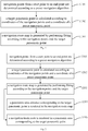
- Fig. 1 is a flowchart of a method for generating a navigation route according to an embodiment of the present disclosure. As shown in the figure, the method includes followings.
- navigation points from a start point to an end point are determined according to a preset navigation algorithm.
- a preset navigation algorithm when performing a route planning according to the start point and the end point, a preset navigation algorithm is configured to calculate navigation points between the start point and the end point, and the navigation points correspond to locations such as an intersection, a road and the like passing between the start point and the end point.
- the foregoing preset navigation algorithm may be an A* algorithm, a Dijkstra algorithm and the like.
- the method for calculating the navigation points on the route passing through from the start point to the end point by using the preset algorithm may be implemented by a method that implements the same or similar functions in the prior art, and the details are not described herein.
- a target panoramic point is determined according to coordinates of the navigation points and a coordinate of a preset panoramic point.
- the panoramic point directly reflects the real environment including terrains, roads, buildings and the like.
- the panoramic point is stitched by images of the real world, which may truly and objectively reflect the image information around a certain location, providing a realistic three-dimensional experience, and the displayed panoramic image can be freely rotated and scaled.
- the method for generating the navigation route introduces the panoramic point between the start point and the end point so as to implement the navigation.
- the corresponding coordinates for each preset panoramic point may be acquired in advance, such that a target panoramic point is determined according to the coordinates of the navigation points and the coordinate of the preset panoramic point.
- the panoramic point is generally collected along the road surface 5 to 10 meters, and the position of the navigation point is related to the navigation algorithm for calculation, not every navigation point completely corresponds to the target panoramic point in conformity with its coordinates.
- the coordinates of the target panoramic point and of the navigation point may have multiple corresponding situations. Therefore, the target panoramic point needs to be determined according to specific situations, which will be described as follows.
- the target panoramic point with the coordinate same as the coordinate of the navigation point are determined according to the coordinate of the preset panoramic point.
- the target panoramic point having a coordinate distance from the navigation point within a preset range may be determined according to the coordinate of the preset panoramic point.
- the target panoramic point on the line connecting the navigation points may be determined according to the coordinate of the present panoramic point.
- a navigation route map is generated by performing fitting according to the navigation points and the target panoramic point.
- the navigation route map is generated by performing fitting according to the navigation points and the target panoramic point, such that the navigation route may provide the user with a universal navigation function based on the navigation points, and the panoramic point in the navigation route map may also facilitate the user to visually view the navigation route according to the panoramic point, providing convenience for the user during travelling.
- a smoothing process may be performed according to the navigation points and the target panoramic point in the actual execution process. The details are described as follows.
- the navigation point having the same coordinate as that of the target panoramic point may be deleted, and the navigation route map is generated according to the target panoramic point and the remaining navigation points.
- the navigation point within the preset range from the target panoramic point is deleted, and the navigation route map is generated according to the target panoramic point and the remaining navigation points.
- the target panoramic point on the line connecting the navigation points is inserted, and the navigation route map is generated according to the target panoramic point and the navigation points.
- navigation points from a start point to an end point are determined according to a preset navigation algorithm
- a target panoramic point is determined according to coordinates of the navigation points and a coordinate of a preset panoramic point
- a navigation route map is generated by performing fitting according to the navigation points and the target panoramic point. Therefore, the panoramic point is introduced in the navigation route map, which facilitates the user to visually view the navigation route according to the panoramic point and provides convenience for the user during travelling.
- a corresponding navigation track route may be rendered in the panoramic area provided by the panoramic point. The details are described as follows.
- Fig. 2 is a flowchart of a method for generating a navigation route according to an embodiment of the present disclosure. As shown in Fig. 2 , the method includes followings.
- navigation points from a start point to an end point are determined according to a preset navigation algorithm.
- a target panoramic point is determined according to coordinates of the navigation points and a coordinate of a preset panoramic point.
- a navigation route map is generated by performing fitting according to the navigation points and the target panoramic point.
- a panoramic area entrance corresponding to the target panoramic point is rendered in the navigation route map.
- the panoramic area entrance corresponding to the target panoramic point may be rendered in the navigation route map, such that only when the user triggers the relevant entrance, the panoramic area corresponding to the target panoramic point can be rendered in the navigation route map for the user.
- a panoramic area entrance corresponding to the target panoramic point may be rendered in the navigation route map.
- the panoramic area entrances corresponding to the target panoramic points including the Kaituo Road and the Sixth Street may be respectively bound in the navigation route map, such that the user is provided with the panoramic area corresponding to the relevant panoramic points only when the user triggers the corresponding panoramic area entrance.
- the range of the panoramic area rendered for each panoramic point has a certain limit.
- the navigation route is no longer displayed until the user deviates from the navigation route for a certain distance.
- a navigation track route is rendered in a panoramic area corresponding to the target panoramic point.
- the navigation track route may also be rendered in the panoramic area corresponding to the target panoramic point.
- the navigation track route may be a continuous track in the panoramic area, or may be any other marks indicating the traveling direction, such as an intermittent track, an arrow indicator, and the like.
- the navigation track route may be provided to indicate the travelling direction for the user at the meantime of entering a certain target panoramic point and displaying the panoramic area corresponding to the target panoramic point.
- reference coordinates corresponding to the navigation route may be determined in the panoramic area, and the navigation track route is rendered in the panoramic area according to the reference coordinates.
- the navigation track route is rendered in the panoramic area corresponding to the target panoramic point. Therefore, it is ensured that the user may clearly know the current navigation direction in the panoramic area, providing convenience to the user during travelling.
- the present disclosure also provides an apparatus for generating a navigation route.
- Fig. 5 is a schematic structural diagram of an apparatus for generating a navigation route according to an embodiment of the present disclosure. As shown in FIG. 5 , the apparatus for generating the navigation route includes: a first determining module 10, a second determining module 20, and a generating module 30.
- the first determining module 10 is configured to determine navigation points from a start point to an end point according to a preset navigation algorithm.
- the first determining module 10 when performing a route planning according to the start point and the end point, the first determining module 10 needs to use a preset navigation algorithm to calculate navigation points between the start point and the end point.
- the navigation points correspond to locations such as an intersection, a road and the like on the route passing through from the start point to the end point.
- the second determining module 20 is configured to determine a target panoramic point according to coordinates of the navigation points and a coordinate of a preset panoramic point.
- the corresponding coordinates for each preset panoramic point may be acquired in advance, such that the second determining module 20 may determine a target panoramic point according to the coordinates of the navigation points and the coordinate of the preset panoramic point.
- the panoramic point is generally collected along the road surface 5 to 10 meters, and the position of the navigation point is related to the navigation algorithm for calculation, not every navigation point completely corresponds to the target panoramic point in conformity with its coordinates.
- the coordinates of the target panoramic point and of the navigation point may have multiple corresponding situations. Therefore, the target panoramic point needs to be determined according to specific situations, which will be described as follows.
- the second determining module 20 may determine the target panoramic point with the coordinate same as the coordinate of the navigation point according to the coordinate of the preset panoramic point.
- the second determining module 20 may determine the target panoramic point having a coordinate distance from the navigation point within a preset range according to the coordinate of the preset panoramic point.
- the second determining module 20 may determine the target panoramic point on the line connecting the navigation points according to the coordinate of the present panoramic point.
- the generating module 30 is configured to perform fitting according to the navigation points and the target panoramic point to generate a navigation route map.
- the generating module 30 performs fitting according to the navigation points and the target panoramic point to generate the navigation route map, such that the navigation route may provide the user with a universal navigation function based on the navigation points, and the panoramic point in the navigation route map may also facilitate the user to visually view the navigation route according to the panoramic point, providing convenience for the user during travelling.
- the generating module 30 may perform a smoothing process according to the navigation points and the target panoramic point in the actual execution process. The details are described as follows.
- the generating module 30 may delete the navigation point having the same coordinate as that of the target panoramic point, and generate the navigation route map according to the target panoramic point and the remaining navigation points.
- the generating module 30 may delete the navigation point within the preset range from the target panoramic point, and generate the navigation route map according to the target panoramic point and the remaining navigation points.
- the generating module 30 may insert the target panoramic point on the line connecting the navigation points, and generate the navigation route map according to the target panoramic point and the navigation points.
- navigation points from a start point to an end point are determined according to a preset navigation algorithm
- a target panoramic point is determined according to coordinates of the navigation points and a coordinate of a preset panoramic point
- a navigation route map is generated by performing fitting according to the navigation points and the target panoramic point. Therefore, the panoramic point is introduced in the navigation route map, which facilitates the user to visually view the navigation route according to the panoramic point and provides convenience for the user during travelling.
- a corresponding navigation track route may be rendered in the panoramic area provided by the panoramic point. The details are described as follows.
- Fig. 6 is a schematic structural diagram of an apparatus for generating a navigation route according to another embodiment of the present disclosure. As shown in Fig. 6 , based on the illustration of Fig. 5 , the apparatus for generating the navigation route also includes a first rendering module 40.
- the first rendering module 40 is configured to render a panoramic area entrance corresponding to the target panoramic point in the navigation route map.
- the first rendering module 40 may render the panoramic area entrance corresponding to the target panoramic point in the navigation route map, such that only when the user triggers the relevant entrance, the panoramic area corresponding to the target panoramic point can be rendered in the navigation route map for the user.
- Fig. 7 is a schematic structural diagram of an apparatus for generating a navigation route according to yet another embodiment of the present disclosure. As shown in Fig. 7 , based on the illustration of Fig. 5 , the apparatus for generating the navigation route also includes a second rendering module 50.
- the second rendering module 50 may also render the navigation track route in the panoramic area corresponding to the target panoramic point.
- the navigation track route may be a continuous track in the panoramic area, or may be any other marks indicating the traveling direction, such as an intermittent track, an arrow indicator, and the like.
- the apparatus for generating the navigation route according to the embodiment of the present disclosure, after the navigation route map is generated by performing fitting according to the navigation points and the target panoramic point, the navigation track route is rendered in the panoramic area corresponding to the target panoramic point. Therefore, it is ensured that the user may clearly know the current navigation direction in the panoramic area, providing convenience to the user during travelling.
Landscapes
- Engineering & Computer Science (AREA)
- Radar, Positioning & Navigation (AREA)
- Remote Sensing (AREA)
- Automation & Control Theory (AREA)
- Physics & Mathematics (AREA)
- General Physics & Mathematics (AREA)
- Multimedia (AREA)
- Navigation (AREA)
Abstract
Description
- This application claims priority to Chinese Patent Application Serial No.
201610877706.5, filed on September 30, 2016 - The present disclosure relates to a field of route navigation technologies, and in particular, to a method and an apparatus for generating a navigation route.
- With the advancement of technology, map navigation has become a common function in users' productions and lives. Map navigation provides users with convenient and effective navigation routes for activities such as driving, traveling and the like to ensure that the users can reach the destination smoothly.
- In the related art, the navigation route is planned and generated according to navigation points between a start point and an end point on a plane map, such that the user may compare with the navigation route according to the location of the user himself/herself during the traveling process, and smoothly reach the end point.
- However, since the above navigation route is generated on the plane map, there is a high requirement for the user's ability of the image recognition. The user may not know how to proceed in the real environment even if he/she obtains the navigation route, making the navigation function failure.
- The object of the present disclosure is to solve at least one of the above technical problems to some extent.
- To this end, the first object of the present disclosure is to provide a method for generating a navigation route, which introduces a panoramic point in the navigation route map, facilitating the user to visually view the navigation route according to the panoramic point and providing convenience for the user during travelling.
- A second object of the present disclosure is to provide an apparatus for generating a navigation route.
- A third object of the present disclosure is to provide another apparatus for generating a navigation route.
- A fourth object of the present disclosure is to provide a non-transitory computer readable storage medium.
- A fifth object of the present disclosure is to provide a computer program product.
- A sixth object of the present disclosure is to provide a device.
- A seventh object of the present disclosure is to provide a non-volatile computer storage medium.
- In order to achieve the above objects, a first aspect of the present disclosure provides a method for generating a navigation route, including: determining navigation points from a start point to an end point according to a preset navigation algorithm; determining a target panoramic point according to coordinates of the navigation points and a coordinate of a preset panoramic point; and performing fitting according to the navigation points and the target panoramic point to generate a navigation route map.
- With the method for generating the navigation route according to embodiments of the present disclosure, navigation points from a start point to an end point are determined according to a preset navigation algorithm, a target panoramic point is determined according to coordinates of the navigation points and a coordinate of a preset panoramic point, and a navigation route map is generated by performing fitting according to the navigation points and the target panoramic point. Therefore, the panoramic point is introduced in the navigation route map, which facilitates the user to visually view the navigation route according to the panoramic point and provides convenience for the user during travelling.
- In addition, the method for generating the navigation route according to embodiments of the present disclosure also has the following additional technical features.
- In an embodiment of the present disclosure, determining the target panoramic point according to the coordinates of the navigation points and the coordinate of the preset panoramic point may include: determining the target panoramic point having the coordinate same as a coordinate of a navigation point among the navigation points according to the coordinate of the preset panoramic point; and/or determining the target panoramic point having a coordinate distance from a navigation point among the navigation points within a preset range according to the coordinate of the preset panoramic point; and/or determining the target panoramic point on a line connecting the coordinates of navigation points according to the coordinate of the present panoramic point.
- In an embodiment of the present disclosure, performing fitting according to the navigation points and the target panoramic point to generate a navigation route map may include: deleting a navigation point among the navigation points which has a coordinate same as the coordinate of the target panoramic point, and generating the navigation route map according to the target panoramic point and remaining navigation points; and/or deleting a navigation point among the navigation points which has a coordinate distance from the target panoramic point within a preset range, and generating the navigation route map according to the target panoramic point and remaining navigation points; and/or inserting the target panoramic point on a line connecting the navigation points, and generating the navigation route map according to the target panoramic point and the navigation points.
- In an embodiment of the present disclosure, after performing fitting according to the navigation points and the target panoramic point to generate a navigation route map, the method may also include: rendering a panoramic area entrance corresponding to the target panoramic point in the navigation route map.
- In an embodiment of the present disclosure, performing fitting according to the navigation points and the target panoramic point to generate a navigation route map, the method may also include: rendering a navigation track route in a panoramic area corresponding to the target panoramic point.
- In an embodiment of the present disclosure, rendering the navigation track route in the panoramic area corresponding to the target panoramic point may include: determining a reference coordinate in the panoramic area; and rendering the navigation track route in the panoramic area according to the reference coordinate.
- In order to achieve the above objects, a second aspect of the present disclosure provides an apparatus for generating a navigation route, including: a first determining module, configured to determine navigation points from a start point to an end point according to a preset navigation algorithm; a second determining module, configured to determine a target panoramic point according to coordinates of the navigation points and a coordinate of a preset panoramic point; and a generating module, configured to perform fitting according to the navigation points and the target panoramic point to generate a navigation route map.
- With the apparatus for generating the navigation route according to embodiments of the present disclosure, navigation points from a start point to an end point are determined according to a preset navigation algorithm, a target panoramic point is determined according to coordinates of the navigation points and a coordinate of a preset panoramic point, and a navigation route map is generated by performing fitting according to the navigation points and the target panoramic point. Therefore, the panoramic point is introduced in the navigation route map, which facilitates the user to visually view the navigation route according to the panoramic point and provides convenience for the user during travelling.
- In addition, the apparatus for generating the navigation route according to embodiments of the present disclosure also has the following additional technical features.
- In an embodiment of the present disclosure, the second determining module is configured to: determine the target panoramic point having the coordinate same as a coordinate of a navigation point among the navigation points according to the coordinate of the preset panoramic point; and/or determine the target panoramic point having a coordinate distance from a navigation point among the navigation points within a preset range according to the coordinate of the preset panoramic point; and/or determine the target panoramic point on a line connecting the coordinates of navigation points according to the coordinate of the present panoramic point.
- In an embodiment of the present disclosure, the generating module is configured to: delete a navigation point among the navigation points which has a coordinate same as the coordinate of the target panoramic point, and generate the navigation route map according to the target panoramic point and remaining navigation points; and/or delete a navigation point among the navigation points which has a coordinate distance from the target panoramic point within a preset range, and generate the navigation route map according to the target panoramic point and remaining navigation points; and/or insert the target panoramic point on a line connecting the navigation points, and generate the navigation route map according to the target panoramic point and the navigation points.
- In an embodiment of the present disclosure, the apparatus also includes: a first rendering module, configured to render a panoramic area entrance corresponding to the target panoramic point in the navigation route map.
- In an embodiment of the present disclosure, the apparatus also includes: a second rendering module, configured to render a navigation track route in a panoramic area corresponding to the target panoramic point.
- In an embodiment of the present disclosure, the second rendering module includes: a determining unit, configured to determine a reference coordinate in the panoramic area; and a rendering unit, configured to render the navigation track route in the panoramic area according to the reference coordinate.
- In order to achieve the above objects, a third aspect of the present disclosure provides another apparatus for generating a navigation route, including: a processor; a memory for storing processor executable instructions, in which the processor is configured to: determine navigation points from a start point to an end point according to a preset navigation algorithm; determine a target panoramic point according to coordinates of the navigation points and a coordinate of a preset panoramic point; and perform fitting according to the navigation points and the target panoramic point to generate a navigation route map.
- In order to achieve the above objects, a fourth aspect of the present disclosure provides a non-transitory computer readable storage medium, in which when an instruction in the storage medium is executed by a processor of a mobile terminal, a mobile terminal is caused to perform a method for generating a navigation route. The method includes: determining navigation points from a start point to an end point according to a preset navigation algorithm; determining a target panoramic point according to coordinates of the navigation points and a coordinate of a preset panoramic point; and performing fitting according to the navigation points and the target panoramic point to generate a navigation route map.
- In order to achieve the above objects, a fifth aspect of the present disclosure provides a computer program product, in which when instructions in the computer program product are executed by a processor, the method for generating a navigation route is performed. The method includes: determining navigation points from a start point to an end point according to a preset navigation algorithm; determining a target panoramic point according to coordinates of the navigation points and a coordinate of a preset panoramic point; and performing fitting according to the navigation points and the target panoramic point to generate a navigation route map.
- A sixth aspect of the present disclosure provides a device, including: one or more processors; a memory; one or more programs stored in the memory, when the one or more programs are executed by the one or more processors, following acts are performed: determining navigation points from a start point to an end point according to a preset navigation algorithm; determining a target panoramic point according to coordinates of the navigation points and a coordinate of a preset panoramic point; and performing fitting according to the navigation points and the target panoramic point to generate a navigation route map.
- A seventh aspect of the present disclosure provides a non-volatile computer storage medium storing one or more programs, when the one or more programs are executed by a device, the device is caused to perform following acts: determining navigation points from a start point to an end point according to a preset navigation algorithm; determining a target panoramic point according to coordinates of the navigation points and a coordinate of a preset panoramic point; and performing fitting according to the navigation points and the target panoramic point to generate a navigation route map.
- Additional aspects and advantages of embodiments of present disclosure will be given in part in the following descriptions, become apparent in part from the following descriptions, or be learned from the practice of the embodiments of the present disclosure.
- The aforementioned and/or additional aspects and advantages of the present disclosure will become apparent and easy to understand through the following embodiments associated with the accompanying drawings, in which,
-
Fig. 1 is a flowchart of a method for generating a navigation route according to an embodiment of the present disclosure; -
Fig. 2 is a flowchart of a method for generating a navigation route according to an embodiment of the present disclosure; -
Fig. 3 is a schematic diagram of an interface of a navigation route map with a panoramic area entrance corresponding to a target panoramic point according to an embodiment of the present disclosure; -
Fig. 4 is a schematic diagram of an interface of a navigation track route in a panoramic area corresponding to a target panoramic point according to an embodiment of the present disclosure; -
Fig. 5 is a schematic structural diagram of an apparatus for generating a navigation route according to an embodiment of the present disclosure; -
Fig. 6 is a schematic structural diagram of an apparatus for generating a navigation route according to another embodiment of the present disclosure; and -
Fig. 7 is a schematic structural diagram of an apparatus for generating a navigation route according to yet another embodiment of the present disclosure. - The embodiments of the present disclosure are described in detail below, and the examples of the embodiments are illustrated in the drawings, in which the same or similar reference numerals are used to refer to the same or similar elements or elements having the same or similar functions. The embodiments described below with reference to the drawings are intended to illustrate the present disclosure and are not to be construed as a limitation.
- A method and an apparatus for generating a navigation route according to embodiments of the present disclosure will be described below with reference to the accompanying drawings.
- Generally, a method for calculating a navigation route in a plane map is to calculate according to related algorithms (such as, the Dijkstra algorithm). The current position and the traveling direction of the user are represented on the plane map by related positioning functions, and then the user may compare with the navigation route according to the location of the user himself/herself during the traveling process, and smoothly reach the end point.
- However, since the navigation route on the plane map is formed by connecting a plurality of navigation points from the start point to the end point, it is only a schematic diagram of a two-dimensional plane. When the user's ability of the image recognition is not strong, he/she cannot combine the real environment with the navigation route. Therefore, the user may not know how to proceed in the real environment even if he/she obtains the navigation route, making the navigation function failure.
- In order to solve the above problems, the present disclosure provides a method for generating a navigation route, which may add a panoramic point in the navigation route map, facilitating the user to visually view the navigation route according to the panoramic point and providing convenience for the user during travelling. The details are described as follows.
-
Fig. 1 is a flowchart of a method for generating a navigation route according to an embodiment of the present disclosure. As shown in the figure, the method includes followings. - At block S101, navigation points from a start point to an end point are determined according to a preset navigation algorithm.
- Specifically, when performing a route planning according to the start point and the end point, a preset navigation algorithm is configured to calculate navigation points between the start point and the end point, and the navigation points correspond to locations such as an intersection, a road and the like passing between the start point and the end point. It should be noted that the foregoing preset navigation algorithm may be an A* algorithm, a Dijkstra algorithm and the like.
- It should be noted that the method for calculating the navigation points on the route passing through from the start point to the end point by using the preset algorithm may be implemented by a method that implements the same or similar functions in the prior art, and the details are not described herein.
- At block S102, a target panoramic point is determined according to coordinates of the navigation points and a coordinate of a preset panoramic point.
- It can be understood that the panoramic point directly reflects the real environment including terrains, roads, buildings and the like. The panoramic point is stitched by images of the real world, which may truly and objectively reflect the image information around a certain location, providing a realistic three-dimensional experience, and the displayed panoramic image can be freely rotated and scaled.
- In addition, since the panoramic point is collected along the road based on the panoramic technology, in order to provide a more intuitive navigation, the method for generating the navigation route according to embodiments of the present disclosure introduces the panoramic point between the start point and the end point so as to implement the navigation.
- Specifically, the corresponding coordinates for each preset panoramic point may be acquired in advance, such that a target panoramic point is determined according to the coordinates of the navigation points and the coordinate of the preset panoramic point.
- It should be noted that, since the panoramic point is generally collected along the road surface 5 to 10 meters, and the position of the navigation point is related to the navigation algorithm for calculation, not every navigation point completely corresponds to the target panoramic point in conformity with its coordinates. In other words, during the process of acquiring the target panoramic point corresponding to the navigation point, the coordinates of the target panoramic point and of the navigation point may have multiple corresponding situations. Therefore, the target panoramic point needs to be determined according to specific situations, which will be described as follows.
- In an embodiment of the present disclosure, when the coordinate of the preset panoramic point and the coordinate of the navigation point are the same, i.e., there is two-dimensional display coordinate for the navigation point corresponding to the three-dimensional display coordinate of the preset panoramic point, the target panoramic point with the coordinate same as the coordinate of the navigation point are determined according to the coordinate of the preset panoramic point.
- In an embodiment of the present disclosure, when the coordinates of some preset panoramic points are different from the coordinate of the navigation point, but a preset panoramic point are within a relatively close range of the navigation points near them, there is no significant influence on the direction of the navigation if the preset panoramic point is introduced. Therefore, the target panoramic point having a coordinate distance from the navigation point within a preset range may be determined according to the coordinate of the preset panoramic point.
- In an embodiment of the present disclosure, when the coordinates of some preset panoramic points are different from the coordinate of the navigation point, but a coordinate of a preset panoramic points is located on a line connecting two navigation points, there is no significant influence on the direction of the navigation if the preset panoramic point is introduced. Therefore, the target panoramic point on the line connecting the navigation points may be determined according to the coordinate of the present panoramic point.
- At block S103, a navigation route map is generated by performing fitting according to the navigation points and the target panoramic point.
- Specifically, after the target panoramic point is determined, the navigation route map is generated by performing fitting according to the navigation points and the target panoramic point, such that the navigation route may provide the user with a universal navigation function based on the navigation points, and the panoramic point in the navigation route map may also facilitate the user to visually view the navigation route according to the panoramic point, providing convenience for the user during travelling.
- It should be noted that, when performing fitting according to the navigation points and the target panoramic point to generate a navigation route map, in order to make the generated navigation route map clear and elegant, a smoothing process may be performed according to the navigation points and the target panoramic point in the actual execution process. The details are described as follows.
- In an embodiment of the present disclosure, when the coordinate of the navigation point corresponds to that of the target panoramic point, the navigation point having the same coordinate as that of the target panoramic point may be deleted, and the navigation route map is generated according to the target panoramic point and the remaining navigation points.
- In an embodiment of the present disclosure, when the target panoramic point is within a preset distance range from the navigation point in the vicinity, the navigation point within the preset range from the target panoramic point is deleted, and the navigation route map is generated according to the target panoramic point and the remaining navigation points.
- In an embodiment of the present disclosure, when the target panoramic point is on a line connecting the navigation points, the target panoramic point on the line connecting the navigation points is inserted, and the navigation route map is generated according to the target panoramic point and the navigation points.
- In summary, with the method for generating the navigation route according to embodiments of the present disclosure, navigation points from a start point to an end point are determined according to a preset navigation algorithm, a target panoramic point is determined according to coordinates of the navigation points and a coordinate of a preset panoramic point, and a navigation route map is generated by performing fitting according to the navigation points and the target panoramic point. Therefore, the panoramic point is introduced in the navigation route map, which facilitates the user to visually view the navigation route according to the panoramic point and provides convenience for the user during travelling.
- Based on the above embodiments, it should be understood that in order to provide a clear navigation service for the user, a corresponding navigation track route may be rendered in the panoramic area provided by the panoramic point. The details are described as follows.
-
Fig. 2 is a flowchart of a method for generating a navigation route according to an embodiment of the present disclosure. As shown inFig. 2 , the method includes followings. - At block S201, navigation points from a start point to an end point are determined according to a preset navigation algorithm.
- At block S202, a target panoramic point is determined according to coordinates of the navigation points and a coordinate of a preset panoramic point.
- At block S203, a navigation route map is generated by performing fitting according to the navigation points and the target panoramic point.
- It should be noted that the foregoing explanations of acts in blocks S101 to S103 are also applicable to the explanations of acts in blocks S201 to S203, which will not be described in detail herein.
- At block S204, a panoramic area entrance corresponding to the target panoramic point is rendered in the navigation route map.
- It can be understood that, it is possible that the user is particularly familiar with a certain route in the navigation route in practical applications. Therefore, in order to avoid waste of traffic, it is not necessary to provide the user with the panoramic area corresponding to the target panoramic point in this route.
- Therefore, in order to selectively provide the panoramic area for the user, when the user is not familiar with the panoramic area corresponding to the target panoramic point in the route, the panoramic area entrance corresponding to the target panoramic point may be rendered in the navigation route map, such that only when the user triggers the relevant entrance, the panoramic area corresponding to the target panoramic point can be rendered in the navigation route map for the user.
- For example, when performing fitting according to navigation points between the user's current location and Tsinghua University and a determined target panoramic point to generate a navigation route, a panoramic area entrance corresponding to the target panoramic point may be rendered in the navigation route map.
- That is, as shown in
Fig. 3 , the panoramic area entrances corresponding to the target panoramic points including the Kaituo Road and the Sixth Street may be respectively bound in the navigation route map, such that the user is provided with the panoramic area corresponding to the relevant panoramic points only when the user triggers the corresponding panoramic area entrance. - In addition, it should be noted that, in an embodiment of the present disclosure, the range of the panoramic area rendered for each panoramic point has a certain limit. In order to save the user's traffic, under the premise that the route ahead and behind the panoramic point can be clearly displayed and the user can freely travel within the panoramic area, the navigation route is no longer displayed until the user deviates from the navigation route for a certain distance.
- At block S205, a navigation track route is rendered in a panoramic area corresponding to the target panoramic point.
- Specifically, in order to ensure that the user can clearly know the current navigation direction in the panoramic area, the navigation track route may also be rendered in the panoramic area corresponding to the target panoramic point.
- The navigation track route may be a continuous track in the panoramic area, or may be any other marks indicating the traveling direction, such as an intermittent track, an arrow indicator, and the like.
- For example, as shown in
Fig. 4 , the navigation track route may be provided to indicate the travelling direction for the user at the meantime of entering a certain target panoramic point and displaying the panoramic area corresponding to the target panoramic point. - It should be noted that, different manners may be used to render the navigation track route in the panoramic area corresponding to the target panoramic point according to different application scenarios. Examples are taken as follows.
- As an example, reference coordinates corresponding to the navigation route may be determined in the panoramic area, and the navigation track route is rendered in the panoramic area according to the reference coordinates.
- In summary, with the method for generating the navigation route according to the embodiment of the present disclosure, after the navigation route map is generated by performing fitting according to the navigation points and the target panoramic point, the navigation track route is rendered in the panoramic area corresponding to the target panoramic point. Therefore, it is ensured that the user may clearly know the current navigation direction in the panoramic area, providing convenience to the user during travelling.
- In order to implement the above embodiments, the present disclosure also provides an apparatus for generating a navigation route.
-
Fig. 5 is a schematic structural diagram of an apparatus for generating a navigation route according to an embodiment of the present disclosure. As shown inFIG. 5 , the apparatus for generating the navigation route includes: a first determiningmodule 10, a second determiningmodule 20, and agenerating module 30. - The first determining
module 10 is configured to determine navigation points from a start point to an end point according to a preset navigation algorithm. - Specifically, when performing a route planning according to the start point and the end point, the first determining
module 10 needs to use a preset navigation algorithm to calculate navigation points between the start point and the end point. The navigation points correspond to locations such as an intersection, a road and the like on the route passing through from the start point to the end point. - The second determining
module 20 is configured to determine a target panoramic point according to coordinates of the navigation points and a coordinate of a preset panoramic point. - Specifically, the corresponding coordinates for each preset panoramic point may be acquired in advance, such that the second determining
module 20 may determine a target panoramic point according to the coordinates of the navigation points and the coordinate of the preset panoramic point. - It should be noted that, since the panoramic point is generally collected along the road surface 5 to 10 meters, and the position of the navigation point is related to the navigation algorithm for calculation, not every navigation point completely corresponds to the target panoramic point in conformity with its coordinates. In other words, during the process of the second determining
module 20 acquiring the target panoramic point corresponding to the navigation point, the coordinates of the target panoramic point and of the navigation point may have multiple corresponding situations. Therefore, the target panoramic point needs to be determined according to specific situations, which will be described as follows. - In an embodiment of the present disclosure, when the coordinate of the preset panoramic point and the coordinate of the navigation point are the same, i.e., there is two-dimensional display coordinate for the navigation point corresponding to the three-dimensional display coordinate of the preset panoramic point, the second determining
module 20 may determine the target panoramic point with the coordinate same as the coordinate of the navigation point according to the coordinate of the preset panoramic point. - In an embodiment of the present disclosure, when the coordinates of some preset panoramic points are different from the coordinate of the navigation point, but a preset panoramic point are within a relatively close range of the navigation points near them, there is no significant influence on the direction of the navigation if the preset panoramic point is introduced. Therefore, the second determining
module 20 may determine the target panoramic point having a coordinate distance from the navigation point within a preset range according to the coordinate of the preset panoramic point. - In an embodiment of the present disclosure, when the coordinates of some preset panoramic points are different from the coordinate of the navigation point, but a coordinate of a preset panoramic points is located on a line connecting two navigation points, there is no significant influence on the direction of the navigation if the preset panoramic point is introduced. Therefore, the second determining
module 20 may determine the target panoramic point on the line connecting the navigation points according to the coordinate of the present panoramic point. - The generating
module 30 is configured to perform fitting according to the navigation points and the target panoramic point to generate a navigation route map. - Specifically, after the target panoramic point is determined, the generating
module 30 performs fitting according to the navigation points and the target panoramic point to generate the navigation route map, such that the navigation route may provide the user with a universal navigation function based on the navigation points, and the panoramic point in the navigation route map may also facilitate the user to visually view the navigation route according to the panoramic point, providing convenience for the user during travelling. - It should be noted that, when performing fitting according to the navigation points and the target panoramic point to generate a navigation route map, in order to make the generated navigation route map clear and elegant, the generating
module 30 may perform a smoothing process according to the navigation points and the target panoramic point in the actual execution process. The details are described as follows. - In an embodiment of the present disclosure, when the coordinate of the navigation point corresponds to that of the target panoramic point, the generating
module 30 may delete the navigation point having the same coordinate as that of the target panoramic point, and generate the navigation route map according to the target panoramic point and the remaining navigation points. - In an embodiment of the present disclosure, when the target panoramic point is within a preset distance range from the navigation point in the vicinity, the generating
module 30 may delete the navigation point within the preset range from the target panoramic point, and generate the navigation route map according to the target panoramic point and the remaining navigation points. - In an embodiment of the present disclosure, when the target panoramic point is on a line connecting the navigation points, the generating
module 30 may insert the target panoramic point on the line connecting the navigation points, and generate the navigation route map according to the target panoramic point and the navigation points. - It should be noted that the foregoing explanations of the method for generating a navigation route are also applicable to the apparatus for generating a navigation route according to the embodiment of the present disclosure, and the implementation principles thereof are similar, which will not be described in detail herein.
- In summary, with the apparatus for generating the navigation route according to embodiments of the present disclosure, navigation points from a start point to an end point are determined according to a preset navigation algorithm, a target panoramic point is determined according to coordinates of the navigation points and a coordinate of a preset panoramic point, and a navigation route map is generated by performing fitting according to the navigation points and the target panoramic point. Therefore, the panoramic point is introduced in the navigation route map, which facilitates the user to visually view the navigation route according to the panoramic point and provides convenience for the user during travelling.
- Based on the above embodiments, it should be understood that in order to provide a clear navigation service for the user, a corresponding navigation track route may be rendered in the panoramic area provided by the panoramic point. The details are described as follows.
-
Fig. 6 is a schematic structural diagram of an apparatus for generating a navigation route according to another embodiment of the present disclosure. As shown inFig. 6 , based on the illustration ofFig. 5 , the apparatus for generating the navigation route also includes afirst rendering module 40. - The
first rendering module 40 is configured to render a panoramic area entrance corresponding to the target panoramic point in the navigation route map. - It can be understood that, it is possible that the user is particularly familiar with a certain route in the navigation route in practical applications. Therefore, in order to avoid waste of traffic, it is not necessary to provide the user with the panoramic area corresponding to the target panoramic point in this route.
- Therefore, in order to selectively provide the panoramic area for the user, when the user is not familiar with the panoramic area corresponding to the target panoramic point in the route, the
first rendering module 40 may render the panoramic area entrance corresponding to the target panoramic point in the navigation route map, such that only when the user triggers the relevant entrance, the panoramic area corresponding to the target panoramic point can be rendered in the navigation route map for the user. -
Fig. 7 is a schematic structural diagram of an apparatus for generating a navigation route according to yet another embodiment of the present disclosure. As shown inFig. 7 , based on the illustration ofFig. 5 , the apparatus for generating the navigation route also includes asecond rendering module 50. - Specifically, in order to ensure that the user can clearly know the current navigation direction in the panoramic area, the
second rendering module 50 may also render the navigation track route in the panoramic area corresponding to the target panoramic point. - The navigation track route may be a continuous track in the panoramic area, or may be any other marks indicating the traveling direction, such as an intermittent track, an arrow indicator, and the like.
- It should be noted that the foregoing explanations of the method for generating a navigation route are also applicable to the apparatus for generating a navigation route according to the embodiment of the present disclosure, and the implementation principles thereof are similar, which will not be described in detail herein.
- In summary, with the apparatus for generating the navigation route according to the embodiment of the present disclosure, after the navigation route map is generated by performing fitting according to the navigation points and the target panoramic point, the navigation track route is rendered in the panoramic area corresponding to the target panoramic point. Therefore, it is ensured that the user may clearly know the current navigation direction in the panoramic area, providing convenience to the user during travelling.
- In the description of the present specification, the descriptions with reference to the terms "one embodiment", "some embodiments", "example", "specific example", or "some examples" and the like mean that specific features, structures, materials or characteristics described in connection with an embodiment or an example are included in at least one embodiment or example of the present disclosure. In the present specification, the schematic representations of the above terms are not necessarily directed to the same embodiment or example. Furthermore, the described specific features, structures, materials, or characteristics may be combined in any one or more embodiments or examples in a suitable manner. In addition, those skilled in the art may incorporate and combine various embodiments or examples and features of various embodiments or examples described in the specification without causing any contradiction.
- Although the embodiments of the present disclosure have been illustrated and described above, it can be understood that the above-described embodiments are illustrative and are not to be construed as a limitation of the scope of the present disclosure. Those skilled in the art may change, modify, substitute and vary the above embodiments within the scope of the present disclosure.
Claims (14)
- A method for generating a navigation route, comprising:determining navigation points from a start point to an end point according to a preset navigation algorithm;determining a target panoramic point according to coordinates of the navigation points and a coordinate of a preset panoramic point; andperforming fitting according to the navigation points and the target panoramic point to generate a navigation route map.
- The method according to claim 1, determining the target panoramic point according to the coordinates of the navigation points and the coordinate of the preset panoramic point comprising:determining the target panoramic point having the coordinate same as a coordinate of a navigation point among the navigation points according to the coordinate of the preset panoramic point; and/ordetermining the target panoramic point having a coordinate distance from a navigation point among the navigation points within a preset range according to the coordinate of the preset panoramic point; and/ordetermining the target panoramic point on a line connecting the coordinates of navigation points according to the coordinate of the present panoramic point.
- The method according to claim 1 or 2, performing fitting according to the navigation points and the target panoramic point to generate the navigation route map comprising:deleting a navigation point among the navigation points which has a coordinate same as the coordinate of the target panoramic point, and generating the navigation route map according to the target panoramic point and remaining navigation points; and/ordeleting a navigation point among the navigation points which has a coordinate distance from the target panoramic point within a preset range, and generating the navigation route map according to the target panoramic point and remaining navigation points; and/orinserting the target panoramic point on a line connecting the navigation points, and generating the navigation route map according to the target panoramic point and the navigation points.
- The method according to any of claims 1 to 3, after performing fitting according to the navigation points and the target panoramic point to generate the navigation route map, the method further comprising:
rendering a panoramic area entrance corresponding to the target panoramic point in the navigation route map. - The method according to any of claims 1 to 4, after performing fitting according to the navigation points and the target panoramic point to generate the navigation route map, the method further comprising:
rendering a navigation track route in a panoramic area corresponding to the target panoramic point. - The method according to any of claims 1 to 5, rendering the navigation track route in the panoramic area corresponding to the target panoramic point comprising:determining a reference coordinate in the panoramic area; andrendering the navigation track route in the panoramic area according to the reference coordinate.
- An apparatus for generating a navigation rout, comprising:a first determining module, configured to determine navigation points from a start point to an end point according to a preset navigation algorithm;a second determining module, configured to determine a target panoramic point according to coordinates of the navigation points and a coordinate of a preset panoramic point; anda generating module, configured to perform fitting according to the navigation points and the target panoramic point to generate a navigation route map.
- The apparatus according to claim 7, the second determining module being configured to:determine the target panoramic point having the coordinate same as a coordinate of a navigation point among the navigation points according to the coordinate of the preset panoramic point; and/ordetermine the target panoramic point having a coordinate distance from a navigation point among the navigation points within a preset range according to the coordinate of the preset panoramic point; and/ordetermine the target panoramic point on a line connecting the coordinates of navigation points according to the coordinate of the present panoramic point.
- The apparatus according to claim 7 or 8, the generating module being configured to:delete a navigation point among the navigation points which has a coordinate same as the coordinate of the target panoramic point, and generate the navigation route map according to the target panoramic point and remaining navigation points; and/ordelete a navigation point among the navigation points which has a coordinate distance from the target panoramic point within a preset range, and generate the navigation route map according to the target panoramic point and remaining navigation points; and/orinsert the target panoramic point on a line connecting the navigation points, and generate the navigation route map according to the target panoramic point and the navigation points.
- The apparatus according to any of claims 7 to 9, further comprising:
a first rendering module, configured to render a panoramic area entrance corresponding to the target panoramic point in the navigation route map. - The apparatus according to any of claims 7 to 10, further comprising:
a second rendering module, configured to render a navigation track route in a panoramic area corresponding to the target panoramic point. - The apparatus according to any of claims 7 to 11, the second rendering module comprising:a determining unit, configured to determine a reference coordinate in the panoramic area; anda rendering unit, configured to render the navigation track route in the panoramic area according to the reference coordinate.
- A device, comprising:one or more processors;a memory;one or more programs stored in the memory, when the one or more programs are executed by the one or more processors, following acts being performed:determining navigation points from a start point to an end point according to a preset navigation algorithm;determining a target panoramic point according to coordinates of the navigation points and a coordinate of a preset panoramic point; andperforming fitting according to the navigation points and the target panoramic point to generate a navigation route map.
- A non-volatile computer storage medium, storing one or more programs, when the one or more programs are executed by a device, the device being caused to perform following acts:determining navigation points from a start point to an end point according to a preset navigation algorithm;determining a target panoramic point according to coordinates of the navigation points and a coordinate of a preset panoramic point; andperforming fitting according to the navigation points and the target panoramic point to generate a navigation route map.
Applications Claiming Priority (2)
| Application Number | Priority Date | Filing Date | Title |
|---|---|---|---|
| CN201610877706.5A CN106403978A (en) | 2016-09-30 | 2016-09-30 | Navigation route generating method and device |
| PCT/CN2016/110834 WO2018058810A1 (en) | 2016-09-30 | 2016-12-19 | Navigation route generating method and device |
Publications (2)
| Publication Number | Publication Date |
|---|---|
| EP3521758A1 true EP3521758A1 (en) | 2019-08-07 |
| EP3521758A4 EP3521758A4 (en) | 2020-09-09 |
Family
ID=59228364
Family Applications (1)
| Application Number | Title | Priority Date | Filing Date |
|---|---|---|---|
| EP16917555.1A Pending EP3521758A4 (en) | 2016-09-30 | 2016-12-19 | METHOD AND DEVICE FOR GENERATING A NAVIGATION ROUTE |
Country Status (7)
| Country | Link |
|---|---|
| US (1) | US11549820B2 (en) |
| EP (1) | EP3521758A4 (en) |
| JP (1) | JP6799675B2 (en) |
| KR (1) | KR102161390B1 (en) |
| CN (1) | CN106403978A (en) |
| SG (1) | SG11201902716UA (en) |
| WO (1) | WO2018058810A1 (en) |
Families Citing this family (7)
| Publication number | Priority date | Publication date | Assignee | Title |
|---|---|---|---|---|
| CN110646002B (en) * | 2018-06-27 | 2021-07-06 | 百度在线网络技术(北京)有限公司 | Method and apparatus for processing information |
| CN110017840B (en) * | 2019-04-16 | 2022-03-18 | 阿波罗智联(北京)科技有限公司 | Navigation data processing method and device, electronic equipment and computer readable medium |
| CN110555256B (en) * | 2019-08-28 | 2023-05-19 | 浙江鸿泉车联网有限公司 | GPS route simulation data generation method and device |
| CN110617817B (en) * | 2019-09-29 | 2022-04-08 | 阿波罗智联(北京)科技有限公司 | Navigation route determining method, device, equipment and storage medium |
| JP7363718B2 (en) * | 2020-08-26 | 2023-10-18 | トヨタ自動車株式会社 | Route determination system, route determination method and route determination program |
| CN114049410B (en) * | 2021-09-29 | 2025-05-09 | 广州文远知行科技有限公司 | A test route generation method, test method and device based on semantic map |
| CN116518980B (en) * | 2023-06-29 | 2023-09-12 | 亚信科技(南京)有限公司 | Navigation method, navigation device, electronic equipment and computer readable storage medium |
Family Cites Families (29)
| Publication number | Priority date | Publication date | Assignee | Title |
|---|---|---|---|---|
| DE59607547D1 (en) * | 1995-11-14 | 2001-09-27 | Mannesmann Ag | METHOD AND GUIDE UNIT FOR SAFE GUIDANCE OF A VEHICLE |
| JP3982273B2 (en) * | 2002-02-05 | 2007-09-26 | 三菱電機株式会社 | Navigation device |
| JP4506862B2 (en) | 2004-04-05 | 2010-07-21 | ソニー株式会社 | Navigation device, data processing method, and computer program |
| US7945383B2 (en) | 2005-04-20 | 2011-05-17 | Alpine Electronics, Inc | Route determination method and apparatus for navigation system |
| JP4917764B2 (en) * | 2005-06-14 | 2012-04-18 | 株式会社ゼンリン | MAP INFORMATION CREATION DEVICE, MAP INFORMATION CREATION METHOD, AND PROGRAM |
| EP1957940B1 (en) * | 2005-12-01 | 2014-09-17 | Robert Bosch Gmbh | Navigation method for at least one means of transportation |
| JP2007206014A (en) | 2006-02-06 | 2007-08-16 | Matsushita Electric Ind Co Ltd | Navigation device |
| US20080079808A1 (en) * | 2006-09-29 | 2008-04-03 | Jeffrey Michael Ashlock | Method and device for collection and application of photographic images related to geographic location |
| US8428873B2 (en) * | 2008-03-24 | 2013-04-23 | Google Inc. | Panoramic images within driving directions |
| JP2009250827A (en) * | 2008-04-08 | 2009-10-29 | Panasonic Corp | Navigation device, method, and program |
| US8150620B2 (en) | 2009-04-14 | 2012-04-03 | Alpine Electronics, Inc. | Route search method and apparatus for navigation system utilizing map data of XML format |
| JP5391891B2 (en) | 2009-07-15 | 2014-01-15 | 富士ゼロックス株式会社 | Information processing apparatus, information processing program, and information processing system |
| US20110022295A1 (en) * | 2009-07-27 | 2011-01-27 | Htc Corporation | Method for simulating navigation route, navigation apparatus and recording medium |
| CN102121831B (en) * | 2010-12-01 | 2013-01-09 | 北京腾瑞万里科技有限公司 | Real-time street view navigation method and device |
| US20120314899A1 (en) * | 2011-06-13 | 2012-12-13 | Microsoft Corporation | Natural user interfaces for mobile image viewing |
| US20130162665A1 (en) * | 2011-12-21 | 2013-06-27 | James D. Lynch | Image view in mapping |
| CN103017750B (en) * | 2012-07-03 | 2015-11-18 | 腾讯科技(深圳)有限公司 | Mobile terminal air navigation aid and corresponding navigational system |
| US9217646B2 (en) * | 2012-09-17 | 2015-12-22 | Alk Technologies, Inc. | Semi-autonomous route compliance navigation system and method |
| JP6181993B2 (en) * | 2012-12-04 | 2017-08-16 | 任天堂株式会社 | Information processing system, information processing apparatus, information processing program, and information transmission / reception method |
| CN104515529A (en) * | 2013-09-27 | 2015-04-15 | 高德软件有限公司 | Real-scenery navigation method and navigation equipment |
| US10126913B1 (en) * | 2013-11-05 | 2018-11-13 | Google Llc | Interactive digital map including context-based photographic imagery |
| CN103644921B (en) * | 2013-12-06 | 2017-10-31 | 北京奇虎科技有限公司 | It is a kind of to realize the method and apparatus that streetscape is shown |
| CN104613973B (en) * | 2014-05-07 | 2018-11-06 | 腾讯科技(深圳)有限公司 | Picture generation, methods of exhibiting and device |
| KR20150128140A (en) * | 2014-05-08 | 2015-11-18 | 현대모비스 주식회사 | Around view system |
| CN105300392B (en) * | 2014-05-27 | 2018-07-27 | 中国电信股份有限公司 | Methods, devices and systems for showing planning path in streetscape map |
| US9002647B1 (en) | 2014-06-27 | 2015-04-07 | Google Inc. | Generating turn-by-turn direction previews |
| CN104613975B (en) * | 2014-07-30 | 2019-03-08 | 腾讯科技(深圳)有限公司 | Method and device, server and system for displaying and sending street view images in navigation |
| CN105222773B (en) | 2015-09-29 | 2018-09-21 | 小米科技有限责任公司 | Air navigation aid and device |
| CN105157711A (en) * | 2015-10-14 | 2015-12-16 | 北京乐动卓越科技有限公司 | Navigation method and system for panoramic map |
-
2016
- 2016-09-30 CN CN201610877706.5A patent/CN106403978A/en active Pending
- 2016-12-19 KR KR1020197010774A patent/KR102161390B1/en active Active
- 2016-12-19 US US16/323,343 patent/US11549820B2/en active Active
- 2016-12-19 JP JP2019510704A patent/JP6799675B2/en active Active
- 2016-12-19 SG SG11201902716UA patent/SG11201902716UA/en unknown
- 2016-12-19 WO PCT/CN2016/110834 patent/WO2018058810A1/en not_active Ceased
- 2016-12-19 EP EP16917555.1A patent/EP3521758A4/en active Pending
Also Published As
| Publication number | Publication date |
|---|---|
| KR20190045943A (en) | 2019-05-03 |
| JP2019525193A (en) | 2019-09-05 |
| CN106403978A (en) | 2017-02-15 |
| WO2018058810A1 (en) | 2018-04-05 |
| SG11201902716UA (en) | 2019-05-30 |
| JP6799675B2 (en) | 2020-12-16 |
| KR102161390B1 (en) | 2020-09-29 |
| US20210293568A1 (en) | 2021-09-23 |
| US11549820B2 (en) | 2023-01-10 |
| EP3521758A4 (en) | 2020-09-09 |
Similar Documents
| Publication | Publication Date | Title |
|---|---|---|
| US11549820B2 (en) | Method and apparatus for generating navigation route and storage medium | |
| US11698268B2 (en) | Street-level guidance via route path | |
| CN102047301B (en) | Method for providing lane information and apparatus for executing the method | |
| WO2015109885A1 (en) | Navigation map displaying method and system | |
| CN113724397B (en) | Method, device, electronic device and storage medium for positioning virtual objects | |
| CN105300392A (en) | Method, device and system for displaying planned route in street view map | |
| CN104697545A (en) | Navigation prompt information processing method and device | |
| JP6244137B2 (en) | 3D map display system | |
| JP5883723B2 (en) | 3D image display system | |
| US9791287B2 (en) | Drive assist system, method, and program | |
| JP2019511718A (en) | Road name display method, device and storage medium | |
| CN114689063A (en) | Map modeling and navigation guiding method, electronic device and computer program product | |
| JP6345381B2 (en) | Augmented reality system | |
| JP2008128827A (en) | Navigation device, navigation method and program thereof | |
| Wang et al. | A system of automatic generation of landmark-based pedestrian navigation instructions and its effectiveness for wayfinding | |
| CN114677486B (en) | Map generation method and electronic device | |
| US20120331009A1 (en) | Map editing with little user input | |
| JP2016102735A (en) | Navigation system, navigation method, and navigation program | |
| Omer et al. | Virtual city design based on urban image theory | |
| Kumar et al. | Enhancement Of Navigation Technology Using Augmented Reality | |
| JP6164854B2 (en) | Map data generation method and computer program | |
| KR102231556B1 (en) | Apparatus and method for displaying buliding data around the junction when driving in an alley | |
| Kiruthika et al. | AR Cloud-Based Indoor Navigation | |
| JP6016684B2 (en) | 3D map display system | |
| CN113082698B (en) | Game display control method and device, electronic equipment and readable storage medium |
Legal Events
| Date | Code | Title | Description |
|---|---|---|---|
| STAA | Information on the status of an ep patent application or granted ep patent |
Free format text: STATUS: THE INTERNATIONAL PUBLICATION HAS BEEN MADE |
|
| PUAI | Public reference made under article 153(3) epc to a published international application that has entered the european phase |
Free format text: ORIGINAL CODE: 0009012 |
|
| STAA | Information on the status of an ep patent application or granted ep patent |
Free format text: STATUS: REQUEST FOR EXAMINATION WAS MADE |
|
| 17P | Request for examination filed |
Effective date: 20190404 |
|
| AK | Designated contracting states |
Kind code of ref document: A1 Designated state(s): AL AT BE BG CH CY CZ DE DK EE ES FI FR GB GR HR HU IE IS IT LI LT LU LV MC MK MT NL NO PL PT RO RS SE SI SK SM TR |
|
| AX | Request for extension of the european patent |
Extension state: BA ME |
|
| DAV | Request for validation of the european patent (deleted) | ||
| DAX | Request for extension of the european patent (deleted) | ||
| RIC1 | Information provided on ipc code assigned before grant |
Ipc: G01C 21/36 20060101AFI20200417BHEP |
|
| A4 | Supplementary search report drawn up and despatched |
Effective date: 20200811 |
|
| RIC1 | Information provided on ipc code assigned before grant |
Ipc: G01C 21/36 20060101AFI20200805BHEP |
|
| RAP3 | Party data changed (applicant data changed or rights of an application transferred) |
Owner name: BEIJING BAIDU NETCOM SCIENCE TECHNOLOGY CO., LTD. |
|
| RIN1 | Information on inventor provided before grant (corrected) |
Inventor name: SUN, JIEFENG |
|
| RAP3 | Party data changed (applicant data changed or rights of an application transferred) |
Owner name: BEIJING BAIDU NETCOM SCIENCE AND TECHNOLOGY CO., LTD. |
|
| RAP1 | Party data changed (applicant data changed or rights of an application transferred) |
Owner name: APOLLO INTELLIGENT DRIVING TECHNOLOGY (BEIJING) CO., LTD. |
|
| STAA | Information on the status of an ep patent application or granted ep patent |
Free format text: STATUS: EXAMINATION IS IN PROGRESS |
|
| 17Q | First examination report despatched |
Effective date: 20221110 |