EP3425876B1 - Location-based service implementing method and apparatus - Google Patents
Location-based service implementing method and apparatus Download PDFInfo
- Publication number
- EP3425876B1 EP3425876B1 EP17759127.8A EP17759127A EP3425876B1 EP 3425876 B1 EP3425876 B1 EP 3425876B1 EP 17759127 A EP17759127 A EP 17759127A EP 3425876 B1 EP3425876 B1 EP 3425876B1
- Authority
- EP
- European Patent Office
- Prior art keywords
- level
- region
- location
- service
- service request
- Prior art date
- Legal status (The legal status is an assumption and is not a legal conclusion. Google has not performed a legal analysis and makes no representation as to the accuracy of the status listed.)
- Active
Links
- 238000000034 method Methods 0.000 title claims description 19
- 230000004044 response Effects 0.000 claims description 11
- 238000004364 calculation method Methods 0.000 claims description 3
- 238000010586 diagram Methods 0.000 description 8
- 238000005516 engineering process Methods 0.000 description 3
- 238000004422 calculation algorithm Methods 0.000 description 2
- 230000006870 function Effects 0.000 description 2
- 230000000977 initiatory effect Effects 0.000 description 2
- 238000004590 computer program Methods 0.000 description 1
- 230000001419 dependent effect Effects 0.000 description 1
- 230000010365 information processing Effects 0.000 description 1
- 238000003672 processing method Methods 0.000 description 1
Images


Classifications
-
- H—ELECTRICITY
- H04—ELECTRIC COMMUNICATION TECHNIQUE
- H04W—WIRELESS COMMUNICATION NETWORKS
- H04W4/00—Services specially adapted for wireless communication networks; Facilities therefor
- H04W4/02—Services making use of location information
- H04W4/029—Location-based management or tracking services
-
- H—ELECTRICITY
- H04—ELECTRIC COMMUNICATION TECHNIQUE
- H04L—TRANSMISSION OF DIGITAL INFORMATION, e.g. TELEGRAPHIC COMMUNICATION
- H04L67/00—Network arrangements or protocols for supporting network services or applications
- H04L67/01—Protocols
- H04L67/10—Protocols in which an application is distributed across nodes in the network
- H04L67/1001—Protocols in which an application is distributed across nodes in the network for accessing one among a plurality of replicated servers
- H04L67/1004—Server selection for load balancing
- H04L67/1021—Server selection for load balancing based on client or server locations
-
- H—ELECTRICITY
- H04—ELECTRIC COMMUNICATION TECHNIQUE
- H04W—WIRELESS COMMUNICATION NETWORKS
- H04W4/00—Services specially adapted for wireless communication networks; Facilities therefor
- H04W4/02—Services making use of location information
- H04W4/021—Services related to particular areas, e.g. point of interest [POI] services, venue services or geofences
-
- G—PHYSICS
- G06—COMPUTING; CALCULATING OR COUNTING
- G06F—ELECTRIC DIGITAL DATA PROCESSING
- G06F16/00—Information retrieval; Database structures therefor; File system structures therefor
- G06F16/90—Details of database functions independent of the retrieved data types
- G06F16/901—Indexing; Data structures therefor; Storage structures
- G06F16/9014—Indexing; Data structures therefor; Storage structures hash tables
-
- H—ELECTRICITY
- H04—ELECTRIC COMMUNICATION TECHNIQUE
- H04L—TRANSMISSION OF DIGITAL INFORMATION, e.g. TELEGRAPHIC COMMUNICATION
- H04L65/00—Network arrangements, protocols or services for supporting real-time applications in data packet communication
- H04L65/40—Support for services or applications
-
- H—ELECTRICITY
- H04—ELECTRIC COMMUNICATION TECHNIQUE
- H04L—TRANSMISSION OF DIGITAL INFORMATION, e.g. TELEGRAPHIC COMMUNICATION
- H04L67/00—Network arrangements or protocols for supporting network services or applications
- H04L67/50—Network services
- H04L67/52—Network services specially adapted for the location of the user terminal
-
- H—ELECTRICITY
- H04—ELECTRIC COMMUNICATION TECHNIQUE
- H04L—TRANSMISSION OF DIGITAL INFORMATION, e.g. TELEGRAPHIC COMMUNICATION
- H04L67/00—Network arrangements or protocols for supporting network services or applications
- H04L67/50—Network services
- H04L67/535—Tracking the activity of the user
-
- H—ELECTRICITY
- H04—ELECTRIC COMMUNICATION TECHNIQUE
- H04W—WIRELESS COMMUNICATION NETWORKS
- H04W4/00—Services specially adapted for wireless communication networks; Facilities therefor
- H04W4/02—Services making use of location information
- H04W4/025—Services making use of location information using location based information parameters
Definitions
- the present disclosure relates to the field of communications technologies, and in particular, to a location-based service implementing method and apparatus.
- a region that a requesting location belongs to is usually first determined based on the GeoHash algorithm, and then a service needed by the user is searched for based on the determined region.
- the GeoHash algorithm a latitude and a longitude are encoded through a dichotomic search, and the sizes of the regions with different encoded latitudes are different. Because the size of a low-latitude region is greater than the size of a high-latitude region, considerable processing resources of a server are wasted when processing a service in the low-latitude region.
- 2013/054647 to Terauchi, dated 28 February 2013 discloses an information processing method that includes the operations of generating a search reference point geohash indicative of a grid including a search reference point specified by latitude/ longitude information; setting a primary search range at least including the grid represented by the generated search reference point geohash by use of a geohash; searching the primary search range for the search object by referencing a database configured to manage latitude/ longitude information and a geohash as positional information about search objects; setting a secondary search range formed by a grid with the search reference point at the center thereof by use of latitude/longitude information; and searching the secondary search range for the search object.
- the invention is defined by a method according to claim 1 and an apparatus according to claim 5. Further embodiments are defined by the dependent claims. Because all level-2 regions are of the same size, processing a service in a low-latitude region can save processing resources of a server, and improve performance of the server.
- first, second, third, etc. may be used in the present disclosure to describe various types of information, the information is not limited to the terms. These terms are only used to differentiate information of a same type. For example, without departing from the scope of the present disclosure, first information may also be referred to as second information, and similarly, the second information may be referred to as the first information. Depending on the context, for example, the word “if” used here may be explained as “while”, “when”, or "in response to determining”.
- FIG 1 is a flowchart illustrating a location-based service implementing method, according to an implementation of the present disclosure.
- the location-based service implementing method can be applied to a server, and includes the steps below.
- Step 101 Determine, based on a requesting location in a service request, a level-1 region that the service request belongs to.
- the service request is a request for obtaining a service object based on a location
- the service object includes a service provider, a service provided by the service provider, etc.
- the service request is usually initiated by a user, for example, the service request can be a request for searching for a restaurant, a parking lot, etc. near a current location.
- the level-1 region is usually divided by a developer in advance, for example, the developer can divide continent areas on the earth into a plurality of level-1 regions based on a predetermined size.
- the Chinese mainland is used as an example.
- the developer can divide the Chinese mainland into a plurality of level-1 regions based on a size of 0.5° x 0.5° (longitude x latitude).
- the requesting location included in the service request can be obtained, and the level-1 region that the service request belongs to is determined based on the requesting location.
- the requesting location is usually represented in a form of latitude and longitude coordinates. For example, assuming that the Chinese mainland is divided into a plurality of level-1 regions based on a size of 0.5° x 0.5° (longitude x latitude), and the requesting location lies at longitude 110.1° east and latitude 28.2° north, in this step, referring to FIG. 2 , it can be determined that the service request belongs to a level-1 region whose southwest coordinates are longitude 110° east and latitude 28° north and northeast coordinates are longitude 110.5° east and latitude 28.5° north.
- Step 102 Divide the level-1 region into a plurality of level-2 regions based on predetermined granularity.
- the predetermined granularity can be set by the developer.
- the developer can set the predetermined granularity to, for example, 50 meters or 100 meters based on a requirement for service granularity in actual disclosure. No limitation is imposed in the present disclosure.
- the level-1 region can be divided into a plurality of level-2 regions based on the predetermined granularity.
- the dividing the level-1 region into a plurality of level-2 regions can include the steps below.
- Step 1021 Determine a reference location in the level-1 region.
- the sizes of actual geographic regions mapped from different latitudes are different, for example, the size of an actual region that is mapped from changing latitude by one degree in a high-latitude region is smaller than the size in a low-latitude region. Therefore, in this step, the reference location can be determined based on a latitude of the level-1 region that the service request belongs to.
- a higher-latitude location in the level-1 region can be determined as the reference location, for example, a northeast corner or a northwest corner of the level-1 region can be determined as the reference location.
- a higher-latitude location in the level-1 region can also be determined as the reference location, for example, a southeast corner or a southwest corner of the level-1 region can be determined as the reference location.
- Step 1022 Reach an offset location by performing shifting in a predetermined direction by the predetermined granularity based on the reference location, and obtain offset coordinate information of the offset location.
- shifting can be performed in a low-latitude direction based on the reference location.
- shifting can be separately performed westwards and southwards by the granularity based on the northeast corner, and a location reached after the shifting is referred to as the offset location.
- shifting can be separately performed eastwards and southwards by the granularity based on the northwest corner, to reach the offset location.
- shifting can be separately performed westwards and northwards by the granularity based on the southeast corner, to reach the offset location.
- shifting can be separately performed eastwards and northwards by the granularity based on the southwest corner, to reach the offset location.
- the offset coordinate information of the offset location can be obtained.
- the coordinate information of the offset location can be referred to as offset coordinate information.
- the offset coordinate information can also be represented in a form of latitude and longitude coordinates.
- Step 1023 Calculate a change value between reference coordinate information of the reference location and the offset coordinate information.
- the change value between the reference coordinate information and the offset coordinate information can be calculated. For example, a difference between latitude and longitude coordinate values of the reference location and latitude and longitude coordinate values of the offset location is calculated.
- Step 1024 Determine a size of the level-2 region based on the change value.
- x and y can be determined as a length and a width of the level-2 region.
- Step 1025 Divide, based on the size of the level-2 region, the level-1 region that the service request belongs to into a plurality of level-2 regions.
- the level-1 region that the service request belongs to can be divided into a plurality of level-2 regions based on the determined size.
- the level-1 region can be divided into a plurality of level-2 regions along a boundary of the level-1 region starting from the northeast corner of the level-1 region.
- division when division is performed to obtain the level-2 region, division can be performed starting from any corner of the level-1 region, for example, the southeast corner, the northwest corner, or the southwest corner. No limitation is imposed in the present disclosure.
- the plurality of level-2 regions obtained through division can cover the level-1 region, that is, the sum of each size of the level-2 region obtained through division is usually greater than or equal to the size of the level-1 region.
- the sum of each size of the level-2 region obtained through division is equal to the size of the level-1 region, it indicates that the level-1 region is divided into a plurality of level-2 regions of the same size.
- Step 103 Determine, based on the requesting location, a level-2 region that the service request belongs to.
- the level-2 region that the service request belongs to can be determined based on the requesting location.
- Step 104 Respond to the service request based on location information of all service objects in the level-2 region that the service request belongs to and an adjacent level-2 region.
- step 103 After the level-2 region that the service request belongs to is determined, referring to FIG. 5 , the service request can be responded to based on the steps below.
- Step 1041 Obtain the location information of all the service objects in the level-2 region that the service request belongs to and the adjacent level-2 region.
- eight level-2 regions adjacent to the level-2 region can be determined. Referring to FIG 6 , assuming that a rectangular region located in the center is the level-2 region that the service request belongs to, eight level-2 regions that are numbered from 1 to 8 around the level-2 region are level-2 regions adjacent to the level-2 region. In this step, location information of all service objects in the level-2 region that the service request belongs to and the eight level-2 regions adjacent to the level-2 region can be obtained.
- the service request is a service request for searching for a restaurant near the current location
- location information of all restaurants in the level-2 region that the service request belongs to and the eight level-2 regions adjacent to the level-2 region can be obtained.
- Step 1042 Calculate a distance between each service object and the requesting location based on the location information of the service object.
- the distance between the service object and the requesting location can be calculated based on the location information.
- the service request for searching for a restaurant near the current location is still used as an example.
- a distance between each restaurant and the requesting location can be calculated based on the obtained location information of the restaurants.
- Step 1043 Push a service object with a distance satisfying a predetermined condition as a response to the service request.
- step 1042 after the distance between each service object and the requesting location is calculated, the service object with a distance satisfying the predetermined condition can be pushed to the user initiating the service request as the response to the service request.
- the predetermined condition is usually a distance condition, which can be set by the developer, or can be customized by the user initiating the service request. Assuming that the service request is a request for searching for a nearby restaurant, the user can customize a distance of searching for the restaurant, for example, 200 meters or 500 meters, and the predetermined condition is as follows: the distance is less than 200 meters or 500 meters. If the user does not customize the distance, a default distance set by the developer can be used, for example, 300 meters.
- the level-1 region that the service request belongs to can be determined based on the requesting location; the level-1 region is divided into a plurality of level-2 regions based on the predetermined granularity; and the service request is responded to based on the location information of all the service objects in the level-2 region that the service request belongs to and the adjacent level-2 region. Because all level-2 regions are of the same size, processing a service in a low-latitude region can save processing resources of a server, and improve performance of the server.
- the present disclosure further provides an implementation of a location-based service implementing apparatus.
- the implementation of the location-based service implementing apparatus in the present disclosure can be applied to a server.
- the apparatus implementation can be implemented by software, hardware, or a combination of hardware and software.
- Software implementation is used as an example.
- the software is formed by reading a corresponding computer program instruction in a non-volatile memory and running the instruction in a memory by a processor in a server of the apparatus.
- FIG. 7 is a hardware structural diagram illustrating a server of a location-based service implementing apparatus in the present disclosure.
- the server of the apparatus in the implementations can usually include other hardware based on an actual function of the server. Details are not described.
- FIG 8 is a schematic structural diagram illustrating a location-based service implementing apparatus, according to an implementation of the present disclosure.
- a location-based service implementing apparatus 700 can be applied to the server shown in FIG 7 , and the implementing apparatus 700 includes a first determining unit 701, a division unit 702, a second determining unit 703, and a service response unit 704.
- the division unit 702 can include a reference determining subunit 7021, a granularity shifting subunit 7022, a change calculation subunit 7023, a size determining subunit 7024, and a region division subunit 7025.
- the first determining unit 701 is configured to determine, based on a requesting location in a service request, a level-1 region that the service request belongs to.
- the division unit 702 is configured to divide the level-1 region into a plurality of level-2 regions based on predetermined granularity.
- the second determining unit 703 is configured to determine, based on the requesting location, a level-2 region that the service request belongs to.
- the service response unit 704 is configured to respond to the service request based on location information of all service objects in the level-2 region that the service request belongs to and an adjacent level-2 region.
- the reference determining subunit 7021 is configured to determine a reference location in the level-1 region.
- the granularity shifting subunit 7022 is configured to: reach an offset location by performing shifting in a predetermined direction by the granularity based on the reference location, and obtain offset coordinate information of the offset location.
- the change value calculation subunit 7023 is configured to calculate a change value between reference coordinate information of the reference location and the offset coordinate information.
- the size determining subunit 7024 is configured to determine a size of the level-2 region based on the change value.
- the region division subunit 7025 is configured to divide, based on the size of the level-2 region, the level-1 region that the service request belongs to into a plurality of level-2 regions.
- the reference determining subunit 7021 is configured to: when the level-1 region is in the northern hemisphere, determine a northeast corner or a northwest corner of the level-1 region as the reference location; or when the level-1 region is in the southern hemisphere, determine a southeast corner or a southwest corner of the level-1 region as the reference location.
- the granularity shifting subunit 7022 is configured to: when the reference location is the northeast corner of the level-1 region, separately perform shifting westwards and southwards by the granularity based on the northeast corner, to reach the offset location; when the reference location is the northwest corner of the level-1 region, separately perform shifting eastwards and southwards by the granularity based on the northwest corner, to reach the offset location; when the reference location is the southeast corner of the level-1 region, separately perform shifting westwards and northwards by the granularity based on the southeast corner, to reach the offset location; or when the reference location is the southwest corner of the level-1 region, separately perform shifting eastwards and northwards by the granularity based on the southwest corner, to reach the offset location.
- the service response unit 704 is configured to: obtain the location information of all the service objects in the level-2 region that the service request belongs to and the adjacent level-2 region; calculate a distance between each service object and the requesting location based on the location information of the service object; and push a service object with a distance satisfying a predetermined condition as a response to the service request.
- an apparatus implementation basically corresponds to a method implementation, for related parts, refer to related descriptions in the method implementation.
- the previously described apparatus implementation is merely an example.
- the units described as separate parts may or may not be physically separate, and parts displayed as units may or may not be physical units, may be located in one position, or may be distributed on a plurality of network units. Some or all of the modules or units may be selected according to actual needs to achieve the objectives of the solutions in the present disclosure. A person of ordinary skill in the art may understand and implement the present disclosure without creative efforts.
Description
- The present disclosure claims priority to Chinese Patent Disclosure No.
201610113493.9, filed on February, 29, 2016 - The present disclosure relates to the field of communications technologies, and in particular, to a location-based service implementing method and apparatus.
- With the rapid development of Internet technologies, a growing number of service providers provide users with geographic location-based services, such as searching for a nearby restaurant or parking lot based on a current location.
- In related technologies, when the geographic location-based service is provided, a region that a requesting location belongs to is usually first determined based on the GeoHash algorithm, and then a service needed by the user is searched for based on the determined region. However, in the GeoHash algorithm, a latitude and a longitude are encoded through a dichotomic search, and the sizes of the regions with different encoded latitudes are different. Because the size of a low-latitude region is greater than the size of a high-latitude region, considerable processing resources of a server are wasted when processing a service in the low-latitude region.
US Patent Publication No. 2013/054647 to Terauchi, dated 28 February 2013 , discloses an information processing method that includes the operations of generating a search reference point geohash indicative of a grid including a search reference point specified by latitude/ longitude information; setting a primary search range at least including the grid represented by the generated search reference point geohash by use of a geohash; searching the primary search range for the search object by referencing a database configured to manage latitude/ longitude information and a geohash as positional information about search objects; setting a secondary search range formed by a grid with the search reference point at the center thereof by use of latitude/longitude information; and searching the secondary search range for the search object. - The invention is defined by a method according to
claim 1 and an apparatus according toclaim 5. Further embodiments are defined by the dependent claims. Because all level-2 regions are of the same size, processing a service in a low-latitude region can save processing resources of a server, and improve performance of the server. -
-
FIG 1 is a flowchart illustrating a location-based service implementing method, according to an implementation of the present disclosure. -
FIG 2 is a schematic diagram illustrating a level-1 region, according to an implementation of the present disclosure. -
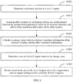
FIG 3 is a flowchart illustrating division of a level-1 region into a plurality of level-2 regions, according to an implementation of the present disclosure. -
FIG 4 is a schematic diagram illustrating location shifting, according to an implementation of the present disclosure. -
FIG 5 is a schematic diagram illustrating responding to a service request, according to an implementation of the present disclosure. -
FIG 6 is a schematic diagram illustrating a level-2 region adjacent to a level-2 region that a service request belongs to, according to an implementation of the present disclosure. -
FIG 7 is a schematic structural diagram illustrating a location-based service implementing apparatus, according to an implementation of the present disclosure. -
FIG 8 is a schematic structural diagram illustrating a location-based service implementing apparatus, according to an implementation of the present disclosure. - Implementations are described in detail here, and examples of the implementations are presented in the accompanying drawings. When the following descriptions relate to the accompanying drawings, unless otherwise specified, same numbers in different accompanying drawings represent same or similar elements. Implementations described in the following implementations do not represent all implementations in accordance with the present disclosure. Instead, they are only examples of apparatuses and methods in accordance with some aspects of the present disclosure that are described in detail in the appended claims.
- The terms used in the present disclosure are merely for illustrating specific implementations, and are not intended to limit the present disclosure. The terms "a", "said", and "the" of singular forms used in the present disclosure and the appended claims are also intended to include plural forms, unless otherwise specified in the context clearly. It should also be understood that, the term "and/or" used in this specification indicates and includes any or all possible combinations of one or more associated listed items.
- It should be understood that although terms "first", "second", "third", etc. may be used in the present disclosure to describe various types of information, the information is not limited to the terms. These terms are only used to differentiate information of a same type. For example, without departing from the scope of the present disclosure, first information may also be referred to as second information, and similarly, the second information may be referred to as the first information. Depending on the context, for example, the word "if" used here may be explained as "while", "when", or "in response to determining".
-
FIG 1 is a flowchart illustrating a location-based service implementing method, according to an implementation of the present disclosure. - Referring to
FIG 1 , the location-based service implementing method can be applied to a server, and includes the steps below. - Step 101: Determine, based on a requesting location in a service request, a level-1 region that the service request belongs to.
- In this implementation, the service request is a request for obtaining a service object based on a location, and the service object includes a service provider, a service provided by the service provider, etc. The service request is usually initiated by a user, for example, the service request can be a request for searching for a restaurant, a parking lot, etc. near a current location.
- In this implementation, the level-1 region is usually divided by a developer in advance, for example, the developer can divide continent areas on the earth into a plurality of level-1 regions based on a predetermined size. The Chinese mainland is used as an example. The developer can divide the Chinese mainland into a plurality of level-1 regions based on a size of 0.5° x 0.5° (longitude x latitude).
- In this implementation, after the service request is received, the requesting location included in the service request can be obtained, and the level-1 region that the service request belongs to is determined based on the requesting location. The requesting location is usually represented in a form of latitude and longitude coordinates. For example, assuming that the Chinese mainland is divided into a plurality of level-1 regions based on a size of 0.5° x 0.5° (longitude x latitude), and the requesting location lies at longitude 110.1° east and latitude 28.2° north, in this step, referring to
FIG. 2 , it can be determined that the service request belongs to a level-1 region whose southwest coordinates are longitude 110° east and latitude 28° north and northeast coordinates are longitude 110.5° east and latitude 28.5° north. - Step 102: Divide the level-1 region into a plurality of level-2 regions based on predetermined granularity.
- In this implementation, the predetermined granularity can be set by the developer. For example, the developer can set the predetermined granularity to, for example, 50 meters or 100 meters based on a requirement for service granularity in actual disclosure. No limitation is imposed in the present disclosure.
- Based on step 101, after the level-1 region that the service request belongs to is determined, the level-1 region can be divided into a plurality of level-2 regions based on the predetermined granularity. Referring to
FIG 3 , the dividing the level-1 region into a plurality of level-2 regions can include the steps below. - Step 1021: Determine a reference location in the level-1 region.
- In this implementation, the sizes of actual geographic regions mapped from different latitudes are different, for example, the size of an actual region that is mapped from changing latitude by one degree in a high-latitude region is smaller than the size in a low-latitude region. Therefore, in this step, the reference location can be determined based on a latitude of the level-1 region that the service request belongs to.
- In one example, when the level-1 region is located in the north hemisphere, a higher-latitude location in the level-1 region can be determined as the reference location, for example, a northeast corner or a northwest corner of the level-1 region can be determined as the reference location. In another example, when the level-1 region is located in the south hemisphere, a higher-latitude location in the level-1 region can also be determined as the reference location, for example, a southeast corner or a southwest corner of the level-1 region can be determined as the reference location.
- Step 1022: Reach an offset location by performing shifting in a predetermined direction by the predetermined granularity based on the reference location, and obtain offset coordinate information of the offset location.
- In this implementation, shifting can be performed in a low-latitude direction based on the reference location. For example, referring to
FIG 4 , when the reference location is the northeast corner of the level-1 region, shifting can be separately performed westwards and southwards by the granularity based on the northeast corner, and a location reached after the shifting is referred to as the offset location. Similarly, when the reference location is the northwest corner of the level-1 region, shifting can be separately performed eastwards and southwards by the granularity based on the northwest corner, to reach the offset location. When the reference location is the southeast corner of the level-1 region, shifting can be separately performed westwards and northwards by the granularity based on the southeast corner, to reach the offset location. When the reference location is the southwest corner of the level-1 region, shifting can be separately performed eastwards and northwards by the granularity based on the southwest corner, to reach the offset location. - In this step, after the offset location is reached, coordinate information of the offset location can be obtained. For ease of distinguishing, the coordinate information of the offset location can be referred to as offset coordinate information. Usually, the offset coordinate information can also be represented in a form of latitude and longitude coordinates.
- Step 1023: Calculate a change value between reference coordinate information of the reference location and the offset coordinate information.
- Based on
step 1022, after the offset coordinate information of the offset location is obtained, the change value between the reference coordinate information and the offset coordinate information can be calculated. For example, a difference between latitude and longitude coordinate values of the reference location and latitude and longitude coordinate values of the offset location is calculated. - Step 1024: Determine a size of the level-2 region based on the change value.
- In this implementation, assuming that the longitude difference between the reference location and the offset location is x, and the latitude difference between the reference location and the offset location is y, x and y can be determined as a length and a width of the level-2 region.
- Step 1025: Divide, based on the size of the level-2 region, the level-1 region that the service request belongs to into a plurality of level-2 regions.
- Based on
step 1024, after the size of the level-2 region is determined, the level-1 region that the service request belongs to can be divided into a plurality of level-2 regions based on the determined size. For example, the level-1 region can be divided into a plurality of level-2 regions along a boundary of the level-1 region starting from the northeast corner of the level-1 region. - It should be noted that, when division is performed to obtain the level-2 region, division can be performed starting from any corner of the level-1 region, for example, the southeast corner, the northwest corner, or the southwest corner. No limitation is imposed in the present disclosure. In addition, when the level-1 region is divided into a plurality of level-2 regions, the plurality of level-2 regions obtained through division can cover the level-1 region, that is, the sum of each size of the level-2 region obtained through division is usually greater than or equal to the size of the level-1 region. When the sum of each size of the level-2 region obtained through division is equal to the size of the level-1 region, it indicates that the level-1 region is divided into a plurality of level-2 regions of the same size.
- Step 103: Determine, based on the requesting location, a level-2 region that the service request belongs to.
- Based on
step 102, after the level-1 region that the service request belongs to is divided into a plurality of level-2 regions, the level-2 region that the service request belongs to can be determined based on the requesting location. - Step 104: Respond to the service request based on location information of all service objects in the level-2 region that the service request belongs to and an adjacent level-2 region.
- Based on step 103, after the level-2 region that the service request belongs to is determined, referring to
FIG. 5 , the service request can be responded to based on the steps below. - Step 1041: Obtain the location information of all the service objects in the level-2 region that the service request belongs to and the adjacent level-2 region.
- In this implementation, after the level-2 region that the service request belongs to is determined, eight level-2 regions adjacent to the level-2 region can be determined. Referring to
FIG 6 , assuming that a rectangular region located in the center is the level-2 region that the service request belongs to, eight level-2 regions that are numbered from 1 to 8 around the level-2 region are level-2 regions adjacent to the level-2 region. In this step, location information of all service objects in the level-2 region that the service request belongs to and the eight level-2 regions adjacent to the level-2 region can be obtained. - For example, assuming that the service request is a service request for searching for a restaurant near the current location, location information of all restaurants in the level-2 region that the service request belongs to and the eight level-2 regions adjacent to the level-2 region can be obtained.
- Step 1042: Calculate a distance between each service object and the requesting location based on the location information of the service object.
- Based on step 1041, after the location information of each service object is obtained, the distance between the service object and the requesting location can be calculated based on the location information. The service request for searching for a restaurant near the current location is still used as an example. A distance between each restaurant and the requesting location can be calculated based on the obtained location information of the restaurants.
- Step 1043: Push a service object with a distance satisfying a predetermined condition as a response to the service request.
- Based on
step 1042, after the distance between each service object and the requesting location is calculated, the service object with a distance satisfying the predetermined condition can be pushed to the user initiating the service request as the response to the service request. - In this implementation, the predetermined condition is usually a distance condition, which can be set by the developer, or can be customized by the user initiating the service request. Assuming that the service request is a request for searching for a nearby restaurant, the user can customize a distance of searching for the restaurant, for example, 200 meters or 500 meters, and the predetermined condition is as follows: the distance is less than 200 meters or 500 meters. If the user does not customize the distance, a default distance set by the developer can be used, for example, 300 meters.
- It can be learned from the previous descriptions that, during implementation of a location-based service in the present disclosure, the level-1 region that the service request belongs to can be determined based on the requesting location; the level-1 region is divided into a plurality of level-2 regions based on the predetermined granularity; and the service request is responded to based on the location information of all the service objects in the level-2 region that the service request belongs to and the adjacent level-2 region. Because all level-2 regions are of the same size, processing a service in a low-latitude region can save processing resources of a server, and improve performance of the server.
- Corresponding to the previous implementation of the location-based service implementing method, the present disclosure further provides an implementation of a location-based service implementing apparatus.
- The implementation of the location-based service implementing apparatus in the present disclosure can be applied to a server. The apparatus implementation can be implemented by software, hardware, or a combination of hardware and software. Software implementation is used as an example. As a logical apparatus, the software is formed by reading a corresponding computer program instruction in a non-volatile memory and running the instruction in a memory by a processor in a server of the apparatus. In terms of hardware, referring to
FIG. 7, FIG 7 is a hardware structural diagram illustrating a server of a location-based service implementing apparatus in the present disclosure. In addition to a processor, a memory, a network interface, and a non-volatile memory shown inFIG. 7 , the server of the apparatus in the implementations can usually include other hardware based on an actual function of the server. Details are not described. -
FIG 8 is a schematic structural diagram illustrating a location-based service implementing apparatus, according to an implementation of the present disclosure. - Referring to
FIG. 8 , a location-based service implementing apparatus 700 can be applied to the server shown inFIG 7 , and the implementing apparatus 700 includes a first determiningunit 701, adivision unit 702, a second determiningunit 703, and aservice response unit 704. Thedivision unit 702 can include areference determining subunit 7021, agranularity shifting subunit 7022, achange calculation subunit 7023, asize determining subunit 7024, and aregion division subunit 7025. - The first determining
unit 701 is configured to determine, based on a requesting location in a service request, a level-1 region that the service request belongs to. - The
division unit 702 is configured to divide the level-1 region into a plurality of level-2 regions based on predetermined granularity. - The second determining
unit 703 is configured to determine, based on the requesting location, a level-2 region that the service request belongs to. - The
service response unit 704 is configured to respond to the service request based on location information of all service objects in the level-2 region that the service request belongs to and an adjacent level-2 region. - The
reference determining subunit 7021 is configured to determine a reference location in the level-1 region. - The
granularity shifting subunit 7022 is configured to: reach an offset location by performing shifting in a predetermined direction by the granularity based on the reference location, and obtain offset coordinate information of the offset location. - The change
value calculation subunit 7023 is configured to calculate a change value between reference coordinate information of the reference location and the offset coordinate information. - The
size determining subunit 7024 is configured to determine a size of the level-2 region based on the change value. - The
region division subunit 7025 is configured to divide, based on the size of the level-2 region, the level-1 region that the service request belongs to into a plurality of level-2 regions. - Optionally, the
reference determining subunit 7021 is configured to: when the level-1 region is in the northern hemisphere, determine a northeast corner or a northwest corner of the level-1 region as the reference location; or when the level-1 region is in the southern hemisphere, determine a southeast corner or a southwest corner of the level-1 region as the reference location. - Optionally, the
granularity shifting subunit 7022 is configured to: when the reference location is the northeast corner of the level-1 region, separately perform shifting westwards and southwards by the granularity based on the northeast corner, to reach the offset location; when the reference location is the northwest corner of the level-1 region, separately perform shifting eastwards and southwards by the granularity based on the northwest corner, to reach the offset location; when the reference location is the southeast corner of the level-1 region, separately perform shifting westwards and northwards by the granularity based on the southeast corner, to reach the offset location; or when the reference location is the southwest corner of the level-1 region, separately perform shifting eastwards and northwards by the granularity based on the southwest corner, to reach the offset location. - Optionally, the
service response unit 704 is configured to: obtain the location information of all the service objects in the level-2 region that the service request belongs to and the adjacent level-2 region; calculate a distance between each service object and the requesting location based on the location information of the service object; and push a service object with a distance satisfying a predetermined condition as a response to the service request. - For an implementation process of functions and roles of each unit in the apparatus, refer to an implementation process of corresponding steps in the previous method. Details are not described here again.
- Because an apparatus implementation basically corresponds to a method implementation, for related parts, refer to related descriptions in the method implementation. The previously described apparatus implementation is merely an example. The units described as separate parts may or may not be physically separate, and parts displayed as units may or may not be physical units, may be located in one position, or may be distributed on a plurality of network units. Some or all of the modules or units may be selected according to actual needs to achieve the objectives of the solutions in the present disclosure. A person of ordinary skill in the art may understand and implement the present disclosure without creative efforts.
- The previous descriptions are merely implementations of the present disclosure, and are not intended to limit the present disclosure.
Claims (8)
- A location-based service implementing method performed by a location-based service implementing apparatus, wherein the method comprises:determining (S101), based on a requesting location in a service request, a level-1 region that the service request belongs to, wherein the level-1 region is one of a plurality of level-1 regions into which an area is divided based on a predetermined size in longitude and latitude;dividing (SI02) the level-1 region into a plurality of level-2 regions based on predetermined granularity, wherein the predetermined granularity is set to a predetermined geographical distance, and wherein the plurality of level-2 regions are of the same size;determining (S103), based on the requesting location, a level-2 region that the service request belongs to;determining eight level-2 regions adjacent to the level-2 region that the service request belongs to; andresponding (SI04) to the service request based on the location information of all service objects in the level-2 region that the service request belongs to and on the location information of all service objects in the eight adjacent level-2 regions.
- The method according to claim 1, wherein the dividing the level-1 region into a plurality of level-2 regions based on predetermined granularity comprises:determining (SI021) a reference location in the level-1 region;reaching (S1022) an offset location by performing shifting in a predetermined direction by the granularity based on the reference location, and obtaining offset coordinate information of the offset location;calculating (S1023) a change value between reference coordinate information of the reference location and the offset coordinate information, wherein the change value is a difference between latitude and longitude coordinate values of the reference location and latitude and longitude coordinate values of the offset coordinate information;determining (S1024) a size of the level-2 region based on the change value; anddividing (S1025), based on the size of the level-2 region, the level-1 region that the service request belongs to into a plurality of level-2 regions.
- The method according to claim 2, wherein the determining a reference location in the level-1 region comprises:when the level-1 region is in the northern hemisphere, determining a northeast corner or a northwest corner of the level-1 region as the reference location; orwhen the level-1 region is in the southern hemisphere, determining a southeast corner or a southwest corner of the level-1 region as the reference location.
- The method according to claim 1, wherein the responding to the service request based on location information of all service objects in the level-2 region that the service request belongs to and on the location information of all service objects in the eight adjacent level-2 regions comprises:obtaining (S1041) the location information of all the service objects in the level-2 region that the service request belongs to and on the location information of all service objects in the eight adjacent level-2 regions;calculating (S1042) a distance between each service object and the requesting location based on the location information of the service object; andpushing (S1043) a service object with a distance satisfying a predetermined condition as a response to the service request.
- A location-based service implementing apparatus, wherein the apparatus comprises:a first determining unit (701), configured to determine (S101), based on a requesting location in a service request, a level-1 region that the service request belongs to, wherein the level-1 region is one of a plurality of level-1 regions into which an area is divided based on a predetermined size in longitude and latitude;a division unit (702), configured to divide (S102) the level-1 region into a plurality of level-2 regions based on predetermined granularity, wherein the predetermined granularity is set to a predetermined geographical distance, and wherein the plurality of level-2 regions are of the same size;a second determining unit (703), configured to determine (SI03), based on the requesting location, a level-2 region that the service request belongs to and configured to determine eight level-2 regions adjacent to the level-2 region that the service request belongs to; anda service response unit (704), configured to respond (SI04) to the service request based on the location information of all service objects in the level-2 region that the service request belongs to and on the location information of all service objects in the eight adjacent level-2 regions.
- The apparatus according to claim 5, wherein the division unit comprises:a reference determining subunit (7021), configured to determine (S 1021) a reference location in the level-1 region;a granularity shifting subunit (7022), configured to reach (S1022) an offset location by performing shifting in a predetermined direction by the granularity based on the reference location, and obtain offset coordinate information of the offset location;a change value calculation subunit (7023), configured to calculate (S1023) a change value between reference coordinate information of the reference location and the offset coordinate information, wherein the change value is a difference between latitude and longitude coordinate values of the reference location and latitude and longitude coordinate values of the offset coordinate information;a size determining subunit (7024), configured to determine (S1024) a size of the level-2 region based on the change value; anda region division subunit (7025), configured to divide (S1025), based on the size of the level-2 region, the level-1 region that the service request belongs to into a plurality of level-2 regions.
- The apparatus according to claim 6, wherein:
the reference determining subunit (7021) is configured to: when the level-1 region is in the northern hemisphere, determine a northeast corner or a northwest corner of the level-1 region as the reference location; or when the level-1 region is in the southern hemisphere, determine a southeast corner or a southwest corner of the level-1 region as the reference location. - The apparatus according to claim 5, wherein:
the service response unit (704) is configured to: obtain the location information of all the service objects in the level-2 region that the service request belongs to and on the location information of all service objects in the eight adjacent level-2 regions; calculate a distance between each service object and the requesting location based on the location information of the service object; and push a service object with a distance satisfying a predetermined condition as a response to the service request.
Priority Applications (1)
| Application Number | Priority Date | Filing Date | Title |
|---|---|---|---|
| PL17759127T PL3425876T3 (en) | 2016-02-29 | 2017-02-17 | Location-based service implementing method and apparatus |
Applications Claiming Priority (2)
| Application Number | Priority Date | Filing Date | Title |
|---|---|---|---|
| CN201610113493.9A CN107135244B (en) | 2016-02-29 | 2016-02-29 | Location-based service implementation method and device |
| PCT/CN2017/073915 WO2017148276A1 (en) | 2016-02-29 | 2017-02-17 | Location-based service implementing method and apparatus |
Publications (3)
| Publication Number | Publication Date |
|---|---|
| EP3425876A1 EP3425876A1 (en) | 2019-01-09 |
| EP3425876A4 EP3425876A4 (en) | 2019-02-27 |
| EP3425876B1 true EP3425876B1 (en) | 2020-06-17 |
Family
ID=59721650
Family Applications (1)
| Application Number | Title | Priority Date | Filing Date |
|---|---|---|---|
| EP17759127.8A Active EP3425876B1 (en) | 2016-02-29 | 2017-02-17 | Location-based service implementing method and apparatus |
Country Status (8)
| Country | Link |
|---|---|
| US (2) | US10425770B2 (en) |
| EP (1) | EP3425876B1 (en) |
| JP (1) | JP6771575B2 (en) |
| CN (1) | CN107135244B (en) |
| ES (1) | ES2808952T3 (en) |
| PL (1) | PL3425876T3 (en) |
| TW (1) | TWI690230B (en) |
| WO (1) | WO2017148276A1 (en) |
Families Citing this family (6)
| Publication number | Priority date | Publication date | Assignee | Title |
|---|---|---|---|---|
| CN107135244B (en) | 2016-02-29 | 2020-04-21 | 阿里巴巴集团控股有限公司 | Location-based service implementation method and device |
| CN109511083A (en) * | 2017-09-11 | 2019-03-22 | 中兴通讯股份有限公司 | A kind of location information reports, acquisition methods and device |
| CN110895591A (en) * | 2018-09-12 | 2020-03-20 | 北京京东尚科信息技术有限公司 | Method and device for positioning self-picking point |
| US10798566B2 (en) | 2018-12-05 | 2020-10-06 | At&T Intellectual Property I, L.P. | Securely conveying location and other information in advanced networks |
| CN110909260B (en) * | 2019-11-12 | 2023-03-07 | 浙江大搜车软件技术有限公司 | Vehicle display method, device, computer readable storage medium and computer equipment |
| CN116625367B (en) * | 2023-05-04 | 2024-02-06 | 中远海运散货运输有限公司 | Sea chart selection method for crossing east-west longitude 180 DEG by using course based on PAYS |
Family Cites Families (15)
| Publication number | Priority date | Publication date | Assignee | Title |
|---|---|---|---|---|
| JP2002358004A (en) | 2001-06-02 | 2002-12-13 | Navitime Japan Co Ltd | Map display terminal, map display system |
| CN1278285C (en) * | 2004-11-02 | 2006-10-04 | 北京航空航天大学 | Electronic map location matching method for intelligent vehicle positioning navigation system |
| CN102102992B (en) * | 2009-12-22 | 2013-04-17 | 山东省计算中心 | Multistage network division-based preliminary screening method for matched roads and map matching system |
| KR101527000B1 (en) * | 2011-03-03 | 2015-06-10 | 에스케이플래닛 주식회사 | Method For Providing Location-Based Electronic Business Card, System And Apparatus Therefor |
| JP2013045319A (en) | 2011-08-25 | 2013-03-04 | Sony Corp | Information processing apparatus, information processing method, and program |
| US8983953B2 (en) * | 2011-10-18 | 2015-03-17 | Nokia Corporation | Methods and apparatuses for facilitating interaction with a geohash-indexed data set |
| CN103888895B (en) * | 2012-12-20 | 2018-12-18 | 腾讯科技(深圳)有限公司 | information processing method, server apparatus and mobile terminal |
| CN103927933B (en) * | 2013-01-14 | 2016-07-13 | 北京中交兴路信息科技有限公司 | A kind of magnanimity moves method and the device that target renders |
| CN103338509A (en) * | 2013-04-10 | 2013-10-02 | 南昌航空大学 | WSN (wireless sensor network) indoor positioning method based on hidden markov models |
| GB2513196A (en) * | 2013-04-19 | 2014-10-22 | What3Words Ltd | A method and apparatus for identifying and communicating locations |
| CN104184769A (en) * | 2013-05-21 | 2014-12-03 | 腾讯科技(深圳)有限公司 | Information push method and system |
| US9426620B2 (en) * | 2014-03-14 | 2016-08-23 | Twitter, Inc. | Dynamic geohash-based geofencing |
| US9426776B2 (en) * | 2014-07-30 | 2016-08-23 | Google Technology Holdings LLC | Method and apparatus for enforcing tiered geographical anonymity in a mobile device |
| CN105260468A (en) * | 2015-10-16 | 2016-01-20 | 广州市百果园网络科技有限公司 | Coordinate based near point search method and apparatus |
| CN107135244B (en) | 2016-02-29 | 2020-04-21 | 阿里巴巴集团控股有限公司 | Location-based service implementation method and device |
-
2016
- 2016-02-29 CN CN201610113493.9A patent/CN107135244B/en active Active
- 2016-12-29 TW TW105143944A patent/TWI690230B/en active
-
2017
- 2017-02-17 WO PCT/CN2017/073915 patent/WO2017148276A1/en active Application Filing
- 2017-02-17 EP EP17759127.8A patent/EP3425876B1/en active Active
- 2017-02-17 JP JP2018545449A patent/JP6771575B2/en active Active
- 2017-02-17 ES ES17759127T patent/ES2808952T3/en active Active
- 2017-02-17 PL PL17759127T patent/PL3425876T3/en unknown
-
2018
- 2018-08-28 US US16/115,204 patent/US10425770B2/en active Active
-
2019
- 2019-09-23 US US16/579,335 patent/US10904707B2/en active Active
Non-Patent Citations (1)
| Title |
|---|
| None * |
Also Published As
| Publication number | Publication date |
|---|---|
| US10425770B2 (en) | 2019-09-24 |
| US20200120449A1 (en) | 2020-04-16 |
| US20180367955A1 (en) | 2018-12-20 |
| PL3425876T3 (en) | 2020-11-02 |
| EP3425876A4 (en) | 2019-02-27 |
| CN107135244A (en) | 2017-09-05 |
| US10904707B2 (en) | 2021-01-26 |
| TWI690230B (en) | 2020-04-01 |
| JP6771575B2 (en) | 2020-10-21 |
| EP3425876A1 (en) | 2019-01-09 |
| TW201733387A (en) | 2017-09-16 |
| JP2019512775A (en) | 2019-05-16 |
| ES2808952T3 (en) | 2021-03-02 |
| WO2017148276A1 (en) | 2017-09-08 |
| CN107135244B (en) | 2020-04-21 |
Similar Documents
| Publication | Publication Date | Title |
|---|---|---|
| EP3425876B1 (en) | Location-based service implementing method and apparatus | |
| US9092532B2 (en) | Method and server for searching for nearby user in social networking services | |
| US10091646B2 (en) | Reduced resolution location determination for improved anonymity of user location | |
| CN107273376B (en) | Target position searching method and device | |
| CN107092623B (en) | Interest point query method and device | |
| US20130205196A1 (en) | Location-based mobile application marketplace system | |
| EP3312738B1 (en) | Method and device for displaying keyword | |
| CN108712712B (en) | Wireless fidelity WiFi network associated information display method and device | |
| US20160366552A1 (en) | Method and System for Determining a Positioning Interval of a Mobile Terminal | |
| CN110888866B (en) | Data expansion method and device, data processing equipment and storage medium | |
| WO2016192214A1 (en) | End server deployment method and device | |
| US8874713B1 (en) | Location correction | |
| US20180035367A1 (en) | Method and Apparatus for Accessing Wifi Access Point in Target Shop | |
| KR101934420B1 (en) | Method and apparatus for obtaining candidate address information in map | |
| WO2016188018A1 (en) | Data processing method and apparatus | |
| CN109800360B (en) | Cell query method, cell query device, electronic equipment and storage medium | |
| US10708880B2 (en) | Electronic device and method for determining entry of region of interest of electronic device | |
| CN113449986A (en) | Service distribution method, device, server and storage medium | |
| CN108882165B (en) | Navigation method and device | |
| WO2023109950A1 (en) | Tracking area boundary information processing method and apparatus, electronic device, and readable medium | |
| CN111026979A (en) | Target recommendation method and system and computer-readable storage medium | |
| CN104023392B (en) | The method and apparatus for determining the position of WAP | |
| CN111954874A (en) | Identifying functional regions within a geographic area | |
| US9888347B1 (en) | Resolving location criteria using user location data | |
| CN108337644B (en) | Data processing method and device |
Legal Events
| Date | Code | Title | Description |
|---|---|---|---|
| STAA | Information on the status of an ep patent application or granted ep patent |
Free format text: STATUS: THE INTERNATIONAL PUBLICATION HAS BEEN MADE |
|
| PUAI | Public reference made under article 153(3) epc to a published international application that has entered the european phase |
Free format text: ORIGINAL CODE: 0009012 |
|
| STAA | Information on the status of an ep patent application or granted ep patent |
Free format text: STATUS: REQUEST FOR EXAMINATION WAS MADE |
|
| 17P | Request for examination filed |
Effective date: 20180918 |
|
| AK | Designated contracting states |
Kind code of ref document: A1 Designated state(s): AL AT BE BG CH CY CZ DE DK EE ES FI FR GB GR HR HU IE IS IT LI LT LU LV MC MK MT NL NO PL PT RO RS SE SI SK SM TR |
|
| AX | Request for extension of the european patent |
Extension state: BA ME |
|
| A4 | Supplementary search report drawn up and despatched |
Effective date: 20190124 |
|
| RIC1 | Information provided on ipc code assigned before grant |
Ipc: H04W 4/02 20180101ALI20190118BHEP Ipc: G06F 16/901 20190101ALI20190118BHEP Ipc: H04L 29/08 20060101AFI20190118BHEP Ipc: H04W 4/029 20180101ALI20190118BHEP Ipc: H04W 4/021 20180101ALI20190118BHEP |
|
| DAV | Request for validation of the european patent (deleted) | ||
| DAX | Request for extension of the european patent (deleted) | ||
| STAA | Information on the status of an ep patent application or granted ep patent |
Free format text: STATUS: EXAMINATION IS IN PROGRESS |
|
| 17Q | First examination report despatched |
Effective date: 20191113 |
|
| GRAP | Despatch of communication of intention to grant a patent |
Free format text: ORIGINAL CODE: EPIDOSNIGR1 |
|
| STAA | Information on the status of an ep patent application or granted ep patent |
Free format text: STATUS: GRANT OF PATENT IS INTENDED |
|
| INTG | Intention to grant announced |
Effective date: 20200313 |
|
| GRAS | Grant fee paid |
Free format text: ORIGINAL CODE: EPIDOSNIGR3 |
|
| GRAA | (expected) grant |
Free format text: ORIGINAL CODE: 0009210 |
|
| STAA | Information on the status of an ep patent application or granted ep patent |
Free format text: STATUS: THE PATENT HAS BEEN GRANTED |
|
| AK | Designated contracting states |
Kind code of ref document: B1 Designated state(s): AL AT BE BG CH CY CZ DE DK EE ES FI FR GB GR HR HU IE IS IT LI LT LU LV MC MK MT NL NO PL PT RO RS SE SI SK SM TR |
|
| REG | Reference to a national code |
Ref country code: GB Ref legal event code: FG4D |
|
| REG | Reference to a national code |
Ref country code: CH Ref legal event code: EP |
|
| REG | Reference to a national code |
Ref country code: IE Ref legal event code: FG4D |
|
| REG | Reference to a national code |
Ref country code: DE Ref legal event code: R096 Ref document number: 602017018424 Country of ref document: DE |
|
| REG | Reference to a national code |
Ref country code: AT Ref legal event code: REF Ref document number: 1282738 Country of ref document: AT Kind code of ref document: T Effective date: 20200715 Ref country code: CH Ref legal event code: NV Representative=s name: NOVAGRAAF INTERNATIONAL SA, CH |
|
| REG | Reference to a national code |
Ref country code: FI Ref legal event code: FGE |
|
| REG | Reference to a national code |
Ref country code: NL Ref legal event code: FP |
|
| REG | Reference to a national code |
Ref country code: NO Ref legal event code: T2 Effective date: 20200617 |
|
| PG25 | Lapsed in a contracting state [announced via postgrant information from national office to epo] |
Ref country code: GR Free format text: LAPSE BECAUSE OF FAILURE TO SUBMIT A TRANSLATION OF THE DESCRIPTION OR TO PAY THE FEE WITHIN THE PRESCRIBED TIME-LIMIT Effective date: 20200918 Ref country code: SE Free format text: LAPSE BECAUSE OF FAILURE TO SUBMIT A TRANSLATION OF THE DESCRIPTION OR TO PAY THE FEE WITHIN THE PRESCRIBED TIME-LIMIT Effective date: 20200617 Ref country code: LT Free format text: LAPSE BECAUSE OF FAILURE TO SUBMIT A TRANSLATION OF THE DESCRIPTION OR TO PAY THE FEE WITHIN THE PRESCRIBED TIME-LIMIT Effective date: 20200617 |
|
| REG | Reference to a national code |
Ref country code: LT Ref legal event code: MG4D |
|
| PG25 | Lapsed in a contracting state [announced via postgrant information from national office to epo] |
Ref country code: RS Free format text: LAPSE BECAUSE OF FAILURE TO SUBMIT A TRANSLATION OF THE DESCRIPTION OR TO PAY THE FEE WITHIN THE PRESCRIBED TIME-LIMIT Effective date: 20200617 Ref country code: HR Free format text: LAPSE BECAUSE OF FAILURE TO SUBMIT A TRANSLATION OF THE DESCRIPTION OR TO PAY THE FEE WITHIN THE PRESCRIBED TIME-LIMIT Effective date: 20200617 Ref country code: LV Free format text: LAPSE BECAUSE OF FAILURE TO SUBMIT A TRANSLATION OF THE DESCRIPTION OR TO PAY THE FEE WITHIN THE PRESCRIBED TIME-LIMIT Effective date: 20200617 Ref country code: BG Free format text: LAPSE BECAUSE OF FAILURE TO SUBMIT A TRANSLATION OF THE DESCRIPTION OR TO PAY THE FEE WITHIN THE PRESCRIBED TIME-LIMIT Effective date: 20200917 |
|
| REG | Reference to a national code |
Ref country code: AT Ref legal event code: MK05 Ref document number: 1282738 Country of ref document: AT Kind code of ref document: T Effective date: 20200617 |
|
| PG25 | Lapsed in a contracting state [announced via postgrant information from national office to epo] |
Ref country code: AL Free format text: LAPSE BECAUSE OF FAILURE TO SUBMIT A TRANSLATION OF THE DESCRIPTION OR TO PAY THE FEE WITHIN THE PRESCRIBED TIME-LIMIT Effective date: 20200617 |
|
| REG | Reference to a national code |
Ref country code: CH Ref legal event code: PUE Owner name: ADVANCED NEW TECHNOLOGIES CO., LTD., KY Free format text: FORMER OWNER: ALIBABA GROUP HOLDING LIMITED, KY |
|
| RAP2 | Party data changed (patent owner data changed or rights of a patent transferred) |
Owner name: ADVANCED NEW TECHNOLOGIES CO., LTD. |
|
| PG25 | Lapsed in a contracting state [announced via postgrant information from national office to epo] |
Ref country code: SM Free format text: LAPSE BECAUSE OF FAILURE TO SUBMIT A TRANSLATION OF THE DESCRIPTION OR TO PAY THE FEE WITHIN THE PRESCRIBED TIME-LIMIT Effective date: 20200617 Ref country code: RO Free format text: LAPSE BECAUSE OF FAILURE TO SUBMIT A TRANSLATION OF THE DESCRIPTION OR TO PAY THE FEE WITHIN THE PRESCRIBED TIME-LIMIT Effective date: 20200617 Ref country code: CZ Free format text: LAPSE BECAUSE OF FAILURE TO SUBMIT A TRANSLATION OF THE DESCRIPTION OR TO PAY THE FEE WITHIN THE PRESCRIBED TIME-LIMIT Effective date: 20200617 Ref country code: PT Free format text: LAPSE BECAUSE OF FAILURE TO SUBMIT A TRANSLATION OF THE DESCRIPTION OR TO PAY THE FEE WITHIN THE PRESCRIBED TIME-LIMIT Effective date: 20201019 Ref country code: EE Free format text: LAPSE BECAUSE OF FAILURE TO SUBMIT A TRANSLATION OF THE DESCRIPTION OR TO PAY THE FEE WITHIN THE PRESCRIBED TIME-LIMIT Effective date: 20200617 Ref country code: AT Free format text: LAPSE BECAUSE OF FAILURE TO SUBMIT A TRANSLATION OF THE DESCRIPTION OR TO PAY THE FEE WITHIN THE PRESCRIBED TIME-LIMIT Effective date: 20200617 |
|
| REG | Reference to a national code |
Ref country code: DE Ref legal event code: R082 Ref document number: 602017018424 Country of ref document: DE Representative=s name: FISH & RICHARDSON P.C., DE Ref country code: DE Ref legal event code: R081 Ref document number: 602017018424 Country of ref document: DE Owner name: ADVANCED NEW TECHNOLOGIES CO., LTD., GEORGE TO, KY Free format text: FORMER OWNER: ALIBABA GROUP HOLDING LIMITED, GEORGE TOWN, GRAND CAYMAN, KY |
|
| REG | Reference to a national code |
Ref country code: NO Ref legal event code: CHAD Owner name: ADVANCED NEW TECHNOLOGIES CO., KY |
|
| REG | Reference to a national code |
Ref country code: NL Ref legal event code: PD Owner name: ADVANCED NEW TECHNOLOGIES CO., LTD.; KY Free format text: DETAILS ASSIGNMENT: CHANGE OF OWNER(S), ASSIGNMENT; FORMER OWNER NAME: ALIBABA GROUP HOLDING LIMITED Effective date: 20210112 |
|
| PG25 | Lapsed in a contracting state [announced via postgrant information from national office to epo] |
Ref country code: IS Free format text: LAPSE BECAUSE OF FAILURE TO SUBMIT A TRANSLATION OF THE DESCRIPTION OR TO PAY THE FEE WITHIN THE PRESCRIBED TIME-LIMIT Effective date: 20201017 Ref country code: SK Free format text: LAPSE BECAUSE OF FAILURE TO SUBMIT A TRANSLATION OF THE DESCRIPTION OR TO PAY THE FEE WITHIN THE PRESCRIBED TIME-LIMIT Effective date: 20200617 |
|
| REG | Reference to a national code |
Ref country code: ES Ref legal event code: FG2A Ref document number: 2808952 Country of ref document: ES Kind code of ref document: T3 Effective date: 20210302 |
|
| REG | Reference to a national code |
Ref country code: GB Ref legal event code: 732E Free format text: REGISTERED BETWEEN 20210218 AND 20210224 |
|
| REG | Reference to a national code |
Ref country code: DE Ref legal event code: R097 Ref document number: 602017018424 Country of ref document: DE |
|
| PLBE | No opposition filed within time limit |
Free format text: ORIGINAL CODE: 0009261 |
|
| STAA | Information on the status of an ep patent application or granted ep patent |
Free format text: STATUS: NO OPPOSITION FILED WITHIN TIME LIMIT |
|
| PG25 | Lapsed in a contracting state [announced via postgrant information from national office to epo] |
Ref country code: DK Free format text: LAPSE BECAUSE OF FAILURE TO SUBMIT A TRANSLATION OF THE DESCRIPTION OR TO PAY THE FEE WITHIN THE PRESCRIBED TIME-LIMIT Effective date: 20200617 |
|
| 26N | No opposition filed |
Effective date: 20210318 |
|
| PG25 | Lapsed in a contracting state [announced via postgrant information from national office to epo] |
Ref country code: SI Free format text: LAPSE BECAUSE OF FAILURE TO SUBMIT A TRANSLATION OF THE DESCRIPTION OR TO PAY THE FEE WITHIN THE PRESCRIBED TIME-LIMIT Effective date: 20200617 |
|
| PG25 | Lapsed in a contracting state [announced via postgrant information from national office to epo] |
Ref country code: MC Free format text: LAPSE BECAUSE OF FAILURE TO SUBMIT A TRANSLATION OF THE DESCRIPTION OR TO PAY THE FEE WITHIN THE PRESCRIBED TIME-LIMIT Effective date: 20200617 |
|
| REG | Reference to a national code |
Ref country code: BE Ref legal event code: MM Effective date: 20210228 |
|
| PG25 | Lapsed in a contracting state [announced via postgrant information from national office to epo] |
Ref country code: LU Free format text: LAPSE BECAUSE OF NON-PAYMENT OF DUE FEES Effective date: 20210217 |
|
| REG | Reference to a national code |
Ref country code: DE Ref legal event code: R079 Ref document number: 602017018424 Country of ref document: DE Free format text: PREVIOUS MAIN CLASS: H04L0029080000 Ipc: H04L0065000000 |
|
| PG25 | Lapsed in a contracting state [announced via postgrant information from national office to epo] |
Ref country code: IE Free format text: LAPSE BECAUSE OF NON-PAYMENT OF DUE FEES Effective date: 20210217 |
|
| PG25 | Lapsed in a contracting state [announced via postgrant information from national office to epo] |
Ref country code: BE Free format text: LAPSE BECAUSE OF NON-PAYMENT OF DUE FEES Effective date: 20210228 |
|
| PGFP | Annual fee paid to national office [announced via postgrant information from national office to epo] |
Ref country code: NL Payment date: 20230226 Year of fee payment: 7 |
|
| PGFP | Annual fee paid to national office [announced via postgrant information from national office to epo] |
Ref country code: ES Payment date: 20230301 Year of fee payment: 7 Ref country code: CH Payment date: 20230307 Year of fee payment: 7 Ref country code: NO Payment date: 20230227 Year of fee payment: 7 |
|
| PGFP | Annual fee paid to national office [announced via postgrant information from national office to epo] |
Ref country code: TR Payment date: 20230210 Year of fee payment: 7 Ref country code: PL Payment date: 20230131 Year of fee payment: 7 Ref country code: IT Payment date: 20230221 Year of fee payment: 7 Ref country code: GB Payment date: 20230227 Year of fee payment: 7 Ref country code: DE Payment date: 20230223 Year of fee payment: 7 |
|
| P01 | Opt-out of the competence of the unified patent court (upc) registered |
Effective date: 20230521 |
|
| PG25 | Lapsed in a contracting state [announced via postgrant information from national office to epo] |
Ref country code: CY Free format text: LAPSE BECAUSE OF FAILURE TO SUBMIT A TRANSLATION OF THE DESCRIPTION OR TO PAY THE FEE WITHIN THE PRESCRIBED TIME-LIMIT Effective date: 20200617 |
|
| PG25 | Lapsed in a contracting state [announced via postgrant information from national office to epo] |
Ref country code: HU Free format text: LAPSE BECAUSE OF FAILURE TO SUBMIT A TRANSLATION OF THE DESCRIPTION OR TO PAY THE FEE WITHIN THE PRESCRIBED TIME-LIMIT; INVALID AB INITIO Effective date: 20170217 |
|
| PGFP | Annual fee paid to national office [announced via postgrant information from national office to epo] |
Ref country code: FR Payment date: 20231222 Year of fee payment: 8 Ref country code: FI Payment date: 20231226 Year of fee payment: 8 |
|
| PGFP | Annual fee paid to national office [announced via postgrant information from national office to epo] |
Ref country code: NL Payment date: 20240108 Year of fee payment: 8 |
|
| PGFP | Annual fee paid to national office [announced via postgrant information from national office to epo] |
Ref country code: ES Payment date: 20240307 Year of fee payment: 8 |