EP3394845B1 - Procede de signalisation d'un accident par un drone de signalisation - Google Patents
Procede de signalisation d'un accident par un drone de signalisation Download PDFInfo
- Publication number
- EP3394845B1 EP3394845B1 EP16822446.7A EP16822446A EP3394845B1 EP 3394845 B1 EP3394845 B1 EP 3394845B1 EP 16822446 A EP16822446 A EP 16822446A EP 3394845 B1 EP3394845 B1 EP 3394845B1
- Authority
- EP
- European Patent Office
- Prior art keywords
- accident
- drone
- signaling
- location
- coordinates
- Prior art date
- Legal status (The legal status is an assumption and is not a legal conclusion. Google has not performed a legal analysis and makes no representation as to the accuracy of the status listed.)
- Active
Links
Images

Classifications
-
- B—PERFORMING OPERATIONS; TRANSPORTING
- B60—VEHICLES IN GENERAL
- B60Q—ARRANGEMENT OF SIGNALLING OR LIGHTING DEVICES, THE MOUNTING OR SUPPORTING THEREOF OR CIRCUITS THEREFOR, FOR VEHICLES IN GENERAL
- B60Q1/00—Arrangement of optical signalling or lighting devices, the mounting or supporting thereof or circuits therefor
- B60Q1/26—Arrangement of optical signalling or lighting devices, the mounting or supporting thereof or circuits therefor the devices being primarily intended to indicate the vehicle, or parts thereof, or to give signals, to other traffic
- B60Q1/46—Arrangement of optical signalling or lighting devices, the mounting or supporting thereof or circuits therefor the devices being primarily intended to indicate the vehicle, or parts thereof, or to give signals, to other traffic for giving flashing caution signals during drive, other than signalling change of direction, e.g. flashing the headlights or hazard lights
-
- B—PERFORMING OPERATIONS; TRANSPORTING
- B64—AIRCRAFT; AVIATION; COSMONAUTICS
- B64D—EQUIPMENT FOR FITTING IN OR TO AIRCRAFT; FLIGHT SUITS; PARACHUTES; ARRANGEMENT OR MOUNTING OF POWER PLANTS OR PROPULSION TRANSMISSIONS IN AIRCRAFT
- B64D47/00—Equipment not otherwise provided for
- B64D47/02—Arrangements or adaptations of signal or lighting devices
-
- G—PHYSICS
- G08—SIGNALLING
- G08G—TRAFFIC CONTROL SYSTEMS
- G08G1/00—Traffic control systems for road vehicles
- G08G1/01—Detecting movement of traffic to be counted or controlled
- G08G1/04—Detecting movement of traffic to be counted or controlled using optical or ultrasonic detectors
-
- G—PHYSICS
- G08—SIGNALLING
- G08G—TRAFFIC CONTROL SYSTEMS
- G08G1/00—Traffic control systems for road vehicles
- G08G1/09—Arrangements for giving variable traffic instructions
- G08G1/095—Traffic lights
- G08G1/0955—Traffic lights transportable
-
- G—PHYSICS
- G08—SIGNALLING
- G08G—TRAFFIC CONTROL SYSTEMS
- G08G1/00—Traffic control systems for road vehicles
- G08G1/16—Anti-collision systems
- G08G1/166—Anti-collision systems for active traffic, e.g. moving vehicles, pedestrians, bikes
-
- B—PERFORMING OPERATIONS; TRANSPORTING
- B64—AIRCRAFT; AVIATION; COSMONAUTICS
- B64U—UNMANNED AERIAL VEHICLES [UAV]; EQUIPMENT THEREFOR
- B64U2101/00—UAVs specially adapted for particular uses or applications
- B64U2101/30—UAVs specially adapted for particular uses or applications for imaging, photography or videography
-
- B—PERFORMING OPERATIONS; TRANSPORTING
- B64—AIRCRAFT; AVIATION; COSMONAUTICS
- B64U—UNMANNED AERIAL VEHICLES [UAV]; EQUIPMENT THEREFOR
- B64U2201/00—UAVs characterised by their flight controls
- B64U2201/10—UAVs characterised by their flight controls autonomous, i.e. by navigating independently from ground or air stations, e.g. by using inertial navigation systems [INS]
- B64U2201/104—UAVs characterised by their flight controls autonomous, i.e. by navigating independently from ground or air stations, e.g. by using inertial navigation systems [INS] using satellite radio beacon positioning systems, e.g. GPS
Definitions
- the invention relates to the general field of road safety.
- the invention relates more particularly to a method of signaling a road accident by a signaling drone.
- the method according to the invention makes it possible to avoid further accidents and thus, it makes it possible to bring aid to victims in complete safety.
- the invention relates to a signaling drone implementing said method.
- the role of the witness or the intervenor is fundamental. Indeed, arrived at the scene of the accident, the witness must ensure the protection of the scene of the accident in order to avoid the additional accident and thus ensure the protection of victims and help.
- the witness when approaching the scene of the accident, the witness must first turn on his hazard lights and gradually slow down while checking that another vehicle is not approaching at high speed. He must then park his vehicle after the scene of the accident, ideally on the emergency lane. Then the witness must wear reflective clothing so that it is visible to other vehicles.
- the witness must then ensure the marking of the place of the accident.
- the marking of the place of the accident delimits the zone of intervention of the witness (s) and / or the emergency services and constitutes a physical barrier of protection for the victim and / or the witnesses and / or the emergency services.
- Beaconing elements exhibiting fluorescence and retro-reflection characteristics must then be positioned at a regulated distance from the site of the accident. Thus, motorists are warned of the obstacle sufficiently in advance to slow down and / or stop if necessary and take another lane, for example.
- the invention aims to remedy all or part of the drawbacks of the state of the art identified above, in particular by proposing a solution making it possible to automatically ensure the marking of the place of the accident so that the first witness can help the victims as soon as they arrive at the scene of the accident.
- the invention relates to a signaling method according to claim 1.
- the method according to the first aspect of the invention makes it possible to solve the previously mentioned problems.
- the drone automatically calculates a coordinate of at least one signaling position which takes into account the data relating to the location of the accident.
- the location of the place of the accident allows, for example, the drone to determine the regulations applicable in the place of the accident, in particular the distance at which the accident must be reported to other vehicles.
- An operator arriving at the scene of the accident does not necessarily know the regulations in force concerning the safety distance to be observed in the geographical area where he is located.
- the drone automatically positions itself according to said signaling position in order to signal to other vehicles that an accident has occurred and therefore that they must slow down and take another lane. Signaling the accident to other vehicles makes it possible to avoid a further accident and thus ensure the safety of the operator, the victims, the emergency services and motorists using the same lane.
- the operator can rescue the victims of the accident without wasting time.
- the method according to the first aspect of the invention can also exhibit one or more of the characteristics below, considered individually or in any technically possible combination.
- the coordinates of the point associated with the place of the accident are acquired by the geolocation system of the drone at the location in which an operator has positioned the drone, said location being assimilated instead of the accident via the activation of an actuator of said drone.
- the method according to the first aspect of the invention comprises a recognition of the place of the accident by image analysis means of the drone.
- the invention relates to a signaling drone implementing the steps of the method according to the first aspect of the invention.
- the invention relates to a PRC method for signaling an accident implemented by at least one signaling drone 4.
- drone is understood to mean an unmanned flying device capable of transporting one or more load (s) and depositing. said charges on a given location.
- the size and mass of such drones are chosen according to the required operational capacities. In the context of the invention, for example, the mass of the drone 4 is of the order of 8.5 kg and the drone 4 has the following dimensions 115 x 115 x 70 cm (width x length x height).
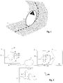
- the figure 1 represents an example of marking the site of an accident on a one-way road.
- the location 1 of the accident on a track 2 has been marked out, according to one embodiment.
- the beaconing was carried out by the positioning of beaconing elements 3, here pads, at calculated signaling positions. Thanks to such markings, motorists taking the same lane as that where the accident took place are warned sufficiently in advance of the place 1 of the accident to slow down correctly and thus bypass the accident zone 5 according to the arrows shown.
- the term “accidental area” is understood to mean an area comprising the location 1 of the accident and which is delimited by the signaling positions.
- the signaling of place 1 of the accident is implemented by an IFR infrastructure shown in figure 2 .
- the microprocessor 41 of the drone 4, the storage means 42 of the drone 4, the communication interface 43 of the drone 4 and the geolocation system 45 of the drone 4 are interconnected by a bus 44.
- storage means is meant, for example, a hard disk, an SD card, a micro-Sim, etc.
- wireless communication interface is understood to mean, for example, a WiFi interface, a Zigbee interface, etc.
- the interface of communication 43 uses an antenna 46 of the drone 4 to receive or transmit data by radio waves.
- GPS Globalstar system
- Galileo system a Galileo system
- the IFR infrastructure comprises at least two signaling drones 4.
- At least one operator communicates with said drone 4 by means of an application executed via its terminal 6.
- the microprocessor 61 of the terminal 6, the storage means 62 of the terminal 6, the communication interface 63 of the terminal 6 and the screen 64 of the terminal 6 are interconnected by a bus 65.
- the communication interface 63 uses an antenna 66 of the drone 4 to receive or transmit data by radio waves.
- the operator communicates via his terminal 6 with at least one remote server 7.
- the signaling drone 4 communicates with at least one remote server 7.
- the signaling drone 4 and the terminal 6 communicate with at least one remote server 7.
- the microprocessor 71 of the remote server 7, the storage means 72 of the remote server 7 and the communication interface 73 of the remote server 7 are interconnected by a bus 74.
- the signaling drone 4, the terminal 6 and the remote server 7 are interconnected by a network 8, for example the Internet network.
- a network 8 for example the Internet network.
- the communication interface 43 of the signaling drone 4 communicates directly with the communication interface 66 of the terminal 6 which communicates to it with the communication interface 73 of the server. remote 7.
- the figure 3 represents steps of the PRC signaling method according to one embodiment of the invention.
- the signaling drone 4 is configured according to data relating to the geographical area of the accident.
- data relating to the geographical area of the accident is meant a recovery of information relating to the geographical area (country, city, etc.) in which said drone 4 is located, either in the surroundings, in the vicinity or at the location. 1 of the accident.
- the drone 4 is first unlocked by the operator by means of a button for locking / unlocking the drone 4.
- the data relating to the geographical area are regulatory data specific to the geographical area in which the accident took place.
- regulatory data is meant, for example, regulatory signaling distances which may vary according to the country and according to the type of road (road, motorway, etc.). In France, for example, a marking element must be placed at least 30 meters from the obstacle so that a motorist can see the marking element at 100 meters.
- the signaling distance may vary depending on the type of road. For example, in Belgium, for ordinary roads, the marking element must be positioned at 30 meters while on a motorway, said element must be placed at 100 meters from the place of the accident.
- the data relating to the geographical area is a road map of said geographical area in which the drone 6 is located.
- the term “road map” is understood to mean a schematic representation of the road axes in digital form. .
- the data relating to the geographical area are data describing the topography of said geographical area in which the drone 6 is located.
- topography of the geographical area is understood to mean markings on the ground (continu line, deterrent, warning, guidance etc.), the type of road surface (bituminous concrete, cement concrete, paving stones, surface plasters etc.), guardrails, roadway etc.
- An automatic configuration of the drone 4 makes it possible to automatically update information relating to the geographical area which is stored in the storage means 42 of the drone 4.
- the preliminary step 1000 of configuring the signaling drone 4 enables said drone 4 to be already operational when it arrives at the scene of the accident.
- the recovery of information relating to the geographical area can be carried out as soon as the location 1 of the accident is known, even before the drone 4 has arrived on site.
- an acquisition of a location of the location 1 of the accident is carried out by the drone 4.
- acquisition of a location is understood to mean the coordinates of a point associated with the location 1 of the accident. accident or a plurality of coordinates associated with several points forming an area associated with place 1 of the accident.
- Acquiring the location of the location 1 of the accident comprises, according to one embodiment, a location of the location in which the operator has positioned the drone 4, said location being assimilated to the location of the accident via the activation of an actuator of said drone 4.
- the drone 4 records said location as corresponding to the place 1 of the accident.
- the location of the location in which the operator has positioned the drone 4 is carried out by means of the geolocation system 45 of said drone 4.
- the actuator therefore makes it possible either to define a zero making it possible to define a position relative update via accelerometers or to read a value from the geolocation system 45 to make it an absolute starting point.
- the acquisition of the location of the location 1 of the accident comprises a reception of location data transmitted by the terminal 6 to the drone 4.
- location data is understood to mean one or more coordinates associated with the. scene of the accident.
- the operator selects, via a dedicated application executed on his terminal 6, the location 1 of the accident which is then transmitted to the drone 4 in the form of location data.
- the location of the place 1 of the accident comprises a recognition of the place 1 of the accident by image analysis means of the drone 4.
- the image analysis means comprise, according to one embodiment, image capture means, for example a camera (visible spectrum, IR).
- the image analysis means thus comprise the microprocessor 41 of the drone 4 and instruction codes recorded in the second zone 42.1 of the storage means 42 of the drone 4.
- the image capture means capture images in which, for example, moving and stationary elements appear (debris, vehicles, residents, etc.).
- said image capture means capture images in which appear, for example, various elements constituting the traffic lane (roadway, shoulder, road markings, safety barriers, etc.). The captured images are then analyzed, according to one embodiment, by performing a shape recognition.
- pattern recognition is meant a set of techniques and methods aimed at identifying computer patterns from raw data in order to make a decision depending on a category assigned to this pattern.
- contours of a stationary vehicle, of a person on the ground will be recognized by the image analysis means of the drone 4 as being the vehicle and the body of the victim. The same is true when it comes to recognizing characteristics of the lane such as a marking on the ground, a roadway, a shoulder or even guardrails, the contours of said elements being correlated with prerecorded contours.
- the outlines of elements associated with categories are contained in the storage means 42 of the drone 4.
- said contours associated with categories are contained in the storage means 72 of the remote service 7 and / or in the storage means 62 of the terminal 6 which are then transmitted to the drone 4.
- the image captures made by the drone 4 are transmitted so that the processing is carried out remotely by the terminal 6 or the remote server 7. The drone 4 therefore receives the results of the processing for the recognition of the shape or having to carry it out itself.
- the preliminary step 1000 of configuring the drone 4 is carried out after the first step 1001 of acquiring the location of the place of the accident.
- a coordinate of at least one signaling position is calculated.
- the coordinate associated with at least one signaling position is calculated according to the coordinates of location 1 of the accident determined during the first step 1001 of acquiring the location of location 1 of the accident.
- the calculation of the coordinate of at least one signaling position takes into account at least one piece of data relating to the geographical area of the accident determined in the preliminary step 1000 for configuring the drone 4.
- the coordinates of the position (s) at which the signaling is carried out varies. For example, the signaling of the place of the accident on a motorway must be carried out at a distance from the place of the accident greater than the distance at which the signaling must be carried out on an ordinary road.
- the position P s at which the signaling of place 1 of the accident must be carried out corresponds to the intersection between the road on which the accident occurred and the circle whose center corresponds to place 1 of accident and whose radius corresponds to the regulatory distance ds between location 1 of the accident and the markings for the type of road concerned.
- the second step 1002 comprises the calculation of coordinates associated with at least two positions P s at which the signaling must be carried out.
- the accident is signaled.
- the signaling of the accident is carried out upstream of the place 1 of the accident according to the direction of the track.
- the signaling is also carried out downstream of the accident, in particular when the track is two-way.
- the signaling of the accident is carried out on several one-way lanes or on several two-way lanes.
- the signaling of the accident is carried out by a combination of the location of the place 1 of the accident determined in the first step 1001 and the coordinates of the signaling position calculated in the second step 1002.
- the signaling of the accident is achieved by the deployment of at least one markup element.
- markup element is meant elements exhibiting fluorescence and retro-reflection characteristics.
- the markup element 3 is a pre-signaling triangle.
- the markup element 3 is a stud.
- the drone 4 transports at least one beaconing element 3 from a starting point (trunk of an intervention vehicle, road) to at least one signaling position by means of a beacon holder of the drone 4.
- the beaconing element 3 is on board the drone 4, said beaconing element 3 being withdrawn and deposited when the drone 4 arrives at the signaling position.
- the signaling of the accident is carried out by a light and / or sound signal emitted by said at least one drone 4.
- the emission of a light and / or sound signal makes it possible to reduce the setting time. taking into account the accident by motorists as they approach place 1 of the accident.
- the drone 4 flies in a stationary manner at the signaling position high enough to be visible from approaching vehicles.
- the light signal is emitted in the form of a message visible on a screen of the drone 4.
- the light signal is emitted by at least one light-emitting diode (LED) of the drone 4.
- LED light-emitting diode
- the location of the place 1 of the accident is transmitted to the emergency services and / or to the gendarmerie / police.
- the transmission of the location of the location 1 of the accident to the emergency services and / or the gendarmerie / police is carried out automatically by the drone 7.
- the transmission of the location of the location 1 of the accident to the emergency services and / or to the gendarmerie / police is carried out by the terminal 2. It is noted that in one embodiment, the location data of the place 1 of the accident transmitted to the emergency services correspond to the location data of place 1 of the accident acquired during the first stage 1001.
- the transmission of the location 1 of the emergency accident and / or to the gendarmerie / police is accompanied by information relating to the physical condition of the victim (s).
- the fourth step 1004 of transmitting the location of the location 1 of the accident to the emergency services is carried out following the first step 1001 of acquiring the location of the location 1 of the accident. or more generally as soon as the required information is known.
- a fifth step 1005 the signaling of the place 1 of the accident by the drone 4 is stopped.
- the drone 4 when the drone 4 is no longer useful, said drone 4 recovers, according to one embodiment, the markup element (s) 3 and reposition itself near the operator.
- the drone 4 is repositioned to the initial location where it had been positioned by the operator before the signaling. According to one embodiment, the drone 4 is then locked by the operator via the locking / unlocking button of the drone 4.
- the PRC method according to the invention therefore makes it possible to carry out automatic and precise beaconing of the location 1 of an accident, which allows a witness to provide assistance to the victims as soon as he arrives at said location 1 of the accident in complete safety.
- the PRC process therefore saves precious time in helping victims.
Landscapes
- Physics & Mathematics (AREA)
- General Physics & Mathematics (AREA)
- Engineering & Computer Science (AREA)
- Aviation & Aerospace Engineering (AREA)
- Mechanical Engineering (AREA)
- Traffic Control Systems (AREA)
- Emergency Alarm Devices (AREA)
- Alarm Systems (AREA)
Description
- L'invention se rapporte au domaine général de la sécurité routière. L'invention concerne plus particulièrement un procédé de signalisation d'un accident routier par un drone de signalisation. Le procédé selon l'invention permet d'éviter les sur-accidents et ainsi, il permet de porter secours aux victimes en toute sécurité. En outre, l'invention concerne un drone de signalisation mettant en œuvre ledit procédé.
- Devant un accident de la route, le rôle du témoin ou de l'intervenant est fondamental. En effet, arrivé sur le lieu de l'accident, le témoin doit assurer la protection du lieu de l'accident afin d'éviter le sur-accident et ainsi assurer la protection des victimes et des secours.
- Pour ce faire, à l'approche du lieu de l'accident, le témoin doit, dans un premier temps, allumer ses feux de détresse et ralentir progressivement tout en vérifiant qu'un autre véhicule n'arrive pas à grande vitesse. Il doit ensuite stationner son véhicule après le lieu de l'accident, idéalement sur la bande d'arrêt d'urgence. Ensuite, le témoin doit porter un vêtement réfléchissant afin qu'il soit visible par les autres véhicules.
- Le témoin doit, par la suite, assurer le balisage du lieu de l'accident. Le balisage du lieu de l'accident délimite la zone d'intervention du/des témoin(s) et/ou des secours et constitue une barrière physique de protection pour la victime et/ou les témoins et/ou les secours. Des éléments de balisage présentant des caractéristiques de fluorescence et de rétro-réflexion doivent alors être positionnés à une distance réglementée du lieu de l'accident. Ainsi, les automobilistes sont prévenus de l'obstacle suffisamment à l'avance pour ralentir et/ou s'arrêter si nécessaire et emprunter une autre voie par exemple.
- Cependant, assurer le balisage du lieu de l'accident retarde le témoin dans la prise en charge des victimes dont les vies sont en danger.
- Le document
FR 2 986 647 - Dans ce contexte, l'invention vise à remédier à tout ou partie des inconvénients de l'état de la technique identifiés ci-dessus, notamment en proposant une solution permettant d'assurer automatiquement le balisage du lieu de l'accident de sorte que le premier témoin puisse porter secours aux victimes dès son arrivée sur le lieu de l'accident.
- Ainsi, selon un premier aspect, l'invention concerne un procédé de signalisation selon la revendication 1.
- Le procédé selon le premier aspect de l'invention permet de résoudre les problèmes préalablement cités.
- En effet, dès la localisation du lieu de l'accident, le drone calcule automatiquement une coordonnée d'au moins une position de signalisation qui prend en compte les données relatives au lieu de l'accident. En effet, la localisation du lieu de l'accident permet, par exemple, au drone de déterminer la réglementation applicable dans le lieu de l'accident notamment la distance à laquelle doit être fait le signalement de l'accident aux autres véhicules. Un opérateur arrivant sur le lieu de l'accident ne connait pas forcément la réglementation en vigueur concernant la distance de sécurité à respecter dans la zone géographique où il se trouve.
- Une fois la coordonnée de la position de signalisation calculée, le drone se positionne automatiquement selon ladite position de signalisation afin de signaler aux autres véhicules qu'un accident a eu lieu et donc qu'ils doivent ralentir et prendre une autre voie. La signalisation de l'accident aux autres véhicules permet d'éviter le sur-accident et ainsi d'assurer la sécurité de l'opérateur, celle des victimes, des secours ainsi que des automobilistes empruntant la même voie.
- Ainsi, alors que le drone procède au balisage du lieu de l'accident, l'opérateur peut secourir les victimes de l'accident sans perdre de temps.
- Le procédé selon le premier aspect de l'invention peut également présenter une ou plusieurs des caractéristiques ci-dessous, considérées individuellement ou selon toutes les combinaisons techniquement possibles.
- Selon un mode de réalisation non limitatif, les coordonnées du point associé au lieu de l'accident sont acquises par le système de géolocalisation du drone à l'emplacement dans lequel un opérateur a positionné le drone, ledit emplacement étant assimilé au lieu de l'accident via l'activation d'un actionneur dudit drone.
- Selon un mode de réalisation non limitatif, le procédé selon le premier aspect de l'invention comporte une reconnaissance du lieu de l'accident par des moyens d'analyse d'image du drone.
- En outre, selon un second aspect, l'invention concerne un drone de signalisation mettant en œuvre les étapes du procédé selon le premier aspect de l'invention.
- D'autres caractéristiques et avantages de l'invention ressortiront à la lecture de la description qui suit, en référence aux figures annexées qui illustrent :
- à la
figure 1 , un exemple de balisage du lieu d'un accident selon un mode de réalisation de l'invention, - à la
figure 2 , une infrastructure permettant la mise en œuvre de l'invention selon un mode de réalisation, - à la
figure 3 , les étapes du procédé de signalisation selon un mode de réalisation de l'invention. - L'invention et ses différentes applications seront mieux comprises à la lecture de la description qui suit et à l'examen des figures qui l'accompagnent. Celles-ci sont présentées à titre d'exemples non limitatifs de l'invention.
- Sauf précision contraire, un même élément apparaissant sur des figures différentes présente une référence unique.
- L'invention se rapporte à un procédé PRC de signalisation d'un accident mis en œuvre par au moins un drone de signalisation 4. Par « drone », on entend un dispositif volant sans pilote pouvant transporter une ou plusieurs charge(s) et déposer lesdites charges sur un lieu donné. La taille et la masse de tels drones sont choisies selon les capacités opérationnelles recherchées. Dans le cadre de l'invention, par exemple, la masse du drone 4 est de l'ordre de 8, 5 kg et le drone 4 présente les dimensions suivantes 115x115x70 cm (largeur x longueur x hauteur).
- La
figure 1 représente un exemple de balisage du lieu d'un accident sur une voie à sens unique. - En référence à la
figure 1 , le lieu 1 de l'accident survenu sur une voie 2 a été balisé, selon un mode de réalisation. Le balisage a été effectué par le positionnement d'éléments de balisage 3, ici des plots, à des positions de signalisation calculées. Grâce à un tel balisage, des automobilistes empruntant la même voie que celle où a eu lieu l'accident sont prévenus suffisamment à l'avance du lieu 1 de l'accident pour ralentir correctement et ainsi contourner la zone accidentée 5 selon les flèches représentées. Par « zone accidentée », on entend une zone comprenant le lieu 1 de l'accident et qui est délimitée par les positions de signalisation. - La signalisation du lieu 1 de l'accident est mise en oeuvre par une infrastructure IFR représentée à la
figure 2 . - Le balisage du lieu 1 de l'accident est réalisé par au moins un drone de signalisation 4. En référence à la
figure 2 , le drone de signalisation 4 de l'infrastructure IFR comporte : - un microprocesseur 41,
- des moyens de stockage 42,
- une interface de communication 43, par exemple une carte de communication sans fil,
- un système de géolocalisation 45.
- Le microprocesseur 41 du drone 4, les moyens de stockage 42 du drone 4, l'interface de communication 43 du drone 4 et le système de géolocalisation 45 du drone 4 sont interconnectés par un bus 44.
- On note que par « moyens de stockage », on entend, par exemple, un disque dur, une carte SD, une micro-Sim, etc.
- En outre, en référence à la
figure 2 , les moyens de stockage 42 du drone 4 comportent : - une première zone 42.1 stockant des données de cartographie routière,
- une deuxième zone 42.2 stockant des codes d'instructions pour la mise en œuvre du procédé PRC selon l'invention.
- On note que par « interface de communication sans fil », on entend, par exemple, une interface Wifi, une interface Zigbee etc. En outre, on note que l'interface de communication 43 utilise une antenne 46 du drone 4 pour recevoir ou transmettre des données par ondes radio.
- On note également que par « système de géolocalisation », on entend un GPS, un système Galileo etc.
- On rappelle que lorsque l'on prête une action à un dispositif celle-ci est en fait effectuée par un microprocesseur du dispositif commandé par des codes instructions enregistrés dans des moyens de stockage du dispositif. De plus, si l'on prête une action à une application, celle-ci est en fait effectuée par un microprocesseur du dispositif dans une mémoire duquel les codes instructions correspondant à l'application sont enregistrés. Lorsqu'un dispositif, ou une application émet un message, ce message est émis via une interface de communication dudit dispositif ou de la dite application.
- Selon un autre mode de réalisation, l'infrastructure IFR comporte au moins deux drones de signalisation 4.
- En outre, selon un mode de réalisation, au moins un opérateur, par exemple un témoin de l'accident, communique avec ledit drone 4 au moyen d'une application exécutée via son terminal 6.
- Le terminal 6 de l'infrastructure IFR, qu'il s'agisse d'un ordinateur, d'un téléphone mobile, d'une tablette ou d'un objet connecté, comporte :
- un microprocesseur 61,
- des moyens de stockage 62,
- une interface de communication 63, par exemple une carte de communication sans fil,
- un écran 64.
- Le microprocesseur 61 du terminal 6, les moyens de stockage 62 du terminal 6, l'interface de communication 63 du terminal 6 et l'écran 64 du terminal 6 sont interconnectés par un bus 65.
- En outre, on note que l'interface de communication 63 utilise une antenne 66 du drone 4 pour recevoir ou transmettre des données par ondes radio.
- Par ailleurs, selon un mode de réalisation, l'opérateur communique via son terminal 6 avec au moins un serveur distant 7. Selon un autre mode de réalisation, le drone de signalisation 4 communique avec au moins un serveur distant 7. Selon un autre mode de réalisation, le drone de signalisation 4 et le terminal 6 communiquent avec au moins un serveur distant 7.
- En référence à la
figure 2 , le serveur distant 7 de l'infrastructure IFR, comporte : - un microprocesseur 71,
- des moyens de stockage 72,
- une interface de communication 73.
- Le microprocesseur 71 du serveur distant 7, les moyens de stockage 72 du serveur distant 7 et l'interface de communication 73 du serveur distant 7 sont interconnectés par un bus 74.
- Selon un mode de réalisation, le drone de signalisation 4, le terminal 6 et le serveur distant 7 sont interconnectés par un réseau 8, par exemple le réseau Internet. Ce n'est qu'un exemple, un autre cas fréquent est que l'interface de communication 43 du drone de signalisation 4 communique directement avec l'interface de communication 66 du terminal 6 qui lui communique avec l'interface de communication 73 du serveur distant 7.
- La
figure 3 représente des étapes du procédé PRC de signalisation selon un mode de réalisation de l'invention. - Selon une étape préliminaire 1000, le drone de signalisation 4 est configuré selon des données relatives à la zone géographique de l'accident. Par « données relatives à la zone géographique de l'accident », on entend une récupération des informations relatives à la zone géographique (pays, ville, etc.) dans laquelle se trouve ledit drone 4 soit aux alentours, à proximité ou sur le lieu 1 de l'accident. Selon un mode de réalisation, le drone 4 est, au préalable, déverrouillé par l'opérateur au moyen d'un bouton de verrouillage/déverrouillage du drone 4.
- La zone géographique dans laquelle se trouve le drone de signalisation 4 est déterminée:
- selon un premier mode de réalisation, par le système de géolocalisation 45 du drone 4,
- selon un deuxième mode de réalisation, par le terminal 6 qui, au moyen d'un système de géolocalisation du terminal 6 transmet au drone 4 la zone géographique dans laquelle il se trouve,
- selon un troisième mode de réalisation, à la suite d'une sélection de ladite zone géographique par l'opérateur via son terminal 6 qui est ensuite transmise au drone 4.
- Une fois la zone géographique déterminée, le drone 4 récupère les informations relatives à la zone géographique via :
- selon un premier mode de réalisation, le drone 4 qui comporte lesdites informations dans les moyens de stockage 42 dudit drone 4,
- selon un deuxième mode de réalisation, le terminal 6 qui comporte lesdites informations dans les moyens de stockage 62 dudit terminal 6.
- selon un troisième mode de réalisation, le serveur distant 7 qui comporte lesdites informations dans les moyens de stockage 72 dudit serveur 7.
- Selon un mode de réalisation, les données relatives à la zone géographique sont des données de réglementation spécifiques à la zone géographique dans laquelle a eu lieu l'accident. Par « données de réglementation », on entend, par exemple, des distances de signalisation réglementaires qui peuvent varier selon les pays et selon le type de voie (route, autoroute etc.). En France, par exemple, un élément de balisage doit être placé au moins à 30 mètres de l'obstacle de sorte qu'un automobiliste puisse apercevoir l'élément de balisage à 100 mètres. En outre, la distance de signalisation peut varier selon le type de route. Par exemple, en Belgique, pour les routes ordinaires, l'élément de balisage doit être positionné à 30 mètres alors que sur une autoroute, ledit élément doit être placé à 100 mètres du lieu de l'accident.
- En outre, selon un autre mode de réalisation, les données relatives à la zone géographique sont une cartographie routière de ladite zone géographique dans laquelle se trouve le drone 6. Par « cartographie routière », on entend une représentation schématique des axes routiers sous forme numérique.
- Selon un autre mode de réalisation, les données relatives à la zone géographique sont des données de description de la topographie de ladite zone géographique dans laquelle se trouve le drone 6. Par « topographie » de la zone géographique, on entend des marquages au sol (ligne continue, de dissuasion, d'avertissement, de guidage etc.), le type de revêtement de la voie (béton bitumeux, béton de ciment, pavés, enduits superficiels etc.), des glissières de sécurité, la chaussée etc.
- Le déclenchement de la configuration du drone de signalisation 4 selon l'étape préliminaire 1000 est :
- selon un premier mode de réalisation, réalisé par l'opérateur via l'application exécutée sur son terminal 6,
- selon un deuxième mode de réalisation, est automatiquement réalisé par le drone de signalisation 4 dès son allumage.
- Une configuration automatique du drone 4 permet de mettre à jour automatiquement des informations relatives à la zone géographique qui sont stockées dans les moyens de stockage 42 du drone 4.
- L'étape préliminaire 1000 de configuration du drone de signalisation 4 permet audit drone 4 d'être déjà opérationnel quand il arrive sur les lieux de l'accident. La récupération des informations relatives à la zone géographique peut être effectuée dès que le lieu 1 de l'accident est connu, avant même que le drone 4 ne soit arrivé sur place.
- Selon une première étape 1001, une acquisition d'une localisation du lieu 1 de l'accident est effectuée par le drone 4. Par « acquisition d'une localisation », on entend des coordonnées d'un point associé au lieu 1 de l'accident ou une pluralité de cordonnées associées à plusieurs points formant une zone associée au lieu 1 de l'accident.
- L'acquisition de la localisation du lieu 1 de l'accident comporte, selon un mode de réalisation, une localisation de l'emplacement dans lequel l'opérateur a positionné le drone 4, ledit emplacement étant assimilé au lieu de l'accident via l'activation d'un actionneur dudit drone 4. Ainsi, lorsque le drone 4 est positionné par l'opérateur sur la route par exemple, à proximité du lieu 1 de l'accident, le drone 4 enregistre ledit emplacement comme correspondant au lieu 1 de l'accident. Selon un mode de réalisation, la localisation de l'emplacement dans lequel l'opérateur a positionné le drone 4 est réalisée au moyen du système de géolocalisation 45 dudit drone 4. L'actionneur permet donc soit de définir un zéro permettant de définir une position relative mise à jour via des accéléromètres soit de lire une valeur du système de géolocalisation 45 pour en faire un point de départ absolu.
- Selon un autre mode de réalisation, l'acquisition de la localisation du lieu 1 l'accident comporte une réception de données de localisation transmises par le terminal 6 au drone 4. Par « données de localisation », on entend une ou plusieurs cordonnées associés au lieu de l'accident. En effet, selon un mode de réalisation, l'opérateur sélectionne, via une application dédiée exécutée sur son terminal 6, le lieu 1 de l'accident qui est alors transmis au drone 4 sous forme de données de localisation.
- Selon un autre mode de réalisation, la localisation du lieu 1 de l'accident comporte une reconnaissance du lieu 1 de l'accident par des moyens d'analyse d'images du drone 4. Les moyens d'analyse d'image comportent, selon un mode de réalisation, des moyens de capture d'images, par exemple une caméra (spectre visible, IR). Les moyens d'analyse d'images comportent ainsi le microprocesseur 41 du drone 4 et des codes d'instructions enregistrés dans la deuxième zone 42.1 des moyens de stockage 42 du drone 4. Selon un mode de réalisation, les moyens de capture d'images capturent des images dans lesquelles apparaissent, par exemple, des éléments mobiles et immobiles (débris, véhicules, riverains ...). Selon un autre mode de réalisation, lesdits moyens de capture d'images capturent des images dans lesquelles apparaissent, par exemple, divers éléments constituant la voie de circulation (chaussée, accotement, marquage au sol, glissières de sécurité etc.). Les images capturées sont ensuite analysées, selon un mode de réalisation, en procédant à une reconnaissance de forme. Par « reconnaissance de formes » (ou parfois reconnaissance de motifs), on entend un ensemble de techniques et de méthodes visant à identifier des motifs informatiques à partir de données brutes afin de prendre une décision dépendant d'une catégorie attribuée à ce motif. Par exemple, les contours d'un véhicule à l'arrêt, d'une personne à terre seront reconnus par les moyens d'analyse d'images du drone 4 comme étant le véhicule et le corps de la victime. Il en de même lorsqu'il s'agit de reconnaitre des caractéristiques de la voie tels qu'un marquage au sol, une chaussée, un accotement ou encore des glissières de sécurité, les contours desdits éléments étant corrélés à des contours préenregistrés. Selon un mode de réalisation, les contours d'éléments associés à des catégories sont contenus dans les moyens de stockage 42 du drone 4. Selon un autre mode de réalisation, lesdits contours associés à des catégories sont contenus dans les moyens de stockage 72 du service distant 7 et/ou dans les moyens de stockage 62 du terminal 6 qui sont transmis ensuite au drone 4. Dans une variante de réalisation, les captures d'images effectuées par le drone 4 sont transmises pour que le traitement soit effectué à distance par le terminal 6 ou le serveur distant 7. Le drone 4 reçoit donc les résultats du traitement pour la reconnaissance de forme soit avoir à le réaliser lui-même.
- On note que, dans une variante, l'étape préliminaire 1000 de configuration du drone 4 est effectuée après la première étape 1001 d'acquisition de la localisation du lieu de l'accident.
- Selon une deuxième étape 1002, une coordonnée d'au moins une position de signalisation est calculée. La cordonnée associée à au moins une position de signalisation est calculée selon les coordonnées du lieu 1 de l'accident déterminées lors de la première étape 1001 d'acquisition de la localisation du lieu 1 de l'accident.
- Selon un mode de réalisation, le calcul de la coordonnée d'au moins une position de signalisation prend en compte au moins une donnée des données relatives à la zone géographique de l'accident déterminée dans l'étape préliminaire 1000 de configuration du drone 4. En effet, on rappelle que selon notamment le type de voie, la réglementation, la topographie de la voie, les coordonnées de la ou des position(s) à laquelle la signalisation est réalisée varie. Par exemple, la signalisation du lieu de l'accident sur une autoroute doit être réalisée à une distance du lieu de l'accident supérieure à la distance à laquelle doit être réalisée la signalisation sur une route ordinaire.
- Dans un exemple de réalisation, la position Ps à laquelle doit être effectuée la signalisation du lieu 1 de l'accident correspond à l'intersection entre la route sur laquelle est survenu l'accident et le cercle dont le centre correspond au lieu 1 de l'accident et dont le rayon correspond à la distance réglementaire ds entre le lieu 1 de l'accident et le balisage pour le type de route concerné.
- Selon un mode de réalisation, la deuxième étape 1002 comporte le calcul de coordonnées associées à au moins à deux positions Ps auxquelles doit être effectuée la signalisation.
- Selon une troisième étape 1003, une signalisation de l'accident est effectuée.
- Selon un mode de réalisation, la signalisation de l'accident est effectuée en amont du lieu 1 de l'accident selon le sens de la voie. Selon un autre mode de réalisation, la signalisation est effectuée également en aval de l'accident, en particulier lorsque la voie est à double-sens. En outre, selon un mode de réalisation, la signalisation de l'accident est effectuée sur plusieurs voies à sens unique ou sur plusieurs voies à double-sens.
- La signalisation de l'accident est réalisée par une combinaison de la localisation du lieu 1 de l'accident déterminée dans la première étape 1001 et des coordonnées de la position de signalisation calculées dans la deuxième étape 1002. Selon un mode de réalisation, la signalisation de l'accident est réalisée par le déploiement d'au moins un élément de balisage. Par « élément de balisage », on entend des éléments présentant des caractéristiques de fluorescence et de rétro-réflexion. Selon un mode de réalisation, l'élément de balisage 3 est un triangle de pré-signalisation. Selon un autre mode de réalisation, l'élément de balisage 3 est un plot. Dans ledit mode de réalisation, le drone 4 transporte au moins un élément de balisage 3 d'un point de départ (coffre d'un véhicule d'intervention, route) à au moins une position de signalisation au moyen d'un porte-balises du drone 4. Dans un autre mode de réalisation, l'élément de balisage 3 est embarqué dans le drone 4, ledit élément de balisage 3 étant retiré et déposé lorsque le drone 4 arrive au niveau de la position de signalisation. Selon un mode de réalisation, la signalisation de l'accident est réalisée par un signal lumineux et/ou sonore émis par ledit au moins un drone 4. L'émission d'un signal lumineux et/ou sonore permet de réduire le délai de prise en compte de l'accident par les automobilistes à l'approche du lieu 1 de l'accident. Selon un mode de réalisation, lorsque la signalisation est réalisée par l'émission d'un signal lumineux, le drone 4 vole de manière stationnaire au niveau de la position de signalisation suffisamment haut pour être visible des véhicules en approche. Selon un mode de réalisation, le signal lumineux est émis sous la forme d'un message visible sur un écran du drone 4. Selon un mode de réalisation le signal lumineux est émis par au moins une diode électroluminescente (LED) du drone 4.
- Selon une quatrième étape 1004, la localisation du lieu 1 de l'accident est transmise aux secours et/ou à la gendarmerie/police.
- Selon un mode de réalisation, la transmission de la localisation du lieu 1 de l'accident aux secours et/ou à la gendarmerie/police est réalisée automatiquement par le drone 7. Selon un autre mode de réalisation, la transmission de la localisation du lieu 1 de l'accident aux secours et/ou à la gendarmerie/police est réalisée par le terminal 2. On note que dans un mode de réalisation, les données de localisation du lieu 1 de l'accident transmise aux secours correspondent aux données de localisation du lieu 1 de l'accident acquises lors de la première étape 1001.
- Selon un mode de réalisation, la transmission de la localisation 1 de l'accident secours et/ou à la gendarmerie/police est accompagnée d'informations relatives à l'état physique de la ou les victimes.
- On note que selon un mode de réalisation, la quatrième étape 1004 de transmission de la localisation du lieu 1 de l'accident aux secours est réalisée à la suite de la première étape 1001 d'acquisition de la localisation du lieu 1 de l'accident ou plus généralement dès que les informations requises sont connues.
- Selon une cinquième étape 1005, la signalisation du lieu 1 de l'accident par le drone 4 est stoppée.
- En effet, lorsque le drone 4 n'est plus utile, ledit drone 4 récupère, selon un mode de réalisation, le(s) élément(s) de balisage 3 et se repositionne à proximité de l'opérateur. Dans un autre mode de réalisation, le drone 4 se repositionne à l'emplacement initial où il avait été positionné par l'opérateur avant la signalisation. Selon un mode de réalisation, le drone 4 est ensuite verrouillé par l'opérateur via le bouton de verrouillage/déverrouillage du drone 4.
- Le procédé PRC selon l'invention permet donc de réaliser un balisage automatique et précis du lieu 1 d'un accident ce qui permet à un témoin de porter secours aux victimes dès son arrivée sur ledit lieu 1 de l'accident en toute sécurité. Le procédé PRC permet donc de gagner un temps précieux dans le secours des victimes.
Claims (6)
- Procédé (PRC) de signalisation d'un accident ayant eu lieu dans une zone géographique donnée, mis en œuvre par au moins un drone (4), ledit procédé (PRC) comportant- une étape d'Acquisition (1001) par le drone (4) de coordonnées d'au moins un point associé à un lieu (1) de l'accident, lesquelles coordonnées forment une localisation dudit lieu (1), les coordonnées du point associé au lieu (1) de l'accident étant acquises via un système de géolocalisation (45) du drone (4) ou reçues d'un terminal (6) via une antenne (46) du drone (4) ;ledit procédé étant caractérisé en ce qu'il comporte les étapes suivantes:- Calcul par le microprocesseur (41) du drone (4), des coordonnées d'au moins une position (1002) de signalisation, les coordonnées de la position (1002) de signalisation étant calculées à partir des coordonnées du point associé au lieu (1) de l'accident acquises et d'au moins une donnée relative à la zone géographique de l'accident, la donnée relative à la zone géographique de l'accident comprenant une donnée de réglementation spécifique à la zone géographique de l'accident et/ou une cartographie routière de la zone géographique de l'accident et/ou une donnée de description de la topographie de la zone géographique de l'accident ;- Signalisation de l'accident (1003) mise en œuvre par le drone (4) à la position (1002) de signalisation calculée, la signalisation de l'accident (1003) étant réalisée par le déploiement d'au moins un élément de balisage (3) transporté par le drone (4) ou par l'émission d'un signal lumineux via un écran du drone (4) ou au moins une diode électroluminescente du drone (4).
- Procédé (PRC) de signalisation selon la revendication 1 caractérisé en ce que les coordonnées du point associé au lieu (1) de l'accident sont acquises par le système de géolocalisation (45) du drone (4) à l'emplacement dans lequel un opérateur a positionné le drone (4), ledit emplacement étant assimilé au lieu (1) de l'accident via l'activation d'un actionneur dudit drone (4).
- Procédé (PRC) de signalisation selon l'une quelconque des revendications 1 ou 2, caractérisé en ce qu'il comporte une reconnaissance du lieu (1) de l'accident par des moyens d'analyse d'images du drone (4).
- Drone de signalisation (4) configuré pour mettre en oeuvre les étapes du procédé (PRC) selon l'une quelconque des revendications 1 à 3, le drone de signalisation (4) comportant :- un système de géolocalisation (45) configuré pour acquérir les coordonnées d'au moins un point associé à un lieu (1) d'un accident et/ou une antenne (46) configuré pour recevoir les coordonnées du point associé au lieu (1) de l'accident d'un terminal (6) ;- un microprocesseur (41) configuré pour calculer des coordonnées d'au moins une position (1002) de signalisation à partir des coordonnées du point associé au lieu (1) de l'accident et d'au moins une donnée relative à une zone géographique de l'accident- un porte-balise ou un écran ou une diode électroluminescente, configuré pour permettre la signalisation de l'accident à la position (1002) de signalisation calculée.
- Drone de signalisation (4) selon la revendication 4, configuré pour mettre en œuvre les étapes du procédé (PRC) selon la revendication 2, caractérisé en ce qu'il comporte en outre un actionneur configuré pour permettre l'assimilation d'un emplacement du drone (4) au lieu de l'accident à son activation.
- Drone de signalisation (4) selon l'une quelconque des revendications 4 ou 5, configuré pour mettre en œuvre les étapes du procédé (PRC) selon la revendication 3, caractérisé en ce qu'il comporte en outre des moyens d'analyse d'images du drone (4) configurés pour reconnaître le lieu (1) de l'accident.
Applications Claiming Priority (2)
| Application Number | Priority Date | Filing Date | Title |
|---|---|---|---|
| FR1563131A FR3045910B1 (fr) | 2015-12-22 | 2015-12-22 | Procede de signalisation d'un accident par un drone de signalisation |
| PCT/EP2016/081727 WO2017108681A1 (fr) | 2015-12-22 | 2016-12-19 | Procede de signalisation d'un accident par un drone de signalisation |
Publications (2)
| Publication Number | Publication Date |
|---|---|
| EP3394845A1 EP3394845A1 (fr) | 2018-10-31 |
| EP3394845B1 true EP3394845B1 (fr) | 2021-11-24 |
Family
ID=55361835
Family Applications (1)
| Application Number | Title | Priority Date | Filing Date |
|---|---|---|---|
| EP16822446.7A Active EP3394845B1 (fr) | 2015-12-22 | 2016-12-19 | Procede de signalisation d'un accident par un drone de signalisation |
Country Status (7)
| Country | Link |
|---|---|
| US (1) | US10773641B2 (fr) |
| EP (1) | EP3394845B1 (fr) |
| JP (1) | JP2019508778A (fr) |
| CN (1) | CN108431882A (fr) |
| CA (1) | CA3009285A1 (fr) |
| FR (1) | FR3045910B1 (fr) |
| WO (1) | WO2017108681A1 (fr) |
Families Citing this family (6)
| Publication number | Priority date | Publication date | Assignee | Title |
|---|---|---|---|---|
| FR3074346B1 (fr) * | 2017-11-30 | 2020-08-28 | Valeo Vision | Dispositif de signalisation d'un objet en position fixe sur une scene de route |
| FR3074345B1 (fr) * | 2017-11-30 | 2020-03-06 | Valeo Vision | Dispositif de signalisation d'une situation accidentogene d'un vehicule automobile |
| WO2019147795A1 (fr) * | 2018-01-24 | 2019-08-01 | Avis Budget Car Rental, LLC | Utilisation de drone dans des systèmes d'interface et de communication d'utilisateur connecté et de parc connecté |
| CN111038376B (zh) * | 2018-10-12 | 2023-07-11 | 宝马股份公司 | 一种用于控制用于车辆的警示标志的方法、装置和系统 |
| CN112785836B (zh) * | 2019-11-06 | 2022-08-23 | 阿波罗智联(北京)科技有限公司 | 一种交通监控方法及装置 |
| WO2021098967A1 (fr) * | 2019-11-22 | 2021-05-27 | Huawei Technologies Co., Ltd. | Dispositifs et procédés de collecte d'informations d'accidents de la circulation |
Family Cites Families (38)
| Publication number | Priority date | Publication date | Assignee | Title |
|---|---|---|---|---|
| US6084510A (en) * | 1997-04-18 | 2000-07-04 | Lemelson; Jerome H. | Danger warning and emergency response system and method |
| US20040015336A1 (en) * | 2002-07-19 | 2004-01-22 | Kulesz James J. | Automatic detection and assessment of chemical, biological, radiological and nuclear threats |
| US20150054639A1 (en) * | 2006-08-11 | 2015-02-26 | Michael Rosen | Method and apparatus for detecting mobile phone usage |
| US9932033B2 (en) * | 2007-05-10 | 2018-04-03 | Allstate Insurance Company | Route risk mitigation |
| US20090205845A1 (en) * | 2008-02-16 | 2009-08-20 | Fire Termination Equipment, Incorporated | System and method for extinguishing wildfires |
| US20100194592A1 (en) * | 2009-02-04 | 2010-08-05 | Raymond Yim | Method and System for Disseminating Vehicle and Road Related Information in Multi-Hop Broadcast Networks |
| US8068016B2 (en) * | 2009-02-04 | 2011-11-29 | Mitsubishi Electric Research Laboratories, Inc. | Method and system for disseminating witness information in multi-hop broadcast network |
| WO2012135362A2 (fr) * | 2011-03-28 | 2012-10-04 | Waze, Inc. | Dispositif, système et procédé de télédiffusion en direct à partir de dispositifs mobiles |
| FR2986647A3 (fr) * | 2012-02-07 | 2013-08-09 | Renault Sas | Vehicule automobile associe a un drone d'observation |
| GB201300901D0 (en) * | 2013-01-18 | 2013-03-06 | Tomtom Dev Germany Gmbh | Method and apparatus for creating map data |
| US10262373B2 (en) * | 2013-06-07 | 2019-04-16 | State Farm Mutual Automobile Insurance Company | Systems and methods for grid-based insurance rating |
| US9064412B2 (en) * | 2013-10-09 | 2015-06-23 | Bayerische Motoren Werke Aktiengesellschaft | Method for providing information to first responders of vehicle accidents |
| US9877176B2 (en) * | 2013-12-18 | 2018-01-23 | Medlegal Network, Inc. | Methods and systems of managing accident communications over a network |
| US9435652B2 (en) * | 2013-12-19 | 2016-09-06 | Novatel Wireless, Inc. | Dynamic routing intelligent vehicle enhancement system |
| US9567102B1 (en) * | 2014-01-29 | 2017-02-14 | Stan W. Ross | Safety system with projectable warning indicia |
| US20160189303A1 (en) * | 2014-03-21 | 2016-06-30 | Gil Emanuel Fuchs | Risk Based Automotive Insurance Rating System |
| US9142127B1 (en) * | 2014-04-29 | 2015-09-22 | Maxwell Consulting, LLC | Systems and methods for traffic guidance nodes and traffic navigating entities |
| US9948898B2 (en) * | 2014-08-22 | 2018-04-17 | Verizon Patent And Licensing Inc. | Using aerial imaging to provide supplemental information about a location |
| US10762571B2 (en) * | 2014-09-02 | 2020-09-01 | Metropolitan Life Insurance Co. | Use of drones to assist with insurance, financial and underwriting related activities |
| US10145684B1 (en) * | 2014-09-22 | 2018-12-04 | State Farm Mutual Automobile Insurance Company | Accident reconstruction implementing unmanned aerial vehicles (UAVs) |
| CN104332053A (zh) * | 2014-11-13 | 2015-02-04 | 深圳大学 | 一种基于小型无人机的道路交通巡检系统及其巡检方法 |
| US9858478B2 (en) * | 2014-12-19 | 2018-01-02 | Intel Corporation | Bi-directional community information brokerage |
| US10633091B2 (en) * | 2015-01-29 | 2020-04-28 | Scope Technologies Holdings Limited | Accident monitoring using remotely operated or autonomous aerial vehicles |
| KR20160112252A (ko) * | 2015-03-18 | 2016-09-28 | 엘지전자 주식회사 | 무인항공장치 및 이의 제어방법 |
| KR101535401B1 (ko) * | 2015-04-01 | 2015-07-08 | 오인선 | 드론방식 구명장비 투하장치 |
| US9767625B1 (en) * | 2015-04-13 | 2017-09-19 | Allstate Insurance Company | Automatic crash detection |
| US10102586B1 (en) * | 2015-04-30 | 2018-10-16 | Allstate Insurance Company | Enhanced unmanned aerial vehicles for damage inspection |
| US9984331B2 (en) * | 2015-06-08 | 2018-05-29 | International Business Machines Corporation | Automated vehicular accident detection |
| KR101714158B1 (ko) * | 2015-06-09 | 2017-03-08 | 현대자동차주식회사 | 차량사고 기록장치 및 그의 사고정보 생성 방법 |
| US9652990B2 (en) * | 2015-06-30 | 2017-05-16 | DreamSpaceWorld Co., LTD. | Systems and methods for monitoring unmanned aerial vehicles |
| JP6402876B2 (ja) * | 2015-07-06 | 2018-10-10 | 株式会社エアロネクスト | 回転翼機着陸装置 |
| US20170011465A1 (en) * | 2015-07-08 | 2017-01-12 | Here Global B.V. | Method and apparatus for providing fee rate based on safety score |
| CN204822072U (zh) * | 2015-07-09 | 2015-12-02 | 湖北省机电研究设计院股份公司 | 具有消防侦察功能的多旋翼无人机飞行器 |
| US11461717B2 (en) * | 2015-07-21 | 2022-10-04 | Avaya, Inc. | Device, system, and method for automated vehicle guidance system |
| US9734721B2 (en) * | 2015-08-14 | 2017-08-15 | Here Global B.V. | Accident notifications |
| CN105069595A (zh) * | 2015-08-18 | 2015-11-18 | 杨珊珊 | 一种利用无人机实现的快递系统及方法 |
| US20170103659A1 (en) * | 2015-10-10 | 2017-04-13 | Xin Jin | Method and system for implementing and enforcing a no-fly zone or prohibitive zone for drones and unmanned vehicles |
| EP3387850A4 (fr) * | 2015-12-10 | 2019-08-21 | Telefonaktiebolaget LM Ericsson (publ) | Technique pour collecter des informations relatives à des accidents de la circulation |
-
2015
- 2015-12-22 FR FR1563131A patent/FR3045910B1/fr active Active
-
2016
- 2016-12-19 EP EP16822446.7A patent/EP3394845B1/fr active Active
- 2016-12-19 JP JP2018532754A patent/JP2019508778A/ja active Pending
- 2016-12-19 CA CA3009285A patent/CA3009285A1/fr not_active Abandoned
- 2016-12-19 US US16/064,019 patent/US10773641B2/en active Active
- 2016-12-19 CN CN201680075602.0A patent/CN108431882A/zh active Pending
- 2016-12-19 WO PCT/EP2016/081727 patent/WO2017108681A1/fr not_active Ceased
Non-Patent Citations (1)
| Title |
|---|
| None * |
Also Published As
| Publication number | Publication date |
|---|---|
| FR3045910A1 (fr) | 2017-06-23 |
| CN108431882A (zh) | 2018-08-21 |
| US20190001872A1 (en) | 2019-01-03 |
| US10773641B2 (en) | 2020-09-15 |
| WO2017108681A1 (fr) | 2017-06-29 |
| FR3045910B1 (fr) | 2018-01-05 |
| JP2019508778A (ja) | 2019-03-28 |
| CA3009285A1 (fr) | 2017-06-29 |
| EP3394845A1 (fr) | 2018-10-31 |
Similar Documents
| Publication | Publication Date | Title |
|---|---|---|
| EP3394845A1 (fr) | Procede de signalisation d'un accident par un drone de signalisation | |
| CN104094331B (zh) | 确定车辆在道路行车道中的定位的方法,以及用于检测两个车辆之间的对齐和碰撞风险的方法 | |
| US10397861B2 (en) | Communication system, vehicle-mounted apparatus, and recording medium recording program | |
| US8983771B2 (en) | Inter-vehicle information conveyance system and method | |
| US20110302214A1 (en) | Method for updating a database | |
| US20250157331A1 (en) | Technology for situational modification of autonomous vehicle operation | |
| US20180157262A1 (en) | Vehicle control system, server device, vehicle control method, and vehicle control program | |
| US20120044063A1 (en) | System and method for defining areas of interest and modifying asset monitoring in relation thereto | |
| WO2018017793A1 (fr) | Système et procédé de création, mise à jour et utilisation de cartes générées par des véhicules à sonde | |
| CN112485815A (zh) | 精确定位信息和gnss定位信息之间的定位差的分布式信息生成装置及方法 | |
| US20200164799A1 (en) | Mixed reality view for enhancing pedestrian safety | |
| KR20150097782A (ko) | 교통 이벤트를 습득하기 위한 방법 및 시스템, 및 그 시스템의 사용 방법 | |
| WO2012002005A1 (fr) | Dispositif de transmission d'informations | |
| EP3123195B1 (fr) | Systeme de protection de personnes sur chantier par localisation precise | |
| JP2023530069A (ja) | 沿道検知警報システム及び方法 | |
| JP2018010535A (ja) | 固定カメラ、サーバ、道路情報更新システム、および情報処理プログラム | |
| EP3732905A1 (fr) | Sécurisation d'un environnement de travail a l'aide d'au moins une balise électronique et d'une étiquette électronique | |
| Tadic et al. | GHOST: A novel approach to smart city infrastructures monitoring through GNSS precise positioning | |
| WO2010133811A1 (fr) | Systeme de presignalisation pour une population de pietons ou utilisateurs de vehicule | |
| WO2017160562A1 (fr) | Procédés et systèmes pour surveiller des intersections avec des véhicules connectés à l'arrêt | |
| JP2019008348A (ja) | 地図データ構造、送信装置、及び、運転支援装置 | |
| FR3082166A1 (fr) | Système d’assistance a la conduite | |
| FR2946424A1 (fr) | Dispositif et procede de detection du sens de circulation d'un vehicule par analyse de positions successives | |
| WO2019233804A1 (fr) | Dispositif d'affichage pour l'aide à la conduite | |
| FR3052905A1 (fr) | Procede et dispositif d'assistance pour alerter des vehicules de la presence interdite d'une personne sur une voie de circulation |
Legal Events
| Date | Code | Title | Description |
|---|---|---|---|
| STAA | Information on the status of an ep patent application or granted ep patent |
Free format text: STATUS: UNKNOWN |
|
| STAA | Information on the status of an ep patent application or granted ep patent |
Free format text: STATUS: THE INTERNATIONAL PUBLICATION HAS BEEN MADE |
|
| PUAI | Public reference made under article 153(3) epc to a published international application that has entered the european phase |
Free format text: ORIGINAL CODE: 0009012 |
|
| STAA | Information on the status of an ep patent application or granted ep patent |
Free format text: STATUS: REQUEST FOR EXAMINATION WAS MADE |
|
| 17P | Request for examination filed |
Effective date: 20180618 |
|
| AK | Designated contracting states |
Kind code of ref document: A1 Designated state(s): AL AT BE BG CH CY CZ DE DK EE ES FI FR GB GR HR HU IE IS IT LI LT LU LV MC MK MT NL NO PL PT RO RS SE SI SK SM TR |
|
| AX | Request for extension of the european patent |
Extension state: BA ME |
|
| DAV | Request for validation of the european patent (deleted) | ||
| DAX | Request for extension of the european patent (deleted) | ||
| STAA | Information on the status of an ep patent application or granted ep patent |
Free format text: STATUS: EXAMINATION IS IN PROGRESS |
|
| 17Q | First examination report despatched |
Effective date: 20190913 |
|
| GRAP | Despatch of communication of intention to grant a patent |
Free format text: ORIGINAL CODE: EPIDOSNIGR1 |
|
| STAA | Information on the status of an ep patent application or granted ep patent |
Free format text: STATUS: GRANT OF PATENT IS INTENDED |
|
| INTG | Intention to grant announced |
Effective date: 20210617 |
|
| GRAS | Grant fee paid |
Free format text: ORIGINAL CODE: EPIDOSNIGR3 |
|
| GRAA | (expected) grant |
Free format text: ORIGINAL CODE: 0009210 |
|
| STAA | Information on the status of an ep patent application or granted ep patent |
Free format text: STATUS: THE PATENT HAS BEEN GRANTED |
|
| AK | Designated contracting states |
Kind code of ref document: B1 Designated state(s): AL AT BE BG CH CY CZ DE DK EE ES FI FR GB GR HR HU IE IS IT LI LT LU LV MC MK MT NL NO PL PT RO RS SE SI SK SM TR |
|
| REG | Reference to a national code |
Ref country code: GB Ref legal event code: FG4D Free format text: NOT ENGLISH |
|
| REG | Reference to a national code |
Ref country code: AT Ref legal event code: REF Ref document number: 1450466 Country of ref document: AT Kind code of ref document: T Effective date: 20211215 |
|
| REG | Reference to a national code |
Ref country code: DE Ref legal event code: R096 Ref document number: 602016066628 Country of ref document: DE |
|
| REG | Reference to a national code |
Ref country code: IE Ref legal event code: FG4D Free format text: LANGUAGE OF EP DOCUMENT: FRENCH |
|
| REG | Reference to a national code |
Ref country code: LT Ref legal event code: MG9D |
|
| REG | Reference to a national code |
Ref country code: NL Ref legal event code: MP Effective date: 20211124 |
|
| REG | Reference to a national code |
Ref country code: AT Ref legal event code: MK05 Ref document number: 1450466 Country of ref document: AT Kind code of ref document: T Effective date: 20211124 |
|
| PG25 | Lapsed in a contracting state [announced via postgrant information from national office to epo] |
Ref country code: RS Free format text: LAPSE BECAUSE OF FAILURE TO SUBMIT A TRANSLATION OF THE DESCRIPTION OR TO PAY THE FEE WITHIN THE PRESCRIBED TIME-LIMIT Effective date: 20211124 Ref country code: LT Free format text: LAPSE BECAUSE OF FAILURE TO SUBMIT A TRANSLATION OF THE DESCRIPTION OR TO PAY THE FEE WITHIN THE PRESCRIBED TIME-LIMIT Effective date: 20211124 Ref country code: FI Free format text: LAPSE BECAUSE OF FAILURE TO SUBMIT A TRANSLATION OF THE DESCRIPTION OR TO PAY THE FEE WITHIN THE PRESCRIBED TIME-LIMIT Effective date: 20211124 Ref country code: BG Free format text: LAPSE BECAUSE OF FAILURE TO SUBMIT A TRANSLATION OF THE DESCRIPTION OR TO PAY THE FEE WITHIN THE PRESCRIBED TIME-LIMIT Effective date: 20220224 Ref country code: AT Free format text: LAPSE BECAUSE OF FAILURE TO SUBMIT A TRANSLATION OF THE DESCRIPTION OR TO PAY THE FEE WITHIN THE PRESCRIBED TIME-LIMIT Effective date: 20211124 |
|
| PG25 | Lapsed in a contracting state [announced via postgrant information from national office to epo] |
Ref country code: IS Free format text: LAPSE BECAUSE OF FAILURE TO SUBMIT A TRANSLATION OF THE DESCRIPTION OR TO PAY THE FEE WITHIN THE PRESCRIBED TIME-LIMIT Effective date: 20220324 Ref country code: SE Free format text: LAPSE BECAUSE OF FAILURE TO SUBMIT A TRANSLATION OF THE DESCRIPTION OR TO PAY THE FEE WITHIN THE PRESCRIBED TIME-LIMIT Effective date: 20211124 Ref country code: PT Free format text: LAPSE BECAUSE OF FAILURE TO SUBMIT A TRANSLATION OF THE DESCRIPTION OR TO PAY THE FEE WITHIN THE PRESCRIBED TIME-LIMIT Effective date: 20220324 Ref country code: PL Free format text: LAPSE BECAUSE OF FAILURE TO SUBMIT A TRANSLATION OF THE DESCRIPTION OR TO PAY THE FEE WITHIN THE PRESCRIBED TIME-LIMIT Effective date: 20211124 Ref country code: NO Free format text: LAPSE BECAUSE OF FAILURE TO SUBMIT A TRANSLATION OF THE DESCRIPTION OR TO PAY THE FEE WITHIN THE PRESCRIBED TIME-LIMIT Effective date: 20220224 Ref country code: NL Free format text: LAPSE BECAUSE OF FAILURE TO SUBMIT A TRANSLATION OF THE DESCRIPTION OR TO PAY THE FEE WITHIN THE PRESCRIBED TIME-LIMIT Effective date: 20211124 Ref country code: LV Free format text: LAPSE BECAUSE OF FAILURE TO SUBMIT A TRANSLATION OF THE DESCRIPTION OR TO PAY THE FEE WITHIN THE PRESCRIBED TIME-LIMIT Effective date: 20211124 Ref country code: HR Free format text: LAPSE BECAUSE OF FAILURE TO SUBMIT A TRANSLATION OF THE DESCRIPTION OR TO PAY THE FEE WITHIN THE PRESCRIBED TIME-LIMIT Effective date: 20211124 Ref country code: GR Free format text: LAPSE BECAUSE OF FAILURE TO SUBMIT A TRANSLATION OF THE DESCRIPTION OR TO PAY THE FEE WITHIN THE PRESCRIBED TIME-LIMIT Effective date: 20220225 Ref country code: ES Free format text: LAPSE BECAUSE OF FAILURE TO SUBMIT A TRANSLATION OF THE DESCRIPTION OR TO PAY THE FEE WITHIN THE PRESCRIBED TIME-LIMIT Effective date: 20211124 |
|
| PG25 | Lapsed in a contracting state [announced via postgrant information from national office to epo] |
Ref country code: SM Free format text: LAPSE BECAUSE OF FAILURE TO SUBMIT A TRANSLATION OF THE DESCRIPTION OR TO PAY THE FEE WITHIN THE PRESCRIBED TIME-LIMIT Effective date: 20211124 Ref country code: SK Free format text: LAPSE BECAUSE OF FAILURE TO SUBMIT A TRANSLATION OF THE DESCRIPTION OR TO PAY THE FEE WITHIN THE PRESCRIBED TIME-LIMIT Effective date: 20211124 Ref country code: RO Free format text: LAPSE BECAUSE OF FAILURE TO SUBMIT A TRANSLATION OF THE DESCRIPTION OR TO PAY THE FEE WITHIN THE PRESCRIBED TIME-LIMIT Effective date: 20211124 Ref country code: EE Free format text: LAPSE BECAUSE OF FAILURE TO SUBMIT A TRANSLATION OF THE DESCRIPTION OR TO PAY THE FEE WITHIN THE PRESCRIBED TIME-LIMIT Effective date: 20211124 Ref country code: DK Free format text: LAPSE BECAUSE OF FAILURE TO SUBMIT A TRANSLATION OF THE DESCRIPTION OR TO PAY THE FEE WITHIN THE PRESCRIBED TIME-LIMIT Effective date: 20211124 Ref country code: CZ Free format text: LAPSE BECAUSE OF FAILURE TO SUBMIT A TRANSLATION OF THE DESCRIPTION OR TO PAY THE FEE WITHIN THE PRESCRIBED TIME-LIMIT Effective date: 20211124 |
|
| REG | Reference to a national code |
Ref country code: CH Ref legal event code: PL |
|
| REG | Reference to a national code |
Ref country code: DE Ref legal event code: R097 Ref document number: 602016066628 Country of ref document: DE |
|
| PG25 | Lapsed in a contracting state [announced via postgrant information from national office to epo] |
Ref country code: MC Free format text: LAPSE BECAUSE OF FAILURE TO SUBMIT A TRANSLATION OF THE DESCRIPTION OR TO PAY THE FEE WITHIN THE PRESCRIBED TIME-LIMIT Effective date: 20211124 |
|
| REG | Reference to a national code |
Ref country code: BE Ref legal event code: MM Effective date: 20211231 |
|
| PLBE | No opposition filed within time limit |
Free format text: ORIGINAL CODE: 0009261 |
|
| STAA | Information on the status of an ep patent application or granted ep patent |
Free format text: STATUS: NO OPPOSITION FILED WITHIN TIME LIMIT |
|
| PG25 | Lapsed in a contracting state [announced via postgrant information from national office to epo] |
Ref country code: LU Free format text: LAPSE BECAUSE OF NON-PAYMENT OF DUE FEES Effective date: 20211219 Ref country code: IE Free format text: LAPSE BECAUSE OF NON-PAYMENT OF DUE FEES Effective date: 20211219 Ref country code: AL Free format text: LAPSE BECAUSE OF FAILURE TO SUBMIT A TRANSLATION OF THE DESCRIPTION OR TO PAY THE FEE WITHIN THE PRESCRIBED TIME-LIMIT Effective date: 20211124 |
|
| 26N | No opposition filed |
Effective date: 20220825 |
|
| PG25 | Lapsed in a contracting state [announced via postgrant information from national office to epo] |
Ref country code: SI Free format text: LAPSE BECAUSE OF FAILURE TO SUBMIT A TRANSLATION OF THE DESCRIPTION OR TO PAY THE FEE WITHIN THE PRESCRIBED TIME-LIMIT Effective date: 20211124 Ref country code: BE Free format text: LAPSE BECAUSE OF NON-PAYMENT OF DUE FEES Effective date: 20211231 |
|
| PG25 | Lapsed in a contracting state [announced via postgrant information from national office to epo] |
Ref country code: LI Free format text: LAPSE BECAUSE OF NON-PAYMENT OF DUE FEES Effective date: 20211231 Ref country code: CH Free format text: LAPSE BECAUSE OF NON-PAYMENT OF DUE FEES Effective date: 20211231 |
|
| PG25 | Lapsed in a contracting state [announced via postgrant information from national office to epo] |
Ref country code: IT Free format text: LAPSE BECAUSE OF FAILURE TO SUBMIT A TRANSLATION OF THE DESCRIPTION OR TO PAY THE FEE WITHIN THE PRESCRIBED TIME-LIMIT Effective date: 20211124 |
|
| P01 | Opt-out of the competence of the unified patent court (upc) registered |
Effective date: 20230330 |
|
| PG25 | Lapsed in a contracting state [announced via postgrant information from national office to epo] |
Ref country code: CY Free format text: LAPSE BECAUSE OF FAILURE TO SUBMIT A TRANSLATION OF THE DESCRIPTION OR TO PAY THE FEE WITHIN THE PRESCRIBED TIME-LIMIT Effective date: 20211124 |
|
| PG25 | Lapsed in a contracting state [announced via postgrant information from national office to epo] |
Ref country code: HU Free format text: LAPSE BECAUSE OF FAILURE TO SUBMIT A TRANSLATION OF THE DESCRIPTION OR TO PAY THE FEE WITHIN THE PRESCRIBED TIME-LIMIT; INVALID AB INITIO Effective date: 20161219 |
|
| PG25 | Lapsed in a contracting state [announced via postgrant information from national office to epo] |
Ref country code: MK Free format text: LAPSE BECAUSE OF FAILURE TO SUBMIT A TRANSLATION OF THE DESCRIPTION OR TO PAY THE FEE WITHIN THE PRESCRIBED TIME-LIMIT Effective date: 20211124 |
|
| PG25 | Lapsed in a contracting state [announced via postgrant information from national office to epo] |
Ref country code: TR Free format text: LAPSE BECAUSE OF FAILURE TO SUBMIT A TRANSLATION OF THE DESCRIPTION OR TO PAY THE FEE WITHIN THE PRESCRIBED TIME-LIMIT Effective date: 20211124 |
|
| PG25 | Lapsed in a contracting state [announced via postgrant information from national office to epo] |
Ref country code: MT Free format text: LAPSE BECAUSE OF FAILURE TO SUBMIT A TRANSLATION OF THE DESCRIPTION OR TO PAY THE FEE WITHIN THE PRESCRIBED TIME-LIMIT Effective date: 20211124 |
|
| PGFP | Annual fee paid to national office [announced via postgrant information from national office to epo] |
Ref country code: GB Payment date: 20251218 Year of fee payment: 10 |
|
| PGFP | Annual fee paid to national office [announced via postgrant information from national office to epo] |
Ref country code: FR Payment date: 20251217 Year of fee payment: 10 |
|
| PGFP | Annual fee paid to national office [announced via postgrant information from national office to epo] |
Ref country code: DE Payment date: 20251222 Year of fee payment: 10 |