EP3249558A1 - Form optimization control method applied to peripheral buildings of open space and using evaluation of visible sky area - Google Patents
Form optimization control method applied to peripheral buildings of open space and using evaluation of visible sky area Download PDFInfo
- Publication number
- EP3249558A1 EP3249558A1 EP16869388.5A EP16869388A EP3249558A1 EP 3249558 A1 EP3249558 A1 EP 3249558A1 EP 16869388 A EP16869388 A EP 16869388A EP 3249558 A1 EP3249558 A1 EP 3249558A1
- Authority
- EP
- European Patent Office
- Prior art keywords
- open space
- sky
- sky view
- value
- building form
- Prior art date
- Legal status (The legal status is an assumption and is not a legal conclusion. Google has not performed a legal analysis and makes no representation as to the accuracy of the status listed.)
- Withdrawn
Links
Images

Classifications
-
- G—PHYSICS
- G06—COMPUTING OR CALCULATING; COUNTING
- G06F—ELECTRIC DIGITAL DATA PROCESSING
- G06F30/00—Computer-aided design [CAD]
- G06F30/10—Geometric CAD
- G06F30/13—Architectural design, e.g. computer-aided architectural design [CAAD] related to design of buildings, bridges, landscapes, production plants or roads
-
- G—PHYSICS
- G06—COMPUTING OR CALCULATING; COUNTING
- G06F—ELECTRIC DIGITAL DATA PROCESSING
- G06F30/00—Computer-aided design [CAD]
-
- G—PHYSICS
- G06—COMPUTING OR CALCULATING; COUNTING
- G06F—ELECTRIC DIGITAL DATA PROCESSING
- G06F30/00—Computer-aided design [CAD]
- G06F30/10—Geometric CAD
- G06F30/12—Geometric CAD characterised by design entry means specially adapted for CAD, e.g. graphical user interfaces [GUI] specially adapted for CAD
-
- G—PHYSICS
- G06—COMPUTING OR CALCULATING; COUNTING
- G06T—IMAGE DATA PROCESSING OR GENERATION, IN GENERAL
- G06T17/00—Three-dimensional [3D] modelling for computer graphics
- G06T17/05—Geographic models
-
- G—PHYSICS
- G06—COMPUTING OR CALCULATING; COUNTING
- G06F—ELECTRIC DIGITAL DATA PROCESSING
- G06F2111/00—Details relating to CAD techniques
- G06F2111/10—Numerical modelling
-
- G—PHYSICS
- G06—COMPUTING OR CALCULATING; COUNTING
- G06T—IMAGE DATA PROCESSING OR GENERATION, IN GENERAL
- G06T2200/00—Indexing scheme for image data processing or generation, in general
- G06T2200/04—Indexing scheme for image data processing or generation, in general involving 3D image data
-
- G—PHYSICS
- G06—COMPUTING OR CALCULATING; COUNTING
- G06T—IMAGE DATA PROCESSING OR GENERATION, IN GENERAL
- G06T2200/00—Indexing scheme for image data processing or generation, in general
- G06T2200/08—Indexing scheme for image data processing or generation, in general involving all processing steps from image acquisition to 3D model generation
Definitions
- the present invention relates to the field of city planning methods, and in particular, to a method for optimal control of an open space surrounding building form based on sky view evaluation.
- Sky view also referred to as sky view range, sky visibility, sky openness, sky visible factor, firmament visibility, terrain openness, and so on, specifically refers to a percentage of a visible sky range that can be reached by people's line of sight in city open spaces enclosed by buildings. It directly depends on development layout of city construction, and are directly associated with multiple factors such as the degree of comfort and visual and psychological anticipation of public activities in a city. Therefore, the sky view is an important factor reflecting open space quality in city planning.
- the present invention proposes a method for optimal control of an open space surrounding building form based on sky view evaluation, which aims at providing an evaluation method that can demonstrate feeling from human eyes, such that the degree of simulation of a planning scheme with actual human body perception can cover a whole planning area, thereby achieving optimal control on an open space surrounding building form.
- the present invention may employ the following technical solution:
- the present invention Compared with the prior art, the present invention, from a human-oriented point of view, achieves indexed evaluation on a sky view that can be actually felt by a human body and feedback of the evaluation to a planning scheme, and accordingly, presents a guide on optimal control of an open space surrounding building form, thereby providing a scientific basis for creating a 3D material space of a city that has comfortable dimensions for people.
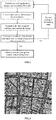
- FIG. 1 is a flowchart of the whole embodiment of the present application.
- a method for optimal control of an open space surrounding building form based on sky view evaluation includes the following steps:
Landscapes
- Engineering & Computer Science (AREA)
- Physics & Mathematics (AREA)
- Geometry (AREA)
- Theoretical Computer Science (AREA)
- General Physics & Mathematics (AREA)
- Computer Hardware Design (AREA)
- General Engineering & Computer Science (AREA)
- Evolutionary Computation (AREA)
- Software Systems (AREA)
- Architecture (AREA)
- Mathematical Optimization (AREA)
- Pure & Applied Mathematics (AREA)
- Mathematical Analysis (AREA)
- Computational Mathematics (AREA)
- Structural Engineering (AREA)
- Civil Engineering (AREA)
- Remote Sensing (AREA)
- Computer Graphics (AREA)
- Human Computer Interaction (AREA)
- Management, Administration, Business Operations System, And Electronic Commerce (AREA)
- Processing Or Creating Images (AREA)
Abstract
Description
- The present invention relates to the field of city planning methods, and in particular, to a method for optimal control of an open space surrounding building form based on sky view evaluation.
- Sky view, also referred to as sky view range, sky visibility, sky openness, sky visible factor, firmament visibility, terrain openness, and so on, specifically refers to a percentage of a visible sky range that can be reached by people's line of sight in city open spaces enclosed by buildings. It directly depends on development layout of city construction, and are directly associated with multiple factors such as the degree of comfort and visual and psychological anticipation of public activities in a city. Therefore, the sky view is an important factor reflecting open space quality in city planning.
- Existing city planning schemes generally ignore spatial feeling from human eyes. This often leads to disordered open spaces in a city space, and some open spaces are overcrowded to cause decreased open space quality;
- 1) there is a lack of a quantitative index to reflect the spatial feeling from human eyes, causing a gap in visual and psychological anticipation of the public, and failing to embody the human-oriented principle in city construction and development;
- 2) the whole technical solution lacks global simulation and evaluation. City planning and development is a long-term process, and if there is no global simulation and evaluation, different areas in city construction may interfere with each other during the development, thus affecting the degree of comfort of public activities in a city.
- One of the important reasons is that there is no spatial experience, which is actually perceived from line of sight of human eyes, for simulation and analysis of the whole planning scheme. In particular, there is no evaluation factor and evaluation criterion for global simulation operation of the whole planning range.
- The present invention proposes a method for optimal control of an open space surrounding building form based on sky view evaluation, which aims at providing an evaluation method that can demonstrate feeling from human eyes, such that the degree of simulation of a planning scheme with actual human body perception can cover a whole planning area, thereby achieving optimal control on an open space surrounding building form.
- In order to achieve the foregoing objective, the present invention may employ the following technical solution:
- A method for optimal control of an open space surrounding building form based on sky view evaluation includes the following steps:
- 1) vectorizing an existing planning scheme, and establishing a 3D model;
- 2) classifying open spaces in the model, the classified open spaces being a municipal open space, a regional open space, a street open space, and an intra-neighborhood open space respectively, and setting preset sky view indexes of the municipal open space, the regional open space, the street open space, and the neighborhood open space respectively;
- 3) 360°-scanning for mean elevations, calculating and simulating sky views of a whole region, generating a 3D contour plot, and rasterizing the 3D contour plot, such that each grid has an open space classification attribute and a sky view value; and
- 4) performing optimal adjustment of the building form on an open space surrounding region having a sky view value that is inconsistent with a corresponding preset sky view index within the range of the whole region, and bringing an adjusted scheme into the model for calculation again, till the sky view value is consistent with the corresponding preset sky view index.
- Compared with the prior art, the present invention, from a human-oriented point of view, achieves indexed evaluation on a sky view that can be actually felt by a human body and feedback of the evaluation to a planning scheme, and accordingly, presents a guide on optimal control of an open space surrounding building form, thereby providing a scientific basis for creating a 3D material space of a city that has comfortable dimensions for people.
-
-
FIG. 1 is a flowchart of the present invention; -
FIG. 2 is a schematic view of outlining outer contours of blocks and buildings according to the present invention; -
FIG. 3 is a schematic view of generating a 3D model of an existing scheme according to the present invention; and -
FIG. 4 is a 3D contour map of a global sky view simulated by software according to the present invention. - The technical solution of the present invention is further described below with reference to the drawings.
-
FIG. 1 is a flowchart of the whole embodiment of the present application. - A method for optimal control of an open space surrounding building form based on sky view evaluation includes the following steps:
- 1) Vectorize an existing planning scheme, and establish a 3D model. Step 1) specifically includes:
- 1.1) inserting a raster image of an existing general layout plan (for example, inserting in AutoCAD software), and scaling the image (by a "Scale" command) to adjust the size of the image to an actual size;
- 1.2) outlining contour lines of all blocks and contour lines of all buildings in each block (for example, by a "Polyline" command), and marking a number indicating the number of floors of each building within the contour line of the corresponding building (referring to
FIG. 3 ); and - 1.3) extruding a building with a number-of-floor attribute into a 3D model (for example, modeling in software ArcGIS, referring to
FIG. 4 ).
- 2) Classify open spaces in the model, the classified open spaces being a municipal open space, a regional open space, a street open space, and an intra-neighborhood open space respectively, and set preset sky view indexes of the municipal open space, the regional open space, the street open space, and the intra-neighborhood open space respectively. The municipal open space refers to a crossroad and square at a primary center of a city, the regional open space refers to a crossroad and square at a secondary center of the city, the street open space refers to a street space excluding the municipal open space and the regional open space, and the intra-neighborhood open space refers to an intra-block open space excluding the municipal open space, the regional open space, and the street open space. The preset sky view indexes set for various types of open spaces are as follows: an index value of the municipal open space is 0.8, an index value of the regional open space is 0.7, an index value of the street open space is 0.65, and an index value of the intra-neighborhood open space is 0.6. Open spaces of different cities and regions have different preset sky view indexes, and the preset sky view indexes are adjustable within ±5% according to different cities and regions. Using the Xinjiekou region as an example, considering that the Xinjiekou region is the primary center of Nanjing, the preset index value of the municipal open space is increased by 2.5%.
- 3) 360°-scan for mean elevations, calculate and simulate sky views of a whole region, generate a 3D contour plot, and rasterize the 3D contour plot (in conjunction with FIG. 5), such that each grid has an open space classification attribute and a sky view value. Step 3) specifically includes:
- 3.1) performing global simulation on the 3D model by using sky view simulation software, selecting, in a whole research area, multiple observation points covering the whole area, 360°-scanning all buildings in the research area from the multiple observation points, calculating a maximum elevation, and statistically calculating a mean elevation, and then calculating average sky occlusions of all observation points in the whole research area according to the following formula:

- wherein scanning needs to be performed n = 2π/∂
0 times, ∪ denotes a sky occlusion of a corresponding observation point, radian ∂0 denotes a scan angular interval, n denotes the number of scans, each observation point being subjected to multiple scans, and βmax denotes a maximum elevation rotated into during each scan; all maximum elevations of n scans are subjected to statistical averaging of elevations, to obtain a sky occlusion of a corresponding observation point, and i denotes an observation point; and - calculating, according to the following formula, a difference with an unoccluded sky visibility 1, to obtain an average sky visibility ∩ of a corresponding observation point:

- wherein scanning needs to be performed n = 2π/∂
- 3.2) importing an image, and performing interpolation operation on the average sky visibilities of all the observation points, to obtain a simulated 3D contour map of the sky view; and
- 3.3) rasterizing the image, and superimposing the image with the previous preset sky view indexes of open spaces, such that each grid has an open space classification attribute and a sky view value;
pixel precision of the generated grids is at least 20 m*20 m; - 3.2) importing an image, and performing interpolation operation on the average sky visibilities of all the observation points, to obtain a simulated 3D contour map of the sky view; and
- 3.3) rasterizing the image, and superimposing the image with the previous preset sky view indexes of open spaces, such that each grid has an open space classification attribute and a sky view value.
- 3.1) performing global simulation on the 3D model by using sky view simulation software, selecting, in a whole research area, multiple observation points covering the whole area, 360°-scanning all buildings in the research area from the multiple observation points, calculating a maximum elevation, and statistically calculating a mean elevation, and then calculating average sky occlusions of all observation points in the whole research area according to the following formula:
- 4) perform optimal adjustment of the building form on an open space surrounding region having a sky view value that is inconsistent with a corresponding preset sky view index within the range of the whole region, and bring an adjusted scheme into the model for calculation again, till the sky view value is consistent with the corresponding preset sky view index. Step 4) includes:
- 4.1) designating the preset sky view index of each grid point as S, comparing a value of the average sky view ∩ with a value of S, and marking all grids in which ∩ >S;
- 4.2) if there exists a marked point having a sky view value that is inconsistent with the corresponding preset index, performing optimal adjustment of the building form on an open space surrounding region where the marked grid point exists, then returning to Step 1), and performing calculation using the model according to the steps; and
- 4.3) if there exists no marked point having a sky view value that is inconsistent with the corresponding preset index, indicating that an optimized building form design scheme is obtained.
- In addition, the present invention has numerous implementation methods and approaches, and the above description is merely the preferred embodiment of the present invention. It should be noted that, several improvements and modifications may be made by those of ordinary skill in the art without departing from the principle of the present invention, and these improvements and modifications should also be considered within the protection scope of the present invention. Various components not explicitly described in the present embodiment can all be achieved using the prior art.
Claims (8)
- A method for optimal control of an open space surrounding building form based on sky view evaluation, comprising the following steps:1) vectorizing an existing planning scheme, and establishing a 3D model;2) classifying open spaces in the model, the classified open spaces being a municipal open space, a regional open space, a street open space, and an intra-neighborhood open space respectively, and setting preset sky view indexes of the municipal open space, the regional open space, the street open space, and the intra-neighborhood open space respectively;3) 360°-scanning for mean elevations, calculating and simulating sky views of a whole region, generating a 3D contour plot, and rasterizing the 3D contour plot, such that each grid has an open space classification attribute and a sky view value; and4) performing optimal adjustment of the building form on an open space surrounding region having a sky view value that is inconsistent with a corresponding preset sky view index within the range of the whole region, and bringing an adjusted scheme into the model for calculation again, till the sky view value is consistent with the corresponding preset sky view index.
- The method for optimal control of an open space surrounding building form based on sky view evaluation according to claim 1, wherein Step 1) comprises:1.1) inserting a raster image of an existing general layout plan, and scaling the image to adjust the size of the image to an actual size;1.2) outlining contour lines of all blocks and contour lines of all buildings in each block, and marking a number indicating the number of floors of each building within the contour line of the corresponding building; and1.3) extruding a building with a number-of-floor attribute into a 3D model.
- The method for optimal control of an open space surrounding building form based on sky view evaluation according to claim 1, wherein in Step 2), the municipal open space refers to a crossroad and square at a primary center of a city, the regional open space refers to a crossroad and square at a secondary center of the city, the street open space refers to a street space excluding the municipal open space and the regional open space, and the intra-neighborhood open space refers to an intra-block open space excluding the municipal open space, the regional open space, and the street open space.
- The method for optimal control of an open space surrounding building form based on sky view evaluation according to claim 3, wherein in Step 2), the preset sky view index of each open space is set as follows: an index value of the municipal open space is 0.8, an index value of the regional open space is 0.7, an index value of the street open space is 0.65, and an index value of the intra-neighborhood open space is 0.6.
- The method for optimal control of an open space surrounding building form based on sky view evaluation according to claim 4, wherein open spaces of different cities and regions have different preset sky view indexes, and the preset sky view indexes are adjustable within ±5% according to different cities and regions.
- The method for optimal control of an open space surrounding building form based on sky view evaluation according to claim 1, wherein Step 3) comprises:3.1) performing global simulation on the 3D model by using sky view simulation software, selecting, in a whole research area, multiple observation points covering the whole area, 360° scanning all buildings in the research area from the multiple observation points, calculating a maximum elevation βmax in each scan, and statistically calculating a mean elevation, and then calculating average sky occlusions of all observation points in the whole study area according to the following formula:
 wherein scanning needs to be performed n = 2π /∂
0 times, ∪ denotes a sky occlusion of a corresponding observation point, radian ∂0 denotes a scan angular interval, n denotes the number of scans, each observation point being subjected to multiple scans, and βmax denotes a maximum elevation rotated into during each scan; all maximum elevations of n scans are subjected to statistical averaging of elevations, to obtain a sky occlusion of a corresponding observation point, and i denotes an observation point; andcalculating, according to the following formula, a difference with an unoccluded sky visibility 1, to obtain an average sky visibility ∩ of a corresponding observation point: 3.2) importing an image, and performing interpolation operation on the average sky visibilities of all the observation points, to obtain a simulated 3D contour map of the sky view; and3.3) rasterizing the image, and superimposing the image with the previous preset sky view indexes of open spaces, such that each grid has an open space classification attribute and a sky view value.
 - The method for optimal control of an open space surrounding building form based on sky view evaluation according to claim 6, wherein Step 4) comprises:4.1) designating the preset sky view index of each grid point as S, comparing a value of the average sky view ∩ with a value of S, and marking all grids in which ∩ >S;4.2) if there exists a marked point having a sky view value that is inconsistent with the corresponding preset index, performing optimal adjustment of the building form on an open space surrounding region where the marked grid point exists, then returning to Step 1), and performing calculation using the model according to the steps; and4.3) if there exists no marked point having a sky view value that is inconsistent with the corresponding preset index, indicating that an optimized building form design scheme is obtained.
- The method for optimal control of an open space surrounding building form based on sky view evaluation according to claim 6, wherein pixel precision of the grids generated in Step 3) is at least 20 m*20 m.
Applications Claiming Priority (2)
| Application Number | Priority Date | Filing Date | Title |
|---|---|---|---|
| CN201610197548.9A CN105893675B (en) | 2016-03-31 | 2016-03-31 | A kind of open space neighboring buildings form optimal control method based on the evaluation of sky visible range |
| PCT/CN2016/081023 WO2017166371A1 (en) | 2016-03-31 | 2016-05-04 | Form optimization control method applied to peripheral buildings of open space and using evaluation of visible sky area |
Publications (2)
| Publication Number | Publication Date |
|---|---|
| EP3249558A1 true EP3249558A1 (en) | 2017-11-29 |
| EP3249558A4 EP3249558A4 (en) | 2018-08-15 |
Family
ID=57011928
Family Applications (1)
| Application Number | Title | Priority Date | Filing Date |
|---|---|---|---|
| EP16869388.5A Withdrawn EP3249558A4 (en) | 2016-03-31 | 2016-05-04 | Form optimization control method applied to peripheral buildings of open space and using evaluation of visible sky area |
Country Status (4)
| Country | Link |
|---|---|
| US (1) | US10423729B2 (en) |
| EP (1) | EP3249558A4 (en) |
| CN (1) | CN105893675B (en) |
| WO (1) | WO2017166371A1 (en) |
Cited By (1)
| Publication number | Priority date | Publication date | Assignee | Title |
|---|---|---|---|---|
| CN113192000A (en) * | 2021-03-02 | 2021-07-30 | 中国人民解放军空军航空大学 | Occlusion detection method based on elevation and angle constraints |
Families Citing this family (24)
| Publication number | Priority date | Publication date | Assignee | Title |
|---|---|---|---|---|
| CN108109197B (en) * | 2017-12-15 | 2021-03-02 | 北京中睿华信信息技术有限公司 | Image processing modeling method |
| CN109881915A (en) * | 2019-01-15 | 2019-06-14 | 上海尤安建筑设计股份有限公司 | A kind of business block dimensional analysis method |
| CN109977600B (en) * | 2019-04-10 | 2022-06-14 | 中国科学院城市环境研究所 | A standardized method and system for measuring compactness of urban three-dimensional spatial form |
| CN110135043B (en) * | 2019-05-08 | 2023-04-18 | 南京大学 | City street contour space form classification method and system |
| CN110728652B (en) * | 2019-09-04 | 2021-09-14 | 中国地质大学(武汉) | Two-dimensional rule vector space data-oriented visual field analysis method and device |
| CN111008419B (en) * | 2019-11-18 | 2022-02-18 | 浙江大学 | Building space openness information processing method based on three-dimensional model |
| CN111192366B (en) * | 2019-12-30 | 2023-04-07 | 重庆市勘测院 | Method and device for three-dimensional control of building height and server |
| CN111428582B (en) * | 2020-03-05 | 2023-05-05 | 南京大学 | A Method of Calculating Urban Sky Openness Using Internet Street View Photos |
| CN111696195B (en) * | 2020-05-09 | 2022-11-11 | 东南大学 | Quantitative analysis method for three-dimensional space form of block |
| CN111681313B (en) * | 2020-05-18 | 2023-04-28 | 云南迅测科技有限公司 | Space vision analysis method based on digital topography and electronic equipment |
| CN111639806B (en) * | 2020-05-29 | 2022-08-26 | 河南大学 | GIS-based territorial space planning optimization method and system |
| CN111709077B (en) * | 2020-06-15 | 2023-02-07 | 广州城市信息研究所有限公司 | Visual space quantitative analysis method |
| CN112084916A (en) * | 2020-08-31 | 2020-12-15 | 东南大学 | Automatic generation and diagnosis method for urban three-dimensional skyline contour line based on shielding rate |
| CN113256806A (en) * | 2021-05-24 | 2021-08-13 | 昆明理工大学 | Urban road sky visible field mass data optimization processing method |
| CN114004942A (en) * | 2021-09-09 | 2022-02-01 | 上海建为历保科技股份有限公司 | Evaluation method for space visual corridor in protection planning |
| CN114494598B (en) * | 2022-01-25 | 2023-03-21 | 南京师范大学 | Method for optimizing urban three-dimensional visual space ratio index |
| JP2023113470A (en) * | 2022-02-03 | 2023-08-16 | 株式会社大林組 | Design method and design program |
| CN119234216A (en) * | 2022-03-24 | 2024-12-31 | 香港大学 | System and method for quantifying and calculating window field of view opening index |
| CN115423935B (en) * | 2022-08-12 | 2024-03-22 | 广州市城市规划设计有限公司 | Visual field analysis method and system for historical culture neighborhood |
| CN116258965B (en) * | 2023-03-17 | 2026-03-13 | 东南大学 | Machine Learning-Based Approach to Adjusting the Structure of Green Spaces in Neighborhoods |
| CN116340652B (en) * | 2023-03-29 | 2024-07-23 | 苏州科技大学 | PPGIS-based landscape planning method |
| CN116451330B (en) * | 2023-06-14 | 2023-09-05 | 北京建筑大学 | Viewpoint selecting method for visual shielding evaluation of ancient building space |
| CN118094699B (en) * | 2024-01-22 | 2024-10-29 | 深圳大学 | A method and terminal for predicting building environment based on point-by-point calculation of three-dimensional information |
| CN119623283B (en) * | 2024-11-27 | 2025-09-26 | 同济大学 | A multi-dimensional intelligent evaluation method and computer system for architectural space visual comfort based on model knowledge transfer |
Family Cites Families (14)
| Publication number | Priority date | Publication date | Assignee | Title |
|---|---|---|---|---|
| GB0118853D0 (en) * | 2001-08-02 | 2001-09-26 | Univ Birmingham | Road weather prediction system and method |
| US7305983B1 (en) * | 2003-07-08 | 2007-12-11 | University Of Hawai'i | Assessment of solar energy potential on existing buildings in a region |
| CN101364311A (en) * | 2008-07-23 | 2009-02-11 | 上海同盛工程建设配套管理有限公司 | Fast and automatically modeling method in large-scale city simulation |
| CN101598797B (en) * | 2009-07-16 | 2011-12-14 | 北京航空航天大学 | Method for realizing rugged topography remote sensing scene simulation |
| CN102467591A (en) * | 2010-11-10 | 2012-05-23 | 上海日浦信息技术有限公司 | Three-dimensional virtual city-based community ditch layout method |
| CN103150412B (en) * | 2011-12-06 | 2016-01-20 | 泰瑞数创科技(北京)有限公司 | Based on the electric power facility site selecting method of Spatial Data Mining Technique |
| CN103186819A (en) * | 2011-12-28 | 2013-07-03 | 象山县供电局 | Quadratic optimization method for electric power facility site selection based on three-dimensional geographic information system |
| US20140039850A1 (en) * | 2012-08-03 | 2014-02-06 | Joon-Bum JEE | Method and apparatus of forming solar radiation model applying topographical effects |
| JP2014167717A (en) * | 2013-02-28 | 2014-09-11 | Shimizu Corp | Green space evaluation device and green space evaluation method |
| CN103336894B (en) * | 2013-06-14 | 2016-08-10 | 东南大学 | A kind of city plot ratio automatic Mesh Partition Method |
| GB201321107D0 (en) * | 2013-11-29 | 2014-01-15 | Costello Con W | A method for identifying scenic routes |
| CN104463442B (en) * | 2014-11-25 | 2018-01-26 | 中国科学院地理科学与资源研究所 | A Detection Method of Urban and Rural Construction Agglomeration |
| CN104392064B (en) * | 2014-12-09 | 2017-12-19 | 南京大学 | Alleviate the Optimizing City form Design method of tropical island effect under a kind of medium measure |
| CN105279793A (en) * | 2015-11-04 | 2016-01-27 | 深圳职业技术学院 | Modeling method and system based on DEM real three-dimensional map and greenway |
-
2016
- 2016-03-31 CN CN201610197548.9A patent/CN105893675B/en active Active
- 2016-05-04 EP EP16869388.5A patent/EP3249558A4/en not_active Withdrawn
- 2016-05-04 WO PCT/CN2016/081023 patent/WO2017166371A1/en not_active Ceased
- 2016-05-04 US US16/086,315 patent/US10423729B2/en active Active
Cited By (2)
| Publication number | Priority date | Publication date | Assignee | Title |
|---|---|---|---|---|
| CN113192000A (en) * | 2021-03-02 | 2021-07-30 | 中国人民解放军空军航空大学 | Occlusion detection method based on elevation and angle constraints |
| CN113192000B (en) * | 2021-03-02 | 2022-07-22 | 中国人民解放军空军航空大学 | Occlusion detection method based on elevation and angle constraints |
Also Published As
| Publication number | Publication date |
|---|---|
| CN105893675B (en) | 2019-01-29 |
| EP3249558A4 (en) | 2018-08-15 |
| CN105893675A (en) | 2016-08-24 |
| US20190087515A1 (en) | 2019-03-21 |
| US10423729B2 (en) | 2019-09-24 |
| WO2017166371A1 (en) | 2017-10-05 |
Similar Documents
| Publication | Publication Date | Title |
|---|---|---|
| US10423729B2 (en) | Method for optimal control of open space surrounding building form based on sky view evaluation | |
| CN101517618B (en) | Method and system for displaying electric fields generated by transcranial magnetic stimulation in the brain | |
| DE202015009181U1 (en) | Crossfade between street view and earth view | |
| CN110874613B (en) | A seamless fusion method of multi-source and multi-scale terrain data | |
| TWI574237B (en) | Three-dimensional map display system | |
| CN105761310A (en) | Simulated analysis and image display method of digital map of sky visible range | |
| Albrecht et al. | Assessing façade visibility in 3D city models for city marketing | |
| Eren et al. | Evaluation of X-ray visualization techniques for vertical depth judgments in underground exploration | |
| KR101344756B1 (en) | Generating system using method of generating coordinate information of specific facility according to city planning information | |
| TW201539398A (en) | Three-dimensional map display system | |
| CN116451330B (en) | Viewpoint selecting method for visual shielding evaluation of ancient building space | |
| CN115423935B (en) | Visual field analysis method and system for historical culture neighborhood | |
| US20190096108A1 (en) | Phase specifying method, phase specifying apparatus and non-transitory computer-readable storage medium | |
| JP3156645B2 (en) | Information transmission type landscape labeling device and system | |
| JP2007200130A (en) | Landscape analysis method, computer program for executing the method, and medium storing the program | |
| Pokonieczny et al. | Using high resolution spatial data to develop military maps of passability | |
| CN117435790B (en) | Visual data analysis method and system | |
| JP7663340B2 (en) | Small Area Generator | |
| CN115761516B (en) | Method, server and storage medium for analyzing landing zone of air emergency delivery | |
| CN116151636B (en) | An evaluation method for visual viewing of dynamic linear movement | |
| Wang et al. | A study on empirically relevant aspects for qualitative alignment of sketch maps | |
| JP2013218536A (en) | Method for creating stereoscopic vision image with three-dimensional shape, method for displaying stereoscopic vision image with three-dimensional shape and program for creating stereoscopic vision image with three-dimensional shape | |
| CN112819942A (en) | Data processing method and device | |
| JPH1132250A (en) | Voice-guided landscape labeling device and system | |
| KR20130002239A (en) | A system and method for generating road layer using the slope of road date obtained by filtering of point cloud data |
Legal Events
| Date | Code | Title | Description |
|---|---|---|---|
| STAA | Information on the status of an ep patent application or granted ep patent |
Free format text: STATUS: UNKNOWN |
|
| STAA | Information on the status of an ep patent application or granted ep patent |
Free format text: STATUS: THE INTERNATIONAL PUBLICATION HAS BEEN MADE |
|
| PUAI | Public reference made under article 153(3) epc to a published international application that has entered the european phase |
Free format text: ORIGINAL CODE: 0009012 |
|
| STAA | Information on the status of an ep patent application or granted ep patent |
Free format text: STATUS: REQUEST FOR EXAMINATION WAS MADE |
|
| 17P | Request for examination filed |
Effective date: 20170609 |
|
| AK | Designated contracting states |
Kind code of ref document: A1 Designated state(s): AL AT BE BG CH CY CZ DE DK EE ES FI FR GB GR HR HU IE IS IT LI LT LU LV MC MK MT NL NO PL PT RO RS SE SI SK SM TR |
|
| AX | Request for extension of the european patent |
Extension state: BA ME |
|
| A4 | Supplementary search report drawn up and despatched |
Effective date: 20180712 |
|
| RIC1 | Information provided on ipc code assigned before grant |
Ipc: G06F 17/50 20060101AFI20180706BHEP |
|
| DAV | Request for validation of the european patent (deleted) | ||
| DAX | Request for extension of the european patent (deleted) | ||
| STAA | Information on the status of an ep patent application or granted ep patent |
Free format text: STATUS: EXAMINATION IS IN PROGRESS |
|
| 17Q | First examination report despatched |
Effective date: 20210406 |
|
| STAA | Information on the status of an ep patent application or granted ep patent |
Free format text: STATUS: THE APPLICATION HAS BEEN WITHDRAWN |
|
| 18W | Application withdrawn |
Effective date: 20210713 |