EP2789979A1 - Navigation system and method for displaying map on navigation system - Google Patents
Navigation system and method for displaying map on navigation system Download PDFInfo
- Publication number
- EP2789979A1 EP2789979A1 EP20130190228 EP13190228A EP2789979A1 EP 2789979 A1 EP2789979 A1 EP 2789979A1 EP 20130190228 EP20130190228 EP 20130190228 EP 13190228 A EP13190228 A EP 13190228A EP 2789979 A1 EP2789979 A1 EP 2789979A1
- Authority
- EP
- European Patent Office
- Prior art keywords
- photomap
- map
- navigation system
- numerical map
- matching
- Prior art date
- Legal status (The legal status is an assumption and is not a legal conclusion. Google has not performed a legal analysis and makes no representation as to the accuracy of the status listed.)
- Ceased
Links
Images


Classifications
-
- G—PHYSICS
- G01—MEASURING; TESTING
- G01C—MEASURING DISTANCES, LEVELS OR BEARINGS; SURVEYING; NAVIGATION; GYROSCOPIC INSTRUMENTS; PHOTOGRAMMETRY OR VIDEOGRAMMETRY
- G01C21/00—Navigation; Navigational instruments not provided for in groups G01C1/00 - G01C19/00
- G01C21/26—Navigation; Navigational instruments not provided for in groups G01C1/00 - G01C19/00 specially adapted for navigation in a road network
- G01C21/34—Route searching; Route guidance
- G01C21/36—Input/output arrangements for on-board computers
- G01C21/3626—Details of the output of route guidance instructions
- G01C21/3647—Guidance involving output of stored or live camera images or video streams
-
- G—PHYSICS
- G01—MEASURING; TESTING
- G01C—MEASURING DISTANCES, LEVELS OR BEARINGS; SURVEYING; NAVIGATION; GYROSCOPIC INSTRUMENTS; PHOTOGRAMMETRY OR VIDEOGRAMMETRY
- G01C21/00—Navigation; Navigational instruments not provided for in groups G01C1/00 - G01C19/00
- G01C21/38—Electronic maps specially adapted for navigation; Updating thereof
- G01C21/3804—Creation or updating of map data
- G01C21/3807—Creation or updating of map data characterised by the type of data
- G01C21/3815—Road data
-
- G—PHYSICS
- G01—MEASURING; TESTING
- G01C—MEASURING DISTANCES, LEVELS OR BEARINGS; SURVEYING; NAVIGATION; GYROSCOPIC INSTRUMENTS; PHOTOGRAMMETRY OR VIDEOGRAMMETRY
- G01C21/00—Navigation; Navigational instruments not provided for in groups G01C1/00 - G01C19/00
- G01C21/38—Electronic maps specially adapted for navigation; Updating thereof
- G01C21/3804—Creation or updating of map data
- G01C21/3833—Creation or updating of map data characterised by the source of data
- G01C21/3852—Data derived from aerial or satellite images
-
- G—PHYSICS
- G01—MEASURING; TESTING
- G01C—MEASURING DISTANCES, LEVELS OR BEARINGS; SURVEYING; NAVIGATION; GYROSCOPIC INSTRUMENTS; PHOTOGRAMMETRY OR VIDEOGRAMMETRY
- G01C21/00—Navigation; Navigational instruments not provided for in groups G01C1/00 - G01C19/00
- G01C21/38—Electronic maps specially adapted for navigation; Updating thereof
- G01C21/3863—Structures of map data
- G01C21/3867—Geometry of map features, e.g. shape points, polygons or for simplified maps
-
- G—PHYSICS
- G06—COMPUTING OR CALCULATING; COUNTING
- G06T—IMAGE DATA PROCESSING OR GENERATION, IN GENERAL
- G06T11/00—Two-dimensional [2D] image generation
- G06T11/10—Texturing; Colouring; Generation of textures or colours
-
- G—PHYSICS
- G08—SIGNALLING
- G08G—TRAFFIC CONTROL SYSTEMS
- G08G1/00—Traffic control systems for road vehicles
- G08G1/09—Arrangements for giving variable traffic instructions
- G08G1/0962—Arrangements for giving variable traffic instructions having an indicator mounted inside the vehicle, e.g. giving voice messages
- G08G1/0968—Systems involving transmission of navigation instructions to the vehicle
- G08G1/0969—Systems involving transmission of navigation instructions to the vehicle having a display in the form of a map
-
- G—PHYSICS
- G09—EDUCATION; CRYPTOGRAPHY; DISPLAY; ADVERTISING; SEALS
- G09B—EDUCATIONAL OR DEMONSTRATION APPLIANCES; APPLIANCES FOR TEACHING, OR COMMUNICATING WITH, THE BLIND, DEAF OR MUTE; MODELS; PLANETARIA; GLOBES; MAPS; DIAGRAMS
- G09B29/00—Maps; Plans; Charts; Diagrams, e.g. route diagram
- G09B29/10—Map spot or coordinate position indicators; Map reading aids
Definitions
- the present invention relates to a navigation system and a method for displaying a map on the navigation system. More specifically, the present invention relates to a navigation system and a method for displaying a map on the navigation system, capable of displaying the map that is produced by composing a numerical map and a photomap when displaying the map on the navigation system.
- a navigation system receives a navigation message transmitted from satellites for GPS (Global Positioning System) to determine a current position of a moving body, matches the current position of the moving body to map data to display it on a screen of the navigation system, and searches for a driving route from the current position of the moving body to a destination. Further, the navigation system guides a user to drive a moving body along the searched driving route, whereby the user can make use of a road network given efficiently.
- GPS Global Positioning System
- the map displayed on a screen in a navigation system is a numerical map, which displays roads and geographic features using digitized map data on the basis of 2D images, or models the geographic features in 3D images to display them so that a user feels more real.
- the present invention provides a navigation system and a method for displaying a map on the navigation system, capable of displaying the map of the latest update that is produced by composing a numerical map and a photomap when displaying the map on the navigation system and improving a quality of the map by displaying a real space.
- the present invention provides a navigation system and a method for displaying a map on the navigation system, capable of smoothly overlapping a numerical map with a photomap with a controlled transparency at a boundary of them when displaying the map on the navigation system, thereby minimizing a sense of the difference between data.
- a method for displaying a map performed by a navigation system which includes: defining a matching area of a numerical map to which a photomap is matched; extracting the photomap corresponding to the matching area from a map data storage; matching a reference point of the photomap and a reference point of the numerical map; matching a scale of the photomap in line with a scale of the numerical map; and performing a boundary treatment at an overlap area of the numerical map and the photomap that are matched.
- the defining a matching area comprises: setting the matching area in a rectangular block unit.
- the defining a matching area comprises; setting the matching area in a polygon unit.
- the extracting the photomap comprises; extracting the photomap larger than the matching area.
- the performing a boundary treatment comprises; performing an Alpha Blending process with respect to the overlap area.
- the photomap includes an aerial photomap or a satellite photomap.
- a navigation system comprising: a display unit; a map data storage configured to store a numerical map and a photomap; and a control unit configured to define a matching area of the numerical map to which the photomap is matched, to extract the photomap corresponding to the matching area from the map data storage, to match reference points and scales of the numerical map and the extracted photomap, and to perform a boundary treatment with respect to an overlap area of the numerical map and the extracted photomap that are matched to be displayed through the display unit.
- control unit sets the matching area in a block unit.
- control unit sets the matching area in a polygon unit.
- control unit extracts the photomap larger than the matching area.
- control unit performs an Alpha Blending process with respect to the overlap area.
- the photomap includes an aerial photomap or a satellite photomap.
- a method for displaying a map on a navigation system which includes: defining a matching area of a photomap to which a numerical map is matched; extracting a part of the numerical map corresponding to the matching area from a map data storage; matching a reference point of the numerical map and a reference point of the photomap; matching a scale of the numerical map in line with a scale of the photomap; and performing a boundary treatment at an overlap area of the photomap and the numerical map that are matched.
- a navigation system and a method for displaying a map on the navigation system in accordance with the embodiments of the present invention, it is possible to minimize a sense of the difference between data by smoothly overlapping a numerical map with a photomap with a controlled transparency at a boundary of them when displaying the map on a navigation system, thereby embodying a natural guide image.
- Fig. 1 is a block diagram of a navigation system in accordance with an embodiment of the present invention.
- the navigation system includes a GPS module 10, a map data storage 20, a memory unit 60, a key input unit 40, a control unit 30, and a display unit 50.
- the GPS module 10 receives navigation messages from a plurality of GPS satellites (not shown) positioned over the earth and provides them to the control unit 30 so that its current position can be acquired.
- the map data storage 20 stores map data of both a numerical map and a photomap used to guide a driving route of a moving body (not shown) obtained after searching the driving route.
- the numerical map refers to a map that displays roads and geographic features based on a 2D image through digitized map data or that realistically displays geographic features by modeling roads and geographical features in a 3D image.
- the photomap refers to a map that provides an image of a driving route along a coordinate through an aerial photograph really taken from an aircraft to easily recognize real road states and surrounding situations.
- the photomap may include a satellite photomap displayed on the basis of satellite photographs taken from satellites.
- the memory unit 60 stores various kinds of data including setting values to operate the navigation system and searched driving routes.
- the key input unit 40 includes a plurality of function keys or buttons to receive from a user each setting value to operate the navigation system and a destination chosen to set a driving route.
- the control unit 30 detects a current position of the moving body, e.g., a vehicle or a car, using the navigation messages received through the GPS module 10, and reads out map data stored in the map data storage 20 to display the current position of the moving body on the map.
- a current position of the moving body e.g., a vehicle or a car
- the control unit 30 also extracts the photomap along with the numerical map from the map data storage 20 using longitudinal and latitudinal coordinates and then combines the numerical map and the photomap in conformity with a reference point and scale of the numerical map, when displaying the map data.
- control unit 30 defines or selects a candidate area from the numerical map, extracts or cuts out a matching area of the photomap, which corresponds to the candidate area, and then combines the numerical map and the matching area of the photomap so that the candidate area of the numerical map is substituted with the matching area of the photomap.
- the navigation system displays a combined image in which the matching area of the photomap is fused into the numerical map on behalf of the candidate area.
- candidate area means an area defined or selected from the numerical map by a user who desires to see an actual image with respect to the candidate area
- matching area means a section which corresponds to an area having the actual image in the photomap.
- control unit 30 may define or select the candidate area and the matching area in a unit of block or polygon. Further, the control unit 30 may perform a boundary treatment, for example, such as an Alpha Blending process to control a transparency in a boundary between the photomap and the numerical map that are combined so that the boundary can be smoothly viewd, thereby minimizing a sense of difference between the numerical map and the photomap.
- a boundary treatment for example, such as an Alpha Blending process to control a transparency in a boundary between the photomap and the numerical map that are combined so that the boundary can be smoothly viewd, thereby minimizing a sense of difference between the numerical map and the photomap.
- the candidate area and the matching area are respectively defined or selected from the numerical map and the photomap, it may be possible to respectively defined or selected from the photomap and the numerical map in reverse.
- control unit 30 searches a driving route from a current position to a destination on the basis of map data, which is stored in the map data storage 20, in accordance with the commands inputted through the key input unit 40 and guides a user along the searched driving route.
- the display unit 50 displays various operation states of the components under the control of the control unit 30 and the driving route searched by the control unit 30, and the numerical map and photomap matched by the control unit 30.
- Fig. 4 is a flowchart illustrating a method for displaying a map on a navigation system in accordance with an embodiment of the present invention
- Figs. 5A to 5C are exemplary diagrams illustrating a procedure in which a numerical map and a photomap are matched in a rectangular block unit based on a method for displaying a map on a navigation system in accordance with an embodiment of the present invention
- Fig. 6 is an exemplary view illustrating an Alpha Blending process performed on an overlap area based on a method for displaying a map on a navigation system in accordance with an embodiment of the present invention
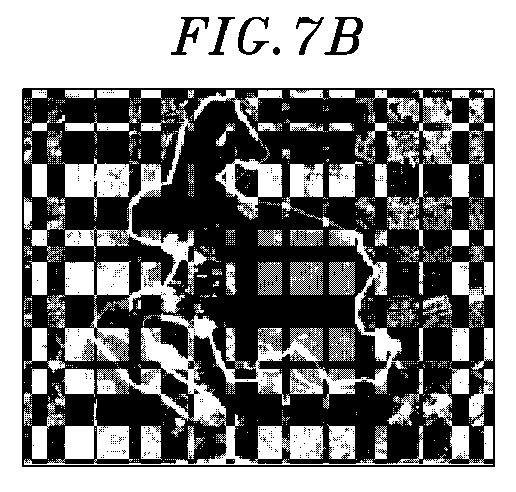
- Figs. 7A to 7C are exemplary views illustrating a procedure in which a photomap is matched to a numerical map in a polygon unit based on a method for displaying a map on a navigation system in accordance with an embodiment of the present invention.
- the control unit 30 loads from the map data storage 20 a numerical map, which includes a current position detected through the GPS module 10 or a position selected through the key input unit 40 in block S10.
- the control unit 30 defines a matching area in the numerical map to which a partial area of the photomap will be matched or overwiten.
- the matching area may be set in a rectangular block unit as illustrated in Figs. 5A to 5C , or in a polygon unit as illustrated in Figs. 7A to 7C .
- the matching area or condition of the numerical map to which the photomap will be matched may be set by a user.
- the matching area of the numerical map to which the photomap will be matched may be set, or a specific condition for directly choosing a given matching zone, for example, such as a park, a golf course, a contour line, a green belt, a water system, or the like.
- the photomap may include an aerial photomap or a satellite photomap of which coordinates are established based on aerial photographs taken from an aircraft, or satellite photographs taken from satellites.
- control unit 30 extracts a corresponding area of the photomap, which will be matched to the matching area, from the map data storage 20.
- the control unit 30 may extract the corresponding area of the photomap larger than the matching area through the use of longitudinal and latitudinal coordinates with respect to the matching area when extracting the corresponding area of the photomap, so that the corresponding area of the photomap may be fully overlapped the matching area of the numerical map.
- control unit 30 matches reference points between the areas of the photomap and the numerical map that are extracted using the longitudinal and latitudinal coordinates of both maps.
- reference points means base points used to match corresponding points between the photomap and the numerical map, which may be set in various positions and schemes depending on each system specification.
- control unit 30 After matching the reference points of the numerical map and the photomap each other as described above, the control unit 30 adjusts a scale of the photomap in line with a scale of the numerical map to match both the maps in block S50.
- the photomap when the numerical map is displayed in a large scale in the navigation system, the photomap is also controlled in a large scale correspondingly to that of the numerical map. In contrast, when the numerical map is displayed in a small scale in the navigation system, the photomap is also controlled in a small scale correspondingly to that of the numerical map. Therefore, both maps can be matched to be displayed at the same size.
- the control unit 30 controls a transparency in an overlap area of the numerical map and the photomap by performing an Alpha Blending process, so that the boundary of the overlap area can be displayed smoothly in block S60.
- the Alpha Blending refers to a process in which when an overlap area of a numerical map and a photomap matched thereto comes in sight, the boundary of the overlap area may be smoothly displayed without a sense of difference so that an image is naturally seen.
- a matching area 'A' of the numerical map to which a corresponding area of the photomap is intended to be matched is defined as illustrated in Fig. 5A
- the corresponding area of the photomap, which is larger than the matching area 'A' is extracted from the map data storage 20 as illustrated in Fig. 5B .
- the control unit 30 then matches reference points and scales of the numerical map and the extracted photomap as illustrated in Fig. 5C , and then smoothly displays an overlap area 'B' by performing the Alpha Blending process as illustrated in Fig. 6 .
- the outside of the overlap area 'B' is processed in ⁇ :0.0 so that the photomap is composed 0%.
- the composing ratio increases as approaching the center of the overlap area, and the inside of the overlap area 'B' is processed in ⁇ :1.0 so that the photomap is composed 100%, whereby a boundary of the overlap area 'B' may be smoothly viewed.
- the numerical map is viewed 100% in the outside of the overlap area 'B'
- an intermediate part of the overlap area 'B' is composed of 50% of the numerical map and 50% of the photomap
- the photomap is viewed 100% in the innermost part of the overlap area 'B'.
- the control unit 30 when matching a photomap to a numerical map in a polygon unit, the control unit 30 forms a polyline, e.g., along a green belt in the numerical map so as to define a matching area to which the photomap will be matched as illustrated in Fig. 7A and then extracts a corresponding area of the photomap larger than the matching area, which is defined in the numerical map, for map matching from the map data storage 20 as illustrated in Fig 7B .
- control unit 30 matches the reference points on the numerical map and the extracted photomap, controls the scales of them, and then performs the Alpha Blending process with respect to the overlap area, thereby smoothly displaying the overlap area as illustrated in Fig. 7C .
- control unit 30 smoothly displays a map by controlling a transparency with the Alpha Blending process with respect to the overlap area 'B' when composing and displaying the numerical map and the photomap, thereby minimizing a sense of difference between map data of the numerical map and the photomap in block S70.
- a navigation system and a method to display a map on the navigation system it is possible to display the map of the latest update by composing a numerical map and a photomap together and displaying the composed map and to enhance a quality of the map by displaying a real space when displaying the composed map in the navigation system. Further, it is possible to minimize a sense of the difference between data by smoothly overlapping the numerical map with the photomap with a controlled transparency at a boundary of them.
Landscapes
- Engineering & Computer Science (AREA)
- Remote Sensing (AREA)
- Radar, Positioning & Navigation (AREA)
- Physics & Mathematics (AREA)
- General Physics & Mathematics (AREA)
- Automation & Control Theory (AREA)
- Theoretical Computer Science (AREA)
- Geometry (AREA)
- Multimedia (AREA)
- Mathematical Physics (AREA)
- Business, Economics & Management (AREA)
- Educational Administration (AREA)
- Educational Technology (AREA)
- Navigation (AREA)
- Instructional Devices (AREA)
- Processing Or Creating Images (AREA)
- Traffic Control Systems (AREA)
Abstract

Description
- This application claims the benefit of Korean Patent Application No.
10-2013-0038342, filed on April 8, 2013 - The present invention relates to a navigation system and a method for displaying a map on the navigation system. More specifically, the present invention relates to a navigation system and a method for displaying a map on the navigation system, capable of displaying the map that is produced by composing a numerical map and a photomap when displaying the map on the navigation system.
- Currently, as the number of moving bodies such as a vehicle continues to increase, the traffic congestion becomes worse and worse. Further, since the increasing speed of the number of the moving bodies is becoming faster than that of the infrastructure such as road, there occur severe problems such as a traffic congestion.
- In such a situation, navigation systems are highlighted as one of the solutions to the traffic congestion. A navigation system receives a navigation message transmitted from satellites for GPS (Global Positioning System) to determine a current position of a moving body, matches the current position of the moving body to map data to display it on a screen of the navigation system, and searches for a driving route from the current position of the moving body to a destination. Further, the navigation system guides a user to drive a moving body along the searched driving route, whereby the user can make use of a road network given efficiently.
- Typically, the map displayed on a screen in a navigation system is a numerical map, which displays roads and geographic features using digitized map data on the basis of 2D images, or models the geographic features in 3D images to display them so that a user feels more real.
- Recently, images of driving route through the use of photomaps such as aerial photographs taken from aircrafts or satellite photographs taken from satellites are provided, so that it may be possible to precisely capture a real road state and surrounding situation.
- However, in case of providing the photomaps only, it may not be possible to keep them latest due to the difference between the time point when an aerial photograph or a satellite photograph is taken and the time point when it is updated. Therefore, there occurs a problem in that an image of a newly opened road or closed road is not timely reflected and provided.
- Related art of the disclosure of the present invention is disclosed in Korean Laid-Open Patent No.
10-2002-0047531 - In view of the above, the present invention provides a navigation system and a method for displaying a map on the navigation system, capable of displaying the map of the latest update that is produced by composing a numerical map and a photomap when displaying the map on the navigation system and improving a quality of the map by displaying a real space.
- Further, the present invention provides a navigation system and a method for displaying a map on the navigation system, capable of smoothly overlapping a numerical map with a photomap with a controlled transparency at a boundary of them when displaying the map on the navigation system, thereby minimizing a sense of the difference between data.
- In accordance with an embodiment of the present invention, there is provided a method for displaying a map performed by a navigation system, which includes: defining a matching area of a numerical map to which a photomap is matched; extracting the photomap corresponding to the matching area from a map data storage; matching a reference point of the photomap and a reference point of the numerical map; matching a scale of the photomap in line with a scale of the numerical map; and performing a boundary treatment at an overlap area of the numerical map and the photomap that are matched.
- In the exemplary embodiment, wherein the defining a matching area comprises: setting the matching area in a rectangular block unit.
- In the exemplary embodiment, wherein the defining a matching area comprises; setting the matching area in a polygon unit.
- In the exemplary embodiment, wherein the extracting the photomap comprises; extracting the photomap larger than the matching area.
- In the exemplary embodiment, wherein the performing a boundary treatment comprises; performing an Alpha Blending process with respect to the overlap area.
- In the exemplary embodiment, wherein the photomap includes an aerial photomap or a satellite photomap.
- In accordance with an embodiment of the present invention, there is provided a navigation system, comprising: a display unit; a map data storage configured to store a numerical map and a photomap; and a control unit configured to define a matching area of the numerical map to which the photomap is matched, to extract the photomap corresponding to the matching area from the map data storage, to match reference points and scales of the numerical map and the extracted photomap, and to perform a boundary treatment with respect to an overlap area of the numerical map and the extracted photomap that are matched to be displayed through the display unit.
- In the exemplary embodiment, wherein the control unit sets the matching area in a block unit.
- In the exemplary embodiment, wherein the control unit sets the matching area in a polygon unit.
- In the exemplary embodiment, wherein the control unit extracts the photomap larger than the matching area.
- In the exemplary embodiment, wherein the control unit performs an Alpha Blending process with respect to the overlap area.
- In the exemplary embodiment, wherein the photomap includes an aerial photomap or a satellite photomap.
- In accordance with an embodiment of the present invention, there is provided a method for displaying a map on a navigation system, which includes: defining a matching area of a photomap to which a numerical map is matched; extracting a part of the numerical map corresponding to the matching area from a map data storage; matching a reference point of the numerical map and a reference point of the photomap; matching a scale of the numerical map in line with a scale of the photomap; and performing a boundary treatment at an overlap area of the photomap and the numerical map that are matched.
- As described above, in a navigation system and a method for displaying a map on the navigation system in accordance with the embodiments of the present invention, it is possible to display a newly updated map produced by composing a numerical map and a photomap together and thus to enhance a quality of the map by displaying a real space when displaying the map.
- Further, in a navigation system and a method for displaying a map on the navigation system in accordance with the embodiments of the present invention, it is possible to minimize a sense of the difference between data by smoothly overlapping a numerical map with a photomap with a controlled transparency at a boundary of them when displaying the map on a navigation system, thereby embodying a natural guide image.
- The above and other objects and features of the present invention will become apparent from the following description of the embodiments given in conjunction with the accompanying drawings, in which:
-
Fig. 1 is a block diagram of a navigation system in accordance with an embodiment of the present invention; -
Fig. 2 illustrates an exemplary numerical map displayed on a navigation system in accordance with an embodiment of the present invention; -
Fig. 3 illustrates an exemplary photomap displayed on a navigation system in accordance with an embodiment of the present invention; -
Fig. 4 is a flowchart illustrating a method for displaying a map on a navigation system in accordance with an embodiment of the present invention; -
Figs. 5A to 5C are exemplary diagrams illustrating a procedure in which a numerical map and a photomap are matched in a rectangular block unit based on a method for displaying a map on a navigation system in accordance with an embodiment of the present invention; -
Fig. 6 is an exemplary view illustrating an Alpha Blending process performed on an overlap area based on a method for displaying a map on a navigation system in accordance with an embodiment of the present invention; and -
Figs. 7A to 7C are exemplary views illustrating a procedure in which a photomap is matched to a numerical map in a polygon unit based on a method for displaying a map on a navigation system in accordance with an embodiment of the present invention. - Hereinafter, an embodiment of a method for displaying a map on a navigation system in accordance with the present invention will be described with reference to the accompanying drawings. In referring to the drawings, thickness of lines and size of components shown in the drawings may be exaggerated for the purpose of descriptive clarity and for the sake of convenience. Further, the following terms are defined in consideration of the functions of the present invention, which may vary depending on the intentions of a user or an operator or practices. Therefore, the definition of such terms should be made on the basis of the disclosure throughout the present specification.
-
Fig. 1 is a block diagram of a navigation system in accordance with an embodiment of the present invention. - As illustrated in
Fig. 1 , the navigation system includes aGPS module 10, amap data storage 20, amemory unit 60, akey input unit 40, acontrol unit 30, and adisplay unit 50. - The
GPS module 10 receives navigation messages from a plurality of GPS satellites (not shown) positioned over the earth and provides them to thecontrol unit 30 so that its current position can be acquired. - The
map data storage 20 stores map data of both a numerical map and a photomap used to guide a driving route of a moving body (not shown) obtained after searching the driving route. - As illustrated in
Fig. 2 , the numerical map refers to a map that displays roads and geographic features based on a 2D image through digitized map data or that realistically displays geographic features by modeling roads and geographical features in a 3D image. - Further, as illustrated in
Fig. 3 , the photomap refers to a map that provides an image of a driving route along a coordinate through an aerial photograph really taken from an aircraft to easily recognize real road states and surrounding situations. The photomap may include a satellite photomap displayed on the basis of satellite photographs taken from satellites. - The
memory unit 60 stores various kinds of data including setting values to operate the navigation system and searched driving routes. - The
key input unit 40 includes a plurality of function keys or buttons to receive from a user each setting value to operate the navigation system and a destination chosen to set a driving route. - The
control unit 30 detects a current position of the moving body, e.g., a vehicle or a car, using the navigation messages received through theGPS module 10, and reads out map data stored in themap data storage 20 to display the current position of the moving body on the map. - The
control unit 30 also extracts the photomap along with the numerical map from themap data storage 20 using longitudinal and latitudinal coordinates and then combines the numerical map and the photomap in conformity with a reference point and scale of the numerical map, when displaying the map data. - More specifically, the
control unit 30 defines or selects a candidate area from the numerical map, extracts or cuts out a matching area of the photomap, which corresponds to the candidate area, and then combines the numerical map and the matching area of the photomap so that the candidate area of the numerical map is substituted with the matching area of the photomap. As a result, the navigation system displays a combined image in which the matching area of the photomap is fused into the numerical map on behalf of the candidate area.The term used herein such as "candidate area" means an area defined or selected from the numerical map by a user who desires to see an actual image with respect to the candidate area, and the term "matching area" means a section which corresponds to an area having the actual image in the photomap. - During such a matching process as mentioned above, the
control unit 30 may define or select the candidate area and the matching area in a unit of block or polygon. Further, thecontrol unit 30 may perform a boundary treatment, for example, such as an Alpha Blending process to control a transparency in a boundary between the photomap and the numerical map that are combined so that the boundary can be smoothly viewd, thereby minimizing a sense of difference between the numerical map and the photomap. - Although the embodiment of the present invention has been described and shown that the candidate area and the matching area are respectively defined or selected from the numerical map and the photomap, it may be possible to respectively defined or selected from the photomap and the numerical map in reverse.
- Further, the
control unit 30 searches a driving route from a current position to a destination on the basis of map data, which is stored in themap data storage 20, in accordance with the commands inputted through thekey input unit 40 and guides a user along the searched driving route. - The
display unit 50 displays various operation states of the components under the control of thecontrol unit 30 and the driving route searched by thecontrol unit 30, and the numerical map and photomap matched by thecontrol unit 30. -
Fig. 4 is a flowchart illustrating a method for displaying a map on a navigation system in accordance with an embodiment of the present invention;Figs. 5A to 5C are exemplary diagrams illustrating a procedure in which a numerical map and a photomap are matched in a rectangular block unit based on a method for displaying a map on a navigation system in accordance with an embodiment of the present invention;Fig. 6 is an exemplary view illustrating an Alpha Blending process performed on an overlap area based on a method for displaying a map on a navigation system in accordance with an embodiment of the present invention; andFigs. 7A to 7C are exemplary views illustrating a procedure in which a photomap is matched to a numerical map in a polygon unit based on a method for displaying a map on a navigation system in accordance with an embodiment of the present invention. - As illustrated in
Fig. 4 , in a method for displaying a map on a navigation system in accordance with an embodiment of the present invention, thecontrol unit 30 loads from the map data storage 20 a numerical map, which includes a current position detected through theGPS module 10 or a position selected through thekey input unit 40 in block S10. - Subsequently, in block S20, the
control unit 30 defines a matching area in the numerical map to which a partial area of the photomap will be matched or overwiten. In this process, the matching area may be set in a rectangular block unit as illustrated inFigs. 5A to 5C , or in a polygon unit as illustrated inFigs. 7A to 7C . - Further, in case of defining the matching area in a block unit, the matching area or condition of the numerical map to which the photomap will be matched may be set by a user. Also, in case of defining the matching area in a polygon unit, the matching area of the numerical map to which the photomap will be matched may be set, or a specific condition for directly choosing a given matching zone, for example, such as a park, a golf course, a contour line, a green belt, a water system, or the like.
- In these cases, the photomap may include an aerial photomap or a satellite photomap of which coordinates are established based on aerial photographs taken from an aircraft, or satellite photographs taken from satellites.
- After the matching area has been defined, in block S30, the
control unit 30 extracts a corresponding area of the photomap, which will be matched to the matching area, from themap data storage 20. - The
control unit 30 may extract the corresponding area of the photomap larger than the matching area through the use of longitudinal and latitudinal coordinates with respect to the matching area when extracting the corresponding area of the photomap, so that the corresponding area of the photomap may be fully overlapped the matching area of the numerical map. - Next, in block S40, the
control unit 30 matches reference points between the areas of the photomap and the numerical map that are extracted using the longitudinal and latitudinal coordinates of both maps. Here, the term "reference points" means base points used to match corresponding points between the photomap and the numerical map, which may be set in various positions and schemes depending on each system specification. - After matching the reference points of the numerical map and the photomap each other as described above, the
control unit 30 adjusts a scale of the photomap in line with a scale of the numerical map to match both the maps in block S50. - That is, when the numerical map is displayed in a large scale in the navigation system, the photomap is also controlled in a large scale correspondingly to that of the numerical map. In contrast, when the numerical map is displayed in a small scale in the navigation system, the photomap is also controlled in a small scale correspondingly to that of the numerical map. Therefore, both maps can be matched to be displayed at the same size.
- Subsequently, the
control unit 30 controls a transparency in an overlap area of the numerical map and the photomap by performing an Alpha Blending process, so that the boundary of the overlap area can be displayed smoothly in block S60. Here, the Alpha Blending refers to a process in which when an overlap area of a numerical map and a photomap matched thereto comes in sight, the boundary of the overlap area may be smoothly displayed without a sense of difference so that an image is naturally seen. - For example, referring to
Figs. 5A to 5C , when matching a photomap to a numerical map in a block unit, a matching area 'A' of the numerical map to which a corresponding area of the photomap is intended to be matched is defined as illustrated inFig. 5A , and the corresponding area of the photomap, which is larger than the matching area 'A', is extracted from themap data storage 20 as illustrated inFig. 5B . - The
control unit 30 then matches reference points and scales of the numerical map and the extracted photomap as illustrated inFig. 5C , and then smoothly displays an overlap area 'B' by performing the Alpha Blending process as illustrated inFig. 6 . - For example, as illustrated in
Fig. 6 , when two images are composed by performing the Alpha Blending process on the numerical map and the photomap, the outside of the overlap area 'B' is processed in α:0.0 so that the photomap is composed 0%. Further, the composing ratio increases as approaching the center of the overlap area, and the inside of the overlap area 'B' is processed in α:1.0 so that the photomap is composed 100%, whereby a boundary of the overlap area 'B' may be smoothly viewed. - As a result, the numerical map is viewed 100% in the outside of the overlap area 'B', an intermediate part of the overlap area 'B' is composed of 50% of the numerical map and 50% of the photomap, and the photomap is viewed 100% in the innermost part of the overlap area 'B'.
- In similar, referring to
Figs. 7A to 7C , when matching a photomap to a numerical map in a polygon unit, thecontrol unit 30 forms a polyline, e.g., along a green belt in the numerical map so as to define a matching area to which the photomap will be matched as illustrated inFig. 7A and then extracts a corresponding area of the photomap larger than the matching area, which is defined in the numerical map, for map matching from themap data storage 20 as illustrated inFig 7B . - Further, the
control unit 30 matches the reference points on the numerical map and the extracted photomap, controls the scales of them, and then performs the Alpha Blending process with respect to the overlap area, thereby smoothly displaying the overlap area as illustrated inFig. 7C . - As such, the
control unit 30 smoothly displays a map by controlling a transparency with the Alpha Blending process with respect to the overlap area 'B' when composing and displaying the numerical map and the photomap, thereby minimizing a sense of difference between map data of the numerical map and the photomap in block S70. - As described above, in accordance with a navigation system and a method to display a map on the navigation system, it is possible to display the map of the latest update by composing a numerical map and a photomap together and displaying the composed map and to enhance a quality of the map by displaying a real space when displaying the composed map in the navigation system. Further, it is possible to minimize a sense of the difference between data by smoothly overlapping the numerical map with the photomap with a controlled transparency at a boundary of them.
- While the present invention has been shown and described with respect to the embodiments illustrated with drawings, the embodiments are exemplary only and not limited thereto. It will be understood by those skilled in the art that it is possible to make various changes and equivalent another embodiment based on the disclosure. Therefore, the scope of the present invention should be defined by the appended claims rather than by the foregoing embodiments.
Claims (13)
- A method for displaying a map performed by a navigation system, the method comprising:defining a matching area of a numerical map to which a photomap is matched;extracting the photomap corresponding to the matching area from a map data storage;matching a reference point of the photomap and a reference point of the numerical map;matching a scale of the photomap in line with a scale of the numerical map; andperforming a boundary treatment at an overlap area of the numerical map and the photomap that are matched.
- The method of claim 1, wherein the defining a matching area comprises:setting the matching area in a rectangular block unit.
- The method of claim 1, wherein the defining a matching area comprises;
setting the matching area in a polygon unit. - The method of claim 1, wherein the extracting the photomap comprises;
extracting the photomap larger than the matching area. - The method of claim 1, wherein the performing a boundary treatment comprises;
performing an Alpha Blending process with respect to the overlap area. - The method of claim 1, wherein the photomap includes an aerial photomap or a satellite photomap.
- A navigation system, comprising:a display unit;a map data storage configured to store a numerical map and a photomap; anda control unit configured to define a matching area of the numerical map to which the photomap is matched, to extract the photomap corresponding to the matching area from the map data storage, to match reference points and scales of the numerical map and the extracted photomap, and to perform a boundary treatment with respect to an overlap area of the numerical map and the extracted photomap that are matched to be displayed through the display unit.
- The navigation system of claim 7, wherein the control unit sets the matching area in a block unit.
- The navigation system of claim 7, wherein the control unit sets the matching area in a polygon unit.
- The navigation system of claim 7, wherein the control unit extracts the photomap larger than the matching area.
- The navigation system of claim 7, wherein the control unit performs an Alpha Blending process with respect to the overlap area.
- The navigation system of claim 7, wherein the photomap includes an aerial photomap or a satellite photomap.
- A method for displaying a map on a navigation system, the method comprising:defining a matching area of a photomap to which a numerical map is matched;extracting a part of the numerical map corresponding to the matching area from a map data storage;matching a reference point of the numerical map and a reference point of the photomap;matching a scale of the numerical map in line with a scale of the photomap; andperforming a boundary treatment at an overlap area of the photomap and the numerical map that are matched.
Applications Claiming Priority (1)
| Application Number | Priority Date | Filing Date | Title |
|---|---|---|---|
| KR1020130038342A KR101459636B1 (en) | 2013-04-08 | 2013-04-08 | Method for displaying map of navigation apparatus and navigation apparatus |
Publications (1)
| Publication Number | Publication Date |
|---|---|
| EP2789979A1 true EP2789979A1 (en) | 2014-10-15 |
Family
ID=49484196
Family Applications (1)
| Application Number | Title | Priority Date | Filing Date |
|---|---|---|---|
| EP20130190228 Ceased EP2789979A1 (en) | 2013-04-08 | 2013-10-25 | Navigation system and method for displaying map on navigation system |
Country Status (5)
| Country | Link |
|---|---|
| US (1) | US9383211B2 (en) |
| EP (1) | EP2789979A1 (en) |
| JP (1) | JP6375110B2 (en) |
| KR (1) | KR101459636B1 (en) |
| CN (1) | CN104101348B (en) |
Families Citing this family (13)
| Publication number | Priority date | Publication date | Assignee | Title |
|---|---|---|---|---|
| CN105698794B (en) * | 2014-11-27 | 2019-02-05 | 英业达科技有限公司 | map capture method |
| US10378909B2 (en) * | 2016-05-06 | 2019-08-13 | Here Global B.V. | Stitching mixed-version map tiles in hybrid navigation for partial map updates |
| KR102479037B1 (en) * | 2016-05-25 | 2022-12-20 | 한국전자통신연구원 | Device for tile map service and method thereof |
| CN106441298A (en) * | 2016-08-26 | 2017-02-22 | 陈明 | Method for map data man-machine interaction with robot view image |
| IL248749B (en) * | 2016-11-03 | 2019-08-29 | Dan El Eglick | System for a route overview using several sources of data |
| CN108287846B (en) * | 2017-01-09 | 2020-12-08 | 北京四维图新科技股份有限公司 | A method and system for making navigation electronic map data and navigation equipment |
| US20180275856A1 (en) * | 2017-03-23 | 2018-09-27 | Vizio Inc | Systems and methods for zooming a selected portion of the graphics layer of a display screen |
| KR102053659B1 (en) | 2017-09-13 | 2019-12-09 | (주)다비오 | Apparatus of manufacturing map based on machine learning and image processing |
| CN107918930A (en) * | 2017-12-28 | 2018-04-17 | 华润电力技术研究院有限公司 | A Topographic Map Generating System |
| CN108318043B (en) * | 2017-12-29 | 2020-07-31 | 百度在线网络技术(北京)有限公司 | Method, apparatus, and computer-readable storage medium for updating electronic map |
| KR102221695B1 (en) | 2018-01-15 | 2021-03-02 | 에스케이텔레콤 주식회사 | Apparatus and method for updating high definition map for autonomous driving |
| CN111263960B (en) * | 2018-01-15 | 2022-04-05 | Sk电信有限公司 | Apparatus and method for updating high definition maps |
| CN109192054B (en) * | 2018-07-27 | 2020-04-28 | 阿里巴巴集团控股有限公司 | A data processing method and device for merging map regions |
Citations (5)
| Publication number | Priority date | Publication date | Assignee | Title |
|---|---|---|---|---|
| KR20020047531A (en) | 2000-12-13 | 2002-06-22 | 정문술 | System for testing Semi-conductor and method for controling the same |
| US20040128070A1 (en) * | 2002-12-31 | 2004-07-01 | Hauke Schmidt | System and method for advanced 3D visualization for mobile navigation units |
| JP2006126402A (en) * | 2004-10-28 | 2006-05-18 | Alpine Electronics Inc | Map display method and navigation system |
| US20080228393A1 (en) * | 2007-01-10 | 2008-09-18 | Pieter Geelen | Navigation device and method |
| US20130047106A1 (en) * | 2010-05-26 | 2013-02-21 | Mitsubishi Electric Corporation | Object relocation device, method and program for relocating map object |
Family Cites Families (12)
| Publication number | Priority date | Publication date | Assignee | Title |
|---|---|---|---|---|
| JP2554112B2 (en) * | 1987-12-21 | 1996-11-13 | 日本電気ホームエレクトロニクス株式会社 | Map display device |
| JP3162664B2 (en) * | 1997-10-09 | 2001-05-08 | 株式会社シーエスケイ | Method and apparatus for creating three-dimensional cityscape information |
| JP5294522B2 (en) * | 2001-06-20 | 2013-09-18 | 株式会社パスコ | Map / photo image distribution system and its client system |
| JP2004012307A (en) | 2002-06-07 | 2004-01-15 | Fujitsu Ten Ltd | Image display |
| KR20020070237A (en) | 2002-08-12 | 2002-09-05 | 주식회사 모빌콤 | Method and apparatus for searching information of point of interest, and method and system for providing information of point interest |
| JP2005165045A (en) * | 2003-12-03 | 2005-06-23 | Denso Corp | Electronic device and program having map display function |
| US7660441B2 (en) * | 2004-07-09 | 2010-02-09 | Southern California, University | System and method for fusing geospatial data |
| JP4483525B2 (en) * | 2004-10-26 | 2010-06-16 | 株式会社デンソー | Vehicle display device |
| US8351713B2 (en) * | 2007-02-20 | 2013-01-08 | Microsoft Corporation | Drag-and-drop pasting for seamless image composition |
| KR100864083B1 (en) | 2007-07-06 | 2008-10-16 | (주)현대유비스 | Overlay display device and method for navigation device |
| KR101643613B1 (en) | 2010-02-01 | 2016-07-29 | 삼성전자주식회사 | Digital image process apparatus, method for image processing and storage medium thereof |
| JP5195986B2 (en) * | 2010-12-27 | 2013-05-15 | カシオ計算機株式会社 | Image output apparatus and program |
-
2013
- 2013-04-08 KR KR1020130038342A patent/KR101459636B1/en active Active
- 2013-10-25 EP EP20130190228 patent/EP2789979A1/en not_active Ceased
- 2013-10-30 CN CN201310527076.5A patent/CN104101348B/en active Active
- 2013-10-30 US US14/066,763 patent/US9383211B2/en active Active
- 2013-11-15 JP JP2013237464A patent/JP6375110B2/en active Active
Patent Citations (5)
| Publication number | Priority date | Publication date | Assignee | Title |
|---|---|---|---|---|
| KR20020047531A (en) | 2000-12-13 | 2002-06-22 | 정문술 | System for testing Semi-conductor and method for controling the same |
| US20040128070A1 (en) * | 2002-12-31 | 2004-07-01 | Hauke Schmidt | System and method for advanced 3D visualization for mobile navigation units |
| JP2006126402A (en) * | 2004-10-28 | 2006-05-18 | Alpine Electronics Inc | Map display method and navigation system |
| US20080228393A1 (en) * | 2007-01-10 | 2008-09-18 | Pieter Geelen | Navigation device and method |
| US20130047106A1 (en) * | 2010-05-26 | 2013-02-21 | Mitsubishi Electric Corporation | Object relocation device, method and program for relocating map object |
Also Published As
| Publication number | Publication date |
|---|---|
| US20140300621A1 (en) | 2014-10-09 |
| JP2014202745A (en) | 2014-10-27 |
| CN104101348A (en) | 2014-10-15 |
| KR20140121737A (en) | 2014-10-16 |
| US9383211B2 (en) | 2016-07-05 |
| KR101459636B1 (en) | 2014-11-07 |
| JP6375110B2 (en) | 2018-08-15 |
| CN104101348B (en) | 2017-12-19 |
Similar Documents
| Publication | Publication Date | Title |
|---|---|---|
| US9383211B2 (en) | Navigation system and method for displaying map on navigation system | |
| KR102570574B1 (en) | Method and system for providing lane information using a navigation device | |
| JP4138574B2 (en) | Car navigation system | |
| EP3359918B1 (en) | Systems and methods for orienting a user in a map display | |
| US20100250116A1 (en) | Navigation device | |
| US20110288763A1 (en) | Method and apparatus for displaying three-dimensional route guidance | |
| EP2179252B1 (en) | Method and apparatus for navigating on non-linearly scaled maps | |
| US20100245561A1 (en) | Navigation device | |
| JP2009020089A (en) | NAVIGATION DEVICE, NAVIGATION METHOD, AND NAVIGATION PROGRAM | |
| US9549169B2 (en) | Stereoscopic map display system | |
| KR20230002210A (en) | Electronic apparatus, route guidance method of electronic apparatus, computer program and computer readable recording medium | |
| WO2009084126A1 (en) | Navigation device | |
| EP2610589A1 (en) | Method of displaying points of interest | |
| EP2789978B1 (en) | Navigation system and method for displaying photomap on navigation system | |
| EP4198949A1 (en) | Navigation using computer system | |
| EP2980776A1 (en) | System method and program for site display | |
| JP2008128827A (en) | Navigation device, navigation method and program thereof | |
| KR20140000488A (en) | Method for guiding turn point of crossroad and navigation system | |
| KR20180002249A (en) | Intersection guidance method using the crossroads facilities in a navigation | |
| JP2007093276A (en) | Place search device and on-vehicle navigation device | |
| US20180143030A1 (en) | Vector map display system and method based on map scale change | |
| JP2007309823A (en) | On-board navigation device | |
| JP2004333155A (en) | Information presentation apparatus, information presentation method, and computer program | |
| JP2005114424A (en) | Navigation system and method, and program therefor | |
| JP2011079338A (en) | Navigation device |
Legal Events
| Date | Code | Title | Description |
|---|---|---|---|
| PUAI | Public reference made under article 153(3) epc to a published international application that has entered the european phase |
Free format text: ORIGINAL CODE: 0009012 |
|
| 17P | Request for examination filed |
Effective date: 20131025 |
|
| AK | Designated contracting states |
Kind code of ref document: A1 Designated state(s): AL AT BE BG CH CY CZ DE DK EE ES FI FR GB GR HR HU IE IS IT LI LT LU LV MC MK MT NL NO PL PT RO RS SE SI SK SM TR |
|
| AX | Request for extension of the european patent |
Extension state: BA ME |
|
| RBV | Designated contracting states (corrected) |
Designated state(s): AL AT BE BG CH CY CZ DE DK EE ES FI FR GB GR HR HU IE IS IT LI LT LU LV MC MK MT NL NO PL PT RO RS SE SI SK SM TR |
|
| 17Q | First examination report despatched |
Effective date: 20170223 |
|
| 18R | Application refused |
Effective date: 20181012 |