EP2351989A1 - Portable mobile transceiver for GPS navigation and vehicle data input for dead reckoning mode - Google Patents
Portable mobile transceiver for GPS navigation and vehicle data input for dead reckoning mode Download PDFInfo
- Publication number
- EP2351989A1 EP2351989A1 EP20100169740 EP10169740A EP2351989A1 EP 2351989 A1 EP2351989 A1 EP 2351989A1 EP 20100169740 EP20100169740 EP 20100169740 EP 10169740 A EP10169740 A EP 10169740A EP 2351989 A1 EP2351989 A1 EP 2351989A1
- Authority
- EP
- European Patent Office
- Prior art keywords
- mobile transceiver
- dead reckoning
- transceiver device
- gps
- inputs
- Prior art date
- Legal status (The legal status is an assumption and is not a legal conclusion. Google has not performed a legal analysis and makes no representation as to the accuracy of the status listed.)
- Granted
Links
Images




Classifications
-
- G—PHYSICS
- G01—MEASURING; TESTING
- G01C—MEASURING DISTANCES, LEVELS OR BEARINGS; SURVEYING; NAVIGATION; GYROSCOPIC INSTRUMENTS; PHOTOGRAMMETRY OR VIDEOGRAMMETRY
- G01C21/00—Navigation; Navigational instruments not provided for in groups G01C1/00 - G01C19/00
- G01C21/10—Navigation; Navigational instruments not provided for in groups G01C1/00 - G01C19/00 by using measurements of speed or acceleration
- G01C21/12—Navigation; Navigational instruments not provided for in groups G01C1/00 - G01C19/00 by using measurements of speed or acceleration executed aboard the object being navigated; Dead reckoning
- G01C21/16—Navigation; Navigational instruments not provided for in groups G01C1/00 - G01C19/00 by using measurements of speed or acceleration executed aboard the object being navigated; Dead reckoning by integrating acceleration or speed, i.e. inertial navigation
- G01C21/165—Navigation; Navigational instruments not provided for in groups G01C1/00 - G01C19/00 by using measurements of speed or acceleration executed aboard the object being navigated; Dead reckoning by integrating acceleration or speed, i.e. inertial navigation combined with non-inertial navigation instruments
- G01C21/1654—Navigation; Navigational instruments not provided for in groups G01C1/00 - G01C19/00 by using measurements of speed or acceleration executed aboard the object being navigated; Dead reckoning by integrating acceleration or speed, i.e. inertial navigation combined with non-inertial navigation instruments with electromagnetic compass
-
- G—PHYSICS
- G01—MEASURING; TESTING
- G01C—MEASURING DISTANCES, LEVELS OR BEARINGS; SURVEYING; NAVIGATION; GYROSCOPIC INSTRUMENTS; PHOTOGRAMMETRY OR VIDEOGRAMMETRY
- G01C21/00—Navigation; Navigational instruments not provided for in groups G01C1/00 - G01C19/00
- G01C21/26—Navigation; Navigational instruments not provided for in groups G01C1/00 - G01C19/00 specially adapted for navigation in a road network
- G01C21/28—Navigation; Navigational instruments not provided for in groups G01C1/00 - G01C19/00 specially adapted for navigation in a road network with correlation of data from several navigational instruments
-
- G—PHYSICS
- G01—MEASURING; TESTING
- G01C—MEASURING DISTANCES, LEVELS OR BEARINGS; SURVEYING; NAVIGATION; GYROSCOPIC INSTRUMENTS; PHOTOGRAMMETRY OR VIDEOGRAMMETRY
- G01C21/00—Navigation; Navigational instruments not provided for in groups G01C1/00 - G01C19/00
- G01C21/26—Navigation; Navigational instruments not provided for in groups G01C1/00 - G01C19/00 specially adapted for navigation in a road network
- G01C21/34—Route searching; Route guidance
-
- G—PHYSICS
- G01—MEASURING; TESTING
- G01S—RADIO DIRECTION-FINDING; RADIO NAVIGATION; DETERMINING DISTANCE OR VELOCITY BY USE OF RADIO WAVES; LOCATING OR PRESENCE-DETECTING BY USE OF THE REFLECTION OR RERADIATION OF RADIO WAVES; ANALOGOUS ARRANGEMENTS USING OTHER WAVES
- G01S19/00—Satellite radio beacon positioning systems; Determining position, velocity or attitude using signals transmitted by such systems
- G01S19/38—Determining a navigation solution using signals transmitted by a satellite radio beacon positioning system
- G01S19/39—Determining a navigation solution using signals transmitted by a satellite radio beacon positioning system the satellite radio beacon positioning system transmitting time-stamped messages, e.g. GPS [Global Positioning System], GLONASS [Global Orbiting Navigation Satellite System] or GALILEO
- G01S19/42—Determining position
- G01S19/48—Determining position by combining or switching between position solutions derived from the satellite radio beacon positioning system and position solutions derived from a further system
- G01S19/49—Determining position by combining or switching between position solutions derived from the satellite radio beacon positioning system and position solutions derived from a further system whereby the further system is an inertial position system, e.g. loosely-coupled
-
- G—PHYSICS
- G01—MEASURING; TESTING
- G01C—MEASURING DISTANCES, LEVELS OR BEARINGS; SURVEYING; NAVIGATION; GYROSCOPIC INSTRUMENTS; PHOTOGRAMMETRY OR VIDEOGRAMMETRY
- G01C21/00—Navigation; Navigational instruments not provided for in groups G01C1/00 - G01C19/00
- G01C21/26—Navigation; Navigational instruments not provided for in groups G01C1/00 - G01C19/00 specially adapted for navigation in a road network
- G01C21/28—Navigation; Navigational instruments not provided for in groups G01C1/00 - G01C19/00 specially adapted for navigation in a road network with correlation of data from several navigational instruments
- G01C21/30—Map- or contour-matching
Definitions
- the following relates to data-enabled mobile transceiver devices, such as data-enabled mobile phones, digital assistants, and smartphones, and more particularly to using these devices for navigation based on received satellite signals, such as Global Positioning System (GPS) signals, and dead reckoning techniques, at times when GPS signals are unavailable.
- GPS Global Positioning System
- Portable communication devices such as mobile phones, increasingly have GPS receivers built-in.
- the devices can use received GPS signals to determine a current position of the mobile device, and in turn use that current position information as input fr navigation applications.
- GPS signals are not always reliably received by a mobile device, such that a mobile device cannot always obtain a positional fix when desired, such as when using a navigation application on the mobile device while driving an automobile.
- tall objects such as buildings and trees obstruct GPS signal reception.
- FIG. 1 depicts example components of an arrangement in which a mobile transceiver device can receive inputs from an automobile data system for use in dead reckoning navigation;
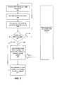
- FIG. 2 depicts an example method for using GPS and the dead reckoning inputs from the automobile data system in navigation
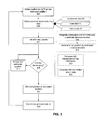
- FIG. 3 depicts another example method in which inputs from an automobile data system can be used in dead reckoning navigation
- FIG. 4 depicts a display of a device which can function according to the example methods depicted and described;
- FIG. 5 depicts a functional module view of a mobile transceiver device that can be used in the FIG. 1 system.
- FIG. 6 depicts example functional blocks of a mobile transceiver device, which can be used in implementing embodiments according to the presented examples.
- mobile transceiver device (shorted in “device”) is generally used to refer to any portable or mobile network-enabled device that has capabilities to send and receive data, such as data generated by web browsing, e-mail, SMS, instant messaging, and the like.
- devices in a variety of form factors can meet such a definition, including, for example, smartphones, laptops configured with appropriate network connections and user input devices, tablet computers, and netbooks.
- Determining a physical position of an object should be understood to require using one or more data inputs, and using those inputs in appropriate calculations to estimate a physical position.
- a determination of a physical position involves degrees of uncertainty, imprecision and inaccuracy.
- two kinds of position determination are used (1) determining a physical position based on received GPS signals and (2) using dead reckoning to determine a physical position.
- Dead reckoning navigation involves beginning from a given position and as time elapses during movement, estimating a current location based on speed and, in some cases, heading information, and potentially other information. When available, using GPS signals would be expected generally to yield better position information than dead reckoning position estimation.
- this description refers to estimating and determining positions, but it would be understood by a person of ordinary skill in the art that all methods and apparatuses cannot determine an absolutely precise physical position, and thus determining should be understood in that context to mean determining a position within a the degree of accuracy provided by the method or apparatus being used in that positional determination.
- Starting points for dead reckoning herein may be a GPS position, a user-entered position, or a position previously estimated by dead reckoning. A combination of such inputs also can be supported.
- Embodiments e.g., devices
- a dynamic switching can occur between using GPS-determined positions and dead reckoning based on inputs from the automobile data system.
- GPS signals may be sporadically available, and between that sporadic availability, dead reckoning is used in positional estimation. When GPS signals are again available, the positional estimate can be corrected or refined based on those GPS signals.
- FIG. 1 depicts a system architecture 100 in which a data-enabled mobile transceiver device 109 (device 109, hereinafter) can communicate with data processing logic 113 provided in an automobile 111 over an interface 166.
- a data-enabled mobile transceiver device 109 device 109, hereinafter
- data processing logic 113 provided in an automobile 111 over an interface 166.
- a broadcast radio receiver can be located or installed in an automobile 111, and data processing logic 113 can be implemented at least partially using the broadcast radio receiver, which can receive inputs from one or more sensors or other data sources in automobile 111, including a speed sensor 141, a compass 142 that allows determination of a heading based on magnetic north, and an accelerometer 143.
- data processing logic 113 can represent portions of a vehicle entertainment, navigation system, and a vehicle engine control system.
- An engine control system can provide outputs to the entertainment system or navigation system, which in turn can implement interface 166 to transfer that data to device 109.
- Interface 166 also can be implemented using an on-board-diagnostics (OBD) connection.
- OBD on-board-diagnostics
- Device 109 also can include modules comprising a compass module 122, which allows determination of a heading based on magnetic north, a GPS receiver 123, and an accelerometer 124, which can detect acceleration along one or more axes.
- GPS receiver 123 can receive GPS signals from a constellation of GPS satellites 146.
- Device 109 can communicate using a plurality of different wireless data communication protocols and standards.
- device 109 can communicate over a radio access network (RAN) 107, which can be, for example, a cellular network.
- RAN radio access network
- technologies that can be used for implementing RAN 107 include EDGE, UMTS, LTO, EVDO, GPRS, and other technologies for providing data transmit and receive capability to mobile devices. These technologies are used by example and such examples are not exhaustive, as embodiments of these examples do not depend on any particular characteristics or capabilities of such RAN 107.
- a network-accessible map engine 103 can be provided, which can be made accessible via a link 128 to data networks 117, from which devices can access its functionality.
- WLAN Device 109 also can communicate with Local Area Network (LAN) wireless access points, such as WLAN AP 114. Technologies that can be used in providing such wireless LAN access include equipment based on the 802.11 series of IEEE standards. WLAN AP 114 can communicate over a link 128 with a data network 117.
- LAN Local Area Network
- Data network 117 can be implemented using the Internet, or more generally any collection of one or more networks that allow data communication among elements depicted in system 100.
- the communication links depicted can be implemented using public and/or private networks that can communicate using packet data technologies, such as X.25 or Internet Protocol (IP) based addressing and routing techniques. Some connections can be implemented as secure connections over leased lines, such as a frame relay, or using Virtual Private Network (VPN) technologies.
- packet data technologies such as X.25 or Internet Protocol (IP) based addressing and routing techniques.
- IP Internet Protocol
- Some connections can be implemented as secure connections over leased lines, such as a frame relay, or using Virtual Private Network (VPN) technologies.
- VPN Virtual Private Network
- Interface 166 can be implemented, for example, using one or more local communication links, such as a Universal Serial Bus (USB) port, and a Bluetooth link, which can operate according to an extension of existing Microsoft R Sync R technology.
- USB Universal Serial Bus
- Sync provides a capability for a mobile transceiver device to send data to a computer system embedded in certain automobiles (such as automobile 111), and can use Bluetooth as a physical link.
- Sync can be used as a logical link connection to send the described metadata from the embedded computer system to device 109. Further explanation of the functioning of system 100 and methods for such are described below.
- FIG. 2 depicts a first example method that can be performed by device 109 in producing a navigation output, which can be used in a navigation application, or presented through a user interface (e.g., a display) of device 109.
- GPS signals can be received (201) by mobile transceiver device 109 (device 109). Based on the received GPS signals, position information can be calculated (203), which can include a physical position of device 109. The calculated positional information can be used in producing (205) a navigation output.
- the produced navigation output may comprise a display of a position of the device on a display of device 109, as well as using the position information in determining whether the device remains on a pre-determined route, and for other navigation purposes.
- the flow of the method through receiving, calculating positional information and using the positional information in producing a navigation output represents a normal situation where adequate GPS signal coverage is available at the device's location, and the device is able to use that signals in determining a position, which can then be used for a variety of purposes.
- device 109 may not be able to receive sufficient GPS signals in order to calculate a position, or the signals received may not be of sufficient strength and consistency in order to calculate a position with enough accuracy.
- device 109 may be shielded by buildings, trees, or geographical features from being able to receive adequate GPS signals when a position is desired to be calculated.
- Such circumstances are depicted in FIG. 2 by a decision of determining (207) whether there is adequate GPS coverage to obtain a GPS positional fix with enough accuracy to be used as a sole basis for a positional determination for use or output.
- adequate coverage can be a device designer decision, in that some designers may have laxer or more restrictive requirements for such accuracy.
- what is inadequate coverage can be influenced by the design of device 109, what kind of antenna used, electromagnetic noise, as well as programming provided in device 109.
- some devices may be able to use weaker signals than other devices, and what is inadequate coverage thus can vary among devices.
- the depicted method iterates to again use received GPS signals in calculating an updated position for device 109. For example, as device 109 moves with automobile 111, device 109 may update a display of the GPS-calculated position on an approximately regular interval.
- dead reckoning input data received (213) from an automobile data interface is used either to supplement or in substitution for the GPS-signal based position, for determining (209) an updated position of device 109.
- Such dead reckoning input can comprise speed information for an interval or intervals of time.
- data processing 113 functionality may provide an average speed for a just-completed time interval, or an instantaneous speed at regular intervals. Where average speed information is provided, the interval can be longer, while if instantaneous speed information is provided, then the interval preferably is made shorter.
- the speed information can be used with interval duration information in estimating a distance traveled since the last position update.
- the interval can be multiplied by average speed in order to approximate distance traveled.
- device 109 can take an average of two speed values, or fit a curve to a series of instantaneous speed values, or otherwise develop an average speed value or speed value curve for that interval. That speed information can then be piece-wise or continuously multiplied with time information to obtain estimates of distance traveled.
- time information For convenience, such process can be termed integration of the speed over the time interval, but it would be understood that any approach to determining distance based on elapsed time and speed information can be used, and integration is not used here to imply a strict mathematical definition.
- duration of the intervals can be pre-defined, selected by device 109 or data processing 113, or determined in a negotiation process.
- the average speed may be provided for time segments of duration about 0.1, 0.5, 1, 2, 3, 4, 5, or more seconds, or a time segment duration between about a selection of these values.
- the time segment duration can be speed-dependent, such as becoming shorter as speed increases.
- a speed of one mile per hour translates into about 1.5 feet per second.
- Traveling at 30-45 miles per hour translates into traveling about 44-66 feet per second. Therefore, a 0.1 second interval would provide an update for about every 4-7 feet, which may be more frequent than necessary.
- a one-second interval may not provide sufficient granularity to be able to update a position. For example, traveling on an urban street, a 20 or 30 foot discrepancy can be significant, while on an open highway, 20 or 30 feet may not be.
- the data received form data processing 113 can also include other data available from other sensors or functions providing data to data processing 113.
- sensors or functions can include magnetic compass 141 and accelerometer 143. Heading information from data processing 113 can be used in conjunction with speed information (effectively providing velocity information). Also, accelerometer 143 can be used in more sophisticated distance estimation algorithms that can use that acceleration information for more accurate estimation and prediction of position.
- sensed speed information may have a lag between when it is gathered by data processing 113, received in device 109, processed and used to generate a navigation output. That lag can be affected by an averaging filter applied to the speed values, and the parameters of that filter. The speed of processing of the system also can affect that lag (i.e., there can be intentional delay and delay inherent in the system). These delays can vary, causing jitter. Having acceleration information available can allow device 109 to predict where device 109 actually is, accounting for such delays.
- FIG. 2 depicts that dead reckoning data can be received from data processing 113 even when GPS signals are adequate. That data can be ignored if desired, or a certain amount of previously-received information can be retained, to account for filtering and other delays. For example, if a smoothing filter is applied, preferably, device 109 would not require reception of several intervals of dead reckoning data to fill that filter after there is loss of GPS signals; rather that data preferably is always available. Dead reckoning information also can be used in checking whether a calculated GPS position is reasonable, when there is spotty GPS coverage.
- FIG. 2 depicts that the method can produce (211) a navigation output that is based on the estimated position. For example, a current position of device 109 on a display can be updated, time to arrive estimates can be changed, turn announcement determinations can be run, and so on.
- a loop 286 depicts that after outputting a navigation output, determination 207 can be repeated. Determination 207 also can be viewed as a dynamic switching between a GPS mode and a dead reckoning mode.
- FIG. 3 depicts another example method that can be performed in device 109.
- the example method depicted in FIG. 3 obtains (303) one or more positions that were determined based on GPS signals or based on a last-estimated position.
- Dead reckoning data is obtained (305); such data is represented by accelerometer data 313, speed data 315 and heading data 317. Dashed lines for accelerometer data 313 and heading data 317 represent that such data is optional; however, speed data preferably is available.
- a trial estimated position is calculated (307), and such calculation can include integrating (319) speed data over time intervals, as described above and incrementing (321) a last position (either GPS calculated or dead-reckoning input based).
- a check can be performed to determine whether there is any evidence that the trial estimated position conflicts with other available data.
- the method can use map data (e.g., topographical map data) to determine whether the trial estimated position is in an inaccessible place. For example, if the trial estimated position is off of any known road, or on a median, or hillside, and so on, then the trial estimated position is unlikely to be accurate. Where available, the trial estimated position also can be compared (325) with route information. If a conflict or other discrepancy is identified, then a revised (311) trial estimated position can be made. That trial position can be checked (309) again for conflict. For example, if an original trial position was off the road, then the revised position can be put back on the road. If the revised position is on a road that would have involved a turn from a known route, then a different street may be selected.
- map data e.g., topographical map data
- a trial position for which a conflict is not found can be used (327) as the estimated position and navigational outputs can be updated (329) using that estimated position.
- FIG. 4 depicts an example user interface for device 109, which comprises a display 405 and a keyboard area 407.
- a last position 415 is shown as (which may not actually be displayed, but can be represented internally and used for calculating estimated positions, as described above).
- a trial estimated position 418 is first calculated based on dead reckoning inputs received from automobile data processing 113. However, a validity (conflict check - see FIG. 3 , 309) determines that the position is not on a road, and so a revised trial position 420 can be determined, and used as the estimated position absent other conflicts.
- An intended destination 424 can be displayed as well, and used as appropriate in conflict checking, as described with respect to FIG. 3 .
- FIG. 5 depicts an example functional arrangement for an embodiment of device 109.
- device 109 can comprise a local area network 533 and wide area network 534 capabilities.
- FIG. 5 depicts that device 109 comprises one or more physical layers 520, which communicate with one or more Media Access Control (MAC) functions (519) appropriate for the physical media.
- MAC Media Access Control
- MAC algorithms for a local area wireless technology such as 802.11 desirably are different from a MAC for a cellular wireless technology and from a wired local area network.
- Respective MAC layers communicate with a network addressing layer (518).
- Network addressing can be common between different networks, for example Internet Protocol (IP) addressing can be used over 802.11 type wireless LANs, Bluetooth, and cellular wireless.
- IP Internet Protocol
- Network address 518 communicates with a session control/transport layer (517); common transport protocols include TCP (Transport Control Protocol) and User Datagram Protocol (UDP), both of which can be used with IP addressing.
- An operating system 513 can communicate with the session control/transport (517) functions, on behalf of applications.
- the logical division depicted here is for explanation purposes and some embodiments can provide an operating system that comprises session control/transport 517 and network addressing 518 functionality.
- Operating system 513 provides a platform on which applications can be developed.
- a programming environment 511 can be provided as part of operating system 513 or as an additional middle ware layer to which applications can be developed.
- programming environment 511 can comprise a set of script engines 508, and a java 509 implementation.
- Script engines 508 comprise interpreters for scripting languages in which scripts to accomplish tasks can be written.
- Java 509 can provide a set of pre-defined routines and other functions that can be called by an application.
- a browser platform 510 can be written to use the script engines 508 and Jave 509 implementation.
- Browser platform 510 can comprise markup and script language renderers. Browser platform 510 may install Java 509 and script engines 508, which it will use.
- Applications 507 can be written to use browser platform 510, Java 509, script engines 508, as well as other functions provided by operating system 513. Applications 507 can be written to use programming interfaces provided by these elements, such as using published procedure names and passing appropriate arguments when calling such procedures. Applications also can inter-operate and exchange information, either using operating system 513 or by another programming model.
- One application that can be provided in such a device is an application that performs according to the Microsoft Sync model, except that the application is extended to allow communication from data processing 113 to the application running on the device, rather than only allowing communication from the device to the built-in computer, as presently is the case.
- Another application that can be provided for use in the device depicted in FIG. 5 is an application that processes metadata from a broadcast receiver according to the examples described above.
- FIG. 6 depicts example components that can be used in implementing a mobile transceiver device 109 according to the above description.
- a processing module 621 may be composed of a plurality of different processing elements, including one or more ASICs 622, a programmable processor 624, one or more coprocessors 626, which each can be fixed function, reconfigurable or programmable, one or more digital signal processors 628.
- ASICs 622 a programmable processor 624
- coprocessors 626 which each can be fixed function, reconfigurable or programmable, one or more digital signal processors 628.
- an ASIC or co-processor may be provided for implementing graphics functionality, encryption and decryption, audio filtering, and other such functions that often involve many repetitive, math-intensive steps.
- Processing module 621 can comprise memory to be used during processing, such as one or more cache memories 630.
- Non-volatile memory 643 can be implemented with one or more of Flash memory, PROM, EPROM, and so on.
- Non-volatile memory 643 can be implemented as flash memory, ferromagnetic, phase-change memory, and other non-volatile memory technologies.
- Non-volatile memory 643 also can store programs, device state, various user information, one or more operating systems, device configuration data, and other data that may need to be accessed persistently.
- User input interface 610 can comprise a plurality of different sources of user input, such as a camera 602, a keyboard 604, a touchscreen 606, and a microphone, which can provide input to speech recognition functionality 608.
- Processing module 621 also can receive input from a GPS receiver 668, which processes signals received from antenna 669.
- Processing module 621 also can use a variety of network communication protocols, grouped for description purposes here into a communication module 637, which can include a Bluetooth communication stack 642, which comprises a L2CAP layer 644, a baseband 646 and a radio 648.
- Communications module 637 also can comprise a Wireless Local Area Network (647) interface, which comprises a link layer 652 with a MAC 654, and a radio 656.
- Communications module 637 also can comprise a cellular broadband data network interface 650, which in turn comprises a link layer 661, with MAC 662.
- Cellular interface 650 also can comprise a radio for an appropriate frequency spectrum 664.
- Communications module 637 also can comprise a USB interface 666, to provide wired data communication capability.
- Other wireless and wired communication technologies also can be provided, and this description is exemplary.
- different embodiments of devices can provide some functions in an operating system installation that are provided at an application layer or in a middle layer in other devices.
- Different devices can have different designs, such that while some devices implement some functions in fixed function hardware, other devices can implement such functions in a programmable processor with code obtained from a computer readable medium.
Landscapes
- Engineering & Computer Science (AREA)
- Radar, Positioning & Navigation (AREA)
- Remote Sensing (AREA)
- Physics & Mathematics (AREA)
- General Physics & Mathematics (AREA)
- Automation & Control Theory (AREA)
- Computer Networks & Wireless Communication (AREA)
- Electromagnetism (AREA)
- Navigation (AREA)
- Position Fixing By Use Of Radio Waves (AREA)
Abstract
Description
- This application claims benefit of
U.S. Application 12/696,768, filed 29 January 2010 - The following relates to data-enabled mobile transceiver devices, such as data-enabled mobile phones, digital assistants, and smartphones, and more particularly to using these devices for navigation based on received satellite signals, such as Global Positioning System (GPS) signals, and dead reckoning techniques, at times when GPS signals are unavailable.
- Portable communication devices, such as mobile phones, increasingly have GPS receivers built-in. The devices can use received GPS signals to determine a current position of the mobile device, and in turn use that current position information as input fr navigation applications. GPS signals are not always reliably received by a mobile device, such that a mobile device cannot always obtain a positional fix when desired, such as when using a navigation application on the mobile device while driving an automobile. In particular, it is known that tall objects, such as buildings and trees obstruct GPS signal reception. However, it remains desirable to be able to continue to provide position information and navigation assistance even when the device cannot receive GPS signals adequate to determine a position of the device.
- In order to more fully explain describe various aspects, examples, and inventive embodiments, the following figures are provided, in which:
-
FIG. 1 depicts example components of an arrangement in which a mobile transceiver device can receive inputs from an automobile data system for use in dead reckoning navigation; -
FIG. 2 depicts an example method for using GPS and the dead reckoning inputs from the automobile data system in navigation; -
FIG. 3 depicts another example method in which inputs from an automobile data system can be used in dead reckoning navigation; -
FIG. 4 depicts a display of a device which can function according to the example methods depicted and described; -
FIG. 5 depicts a functional module view of a mobile transceiver device that can be used in theFIG. 1 system; and -
FIG. 6 depicts example functional blocks of a mobile transceiver device, which can be used in implementing embodiments according to the presented examples. - The following description provides examples and other disclosure, which teach those of ordinary skill in the art how to practice implementations and embodiments of inventive aspects described herein. As such, the description is not limiting, but rather is exemplary.
- For convenience, in this description, the term "mobile transceiver device" (shorted in "device") is generally used to refer to any portable or mobile network-enabled device that has capabilities to send and receive data, such as data generated by web browsing, e-mail, SMS, instant messaging, and the like. As will become clear, a variety of devices in a variety of form factors can meet such a definition, including, for example, smartphones, laptops configured with appropriate network connections and user input devices, tablet computers, and netbooks.
- Determining a physical position of an object should be understood to require using one or more data inputs, and using those inputs in appropriate calculations to estimate a physical position. Thus, a determination of a physical position involves degrees of uncertainty, imprecision and inaccuracy. In disclosed examples, two kinds of position determination are used (1) determining a physical position based on received GPS signals and (2) using dead reckoning to determine a physical position.
- Dead reckoning navigation involves beginning from a given position and as time elapses during movement, estimating a current location based on speed and, in some cases, heading information, and potentially other information. When available, using GPS signals would be expected generally to yield better position information than dead reckoning position estimation.
- For ease of explanation, this description refers to estimating and determining positions, but it would be understood by a person of ordinary skill in the art that all methods and apparatuses cannot determine an absolutely precise physical position, and thus determining should be understood in that context to mean determining a position within a the degree of accuracy provided by the method or apparatus being used in that positional determination.
- Starting points for dead reckoning herein may be a GPS position, a user-entered position, or a position previously estimated by dead reckoning. A combination of such inputs also can be supported. Embodiments (e.g., devices) according to one example can use a last-determined position, such as a GPS position, as a starting point for dead reckoning navigation, and obtain inputs from an automobile data system, in which the device is located, for use in that dead reckoning navigation. In some embodiments, a dynamic switching can occur between using GPS-determined positions and dead reckoning based on inputs from the automobile data system. For example, GPS signals may be sporadically available, and between that sporadic availability, dead reckoning is used in positional estimation. When GPS signals are again available, the positional estimate can be corrected or refined based on those GPS signals.
- As an example,
FIG. 1 depicts asystem architecture 100 in which a data-enabled mobile transceiver device 109 (device 109, hereinafter) can communicate withdata processing logic 113 provided in anautomobile 111 over aninterface 166. - In one example, a broadcast radio receiver can be located or installed in an
automobile 111, anddata processing logic 113 can be implemented at least partially using the broadcast radio receiver, which can receive inputs from one or more sensors or other data sources inautomobile 111, including aspeed sensor 141, acompass 142 that allows determination of a heading based on magnetic north, and anaccelerometer 143. For example,data processing logic 113 can represent portions of a vehicle entertainment, navigation system, and a vehicle engine control system. An engine control system can provide outputs to the entertainment system or navigation system, which in turn can implementinterface 166 to transfer that data todevice 109.Interface 166 also can be implemented using an on-board-diagnostics (OBD) connection. -
Device 109 also can include modules comprising acompass module 122, which allows determination of a heading based on magnetic north, aGPS receiver 123, and anaccelerometer 124, which can detect acceleration along one or more axes.GPS receiver 123 can receive GPS signals from a constellation ofGPS satellites 146. -
Device 109 can communicate using a plurality of different wireless data communication protocols and standards. For example,device 109 can communicate over a radio access network (RAN) 107, which can be, for example, a cellular network. Examples of technologies that can be used for implementing RAN 107 include EDGE, UMTS, LTO, EVDO, GPRS, and other technologies for providing data transmit and receive capability to mobile devices. These technologies are used by example and such examples are not exhaustive, as embodiments of these examples do not depend on any particular characteristics or capabilities of such RAN 107. - A network-
accessible map engine 103 can be provided, which can be made accessible via alink 128 todata networks 117, from which devices can access its functionality. -
Device 109 also can communicate with Local Area Network (LAN) wireless access points, such as WLANAP 114. Technologies that can be used in providing such wireless LAN access include equipment based on the 802.11 series of IEEE standards.WLAN AP 114 can communicate over alink 128 with adata network 117. -
Data network 117 can be implemented using the Internet, or more generally any collection of one or more networks that allow data communication among elements depicted insystem 100. - The communication links depicted can be implemented using public and/or private networks that can communicate using packet data technologies, such as X.25 or Internet Protocol (IP) based addressing and routing techniques. Some connections can be implemented as secure connections over leased lines, such as a frame relay, or using Virtual Private Network (VPN) technologies.
-
Interface 166 can be implemented, for example, using one or more local communication links, such as a Universal Serial Bus (USB) port, and a Bluetooth link, which can operate according to an extension of existing Microsoft Ⓡ Sync Ⓡ technology. Currently, Sync provides a capability for a mobile transceiver device to send data to a computer system embedded in certain automobiles (such as automobile 111), and can use Bluetooth as a physical link. Sync can be used as a logical link connection to send the described metadata from the embedded computer system todevice 109. Further explanation of the functioning ofsystem 100 and methods for such are described below. -
FIG. 2 depicts a first example method that can be performed bydevice 109 in producing a navigation output, which can be used in a navigation application, or presented through a user interface (e.g., a display) ofdevice 109. GPS signals can be received (201) by mobile transceiver device 109 (device 109). Based on the received GPS signals, position information can be calculated (203), which can include a physical position ofdevice 109. The calculated positional information can be used in producing (205) a navigation output. The produced navigation output may comprise a display of a position of the device on a display ofdevice 109, as well as using the position information in determining whether the device remains on a pre-determined route, and for other navigation purposes. - Thus, the flow of the method through receiving, calculating positional information and using the positional information in producing a navigation output represents a normal situation where adequate GPS signal coverage is available at the device's location, and the device is able to use that signals in determining a position, which can then be used for a variety of purposes. Sometimes however,
device 109 may not be able to receive sufficient GPS signals in order to calculate a position, or the signals received may not be of sufficient strength and consistency in order to calculate a position with enough accuracy. For example,device 109 may be shielded by buildings, trees, or geographical features from being able to receive adequate GPS signals when a position is desired to be calculated. - Such circumstances are depicted in
FIG. 2 by a decision of determining (207) whether there is adequate GPS coverage to obtain a GPS positional fix with enough accuracy to be used as a sole basis for a positional determination for use or output. Thus, adequate coverage can be a device designer decision, in that some designers may have laxer or more restrictive requirements for such accuracy. Also, in embodiments of examples presented in this disclosure, what is inadequate coverage can be influenced by the design ofdevice 109, what kind of antenna used, electromagnetic noise, as well as programming provided indevice 109. Thus, some devices may be able to use weaker signals than other devices, and what is inadequate coverage thus can vary among devices. - Where determining (207) shows that there is adequate GPS signal coverage, the depicted method iterates to again use received GPS signals in calculating an updated position for
device 109. For example, asdevice 109 moves withautomobile 111,device 109 may update a display of the GPS-calculated position on an approximately regular interval. - Upon determining that there is inadequate GPS coverage, dead reckoning input data received (213) from an automobile data interface is used either to supplement or in substitution for the GPS-signal based position, for determining (209) an updated position of
device 109. - Such dead reckoning input can comprise speed information for an interval or intervals of time. For example,
data processing 113 functionality may provide an average speed for a just-completed time interval, or an instantaneous speed at regular intervals. Where average speed information is provided, the interval can be longer, while if instantaneous speed information is provided, then the interval preferably is made shorter. - The speed information can be used with interval duration information in estimating a distance traveled since the last position update. For average speed, the interval can be multiplied by average speed in order to approximate distance traveled. For instantaneous speed,
device 109 can take an average of two speed values, or fit a curve to a series of instantaneous speed values, or otherwise develop an average speed value or speed value curve for that interval. That speed information can then be piece-wise or continuously multiplied with time information to obtain estimates of distance traveled. For convenience, such process can be termed integration of the speed over the time interval, but it would be understood that any approach to determining distance based on elapsed time and speed information can be used, and integration is not used here to imply a strict mathematical definition. - Returning to interval duration selection, duration of the intervals can be pre-defined, selected by
device 109 ordata processing 113, or determined in a negotiation process. For example, the average speed may be provided for time segments of duration about 0.1, 0.5, 1, 2, 3, 4, 5, or more seconds, or a time segment duration between about a selection of these values. - The time segment duration can be speed-dependent, such as becoming shorter as speed increases. A speed of one mile per hour translates into about 1.5 feet per second. Traveling at 30-45 miles per hour translates into traveling about 44-66 feet per second. Therefore, a 0.1 second interval would provide an update for about every 4-7 feet, which may be more frequent than necessary. However, a one-second interval may not provide sufficient granularity to be able to update a position. For example, traveling on an urban street, a 20 or 30 foot discrepancy can be significant, while on an open highway, 20 or 30 feet may not be.
- The data received
form data processing 113 can also include other data available from other sensors or functions providing data todata processing 113. Such sensors or functions can includemagnetic compass 141 andaccelerometer 143. Heading information fromdata processing 113 can be used in conjunction with speed information (effectively providing velocity information). Also,accelerometer 143 can be used in more sophisticated distance estimation algorithms that can use that acceleration information for more accurate estimation and prediction of position. - For example, sensed speed information may have a lag between when it is gathered by
data processing 113, received indevice 109, processed and used to generate a navigation output. That lag can be affected by an averaging filter applied to the speed values, and the parameters of that filter. The speed of processing of the system also can affect that lag (i.e., there can be intentional delay and delay inherent in the system). These delays can vary, causing jitter. Having acceleration information available can allowdevice 109 to predict wheredevice 109 actually is, accounting for such delays. For example, in a hard deceleration, using only speed information gathered at the start of such deceleration would cause over-estimation of distance traveled, but with an instantaneous acceleration sample, the estimate can be made more accurate by predicting or modeling the decrease in speed until a next speed sample is available. -
FIG. 2 depicts that dead reckoning data can be received fromdata processing 113 even when GPS signals are adequate. That data can be ignored if desired, or a certain amount of previously-received information can be retained, to account for filtering and other delays. For example, if a smoothing filter is applied, preferably,device 109 would not require reception of several intervals of dead reckoning data to fill that filter after there is loss of GPS signals; rather that data preferably is always available. Dead reckoning information also can be used in checking whether a calculated GPS position is reasonable, when there is spotty GPS coverage. - Following the estimation of position (209),
FIG. 2 depicts that the method can produce (211) a navigation output that is based on the estimated position. For example, a current position ofdevice 109 on a display can be updated, time to arrive estimates can be changed, turn announcement determinations can be run, and so on. A loop 286 depicts that after outputting a navigation output,determination 207 can be repeated.Determination 207 also can be viewed as a dynamic switching between a GPS mode and a dead reckoning mode. -
FIG. 3 depicts another example method that can be performed indevice 109. The example method depicted inFIG. 3 obtains (303) one or more positions that were determined based on GPS signals or based on a last-estimated position. Dead reckoning data is obtained (305); such data is represented byaccelerometer data 313,speed data 315 and headingdata 317. Dashed lines foraccelerometer data 313 and headingdata 317 represent that such data is optional; however, speed data preferably is available. - A trial estimated position is calculated (307), and such calculation can include integrating (319) speed data over time intervals, as described above and incrementing (321) a last position (either GPS calculated or dead-reckoning input based).
- A check can be performed to determine whether there is any evidence that the trial estimated position conflicts with other available data. For example, the method can use map data (e.g., topographical map data) to determine whether the trial estimated position is in an inaccessible place. For example, if the trial estimated position is off of any known road, or on a median, or hillside, and so on, then the trial estimated position is unlikely to be accurate. Where available, the trial estimated position also can be compared (325) with route information. If a conflict or other discrepancy is identified, then a revised (311) trial estimated position can be made. That trial position can be checked (309) again for conflict. For example, if an original trial position was off the road, then the revised position can be put back on the road. If the revised position is on a road that would have involved a turn from a known route, then a different street may be selected.
- Eventually, a trial position for which a conflict is not found can be used (327) as the estimated position and navigational outputs can be updated (329) using that estimated position.
-
FIG. 4 depicts an example user interface fordevice 109, which comprises adisplay 405 and akeyboard area 407. Alast position 415 is shown as (which may not actually be displayed, but can be represented internally and used for calculating estimated positions, as described above). A trial estimatedposition 418 is first calculated based on dead reckoning inputs received fromautomobile data processing 113. However, a validity (conflict check - seeFIG. 3 , 309) determines that the position is not on a road, and so a revisedtrial position 420 can be determined, and used as the estimated position absent other conflicts. An intendeddestination 424 can be displayed as well, and used as appropriate in conflict checking, as described with respect toFIG. 3 . -
FIG. 5 depicts an example functional arrangement for an embodiment ofdevice 109. According toFIG. 5 ,device 109 can comprise alocal area network 533 andwide area network 534 capabilities. To implement these capabilities,FIG. 5 depicts thatdevice 109 comprises one or morephysical layers 520, which communicate with one or more Media Access Control (MAC) functions (519) appropriate for the physical media. For example, MAC algorithms for a local area wireless technology such as 802.11 desirably are different from a MAC for a cellular wireless technology and from a wired local area network. Respective MAC layers communicate with a network addressing layer (518). Network addressing can be common between different networks, for example Internet Protocol (IP) addressing can be used over 802.11 type wireless LANs, Bluetooth, and cellular wireless.Network address 518 communicates with a session control/transport layer (517); common transport protocols include TCP (Transport Control Protocol) and User Datagram Protocol (UDP), both of which can be used with IP addressing. Anoperating system 513 can communicate with the session control/transport (517) functions, on behalf of applications. The logical division depicted here is for explanation purposes and some embodiments can provide an operating system that comprises session control/transport 517 and network addressing 518 functionality. -
Operating system 513 provides a platform on which applications can be developed. Aprogramming environment 511 can be provided as part ofoperating system 513 or as an additional middle ware layer to which applications can be developed. For example,programming environment 511 can comprise a set ofscript engines 508, and ajava 509 implementation.Script engines 508 comprise interpreters for scripting languages in which scripts to accomplish tasks can be written.Java 509 can provide a set of pre-defined routines and other functions that can be called by an application. Abrowser platform 510 can be written to use thescript engines 508 andJave 509 implementation.Browser platform 510 can comprise markup and script language renderers.Browser platform 510 may installJava 509 andscript engines 508, which it will use.Applications 507 can be written to usebrowser platform 510,Java 509,script engines 508, as well as other functions provided byoperating system 513.Applications 507 can be written to use programming interfaces provided by these elements, such as using published procedure names and passing appropriate arguments when calling such procedures. Applications also can inter-operate and exchange information, either usingoperating system 513 or by another programming model. - One application that can be provided in such a device is an application that performs according to the Microsoft Sync model, except that the application is extended to allow communication from
data processing 113 to the application running on the device, rather than only allowing communication from the device to the built-in computer, as presently is the case. Another application that can be provided for use in the device depicted inFIG. 5 is an application that processes metadata from a broadcast receiver according to the examples described above. -
FIG. 6 depicts example components that can be used in implementing amobile transceiver device 109 according to the above description.FIG. 6 depicts that aprocessing module 621 may be composed of a plurality of different processing elements, including one ormore ASICs 622, aprogrammable processor 624, one ormore coprocessors 626, which each can be fixed function, reconfigurable or programmable, one or moredigital signal processors 628. For example, an ASIC or co-processor may be provided for implementing graphics functionality, encryption and decryption, audio filtering, and other such functions that often involve many repetitive, math-intensive steps.Processing module 621 can comprise memory to be used during processing, such as one ormore cache memories 630. -
Processing module 621 communicates withmass storage 640, which can be composed of aRandom Access Memory 641 and ofnon-volatile memory 643.Non-volatile memory 643 can be implemented with one or more of Flash memory, PROM, EPROM, and so on.Non-volatile memory 643 can be implemented as flash memory, ferromagnetic, phase-change memory, and other non-volatile memory technologies.Non-volatile memory 643 also can store programs, device state, various user information, one or more operating systems, device configuration data, and other data that may need to be accessed persistently. -
User input interface 610 can comprise a plurality of different sources of user input, such as acamera 602, akeyboard 604, atouchscreen 606, and a microphone, which can provide input tospeech recognition functionality 608.Processing module 621 also can receive input from a GPS receiver 668, which processes signals received fromantenna 669.Processing module 621 also can use a variety of network communication protocols, grouped for description purposes here into acommunication module 637, which can include aBluetooth communication stack 642, which comprises aL2CAP layer 644, abaseband 646 and aradio 648.Communications module 637 also can comprise a Wireless Local Area Network (647) interface, which comprises alink layer 652 with aMAC 654, and aradio 656.Communications module 637 also can comprise a cellular broadband data network interface 650, which in turn comprises alink layer 661, withMAC 662. Cellular interface 650 also can comprise a radio for anappropriate frequency spectrum 664.Communications module 637 also can comprise a USB interface 666, to provide wired data communication capability. Other wireless and wired communication technologies also can be provided, and this description is exemplary. - In addition, separate boxes or illustrated separation of functional elements of illustrated systems does not necessarily require physical separation of such functions, as communications between such elements can occur by way of messaging, function calls, shared memory space, and so on, without any such physical separation. As such, functions need not be implemented in physically or logically separated platforms, although they are illustrated separately for ease of explanation herein.
- For example, different embodiments of devices can provide some functions in an operating system installation that are provided at an application layer or in a middle layer in other devices. Different devices can have different designs, such that while some devices implement some functions in fixed function hardware, other devices can implement such functions in a programmable processor with code obtained from a computer readable medium.
- Further, some aspects may be disclosed with respect to only certain examples. However, such disclosures are not to be implied as requiring that such aspects be used only in embodiments according to such examples.
- More generally, a person of ordinary skill would be able to adapt these disclosures to implementations of any of a variety of communication devices. Similarly, a person of ordinary skill would be able to use these disclosures to produce implementations and embodiments on different physical platforms or form factors without deviating from the scope of the claims and their equivalents.
Claims (14)
- A method for implementation on a mobile transceiver device (109), comprising:determining (203) a position of the mobile transceiver device (109) based on received GPS signals; andresponsive to detecting (207) GPS signal reception inadequate to update the position of the mobile transceiver device (109), using (209) dead reckoning input (213) received from a vehicle (111) in which the mobile transceiver device (109) is located, in conjunction with a past GPS determined position, to provide (209) an estimated position of the vehicle (111), for use in producing a navigation output (211).
- The method of claim 1, further comprising repeatedly (281) updating the estimated position based on a sequence of dead reckoning inputs received from the vehicle (111).
- The method of claim 2, wherein the dead reckoning inputs are received (209) via a data processing system (113) coupled to one or more vehicle (111) sensors (141, 142, 143).
- The method of claim 1, further comprising using (211) the last GPS determined position as a starting point for providing the estimated current position of the vehicle using dead reckoning.
- The method of claim 1, further comprising receiving (213) the dead reckoning input on a regular interval and producing the navigation output based on either a GPS-determined position, if available, and if unavailable, based on the estimated position.
- The method of claim 1, further comprising receiving (213) the dead reckoning input while receiving GPS signals at a mobile transceiver device (109) and computing (209) a physical position of the mobile transceiver device (109) based on the received GPS signals, and using the dead reckoning inputs when detecting GPS signal reception that is inadequate.
- The method of claim 1, further comprising supplementing the dead reckoning input received from the vehicle (111) with an input representing a condition sensed by the mobile transceiver device (109) to produce the estimated position of the vehicle.
- A mobile transceiver device (109), comprising:a receiver module (123) for receiving a plurality of signals from which a physical position can be determined, and for calculating a current position based on the received plurality of signals, wherein the receiver module may fail to calculate a current position at times;a microprocessor (621, 624); anda memory (640) storing code for configuring the microprocessor (624) to
receive the current calculated position, when available, and use the current calculated position in providing a navigation output through a user interface of the mobile transceiver device, and
receive dead reckoning inputs from an interface (166) to an automobile data system (113), during one or more times when the receiver module (123) fails to calculate the current position, and to use the dead reckoning inputs in estimating the current position of the mobile transceiver device (109). - The mobile transceiver device of claim 8, wherein the receiver module (123) comprises a Global Positioning System signal receiver module.
- The mobile transceiver device of claim 8, wherein the code is further for configuring the microprocessor (621) to receive the dead reckoning inputs at generally regular intervals and to responsively estimate the current position.
- The mobile transceiver device of claim 8, wherein the code is for using dead reckoning data sensed by the mobile transceiver device (109) in conjunction with the dead reckoning inputs received from the automobile data system (113).
- The mobile transceiver device of claim 8, wherein the code for configuring the microprocessor (109) is further to receive dead reckoning inputs comprising heading information and speed information.
- A computer readable medium(640) storing computer executable code comprising code for programming a microprocessor (624) located in a mobile transceiver device (109) to
dynamically switch (207) from GPS-based navigation to dead reckoning navigation, during times when a position of the mobile transceiver device (109) is not sufficiently determinable based on received GPS signals;
perform the dead reckoning navigation (211) based at least on one or more inputs received (209) from a data system of an automobile with which the mobile transceiver device (109) is moving; and
dynamically switch (207) from dead reckoning based navigation to GPS-based navigation upon availability of an updated GPS-based position fix. - The computer readable medium of claim 13, wherein the one or more inputs comprises speed information (315) for the automobile.
Applications Claiming Priority (1)
| Application Number | Priority Date | Filing Date | Title |
|---|---|---|---|
| US12/696,768 US9234760B2 (en) | 2010-01-29 | 2010-01-29 | Portable mobile transceiver for GPS navigation and vehicle data input for dead reckoning mode |
Publications (2)
| Publication Number | Publication Date |
|---|---|
| EP2351989A1 true EP2351989A1 (en) | 2011-08-03 |
| EP2351989B1 EP2351989B1 (en) | 2015-09-02 |
Family
ID=43027544
Family Applications (1)
| Application Number | Title | Priority Date | Filing Date |
|---|---|---|---|
| EP10169740.7A Active EP2351989B1 (en) | 2010-01-29 | 2010-07-15 | Portable mobile transceiver for GPS navigation and vehicle data input for dead reckoning mode |
Country Status (3)
| Country | Link |
|---|---|
| US (2) | US9234760B2 (en) |
| EP (1) | EP2351989B1 (en) |
| CA (1) | CA2729410C (en) |
Cited By (5)
| Publication number | Priority date | Publication date | Assignee | Title |
|---|---|---|---|---|
| CN103968849A (en) * | 2013-01-29 | 2014-08-06 | 延锋伟世通汽车电子有限公司 | A vehicle navigation method using an intelligent mobile phone sensor |
| WO2014088783A3 (en) * | 2012-12-06 | 2014-11-13 | Qualcomm Incorporated | Determination of position, velocity and/or heading by simultaneous use of on-device and on-vehicle information |
| CN105044756A (en) * | 2015-08-29 | 2015-11-11 | 安凯 | Vehicle tracking method based on GPS and electronic compass |
| FR3024901A1 (en) * | 2014-08-14 | 2016-02-19 | Peugeot Citroen Automobiles Sa | METHOD FOR ESTIMATING THE LOCATION OF A VEHICLE |
| DE102015222018B4 (en) | 2015-11-09 | 2024-03-07 | Volkswagen Aktiengesellschaft | Method and system for detecting the geographical position of a vehicle |
Families Citing this family (46)
| Publication number | Priority date | Publication date | Assignee | Title |
|---|---|---|---|---|
| US9756684B2 (en) * | 2011-02-17 | 2017-09-05 | Clearwire Ip Holdings Llc | System and method for providing multi network connectivity |
| US8981995B2 (en) | 2011-06-03 | 2015-03-17 | Microsoft Technology Licensing, Llc. | Low accuracy positional data by detecting improbable samples |
| US9464903B2 (en) | 2011-07-14 | 2016-10-11 | Microsoft Technology Licensing, Llc | Crowd sourcing based on dead reckoning |
| US9470529B2 (en) | 2011-07-14 | 2016-10-18 | Microsoft Technology Licensing, Llc | Activating and deactivating sensors for dead reckoning |
| US9336240B2 (en) | 2011-07-15 | 2016-05-10 | Apple Inc. | Geo-tagging digital images |
| US10184798B2 (en) | 2011-10-28 | 2019-01-22 | Microsoft Technology Licensing, Llc | Multi-stage dead reckoning for crowd sourcing |
| US9429657B2 (en) * | 2011-12-14 | 2016-08-30 | Microsoft Technology Licensing, Llc | Power efficient activation of a device movement sensor module |
| US10324108B2 (en) | 2012-02-07 | 2019-06-18 | Mcube, Inc. | Dynamic offset correction for calibration of MEMS sensor |
| JP2013167576A (en) * | 2012-02-16 | 2013-08-29 | Jvc Kenwood Corp | Communication terminal, method of controlling communication terminal, and, program |
| US10197587B2 (en) * | 2012-03-17 | 2019-02-05 | MCube Inc. | Device and method for using time rate of change of sensor data to determine device rotation |
| US9817125B2 (en) | 2012-09-07 | 2017-11-14 | Microsoft Technology Licensing, Llc | Estimating and predicting structures proximate to a mobile device |
| US9405011B2 (en) | 2012-10-05 | 2016-08-02 | Hand Held Products, Inc. | Navigation system configured to integrate motion sensing device inputs |
| US9002641B2 (en) | 2012-10-05 | 2015-04-07 | Hand Held Products, Inc. | Navigation system configured to integrate motion sensing device inputs |
| US9175963B2 (en) * | 2013-01-10 | 2015-11-03 | MCube Inc. | Dead reckoning based initialization of position and heading using discrete position indicators |
| EP2754524B1 (en) | 2013-01-15 | 2015-11-25 | Corning Laser Technologies GmbH | Method of and apparatus for laser based processing of flat substrates being wafer or glass element using a laser beam line |
| US8781502B1 (en) * | 2013-02-01 | 2014-07-15 | Swirl Networks, Inc. | Systems and methods for display of supplemental content responsive to location |
| EP2781296B1 (en) | 2013-03-21 | 2020-10-21 | Corning Laser Technologies GmbH | Device and method for cutting out contours from flat substrates using a laser |
| US10293436B2 (en) | 2013-12-17 | 2019-05-21 | Corning Incorporated | Method for rapid laser drilling of holes in glass and products made therefrom |
| US11556039B2 (en) | 2013-12-17 | 2023-01-17 | Corning Incorporated | Electrochromic coated glass articles and methods for laser processing the same |
| US9607319B2 (en) | 2013-12-30 | 2017-03-28 | Adtile Technologies, Inc. | Motion and gesture-based mobile advertising activation |
| US9593953B2 (en) | 2014-01-21 | 2017-03-14 | Telenav, Inc. | Navigation system with location correction mechanism and method of operation thereof |
| JP6193179B2 (en) * | 2014-05-27 | 2017-09-06 | アイシン・エィ・ダブリュ株式会社 | Facility output system, facility output method, and facility output program |
| TWI730945B (en) | 2014-07-08 | 2021-06-21 | 美商康寧公司 | Methods and apparatuses for laser processing materials |
| KR20170028943A (en) | 2014-07-14 | 2017-03-14 | 코닝 인코포레이티드 | System for and method of processing transparent materials using laser beam focal lines adjustable in length and diameter |
| US9462319B2 (en) * | 2014-08-08 | 2016-10-04 | GM Global Technology Operations LLC | Method and apparatus for sensor synthesis and arbitration between mobile devices and vehicles |
| US11773004B2 (en) | 2015-03-24 | 2023-10-03 | Corning Incorporated | Laser cutting and processing of display glass compositions |
| WO2017011296A1 (en) | 2015-07-10 | 2017-01-19 | Corning Incorporated | Methods of continuous fabrication of holes in flexible substrate sheets and products relating to the same |
| US9578493B1 (en) * | 2015-08-06 | 2017-02-21 | Adtile Technologies Inc. | Sensor control switch |
| KR102398320B1 (en) * | 2015-08-07 | 2022-05-16 | 삼성전자주식회사 | Method for providing route information and an electronic device thereof |
| US10437463B2 (en) | 2015-10-16 | 2019-10-08 | Lumini Corporation | Motion-based graphical input system |
| US11162794B2 (en) * | 2016-09-13 | 2021-11-02 | Trekace Technologies Ltd. | Method, system and software for navigation in global positioning system (GPS)-denied environments |
| US10730783B2 (en) | 2016-09-30 | 2020-08-04 | Corning Incorporated | Apparatuses and methods for laser processing transparent workpieces using non-axisymmetric beam spots |
| KR102428350B1 (en) | 2016-10-24 | 2022-08-02 | 코닝 인코포레이티드 | Substrate processing station for laser-based machining of sheet-like glass substrates |
| US9983687B1 (en) | 2017-01-06 | 2018-05-29 | Adtile Technologies Inc. | Gesture-controlled augmented reality experience using a mobile communications device |
| CN108693549A (en) * | 2018-03-28 | 2018-10-23 | 东风商用车有限公司 | Vehicle-mounted real-time positioning system and method |
| US11068530B1 (en) * | 2018-11-02 | 2021-07-20 | Shutterstock, Inc. | Context-based image selection for electronic media |
| US11994601B2 (en) * | 2018-12-12 | 2024-05-28 | Volvo Truck Corporation | Method for estimating the attitude of a vehicle |
| DE102019215677A1 (en) * | 2019-10-11 | 2021-04-15 | Zf Friedrichshafen Ag | Method for processing GPS route data of a vehicle |
| CN112558130B (en) * | 2020-12-07 | 2023-12-19 | 安徽江淮汽车集团股份有限公司 | Synchronization method, device, equipment and storage medium of positioning data |
| CN113267184B (en) * | 2021-04-25 | 2022-09-16 | 北京航空航天大学 | A curve-based vehicle inertial navigation trajectory map matching method |
| US12078738B2 (en) | 2021-11-09 | 2024-09-03 | Msrs Llc | Method, apparatus, and computer readable medium for a multi-source reckoning system |
| CN114624744A (en) * | 2022-01-20 | 2022-06-14 | 浙江零跑科技股份有限公司 | Automobile machine GPS signal loss processing method |
| US12276735B2 (en) | 2022-08-04 | 2025-04-15 | Qualcomm Incorporated | Enhanced navigation mode with location detection and map layer switching |
| JP7826954B2 (en) * | 2023-01-13 | 2026-03-10 | トヨタ自動車株式会社 | Vehicle control device |
| WO2025014511A1 (en) * | 2023-07-07 | 2025-01-16 | Greater Shine Limited | Mobile device aided vehicle dead reckoning navigation |
| US12259246B1 (en) | 2024-05-13 | 2025-03-25 | Msrs Llc | Method, apparatus, and computer readable medium for calculating a handrail influence intensity factor |
Citations (3)
| Publication number | Priority date | Publication date | Assignee | Title |
|---|---|---|---|---|
| US5828585A (en) * | 1997-01-17 | 1998-10-27 | Delco Electronics Corporation | Vehicle speed signal calibration |
| US20020049538A1 (en) * | 2000-10-23 | 2002-04-25 | Knapton Cary Paul | Vehicle tracking systems and methods |
| DE102006054346A1 (en) * | 2006-11-17 | 2008-05-21 | Conti Temic Microelectronic Gmbh | Satellite-based navigation device for determining geographical position of vehicle in e.g. forest area, has interface e.g. infra-red interface, for receiving movement data of vehicle, where navigation device is mobile device |
Family Cites Families (37)
| Publication number | Priority date | Publication date | Assignee | Title |
|---|---|---|---|---|
| ATE54398T1 (en) * | 1985-04-17 | 1990-07-15 | Siemens Ag | CELLULAR SYSTEM. |
| US4999783A (en) * | 1987-05-11 | 1991-03-12 | Sumitomo Electric Industries, Ltd. | Location detecting method |
| US5058023A (en) * | 1990-07-30 | 1991-10-15 | Motorola, Inc. | Vehicle position determining apparatus |
| JPH0731062B2 (en) * | 1992-02-10 | 1995-04-10 | 住友電気工業株式会社 | Gyro offset correction method and apparatus |
| DE4211933A1 (en) * | 1992-04-09 | 1993-10-14 | Philips Patentverwaltung | Arrangement for determining the position of a land vehicle |
| US5459667A (en) * | 1993-01-22 | 1995-10-17 | Sumitomo Electric Industries, Ltd. | Navigation apparatus for informing vehicle driver of information regarding travel route |
| US5961571A (en) * | 1994-12-27 | 1999-10-05 | Siemens Corporated Research, Inc | Method and apparatus for automatically tracking the location of vehicles |
| JP2902340B2 (en) * | 1995-12-28 | 1999-06-07 | アルパイン株式会社 | Vehicle position correction method |
| US5922042A (en) * | 1996-09-30 | 1999-07-13 | Visteon Technologies, Llc | Automatic resumption of route guidance in vehicle navigation system |
| US5987381A (en) * | 1997-03-11 | 1999-11-16 | Visteon Technologies, Llc | Automobile navigation system using remote download of data |
| JP3449240B2 (en) * | 1998-09-24 | 2003-09-22 | 株式会社デンソー | Vehicle current position detection device, vehicle current position display device, navigation device, and recording medium |
| CN1292388C (en) * | 1999-04-28 | 2006-12-27 | 丰田自动车株式会社 | Billing System |
| US6360165B1 (en) * | 1999-10-21 | 2002-03-19 | Visteon Technologies, Llc | Method and apparatus for improving dead reckoning distance calculation in vehicle navigation system |
| CN100403341C (en) * | 2000-09-29 | 2008-07-16 | 丰田自动车株式会社 | Position recognition device and position recognition method, and accounting processor and accounting processing method |
| US6622087B2 (en) * | 2000-12-26 | 2003-09-16 | Intel Corporation | Method and apparatus for deriving travel profiles |
| US6597987B1 (en) * | 2001-05-15 | 2003-07-22 | Navigation Technologies Corp. | Method for improving vehicle positioning in a navigation system |
| US6801855B1 (en) * | 2002-06-28 | 2004-10-05 | Garmin Ltd. | Systems and methods with integrated GPS and dead reckoning capabilities |
| JP2006189325A (en) * | 2005-01-06 | 2006-07-20 | Aisin Aw Co Ltd | Present location information management device of vehicle |
| EP1853878A2 (en) * | 2005-02-07 | 2007-11-14 | Siemens VDO Automotive Corporation | Navigation system |
| US7369845B2 (en) * | 2005-07-28 | 2008-05-06 | International Business Machines Corporation | Managing features available on a portable communication device based on a travel speed detected by the portable communication device |
| JP4735179B2 (en) * | 2005-10-12 | 2011-07-27 | 株式会社デンソー | Vehicle control device |
| JP5028851B2 (en) * | 2006-04-24 | 2012-09-19 | 株式会社デンソー | Road information detection apparatus and program |
| JP5162103B2 (en) * | 2006-05-15 | 2013-03-13 | トヨタ自動車株式会社 | Support control device |
| US7603233B2 (en) * | 2006-10-16 | 2009-10-13 | Alpine Electronics, Inc. | Map matching method and apparatus for navigation system |
| JP2008236497A (en) * | 2007-03-22 | 2008-10-02 | Nec Corp | Service providing system and rendering execution method |
| US8180379B2 (en) * | 2007-06-28 | 2012-05-15 | Apple Inc. | Synchronizing mobile and vehicle devices |
| US8204684B2 (en) * | 2007-06-28 | 2012-06-19 | Apple Inc. | Adaptive mobile device navigation |
| US8175802B2 (en) * | 2007-06-28 | 2012-05-08 | Apple Inc. | Adaptive route guidance based on preferences |
| ATE528946T1 (en) * | 2007-06-29 | 2011-10-15 | Octaview Technologies B V | SYSTEM AND METHOD FOR DETERMINING LOCATIONS VIA CELL PHONE TRANSMISSION PATTERNS |
| JP4964047B2 (en) * | 2007-07-12 | 2012-06-27 | アルパイン株式会社 | Position detection apparatus and position detection method |
| JP2009058242A (en) * | 2007-08-30 | 2009-03-19 | Alpine Electronics Inc | Method and device for correcting vehicle position-azimuth |
| WO2009073806A2 (en) | 2007-12-05 | 2009-06-11 | Johnson Controls Technology Company | Vehicle user interface systems and methods |
| FR2931285A1 (en) * | 2008-05-15 | 2009-11-20 | Peugeot Citroen Automobiles Sa | Vehicle i.e. motor vehicle, has transmitter for transmitting dead reckoning navigation data to portable satellite positioning navigation system, and standardization processing unit for standardizing transmitted navigation data |
| KR101495166B1 (en) * | 2008-07-01 | 2015-02-24 | 엘지전자 주식회사 | Vehicle navigation methods and devices |
| KR101555552B1 (en) * | 2008-12-29 | 2015-09-24 | 엘지전자 주식회사 | Navigation apparatus and navigating method thereof |
| KR101612785B1 (en) * | 2009-06-01 | 2016-04-26 | 엘지전자 주식회사 | Mobile vehicle navigation method and apparatus thereof |
| US20110039581A1 (en) * | 2009-08-12 | 2011-02-17 | Yigang Cai | Method and apparatus for restricting the use of a mobile telecommunications device by a vehicle's driver |
-
2010
- 2010-01-29 US US12/696,768 patent/US9234760B2/en active Active
- 2010-07-15 EP EP10169740.7A patent/EP2351989B1/en active Active
-
2011
- 2011-01-26 CA CA2729410A patent/CA2729410C/en active Active
-
2016
- 2016-01-08 US US14/991,664 patent/US20160252353A1/en not_active Abandoned
Patent Citations (3)
| Publication number | Priority date | Publication date | Assignee | Title |
|---|---|---|---|---|
| US5828585A (en) * | 1997-01-17 | 1998-10-27 | Delco Electronics Corporation | Vehicle speed signal calibration |
| US20020049538A1 (en) * | 2000-10-23 | 2002-04-25 | Knapton Cary Paul | Vehicle tracking systems and methods |
| DE102006054346A1 (en) * | 2006-11-17 | 2008-05-21 | Conti Temic Microelectronic Gmbh | Satellite-based navigation device for determining geographical position of vehicle in e.g. forest area, has interface e.g. infra-red interface, for receiving movement data of vehicle, where navigation device is mobile device |
Cited By (10)
| Publication number | Priority date | Publication date | Assignee | Title |
|---|---|---|---|---|
| WO2014088783A3 (en) * | 2012-12-06 | 2014-11-13 | Qualcomm Incorporated | Determination of position, velocity and/or heading by simultaneous use of on-device and on-vehicle information |
| CN104813142A (en) * | 2012-12-06 | 2015-07-29 | 高通股份有限公司 | Determining position, velocity and/or heading through the simultaneous use of on-device and on-vehicle information |
| CN104813142B (en) * | 2012-12-06 | 2018-05-18 | 高通股份有限公司 | Determining position, velocity and/or heading through the simultaneous use of on-device and on-vehicle information |
| US10041798B2 (en) | 2012-12-06 | 2018-08-07 | Qualcomm Incorporated | Determination of position, velocity and/or heading by simultaneous use of on-device and on-vehicle information |
| US11441904B2 (en) | 2012-12-06 | 2022-09-13 | Qualcomm Incorporated | Determination of position, velocity and/or heading by simultaneous use of on-device and on-vehicle information |
| US12196556B2 (en) | 2012-12-06 | 2025-01-14 | Qualcomm Incorporated | Determination of position, velocity, and/or heading by simultaneous use of on-device and on-vehicle information |
| CN103968849A (en) * | 2013-01-29 | 2014-08-06 | 延锋伟世通汽车电子有限公司 | A vehicle navigation method using an intelligent mobile phone sensor |
| FR3024901A1 (en) * | 2014-08-14 | 2016-02-19 | Peugeot Citroen Automobiles Sa | METHOD FOR ESTIMATING THE LOCATION OF A VEHICLE |
| CN105044756A (en) * | 2015-08-29 | 2015-11-11 | 安凯 | Vehicle tracking method based on GPS and electronic compass |
| DE102015222018B4 (en) | 2015-11-09 | 2024-03-07 | Volkswagen Aktiengesellschaft | Method and system for detecting the geographical position of a vehicle |
Also Published As
| Publication number | Publication date |
|---|---|
| CA2729410C (en) | 2016-03-29 |
| US9234760B2 (en) | 2016-01-12 |
| US20160252353A1 (en) | 2016-09-01 |
| EP2351989B1 (en) | 2015-09-02 |
| US20110191024A1 (en) | 2011-08-04 |
| CA2729410A1 (en) | 2011-07-29 |
Similar Documents
| Publication | Publication Date | Title |
|---|---|---|
| EP2351989B1 (en) | Portable mobile transceiver for GPS navigation and vehicle data input for dead reckoning mode | |
| CN101382431B (en) | Positioning system and method thereof | |
| US9182240B2 (en) | Method, apparatus and system for mapping a course of a mobile device | |
| US9791572B2 (en) | Batch processing for improved georeferencing | |
| JP6013645B2 (en) | Mobile device power management while providing location services | |
| US20120253663A1 (en) | Electronic system and method for personal navigation | |
| JP2010515905A (en) | Navigation apparatus and method for increasing transferred data | |
| US20140288828A1 (en) | Estimating an initial position and navigation state using vehicle odometry | |
| HUE027043T2 (en) | Positioning on request | |
| US20150264534A1 (en) | Method and apparatus for adaptive positioning | |
| EP2976659A1 (en) | Heading, velocity, and position estimation with vehicle sensors, mobile device, and gnss inputs | |
| US9261603B2 (en) | Navigation system with conditional based application sharing mechanism and method of operation thereof | |
| CN108780157B (en) | Vehicle dead reckoning using dynamic calibration and/or dynamic weighting | |
| JP2012505383A (en) | Navigation device and method for recording image data | |
| US9277368B2 (en) | Method and apparatus for determining whether or not a mobile device is indoors | |
| US10771937B2 (en) | Emergency notification apparatus | |
| EP2972492A2 (en) | Mobile device positioning responsive to externally generated regional candidate position fix mode selection | |
| JP2020020634A (en) | Information processing system, program, and control method | |
| JP2013171044A (en) | Method and apparatus for location positioning and electronic device | |
| WO2011153176A1 (en) | Navigation system with dynamic application execution mechanism and method of operation thereof | |
| US9612343B1 (en) | Method and mobile station for using a location determining mechanism based on an extent of turning | |
| CN114812563A (en) | Positioning compensation method and device, electronic equipment and storage medium | |
| CN112558130A (en) | Method, device and equipment for synchronizing positioning data and storage medium | |
| Ha et al. | INS/GPS navigation for land applications via GSM/GPRS network | |
| WO2023248314A1 (en) | Control device, control method, and program |
Legal Events
| Date | Code | Title | Description |
|---|---|---|---|
| PUAI | Public reference made under article 153(3) epc to a published international application that has entered the european phase |
Free format text: ORIGINAL CODE: 0009012 |
|
| 17P | Request for examination filed |
Effective date: 20100715 |
|
| AK | Designated contracting states |
Kind code of ref document: A1 Designated state(s): AL AT BE BG CH CY CZ DE DK EE ES FI FR GB GR HR HU IE IS IT LI LT LU LV MC MK MT NL NO PL PT RO SE SI SK SM TR |
|
| AX | Request for extension of the european patent |
Extension state: BA ME RS |
|
| 17Q | First examination report despatched |
Effective date: 20120612 |
|
| RAP1 | Party data changed (applicant data changed or rights of an application transferred) |
Owner name: BLACKBERRY LIMITED |
|
| RAP1 | Party data changed (applicant data changed or rights of an application transferred) |
Owner name: BLACKBERRY LIMITED |
|
| GRAP | Despatch of communication of intention to grant a patent |
Free format text: ORIGINAL CODE: EPIDOSNIGR1 |
|
| INTG | Intention to grant announced |
Effective date: 20150306 |
|
| GRAS | Grant fee paid |
Free format text: ORIGINAL CODE: EPIDOSNIGR3 |
|
| GRAA | (expected) grant |
Free format text: ORIGINAL CODE: 0009210 |
|
| AK | Designated contracting states |
Kind code of ref document: B1 Designated state(s): AL AT BE BG CH CY CZ DE DK EE ES FI FR GB GR HR HU IE IS IT LI LT LU LV MC MK MT NL NO PL PT RO SE SI SK SM TR |
|
| REG | Reference to a national code |
Ref country code: GB Ref legal event code: FG4D |
|
| REG | Reference to a national code |
Ref country code: AT Ref legal event code: REF Ref document number: 746894 Country of ref document: AT Kind code of ref document: T Effective date: 20150915 Ref country code: CH Ref legal event code: EP |
|
| REG | Reference to a national code |
Ref country code: IE Ref legal event code: FG4D |
|
| REG | Reference to a national code |
Ref country code: DE Ref legal event code: R096 Ref document number: 602010027122 Country of ref document: DE |
|
| REG | Reference to a national code |
Ref country code: AT Ref legal event code: MK05 Ref document number: 746894 Country of ref document: AT Kind code of ref document: T Effective date: 20150902 |
|
| PG25 | Lapsed in a contracting state [announced via postgrant information from national office to epo] |
Ref country code: FI Free format text: LAPSE BECAUSE OF FAILURE TO SUBMIT A TRANSLATION OF THE DESCRIPTION OR TO PAY THE FEE WITHIN THE PRESCRIBED TIME-LIMIT Effective date: 20150902 Ref country code: GR Free format text: LAPSE BECAUSE OF FAILURE TO SUBMIT A TRANSLATION OF THE DESCRIPTION OR TO PAY THE FEE WITHIN THE PRESCRIBED TIME-LIMIT Effective date: 20151203 Ref country code: NO Free format text: LAPSE BECAUSE OF FAILURE TO SUBMIT A TRANSLATION OF THE DESCRIPTION OR TO PAY THE FEE WITHIN THE PRESCRIBED TIME-LIMIT Effective date: 20151202 Ref country code: LV Free format text: LAPSE BECAUSE OF FAILURE TO SUBMIT A TRANSLATION OF THE DESCRIPTION OR TO PAY THE FEE WITHIN THE PRESCRIBED TIME-LIMIT Effective date: 20150902 Ref country code: LT Free format text: LAPSE BECAUSE OF FAILURE TO SUBMIT A TRANSLATION OF THE DESCRIPTION OR TO PAY THE FEE WITHIN THE PRESCRIBED TIME-LIMIT Effective date: 20150902 |
|
| REG | Reference to a national code |
Ref country code: LT Ref legal event code: MG4D Ref country code: NL Ref legal event code: FP |
|
| PG25 | Lapsed in a contracting state [announced via postgrant information from national office to epo] |
Ref country code: ES Free format text: LAPSE BECAUSE OF FAILURE TO SUBMIT A TRANSLATION OF THE DESCRIPTION OR TO PAY THE FEE WITHIN THE PRESCRIBED TIME-LIMIT Effective date: 20150902 Ref country code: SE Free format text: LAPSE BECAUSE OF FAILURE TO SUBMIT A TRANSLATION OF THE DESCRIPTION OR TO PAY THE FEE WITHIN THE PRESCRIBED TIME-LIMIT Effective date: 20150902 Ref country code: PL Free format text: LAPSE BECAUSE OF FAILURE TO SUBMIT A TRANSLATION OF THE DESCRIPTION OR TO PAY THE FEE WITHIN THE PRESCRIBED TIME-LIMIT Effective date: 20150902 Ref country code: AT Free format text: LAPSE BECAUSE OF FAILURE TO SUBMIT A TRANSLATION OF THE DESCRIPTION OR TO PAY THE FEE WITHIN THE PRESCRIBED TIME-LIMIT Effective date: 20150902 |
|
| PG25 | Lapsed in a contracting state [announced via postgrant information from national office to epo] |
Ref country code: CZ Free format text: LAPSE BECAUSE OF FAILURE TO SUBMIT A TRANSLATION OF THE DESCRIPTION OR TO PAY THE FEE WITHIN THE PRESCRIBED TIME-LIMIT Effective date: 20150902 Ref country code: IS Free format text: LAPSE BECAUSE OF FAILURE TO SUBMIT A TRANSLATION OF THE DESCRIPTION OR TO PAY THE FEE WITHIN THE PRESCRIBED TIME-LIMIT Effective date: 20160102 Ref country code: SK Free format text: LAPSE BECAUSE OF FAILURE TO SUBMIT A TRANSLATION OF THE DESCRIPTION OR TO PAY THE FEE WITHIN THE PRESCRIBED TIME-LIMIT Effective date: 20150902 Ref country code: EE Free format text: LAPSE BECAUSE OF FAILURE TO SUBMIT A TRANSLATION OF THE DESCRIPTION OR TO PAY THE FEE WITHIN THE PRESCRIBED TIME-LIMIT Effective date: 20150902 Ref country code: IT Free format text: LAPSE BECAUSE OF FAILURE TO SUBMIT A TRANSLATION OF THE DESCRIPTION OR TO PAY THE FEE WITHIN THE PRESCRIBED TIME-LIMIT Effective date: 20150902 |
|
| PG25 | Lapsed in a contracting state [announced via postgrant information from national office to epo] |
Ref country code: PT Free format text: LAPSE BECAUSE OF FAILURE TO SUBMIT A TRANSLATION OF THE DESCRIPTION OR TO PAY THE FEE WITHIN THE PRESCRIBED TIME-LIMIT Effective date: 20160104 Ref country code: RO Free format text: LAPSE BECAUSE OF FAILURE TO SUBMIT A TRANSLATION OF THE DESCRIPTION OR TO PAY THE FEE WITHIN THE PRESCRIBED TIME-LIMIT Effective date: 20150902 |
|
| REG | Reference to a national code |
Ref country code: DE Ref legal event code: R097 Ref document number: 602010027122 Country of ref document: DE |
|
| PLBE | No opposition filed within time limit |
Free format text: ORIGINAL CODE: 0009261 |
|
| STAA | Information on the status of an ep patent application or granted ep patent |
Free format text: STATUS: NO OPPOSITION FILED WITHIN TIME LIMIT |
|
| REG | Reference to a national code |
Ref country code: FR Ref legal event code: PLFP Year of fee payment: 7 |
|
| 26N | No opposition filed |
Effective date: 20160603 |
|
| PG25 | Lapsed in a contracting state [announced via postgrant information from national office to epo] |
Ref country code: DK Free format text: LAPSE BECAUSE OF FAILURE TO SUBMIT A TRANSLATION OF THE DESCRIPTION OR TO PAY THE FEE WITHIN THE PRESCRIBED TIME-LIMIT Effective date: 20150902 Ref country code: SI Free format text: LAPSE BECAUSE OF FAILURE TO SUBMIT A TRANSLATION OF THE DESCRIPTION OR TO PAY THE FEE WITHIN THE PRESCRIBED TIME-LIMIT Effective date: 20150902 |
|
| PG25 | Lapsed in a contracting state [announced via postgrant information from national office to epo] |
Ref country code: BE Free format text: LAPSE BECAUSE OF FAILURE TO SUBMIT A TRANSLATION OF THE DESCRIPTION OR TO PAY THE FEE WITHIN THE PRESCRIBED TIME-LIMIT Effective date: 20150902 |
|
| REG | Reference to a national code |
Ref country code: CH Ref legal event code: PL |
|
| PG25 | Lapsed in a contracting state [announced via postgrant information from national office to epo] |
Ref country code: MC Free format text: LAPSE BECAUSE OF FAILURE TO SUBMIT A TRANSLATION OF THE DESCRIPTION OR TO PAY THE FEE WITHIN THE PRESCRIBED TIME-LIMIT Effective date: 20150902 |
|
| PG25 | Lapsed in a contracting state [announced via postgrant information from national office to epo] |
Ref country code: CH Free format text: LAPSE BECAUSE OF NON-PAYMENT OF DUE FEES Effective date: 20160731 Ref country code: LI Free format text: LAPSE BECAUSE OF NON-PAYMENT OF DUE FEES Effective date: 20160731 |
|
| REG | Reference to a national code |
Ref country code: IE Ref legal event code: MM4A |
|
| REG | Reference to a national code |
Ref country code: FR Ref legal event code: PLFP Year of fee payment: 8 |
|
| PG25 | Lapsed in a contracting state [announced via postgrant information from national office to epo] |
Ref country code: IE Free format text: LAPSE BECAUSE OF NON-PAYMENT OF DUE FEES Effective date: 20160715 |
|
| PG25 | Lapsed in a contracting state [announced via postgrant information from national office to epo] |
Ref country code: LU Free format text: LAPSE BECAUSE OF NON-PAYMENT OF DUE FEES Effective date: 20160715 |
|
| PG25 | Lapsed in a contracting state [announced via postgrant information from national office to epo] |
Ref country code: SM Free format text: LAPSE BECAUSE OF FAILURE TO SUBMIT A TRANSLATION OF THE DESCRIPTION OR TO PAY THE FEE WITHIN THE PRESCRIBED TIME-LIMIT Effective date: 20150902 Ref country code: HU Free format text: LAPSE BECAUSE OF FAILURE TO SUBMIT A TRANSLATION OF THE DESCRIPTION OR TO PAY THE FEE WITHIN THE PRESCRIBED TIME-LIMIT; INVALID AB INITIO Effective date: 20100715 Ref country code: CY Free format text: LAPSE BECAUSE OF FAILURE TO SUBMIT A TRANSLATION OF THE DESCRIPTION OR TO PAY THE FEE WITHIN THE PRESCRIBED TIME-LIMIT Effective date: 20150902 |
|
| PG25 | Lapsed in a contracting state [announced via postgrant information from national office to epo] |
Ref country code: MK Free format text: LAPSE BECAUSE OF FAILURE TO SUBMIT A TRANSLATION OF THE DESCRIPTION OR TO PAY THE FEE WITHIN THE PRESCRIBED TIME-LIMIT Effective date: 20150902 Ref country code: HR Free format text: LAPSE BECAUSE OF FAILURE TO SUBMIT A TRANSLATION OF THE DESCRIPTION OR TO PAY THE FEE WITHIN THE PRESCRIBED TIME-LIMIT Effective date: 20150902 Ref country code: TR Free format text: LAPSE BECAUSE OF FAILURE TO SUBMIT A TRANSLATION OF THE DESCRIPTION OR TO PAY THE FEE WITHIN THE PRESCRIBED TIME-LIMIT Effective date: 20150902 Ref country code: MT Free format text: LAPSE BECAUSE OF NON-PAYMENT OF DUE FEES Effective date: 20160731 |
|
| REG | Reference to a national code |
Ref country code: FR Ref legal event code: PLFP Year of fee payment: 9 |
|
| PG25 | Lapsed in a contracting state [announced via postgrant information from national office to epo] |
Ref country code: BG Free format text: LAPSE BECAUSE OF FAILURE TO SUBMIT A TRANSLATION OF THE DESCRIPTION OR TO PAY THE FEE WITHIN THE PRESCRIBED TIME-LIMIT Effective date: 20150902 |
|
| PG25 | Lapsed in a contracting state [announced via postgrant information from national office to epo] |
Ref country code: AL Free format text: LAPSE BECAUSE OF FAILURE TO SUBMIT A TRANSLATION OF THE DESCRIPTION OR TO PAY THE FEE WITHIN THE PRESCRIBED TIME-LIMIT Effective date: 20150902 |
|
| REG | Reference to a national code |
Ref country code: DE Ref legal event code: R082 Ref document number: 602010027122 Country of ref document: DE Ref country code: DE Ref legal event code: R081 Ref document number: 602010027122 Country of ref document: DE Owner name: MALIKIE INNOVATIONS LTD., IE Free format text: FORMER OWNER: BLACKBERRY LTD., WATERLOO, ONTARIO, CA |
|
| PGFP | Annual fee paid to national office [announced via postgrant information from national office to epo] |
Ref country code: NL Payment date: 20250724 Year of fee payment: 16 |
|
| PGFP | Annual fee paid to national office [announced via postgrant information from national office to epo] |
Ref country code: DE Payment date: 20250728 Year of fee payment: 16 |
|
| PGFP | Annual fee paid to national office [announced via postgrant information from national office to epo] |
Ref country code: GB Payment date: 20250722 Year of fee payment: 16 |
|
| PGFP | Annual fee paid to national office [announced via postgrant information from national office to epo] |
Ref country code: FR Payment date: 20250725 Year of fee payment: 16 |