EP2075596B1 - Aufzeichnung seismischer Daten - Google Patents
Aufzeichnung seismischer Daten Download PDFInfo
- Publication number
- EP2075596B1 EP2075596B1 EP08171160.8A EP08171160A EP2075596B1 EP 2075596 B1 EP2075596 B1 EP 2075596B1 EP 08171160 A EP08171160 A EP 08171160A EP 2075596 B1 EP2075596 B1 EP 2075596B1
- Authority
- EP
- European Patent Office
- Prior art keywords
- unit
- remote acquisition
- acquisition units
- harvester
- data
- Prior art date
- Legal status (The legal status is an assumption and is not a legal conclusion. Google has not performed a legal analysis and makes no representation as to the accuracy of the status listed.)
- Active
Links
- 238000000034 method Methods 0.000 claims description 28
- 238000004891 communication Methods 0.000 claims description 11
- 238000007906 compression Methods 0.000 claims description 4
- 230000006835 compression Effects 0.000 claims description 4
- 239000000284 extract Substances 0.000 claims description 2
- 238000012546 transfer Methods 0.000 description 6
- 230000008569 process Effects 0.000 description 4
- 238000013518 transcription Methods 0.000 description 4
- 230000035897 transcription Effects 0.000 description 4
- 238000003908 quality control method Methods 0.000 description 3
- 230000005540 biological transmission Effects 0.000 description 2
- 238000013500 data storage Methods 0.000 description 2
- 230000006870 function Effects 0.000 description 2
- 230000003993 interaction Effects 0.000 description 2
- 238000012986 modification Methods 0.000 description 2
- 230000004048 modification Effects 0.000 description 2
- 230000015572 biosynthetic process Effects 0.000 description 1
- 238000006243 chemical reaction Methods 0.000 description 1
- 238000013481 data capture Methods 0.000 description 1
- 238000013144 data compression Methods 0.000 description 1
- 230000002950 deficient Effects 0.000 description 1
- 230000001934 delay Effects 0.000 description 1
- 230000003111 delayed effect Effects 0.000 description 1
- 238000011161 development Methods 0.000 description 1
- 238000010586 diagram Methods 0.000 description 1
- 238000005516 engineering process Methods 0.000 description 1
- 238000001914 filtration Methods 0.000 description 1
- 238000005755 formation reaction Methods 0.000 description 1
- 238000003306 harvesting Methods 0.000 description 1
- 230000007257 malfunction Effects 0.000 description 1
- 238000011017 operating method Methods 0.000 description 1
- 238000012545 processing Methods 0.000 description 1
- 230000009467 reduction Effects 0.000 description 1
- 230000004044 response Effects 0.000 description 1
- 238000012360 testing method Methods 0.000 description 1
Images



Classifications
-
- G—PHYSICS
- G01—MEASURING; TESTING
- G01V—GEOPHYSICS; GRAVITATIONAL MEASUREMENTS; DETECTING MASSES OR OBJECTS; TAGS
- G01V5/00—Prospecting or detecting by the use of ionising radiation, e.g. of natural or induced radioactivity
- G01V5/02—Prospecting or detecting by the use of ionising radiation, e.g. of natural or induced radioactivity specially adapted for surface logging, e.g. from aircraft
-
- G—PHYSICS
- G01—MEASURING; TESTING
- G01V—GEOPHYSICS; GRAVITATIONAL MEASUREMENTS; DETECTING MASSES OR OBJECTS; TAGS
- G01V1/00—Seismology; Seismic or acoustic prospecting or detecting
- G01V1/24—Recording seismic data
-
- G—PHYSICS
- G01—MEASURING; TESTING
- G01V—GEOPHYSICS; GRAVITATIONAL MEASUREMENTS; DETECTING MASSES OR OBJECTS; TAGS
- G01V1/00—Seismology; Seismic or acoustic prospecting or detecting
-
- G—PHYSICS
- G01—MEASURING; TESTING
- G01V—GEOPHYSICS; GRAVITATIONAL MEASUREMENTS; DETECTING MASSES OR OBJECTS; TAGS
- G01V1/00—Seismology; Seismic or acoustic prospecting or detecting
- G01V1/22—Transmitting seismic signals to recording or processing apparatus
- G01V1/223—Radioseismic systems
-
- G—PHYSICS
- G01—MEASURING; TESTING
- G01V—GEOPHYSICS; GRAVITATIONAL MEASUREMENTS; DETECTING MASSES OR OBJECTS; TAGS
- G01V1/00—Seismology; Seismic or acoustic prospecting or detecting
- G01V1/003—Seismic data acquisition in general, e.g. survey design
Definitions
- This invention relates to seismic surveying, and in particular to a method of acquiring seismic data, and to a system for use with such a method.
- an array of seismic sensors is positioned to detect acoustic signals reflected from earth formations.
- the seismic sensors may be either analogue geophones or digital accelerometers.
- the signals from these sensors are input to Field Units where, in the case of analogue geophones, the signal is converted to a high-precision digital sample stream, and where with either type of sensor the digital sample stream is transmitted in real-time over a communications network to a Central Unit to be recorded on bulk recording media.
- the communications network involved in this process may be a cable-based network with repeaters and battery feeds as required; it may be an entirely cable-free network utilizing wireless techniques to transfer the data; or the network may consist of elements of both cabled and wireless technologies.
- the invention in one aspect, provides a method according to claim 1.
- the seismic data stored and transmitted by each of the remote acquisition units includes timestamp information relating to the relevant seismic event.
- the timestamp information may suitably be derived at the remote acquisition unit from an independent remote source such as GPS or terrestrial radio time signals.
- the harvester unit may traverse the survey area in a vehicle such as an aircraft, vessel, ground-effect vehicle, or all-terrain wheeled or tracked vehicle.
- a vehicle such as an aircraft, vessel, ground-effect vehicle, or all-terrain wheeled or tracked vehicle.
- Seismic data is preferably compressed by a lossless compression algorithm before being transmitted by the remote acquisition unit.
- each of the remote acquisition units is programmed to periodically search for the presence of an access point, the remote acquisition unit reverting to an energy-saving state in the absence of an access point.
- each of the remote acquisition units is configured with parameters defining working hours and optionally one or more of sample interval, amplifier gain and fitter characteristics.
- Each remote acquisition unit may be arranged to transmit to the harvester unit only data relating to a start time and number of samples as defined in a signal from the harvester unit to the remote acquisition unit.
- the harvester unit extracts and transmits a limited data set (such as battery status, sensor status, and position) from each remote acquisition unit for receipt by a central control unit during passage of the harvester unit across the survey area.
- a limited data set such as battery status, sensor status, and position
- the seismic survey method preferably includes the further step of uploading seismic data from the harvester unit to a central unit, for example by transporting the harvester unit to the central unit and downloading via cable connection, or by downloading from the vehicle remotely to the central unit over a wireless data connection.
- a further aspect of the present invention provides a seismic data acquisition system according to claim 11.
- the storage means in each of the remote acquisition units is most suitably a non-volatile memory.
- each of the remote acquisition units is adapted to associate a timestamp with a given set of seismic data, the timestamp being derived from a timing signal received by wireless from a central unit, or from GPS timing information.
- the system typically includes a harvester unit with an associated point-multipoint transceiver in a portable form capable of traversing the survey area.
- the harvester unit may be mounted in a vehicle such as helicopter, light aircraft, either manned or remote controlled (UAV). Including microlight and other "experimental" aircraft, un-tethered blimp, either remote controlled or piloted, boat, including air-boats of the type typically used in swamps and marshland, hovercraft, or motor vehicle, including pickup truck, all-terrain vehicles and quads; or in a backpack for pedestrian use.
- a vehicle such as helicopter, light aircraft, either manned or remote controlled (UAV).
- UAV remote controlled
- the invention in another aspect provides harvester unit for use in the above method or system, comprising a ruggedised field portable computer operably coupled with a power source, a bulk storage memory, and point-multipoint communication access point and an antenna, all of the foregoing forming a transportable package suitable for being traversed across a seismic survey terrain.
- RAUs 10 Remote Acquisition Units
- each RAU 10 is connected to one or more geophones 12.
- each of the RAUs comprises an analog-to-digital converter 14 (in the case of analog geophones), and a memory 16.
- the AD converter 14 performs a high-precision, 24-bit analogue-to-digital conversion on the sensor signal.
- the memory 16 is suitably a non-volatile memory such as a hard disc drive or a flash memory.
- the RAU 10 also comprises a time reference means 18 which in a preferred form is a GPS receiver capable of deriving an accurate time reference from GPS transmissions; however in principle other sources of time reference may be used, such as an accurate internal clock or a receiver for terrestrial time radio signals.
- the RAU 10 is self powered by an internal source such as battery 20, and also comprises a transceiver 22 adapted to operate in a point-multipoint system.
- the wireless transceiver 22 is preferably compliant with the IEEE802.11 family of wireless standards particularly the IEEE802.11 b, IEEE802.11g, IEEE802.11a, and IEEE802.11n standards operating in the 2.4GHz or 5.8GHz frequency bands; however other transceivers such as Ultra Wide Band devices, Bluetooth devices, VHF devices, UHF devices operating in the 900MHz, 2.4GHz, 5.8GHz, 60GHz, 150MHz-174MHz, 400MHz - 470MHz frequency bands, or other frequency bands, whether compliant with standards such as IEEE802.15 or using proprietary protocols may also be used.
- the RAUs 10 operate autonomously to acquire and store seismic information which is subsequently captured by a harvester unit 28 which is traversed across the geophone territory, for example in an aircraft 24, all the data thus retrieved being subsequently transferred from the harvester unit 28 to a central unit 26. This process is described in more detail below.
- the central unit 26 performs two functions. First, it is used to configure the RAUs 10, as discussed below. Secondly, the central unit 26 uploads the seismic data, processes and merges it with any requisite data from its source control database and generates seismic trace data in an SEG (Society of Exploration Geophysicists) compatible format.
- SEG Society of Exploration Geophysicists
- FIG. 3 illustrates the harvester unit 28, which comprises the following components:
- the process of recording is subject to a configuration procedure which can take place either before the RAUs 10 are deployed or subsequent to deployment.
- the RAUs 10 are connected by means of a cable or by a wireless link to a computer from where operating parameters of the RAUs are configured. These parameters are the sample interval and working hours, and optionally amplifier gain (analogue only) and filter characteristics (that is, characteristics of filtering applied to the seismic signal before being recorded).
- the working hours parameter determines the times of day during which the RAU 10 acquires and records data from its sensors 12; at other times the RAU 10 enters a mode whereby power consumption is reduced to an absolute minimum.
- the other parameters relate to the manner in which the seismic data is acquired from the sensors.
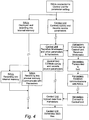
- the RAUs 10 While the RAUs 10 are acquiring and recording data, they periodically switch on the internal wireless module 22 and search for a wireless access point which is transmitting a correct service set identifier. If no such transmitting access point is detected, the wireless module 22 is switched off for a certain period of time, after which a renewed search will take place. The length of time that the wireless module 22 is switched off is optimized in order to reduce the overall power consumption of the RAU 10, while maintaining an acceptable response time in the presence of a valid access point.
- the RAUs 10 acquire seismic data during the configured working hours and store this data in non-volatile memory 16 together with associated timestamp information derived from timing means 18. This happens autonomously, without any communication with the central unit 26. The stored data is subsequently collected by the harvester unit 28 whenever the access point of the harvester unit 28 is identified by the RAU 10.
- the above procedure allows the field crew to be able to retrieve recorded seismic data from the RAUs 10 by the method described below.
- the seismic field crew is equipped with the harvester unit 28 of Figure 3 .
- the wireless access point 34 acts as a point-multipoint wireless access point compatible with the transceivers 22 in the RAUs 10, and transmits a service set identifier which the RAUs 10 will recognize as valid.
- the field crew connects the harvester unit 28 to the central unit 26 from where the entire seismic operation, including control of the seismic sources is undertaken.
- the central unit 26 transfers a list to the computer 30 containing the precise start time, and number of samples, of every seismic record of interest to be recorded. This precise start time is hereafter referred to as the timebreak.
- the field crew then proceeds across the prospect with the harvester unit 28, which establishes communications with RAUs 10 as it comes within wireless range of them.
- the harvester unit 28 transfers the timebreak and number of samples required for each record to the RAU 10, which then transmits the required recorded data to the harvester unit 28.
- the point-multipoint wireless access point 34 in the harvester unit 28 may communicate with multiple RAUs 10 simultaneously, limited by wireless transmission range, vegetation and topology; however, also limited by the harvester software which is configured with a maximum limit of RAU connections to optimize the wireless data throughput.
- the data throughput may be further optimized by the use of a lossless compression algorithm to reduce the actual amount of data transferred.
- a lossless compression algorithm to reduce the actual amount of data transferred.
- Various forms of lossless data compression are well known and may be used here. However, a particularly suitable form of compression is described in WO03079039 (A2 ).
- the data retrieved from the RAUs 10 is stored in the local bulk storage 32 such as a hard disk drive.
- the harvested data is transferred to the central unit 26 by any suitable means, for example by transporting the harvester unit 28 to the central unit 26 and downloading via cable connection, or by downloading from the vehicle remotely to the central unit 26 over a wireless data connection.
- the harvester unit 28 is additionally provided with a radio link such as VHF or UHF transceiver 40 which is capable of effecting communication at a relatively low rate with the central control unit 26 (as indicated by dashed line in Fig. 1 ).
- a radio link such as VHF or UHF transceiver 40 which is capable of effecting communication at a relatively low rate with the central control unit 26 (as indicated by dashed line in Fig. 1 ).
- the harvester unit 28 derives from the RAUs information which may be referred to as quality control (QC) data and transmits this to the central control unit 26 in real time.
- QC quality control
- the QC information will typically be battery power level and the status of the RAU, plus optionally a GPS-derived position of the individual RAU. This will typically amount to a few kilobits of information, which can be transmitted over a simple VHF link in real time.
- the status of the RAU will typically be a simple yes/no indication that the seismic sensor is working, for example that the correct number of geophones are connected, or that a digital sensor has passed a built-in test sequence.
- This modification allows the central control unit to have very quickly some basic information about each of the RAUs, particularly the fact that it is operational and is acquiring seismic data. If the proportion of inoperative or defective RAUs exceeds a predetermined threshold, the relevant part of the seismic survey can be ignored or aborted without transferring and analysing large amounts of data.
- the harvester unit 28 may be transported across the prospect by a number of different means, examples of which are given below.
- the RAUs operate in an "autonomous" mode, and perform the functions of data capture, storage and forwarding without any interaction with a Central Control Unit, relying on preconfigured parameters for pre-amplifier gain, sample interval and other relevant settings.
- timing synchronisation is provided by a GPS receiver or a radio timing signal, and thus also without any interaction with the Central Control Unit.
- Point-multipoint transceivers suitable for use in the invention are known per se .
- the data transfer rate typically required between the RAU and the harvester unit 28 is 11 Mbits/sec, and an example of a suitable point-multipoint transceiver for this application is the Abicom Freedom CPE by Abicom International of Market Drayton, Shropshire.
- the invention thus provides a method and system which minimises the labour involved in setting out a survey, makes retrieval of the seismic data more convenient, and can operate with relatively limited memory capacity in the RAUs owing to the ease of harvesting.
Landscapes
- Physics & Mathematics (AREA)
- Engineering & Computer Science (AREA)
- Life Sciences & Earth Sciences (AREA)
- Remote Sensing (AREA)
- Geophysics (AREA)
- General Life Sciences & Earth Sciences (AREA)
- General Physics & Mathematics (AREA)
- Environmental & Geological Engineering (AREA)
- Geology (AREA)
- Acoustics & Sound (AREA)
- Aviation & Aerospace Engineering (AREA)
- High Energy & Nuclear Physics (AREA)
- Geophysics And Detection Of Objects (AREA)
- Arrangements For Transmission Of Measured Signals (AREA)
Claims (15)
- Verfahren zum Übertragen von Daten während einer seismischen Untersuchung von zahlreichen entfernten Erfassungseinheiten (10), die über einen Überwachungsbereich positioniert sind, an eine zentrale Steuereinheit (26), wobei jeder entfernte Erfassungseinheit (10) seismische Daten von einem oder mehreren Geophonen (12) speichert, wobei das Verfahren Folgendes umfasst:Durchführen eines oder mehrerer seismischer Ereignisse und Erfassen und Speichern der sich ergebenden seismischen Daten in den zahlreichen entfernten Erfassungseinheiten (10),Durchqueren einer Erhebungseinheit (28) des Untersuchungsbereichs, wobei die Erhebungseinheit (28) einen drahtlosen Zugangspunkt (34) einschließt oder von diesem begleitet ist, der als ein drahtloser Punkt-Merkpunkt-Zugangspunkt dient, der kompatibel mit Transceivern (22) ist, die in die zahlreichen entfernten Erfassungseinheiten (10) integriert sind und von dem drahtlosen Zugangspunkt (34) einen Identifizierer übertragen,Suchen, durch die entfernten Erfassungseinheiten (10), nach der Anwesenheit des drahtlosen Zugangspunkts (34), der den Identifizierer überträgt,drahtloses Weiterleiten der seismischen Daten, die in den entfernten Erfassungseinheiten (10) gespeichert sind, an die Erhebungseinheit (28), immer, wenn der drahtlose Zugangspunkt (34) durch die entfernten Erfassungseinheiten (10) identifiziert wird, wobei die entfernten Erfassungseinheiten (10) selbständig arbeiten, während sie die seismischen Daten erfassen, speichern und weiterleiten, undÜbertragen der seismischen Daten von der Erhebungseinheit (28) an die zentrale Steuereinheit (26), nachdem die Erhebungseinheit (28) den Untersuchungsbereich durchquert hat.
- Verfahren nach Anspruch 1, wobei die seismischen Daten, die von jeder der entfernten Erfassungseinheiten (10) gepeichert und übertragen werden, Zeitstempelinformation einschließt, die sich auf das relevante seismische Ereignis bezieht.
- Verfahren nach Anspruch 2, wobei die Zeitstempelinformation an der entfernten Erfassungseinheit (10) von einer unabhängigen entfernten Quelle wie z. B. GPS oder terrestrischen Funkzeitsignalen abgeleitet ist.
- Verfahren nach einem der vorhergehenden Ansprüche, wobei die Erhebunseinheit (28) den Untersuchungsbereich in einem Fahrzeug wie z. B. einem Flugzeug (24), einem Schiff, einem Bodeneffektfahrzeug oder einem Gelände-Rad- oder Kettenfahrzeug durchquert.
- Verfahren nach einem der vorhergehenden Ansprüche, wobei die seismischen Daten durch einen verlustlosen Kompressionsalgorithmus komprimiert werden, bevor sie durch die entfernte Erfassungseinheit (10) weitergeleitet werden.
- Verfahren nach einem der vorhergehenden Ansprüche, wobei jede der entfernten Erfassungseinheiten (10) programmiert ist, um periodisch nach der Anwesenheit eines Zugangspunkts (34) zu suchen, wobei die entfernte Erfassungseinheit (10) in Abwesenheit eines Zugangspunkts (34) in einen energiesparenden Zustand zurückkehrt.
- Verfahren nach Anspruch 1, wobei, bevor Daten erfasst werden, jede der entfernten Erfassungseinheiten (10) mit Parametern konfiguriert ist, die Arbeitsstunden und optional ein oder mehrere Probenintervalle, Verstärkergewinn und Filtereigenschaften definieren.
- Verfahren nach Anspruch 7, wobei jede entfernte Erfassungseinheit (10) an die Erhebungseinheit (28) nur Daten (28) überträgt, die sich auf eine Startzeit und eine Anzahl von Proben beziehen, wie in einem Singnal von der Erhebungseinheit (28) an die entfernte Erfassungseinheit (10) definiert.
- Verfahren nach Anspruch 1, wobei die Erhebungseinheit (28) einen begrenzten Datensatz (wie z. B. den Batteriestatus, den Sensorstatus und die Position) von jeder entfernten Erfassungseinheit (10) zum Empfang durch die zentrale Steuereinheit (26) während des Durchgangs der Erhebungseinheit (28) über den Untersuchungsbereich extrahiert und überträgt.
- Verfahren nach einem der Ansprüche 1 bis 8, wobei die Übertragung der Daten von der Erhebungseinheit (28) an die zentrale Einheit (26) das Transportieren der Erhebunseinheit (28) an die zentrale Einheit (26) und das Herunterladen über eine Kabelverbindung oder das entfernte Herunterladen an die zentrale Einheit (26) über eine drahtlose Datenverbindung umfasst.
- System zum Erfassen von seismischen Daten, umfassend:zahlreiche entfernte Erfassungseinheiten (10), die in einer Anordnung über einem Untersuchungsbereich entfaltet sind, wobei jede der entfernten Erfassungseinheiten (10) mit einem oder mehreren Geophonen (12) verbunden ist und Speichermittel (16) einschließt, um seismische Information von dem/den Geophon(en) (12) in digitaler Form zu speichern, und wobei jede der entfernten Erfassungseinheiten (10) einen Transceiver (22) einschließt, der ausgelegt ist, um in einem drahtlosen Punkt-Mehrpunkt-System zu arbeiten;eine Erhebungseinheit (28), die dazu in der Lage ist, den Überwachungsbereich zu queren, wobei die Erhebungseinheit (28) einen drahtlosen Zugangspunkt (34) einschließt oder von diesem begleitet ist, der als ein drahtloser Punkt-Mehrpunkt Zugangspunkt dient, der mit Transceivern (22) der zahlreichen entferenten Erfassungseinheiten (10) kompatibel ist, wobei die drahtlosen Zugangspunkte (34) konfiguriert sind, um einen Identifizierer zu übertragen;und eine zentrale Steuereinheit (26), wobei die zahlreichen entfernten Erfassungseinheiten (10) ausgelegt sind, um seismische Daten zu erfassen und zu speichern, die sich aus einem oder mehreren seismischen Ereignissen ergeben, um nach der Anwesenheit des drahtlosen Zugangspunkts (34) zu suchen, der den Identifizierer überträgt, und um drahtlos seismische Daten weiterzuleiten, immer, wenn der drahtlose Zugangspunkt (34) durch die entfernten Erfassungseinheiten (10) identifiziert wird, wobei die entfernten Erfassungseinheiten (10) selbständig arbeiten, während sie die seismischen Daten erfassen, speichern und weiterleiten, unddie zentrale Steuereinheit (26) ausgelegt ist, um die seismischen Daten von der Erhebungseinheit (28) zu empfangen, nachdem die Erhebungseinheit (28) den Untersuchungsbereich durchquert hat.
- System nach Anspruch 11, wobei das Speichermittel (16) in jeder der entfernten Erfassungseinheiten (10) ein nicht flüchtiger Speicher ist.
- System nach Anspruch 11 oder 12, wobei jede der entfernten Erfassungseinheiten (10) ausgelegt ist, um einen Zeitstempel mit einem bestimmten Satz von seismischen Daten zu assoziieren, wobei der Zeitstempel von einem Zeitsignal abgeleitet ist, das drahtlos von einer zentralen Einheit (26) oder von einer GPS-Zeitinformation (18) empfangen wird.
- System nach Anspruch 11, wobei die Erhebungseinheit (28) weiter einen Funksender (40) umfasst, der ausgelegt ist, um an die zentrale Steuereinheit (26) einen begrenzten Datensatz (wie z. B. den Batteriestatus, den Sensorstatus und die Position) von jeder entfernten Erhebungsseinheit (28) während des Durchgangs der Erhebungseinheit durch den Untersuchungsbereich zu übertragen.
- System nach einem der Ansprüche 11 bis 14, wobei die Erhebungseinheit (28) in einem Fahrzeug wie z. B. einem Hubschrauber, einem Leichtflugzeug (24), entweder bemannt oder ferngesteuert (UAV) montiert ist, darin eingeschlossen Ultraleichtflugzeuge oder andere "experimentelle" Flugzeuge, nicht angebundene Luftschiffe, entweder ferngesteuert oder gesteuert, Boote, darin eingeschlossen Luftboote der Art, die typischerweise in Sümpfen und Sumpfland verwendet werden, Hovercrafts oder Motorfahrzeuge, darin eingeschlossen Pickups, Allradfahrzeuge und Quads; oder in einem Rucksack zur Verwendung von Fußgängern.
Applications Claiming Priority (1)
| Application Number | Priority Date | Filing Date | Title |
|---|---|---|---|
| GBGB0725276.0A GB0725276D0 (en) | 2007-12-28 | 2007-12-28 | Seismic data recording |
Publications (3)
| Publication Number | Publication Date |
|---|---|
| EP2075596A2 EP2075596A2 (de) | 2009-07-01 |
| EP2075596A3 EP2075596A3 (de) | 2009-12-02 |
| EP2075596B1 true EP2075596B1 (de) | 2020-07-15 |
Family
ID=39092417
Family Applications (1)
| Application Number | Title | Priority Date | Filing Date |
|---|---|---|---|
| EP08171160.8A Active EP2075596B1 (de) | 2007-12-28 | 2008-12-10 | Aufzeichnung seismischer Daten |
Country Status (5)
| Country | Link |
|---|---|
| US (3) | US8547796B2 (de) |
| EP (1) | EP2075596B1 (de) |
| CN (1) | CN101470210B (de) |
| CA (2) | CA2646308C (de) |
| GB (1) | GB0725276D0 (de) |
Families Citing this family (27)
| Publication number | Priority date | Publication date | Assignee | Title |
|---|---|---|---|---|
| US7006530B2 (en) * | 2000-12-22 | 2006-02-28 | Wi-Lan, Inc. | Method and system for adaptively obtaining bandwidth allocation requests |
| US9084276B2 (en) | 2009-09-11 | 2015-07-14 | Aerovironment, Inc. | Dynamic transmission control for a wireless network |
| US8660057B2 (en) | 2010-08-26 | 2014-02-25 | Golba, Llc | Method and system for distributed communication |
| TW201224500A (en) * | 2010-10-24 | 2012-06-16 | Takamune Cho | Method and system for detecting ground displacement |
| US9400338B2 (en) * | 2012-09-18 | 2016-07-26 | Westerngeco L.L.C. | Seismic acquisition system-based unmanned airborne vehicle |
| WO2014068359A1 (en) * | 2012-10-29 | 2014-05-08 | Hewlett-Packard Development Company, L.P. | Displaying status information of sensors and extraction devices |
| US20140362661A1 (en) * | 2013-04-23 | 2014-12-11 | Westerngeco L.L.C. | Unmanned vehicle-based seismic surveying |
| US20150276955A1 (en) * | 2013-11-06 | 2015-10-01 | Robert H. Brune | Method and System for Extending Spatial Wavenumber Spectrum Of Seismic Wavefields On Land Or Water Bottom Using Rotational Motion |
| WO2015085155A1 (en) * | 2013-12-06 | 2015-06-11 | Westerngeco Llc | Positioning survey sensors using an airborne vehicle |
| EP2887100B1 (de) * | 2013-12-20 | 2022-10-26 | Sercel | Verfahren zum Herunterladen von Daten auf eine zentrale Einheit in einem seismisches Datenerfassungssystem |
| JP6135529B2 (ja) * | 2014-02-04 | 2017-05-31 | 横河電機株式会社 | 情報表示装置、情報処理装置、情報表示システム、および情報表示方法 |
| WO2015125015A2 (en) | 2014-02-19 | 2015-08-27 | Cgg Services Sa | Systems and methods for wireless data acquisition in seismic monitoring systems |
| US9599733B2 (en) | 2014-03-12 | 2017-03-21 | Sercel | Method for collecting, in a harvester equipment distinct from a central unit, data coming from a plurality of seismic acquisition units |
| CA2953223C (en) | 2014-06-06 | 2022-04-19 | Austin Star Detonator Company | Methods and apparatus for confirmation time break (ctb) determination and shotpoint in-situ recording in seismic detonators |
| US20160003954A1 (en) * | 2014-07-07 | 2016-01-07 | Schlumberger Technology Corporation | Aerial vehicle acquisition of seismic data |
| US20160011324A1 (en) | 2014-07-11 | 2016-01-14 | Sercel | Method For Harvesting Seismic Data And Generating Seismic Output Files |
| CN107592914B (zh) * | 2015-03-02 | 2020-03-17 | 道达尔公司 | 用于将地震波传感器耦合到地面的系统和方法 |
| CN105607136B (zh) * | 2015-12-22 | 2018-01-23 | 中国科学院东北地理与农业生态研究所 | 基于气垫船勘测泥炭储量的系统及其勘测泥炭储量的方法 |
| CN106772568A (zh) * | 2017-01-22 | 2017-05-31 | 中国石油天然气集团公司 | 获取采集节点数据的方法、装置、系统及飞行设备 |
| US10395509B2 (en) * | 2017-06-08 | 2019-08-27 | Total Sa | Method of preparing and/or carrying out a ground survey in a region of interest and related apparatus |
| WO2019195286A1 (en) * | 2018-04-02 | 2019-10-10 | Magseis Ff Llc | Systems and methods to locate seismic data acquisition units |
| US11525933B2 (en) | 2019-09-13 | 2022-12-13 | Sercel | Wireless seismic acquisition node and method |
| US11681063B2 (en) | 2019-09-13 | 2023-06-20 | Sercel | Multi-function acquisition device and operating method |
| US11022708B2 (en) | 2019-09-13 | 2021-06-01 | Sercel | Docking station for wireless seismic acquisition nodes |
| US12111435B2 (en) * | 2021-12-27 | 2024-10-08 | King Fahd University Of Petroleum And Minerals | OFDMA-TDMA-based seismic data transmission over TV white space |
| US12189071B2 (en) | 2022-02-11 | 2025-01-07 | Sercel | Mobile docking device for seismic acquisition nodes and method |
| US20260016610A1 (en) * | 2024-07-15 | 2026-01-15 | Saudi Arabian Oil Company | Systems and methods for managing seismic data |
Citations (1)
| Publication number | Priority date | Publication date | Assignee | Title |
|---|---|---|---|---|
| GB2055467A (en) * | 1979-07-16 | 1981-03-04 | Fairfield Ind Inc | Geophysical exploration utilizing telemetered seismic data and airborne receivers |
Family Cites Families (26)
| Publication number | Priority date | Publication date | Assignee | Title |
|---|---|---|---|---|
| US3062315A (en) * | 1959-01-05 | 1962-11-06 | Texaco Inc | Radio-link system of seismic exploration |
| US4236234A (en) * | 1979-07-25 | 1980-11-25 | Fairfield Industries, Inc. | Radio frequency seismic gathering system employing an airborne blimp |
| CA1231429A (en) * | 1984-11-23 | 1988-01-12 | Ben B. Thigpen | Rf telemetric system |
| FR2671197A1 (fr) | 1990-12-28 | 1992-07-03 | Inst Francais Du Petrole | Methode et dispositif pour simplifier la localisation d'une zone souterraine dans le cadre d'une exploration sismique. |
| FR2696839B1 (fr) * | 1992-10-12 | 1994-12-09 | Inst Francais Du Petrole | Méthode et système de transmission sismique utilisant des unités de concentration. |
| FR2720518B1 (fr) * | 1994-05-26 | 1996-07-12 | Inst Francais Du Petrole | Système d'acquisition et de transmission sismique avec décentralisation des fonctions. |
| US5724241A (en) * | 1996-01-11 | 1998-03-03 | Western Atlas International, Inc. | Distributed seismic data-gathering system |
| US6002640A (en) * | 1997-05-15 | 1999-12-14 | Geo-X Systems, Inc. | Seismic data acquisition system |
| FR2781944B1 (fr) * | 1998-07-29 | 2001-10-05 | Inst Francais Du Petrole | Methode pour realiser une compression sans pertes de signaux a grande dynamique en vue de leur transmission |
| US20040105533A1 (en) * | 1998-08-07 | 2004-06-03 | Input/Output, Inc. | Single station wireless seismic data acquisition method and apparatus |
| US6957147B2 (en) | 2002-03-12 | 2005-10-18 | Sercel, Inc. | Data management for seismic acquisition using variable compression ratio as a function of background noise |
| US7269095B2 (en) | 2002-10-04 | 2007-09-11 | Aram Systems, Ltd. | Synchronization of seismic data acquisition systems |
| GB2395640B (en) | 2002-11-22 | 2006-06-07 | Westerngeco Seismic Holdings | Implementing a network infrastructure in a seismic acquisition system |
| US7813221B2 (en) * | 2002-11-22 | 2010-10-12 | Westerngeco L.L.C. | Sensor and recorder communication |
| US7107153B2 (en) | 2004-04-02 | 2006-09-12 | Schlumberger Technology Corporation | Data compression methods and systems |
| US20060247505A1 (en) * | 2005-04-28 | 2006-11-02 | Siddiqui Waqaas A | Wireless sensor system |
| US7224642B1 (en) * | 2006-01-26 | 2007-05-29 | Tran Bao Q | Wireless sensor data processing systems |
| EP2027493A2 (de) | 2006-06-09 | 2009-02-25 | ION Geophysical Corporation | Betriebsstatusverwaltung für den erwerb von erdbebendaten |
| EP2059835A2 (de) * | 2006-09-14 | 2009-05-20 | Geco Technology B.V. | Drahtlose systeme und verfahren zur seismischen datenbeschaffung |
| US7660203B2 (en) * | 2007-03-08 | 2010-02-09 | Westerngeco L.L.C. | Systems and methods for seismic data acquisition employing asynchronous, decoupled data sampling and transmission |
| US8605546B2 (en) * | 2006-09-29 | 2013-12-10 | Inova Ltd. | Seismic data acquisition systems and method utilizing a wireline repeater unit |
| CA2664689A1 (en) * | 2006-09-29 | 2008-04-10 | Ion Geophysical Corporation | For in-field control module for managing wireless seismic data acquisition systems and related methods |
| US7715887B2 (en) * | 2006-11-14 | 2010-05-11 | Harris Corporation | Low power distribution system for an unattended ground sensor system |
| US20080285385A1 (en) * | 2007-05-18 | 2008-11-20 | Cherry J Theodore | Methods and systems for seismic event detection |
| US8296067B2 (en) * | 2008-03-17 | 2012-10-23 | Bp Corporation North America Inc. | Satellite communications with cableless seismographs |
| GB2472428A (en) * | 2009-08-06 | 2011-02-09 | Wireless Fibre Systems Ltd | Wireless communication via seabed for underwater seismic detection network |
-
2007
- 2007-12-28 GB GBGB0725276.0A patent/GB0725276D0/en not_active Ceased
-
2008
- 2008-12-10 EP EP08171160.8A patent/EP2075596B1/de active Active
- 2008-12-11 CA CA2646308A patent/CA2646308C/en active Active
- 2008-12-11 CA CA2973588A patent/CA2973588C/en active Active
- 2008-12-19 US US12/317,135 patent/US8547796B2/en not_active Expired - Fee Related
- 2008-12-26 CN CN2008101892621A patent/CN101470210B/zh not_active Expired - Fee Related
-
2012
- 2012-09-12 US US13/611,593 patent/US8547797B2/en active Active
-
2013
- 2013-09-05 US US14/018,853 patent/US9632207B2/en not_active Expired - Fee Related
Patent Citations (1)
| Publication number | Priority date | Publication date | Assignee | Title |
|---|---|---|---|---|
| GB2055467A (en) * | 1979-07-16 | 1981-03-04 | Fairfield Ind Inc | Geophysical exploration utilizing telemetered seismic data and airborne receivers |
Also Published As
| Publication number | Publication date |
|---|---|
| GB0725276D0 (en) | 2008-02-06 |
| US20130033962A1 (en) | 2013-02-07 |
| US20090168602A1 (en) | 2009-07-02 |
| CA2646308C (en) | 2018-06-05 |
| CA2973588A1 (en) | 2009-06-28 |
| US9632207B2 (en) | 2017-04-25 |
| CN101470210B (zh) | 2013-09-25 |
| US8547796B2 (en) | 2013-10-01 |
| US20140003192A1 (en) | 2014-01-02 |
| CA2973588C (en) | 2021-03-30 |
| US8547797B2 (en) | 2013-10-01 |
| CN101470210A (zh) | 2009-07-01 |
| EP2075596A3 (de) | 2009-12-02 |
| EP2075596A2 (de) | 2009-07-01 |
| CA2646308A1 (en) | 2009-06-28 |
Similar Documents
| Publication | Publication Date | Title |
|---|---|---|
| CA2646308C (en) | Seismic data recording | |
| US12330811B2 (en) | Pod operating system for a vertical take-off and landing (VTOL) unmanned aerial vehicle (UAV) | |
| US11840152B2 (en) | Survey migration system for vertical take-off and landing (VTOL) unmanned aerial vehicles (UAVs) | |
| CA2538952C (en) | Single station wireless seismic data acquisition method and apparatus | |
| US7725264B2 (en) | In-field control module for managing wireless seismic data acquisition systems and related methods | |
| US10534372B2 (en) | Geographic survey system for vertical take-off and landing (VTOL) unmanned aerial vehicles (UAVS) | |
| JP6955468B2 (ja) | 無人飛行体 | |
| Herwitz et al. | Precision agriculture as a commercial application for solar-powered unmanned aerial vehicles | |
| EP0517896B1 (de) | Verfahren und vorrichtung zur vereinfachung der ortung einer untergrundformation in zusammenhang mit einer seismischen exploration | |
| CN105277969A (zh) | 用于收集地震数据且产生地震输出文件的方法 | |
| US20110264311A1 (en) | Unmanned aerial vehicle and method for collecting video using the same | |
| KR20080014104A (ko) | 해양환경 관측 시스템 및 무인비행체 및 그 운용방법 | |
| EP4195532A1 (de) | Delta-codierung für fernmessung | |
| US10419902B1 (en) | Agricultural data transportation system | |
| EP4173161A1 (de) | Drahtloses funkrelais | |
| CN212723394U (zh) | 一种基于无线传输的物勘传感器 | |
| CN115085796A (zh) | 一种基于ris无线通讯的无人机通信系统 | |
| US10164703B2 (en) | Architecture for observing a plurality of objects arranged in geographically separate locations and method of collecting the associated observation data | |
| US20250112697A1 (en) | Aircraft to airport laser communication | |
| WO2024130085A1 (en) | Methods and systems for recharging aerial electric vehicles using ground vehicles | |
| US20130188447A1 (en) | Analog in power supply module | |
| CN116760445A (zh) | 一种无人机通信连接系统 |
Legal Events
| Date | Code | Title | Description |
|---|---|---|---|
| PUAI | Public reference made under article 153(3) epc to a published international application that has entered the european phase |
Free format text: ORIGINAL CODE: 0009012 |
|
| AK | Designated contracting states |
Kind code of ref document: A2 Designated state(s): AT BE BG CH CY CZ DE DK EE ES FI FR GB GR HR HU IE IS IT LI LT LU LV MC MT NL NO PL PT RO SE SI SK TR |
|
| AX | Request for extension of the european patent |
Extension state: AL BA MK RS |
|
| PUAL | Search report despatched |
Free format text: ORIGINAL CODE: 0009013 |
|
| RIC1 | Information provided on ipc code assigned before grant |
Ipc: G01V 1/24 20060101ALI20091019BHEP Ipc: G01V 1/22 20060101AFI20091019BHEP |
|
| AK | Designated contracting states |
Kind code of ref document: A3 Designated state(s): AT BE BG CH CY CZ DE DK EE ES FI FR GB GR HR HU IE IS IT LI LT LU LV MC MT NL NO PL PT RO SE SI SK TR |
|
| AX | Request for extension of the european patent |
Extension state: AL BA MK RS |
|
| 17P | Request for examination filed |
Effective date: 20100430 |
|
| RAP1 | Party data changed (applicant data changed or rights of an application transferred) |
Owner name: SERCEL ENGLAND LIMITED |
|
| 17Q | First examination report despatched |
Effective date: 20100615 |
|
| AKX | Designation fees paid |
Designated state(s): AT BE BG CH CY CZ DE DK EE ES FI FR GB GR HR HU IE IS IT LI LT LU LV MC MT NL NO PL PT RO SE SI SK TR |
|
| TPAC | Observations filed by third parties |
Free format text: ORIGINAL CODE: EPIDOSNTIPA |
|
| RAP1 | Party data changed (applicant data changed or rights of an application transferred) |
Owner name: SERCEL ENGLAND LIMITED |
|
| STAA | Information on the status of an ep patent application or granted ep patent |
Free format text: STATUS: EXAMINATION IS IN PROGRESS |
|
| GRAP | Despatch of communication of intention to grant a patent |
Free format text: ORIGINAL CODE: EPIDOSNIGR1 |
|
| STAA | Information on the status of an ep patent application or granted ep patent |
Free format text: STATUS: GRANT OF PATENT IS INTENDED |
|
| INTG | Intention to grant announced |
Effective date: 20200424 |
|
| RIN1 | Information on inventor provided before grant (corrected) |
Inventor name: ALEXANDER, JONATHAN Inventor name: WILCOX, STEVEN WILLIAM Inventor name: WHELAN, JOHN CHRISTOPHER |
|
| GRAS | Grant fee paid |
Free format text: ORIGINAL CODE: EPIDOSNIGR3 |
|
| GRAA | (expected) grant |
Free format text: ORIGINAL CODE: 0009210 |
|
| STAA | Information on the status of an ep patent application or granted ep patent |
Free format text: STATUS: THE PATENT HAS BEEN GRANTED |
|
| AK | Designated contracting states |
Kind code of ref document: B1 Designated state(s): AT BE BG CH CY CZ DE DK EE ES FI FR GB GR HR HU IE IS IT LI LT LU LV MC MT NL NO PL PT RO SE SI SK TR |
|
| REG | Reference to a national code |
Ref country code: GB Ref legal event code: FG4D Ref country code: CH Ref legal event code: EP |
|
| REG | Reference to a national code |
Ref country code: IE Ref legal event code: FG4D |
|
| REG | Reference to a national code |
Ref country code: DE Ref legal event code: R096 Ref document number: 602008062980 Country of ref document: DE |
|
| REG | Reference to a national code |
Ref country code: AT Ref legal event code: REF Ref document number: 1291638 Country of ref document: AT Kind code of ref document: T Effective date: 20200815 |
|
| REG | Reference to a national code |
Ref country code: LT Ref legal event code: MG4D |
|
| REG | Reference to a national code |
Ref country code: AT Ref legal event code: MK05 Ref document number: 1291638 Country of ref document: AT Kind code of ref document: T Effective date: 20200715 |
|
| REG | Reference to a national code |
Ref country code: NL Ref legal event code: MP Effective date: 20200715 |
|
| PG25 | Lapsed in a contracting state [announced via postgrant information from national office to epo] |
Ref country code: SE Free format text: LAPSE BECAUSE OF FAILURE TO SUBMIT A TRANSLATION OF THE DESCRIPTION OR TO PAY THE FEE WITHIN THE PRESCRIBED TIME-LIMIT Effective date: 20200715 Ref country code: ES Free format text: LAPSE BECAUSE OF FAILURE TO SUBMIT A TRANSLATION OF THE DESCRIPTION OR TO PAY THE FEE WITHIN THE PRESCRIBED TIME-LIMIT Effective date: 20200715 Ref country code: AT Free format text: LAPSE BECAUSE OF FAILURE TO SUBMIT A TRANSLATION OF THE DESCRIPTION OR TO PAY THE FEE WITHIN THE PRESCRIBED TIME-LIMIT Effective date: 20200715 Ref country code: BG Free format text: LAPSE BECAUSE OF FAILURE TO SUBMIT A TRANSLATION OF THE DESCRIPTION OR TO PAY THE FEE WITHIN THE PRESCRIBED TIME-LIMIT Effective date: 20201015 Ref country code: NO Free format text: LAPSE BECAUSE OF FAILURE TO SUBMIT A TRANSLATION OF THE DESCRIPTION OR TO PAY THE FEE WITHIN THE PRESCRIBED TIME-LIMIT Effective date: 20201015 Ref country code: GR Free format text: LAPSE BECAUSE OF FAILURE TO SUBMIT A TRANSLATION OF THE DESCRIPTION OR TO PAY THE FEE WITHIN THE PRESCRIBED TIME-LIMIT Effective date: 20201016 Ref country code: FI Free format text: LAPSE BECAUSE OF FAILURE TO SUBMIT A TRANSLATION OF THE DESCRIPTION OR TO PAY THE FEE WITHIN THE PRESCRIBED TIME-LIMIT Effective date: 20200715 Ref country code: PT Free format text: LAPSE BECAUSE OF FAILURE TO SUBMIT A TRANSLATION OF THE DESCRIPTION OR TO PAY THE FEE WITHIN THE PRESCRIBED TIME-LIMIT Effective date: 20201116 Ref country code: HR Free format text: LAPSE BECAUSE OF FAILURE TO SUBMIT A TRANSLATION OF THE DESCRIPTION OR TO PAY THE FEE WITHIN THE PRESCRIBED TIME-LIMIT Effective date: 20200715 Ref country code: LT Free format text: LAPSE BECAUSE OF FAILURE TO SUBMIT A TRANSLATION OF THE DESCRIPTION OR TO PAY THE FEE WITHIN THE PRESCRIBED TIME-LIMIT Effective date: 20200715 |
|
| PG25 | Lapsed in a contracting state [announced via postgrant information from national office to epo] |
Ref country code: IS Free format text: LAPSE BECAUSE OF FAILURE TO SUBMIT A TRANSLATION OF THE DESCRIPTION OR TO PAY THE FEE WITHIN THE PRESCRIBED TIME-LIMIT Effective date: 20201115 Ref country code: LV Free format text: LAPSE BECAUSE OF FAILURE TO SUBMIT A TRANSLATION OF THE DESCRIPTION OR TO PAY THE FEE WITHIN THE PRESCRIBED TIME-LIMIT Effective date: 20200715 Ref country code: PL Free format text: LAPSE BECAUSE OF FAILURE TO SUBMIT A TRANSLATION OF THE DESCRIPTION OR TO PAY THE FEE WITHIN THE PRESCRIBED TIME-LIMIT Effective date: 20200715 |
|
| PG25 | Lapsed in a contracting state [announced via postgrant information from national office to epo] |
Ref country code: NL Free format text: LAPSE BECAUSE OF FAILURE TO SUBMIT A TRANSLATION OF THE DESCRIPTION OR TO PAY THE FEE WITHIN THE PRESCRIBED TIME-LIMIT Effective date: 20200715 |
|
| REG | Reference to a national code |
Ref country code: DE Ref legal event code: R097 Ref document number: 602008062980 Country of ref document: DE |
|
| PG25 | Lapsed in a contracting state [announced via postgrant information from national office to epo] |
Ref country code: RO Free format text: LAPSE BECAUSE OF FAILURE TO SUBMIT A TRANSLATION OF THE DESCRIPTION OR TO PAY THE FEE WITHIN THE PRESCRIBED TIME-LIMIT Effective date: 20200715 Ref country code: EE Free format text: LAPSE BECAUSE OF FAILURE TO SUBMIT A TRANSLATION OF THE DESCRIPTION OR TO PAY THE FEE WITHIN THE PRESCRIBED TIME-LIMIT Effective date: 20200715 Ref country code: CZ Free format text: LAPSE BECAUSE OF FAILURE TO SUBMIT A TRANSLATION OF THE DESCRIPTION OR TO PAY THE FEE WITHIN THE PRESCRIBED TIME-LIMIT Effective date: 20200715 Ref country code: DK Free format text: LAPSE BECAUSE OF FAILURE TO SUBMIT A TRANSLATION OF THE DESCRIPTION OR TO PAY THE FEE WITHIN THE PRESCRIBED TIME-LIMIT Effective date: 20200715 Ref country code: IT Free format text: LAPSE BECAUSE OF FAILURE TO SUBMIT A TRANSLATION OF THE DESCRIPTION OR TO PAY THE FEE WITHIN THE PRESCRIBED TIME-LIMIT Effective date: 20200715 |
|
| PLBE | No opposition filed within time limit |
Free format text: ORIGINAL CODE: 0009261 |
|
| STAA | Information on the status of an ep patent application or granted ep patent |
Free format text: STATUS: NO OPPOSITION FILED WITHIN TIME LIMIT |
|
| 26N | No opposition filed |
Effective date: 20210416 |
|
| PG25 | Lapsed in a contracting state [announced via postgrant information from national office to epo] |
Ref country code: SK Free format text: LAPSE BECAUSE OF FAILURE TO SUBMIT A TRANSLATION OF THE DESCRIPTION OR TO PAY THE FEE WITHIN THE PRESCRIBED TIME-LIMIT Effective date: 20200715 |
|
| REG | Reference to a national code |
Ref country code: CH Ref legal event code: PL |
|
| PG25 | Lapsed in a contracting state [announced via postgrant information from national office to epo] |
Ref country code: MC Free format text: LAPSE BECAUSE OF FAILURE TO SUBMIT A TRANSLATION OF THE DESCRIPTION OR TO PAY THE FEE WITHIN THE PRESCRIBED TIME-LIMIT Effective date: 20200715 Ref country code: SI Free format text: LAPSE BECAUSE OF FAILURE TO SUBMIT A TRANSLATION OF THE DESCRIPTION OR TO PAY THE FEE WITHIN THE PRESCRIBED TIME-LIMIT Effective date: 20200715 |
|
| REG | Reference to a national code |
Ref country code: BE Ref legal event code: MM Effective date: 20201231 |
|
| PG25 | Lapsed in a contracting state [announced via postgrant information from national office to epo] |
Ref country code: LU Free format text: LAPSE BECAUSE OF NON-PAYMENT OF DUE FEES Effective date: 20201210 Ref country code: IE Free format text: LAPSE BECAUSE OF NON-PAYMENT OF DUE FEES Effective date: 20201210 |
|
| PG25 | Lapsed in a contracting state [announced via postgrant information from national office to epo] |
Ref country code: LI Free format text: LAPSE BECAUSE OF NON-PAYMENT OF DUE FEES Effective date: 20201231 Ref country code: CH Free format text: LAPSE BECAUSE OF NON-PAYMENT OF DUE FEES Effective date: 20201231 |
|
| REG | Reference to a national code |
Ref country code: GB Ref legal event code: 732E Free format text: REGISTERED BETWEEN 20211230 AND 20220105 |
|
| PGFP | Annual fee paid to national office [announced via postgrant information from national office to epo] |
Ref country code: DE Payment date: 20211210 Year of fee payment: 14 Ref country code: FR Payment date: 20211224 Year of fee payment: 14 Ref country code: GB Payment date: 20211222 Year of fee payment: 14 |
|
| REG | Reference to a national code |
Ref country code: DE Ref legal event code: R081 Ref document number: 602008062980 Country of ref document: DE Owner name: SERCEL SAS, FR Free format text: FORMER OWNER: SERCEL ENGLAND LTD., SOMERCOTES, GB |
|
| PG25 | Lapsed in a contracting state [announced via postgrant information from national office to epo] |
Ref country code: TR Free format text: LAPSE BECAUSE OF FAILURE TO SUBMIT A TRANSLATION OF THE DESCRIPTION OR TO PAY THE FEE WITHIN THE PRESCRIBED TIME-LIMIT Effective date: 20200715 Ref country code: MT Free format text: LAPSE BECAUSE OF FAILURE TO SUBMIT A TRANSLATION OF THE DESCRIPTION OR TO PAY THE FEE WITHIN THE PRESCRIBED TIME-LIMIT Effective date: 20200715 Ref country code: CY Free format text: LAPSE BECAUSE OF FAILURE TO SUBMIT A TRANSLATION OF THE DESCRIPTION OR TO PAY THE FEE WITHIN THE PRESCRIBED TIME-LIMIT Effective date: 20200715 |
|
| PG25 | Lapsed in a contracting state [announced via postgrant information from national office to epo] |
Ref country code: BE Free format text: LAPSE BECAUSE OF NON-PAYMENT OF DUE FEES Effective date: 20201231 |
|
| REG | Reference to a national code |
Ref country code: DE Ref legal event code: R119 Ref document number: 602008062980 Country of ref document: DE |
|
| GBPC | Gb: european patent ceased through non-payment of renewal fee |
Effective date: 20221210 |
|
| PG25 | Lapsed in a contracting state [announced via postgrant information from national office to epo] |
Ref country code: GB Free format text: LAPSE BECAUSE OF NON-PAYMENT OF DUE FEES Effective date: 20221210 Ref country code: DE Free format text: LAPSE BECAUSE OF NON-PAYMENT OF DUE FEES Effective date: 20230701 |
|
| PG25 | Lapsed in a contracting state [announced via postgrant information from national office to epo] |
Ref country code: FR Free format text: LAPSE BECAUSE OF NON-PAYMENT OF DUE FEES Effective date: 20221231 |