EP2050610B1 - Motor vehicle - Google Patents
Motor vehicle Download PDFInfo
- Publication number
- EP2050610B1 EP2050610B1 EP08015508A EP08015508A EP2050610B1 EP 2050610 B1 EP2050610 B1 EP 2050610B1 EP 08015508 A EP08015508 A EP 08015508A EP 08015508 A EP08015508 A EP 08015508A EP 2050610 B1 EP2050610 B1 EP 2050610B1
- Authority
- EP
- European Patent Office
- Prior art keywords
- menu
- information
- road
- motor vehicle
- displayed
- Prior art date
- Legal status (The legal status is an assumption and is not a legal conclusion. Google has not performed a legal analysis and makes no representation as to the accuracy of the status listed.)
- Expired - Fee Related
Links
- 230000004913 activation Effects 0.000 claims description 3
- 230000000007 visual effect Effects 0.000 claims 1
- 230000008859 change Effects 0.000 description 14
- 238000001514 detection method Methods 0.000 description 3
- 238000010586 diagram Methods 0.000 description 3
- 230000008901 benefit Effects 0.000 description 2
- 230000001419 dependent effect Effects 0.000 description 2
- 230000003287 optical effect Effects 0.000 description 2
- 230000003044 adaptive effect Effects 0.000 description 1
- 230000000694 effects Effects 0.000 description 1
- 230000004044 response Effects 0.000 description 1
- 230000007704 transition Effects 0.000 description 1
Images

Classifications
-
- G—PHYSICS
- G01—MEASURING; TESTING
- G01C—MEASURING DISTANCES, LEVELS OR BEARINGS; SURVEYING; NAVIGATION; GYROSCOPIC INSTRUMENTS; PHOTOGRAMMETRY OR VIDEOGRAMMETRY
- G01C21/00—Navigation; Navigational instruments not provided for in groups G01C1/00 - G01C19/00
- G01C21/26—Navigation; Navigational instruments not provided for in groups G01C1/00 - G01C19/00 specially adapted for navigation in a road network
- G01C21/34—Route searching; Route guidance
- G01C21/36—Input/output arrangements for on-board computers
-
- B—PERFORMING OPERATIONS; TRANSPORTING
- B60—VEHICLES IN GENERAL
- B60K—ARRANGEMENT OR MOUNTING OF PROPULSION UNITS OR OF TRANSMISSIONS IN VEHICLES; ARRANGEMENT OR MOUNTING OF PLURAL DIVERSE PRIME-MOVERS IN VEHICLES; AUXILIARY DRIVES FOR VEHICLES; INSTRUMENTATION OR DASHBOARDS FOR VEHICLES; ARRANGEMENTS IN CONNECTION WITH COOLING, AIR INTAKE, GAS EXHAUST OR FUEL SUPPLY OF PROPULSION UNITS IN VEHICLES
- B60K35/00—Arrangement of adaptations of instruments
-
- B60K35/10—
-
- B60K35/29—
-
- B60K2360/143—
-
- B60K2360/1868—
-
- B60K2360/195—
-
- B—PERFORMING OPERATIONS; TRANSPORTING
- B60—VEHICLES IN GENERAL
- B60K—ARRANGEMENT OR MOUNTING OF PROPULSION UNITS OR OF TRANSMISSIONS IN VEHICLES; ARRANGEMENT OR MOUNTING OF PLURAL DIVERSE PRIME-MOVERS IN VEHICLES; AUXILIARY DRIVES FOR VEHICLES; INSTRUMENTATION OR DASHBOARDS FOR VEHICLES; ARRANGEMENTS IN CONNECTION WITH COOLING, AIR INTAKE, GAS EXHAUST OR FUEL SUPPLY OF PROPULSION UNITS IN VEHICLES
- B60K31/00—Vehicle fittings, acting on a single sub-unit only, for automatically controlling vehicle speed, i.e. preventing speed from exceeding an arbitrarily established velocity or maintaining speed at a particular velocity, as selected by the vehicle operator
-
- B—PERFORMING OPERATIONS; TRANSPORTING
- B60—VEHICLES IN GENERAL
- B60W—CONJOINT CONTROL OF VEHICLE SUB-UNITS OF DIFFERENT TYPE OR DIFFERENT FUNCTION; CONTROL SYSTEMS SPECIALLY ADAPTED FOR HYBRID VEHICLES; ROAD VEHICLE DRIVE CONTROL SYSTEMS FOR PURPOSES NOT RELATED TO THE CONTROL OF A PARTICULAR SUB-UNIT
- B60W2552/00—Input parameters relating to infrastructure
- B60W2552/05—Type of road
Landscapes
- Engineering & Computer Science (AREA)
- Radar, Positioning & Navigation (AREA)
- Remote Sensing (AREA)
- Automation & Control Theory (AREA)
- Physics & Mathematics (AREA)
- General Physics & Mathematics (AREA)
- Chemical & Material Sciences (AREA)
- Combustion & Propulsion (AREA)
- Transportation (AREA)
- Mechanical Engineering (AREA)
- Navigation (AREA)
- Traffic Control Systems (AREA)
Description
Die Erfindung betrifft ein Kraftfahrzeug umfassend eine Anzeigevorrichtung zur optischen Darstellung von Informationen zu oder von fahrzeugseitigen Betriebssystemen, sowie eine Einrichtung zur Ermittlung von eine befahrene Straße klassifizierenden Daten.The invention relates to a motor vehicle comprising a display device for the optical representation of information to or from vehicle-side operating systems, as well as a device for determining a road classifying data.
Bekannte Kraftfahrzeuge verfügen über eine Vielzahl fahrzeugseitig vorgesehene Betriebssysteme, die entweder selbständig Informationen generieren, oder zu denen Informationen existieren, wobei zumindest ein Teil dieser verschiedenartigen Informationen über eine optische Anzeigevorrichtung, üblicherweise ein Display, z.B. ein LCD-Display, dargestellt werden. Zu nennen sind hierunter vor allem Fahrerassistenzsysteme wie ein Navigationssystem, ein Längsführungssystem (ACC-System, ACC = adaptive cruise control), ein Autotelefon, ein Infotainment-System mit Radio und gegebenenfalls CD-Spieler, ein System zur Erfassung und Wiedergabe von Verkehrsinformationen, oder verschiedene Fahrzeugeinstellungen erlaubende Betriebssysteme wie pneumatische Federung etc. Die Darstellungsweise ist häufig derart strukturiert, dass ein systemspezifisches Hauptmenü dargestellt werden kann, in dem ein oder mehrere Untermenüs anwählbar sind, wobei über ein geeignetes Eingabeelement innerhalb der einzelnen Menüebenen navigiert und gewählt werden kann. Die Art der Darstellung kann sowohl in Form reinen Textes, in Form von Piktogrammen oder sonstigen Bildern, oder im Falle eines Navigationssystems auch in Form einer Kartendarstellung erfolgen. Die jeweilige Darstellung ist invariant, das heißt, das was dargestellt wird, und wie es dargestellt wird, ist fest vorgegeben und kann benutzerseitig nicht beeinflusst werden, ausgenommen die Möglichkeit, den kartographischen Maßstab im Falle einer Kartendarstellung bei Betrieb des Navigations-systems verändern zu können.Known motor vehicles have a plurality of operating systems provided on the vehicle side, which either independently generate information or to which information exists, wherein at least part of this various information is displayed via an optical display device, usually a display, eg an LCD display. These include above all driver assistance systems such as a navigation system, a longitudinal guidance system (ACC system, ACC = adaptive cruise control), a car phone, an infotainment system with radio and possibly CD player, a system for recording and playback of traffic information, or The vehicle is often structured in such a way that a system-specific main menu can be displayed in which one or more submenus can be selected, wherein a suitable input element can be navigated and selected within the individual menu levels. The type of representation can take place both in the form of pure text, in the form of pictograms or other images, or in the case of a navigation system in the form of a map display. The respective representation is invariant, that is, what is represented, and how it is presented, is fixed and can not be influenced by the user, except the ability to change the cartographic scale in the case of a map display when operating the navigation system ,
Wenngleich über die Anzeigevorrichtung in für den Fahrer vorteilhafter Weise eine Vielzahl von Informationen darstellbar sind, besteht mitunter jedoch das Problem, dass die im Moment angezeigten Informationen entweder situationsbedingt nicht hilfreich sind bzw. vom Fahrer nicht benötigt werden, zum anderen ist mitunter der Informationsinhalt oder die Informationsmenge der momentanen Situation nicht entsprechend gestaltet, das heißt, dass mitunter zu viele oder falsche bzw. nicht benötigte Informationen angezeigt werden, die der Fahrer, der sich beispielsweise aufgrund einer Autobahnfahrt besonders konzentrieren muss, bei Blick auf die Anzeigevorrichtung nicht erfassen kann bzw. überhaupt nicht benötigt.Although a large amount of information can be displayed via the display device in a manner that is advantageous for the driver, there is sometimes the problem that the information displayed at the moment is either unimportant for the situation or not required by the driver, and sometimes the information content or the information is Information amount of the current situation is not designed accordingly, that is sometimes displayed too many or wrong or unnecessary information that the driver, who has to focus, for example, due to a highway ride particularly when looking at the display device can not detect or at all not required.
Ferner sind Kraftfahrzeuge bekannt, die über eine Einrichtung zur Ermittlung von eine befahrene Straße klassifizierenden Daten aufweisen. Im einfachsten Fall kann es sich hierbei bereits um das Navigationssystem handeln, da auch dieses in Verbindung mit der Daten-CD- oder -DVD in der Lage ist, zu erkennen, ob es sich bei der befahrenen Straße um eine Autobahn, eine Landstraße oder eine Straße in der Stadt handelt. Darüber hinaus ist es aber auch bekannt, anhand des Betriebs des eigenen Kraftfahrzeugs zu ermitteln, welche Art die befahrene Straße ist, beispielsweise anhand der Ist-Geschwindigkeit, der Anzahl etwaiger Lenkbewegungen sowie der Lenkwinkelintervalle etc. Derartige Einrichtungen sind durch
Der Erfindung liegt damit das Problem zugrunde, ein Kraftfahrzeug anzugeben, das eine verbesserte Informationsdarstellung ermöglicht.The invention is therefore based on the problem to provide a motor vehicle that allows improved information representation.
Zur Lösung dieses Problems ist bei einem Kraftfahrzeug der eingangs genannten Art erfindungsgemäß vorgesehen, dass die Art und/oder die Menge und/oder die Darstellungsform und/oder der Inhalt der angezeigten Informationen in Abhängigkeit der die befahrene Straße klassifizierenden Daten veränderbar ist, wobei als klassifizierende Daten die Durchschnittsgeschwindigkeit des Kraftfarzeugs verwendet wird.To solve this problem is provided according to the invention in a motor vehicle of the type mentioned that the type and / or the amount and / or the presentation form and / or the content of the displayed information is variable depending on the data classifying the traveled road, being classified as klassifizierende Data the average speed of the motor vehicle is used.
Beim erfindungsgemäßen Kraftfahrzeug wird die bisher im Stand der Technik gegebene, starre und fest vorgegebene Darstellung der Informationen aufgelöst und demgegenüber eine veränderbare Informationsdarstellung ermöglicht, wobei die Veränderung der Darstellungsform in Abhängigkeit der erfassten, die befahrene Straße klassifizierenden Daten erfolgt. Das heißt, die Informationsdarstellung kann in Abhängigkeit der befahrenen Straße variieren, so dass quasi straßentypenabhängig das darzustellende Informationspaket gebildet wird. Die Informationsdarstellung kann in jeder Richtung verändert werden. Es besteht die Möglichkeit, die Art der angezeigten Informationen abhängig von dem befahrenen Straßentyp zu verändern. Beispielsweise können bei einer Autobahnfahrt nur wenige ausgewählte, wichtige und zentrale Informationen dargestellt werden, statt aller sonst üblicherweise in dem vom Fahrer angewählten Menü angezeigten Informationen. Gleichermaßen können hierbei auch Informationen "gemischt" dargestellt werden, also Informationen, die zu verschiedenen Betriebssystemen gehören, die ansonsten getrennt, also in separaten Menüs dargestellt werden, jedoch beispielsweise bei einer Autobahnfahrt für den Fahrer zweckmäßigerweise gemeinsam dargestellt werden, ohne dass er hierfür einen Menüwechsel vornehmen muss oder separate Menüs anwählen muss.In the motor vehicle according to the invention, the previously given in the prior art, rigid and fixed predetermined representation of the information is resolved and in contrast enables a variable information representation, wherein the change of the form of representation takes place as a function of the detected data classifying the traveled road. That is, the information representation may vary depending on the traveled road, so that the information packet to be displayed is formed quasi-type dependent road. The information display can be changed in any direction. It is possible to change the type of information displayed depending on the type of road used. For example, on a highway trip, only a few selected, important, and centralized information may be displayed, rather than all the information otherwise usually displayed in the menu selected by the driver. Similarly, this information can also be displayed "mixed", ie information that belongs to different operating systems that are otherwise separated, so presented in separate menus, but for example, in a highway ride for the driver expediently displayed together without him changing the menu must make or select separate menus must.
Ferner kann die Menge der angezeigten Informationen geändert werden. Während beispielsweise bei langsamer Fahrt in der Stadt oder über Land pro Bildschirmseite mehr Informationen dargestellt werden können, weil der Fahrer anzunehmenderweise mehr Zeit hat, sich der Anzeigevorrichtung zu widmen und Informationen zu erfassen, können bei einer Autobahnfahrt weniger Informationen dargestellt werden, mithin also die Informationsmenge reduziert werden.Furthermore, the amount of displayed information can be changed. For example, while slower driving in the city or overland per screen page more information can be displayed because the driver has assumed to have more time to devote to the display device and capture information, less information can be displayed on a highway ride, thus the amount of information be reduced.
Weiterhin kann die Darstellungsform der angezeigten Informationen variieren, das heißt, es kann beispielsweise die Schriftgröße verändert werden, um wichtige Informationen hervorzuheben und diese deutlicher und leicht erfassbar zu machen, damit beispielsweise bei einer Autobahnfahrt die zentralen Informationen bei auch kurzem Blick auf die Anzeigevorrichtung sofort ins Auge fallen. Auch eine farbliche Veränderung der Darstellungsform ist möglich, beispielsweise können wichtige, zentrale Informationen anstelle in weißer Schrift dann in auffällig roter Schrift gezeigt werden, etc.Furthermore, the form of presentation of the displayed information can vary, that is, it can, for example, the font size to highlight important information and make it clearer and more easily detectable, so that, for example, in a highway ride the central information with a quick look at the display immediately Eye fall. Also a color change of the form of representation is possible, for example, important, central information can be displayed instead of white text in a striking red font, etc.
Schließlich besteht die Möglichkeit, den Inhalt der angezeigten Informationen zu ändern. Hierunter ist es möglich, statt längerer Textinformationen diese nur auf Schlagwörter zu verkürzen, was dann, wenn der Fahrer stark beansprucht ist, wiederum eine leichtere Erfassung ermöglicht.Finally, it is possible to change the content of the displayed information. Among these it is possible, instead of lengthy textual information, to shorten these only to keywords, which in turn, when the driver is heavily used, in turn enables easier detection.
Insgesamt lässt das erfindungsgemäße Kraftfahrzeug mit besonderem Vorteil eine Variation der Informationsdarstellung zu, so dass dem Fahrer abhängig von dem Typ der befahrenen Straße individuell aufbereitete Informationen dargestellt werden.Overall, the motor vehicle according to the invention can with particular advantage to a variation of the information representation, so that the driver depending on the type of the road used individually prepared information is displayed.
An der Anzeigevorrichtung selbst sind verschiedene unterschiedlichen Betriebssystemen zugeordnete anwählbare Menuicons oder Haupt- oder Untermenüs, wobei jedes Menüicon ein Hauptmenü und jedes Hauptmenü wenigstens ein Untermenü umfasst, anzeigbar, wobei das dargestellte Menüicon oder Haupt- oder Untermenü, gegebenenfalls nach vorheriger Aktivierung eines zugeordneten Betriebssystems, in Abhängigkeit der klassifizierenden Daten gewählt wird. Ein Menüicon ist über ein geeignetes Bedienelement anwählbar, sofern nicht zum Anwählen des zugeordneten Betriebssystems, beispielsweise des Navigationssystems oder des Autotelefons, von Haus aus separate Anwahltasten vorgesehen sind. In jedem Fall ist eine Menüstrukturierung vorgesehen. Je nachdem, welcher Art nun die befahrene Straße ist, variiert die Darstellung. Wird beispielsweise über eine entsprechende Taste das Navigationssystem angewählt, so kann, wenn die befahrene Straße als Stadtstraße erkannt wird, beispielsweise die Hauptmenüseite dargestellt werden, auf welcher die Eingabe eines Fahrtziel möglich ist. Dies kann gleichzeitig mit einer Darstellung der letzten angefahrenen Ziele in einem entsprechenden Displayabschnitt erfolgen, nachdem häufig ein kurz zuvor angefahrenes Ziel erneut angefahren werden soll. Das heißt, dass hierbei Informationen aus zwei unterschiedlichen Menüebenen zusammengeführt werden, zum einen ein Teil des Hauptmenüs, nämlich die Zieleingabe, zum anderen ein Teil eines Untermenüs mit den letztmals angefahrenen Zielen. Diese Darstellungsvariation setzt beispielsweise wie beschrieben voraus, dass zuvor das Navigationssystem über Tastendruck oder dergleichen aktiviert wurde. Falls dem nicht so ist, könnte bei Erfassung einer Stadtfahrt beispielsweise defaultmäßig die Kartendarstellung der Umgebung erfolgen, unabhängig davon, ob zuvor das Navigationssystem eben aktiviert wurde. Wird beispielsweise das Navigationssystem bei einer Landstraßen- oder Autobahnfahrt angewählt, nachdem das Navigationssystem zu einem früheren Zeitpunkt bereits aktiviert wurde und in Betrieb ist und zu einem gewählten Fahrtziel navigiert, so wäre es bei erneuter Anwahl denkbar, sogleich das Untermenü mit der Möglichkeit zur Veränderung der Routenkriterien darzustellen, gegebenenfalls gekoppelt mit der Darstellung aktueller Verkehrsmeldungen in einem weiteren Displayabschnitt. Diese Darstellungsmöglichkeit geht von der Überlegung aus, dass ein Fahrer, der eine Landstraße befährt und erneut das vormals aktivierte und noch aktive Navigationssystem anwählt, voraussichtlich eine Veränderung der Routenkriterien vornehmen möchte. Dem Fahrer wird also hier wiederum eine vom Straßentyp abhängige Informationsdarstellung geboten, die individuell aufbereitet ist.On the display device itself, selectable menu icons or main or sub-menus associated with different operating systems, each menu icon comprising a main menu and each main menu comprising at least one submenu, being displayable, the displayed menu icon or main or submenu, optionally after prior activation of an associated operating system, depending on the classified data. A menu icon can be selected via a suitable control element, unless separate selection keys are provided for selecting the assigned operating system, for example the navigation system or the car telephone. In any case, a menu structure is provided. Depending on which type is now the road, the presentation varies. If, for example, the navigation system is selected via a corresponding key, then if the busy road is recognized as a city street, for example, the main menu page can be displayed on which the entry of a destination is possible. This can be done simultaneously with a representation of the last approached targets in a corresponding display section, after often a recently approached target is to be approached again. This means that in this case information from two different menu levels are merged, on the one hand a part of the main menu, namely the destination input, on the other hand, a part of a submenu with the last approached goals. As described, for example, this representation variation assumes that the navigation system was previously activated by pressing a button or the like. If that is not the case, it could be when entering a city trip For example, by default, the map representation of the environment carried out, regardless of whether previously the navigation system has just been activated. If, for example, the navigation system is selected during a country road or highway drive, after the navigation system has already been activated and is in operation at an earlier point in time and navigates to a selected destination, it would be conceivable to re-select the submenu with the option of changing the navigation system Represent route criteria, possibly coupled with the presentation of current traffic reports in another display section. This presentation option is based on the consideration that a driver driving on a country road and re-dialing the previously activated and still active navigation system would probably like to make a change to the route criteria. The driver is thus once again provided with an information representation dependent on the type of road, which is prepared individually.
Wie bereits beschrieben, besteht grundsätzlich die Möglichkeit, in Abhängigkeit der klassifizierenden Daten gleichzeitig die Menüicons oder Haupt- oder Untermenüs oder aus diesen ausgewählte Menüpunkte, seien es anwählbare Menüpunkte oder reine Informationspunkte, zweier oder mehr Menüs anzuzeigen. Beispielsweise besteht die Möglichkeit, im Falle einer Autobahnfahrt stets mehrere Menüicons anderer Betriebssysteme am Display darzustellen, auch wenn die Hauptdarstellung eines Menüs eines anderes Betriebssystems erfolgt. Es ermöglicht es dem Fahrer, unmittelbar ein Menü eines anderen Betriebssystems aufzurufen, um am Bildschirm quasi "zurückzublättern", bis er zu dem Basismenü gelangt, innerhalb dem, sofern dies am Bildschirm erfolgt, die einzelnen Hauptmenüs der Betriebssysteme angewählt werden können. Vor allem bei Verwendung eines Touchscreens ist dies von Vorteil, als unmittelbar von einem Hauptmenü eines Betriebssystems in ein anderes Hauptmenü gesprungen werden kann, bzw. dort direkt in ein Untermenü, wenn dieses nach dem gerade befahrenen Straßentyp angezeigt werden soll. Denkbar ist es beispielsweise, wenn das Navigationssystem aktiv ist und an der Anzeigevorrichtung, also dem LCD-Bildschirm, die Straßenkarte angezeigt wird, in einem zweiten Anzeigebereich Informationen zum ACC-System darzustellen, oder zumindest das ACC-Menüicon, so dass der Fahrer trotz aktivem Navigationssystem direkt am Bildschirm unmittelbar in das ACC-Menü wechseln kann, was über ein geeignetes Bedienelement, beispielsweise einem Drehknopf oder einem Joystick, möglich ist, um dann in diesem Menü direkt die Einstellungen vorzunehmen bzw. dieses unmittelbar aufzurufen.As already described, it is basically possible, depending on the classifying data, to simultaneously display the menu icons or main or sub-menus or menu items selected therefrom, be it selectable menu items or pure information items, two or more menus. For example, in the case of a highway trip, it is always possible to display several menu icons of other operating systems on the display, even if the main display of a menu of another operating system takes place. It allows the driver to immediately call up a menu of another operating system to virtually "scroll back" on the screen until he reaches the basic menu, within which, if this is done on the screen, the individual main menus of the operating systems can be selected. Especially when using a touch screen, this is advantageous, as can jump directly from a main menu of an operating system in another main menu, or there directly into a submenu, if this is to be displayed according to the type of road currently being traveled. It is conceivable, for example, if the navigation system is active and displayed on the display device, so the LCD screen, the road map to display information on the ACC system in a second display area, or at least the ACC menu icon, so that the driver, despite active navigation system directly on the screen can switch directly to the ACC menu, which is a suitable control element, such as a knob or a joystick, possible, then directly make the settings in this menu or call this immediately.
Wie bereits beschrieben, besteht eine grundsätzliche Möglichkeit, die Darstellungsform angezeigter Informationen abhängig vom befahrenen Straßentyp zu variieren. Denkbar ist dabei, die Größe und/oder Farbdarstellung dargestellter Schriftzeichen oder dargestellter Symbole wie etwaiger Piktogramme oder sonstiger beliebiger geometrischer Darstellungen zu verändern.As already described, there is a fundamental possibility to vary the display form of displayed information depending on the type of road used. It is conceivable to change the size and / or color representation of displayed characters or displayed symbols such as any pictograms or other arbitrary geometric representations.
Weitere Vorteile, Merkmale und Einzelheiten der Erfindung ergeben sich aus dem im folgenden beschriebenen Ausführungsbeispiel sowie anhand der Zeichnungen. Dabei zeigen:
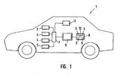
- Fig. 1
- eine Prinzipdarstellung eines erfindungsgemäßen Kraftfahrzeugs, und
- Fig. 2
- eine Prinzipdarstellung einer Autofahrt, bei der unterschiedliche Straßen befahren und unterschiedliche Betriebssysteme angewählt werden, sowie entsprechende Bildschirmdarstellungen.
- Fig. 1
- a schematic diagram of a motor vehicle according to the invention, and
- Fig. 2
- a schematic representation of a car drive in the driving different roads and different operating systems are selected, and corresponding screen images.
Ferner ist eine Einrichtung 11 vorgesehen, mittels der es möglich ist, Daten zu erfassen bzw. zu erzeugen, anhand derer die Klassifikation des Typs der befahrenen Straße möglich ist, die also eine Aussage darüber ermöglichen, ob die befahrene Straße eine Stadtstraße, eine Landstraße oder eine Autobahn ist. Die Einrichtung 11 kommuniziert mit weiteren, hier nicht näher gezeigten Betriebssystemen oder Bedienelementen des Kraftfahrzeugs, insbesondere werden Informationen hinsichtlich der Ist-Geschwindigkeit, die von der Geschwindigkeitsanzeige abgegriffen werden können, hinsichtlich der Lenkradbewegung bzw. Lenkwinkelveränderung, die über das Lenkrad abgegriffen werden können, sowie beispielsweise über die Bremspedalbetätigung, die am Bremspedal abgegriffen werden können, erfasst. Die genannten, erfassten Betriebsparameter sind lediglich exemplarisch, es können selbstverständlich andere bzw. weitere Parameter erfasst werden, anhand welcher die entsprechenden Daten zur Bestimmung des Straßentyps abgeleitet werden können bzw. die entsprechende derartige Daten liefern.Further, a
Eine Straßentypklassifizierung kann beispielsweise gemäß folgendem Schema erfolgen:
- Häufigkeit Lenkradwinkelveränderung größer 10° mehr als siebenmal pro Minute
- Häufigkeit Lenkradwinkelveränderung größer 10° weniger als siebenmal pro Minute
- Frequency of steering wheel angle change greater than 10 ° more than seven times per minute
- Frequency of steering wheel angle change greater than 10 ° less than seven times per minute
Die Berechnung der Durchschnittsgeschwindigkeit kann kontinuierlich erfolgen, oder in Abhängigkeit des Erreichens eines vorgegebenen Lenkraddrehwinkels, z.B. von 45°. Hierbei wird die Durchschnittsgeschwindigkeit erst dann berechnet, wenn der Lenkradwinkel z.B. die genannten 45° überschritten hat, bis zu dem Zeitpunkt, an dem der Lenkradwinkel erneut 45° überschritten hat. Danach beginnt ein neuer Abschnitt für die Berechnung der Durchschnittsgeschwindigkeit. Die Berechnungsdauer wird also über den Lenkwinkel bestimmt.The calculation of the average speed may be continuous, or in response to reaching a given steering wheel turning angle, e.g. of 45 °. Here, the average speed is calculated only when the steering wheel angle is e.g. has exceeded said 45 ° until the time when the steering wheel angle has again exceeded 45 °. Then begins a new section for calculating the average speed. The calculation duration is thus determined via the steering angle.
Anhand dieser wenigen Informationen lässt sich hinreichend zuverlässig ermitteln, welchen Typs die befahrene Straße ist, wobei, wie die Tabelle zeigt, hierüber nicht nur der Straßentyp bestimmt werden kann, sondern letztlich auch die Verkehrssituation, nachdem auch ein Stau bzw. stockender Verkehr, unabhängig vom Straßentyp, erfasst werden kann.On the basis of this little information can be determined sufficiently reliable, which type is the busy road, which, as the table shows, over this not only the type of road can be determined, but ultimately the traffic situation, after a traffic jam or traffic, regardless of Street type, can be detected.
Erfindungsgemäß kann nun die Informationsdarstellung an der Anzeigevorrichtung 6 in Abhängigkeit des erfassten Straßentyps variiert werden.
Es sei angenommen, dass eine Stadtfahrt gegeben ist, es wird also eine Stadtstraße erkannt, nachdem die Durchschnittsgeschwindigkeit im Bereich zwischen 10 - 60 km/h liegt. Bei Erfassung einer Stadtstraße bzw. unmittelbar mit Beginn der Fahrt kann beispielsweise an der Anzeigevorrichtung 6 defaultmäßig eine Straßenkarte dargestellt werden, wie im ersten Darstellungsbeispiel in
Nach Aufnahme der Fahrt wird als eines der Betriebssysteme das Navigationssystem angewählt, beispielsweise durch Drücken der zugeordneten Taste 9.After starting the journey, the navigation system is selected as one of the operating systems, for example by pressing the assigned
Unmittelbar mit Anwahl des Navigationssystem ändert sich die Bildschirmdarstellung, wie
Mit Fortsetzung der Fahrt ändert sich der Straßentyp, der Fahrer befährt eine Landstraße, wie im Übergang zur Bildschirmdarstellung c) dargestellt ist. Die Landstraße wird durch die höhere Durchschnittsgeschwindigkeit definiert. Während der Landstraßenfahrt wird beispielsweise das ACC-System durch Drücken des entsprechenden zugeordneten Bedienknopfs 9 angewählt. Die vormalige Bildschirmdarstellung mit der vollflächigen Straßenkarte ändert sich nun, wie in
Der Fahrer setzt nun seine Fahrt fort, es sind sowohl das Navigationssystem als auch das ACC-System aktiviert. Zu einem späteren Zeitpunkt wählt der Fahrer erneut das Navigationssystem an, die Bildschirmdarstellung ändert sich erneut, siehe die Darstellung gemäß d) in
Es sei nun angenommen, dass der Fahrer seine Fahrt fortsetzt und auf eine Autobahn auffährt. Dieser Wechsel des Straßentyps wird erneut über die entsprechend erfassten Daten von der Einrichtung 11 erkannt. Der Wechsel des Straßentyps hat nun, wie bereits beim Wechsel von der Stadtstraße auf die Landstraße, Auswirkung auf die Bildschirmdarstellung. Wie
Das dargestellte Beispiel ist lediglich exemplarischer Natur und keinesfalls in irgendeiner Form beschränkend. Vielmehr sind beliebige Darstellungsvariationen möglich, wobei die jeweilige Darstellung zum jeweils angewählten Betriebssystem vom jeweils befahrenen Straßentyp abhängt. Die Informationsdarstellungsveränderbarkeit ist grundsätzlich zu den Informationen zu dem Betriebssystem in 2 - 4, also dem Navigationssystem, dem ACC-System und dem Autotelefon, gegeben. Die Bedienung des Betriebssystems 5, im beschriebenen Beispiel des Infotainment-Systems mit Radiobedienung und CD-Bedienung, bleibt unverändert, das heißt, die Informationsdarstellung erfolgt hier über alle Straßentypen hinweg gleichartig.The example shown is merely exemplary in nature and is in no way limiting in any way. Rather, any representation variations are possible, with the respective representation depending on the selected operating system depends on the type of road used in each case. The information presentation changeability is basically given to the information about the operating system in FIGS. 2-4, that is, the navigation system, the ACC system, and the car phone. The operation of the operating system 5, in the described example of the infotainment system with radio control and CD operation, remains unchanged, that is, the information representation is similar here across all types of roads.
Claims (4)
- Motor vehicle (1) comprising a display apparatus (6) for the visual presentation of information relating to or from vehicle operating systems (2, 3, 4, 5), and a device (11) for ascertaining data which classify a road which is being used, wherein the type and/or volume and/or form of presentation and/or content of the displayed information can be altered on the basis of the data which classify the road which is being used,
characterized
in that the classifying data used are the average speed of the motor vehicle. - Motor vehicle according to Claim 1,
characterized
in that the display apparatus (6) can be used to display various selectable menu icons or main or submenus which are associated with different operating systems, wherein each menu icon comprises a main menu and each main menu comprises at least one submenu, wherein the presented menu icon or main or submenu is chosen, possibly following prior activation of an associated operating system (2, 3, 4, 5), on the basis of the classifying data. - Motor vehicle according to Claim 1 or 2,
characterized
in that the classifying data can be taken as a basis for simultaneously displaying the menu icons or main or submenus or menu items selected from these on two or more menus. - Motor vehicle according to one of the preceding claims,
characterized
in that the classifying data can be taken as a basis for altering the size and/or colour presentation of presented characters or presented symbols.
Applications Claiming Priority (1)
| Application Number | Priority Date | Filing Date | Title |
|---|---|---|---|
| DE102007049638A DE102007049638A1 (en) | 2007-10-17 | 2007-10-17 | motor vehicle |
Publications (2)
| Publication Number | Publication Date |
|---|---|
| EP2050610A1 EP2050610A1 (en) | 2009-04-22 |
| EP2050610B1 true EP2050610B1 (en) | 2012-04-18 |
Family
ID=40278904
Family Applications (1)
| Application Number | Title | Priority Date | Filing Date |
|---|---|---|---|
| EP08015508A Expired - Fee Related EP2050610B1 (en) | 2007-10-17 | 2008-09-03 | Motor vehicle |
Country Status (2)
| Country | Link |
|---|---|
| EP (1) | EP2050610B1 (en) |
| DE (1) | DE102007049638A1 (en) |
Families Citing this family (6)
| Publication number | Priority date | Publication date | Assignee | Title |
|---|---|---|---|---|
| US8892299B2 (en) | 2009-10-05 | 2014-11-18 | Tesla Motors, Inc. | Vehicle user interface with proximity activation |
| US9079498B2 (en) | 2009-10-05 | 2015-07-14 | Tesla Motors, Inc. | Morphing vehicle user interface |
| US8818624B2 (en) | 2009-10-05 | 2014-08-26 | Tesla Motors, Inc. | Adaptive soft buttons for a vehicle user interface |
| DE102012002304A1 (en) * | 2012-02-06 | 2013-08-08 | Audi Ag | Apparatus for automated driving of a motor vehicle and method for operating a motor vehicle |
| DE102013003036B4 (en) | 2013-02-22 | 2018-03-29 | Audi Ag | Car infotainment system with search functionality |
| DE102021202124A1 (en) | 2021-03-04 | 2022-09-08 | Volkswagen Aktiengesellschaft | Method for determining a roadway type of a roadway, computer program product and assistance system |
Family Cites Families (9)
| Publication number | Priority date | Publication date | Assignee | Title |
|---|---|---|---|---|
| JPH09123848A (en) * | 1995-11-06 | 1997-05-13 | Toyota Motor Corp | Vehicular information display device |
| DE10052654B4 (en) * | 2000-10-24 | 2019-03-14 | Volkswagen Ag | Method and device for controlling optical and / or acoustic information in a motor vehicle |
| DE10056305C5 (en) * | 2000-11-14 | 2005-07-21 | Volkswagen Ag | Operating and display system for a motor vehicle |
| DE10144752A1 (en) * | 2001-09-11 | 2003-03-27 | Volkswagen Ag | Optical information representation method for automobile with classification and filtering of information supplied to display device |
| SE521017C2 (en) * | 2002-01-11 | 2003-09-23 | Saab Automobile | Vehicle control system and method for controlling the same and driver interface with dashboard |
| DE10313001A1 (en) * | 2003-03-24 | 2004-10-14 | Daimlerchrysler Ag | Method for imaging different image data on a vehicle display |
| DE10343683A1 (en) * | 2003-09-20 | 2005-04-21 | Daimler Chrysler Ag | Information system for motor vehicles |
| JP4659754B2 (en) * | 2003-11-20 | 2011-03-30 | ボルボ テクノロジー コーポレイション | Method and system for interaction between vehicle driver and multiple applications |
| DE102005052175A1 (en) * | 2005-11-02 | 2007-05-24 | Robert Bosch Gmbh | Information outputting method for use in motor vehicle, involves detecting surrounding of vehicle using image detection unit, and determining momentary driving region and/or momentary driving street type from detected image |
-
2007
- 2007-10-17 DE DE102007049638A patent/DE102007049638A1/en not_active Withdrawn
-
2008
- 2008-09-03 EP EP08015508A patent/EP2050610B1/en not_active Expired - Fee Related
Also Published As
| Publication number | Publication date |
|---|---|
| DE102007049638A1 (en) | 2009-04-23 |
| EP2050610A1 (en) | 2009-04-22 |
Similar Documents
| Publication | Publication Date | Title |
|---|---|---|
| EP2766211B1 (en) | Method for making available an operator control, in particular in a vehicle, and operator control for a vehicle | |
| EP2050610B1 (en) | Motor vehicle | |
| DE102008053547B4 (en) | Method and device for displaying information on a display surface in a vehicle | |
| EP1840522A1 (en) | Navigation device and method for operating a navigation device | |
| DE102010055132B4 (en) | Method and device for providing a user interface in a vehicle | |
| EP1262740A2 (en) | Vehicle computer system and method for controlling a cursor for a vehicle computer system | |
| DE112007002128T5 (en) | Driving assistance device | |
| WO2018211030A1 (en) | Activating a driving function for an automated drive | |
| EP1930696A2 (en) | Method and device for controlling the display of information in two areas on a display screen in a means of transport | |
| DE102008021186A1 (en) | Information displaying method for motor vehicle, involves selecting displayed object by user using input device, and executing input operation with selected object such that data of hierarchy plane is displayed on display | |
| EP3649434B1 (en) | Method and device for displaying lane information in a vehicle | |
| WO2008098658A1 (en) | Information device and method for providing items of information in a motor vehicle with improved operability | |
| DE102007018517A1 (en) | Driving condition e.g. view movement, complexity signaling method for car, involves deriving complexity measure as quantitative measure for complexity of driving conditions, and quantitatively delivering complexity measure | |
| WO2018211031A1 (en) | Driver assistance device with automatic proposal of a driver assistance function, and corresponding method | |
| WO2012167952A1 (en) | Method and apparatus for providing a user interface | |
| DE102005058145A1 (en) | Selectable objective term e.g. street name, optical display method for use in navigation system, involves determining preferential objective term, where inputs of terms into system relates to direct geographical vicinity | |
| EP3254882A2 (en) | Multifunctional display and operating device for a motor vehicle | |
| EP2925552A2 (en) | Operating method and operating system in a road vehicle | |
| EP3394570B1 (en) | Display system and method of operating a display system in a vehicle with at least a first and a second display surface | |
| DE102008039472A1 (en) | Navigation system operating method for computing route from starting point to destination point, involves comparing actual speed with curve speed limit value, and outputting warning information when exceeding curve speed limit value | |
| WO2014114426A1 (en) | Display system and method for operating a display system epending on the line of vision | |
| EP3367227B1 (en) | Operating system, method for operating an operating system and a motor vehicle provided with operating system | |
| DE102017001614A1 (en) | Operating system, method for operating an operating system and a vehicle with an operating system | |
| EP1212741B1 (en) | Navigation device | |
| EP2054700B1 (en) | Method for inputting a travel destination |
Legal Events
| Date | Code | Title | Description |
|---|---|---|---|
| PUAI | Public reference made under article 153(3) epc to a published international application that has entered the european phase |
Free format text: ORIGINAL CODE: 0009012 |
|
| AK | Designated contracting states |
Kind code of ref document: A1 Designated state(s): AT BE BG CH CY CZ DE DK EE ES FI FR GB GR HR HU IE IS IT LI LT LU LV MC MT NL NO PL PT RO SE SI SK TR |
|
| AX | Request for extension of the european patent |
Extension state: AL BA MK RS |
|
| 17P | Request for examination filed |
Effective date: 20091022 |
|
| AKX | Designation fees paid |
Designated state(s): DE FR GB IT |
|
| GRAP | Despatch of communication of intention to grant a patent |
Free format text: ORIGINAL CODE: EPIDOSNIGR1 |
|
| GRAS | Grant fee paid |
Free format text: ORIGINAL CODE: EPIDOSNIGR3 |
|
| GRAA | (expected) grant |
Free format text: ORIGINAL CODE: 0009210 |
|
| AK | Designated contracting states |
Kind code of ref document: B1 Designated state(s): DE FR GB IT |
|
| REG | Reference to a national code |
Ref country code: GB Ref legal event code: FG4D Free format text: NOT ENGLISH |
|
| REG | Reference to a national code |
Ref country code: DE Ref legal event code: R096 Ref document number: 502008006949 Country of ref document: DE Effective date: 20120614 |
|
| PLBE | No opposition filed within time limit |
Free format text: ORIGINAL CODE: 0009261 |
|
| STAA | Information on the status of an ep patent application or granted ep patent |
Free format text: STATUS: NO OPPOSITION FILED WITHIN TIME LIMIT |
|
| 26N | No opposition filed |
Effective date: 20130121 |
|
| REG | Reference to a national code |
Ref country code: DE Ref legal event code: R097 Ref document number: 502008006949 Country of ref document: DE Effective date: 20130121 |
|
| REG | Reference to a national code |
Ref country code: FR Ref legal event code: PLFP Year of fee payment: 9 |
|
| REG | Reference to a national code |
Ref country code: FR Ref legal event code: PLFP Year of fee payment: 10 |
|
| REG | Reference to a national code |
Ref country code: FR Ref legal event code: PLFP Year of fee payment: 11 |
|
| PGFP | Annual fee paid to national office [announced via postgrant information from national office to epo] |
Ref country code: FR Payment date: 20190925 Year of fee payment: 12 |
|
| PGFP | Annual fee paid to national office [announced via postgrant information from national office to epo] |
Ref country code: GB Payment date: 20190926 Year of fee payment: 12 |
|
| PGFP | Annual fee paid to national office [announced via postgrant information from national office to epo] |
Ref country code: DE Payment date: 20190930 Year of fee payment: 12 |
|
| PGFP | Annual fee paid to national office [announced via postgrant information from national office to epo] |
Ref country code: IT Payment date: 20190930 Year of fee payment: 12 |
|
| REG | Reference to a national code |
Ref country code: DE Ref legal event code: R119 Ref document number: 502008006949 Country of ref document: DE |
|
| GBPC | Gb: european patent ceased through non-payment of renewal fee |
Effective date: 20200903 |
|
| PG25 | Lapsed in a contracting state [announced via postgrant information from national office to epo] |
Ref country code: DE Free format text: LAPSE BECAUSE OF NON-PAYMENT OF DUE FEES Effective date: 20210401 Ref country code: FR Free format text: LAPSE BECAUSE OF NON-PAYMENT OF DUE FEES Effective date: 20200930 |
|
| PG25 | Lapsed in a contracting state [announced via postgrant information from national office to epo] |
Ref country code: GB Free format text: LAPSE BECAUSE OF NON-PAYMENT OF DUE FEES Effective date: 20200903 |
|
| PG25 | Lapsed in a contracting state [announced via postgrant information from national office to epo] |
Ref country code: IT Free format text: LAPSE BECAUSE OF NON-PAYMENT OF DUE FEES Effective date: 20200903 |