Detailed Description
In order to make the objects, technical solutions and advantages of the embodiments of the present application clearer, the technical solutions in the embodiments of the present application will be clearly and completely described below with reference to the drawings in the embodiments of the present application, and it is obvious that the described embodiments are some embodiments of the present application, but not all embodiments. All other embodiments, which can be derived by a person skilled in the art from the embodiments given herein without making any creative effort, shall fall within the protection scope of the present application.
Fig. 1 is a schematic view of an application scenario provided in the embodiment of the present application, and referring to fig. 1, one or more radars 12 are mounted on a movable platform 11. For example, the radar 12 installed at, for example, the front of the vehicle may be used to detect a situation in front of the vehicle, to implement functions such as following, warning, etc., and the radar 12 installed at, for example, the rear of the vehicle may be used to detect a situation in the rear of the vehicle, to implement functions such as backing, parking indication, etc. The radar 12 may be disposed at any suitable position of the movable platform 11 for obtaining the surrounding environment information of the radar.
Wherein, the movable platform 11 can be a vehicle, an unmanned aerial vehicle, a robot, etc. The radar 12 may be a millimeter wave radar, a microwave radar, a laser radar, etc., and is not limited in this embodiment.
First, a method for acquiring a radar position according to the present application will be described with reference to specific embodiments.
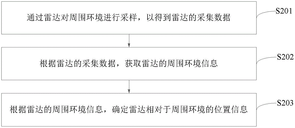
Fig. 2 is a first flowchart of a method for acquiring a radar position according to an embodiment of the present disclosure. The execution subject of this embodiment may be a device for acquiring a radar position, and the device for acquiring a radar position is all or part of a radar, or the device for acquiring a radar position is all or part of a movable platform, referring to fig. 2, the method of this embodiment includes:
step S201, sampling the surrounding environment through a radar to obtain the collected data of the radar.
In one mode, the radar may send a detection signal to the surrounding environment, and the detection signal is reflected by an object in the surrounding environment to generate an echo signal, where the collected data of the radar may be the echo signal, and may also be data obtained by sampling the echo signal, for example, the collected data of the radar may be point cloud data of the surrounding environment.
And S202, acquiring surrounding environment information of the radar according to the acquired data of the radar.
The information of the surrounding environment of the radar may include a ground where the radar is located, and the information of the surrounding environment of the radar may also include other environment information, such as information of shelters like trees and walls, which is not limited in this embodiment.
Under the condition that the surrounding environment information of the radar includes the ground where the radar is located, the acquiring the surrounding environment information of the radar according to the collected data of the radar may include: and acquiring information of the ground where the radar is located according to the acquired data of the radar. In this embodiment, the ground on which the radar is located may be the ground on which the movable platform on which the radar is located operates.
Optionally, according to data collected by the radar, the random sample consensus (RANSAC) algorithm may be used to obtain the ambient environment information of the radar, so that the method for obtaining the radar position in this embodiment is high in efficiency and fast in operation speed, and can achieve efficient and fast obtaining of the radar position.
Step S203, according to the surrounding environment information of the radar, the position information of the radar relative to the surrounding environment is determined.
If the surrounding environment information of the radar is the information of the ground where the radar is located, the position information of the radar relative to the ground can be determined according to the information of the ground where the radar is located. The set of position information of the radar relative to the ground may include at least one of: pitch angle, roll angle, height of the radar relative to the ground.
It will be appreciated that the surrounding environment may be sampled by the radar in real time, and therefore, a plurality of sets of radar acquisition data, and accordingly, a plurality of sets of radar position information relative to the surrounding environment, may be obtained.
Optionally, after obtaining the plurality of sets of location information of the radar relative to the surrounding environment, further comprising: and carrying out post-processing on the multiple groups of position information of the radar relative to the surrounding environment, wherein the post-processing is used for filtering abnormal position information in the multiple groups of position information. Wherein the post-processing may be filtering processing. The filtering process may be any of the following: median filtering processing or mean filtering processing or weighted average filtering processing.
The position information of the radar relative to the surrounding environment can be acquired through the surrounding environment data acquired by the radar in the embodiment, the position information of the radar relative to the ground does not need to be converted into the position information of the radar relative to the ground through a binocular camera or other devices, the introduction of errors when the position information of the radar relative to the ground is converted into the position information of the radar relative to the ground through the binocular camera or other devices is avoided, and the efficiency of acquiring the position information of the radar relative to the ground is high and accurate.
Fig. 3 is a second flowchart of a method for acquiring a radar position according to an embodiment of the present disclosure. Referring to fig. 3, the method of the present embodiment includes:
step S301, sampling the surrounding environment through the radar to obtain the acquisition data of the radar.
For specific implementation of this step, refer to the specific implementation of step S201 in the embodiment shown in fig. 2, and details are not described here.
And S302, acquiring an equation of the ground where the radar is located according to the acquired data of the radar.
The meaning of the data collected by the radar is the same as that explained in the embodiment shown in fig. 2, and is not repeated herein; further, the equation of the ground on which the radar is located is information of the ground on which the radar is located in the embodiment shown in fig. 2.
Optionally, according to the data collected by the radar, the RANSAC algorithm is used to obtain an equation of the ground where the radar is located.
The method for acquiring the equation of the ground where the radar is located by using the RANSAC algorithm specifically includes:
when the data collected by the radar is point cloud data of the surrounding environment, each data in the point cloud data of the surrounding environment can be a three-dimensional coordinate, and each three-dimensional coordinate corresponds to a point.
(1) Randomly extracting N data from a set { P } formed by point cloud data of the surrounding environment, and fitting a plane 1 according to the N data: a1x + B1y + C1z + D1 is 0. The distances from the plane 1 to the points corresponding to the N data are obtained, and the number E1 of points (also referred to as interior points (iners)) whose distances from the plane 1 to the points corresponding to the N data are smaller than a preset threshold is counted.
(2) And (3) repeatedly executing the method in the step 1 for a preset number of times, and obtaining a fitting plane A0x + B0y + C0z + D0 which is obtained by the process of obtaining the one-time fitting plane with the maximum corresponding internal value point, wherein the fitting plane A0 + B0y + C0z + D0 is 0.
(3) Acquiring all preselected data having a distance between the corresponding point in the set { P } and the plane A0x + B0y + C0z + D0 ═ 0 smaller than a preset threshold, and re-fitting the plane according to all preselected data: the obtained plane Ax + By + Cz + D is 0, and the plane Ax + By + Cz + D is a plane equation of the ground where the radar is located.
When the ground equation of the radar is Ax + By + Cz + D is 0, a is a coefficient related to an X axis of a ground coordinate system, B is a coefficient related to a Y axis of the ground coordinate system, C is a coefficient related to a Z axis of the ground coordinate system, and D is a constant term. The plane equation indicates that the intersection points of the ground and the three coordinate axes are S (-D/A, 0, 0), T (0, -D/B, 0), U (0, 0, -D/C), respectively. If C is less than or equal to 0, the direction of the Z axis of the ground coordinate system is downward; if C > 0, the Z axis of the ground coordinate system is oriented upward.
And step S303, acquiring position information of the radar relative to the ground according to the coefficient of the plane equation of the ground where the radar is located.
In one scheme, according to the coefficient of the plane equation of the ground where the radar is located, obtaining the information of the radar relative to the ground can be realized through the steps a 1-a 2:
a1, preprocessing the coefficient of the plane equation of the ground where the radar is located to obtain a preprocessed coefficient.
Optionally, preprocessing a coefficient of a plane equation of a ground where the radar is located to obtain a preprocessed coefficient, including: and carrying out normalization processing on the coefficient of the plane equation to obtain a normalization coefficient, wherein the normalization coefficient is the preprocessed coefficient.
If the orientation of the Z axis of the ground coordinate system is downward, normalizing the coefficients of the plane equation to obtain normalized coefficients includes: normalizing the coefficient of the plane equation to obtain the normalized coefficient, and acquiring the opposite number of the normalized coefficient, wherein the opposite number of the normalized coefficient is the normalized coefficient; or acquiring the inverse number of the coefficient of the plane equation, and normalizing the inverse number of the coefficient of the plane equation to obtain a normalized coefficient. It is understood that all or a portion of the coefficients of the plane equation may be normalized to obtain the pre-processed coefficients.
In one approach, the coefficient a associated with the X-axis of the plane equation may be normalized to obtain a first coefficient a1 by:
if the Z-axis of the ground coordinate system is oriented upwards: a1 ═ a/sqrt (a2+ B2+ C2);
if the Z-axis of the ground coordinate system is oriented downwards: a1 ═ a/sqrt (a2+ B2+ C2).
Where sqrt () represents a square root computation function.
In one approach, the coefficient B associated with the Y-axis of the plane equation may be normalized to obtain the second coefficient B1 by:
if the Z-axis of the ground coordinate system is oriented upwards: b1 ═ B/sqrt (a2+ B2+ C2);
if the Z-axis of the ground coordinate system is oriented downwards: b1 ═ B/sqrt (a2+ B2+ C2).
In one approach, the Z-axis related coefficient C of the plane equation may be normalized to obtain a third coefficient C1 by:
if the Z-axis of the ground coordinate system is oriented upwards: c1 ═ C/sqrt (a2+ B2+ C2);
if the Z-axis of the ground coordinate system is oriented downwards: c1 ═ C/sqrt (a2+ B2+ C2).
In one way, the constant term D of the plane equation can be normalized by the following formula to obtain the fourth coefficient D1:
if the Z-axis of the ground coordinate system is oriented upwards: d1 ═ D/sqrt (a2+ B2+ C2);
if the Z-axis of the ground coordinate system is oriented downwards: d1 ═ D/sqrt (a2+ B2+ C2).
and a2, acquiring information of the radar relative to the ground according to the preprocessed coefficients.
Wherein the preprocessed coefficients may include: the radar detection method comprises the steps that a first coefficient after a coefficient related to an X axis of a ground coordinate system in a plane equation of the ground where the radar is located is preprocessed, and/or a second coefficient after a coefficient related to a Y axis of the ground coordinate system in the plane equation is preprocessed, and/or a third coefficient after a coefficient related to a Z axis of the ground coordinate system in the plane equation is preprocessed, and/or a fourth coefficient after a constant term in the plane equation is preprocessed.
(1) If the preprocessed coefficients include: the first coefficient, then obtaining the information of the radar relative to the ground may include: and acquiring the pitch angle of the radar relative to the ground according to the first coefficient.
In one approach, the pitch angle P of the radar relative to the ground may be obtained by:
P=arccos(A1)*180°/π-90°;
where arccos () represents an inverse cosine function and a1 is the first coefficient.
(2) If the preprocessed coefficients include the second coefficient and the third coefficient, acquiring the position information of the radar relative to the ground may include: and acquiring the roll angle of the radar relative to the ground according to the second coefficient and the third coefficient.
In one approach, the roll angle R of the radar relative to the ground may be calculated by the following equation:
R=-arccos(B1/sqrt(B12+C12))×180°/π+90°;
wherein B1 is the second coefficient, and C1 is the third coefficient.
(3) If the preprocessed coefficient includes a fourth coefficient, acquiring position information of the radar relative to the ground, including: and acquiring the height of the radar relative to the ground according to the fourth coefficient.
In one approach, the height H of the radar relative to the ground may be obtained by the following equation:
H=|D1|。
where D1 is the fourth coefficient.
Correspondingly, after obtaining multiple sets of position information of the radar relative to the ground, the method further comprises the following steps: and carrying out post-processing on multiple groups of position information of the radar relative to the ground, wherein the post-processing is used for filtering abnormal position information in the multiple groups of position information. The meaning of the post-processing refers to the explanation in the embodiment shown in fig. 2, and is not described herein again.
The position information of the radar relative to the ground can be used for acquiring information of the ground, such as the gradient of the ground, the height difference of the ground on two sides of the vehicle when the vehicle turns, the height of other objects on the ground, and the like.
The method for acquiring the radar position enables the efficiency of acquiring the position information of the radar relative to the ground to be high and accurate.
The method for acquiring a radar position according to the present application is explained above, and the apparatus according to the embodiment of the present application is explained below.
Fig. 4 is a schematic structural diagram of a radar provided in an embodiment of the present application, and as shown in fig. 4, the radar of the present embodiment includes: a data acquisition device 41 and a processor 42.
The data acquisition device 41 is used for sampling the surrounding environment to obtain the acquired data of the radar; a processor 42 connected to the data acquisition device 41 for performing the following operations: acquiring the acquired data of the radar from the data acquisition device; acquiring surrounding environment information of the radar according to the acquired data of the radar; and determining the position information of the radar relative to the surrounding environment according to the surrounding environment information.
Optionally, the surrounding environment includes a ground where the radar is located, and when the processor 42 is configured to execute acquiring, according to the collected data of the radar, the surrounding environment information of the radar, specifically: and acquiring information of the ground where the radar is located according to the acquired data of the radar.
Optionally, the information of the ground surface comprises a plane equation of the ground surface.
Optionally, the processor 42, when configured to perform the operation of determining the position information of the radar relative to the surrounding environment according to the surrounding environment information, is specifically configured to: and acquiring the position information of the radar relative to the ground according to the coefficient of the plane equation of the ground.
Optionally, the processor 42, when configured to perform the operation of obtaining the position information of the radar relative to the ground according to the coefficient of the plane equation of the ground, is specifically configured to: preprocessing the coefficient of the plane equation of the ground to obtain a preprocessed coefficient; and acquiring the position information of the radar relative to the ground according to the preprocessed coefficient.
Optionally, when the processor 42 is configured to perform an operation of preprocessing the coefficients of the plane equation of the ground to obtain preprocessed coefficients, specifically, the processor is configured to: and carrying out normalization processing on the coefficient of the plane equation to obtain a normalization coefficient, wherein the normalization coefficient is the preprocessed coefficient.
Optionally, when the processor 42 is configured to perform an operation of performing normalization processing on the coefficients of the plane equation to obtain normalized coefficients, specifically, the processor is configured to: normalizing the coefficients of the plane equation to obtain normalized coefficients, and acquiring the opposite numbers of the normalized coefficients, wherein the opposite numbers of the normalized coefficients are the normalized coefficients; or acquiring the inverse number of the coefficient of the plane equation, and performing normalization processing on the inverse number of the coefficient of the plane equation to obtain the normalized coefficient.
Optionally, the preprocessed coefficients include: a first coefficient in the plane equation after preprocessing of a coefficient related to an X axis of a ground coordinate system; the processor 42, when configured to perform the operation of obtaining the position information of the radar with respect to the ground, is specifically configured to: and acquiring the pitch angle of the radar relative to the ground according to the first coefficient.
Optionally, the preprocessed coefficients include: a second coefficient in the plane equation after the coefficient related to the Y axis of the ground coordinate system is preprocessed and a third coefficient in the plane equation after the coefficient related to the Z axis of the ground coordinate system is preprocessed; the processor 42, when configured to perform the operation of obtaining the position information of the radar with respect to the ground, is specifically configured to: and acquiring the roll angle of the radar relative to the ground according to the second coefficient and the third coefficient.
Optionally, the processing according to the preprocessed coefficients includes: a fourth coefficient after constant terms in the plane equation are preprocessed; the processor 42, when configured to perform the operation of obtaining the position information of the radar with respect to the ground, is specifically configured to: and acquiring the height of the radar relative to the ground according to the fourth coefficient.
Optionally, the plane equation is: ax + By + Cz + D ═ 0; wherein A is a coefficient related to an X-axis of a ground coordinate system, B is a coefficient related to a Y-axis of the ground coordinate system, C is a coefficient related to a Z-axis of the ground coordinate system, and D is a constant term.
Optionally, if C is less than or equal to 0, the Z axis of the ground coordinate system faces downwards; if C > 0, the Z axis of the ground coordinate system is oriented upward.
Optionally, the processor 42, after being configured to determine the position information of the radar relative to the surrounding environment according to the surrounding environment information, is further configured to:
and carrying out post-processing on a plurality of groups of position information of the radar relative to the surrounding environment, wherein the post-processing is used for filtering abnormal position information in the plurality of groups of position information.
Optionally, the post-processing is filtering processing.
Optionally, the filtering process is any one of: median filtering processing or mean filtering processing or weighted average filtering processing.
Optionally, when the processor 42 is configured to execute the operation of acquiring the ambient environment information of the radar according to the collected data of the radar, specifically, the processor is configured to: and acquiring the ambient environment information of the radar by adopting a random sample consensus (RANSAC) algorithm according to the acquired data of the radar.
Optionally, each position information of the radar relative to the ground comprises at least one of: the pitch angle, roll angle, height of the radar relative to the ground.
The radar of this embodiment may be used to implement the technical solutions in the above method embodiments, and the implementation principle and the technical effect are similar, which are not described herein again.
The embodiment of the application further provides a movable platform, and the radar in the embodiment shown in fig. 4 is mounted on the movable platform.
Fig. 5 is a schematic structural diagram of another movable platform provided in the embodiment of the present application, where the movable platform of the embodiment includes: a radar 51 and a processor 52.
The radar 51 is used for sampling the surrounding environment to obtain the acquisition data of the radar 51; the processor 52 is communicatively connected to the radar 51, and is configured to: acquiring acquisition data of the radar 51 from the radar 51; acquiring surrounding environment information of the radar 51 according to the acquired data of the radar 51; from the ambient information, position information of the radar 51 relative to the ambient is determined.
Optionally, the surrounding environment includes a ground where the radar 51 is located, and when the processor 52 is configured to execute acquiring, according to the collected data of the radar 51, the surrounding environment information of the radar 51, specifically: and acquiring information of the ground where the radar 51 is located according to the acquired data of the radar 51.
Optionally, the information of the ground surface comprises a plane equation of the ground surface.
Optionally, when the processor 52 is configured to perform the operation of determining the position information of the radar 51 relative to the surrounding environment according to the surrounding environment information, specifically, to: and acquiring the position information of the radar 51 relative to the ground according to the coefficient of the plane equation of the ground.
Optionally, the processor 52 is specifically configured to, when the processor is configured to perform an operation of obtaining the position information of the radar 51 with respect to the ground according to the coefficient of the plane equation of the ground: preprocessing the coefficient of the plane equation of the ground to obtain a preprocessed coefficient; and acquiring the position information of the radar 51 relative to the ground according to the preprocessed coefficient.
Optionally, when the processor 52 is configured to perform an operation of preprocessing the coefficients of the plane equation of the ground to obtain preprocessed coefficients, specifically, the processor is configured to: and carrying out normalization processing on the coefficient of the plane equation to obtain a normalization coefficient, wherein the normalization coefficient is the preprocessed coefficient.
Optionally, when the processor 52 is configured to perform an operation of performing normalization processing on the coefficients of the plane equation to obtain normalized coefficients, specifically, the processor is configured to: normalizing the coefficients of the plane equation to obtain normalized coefficients, and acquiring the opposite numbers of the normalized coefficients, wherein the opposite numbers of the normalized coefficients are the normalized coefficients; or acquiring the inverse number of the coefficient of the plane equation, and performing normalization processing on the inverse number of the coefficient of the plane equation to obtain the normalized coefficient.
Optionally, the preprocessed coefficients include: a first coefficient in the plane equation after preprocessing of a coefficient related to an X axis of a ground coordinate system; the processor 52, when configured to perform the operation of acquiring the position information of the radar 51 with respect to the ground, is specifically configured to: and acquiring the pitch angle of the radar 51 relative to the ground according to the first coefficient.
Optionally, the preprocessed coefficients include: a second coefficient in the plane equation after the coefficient related to the Y axis of the ground coordinate system is preprocessed and a third coefficient in the plane equation after the coefficient related to the Z axis of the ground coordinate system is preprocessed; the processor 52, when configured to perform the operation of acquiring the position information of the radar 51 with respect to the ground, is specifically configured to: and acquiring the roll angle of the radar 51 relative to the ground according to the second coefficient and the third coefficient.
Optionally, the processing according to the preprocessed coefficients includes: a fourth coefficient after constant terms in the plane equation are preprocessed; the processor 52, when configured to perform the operation of acquiring the position information of the radar 51 with respect to the ground, is specifically configured to: and acquiring the height of the radar 51 relative to the ground according to the fourth coefficient.
Optionally, the plane equation is: ax + By + Cz + D ═ 0;
wherein A is a coefficient related to an X-axis of a ground coordinate system, B is a coefficient related to a Y-axis of the ground coordinate system, C is a coefficient related to a Z-axis of the ground coordinate system, and D is a constant term.
Optionally, if C is less than or equal to 0, the Z axis of the ground coordinate system faces downwards; if C > 0, the Z axis of the ground coordinate system is oriented upward.
Optionally, the processor 52, after being configured to determine the position information of the radar 51 relative to the surrounding environment according to the surrounding environment information, is further configured to: and performing post-processing on multiple sets of position information of the radar 51 relative to the surrounding environment, wherein the post-processing is used for filtering abnormal position information in the multiple sets of position information.
Optionally, the post-processing is filtering processing.
Optionally, the filtering process is any one of: median filtering processing or mean filtering processing or weighted average filtering processing.
Optionally, when the processor 52 is configured to execute the operation of acquiring the ambient environment information of the radar 51 according to the collected data of the radar 51, specifically, the processor is configured to: according to the collected data of the radar 51, the random sample consensus RANSAC algorithm is adopted to obtain the ambient environment information of the radar 51.
Optionally, each position information of the radar 51 relative to the ground comprises at least one of: pitch angle, roll angle, height of the radar 51 relative to the ground.
The movable platform of this embodiment may be used to implement the technical solutions in the above method embodiments, and the implementation principle and the technical effect are similar, which are not described herein again.
Those of ordinary skill in the art will understand that: all or a portion of the steps of implementing the above-described method embodiments may be performed by hardware associated with program instructions. The program may be stored in a computer-readable storage medium. When executed, the program performs steps comprising the method embodiments described above; and the aforementioned storage medium includes: various media that can store program codes, such as ROM, RAM, magnetic or optical disks.
Finally, it should be noted that: the above embodiments are only used for illustrating the technical solutions of the present application, and not for limiting the same; although the present application has been described in detail with reference to the foregoing embodiments, it should be understood by those of ordinary skill in the art that: the technical solutions described in the foregoing embodiments may still be modified, or some or all of the technical features may be equivalently replaced; and the modifications or the substitutions do not make the essence of the corresponding technical solutions depart from the scope of the technical solutions of the embodiments of the present application.