WO2018078863A1 - ドローン制御システム、方法及びプログラム - Google Patents
ドローン制御システム、方法及びプログラム Download PDFInfo
- Publication number
- WO2018078863A1 WO2018078863A1 PCT/JP2016/082298 JP2016082298W WO2018078863A1 WO 2018078863 A1 WO2018078863 A1 WO 2018078863A1 JP 2016082298 W JP2016082298 W JP 2016082298W WO 2018078863 A1 WO2018078863 A1 WO 2018078863A1
- Authority
- WO
- WIPO (PCT)
- Prior art keywords
- drone
- action
- data
- control system
- state
- Prior art date
- Legal status (The legal status is an assumption and is not a legal conclusion. Google has not performed a legal analysis and makes no representation as to the accuracy of the status listed.)
- Ceased
Links
Images



Classifications
-
- A—HUMAN NECESSITIES
- A01—AGRICULTURE; FORESTRY; ANIMAL HUSBANDRY; HUNTING; TRAPPING; FISHING
- A01M—CATCHING, TRAPPING OR SCARING OF ANIMALS; APPARATUS FOR THE DESTRUCTION OF NOXIOUS ANIMALS OR NOXIOUS PLANTS
- A01M7/00—Special adaptations or arrangements of liquid-spraying apparatus for purposes covered by this subclass
- A01M7/0025—Mechanical sprayers
- A01M7/0032—Pressure sprayers
- A01M7/0042—Field sprayers, e.g. self-propelled, drawn or tractor-mounted
-
- B—PERFORMING OPERATIONS; TRANSPORTING
- B64—AIRCRAFT; AVIATION; COSMONAUTICS
- B64C—AEROPLANES; HELICOPTERS
- B64C13/00—Control systems or transmitting systems for actuating flying-control surfaces, lift-increasing flaps, air brakes, or spoilers
- B64C13/02—Initiating means
- B64C13/16—Initiating means actuated automatically, e.g. responsive to gust detectors
-
- B—PERFORMING OPERATIONS; TRANSPORTING
- B64—AIRCRAFT; AVIATION; COSMONAUTICS
- B64D—EQUIPMENT FOR FITTING IN OR TO AIRCRAFT; FLIGHT SUITS; PARACHUTES; ARRANGEMENT OR MOUNTING OF POWER PLANTS OR PROPULSION TRANSMISSIONS IN AIRCRAFT
- B64D1/00—Dropping, ejecting, releasing or receiving articles, liquids, or the like, in flight
- B64D1/16—Dropping or releasing powdered, liquid, or gaseous matter, e.g. for fire-fighting
-
- G—PHYSICS
- G05—CONTROLLING; REGULATING
- G05D—SYSTEMS FOR CONTROLLING OR REGULATING NON-ELECTRIC VARIABLES
- G05D1/00—Control of position, course, altitude or attitude of land, water, air or space vehicles, e.g. using automatic pilots
- G05D1/0094—Control of position, course, altitude or attitude of land, water, air or space vehicles, e.g. using automatic pilots involving pointing a payload, e.g. camera, weapon, sensor, towards a fixed or moving target
-
- B—PERFORMING OPERATIONS; TRANSPORTING
- B64—AIRCRAFT; AVIATION; COSMONAUTICS
- B64D—EQUIPMENT FOR FITTING IN OR TO AIRCRAFT; FLIGHT SUITS; PARACHUTES; ARRANGEMENT OR MOUNTING OF POWER PLANTS OR PROPULSION TRANSMISSIONS IN AIRCRAFT
- B64D1/00—Dropping, ejecting, releasing or receiving articles, liquids, or the like, in flight
- B64D1/16—Dropping or releasing powdered, liquid, or gaseous matter, e.g. for fire-fighting
- B64D1/18—Dropping or releasing powdered, liquid, or gaseous matter, e.g. for fire-fighting by spraying, e.g. insecticides
-
- B—PERFORMING OPERATIONS; TRANSPORTING
- B64—AIRCRAFT; AVIATION; COSMONAUTICS
- B64U—UNMANNED AERIAL VEHICLES [UAV]; EQUIPMENT THEREFOR
- B64U2101/00—UAVs specially adapted for particular uses or applications
- B64U2101/30—UAVs specially adapted for particular uses or applications for imaging, photography or videography
-
- B—PERFORMING OPERATIONS; TRANSPORTING
- B64—AIRCRAFT; AVIATION; COSMONAUTICS
- B64U—UNMANNED AERIAL VEHICLES [UAV]; EQUIPMENT THEREFOR
- B64U2101/00—UAVs specially adapted for particular uses or applications
- B64U2101/45—UAVs specially adapted for particular uses or applications for releasing liquids or powders in-flight, e.g. crop-dusting
-
- B—PERFORMING OPERATIONS; TRANSPORTING
- B64—AIRCRAFT; AVIATION; COSMONAUTICS
- B64U—UNMANNED AERIAL VEHICLES [UAV]; EQUIPMENT THEREFOR
- B64U2201/00—UAVs characterised by their flight controls
- B64U2201/20—Remote controls
-
- G—PHYSICS
- G05—CONTROLLING; REGULATING
- G05D—SYSTEMS FOR CONTROLLING OR REGULATING NON-ELECTRIC VARIABLES
- G05D1/00—Control of position, course, altitude or attitude of land, water, air or space vehicles, e.g. using automatic pilots
- G05D1/0011—Control of position, course, altitude or attitude of land, water, air or space vehicles, e.g. using automatic pilots associated with a remote control arrangement
- G05D1/0016—Control of position, course, altitude or attitude of land, water, air or space vehicles, e.g. using automatic pilots associated with a remote control arrangement characterised by the operator's input device
Definitions
- the present invention relates to a drone control system, method, and program for controlling a drone capable of performing a predetermined action on a predetermined object.
- Non-Patent Document 1 a technique is known in which a position called a waypoint is designated and a drone is moved so as to pass through this waypoint (see Non-Patent Document 1).
- Non-Patent Document 1 a person has to set a position called a waypoint in advance.
- the purpose of moving the drone for example, exterior inspection or pest control
- the target object for example, if the purpose is an exterior inspection of the building
- the drone moves to a position where the purpose can be achieved and performs the action according to the purpose. It is desirable to do.
- the present invention provides the following solutions.
- the invention according to the first feature is A drone control system for controlling a drone capable of performing a predetermined action on a predetermined object, State data acquisition means for acquiring state data indicating the state of the object; Objective data acquisition means for acquiring objective data that is the purpose of moving the drone; Detecting means for detecting an action point that is position information for executing an action for the purpose based on the acquired state data and the target data;
- a drone control system comprising:
- the state data acquisition unit acquires state data indicating the state of the object.
- the target data acquisition means acquires target data that is a purpose of moving the drone.
- the detection means detects an action point that is position information for executing an action for the purpose based on the acquired state data and the purpose data.
- the action point that is the position information for executing the action for the purpose is detected. Even if a person does not set an action point that causes the drone to execute an action, the action point corresponding to the state and purpose of the object can be automatically detected.
- the invention according to the first feature is a category of the system, but the method and the program exhibit the same operations and effects.
- the invention according to the second feature is in addition to the invention according to the first feature, There is provided a drone control system including movement control means for controlling a drone so as to move to the detected action point.
- the drone can be controlled to move to the detected action point, for example, even if the operator of the drone does not set a route according to the action point, Can be moved according to the action point.
- the invention according to the third feature is in addition to the invention according to the second feature,
- a drone control system including an action control unit that controls the drone so as to execute the action corresponding to the target data is provided.
- the drone when the drone moves to the action point, the drone can be controlled to execute an action corresponding to the target data.
- the target action is automatically set according to the action point. Can be executed.
- the invention according to the fourth feature is in addition to the invention according to the third feature,
- the purpose data includes a specific purpose which is any one of photographing of the object, security of the object, and inspection of the object,
- the action control means provides a drone control system for photographing the object by a camera provided in the drone when the purpose data is the specific purpose.
- the purpose of moving the drone is any one of shooting of the object, security of the object, and inspection of the object, at the action point, by the camera included in the drone
- the subject can be photographed.
- the operator of the drone moves the drone to the action point for the purpose of photographing the object, guarding the object, or inspecting the object
- the subject can be automatically photographed.
- the invention according to the fifth feature is in addition to the invention according to the third feature,
- the purpose data includes the application of pesticides to the object,
- the action control means provides a drone control system for spraying agricultural chemicals on the object by a spreader provided in the drone when the target data is spraying agricultural chemicals on the object.
- the target when the purpose of moving the drone is spraying the pesticide on the target, the target can be sprayed with the pesticide by the sprayer included in the drone at the action point. .
- the operator of the drone can spray the pesticide on the target without spraying the pesticide after moving the drone to the action point for the purpose of spraying the pesticide on the target.
- a drone control system, method and program capable of moving a drone to a position where the purpose can be achieved and performing an action according to the purpose.
- FIG. 1 is a diagram for explaining an outline of a drone control system 1 which is a preferred embodiment of the present invention.
- FIG. 2 is a diagram illustrating the relationship between the function blocks of the drone control system 1 and the respective functions.
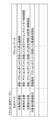
- FIG. 3 is a diagram for explaining the action determination table 230 stored in the storage unit 22 of the operator terminal 20.
- FIG. 4 is a flowchart of the drone control process executed by the operator terminal 20 of the drone control system 1.
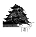
- FIG. 5 is a diagram for explaining an example of the operation of the drone 10 in the drone control system 1.
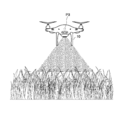
- FIG. 6 is a diagram for explaining an example of the operation of the drone 10 in the drone control system 1.
- FIG. 1 is a diagram for explaining an outline of a drone control system 1 which is a preferred embodiment of the present invention. An outline of the drone control system 1 will be described based on FIG. The drone control system 1 controls the drone 10 capable of performing a predetermined action on a predetermined object.
- the “predetermined action” is an operation that can be performed in a drone or a device attached to the drone (for example, a camera or a pesticide spraying device), such as photographing or pesticide spraying.
- the “predetermined object” is an object on which a predetermined action is performed, such as a building, a structure, a person, an animal, and a farm.
- the drone 10 is communicable with the operator terminal 20 and is autonomously operated based on the remote operation by the operator terminal 20 or the movement plan data transmitted from the operator terminal 20. It is a drone that generates and flies. In the present embodiment, a flight type is described as an example of the drone 10, but the drone 10 may be a vehicle type or a ship type.
- the operator terminal 20 acquires state data indicating the state of the object.
- the “state data” is, for example, 3D data of the building or position (eg, latitude / longitude) data of the building if the object is a building, and if the object is a farm, It is farm position (for example, latitude / longitude) data.
- the operator terminal 20 acquires target data that is the purpose of moving the drone 10 based on the operation of the operator, and determines a predetermined action according to the acquired target data.
- the “purpose” includes, for example, photographing of an object, security of the object, inspection of the object, spraying of agricultural chemicals on the object, and the like.
- the operator terminal 20 detects an action point that is position information for executing an action for the purpose based on the acquired state data and the purpose data.
- the operator terminal 20 creates route data indicating a route including the detected action point as a passing point.
- the operator terminal 20 transmits to the drone 10 the action point data indicating the detected action point, the action data indicating the determined action, and the movement plan data including the created route data.
- the drone 10 moves based on the movement plan data received from the operator terminal 20. Specifically, the drone 10 moves along a route based on the route data, and executes a predetermined action at an action point indicated by the action point data.
- the action point that is the position information for executing the action for the purpose is determined. Therefore, for example, even if the operator of the drone 10 does not set an action point for causing the drone 10 to execute an action, the action point corresponding to the state and purpose of the object can be automatically detected.
- the drone 10 moves to a position where the purpose can be achieved and to perform an action according to the purpose.
- FIG. 2 is a diagram illustrating the relationship between the function blocks of the drone control system 1 and the respective functions.
- the drone control system 1 includes a drone 10 and an operator terminal 20 that can communicate with the drone 10.
- the drone 10 includes a central processing unit (CPU), a random access memory (RAM), a read only memory (ROM), and the like as the control unit 11, and includes a hard disk or a semiconductor memory as the storage unit 12.
- the data storage unit, the drive unit 13 includes, for example, a plurality of rotor blades, a motor that rotates the rotor blades under the control of the control unit 11, and the sensor 14 includes various sensors (for the drone 10).
- a gyro sensor that detects the accelerated direction
- an altitude sensor that detects the altitude of the drone 10
- a geomagnetic sensor that detects the direction in which the drone 10 is moving, etc.
- Equipment eg camera or farm Comprising a spraying device, etc.
- the storage unit 12 stores the movement control program 100 and other data necessary for the control and movement of the drone 10.
- the drone 10 includes a battery for supplying power, a GPS (Global Positioning System) receiver for acquiring the current position, and a configuration necessary for unmanned flight, in addition to the above configuration.
- GPS Global Positioning System
- the control unit 11 reads the movement control program 100, thereby realizing the movement module 101 in cooperation with the storage unit 12, the drive unit 13, and the sensor 14.
- the action control module 102 is realized in cooperation with the storage unit 12, the drive unit 13, and the accessory device 15 by the control unit 11 reading the movement control program 100.
- the operator terminal 20 includes a CPU, RAM, ROM and the like as the control unit 21, a data storage unit as the storage unit 22, a touch panel and the like as the input / output unit 23, and the communication unit 24, for example.
- the device includes a WiFi compatible device compliant with IEEE 802.11, a wireless device compliant with International Telecommunications Union standards such as third generation and fourth generation mobile communication systems
- the storage unit 22 includes a drone control program 200, a state Data 220, action determination table 230, and other data necessary for control of operator terminal 20 are stored.
- the state data 220 is data of an object for detecting an action point that is position information for the drone 10 to perform an action. If the object is a building, the 3D data of the building or the position of the building (for example, , Latitude / longitude) data, and if the object is a farm, the farm position (for example, latitude / longitude) data.
- FIG. 3 is a diagram for explaining the action determination table 230 stored in the storage unit 22 of the operator terminal 20.
- action data indicating an action executed by the drone 10 is associated with purpose data indicating the purpose of moving the drone 10.
- the action (for example, shooting) executed by the drone 10 and the detailed contents of the action are associated with each other according to the associated target data. Yes. For this reason, even if the action is the same shooting, different detailed contents are associated with each other if the purpose indicated by the purpose data is different.
- the purpose of “security of an object” and “inspection of an object” are associated with the same “shooting” as an action, but the detailed contents of “shooting” are in “guarding of an object” Is associated with “video shooting until the next action point when it arrives at an action point”, and “inspection of an object” is associated with “video shooting for a predetermined period (30 seconds) upon arrival at an action point” Yes.
- the state data acquisition module 201 and the movement are cooperated with the storage unit 22, the input / output unit 23, and the communication unit 24.
- the planning module 205 is realized. Further, by reading the drone control program 200 in the operator terminal 20, the object data acquisition module 202, the detection module 203, and the action determination module 204 are realized in cooperation with the storage unit 22 and the input / output unit 23.
- FIG. 4 is a flowchart of the drone control process executed by the operator terminal 20 of the drone control system 1. A drone control process performed by the various modules of the drone control system 1 described above will be described.
- the state data acquisition module 201 acquires state data 220 indicating the state of the object. Specifically, the state data acquisition module 201 searches the storage unit 22 for 3D data and position data of an object specified based on an operation of the input / output unit 23 by an operator, and stores the state data 220 of the object. get. In addition, when the 3D data of the target object is not stored in the storage unit 22, the state data acquisition module 201 captures image data captured by the drone 10 (for example, the target object or the target object with a stereo camera). 3D data of the object is created from the image data obtained by capturing the surrounding environment) and stored in the storage unit 22. Note that the process of creating 3D data from such imaging data may be performed by an external server, and the state data acquisition module 201 may acquire 3D data created by the external server.
- step S2 the target data acquisition module 202 acquires target data that is the purpose of moving the drone based on the operation of the input / output unit 23 by the operator.
- step S3 the detection module 203 performs an action for the purpose based on the state data acquired by the state data acquisition module 201 in step S1 and the target data acquired by the target data acquisition module 202 in step S2. An action point that is position information to be executed is detected.
- the detection module 203 displays the position indicated by the position data (for example, data indicating latitude / longitude and altitude) of the imaging data stored in the storage unit 22 or an external server. Detect as an action point. Further, if the purpose is inspection of building piping, the detection module 203 detects a position indicated by position data of a position having a problem in the past stored in the storage unit 22 or an external server as an action point. In addition, when the purpose is security of the building, the detection module 203 has a position (for example, a door or window provided between the inside and the outside) where a person or an animal can enter the building from the state data (3D data).
- the position data for example, data indicating latitude / longitude and altitude
- the position at which the air vent is provided and the position at which the air vent that communicates the inside and the outside is provided) is detected as an action point.
- the 3D data it is preferable to use not only shape data but also 3D CAD data capable of recognizing members constituting the building.
- the detection module 203 detects, as an action point, the position indicated by the position data of the position where the agricultural chemicals were previously sprayed stored in the storage unit 22 or an external server.
- the action determination module 204 refers to the action determination table 230 (see FIG. 3) stored in the storage unit 22, and causes the drone 10 to execute the action point detected by the detection module 203 in step S3. To decide. Specifically, the action determination module 204 refers to the action determination table 230 (see FIG. 3) if, for example, the target data acquired by the target data acquisition module 202 in step S2 is “photographing of an object”. Then, “shooting: still image shooting when arriving at action point” is determined as an action executed by drone 10.
- the action executed by the drone 10 is referred to by referring to the action determination table 230 (see FIG. 3).
- Agricultural chemical spraying When the action point is reached, “pesticide spraying starts” is determined.
- step S5 the movement planning module 205 creates route data indicating a route including the action point detected in step S3 as a passing point.
- step S6 the movement plan module 205 includes action point data indicating the action point detected by the detection module 203 in step S3, action data indicating the action determined by the action determination module 204 in step S4, and route data generated in step S5. Is transmitted to the drone 10.
- 5 and 6 are diagrams for explaining an example of the operation of the drone 10 in the drone control system 1.
- FIG. 5 is a diagram showing a case in which action points P1 and P2 are included in the action point data in the movement plan data, and the action data is “shooting: still image shooting when arriving at the action point”.
- the drone 10 moves along the route data (arrows shown in FIG. 5) of the movement plan data, takes a still image when it arrives at the action point P1, and then moves along the route data.
- a still image is taken.
- FIG. 6 is a diagram showing a case where action point P3 is included in the action point data in the movement plan data, and the action data is “pesticidal spraying: start spraying agricultural chemicals when arriving at the action point”.
- the drone 10 moves along the route data of the movement plan data, and starts pesticide spraying when it reaches the action point P3.
- the means and functions described above are realized by a computer (including a CPU, an information processing device, and various terminals) reading and executing a predetermined program.
- the program is provided in a form recorded on a computer-readable recording medium such as a flexible disk, CD (CD-ROM, etc.), DVD (DVD-ROM, DVD-RAM, etc.), for example.
- the computer reads the program from the recording medium, transfers it to the internal storage device or the external storage device, stores it, and executes it.
- the program may be recorded in advance in a storage device (recording medium) such as a magnetic disk, an optical disk, or a magneto-optical disk, and provided from the storage device to the computer.
- 1 drone control system 10 drone, 20 operator terminal, 201 status data acquisition module, 202 purpose data acquisition module, 203 detection module
Landscapes
- Engineering & Computer Science (AREA)
- Aviation & Aerospace Engineering (AREA)
- Life Sciences & Earth Sciences (AREA)
- Pest Control & Pesticides (AREA)
- Automation & Control Theory (AREA)
- Insects & Arthropods (AREA)
- Wood Science & Technology (AREA)
- Zoology (AREA)
- Environmental Sciences (AREA)
- Mechanical Engineering (AREA)
- Radar, Positioning & Navigation (AREA)
- Remote Sensing (AREA)
- Physics & Mathematics (AREA)
- General Physics & Mathematics (AREA)
- Control Of Position, Course, Altitude, Or Attitude Of Moving Bodies (AREA)
- Catching Or Destruction (AREA)
Abstract
【課題】ドローンが、目的を達成可能な位置に移動し、目的に応じたアクションを行うことが可能なドローン制御システムを提供する。 【解決手段】ドローン制御システム1は、所定の対象物に対して、所定のアクションを行うことが可能なドローン10を制御し、対象物の状態を示す状態データを取得する状態データ取得モジュール201と、ドローン10を移動させる目的である目的データを取得する目的データ取得モジュール202と、取得した状態データと目的データとに基づいて、当該目的のためのアクションを実行する位置情報であるアクションポイントを検出する検出モジュール203と、を備える。
Description
本発明は、所定の対象物に対して、所定のアクションを行うことが可能なドローンを制御するドローン制御システム、方法及びプログラムに関する。
従来、ウェイポイントと呼ばれる位置を指定し、このウェイポイントを経由するようにドローンを移動させる技術が知られている(非特許文献1参照)。
nelsonships、"Phantom3の新機能「ウェイポイント」について"、[平成28年10月5日検索]、インターネット<URL:http://www.nelsonships.biz/2015/09/26/phantom3%E3%81%AE%E6%96%B0%E6%A9%9F%E8%83%BD%E3%80%8C%E3%82%A6%E3%82%A7%E3%82%A4%E3%83%9D%E3%82%A4%E3%83%B3%E3%83%88%E3%80%8D%E3%81%AB%E3%81%A4%E3%81%84%E3%81%A6/>
しかしながら、非特許文献1に示された技術では、ウェイポイントと呼ばれる位置を、予め人が設定しなければならない。
ここで、ドローンを移動させる際には、ドローンを移動させる目的(例えば、建物の外観検査や害虫駆除等)と、この目的の対象となる対象物(例えば、目的が建物の外観検査であれば、検査対象となる建物であり、目的が害虫駆除であれば、害虫を駆除したい農場等)と、がある。
このため、ドローンを移動させる目的と、この目的の対象となる対象物とに応じて、操作者の設定にかかわらず、ドローンが、目的を達成可能な位置に移動し、目的に応じたアクションを行うことが望ましい。
本発明は、これらの課題に鑑み、ドローンが、目的を達成可能な位置に移動し、目的に応じたアクションを行うことが可能なドローン制御システム、方法及びプログラムを提供することを目的とする。
本発明では、以下のような解決手段を提供する。
第1の特徴に係る発明は、
所定の対象物に対して、所定のアクションを行うことが可能なドローンを制御するドローン制御システムであって、
前記対象物の状態を示す状態データを取得する状態データ取得手段と、
前記ドローンを移動させる目的である目的データを取得する目的データ取得手段と、
取得した前記状態データと前記目的データとに基づいて、当該目的のためのアクションを実行する位置情報であるアクションポイントを検出する検出手段と、
を備えるドローン制御システムを提供する。
所定の対象物に対して、所定のアクションを行うことが可能なドローンを制御するドローン制御システムであって、
前記対象物の状態を示す状態データを取得する状態データ取得手段と、
前記ドローンを移動させる目的である目的データを取得する目的データ取得手段と、
取得した前記状態データと前記目的データとに基づいて、当該目的のためのアクションを実行する位置情報であるアクションポイントを検出する検出手段と、
を備えるドローン制御システムを提供する。
第1の特徴に係る発明によれば、所定の対象物に対して、所定のアクションを行うことが可能なドローンを制御するドローン制御システムは、状態データ取得手段と、目的データ取得手段と、検出手段と、を備える。状態データ取得手段は、対象物の状態を示す状態データを取得する。目的データ取得手段は、ドローンを移動させる目的である目的データを取得する。検出手段は、取得した状態データと目的データとに基づいて、当該目的のためのアクションを実行する位置情報であるアクションポイントを検出する。
これにより、対象物の状態を示す状態データとドローンを移動させる目的である目的データに基づいて、当該目的のためのアクションを実行する位置情報であるアクションポイントを検出するので、例えば、ドローンの操作者が、ドローンにアクションを実行させるアクションポイントを設定しなくとも、自動的に対象物の状態と目的に応じたアクションポイントを検出できる。
第1の特徴に係る発明は、システムのカテゴリであるが、方法及びプログラムであっても同様の作用、効果を奏する。
したがって、ドローンが、目的を達成可能な位置に移動し、目的に応じたアクションを行うことが可能なドローン制御システム、方法及びプログラムを提供できる。
第2の特徴に係る発明は、第1の特徴に係る発明に加え、
検出した前記アクションポイントに移動するようにドローンを制御する移動制御手段を備えるドローン制御システムを提供する。
検出した前記アクションポイントに移動するようにドローンを制御する移動制御手段を備えるドローン制御システムを提供する。
第2の特徴に係る発明によれば、検出したアクションポイントに移動するようにドローンを制御することができるので、例えば、ドローンの操作者が、アクションポイントに応じた経路を設定しなくとも、自動的にアクションポイントに応じて移動させることができる。
第3の特徴に係る発明は、第2の特徴に係る発明に加え、
前記ドローンが、前記アクションポイントに移動したら、前記目的データに対応した前記アクションを実行するように当該ドローンを制御するアクション制御手段を備えるドローン制御システムを提供する。
前記ドローンが、前記アクションポイントに移動したら、前記目的データに対応した前記アクションを実行するように当該ドローンを制御するアクション制御手段を備えるドローン制御システムを提供する。
第3の特徴に係る発明によれば、ドローンが、アクションポイントに移動したら、目的データに対応したアクションを実行するように当該ドローンを制御できる。これにより、例えば、ドローンの操作者が、アクションポイントに移動したドローンにアクションを実行させたり、アクションを実行させるタイミングを設定したりしなくとも、自動的にアクションポイントに応じて、目的のアクションを実行させることができる。
第4の特徴に係る発明は、第3の特徴に係る発明に加え、
前記目的データには、前記対象物の撮影、前記対象物の警備、前記対象物の点検のいずれかである特定目的が含まれ、
前記アクション制御手段は、前記目的データが前記特定目的である場合に、前記ドローンが備えるカメラにより、前記対象物を撮影させるドローン制御システムを提供する。
前記目的データには、前記対象物の撮影、前記対象物の警備、前記対象物の点検のいずれかである特定目的が含まれ、
前記アクション制御手段は、前記目的データが前記特定目的である場合に、前記ドローンが備えるカメラにより、前記対象物を撮影させるドローン制御システムを提供する。
第4の特徴に係る発明によれば、ドローンを移動させる目的が、対象物の撮影、対象物の警備、対象物の点検のいずれかである場合に、アクションポイントにおいて、ドローンが備えるカメラにより、対象物を撮影できる。これにより、例えば、ドローンの操作者が、対象物の撮影、対象物の警備、対象物の点検のいずれかを目的として、ドローンをアクションポイントに移動させた後に、対象物を撮影させなくとも、自動的に対象物を撮影できる。
第5の特徴に係る発明は、第3の特徴に係る発明に加え、
前記目的データには、前記対象物への農薬散布が含まれ、
前記アクション制御手段は、前記目的データが前記対象物への農薬散布である場合に、前記ドローンが備える散布機により、前記対象物に農薬を散布させるドローン制御システムを提供する。
前記目的データには、前記対象物への農薬散布が含まれ、
前記アクション制御手段は、前記目的データが前記対象物への農薬散布である場合に、前記ドローンが備える散布機により、前記対象物に農薬を散布させるドローン制御システムを提供する。
第5の特徴に係る発明によれば、ドローンを移動させる目的が、対象物への農薬散布である場合に、アクションポイントにおいて、ドローンが備える散布機により、対象物に農薬を散布させることができる。これにより、例えば、ドローンの操作者が、対象物への農薬散布を目的として、ドローンをアクションポイントに移動させた後に、農薬を散布させなくとも、対象物に農薬を散布できる。
本発明によれば、ドローンが、目的を達成可能な位置に移動し、目的に応じたアクションを行うことが可能なドローン制御システム、方法及びプログラムを提供できる。
以下、本発明を実施するための最良の形態について図を参照しながら説明する。なお、これはあくまでも一例であって、本発明の技術的範囲はこれに限られるものではない。
[ドローン制御システムの概要]
図1は、本発明の好適な実施形態であるドローン制御システム1の概要を説明するための図である。この図1に基づいて、ドローン制御システム1の概要を説明する。ドローン制御システム1は、所定の対象物に対して、所定のアクションを行うことが可能なドローン10を制御する。
図1は、本発明の好適な実施形態であるドローン制御システム1の概要を説明するための図である。この図1に基づいて、ドローン制御システム1の概要を説明する。ドローン制御システム1は、所定の対象物に対して、所定のアクションを行うことが可能なドローン10を制御する。
本実施形態において、「所定のアクション」とは、撮影や、農薬散布等、ドローンやドローンに装着された装置(例えば、カメラや農薬散布装置)において行うことができる動作である。また、「所定の対象物」とは、所定のアクションを行う対象であり、例えば、建物、構造物、人、動物、農場等である。
ドローン10は、操作者端末20と通信可能であり、操作者端末20による遠隔操作又は操作者端末20から送信された移動計画データに基づき自律して、複数の回転翼を回転させることで、揚力を発生し飛行する無人機である。なお、本実施形態では、ドローン10の一例として飛行型を例に説明するが、ドローン10は車両型や船舶型であってもよい。
操作者端末20は、対象物の状態を示す状態データを取得する。ここで、「状態データ」とは、例えば、対象物が建物であれば、当該建物の3Dデータや当該建物の位置(例えば、緯度・経度)データであり、対象物が農場であれば、当該農場の位置(例えば、緯度・経度)データである。
また、操作者端末20は、操作者の操作に基づき、ドローン10を移動させる目的である目的データを取得し、取得した目的データに応じた所定のアクションを決定する。ここで、「目的」には、例えば、対象物の撮影や、対象物の警備や、対象物の点検や、対象物への農薬散布等が含まれる。
また、操作者端末20は、取得した状態データと目的データとに基づいて、当該目的のためのアクションを実行する位置情報であるアクションポイントを検出する。
また、操作者端末20は、検出したアクションポイントを通過点として含む経路を示す経路データを作成する。
そして、操作者端末20は、検出したアクションポイントを示すアクションポイントデータ、決定したアクションを示すアクションデータ及び作成した経路データを含む移動計画データを、ドローン10に送信する。
ドローン10は、操作者端末20から受信した移動計画データに基づき、移動する。具体的には、ドローン10は、経路データに基づく経路に沿って移動し、アクションポイントデータが示すアクションポイントで、所定のアクションを実行する。
このようなドローン制御システム1によれば、対象物の状態を示す状態データとドローン10を移動させる目的である目的データに基づいて、当該目的のためのアクションを実行する位置情報であるアクションポイントを検出するので、例えば、ドローン10の操作者が、ドローン10にアクションを実行させるアクションポイントを設定しなくとも、自動的に対象物の状態と目的に応じたアクションポイントを検出できる。
したがって、ドローン10が、目的を達成可能な位置に移動し、目的に応じたアクションを行うことが可能となる。
[各機能の説明]
図2は、ドローン制御システム1の機能ブロックと各機能の関係を示す図である。ドローン制御システム1は、ドローン10と、ドローン10と相互通信可能な操作者端末20と、を備える。
図2は、ドローン制御システム1の機能ブロックと各機能の関係を示す図である。ドローン制御システム1は、ドローン10と、ドローン10と相互通信可能な操作者端末20と、を備える。
図2に示すように、ドローン10は、制御部11として、CPU(Central Processing Unit),RAM(Random Access Memory),ROM(Read Only Memory)等を備え、記憶部12として、ハードディスクや半導体メモリによる、データのストレージ部を備え、駆動部13として、例えば、複数の回転翼、制御部11の制御により回転翼を回転させるモータ等を備え、センサ14として、移動に必要な各種センサ(ドローン10の加速した方向を検知するジャイロセンサ、ドローン10の高度を検知する高度センサ、ドローン10が移動している方向を検知する地磁気センサ等)を備え、付属装置15として、アクションを実行するのに必要な装置(例えば、カメラや農薬散布装置等)を備える。記憶部12は、移動制御プログラム100、その他、ドローン10の制御や移動に必要なデータを記憶する。
また、ドローン10は、図示しないが、上記構成に加え、電力を供給するバッテリー、現在位置を取得するGPS(Global Positioning System)受信機、無人飛行に必要な構成を備える。
ドローン10において、制御部11が移動制御プログラム100を読み込むことで、記憶部12、駆動部13及びセンサ14と協働して、移動モジュール101を実現する。また、ドローン10において、制御部11が移動制御プログラム100を読み込むことで、記憶部12、駆動部13及び付属装置15と協働して、アクション制御モジュール102を実現する。
操作者端末20は、制御部21として、CPU,RAM,ROM等を備え、記憶部22として、データのストレージ部を備え、入出力部23として、例えば、タッチパネル等を備え、通信部24として、例えば、IEEE802.11に準拠したWiFi対応デバイス、第3世代、第4世代移動通信システム等の国際電気通信連合の規格に準拠した無線デバイス等を備え、記憶部22は、ドローン制御プログラム200、状態データ220、アクション決定テーブル230、その他、操作者端末20の制御に必要なデータを記憶する。
状態データ220は、ドローン10がアクションを実行する位置情報であるアクションポイントを検出するための対象物のデータであり、対象物が建物であれば、当該建物の3Dデータや当該建物の位置(例えば、緯度・経度)データであり、対象物が農場であれば、当該農場の位置(例えば、緯度・経度)データである。
図3は、操作者端末20の記憶部22に記憶されたアクション決定テーブル230を説明する図である。アクション決定テーブル230は、ドローン10を移動させる目的を示す目的データに、ドローン10が実行するアクションを示すアクションデータが対応付けられている。アクションデータは、対応付けられた目的データに応じて、ドローン10が実行するアクション(例えば、撮影)とアクションの詳細な内容(例えば、「アクションポイントに到着したら静止画撮影」)が対応付けられている。このため、アクションが同じ撮影であっても、目的データが示す目的が異なれば、異なる詳細な内容が対応付けられている。例えば、目的が「対象物の警備」と「対象物の点検」には、アクションとして同じ「撮影」が対応付けられているが、「撮影」の詳細な内容は、「対象物の警備」には「アクションポイントに到着したら次のアクションポイントまで動画撮影」が対応付けられており、「対象物の点検」には「アクションポイントに到着したら所定期間(30秒間)動画撮影」が対応付けられている。
図2に戻って、操作者端末20において、制御部21がドローン制御プログラム200を読み込むことで、記憶部22、入出力部23及び通信部24と協働して、状態データ取得モジュール201及び移動計画モジュール205を実現する。また、操作者端末20において、ドローン制御プログラム200を読み込むことで、記憶部22及び入出力部23と協働して、目的データ取得モジュール202、検出モジュール203及びアクション決定モジュール204を実現する。
[ドローン制御処理]
図4は、ドローン制御システム1の操作者端末20が実行するドローン制御処理のフローチャートである。上述したドローン制御システム1の各種モジュールが行うドローン制御処理について説明する。
図4は、ドローン制御システム1の操作者端末20が実行するドローン制御処理のフローチャートである。上述したドローン制御システム1の各種モジュールが行うドローン制御処理について説明する。
ステップS1において、状態データ取得モジュール201は、対象物の状態を示す状態データ220を取得する。詳細には、状態データ取得モジュール201は、操作者による入出力部23の操作に基づき指定された対象物の3Dデータや位置データを、記憶部22を検索し、当該対象物の状態データ220を取得する。また、状態データ取得モジュール201は、記憶部22に、当該対象物の3Dデータが記憶されていない場合には、ドローン10により撮像された撮像データ(例えば、ステレオカメラで対象物や、対象物の周辺環境を撮像した画像データ)から、対象物の3Dデータを作成し、記憶部22に記憶する。なお、このような撮像データから3Dデータを作成する処理は、外部のサーバに処理させ、状態データ取得モジュール201が、この外部のサーバで作成された3Dデータを取得してもよい。
ステップS2において、目的データ取得モジュール202は、操作者による入出力部23の操作に基づき、ドローンを移動させる目的である目的データを取得する。
ステップS3において、検出モジュール203は、ステップS1で状態データ取得モジュール201が取得した状態データと、ステップS2で目的データ取得モジュール202が取得した目的データと、に基づいて、当該目的のためのアクションを実行する位置情報であるアクションポイントを検出する。
具体的には、検出モジュール203は、目的が全体撮影であれば、記憶部22や外部のサーバに記憶された撮像データの位置データ(例えば、緯度・経度や高度を示すデータ)が示す位置を、アクションポイントとして検出する。また、検出モジュール203は、目的が建物の配管の点検であれば、記憶部22や外部のサーバに記憶された過去に問題があった位置の位置データが示す位置を、アクションポイントとして検出する。また、検出モジュール203は、目的が建物の警備であれば、状態データ(3Dデータ)から建物内部へ人や動物が立ち入りできる位置(例えば、内部と外部との間に設けられたドアや窓が設けられている位置や、内部と外部とを連通する通気口が設けられている位置)を、アクションポイントとして検出する。なお、この場合、3Dデータは、形状データのみでなく、建物を構成する部材を認識可能な3DCADデータを用いることが好ましい。また、検出モジュール203は、目的が農薬散布であれば、記憶部22や外部のサーバに記憶された過去に農薬散布した位置の位置データが示す位置を、アクションポイントとして検出する。
ステップS4において、アクション決定モジュール204は、記憶部22に記憶されたアクション決定テーブル230(図3参照)を参照して、ステップS3で検出モジュール203が検出したアクションポイントにおいて、ドローン10に実行させるアクションを決定する。具体的には、アクション決定モジュール204は、例えば、ステップS2で目的データ取得モジュール202が取得した目的データが、「対象物の撮影」であれば、アクション決定テーブル230(図3参照)を参照して、ドローン10が実行するアクションとして「撮影:アクションポイントに到着したら静止画撮影」を決定する。また、ステップS2で目的データ取得モジュール202が取得した目的データが、「対象物の農薬散布」であれば、アクション決定テーブル230(図3参照)を参照して、ドローン10が実行するアクションとして「農薬散布:アクションポイントに到着したら農薬散布開始」を決定する。
ステップS5において、移動計画モジュール205は、ステップS3で検出したアクションポイントを通過点として含む経路を示す経路データを作成する。
ステップS6において、移動計画モジュール205は、ステップS3で検出モジュール203が検出したアクションポイントを示すアクションポイントデータ、ステップS4でアクション決定モジュール204が決定したアクションを示すアクションデータ及びステップS5で作成した経路データを含む移動計画データを、ドローン10に送信する。
図5及び図6は、ドローン制御システム1におけるドローン10の動作の一例を説明する図である。
図5に示す例は、移動計画データにおいて、アクションポイントデータにアクションポイントP1,P2が含まれ、アクションデータが「撮影:アクションポイントに到着したら静止画撮影」である場合を示す図である。この場合、ドローン10は、移動計画データの経路データ(図5中に示す矢印)に沿って移動し、アクションポイントP1に到着したら静止画を撮影し、その後、経路データに沿って移動し、アクションポイントP2に到着したら静止画を撮影する。
図6に示す例は、移動計画データにおいて、アクションポイントデータにアクションポイントP3が含まれ、アクションデータが「農薬散布:アクションポイントに到着したら農薬散布開始」である場合を示す図である。この場合、ドローン10は、移動計画データの経路データに沿って移動し、アクションポイントP3に到着したら農薬散布を開始する。
上述した手段、機能は、コンピュータ(CPU,情報処理装置,各種端末を含む)が、所定のプログラムを読み込んで、実行することによって実現される。プログラムは、例えば、フレキシブルディスク、CD(CD-ROM等)、DVD(DVD-ROM、DVD-RAM等)等のコンピュータ読取可能な記録媒体に記録された形態で提供される。この場合、コンピュータはその記録媒体からプログラムを読み取って内部記憶装置又は外部記憶装置に転送し記憶して実行する。また、そのプログラムを、例えば、磁気ディスク、光ディスク、光磁気ディスク等の記憶装置(記録媒体)に予め記録しておき、その記憶装置からコンピュータに提供するようにしてもよい。
以上、本発明の実施形態について説明したが、本発明は上述したこれらの実施形態に限るものではない。また、本発明の実施形態に記載された効果は、本発明から生じる最も好適な効果を列挙したに過ぎず、本発明による効果は、本発明の実施形態に記載されたものに限定されるものではない。
1 ドローン制御システム、10 ドローン、20 操作者端末、201 状態データ取得モジュール、202 目的データ取得モジュール、203 検出モジュール
Claims (7)
- 所定の対象物に対して、所定のアクションを行うことが可能なドローンを制御するドローン制御システムであって、
前記対象物の状態を示す状態データを取得する状態データ取得手段と、
前記ドローンを移動させる目的である目的データを取得する目的データ取得手段と、
取得した前記状態データと前記目的データとに基づいて、当該目的のためのアクションを実行する位置情報であるアクションポイントを検出する検出手段と、
を備えるドローン制御システム。 - 検出した前記アクションポイントに移動するようにドローンを制御する移動制御手段を備える請求項1に記載のドローン制御システム。
- 前記ドローンが、前記アクションポイントに移動したら、前記目的データに対応した前記アクションを実行するように当該ドローンを制御するアクション制御手段を備える請求項2に記載のドローン制御システム。
- 前記目的データには、前記対象物の撮影、前記対象物の警備、前記対象物の点検のいずれかである特定目的が含まれ、
前記アクション制御手段は、前記目的データが前記特定目的である場合に、前記ドローンが備えるカメラにより、前記対象物を撮影させる請求項3に記載のドローン制御システム。 - 前記目的データには、前記対象物への農薬散布が含まれ、
前記アクション制御手段は、前記目的データが前記対象物への農薬散布である場合に、前記ドローンが備える散布機により、前記対象物に農薬を散布させる請求項3に記載のドローン制御システム。 - 所定の対象物に対して、所定のアクションを行うことが可能なドローンを制御するドローン制御システムが実行する方法であって、
前記対象物の状態を示す状態データを取得するステップと、
前記ドローンを移動させる目的である目的データを取得するステップと、
取得した前記状態データと前記目的データとに基づいて、当該目的のためのアクションを実行する位置情報であるアクションポイントを検出するステップと、
を含むドローン制御方法。 - 所定の対象物に対して、所定のアクションを行うことが可能なドローンを制御するドローン制御システムを制御するコンピュータを、
前記対象物の状態を示す状態データを取得する状態データ取得手段、
前記ドローンを移動させる目的である目的データを取得する目的データ取得手段、
取得した前記状態データと前記目的データとに基づいて、当該目的のためのアクションを実行する位置情報であるアクションポイントを検出する検出手段、
として機能させるプログラム。
Priority Applications (3)
| Application Number | Priority Date | Filing Date | Title |
|---|---|---|---|
| JP2018545394A JP6495557B2 (ja) | 2016-10-31 | 2016-10-31 | ドローン制御システム、方法及びプログラム |
| PCT/JP2016/082298 WO2018078863A1 (ja) | 2016-10-31 | 2016-10-31 | ドローン制御システム、方法及びプログラム |
| US16/345,796 US10589861B2 (en) | 2016-10-31 | 2016-10-31 | Drone control system, method, and program |
Applications Claiming Priority (1)
| Application Number | Priority Date | Filing Date | Title |
|---|---|---|---|
| PCT/JP2016/082298 WO2018078863A1 (ja) | 2016-10-31 | 2016-10-31 | ドローン制御システム、方法及びプログラム |
Publications (1)
| Publication Number | Publication Date |
|---|---|
| WO2018078863A1 true WO2018078863A1 (ja) | 2018-05-03 |
Family
ID=62023299
Family Applications (1)
| Application Number | Title | Priority Date | Filing Date |
|---|---|---|---|
| PCT/JP2016/082298 Ceased WO2018078863A1 (ja) | 2016-10-31 | 2016-10-31 | ドローン制御システム、方法及びプログラム |
Country Status (3)
| Country | Link |
|---|---|
| US (1) | US10589861B2 (ja) |
| JP (1) | JP6495557B2 (ja) |
| WO (1) | WO2018078863A1 (ja) |
Cited By (4)
| Publication number | Priority date | Publication date | Assignee | Title |
|---|---|---|---|---|
| WO2019230885A1 (ja) * | 2018-05-30 | 2019-12-05 | 株式会社センシンロボティクス | 無人飛行体のフライト管理サーバ及びフライト管理システム |
| WO2020075782A1 (ja) * | 2018-10-09 | 2020-04-16 | 株式会社スカイマティクス | 診断支援システム及びその方法 |
| WO2020187437A1 (de) * | 2019-03-19 | 2020-09-24 | Ebm-Papst Mulfingen Gmbh & Co. Kg | Positionsbestimmungssystem und verfahren zur positionsbestimmung von ventilatoren |
| WO2020217701A1 (ja) * | 2019-04-25 | 2020-10-29 | クミアイ化学工業株式会社 | 粒状農薬組成物およびこれの散布方法 |
Families Citing this family (4)
| Publication number | Priority date | Publication date | Assignee | Title |
|---|---|---|---|---|
| US20230005312A1 (en) * | 2020-10-14 | 2023-01-05 | 1Ahead Technologies | Access management system |
| US11756357B2 (en) | 2020-10-14 | 2023-09-12 | 1Ahead Technologies | Access management system |
| US11854328B2 (en) | 2020-10-14 | 2023-12-26 | 1Ahead Technologies | Access management system |
| JP7127099B2 (ja) * | 2020-11-06 | 2022-08-29 | 西日本電信電話株式会社 | 選定装置、選定方法及びプログラム |
Citations (6)
| Publication number | Priority date | Publication date | Assignee | Title |
|---|---|---|---|---|
| US20140303814A1 (en) * | 2013-03-24 | 2014-10-09 | Bee Robotics Corporation | Aerial farm robot system for crop dusting, planting, fertilizing and other field jobs |
| US20140316616A1 (en) * | 2013-03-11 | 2014-10-23 | Airphrame, Inc. | Unmanned aerial vehicle and methods for controlling same |
| WO2016125422A1 (ja) * | 2015-02-07 | 2016-08-11 | ヤンマー株式会社 | 空中散布装置 |
| US20160282872A1 (en) * | 2015-03-25 | 2016-09-29 | Yokogawa Electric Corporation | System and method of monitoring an industrial plant |
| JP2016172498A (ja) * | 2015-03-17 | 2016-09-29 | セコム株式会社 | 飛行ロボット制御システム及び飛行ロボット |
| JP2016211973A (ja) * | 2015-05-08 | 2016-12-15 | 富士通株式会社 | 情報処理装置、情報処理プログラム、情報処理方法、端末装置、設定方法、設定プログラム |
Family Cites Families (5)
| Publication number | Priority date | Publication date | Assignee | Title |
|---|---|---|---|---|
| US20130134254A1 (en) * | 2011-11-29 | 2013-05-30 | Jason Moore | UAV Fire-fighting System |
| US9852644B2 (en) * | 2013-03-24 | 2017-12-26 | Bee Robotics Corporation | Hybrid airship-drone farm robot system for crop dusting, planting, fertilizing and other field jobs |
| US9611038B2 (en) * | 2014-06-03 | 2017-04-04 | Working Drones, Inc. | Mobile computing device-based guidance navigation and control for unmanned aerial vehicles and robotic systems |
| US9776200B2 (en) * | 2014-09-19 | 2017-10-03 | Luryto, Llc | Systems and methods for unmanned aerial painting applications |
| WO2018003082A1 (ja) * | 2016-06-30 | 2018-01-04 | 株式会社オプティム | 移動体制御アプリケーション及び移動体制御方法 |
-
2016
- 2016-10-31 JP JP2018545394A patent/JP6495557B2/ja active Active
- 2016-10-31 WO PCT/JP2016/082298 patent/WO2018078863A1/ja not_active Ceased
- 2016-10-31 US US16/345,796 patent/US10589861B2/en active Active
Patent Citations (6)
| Publication number | Priority date | Publication date | Assignee | Title |
|---|---|---|---|---|
| US20140316616A1 (en) * | 2013-03-11 | 2014-10-23 | Airphrame, Inc. | Unmanned aerial vehicle and methods for controlling same |
| US20140303814A1 (en) * | 2013-03-24 | 2014-10-09 | Bee Robotics Corporation | Aerial farm robot system for crop dusting, planting, fertilizing and other field jobs |
| WO2016125422A1 (ja) * | 2015-02-07 | 2016-08-11 | ヤンマー株式会社 | 空中散布装置 |
| JP2016172498A (ja) * | 2015-03-17 | 2016-09-29 | セコム株式会社 | 飛行ロボット制御システム及び飛行ロボット |
| US20160282872A1 (en) * | 2015-03-25 | 2016-09-29 | Yokogawa Electric Corporation | System and method of monitoring an industrial plant |
| JP2016211973A (ja) * | 2015-05-08 | 2016-12-15 | 富士通株式会社 | 情報処理装置、情報処理プログラム、情報処理方法、端末装置、設定方法、設定プログラム |
Cited By (16)
| Publication number | Priority date | Publication date | Assignee | Title |
|---|---|---|---|---|
| JPWO2019230885A1 (ja) * | 2018-05-30 | 2020-06-11 | 株式会社センシンロボティクス | 無人飛行体のフライト管理サーバ及びフライト管理システム |
| JP2020140726A (ja) * | 2018-05-30 | 2020-09-03 | 株式会社センシンロボティクス | 無人飛行体のフライト管理サーバ及びフライト管理システム |
| WO2019230885A1 (ja) * | 2018-05-30 | 2019-12-05 | 株式会社センシンロボティクス | 無人飛行体のフライト管理サーバ及びフライト管理システム |
| JP2024096828A (ja) * | 2018-05-30 | 2024-07-17 | 株式会社センシンロボティクス | 無人飛行体のフライト管理サーバ及びフライト管理システム |
| JP7190143B2 (ja) | 2018-10-09 | 2022-12-15 | 株式会社スカイマティクス | 診断支援システム及びその方法 |
| WO2020075782A1 (ja) * | 2018-10-09 | 2020-04-16 | 株式会社スカイマティクス | 診断支援システム及びその方法 |
| US12147506B2 (en) | 2018-10-09 | 2024-11-19 | Skymatix, Inc. | Diagnostic assistance system and method therefor |
| JPWO2020075782A1 (ja) * | 2018-10-09 | 2021-09-02 | 株式会社スカイマティクス | 診断支援システム及びその方法 |
| US11907341B2 (en) | 2018-10-09 | 2024-02-20 | Skymatix, Inc. | Diagnostic assistance system and method therefor |
| WO2020187437A1 (de) * | 2019-03-19 | 2020-09-24 | Ebm-Papst Mulfingen Gmbh & Co. Kg | Positionsbestimmungssystem und verfahren zur positionsbestimmung von ventilatoren |
| DE102019106945B4 (de) | 2019-03-19 | 2023-06-29 | Ebm-Papst Mulfingen Gmbh & Co. Kg | Positionsbestimmungssystem und Verfahren zur Positionsbestimmung von Ventilatoren |
| JP7350844B2 (ja) | 2019-04-25 | 2023-09-26 | クミアイ化学工業株式会社 | 粒状農薬組成物およびこれの散布方法 |
| KR20220004017A (ko) * | 2019-04-25 | 2022-01-11 | 구미아이 가가쿠 고교 가부시키가이샤 | 입상 농약조성물 및 이의 살포방법 |
| JPWO2020217701A1 (ja) * | 2019-04-25 | 2020-10-29 | ||
| WO2020217701A1 (ja) * | 2019-04-25 | 2020-10-29 | クミアイ化学工業株式会社 | 粒状農薬組成物およびこれの散布方法 |
| KR102803629B1 (ko) | 2019-04-25 | 2025-05-07 | 구미아이 가가쿠 고교 가부시키가이샤 | 입상 농약조성물 및 이의 살포방법 |
Also Published As
| Publication number | Publication date |
|---|---|
| JPWO2018078863A1 (ja) | 2018-12-20 |
| US10589861B2 (en) | 2020-03-17 |
| US20190263524A1 (en) | 2019-08-29 |
| JP6495557B2 (ja) | 2019-04-03 |
Similar Documents
| Publication | Publication Date | Title |
|---|---|---|
| JP6495557B2 (ja) | ドローン制御システム、方法及びプログラム | |
| US10203695B2 (en) | Autonomous vehicle re-tasking during performance of a programmed task based on detection of a task interruption scenario | |
| US9954992B2 (en) | Mobile device enabled robotic system | |
| TWI827649B (zh) | 用於vslam比例估計的設備、系統和方法 | |
| US20170102699A1 (en) | Drone control through imagery | |
| CN104932533A (zh) | 无人机、无人机控制方法及无人机远程操控系统、方法 | |
| Nguyen et al. | Post-mission autonomous return and precision landing of uav | |
| JP2019039867A (ja) | 位置測定装置、位置測定方法および位置測定用プログラム | |
| KR20190007632A (ko) | 3차원 지도를 작성하여 사물 위치를 인지하는 운반용 드론 | |
| US12265392B2 (en) | Information processing device, information processing system, and behavior planning method | |
| WO2020026480A1 (ja) | 位置検出システム及び位置検出方法 | |
| US10832444B2 (en) | System and method for estimating device pose in a space | |
| JP2019075037A (ja) | 情報処理装置、情報処理方法、およびプログラム | |
| WO2017022057A1 (ja) | 位置推定装置、位置推定方法、及びコンピュータ読み取り可能な記録媒体 | |
| US20240118703A1 (en) | Display apparatus, communication system, display control method, and recording medium | |
| CN108459598B (zh) | 一种用于处理任务区域的任务的移动电子设备以及方法 | |
| JP2024177053A (ja) | 情報処理システム及び情報処理方法 | |
| CN111247791A (zh) | 一种负载的控制方法、装置及控制设备 | |
| JP2022146885A (ja) | 表示装置、通信システム、表示制御方法およびプログラム | |
| Urbano et al. | Vision-based Software Tool System for Position Estimation Using a Smartphone | |
| JP2023064983A (ja) | 移動体管理装置、移動体管理方法、移動体管理プログラム、および移動体管理システム | |
| Xiang | Mapping and control with telepresence robots | |
| JP7844252B2 (ja) | 現場監視システム | |
| US20240427343A1 (en) | Mobile apparatus, method for determining position, and non-transitory recording medium | |
| US20240264606A1 (en) | Method and system for generating scan data of an area of interest |
Legal Events
| Date | Code | Title | Description |
|---|---|---|---|
| WWE | Wipo information: entry into national phase |
Ref document number: 2018545394 Country of ref document: JP |
|
| 121 | Ep: the epo has been informed by wipo that ep was designated in this application |
Ref document number: 16920428 Country of ref document: EP Kind code of ref document: A1 |
|
| NENP | Non-entry into the national phase |
Ref country code: DE |
|
| 122 | Ep: pct application non-entry in european phase |
Ref document number: 16920428 Country of ref document: EP Kind code of ref document: A1 |