WO2011150472A1 - A method of quantifying soil carbon - Google Patents
A method of quantifying soil carbon Download PDFInfo
- Publication number
- WO2011150472A1 WO2011150472A1 PCT/AU2011/000702 AU2011000702W WO2011150472A1 WO 2011150472 A1 WO2011150472 A1 WO 2011150472A1 AU 2011000702 W AU2011000702 W AU 2011000702W WO 2011150472 A1 WO2011150472 A1 WO 2011150472A1
- Authority
- WO
- WIPO (PCT)
- Prior art keywords
- carbon content
- determining
- land
- unit
- sample
- Prior art date
Links
Classifications
-
- G—PHYSICS
- G16—INFORMATION AND COMMUNICATION TECHNOLOGY [ICT] SPECIALLY ADAPTED FOR SPECIFIC APPLICATION FIELDS
- G16C—COMPUTATIONAL CHEMISTRY; CHEMOINFORMATICS; COMPUTATIONAL MATERIALS SCIENCE
- G16C20/00—Chemoinformatics, i.e. ICT specially adapted for the handling of physicochemical or structural data of chemical particles, elements, compounds or mixtures
- G16C20/20—Identification of molecular entities, parts thereof or of chemical compositions
-
- G—PHYSICS
- G01—MEASURING; TESTING
- G01N—INVESTIGATING OR ANALYSING MATERIALS BY DETERMINING THEIR CHEMICAL OR PHYSICAL PROPERTIES
- G01N33/00—Investigating or analysing materials by specific methods not covered by groups G01N1/00 - G01N31/00
- G01N33/24—Earth materials
-
- G—PHYSICS
- G06—COMPUTING; CALCULATING OR COUNTING
- G06Q—INFORMATION AND COMMUNICATION TECHNOLOGY [ICT] SPECIALLY ADAPTED FOR ADMINISTRATIVE, COMMERCIAL, FINANCIAL, MANAGERIAL OR SUPERVISORY PURPOSES; SYSTEMS OR METHODS SPECIALLY ADAPTED FOR ADMINISTRATIVE, COMMERCIAL, FINANCIAL, MANAGERIAL OR SUPERVISORY PURPOSES, NOT OTHERWISE PROVIDED FOR
- G06Q10/00—Administration; Management
- G06Q10/06—Resources, workflows, human or project management; Enterprise or organisation planning; Enterprise or organisation modelling
-
- G—PHYSICS
- G16—INFORMATION AND COMMUNICATION TECHNOLOGY [ICT] SPECIALLY ADAPTED FOR SPECIFIC APPLICATION FIELDS
- G16C—COMPUTATIONAL CHEMISTRY; CHEMOINFORMATICS; COMPUTATIONAL MATERIALS SCIENCE
- G16C99/00—Subject matter not provided for in other groups of this subclass
Definitions
- the present invention relates generally to a method of quantifying soil carbon, and particularly to a method of quantifying soil carbon based on a sampling strategy.
- the quadrat method has two drawbacks.
- the sampling area that is, the subarea
- the extrapolation of the average carbon content from the smaller subarea to the larger unit of land under sequestration management leads to a large sampling variance resulting in an uncertain estimate of the change in carbon content.
- a method of quantifying soil carbon in a unit of land comprising the steps of:
- sample carbon content associated with the one or more locations determining sample carbon content associated with the one or more locations; and determining total carbon content in the unit of land based at least partly on the sample carbon content.
- a method of quantifying soil carbon sequestered in a unit of land comprising the steps of: obtaining an estimated spatial distribution of carbon content in the unit of land; stratifying the unit of land into a plurality of strata based at least partly on the spatial distribution of carbon content;
- a third aspect of the invention there is provided a method of quantifying soil carbon sequestered in a unit of land, the method comprising the steps of:
- the step of obtaining a spatial distribution of carbon content includes the step of obtaining a regional prediction of spatial distribution of carbon content.
- the step of obtaining an estimated spatial distribution of carbon content includes the step of obtaining an estimated spatial distribution of carbon content based at least partly on information associated with the unit of land.
- the step of obtaining an estimated spatial distribution of carbon content includes the step of obtaining an estimated spatial distribution of carbon content based at least partly on any one or more of terrain information, gamma radiometric information, climate information, geologic information, regolith information, land use classification information and known soil carbon information associated with the unit of land.
- the method further comprises the step of downscaling the information associated with the unit of land.
- the step of determining sample carbon content includes the step of measuring the sample carbon content as measured sample carbon content. More preferably the step of measuring the sample carbon content includes the step of measuring the sample carbon content by combustion of soil at the one or more locations. Alternatively the step of measuring the sample carbon content includes the step of measuring the sample carbon content by near infrared spectroscopy analysis of soil at the one or more locations.
- the step of measuring the sample carbon content includes the step of correcting the measured sample carbon content for inorganic carbon in the soil.
- the step of determining sample carbon content includes the step of determining sample carbon content in one or more layers of measured mass of soil over a determined area of the unit of land. More preferably the step of determining sample carbon content includes the step of spline fitting the measured sample carbon content in three or more layers of measured mass of soil. Alternatively the step of determining sample carbon content includes determining sample carbon content based on the maximum measured sample carbon content.
- the step of determining sample carbon content includes the step of determining composite carbon content from two or more of said locations.
- the step of determining sample carbon content includes the step of determining non-composite carbon content at each of said locations. More preferably the step of determining composite carbon content from two or more of said locations includes the step of compositing respective two or more layers of equal mass of soil from the two or more of said locations.
- the step of determining sample carbon content includes the step of determining sample carbon content by absolute, percentage or fractional weight or mass of carbon.
- the step of determining sample carbon content includes the step of determining any one or more of the average, variance and standard error of the sample carbon content across the one or more locations for each of the plurality of strata or re-stratified strata.
- the step of determining sample carbon content includes the step of determining any one or more of the cutting shoe diameter, push depth, pulled core length and hole depth associated with the measured mass of soil.
- the step of determining total carbon content includes the step of determining total carbon content in a predetermined mass of soil per unit area of the unit of land. More preferably the step of determining total carbon content includes the step of determining total carbon content in 1500 kilograms of soil per square metre of the unit of land.
- the step of determining total carbon content includes the step of determining total carbon content in a predetermined mass of soil per unit area of the unit of land based at least partly on the measured mass and the determined area.
- the step of determining total carbon content includes the step of determining any one or more of the variance, standard error, a confidence interval, a minimum detectable difference of the total carbon content in the unit of land.
- the step of determining an amount of sequestered carbon includes the step of determining a difference between the first total carbon content and the second total carbon content.
- the method further comprises the step of determining a variance, standard error or confidence interval of the sequestered carbon. More preferably the step of determining a variance, standard error or confidence interval of the sequestered carbon includes the step of determining a variance, standard error or confidence interval of the sequestered carbon based at least partly on the variance or standard error of the first sample carbon content and/or the variance or standard error of the second sample carbon content.
- the first time and the second time are separated by a period based at least partly on a carbon sequestration contract.
- the first time and the second time are separated by a period of approximately 5 years apart.
- the first time and the second time are separated by a period based at least partly on the minimum detectable difference of the first total carbon content in the unit of land
- the step of stratifying the unit of land into a plurality of strata includes the step of stratifying the unit of land into a designated number of strata. More preferably the designated number of strata is based at least partly on any one or more of diversity of landscape, land use type, total area, and allowable uncertainty in quantifying the first total carbon content.
- the step of re-stratifying the unit of land into a plurality of re-stratified strata includes the step of re-stratifying the unit of land into a designated number of re-stratified strata. More preferably the designated number of re-stratified strata is based at least partly on any one or more of diversity of landscape, land use type, total area, and allowable uncertainty in quantifying the second total carbon content. Preferably the designated number of strata and/or the designated number of re-stratified strata are in the range of five to seven.
- the step of stratifying the unit of land into a plurality of strata includes the step of determining one or more stratum boundaries between the designated number of strata. More preferably the step of determining the one or more stratum boundaries includes the step of determining the one or more stratum boundaries based at least partly on the spatial distribution of carbon content. Even more preferably the step of determining the one or more stratum boundaries includes the step of determining the stratum boundaries based at least partly on a cumulative function of the square root of frequencies of occurrence of carbon derived from the spatial distribution of carbon content.
- the step of re-stratifying the unit of land into a plurality of re-stratified strata includes the step of determining one or more re-stratified stratum boundaries between the designated number of re-stratified strata. More preferably the step of determining the one or more re-stratified stratum boundaries includes the step of determining the one or more re- stratified stratum boundaries based at least partly on the first sample carbon content. Even more preferably the step of determining the one or more re-stratified stratum boundaries includes the step of determining the re-stratified stratum boundaries based at least partly on a cumulative function of the square root of the frequencies of occurrence of carbon derived from the first sample carbon content.
- the step of determining one or more stratum boundaries includes the step of determining one or more optimum stratum boundaries under Neyman allocation.
- the step of determining one or more re-stratified stratum boundaries includes the step of determining one or more optimum re-stratified stratum boundaries under Neyman allocation.
- the step of selecting one or more locations includes the step of determining a designated number of locations. More preferably the step of determining a designated number of locations includes the step of determining a designated number of locations based at least partly on the designated number of strata or re-stratified strata. Even more preferably the step of determining a designated number of locations includes the step of determining a designated number of locations to be one greater than the designated number of strata or re- stratified strata. Still more preferably the step of determining a designated number of locations includes the step of determining a designated number of locations to be two greater than the designated number of strata or re-stratified strata.
- the step of selecting one or more locations includes the step of selecting one or more locations via random sampling.
- the step of selecting one or more locations includes the step of selecting one or more locations from a sampling grid of locations being spaced apart by approximately 5 metres.
- the step of determining sample carbon content includes the step of determining sample carbon content to a sampling depth of approximately 1 metre.
- the unit of land includes a farm area or a catchment area.
- the unit of land includes a unit of land of a size between approximately 400 and approximately 3000 hectares.
- the carbon includes either or both of organic carbon and inorganic carbon.
- the carbon includes any one or more of elemental carbon, carbon oxides and carbonates
- the soil includes air-dry soil and/or oven-dry soil.
- FIG. 1 Flowchart illustrating an embodiment of the method according to the present
- FIG. 2A Examples of landscape variables from gamma radiometrics (two leftmost columns) and attributes derived from an elevation model (two rightmost columns).
- Fig. 2B An exemplary spatial distribution of percentage topsoil organic carbon in Australia.
- Fig. 2C Examples of primary divisions in the land use classification for soil carbon response.
- FIG. 2D Details of the primary divisions shown in Fig. 2C.
- FIG. 2E An example of a unit of land being divided into the primary divisions shown in Fig. 2C.
- Fig. 2F An example of prior or known soil carbon observations for constructing the prediction function for soil organic carbon.
- FIG. 2G An example of estimated or predicted spatial distribution of soil organic carbon (kg 1 m 3 ) in the unit of land shown in Fig. 2E.
- FIG. 3 An example of stratification of (left) and selected locations in (right) the unit of land shown in Fig. 2E based on the estimated or predicted soil carbon distribution shown in Fig. 2G.
- Figs. 4A-C A table showing a summary of variables used in calculation examples.
- Fig. 5A A table showing processed data of core ID "2i" calculated in Example 1.
- Fig. 5B A graph plotting cumulative soil mass against cumulative carbon content in Example 1 .
- Fig. 5C A table showing processed data of two strata calculated in Example 1.
- Fig 5D A table showing processed data of the unit of land calculated in Example 1.
- Fig 6A A table showing processed data of composited cores ID "2a" and "2i" calculated in Example 2.
- Fig. 6B A graph plotting cumulative soil mass against cumulative carbon content in Example
- Fig. 6C A table showing processed data of two strata calculated in Example 2.
- Fig. 6D A table showing processed data of the unit of land calculated in Example 2.
- Fig. 7A A table showing processed data of core ID "2i" calculated in Example 3.
- Fig. 7B A graph plotting cumulative soil depth against cumulative carbon content in Example 3.
- Fig. 7C A table showing processed data of two strata calculated in Example 3.
- Fig. 7D A table showing processed data of the unit of land calculated in Example 3.
- Fig. 8A A table showing processed data in calculated in Example 4.
- Fig. 8B A table showing processed data of two strata calculated in Example 4.
- Fig. 8C A table showing processed data of the unit of land calculated in Example 4.
- This present invention relates generally to a method of quantifying soil carbon, particularly soil organic carbon (SOC), in a unit of land.
- the method may be suited to a farm area or similar landscape of approximately 400 to approximately 3000 hectares.
- the method may be applicable to smaller and larger areas such as catchment areas.
- the method may be part of a soil carbon auditing protocol, in which changes in the soil carbon over a period of time may be determined by quantifying the soil carbon at the start (time f ( ) and the end (time t 2 ) of that period.
- the changes in the soil carbon may be determined as the difference between the soil carbon at t 1 and the soil carbon at t 2 , and may be attributed to the amount of sequestered carbon in the unit of land over that period.
- the soil carbon auditing protocol may be used to, for example, verify a carbon sequestration contract.
- This soil carbon auditing protocol is intended to enable the ascription of carbon credits to the soil body within a defined area for a defined period. Implicit within this style of auditing protocol is that it is time dependant and post event. That is, sequestered SOC may be verified for a given period and traded on the basis of the agreed value to the atmosphere of that period.
- Such a validation system does not, in itself, offer validation of permanent or perpetual sequestration since the target variable is total carbon or total organic carbon, and not an undefined long-lived carbon fraction.
- the method of quantifying soil carbon generally comprises the steps of (i) obtaining a spatial distribution of carbon content in the unit of land, (ii) stratifying the unit of land into a plurality of strata based at least partly on the spatial distribution of carbon content, (iii) selecting one or more first locations from each of one or more of the plurality of strata, (iv) determining at a first time first sample carbon content associated with the one or more first locations, and (v) determining first total carbon content in the unit of land based at least partly on the first sample carbon content.
- the first locations should be selected with randomness, for example by randomly sampling or other sampling techniques with stochasticity, to avoid fraudulent practices, such as deliberate sequestration of carbon at known or predetermined locations.
- Steps (i) to (v) above relate to quantification of the soil carbon at time t 1 for determining, for example, the baseline carbon content.
- the method may further comprises the steps of (vi) selecting one or more second locations from each of one or more of the plurality of strata, (vii) determining at a second time second sample carbon content associated with the one or more second locations, and (viii) determining second total carbon content of the unit of land based at least partly on the second sample carbon content.
- the second locations may be selected with randomness. Additionally, they may be selected independent of the first locations (for example, not repeating the randomly selected first locations as the second locations) to avoid fraudulent practices.
- the second time may be separated from the first time by a period determined by carbon sequestration contract, for example 5 years.
- the separation period may also be determined based on the minimum detectable difference associated with the fist sample carbon content. For example, if the variance or standard error of the first sample carbon content is large, a longer separation period may be more sensible, since the carbon sequestered in a short period may be well under the minimum detectable difference.
- the stratification for the soil carbon quantification at time t 2 may be based on the carbon content quantified at f,, instead of the spatial distribution of carbon content obtained prior to or immediately prior to the soil carbon quantification at time f ( . Therefore steps (vi) to (viii) above may be replaced by the steps of (vi) re-stratifying the unit of land into a plurality of re-stratified strata based at least partly on the first sample carbon content, (vii) selecting (with
- the spatial distribution or map of soil carbon of the unit of land may be obtained by predicting or estimating the spatial distribution based at least partly on information associated with the unit of land.
- the prediction or estimation may be constructed using stepwise regression, or other models such as network approaches, from inputs such as:
- Typical input variables publically available for the main Australian agricultural regions include the joint METI and NASA ASTER Global Digital Elevation Model V001 and its derived terrain attributes (at 30 m resolution) and the Radiometric Map of Australia (at 100 m resolution); examples of which are depicted in Fig. 2A.
- other sources of information such as the topsoil and subsoil SOC% estimation (Fig. 2B) as well as climatic layers from the Australian Soil Resource Information System (ASRIS) dataset (ranging from 250 to 1000 m resolution) may also prove useful given that a wide enough spatial range of carbon observations are used to generate the carbon prediction map.
- ASRIS Australian Soil Resource Information System
- Prior or known soil carbon information may be required to construct a soil carbon prediction map in order to map the 'best guess' at the distribution of soil carbon within the unit of land.
- An example of this prior information is provided in Fig. 2F.
- the relevant variables for each carbon observation may then be extracted from each variable layer based on spatial proximity in order to develop the soil carbon prediction function, which, in this instance was performed using step-wise regression.
- This particular spatial prediction function relies on relationships between an index for water accumulation in the landscape, the type of land use and the ratio of uranium to thorium within the soil/regolith. This relationship is then used to predict the soil carbon distribution across the unit of land as depicted in Fig. 2G.
- this prediction function need only represent the 'best available' prediction of soil carbon spatial distribution from the available data, as this process is about combining prior information into a single variable to allow polythetic division as the basis of stratification.
- GAMs Generalised Additive Models
- the outcome of the downscaling process may provide soil carbon information on a finer scale necessary for the stratification procedure in accordance with this invention.
- the predicted distribution of soil organic carbon may be used for stratification of the unit of land to, for example, develop a stratified simple random sample.
- the purpose of this stratification is to partition the known variation of soil carbon distribution into the sampling design - an approach referred to as a design-based approach to sampling as opposed to a model-based approach to sampling.
- the implication of utilising a design-based (as opposed to model-based) approach to sampling design is that actual values are considered spatially fixed and sampling points are random (model based approaches reverse these assumptions). This ensures that repeat sampling (through time) is independent and can therefore be used as a monitoring system whilst simultaneously providing verification of SOC storage through time.
- the number of strata is generally determined or designated in the region of 5 to 7 given that the carbon prediction model may not be too accurate (i.e. R 2 ⁇ 0.9).
- the number of strata may be designated based on the diversity of the landscape, land use types, total area and the level of investment directed towards reducing the uncertainty in determining the total carbon content or carbon sequestered. Where larger properties are targeted (i.e. >2000 ha), higher quality prior data is accessible, or additional funds are available to increase the confidence in estimates it is possible to increase the number of strata used.
- stratum boundaries between the strata may be determined using the 'cum f rule.
- the stratification cut-off levels (which then determine the stratum boundaries) can be optimised for a given number of strata by applying the 'cum ⁇ / rule. This is the cumulative function of the square root of the frequencies of carbon occurrence from the predicted spatial distribution.
- the spatial distribution may be nominally divided into approximately 100 bins, which are then equally divided on the basis of number of strata. Internal boundaries are then converted back into original carbon units and used as the subsequent stratum break points.
- Stratification under the 'cum f rule is close to optimal for Neyman allocation.
- Fig. 3 (left) depicts an example of the stratification of a unit of land into six strata based on the predicted spatial distribution shown in Fig. 2G.
- Re-stratification, if necessary, of the unit of land at time t 2 may follow similar stratification steps above.
- the number of re-stratified strata may be determined or designated based on the sample carbon content determined at time f ( .
- re-stratified stratum boundaries may be determined by the 'cum f rule applied to the sample carbon content determined at time f / , instead of the predicted spatial distribution of carbon content.
- the local scale information may be added to information to be stratified through various approaches including choosing the highest locally correlated covariates, updating the regional model and/or constructing local predictions, and postulating likely sequestration rates as per land use.
- a sample (with replacement) may be randomly drawn or selected at a minimum of one sampling point, and preferably a minimum of two sampling points (i.e. locations or composites) from within each stratum.
- Extra sampling points may also be drawn as backups for field decisions relating to issues such as lack of access and inappropriate locations such as dams, trees or roads that are below the practical resolution of the land use classification.
- Drawing sample points as close to spatially random as is practical requires creation of a finer spatial resolution of each stratum, which can be roughly equivalent to the positional accuracy of commonly available GPS equipment (i.e. 30 m resolution re-sampled to 5 m resolution before selection of random sample from each stratum).
- Sample points are typically allocated equally between strata with the minimum number of sampling points informed by the need for >2 composites per stratum. Beyond this level, additional sample points are usually informed by the level of investment available and optimal levels will vary with landscape and land use. As a general rule, the number of sampling points within each stratum is determined or designated as one, and preferably two, greater than the total number of strata. For instance, a sample of 48 sampling points for 6 strata, with 8 sampling points per stratum, may be selected.
- Fig. 3 depicts 8 randomly selected locations (with replacement) within each stratum. Soil samples are collected to maximum practical sampling depth (nominally 1 m) from within each stratum. The cutting shoe diameter (for determining the core area), push depth, pulled core length and hole depth (after extraction) are recorded for compression/expansion corrections if carbon density (as opposed to mass per area) reporting is desired.
- Whole core soil samples may be physically composited within strata to reduce analysis costs. If soil samples are to be composited, the bulking process may occur within strata and yield a minimum of 2 composites, with individual air dry weight and volume recorded prior to mixing or kept separate to provide in situ information for refinement of SOC prediction and stratification for the next soil carbon quantification process.
- a composite may be formed by bulking a 20 cm layer of one core soil sample with a 20 cm layer of another core soil sample from the same stratum.
- a composite may be formed by bulking 200 g of soil from one core soil sample with 200 g of soil from another core soil sample from the same stratum. The cores may be randomly matched.
- Soil samples (whether composited, individual or sub-individual) are assessed for sample carbon content utilising standard combustion methodologies to determine the total carbon content in the unit of land.
- the sample carbon content may be determined using a 53 ⁇ Vario Max CNS analyser, which may measure carbon content by combustion of the soil samples, or using near infrared spectroscopy analysis of the soil samples in the field.
- the measurement of content carbon may involve correction for inorganic carbon so that organic carbon content may be determined.
- the measured sample carbon content may be reported by absolute, percentage or fractional weight or mass of carbon, and may include any carbon compounds such as elemental carbon, carbon oxides and carbonates.
- the mass or material coordinate system reports total carbon content in a predetermined or standard mass of soil per unit area (e.g. 1500 kg m "2 of air dry soil) of the unit of land
- the volumetric or space coordinate system reports total carbon content in a predetermined or standard soil depth (e.g. 100 cm) per unit area of the unit of land.
- the volumetric or spatial coordinate system is considered less advantageous due to greater variability introduced via density determination i.e. sampling consistently to 1 m depth whilst avoiding compression or expansion and assuming consistent bulk density of soil in space is highly improbable. Therefore changes in soil carbon may be ascribed to any change in concentration, but also to a greater sampled mass with a given volume for instance.
- the advantages of the mass or material coordinate system over the volumetric or spatial coordinate systems include: seasonal or management effects on bulk density do not confound changes in SOC storage which increases accuracy of estimates; a set standard reporting mass allows greater precision in determining changes in SOC storage between discrete auditing events; and monitoring of SOC is simpler, requiring fewer corrections and therefore reduced uncertainties.
- any additional mass/depth added in the calculation process may be assumed to contain no additional carbon.
- the reduced dataset has been used for these example calculations.
- the reduced dataset consists of hypothetical soil sample results from 2 strata, each having 3 cores (i.e. selected locations or sampling points). Each core is divided into three layers of soil and various observations (including layer mass and depth) at each layer are made.
- a summary of the variables used in these examples is provided in Fig. 4.
- a more detailed description of the statistical theory applied in these examples is also provided in Appendix A.
- Example 1 Mass coordinate system - single cores with no composites The mass or material coordinate approach, utilising a standard or predetermined mass per unit area of 1500 kg.m "2 of oven-dry mass with no compositing is presented here for the sample dataset.
- Fig. 5A shows the sample carbon content at one of the selected locations (with core ID "2i") of each of the three layers as well as processed data including cumulative carbon (C) mass as a function of cumulative oven-dry (OD) soil mass for a single core as described in Eqs.
- AD oa - (AD soil x 0) OD, (1.2)
- Fig. 5B depicts a linear fit interpolation to obtain C mass to the predetermined or standard
- sample carbon content is determined to be 9.42 kg m "2 .
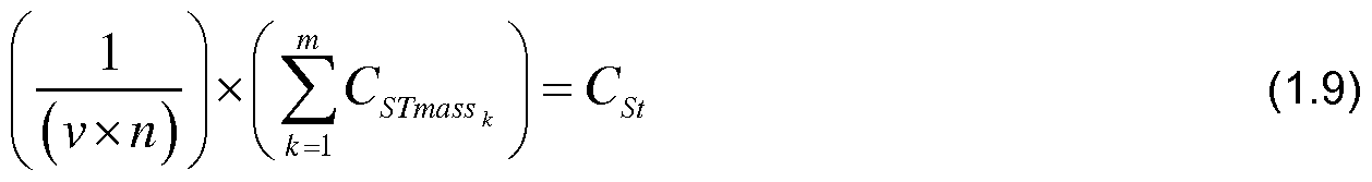
- Eqs. 1 .9 to 1.13 and Fig. 5C illustrate the determination of average or mean sample carbon content, its variance and standard error (normalised to the predetermined or standard mass) across the three selected locations in each stratum (core ID's 1 e, 1f and 1g in Stratum 1 and core ID's 2k, 2a and 2i in Stratum 2).
- Eqs.1.15 to 1.20 and Fig.5D illustrate the determination of combining sample carbon content from all strata to determine the total carbon content (including the average, variance, standard error, confidence intervals, such as a 95% confidence interval, and minimum detectable
- Eqs. 1.21 to 1.24 define the change in total carbon content (including the average, variance, standard error, confidence intervals, such as a 95% confidence interval) between time t 1 and time t 2 ..
- Composites within this method require bulking of equal amounts of OD soil mass per layer.
- estimates of average total carbon content and its variance can be manipulated either deliberately or through unintended preference (i.e. combining similar textured or
- AD soil - (AD soil x 0) OD soil (2.2)
- Fig. 6B and Eq. 2.8 illustrate a linear fit interpolation to obtain C mass to the standard mass.
- the sample carbon content of the composite is determined to be 10.22 kg m "2 .
- V(C Sl ) x St a 2 V(C conlenl ) (2.14)
- Eqs. 2.15 to 2.21 and Fig. 6D illustrate the process of combining sample carbon content to obtain total carbon content (including variance, standard error, a confidence interval such as a 95% confidence interval) in the unit of land.
- FC content (2.15)
- Eqs.2.22 to 2.25 define the change in total carbon content (including the average, variance, standard error, confidence intervals, such as a 95% confidence interval) between time f, and time t 2 ..
- FC content tl -FC content t2 AFC storage (2.22)
- FCcontent FCcontent 1 2) ⁇ F ⁇ S ora g e ⁇ (2.23)
- volumetric or spatial coordinate approach utilising a standard or predetermined soil
- Fig. 7A shows the sample carbon content at one of the selected locations (with core ID "2i") of each of the three layers as well as processed data including cumulative carbon (C) density as a function of depth for a single core is described in Eqs. 3.1 - 3.9.
- AD soil - (AD soU x 0)
- Fig. 7B depicts a linear fit approach to interpolation to obtain C density to the predetermined or standard depth as described in Eq. 3.10. Approaches such as spline fitting may also be
- V(C Sl ) x St V(C conlenl ) (3.15)
- Eq. 3.16 to 3.22 and Fig. 7D illustrate the combining of the sample carbon content from all strata to determine the total carbon content (including the average, variance, standard error, confidence intervals, such as a 95% confidence interval, and minimum detectable difference) in the unit of land.
- Eqs. 3.23 to 3.26 define the change in total carbon content (including the average, variance, standard error, confidence intervals, such as a 95% confidence interval between time t 1 and time t 2 ..
- V (FC contentti ) + V (FC contenti2 ) - 2pJv(FC contentii ) v(FC contenti2 ) V(AFC storage ) (3.24)
- volumetric or spatial coordinate approach utilising a predetermined or standard depth of
- Fig. 8A shows the sample carbon content of a composite of two cores (with core ID's "2a” and “2i") as well as processed data including cumulative carbon (C) density as a function of depth for a composite of two cores and is described in Eqs. 4.1 to 4.8.
- AD oil - (AD oil x 0) OD, (4.2)
- V(C St )xSt a 2 V(C content ) (4.14)
- Eqs.4.15 to 4.21 and Fig.8C illustrate the process of combining sample carbon content to obtain obtain total carbon content (including variance, standard error, a confidence interval such as a 95% confidence interval as well as minimum detectable difference) in the unit of
- Eq. 4.22 to 4.25 define the change in total carbon content (including the average, variance, standard error, confidence intervals, such as a 95% confidence interval, and minimum
- FC content ;1 -FC content t 2 AFC storage (4.22)
- V (FC contentii ) + V (FC contenti2 ) - 2p ⁇ v(FC contentti ) ⁇ v(FC contentt2 ) V(AFC storage ) (4.23)
- a confidence interval (or other statistical measures such as variance) of the soil carbon may be determined so that the uncertainty in the soil carbon quantification results may be specified.
- the compactness of the soil does not affect the soil carbon quantification results.
- the method does not impede nor prescribe nor penalise changes in land use; does not impede 'real' reductions in fossil carbon emissions (due to temporary crediting for SOC).
- the method provides an ongoing (and validated) revenue stream for landholders increasing the likelihood of SOC perpetuation.
- n cores were taken from the stratum, which were used to make m composites ( m > 1 ).
- n k be the number of cores in composite k, making a volume of x k m 3 , with a measured carbon content of ⁇ 3 ⁇ 4 kg.
- the volume of a composite equals its number of cores times the standard core volume (v):
- x k n k ⁇ v .
- X [jC j ... x k ... jc m ]' : the m x l design-matrix with composite volumes, ⁇ : the mean carbon density of the stratum, e: the vector of random errors.
- WLS estimate of ⁇ : ⁇ (X'V “1 X) "1 X'V “1 c
- V "1 is the diagonal matrix of weights, with 1/n-i , Mn m on the diagonal, because the sampling variance of the carbon content of a composite is proportional to the number of cores.
- V(SOC farm ) ⁇ a h 2 V(0 h )
- SOC is the total SOC storage on the farm
- H is the number of strata
- a h is the relative area squared of each stratum.
- a time-weighted measure of SOC storage sequestered
- V ⁇ SOC arm V ⁇ SOC% m ) + V ⁇ SOC sequestered )
Landscapes
- Engineering & Computer Science (AREA)
- Life Sciences & Earth Sciences (AREA)
- Chemical & Material Sciences (AREA)
- Physics & Mathematics (AREA)
- Theoretical Computer Science (AREA)
- Business, Economics & Management (AREA)
- Health & Medical Sciences (AREA)
- General Physics & Mathematics (AREA)
- Bioinformatics & Computational Biology (AREA)
- Human Resources & Organizations (AREA)
- Entrepreneurship & Innovation (AREA)
- Economics (AREA)
- Strategic Management (AREA)
- Computing Systems (AREA)
- Bioinformatics & Cheminformatics (AREA)
- Biochemistry (AREA)
- Medicinal Chemistry (AREA)
- Analytical Chemistry (AREA)
- Food Science & Technology (AREA)
- General Health & Medical Sciences (AREA)
- Remote Sensing (AREA)
- Immunology (AREA)
- Pathology (AREA)
- Geology (AREA)
- Environmental & Geological Engineering (AREA)
- General Life Sciences & Earth Sciences (AREA)
- Educational Administration (AREA)
- Development Economics (AREA)
- Game Theory and Decision Science (AREA)
- Crystallography & Structural Chemistry (AREA)
- Spectroscopy & Molecular Physics (AREA)
- Marketing (AREA)
- Operations Research (AREA)
- Quality & Reliability (AREA)
- Tourism & Hospitality (AREA)
- General Business, Economics & Management (AREA)
- Sampling And Sample Adjustment (AREA)
- Investigating Or Analysing Materials By Optical Means (AREA)
- Investigating Or Analyzing Non-Biological Materials By The Use Of Chemical Means (AREA)
Abstract
Description


Claims
Priority Applications (10)
| Application Number | Priority Date | Filing Date | Title |
|---|---|---|---|
| US13/701,786 US11657903B2 (en) | 2010-06-04 | 2011-06-06 | Method of quantifying soil carbon |
| ES11788990.7T ES2665046T3 (en) | 2010-06-04 | 2011-06-06 | A method to quantify soil carbon |
| DK11788990.7T DK2577293T3 (en) | 2010-06-04 | 2011-06-06 | A PROCEDURE TO QUANTIFY CARBON IN EARTH |
| AU2011261179A AU2011261179B2 (en) | 2010-06-04 | 2011-06-06 | A method of quantifying soil carbon |
| PL11788990T PL2577293T3 (en) | 2010-06-04 | 2011-06-06 | A method of quantifying soil carbon |
| EP11788990.7A EP2577293B1 (en) | 2010-06-04 | 2011-06-06 | A method of quantifying soil carbon |
| CA2801379A CA2801379C (en) | 2010-06-04 | 2011-06-06 | A method of quantifying soil carbon |
| ZA2012/09641A ZA201209641B (en) | 2010-06-04 | 2012-12-19 | A method of quantifying soil carbon |
| US17/342,195 US11670401B2 (en) | 2010-06-04 | 2021-06-08 | Method of quantifying soil carbon |
| US18/139,615 US12020780B2 (en) | 2010-06-04 | 2023-04-26 | Method of quantifying soil carbon |
Applications Claiming Priority (2)
| Application Number | Priority Date | Filing Date | Title |
|---|---|---|---|
| AU2010902472A AU2010902472A0 (en) | 2010-06-04 | A method of quantifying soil carbon | |
| AU2010902472 | 2010-06-04 |
Related Child Applications (2)
| Application Number | Title | Priority Date | Filing Date |
|---|---|---|---|
| US13/701,786 A-371-Of-International US11657903B2 (en) | 2010-06-04 | 2011-06-06 | Method of quantifying soil carbon |
| US17/342,195 Continuation US11670401B2 (en) | 2010-06-04 | 2021-06-08 | Method of quantifying soil carbon |
Publications (1)
| Publication Number | Publication Date |
|---|---|
| WO2011150472A1 true WO2011150472A1 (en) | 2011-12-08 |
Family
ID=45066069
Family Applications (1)
| Application Number | Title | Priority Date | Filing Date |
|---|---|---|---|
| PCT/AU2011/000702 WO2011150472A1 (en) | 2010-06-04 | 2011-06-06 | A method of quantifying soil carbon |
Country Status (10)
| Country | Link |
|---|---|
| US (3) | US11657903B2 (en) |
| EP (1) | EP2577293B1 (en) |
| AU (1) | AU2011261179B2 (en) |
| CA (1) | CA2801379C (en) |
| DK (1) | DK2577293T3 (en) |
| ES (1) | ES2665046T3 (en) |
| HU (1) | HUE038532T2 (en) |
| PL (1) | PL2577293T3 (en) |
| WO (1) | WO2011150472A1 (en) |
| ZA (1) | ZA201209641B (en) |
Cited By (10)
| Publication number | Priority date | Publication date | Assignee | Title |
|---|---|---|---|---|
| CN102590007A (en) * | 2012-02-24 | 2012-07-18 | 中国科学院亚热带农业生态研究所 | Method for estimating net carbon reserve in surface soil of rice field |
| CN102798607A (en) * | 2012-08-13 | 2012-11-28 | 浙江大学 | Method for estimating soil organic carbon content by using mid-infrared spectrum technology |
| CN104849427A (en) * | 2015-04-27 | 2015-08-19 | 中国石油天然气股份有限公司 | Method for measuring organic carbon content of shale bed series |
| CN110276160A (en) * | 2019-07-02 | 2019-09-24 | 四川农业大学 | A kind of region of no relief soil organic matter three-dimensional spatial distribution analogy method |
| CN111488910A (en) * | 2020-03-12 | 2020-08-04 | 河南城建学院 | Farmland soil organic carbon space-time data acquisition method |
| US11499956B2 (en) * | 2019-06-28 | 2022-11-15 | Institute Of Geochemistry, Chinese Academy Of Sciences | Method for estimating soil organic carbon in karst area |
| CN115659654A (en) * | 2022-10-28 | 2023-01-31 | 四川大学 | Calculation method for researching river entering supply amount of organic baits in river beach in river flood period |
| CN116754738A (en) * | 2023-08-16 | 2023-09-15 | 哈尔滨工业大学(深圳)(哈尔滨工业大学深圳科技创新研究院) | Water area carbon dynamic monitoring method, equipment, robot and computer storage medium |
| WO2024006146A1 (en) * | 2022-06-30 | 2024-01-04 | Nutrien Ag Solutions, Inc. | Methods for measuring organic carbon content of argicultural soils |
| CN118052477A (en) * | 2024-04-16 | 2024-05-17 | 菏泽市国土综合整治服务中心 | Method and system for evaluating ecological restoration effect of comprehensive land space restoration area |
Families Citing this family (15)
| Publication number | Priority date | Publication date | Assignee | Title |
|---|---|---|---|---|
| US9952060B2 (en) * | 2012-10-16 | 2018-04-24 | Lyonnaise Des Eaux France | Method for the real-time estimation of the total consumption of a fluid distributed to users, and a distribution network implementing said method |
| US9524510B2 (en) | 2013-10-02 | 2016-12-20 | Turn Inc. | Adaptive fuzzy fallback stratified sampling for fast reporting and forecasting |
| US11041841B2 (en) * | 2015-10-22 | 2021-06-22 | Colorado State University Research Foundation | Soil moisture downscaling using topography, soil, and vegetation data |
| CA3041142C (en) | 2016-12-16 | 2021-06-15 | Farmers Edge Inc. | Classification of soil texture and content by near-infrared spectroscopy |
| US11263707B2 (en) | 2017-08-08 | 2022-03-01 | Indigo Ag, Inc. | Machine learning in agricultural planting, growing, and harvesting contexts |
| CN107993157B (en) * | 2017-11-13 | 2021-01-22 | 中国水利水电科学研究院 | Method for identifying influence of grassland vegetation root system on slope runoff production |
| US20190325466A1 (en) | 2018-04-24 | 2019-10-24 | Indigo Ag, Inc. | Satellite-based agricultural modeling |
| US11367093B2 (en) | 2018-04-24 | 2022-06-21 | Indigo Ag, Inc. | Satellite-based agricultural modeling |
| CN112683939A (en) * | 2020-12-15 | 2021-04-20 | 中国科学院地理科学与资源研究所 | Method for researching formation process of inorganic carbon in saline-alkali soil under action of microorganisms |
| CN113092717B (en) * | 2021-03-24 | 2023-09-29 | 自然资源部第三海洋研究所 | Method for investigating carbon reserves of vegetation covered coastal wetland soil |
| EP4327093A1 (en) | 2021-04-20 | 2024-02-28 | Indigo AG, Inc. | Addressing incomplete soil sample data in soil enrichment protocol projects |
| WO2023034118A1 (en) | 2021-08-30 | 2023-03-09 | Indigo Ag, Inc. | Systems for management of location-aware market data |
| CA3230474A1 (en) | 2021-08-31 | 2023-03-09 | Eleanor Elizabeth Campbell | Systems and methods for ecosystem credit recommendations |
| WO2024006488A1 (en) * | 2022-07-01 | 2024-01-04 | Soil In Formation, Pbc | Total soil carbon sensing system |
| WO2024020418A1 (en) * | 2022-07-18 | 2024-01-25 | Carbon Metrics Global | Carbon offset platform |
Family Cites Families (9)
| Publication number | Priority date | Publication date | Assignee | Title |
|---|---|---|---|---|
| US3508877A (en) * | 1967-11-13 | 1970-04-28 | Shell Oil Co | Process for measuring the live carbon content of organic samples |
| US4686364A (en) * | 1985-07-19 | 1987-08-11 | Schlumberger Technology Corporation | In situ determination of total carbon and evaluation of source rock therefrom |
| US5488876A (en) * | 1992-09-30 | 1996-02-06 | Precision Sampling Incorporated | Soil sampling system with sample container ridgidly coupled to drive casing |
| US7457758B2 (en) | 2003-02-10 | 2008-11-25 | South Dakota School Of Mines And Technology | Method and apparatus for generating standardized carbon emission reduction credits |
| NZ524645A (en) * | 2003-03-07 | 2005-10-28 | Agres Ltd | A method for the preparation of soil samples |
| US9034594B2 (en) * | 2007-04-24 | 2015-05-19 | University Of Southern California | Methodology for verifying carbon storage in seawater |
| US8111924B2 (en) * | 2007-12-20 | 2012-02-07 | 2245060 Ontario Ltd. | Remote sensing and probabilistic sampling based method for determining the carbon dioxide volume of a forest |
| EP2460123A4 (en) * | 2009-07-31 | 2013-03-27 | Carbon Auditors Inc | Greenhouse gas grid and tracking system |
| US20110076356A1 (en) * | 2009-09-29 | 2011-03-31 | Ziemer Cherie J | Novel Fibro-Biotic Bacterium Isolate |
-
2011
- 2011-06-06 CA CA2801379A patent/CA2801379C/en active Active
- 2011-06-06 PL PL11788990T patent/PL2577293T3/en unknown
- 2011-06-06 WO PCT/AU2011/000702 patent/WO2011150472A1/en active Application Filing
- 2011-06-06 US US13/701,786 patent/US11657903B2/en active Active
- 2011-06-06 DK DK11788990.7T patent/DK2577293T3/en active
- 2011-06-06 EP EP11788990.7A patent/EP2577293B1/en active Active
- 2011-06-06 AU AU2011261179A patent/AU2011261179B2/en active Active
- 2011-06-06 ES ES11788990.7T patent/ES2665046T3/en active Active
- 2011-06-06 HU HUE11788990A patent/HUE038532T2/en unknown
-
2012
- 2012-12-19 ZA ZA2012/09641A patent/ZA201209641B/en unknown
-
2021
- 2021-06-08 US US17/342,195 patent/US11670401B2/en active Active
-
2023
- 2023-04-26 US US18/139,615 patent/US12020780B2/en active Active
Non-Patent Citations (9)
| Title |
|---|
| AUSTRALIAN JOURNAL OF SOIL RESEARCH, vol. 48, 6 May 2010 (2010-05-06), pages 248 - 257 |
| B.P. MALONE ET AL.: "Mapping continuous depth functions of soil carbon storage and available water capacity", GEODERMA, vol. 154, 2009, pages 138 - 152, XP026771497 * |
| E.G. JOBBAGY ET AL.: "THE VERTICAL DISTRIBUTION OF SOIL ORGANIC CARBON AND ITS RELATION TO CLIMATE AND VEGETATION", ECOLOGICAL APPLICATIONS, vol. 10, no. 2, 2000, pages 423 - 436, XP008169637 * |
| G.C. SIMBAHAN ET AL.: "Sampling optimization based on secondary information and its utilization in soil carbon mapping", GEODERMA, vol. 133, 2006, pages 345 - 362, XP028066991 * |
| GEODERMA, vol. 132, no. 3-4, 15 September 2005 (2005-09-15), pages 471 - 489 |
| GEODERMA, vol. 133, no. 3-4, 15 September 2005 (2005-09-15), pages 345 - 262 |
| M. MIKLOS ET AL.: "Mapping and comparing the distribution of soil carbon under cropping and grazing management practices in Narrabri north-west New South Wales", AUSTRALIAN JOURNAL OF SOIL RESEARCH, vol. 48, 6 May 2010 (2010-05-06), pages 248 - 257, XP008169636 * |
| S.B. BIRD ET AL.: "Spatial heterogeneity of aggregate stability and soil carbon in semiarid rangeland", ENVIRONMENTAL POLLUTION, vol. 116, 2002, pages 445 - 455, XP055118121 * |
| T. DALENIUS ET AL.: "MINIMUM VARIANCE STRATIFICATION", JOURNAL OF THE AMERICAN STATISTICAL ASSOCIATION, vol. 54, 1959, pages 88 - 101, XP008169579 * |
Cited By (13)
| Publication number | Priority date | Publication date | Assignee | Title |
|---|---|---|---|---|
| CN102590007A (en) * | 2012-02-24 | 2012-07-18 | 中国科学院亚热带农业生态研究所 | Method for estimating net carbon reserve in surface soil of rice field |
| CN102590007B (en) * | 2012-02-24 | 2013-06-19 | 中国科学院亚热带农业生态研究所 | Method for estimating net carbon reserve in surface soil of rice field |
| CN102798607A (en) * | 2012-08-13 | 2012-11-28 | 浙江大学 | Method for estimating soil organic carbon content by using mid-infrared spectrum technology |
| CN104849427A (en) * | 2015-04-27 | 2015-08-19 | 中国石油天然气股份有限公司 | Method for measuring organic carbon content of shale bed series |
| US11499956B2 (en) * | 2019-06-28 | 2022-11-15 | Institute Of Geochemistry, Chinese Academy Of Sciences | Method for estimating soil organic carbon in karst area |
| CN110276160A (en) * | 2019-07-02 | 2019-09-24 | 四川农业大学 | A kind of region of no relief soil organic matter three-dimensional spatial distribution analogy method |
| CN111488910A (en) * | 2020-03-12 | 2020-08-04 | 河南城建学院 | Farmland soil organic carbon space-time data acquisition method |
| CN111488910B (en) * | 2020-03-12 | 2023-04-07 | 河南城建学院 | Farmland soil organic carbon space-time data acquisition method |
| WO2024006146A1 (en) * | 2022-06-30 | 2024-01-04 | Nutrien Ag Solutions, Inc. | Methods for measuring organic carbon content of argicultural soils |
| CN115659654A (en) * | 2022-10-28 | 2023-01-31 | 四川大学 | Calculation method for researching river entering supply amount of organic baits in river beach in river flood period |
| CN116754738A (en) * | 2023-08-16 | 2023-09-15 | 哈尔滨工业大学(深圳)(哈尔滨工业大学深圳科技创新研究院) | Water area carbon dynamic monitoring method, equipment, robot and computer storage medium |
| CN116754738B (en) * | 2023-08-16 | 2023-11-28 | 哈尔滨工业大学(深圳)(哈尔滨工业大学深圳科技创新研究院) | Water area carbon dynamic monitoring method, equipment, robot and computer storage medium |
| CN118052477A (en) * | 2024-04-16 | 2024-05-17 | 菏泽市国土综合整治服务中心 | Method and system for evaluating ecological restoration effect of comprehensive land space restoration area |
Also Published As
| Publication number | Publication date |
|---|---|
| CA2801379C (en) | 2019-07-02 |
| ES2665046T3 (en) | 2018-04-24 |
| AU2011261179A1 (en) | 2013-01-10 |
| AU2011261179B2 (en) | 2015-01-22 |
| PL2577293T3 (en) | 2018-07-31 |
| DK2577293T3 (en) | 2018-04-16 |
| HUE038532T2 (en) | 2018-10-29 |
| CA2801379A1 (en) | 2011-12-08 |
| EP2577293A1 (en) | 2013-04-10 |
| US11657903B2 (en) | 2023-05-23 |
| US20130197814A1 (en) | 2013-08-01 |
| US11670401B2 (en) | 2023-06-06 |
| US12020780B2 (en) | 2024-06-25 |
| EP2577293B1 (en) | 2018-01-10 |
| EP2577293A4 (en) | 2016-11-30 |
| ZA201209641B (en) | 2015-07-29 |
| US20210304850A1 (en) | 2021-09-30 |
| US20230260599A1 (en) | 2023-08-17 |
Similar Documents
| Publication | Publication Date | Title |
|---|---|---|
| US12020780B2 (en) | Method of quantifying soil carbon | |
| Sreenivas et al. | Digital mapping of soil organic and inorganic carbon status in India | |
| Malone et al. | Mapping continuous depth functions of soil carbon storage and available water capacity | |
| Tabor et al. | Globally downscaled climate projections for assessing the conservation impacts of climate change | |
| Uniyal et al. | Parameter identification and uncertainty analysis for simulating streamflow in a river basin of Eastern India | |
| Castellarin et al. | Prediction of flow duration curves in ungauged basins | |
| Taylor et al. | A review of forest succession models and their suitability for forest management planning | |
| Pugliese et al. | Regional flow duration curves: Geostatistical techniques versus multivariate regression | |
| Veihe et al. | Sensitivity analysis of EUROSEM using Monte Carlo simulation I: hydrological, soil and vegetation parameters | |
| Rosolem et al. | Towards a comprehensive approach to parameter estimation in land surface parameterization schemes | |
| Pomeroy et al. | Putting prediction in ungauged basins into practice | |
| Nassery et al. | A proposed modelling towards the potential impacts of climate change on a semi-arid, small-scaled aquifer: a case study of Iran | |
| Giardina et al. | Diagnosing evapotranspiration responses to water deficit across biomes using deep learning | |
| Usman et al. | Assessment of inter-seasonal, inter-annual and intra-annual variability in snow and rainfall recharged fresh water discharge under IPCC AR5 based climate change scenarios: a case study of Soan river basin, Potowar region, Pakistan | |
| Naha et al. | Quantifying the impact of land cover changes on hydrological responses in India | |
| Babister et al. | The Australian rainfall and runoff datahub | |
| Tola et al. | A modeling approach for evaluating and predicting the impacts of land use land cover changes on groundwater recharge in Walga Watershed, Upper Omo Basin, Central Ethiopia | |
| Westra et al. | Impacts of Climate Change on Surface Water in the Onkaparinga Catchment–Volume 3: Impact of Climate Change on Runoff in the Onkaparinga Catchment | |
| Dey et al. | Evaluation of uncertainty in stream flow prediction using Monte Carlo simulation for watershed-scale hydrological modeling | |
| Baninajar et al. | Multi-criteria calibration and uncertainty analysis of SWAT model: integrating in-situ discharge and remotely sensed ET in the Ilam dam basin, and direct calibration in ungauged basins | |
| Dey | Sensitivity and uncertainty analysis in hydrological modeling: A case study of South Chickamauga Creek watershed using BASINS/HSPF | |
| Gwapedza et al. | International Soil and Water Conservation Research | |
| Sellart Aldomà | Research about required temporal resolution of hydrological input data in hydrological simulation | |
| Laimighofer et al. | Statistical learning and topkriging improve spatio-temporal low-flow estimation | |
| Habib | Uncertainty Estimation Due to Climate Change for Improving Water Resources Management in the Nueces River Basin, Texas |
Legal Events
| Date | Code | Title | Description |
|---|---|---|---|
| 121 | Ep: the epo has been informed by wipo that ep was designated in this application |
Ref document number: 11788990 Country of ref document: EP Kind code of ref document: A1 |
|
| DPE1 | Request for preliminary examination filed after expiration of 19th month from priority date (pct application filed from 20040101) | ||
| ENP | Entry into the national phase |
Ref document number: 2801379 Country of ref document: CA |
|
| NENP | Non-entry into the national phase |
Ref country code: DE |
|
| WWE | Wipo information: entry into national phase |
Ref document number: 2011788990 Country of ref document: EP |
|
| ENP | Entry into the national phase |
Ref document number: 2011261179 Country of ref document: AU Date of ref document: 20110606 Kind code of ref document: A |
|
| WWE | Wipo information: entry into national phase |
Ref document number: 13701786 Country of ref document: US |