KR101240629B1 - Detecting and localization method of unknown signal using aircraft with ads-b system - Google Patents
Detecting and localization method of unknown signal using aircraft with ads-b system Download PDFInfo
- Publication number
- KR101240629B1 KR101240629B1 KR1020120137566A KR20120137566A KR101240629B1 KR 101240629 B1 KR101240629 B1 KR 101240629B1 KR 1020120137566 A KR1020120137566 A KR 1020120137566A KR 20120137566 A KR20120137566 A KR 20120137566A KR 101240629 B1 KR101240629 B1 KR 101240629B1
- Authority
- KR
- South Korea
- Prior art keywords
- unknown signal
- unknown
- signal
- ads
- aircraft
- Prior art date
Links
Images


Classifications
-
- G—PHYSICS
- G01—MEASURING; TESTING
- G01S—RADIO DIRECTION-FINDING; RADIO NAVIGATION; DETERMINING DISTANCE OR VELOCITY BY USE OF RADIO WAVES; LOCATING OR PRESENCE-DETECTING BY USE OF THE REFLECTION OR RERADIATION OF RADIO WAVES; ANALOGOUS ARRANGEMENTS USING OTHER WAVES
- G01S19/00—Satellite radio beacon positioning systems; Determining position, velocity or attitude using signals transmitted by such systems
- G01S19/38—Determining a navigation solution using signals transmitted by a satellite radio beacon positioning system
- G01S19/39—Determining a navigation solution using signals transmitted by a satellite radio beacon positioning system the satellite radio beacon positioning system transmitting time-stamped messages, e.g. GPS [Global Positioning System], GLONASS [Global Orbiting Navigation Satellite System] or GALILEO
- G01S19/42—Determining position
- G01S19/45—Determining position by combining measurements of signals from the satellite radio beacon positioning system with a supplementary measurement
- G01S19/46—Determining position by combining measurements of signals from the satellite radio beacon positioning system with a supplementary measurement the supplementary measurement being of a radio-wave signal type
-
- G—PHYSICS
- G01—MEASURING; TESTING
- G01S—RADIO DIRECTION-FINDING; RADIO NAVIGATION; DETERMINING DISTANCE OR VELOCITY BY USE OF RADIO WAVES; LOCATING OR PRESENCE-DETECTING BY USE OF THE REFLECTION OR RERADIATION OF RADIO WAVES; ANALOGOUS ARRANGEMENTS USING OTHER WAVES
- G01S19/00—Satellite radio beacon positioning systems; Determining position, velocity or attitude using signals transmitted by such systems
- G01S19/01—Satellite radio beacon positioning systems transmitting time-stamped messages, e.g. GPS [Global Positioning System], GLONASS [Global Orbiting Navigation Satellite System] or GALILEO
- G01S19/13—Receivers
- G01S19/21—Interference related issues ; Issues related to cross-correlation, spoofing or other methods of denial of service
-
- G—PHYSICS
- G01—MEASURING; TESTING
- G01S—RADIO DIRECTION-FINDING; RADIO NAVIGATION; DETERMINING DISTANCE OR VELOCITY BY USE OF RADIO WAVES; LOCATING OR PRESENCE-DETECTING BY USE OF THE REFLECTION OR RERADIATION OF RADIO WAVES; ANALOGOUS ARRANGEMENTS USING OTHER WAVES
- G01S19/00—Satellite radio beacon positioning systems; Determining position, velocity or attitude using signals transmitted by such systems
- G01S19/01—Satellite radio beacon positioning systems transmitting time-stamped messages, e.g. GPS [Global Positioning System], GLONASS [Global Orbiting Navigation Satellite System] or GALILEO
- G01S19/03—Cooperating elements; Interaction or communication between different cooperating elements or between cooperating elements and receivers
-
- G—PHYSICS
- G01—MEASURING; TESTING
- G01S—RADIO DIRECTION-FINDING; RADIO NAVIGATION; DETERMINING DISTANCE OR VELOCITY BY USE OF RADIO WAVES; LOCATING OR PRESENCE-DETECTING BY USE OF THE REFLECTION OR RERADIATION OF RADIO WAVES; ANALOGOUS ARRANGEMENTS USING OTHER WAVES
- G01S5/00—Position-fixing by co-ordinating two or more direction or position line determinations; Position-fixing by co-ordinating two or more distance determinations
- G01S5/0009—Transmission of position information to remote stations
- G01S5/0018—Transmission from mobile station to base station
- G01S5/0036—Transmission from mobile station to base station of measured values, i.e. measurement on mobile and position calculation on base station
-
- G—PHYSICS
- G01—MEASURING; TESTING
- G01S—RADIO DIRECTION-FINDING; RADIO NAVIGATION; DETERMINING DISTANCE OR VELOCITY BY USE OF RADIO WAVES; LOCATING OR PRESENCE-DETECTING BY USE OF THE REFLECTION OR RERADIATION OF RADIO WAVES; ANALOGOUS ARRANGEMENTS USING OTHER WAVES
- G01S5/00—Position-fixing by co-ordinating two or more direction or position line determinations; Position-fixing by co-ordinating two or more distance determinations
- G01S5/0009—Transmission of position information to remote stations
- G01S5/0072—Transmission between mobile stations, e.g. anti-collision systems
-
- G—PHYSICS
- G01—MEASURING; TESTING
- G01S—RADIO DIRECTION-FINDING; RADIO NAVIGATION; DETERMINING DISTANCE OR VELOCITY BY USE OF RADIO WAVES; LOCATING OR PRESENCE-DETECTING BY USE OF THE REFLECTION OR RERADIATION OF RADIO WAVES; ANALOGOUS ARRANGEMENTS USING OTHER WAVES
- G01S5/00—Position-fixing by co-ordinating two or more direction or position line determinations; Position-fixing by co-ordinating two or more distance determinations
- G01S5/01—Determining conditions which influence positioning, e.g. radio environment, state of motion or energy consumption
- G01S5/011—Identifying the radio environment
-
- G—PHYSICS
- G01—MEASURING; TESTING
- G01S—RADIO DIRECTION-FINDING; RADIO NAVIGATION; DETERMINING DISTANCE OR VELOCITY BY USE OF RADIO WAVES; LOCATING OR PRESENCE-DETECTING BY USE OF THE REFLECTION OR RERADIATION OF RADIO WAVES; ANALOGOUS ARRANGEMENTS USING OTHER WAVES
- G01S5/00—Position-fixing by co-ordinating two or more direction or position line determinations; Position-fixing by co-ordinating two or more distance determinations
- G01S5/02—Position-fixing by co-ordinating two or more direction or position line determinations; Position-fixing by co-ordinating two or more distance determinations using radio waves
- G01S5/0205—Details
- G01S5/0215—Interference
-
- G—PHYSICS
- G01—MEASURING; TESTING
- G01S—RADIO DIRECTION-FINDING; RADIO NAVIGATION; DETERMINING DISTANCE OR VELOCITY BY USE OF RADIO WAVES; LOCATING OR PRESENCE-DETECTING BY USE OF THE REFLECTION OR RERADIATION OF RADIO WAVES; ANALOGOUS ARRANGEMENTS USING OTHER WAVES
- G01S5/00—Position-fixing by co-ordinating two or more direction or position line determinations; Position-fixing by co-ordinating two or more distance determinations
- G01S5/02—Position-fixing by co-ordinating two or more direction or position line determinations; Position-fixing by co-ordinating two or more distance determinations using radio waves
- G01S5/04—Position of source determined by a plurality of spaced direction-finders
-
- G—PHYSICS
- G01—MEASURING; TESTING
- G01S—RADIO DIRECTION-FINDING; RADIO NAVIGATION; DETERMINING DISTANCE OR VELOCITY BY USE OF RADIO WAVES; LOCATING OR PRESENCE-DETECTING BY USE OF THE REFLECTION OR RERADIATION OF RADIO WAVES; ANALOGOUS ARRANGEMENTS USING OTHER WAVES
- G01S5/00—Position-fixing by co-ordinating two or more direction or position line determinations; Position-fixing by co-ordinating two or more distance determinations
- G01S5/02—Position-fixing by co-ordinating two or more direction or position line determinations; Position-fixing by co-ordinating two or more distance determinations using radio waves
- G01S5/06—Position of source determined by co-ordinating a plurality of position lines defined by path-difference measurements
Landscapes
- Engineering & Computer Science (AREA)
- Radar, Positioning & Navigation (AREA)
- Remote Sensing (AREA)
- Physics & Mathematics (AREA)
- General Physics & Mathematics (AREA)
- Computer Networks & Wireless Communication (AREA)
- Position Fixing By Use Of Radio Waves (AREA)
- Traffic Control Systems (AREA)
Abstract
Description
본 발명은 ADS-B 시스템이 탑재된 항공기를 이용하여 미지신호를 검출하고 미지신호 발생원의 위치를 추정하는 방법에 관한 것으로, 좀 더 상세하게는 ADS-B 시스템이 탑재된 항공기에서 항공기의 교통관제 시스템에 위협을 주는 미지신호를 신속하게 검출하고, 이를 바탕으로 미지신호의 발생원의 위치를 추정할 수 있도록 하는 ADS-B 시스템이 탑재된 항공기를 이용한 미지신호 검출 및 발생원 위치 추정방법에 관한 것이다.
The present invention relates to a method for detecting an unknown signal and estimating a location of an unknown signal source using an aircraft equipped with an ADS-B system. More particularly, the present invention relates to traffic control of an aircraft in an aircraft equipped with an ADS-B system. The present invention relates to an unknown signal detection and source location estimation method using an aircraft equipped with an ADS-B system capable of quickly detecting an unknown signal threatening a system and estimating a location of an unknown source.
위성항법시스템(GNSS)이란 항법위성 네트워크를 이용하여 지상이나 공중에 있는 목표물의 위치를 정확히 추적해내는 시스템으로서, 이러한 위성항법시스템은 복수개의 항법위성과, 이들 항법위성으로부터 발신된 신호를 수신하는 수신기, 지상의 감시국과 시스템 보전성 감시체계로 이루어져, 항법위성으로부터 발신된 신호를 수신기에서 받아 항법위성으로부터의 거리를 구하여 수신기의 위치를 결정하는 방식으로서 사용자의 지리적 위치에 관계없이 수신기를 구비하면 신호를 이용할 수 있고, 수신기가 소형이며, 실시간으로 출력을 얻을 수 있어 이동 중에도 측위를 할 수 있다는 장점 때문에 항공기, 선박, 차량의 자동항법시스템 등에 널리 사용되고 있다.The satellite navigation system (GNSS) is a system that accurately tracks the position of a target on the ground or in the air using a navigation satellite network. The satellite navigation system receives a plurality of navigation satellites and signals from these navigation satellites. It consists of a receiver, a ground monitoring station and a system integrity monitoring system, and receives a signal from a navigation satellite at a receiver to find the distance from the navigation satellite to determine the location of the receiver. It is widely used in aircrafts, ships, and auto navigation systems because of the advantage that the receiver is compact and the output can be obtained in real time and can be positioned on the move.
최근 전 세계적으로 항공수요가 급속히 증가함에 따라 관제업무량이 폭주하면서 안전성과 신속성ㆍ효율성 문제가 제기되기 시작했고, 지금까지 지상에서만 실시해오고 있는 항공교통관제(ATM) 시스템으로는 한계가 있기 때문에 공대지(空對地), 공대공(空對空)의 상호 보완적인 역할을 할 수 있도록 함으로써 이를 보완하도록 개발된 것이 방송형 자동 종속감시(ADS-B, Automatic Dependent Surveillance -Broadcast) 시스템이다.Recently, due to the rapid increase in aviation demand all over the world, due to the surge in traffic control work, safety, promptness and efficiency problems have arisen, and there is a limit to the air traffic control (ATM) system that has been implemented only on the ground. The Automatic Dependent Surveillance-Broadcast (ADS-B) system was developed to compensate for this by allowing complementary roles of airspace and air-to-air.
방송형 자동 종속감시(ADS-B) 시스템이란, 관제사와 조종사가 항공기의 위치, 속도 등의 정보를 공유하는 상호 협조형 감시시스템으로서 국제민간항공기구(ICAO)는 ADS-B를 새로운 CNS/ATM(위성항행시스템)의 구상에 적합하고 저렴한 범용시스템으로 인정하여 항공기에의 탑재를 권장하고 있다.ADS-B is a coordinated surveillance system in which controllers and pilots share information such as aircraft position and speed, and the International Civil Aviation Organization (ICAO) has introduced ADS-B as a new CNS / ATM. It is recommended as a low-cost general purpose system suitable for the concept of (Satellite Navigation System) and recommended to be mounted on an aircraft.
ADS-B 시스템은 도 1 및 도 5에 도시된 바와 같이 항공교통관제국(ATC, Air Traffic Control)은 무선 접근 포인트, 항공기는 클라이언트로 작용하는 하나의 큰 무선 네트워크와 같이 이루어지고, 이때 항공기는 네트워크를 통해 자신의 위치를 보고하며, 아울러 지상시스템으로부터 교통상황과 다른 정보를 다시 수신하며, 지상시스템의 컴퓨터는 모든 정보를 취합하여 문제가 있는 경우 적시에 제어기에 제공하여 이를 경고하도록 하고, 이때 도 1에서 가장 높은 위치에 도시된 항법위성은 지상국 간의 통신을 연결하는 기능을 수행한다.As shown in Figs. 1 and 5, the ADS-B system consists of an air traffic control (ATC) as a wireless access point and an aircraft as one large wireless network serving as a client. It reports its location through the network and receives traffic and other information from the ground system again, and the ground system computer collects all the information and provides it to the controller in a timely manner if there is a problem. The navigation satellite shown at the highest position in FIG. 1 performs a function of connecting communication between ground stations.
이때 ADS-B 시스템은 각 항공기의 위치정보를 측정하기 위해 지금까지 사용되어온 레이더 기술을 이용하는 대신, 더욱 정확한 측위가 가능한 GNSS를 사용하여 측정한 다음, 지상시스템으로 전송하여 항공교통관제에 사용하는데, 이에 따라 미지신호 또는 의도적인 미지신호 등에 의해 GNSS 신호가 교란되거나 간섭이 발생되는 경우 항공기의 안전 운행이 위협받을 수 있으며, 특히 고출력의 미지신호가 운용되는 경우에는 이러한 신호가 영향을 미치는 지역이 광범위하여 다수의 항공기가 동시에 영향을 받아 안전 운행을 위협받을 수 있고, 그 결과 항공교통관제국에 문제가 발생될 우려가 있다.At this time, instead of using the radar technology used to measure the location information of each aircraft, the ADS-B system uses GNSS for more accurate positioning, and then transmits it to the ground system for air traffic control. As a result, when the GNSS signal is disturbed or interfered by an unknown signal or intentional unknown signal, the safe operation of the aircraft may be threatened, especially when a high power unknown signal is operated. As a result, multiple aircraft may be affected at the same time, threatening safe operation, and as a result, there may be a problem in the ATC.
이와 같이 미지신호가 존재하는 경우 지상에 분포되어 위치하는 수신기에 의해 수신된 신호를 이용하여 미지신호의 발생여부와 미지신호를 발생시키는 발생원의 위치 등을 추정할 수는 있지만, 지상의 분포된 수신기 중의 일부는 미지신호의 영향을 받지 않아 미지신호를 제대로 검출하지 못하는 경우가 많고, 이 경우 미지신호의 발생여부와 미지신호 발생원의 위치를 파악하기 어려우며, 더구나 지상의 수신기에 수신된 미지신호는 회절과 반사 등에 의해 왜곡될 수 있는데 이러한 왜곡된 미지신호를 분석하여 발생원의 위치를 추정하는 경우 그 정확성이 담보되지 못한다는 문제가 있다.
As such, if there is an unknown signal, it is possible to estimate whether the unknown signal is generated and the location of the source generating the unknown signal using the signals received by the receivers distributed and located on the ground. Some of them are not affected by the unknown signal, so it is difficult to detect the unknown signal properly.In this case, it is difficult to determine whether the unknown signal is generated and the location of the unknown signal source. Moreover, the unknown signal received by the receiver on the ground is diffracted. It may be distorted due to reflection and reflection, but when the location of the source is estimated by analyzing the distorted unknown signal, its accuracy is not guaranteed.
본 발명은 상기와 같은 지상의 수신기에 수신된 미지신호를 이용하여 미지신호와 미지신호 발생원의 위치를 추정하는 종래의 미지신호 추적 기술이 가지는 문제점을 해결하기 위해 안출된 것으로, 미지신호를 효과적으로 수신할 수 있고, 또한 왜곡되지 않은 미지신호를 수신하여 분석함으로써 더욱 신속하고도 정확하게 미지신호의 존재를 검출하고, 아울러 미지신호 발생원의 위치를 추정할 수 있도록 하는 미지신호 검출 및 발생원의 위치 추정방법을 제공하는 데에 그 목적이 있다.
The present invention has been made to solve the problem of the conventional unknown signal tracking technology for estimating the location of the unknown signal and the source of the unknown signal using the unknown signal received by the above-described receiver, effectively receiving the unknown signal And a method for detecting unknown signals and estimating positions of unknown sources, which can detect and detect the presence of unknown signals more quickly and accurately by receiving and analyzing the unknown signals that are not distorted. The purpose is to provide.
본 발명은 ADS-B 시스템이 장착되어 비행 중의 복수 대의 항공기에서 각각 항법위성과 미지신호 발생원으로부터 발신된 GNSS 신호와 미지신호를 수신하여 ADS-B 시스템을 통해 항공교통관제국에 송신하는 신호 획득단계와; 상기 신호 획득단계(S100)에 의해 복수 대의 항공기로부터 송신된 신호를 이용하여 항공교통관제국에서 TDOA 기법, TOA 기법, AOA 기법 중 어느 하나의 기법을 이용하여 상기 신호에 미지신호가 포함되어 있는지 여부를 검출하는 미지신호 검출단계와; 상기 미지신호 검출단계(S200)에 의해 상기 신호에 미지신호가 포함된 것으로 검출되는 경우 상기 TDOA 기법, TOA 기법, AOA 기법 중 어느 하나의 기법을 이용하여 미지신호 발생원의 위치를 추정하는 미지신호 발생원 위치 추정단계 및; 상기 미지신호 발생원 위치 추정단계에 의해 추정된 미지신호와 미지신호 발생원의 위치정보를 ADS-B 지상 장비로부터 FIS-B 또는 NOTAM를 통해 주변 항공기 및 지상의 항공교통관제국에 입력되도록 하는 미지신호 발생 정보 송출단계로 이루어지는 것을 특징으로 한다.The present invention is equipped with the ADS-B system is a signal acquisition step of receiving a GNSS signal and an unknown signal transmitted from the navigation satellite and the unknown signal source in each of a plurality of aircraft in flight and transmits to the ATC through the ADS-B system Wow; Whether an unknown signal is included in the signal using any one of a TDOA technique, a TOA technique, and an AOA technique in an ATC using signals transmitted from a plurality of aircrafts by the signal obtaining step (S100). Detecting an unknown signal; When the unknown signal is detected by the unknown signal detection step (S200), the unknown signal source that estimates the location of the unknown signal source using any one of the TDOA technique, the TOA technique, and the AOA technique. A position estimation step; Unknown signal generation for inputting the unknown signal and the location information of the unknown signal source estimated by the unknown signal source location estimation step into the aircraft and ground air traffic control station from the ADS-B ground equipment through FIS-B or NOTAM Characterized in that the information sending step.
또한 본 발명은 ADS-B 시스템이 장착되어 비행 중의 복수 대의 항공기에서 각각 항법위성과 미지신호 발생원으로부터 발신된 GNSS 신호와 미지신호를 수신하여 ADS-B 시스템을 통해 주변의 항공기들에게 송신하는 신호 획득단계(S100')와; 상기 신호 획득단계(S100')에 의해 주변 항공기들로부터 송신된 신호를 이용하여 항공기에서 TDOA 기법, TOA 기법, AOA 기법 중 어느 하나의 기법을 이용하여 상기 신호에 미지신호가 포함되어 있는지 여부를 검출하는 미지신호 검출단계(S200')와; 상기 미지신호 검출단계(S200')에 의해 상기 신호에 미지신호가 포함된 것으로 검출되는 경우 상기 TDOA 기법, TOA 기법, AOA 기법 중 어느 하나의 기법을 이용하여 미지신호 발생원의 위치를 추정하는 미지신호 발생원 위치 추정단계 및; 상기 미지신호 발생원 위치 추정단계에 의해 추정된 미지신호와 미지신호 발생원의 위치정보를 항공기에 탑재된 ADS-B 장비로부터 FIS-B를 통해 주변 항공기에 입력되도록 하는 미지신호 발생 정보 송출단계로 이루어지는 것을 또 다른 특징으로 한다.In addition, the present invention is equipped with the ADS-B system in a plurality of aircraft in flight to receive the signals received from the navigation satellite and unknown signal source, respectively, and receive signals transmitted to the surrounding aircraft through the ADS-B system Step S100 '; Detecting whether an unknown signal is included in the signal using any one of a TDOA technique, a TOA technique, and an AOA technique in the aircraft using the signal transmitted from the neighboring aircrafts by the signal obtaining step (S100 '). An unknown signal detection step (S200 ′); When it is detected that the unknown signal is included in the signal by the detection of the unknown signal (S200 ′), the unknown signal estimates the position of the unknown signal source using any one of the TDOA technique, the TOA technique, and the AOA technique. Source position estimation step; And performing an unknown signal generation information sending step of inputting the unknown signal estimated by the unknown signal source location estimation step and location information of the unknown signal source to the neighboring aircraft through the FIS-B from the ADS-B equipment mounted on the aircraft. It is another feature.
이에 더하여 본 발명은 ADS-B 시스템이 장착되어 비행 중의 복수 대의 항공기에서 항법위성과 미지신호 발생원으로부터 발신된 GNSS 신호와 미지신호를 수신하여 J/N 측정치를 획득한 다음, ADS-B 시스템을 통해 항공교통관제국에 송신하는 신호 획득단계와; 상기 신호 획득단계에 의해 항공기로부터 송신된 신호를 이용하여 항공교통관제국에서 J/N 측정치를 분석함으로써 상기 신호에 미지신호가 포함되어 있는지 여부를 검출하는 미지신호 검출단계와; 상기 미지신호 검출단계에 의해 상기 신호에 미지신호가 포함된 것으로 검출되는 경우 상기 J/N 측정치를 이용하여 미지신호 발생원의 위치를 추정하는 미지신호 발생원 위치 추정단계 및; 상기 미지신호 발생원 위치 추정단계(S300)에 의해 추정된 미지신호와 미지신호 발생원의 위치정보를 ADS-B 지상 장비로부터 FIS-B 또는 NOTAM을 통해 주변 항공기와 지상의 항공교통관제국에 입력되도록 하는 미지신호 발생 정보 송출단계로 이루어지는 것을 또 다른 특징으로 한다.
In addition, the present invention is equipped with an ADS-B system to receive GNSS signals and unknown signals from navigation satellites and unknown signal sources in a plurality of aircraft in flight to obtain J / N measurements, and then through the ADS-B system. A signal acquisition step of transmitting to an air traffic control station; An unknown signal detection step of detecting whether an unknown signal is included in the signal by analyzing a J / N measurement value in the ATC using the signal transmitted from the aircraft by the signal obtaining step; An unknown signal source position estimating step of estimating a position of an unknown signal source using the J / N measurement value when it is detected by the unknown signal detecting step that the unknown signal is included in the signal; The unknown signal and the location information of the unknown signal generation source estimated by the unknown signal source location estimation step (S300) is input from the ADS-B ground equipment through the FIS-B or NOTAM to the surrounding aircraft and the ground air traffic control station. Another feature is that the unknown signal generation information is sent.
본 발명은 미지신호를 ADS-B 시스템이 장착되어 비행 중의 항공기에서 수집된 정보를 이용하여 미지신호와 발생원의 위치를 검출하기 때문에 신호의 회절 및 반사 등에 의한 영향이 배제되어 미지신호와 그 발생원의 위치를 신속하고도 정확하게 검출할 수 있다.In the present invention, since the ADS-B system is equipped with the ADS-B system to detect the location of the unknown signal and the source using the information collected from the aircraft during the flight, the influence of the signal and the source of the unknown is eliminated by the effect of the diffraction and reflection of the signal. The position can be detected quickly and accurately.
또한 본 발명은 비행 중의 복수 대의 항공기에서 각각 수신된 정보를 이용할 수 있기 때문에 GNSS 위치해의 문제점 발생 시 미지신호에 의한 영향인지 아니면 다른 원인에 의한 영향인지에 대해 정확하고 신속하게 판단할 수 있다. In addition, since the present invention can use the information received from each of a plurality of aircraft in flight, it is possible to accurately and quickly determine whether the problem caused by the unknown signal or other causes when the problem of GNSS location occurs.
또한 본 발명은 다양한 위치에서 비행 중의 복수 대의 항공기로부터 획득된 정보를 이용하여 미지신호 발생원의 위치를 추정하기 때문에 미지신호 발생원의 위치뿐만 아니라 미지신호 발생원의 고도도 쉽게 추정할 수 있다.In addition, since the present invention estimates the location of the unknown signal source using information obtained from a plurality of aircraft in flight at various locations, the altitude of the unknown signal source as well as the unknown signal source can be easily estimated.
이에 더하여 본 발명은 J/N 측정치를 이용하여 미지신호의 검출과 미지신호 발생원의 위치를 추정할 수 있기 때문에 간단하면서도 저비용으로 미지신호 발생원의 위치를 추정할 수 있다.
In addition, since the present invention can estimate the location of the unknown signal source and the detection of the unknown signal using the J / N measurement, the location of the unknown signal source can be estimated simply and at low cost.
도 1은 ADS-B 시스템의 대략적인 구성을 보인 도면,
도 2와 도 3은 본 발명에 따른 ADS-B 시스템 기반 항공기를 이용한 미지신호 검출 및 발생원 위치 추정방법을 순서대로 나타낸 흐름도,
도 4a는 미지신호 발생원에 대한 위치추정 원리를 나타낸 개략도,
도 4b은 교차상관함수를 적용하였을 때의 TDOA 측정치를 나타낸 그래프,
도 5는 본 발명에 따른 ADS-B 시스템 기반 항공기를 이용한 미지신호 검출 및 미지신호 발생원의 위치 추정방법을 보인 구성도이다.1 is a view showing a schematic configuration of an ADS-B system;
2 and 3 is a flow chart showing a method of detecting an unknown signal and a source location estimation method using an ADS-B system-based aircraft according to the present invention;
4A is a schematic diagram showing a position estimation principle for an unknown signal source;
Figure 4b is a graph showing the TDOA measurement when the cross-correlation function is applied,
5 is a block diagram illustrating a method for detecting an unknown signal and estimating a location of an unknown signal source using an ADS-B system-based aircraft according to the present invention.
이하에서는 바람직한 실시예를 도시한 첨부 도면을 통해 본 발명의 구성을 더욱 상세히 설명한다.
Hereinafter, the configuration of the present invention through the accompanying drawings showing a preferred embodiment will be described in more detail.
본 발명은 미지신호와 이러한 미지신호를 발생하는 발생원의 위치를 신속하고도 정확하게 추정할 수 있도록 하는 미지신호 검출 및 발생원 위치 추정방법을 제공하고자 하는 것으로, 이를 위해 본 발명은 ADS-B 시스템이 탑재되어 비행 중의 항공기를 이용하여 미지신호를 검출하는데, 이때 미지신호의 발생여부와 발생원의 위치를 지상의 항공교통관제국 또는 항공기 중 어느 하나에서 추정할 수 있으며, 따라서 이하에서는 추정 주체에 따라 2가지 실시예로 나누어 미지신호 검출과 발생원의 위치를 추정하는 방법에 대해 설명한다.
The present invention is to provide an unknown signal detection and source location estimation method for quickly and accurately estimating the location of the unknown signal and the source that generates such an unknown signal, the present invention is equipped with an ADS-B system It detects the unknown signal by using the aircraft in flight. At this time, whether the unknown signal is generated and the location of the source can be estimated by any one of the air traffic control station or the aircraft. The method for estimating the unknown signal and estimating the position of the generation source will be described by dividing the embodiment.
<실시예 1: 지상의 항공교통관제국에서 이루어지는 경우>Example 1 in the Air Traffic Control Ground
미지신호의 검출과 발생원의 위치 추정을 항공교통관제국에서 수행하는 경우에 있어서의 미지신호 검출 및 발생원 위치 추정방법은, 도 2에 도시된 바와 같이 신호 획득단계(S100), 미지신호 검출단계(S200), 미지신호 발생원 위치 추정단계(S300) 및 미지신호 발생 정보 송출단계(S400)로 이루어진다.
In the case where the detection of the unknown signal and the estimation of the location of the source are performed by the ATC, the method of detecting the unknown signal and the source location estimation method includes a signal acquisition step S100 and an unknown signal detection step as shown in FIG. S200), the unknown signal source position estimation step (S300) and the unknown signal generation information sending step (S400).
(1) 신호 획득단계(S100)(1) signal acquisition step (S100)
이 단계는 ADS-B 시스템이 탑재되어 비행 중의 항공기에서 항법위성과 미지신호 발생원 등으로부터 발신된 GNSS 신호와 미지신호를 수신하여 이를 ADS-B 시스템을 통해 항공교통관제국에 송신하는 단계이다.In this step, the ADS-B system is mounted to receive GNSS signals and unknown signals from navigation satellites and unknown signal sources, and transmit them to the ATC through the ADS-B system.
이때 미지신호를 검출하기 위해 J/N 측정치가 사용되는 경우에는 비행 중의 복수대의 항공기에서 각각 ADS-B 시스템을 통해 GNSS 신호와 미지신호를 지상의 항공교통관제국에 전송하는 대신에 J/N 측정치를 송신한다. J/N 측정치에 대해서는 후술한다.
If J / N measurements are used to detect unknown signals, the J / N measurements instead of transmitting GNSS signals and unknown signals to the ground air traffic control stations through the ADS-B system, respectively, in flight. Send. J / N measurement value is mentioned later.
통상 수신기에 의해 수신된 신호를 이용하여 항공교통관제국에서 미지신호를 검출하는 것과 달리, 본 발명에서는 항법위성과 미지신호 발생원 등으로부터 발신된 신호를 비행 중의 항공기에서 수신하여 ADS-B 시스템을 통해 지상의 항공교통관제국에 송신하는데, 이는 앞서 설명한 바와 같이 항공교통관제국과 같은 지상에 설치된 수신기는 미지신호를 수신하지 못하는 경우가 발생될 수 있고, 또한 회절과 반사 등에 의해 왜곡된 신호를 수신할 수 있기 때문에 항공교통관제국에서 수신된 신호를 사용하는 대신 항공기에서 수신된 신호를 사용하여 미지신호 검출의 정확성을 높이고자 한데 따른 것이다.In contrast to detecting an unknown signal in an ATC using a signal received by a receiver, in the present invention, a signal transmitted from a navigation satellite, an unknown signal source, or the like is received by an aircraft in flight and transmitted through an ADS-B system. It is transmitted to the ground air traffic control station. As described above, a receiver installed on the ground, such as the air traffic control station, may not receive an unknown signal, and may also receive a distorted signal due to diffraction and reflection. This is because instead of using the signal received by the ATC, the signal received from the aircraft is used to increase the accuracy of the detection of the unknown signal.
그리고 상기와 같은 ADS-B 시스템이 탑재된 항공기에서 항법위성과 미지신호 발생원 등으로부터 발신된 GNSS 신호와 미지신호를 수신하여 이를 ADS-B 시스템을 통해 지상의 항공교통관제국에 송신함으로써 미지신호를 지속적으로 검출할 수 있도록 하는데, 이를 위해 본 발명에서는 ADS-B 시스템에서 기본적으로 수집하는 항공기의 위치, 속도 및 고도 정보에 더하여 미지신호 검출여부를 판단하는 메시지(소스코드)를 추가하며, 이에 의해 통신장비의 교체나 추가 설치 없이도 미지신호를 검출할 수 있는 시스템이 구축된다.
In the aircraft equipped with the ADS-B system as described above, the GNSS signal and the unknown signal transmitted from the navigation satellite and the unknown signal source are received and transmitted to the air traffic control station on the ground through the ADS-B system. The present invention adds a message (source code) for determining whether an unknown signal is detected in addition to the position, speed, and altitude information of the aircraft basically collected by the ADS-B system. A system is constructed that can detect unknown signals without replacing or adding communication equipment.
(2) 미지신호 검출단계(S200)(2) Unknown signal detection step (S200)
이 단계는 각각의 항공기로부터 송신된 신호를 분석하여 이들 신호에 미지신호가 포함되어 있는지 여부를 조사하여 검출하는 단계이다.
This step analyzes the signals transmitted from each aircraft, and detects whether these signals contain unknown signals.
복수대의 항공기로부터 각각 송신된 신호를 분석하게 되면, 이 신호에 미지신호가 포함되어 있는 경우 각각의 항공기에서 송신된 신호를 똑같은 시간 블록으로 분할한 다음, 복수개의 주파수 영역으로 변환한 후 각각의 주파수 영역에서의 전력통계를 구하고, 적법한 신호의 스펙트럼 마스크를 적용하게 되면 주파수 마스크로부터 상당히 벗어나는 전력을 갖는 주파수가 존재하는 경우 미지신호에 의한 간섭으로 간주할 수 있으며, 따라서 미지신호가 존재하는지를 검출할 수 있다.
When the signals transmitted from the plurality of aircraft are analyzed, if the signals include unknown signals, the signals transmitted from each aircraft are divided into the same time blocks, and then converted into a plurality of frequency domains, and then the respective frequencies. By calculating the power statistics in the domain and applying the spectral mask of the legitimate signal, it can be regarded as interference by an unknown signal when there is a frequency with a power that deviates considerably from the frequency mask, thus detecting whether an unknown signal is present. have.
(3) 미지신호 발생원 위치 추정단계(S300)(3) Unknown signal source position estimation step (S300)
상기와 같은 과정에 의해 복수 대의 항공기로부터 수신된 신호에 미지신호가 포함되는 것으로 판단되는 경우 미지신호 발생원의 위치를 추정하는 단계이다.
If it is determined that the unknown signal is included in the signals received from the plurality of aircraft by the above process, the location of the unknown signal source is estimated.
미지신호가 무선방식으로 발생원으로부터 전파되게 되면 미지신호는 모든 방향으로 구면파(spherical wave)로서 방사되고, 이때 미지신호(무선신호)는 일정 속도로 이동하기 때문에 시간 지연이 나타나며, 구면 확산(spherical spreading)으로 인해 전력의 감소가 발생된다. 즉 미지신호 발생원으로부터 미지신호가 방사되는 경우 발신 지점과 수신 지점 사이의 거리에 비례하는 시간 지연이 나타나고, 아울러 발신지점과 수신지점 사이의 거리에 비례하는 양만큼의 전력 감소가 나타나기 때문에 이러한 특성들을 이용하면 미지신호를 발생시키는 발생원의 위치를 추정할 수 있다.
When an unknown signal propagates from a source in a wireless manner, the unknown signal is radiated in all directions as a spherical wave, and at this time, the unknown signal (wireless signal) moves at a constant speed, resulting in a time delay, and spherical spreading. ) Causes a reduction in power. In other words, when an unknown signal is emitted from an unknown signal source, a time delay that is proportional to the distance between the originating point and the receiving point appears, and a power decrease by an amount proportional to the distance between the originating point and the receiving point appears. In this case, the position of the source generating the unknown signal can be estimated.
따라서 미지신호 발생원의 위치를 추정하는 방법으로서 제안되고 있는 방법은 크게 시간 지연을 이용한 방법과 미지신호가 전파될 때 전력 특성의 변화를 이용하는 방법으로 구분될 수 있는데, 시간 지연을 이용한 방법의 예로서 신호의 전파도달시간을 이용하는 TOA(Time Of Arrival)기법, 신호의 전파도달시간의 차이를 이용하는 TDOA(Time Difference Of Arrival)기법이 있고, 이외의 측위기법으로 신호의 도달 각도를 이용하는 AOA(Angel Of Arrival)기법이 있다.Therefore, the proposed method as a method of estimating the location of the unknown signal source can be classified into a method using a time delay and a method using a change in power characteristics when an unknown signal is propagated. TOA (Time Of Arrival) technique using signal propagation time and TDOA (Time Difference Of Arrival) technique using difference of signal propagation time is available, and AOA (Angel Of) using signal arrival angle with other positioning techniques Arrival).
또한 전력 특성의 변화를 이용하는 방법에는 수신된 신호의 세기를 이용하는 RSS(Received Signal Strength) 기법, POA(Power Of Arrival) 기법 및 PDOA (Power Difference Of Arrival) 기법이 있으며, 또한 수신기의 이동에 따른 도플러 효과에 의한 주파수 변화를 이용하는 FDOA(Frequency Difference Of Arrival) 기법 등이 있다.
In addition, there are methods using the change in power characteristics such as Received Signal Strength (RSS), Power Of Arrival (POA), and Power Difference Of Arrival (PDOA), which use the strength of the received signal. Frequency Difference Of Arrival (FDOA) technique using the frequency change caused by the effect.
그러나 위 기법 중 TOA 기법은 위성항법시스템에서 주로 사용하는 기법으로서 송·수신기간의 시각 동기화(synchronization)가 필요하고, AOA 기법은 시각 동기화에 민감하지 않는 반면, 수신 센서간의 안테나 정렬이 필요하고 TDOA 기법보다 정확한 위치 추정성능이 떨어지는 문제점이 있으며, TDOA 기법은 입력신호를 모르는 경우에도 적용할 수 있기 때문에 미지신호의 위치추정을 위한 기법으로서 다른 방법에 비해 유리하다.However, the TOA technique, which is mainly used in the satellite navigation system, requires time synchronization of transmission and reception periods, while the AOA technique is not sensitive to time synchronization, while the antenna alignment between receiving sensors is required and TDOA There is a problem in that the accuracy of the position estimation performance is lower than that of the technique. Since the TDOA technique can be applied even when the input signal is not known, it is advantageous as a technique for estimating the position of the unknown signal, compared to other methods.
이하에서는 하나의 예로서 TDOA 기법을 이용하여 미지신호 발생원의 위치를 추정하는 방법에 대해 설명한다.
As an example, a method of estimating a location of an unknown signal source using a TDOA technique will be described.
TDOA 기법을 기반으로 하는 위치추정 기법은 신호 도달지연시간의 차이를 이용한 위치추정 기법으로서, 그 위치추정 원리는 기준센서와 임의의 다른 센서(GPS 수신기)를 배치하고, 이들 두 센서에서 각각 수신된 신호간의 도달지연 시간의 차이를 이용하면 신호 발생원의 위치를 구할 수 있는데, 이때 도달지연시간 차이에 의한 신호 발생원의 위치는 도 4a에 도시된 바와 같이 각각 쌍곡선의 형태로 표시될 수 있고, 이러한 여러 개의 쌍곡선이 만나는 지점을 구함으로써 신호 발생원의 위치를 추정하는 원리이다.The position estimation technique based on the TDOA technique is a position estimation technique using a difference in signal arrival delay time. The position estimation principle is to locate a reference sensor and any other sensor (GPS receiver) and receive each of these two sensors. By using the difference in arrival delay time between signals, the position of the signal source can be obtained. In this case, the position of the signal source due to the difference in arrival delay time can be displayed in the form of a hyperbolic curve as shown in FIG. 4A. It is a principle of estimating the position of a signal source by finding a point where two hyperbolas meet.
이때 두 센서간의 도달지연시간 차이는 아래의 수학식 1로 표현되는 교차상관함수(Cross-Correlation Function)를 이용하여 구할 수 있으며, 두 센서(![]()
![]()
![]()
In this case, the difference in arrival delay between the two sensors can be obtained using a cross-correlation function represented by Equation 1 below. ![]()
![]()
![]()
[수학식 1] [Equation 1]

여기서, ![]()
![]()
![]()
![]()
![]()
![]()
![]()
![]()
![]()
![]()
![]()
![]()
here, ![]()
![]()
![]()
![]()
![]()
![]()
![]()
![]()
![]()
![]()
![]()
![]()
1대의 항공기에 설치된 센서(기준센서, ![]()
![]()
![]()
![]()
![]()
![]()
Sensors installed on one aircraft (reference sensor, ![]()
![]()
![]()
![]()
![]()
![]()
[수학식 4]&Quot; (4) "

여기서, ![]()
![]()
![]()
![]()
![]()
![]()
![]()
![]()
![]()
![]()
here, ![]()
![]()
![]()
![]()
![]()
![]()
![]()
![]()
![]()
![]()
TDOA 측정치(![]()
![]()
![]()
TDOA measurements ( ![]()
![]()
![]()
[수학식 5][Equation 5]

여기서, ![]()
here, ![]()
만약, N개의 센서가 존재하는 경우 1번째 센서를 기준센서(![]()
![]()
![]()
If there are N sensors, the first sensor is referred to as the reference sensor ( ![]()
![]()
![]()
[수학식 6]&Quot; (6) "

여기서, ![]()

![]()
![]()

![]()
![]()
![]()
![]()
![]()
는 위치변화량, ![]()
Is the change in position, ![]()
상기 수학식 6에서 위치변화량(![]()
Position change amount in Equation 6 ![]()
[수학식 7][Equation 7]

여기서, ![]()
here, ![]()
따라서 미지신호 발생원의 추정 위치좌표![]()
![]()
![]()
Therefore, estimated position coordinate of unknown signal source ![]()
![]()
![]()
[수학식 8][Equation 8]

위 수학식 8에서 알 수 있는 바와 같이 미지신호 발생원의 추정 위치![]()
![]()
![]()
![]()
![]()
![]()
![]()
As can be seen from Equation 8, the estimated position of the unknown signal source ![]()
![]()
![]()
![]()
![]()
![]()
![]()
위에서는 TDOA 기법에 의해 미지신호 발생원의 위치를 추정하는 것으로 하여 설명하였으나, 그 외의 기법에 의해 미지신호 발생원의 위치를 추정할 수도 있는데, 그 하나의 예로서 J/N 측정치를 이용하는 DRSS 기법(또는 RSS)의 적용을 들 수 있다.In the above description, the location of the unknown signal source is estimated by the TDOA method. However, the location of the unknown signal source may be estimated by other methods. As one example, the DRSS method using the J / N measurement (or RSS).
J/N 측정치를 이용하는 RSS 기법은 수신된 신호 강도의 차이에 의해 미지신호 발생원의 위치를 추정하는 기법으로서 이때 J/N 측정치가 사용되며, J/N 측정치(Jammer to Noise Power)란 노이즈에 대한 미지신호의 크기를 말한다.The RSS technique using J / N measurement estimates the location of the unknown signal source based on the difference in the received signal strength. In this case, the J / N measurement is used, and the J / N measurement (Jammer to Noise Power) The magnitude of the unknown signal.
GPS 수신기가 수신하는 신호에 미지신호가 포함된 경우 J/N 측정치의 크기가 변하게 되고, 이에 의해 미지신호의 검출과 미지신호 발생원의 위치를 쉽게 추정할 수 있는데, 이러한 J/N 측정치는 GPS 수신기를 구성하는 A/D 컨버터와 함께 장착된 J/N 측정기(meter)에 의해 측정될 수 있다. When the signal received by the GPS receiver includes an unknown signal, the magnitude of the J / N measurement value is changed, thereby making it easy to detect the unknown signal and estimate the location of the source of the unknown signal. It can be measured by a J / N meter mounted with the A / D converter.
상기와 같은 과정에 의해 측정된 J/N 측정치 각각은 주변의 항공기 또는 지상의 항공교통관제국에 전송되어 수집되며, 수집된 J/N 측정치가 정상상태에서의 J/N 측정치 범위를 이용하여 설정된 기준값보다 큰 경우 미지신호가 존재한다고 간주할 수 있고, 또한 상기와 같이 수집된 복수의 J/N 측정치를 기초로 하여 특정 수신기의 이상여부도 아울러 판단할 수 있다. Each of the J / N measurements measured by the above process is transmitted to the surrounding aircraft or the air traffic control station on the ground, and the collected J / N measurements are set using the J / N measurement range in the normal state. If it is larger than the reference value, it can be considered that there is an unknown signal, and it is also possible to determine whether or not an abnormality of a specific receiver based on the plurality of J / N measurements collected as described above.
그리고 미지신호 발생원의 위치는 거리의 변화에 따른 J/N 측정치의 변화를 관찰함으로써 추정할 수 있는데, 이하에서는 이에 대해 설명한다.
The position of the unknown signal source can be estimated by observing the change in the J / N measurement value according to the change in distance, which will be described below.
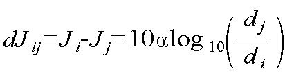
경로손실 모델(path loss model)에 따르면 수신기(![]()
![]()
![]()
According to the path loss model, the receiver ( ![]()
![]()
![]()
[수학식 9]&Quot; (9) "

여기서, ![]()
![]()
![]()
![]()
![]()
![]()
![]()
![]()
![]()
here, ![]()
![]()
![]()
![]()
![]()
![]()
![]()
![]()
![]()
위 수학식 9에서 경로손실 지수(![]()
![]()
In Equation 9 above, the path loss index ( ![]()
![]()
미지신호의 강도의 차이(![]()
![]()
![]()
![]()
![]()
![]()
![]()
![]()
![]()
Difference in the strength of the unknown signal ![]()
![]()
![]()
![]()
![]()
![]()
![]()
![]()
![]()
[수학식 10]&Quot; (10) "
![]()
![]()
상기와 같은 과정에 의해 미지신호의 강도의 차이(![]()

By the above process, the difference of the intensity of the unknown signal ( ![]()
[수학식 11]&Quot; (11) "
![]()
![]()
여기서, 

![]()
![]()
![]()
![]()
![]()

![]()
![]()
![]()
![]()
![]()
따라서 J/N 측정치를 사용하는 경우 TDOA 기법을 사용하는 경우에 비해 더욱 간단하면서도 저비용으로 미지신호 발생원의 위치를 추정할 수 있고, 또한 다량의 데이터 전송도 불필요하여 편리하다.
Therefore, when using the J / N measurement, the location of the unknown signal source can be estimated more easily and at a lower cost than when using the TDOA technique, and a large amount of data transmission is also unnecessary and convenient.
(4) 미지신호 발생 정보 송출단계(S400)(4) Unknown signal generation information sending step (S400)
이 단계는 지상의 항공교통관제국에서 미지신호의 발생을 검출하여 그 발생원의 위치가 추정된 경우 ADS-B 지상 장비로부터 FIS-B(Flight Information Services- Broadcast, 운항정보방송서비스) 또는 NOTAM(Notice To Airmen)을 통해 이러한 정보가 주변 항공기의 조종실 컴퓨터에 입력되도록 함으로써 주변을 운행하는 항공기와 항공교통관제국에 미지신호 발생 사실을 인지시키는 동시에 기존의 레이더 시설, 또는 기존의 항법 시스템 등의 백업시스템으로 전환하는 단계로서, 이때 지상 시스템에서 백업 항법장비 등을 사용하여 주변 항공기와 항공교통관제국에 위치해를 아울러 전달함으로써 미지신호를 배제한 상태에서 운항을 계속할 수 있어 안전이 대폭 향상된다.
This step detects the occurrence of an unknown signal at the ground air traffic control station, and if the location of the source is estimated, FIS-B (Flight Information Services-Broadcast) or NOTAM (Notice) from the ADS-B ground equipment. To Airmen allows this information to be entered into the cockpit computer of a nearby aircraft, letting the aircraft and air traffic control stations in the vicinity know that an unknown signal has occurred, while at the same time backing up existing radar facilities or existing navigation systems. In this step, the ground system can be used for backup navigation equipment, etc., to be located in the surrounding aircraft and the air traffic control station, and transmitted, allowing the operation to continue without the unknown signal, thereby greatly improving safety.
<실시예 2: 항공기에서 이루어지는 경우>Example 2: In Aircraft
실시예 2는 미지신호의 검출과 발생원의 위치추정을 항공기에서 수행하는 경우에 관한 것으로, 이때 미지신호 검출 및 발생원 위치 추정방법은 도 3에 도시된 바와 같이 신호 획득단계(S100'), 미지신호 검출단계(S200'), 미지신호 발생원 위치 추정단계(S300') 및 미지신호 발생 정보 송출단계(S400')로 이루어지는데, 실시예 1과 비교하여 미지신호의 검출과 미지신호 발생원의 위치 추정이 지상의 항공교통관제국에서 이루어지는 대신 항공기에서 이루어진다는 점에서만 차이가 있을 뿐, 다른 절차는 동일한데, 이하에서는 상기의 각 단계에 대해 간략히 설명한다.
(1) 신호 획득단계(S100')(1) Signal Acquisition Step (S100 ')
이 단계는 ADS-B 시스템이 탑재된 항공기에서 항법위성과 미지신호 발생원 등으로부터 발신된 GNSS 신호와 미지신호를 수신하여 이를 ADS-B 시스템을 통해 주변의 항공기들에 각각 송신하는 단계이다.
This step is to receive GNSS signals and unknown signals from navigation satellites and unknown signal sources in ADS-B system and transmit them to neighboring aircraft through ADS-B system.
(2) 미지신호 검출단계(S200')(2) Unknown signal detection step (S200 ')
이 단계는 주변의 항공기로부터 송신된 신호를 분석하여 이들 신호에 미지신호가 포함되어 있는지 여부를 조사하여 검출하는 단계로서, 이때 각각의 항공기에서는 복수 대의 항공기로부터 송신된 신호를 이용하여 TDOA 측정치를 산출하며, TDOA 측정치를 산출하는 방법과 J/N 측정치를 이용하는 방법은 실시예 1과 동일하다.
This step analyzes the signals transmitted from nearby aircraft and investigates whether these signals contain unknown signals. Each aircraft calculates TDOA measurements using signals transmitted from multiple aircraft. The method of calculating the TDOA measurement and the method of using the J / N measurement are the same as in Example 1.
(3) 미지신호 발생원 위치 추정단계(S300')(3) Unknown signal source position estimation step (S300 ')
이 단계는 미지신호 검출단계(S200')에서 구한 TDOA 측정치(![]()
This step is based on the TDOA measurement value obtained in the unknown signal detection step (S200 '). ![]()
(4) 미지신호 발생 정보 송출단계(S400')(4) Unknown signal generation information sending step (S400 ')
이 단계는 항공기에서 미지신호의 발생을 검출하여 그 발생원의 위치가 추정된 경우 항공기에 탑재된 ADS-B 장비로부터 FIS-B 및 NOTAM을 통해 주변을 운행하는 항공기의 조종실 컴퓨터에 이러한 정보가 입력되도록 함으로써 주변 항공기와 항공교통관제국에 미지신호 발생 사실을 인지시키는 동시에 백업시스템으로 전환하는 단계이다.
This step detects the occurrence of an unknown signal in the aircraft and, if the location of the source is estimated, inputs this information to the cockpit computer of the aircraft traveling around via FIS-B and NOTAM from the ADS-B equipment mounted on the aircraft. By notifying the surrounding aircraft and air traffic control stations of unknown signal occurrence, it is a step of switching to a backup system.
위에서는 비행 중의 복수대의 항공기로부터 획득되는 신호를 이용하여 미지신호와 발생원의 위치를 검출하는 것으로 하여 설명하였으나, 이와 달리 한 대의 항공기가 일정 지역을 선회 비행하면서 미지신호 발생원과 항법위성으로부터 발신된 신호를 이용하여 J/N 측정치를 수집하고, 이렇게 수집된 J/N 측정치를 이용하여 앞서 설명한 방법과 같은 방법에 의해 미지신호와 발생원의 위치를 검출하는 것으로 실시될 수 있다.
In the above description, the signal is obtained from a plurality of aircraft in flight to detect the location of the unknown signal and the source, but on the contrary, the signal originated from the unknown signal source and the navigation satellite while one aircraft is flying around a certain area. Using the collected J / N measurements, and using the collected J / N measurements can be carried out by detecting the location of the unknown signal and the source by the same method as described above.
이상 설명한 바와 같이 본 발명은 미지신호를 ADS-B 시스템이 장착된 항공기에서 수집하고, 이 수집된 정보를 이용하여 미지신호와 발생원의 위치를 검출하기 때문에 신호의 회절 및 반사 등에 의한 영향이 배제되어 미지신호와 그 발생원의 위치를 정확하고도 신속하게 검출해낼 수 있다.
As described above, the present invention collects the unknown signal in the aircraft equipped with the ADS-B system, and detects the location of the unknown signal and the source using the collected information, thereby eliminating the effects of diffraction and reflection of the signal. The location of the unknown signal and its source can be detected accurately and quickly.
J: 미지신호 발생원J: Unknown signal source
Claims (7)
상기 신호 획득단계(S100)에 의해 복수 대의 항공기로부터 송신된 신호를 이용하여 항공교통관제국에서 TDOA 기법, TOA 기법, AOA 기법 중 어느 하나의 기법을 이용하여 상기 신호에 미지신호가 포함되어 있는지 여부를 검출하는 미지신호 검출단계(S200)와;
상기 미지신호 검출단계(S200)에 의해 상기 신호에 미지신호가 포함된 것으로 검출되는 경우 상기 TDOA 기법, TOA 기법, AOA 기법 중 어느 하나의 기법을 이용하여 미지신호 발생원의 위치를 추정하는 미지신호 발생원 위치 추정단계(S300) 및;
상기 미지신호 발생원 위치 추정단계(S300)에 의해 추정된 미지신호와 미지신호 발생원의 위치정보를 ADS-B 지상 장비로부터 FIS-B 또는 NOTAM를 통해 주변 항공기와 항공교통관제국에 입력되도록 하는 미지신호 발생 정보 송출단계(S400)로 이루어지는 것을 특징으로 하는 ADS-B 시스템 기반 항공기를 이용한 미지신호 검출 및 미지신호 발생원 위치 추정방법.
Signal acquisition step of receiving the GNSS signal and the unknown signal transmitted from the navigation satellite and the unknown signal source in each of a plurality of aircraft in flight during the flight ADS-B system to transmit to the air traffic control station through the ADS-B system (S100) Wow;
Whether an unknown signal is included in the signal using any one of a TDOA technique, a TOA technique, and an AOA technique in an ATC using signals transmitted from a plurality of aircrafts by the signal obtaining step (S100). Detecting an unknown signal (S200);
When the unknown signal is detected by the unknown signal detection step (S200), the unknown signal source that estimates the location of the unknown signal source using any one of the TDOA technique, the TOA technique, and the AOA technique. Location estimation step (S300);
Unknown signal for estimating the unknown signal and the location information of the unknown signal source by the unknown signal source position estimation step (S300) from the ADS-B ground equipment to the surrounding aircraft and the air traffic control station through FIS-B or NOTAM. Unknown signal detection and unknown source location estimation method using the ADS-B system-based aircraft, characterized in that the generation information sending step (S400).
상기 신호 획득단계(S100')에 의해 주변 항공기들로부터 송신된 신호를 이용하여 항공기에서 TDOA 기법, TOA 기법, AOA 기법 중 어느 하나의 기법을 이용하여 상기 신호에 미지신호가 포함되어 있는지 여부를 검출하는 미지신호 검출단계(S200')와;
상기 미지신호 검출단계(S200')에 의해 상기 신호에 미지신호가 포함된 것으로 검출되는 경우 상기 TDOA 기법, TOA 기법, AOA 기법 중 어느 하나의 기법을 이용하여 미지신호 발생원의 위치를 추정하는 미지신호 발생원 위치 추정단계(S300') 및;
상기 미지신호 발생원 위치 추정단계(S300')에 의해 추정된 미지신호와 미지신호 발생원의 위치정보를 항공기에 탑재된 ADS-B 장비로부터 FIS-B를 통해 주변 항공기와 항공교통관제국에 입력되도록 하는 미지신호 발생 정보 송출단계(S400')로 이루어지는 것을 특징으로 하는 ADS-B 시스템 기반 항공기를 이용한 미지신호 검출 및 미지신호 발생원 위치 추정방법.
ADS-B system is equipped with a signal acquisition step of receiving a GNSS signal and an unknown signal transmitted from the navigation satellite and the unknown signal source in each of a plurality of aircraft in flight (S100 ') through the ADS-B system )Wow;
Detecting whether an unknown signal is included in the signal using any one of a TDOA technique, a TOA technique, and an AOA technique in the aircraft using the signal transmitted from the neighboring aircrafts by the signal obtaining step (S100 '). An unknown signal detection step (S200 ′);
When it is detected that the unknown signal is included in the signal by the detection of the unknown signal (S200 ′), the unknown signal estimates the position of the unknown signal source using any one of the TDOA technique, the TOA technique, and the AOA technique. Source position estimation step (S300 ');
The unknown signal and the location information of the unknown signal generation source estimated by the unknown signal source location estimation step (S300 ') to be input to the neighboring aircraft and air traffic control station through the FIS-B from the ADS-B equipment mounted on the aircraft Unknown signal detection and unknown signal source position estimation method using an ADS-B system-based aircraft, characterized in that the step of transmitting the unknown signal generation information (S400 ').
상기 미지신호 검출단계(S200)에서 미지신호를 검출하는 데에는 TDOA 기법이 사용되고, 상기 미지신호 검출단계(S200)에 의해 상기 신호에 미지신호가 포함된 것으로 검출되는 경우 상기 미지신호 발생원 위치 추정단계(S300)에서는 상기 TDOA 측정치(
The method according to claim 1 or 2,
In the unknown signal detection step (S200), a TDOA technique is used to detect an unknown signal, and when the unknown signal is detected by the unknown signal detection step (S200), the unknown signal source position estimation step ( In S300, the TDOA measurement value (
상기 신호 획득단계(S100)에 의해 항공기로부터 송신된 신호를 이용하여 항공교통관제국에서 J/N 측정치를 분석함으로써 상기 신호에 미지신호가 포함되어 있는지 여부를 검출하는 미지신호 검출단계(S200)와;
상기 미지신호 검출단계(S200)에 의해 상기 신호에 미지신호가 포함된 것으로 검출되는 경우 상기 J/N 측정치를 이용하여 미지신호 발생원의 위치를 추정하는 미지신호 발생원 위치 추정단계(S300) 및;
상기 미지신호 발생원 위치 추정단계(S300)에 의해 추정된 미지신호와 미지신호 발생원의 위치정보를 ADS-B 지상 장비로부터 FIS-B 또는 NOTAM을 통해 주변 항공기와 항공교통관제국에 입력되도록 하는 미지신호 발생 정보 송출단계(S400)로 이루어지는 것을 특징으로 하는 ADS-B 시스템 기반 항공기를 이용한 미지신호 검출 및 미지신호 발생원 위치 추정방법.
Equipped with ADS-B system, multiple aircraft in flight receive GNSS signals and unknown signals from navigation satellites and unknown signal sources, acquire J / N measurements, and then use the ADS-B system to provide air traffic control. A signal acquisition step of transmitting (S100);
An unknown signal detection step (S200) of detecting whether an unknown signal is included in the signal by analyzing a J / N measurement value in the ATC using the signal transmitted from the aircraft by the signal obtaining step (S100); ;
An unknown signal source position estimation step (S300) of estimating a position of an unknown signal source using the J / N measurement when it is detected that the unknown signal is included in the signal by the unknown signal detection step (S200);
Unknown signal for estimating the unknown signal and the location information of the unknown signal source generated by the unknown signal source position estimation step (S300) from the ADS-B ground equipment to the surrounding aircraft and the air traffic control station through FIS-B or NOTAM. Unknown signal detection and unknown source location estimation method using the ADS-B system-based aircraft, characterized in that the generation information sending step (S400).
상기 미지신호 발생원 위치 추정단계(S300)에서의 미지신호 발생원의 위치는 아래의 수학식 9를 이용하여 구하는 것을 특징으로 하는 ADS-B 시스템 기반 항공기를 이용한 미지신호 검출 및 미지신호 발생원 위치 추정방법.
[수학식 9]
여기서,
The method of claim 4,
The location of the unknown signal source in the step of estimating the location of the unknown signal source (S300) is obtained by using Equation (9) below.
[Equation 9]
here,
상기 미지신호 발생원 위치 추정단계(S300)에서의 미지신호 발생원의 위치는 아래의 수학식 10을 이용하여 구하는 것을 특징으로 하는 ADS-B 시스템 기반 항공기를 이용한 미지신호 검출 및 미지신호 발생원 위치 추정방법.
[수학식 10]
여기서,
The method of claim 4,
The unknown signal generation source position estimation method using the ADS-B system-based aircraft, characterized in that the position of the unknown signal source in the step of estimating the location of the unknown signal source (S300) is calculated using Equation 10 below.
[Equation 10]
here,
상기 복수대의 항공기에서 각각 항법위성과 미지신호 발생원으로부터 발신된 GNSS 신호와 미지신호를 수신하는 대신, 한 대의 항공기가 일정 지역을 선회 비행하면서 미지신호 발생원과 항법위성으로부터 발신된 신호를 수집하는 것을 특징으로 하는 ADS-B 시스템 기반 항공기를 이용한 미지신호 검출 및 미지신호 발생원 위치 추정방법.
The method according to any one of claims 4 to 6,
Instead of receiving the GNSS signal and the unknown signal transmitted from the navigation satellite and the unknown signal source in each of the plurality of aircrafts, one aircraft collects signals from the unknown signal source and the navigation satellite while turning around a certain area. Unknown signal detection and unknown source location estimation method using ADS-B system based aircraft.
Priority Applications (5)
| Application Number | Priority Date | Filing Date | Title |
|---|---|---|---|
| KR1020120137566A KR101240629B1 (en) | 2012-11-30 | 2012-11-30 | Detecting and localization method of unknown signal using aircraft with ads-b system |
| PCT/KR2013/009659 WO2014084512A1 (en) | 2012-11-30 | 2013-10-29 | Method of detecting unknown signal and estimating position of source by using plane equipped with ads-b system |
| US14/517,169 US9429655B2 (en) | 2012-11-30 | 2014-10-17 | Detecting and localization method of unknown signal using aircraft with ADS-B system |
| US15/214,194 US10429513B2 (en) | 2012-11-30 | 2016-07-19 | Detecting and localization method of unknown signal using aircraft with ADS-B system |
| US15/214,223 US10539679B2 (en) | 2012-11-30 | 2016-07-19 | Detecting and localization method of unknown signal using aircraft with ADS-B system |
Applications Claiming Priority (1)
| Application Number | Priority Date | Filing Date | Title |
|---|---|---|---|
| KR1020120137566A KR101240629B1 (en) | 2012-11-30 | 2012-11-30 | Detecting and localization method of unknown signal using aircraft with ads-b system |
Publications (1)
| Publication Number | Publication Date |
|---|---|
| KR101240629B1 true KR101240629B1 (en) | 2013-03-11 |
Family
ID=48181339
Family Applications (1)
| Application Number | Title | Priority Date | Filing Date |
|---|---|---|---|
| KR1020120137566A KR101240629B1 (en) | 2012-11-30 | 2012-11-30 | Detecting and localization method of unknown signal using aircraft with ads-b system |
Country Status (3)
| Country | Link |
|---|---|
| US (3) | US9429655B2 (en) |
| KR (1) | KR101240629B1 (en) |
| WO (1) | WO2014084512A1 (en) |
Cited By (5)
| Publication number | Priority date | Publication date | Assignee | Title |
|---|---|---|---|---|
| KR101446445B1 (en) * | 2013-12-06 | 2014-10-06 | 한국항공우주연구원 | Position estimating device and method for estimating position of radio wave source |
| CN104181549A (en) * | 2014-08-18 | 2014-12-03 | 中国航空无线电电子研究所 | Method for positioning aircraft based on 1090ES data chain ground stations |
| US20160035225A1 (en) * | 2014-08-01 | 2016-02-04 | Honeywell International Inc. | Remote air traffic surveillance data compositing based on datalinked radio surveillance |
| KR20180085910A (en) * | 2017-01-20 | 2018-07-30 | 국방과학연구소 | Method for adaptive geo-positioning detection based on tdoa applied to multi-aircraft platform |
| US10529239B2 (en) | 2016-08-15 | 2020-01-07 | Honeywell International Inc. | Air traffic and weather data aggregating and de-conflicting |
Families Citing this family (22)
| Publication number | Priority date | Publication date | Assignee | Title |
|---|---|---|---|---|
| JP6266887B2 (en) * | 2013-03-04 | 2018-01-24 | 株式会社デンソー | Estimator |
| US20150058183A1 (en) * | 2013-08-21 | 2015-02-26 | Synergy Aviation Services, Inc. | System and Method for Identifying Taxable Events for Mobile Property |
| US9766343B2 (en) * | 2014-06-19 | 2017-09-19 | Novatel Inc. | System and method for determining location of an interfering signal source |
| US10303941B2 (en) * | 2014-07-30 | 2019-05-28 | The Boeing Company | Locating light sources using aircraft |
| US9689976B2 (en) * | 2014-12-19 | 2017-06-27 | Xidrone Systems, Inc. | Deterent for unmanned aerial systems |
| JP6447918B2 (en) * | 2015-04-02 | 2019-01-09 | 鹿児島県 | Electrostatic discharge source detection method and electrostatic discharge source visualization method |
| EP3156814B1 (en) * | 2015-10-14 | 2024-03-27 | Bull Sas | Method for locating a terrestrial transmitting source of an unknown signal |
| US9661604B1 (en) * | 2016-06-30 | 2017-05-23 | HawkEye 360, Inc. | Determining emitter locations |
| CA3067545C (en) | 2017-06-30 | 2023-01-24 | HawkEye 360, Inc. | Detecting radio signal emitter locations |
| WO2019014824A1 (en) * | 2017-07-18 | 2019-01-24 | 深圳市大疆创新科技有限公司 | Positioning method, unmanned aerial vehicle and machine-readable storage medium |
| EP3830809A1 (en) | 2018-08-03 | 2021-06-09 | Nexteon Technologies, Inc. | Systems and methods for providing en route rerouting |
| JP6694035B2 (en) * | 2018-10-05 | 2020-05-13 | Hapsモバイル株式会社 | Communication device, communication method, and communication program |
| ES2915661T3 (en) * | 2018-11-13 | 2022-06-24 | Thales Man & Services Deutschland Gmbh | A system and method for determining the position of an aircraft |
| EP3918358A1 (en) * | 2019-01-29 | 2021-12-08 | Nexteon Technologies, Inc. | Systems and methods for exploiting ads-b frequency of arrival for flight surveillance, cyber security and meteorology |
| CN110224742B (en) * | 2019-06-24 | 2020-05-12 | 电子科技大学 | Satellite-borne ADS-B signal forming method for testing signal separation performance |
| US11493591B2 (en) * | 2019-07-23 | 2022-11-08 | Vehere Interactive Pvt. Ltd. | System and method for detection and identification of radio frequency source |
| CN110708396B (en) * | 2019-11-07 | 2022-02-18 | 中国民航大学 | ADS-B text authenticity detection method based on reverse positioning technology |
| US11681052B2 (en) | 2020-01-07 | 2023-06-20 | All. Space Networks Limited | Non-cooperative position, navigation, and timing extraction from VSAT communications signals using multi-beam phased array antenna |
| CN111865866B (en) * | 2020-08-04 | 2021-07-27 | 北京空天智数科技有限公司 | Adaptive coarse synchronization method with high detection rate and low false alarm rate suitable for satellite-based ADS-B signal reception |
| CN113759392B (en) * | 2021-08-23 | 2023-08-18 | 中国民航大学 | Robust GNSS interference source positioning method based on flight big data |
| CN113568010B (en) * | 2021-08-31 | 2024-03-26 | 中国电子科技集团公司第五十四研究所 | Satellite-borne ADS-B-based interference positioning method |
| US20230308120A1 (en) * | 2022-03-28 | 2023-09-28 | Sagetech Avionics, Inc. | Combined Interrogator and Transponder with an Omnidirectional Antenna |
Citations (3)
| Publication number | Priority date | Publication date | Assignee | Title |
|---|---|---|---|---|
| US6300898B1 (en) | 1998-04-16 | 2001-10-09 | Arthur J. Schneider | Airborne GPS guidance system for defeating multiple jammers |
| KR100978535B1 (en) | 2010-02-18 | 2010-08-27 | 국방과학연구소 | A method and apparatus to improve anti-jamming and to eliminate jamming in a gps system by adjusting additional threshold value in the frequency domain |
| KR101169766B1 (en) | 2011-07-28 | 2012-07-30 | 주식회사 현대제이콤 | Apparatus of detecting gps jamming signal |
Family Cites Families (16)
| Publication number | Priority date | Publication date | Assignee | Title |
|---|---|---|---|---|
| WO1994023404A1 (en) * | 1993-04-01 | 1994-10-13 | Bruno Robert | System for selectively positioning and tracking a movable object or individual |
| US5570095A (en) * | 1994-04-01 | 1996-10-29 | Massachusetts Institute Of Technology | Automatic dependent surveillance air navigation system |
| US5936571A (en) * | 1997-01-31 | 1999-08-10 | Lockheed Martin Corporation | Integrated GPS/interference location system |
| US6407703B1 (en) * | 2000-08-07 | 2002-06-18 | Lockheed Martin Corporation | Multi-platform geolocation method and system |
| US6697008B1 (en) * | 2003-02-28 | 2004-02-24 | Rockwell Collins, Inc. | Distributed electronic warfare system |
| US6933888B1 (en) * | 2004-06-14 | 2005-08-23 | Bae Systems Information And Electronic Systems Integration Inc. | Multi-ship coherent geolocation system |
| KR100617787B1 (en) * | 2004-06-29 | 2006-08-28 | 삼성전자주식회사 | Gps receiver for detecting jammer using fast fourier transform and therefor method |
| US20060234641A1 (en) | 2005-02-03 | 2006-10-19 | Lucent Technologies Inc. | System for using an existing cellular network to detect incidents of GPS jaming |
| US7508344B2 (en) * | 2005-11-29 | 2009-03-24 | L-3 Communications Integrated Systems, Lp | Systems and methods for TDOA/FDOA location |
| WO2007124300A2 (en) * | 2006-04-21 | 2007-11-01 | Sensis Corporation | A system and method for multilaterating a position of a target using mobile remote receiving units |
| US7551139B1 (en) * | 2006-05-12 | 2009-06-23 | Northrop Grumman Corporation | Multi-platform precision passive location of continuous wave emitters |
| US7453400B2 (en) * | 2007-02-02 | 2008-11-18 | Bae Systems Information And Electronic Systems Integration Inc. | Multiplatform TDOA correlation interferometer geolocation |
| GB0719004D0 (en) * | 2007-09-27 | 2008-01-02 | Qinetiq Ltd | Interference power measurement |
| US7835687B2 (en) * | 2007-10-18 | 2010-11-16 | Mediatek Inc. | Jamming detector and jamming detecting method |
| US8446310B2 (en) * | 2008-08-22 | 2013-05-21 | Raytheon Company | Method and system for locating signal jammers |
| US8138975B2 (en) * | 2008-12-30 | 2012-03-20 | Trueposition, Inc. | Interference detection, characterization and location in a wireless communications or broadcast system |
-
2012
- 2012-11-30 KR KR1020120137566A patent/KR101240629B1/en active IP Right Grant
-
2013
- 2013-10-29 WO PCT/KR2013/009659 patent/WO2014084512A1/en active Application Filing
-
2014
- 2014-10-17 US US14/517,169 patent/US9429655B2/en active Active
-
2016
- 2016-07-19 US US15/214,194 patent/US10429513B2/en active Active
- 2016-07-19 US US15/214,223 patent/US10539679B2/en active Active
Patent Citations (3)
| Publication number | Priority date | Publication date | Assignee | Title |
|---|---|---|---|---|
| US6300898B1 (en) | 1998-04-16 | 2001-10-09 | Arthur J. Schneider | Airborne GPS guidance system for defeating multiple jammers |
| KR100978535B1 (en) | 2010-02-18 | 2010-08-27 | 국방과학연구소 | A method and apparatus to improve anti-jamming and to eliminate jamming in a gps system by adjusting additional threshold value in the frequency domain |
| KR101169766B1 (en) | 2011-07-28 | 2012-07-30 | 주식회사 현대제이콤 | Apparatus of detecting gps jamming signal |
Cited By (7)
| Publication number | Priority date | Publication date | Assignee | Title |
|---|---|---|---|---|
| KR101446445B1 (en) * | 2013-12-06 | 2014-10-06 | 한국항공우주연구원 | Position estimating device and method for estimating position of radio wave source |
| US20160035225A1 (en) * | 2014-08-01 | 2016-02-04 | Honeywell International Inc. | Remote air traffic surveillance data compositing based on datalinked radio surveillance |
| US9685087B2 (en) * | 2014-08-01 | 2017-06-20 | Honeywell International Inc. | Remote air traffic surveillance data compositing based on datalinked radio surveillance |
| CN104181549A (en) * | 2014-08-18 | 2014-12-03 | 中国航空无线电电子研究所 | Method for positioning aircraft based on 1090ES data chain ground stations |
| US10529239B2 (en) | 2016-08-15 | 2020-01-07 | Honeywell International Inc. | Air traffic and weather data aggregating and de-conflicting |
| KR20180085910A (en) * | 2017-01-20 | 2018-07-30 | 국방과학연구소 | Method for adaptive geo-positioning detection based on tdoa applied to multi-aircraft platform |
| KR102040924B1 (en) * | 2017-01-20 | 2019-11-05 | 국방과학연구소 | Method for adaptive geo-positioning detection based on tdoa applied to multi-aircraft platform |
Also Published As
| Publication number | Publication date |
|---|---|
| US10539679B2 (en) | 2020-01-21 |
| US10429513B2 (en) | 2019-10-01 |
| US9429655B2 (en) | 2016-08-30 |
| WO2014084512A1 (en) | 2014-06-05 |
| US20160327651A1 (en) | 2016-11-10 |
| US20170131411A1 (en) | 2017-05-11 |
| US20150035699A1 (en) | 2015-02-05 |
Similar Documents
| Publication | Publication Date | Title |
|---|---|---|
| KR101240629B1 (en) | Detecting and localization method of unknown signal using aircraft with ads-b system | |
| KR101221978B1 (en) | Localization method of multiple jammers based on tdoa method | |
| US20070222664A1 (en) | Method and system for correlating radar position data with target identification data, and determining target position using round trip delay data | |
| US8094064B2 (en) | Ground-based system and method to monitor for excessive delay gradients | |
| Ostroumov et al. | Compatibility analysis of multi signal processing in APNT with current navigation infrastructure | |
| KR101733034B1 (en) | Pcl system for estimating position of target | |
| US20140368387A1 (en) | Method and system for simultaneous receiver calibration and object localisation for multilateration | |
| WO2010138696A9 (en) | System and method for passive range-aided multilateration using time lag of arrival (tloa) measurements | |
| CN110764050A (en) | Simulation test method for multipoint positioning system | |
| RU2489325C2 (en) | Aircraft landing multistage system | |
| WO2013136648A1 (en) | Wide-area multilateration system, central station, and 2-dimensional-position calculation method using same | |
| Jalloul et al. | DME/DME navigation using a single low-cost SDR and sequential operation | |
| Kuzmenko et al. | Improving the accuracy of aircraft positioning by navigational AIDS using kalman filter | |
| RU2478979C1 (en) | Range radiotechnical system of short-range navigation of aircrafts | |
| KR101486329B1 (en) | Apparatus for evaluate ground based augmentation system and method thereof | |
| Свид et al. | Evaluation of the Responder Capacity of the Indication Channel of Near Navigation Radio Systems | |
| Eier et al. | Method for GPS and GNSS Independent MLAT System Synchronization | |
| Wu et al. | An Alternative Positioning Navigation and Timing concept based on Diverse Ranging | |
| Sadowski et al. | Asynchronous WAM with irregular pulse repetition | |
| Svyd et al. | Evaluation of the Responder Capacity of the Indication Channel of Near Navigation Radio Systems | |
| Yoo et al. | Performance analysis of MLAT system receiver for aircraft flight control system | |
| Ostroumov et al. | Cybersecurity Analysis of Navigation Systems in Civil Aviation | |
| Miyazaki et al. | Performance evaluation of a WAM system using measured range | |
| US11747482B2 (en) | APNT service positioning and integrity monitoring method and system | |
| EP4303852A1 (en) | Radio frequency interference database for vehicle navigation planning |
Legal Events
| Date | Code | Title | Description |
|---|---|---|---|
| A201 | Request for examination | ||
| A302 | Request for accelerated examination | ||
| E701 | Decision to grant or registration of patent right | ||
| GRNT | Written decision to grant | ||
| FPAY | Annual fee payment |
Payment date: 20161121 Year of fee payment: 5 |
|
| FPAY | Annual fee payment |
Payment date: 20171219 Year of fee payment: 6 |
|
| FPAY | Annual fee payment |
Payment date: 20190104 Year of fee payment: 7 |
|
| FPAY | Annual fee payment |
Payment date: 20200102 Year of fee payment: 8 |