EP4152290A1 - Method and system for emergency responses by evaluating media data - Google Patents
Method and system for emergency responses by evaluating media data Download PDFInfo
- Publication number
- EP4152290A1 EP4152290A1 EP21196935.7A EP21196935A EP4152290A1 EP 4152290 A1 EP4152290 A1 EP 4152290A1 EP 21196935 A EP21196935 A EP 21196935A EP 4152290 A1 EP4152290 A1 EP 4152290A1
- Authority
- EP
- European Patent Office
- Prior art keywords
- emergency
- media data
- confidence value
- location
- incident
- Prior art date
- Legal status (The legal status is an assumption and is not a legal conclusion. Google has not performed a legal analysis and makes no representation as to the accuracy of the status listed.)
- Pending
Links
Images



Classifications
-
- G—PHYSICS
- G08—SIGNALLING
- G08B—SIGNALLING SYSTEMS, e.g. PERSONAL CALLING SYSTEMS; ORDER TELEGRAPHS; ALARM SYSTEMS
- G08B25/00—Alarm systems in which the location of the alarm condition is signalled to a central station, e.g. fire or police telegraphic systems
- G08B25/006—Alarm destination chosen according to type of event, e.g. in case of fire phone the fire service, in case of medical emergency phone the ambulance
-
- G—PHYSICS
- G08—SIGNALLING
- G08B—SIGNALLING SYSTEMS, e.g. PERSONAL CALLING SYSTEMS; ORDER TELEGRAPHS; ALARM SYSTEMS
- G08B25/00—Alarm systems in which the location of the alarm condition is signalled to a central station, e.g. fire or police telegraphic systems
- G08B25/002—Generating a prealarm to the central station
-
- G—PHYSICS
- G06—COMPUTING OR CALCULATING; COUNTING
- G06F—ELECTRIC DIGITAL DATA PROCESSING
- G06F16/00—Information retrieval; Database structures therefor; File system structures therefor
- G06F16/90—Details of database functions independent of the retrieved data types
- G06F16/95—Retrieval from the web
- G06F16/953—Querying, e.g. by the use of web search engines
- G06F16/9537—Spatial or temporal dependent retrieval, e.g. spatiotemporal queries
-
- G—PHYSICS
- G06—COMPUTING OR CALCULATING; COUNTING
- G06Q—INFORMATION AND COMMUNICATION TECHNOLOGY [ICT] SPECIALLY ADAPTED FOR ADMINISTRATIVE, COMMERCIAL, FINANCIAL, MANAGERIAL OR SUPERVISORY PURPOSES; SYSTEMS OR METHODS SPECIALLY ADAPTED FOR ADMINISTRATIVE, COMMERCIAL, FINANCIAL, MANAGERIAL OR SUPERVISORY PURPOSES, NOT OTHERWISE PROVIDED FOR
- G06Q50/00—Information and communication technology [ICT] specially adapted for implementation of business processes of specific business sectors, e.g. utilities or tourism
- G06Q50/10—Services
- G06Q50/26—Government or public services
- G06Q50/265—Personal security, identity or safety
-
- G—PHYSICS
- G06—COMPUTING OR CALCULATING; COUNTING
- G06V—IMAGE OR VIDEO RECOGNITION OR UNDERSTANDING
- G06V10/00—Arrangements for image or video recognition or understanding
- G06V10/70—Arrangements for image or video recognition or understanding using pattern recognition or machine learning
- G06V10/764—Arrangements for image or video recognition or understanding using pattern recognition or machine learning using classification, e.g. of video objects
-
- G—PHYSICS
- G06—COMPUTING OR CALCULATING; COUNTING
- G06V—IMAGE OR VIDEO RECOGNITION OR UNDERSTANDING
- G06V20/00—Scenes; Scene-specific elements
- G06V20/50—Context or environment of the image
-
- G—PHYSICS
- G06—COMPUTING OR CALCULATING; COUNTING
- G06V—IMAGE OR VIDEO RECOGNITION OR UNDERSTANDING
- G06V20/00—Scenes; Scene-specific elements
- G06V20/60—Type of objects
-
- G—PHYSICS
- G08—SIGNALLING
- G08B—SIGNALLING SYSTEMS, e.g. PERSONAL CALLING SYSTEMS; ORDER TELEGRAPHS; ALARM SYSTEMS
- G08B25/00—Alarm systems in which the location of the alarm condition is signalled to a central station, e.g. fire or police telegraphic systems
- G08B25/12—Manually actuated calamity alarm transmitting arrangements emergency non-personal manually actuated alarm, activators, e.g. details of alarm push buttons mounted on an infrastructure
-
- G—PHYSICS
- G08—SIGNALLING
- G08B—SIGNALLING SYSTEMS, e.g. PERSONAL CALLING SYSTEMS; ORDER TELEGRAPHS; ALARM SYSTEMS
- G08B29/00—Checking or monitoring of signalling or alarm systems; Prevention or correction of operating errors, e.g. preventing unauthorised operation
- G08B29/18—Prevention or correction of operating errors
- G08B29/185—Signal analysis techniques for reducing or preventing false alarms or for enhancing the reliability of the system
- G08B29/188—Data fusion; cooperative systems, e.g. voting among different detectors
-
- H—ELECTRICITY
- H04—ELECTRIC COMMUNICATION TECHNIQUE
- H04M—TELEPHONIC COMMUNICATION
- H04M3/00—Automatic or semi-automatic exchanges
- H04M3/42—Systems providing special services or facilities to subscribers
- H04M3/50—Centralised arrangements for answering calls; Centralised arrangements for recording messages for absent or busy subscribers ; Centralised arrangements for recording messages
- H04M3/51—Centralised call answering arrangements requiring operator intervention, e.g. call or contact centers for telemarketing
- H04M3/5116—Centralised call answering arrangements requiring operator intervention, e.g. call or contact centers for telemarketing for emergency applications
-
- H—ELECTRICITY
- H04—ELECTRIC COMMUNICATION TECHNIQUE
- H04W—WIRELESS COMMUNICATION NETWORKS
- H04W4/00—Services specially adapted for wireless communication networks; Facilities therefor
- H04W4/02—Services making use of location information
-
- H—ELECTRICITY
- H04—ELECTRIC COMMUNICATION TECHNIQUE
- H04W—WIRELESS COMMUNICATION NETWORKS
- H04W4/00—Services specially adapted for wireless communication networks; Facilities therefor
- H04W4/90—Services for handling of emergency or hazardous situations, e.g. earthquake and tsunami warning systems [ETWS]
-
- G—PHYSICS
- G08—SIGNALLING
- G08B—SIGNALLING SYSTEMS, e.g. PERSONAL CALLING SYSTEMS; ORDER TELEGRAPHS; ALARM SYSTEMS
- G08B13/00—Burglar, theft or intruder alarms
- G08B13/18—Actuation by interference with heat, light, or radiation of shorter wavelength; Actuation by intruding sources of heat, light, or radiation of shorter wavelength
- G08B13/189—Actuation by interference with heat, light, or radiation of shorter wavelength; Actuation by intruding sources of heat, light, or radiation of shorter wavelength using passive radiation detection systems
- G08B13/194—Actuation by interference with heat, light, or radiation of shorter wavelength; Actuation by intruding sources of heat, light, or radiation of shorter wavelength using passive radiation detection systems using image scanning and comparing systems
- G08B13/196—Actuation by interference with heat, light, or radiation of shorter wavelength; Actuation by intruding sources of heat, light, or radiation of shorter wavelength using passive radiation detection systems using image scanning and comparing systems using television cameras
- G08B13/19602—Image analysis to detect motion of the intruder, e.g. by frame subtraction
- G08B13/19613—Recognition of a predetermined image pattern or behaviour pattern indicating theft or intrusion
-
- G—PHYSICS
- G08—SIGNALLING
- G08B—SIGNALLING SYSTEMS, e.g. PERSONAL CALLING SYSTEMS; ORDER TELEGRAPHS; ALARM SYSTEMS
- G08B17/00—Fire alarms; Alarms responsive to explosion
- G08B17/005—Fire alarms; Alarms responsive to explosion for forest fires, e.g. detecting fires spread over a large or outdoors area
-
- G—PHYSICS
- G08—SIGNALLING
- G08B—SIGNALLING SYSTEMS, e.g. PERSONAL CALLING SYSTEMS; ORDER TELEGRAPHS; ALARM SYSTEMS
- G08B21/00—Alarms responsive to a single specified undesired or abnormal condition and not otherwise provided for
- G08B21/02—Alarms for ensuring the safety of persons
- G08B21/10—Alarms for ensuring the safety of persons responsive to calamitous events, e.g. tornados or earthquakes
-
- G—PHYSICS
- G08—SIGNALLING
- G08B—SIGNALLING SYSTEMS, e.g. PERSONAL CALLING SYSTEMS; ORDER TELEGRAPHS; ALARM SYSTEMS
- G08B25/00—Alarm systems in which the location of the alarm condition is signalled to a central station, e.g. fire or police telegraphic systems
- G08B25/01—Alarm systems in which the location of the alarm condition is signalled to a central station, e.g. fire or police telegraphic systems characterised by the transmission medium
- G08B25/08—Alarm systems in which the location of the alarm condition is signalled to a central station, e.g. fire or police telegraphic systems characterised by the transmission medium using communication transmission lines
-
- G—PHYSICS
- G08—SIGNALLING
- G08B—SIGNALLING SYSTEMS, e.g. PERSONAL CALLING SYSTEMS; ORDER TELEGRAPHS; ALARM SYSTEMS
- G08B27/00—Alarm systems in which the alarm condition is signalled from a central station to a plurality of substations
- G08B27/001—Signalling to an emergency team, e.g. firemen
-
- H—ELECTRICITY
- H04—ELECTRIC COMMUNICATION TECHNIQUE
- H04M—TELEPHONIC COMMUNICATION
- H04M2201/00—Electronic components, circuits, software, systems or apparatus used in telephone systems
- H04M2201/50—Telephonic communication in combination with video communication
-
- H—ELECTRICITY
- H04—ELECTRIC COMMUNICATION TECHNIQUE
- H04M—TELEPHONIC COMMUNICATION
- H04M2242/00—Special services or facilities
- H04M2242/30—Determination of the location of a subscriber
Definitions
- the present invention relates to a method and system for emergency responses by evaluating media data.
- New emergency call systems such as Next Generation 911 (NG 911) in North America or Next Generation 112 (NG 112) in Europe will need to be able to handle media data.
- This is useful, for example, when eyewitnesses quickly take media data like a picture or video of an emergency or an emergency scene and pass it on to a responsible emergency authority.
- This allows the emergency response agency to receive additional information about the emergency in the form of media data.
- it may also happen that only signs of an emergency are visible to an eyewitness who cannot say for sure whether it is a real emergency or not.
- a wildfire, bushfire or forest fire is an unplanned, unwanted, uncontrolled fire in an area of combustible vegetation starting in rural as well as in urban areas.
- an object of the invention is to analyze a sign of a potential emergency with a certain confidence which allows that the response to that event is reliable and as fast as possible.
- Another object of the invention is to analyze media data to get the location of an emergency related object.
- a method for emergency responses by evaluating media data comprising the steps of:
- the method further comprising, after the step of calculating a location confidence value:
- the method further comprising, after the step of determining, if a known incident in a certain proximity to the location of the emergency relevant object is present:
- the emergency relevant object is at least one of smoke, heat, fire, abnormal water level, flood, avalanche, riot, robbery, storm, earthquake, tornado, wind pant, acts of war or other natural disasters.
- the area is at least one of forest, bushland, combustible vegetation, seaside, river side, dessert, mountain, grassland, lake side, town, city or wasteland.
- the metadata further comprising a proximity sector or an angle of view of the electronic device.
- the electronical device is a smartphone, tablet, smartwatch, smart glass or any other appropriate equipped device which is configured to send data to the appropriate authority (ap).
- the method further comprising after the first step:
- the method further comprising, after the first step:
- the steps determining and calculating the first confidence value and the second confidence value are performed in parallel or in sequence.
- adding and/or weighting, by the appropriate authority, the first confidence value, the second confidence value, the emergency relevant objects confidence value, the location of the emergency relevant objects confidence value and/or the proximity confidence value adding and/or weighting, by the appropriate authority, the first confidence value, the second confidence value, the emergency relevant objects confidence value, the location of the emergency relevant objects confidence value and/or the proximity confidence value.
- the method further comprising:
- the method further comprising:
- all confident values are scaled to a value from 0 to 100, wherein a value of zero means no confidence, and a value of 100 means extremely confident.
- a system for emergency responses by evaluating media data wherein the system is configured to perform the method steps.
- Fig. 1 schematically shows the system of the invention.
- a group of people 300 are walking in a forested area and think they see an emergency related object 200.
- other media data can also be applied, such as videos, etc. They send this media data 400 together with the meta data of the position of the picture 410 to a responsible appropriate authority 500.
- This appropriate authority 500 evaluates now, automatically or semi-automatically, the media data 400 and its location data 410 with the help of different databases 600, 700, in order to verify whether the media data 400 is genuine and whether actually an emergency is present. If there is indeed an emergency, appropriate help measures can be taken immediately.
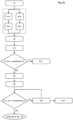
- Fig. 2a and 2b show a flowchart of the method for emergency responses by evaluating media data according to another embodiment of the invention.
- a person first takes a picture of a possible emergency-relevant object in step S1.
- the person does not recognize the cause of the emergency relevant object but is concerned that it could be a major emergency.
- the person sees smoke but does not recognize the cause of the smoke.
- the person now sends the picture with the emergency relevant object on it together with the metadata of the picture to a responsible appropriate authority.
- step S1a the authority can use suitable databases to find out, whether incidents in the proximity of these position data are already recorded in the database.
- step S1b an emergency database is searched for similar incidents.
- the appropriate authority finds an incident in the immediate proximity of the position data of the image, it assigns a confidence value to it in step S1b.
- the appropriate authority can also use social media network databases to search for incidents in the immediate proximity of the image position and assigns them a confidence value S1a', S1b'. This search for already known incidents in the immediate proximity of the image position is optional and does not necessarily have to be performed.
- the individual steps S1a, S1b, S1a' and S1b' can either run in parallel or one after the other.
- the appropriate authority tries to determine and classify the emergency relevant object or objects on the image according to step S2. If this succeeds, a confidence value is assigned to the emergency relevant object in step S3. This confidence value indicates how likely it is that the emergency relevant object really is one. This value is then compared with a previously defined value. If the assigned confidence value for the emergency relevant object CV ero is lower than the predefined value, then the appropriate authority will store the incident as a standard incident together with the image data in an emergency database and terminate the process and the method according to step S13. However, if the assigned confidence value CV ero is higher than the previously defined value, then an attempt is made to determine the position of the emergency relevant object in step S4. If no position can be determined for the object, it is assigned a location confidence value CV L ero of 0.
- step S5 if the location confidence value CV L ero is 0 or lower than a predefined value, the appropriate authority will store a standard incident together with the image data and the confidence value for the emergency relevant object in an emergency database and the method will be terminated according to step S13'.
- the location confidence value is lower than the predefined value, the person who sent the image to the appropriate authority can be contacted and can be asked for another picture.
- a second image can be taken at a certain distance from the location of the first image according to step S5'. On this second picture, of course, the emergency relevant object should be visible. Subsequently, the appropriate authority tries to recognize the object on this image again, and also tries to locate the object.
- the appropriate authority therefore can use other methods for the computation of the location than it did before. If now a determination of the location succeeds together with a location confidence value which is higher than the predefined one, then the method is continued. If no determination of the location succeeds or if the location confidence value is still too low, the method is ended according to step S13'.
- the appropriate authority will try to find possible known incidents in the immediate proximity of the location of the emergency relevant object using an emergency database in which such incidents are stored. If this does not succeed, a proximity confidence value of 0 is assigned in step S6.
- a proximity confidence value CV prox is calculated for it according to step S7. If this value is greater than a predefined value, it means that there is already a known incident for which the image data matches. The appropriate authority therefore adds the image data as well as the confidence value for the emergency relevant object and the confidence value for the location of this object to the already known incident. After that, the method is ended according to step S13".
- the appropriate authority will create a new incident with the image data and all available confidence values in step S8.
- the appropriate authority determines whether houses or buildings are in the immediate proximity of the new incident using appropriate means such as databases, maps, etc. This means that from the buildings, if any, the new incident can be seen and can be confirmed. If such buildings are identified, the building owner or the residents can be contacted via the phone line and asked to verify the new incident according to step S9. here, an IVR (Interactive Voice Response) can be used, too.
- appropriate means such as databases, maps, etc.
- the appropriate authority may automatically or semi-automatically take further appropriate actions to verify the new incident based on image data received from the person and calculated by the appropriate authority. For example, the appropriate authority may perform a cell tower query for mobile devices of other persons in the proximity to the new incident. If mobile devices are found, the owner can be contacted and asked if he or she can verify the new incident in step S10. This can take place by means of a call SMS or by means of IVR.
- drones, helicopters or personnel can be sent to the location of the new incident to verify it in step S11.
- the terrain is very inaccessible, it is probably more advisable to send a helicopter or drone.
- Whether a terrain is inaccessible or not can be determined by the appropriate authority, for example, again with the help of databases, maps or the like.
- the appropriate authority can automatically increase the priority of the new incident so that it can be processed preferentially or faster in step S12.
- FIG. 3 a schematic illustration of location proximity relations is shown.
- Fig. 4 shows a schematic illustration of a standard search area for known incidences.
- the search area is circular since any direction of the camera position can be considered.
- This is the standard area, for example, when there is no other data on the position of the camera or the captured image.
- Fig. 5 shows a schematic illustration of a search area for known incidences when the camera direction of the electronic device is known. thus, the circle of Fig. 4 can be reduced to a semicircle.
- Fig. 6 shows a schematic illustration of a search area for known incidences when the camera direction and the camera's angle of vision is known.
- the search area becomes even more precise if the resolution or wide angle of the camera of the electronic device is also specified. If this is available from the image data, the search sector can be determined even more precisely.
- Incident Type e.g. wood, forest, meadow, grassland, town, etc.
- cv assigned confidence value
- the assigned values are part of the invention and reflect the probability that an event (e. g. FIRE) can occur in the context
- method value means the value, which is output with the automatic media data recognition, e. g. of emergency relevant objects.
- a group is hiking together in the forested mountains. Suddenly, a participant sees smoke coming out of a distant place. The area is far enough and as a result, particular details are not easily noticed. Hence, one cannot identify, if the smoke is due to a chimney of a house that is located there, someone doing construction work or a real fire.
- the group knows that the risk of fire is very high at the moment and decides to report the observation.
- one participant takes media data in form of a picture of the situation with a smartphone. Together with GPS data in the meta data of the picture they send it to an appropriate authority (e. g. a Public Safety Answering Point, an Emergency service provider, etc.).
- an appropriate authority e. g. a Public Safety Answering Point, an Emergency service provider, etc.
- the appropriate authority checks if there is a known incident or an emergency in a certain proximity.
- the media data area (here picture area) is located in a forest (classified using a map database), so according to a predefined media data area factor (maf), a 5 km circle around the media data location (here picture location) is used as proximity.
- a next step with suitable (mathematical) procedures, the image and the contained objects will be classified.
- cv4 value of incident type in the list "Smoke”
- cv4 value of incident type in the list "Smoke”
- a next step with suitable (mathematical) procedures the position of the emergency relevant objects "Smoke" is determined.
- the appropriate authority checks if there is a building at the determined position and any mobile users nearby. Since there is no known building and no mobile user (the hiking group has moved away from the object) and no road nearby, a drone will be used to clarify if the smoke is caused by a fire. As the fire was confirmed by drone (e. g. by pilot) the priority of the incident will be raised, and all additional data (from the drone flight) will be added to the incident.
- drone e. g. by pilot
Landscapes
- Engineering & Computer Science (AREA)
- Business, Economics & Management (AREA)
- Physics & Mathematics (AREA)
- General Physics & Mathematics (AREA)
- Theoretical Computer Science (AREA)
- Databases & Information Systems (AREA)
- Health & Medical Sciences (AREA)
- Emergency Management (AREA)
- Multimedia (AREA)
- Tourism & Hospitality (AREA)
- General Health & Medical Sciences (AREA)
- Signal Processing (AREA)
- Public Health (AREA)
- Computer Security & Cryptography (AREA)
- Marketing (AREA)
- Computer Networks & Wireless Communication (AREA)
- Educational Administration (AREA)
- Artificial Intelligence (AREA)
- Medical Informatics (AREA)
- Software Systems (AREA)
- Data Mining & Analysis (AREA)
- General Engineering & Computer Science (AREA)
- Computing Systems (AREA)
- Development Economics (AREA)
- Computer Vision & Pattern Recognition (AREA)
- Evolutionary Computation (AREA)
- Economics (AREA)
- Human Resources & Organizations (AREA)
- General Business, Economics & Management (AREA)
- Primary Health Care (AREA)
- Strategic Management (AREA)
- Environmental & Geological Engineering (AREA)
- Alarm Systems (AREA)
Abstract
Description
- The present invention relates to a method and system for emergency responses by evaluating media data.
- New emergency call systems such as Next Generation 911 (NG 911) in North America or Next Generation 112 (NG 112) in Europe will need to be able to handle media data. This is useful, for example, when eyewitnesses quickly take media data like a picture or video of an emergency or an emergency scene and pass it on to a responsible emergency authority. This allows the emergency response agency to receive additional information about the emergency in the form of media data. However, it may also happen that only signs of an emergency are visible to an eyewitness who cannot say for sure whether it is a real emergency or not.
- For example, areas across the globe with dry climate are threatened from forest fires destroying the vital oxygen production and reduction of carbon dioxide for the citizens. A wildfire, bushfire or forest fire is an unplanned, unwanted, uncontrolled fire in an area of combustible vegetation starting in rural as well as in urban areas.
- Fast and effective detection is a key factor in wildfire fighting. Early detection efforts were focused on an early response, accurate results in both daytime and nighttime, and the ability to prioritize fire danger. Local societies and fire fighters are trying to prevent forest damages from fires by spending time on special watchtowers trying to detect smoke from a potential fire. People hiking in the mountains during the dry season are also helping towards this direction. However, an issue that arises is how can someone walking on a forestall area and looking at some smoke a few kilometers ahead be sure that this is a real fire and not the smoke of a chimney from a house, canteen, or restaurant. Many times, pedestrians and/or hikers can see smoke, but due to the distance or a low visibility, it is not easy to recognize that it is a real fire. Hence, the event is forgotten for a while until the flames can be clearly visible.
- None of the methods in the state of the art describe such scenarios were eyewitnesses or other persons are taking a picture or video of a sign or an object of a potential emergency, although they could not identify if it is a real emergency or just false alarm due to a false positive determination. Inventions available in the state of the art are analyzing an image to find out if there is a sign of emergency, e. g. smoke, so as to send help. Given the workload of rescue professionals, and also from an economic point of view, it is not practical to send rescue personnel at every potential sign of a threat. On the other hand, of course, no time should be wasted when it comes to a real emergency. Therefore, the safe identification of potential indications of emergency is of crucial importance.
- Therefore, the present invention is based on the object to provide a method and a system for emergency responses by evaluating media data. In particular, an object of the invention is to analyze a sign of a potential emergency with a certain confidence which allows that the response to that event is reliable and as fast as possible. Another object of the invention is to analyze media data to get the location of an emergency related object.
- This object is solved by a method having the features according to
claim 1 and a system having the features of claim 15. Preferred embodiments of the invention are defined in the respective dependent claims. - According to the invention, a method for emergency responses by evaluating media data is provided, the method comprising the steps of:
- detecting, by a person, a potential emergency related object in an area and in a proximity to the person, capturing, by the person with an electronic device, media data of the potential emergency related object and sending, by the person, the media data together with the metadata of the media data location, if available, to an appropriate authority;
- determining and classifying, by the appropriate authority, an emergency relevant object in the media data, and assigning an emergency relevant object confidence value to the emergency relevant object, if no emergency relevant object is determined or the emergency relevant object confidence value is lower than a predefined value, adding, by the appropriate authority, a standard incident together with the media data to an emergency database, and ending the method; otherwise
- determining a location of the emergency relevant object, if no location of the emergency relevant object is determined, assigning a location confidence value of zero; otherwise
- calculating a location confidence value, if the location confidence value is zero or lower than a predefined value,
- creating, by an element of the appropriate authority, a new incident case together with the media data and all available confidential values.
- According to a preferred embodiment, the method further comprising, after the step of calculating a location confidence value:
- determining, by the appropriate authority, if a known incident in a certain proximity to the location of the emergency relevant object is present on the basis of comparative data from an emergency database, if no known incident is determined, assigning a proximity confidence value of zero, and
- creating, by the appropriate authority, a new incident case and adding it together with the media data and all available confidence values to an emergency database and ending the method.
- According to another preferred embodiment, the method further comprising, after the step of determining, if a known incident in a certain proximity to the location of the emergency relevant object is present:
- calculating a proximity confidence value, if the proximity confidence value is greater than a predefined value, and
- adding, by the appropriate authority, the media data and all available confidence values to the already known incident in the emergency database and ending the method.
- According to a preferred embodiment of the method, the emergency relevant object is at least one of smoke, heat, fire, abnormal water level, flood, avalanche, riot, robbery, storm, earthquake, tornado, wind pant, acts of war or other natural disasters.
- According to another preferred embodiment of the method, the area is at least one of forest, bushland, combustible vegetation, seaside, river side, dessert, mountain, grassland, lake side, town, city or wasteland.
- According to still another preferred embodiment of the method, the metadata further comprising a proximity sector or an angle of view of the electronic device.
- Further, according to a preferred embodiment of the method, the electronical device is a smartphone, tablet, smartwatch, smart glass or any other appropriate equipped device which is configured to send data to the appropriate authority (ap).
- According to yet another preferred embodiment of the method, in case the metadata comprising the media data location, the method further comprising after the first step:
- determining, by the appropriate authority, if a known incident in a certain proximity of the media data location is present on the basis of comparative data from an emergency database; and, if a known incident is present
- calculating, a first confidence value; otherwise, if no known incident is present, assigning a first confidence value of zero.
- According to yet another preferred embodiment of the method, in case the metadata comprising the media data location, the method further comprising, after the first step:
- determining, by the appropriate authority, if a known incident in a certain proximity of the media data location is present on the basis of comparative data from a social media network database; and if a known incident is present,
- calculating, a second confidence value, otherwise, if no known incident is present assigning a second confidence value of zero.
- According to yet another preferred embodiment of the method, the steps determining and calculating the first confidence value and the second confidence value are performed in parallel or in sequence.
- According to yet another preferred embodiment of the method, adding and/or weighting, by the appropriate authority, the first confidence value, the second confidence value, the emergency relevant objects confidence value, the location of the emergency relevant objects confidence value and/or the proximity confidence value.
- According to yet another preferred embodiment of the method, wherein, if the location confidence value is lower than a predefined value, the method further comprising:
- contacting and asking the person to take a second media data of the emergency relevant object with a certain distance m to the media data location, and then calculating the location of the emergency relevant object using the second media data and/or a different calculation method.
- According to yet another preferred embodiment of the method, wherein, after creating the new incident case, the method further comprising:
- checking, by the appropriate authority, using a map query, which buildings are in the vicinity of the new incident case and contacting and asking via call, SMS, Short Message Service, or IVR, Interactive Voice Response, if the owner of the building can confirm the new incident case; and/or
- determining, by the appropriate authority, using a cell tower query, which mobile devices of other persons are in the vicinity of the new incident case, and contacting and asking via call, SMS or IVR, if the other persons can confirm the new incident case; and/or
- dispatching, by the appropriate authority, a drone, or personnel to confirm the new incident case, and, if the new incident is confirmed; and/or
- increasing, by the element of the appropriate authority, the priority of the new incident case, if the new incident is confirmed.
- According to yet another preferred embodiment of the method, all confident values are scaled to a value from 0 to 100, wherein a value of zero means no confidence, and a value of 100 means extremely confident.
- According to the invention, a system for emergency responses by evaluating media data is provided, wherein the system is configured to perform the method steps.
- It has also to be noted that aspects of the invention have been described with reference to different subject-matters. In particular, some aspects or embodiments have been described with reference to apparatus type claims whereas other aspects have been described with reference to method type claims. However, a person skilled in the art will gather from the above and the following description that, unless otherwise notified, in addition to any combination between features belonging to one type of subject-matter also any combination between features relating to different types of subject-matters is considered to be disclosed with this text. In particular, combinations between features relating to the apparatus type claims and features relating to the method type claims are considered to be disclosed. The invention and embodiments thereof will be described below in further detail in connection with the drawings.
- Fig. 1
- shows a schematic illustration of the system for emergency responses by evaluating media data according to an embodiment of the invention;
- Fig. 2a to 2b
- show a flowchart of the method for emergency responses by evaluating media data according to another embodiment of the invention;
- Fig. 3
- shows a schematic illustration of location proximity relations according to an embodiment of the invention;
- Fig.4
- shows a schematic illustration of a standard search area for known incidences according to an embodiment of the invention;
- Fig. 5
- shows a schematic illustration of a search area for known incidences when the camera direction is known according to an embodiment of the invention;
- Fig. 6
- shows a schematic illustration of a search area for known incidences when the camera direction and the camera's angle of vision is known according to an embodiment of the invention.
- Fig. 7
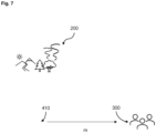
- shows a schematic illustration of a second media data of the emergency relevant object (200) with a certain distance m to the media data location (410) according to an embodiment of the invention.
-
Fig. 1 schematically shows the system of the invention. A group ofpeople 300 are walking in a forested area and think they see an emergency relatedobject 200. The persons think that it could be an open fire because they can only see the smoke, but they do not know anything about the actual cause of the smoke. Therefore, one person of this group takesmedia data 400 in form of a picture with his or hersmartphone 310. Of course, in accordance with the invention, other media data can also be applied, such as videos, etc. They send thismedia data 400 together with the meta data of the position of thepicture 410 to a responsibleappropriate authority 500. Thisappropriate authority 500 evaluates now, automatically or semi-automatically, themedia data 400 and itslocation data 410 with the help ofdifferent databases media data 400 is genuine and whether actually an emergency is present. If there is indeed an emergency, appropriate help measures can be taken immediately. -
Fig. 2a and2b show a flowchart of the method for emergency responses by evaluating media data according to another embodiment of the invention. As described inFigure 1 , a person first takes a picture of a possible emergency-relevant object in step S1. The person does not recognize the cause of the emergency relevant object but is concerned that it could be a major emergency. For example, the person sees smoke but does not recognize the cause of the smoke. The person now sends the picture with the emergency relevant object on it together with the metadata of the picture to a responsible appropriate authority. - If the position data of the image has been transmitted to the appropriate authority, the authority can use suitable databases to find out, whether incidents in the proximity of these position data are already recorded in the database. In step S1a, for example, an emergency database is searched for similar incidents. If the appropriate authority finds an incident in the immediate proximity of the position data of the image, it assigns a confidence value to it in step S1b. For example, if an emergency database is not available, the appropriate authority can also use social media network databases to search for incidents in the immediate proximity of the image position and assigns them a confidence value S1a', S1b'. This search for already known incidents in the immediate proximity of the image position is optional and does not necessarily have to be performed. also, the individual steps S1a, S1b, S1a' and S1b' can either run in parallel or one after the other.
- The appropriate authority tries to determine and classify the emergency relevant object or objects on the image according to step S2. If this succeeds, a confidence value is assigned to the emergency relevant object in step S3. This confidence value indicates how likely it is that the emergency relevant object really is one. This value is then compared with a previously defined value. If the assigned confidence value for the emergency relevant object CV ero is lower than the predefined value, then the appropriate authority will store the incident as a standard incident together with the image data in an emergency database and terminate the process and the method according to step S13. However, if the assigned confidence value CV ero is higher than the previously defined value, then an attempt is made to determine the position of the emergency relevant object in step S4. If no position can be determined for the object, it is assigned a location confidence value CV L ero of 0.
- However, according to step S5, if the location confidence value CV L ero is 0 or lower than a predefined value, the appropriate authority will store a standard incident together with the image data and the confidence value for the emergency relevant object in an emergency database and the method will be terminated according to step S13'. However, there is also the option that if the location confidence value is lower than the predefined value, the person who sent the image to the appropriate authority can be contacted and can be asked for another picture. A second image can be taken at a certain distance from the location of the first image according to step S5'. On this second picture, of course, the emergency relevant object should be visible. Subsequently, the appropriate authority tries to recognize the object on this image again, and also tries to locate the object. The appropriate authority therefore can use other methods for the computation of the location than it did before. If now a determination of the location succeeds together with a location confidence value which is higher than the predefined one, then the method is continued. If no determination of the location succeeds or if the location confidence value is still too low, the method is ended according to step S13'.
- However, if the location confidence value is higher than the predefined value, the appropriate authority will try to find possible known incidents in the immediate proximity of the location of the emergency relevant object using an emergency database in which such incidents are stored. If this does not succeed, a proximity confidence value of 0 is assigned in step S6.
- On the other hand, if such a known incident is detected, a proximity confidence value CV prox is calculated for it according to step S7. If this value is greater than a predefined value, it means that there is already a known incident for which the image data matches. The appropriate authority therefore adds the image data as well as the confidence value for the emergency relevant object and the confidence value for the location of this object to the already known incident. After that, the method is ended according to step S13".
- However, if the proximity confidence value CV prox is less than the predefined value, the appropriate authority will create a new incident with the image data and all available confidence values in step S8.
- After a new incident is created by the appropriate authority, the appropriate authority determines whether houses or buildings are in the immediate proximity of the new incident using appropriate means such as databases, maps, etc. This means that from the buildings, if any, the new incident can be seen and can be confirmed. If such buildings are identified, the building owner or the residents can be contacted via the phone line and asked to verify the new incident according to step S9. here, an IVR (Interactive Voice Response) can be used, too.
- Another possibility is that the appropriate authority may automatically or semi-automatically take further appropriate actions to verify the new incident based on image data received from the person and calculated by the appropriate authority. For example, the appropriate authority may perform a cell tower query for mobile devices of other persons in the proximity to the new incident. If mobile devices are found, the owner can be contacted and asked if he or she can verify the new incident in step S10. This can take place by means of a call SMS or by means of IVR.
- Alternatively, or additionally, drones, helicopters or personnel can be sent to the location of the new incident to verify it in step S11. However, if the terrain is very inaccessible, it is probably more advisable to send a helicopter or drone. Whether a terrain is inaccessible or not can be determined by the appropriate authority, for example, again with the help of databases, maps or the like.
- If the new incident can be verified by one of the aforementioned methods, the appropriate authority can automatically increase the priority of the new incident so that it can be processed preferentially or faster in step S12.
- In
Fig. 3 a schematic illustration of location proximity relations is shown. -
Fig. 4 shows a schematic illustration of a standard search area for known incidences. As can be seen, the search area is circular since any direction of the camera position can be considered. This is the standard area, for example, when there is no other data on the position of the camera or the captured image. -
Fig. 5 shows a schematic illustration of a search area for known incidences when the camera direction of the electronic device is known. thus, the circle ofFig. 4 can be reduced to a semicircle. -
Fig. 6 shows a schematic illustration of a search area for known incidences when the camera direction and the camera's angle of vision is known. The search area becomes even more precise if the resolution or wide angle of the camera of the electronic device is also specified. If this is available from the image data, the search sector can be determined even more precisely. - Known incident is found.
- calculate first confidence value (distance d from known incident to location of "media data", Incident Type, "media data area" = wood etc.)
- distance d from known incident to location of "media data"
- d = 0 means confidence value (cv1) = 100
- d > media data area factor (maf) means confidence value (cv1) = 0 (e. g. forest maf = 5 km, city maf =1 km)
- e. g. cv1 = 100 - 100 (d/maf)
- Relation Incident Type to "media data location classification", e. g. if "media data location classification" = wood (retrieved from maps or database)
- For each media data area factor (e. g. wood, forest, meadow, grassland, town, etc.) a corresponding list will be used which contains related Incident Type (IT) with assigned confidence value (cv). The IT are taken from "Public Safety Communications Common Incident Types for Data Exchange" (Standard written by The APCO International Data Transfer Committee, http://www.apcostandards.org/). The assigned values are part of the invention and reflect the probability that an event (e. g. FIRE) can occur in the context
- (e. g. forest). The values in the list and also the events can be adjusted based on real events in the context.
- e. g. media data area factor: forest IT: cv2
- FIRE: 100
- FIRE SMOKE: 100
- FIRE STRUCTURE: 80
- FIRE BRUSH: 50
- FIRE OTHER: 40
- FIRE *: 30
- Rest: 0
- first confidence value = (cv1 +cv2)/2 or
- In Step S3:
- E. g. emergency relevant object = Smoke Incident type: cv4
- IT: cv4
- FIRE SMOKE: 100
- FIRE: 90
- FIRE STRUCTURE: 80
- FIRE BRUSH: 50
- FIRE OTHER: 40
- FIRE *: 30
- Rest: 0
- emergency relevant object confidence value (CV ero) = returned method value (cv3) + cv4)/2 or
- Or without cv4 = emergency relevant object confidence value = returned method value
- With method value here means the value, which is output with the automatic media data recognition, e. g. of emergency relevant objects.
- Calculate proximity in which to search for a known incident.
- If location confidence value and emergency relevant object confidence value are high, the search radius could be smaller and vice versa. Basis is the media data location. This time emergency relevant object confidence value will be used as weight factor (wf).
- For the emergency relevant object confidence value as a weight factor, a list will be used:
- Fire: 0,9
- Smoke: 0,6 (since it is assumed that smoke is not stationary as e. g. fire)

- Example: maf = 5 km; location confidence value = 100; wf = 0,9
- prox = 0,5 km, the search radius is the 0,5 km around the location of the emergency relevant object.
- It has to be mentioned that it is possible, by considering the camera's angle of vision, to narrow down the 'search field' of the incident rather than using the location as the center and 'drawing' an imaginary circle to be used as the search sector.
- A group is hiking together in the forested mountains. Suddenly, a participant sees smoke coming out of a distant place. The area is far enough and as a result, particular details are not easily noticed. Hence, one cannot identify, if the smoke is due to a chimney of a house that is located there, someone doing construction work or a real fire.
- The group knows that the risk of fire is very high at the moment and decides to report the observation. For this purpose, one participant takes media data in form of a picture of the situation with a smartphone. Together with GPS data in the meta data of the picture they send it to an appropriate authority (e. g. a Public Safety Answering Point, an Emergency service provider, etc.).
- The appropriate authority checks if there is a known incident or an emergency in a certain proximity. The media data area (here picture area) is located in a forest (classified using a map database), so according to a predefined media data area factor (maf), a 5 km circle around the media data location (here picture location) is used as proximity.
- The appropriate authority finds a known incident (IKN) 3 km (d = 3 km) away with the Incident Type (IT) "FIRE SMOKE". Now a first confidence value is calculated:


- In a next step with suitable (mathematical) procedures, the image and the contained objects will be classified. The procedure returns as an emergency relevant object "Smoke" with a probability of 90 (cv3 = 90). cv4 (cv4 = value of incident type in the list "Smoke") is predefined and is only used if the first confidence value > 50. Since cv3 is greater than 50, an emergency relevant object confidence value is calculated:

emergency relevant object confidence value = (cv3 +cv4)/2 = (90+100)/2 = 95
Since the emergency relevant object confidence value is greater than 60 (predefined value), the next step will proceed. - In a next step with suitable (mathematical) procedures the position of the emergency relevant objects "Smoke" is determined. The procedure returns a location with a probability of 80 (location confidence value = 80), since the value is greater than 65 (predefined), the next step will be proceeded.
- The appropriate authority checks if there is a known incident (IKN) in a certain proximity (prox):

location confidence value = 80
wf = weight factor based on emergency relevant object ("Smoke") from list = 0,6
- Thus, a 2,6 km circle around location of emergency relevant object is used as proximity.
- This time no incident was found, therefore the assigned confidence value is zero. Since the confidence value is lower than 60, a new incident case with Incident Type (IT) based on emergency relevant object ("Smoke") will be created and then next step will be proceeded.
- The appropriate authority checks if there is a building at the determined position and any mobile users nearby. Since there is no known building and no mobile user (the hiking group has moved away from the object) and no road nearby, a drone will be used to clarify if the smoke is caused by a fire. As the fire was confirmed by drone (e. g. by pilot) the priority of the incident will be raised, and all additional data (from the drone flight) will be added to the incident.
- It should be noted that the term "comprising" does not exclude other elements or steps and the "a" or "an" does not exclude a plurality. Further, elements described in association with different embodiments may be combined.
- It should also be noted that reference signs in the claims shall not be construed as limiting the scope of the claims.
-
- 100
- system
- 200
- emergency relevant object
- 210
- location of the emergency relevant object
- 300
- person/eyewitness
- 310
- electronic device
- 400
- media data
- 410
- location of the media data
- 500
- appropriate authority
- 600
- emergency database
- 700
- social media database
- IKN
- known incident
- prox
- proximity
- d
- distance d from known incident (IKN) to location of the media data (410)
- m
- distance m from location of the media data (410) to a new location of person (300)
- maf
- media data area factor
- CV
- confidence value
- CV ero
- emergency relevant object confidence value
- CV Lero
- location of the emergency relevant object
- CV prox
- proximity confidence value
- CV first
- a first confidence value
- CV second
- a second confidence value
- S1 - S13"
- steps of the method


Claims (15)
- A method for emergency responses by evaluating media data (400), wherein the method comprising the steps of:- (S1) detecting, by a person (300), a potential emergency related object (200) in an area and in a proximity (prox) to the person (300), capturing, by the person (300), with an electronic device (310) media data (400) of the potential emergency related object (200) and sending, by the person (300), the picture or the video (400) together with the metadata of the media data location (410), if available, to an appropriate authority (500);- (S2) determining and classifying, by the appropriate authority (500), an emergency relevant object (200) in the media data (400) and (S3) assigning an emergency relevant object confidence value (CV ero) to the emergency relevant object (200), if no emergency relevant object (200) is determined or the emergency relevant object confidence value (CV ero) is lower as a predefined value, (S13) adding, by the appropriate authority (500) a standard incident together with the media data (400) to an emergency database (600), and ending the method; otherwise- (S4) determining, a location of the emergency relevant object (210), if no location of the emergency relevant object (210) is determined, assigning a location confidence value (CV L ero) of zero; otherwise- (S5) calculating, a location confidence value (CV L ero), if the location confidence value (CV ero) is zero or lower than a predefined value,- (S8) creating, by the appropriate authority (500), a new incident case and adding it together with the media data (400) and all available confidence values to an emergency database (600) and ending the method (S13').
- The method according to claim 1, wherein after step S5 the method further comprising:- (S6) determining, by the appropriate authority (500), if a known incident (IKN) in a certain proximity (prox) to the location of the emergency relevant object (210) is present on the basis of comparative data from an emergency database (600), if no known incident (IKN) is determined, assigning a proximity confidence value (CV prox) of zero, and- (S8) creating, by the appropriate authority (500), a new incident case and adding it together with the media data (400) and all available confidence values to an emergency database (600) and ending the method.
- The method according to claim 2, wherein after step S6 the method further comprising:- (S7) calculating, a proximity confidence value (CV prox), if the proximity confidence value (CV prox) is greater than a predefined value, and- (S8) adding, by the appropriate authority, the media data (400) and all available confidence values to the already known incident (IKN) in the emergency database (600) and ending the method (S13").
- The method according to any of the preceding claims, wherein the emergency relevant object (200) is at least one of smoke, heat, fire, abnormal water level, flood, avalanche, storm, earthquake, riot, robbery, acts of war, tornado, wind pant or any other natural disaster.
- The method according to any of the preceding claims, wherein the area is at least one of forest, bushland, combustible vegetation, seaside, river side, dessert, mountain, grassland, lake side, town, city or wasteland.
- The method according to any of the preceding claims, wherein the metadata further comprising a proximity sector or an angle of view of the electronic device (310).
- The method according to any of the preceding claims, wherein the electronical device (310) is a smartphone, tablet, smartwatch, smart glass or any other appropriate equipped device which is configured to send data to the appropriate authority (500).
- The method according to any of the preceding claims, wherein, in case the metadata comprising the media data location (410), the method further comprising after step (S1):- (S1a) determining, if a known incident (IKN) in a certain proximity (prox) of the the media data location (410) is present on the basis of comparative data from an emergency database (600); and, if a known incident (IKN) is present- (S1b) calculating, a first confidence value (CV first), otherwise, if no known incident (IKN) is present, assigning a first confidence value (CV first) of zero.
- The method according to any of the preceding claims, wherein, in case the metadata comprising the media data location (410), the method further comprising after step (S1):- (S1a') checking, if a known incident (IKN) in a certain proximity (prox) of the the media data location (410) is present on the basis of comparative data from a social media network database (700); and, if a known incident (IKN) is present- (S1b') calculating, a second confidence value (CV second), otherwise, if no known incident (IKN) is present assigning a second confidence value (CV second) of zero.
- The method according to claims 8 and 9, wherein the steps S1a, S1b, S1a' and S1b' are performed in parallel or in sequence.
- The method according to any of the preceding claims, wherein the method further comprising adding and weighting the first confidence value (CV first), the second confidence value (CV second), the emergency relevant objects confidence value (CV ero), the location of the emergency relevant objects confidence value (CV L ero) and/or the proximity confidence value (CV prox).
- The method according to any of the preceding claims, wherein, if the location confidence value (CV L ero) is lower as a predefined value, the method further comprising:- (S5') contacting and asking the person (300) to take a second media data of the emergency relevant object (200) with a certain distance m to media data location (410) and calculating the location of the emergency relevant object (210) using the second media data and/or a different calculation method.
- The method according to any of the preceding claims, wherein after creating the new incident case, the method further comprising:- (S9) checking, by the appropriate authority (500), using a map query, which buildings are in the vicinity of the new incident case and contacting and asking via call, SMS, Short Message Service, or IVR, Interactive Voice Response, if the owner of the building can confirm the new incident case; and/or- (S10) determining, by the appropriate authority (500), using a cell tower query, which mobile devices of other persons are in the vicinity of the new incident case and contacting and asking via call, SMS or IVR if the other persons can confirm the new incident case; and/or- (S11) dispatching, by the appropriate authority (500), a drone, or personnel to confirm the new incident case; and/or;- (S12) increasing, by the appropriate authority (500), the priority of the new incident case, if the new incident is confirmed.
- The method according to any of the preceding claims, wherein all confident values are scaled to a value from 0 to 100, wherein a value of zero means no confidence and a value of 100 means extremely confident.
- A system (100) for emergency responses by evaluating media data, wherein the system is configured to perform the method according to any of the claims 1 to 14.
Priority Applications (2)
| Application Number | Priority Date | Filing Date | Title |
|---|---|---|---|
| EP21196935.7A EP4152290A1 (en) | 2021-09-15 | 2021-09-15 | Method and system for emergency responses by evaluating media data |
| US17/888,691 US12211365B2 (en) | 2021-09-15 | 2022-08-16 | Method and system for emergency responses by evaluating media data |
Applications Claiming Priority (1)
| Application Number | Priority Date | Filing Date | Title |
|---|---|---|---|
| EP21196935.7A EP4152290A1 (en) | 2021-09-15 | 2021-09-15 | Method and system for emergency responses by evaluating media data |
Publications (1)
| Publication Number | Publication Date |
|---|---|
| EP4152290A1 true EP4152290A1 (en) | 2023-03-22 |
Family
ID=77774838
Family Applications (1)
| Application Number | Title | Priority Date | Filing Date |
|---|---|---|---|
| EP21196935.7A Pending EP4152290A1 (en) | 2021-09-15 | 2021-09-15 | Method and system for emergency responses by evaluating media data |
Country Status (2)
| Country | Link |
|---|---|
| US (1) | US12211365B2 (en) |
| EP (1) | EP4152290A1 (en) |
Cited By (1)
| Publication number | Priority date | Publication date | Assignee | Title |
|---|---|---|---|---|
| CN119048916A (en) * | 2024-10-30 | 2024-11-29 | 水利部中国科学院水工程生态研究所 | Ecological effect influence assessment method and system for river and lake environment |
Citations (2)
| Publication number | Priority date | Publication date | Assignee | Title |
|---|---|---|---|---|
| US20090181640A1 (en) * | 2008-01-16 | 2009-07-16 | Jones M Kelly | Interactive Personal Surveillance and Security (IPSS) System |
| WO2021115555A1 (en) * | 2019-12-09 | 2021-06-17 | Unify Patente Gmbh & Co. Kg | Method of validating data relating to an emergency event and social media server |
Family Cites Families (2)
| Publication number | Priority date | Publication date | Assignee | Title |
|---|---|---|---|---|
| US11917514B2 (en) * | 2018-08-14 | 2024-02-27 | Rapidsos, Inc. | Systems and methods for intelligently managing multimedia for emergency response |
| US12382269B2 (en) * | 2021-08-30 | 2025-08-05 | Rapidsos, Inc. | Facilitating a response to an emergency using an emergency response device |
-
2021
- 2021-09-15 EP EP21196935.7A patent/EP4152290A1/en active Pending
-
2022
- 2022-08-16 US US17/888,691 patent/US12211365B2/en active Active
Patent Citations (2)
| Publication number | Priority date | Publication date | Assignee | Title |
|---|---|---|---|---|
| US20090181640A1 (en) * | 2008-01-16 | 2009-07-16 | Jones M Kelly | Interactive Personal Surveillance and Security (IPSS) System |
| WO2021115555A1 (en) * | 2019-12-09 | 2021-06-17 | Unify Patente Gmbh & Co. Kg | Method of validating data relating to an emergency event and social media server |
Cited By (1)
| Publication number | Priority date | Publication date | Assignee | Title |
|---|---|---|---|---|
| CN119048916A (en) * | 2024-10-30 | 2024-11-29 | 水利部中国科学院水工程生态研究所 | Ecological effect influence assessment method and system for river and lake environment |
Also Published As
| Publication number | Publication date |
|---|---|
| US12211365B2 (en) | 2025-01-28 |
| US20230079013A1 (en) | 2023-03-16 |
Similar Documents
| Publication | Publication Date | Title |
|---|---|---|
| US8768294B2 (en) | Notification and tracking system for mobile devices | |
| US8862092B2 (en) | Emergency notification system for mobile devices | |
| US20180025458A1 (en) | Self-customizing, multi-tenanted mobile system and method for digitally gathering and disseminating real-time visual intelligence on utility asset damage enabling automated priority analysis and enhanced utility outage response | |
| US20130141460A1 (en) | Method and apparatus for virtual incident representation | |
| EP3590276A2 (en) | Methods and systems for security tracking and generating alerts | |
| Maryam et al. | A survey on smartphones systems for emergency management (SPSEM) | |
| CN109155098A (en) | Method and apparatus for controlling urgency communication | |
| US20200402192A1 (en) | Creation of Web-Based Interactive Maps for Emergency Responders | |
| US20210204106A1 (en) | Event alerting using a communications system | |
| KR20200052418A (en) | Automated Violence Detecting System based on Deep Learning | |
| CN110826930A (en) | Security task scheduling method, device, equipment and readable storage medium | |
| US20250071205A1 (en) | Prioritizing emergency calls based on caller response to automated query | |
| Iliopoulou et al. | ITS technologies for decision making during evacuation operations: a review | |
| KR102356290B1 (en) | Mobile urgent disaster reporting and processing system | |
| CN105513232A (en) | Safe emergency dredging method and system | |
| US11909914B2 (en) | Forwarding emergency messages from IoT devices to PSAPs | |
| Diaz | New York City police department surveillance technology | |
| US12211365B2 (en) | Method and system for emergency responses by evaluating media data | |
| CN110619738A (en) | Joint defense warning method and device | |
| JP2002334184A (en) | System for collecting real time situation | |
| KR102333955B1 (en) | Method, system and application for indicating safe area and navigating safe path for socially vulnerable people | |
| CN108876924B (en) | Method and device for determining fire evacuation path | |
| KR102141045B1 (en) | Accident reporting system | |
| CN113628429A (en) | Emergency help-seeking method and system based on 5G communication | |
| CN110448846A (en) | A kind of intelligence fire-fighting system |
Legal Events
| Date | Code | Title | Description |
|---|---|---|---|
| PUAI | Public reference made under article 153(3) epc to a published international application that has entered the european phase |
Free format text: ORIGINAL CODE: 0009012 |
|
| STAA | Information on the status of an ep patent application or granted ep patent |
Free format text: STATUS: THE APPLICATION HAS BEEN PUBLISHED |
|
| AK | Designated contracting states |
Kind code of ref document: A1 Designated state(s): AL AT BE BG CH CY CZ DE DK EE ES FI FR GB GR HR HU IE IS IT LI LT LU LV MC MK MT NL NO PL PT RO RS SE SI SK SM TR |
|
| STAA | Information on the status of an ep patent application or granted ep patent |
Free format text: STATUS: REQUEST FOR EXAMINATION WAS MADE |
|
| 17P | Request for examination filed |
Effective date: 20230720 |
|
| RBV | Designated contracting states (corrected) |
Designated state(s): AL AT BE BG CH CY CZ DE DK EE ES FI FR GB GR HR HU IE IS IT LI LT LU LV MC MK MT NL NO PL PT RO RS SE SI SK SM TR |
|
| RAP1 | Party data changed (applicant data changed or rights of an application transferred) |
Owner name: ATOS PUBLIC SAFETY LLC |
|
| P01 | Opt-out of the competence of the unified patent court (upc) registered |
Effective date: 20240301 |
|
| STAA | Information on the status of an ep patent application or granted ep patent |
Free format text: STATUS: EXAMINATION IS IN PROGRESS |
|
| 17Q | First examination report despatched |
Effective date: 20250410 |