EP4025937B1 - System und verfahren zur seismischen abbildung von unterirdischen volumen mit komplexer geologie - Google Patents
System und verfahren zur seismischen abbildung von unterirdischen volumen mit komplexer geologie Download PDFInfo
- Publication number
- EP4025937B1 EP4025937B1 EP20765097.9A EP20765097A EP4025937B1 EP 4025937 B1 EP4025937 B1 EP 4025937B1 EP 20765097 A EP20765097 A EP 20765097A EP 4025937 B1 EP4025937 B1 EP 4025937B1
- Authority
- EP
- European Patent Office
- Prior art keywords
- seismic
- atrous
- image
- training
- rates
- Prior art date
- Legal status (The legal status is an assumption and is not a legal conclusion. Google has not performed a legal analysis and makes no representation as to the accuracy of the status listed.)
- Active
Links
Images






Classifications
-
- G—PHYSICS
- G01—MEASURING; TESTING
- G01V—GEOPHYSICS; GRAVITATIONAL MEASUREMENTS; DETECTING MASSES OR OBJECTS; TAGS
- G01V1/00—Seismology; Seismic or acoustic prospecting or detecting
- G01V1/28—Processing seismic data, e.g. for interpretation or for event detection
- G01V1/34—Displaying seismic recordings or visualisation of seismic data or attributes
-
- G—PHYSICS
- G01—MEASURING; TESTING
- G01V—GEOPHYSICS; GRAVITATIONAL MEASUREMENTS; DETECTING MASSES OR OBJECTS; TAGS
- G01V1/00—Seismology; Seismic or acoustic prospecting or detecting
- G01V1/28—Processing seismic data, e.g. for interpretation or for event detection
- G01V1/30—Analysis
- G01V1/301—Analysis for determining seismic cross-sections or geostructures
- G01V1/302—Analysis for determining seismic cross-sections or geostructures in 3D data cubes
-
- G—PHYSICS
- G01—MEASURING; TESTING
- G01V—GEOPHYSICS; GRAVITATIONAL MEASUREMENTS; DETECTING MASSES OR OBJECTS; TAGS
- G01V1/00—Seismology; Seismic or acoustic prospecting or detecting
- G01V1/28—Processing seismic data, e.g. for interpretation or for event detection
- G01V1/34—Displaying seismic recordings or visualisation of seismic data or attributes
- G01V1/345—Visualisation of seismic data or attributes, e.g. in 3D cubes
-
- G—PHYSICS
- G01—MEASURING; TESTING
- G01V—GEOPHYSICS; GRAVITATIONAL MEASUREMENTS; DETECTING MASSES OR OBJECTS; TAGS
- G01V1/00—Seismology; Seismic or acoustic prospecting or detecting
- G01V1/28—Processing seismic data, e.g. for interpretation or for event detection
- G01V1/36—Effecting static or dynamic corrections on records, e.g. correcting spread; Correlating seismic signals; Eliminating effects of unwanted energy
-
- G—PHYSICS
- G06—COMPUTING OR CALCULATING; COUNTING
- G06N—COMPUTING ARRANGEMENTS BASED ON SPECIFIC COMPUTATIONAL MODELS
- G06N3/00—Computing arrangements based on biological models
- G06N3/02—Neural networks
- G06N3/04—Architecture, e.g. interconnection topology
- G06N3/045—Combinations of networks
-
- G—PHYSICS
- G06—COMPUTING OR CALCULATING; COUNTING
- G06N—COMPUTING ARRANGEMENTS BASED ON SPECIFIC COMPUTATIONAL MODELS
- G06N3/00—Computing arrangements based on biological models
- G06N3/02—Neural networks
- G06N3/04—Architecture, e.g. interconnection topology
- G06N3/045—Combinations of networks
- G06N3/0455—Auto-encoder networks; Encoder-decoder networks
-
- G—PHYSICS
- G06—COMPUTING OR CALCULATING; COUNTING
- G06N—COMPUTING ARRANGEMENTS BASED ON SPECIFIC COMPUTATIONAL MODELS
- G06N3/00—Computing arrangements based on biological models
- G06N3/02—Neural networks
- G06N3/04—Architecture, e.g. interconnection topology
- G06N3/0464—Convolutional networks [CNN, ConvNet]
-
- G—PHYSICS
- G06—COMPUTING OR CALCULATING; COUNTING
- G06N—COMPUTING ARRANGEMENTS BASED ON SPECIFIC COMPUTATIONAL MODELS
- G06N3/00—Computing arrangements based on biological models
- G06N3/02—Neural networks
- G06N3/08—Learning methods
-
- G—PHYSICS
- G06—COMPUTING OR CALCULATING; COUNTING
- G06N—COMPUTING ARRANGEMENTS BASED ON SPECIFIC COMPUTATIONAL MODELS
- G06N3/00—Computing arrangements based on biological models
- G06N3/02—Neural networks
- G06N3/08—Learning methods
- G06N3/084—Backpropagation, e.g. using gradient descent
-
- G—PHYSICS
- G06—COMPUTING OR CALCULATING; COUNTING
- G06N—COMPUTING ARRANGEMENTS BASED ON SPECIFIC COMPUTATIONAL MODELS
- G06N3/00—Computing arrangements based on biological models
- G06N3/02—Neural networks
- G06N3/08—Learning methods
- G06N3/09—Supervised learning
-
- G—PHYSICS
- G01—MEASURING; TESTING
- G01V—GEOPHYSICS; GRAVITATIONAL MEASUREMENTS; DETECTING MASSES OR OBJECTS; TAGS
- G01V2210/00—Details of seismic processing or analysis
- G01V2210/30—Noise handling
- G01V2210/32—Noise reduction
-
- G—PHYSICS
- G01—MEASURING; TESTING
- G01V—GEOPHYSICS; GRAVITATIONAL MEASUREMENTS; DETECTING MASSES OR OBJECTS; TAGS
- G01V2210/00—Details of seismic processing or analysis
- G01V2210/60—Analysis
- G01V2210/64—Geostructures, e.g. in 3D data cubes
- G01V2210/641—Continuity of geobodies
-
- G—PHYSICS
- G01—MEASURING; TESTING
- G01V—GEOPHYSICS; GRAVITATIONAL MEASUREMENTS; DETECTING MASSES OR OBJECTS; TAGS
- G01V2210/00—Details of seismic processing or analysis
- G01V2210/60—Analysis
- G01V2210/64—Geostructures, e.g. in 3D data cubes
- G01V2210/642—Faults
-
- G—PHYSICS
- G01—MEASURING; TESTING
- G01V—GEOPHYSICS; GRAVITATIONAL MEASUREMENTS; DETECTING MASSES OR OBJECTS; TAGS
- G01V2210/00—Details of seismic processing or analysis
- G01V2210/70—Other details related to processing
- G01V2210/74—Visualisation of seismic data
Definitions
- the disclosed embodiments relate generally to techniques for seismic imaging of subsurface volumes and, in particular, to a method of seismic imaging of subsurface volumes using machine-learning.
- Seismic exploration involves surveying subterranean geological media for hydrocarbon deposits.
- a survey typically involves deploying seismic sources and seismic sensors at predetermined locations.
- the sources generate seismic waves, which propagate into the geological medium creating pressure changes and vibrations.
- Variations in physical properties of the geological medium give rise to changes in certain properties of the seismic waves, such as their direction of propagation and other properties.
- seismic waves Portions of the seismic waves reach the seismic sensors.
- Some seismic sensors are sensitive to pressure changes (e.g., hydrophones), others to particle motion (e.g., geophones), and industrial surveys may deploy one type of sensor or both.
- the sensors In response to the detected seismic waves, the sensors generate corresponding electrical signals, known as traces, and record them in storage media as seismic data.
- Seismic data will include a plurality of "shots" (individual instances of the seismic source being activated), each of which are associated with a plurality of traces recorded at the plurality of sensors.
- Seismic data is processed to create seismic images that can be interpreted to identify subsurface geologic features including hydrocarbon deposits.
- Seismic images particularly in areas of complex subsurface geology, may have regions that are poorly imaged due to poor illumination, conflicting dips, random noise, migration swing noise, and other undesirable artifacts.
- CNN supervised deep 3D convolutional neural network
- the processed outputs of the trained neural network are much cleaner than the inputs, and they highlight geologic structures for easier interpretation. Different scales of geologic structures, from high- resolution faults and diffractors to deep subsalt sediments, are well-preserved by the deep neural network.
- Gao Han ET AL “Simultaneous Denoising and Interpolation of Seismic Data via the Deep Learning Method", Earthquake research in China, 1 January 2019, pages 37-51 . It proposes a simultaneous denoising and interpolation method based on deep learning.
- the seismic records can be reconstructed by solving a least-squares problem and applying a set of pre-trained denoising models alternatively and iteratively.
- Dimitri Bevc ET AL Automatic seismic facies interpretation based on an enhanced encoder-decoder structure
- SEG Technical Program Expanded Abstracts 2019, 1 August 2019 It relates to a scheme which is based on an enhanced encoder-decoder structure named DeepLabv3+ developed by Google.
- the encoder-decoder structure performs more accurately and efficiently than CNN models, and simple semantic segmentation models such as a deconvolutional neural network are used for extracting multi-scale contextual information and recovering more pixel-level details in prediction results: None of the references above discloses that the atrous convolution uses varying rectangular atrous rates instead of equal atrous rates in all dimensions.
- the features extracted by the rectangular atrous rates are concatenated and convolved with a series of 3x3x3 kernels to generate features of varying scales.
- multiple neural networks are trained on separate seismic images of different frequency, grid size and migration algorithm.
- the neural network is applied by one or multiple passes to neighboring depth ranges with different down-sampling rates.
- training the neural network includes an encoder-decoder architecture in three dimensions.
- some embodiments provide a non-transitory computer readable storage medium storing one or more programs according to claim 9.
- the one or more programs comprise instructions, which when executed by a computer system with one or more processors and memory, cause the computer system to perform any of the methods provided herein.
- some embodiments provide a computer system according to claim 7.
- the computer system includes one or more processors, memory, and one or more programs.
- the one or more programs are stored in memory and configured to be executed by the one or more processors.
- the one or more programs include an operating system and instructions that when executed by the one or more processors cause the computer system to perform any of the methods provided herein.
- Described below are methods, systems, and computer readable storage media that provide a manner of seismic imaging. These embodiments are designed to be of particular use for seismic imaging of subsurface volumes in geologically complex areas.
- the embodiments provided herein may be utilized to generate a more accurate digital seismic image (i.e., the corrected digital seismic image).
- the more accurate digital seismic image may improve hydrocarbon exploration and improve hydrocarbon production.
- the more accurate digital seismic image may provide details of the subsurface that were illustrated poorly or not at all in traditional seismic images.
- the more accurate digital seismic image may better delineate where different features begin, end, or any combination thereof.
- the more accurate digital seismic image may illustrate faults and/or salt flanks more accurately.
- the more accurate digital seismic image indicates the presence of a hydrocarbon deposit.
- the more accurate digital seismic image may delineate more accurately the bounds of the hydrocarbon deposit so that the hydrocarbon deposit may be produced.
- the more accurate digital seismic image may be utilized in hydrocarbon exploration and hydrocarbon production for decision making.
- the more accurate digital seismic image may be utilized to pick a location for a wellbore.
- decisions about about (a) where to drill one or more wellbores to produce the hydrocarbon deposit, (b) how many wellbores to drill to produce the hydrocarbon deposit, etc. may be made based on the more accurate digital seismic image.
- the more accurate digital seismic image may even be utilized to select the trajectory of each wellbore to be drilled.
- a higher number of wellbore locations may be selected and that higher number of wellbores may be drilled, as compared to delineation indicating a smaller hydrocarbon deposit.
- the more accurate digital seismic image may be utilized in hydrocarbon exploration and hydrocarbon production for control.
- the more accurate digital seismic image may be utilized to steer a tool (e.g., drilling tool) to drill a wellbore.
- a drilling tool may be steered to drill one or more wellbores to produce the hydrocarbon deposit.
- Steering the tool may include drilling around or avoiding certain subsurface features (e.g., faults, salt diapirs, shale diapirs, shale ridges, pockmarks, buried channels, gas chimneys, shallow gas pockets, and slumps), drilling through certain subsurface features (e.g., hydrocarbon deposit), or any combination thereof depending on the desired outcome.
- the more accurate digital seismic image may be utilized for controlling flow of fluids injected into or received from the subsurface, the wellbore, or any combination thereof.
- the more accurate digital seismic image may be utilized for controlling flow of fluids injected into or received from at least one hydrocarbon producing zone of the subsurface. Chokes or well control devices, positioned on the surface or downhole, may be used to control the flow of fluid into and out. For example, certain subsurface features in the more accurate digital seismic image may prompt activation, deactivation, modification, or any combination thereof of the chokes or well control devices so as control the flow of fluid.
- the more accurate digital seismic image may be utilized to control injection rates, production rates, or any combination thereof.
- the more accurate digital seismic image may be utilized to select completions, components, fluids, etc. for a wellbore.
- a variety of casing, tubing, packers, heaters, sand screens, gravel packs, items for fines migration, etc. may be selected for each wellbore to be drilled based on the more accurate digital seismic image.
- one or more recovery techniques to produce the hydrocarbon deposit may be selected based on the more accurate digital seismic image.
- Seismic imaging of the subsurface is used to identify potential hydrocarbon reservoirs. Seismic data is acquired at a surface (e.g. the earth's surface, ocean's surface, or at the ocean bottom) as seismic traces which collectively make up the seismic dataset. As is known to those of skill in the art, seismic data is subjected to a seismic imaging process such as migration to generate seismic images. Seismic images, particularly in areas of complex subsurface geology, may have regions that are poorly imaged due to sparse seismic acquisition, noise in input traces, poor illumination, incorrect migration velocity, and unrealistic physics in the migration algorithm.
- the resulting undesirable artifacts in migrated images include random noise, migration swing noise, conflicting dips, amplitude striping, poor signal-to-noise ratio (S/N) in deep sections, etc.
- Previous attempts to attenuate these artifacts using machine-learning, such as US2019/0170888 "Systems and Methods for Refining Estimated Parameter Values in Seismic Imaging” have failed to efficiently encode the multi-scale features in seismic images and may result in poor performance (residual coherent noise, poor illumination or damaged signals) mainly in the over-sampled deep part of the image.
- the goal is to train Deep Learning models and apply to new datasets outside of the training set "as is", without re-training or fine-tuning during prediction.
- the volume used in prediction is thus not included in the training set and may have been acquired & migrated at different frequency and sampled on grid sizes different from the training dataset. Since the divergence in object-scale between training set and prediction volume affects the model performance at inference time. It is conceivably difficult for a model trained on a specific training set to generalize universally during prediction on any field dataset. The spatial variation of structural wavelength within one seismic volume further complicates the issue.
- Our solution is to build multiple training sets corresponding to different data acquisition, migration algorithm and frequency and train a collection of models on these training datasets, and only apply the model to a prediction volume with similar data type, imaging algorithm and frequency.
- Figure 2 demonstrates the result of using a U-Net architecture as shown in Figure 1 , wherein the training cubes (examples shown as 20A and 20B) are 128x128x128 pixels. Training cubes of this size are smaller than the coherent swing noise 21. As shown in boxes 22A and 22B, the performance of such networks degrades in the oversampled deep part of the image, where the signal to noise ratio (S/N) is usually lower than shallow with lots of structural uncertainties.
- S/N signal to noise ratio
- the present invention leverages an increasing field of view and extracting multi-scale features so that it can be effectively applied to resolve the multi-scale issue in 3D seismic enhancement.
- Atrous convolution in neural architecture design has previously been used in image segmentation to increase effective field of view.
- the present invention leverages atrous convolution to solve a different problem, handling scale variation and oversampling in the deep part of seismic images as shown in Figure 3 .
- Atrous convolution samples every few pixels of the layer input and convolves with the convolutional filters, or equivalently insert zeros in the filters to convolve with the original input.
- Atrous convolution increases the field of view without increasing memory or computational cost.
- the sampling rate or the number of inserted zeros in atrous convolution is referred to as dilation rate or rate.
- windowed, multi-pass of a single trained model at down-sampled deep section serves as a workaround for spatially varying structural length and oversampled deep.
- Empirical tests based on this method show that a sequence of rates from large to small (such as 2-2-2 followed by 1-1-1 for inline, xline and depth) works reasonably well at depth where dominant frequency is lower than shallow.
- the idea behind a two-pass processing is that the first pass on down-sampled deep section attenuates noise and enhance large-scale structures and the second pass on the original data removes small-scale random noise.
- the largest grid size to start with (2-2-2 in the example) can be picked either from visual inspection of the results or based on the dominant structural wavelength vs. depth and the grid size.
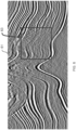
- Figure 4 is a synthetic example of a seismic image.
- Figure 4 concentrate on the subsalt image 41 from the full image 40.
- This synthetic image has poor signal to noise ratio (S/N).
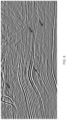
- Figure 5 is the result of seismic image enhancement using machine-learning without atrous convolution.
- the subsalt image 51 has failed to improve the image in area 53.
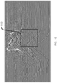
- Figure 6 is the result of seismic image enhancement using machine-learning with atrous convolution.
- the subsalt image 61 has improved the image in area 63 such that the seismic events are much more continuous.
- the bigger field of view due to the use of the atrous convolution in the training of the neural network leads to better decisions on noise/structural distinction because large-scale, contextual information has been used to recover the structure.
- Figure 7 is a synthetic example of a seismic image.
- Figure 8 is the result of seismic image enhancement using machine-learning without atrous convolution.
- the arrows indicate areas where the image is still poor.
- Figure 9 is the result of seismic image enhancement using machine-learning with atrous convolution. The arrows point to the same areas, showing much improvement over Figures 7 and 8 .
- Figure 10 is another synthetic example of a seismic image. This synthetic image has poor signal to noise ratio (S/N) with significant migration swings throughout the lower part of the image as indicated in area 103.
- Figure 11 is the result of seismic image enhancement using machine-learning without atrous convolution. Area 113 is improved but still has non-continuous events throughout.
- Figure 12 is the result of seismic image enhancement using machine-learning with atrous convolution. Area 123 has better S/N and more continuous events than Figure 11 .
- the bigger field of view due to the use of the atrous convolution in the training of the neural network leads to better decisions on noise/structural distinction.
- Figure 13 is a depth slice of a synthetic seismic image (a map view). This synthetic image also has poor signal to noise ratio (S/N).
- Figure 14 is the result of seismic image enhancement using machine-learning without atrous convolution. Figure 14 has less noise but the arrows indicate places where the seismic events are incomplete.
- Figure 15 is the result of seismic image enhancement using machine-learning with atrous convolution and has both better S/N and more complete seismic events at the arrows.
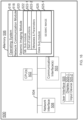
- FIG 16 is a block diagram illustrating a seismic imaging system 500, in accordance with some embodiments. While certain specific features are illustrated, those skilled in the art will appreciate from the present disclosure that various other features have not been illustrated for the sake of brevity and so as not to obscure more pertinent aspects of the embodiments disclosed herein.
- the seismic imaging system 500 includes one or more processing units (CPUs) 502, one or more network interfaces 508 and/or other communications interfaces 503, memory 506, and one or more communication buses 504 for interconnecting these and various other components.
- the seismic imaging system 500 also includes a user interface 505 (e.g., a display 505-1 and an input device 505-2).
- the communication buses 504 may include circuitry (sometimes called a chipset) that interconnects and controls communications between system components.
- Memory 506 includes high-speed random access memory, such as DRAM, SRAM, DDR RAM or other random access solid state memory devices; and may include non-volatile memory, such as one or more magnetic disk storage devices, optical disk storage devices, flash memory devices, or other non-volatile solid state storage devices. Memory 506 may optionally include one or more storage devices remotely located from the CPUs 502. Memory 506, including the non-volatile and volatile memory devices within memory 506, comprises a non-transitory computer readable storage medium and may store seismic data, velocity models, seismic images, and/or geologic structure information.
- memory 506 or the non-transitory computer readable storage medium of memory 506 stores the following programs, modules and data structures, or a subset thereof including an operating system 516, a network communication module 518, and a seismic imaging module 520.
- the operating system 516 includes procedures for handling various basic system services and for performing hardware dependent tasks.
- the network communication module 518 facilitates communication with other devices via the communication network interfaces 508 (wired or wireless) and one or more communication networks, such as the Internet, other wide area networks, local area networks, metropolitan area networks, and so on.
- communication network interfaces 508 wireless or wireless
- communication networks such as the Internet, other wide area networks, local area networks, metropolitan area networks, and so on.
- the seismic imaging module 520 executes the operations of the present method.
- Seismic imaging module 520 may include data sub-module 525, which handles the seismic image(s) 525-1. This seismic image(s) is supplied by data sub-module 525 to other sub-modules.
- ML sub-module 522 contains a set of instructions 522-1 and accepts metadata and parameters 522-2 that will enable it to train and apply a machine-learning algorithm to enhance the seismic images.
- Each sub-module may be configured to execute operations identified as being a part of other sub-modules, and may contain other instructions, metadata, and parameters that allow it to execute other operations of use in processing seismic data and generate the seismic image.
- any of the sub-modules may optionally be able to generate a display that would be sent to and shown on the user interface display 505-1.
- any of the seismic data or processed seismic data products may be transmitted via the communication interface(s) 503 or the network interface 508 and may be stored in memory 506.
- the present method is, optionally, governed by instructions that are stored in computer memory or a non-transitory computer readable storage medium (e.g., memory 506 in Figure 16 ) and are executed by one or more processors (e.g., processors 502) of one or more computer systems.
- the computer readable storage medium may include a magnetic or optical disk storage device, solid state storage devices such as flash memory, or other non-volatile memory device or devices.
- the computer readable instructions stored on the computer readable storage medium may include one or more of: source code, assembly language code, object code, or another instruction format that is interpreted by one or more processors.
- some operations in each method may be combined and/or the order of some operations may be changed from the order shown in the figures.
- method 100 is described as being performed by a computer system, although in some embodiments, various operations of method 100 are distributed across separate computer systems.
- the term “if” may be construed to mean “when” or “upon” or “in response to determining” or “in accordance with a determination” or “in response to detecting,” that a stated condition precedent is true, depending on the context.
- the phrase “if it is determined [that a stated condition precedent is true]” or “if [a stated condition precedent is true]” or “when [a stated condition precedent is true]” may be construed to mean “upon determining” or “in response to determining” or “in accordance with a determination” or “upon detecting” or “in response to detecting” that the stated condition precedent is true, depending on the context.
- stages that are not order dependent may be reordered and other stages may be combined or broken out. While some reordering or other groupings are specifically mentioned, others will be obvious to those of ordinary skill in the art and so do not present an exhaustive list of alternatives. Moreover, it should be recognized that the stages could be implemented in hardware, firmware, software or any combination thereof.
Landscapes
- Engineering & Computer Science (AREA)
- Physics & Mathematics (AREA)
- Life Sciences & Earth Sciences (AREA)
- Theoretical Computer Science (AREA)
- General Physics & Mathematics (AREA)
- Remote Sensing (AREA)
- Biophysics (AREA)
- Mathematical Physics (AREA)
- Data Mining & Analysis (AREA)
- Evolutionary Computation (AREA)
- General Health & Medical Sciences (AREA)
- Molecular Biology (AREA)
- Computing Systems (AREA)
- General Engineering & Computer Science (AREA)
- Biomedical Technology (AREA)
- Computational Linguistics (AREA)
- Software Systems (AREA)
- Artificial Intelligence (AREA)
- Health & Medical Sciences (AREA)
- Acoustics & Sound (AREA)
- Environmental & Geological Engineering (AREA)
- Geology (AREA)
- General Life Sciences & Earth Sciences (AREA)
- Geophysics (AREA)
- Image Analysis (AREA)
- Geophysics And Detection Of Objects (AREA)
Claims (9)
- Computerimplementiertes Verfahren zur seismischen Abbildung, das Folgendes umfasst:a. Empfangen von Trainingspaaren von seismischen 3D-Bildern mit niedrigem Signal-Rausch-Verhältnis und seismischen 3D-Bildern mit hohem Signal-Rausch-Verhältnis;b. Trainieren eines neuronalen Netzes an den Trainingspaaren, wobei das Trainieren Atrous Convolution verwendet;c. Empfangen eines seismischen Bilds, das ein unterirdisches Volumen von Interesse darstellt;d. Anwenden des neuronalen Netzes auf das seismische Bild, um ein zweites seismisches Bild zu generieren; unde. Anzeigen des zweiten seismischen Bilds auf einer grafischen Benutzeroberfläche,wobei:
die Atrous Convolution variierende Rechteck-Atrous-Raten anstatt gleiche Atrous-Raten in allen Dimensionen verwendet. - Verfahren nach Anspruch 1, wobei die variierenden Rechteck-Atrous-Raten 1-1-2 und 2-2-1 oder 1-1-2, 2-2-1, 4-4-6 und 6-6-4 umfassen.
- Verfahren nach Anspruch 1, wobei durch die variierenden Rechteck-Atrous-Raten extrahierte Merkmale mit einer Reihe von 3x3x3 Kernels verkettet und gefaltet werden, um Merkmale mit variierendem Maßstab zu generieren.
- Verfahren nach Anspruch 1, wobei mehrere neuronale Netze an separaten seismischen Bildern mit unterschiedlicher Frequenz, Rastergröße und unterschiedlichem Migrationsalgorithmus trainiert werden.
- Verfahren nach Anspruch 1, wobei das neuronale Netz durch einen oder mehrere Durchgänge auf benachbarte Tiefenbereiche mit unterschiedlichen Downsampling-Raten angewendet wird.
- Verfahren nach Anspruch 1, wobei das Trainieren des neuronalen Netzes eine Encoder-Decoder-Architektur in drei Dimensionen beinhaltet.
- Computersystem (500), das Folgendes umfasst:einen oder mehrere Prozessoren (502); undeinen Speicher (506);wobei ein oder mehrere Programme in dem Speicher (506) gespeichert und dazu ausgelegt sind, durch den einen oder die mehreren Prozessoren (502) ausgeführt zu werden, wobei das eine oder die mehreren Programme Anweisungen enthalten, die bei Ausführung durch den einen oder die mehreren Prozessoren (502) bewirken, dass das System (500) das Verfahren nach einem der Ansprüche 1 bis 6 ausführt.
- Ein oder mehrere Programme, umfassend Anweisungen, die bei Ausführung durch eine elektronische Vorrichtung (500) mit einem oder mehreren Prozessoren (502) und einem Speicher (506) bewirken, dass die Vorrichtung (500) das Verfahren nach einem der Ansprüche 1 bis 6 ausführt.
- Nichtflüchtiges computerlesbares Speichermedium (506), das das eine oder die mehreren Programme nach Anspruch 8 speichert.
Applications Claiming Priority (2)
| Application Number | Priority Date | Filing Date | Title |
|---|---|---|---|
| US201962895494P | 2019-09-03 | 2019-09-03 | |
| PCT/IB2020/057968 WO2021044256A1 (en) | 2019-09-03 | 2020-08-26 | System and method for seismic imaging of subsurface volumes including complex geology |
Publications (2)
| Publication Number | Publication Date |
|---|---|
| EP4025937A1 EP4025937A1 (de) | 2022-07-13 |
| EP4025937B1 true EP4025937B1 (de) | 2024-01-10 |
Family
ID=72322500
Family Applications (1)
| Application Number | Title | Priority Date | Filing Date |
|---|---|---|---|
| EP20765097.9A Active EP4025937B1 (de) | 2019-09-03 | 2020-08-26 | System und verfahren zur seismischen abbildung von unterirdischen volumen mit komplexer geologie |
Country Status (4)
| Country | Link |
|---|---|
| US (1) | US20210063594A1 (de) |
| EP (1) | EP4025937B1 (de) |
| AU (1) | AU2020343900B2 (de) |
| WO (1) | WO2021044256A1 (de) |
Families Citing this family (11)
| Publication number | Priority date | Publication date | Assignee | Title |
|---|---|---|---|---|
| US11403495B2 (en) * | 2019-11-26 | 2022-08-02 | Board Of Regents, The University Of Texas System | Using synthetic data sets to train a neural network for three-dimensional seismic fault segmentation |
| CA3176814A1 (en) * | 2020-03-24 | 2021-09-30 | Schlumberger Canada Limited | Ground roll attenuation using unsupervised deep learning |
| US11675100B2 (en) * | 2020-12-23 | 2023-06-13 | Halliburton Energy Services, Inc. | Mitigation of fiber optic cable coupling for distributed acoustic sensing |
| US20220221609A1 (en) * | 2021-01-14 | 2022-07-14 | Cgg Services Sas | SEISMIC DATA PROCESSING USING DUnet |
| US11971515B2 (en) * | 2021-06-25 | 2024-04-30 | Landmark Graphics Corporation | Deep learning model with dilation module for fault characterization |
| CN114092467B (zh) * | 2021-12-01 | 2025-02-07 | 重庆大学 | 一种基于轻量化卷积神经网络的划痕检测方法及系统 |
| US11460594B1 (en) | 2022-05-10 | 2022-10-04 | King Fahd University Of Petroleum And Minerals | Mitigating wireless channel impairments in seismic data transmission using deep neural networks |
| US11922679B2 (en) | 2022-06-30 | 2024-03-05 | Xi'an Jiaotong University | Automatic seismic facies identification method based on combination of self-attention mechanism and u-shape network architecture |
| CN115081719B (zh) * | 2022-06-30 | 2025-06-17 | 西安交通大学 | 一种基于自注意力机制与u型结构结合的地震相自动化识别方法 |
| CN117991370B (zh) * | 2024-03-08 | 2024-11-29 | 成都星辉科瑞科技有限责任公司 | 一种页岩气多尺度裂缝小断层叠前智能增强检测方法 |
| CN120294842A (zh) * | 2025-05-26 | 2025-07-11 | 河海大学 | 一种多频段预处理的机器学习地震动数据去噪方法 |
Family Cites Families (1)
| Publication number | Priority date | Publication date | Assignee | Title |
|---|---|---|---|---|
| US11231513B2 (en) | 2017-12-06 | 2022-01-25 | Chevron U.S.A. Inc. | Systems and methods for refining estimated parameter values in seismic imaging |
-
2020
- 2020-08-26 EP EP20765097.9A patent/EP4025937B1/de active Active
- 2020-08-26 US US17/003,257 patent/US20210063594A1/en not_active Abandoned
- 2020-08-26 AU AU2020343900A patent/AU2020343900B2/en active Active
- 2020-08-26 WO PCT/IB2020/057968 patent/WO2021044256A1/en not_active Ceased
Also Published As
| Publication number | Publication date |
|---|---|
| AU2020343900B2 (en) | 2024-11-28 |
| AU2020343900A1 (en) | 2022-03-03 |
| WO2021044256A1 (en) | 2021-03-11 |
| US20210063594A1 (en) | 2021-03-04 |
| EP4025937A1 (de) | 2022-07-13 |
Similar Documents
| Publication | Publication Date | Title |
|---|---|---|
| AU2020343900B2 (en) | System and method for seismic imaging of subsurface volumes including complex geology | |
| EP4090997B1 (de) | Maschinenlerngetriebene dispersionskurvenauswahl | |
| AU2020267043B2 (en) | System and method for lateral statistical estimation of rock and fluid properties in a subsurface formation | |
| US20190041534A1 (en) | System and method for automated seismic interpretation | |
| EP3818398B1 (de) | Kaskadierter arbeitsablauf für maschinelles lernen zur seismischen interpretation von salz | |
| CN114787665B (zh) | 无监督的测井记录重建和异常值检测 | |
| CN114402231B (zh) | 用机器学习技术解释地震断层 | |
| US20230109902A1 (en) | Ground roll attenuation using unsupervised deep learning | |
| US11531131B2 (en) | Seismic interpretation using flow fields | |
| WO2019038726A1 (en) | SYSTEM AND METHOD FOR COMPLETE WAVEFORM INVERSION IN IMAGE DOMAIN | |
| US11150371B2 (en) | System and method for deriving reservoir stresses from 4D seismic data | |
| EP4070133B1 (de) | System und verfahren zur vollständigen wellenforminversion seismischer daten mit reduziertem rechenaufwand | |
| EP4018226B1 (de) | System und verfahren zur seismischen abbildung komplexer unterirdischer volumen | |
| US10557957B2 (en) | System and method for improving resolution of digital seismic images | |
| US20190277989A1 (en) | System and method for improving resolution of digital seismic images | |
| US20190277990A1 (en) | System and method for improving resolution of digital seismic images |
Legal Events
| Date | Code | Title | Description |
|---|---|---|---|
| STAA | Information on the status of an ep patent application or granted ep patent |
Free format text: STATUS: UNKNOWN |
|
| STAA | Information on the status of an ep patent application or granted ep patent |
Free format text: STATUS: THE INTERNATIONAL PUBLICATION HAS BEEN MADE |
|
| PUAI | Public reference made under article 153(3) epc to a published international application that has entered the european phase |
Free format text: ORIGINAL CODE: 0009012 |
|
| STAA | Information on the status of an ep patent application or granted ep patent |
Free format text: STATUS: REQUEST FOR EXAMINATION WAS MADE |
|
| 17P | Request for examination filed |
Effective date: 20220211 |
|
| AK | Designated contracting states |
Kind code of ref document: A1 Designated state(s): AL AT BE BG CH CY CZ DE DK EE ES FI FR GB GR HR HU IE IS IT LI LT LU LV MC MK MT NL NO PL PT RO RS SE SI SK SM TR |
|
| DAV | Request for validation of the european patent (deleted) | ||
| DAX | Request for extension of the european patent (deleted) | ||
| GRAP | Despatch of communication of intention to grant a patent |
Free format text: ORIGINAL CODE: EPIDOSNIGR1 |
|
| STAA | Information on the status of an ep patent application or granted ep patent |
Free format text: STATUS: GRANT OF PATENT IS INTENDED |
|
| P01 | Opt-out of the competence of the unified patent court (upc) registered |
Effective date: 20230522 |
|
| INTG | Intention to grant announced |
Effective date: 20230615 |
|
| GRAJ | Information related to disapproval of communication of intention to grant by the applicant or resumption of examination proceedings by the epo deleted |
Free format text: ORIGINAL CODE: EPIDOSDIGR1 |
|
| STAA | Information on the status of an ep patent application or granted ep patent |
Free format text: STATUS: REQUEST FOR EXAMINATION WAS MADE |
|
| INTC | Intention to grant announced (deleted) | ||
| GRAP | Despatch of communication of intention to grant a patent |
Free format text: ORIGINAL CODE: EPIDOSNIGR1 |
|
| STAA | Information on the status of an ep patent application or granted ep patent |
Free format text: STATUS: GRANT OF PATENT IS INTENDED |
|
| INTG | Intention to grant announced |
Effective date: 20230929 |
|
| GRAS | Grant fee paid |
Free format text: ORIGINAL CODE: EPIDOSNIGR3 |
|
| GRAA | (expected) grant |
Free format text: ORIGINAL CODE: 0009210 |
|
| STAA | Information on the status of an ep patent application or granted ep patent |
Free format text: STATUS: THE PATENT HAS BEEN GRANTED |
|
| AK | Designated contracting states |
Kind code of ref document: B1 Designated state(s): AL AT BE BG CH CY CZ DE DK EE ES FI FR GB GR HR HU IE IS IT LI LT LU LV MC MK MT NL NO PL PT RO RS SE SI SK SM TR |
|
| REG | Reference to a national code |
Ref country code: GB Ref legal event code: FG4D |
|
| REG | Reference to a national code |
Ref country code: CH Ref legal event code: EP |
|
| REG | Reference to a national code |
Ref country code: DE Ref legal event code: R096 Ref document number: 602020024233 Country of ref document: DE |
|
| REG | Reference to a national code |
Ref country code: IE Ref legal event code: FG4D |
|
| REG | Reference to a national code |
Ref country code: NL Ref legal event code: FP |
|
| REG | Reference to a national code |
Ref country code: LT Ref legal event code: MG9D |
|
| REG | Reference to a national code |
Ref country code: AT Ref legal event code: MK05 Ref document number: 1649339 Country of ref document: AT Kind code of ref document: T Effective date: 20240110 |
|
| PG25 | Lapsed in a contracting state [announced via postgrant information from national office to epo] |
Ref country code: IS Free format text: LAPSE BECAUSE OF FAILURE TO SUBMIT A TRANSLATION OF THE DESCRIPTION OR TO PAY THE FEE WITHIN THE PRESCRIBED TIME-LIMIT Effective date: 20240510 |
|
| PG25 | Lapsed in a contracting state [announced via postgrant information from national office to epo] |
Ref country code: LT Free format text: LAPSE BECAUSE OF FAILURE TO SUBMIT A TRANSLATION OF THE DESCRIPTION OR TO PAY THE FEE WITHIN THE PRESCRIBED TIME-LIMIT Effective date: 20240110 |
|
| PG25 | Lapsed in a contracting state [announced via postgrant information from national office to epo] |
Ref country code: GR Free format text: LAPSE BECAUSE OF FAILURE TO SUBMIT A TRANSLATION OF THE DESCRIPTION OR TO PAY THE FEE WITHIN THE PRESCRIBED TIME-LIMIT Effective date: 20240411 |
|
| PG25 | Lapsed in a contracting state [announced via postgrant information from national office to epo] |
Ref country code: HR Free format text: LAPSE BECAUSE OF FAILURE TO SUBMIT A TRANSLATION OF THE DESCRIPTION OR TO PAY THE FEE WITHIN THE PRESCRIBED TIME-LIMIT Effective date: 20240110 Ref country code: RS Free format text: LAPSE BECAUSE OF FAILURE TO SUBMIT A TRANSLATION OF THE DESCRIPTION OR TO PAY THE FEE WITHIN THE PRESCRIBED TIME-LIMIT Effective date: 20240410 |
|
| PG25 | Lapsed in a contracting state [announced via postgrant information from national office to epo] |
Ref country code: ES Free format text: LAPSE BECAUSE OF FAILURE TO SUBMIT A TRANSLATION OF THE DESCRIPTION OR TO PAY THE FEE WITHIN THE PRESCRIBED TIME-LIMIT Effective date: 20240110 |
|
| PG25 | Lapsed in a contracting state [announced via postgrant information from national office to epo] |
Ref country code: AT Free format text: LAPSE BECAUSE OF FAILURE TO SUBMIT A TRANSLATION OF THE DESCRIPTION OR TO PAY THE FEE WITHIN THE PRESCRIBED TIME-LIMIT Effective date: 20240110 |
|
| PG25 | Lapsed in a contracting state [announced via postgrant information from national office to epo] |
Ref country code: RS Free format text: LAPSE BECAUSE OF FAILURE TO SUBMIT A TRANSLATION OF THE DESCRIPTION OR TO PAY THE FEE WITHIN THE PRESCRIBED TIME-LIMIT Effective date: 20240410 Ref country code: LT Free format text: LAPSE BECAUSE OF FAILURE TO SUBMIT A TRANSLATION OF THE DESCRIPTION OR TO PAY THE FEE WITHIN THE PRESCRIBED TIME-LIMIT Effective date: 20240110 Ref country code: IS Free format text: LAPSE BECAUSE OF FAILURE TO SUBMIT A TRANSLATION OF THE DESCRIPTION OR TO PAY THE FEE WITHIN THE PRESCRIBED TIME-LIMIT Effective date: 20240510 Ref country code: HR Free format text: LAPSE BECAUSE OF FAILURE TO SUBMIT A TRANSLATION OF THE DESCRIPTION OR TO PAY THE FEE WITHIN THE PRESCRIBED TIME-LIMIT Effective date: 20240110 Ref country code: GR Free format text: LAPSE BECAUSE OF FAILURE TO SUBMIT A TRANSLATION OF THE DESCRIPTION OR TO PAY THE FEE WITHIN THE PRESCRIBED TIME-LIMIT Effective date: 20240411 Ref country code: ES Free format text: LAPSE BECAUSE OF FAILURE TO SUBMIT A TRANSLATION OF THE DESCRIPTION OR TO PAY THE FEE WITHIN THE PRESCRIBED TIME-LIMIT Effective date: 20240110 Ref country code: BG Free format text: LAPSE BECAUSE OF FAILURE TO SUBMIT A TRANSLATION OF THE DESCRIPTION OR TO PAY THE FEE WITHIN THE PRESCRIBED TIME-LIMIT Effective date: 20240110 Ref country code: AT Free format text: LAPSE BECAUSE OF FAILURE TO SUBMIT A TRANSLATION OF THE DESCRIPTION OR TO PAY THE FEE WITHIN THE PRESCRIBED TIME-LIMIT Effective date: 20240110 |
|
| PG25 | Lapsed in a contracting state [announced via postgrant information from national office to epo] |
Ref country code: PL Free format text: LAPSE BECAUSE OF FAILURE TO SUBMIT A TRANSLATION OF THE DESCRIPTION OR TO PAY THE FEE WITHIN THE PRESCRIBED TIME-LIMIT Effective date: 20240110 Ref country code: PT Free format text: LAPSE BECAUSE OF FAILURE TO SUBMIT A TRANSLATION OF THE DESCRIPTION OR TO PAY THE FEE WITHIN THE PRESCRIBED TIME-LIMIT Effective date: 20240510 |
|
| RAP4 | Party data changed (patent owner data changed or rights of a patent transferred) |
Owner name: CHEVRON U.S.A. INC. |
|
| PG25 | Lapsed in a contracting state [announced via postgrant information from national office to epo] |
Ref country code: SE Free format text: LAPSE BECAUSE OF FAILURE TO SUBMIT A TRANSLATION OF THE DESCRIPTION OR TO PAY THE FEE WITHIN THE PRESCRIBED TIME-LIMIT Effective date: 20240110 Ref country code: PT Free format text: LAPSE BECAUSE OF FAILURE TO SUBMIT A TRANSLATION OF THE DESCRIPTION OR TO PAY THE FEE WITHIN THE PRESCRIBED TIME-LIMIT Effective date: 20240510 Ref country code: PL Free format text: LAPSE BECAUSE OF FAILURE TO SUBMIT A TRANSLATION OF THE DESCRIPTION OR TO PAY THE FEE WITHIN THE PRESCRIBED TIME-LIMIT Effective date: 20240110 Ref country code: LV Free format text: LAPSE BECAUSE OF FAILURE TO SUBMIT A TRANSLATION OF THE DESCRIPTION OR TO PAY THE FEE WITHIN THE PRESCRIBED TIME-LIMIT Effective date: 20240110 |
|
| PG25 | Lapsed in a contracting state [announced via postgrant information from national office to epo] |
Ref country code: DK Free format text: LAPSE BECAUSE OF FAILURE TO SUBMIT A TRANSLATION OF THE DESCRIPTION OR TO PAY THE FEE WITHIN THE PRESCRIBED TIME-LIMIT Effective date: 20240110 |
|
| REG | Reference to a national code |
Ref country code: DE Ref legal event code: R097 Ref document number: 602020024233 Country of ref document: DE |
|
| PG25 | Lapsed in a contracting state [announced via postgrant information from national office to epo] |
Ref country code: SM Free format text: LAPSE BECAUSE OF FAILURE TO SUBMIT A TRANSLATION OF THE DESCRIPTION OR TO PAY THE FEE WITHIN THE PRESCRIBED TIME-LIMIT Effective date: 20240110 |
|
| PG25 | Lapsed in a contracting state [announced via postgrant information from national office to epo] |
Ref country code: EE Free format text: LAPSE BECAUSE OF FAILURE TO SUBMIT A TRANSLATION OF THE DESCRIPTION OR TO PAY THE FEE WITHIN THE PRESCRIBED TIME-LIMIT Effective date: 20240110 Ref country code: CZ Free format text: LAPSE BECAUSE OF FAILURE TO SUBMIT A TRANSLATION OF THE DESCRIPTION OR TO PAY THE FEE WITHIN THE PRESCRIBED TIME-LIMIT Effective date: 20240110 |
|
| PG25 | Lapsed in a contracting state [announced via postgrant information from national office to epo] |
Ref country code: SK Free format text: LAPSE BECAUSE OF FAILURE TO SUBMIT A TRANSLATION OF THE DESCRIPTION OR TO PAY THE FEE WITHIN THE PRESCRIBED TIME-LIMIT Effective date: 20240110 |
|
| PG25 | Lapsed in a contracting state [announced via postgrant information from national office to epo] |
Ref country code: SM Free format text: LAPSE BECAUSE OF FAILURE TO SUBMIT A TRANSLATION OF THE DESCRIPTION OR TO PAY THE FEE WITHIN THE PRESCRIBED TIME-LIMIT Effective date: 20240110 Ref country code: SK Free format text: LAPSE BECAUSE OF FAILURE TO SUBMIT A TRANSLATION OF THE DESCRIPTION OR TO PAY THE FEE WITHIN THE PRESCRIBED TIME-LIMIT Effective date: 20240110 Ref country code: RO Free format text: LAPSE BECAUSE OF FAILURE TO SUBMIT A TRANSLATION OF THE DESCRIPTION OR TO PAY THE FEE WITHIN THE PRESCRIBED TIME-LIMIT Effective date: 20240110 Ref country code: EE Free format text: LAPSE BECAUSE OF FAILURE TO SUBMIT A TRANSLATION OF THE DESCRIPTION OR TO PAY THE FEE WITHIN THE PRESCRIBED TIME-LIMIT Effective date: 20240110 Ref country code: DK Free format text: LAPSE BECAUSE OF FAILURE TO SUBMIT A TRANSLATION OF THE DESCRIPTION OR TO PAY THE FEE WITHIN THE PRESCRIBED TIME-LIMIT Effective date: 20240110 Ref country code: CZ Free format text: LAPSE BECAUSE OF FAILURE TO SUBMIT A TRANSLATION OF THE DESCRIPTION OR TO PAY THE FEE WITHIN THE PRESCRIBED TIME-LIMIT Effective date: 20240110 |
|
| PLBE | No opposition filed within time limit |
Free format text: ORIGINAL CODE: 0009261 |
|
| STAA | Information on the status of an ep patent application or granted ep patent |
Free format text: STATUS: NO OPPOSITION FILED WITHIN TIME LIMIT |
|
| PG25 | Lapsed in a contracting state [announced via postgrant information from national office to epo] |
Ref country code: IT Free format text: LAPSE BECAUSE OF FAILURE TO SUBMIT A TRANSLATION OF THE DESCRIPTION OR TO PAY THE FEE WITHIN THE PRESCRIBED TIME-LIMIT Effective date: 20240110 |
|
| 26N | No opposition filed |
Effective date: 20241011 |
|
| PG25 | Lapsed in a contracting state [announced via postgrant information from national office to epo] |
Ref country code: IT Free format text: LAPSE BECAUSE OF FAILURE TO SUBMIT A TRANSLATION OF THE DESCRIPTION OR TO PAY THE FEE WITHIN THE PRESCRIBED TIME-LIMIT Effective date: 20240110 |
|
| REG | Reference to a national code |
Ref country code: DE Ref legal event code: R119 Ref document number: 602020024233 Country of ref document: DE |
|
| REG | Reference to a national code |
Ref country code: CH Ref legal event code: PL |
|
| PG25 | Lapsed in a contracting state [announced via postgrant information from national office to epo] |
Ref country code: LU Free format text: LAPSE BECAUSE OF NON-PAYMENT OF DUE FEES Effective date: 20240826 |
|
| PG25 | Lapsed in a contracting state [announced via postgrant information from national office to epo] |
Ref country code: MC Free format text: LAPSE BECAUSE OF FAILURE TO SUBMIT A TRANSLATION OF THE DESCRIPTION OR TO PAY THE FEE WITHIN THE PRESCRIBED TIME-LIMIT Effective date: 20240110 Ref country code: CH Free format text: LAPSE BECAUSE OF NON-PAYMENT OF DUE FEES Effective date: 20240831 Ref country code: SI Free format text: LAPSE BECAUSE OF FAILURE TO SUBMIT A TRANSLATION OF THE DESCRIPTION OR TO PAY THE FEE WITHIN THE PRESCRIBED TIME-LIMIT Effective date: 20240110 |
|
| REG | Reference to a national code |
Ref country code: BE Ref legal event code: MM Effective date: 20240831 |
|
| PG25 | Lapsed in a contracting state [announced via postgrant information from national office to epo] |
Ref country code: DE Free format text: LAPSE BECAUSE OF NON-PAYMENT OF DUE FEES Effective date: 20250301 |
|
| PG25 | Lapsed in a contracting state [announced via postgrant information from national office to epo] |
Ref country code: BE Free format text: LAPSE BECAUSE OF NON-PAYMENT OF DUE FEES Effective date: 20240831 |
|
| PG25 | Lapsed in a contracting state [announced via postgrant information from national office to epo] |
Ref country code: IE Free format text: LAPSE BECAUSE OF NON-PAYMENT OF DUE FEES Effective date: 20240826 |
|
| PGFP | Annual fee paid to national office [announced via postgrant information from national office to epo] |
Ref country code: NL Payment date: 20250704 Year of fee payment: 6 |
|
| PG25 | Lapsed in a contracting state [announced via postgrant information from national office to epo] |
Ref country code: FI Free format text: LAPSE BECAUSE OF FAILURE TO SUBMIT A TRANSLATION OF THE DESCRIPTION OR TO PAY THE FEE WITHIN THE PRESCRIBED TIME-LIMIT Effective date: 20240110 |
|
| PGFP | Annual fee paid to national office [announced via postgrant information from national office to epo] |
Ref country code: NO Payment date: 20250808 Year of fee payment: 6 |
|
| PGFP | Annual fee paid to national office [announced via postgrant information from national office to epo] |
Ref country code: GB Payment date: 20250703 Year of fee payment: 6 |
|
| PGFP | Annual fee paid to national office [announced via postgrant information from national office to epo] |
Ref country code: FR Payment date: 20250703 Year of fee payment: 6 |
|
| PG25 | Lapsed in a contracting state [announced via postgrant information from national office to epo] |
Ref country code: CY Free format text: LAPSE BECAUSE OF FAILURE TO SUBMIT A TRANSLATION OF THE DESCRIPTION OR TO PAY THE FEE WITHIN THE PRESCRIBED TIME-LIMIT; INVALID AB INITIO Effective date: 20200826 |
|
| PG25 | Lapsed in a contracting state [announced via postgrant information from national office to epo] |
Ref country code: HU Free format text: LAPSE BECAUSE OF FAILURE TO SUBMIT A TRANSLATION OF THE DESCRIPTION OR TO PAY THE FEE WITHIN THE PRESCRIBED TIME-LIMIT; INVALID AB INITIO Effective date: 20200826 |