EP3859278A1 - Road feature point extraction method and system - Google Patents
Road feature point extraction method and system Download PDFInfo
- Publication number
- EP3859278A1 EP3859278A1 EP19867725.4A EP19867725A EP3859278A1 EP 3859278 A1 EP3859278 A1 EP 3859278A1 EP 19867725 A EP19867725 A EP 19867725A EP 3859278 A1 EP3859278 A1 EP 3859278A1
- Authority
- EP
- European Patent Office
- Prior art keywords
- road
- lane
- attribute
- feature point
- ramp
- Prior art date
- Legal status (The legal status is an assumption and is not a legal conclusion. Google has not performed a legal analysis and makes no representation as to the accuracy of the status listed.)
- Granted
Links
Images



Classifications
-
- G—PHYSICS
- G01—MEASURING; TESTING
- G01C—MEASURING DISTANCES, LEVELS OR BEARINGS; SURVEYING; NAVIGATION; GYROSCOPIC INSTRUMENTS; PHOTOGRAMMETRY OR VIDEOGRAMMETRY
- G01C21/00—Navigation; Navigational instruments not provided for in groups G01C1/00 - G01C19/00
- G01C21/26—Navigation; Navigational instruments not provided for in groups G01C1/00 - G01C19/00 specially adapted for navigation in a road network
- G01C21/28—Navigation; Navigational instruments not provided for in groups G01C1/00 - G01C19/00 specially adapted for navigation in a road network with correlation of data from several navigational instruments
-
- G—PHYSICS
- G01—MEASURING; TESTING
- G01C—MEASURING DISTANCES, LEVELS OR BEARINGS; SURVEYING; NAVIGATION; GYROSCOPIC INSTRUMENTS; PHOTOGRAMMETRY OR VIDEOGRAMMETRY
- G01C21/00—Navigation; Navigational instruments not provided for in groups G01C1/00 - G01C19/00
- G01C21/38—Electronic maps specially adapted for navigation; Updating thereof
- G01C21/3804—Creation or updating of map data
- G01C21/3807—Creation or updating of map data characterised by the type of data
- G01C21/3815—Road data
-
- G—PHYSICS
- G05—CONTROLLING; REGULATING
- G05D—SYSTEMS FOR CONTROLLING OR REGULATING NON-ELECTRIC VARIABLES
- G05D1/00—Control of position, course, altitude or attitude of land, water, air or space vehicles, e.g. using automatic pilots
- G05D1/60—Intended control result
- G05D1/646—Following a predefined trajectory, e.g. a line marked on the floor or a flight path
-
- G—PHYSICS
- G01—MEASURING; TESTING
- G01C—MEASURING DISTANCES, LEVELS OR BEARINGS; SURVEYING; NAVIGATION; GYROSCOPIC INSTRUMENTS; PHOTOGRAMMETRY OR VIDEOGRAMMETRY
- G01C21/00—Navigation; Navigational instruments not provided for in groups G01C1/00 - G01C19/00
- G01C21/26—Navigation; Navigational instruments not provided for in groups G01C1/00 - G01C19/00 specially adapted for navigation in a road network
- G01C21/28—Navigation; Navigational instruments not provided for in groups G01C1/00 - G01C19/00 specially adapted for navigation in a road network with correlation of data from several navigational instruments
- G01C21/30—Map- or contour-matching
- G01C21/32—Structuring or formatting of map data
-
- B—PERFORMING OPERATIONS; TRANSPORTING
- B60—VEHICLES IN GENERAL
- B60W—CONJOINT CONTROL OF VEHICLE SUB-UNITS OF DIFFERENT TYPE OR DIFFERENT FUNCTION; CONTROL SYSTEMS SPECIALLY ADAPTED FOR HYBRID VEHICLES; ROAD VEHICLE DRIVE CONTROL SYSTEMS FOR PURPOSES NOT RELATED TO THE CONTROL OF A PARTICULAR SUB-UNIT
- B60W60/00—Drive control systems specially adapted for autonomous road vehicles
- B60W60/001—Planning or execution of driving tasks
- B60W60/0015—Planning or execution of driving tasks specially adapted for safety
- B60W60/0018—Planning or execution of driving tasks specially adapted for safety by employing degraded modes, e.g. reducing speed, in response to suboptimal conditions
- B60W60/00184—Planning or execution of driving tasks specially adapted for safety by employing degraded modes, e.g. reducing speed, in response to suboptimal conditions related to infrastructure
-
- G—PHYSICS
- G01—MEASURING; TESTING
- G01C—MEASURING DISTANCES, LEVELS OR BEARINGS; SURVEYING; NAVIGATION; GYROSCOPIC INSTRUMENTS; PHOTOGRAMMETRY OR VIDEOGRAMMETRY
- G01C21/00—Navigation; Navigational instruments not provided for in groups G01C1/00 - G01C19/00
- G01C21/26—Navigation; Navigational instruments not provided for in groups G01C1/00 - G01C19/00 specially adapted for navigation in a road network
- G01C21/28—Navigation; Navigational instruments not provided for in groups G01C1/00 - G01C19/00 specially adapted for navigation in a road network with correlation of data from several navigational instruments
- G01C21/30—Map- or contour-matching
-
- G—PHYSICS
- G01—MEASURING; TESTING
- G01C—MEASURING DISTANCES, LEVELS OR BEARINGS; SURVEYING; NAVIGATION; GYROSCOPIC INSTRUMENTS; PHOTOGRAMMETRY OR VIDEOGRAMMETRY
- G01C21/00—Navigation; Navigational instruments not provided for in groups G01C1/00 - G01C19/00
- G01C21/26—Navigation; Navigational instruments not provided for in groups G01C1/00 - G01C19/00 specially adapted for navigation in a road network
- G01C21/34—Route searching; Route guidance
- G01C21/3407—Route searching; Route guidance specially adapted for specific applications
- G01C21/3415—Dynamic re-routing, e.g. recalculating the route when the user deviates from calculated route or after detecting real-time traffic data or accidents
-
- G—PHYSICS
- G01—MEASURING; TESTING
- G01C—MEASURING DISTANCES, LEVELS OR BEARINGS; SURVEYING; NAVIGATION; GYROSCOPIC INSTRUMENTS; PHOTOGRAMMETRY OR VIDEOGRAMMETRY
- G01C21/00—Navigation; Navigational instruments not provided for in groups G01C1/00 - G01C19/00
- G01C21/26—Navigation; Navigational instruments not provided for in groups G01C1/00 - G01C19/00 specially adapted for navigation in a road network
- G01C21/34—Route searching; Route guidance
- G01C21/3453—Special cost functions, i.e. other than distance or default speed limit of road segments
- G01C21/3461—Preferred or disfavoured areas, e.g. dangerous zones, toll or emission zones, intersections, manoeuvre types or segments such as motorways, toll roads or ferries
-
- G—PHYSICS
- G01—MEASURING; TESTING
- G01C—MEASURING DISTANCES, LEVELS OR BEARINGS; SURVEYING; NAVIGATION; GYROSCOPIC INSTRUMENTS; PHOTOGRAMMETRY OR VIDEOGRAMMETRY
- G01C21/00—Navigation; Navigational instruments not provided for in groups G01C1/00 - G01C19/00
- G01C21/26—Navigation; Navigational instruments not provided for in groups G01C1/00 - G01C19/00 specially adapted for navigation in a road network
- G01C21/34—Route searching; Route guidance
- G01C21/36—Input/output arrangements for on-board computers
- G01C21/3626—Details of the output of route guidance instructions
-
- G—PHYSICS
- G01—MEASURING; TESTING
- G01C—MEASURING DISTANCES, LEVELS OR BEARINGS; SURVEYING; NAVIGATION; GYROSCOPIC INSTRUMENTS; PHOTOGRAMMETRY OR VIDEOGRAMMETRY
- G01C21/00—Navigation; Navigational instruments not provided for in groups G01C1/00 - G01C19/00
- G01C21/26—Navigation; Navigational instruments not provided for in groups G01C1/00 - G01C19/00 specially adapted for navigation in a road network
- G01C21/34—Route searching; Route guidance
- G01C21/36—Input/output arrangements for on-board computers
- G01C21/3667—Display of a road map
- G01C21/367—Details, e.g. road map scale, orientation, zooming, illumination, level of detail, scrolling of road map or positioning of current position marker
-
- G—PHYSICS
- G05—CONTROLLING; REGULATING
- G05D—SYSTEMS FOR CONTROLLING OR REGULATING NON-ELECTRIC VARIABLES
- G05D1/00—Control of position, course, altitude or attitude of land, water, air or space vehicles, e.g. using automatic pilots
- G05D1/20—Control system inputs
- G05D1/24—Arrangements for determining position or orientation
- G05D1/246—Arrangements for determining position or orientation using environment maps, e.g. simultaneous localisation and mapping [SLAM]
-
- G—PHYSICS
- G06—COMPUTING OR CALCULATING; COUNTING
- G06V—IMAGE OR VIDEO RECOGNITION OR UNDERSTANDING
- G06V20/00—Scenes; Scene-specific elements
- G06V20/50—Context or environment of the image
- G06V20/56—Context or environment of the image exterior to a vehicle by using sensors mounted on the vehicle
- G06V20/588—Recognition of the road, e.g. of lane markings; Recognition of the vehicle driving pattern in relation to the road
Definitions
- the present invention relates to the field of intelligent transportation, in particular to a road feature point extraction method and system.
- ADS Autonomous Driving System
- the automatic driving vehicle acquires general road information in the vicinity of the current position of the vehicle from the map information.
- the present invention aims to provide a road feature point extraction method to at least partially solve the above-mentioned technical problems.
- a road feature point extraction method may comprises: acquiring map information for a current position of a vehicle, wherein the map information comprises current road attributes and next road attributes; comparing the current road attributes with the next road attributes to determine a road type of the next road; and extracting a road feature point representing a road scene on the next road by combining the road type of the next road and the map information corresponding to the next road, and outputting a name of the extracted road feature point and relative distance information between the road feature point and the vehicle.
- the method may further comprises: acquiring navigation information for the current position of the vehicle; and triggering execution of comparing the current road attributes with the next road attributes by means of forward road conditions prompted by the navigation information before comparing the current road attributes with the next road attributes to determine a road type of a next road.
- the outputting a name of the extracted road feature point comprises: determining and outputting the name of the extracted road feature point by combining the navigation information.
- the current road attributes and the next road attributes comprise respective corresponding exchange area attribute, lane line attribute and/or tunnel attribute, wherein the exchange area attribute is information indicating whether there is a change in the number of lanes on the road, the lane line attribute is information indicating the number of lane lines of the road, and the tunnel attribute is information indicating whether there is a tunnel in the road.
- the exchange area attribute is information indicating whether there is a change in the number of lanes on the road
- the lane line attribute is information indicating the number of lane lines of the road
- the tunnel attribute is information indicating whether there is a tunnel in the road.
- the comparing the current road attributes with the next road attributes to determine a road type of a next road comprises any one of: determining that the next road comprises an acceleration lane when the exchange area attribute of the current road is none, and the exchange area attribute of the next road is a lane exit or entrance; determining that the next road comprises a deceleration lane when the exchange area attribute of the current road is none, and the exchange area attribute of the next road is an off-ramp; determining that the next road comprises a main road widening lane when the lane number attribute of the current road is less than the lane number attribute of the next road, and the exchange area attribute of the next road is a main road lane increase; determining that the next road comprises a main road narrowing lane when the lane number attribute of the current road is more than the lane number attribute of the next road, and the exchange area attribute of the next road is a main road lane decrease; determining that the next road comprises a main road bifurcation lane when the exchange area attribute of the current road is none
- the extracting a road feature point on the next road, and outputting a name of the extracted road feature point and relative distance information between the road feature point and the vehicle comprises: extracting a corresponding lane feature point when it is determined that the next road comprises any one of an acceleration lane, a deceleration lane, a main road widening lane, a main road narrowing lane, a main road bifurcation lane, a ramp bifurcation lane, a ramp widening lane, a ramp narrowing lane, a ramp merging lane, a ramp joining lane and a tunnel, and outputting a lane start point and a lane end point corresponding to the lane feature point, and a relative position from the lane start point and the lane end point to the vehicle.
- the road feature point extraction method according to the present invention has the following advantages:
- Another object of the present invention is to provide a road feature point extraction system to at least partially solve the above-mentioned technical problems.
- a road feature point extraction system comprises: a map system, installed on a vehicle and used for acquiring map information for a current position of the vehicle, wherein the map information comprises current road attributes and next road attributes; and a feature point extraction unit, electrically connected to the map system and used for comparing the current road attributes with the next road attributes to determine a road type of a next road, and extracting a road feature point representing a road scene on the next road by combining the road type of the next road and the map information corresponding to the next road, and outputting a name of the extracted road feature point and relative distance information between the road feature point and the vehicle.
- system may further comprises: a navigation system, installed on the vehicle and used for acquiring navigation information for the current position of the vehicle, wherein the feature point extraction unit is further electrically connected to the navigation system, and used for triggering execution of comparing the current road attributes with the next road attributes by means of forward road conditions prompted by the navigation information.
- a navigation system installed on the vehicle and used for acquiring navigation information for the current position of the vehicle
- the feature point extraction unit is further electrically connected to the navigation system, and used for triggering execution of comparing the current road attributes with the next road attributes by means of forward road conditions prompted by the navigation information.
- the feature point extraction unit is further used for determining the name of the extracted road feature point by combining the navigation information.
- the current road attributes and the next road attributes comprise respective corresponding exchange area attribute, lane line attribute and/or tunnel attribute, wherein the exchange area attribute is information indicating whether there is a change in the number of lanes on the road, the lane line attribute is information indicating the number of lane lines of the road, and the tunnel attribute is information indicating whether there is a tunnel in the road.
- the exchange area attribute is information indicating whether there is a change in the number of lanes on the road
- the lane line attribute is information indicating the number of lane lines of the road
- the tunnel attribute is information indicating whether there is a tunnel in the road.
- the feature point extraction unit comparing the current road attributes with the next road attributes to determine a road type of a next road comprises any one of: determining that the next road comprises an acceleration lane when the exchange area attribute of the current road is none, and the exchange area attribute of the next road is a lane exit or entrance; determining that the next road comprises a deceleration lane when the exchange area attribute of the current road is none, and the exchange area attribute of the next road is an off-ramp; determining that the next road comprises a main road widening lane when the lane number attribute of the current road is less than the lane number attribute of the next road, and the exchange area attribute of the next road is a main road lane increase; determining that the next road comprises a main road narrowing lane when the lane number attribute of the current road is more than the lane number attribute of the next road, and the exchange area attribute of the next road is a main road lane decrease; determining that the next road comprises a main road bifurcation lane when the exchange area attribute of the current
- the road feature point extraction system has the same advantages as the above-mentioned road feature point extraction method over the prior art, and details are not described here.
- Another object of the present invention is to provide a machine-readable storage medium, wherein an instruction is stored on the machine-readable storage medium, and the instruction is used for causing a controller to execute the above-mentioned road feature point extraction method.
- Map system 2. Feature point extraction unit; 3. Navigation system.
- connection is used to describe the signal connection between two components, such as a control signal and a feedback signal, and an electrical power connection between two components.
- connection involved in the embodiments of the present invention can be a wired connection or a wireless connection, and the “electrical connection” involved can be a direct electrical connection between two components or an indirect electrical connection through another component.
- FIG. 1 is a schematic flowchart of a road feature point extraction method according to an embodiment of the present invention, wherein the road feature points are points that may represent a road scene and are located at a specific position on the road, such as the start and end points of an acceleration lane, which can represent the scene where a vehicle enters the acceleration lane.
- the road feature points are points that may represent a road scene and are located at a specific position on the road, such as the start and end points of an acceleration lane, which can represent the scene where a vehicle enters the acceleration lane.
- the road feature point extraction method can comprise the following steps: Step S110, acquiring map information for a current position of a vehicle, wherein the map information comprises current road attributes and next road attributes;
- the current road attributes and the next road attributes comprise respective corresponding exchange area attribute, lane line attribute and/or tunnel attribute, wherein the exchange area attribute is information indicating whether there is a change in the number of lanes on the road, the lane line attribute is information indicating the number of lane lines of the road, and the tunnel attribute is information indicating whether there is a tunnel in the road.
- the exchange area attribute is information indicating whether there is a change in the number of lanes on the road
- the lane line attribute is information indicating the number of lane lines of the road
- the tunnel attribute is information indicating whether there is a tunnel in the road.
- the map information is preferably high-precision map information, and those skilled in the art know that the map information can show the location of the road, the length of the road, the distance from the vehicle to the target, and the like.
- the high-precision map divides the road into a set of map points section by section, and the map output will divide the road from the position where the road changes, and will also give the relevant attributes of the current road and the next road.
- Step S120 comparing the current road attributes with the next road attributes to determine a road type of a next road.
- Step S130 extracting a road feature point representing a road scene on the next road by combining the road type of the next road and the map information corresponding to the next road, and outputting a name of the extracted road feature point and relative distance information between the road feature point and the vehicle.
- the road feature point extraction method can further comprise: Step S140: acquiring navigation information for the current position of the vehicle.
- step S140 in step S120, execution of comparing the current road attributes with the next road attributes can be triggered by means of forward road conditions prompted by the navigation information.
- step S130 that is, the navigation information can be used as a trigger condition for whether to start road feature point extraction.
- Steps S110-S140 will be comprehensively described through an example below.
- the map information being a high-precision map is taken as an example, and the following ten road types can be determined and the corresponding ten road feature points can be extracted:
- step S120 when the exchange area attribute of the current road is none, and the exchange area attribute of the next road is a lane exit or entrance, it is determined that the next road comprises an acceleration lane.
- the exchange area attribute is none, meaning that there is no change in the number of lanes; and the exchange area attribute of the next road is a lane exit or entrance, indicating that there is a change in the number of lanes.
- acceleration road feature points can be obtained through comprehensive judgment of the current road attributes and the next road attributes.
- step S130 when it is determined that the next road comprises an acceleration lane, acceleration lane feature points are extracted, and an acceleration lane start point and an acceleration lane end point which belong to the acceleration lane feature points, and a relative position from the acceleration lane start point and the acceleration lane end point to the vehicle are output.
- the start point and the length of the next road can be extracted from the map information, so that the end point can be further determined, and the distances between the vehicle and the start point and the end point of the next road can be calculated.
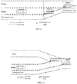
- FIG. 2 is a schematic diagram of extracting acceleration lane feature points according to an embodiment of the present invention. It can be seen that the acceleration lane start point, the acceleration lane end point and position information of the two points can be finally output to accurately represent the current road scene. Therefore, compared with the scheme of extracting other points on the acceleration lane for automatic driving control, more accurate position information of the feature points is extracted, and precise control of the vehicle can be realized.
- the relative position of the road feature points from the vehicle involved in the embodiment of the present invention can be relative position information determined based on a driving coordinate system, wherein the driving coordinate system takes a road boundary line on one side of the road on which the vehicle is located as a reference line, takes a road guide line direction as an X F axis, and takes a direction following a left-hand rule with the road guide line direction as a Y F axis, so that the trend of lane lines can be better reflected.
- the relative position information based on the driving coordinate system can also reflect the distance that the actual vehicle needs to drive along the lane line, rather than the Euclidean distance between two points.
- step S120 when the exchange area attribute of the current road is none, and the exchange area attribute of the next road is an off-ramp, it is determined that the next road comprises a deceleration lane.
- step S130 when it is determined that the next road comprises a deceleration lane, deceleration lane feature points are extracted, and a deceleration lane start point and a deceleration lane end point which belong to the deceleration lane feature points, and a relative position from the deceleration lane start point and the deceleration lane end point to the vehicle are output.
- the navigation information prompting the off-ramp can be used as a trigger condition for extracting deceleration lane feature points, and then the deceleration lane feature points are extracted through step S120 and step S130.
- the navigation information is used as a factor of the trigger condition of the road feature points, so that it can be matched with the map information to more trigger the timely extraction of road feature points and ensure the importance of the extracted feature points.
- FIG. 3 is a schematic diagram of extracting deceleration lane feature points according to an embodiment of the present invention. It can be seen that the deceleration lane start point, the deceleration lane end point and position information of the two points can be finally output to accurately represent the current road scene and realize precise control of the vehicle.
- outputting a name of the extracted road feature point can comprise: determining and outputting the name of the extracted road feature point by combining the navigation information.
- the navigation information will prompt "Enter a deceleration lane ahead”
- the keyword "deceleration lane” in the navigation information can be extracted in the embodiment of the present invention
- the extracted road feature points are named as the deceleration lane start point and the deceleration lane end point.
- step S120 when the lane number attribute of the current road is less than the lane number attribute of the next road, and the exchange area attribute of the next road is a main road lane increase, it is determined that the next road comprises a main road widening lane.
- step S130 when it is determined that the next road comprises a main road widening lane, main road widening feature points are extracted, and a main road widening start point and a main road widening end point which belong to the main road widening feature points, and a relative position from the main road widening start point and the main road widening end point to the vehicle are output.
- the navigation information prompting the road widening (at this time about 2km from the ramp exit) can be used as a trigger condition for extracting main road widening feature points, and then the main road widening feature points are extracted through step S120 and step S130.
- FIG. 4 is a schematic diagram of extracting main road widening feature points according to an embodiment of the present invention. It can be seen that the main road widening start point, the main road widening end point and position information of the two points can be finally output to accurately represent the current road scene and realize precise control of the vehicle.
- step S120 when the lane number attribute of the current road is more than the lane number attribute of the next road, and the exchange area attribute of the next road is a main road lane decrease, it is determined that the next road comprises a main road narrowing lane.
- step S130 when it is determined that the next road comprises a main road narrowing lane, main road narrowing feature points are extracted, and a main road narrowing start point and a main road narrowing end point which belong to the main road narrowing feature points, and a relative position from the main road narrowing start point and the main road narrowing end point to the vehicle are output.
- the navigation information prompting the road narrowing (at this time about 2km from the ramp exit) can be used as a trigger condition for extracting main road narrowing feature points, and then the main road narrowing feature points are extracted through step S120 and step S130.
- FIG. 5 is a schematic diagram of extracting main road narrowing feature points according to an embodiment of the present invention. It can be seen that the main road narrowing start point, the main road narrowing end point and position information of the two points can be finally output to accurately represent the current road scene and realize precise control of the vehicle.
- step S120 when the exchange area attribute of the current road is none, and the exchange area attribute of the next road is a main road lane joining entrance or exit, it is determined that the next road comprises a main road bifurcation lane.
- step S130 when it is determined that the next road comprises a main road bifurcation lane, main road bifurcation feature points are extracted, and a main road bifurcation start point and a main road bifurcation end point which belong to the main road bifurcation feature points, and a relative position from the main road bifurcation start point and the main road bifurcation end point to the vehicle are output.
- the navigation information prompting the main road bifurcation (at this time about 2km from the ramp exit) can be used as a trigger condition for extracting main road bifurcation feature points, and then the main road bifurcation feature points are extracted through step S120 and step S130.
- FIG. 6 is a schematic diagram of extracting main road bifurcation feature points according to an embodiment of the present invention. It can be seen that the main road bifurcation start point, the main road bifurcation end point and position information of the two points can be finally output to accurately represent the current road scene and realize precise control of the vehicle.
- step S120 when the exchange area attribute of the current road is none, and the exchange area attribute of the next road is a ramp lane joining entrance or exit, it is determined that the next road comprises a ramp bifurcation lane.
- step S130 when it is determined that the next road comprises a ramp bifurcation lane, ramp bifurcation feature points are extracted, and a ramp bifurcation start point and a ramp bifurcation end point which belong to the ramp bifurcation feature points, and a relative position from the ramp bifurcation start point and the ramp bifurcation end point to the vehicle are output.
- the navigation information prompting the ramp bifurcation (at this time about 2km from the ramp exit) can be used as a trigger condition for extracting ramp bifurcation feature points, and then the ramp bifurcation feature points are extracted through step S120 and step S130.
- FIG. 7 is a schematic diagram of extracting ramp bifurcation feature points according to an embodiment of the present invention. It can be seen that the ramp bifurcation start point, the ramp bifurcation end point and position information of the two points can be finally output to accurately represent the current road scene and realize precise control of the vehicle.
- step S120 when the lane number attribute of the current road is less than the lane number attribute of the next road, and the exchange area attribute of the next road is a ramp lane increase, it is determined that the next road comprises a ramp widening lane.
- step S130 when it is determined that the next road comprises a ramp widening lane, ramp widening feature points are extracted, and a ramp widening start point and a ramp widening end point which belong to the ramp widening feature points, and a relative position from the ramp widening start point and the ramp widening end point to the vehicle are output.
- step S120 there can be no trigger condition for extracting the ramp widening feature points, but the road type is comprehensively determined directly through step S120, and then the ramp widening feature points are extracted through step S130.
- FIG. 8 is a schematic diagram of extracting ramp widening feature points according to an embodiment of the present invention. It can be seen that the ramp widening start point, the ramp widening end point and position information of the two points can be finally output to accurately represent the current road scene and realize precise control of the vehicle.
- step S120 when the lane number attribute of the current road is more than the lane number attribute of the next road, and the exchange area attribute of the next road is a ramp lane decrease, it is determined that the next road comprises a ramp narrowing lane.
- step S130 when it is determined that the next road comprises a ramp narrowing lane, ramp narrowing feature points are extracted, and a ramp narrowing start point and a ramp narrowing end point which belong to the ramp narrowing feature points, and a relative position from the ramp narrowing start point and the ramp narrowing end point to the vehicle are output.
- step S120 there can be no trigger condition for extracting the ramp narrowing feature points, but the road type is comprehensively determined directly through step S120, and then the ramp narrowing feature points are extracted through step S130.
- FIG. 9 is a schematic diagram of extracting ramp narrowing feature points according to an embodiment of the present invention. It can be seen that the ramp narrowing start point, the ramp narrowing end point and position information of the two points can be finally output to accurately represent the current road scene and realize precise control of the vehicle.
- step S120 when the exchange area attribute of the current road is none, and the exchange area attribute of the next road is a lane joining entrance or exit, it is determined that the next road comprises a ramp merging lane or a ramp joining lane.
- step S130 when it is determined that the next road comprises a ramp merging lane, ramp merging feature points are extracted, and a ramp merging start point and a ramp merging end point which belong to the ramp merging feature points, and a relative position from the ramp merging start point and the ramp merging end point to the vehicle are output; or when it is determined that the next road comprises a ramp joining lane, ramp joining feature points are extracted, and a ramp joining start point and a ramp joining end point which belong to the ramp joining feature points, and a relative position from the ramp joining start point and the ramp joining end point to the vehicle are output.
- step S120 there can be no trigger condition for extracting the ramp merging feature points and the ramp joining feature points, but the road type is comprehensively determined directly through step S120, and then the ramp merging feature points and the ramp joining feature points are extracted through step S130.
- FIG. 10 is a schematic diagram of extracting ramp merging feature points according to an embodiment of the present invention. It can be seen that the ramp merging start point, the ramp merging end point and position information of the two points can be finally output to accurately represent the current road scene and realize precise control of the vehicle.
- FIG. 11 is a schematic diagram of extracting ramp joining feature points according to an embodiment of the present invention. It can be seen that the ramp joining start point, the ramp joining end point and position information of the two points can be finally output to accurately represent the current road scene and realize precise control of the vehicle.
- step S120 when the tunnel attribute of the current road is none, and the tunnel attribute of the next road is present, it is determined that the next road comprises a road tunnel.
- step S130 when it is determined that the next road comprises a road tunnel, tunnel feature points are extracted, and a tunnel start point and a tunnel end point which belong to the tunnel feature points, and a relative position from the tunnel start point and the tunnel end point to the vehicle are output.
- the navigation information prompting a tunnel ahead (at this time about 2km from the ramp exit) can be used as a trigger condition for extracting tunnel feature points, and then the tunnel feature points are extracted through step S120 and step S130.
- FIG. 12 is a schematic diagram of extracting tunnel feature points according to an embodiment of the present invention. It can be seen that the tunnel start point, the tunnel end point and position information of the two points can be finally output to accurately represent the current road scene and realize precise control of the vehicle.
- the road feature point extraction method does not need to acquire general road information in the vicinity of the current position of the vehicle separately, but determines the road feature point capable of precisely representing the road scene through map information, and extracts the name and position information of the important road feature point related to vehicle control, thereby reducing the data analysis amount for vehicle control and being more targetd, and being capable of extracting the information really needed for vehicle control, and being capable of controlling the vehicle precisely to achieve operations such as acceleration, deceleration and lane changing.
- outputting the name of the important road feature point is conducive to simplifying the data format for transmission, and the application of navigation information and map information form redundancy and coordination, which can better ensure the accuracy of extracting the road feature point.
- FIG. 13 is a structural schematic diagram of a road feature point extraction system according to another embodiment of the present invention, which is based on the same inventive idea as the above-mentioned embodiment of the road feature point extraction method.
- the road feature point extraction system comprises: a map system 1, installed on a vehicle and used for acquiring map information for a current position of the vehicle, wherein the map information comprises current road attributes and next road attributes; and a feature point extraction unit 2, electrically connected to the map system 1 and used for comparing the current road attributes with the next road attributes to determine a road type of a next road, and extracting a road feature point representing a road scene on the next road by combining the road type of the next road and the map information corresponding to the next road, and outputting a name of the extracted road feature point and relative distance information between the road feature point and the vehicle.
- the road feature point extraction system further comprises: a navigation system 3, installed on the vehicle and used for acquiring navigation information for the current position of the vehicle.
- the feature point extraction unit 2 is further electrically connected to the navigation system, and used for triggering execution of comparing the current road attributes with the next road attributes by means of forward road conditions prompted by the navigation information.
- the feature point extraction unit 2 is further used for determining the name of the extracted road feature point by combining the navigation information.
- the current road attributes and the next road attributes comprise respective corresponding exchange area attribute, lane line attribute and/or tunnel attribute, wherein the exchange area attribute is information indicating whether there is a change in the number of lanes on the road, the lane line attribute is information indicating the number of lane lines of the road, and the tunnel attribute is information indicating whether there is a tunnel in the road.
- the exchange area attribute is information indicating whether there is a change in the number of lanes on the road
- the lane line attribute is information indicating the number of lane lines of the road
- the tunnel attribute is information indicating whether there is a tunnel in the road.
- the feature point extraction unit 2 comparing the current road attributes with the next road attributes to determine a road type of a next road comprises any one of: determining that the next road comprises an acceleration lane when the exchange area attribute of the current road is none, and the exchange area attribute of the next road is a lane exit or entrance; determining that the next road comprises a deceleration lane when the exchange area attribute of the current road is none, and the exchange area attribute of the next road is an off-ramp; determining that the next road comprises a main road widening lane when the lane number attribute of the current road is less than the lane number attribute of the next road, and the exchange area attribute of the next road is a main road lane increase; determining that the next road comprises a main road narrowing lane when the lane number attribute of the current road is more than the lane number attribute of the next road, and the exchange area attribute of the next road is a main road lane decrease; determining that the next road comprises a main road bifurcation lane when the exchange area attribute attribute
- the feature point extraction unit 2 extracting a road feature point on the next road, and outputting a name of the extracted road feature point and relative distance information between the road feature point and the vehicle comprises: extracting a corresponding lane feature point when it is determined that the next road comprises any one of an acceleration lane, a deceleration lane, a main road widening lane, a main road narrowing lane, a main road bifurcation lane, a ramp bifurcation lane, a ramp widening lane, a ramp narrowing lane, a ramp merging lane, a ramp joining lane and a tunnel, and outputting a lane start point and a lane end point corresponding to the lane feature point, and a relative position from the lane start point and the lane end point to the vehicle.
- the program is stored in a storage medium, and comprises several instructions for causing a single chip computer, a chip, or a processor to execute all or part of the steps of the method described in each embodiment of the present application.
- the aforementioned storage medium comprises various kinds of mediums that may store program codes, such as a U disk, a mobile hard disk, a Read-Only Memory (ROM), a Random Access Memory (RAM), a magnetic disk or an optical disk.
- any combination of the various embodiments of the present invention may be made therebetween, which, as long as not violating the idea of the embodiments of the present invention, shall likewise be considered as contents disclosed in the embodiments of the present invention.
Landscapes
- Engineering & Computer Science (AREA)
- Radar, Positioning & Navigation (AREA)
- Remote Sensing (AREA)
- Automation & Control Theory (AREA)
- Physics & Mathematics (AREA)
- General Physics & Mathematics (AREA)
- Aviation & Aerospace Engineering (AREA)
- Multimedia (AREA)
- Theoretical Computer Science (AREA)
- Human Computer Interaction (AREA)
- Transportation (AREA)
- Mechanical Engineering (AREA)
- Navigation (AREA)
- Traffic Control Systems (AREA)
- Control Of Driving Devices And Active Controlling Of Vehicle (AREA)
Abstract
Description
- The present invention relates to the field of intelligent transportation, in particular to a road feature point extraction method and system.
- At present, vehicles with an Autonomous Driving System (ADS) are gradually brought to the market, which greatly promotes the development of intelligent transportation. The ADS collects data of a road around a vehicle and data of a target (for example, other vehicles ahead) in real time by using various sensing devices installed on the vehicle, identifies static characteristics and dynamic characteristics of the target, and determines a position of the target on the road, so that an automatic driving computer can determine a potential danger in the shortest time, and performs lateral and longitudinal control on the vehicle to prevent the danger from occurring.
- When the vehicle is subject to lateral and longitudinal control on an expressway, it is necessary to know a change in a road ahead and a position of the vehicle to perform lateral and longitudinal control to adjust acceleration, deceleration, or directional control of the vehicle.Therefore, during the traveling of the vehicle, it is necessary to continuously extract and provide map information to the automatic driving computer so that it can grasp the road information ahead. In the prior art, the automatic driving vehicle acquires general road information in the vicinity of the current position of the vehicle from the map information. However, since the information extracted based on the map information is various and is not targeted, there is a high possibility that useless information is extracted or really necessary information is not extracted (for example, information on a start point and an end point of an acceleration lane is not extracted but information on a certain point in the middle of the acceleration lane is extracted), and thus it is impossible to accurately control the vehicle to perform operations such as acceleration, deceleration and lane changing.
- Therefore, in order to achieve accurate control of the vehicle, information that a specific action is performed at a specific position must be provided to the vehicle, for example, the vehicle will pass through an acceleration lane when entering a high-speed main road from a ramp, and at this time, the start and end points of the acceleration lane must be quickly and accurately provided to the vehicle to accurately represent a road scene of the vehicle entering the acceleration lane.
- In view of this, the present invention aims to provide a road feature point extraction method to at least partially solve the above-mentioned technical problems.
- To achieve the above-mentioned object, the technical solution of the present invention is implemented as follows:
A road feature point extraction method may comprises: acquiring map information for a current position of a vehicle, wherein the map information comprises current road attributes and next road attributes; comparing the current road attributes with the next road attributes to determine a road type of the next road; and extracting a road feature point representing a road scene on the next road by combining the road type of the next road and the map information corresponding to the next road, and outputting a name of the extracted road feature point and relative distance information between the road feature point and the vehicle. - Furthermore, the method may further comprises: acquiring navigation information for the current position of the vehicle; and triggering execution of comparing the current road attributes with the next road attributes by means of forward road conditions prompted by the navigation information before comparing the current road attributes with the next road attributes to determine a road type of a next road.
- Furthermore, the outputting a name of the extracted road feature point comprises: determining and outputting the name of the extracted road feature point by combining the navigation information.
- Furthermore, the current road attributes and the next road attributes comprise respective corresponding exchange area attribute, lane line attribute and/or tunnel attribute, wherein the exchange area attribute is information indicating whether there is a change in the number of lanes on the road, the lane line attribute is information indicating the number of lane lines of the road, and the tunnel attribute is information indicating whether there is a tunnel in the road.
- Furthermore, the comparing the current road attributes with the next road attributes to determine a road type of a next road comprises any one of: determining that the next road comprises an acceleration lane when the exchange area attribute of the current road is none, and the exchange area attribute of the next road is a lane exit or entrance; determining that the next road comprises a deceleration lane when the exchange area attribute of the current road is none, and the exchange area attribute of the next road is an off-ramp; determining that the next road comprises a main road widening lane when the lane number attribute of the current road is less than the lane number attribute of the next road, and the exchange area attribute of the next road is a main road lane increase; determining that the next road comprises a main road narrowing lane when the lane number attribute of the current road is more than the lane number attribute of the next road, and the exchange area attribute of the next road is a main road lane decrease; determining that the next road comprises a main road bifurcation lane when the exchange area attribute of the current road is none, and the exchange area attribute of the next road is a main road lane joining entrance or exit; determining that the next road comprises a ramp bifurcation lane when the exchange area attribute of the current road is none, and the exchange area attribute of the next road is a ramp lane joining entrance or exit; determining that the next road comprises a ramp widening lane when the lane number attribute of the current road is less than the lane number attribute of the next road, and the exchange area attribute of the next road is a ramp lane increase; determining that the next road comprises a ramp narrowing lane when the lane number attribute of the current road is more than the lane number attribute of the next road, and the exchange area attribute of the next road is a ramp lane decrease; determining that the next road comprises a ramp merging lane or a ramp joining lane when the exchange area attribute of the current road is none, and the exchange area attribute of the next road is a lane joining entrance or exit; and determining that the next road comprises a road tunnel when the tunnel attribute of the current road is none, and the tunnel attribute of the next road is present.
- Furthermore, the extracting a road feature point on the next road, and outputting a name of the extracted road feature point and relative distance information between the road feature point and the vehicle comprises: extracting a corresponding lane feature point when it is determined that the next road comprises any one of an acceleration lane, a deceleration lane, a main road widening lane, a main road narrowing lane, a main road bifurcation lane, a ramp bifurcation lane, a ramp widening lane, a ramp narrowing lane, a ramp merging lane, a ramp joining lane and a tunnel, and outputting a lane start point and a lane end point corresponding to the lane feature point, and a relative position from the lane start point and the lane end point to the vehicle.
- Compared with the prior art, the road feature point extraction method according to the present invention has the following advantages:
- (1) The road feature point extraction method according to the present invention does not need to acquire general road information in the vicinity of the current position of the vehicle separately, but determines the road feature point capable of precisely representing the road scene through map information, and extracts the name and position information of the important road feature point related to vehicle control, thereby reducing the data analysis amount for vehicle control and being more targeted, and being capable of extracting the information really needed for vehicle control, and being capable of controlling the vehicle precisely to achieve operations such as acceleration, deceleration and lane changing.
- (2) The application of navigation information and map information form redundancy and coordination, which can better ensure the accuracy of extracting a road feature point.
- Another object of the present invention is to provide a road feature point extraction system to at least partially solve the above-mentioned technical problems.
- To achieve the above-mentioned object, the technical solution of the present invention is implemented as follows:
A road feature point extraction system comprises: a map system, installed on a vehicle and used for acquiring map information for a current position of the vehicle, wherein the map information comprises current road attributes and next road attributes; and a feature point extraction unit, electrically connected to the map system and used for comparing the current road attributes with the next road attributes to determine a road type of a next road, and extracting a road feature point representing a road scene on the next road by combining the road type of the next road and the map information corresponding to the next road, and outputting a name of the extracted road feature point and relative distance information between the road feature point and the vehicle. - Furthermore, the system may further comprises: a navigation system, installed on the vehicle and used for acquiring navigation information for the current position of the vehicle, wherein the feature point extraction unit is further electrically connected to the navigation system, and used for triggering execution of comparing the current road attributes with the next road attributes by means of forward road conditions prompted by the navigation information.
- Furthermore, the feature point extraction unit is further used for determining the name of the extracted road feature point by combining the navigation information.
- Furthermore, the current road attributes and the next road attributes comprise respective corresponding exchange area attribute, lane line attribute and/or tunnel attribute, wherein the exchange area attribute is information indicating whether there is a change in the number of lanes on the road, the lane line attribute is information indicating the number of lane lines of the road, and the tunnel attribute is information indicating whether there is a tunnel in the road.
- Furthermore the feature point extraction unit comparing the current road attributes with the next road attributes to determine a road type of a next road comprises any one of: determining that the next road comprises an acceleration lane when the exchange area attribute of the current road is none, and the exchange area attribute of the next road is a lane exit or entrance; determining that the next road comprises a deceleration lane when the exchange area attribute of the current road is none, and the exchange area attribute of the next road is an off-ramp; determining that the next road comprises a main road widening lane when the lane number attribute of the current road is less than the lane number attribute of the next road, and the exchange area attribute of the next road is a main road lane increase; determining that the next road comprises a main road narrowing lane when the lane number attribute of the current road is more than the lane number attribute of the next road, and the exchange area attribute of the next road is a main road lane decrease; determining that the next road comprises a main road bifurcation lane when the exchange area attribute of the current road is none, and the exchange area attribute of the next road is a main road lane joining entrance or exit; determining that the next road comprises a ramp bifurcation lane when the exchange area attribute of the current road is none, and the exchange area attribute of the next road is a ramp lane joining entrance or exit; determining that the next road comprises a ramp widening lane when the lane number attribute of the current road is less than the lane number attribute of the next road, and the exchange area attribute of the next road is a ramp lane increase; determining that the next road comprises a ramp narrowing lane when the lane number attribute of the current road is more than the lane number attribute of the next road, and the exchange area attribute of the next road is a ramp lane decrease; determining that the next road comprises a ramp merging lane or a ramp joining lane when the exchange area attribute of the current road is none, and the exchange area attribute of the next road is a lane joining entrance or exit; and determining that the next road comprises a road tunnel when the tunnel attribute of the current road is none, and the tunnel attribute of the next road is present.
- Furthermore, the feature point extraction unit extracting a road feature point on the next road, and outputting a name of the extracted road feature point and relative distance information between the road feature point and the vehicle comprises: extracting a corresponding lane feature point when it is determined that the next road comprises any one of an acceleration lane, a deceleration lane, a main road widening lane, a main road narrowing lane, a main road bifurcation lane, a ramp bifurcation lane, a ramp widening lane, a ramp narrowing lane, a ramp merging lane, a ramp joining lane and a tunnel, and outputting a lane start point and a lane end point corresponding to the lane feature point, and a relative position from the lane start point and the lane end point to the vehicle.
- The road feature point extraction system has the same advantages as the above-mentioned road feature point extraction method over the prior art, and details are not described here.
- Another object of the present invention is to provide a machine-readable storage medium, wherein an instruction is stored on the machine-readable storage medium, and the instruction is used for causing a controller to execute the above-mentioned road feature point extraction method.
- Other features and advantages of the present invention will be described in detail in the specific embodiments below.
- The drawings, which form a part of the present invention, are used to provide a further understanding of the present invention. The exemplary embodiments of the present invention and the description thereof are used to explain the present invention, and do not constitute an improper limitation on the present invention. In the drawings:
-
FIG. 1 is a schematic flowchart of a road feature point extraction method according to an embodiment of the present invention; -
FIG. 2 is a schematic diagram of extracting acceleration lane feature points according to an embodiment of the present invention; -
FIG. 3 is a schematic diagram of extracting deceleration lane feature points according to an embodiment of the present invention; -
FIG. 4 is a schematic diagram of extracting main road widening feature points according to an embodiment of the present invention; -
FIG. 5 is a schematic diagram of extracting main road narrowing feature points according to an embodiment of the present invention; -
FIG. 6 is a schematic diagram of extracting main road bifurcation feature points according to an embodiment of the present invention; -
FIG. 7 is a schematic diagram of extracting ramp bifurcation feature points according to an embodiment of the present invention; -
FIG. 8 is a schematic diagram of extracting ramp widening feature points according to an embodiment of the present invention; -
FIG. 9 is a schematic diagram of extracting ramp narrowing feature points according to an embodiment of the present invention; -
FIG. 10 is a schematic diagram of extracting ramp merging feature points according to an embodiment of the present invention; -
FIG. 11 is a schematic diagram of extracting ramp joining feature points according to an embodiment of the present invention; -
FIG. 12 is a schematic diagram of extracting tunnel feature points according to an embodiment of the present invention; and -
FIG. 13 is a structural schematic diagram of a road feature point extraction system according to another embodiment of the present invention. - 1. Map system; 2. Feature point extraction unit; 3. Navigation system.
- It should be noted that, in the case of no conflict, the embodiments of the present invention and features in the embodiments can be combined with each other.
- In the embodiments of the present invention, "electrical connection" is used to describe the signal connection between two components, such as a control signal and a feedback signal, and an electrical power connection between two components. In addition, the "connection" involved in the embodiments of the present invention can be a wired connection or a wireless connection, and the "electrical connection" involved can be a direct electrical connection between two components or an indirect electrical connection through another component.
- The present invention will be described in detail below with reference to the drawings and embodiments.
-
FIG. 1 is a schematic flowchart of a road feature point extraction method according to an embodiment of the present invention, wherein the road feature points are points that may represent a road scene and are located at a specific position on the road, such as the start and end points of an acceleration lane, which can represent the scene where a vehicle enters the acceleration lane. - As shown in
FIG. 1 , the road feature point extraction method can comprise the following steps:
Step S110, acquiring map information for a current position of a vehicle, wherein the map information comprises current road attributes and next road attributes; - Wherein, the current road attributes and the next road attributes comprise respective corresponding exchange area attribute, lane line attribute and/or tunnel attribute, wherein the exchange area attribute is information indicating whether there is a change in the number of lanes on the road, the lane line attribute is information indicating the number of lane lines of the road, and the tunnel attribute is information indicating whether there is a tunnel in the road. The application of these attributes will be introduced below, and details are not described here.
- In addition, the map information is preferably high-precision map information, and those skilled in the art know that the map information can show the location of the road, the length of the road, the distance from the vehicle to the target, and the like. The high-precision map divides the road into a set of map points section by section, and the map output will divide the road from the position where the road changes, and will also give the relevant attributes of the current road and the next road.
- Step S120, comparing the current road attributes with the next road attributes to determine a road type of a next road.
- Step S130, extracting a road feature point representing a road scene on the next road by combining the road type of the next road and the map information corresponding to the next road, and outputting a name of the extracted road feature point and relative distance information between the road feature point and the vehicle.
- In a preferred embodiment, the road feature point extraction method can further comprise:
Step S140: acquiring navigation information for the current position of the vehicle. - In the case that step S140 exists, in step S120, execution of comparing the current road attributes with the next road attributes can be triggered by means of forward road conditions prompted by the navigation information. In combination with step S130, that is, the navigation information can be used as a trigger condition for whether to start road feature point extraction.
- Steps S110-S140 will be comprehensively described through an example below. In the example, the map information being a high-precision map is taken as an example, and the following ten road types can be determined and the corresponding ten road feature points can be extracted:
- Through step S120, when the exchange area attribute of the current road is none, and the exchange area attribute of the next road is a lane exit or entrance, it is determined that the next road comprises an acceleration lane. The exchange area attribute is none, meaning that there is no change in the number of lanes; and the exchange area attribute of the next road is a lane exit or entrance, indicating that there is a change in the number of lanes.
- In this scene, there can be no trigger condition for the extraction of the acceleration lane feature points (that is, not prompted by the navigation information), but the acceleration road feature points can be obtained through comprehensive judgment of the current road attributes and the next road attributes.
- Then through step S130, when it is determined that the next road comprises an acceleration lane, acceleration lane feature points are extracted, and an acceleration lane start point and an acceleration lane end point which belong to the acceleration lane feature points, and a relative position from the acceleration lane start point and the acceleration lane end point to the vehicle are output. Specifically, the start point and the length of the next road can be extracted from the map information, so that the end point can be further determined, and the distances between the vehicle and the start point and the end point of the next road can be calculated.
-
FIG. 2 is a schematic diagram of extracting acceleration lane feature points according to an embodiment of the present invention. It can be seen that the acceleration lane start point, the acceleration lane end point and position information of the two points can be finally output to accurately represent the current road scene. Therefore, compared with the scheme of extracting other points on the acceleration lane for automatic driving control, more accurate position information of the feature points is extracted, and precise control of the vehicle can be realized. - In addition, the relative position of the road feature points from the vehicle involved in the embodiment of the present invention can be relative position information determined based on a driving coordinate system, wherein the driving coordinate system takes a road boundary line on one side of the road on which the vehicle is located as a reference line, takes a road guide line direction as an XF axis, and takes a direction following a left-hand rule with the road guide line direction as a YF axis, so that the trend of lane lines can be better reflected. Compared with the vehicle coordinate system, the relative position information based on the driving coordinate system can also reflect the distance that the actual vehicle needs to drive along the lane line, rather than the Euclidean distance between two points.
- Through step S120, when the exchange area attribute of the current road is none, and the exchange area attribute of the next road is an off-ramp, it is determined that the next road comprises a deceleration lane.
- Then through step S130, when it is determined that the next road comprises a deceleration lane, deceleration lane feature points are extracted, and a deceleration lane start point and a deceleration lane end point which belong to the deceleration lane feature points, and a relative position from the deceleration lane start point and the deceleration lane end point to the vehicle are output.
- In this scene, the navigation information prompting the off-ramp (at this time about 2km from the ramp exit) can be used as a trigger condition for extracting deceleration lane feature points, and then the deceleration lane feature points are extracted through step S120 and step S130. Here, the navigation information is used as a factor of the trigger condition of the road feature points, so that it can be matched with the map information to more trigger the timely extraction of road feature points and ensure the importance of the extracted feature points.
-
FIG. 3 is a schematic diagram of extracting deceleration lane feature points according to an embodiment of the present invention. It can be seen that the deceleration lane start point, the deceleration lane end point and position information of the two points can be finally output to accurately represent the current road scene and realize precise control of the vehicle. - In an embodiment of the present invention, outputting a name of the extracted road feature point can comprise: determining and outputting the name of the extracted road feature point by combining the navigation information. Here, for example, the navigation information will prompt "Enter a deceleration lane ahead", the keyword "deceleration lane" in the navigation information can be extracted in the embodiment of the present invention, and the extracted road feature points are named as the deceleration lane start point and the deceleration lane end point.
- Through step S120, when the lane number attribute of the current road is less than the lane number attribute of the next road, and the exchange area attribute of the next road is a main road lane increase, it is determined that the next road comprises a main road widening lane.
- Then through step S130, when it is determined that the next road comprises a main road widening lane, main road widening feature points are extracted, and a main road widening start point and a main road widening end point which belong to the main road widening feature points, and a relative position from the main road widening start point and the main road widening end point to the vehicle are output.
- Further, the navigation information prompting the road widening (at this time about 2km from the ramp exit) can be used as a trigger condition for extracting main road widening feature points, and then the main road widening feature points are extracted through step S120 and step S130.
-
FIG. 4 is a schematic diagram of extracting main road widening feature points according to an embodiment of the present invention. It can be seen that the main road widening start point, the main road widening end point and position information of the two points can be finally output to accurately represent the current road scene and realize precise control of the vehicle. - Through step S120, when the lane number attribute of the current road is more than the lane number attribute of the next road, and the exchange area attribute of the next road is a main road lane decrease, it is determined that the next road comprises a main road narrowing lane.
- Then through step S130, when it is determined that the next road comprises a main road narrowing lane, main road narrowing feature points are extracted, and a main road narrowing start point and a main road narrowing end point which belong to the main road narrowing feature points, and a relative position from the main road narrowing start point and the main road narrowing end point to the vehicle are output.
- Further, the navigation information prompting the road narrowing (at this time about 2km from the ramp exit) can be used as a trigger condition for extracting main road narrowing feature points, and then the main road narrowing feature points are extracted through step S120 and step S130.
-
FIG. 5 is a schematic diagram of extracting main road narrowing feature points according to an embodiment of the present invention. It can be seen that the main road narrowing start point, the main road narrowing end point and position information of the two points can be finally output to accurately represent the current road scene and realize precise control of the vehicle. - Through step S120, when the exchange area attribute of the current road is none, and the exchange area attribute of the next road is a main road lane joining entrance or exit, it is determined that the next road comprises a main road bifurcation lane.
- Then through step S130, when it is determined that the next road comprises a main road bifurcation lane, main road bifurcation feature points are extracted, and a main road bifurcation start point and a main road bifurcation end point which belong to the main road bifurcation feature points, and a relative position from the main road bifurcation start point and the main road bifurcation end point to the vehicle are output.
- Further, the navigation information prompting the main road bifurcation (at this time about 2km from the ramp exit) can be used as a trigger condition for extracting main road bifurcation feature points, and then the main road bifurcation feature points are extracted through step S120 and step S130.
-
FIG. 6 is a schematic diagram of extracting main road bifurcation feature points according to an embodiment of the present invention. It can be seen that the main road bifurcation start point, the main road bifurcation end point and position information of the two points can be finally output to accurately represent the current road scene and realize precise control of the vehicle. - Through step S120, when the exchange area attribute of the current road is none, and the exchange area attribute of the next road is a ramp lane joining entrance or exit, it is determined that the next road comprises a ramp bifurcation lane.
- Then through step S130, when it is determined that the next road comprises a ramp bifurcation lane, ramp bifurcation feature points are extracted, and a ramp bifurcation start point and a ramp bifurcation end point which belong to the ramp bifurcation feature points, and a relative position from the ramp bifurcation start point and the ramp bifurcation end point to the vehicle are output.
- Furthermore, the navigation information prompting the ramp bifurcation (at this time about 2km from the ramp exit) can be used as a trigger condition for extracting ramp bifurcation feature points, and then the ramp bifurcation feature points are extracted through step S120 and step S130.
-
FIG. 7 is a schematic diagram of extracting ramp bifurcation feature points according to an embodiment of the present invention. It can be seen that the ramp bifurcation start point, the ramp bifurcation end point and position information of the two points can be finally output to accurately represent the current road scene and realize precise control of the vehicle. - Through step S120, when the lane number attribute of the current road is less than the lane number attribute of the next road, and the exchange area attribute of the next road is a ramp lane increase, it is determined that the next road comprises a ramp widening lane.
- Then through step S130, when it is determined that the next road comprises a ramp widening lane, ramp widening feature points are extracted, and a ramp widening start point and a ramp widening end point which belong to the ramp widening feature points, and a relative position from the ramp widening start point and the ramp widening end point to the vehicle are output.
- Further, there can be no trigger condition for extracting the ramp widening feature points, but the road type is comprehensively determined directly through step S120, and then the ramp widening feature points are extracted through step S130.
-
FIG. 8 is a schematic diagram of extracting ramp widening feature points according to an embodiment of the present invention. It can be seen that the ramp widening start point, the ramp widening end point and position information of the two points can be finally output to accurately represent the current road scene and realize precise control of the vehicle. - Through step S120, when the lane number attribute of the current road is more than the lane number attribute of the next road, and the exchange area attribute of the next road is a ramp lane decrease, it is determined that the next road comprises a ramp narrowing lane.
- Then through step S130, when it is determined that the next road comprises a ramp narrowing lane, ramp narrowing feature points are extracted, and a ramp narrowing start point and a ramp narrowing end point which belong to the ramp narrowing feature points, and a relative position from the ramp narrowing start point and the ramp narrowing end point to the vehicle are output.
- Furthermore, there can be no trigger condition for extracting the ramp narrowing feature points, but the road type is comprehensively determined directly through step S120, and then the ramp narrowing feature points are extracted through step S130.
-
FIG. 9 is a schematic diagram of extracting ramp narrowing feature points according to an embodiment of the present invention. It can be seen that the ramp narrowing start point, the ramp narrowing end point and position information of the two points can be finally output to accurately represent the current road scene and realize precise control of the vehicle. - Through step S120, when the exchange area attribute of the current road is none, and the exchange area attribute of the next road is a lane joining entrance or exit, it is determined that the next road comprises a ramp merging lane or a ramp joining lane.
- Then through step S130, when it is determined that the next road comprises a ramp merging lane, ramp merging feature points are extracted, and a ramp merging start point and a ramp merging end point which belong to the ramp merging feature points, and a relative position from the ramp merging start point and the ramp merging end point to the vehicle are output; or when it is determined that the next road comprises a ramp joining lane, ramp joining feature points are extracted, and a ramp joining start point and a ramp joining end point which belong to the ramp joining feature points, and a relative position from the ramp joining start point and the ramp joining end point to the vehicle are output.
- Furthermore, there can be no trigger condition for extracting the ramp merging feature points and the ramp joining feature points, but the road type is comprehensively determined directly through step S120, and then the ramp merging feature points and the ramp joining feature points are extracted through step S130.
-
FIG. 10 is a schematic diagram of extracting ramp merging feature points according to an embodiment of the present invention. It can be seen that the ramp merging start point, the ramp merging end point and position information of the two points can be finally output to accurately represent the current road scene and realize precise control of the vehicle. -
FIG. 11 is a schematic diagram of extracting ramp joining feature points according to an embodiment of the present invention. It can be seen that the ramp joining start point, the ramp joining end point and position information of the two points can be finally output to accurately represent the current road scene and realize precise control of the vehicle. - Through step S120, when the tunnel attribute of the current road is none, and the tunnel attribute of the next road is present, it is determined that the next road comprises a road tunnel.
- Then through step S130, when it is determined that the next road comprises a road tunnel, tunnel feature points are extracted, and a tunnel start point and a tunnel end point which belong to the tunnel feature points, and a relative position from the tunnel start point and the tunnel end point to the vehicle are output.
- Furthermore, the navigation information prompting a tunnel ahead (at this time about 2km from the ramp exit) can be used as a trigger condition for extracting tunnel feature points, and then the tunnel feature points are extracted through step S120 and step S130.
-
FIG. 12 is a schematic diagram of extracting tunnel feature points according to an embodiment of the present invention. It can be seen that the tunnel start point, the tunnel end point and position information of the two points can be finally output to accurately represent the current road scene and realize precise control of the vehicle. - It should be noted that for the above-mentioned ten example of extracting feature points, the implementation details of each other can be referred to each other, so that the details of the above-mentioned comprehensible ten feature point extraction solutions that can be implemented in common are not repeated. For example, in the extraction of the above-mentioned ten feature points, navigation information can be used to name the road feature points and the driving coordinate system can be used for position representation.
- In summary, the road feature point extraction method according to the embodiments of the present invention does not need to acquire general road information in the vicinity of the current position of the vehicle separately, but determines the road feature point capable of precisely representing the road scene through map information, and extracts the name and position information of the important road feature point related to vehicle control, thereby reducing the data analysis amount for vehicle control and being more targetd, and being capable of extracting the information really needed for vehicle control, and being capable of controlling the vehicle precisely to achieve operations such as acceleration, deceleration and lane changing. In addition, outputting the name of the important road feature point is conducive to simplifying the data format for transmission, and the application of navigation information and map information form redundancy and coordination, which can better ensure the accuracy of extracting the road feature point.
-
FIG. 13 is a structural schematic diagram of a road feature point extraction system according to another embodiment of the present invention, which is based on the same inventive idea as the above-mentioned embodiment of the road feature point extraction method. As shown inFIG. 13 , the road feature point extraction system comprises: a map system 1, installed on a vehicle and used for acquiring map information for a current position of the vehicle, wherein the map information comprises current road attributes and next road attributes; and a featurepoint extraction unit 2, electrically connected to the map system 1 and used for comparing the current road attributes with the next road attributes to determine a road type of a next road, and extracting a road feature point representing a road scene on the next road by combining the road type of the next road and the map information corresponding to the next road, and outputting a name of the extracted road feature point and relative distance information between the road feature point and the vehicle. - In a preferred embodiment, the road feature point extraction system further comprises: a
navigation system 3, installed on the vehicle and used for acquiring navigation information for the current position of the vehicle. The featurepoint extraction unit 2 is further electrically connected to the navigation system, and used for triggering execution of comparing the current road attributes with the next road attributes by means of forward road conditions prompted by the navigation information. - In a more preferred embodiment, the feature
point extraction unit 2 is further used for determining the name of the extracted road feature point by combining the navigation information. - The current road attributes and the next road attributes comprise respective corresponding exchange area attribute, lane line attribute and/or tunnel attribute, wherein the exchange area attribute is information indicating whether there is a change in the number of lanes on the road, the lane line attribute is information indicating the number of lane lines of the road, and the tunnel attribute is information indicating whether there is a tunnel in the road.
- Accordingly, the feature point extraction unit 2 comparing the current road attributes with the next road attributes to determine a road type of a next road comprises any one of: determining that the next road comprises an acceleration lane when the exchange area attribute of the current road is none, and the exchange area attribute of the next road is a lane exit or entrance; determining that the next road comprises a deceleration lane when the exchange area attribute of the current road is none, and the exchange area attribute of the next road is an off-ramp; determining that the next road comprises a main road widening lane when the lane number attribute of the current road is less than the lane number attribute of the next road, and the exchange area attribute of the next road is a main road lane increase; determining that the next road comprises a main road narrowing lane when the lane number attribute of the current road is more than the lane number attribute of the next road, and the exchange area attribute of the next road is a main road lane decrease; determining that the next road comprises a main road bifurcation lane when the exchange area attribute of the current road is none, and the exchange area attribute of the next road is a main road lane joining entrance or exit; determining that the next road comprises a ramp bifurcation lane when the exchange area attribute of the current road is none, and the exchange area attribute of the next road is a ramp lane joining entrance or exit; determining that the next road comprises a ramp widening lane when the lane number attribute of the current road is less than the lane number attribute of the next road, and the exchange area attribute of the next road is a ramp lane increase; determining that the next road comprises a ramp narrowing lane when the lane number attribute of the current road is more than the lane number attribute of the next road, and the exchange area attribute of the next road is a ramp lane decrease; determining that the next road comprises a ramp merging lane or a ramp joining lane when the exchange area attribute of the current road is none, and the exchange area attribute of the next road is a lane joining entrance or exit; and determining that the next road comprises a road tunnel when the tunnel attribute of the current road is none, and the tunnel attribute of the next road is present.
- The feature
point extraction unit 2 extracting a road feature point on the next road, and outputting a name of the extracted road feature point and relative distance information between the road feature point and the vehicle comprises: extracting a corresponding lane feature point when it is determined that the next road comprises any one of an acceleration lane, a deceleration lane, a main road widening lane, a main road narrowing lane, a main road bifurcation lane, a ramp bifurcation lane, a ramp widening lane, a ramp narrowing lane, a ramp merging lane, a ramp joining lane and a tunnel, and outputting a lane start point and a lane end point corresponding to the lane feature point, and a relative position from the lane start point and the lane end point to the vehicle. - It should be noted that other implementation details and effects of the road feature point extraction system in the embodiments of the present invention can refer to the above-mentioned embodiments of the road feature point extraction method, which will not be repeated here.
- The above descriptions are only the preferred embodiments of the present invention and are not intended to limit the present invention. Any modification, equivalent replacement, improvement, etc., made within the spirit and principle of the present invention, such as adaptively changing the order of execution of steps and adjusting the connection relationship between functional modules, shall be included in the protection scope of the present invention.
- A person skilled in the art can understand that all or part of the steps in the method of the foregoing embodiments can be implemented by a program instructing related hardware. The program is stored in a storage medium, and comprises several instructions for causing a single chip computer, a chip, or a processor to execute all or part of the steps of the method described in each embodiment of the present application. In addition, the aforementioned storage medium comprises various kinds of mediums that may store program codes, such as a U disk, a mobile hard disk, a Read-Only Memory (ROM), a Random Access Memory (RAM), a magnetic disk or an optical disk.
- In addition, any combination of the various embodiments of the present invention may be made therebetween, which, as long as not violating the idea of the embodiments of the present invention, shall likewise be considered as contents disclosed in the embodiments of the present invention.
Claims (13)
- A road feature point extraction method, wherein the method comprises:acquiring map information for a current position of a vehicle, wherein the map information comprises current road attributes and next road attributes;comparing the current road attributes with the next road attributes to determine a road type of the next road; andextracting a road feature point representing a road scene on the next road by combining the road type of the next road and the map information corresponding to the next road, and outputting a name of the extracted road feature point and relative distance information between the road feature point and the vehicle.
- The road feature point extraction method according to claim 1, wherein the method further comprises:acquiring navigation information for the current position of the vehicle; andtriggering execution of comparing the current road attributes with the next road attributes by means of forward road conditions prompted by the navigation information before comparing the current road attributes with the next road attributes to determine a road type of a next road.
- The road feature point extraction method according to claim 1, wherein the outputting a name of the extracted road feature point comprises: determining and outputting the name of the extracted road feature point by combining the navigation information.
- The road feature point extraction method according to any one of claims 1-3, wherein the current road attributes and the next road attributes comprise respective corresponding exchange area attribute, lane line attribute and/or tunnel attribute, wherein the exchange area attribute is information indicating whether there is a change in the number of lanes on the road, the lane line attribute is information indicating the number of lane lines of the road, and the tunnel attribute is information indicating whether there is a tunnel in the road.
- The road feature point extraction method according to claim 4, wherein the comparing the current road attributes with the next road attributes to determine a road type of a next road comprises any one of:determining that the next road comprises an acceleration lane when the exchange area attribute of the current road is none, and the exchange area attribute of the next road is a lane exit or entrance;determining that the next road comprises a deceleration lane when the exchange area attribute of the current road is none, and the exchange area attribute of the next road is an off-ramp;determining that the next road comprises a main road widening lane when the lane number attribute of the current road is less than the lane number attribute of the next road, and the exchange area attribute of the next road is a main road lane increase;determining that the next road comprises a main road narrowing lane when the lane number attribute of the current road is more than the lane number attribute of the next road, and the exchange area attribute of the next road is a main road lane decrease;determining that the next road comprises a main road bifurcation lane when the exchange area attribute of the current road is none, and the exchange area attribute of the next road is a main road lane joining entrance or exit;determining that the next road comprises a ramp bifurcation lane when the exchange area attribute of the current road is none, and the exchange area attribute of the next road is a ramp lane joining entrance or exit;determining that the next road comprises a ramp widening lane when the lane number attribute of the current road is less than the lane number attribute of the next road, and the exchange area attribute of the next road is a ramp lane increase;determining that the next road comprises a ramp narrowing lane when the lane number attribute of the current road is more than the lane number attribute of the next road, and the exchange area attribute of the next road is a ramp lane decrease;determining that the next road comprises a ramp merging lane or a ramp joining lane when the exchange area attribute of the current road is none, and the exchange area attribute of the next road is a lane joining entrance or exit; anddetermining that the next road comprises a road tunnel when the tunnel attribute of the current road is none, and the tunnel attribute of the next road is present.
- The road feature point extraction method according to claim 5, wherein the extracting a road feature point on the next road, and outputting a name of the extracted road feature point and relative distance information between the road feature point and the vehicle comprises:
extracting a corresponding lane feature point when it is determined that the next road comprises any one of an acceleration lane, a deceleration lane, a main road widening lane, a main road narrowing lane, a main road bifurcation lane, a ramp bifurcation lane, a ramp widening lane, a ramp narrowing lane, a ramp merging lane, a ramp joining lane and a tunnel, and outputting a lane start point and a lane end point corresponding to the lane feature point, and a relative position from the lane start point and the lane end point to the vehicle. - A machine-readable storage medium, wherein an instruction is stored on the machine-readable storage medium, and the instruction is used for causing a controller to execute the road feature point extraction method according to any one of claims 1-6.
- A road feature point extraction system, wherein the system comprises:a map system, installed on a vehicle and used for acquiring map information for a current position of a vehicle, wherein the map information comprises current road attributes and next road attributes; anda feature point extraction unit, electrically connected to the map system and used for comparing the current road attributes with the next road attributes to determine a road type of a next road, and extracting a road feature point representing a road scene on the next road by combining the road type of the next road and the map information corresponding to the next road, and outputting a name of the extracted road feature point and relative distance information between the road feature point and the vehicle.
- The road feature point extraction system according to claim 8, wherein the system further comprises:a navigation system, installed on the vehicle and used for acquiring navigation information for the current position of the vehicle,wherein the feature point extraction unit is further electrically connected to the navigation system, and used for triggering execution of comparing the current road attributes with the next road attributes by means of forward road conditions prompted by the navigation information.
- The road feature point extraction system according to claim 8, wherein the feature point extraction unit is further used for determining the name of the extracted road feature point by combining the navigation information.
- The road feature point extraction system according to any one of claims 8-10, wherein the current road attributes and the next road attributes comprise respective corresponding exchange area attribute, lane line attribute and/or tunnel attribute, wherein the exchange area attribute is information indicating whether there is a change in the number of lanes on the road, the lane line attribute is information indicating the number of lane lines of the road, and the tunnel attribute is information indicating whether there is a tunnel in the road.
- The road feature point extraction system according to claim 11, wherein the feature point extraction unit comparing the current road attributes with the next road attributes to determine a road type of a next road comprises any one of:determining that the next road comprises an acceleration lane when the exchange area attribute of the current road is none, and the exchange area attribute of the next road is a lane exit or entrance;determining that the next road comprises a deceleration lane when the exchange area attribute of the current road is none, and the exchange area attribute of the next road is an off-ramp;determining that the next road comprises a main road widening lane when the lane number attribute of the current road is less than the lane number attribute of the next road, and the exchange area attribute of the next road is a main road lane increase;determining that the next road comprises a main road narrowing lane when the lane number attribute of the current road is more than the lane number attribute of the next road, and the exchange area attribute of the next road is a main road lane decrease;determining that the next road comprises a main road bifurcation lane when the exchange area attribute of the current road is none, and the exchange area attribute of the next road is a main road lane joining entrance or exit;determining that the next road comprises a ramp bifurcation lane when the exchange area attribute of the current road is none, and the exchange area attribute of the next road is a ramp lane joining entrance or exit;determining that the next road comprises a ramp widening lane when the lane number attribute of the current road is less than the lane number attribute of the next road, and the exchange area attribute of the next road is a ramp lane increase;determining that the next road comprises a ramp narrowing lane when the lane number attribute of the current road is more than the lane number attribute of the next road, and the exchange area attribute of the next road is a ramp lane decrease;determining that the next road comprises a ramp merging lane or a ramp joining lane when the exchange area attribute of the current road is none, and the exchange area attribute of the next road is a lane joining entrance or exit; anddetermining that the next road comprises a road tunnel when the tunnel attribute of the current road is none, and the tunnel attribute of the next road is present.
- The road feature point extraction system according to claim 12, wherein the feature point extraction unit extracting a road feature point on the next road, and outputting a name of the extracted road feature point and relative distance information between the road feature point and the vehicle comprises:
extracting a corresponding lane feature point when it is determined that the next road comprises any one of an acceleration lane, a deceleration lane, a main road widening lane, a main road narrowing lane, a main road bifurcation lane, a ramp bifurcation lane, a ramp widening lane, a ramp narrowing lane, a ramp merging lane, a ramp joining lane and a tunnel, and outputting a lane start point and a lane end point corresponding to the lane feature point, and a relative position from the lane start point and the lane end point to the vehicle.
Applications Claiming Priority (2)
| Application Number | Priority Date | Filing Date | Title |
|---|---|---|---|
| CN201811153737.1A CN110361015B (en) | 2018-09-30 | 2018-09-30 | Road feature point extraction method and system |
| PCT/CN2019/108401 WO2020063815A1 (en) | 2018-09-30 | 2019-09-27 | Road feature point extraction method and system |
Publications (3)
| Publication Number | Publication Date |
|---|---|
| EP3859278A1 true EP3859278A1 (en) | 2021-08-04 |
| EP3859278A4 EP3859278A4 (en) | 2022-03-23 |
| EP3859278B1 EP3859278B1 (en) | 2024-06-05 |
Family
ID=68214853
Family Applications (1)
| Application Number | Title | Priority Date | Filing Date |
|---|---|---|---|
| EP19867725.4A Active EP3859278B1 (en) | 2018-09-30 | 2019-09-27 | Road feature point extraction method and system |
Country Status (6)
| Country | Link |
|---|---|
| US (1) | US12135552B2 (en) |
| EP (1) | EP3859278B1 (en) |
| JP (1) | JP7185774B2 (en) |
| KR (1) | KR102574546B1 (en) |
| CN (1) | CN110361015B (en) |
| WO (1) | WO2020063815A1 (en) |
Families Citing this family (18)
| Publication number | Priority date | Publication date | Assignee | Title |
|---|---|---|---|---|
| CN110361015B (en) | 2018-09-30 | 2021-04-02 | 长城汽车股份有限公司 | Road feature point extraction method and system |
| CN112699190A (en) * | 2019-10-23 | 2021-04-23 | 合肥四维图新科技有限公司 | Map data detection method, device, system and storage medium |
| CN110853357B (en) * | 2019-12-02 | 2022-02-11 | 华东交通大学 | Early warning control system and method for dangerous highway sections and construction areas |
| CN113022573B (en) * | 2019-12-06 | 2022-11-04 | 华为技术有限公司 | Road structure detection method and device |
| JP7141421B2 (en) * | 2020-03-16 | 2022-09-22 | 本田技研工業株式会社 | VEHICLE CONTROL DEVICE, VEHICLE CONTROL METHOD, AND PROGRAM |
| CN113758490B (en) * | 2020-06-01 | 2024-06-14 | 南宁富联富桂精密工业有限公司 | Method for judging entering ramp and navigation system |
| CN111895972B (en) * | 2020-06-11 | 2022-06-17 | 北京四维图新科技股份有限公司 | High-precision map tunnel portal shape generation method, device and medium |
| CN113971894A (en) * | 2020-07-24 | 2022-01-25 | 奥迪股份公司 | Vehicle control method and device, electronic equipment and vehicle |
| CN113091765A (en) * | 2021-03-31 | 2021-07-09 | 深圳一清创新科技有限公司 | Road characterization method, method for presenting road information and electronic equipment |
| CN114152264B (en) * | 2021-12-03 | 2023-12-05 | 京东鲲鹏(江苏)科技有限公司 | Unmanned vehicle path planning method and device, electronic equipment, storage medium |
| CN114120258B (en) * | 2022-01-26 | 2022-05-03 | 深圳佑驾创新科技有限公司 | A lane line recognition method, device and storage medium |
| US20230266142A1 (en) * | 2022-02-23 | 2023-08-24 | Here Global B.V. | Method, apparatus, and system for reconstructing a road linear feature |
| CN114655214B (en) * | 2022-04-24 | 2024-04-26 | 重庆长安汽车股份有限公司 | A segmented control method and control system for driving through a confluence |
| CN114906154B (en) * | 2022-05-26 | 2024-10-01 | 重庆长安汽车股份有限公司 | Method, system, electronic device and storage medium for judging vehicle driving road type |
| CN115092177B (en) * | 2022-06-22 | 2024-06-25 | 重庆长安汽车股份有限公司 | ID allocation method and storage medium for ramp target scene of unmanned vehicle |
| CN114863689B (en) * | 2022-07-08 | 2022-09-30 | 中汽研(天津)汽车工程研究院有限公司 | A method and system for data collection, recognition and extraction of on and off ramp behavior scenes |
| CN115042820A (en) * | 2022-07-11 | 2022-09-13 | 北京主线科技有限公司 | Automatic driving vehicle control method, device, device and storage medium |
| CN115655289B (en) * | 2022-11-03 | 2024-11-26 | 广州小鹏自动驾驶科技有限公司 | Lane positioning method, device, vehicle and storage medium |
Family Cites Families (21)
| Publication number | Priority date | Publication date | Assignee | Title |
|---|---|---|---|---|
| US20070021907A1 (en) * | 2005-07-21 | 2007-01-25 | Denso Corporation | Navigation system |
| JP2008008860A (en) | 2006-06-30 | 2008-01-17 | Matsushita Electric Ind Co Ltd | Navigation device |
| CN101636636A (en) * | 2007-03-23 | 2010-01-27 | 三菱电机株式会社 | Navigation system and lane information display method |
| JP2008281523A (en) * | 2007-05-14 | 2008-11-20 | Navitime Japan Co Ltd | Navigation system, route search server, terminal device, and route search method |
| JP4985362B2 (en) | 2007-11-30 | 2012-07-25 | アイシン・エィ・ダブリュ株式会社 | Navigation device, navigation method, and navigation program |
| WO2009090879A1 (en) | 2008-01-18 | 2009-07-23 | Panasonic Corporation | Three-dimensional wiring board |
| JP5056737B2 (en) | 2008-12-04 | 2012-10-24 | アイシン・エィ・ダブリュ株式会社 | Navigation device and navigation road data creation device |
| CN102313554B (en) * | 2010-06-30 | 2014-04-16 | 株式会社电装 | Vehicle-mounted navigation system |
| EP2410294A1 (en) * | 2010-07-21 | 2012-01-25 | Harman Becker Automotive Systems GmbH | Method and device for providing cost information associated with junctions and method of determining a route |
| CN102542811A (en) * | 2011-12-08 | 2012-07-04 | 东南大学 | Method for determining step-by-step speed limit value of exit ramp of freeway |
| CN102735256A (en) * | 2012-06-26 | 2012-10-17 | 上海安悦四维信息技术有限公司 | Vehicle-mounted navigation device and navigation method for identifying main and auxiliary roads |
| KR20150066863A (en) * | 2013-12-09 | 2015-06-17 | 현대자동차주식회사 | Route Guidance Apparatus recognizing Driving Lane and method thereof |
| CN104819724B (en) | 2015-03-02 | 2018-04-03 | 北京理工大学 | A kind of autonomous travel assist system of Unmanned Ground Vehicle based on GIS |
| EP3091761B1 (en) * | 2015-05-07 | 2018-07-11 | Volvo Car Corporation | Method and system for providing driving situation based infotainment |
| CN106323305B (en) * | 2015-06-29 | 2020-03-06 | 北京四维图新科技股份有限公司 | A navigation method and device |
| CN105206068B (en) * | 2015-09-29 | 2017-09-22 | 北京工业大学 | One kind carries out highway merging area security coordination control method based on truck traffic technology |
| CN105701204B (en) * | 2016-01-12 | 2018-11-13 | 中国测绘科学研究院 | The extracting method and display methods of electronic map interest point based on road network |
| JP2018025490A (en) | 2016-08-10 | 2018-02-15 | 株式会社デンソー | Position estimation device |
| CN106289303A (en) * | 2016-09-22 | 2017-01-04 | 百度在线网络技术(北京)有限公司 | Information description method based on navigation map and device |
| KR20200047654A (en) * | 2017-09-08 | 2020-05-07 | 닛산 지도우샤 가부시키가이샤 | Driving support method and driving support device |
| CN110361015B (en) * | 2018-09-30 | 2021-04-02 | 长城汽车股份有限公司 | Road feature point extraction method and system |
-
2018
- 2018-09-30 CN CN201811153737.1A patent/CN110361015B/en active Active
-
2019
- 2019-09-27 WO PCT/CN2019/108401 patent/WO2020063815A1/en not_active Ceased
- 2019-09-27 EP EP19867725.4A patent/EP3859278B1/en active Active
- 2019-09-27 US US17/281,558 patent/US12135552B2/en active Active
- 2019-09-27 KR KR1020217013024A patent/KR102574546B1/en active Active
- 2019-09-27 JP JP2021517841A patent/JP7185774B2/en active Active
Also Published As
| Publication number | Publication date |
|---|---|
| KR20210068522A (en) | 2021-06-09 |
| CN110361015A (en) | 2019-10-22 |
| JP7185774B2 (en) | 2022-12-07 |
| CN110361015B (en) | 2021-04-02 |
| KR102574546B1 (en) | 2023-09-06 |
| JP2022501743A (en) | 2022-01-06 |
| EP3859278B1 (en) | 2024-06-05 |
| WO2020063815A1 (en) | 2020-04-02 |
| US12135552B2 (en) | 2024-11-05 |
| EP3859278A4 (en) | 2022-03-23 |
| US20210365027A1 (en) | 2021-11-25 |
Similar Documents
| Publication | Publication Date | Title |
|---|---|---|
| US12135552B2 (en) | Road feature point extraction method and system | |
| CN113460086B (en) | Control system, method, vehicle and storage medium for automatically driving to enter ramp | |
| US12007243B2 (en) | Traffic lane line fitting method and system | |
| US10703362B2 (en) | Autonomous driving autonomous system, automated driving assistance method, and computer program | |
| KR102395283B1 (en) | Apparatus for controlling automatic driving, system having the same and method thereof | |
| WO2020135742A1 (en) | Autonomous driving vehicle horizontal decision system and horizontal decision-making method | |
| US10847034B2 (en) | Apparatus and method for controlling lane change for vehicle | |
| CN110867131A (en) | Method, apparatus, device and storage medium for updating a map | |
| CN110967026A (en) | Lane line fitting method and system | |
| CN115342826B (en) | Scene generation method, device and control method for vehicle automatic driving | |
| CN115042820A (en) | Automatic driving vehicle control method, device, device and storage medium | |
| US12377848B2 (en) | Method of outputting prompt information, device, medium, and vehicle | |
| KR20210035523A (en) | Method and apparatus for vehicle driving control | |
| JP2024520386A (en) | Method and apparatus for determining roadway centerline network | |
| KR20200063039A (en) | Apparatus for planning dual path and determining road judgement area for autonomous driving and method using thereof | |
| CN118672242A (en) | A method and system for automatic driving, and storage medium thereof | |
| JP2020021269A (en) | Traveling lane determination device | |
| KR101965043B1 (en) | Region selection method and device for generating precise map | |
| CN113971788B (en) | Vehicle driving control method, device, electronic equipment and storage medium | |
| CN118306425A (en) | Automatic driving decision method, device, equipment, storage medium and program product | |
| KR20250136126A (en) | Apparatus for controlling driving and method thereof | |
| US20190086216A1 (en) | Map data update system and non-transitory computer-readable storage medium | |
| CN110967025A (en) | Lane line screening method and system | |
| CN117985047A (en) | Method, device, equipment, medium and product for controlling vehicle to run in tunnel | |
| US12545298B2 (en) | Method for enriching a map representation of a traffic infrastructure |
Legal Events
| Date | Code | Title | Description |
|---|---|---|---|
| STAA | Information on the status of an ep patent application or granted ep patent |
Free format text: STATUS: THE INTERNATIONAL PUBLICATION HAS BEEN MADE |
|
| PUAI | Public reference made under article 153(3) epc to a published international application that has entered the european phase |
Free format text: ORIGINAL CODE: 0009012 |
|
| STAA | Information on the status of an ep patent application or granted ep patent |
Free format text: STATUS: REQUEST FOR EXAMINATION WAS MADE |
|
| 17P | Request for examination filed |
Effective date: 20210330 |
|
| AK | Designated contracting states |
Kind code of ref document: A1 Designated state(s): AL AT BE BG CH CY CZ DE DK EE ES FI FR GB GR HR HU IE IS IT LI LT LU LV MC MK MT NL NO PL PT RO RS SE SI SK SM TR |
|
| RIC1 | Information provided on ipc code assigned before grant |
Ipc: B60W 60/00 20200101ALI20211115BHEP Ipc: G01C 21/28 20060101ALI20211115BHEP Ipc: G01C 21/36 20060101ALI20211115BHEP Ipc: G01C 21/32 20060101AFI20211115BHEP |
|
| DAV | Request for validation of the european patent (deleted) | ||
| DAX | Request for extension of the european patent (deleted) | ||
| STAA | Information on the status of an ep patent application or granted ep patent |
Free format text: STATUS: EXAMINATION IS IN PROGRESS |
|
| A4 | Supplementary search report drawn up and despatched |
Effective date: 20220221 |
|
| RIC1 | Information provided on ipc code assigned before grant |
Ipc: B60W 60/00 20200101ALI20220215BHEP Ipc: G01C 21/28 20060101ALI20220215BHEP Ipc: G01C 21/36 20060101ALI20220215BHEP Ipc: G01C 21/32 20060101AFI20220215BHEP |
|
| 17Q | First examination report despatched |
Effective date: 20220304 |
|
| GRAP | Despatch of communication of intention to grant a patent |
Free format text: ORIGINAL CODE: EPIDOSNIGR1 |
|
| STAA | Information on the status of an ep patent application or granted ep patent |
Free format text: STATUS: GRANT OF PATENT IS INTENDED |
|
| INTG | Intention to grant announced |
Effective date: 20240124 |
|
| P01 | Opt-out of the competence of the unified patent court (upc) registered |
Effective date: 20240227 |
|
| GRAS | Grant fee paid |
Free format text: ORIGINAL CODE: EPIDOSNIGR3 |
|
| GRAA | (expected) grant |
Free format text: ORIGINAL CODE: 0009210 |
|
| STAA | Information on the status of an ep patent application or granted ep patent |
Free format text: STATUS: THE PATENT HAS BEEN GRANTED |
|
| AK | Designated contracting states |
Kind code of ref document: B1 Designated state(s): AL AT BE BG CH CY CZ DE DK EE ES FI FR GB GR HR HU IE IS IT LI LT LU LV MC MK MT NL NO PL PT RO RS SE SI SK SM TR |
|
| REG | Reference to a national code |
Ref country code: CH Ref legal event code: EP |
|
| REG | Reference to a national code |
Ref country code: DE Ref legal event code: R096 Ref document number: 602019053370 Country of ref document: DE |
|
| REG | Reference to a national code |
Ref country code: IE Ref legal event code: FG4D |
|
| REG | Reference to a national code |
Ref country code: LT Ref legal event code: MG9D |
|
| PG25 | Lapsed in a contracting state [announced via postgrant information from national office to epo] |
Ref country code: BG Free format text: LAPSE BECAUSE OF FAILURE TO SUBMIT A TRANSLATION OF THE DESCRIPTION OR TO PAY THE FEE WITHIN THE PRESCRIBED TIME-LIMIT Effective date: 20240605 |
|
| REG | Reference to a national code |
Ref country code: NL Ref legal event code: MP Effective date: 20240605 |
|
| PG25 | Lapsed in a contracting state [announced via postgrant information from national office to epo] |
Ref country code: FI Free format text: LAPSE BECAUSE OF FAILURE TO SUBMIT A TRANSLATION OF THE DESCRIPTION OR TO PAY THE FEE WITHIN THE PRESCRIBED TIME-LIMIT Effective date: 20240605 Ref country code: HR Free format text: LAPSE BECAUSE OF FAILURE TO SUBMIT A TRANSLATION OF THE DESCRIPTION OR TO PAY THE FEE WITHIN THE PRESCRIBED TIME-LIMIT Effective date: 20240605 |
|
| PG25 | Lapsed in a contracting state [announced via postgrant information from national office to epo] |
Ref country code: GR Free format text: LAPSE BECAUSE OF FAILURE TO SUBMIT A TRANSLATION OF THE DESCRIPTION OR TO PAY THE FEE WITHIN THE PRESCRIBED TIME-LIMIT Effective date: 20240906 |
|
| PG25 | Lapsed in a contracting state [announced via postgrant information from national office to epo] |
Ref country code: ES Free format text: LAPSE BECAUSE OF FAILURE TO SUBMIT A TRANSLATION OF THE DESCRIPTION OR TO PAY THE FEE WITHIN THE PRESCRIBED TIME-LIMIT Effective date: 20240605 |
|
| PG25 | Lapsed in a contracting state [announced via postgrant information from national office to epo] |
Ref country code: LV Free format text: LAPSE BECAUSE OF FAILURE TO SUBMIT A TRANSLATION OF THE DESCRIPTION OR TO PAY THE FEE WITHIN THE PRESCRIBED TIME-LIMIT Effective date: 20240605 |
|
| PG25 | Lapsed in a contracting state [announced via postgrant information from national office to epo] |
Ref country code: NO Free format text: LAPSE BECAUSE OF FAILURE TO SUBMIT A TRANSLATION OF THE DESCRIPTION OR TO PAY THE FEE WITHIN THE PRESCRIBED TIME-LIMIT Effective date: 20240905 Ref country code: LV Free format text: LAPSE BECAUSE OF FAILURE TO SUBMIT A TRANSLATION OF THE DESCRIPTION OR TO PAY THE FEE WITHIN THE PRESCRIBED TIME-LIMIT Effective date: 20240605 Ref country code: HR Free format text: LAPSE BECAUSE OF FAILURE TO SUBMIT A TRANSLATION OF THE DESCRIPTION OR TO PAY THE FEE WITHIN THE PRESCRIBED TIME-LIMIT Effective date: 20240605 Ref country code: GR Free format text: LAPSE BECAUSE OF FAILURE TO SUBMIT A TRANSLATION OF THE DESCRIPTION OR TO PAY THE FEE WITHIN THE PRESCRIBED TIME-LIMIT Effective date: 20240906 Ref country code: FI Free format text: LAPSE BECAUSE OF FAILURE TO SUBMIT A TRANSLATION OF THE DESCRIPTION OR TO PAY THE FEE WITHIN THE PRESCRIBED TIME-LIMIT Effective date: 20240605 Ref country code: ES Free format text: LAPSE BECAUSE OF FAILURE TO SUBMIT A TRANSLATION OF THE DESCRIPTION OR TO PAY THE FEE WITHIN THE PRESCRIBED TIME-LIMIT Effective date: 20240605 Ref country code: BG Free format text: LAPSE BECAUSE OF FAILURE TO SUBMIT A TRANSLATION OF THE DESCRIPTION OR TO PAY THE FEE WITHIN THE PRESCRIBED TIME-LIMIT Effective date: 20240605 Ref country code: RS Free format text: LAPSE BECAUSE OF FAILURE TO SUBMIT A TRANSLATION OF THE DESCRIPTION OR TO PAY THE FEE WITHIN THE PRESCRIBED TIME-LIMIT Effective date: 20240905 |
|
| PG25 | Lapsed in a contracting state [announced via postgrant information from national office to epo] |
Ref country code: NL Free format text: LAPSE BECAUSE OF FAILURE TO SUBMIT A TRANSLATION OF THE DESCRIPTION OR TO PAY THE FEE WITHIN THE PRESCRIBED TIME-LIMIT Effective date: 20240605 |
|
| REG | Reference to a national code |
Ref country code: AT Ref legal event code: MK05 Ref document number: 1692755 Country of ref document: AT Kind code of ref document: T Effective date: 20240605 |
|
| PG25 | Lapsed in a contracting state [announced via postgrant information from national office to epo] |
Ref country code: NL Free format text: LAPSE BECAUSE OF FAILURE TO SUBMIT A TRANSLATION OF THE DESCRIPTION OR TO PAY THE FEE WITHIN THE PRESCRIBED TIME-LIMIT Effective date: 20240605 |
|
| PG25 | Lapsed in a contracting state [announced via postgrant information from national office to epo] |
Ref country code: PT Free format text: LAPSE BECAUSE OF FAILURE TO SUBMIT A TRANSLATION OF THE DESCRIPTION OR TO PAY THE FEE WITHIN THE PRESCRIBED TIME-LIMIT Effective date: 20241007 |
|
| PG25 | Lapsed in a contracting state [announced via postgrant information from national office to epo] |
Ref country code: PT Free format text: LAPSE BECAUSE OF FAILURE TO SUBMIT A TRANSLATION OF THE DESCRIPTION OR TO PAY THE FEE WITHIN THE PRESCRIBED TIME-LIMIT Effective date: 20241007 |
|
| PG25 | Lapsed in a contracting state [announced via postgrant information from national office to epo] |
Ref country code: PL Free format text: LAPSE BECAUSE OF FAILURE TO SUBMIT A TRANSLATION OF THE DESCRIPTION OR TO PAY THE FEE WITHIN THE PRESCRIBED TIME-LIMIT Effective date: 20240605 |
|
| PG25 | Lapsed in a contracting state [announced via postgrant information from national office to epo] |
Ref country code: EE Free format text: LAPSE BECAUSE OF FAILURE TO SUBMIT A TRANSLATION OF THE DESCRIPTION OR TO PAY THE FEE WITHIN THE PRESCRIBED TIME-LIMIT Effective date: 20240605 |
|
| PG25 | Lapsed in a contracting state [announced via postgrant information from national office to epo] |
Ref country code: AT Free format text: LAPSE BECAUSE OF FAILURE TO SUBMIT A TRANSLATION OF THE DESCRIPTION OR TO PAY THE FEE WITHIN THE PRESCRIBED TIME-LIMIT Effective date: 20240605 Ref country code: IS Free format text: LAPSE BECAUSE OF FAILURE TO SUBMIT A TRANSLATION OF THE DESCRIPTION OR TO PAY THE FEE WITHIN THE PRESCRIBED TIME-LIMIT Effective date: 20241005 |
|
| PG25 | Lapsed in a contracting state [announced via postgrant information from national office to epo] |
Ref country code: CZ Free format text: LAPSE BECAUSE OF FAILURE TO SUBMIT A TRANSLATION OF THE DESCRIPTION OR TO PAY THE FEE WITHIN THE PRESCRIBED TIME-LIMIT Effective date: 20240605 |
|
| PG25 | Lapsed in a contracting state [announced via postgrant information from national office to epo] |
Ref country code: RO Free format text: LAPSE BECAUSE OF FAILURE TO SUBMIT A TRANSLATION OF THE DESCRIPTION OR TO PAY THE FEE WITHIN THE PRESCRIBED TIME-LIMIT Effective date: 20240605 Ref country code: SK Free format text: LAPSE BECAUSE OF FAILURE TO SUBMIT A TRANSLATION OF THE DESCRIPTION OR TO PAY THE FEE WITHIN THE PRESCRIBED TIME-LIMIT Effective date: 20240605 |
|
| PG25 | Lapsed in a contracting state [announced via postgrant information from national office to epo] |
Ref country code: SM Free format text: LAPSE BECAUSE OF FAILURE TO SUBMIT A TRANSLATION OF THE DESCRIPTION OR TO PAY THE FEE WITHIN THE PRESCRIBED TIME-LIMIT Effective date: 20240605 |
|
| PG25 | Lapsed in a contracting state [announced via postgrant information from national office to epo] |
Ref country code: SM Free format text: LAPSE BECAUSE OF FAILURE TO SUBMIT A TRANSLATION OF THE DESCRIPTION OR TO PAY THE FEE WITHIN THE PRESCRIBED TIME-LIMIT Effective date: 20240605 Ref country code: SK Free format text: LAPSE BECAUSE OF FAILURE TO SUBMIT A TRANSLATION OF THE DESCRIPTION OR TO PAY THE FEE WITHIN THE PRESCRIBED TIME-LIMIT Effective date: 20240605 Ref country code: RO Free format text: LAPSE BECAUSE OF FAILURE TO SUBMIT A TRANSLATION OF THE DESCRIPTION OR TO PAY THE FEE WITHIN THE PRESCRIBED TIME-LIMIT Effective date: 20240605 Ref country code: PL Free format text: LAPSE BECAUSE OF FAILURE TO SUBMIT A TRANSLATION OF THE DESCRIPTION OR TO PAY THE FEE WITHIN THE PRESCRIBED TIME-LIMIT Effective date: 20240605 Ref country code: IS Free format text: LAPSE BECAUSE OF FAILURE TO SUBMIT A TRANSLATION OF THE DESCRIPTION OR TO PAY THE FEE WITHIN THE PRESCRIBED TIME-LIMIT Effective date: 20241005 Ref country code: EE Free format text: LAPSE BECAUSE OF FAILURE TO SUBMIT A TRANSLATION OF THE DESCRIPTION OR TO PAY THE FEE WITHIN THE PRESCRIBED TIME-LIMIT Effective date: 20240605 Ref country code: CZ Free format text: LAPSE BECAUSE OF FAILURE TO SUBMIT A TRANSLATION OF THE DESCRIPTION OR TO PAY THE FEE WITHIN THE PRESCRIBED TIME-LIMIT Effective date: 20240605 Ref country code: AT Free format text: LAPSE BECAUSE OF FAILURE TO SUBMIT A TRANSLATION OF THE DESCRIPTION OR TO PAY THE FEE WITHIN THE PRESCRIBED TIME-LIMIT Effective date: 20240605 |
|
| PG25 | Lapsed in a contracting state [announced via postgrant information from national office to epo] |
Ref country code: IT Free format text: LAPSE BECAUSE OF FAILURE TO SUBMIT A TRANSLATION OF THE DESCRIPTION OR TO PAY THE FEE WITHIN THE PRESCRIBED TIME-LIMIT Effective date: 20240605 |
|
| REG | Reference to a national code |
Ref country code: DE Ref legal event code: R097 Ref document number: 602019053370 Country of ref document: DE |
|
| PLBE | No opposition filed within time limit |
Free format text: ORIGINAL CODE: 0009261 |
|
| STAA | Information on the status of an ep patent application or granted ep patent |
Free format text: STATUS: NO OPPOSITION FILED WITHIN TIME LIMIT |
|
| PG25 | Lapsed in a contracting state [announced via postgrant information from national office to epo] |
Ref country code: DK Free format text: LAPSE BECAUSE OF FAILURE TO SUBMIT A TRANSLATION OF THE DESCRIPTION OR TO PAY THE FEE WITHIN THE PRESCRIBED TIME-LIMIT Effective date: 20240605 |
|
| PG25 | Lapsed in a contracting state [announced via postgrant information from national office to epo] |
Ref country code: MC Free format text: LAPSE BECAUSE OF FAILURE TO SUBMIT A TRANSLATION OF THE DESCRIPTION OR TO PAY THE FEE WITHIN THE PRESCRIBED TIME-LIMIT Effective date: 20240605 |
|
| REG | Reference to a national code |
Ref country code: CH Ref legal event code: PL |
|
| 26N | No opposition filed |
Effective date: 20250306 |
|
| PG25 | Lapsed in a contracting state [announced via postgrant information from national office to epo] |
Ref country code: LU Free format text: LAPSE BECAUSE OF NON-PAYMENT OF DUE FEES Effective date: 20240927 |
|
| REG | Reference to a national code |
Ref country code: BE Ref legal event code: MM Effective date: 20240930 |
|
| PG25 | Lapsed in a contracting state [announced via postgrant information from national office to epo] |
Ref country code: BE Free format text: LAPSE BECAUSE OF NON-PAYMENT OF DUE FEES Effective date: 20240930 |
|
| PG25 | Lapsed in a contracting state [announced via postgrant information from national office to epo] |
Ref country code: CH Free format text: LAPSE BECAUSE OF NON-PAYMENT OF DUE FEES Effective date: 20240930 |
|
| PG25 | Lapsed in a contracting state [announced via postgrant information from national office to epo] |
Ref country code: IE Free format text: LAPSE BECAUSE OF NON-PAYMENT OF DUE FEES Effective date: 20240927 |
|
| PG25 | Lapsed in a contracting state [announced via postgrant information from national office to epo] |
Ref country code: SE Free format text: LAPSE BECAUSE OF FAILURE TO SUBMIT A TRANSLATION OF THE DESCRIPTION OR TO PAY THE FEE WITHIN THE PRESCRIBED TIME-LIMIT Effective date: 20240605 |
|
| PGFP | Annual fee paid to national office [announced via postgrant information from national office to epo] |
Ref country code: DE Payment date: 20250916 Year of fee payment: 7 |
|
| PGFP | Annual fee paid to national office [announced via postgrant information from national office to epo] |
Ref country code: GB Payment date: 20250919 Year of fee payment: 7 |
|
| PGFP | Annual fee paid to national office [announced via postgrant information from national office to epo] |
Ref country code: FR Payment date: 20250929 Year of fee payment: 7 |
|
| PG25 | Lapsed in a contracting state [announced via postgrant information from national office to epo] |
Ref country code: CY Free format text: LAPSE BECAUSE OF FAILURE TO SUBMIT A TRANSLATION OF THE DESCRIPTION OR TO PAY THE FEE WITHIN THE PRESCRIBED TIME-LIMIT; INVALID AB INITIO Effective date: 20190927 |
|
| PG25 | Lapsed in a contracting state [announced via postgrant information from national office to epo] |
Ref country code: HU Free format text: LAPSE BECAUSE OF FAILURE TO SUBMIT A TRANSLATION OF THE DESCRIPTION OR TO PAY THE FEE WITHIN THE PRESCRIBED TIME-LIMIT; INVALID AB INITIO Effective date: 20190927 |