EP3716091A1 - Method and apparatus for visualization of public welfare activities - Google Patents
Method and apparatus for visualization of public welfare activities Download PDFInfo
- Publication number
- EP3716091A1 EP3716091A1 EP18899760.5A EP18899760A EP3716091A1 EP 3716091 A1 EP3716091 A1 EP 3716091A1 EP 18899760 A EP18899760 A EP 18899760A EP 3716091 A1 EP3716091 A1 EP 3716091A1
- Authority
- EP
- European Patent Office
- Prior art keywords
- public welfare
- user
- target
- map
- target user
- Prior art date
- Legal status (The legal status is an assumption and is not a legal conclusion. Google has not performed a legal analysis and makes no representation as to the accuracy of the status listed.)
- Withdrawn
Links
Images


Classifications
-
- G—PHYSICS
- G06—COMPUTING OR CALCULATING; COUNTING
- G06F—ELECTRIC DIGITAL DATA PROCESSING
- G06F3/00—Input arrangements for transferring data to be processed into a form capable of being handled by the computer; Output arrangements for transferring data from processing unit to output unit, e.g. interface arrangements
- G06F3/01—Input arrangements or combined input and output arrangements for interaction between user and computer
- G06F3/048—Interaction techniques based on graphical user interfaces [GUI]
- G06F3/0481—Interaction techniques based on graphical user interfaces [GUI] based on specific properties of the displayed interaction object or a metaphor-based environment, e.g. interaction with desktop elements like windows or icons, or assisted by a cursor's changing behaviour or appearance
- G06F3/0482—Interaction with lists of selectable items, e.g. menus
-
- G—PHYSICS
- G06—COMPUTING OR CALCULATING; COUNTING
- G06Q—INFORMATION AND COMMUNICATION TECHNOLOGY [ICT] SPECIALLY ADAPTED FOR ADMINISTRATIVE, COMMERCIAL, FINANCIAL, MANAGERIAL OR SUPERVISORY PURPOSES; SYSTEMS OR METHODS SPECIALLY ADAPTED FOR ADMINISTRATIVE, COMMERCIAL, FINANCIAL, MANAGERIAL OR SUPERVISORY PURPOSES, NOT OTHERWISE PROVIDED FOR
- G06Q50/00—Information and communication technology [ICT] specially adapted for implementation of business processes of specific business sectors, e.g. utilities or tourism
- G06Q50/10—Services
- G06Q50/26—Government or public services
-
- G—PHYSICS
- G06—COMPUTING OR CALCULATING; COUNTING
- G06F—ELECTRIC DIGITAL DATA PROCESSING
- G06F16/00—Information retrieval; Database structures therefor; File system structures therefor
- G06F16/90—Details of database functions independent of the retrieved data types
- G06F16/95—Retrieval from the web
- G06F16/958—Organisation or management of web site content, e.g. publishing, maintaining pages or automatic linking
-
- G—PHYSICS
- G06—COMPUTING OR CALCULATING; COUNTING
- G06F—ELECTRIC DIGITAL DATA PROCESSING
- G06F16/00—Information retrieval; Database structures therefor; File system structures therefor
- G06F16/20—Information retrieval; Database structures therefor; File system structures therefor of structured data, e.g. relational data
- G06F16/29—Geographical information databases
-
- G—PHYSICS
- G06—COMPUTING OR CALCULATING; COUNTING
- G06Q—INFORMATION AND COMMUNICATION TECHNOLOGY [ICT] SPECIALLY ADAPTED FOR ADMINISTRATIVE, COMMERCIAL, FINANCIAL, MANAGERIAL OR SUPERVISORY PURPOSES; SYSTEMS OR METHODS SPECIALLY ADAPTED FOR ADMINISTRATIVE, COMMERCIAL, FINANCIAL, MANAGERIAL OR SUPERVISORY PURPOSES, NOT OTHERWISE PROVIDED FOR
- G06Q50/00—Information and communication technology [ICT] specially adapted for implementation of business processes of specific business sectors, e.g. utilities or tourism
- G06Q50/10—Services
- G06Q50/22—Social work or social welfare, e.g. community support activities or counselling services
-
- G—PHYSICS
- G09—EDUCATION; CRYPTOGRAPHY; DISPLAY; ADVERTISING; SEALS
- G09B—EDUCATIONAL OR DEMONSTRATION APPLIANCES; APPLIANCES FOR TEACHING, OR COMMUNICATING WITH, THE BLIND, DEAF OR MUTE; MODELS; PLANETARIA; GLOBES; MAPS; DIAGRAMS
- G09B29/00—Maps; Plans; Charts; Diagrams, e.g. route diagram
- G09B29/10—Map spot or coordinate position indicators; Map reading aids
- G09B29/102—Map spot or coordinate position indicators; Map reading aids using electrical means
Definitions
- This specification relates to the field of Internet technologies, and in particular, to a method and apparatus for implementing visualization of public welfare activities.
- online public welfare activities may further help public welfare activity initiators to garner users and increase user traffic.
- this specification provides a method and apparatus for implementing visualization of public welfare activities.
- a method for implementing visualization of public welfare activities comprising:
- An apparatus for implementing visualization of public welfare activities comprising:
- An apparatus for implementing visualization of public welfare activities comprising:
- the present specification may display the public welfare map to a user, and the user may select a site for the public welfare activity through the public welfare map, thereby enhancing the sense of reality for the user participating in online public welfare activities, and improving the user's online public welfare experience.
- first, second, third, and the like may be used in this specification to describe various information, the information should not be limited to these terms. These terms are only used to distinguish a same type of information from each other. For example, without departing from the scope of this specification, first information may also be referred to as second information; and similarly, second information may also be referred to as first information. Depending on the context, the word “if' as used herein may be interpreted as "at the time when," "when,” or "in response to determination.”
- the present specification provides a solution for implementing visualization of public welfare activities.
- a user may select a site for the public welfare activity through a public welfare map, thus the sense of reality is enhanced for the user participating in online public welfare activities, and the user's online public welfare experience is improved.
- FIG. 1 is a schematic flow chart of a method for implementing visualization of public welfare activities according to an exemplary embodiment of this specification.
- the solution for implementing visualization of public welfare activities is applicable to a terminal device, for example, an intelligent device with a display screen, such as a mobile phone, a tablet computer, or a PC.
- the solution for implementing visualization of public welfare activities may also be applicable to a server, which may communicate with a terminal device with a display screen, and further send a related instruction to the terminal device, such that the terminal device performs display accordingly through the display screen.
- a server which may communicate with a terminal device with a display screen, and further send a related instruction to the terminal device, such that the terminal device performs display accordingly through the display screen.
- the present specification is not limited thereto.
- the method for implementing visualization of public welfare activities may include the following steps:
- Step 102 in response to a selection operation of a target user regarding a region for carrying out a public welfare activity, displaying to the target user a public welfare map of a target geographic region, wherein the public welfare map includes a first icon indicating that the public welfare activity has been carried out and a second icon indicating that the public welfare activity is able to be carried out.
- the target geographic region may be set by the target user.
- the first icon is different from the second icon.
- the first icon may be used to indicate a geographic location at which a public welfare activity has been carried out
- the second icon may be used to indicate a geographic location at which a public welfare activity is able to be carried out. In other words, no public welfare activity has been carried out at the geographic location corresponding to the second icon.
- the meaning represented by the first icon and the meaning represented by the second icon may be interchangeable. The present specification is not limited thereto.
- the above-described geographic location may represent a geographic location in the real world, such as a location corresponding to a pair of longitude and latitude coordinates.
- the above-described geographic location may represent a geographic location region in the real world, such as a rectangular or a circular location region, or a location region in another shape.
- Step 104 in response to a selection operation of the target user regarding the second icon on the public welfare map, updating the selected second icon to be a first icon.
- the target user may select a second icon on the public welfare map for which the target user intends to have a public welfare activity to be carried out.
- the second icon may be updated to be a first icon, thus prompting the target user that a site selection is successful.
- a public welfare activity provider may carry out a corresponding public welfare activity at a geographic location or in a geographic location region that corresponds to the second icon.
- a public welfare map may be displayed to a user, and the user may select a site for a public welfare activity through the public welfare map, thereby enhancing the sense of reality for the user participating in the online public welfare activity, and improving the user's online public welfare experience.
- Tree planting is taken as an example of public welfare activity below to describe the technical solutions provided in the present specification in detail from the two aspects of selecting a target geographic region and selecting a tree-planting region.
- a user who intends to select a site for a tree-planting public welfare activity to be carried out may be referred to as a target user, and a user who has selected a site for a tree-planting public welfare activity to be carried out may be referred to as a public welfare activity participant user.
- the target user may initiate a tree-planting region selection operation by using related client software loaded in a terminal device. For example, the target user may initiate the tree-planting region selection operation and the like by clicking a "select a site" button and the like.
- a reduced-size image of multiple geographic regions in which a tree planting activity is able to be carried out is displayed to the target user on a display screen.
- a provider for the tree-planting public welfare activity may preset a dividing rule for dividing the geographic regions. For example, the provider may divide an actual region in which a tree-planting behavior is able to be carried out into a plurality of geographic regions.
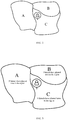
- the reduced-size image includes three geographic regions, which are respectively a geographic region A, a geographic region B, and a geographic region C.
- the target user may select one of the geographic regions by moving a user icon in the reduced-size image.
- the geographic region A is then determined to be the target geographic region.
- a number of public welfare activity participant users may be further determined, each of whom has a designated user relationship with the target user, and has carried out a public welfare activity in the geographic region; and user information of the number of public welfare activity participant users is summarized; and the summarized user information is associated with the reduced-size image of the geographic regions for display.
- user information of public welfare activity participant users who have carried out a tree-planting behavior in the geographic region A may be first obtained. Then it is determined based on the user information whether the public welfare activity participant users have a designated user relationship with the target user, such as a friendship, a follower-following relationship, or a fund-transactional relationship. Then a number of public welfare activity participant users each having a designated user relationship with the target user may be counted, and the number may be associated with the geographic region A for display, such that the target user learns the tree-planting site selection status of the users who have a designated user relationship with the target user.
- a designated user relationship with the target user such as a friendship, a follower-following relationship, or a fund-transactional relationship.
- a number of public welfare activity participant users each having a designated user relationship with the target user may be counted, and the number may be associated with the geographic region A for display, such that the target user learns the tree-planting site selection status of the users who have
- a friendship is taken as an example of the designated user relationship below. Assuming that 25 public welfare activity participant users who have participated in public welfare activities in the geographic region A have a friendship with the target user, 5 public welfare activity participant users who have participated in public welfare activities in the geographic region B have a friendship with the target user, and 8 public welfare activity participant users who have participated in public welfare activities in the geographic region C have a friendship with the target user, a reduced-size image, as shown in FIG. 3 , may then be displayed to the target user.
- the target user may visually see the tree-planting site selection status of friends, and may select the geographic region associated with relatively more friends or the geographic region associated with relatively fewer friends as the target geographic region.
- the user information associated with the reduced-size image of the geographic regions for display may further include other user information, such as profile pictures of the public welfare activity participant users.
- the present specification is not limited thereto.
- the user information of the public welfare activity participant users who have a designated user relationship with the target user is associated with the reduced-size image of the geographic regions for display, thereby enhancing the interaction of the target user with other users during the site-selection process of the online public welfare behavior, and improving the target user's site selection experience.
- a target user may also select a target geographic region by using a list of geographic regions and the like. Naturally, if there is one geographic region, the target user does not have to make a selection.
- the provider of the tree-planting public welfare activity may configure the selection based on actual situations. The present specification is not limited thereto.
- a public welfare map of the target geographic region may be displayed to the target user.
- the display of the public welfare map may be implemented by enlarging the target geographic region, page-redirecting, or the like. The present specification is not limited thereto.
- a location at which the tree-planting activity has been carried out and a location at which the tree-planting activity is able to be carried out may be marked on the public welfare map by using different icons.
- each of the icons may correspond to one of physical tree-planting locations.
- a shaded icon in FIG. 4 may be referred to as a first icon, which is used to indicate that a tree has been planted at a location corresponding to the first icon; an unshaded icon in FIG. 4 may be referred to as a second icon, which is used to indicate that a tree is able to be planted at a location corresponding to the second icon.
- the first icon circled by a cursor in FIG. 4 represents a tree-planting location selected by default for the target user by a system.
- the target user may select a tree-planting location by moving the cursor.
- the target user may move the cursor to a second icon by sliding (a finger) on a display screen, clicking direction buttons (not shown in the figure), or the like.
- the target user may input a selection operation by using an OK button (not shown in the figure).
- the second icon selected by the target user may be updated to be a first icon, so as to prompt the target user that a tree-planting site selection is successful.
- a confirmation prompt box may be outputted to the target user, such that the target user may confirm the selected location and some related information, such as an environmental protection manifesto.
- the present specification is not limited thereto.
- user information of multiple public welfare activity participant users who have carried out public welfare activities on the public welfare map may be further determined; then a number of public welfare activity participant users each of whom has a designated user relationship with the target user is determined; and then the user information of a public welfare activity participant user and public welfare information of the public welfare activity carried out by the public welfare activity participant user are displayed at a first icon, which corresponds to a location at which the public welfare activity participant user who has planted a tree.
- the user information may include a user profile picture, a user nickname, and the like.
- the public welfare information may include a tree-planting manifesto, longitude and latitude coordinates of the tree-planting location, and the like.
- a system selects a tree-planting location by default for the target user and a planter of a tree in the north of the tree-planting location is the target user's friend called Xiaobai
- a profile picture of Xiaobai, a tree-planting manifesto, and longitude and latitude coordinates of the tree-planting location may be displayed in association with the first icon indicating Xiaobai's tree planting.
- the target user may visually see friends' tree-planting locations, such that the target user may choose to plant a tree near or away from the friends' trees.
- user information of the public welfare activity participant user and public welfare information may also be displayed on the public welfare map.
- user information and public welfare information for a public welfare activity participant user who does not have a designated user relationship with the target user may be hidden by default.
- the target user clicks a first icon the user information and the public welfare information of the public welfare activity participant user corresponding to the first icon are then displayed.
- the present specification is not limited thereto.
- a session interface oriented to the public welfare activity participant user may be displayed.
- the session interface may be an instant communication session box, through which the target user may send instant session information to the public welfare activity participant user.
- the session interface may further be a comment session box regarding the tree-planting behavior of the public welfare activity participant user, through which the target user may comment on the tree-planting behavior of the public welfare activity participant user.
- the session interface may further include a button for performing a following operation on the tree-planting behavior of the public welfare activity participant user, such as a Like button or a Set-to-Top button.
- a button for performing a following operation on the tree-planting behavior of the public welfare activity participant user such as a Like button or a Set-to-Top button.
- the present specification is not limited thereto.
- the user in this embodiment may select, on a public welfare map, a tree-planting site that corresponds to a real tree-planting scene, thereby greatly enhancing the sense of reality for the user participating the online tree-planting activity, and improving the user's online public welfare experience.
- the tree-planting public welfare behavior is still taken as an example, and the target user may view a live satellite image of a tree-planting region by using related client software.
- the target user may send an instruction for live view by clicking a "live scene" button or the like; and a current live satellite image of the target geographic region may be displayed to the target user based on the instruction, so that the target user may view the real condition of the target geographic region.
- a satellite image of the target geographic region before the tree-planting activity was carried out may further be displayed to the target user.
- the present specification enables the target user to visually learn the change that the target user's public welfare behavior may bring to the target geographic region, thereby strengthening the target user's interest in public welfare.
- the present specification further provides apparatus embodiments for implementing visualization of public welfare activities.
- An apparatus embodiment for implementing visualization of public welfare activities in the present specification may be applicable to a terminal device or a server.
- the apparatus embodiment may be implemented by software, by hardware, or through a combination of software and hardware.
- an apparatus in the sense of logics is formed by a processor of a terminal device or server at which the apparatus is located reading corresponding computer program instructions in a non-volatile memory into a memory and running the computer program instructions.
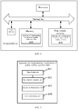
- FIG. 6 is a diagram of a hardware structure of a terminal device or server at which the apparatus for implementing visualization of public welfare activities in this specification is located.
- the terminal device or server at which the apparatus is located in this embodiment may further include other hardware according to actual functions of the terminal device or server, which are not described in detail herein.
- FIG. 7 is a block diagram of an apparatus for implementing visualization of public welfare activities according to an exemplary embodiment of this specification.
- the apparatus 600 for implementing visualization of public welfare activities is applicable to the terminal device or server shown in FIG. 6 , and includes a map display unit 601, a site selection operation unit 602, a session implementation unit 603, and a live scene display unit 604.
- the map display unit 601 is configured to, in response to a selection operation of a target user regarding a region for carrying out a public welfare activity, display to the target user a public welfare map of a target geographic region, wherein the public welfare map includes a first icon indicating that the public welfare activity has been carried out and a second icon indicating that the public welfare activity is able to be carried out;
- the site selection operation unit 602 is configured to, in response to a selection operation of the target user regarding the second icon on the public welfare map, update the selected second icon to be a first icon.
- the map display unit 601 is further configured to: determine user information of a public welfare activity participant user that has carried out the public welfare activity on the public welfare map; determine, based on the user information, whether the public welfare activity participant user has a designated user relationship with the target user; and if the public welfare activity participant user has the designated user relationship with the target user, display on the public welfare map the user information of the public welfare activity participant user and public welfare information of the public welfare activity carried out by the public welfare activity participant user.
- the session implementation unit 603 is configured to: in response to a selection operation of the target user regarding the public welfare activity participant user on the public welfare map, display a session interface oriented to the public welfare activity participant user.
- the session interface may include one or a plurality of functions as follows: sending an instant session message to the public welfare activity participant user; evaluating the public welfare activity carried out by the public welfare activity participant user; and following the public welfare activity carried out by the public welfare activity participant user.
- the live scene display unit 604 is configured to, in response to a live viewing operation of the target user, display to the target user a satellite image of the target geographic region.
- the satellite image may include: a current live satellite image and a satellite image of the target geographic region before the public welfare activity was carried out.
- the map display unit 601 is further configured to: in response to the selection operation of the target user regarding the region for carrying out the public welfare activity, display to the target user a reduced-size image of multiple geographic regions in which the public welfare activity is able to be carried out; and in response to a selection operation of the target user on the reduced-size image, determine a selected geographic region corresponding to the reduced-size image as a target geographic region, and perform an operation of displaying to the target user a public welfare map of the target geographic region.
- the map display unit 601 is further configured to: for each geographic region, determine public welfare activity participant users each having a designated user relationship with the target user and having carried out the public welfare activity in the geographic region; summarize user information of the public welfare activity participant users; and associate the summarized user information with the reduced-size image of the geographic regions for display.
- the apparatus embodiments are basically corresponding to the method embodiments. Therefore, for relevant content, reference may be made to some of the description in the method embodiments.
- the apparatus embodiments described above are merely exemplary.
- the units described as separate components may or may not be physically separated, and the components shown as units may or may not be physical units, i.e., may be located in one place or distributed across a plurality of network units. Some or all of the modules thereof can be selected according to actual needs to achieve the objective of the solutions in this specification. Those skilled in the art can understand and implement this specification without creative efforts.
- a typical implementation device is a computer.
- the computer may be a personal computer, a laptop computer, a cellular phone, a camera phone, a smart phone, a personal digital assistant, a media player, a navigation device, an e-mail transceiver device, a game console, a tablet computer, a wearable device, or a combination of any of these devices.
- the present specification further provides an apparatus for implementing visualization of public welfare activities.
- the apparatus for implementing visualization of public welfare activities includes a processor and a memory configured to store machine-executable instructions.
- the processor and the memory are usually interconnected by using an internal bus.
- the device may further include an external interface to communicate with other devices or components.
- the processor by reading and executing the machine-executable instructions stored in the memory and corresponding to logic for implementing visualization of public welfare activities, the processor is caused to:
- the target user in response to a selection operation of a target user regarding a region for carrying out a public welfare activity, display to the target user a public welfare map of a target geographic region, wherein the public welfare map includes a first icon indicating that the public welfare activity has been carried out and a second icon indicating that the public welfare activity is able to be carried out; and in response to a selection operation of the target user regarding the second icon on the public welfare map, update the selected second icon to be a first icon.
- the processor is further caused to:
- the processor is further caused to: in response to a selection operation of the target user regarding the public welfare activity participant user on the public welfare map, display a session interface oriented to the user who participated in public welfare activities.
- the session interface may include one or a plurality of functions as follows:
- the processor is further caused to: in response to a live viewing operation of the target user, display to the target user a satellite image of the target geographic region.
- the satellite image may include: a current live satellite image and a satellite image of the target geographic region before the public welfare activity was carried out.
- the processor is further caused to:
- the processor is further caused to:
- the present specification further provides a computer-readable storage medium having stored thereon computer programs which, when executed by a processor, implement the following steps:
- the steps further include:
- the steps further include: in response to a selection operation of the target user regarding the public welfare activity participant user on the public welfare map, displaying a session interface oriented to the public welfare activity participant user.
- the session interface may include one or a plurality of functions as follows: sending an instant session message to the public welfare activity participant user; evaluating the public welfare activity carried out by the public welfare activity participant user; and following the public welfare activity carried out by the public welfare activity participant user.
- the steps further include: in response to a live viewing operation of the target user, displaying to the target user a satellite image of the target geographic region.
- the satellite image may include: a current live satellite image and a satellite image of the target geographic region before the public welfare activity was carried out.
- the steps further include:
- the steps further include:
Landscapes
- Engineering & Computer Science (AREA)
- Theoretical Computer Science (AREA)
- Physics & Mathematics (AREA)
- Business, Economics & Management (AREA)
- General Physics & Mathematics (AREA)
- Databases & Information Systems (AREA)
- General Engineering & Computer Science (AREA)
- Tourism & Hospitality (AREA)
- Data Mining & Analysis (AREA)
- Health & Medical Sciences (AREA)
- General Health & Medical Sciences (AREA)
- General Business, Economics & Management (AREA)
- Strategic Management (AREA)
- Economics (AREA)
- Remote Sensing (AREA)
- Human Resources & Organizations (AREA)
- Marketing (AREA)
- Primary Health Care (AREA)
- Educational Administration (AREA)
- Child & Adolescent Psychology (AREA)
- Mathematical Physics (AREA)
- Educational Technology (AREA)
- Human Computer Interaction (AREA)
- Development Economics (AREA)
- User Interface Of Digital Computer (AREA)
- Management, Administration, Business Operations System, And Electronic Commerce (AREA)
- Instructional Devices (AREA)
- Measuring And Recording Apparatus For Diagnosis (AREA)
Abstract
Description
- This specification relates to the field of Internet technologies, and in particular, to a method and apparatus for implementing visualization of public welfare activities.
- With the rapid development of Internet technologies, more and more public welfare activities have been carried out through the Internet. In addition to carrying out public welfare behavior to help others and the society, online public welfare activities may further help public welfare activity initiators to garner users and increase user traffic.
- However, current online public welfare activities provide a relatively poor sense of reality, and users often cannot truly feel that they have participated in public welfare activities. Therefore, it is desirable to provide a more effective solution in carrying out online public welfare activities with a stronger sense of reality.
- In view of the above, this specification provides a method and apparatus for implementing visualization of public welfare activities.
- For example, this specification is implemented by using the following technical solutions:
- A method for implementing visualization of public welfare activities is provided, comprising:
- in response to a selection operation of a target user regarding a region for carrying out a public welfare activity, displaying to the target user a public welfare map of a target geographic region, wherein the public welfare map comprises a first icon indicating that the public welfare activity has been carried out and a second icon indicating that the public welfare activity is able to be carried out; and
- in response to a selection operation of the target user regarding the second icon on the public welfare map, updating the selected second icon to be a first icon.
- An apparatus for implementing visualization of public welfare activities is provided, comprising:
- a map display unit, configured to, in response to a selection operation of a target user regarding a region for carrying out a public welfare activity, display to the target user a public welfare map of a target geographic region, wherein the public welfare map comprises a first icon indicating that the public welfare activity has been carried out and a second icon indicating that the public welfare activity is able to be carried out; and
- a site selection operation unit, configured to, in response to a selection operation of the target user regarding the second icon on the public welfare map, update the selected second icon to be a first icon.
- An apparatus for implementing visualization of public welfare activities is provided, comprising:
- a processor; and
- a memory, configured to store machine-executable instructions, wherein
- by reading and executing the machine-executable instructions stored in the memory and corresponding to logic for implementing visualization of public welfare activities, the processor is caused to:
- in response to a selection operation of a target user regarding a region for carrying out a public welfare activity, display to the target user a public welfare map of a target geographic region, wherein the public welfare map includes a first icon indicating that the public welfare activity has been carried out and a second icon indicating that the public welfare activity is able to be carried out; and
- in response to a selection operation of the target user regarding the second icon on the public welfare map, update the selected second icon to be a first icon.
- It may be seen from the foregoing description that the present specification may display the public welfare map to a user, and the user may select a site for the public welfare activity through the public welfare map, thereby enhancing the sense of reality for the user participating in online public welfare activities, and improving the user's online public welfare experience.
-
-
FIG. 1 is a schematic flow chart of a method for implementing visualization of public welfare activities according to an exemplary embodiment of this specification. -
FIG. 2 is a schematic diagram of a display page for a reduced-size image of geographic regions according to an exemplary embodiment of this specification. -
FIG. 3 is a schematic diagram of a display page for another reduced-size image of geographic regions according to an exemplary embodiment of this specification. -
FIG. 4 is a schematic diagram of a display page for a public welfare map according to an exemplary embodiment of this specification. -
FIG. 5 is a schematic diagram of a display page for another public welfare map according to an exemplary embodiment of this specification. -
FIG. 6 is a schematic structural diagram of an apparatus for implementing visualization of public welfare activities according to an exemplary embodiment of this specification; and -
FIG. 7 is a block diagram of an apparatus for implementing visualization of public welfare activities according to an exemplary embodiment of this specification. - Exemplary embodiments are described hereinafter in detail, examples of which are illustrated in the accompanying drawings. When the following description refers to the accompanying drawings, same numbers in different accompanying drawings indicate same or similar elements unless otherwise indicated. Implementation manners described in the following exemplary embodiments do not represent all implementation manners consistent with this specification. Conversely, they are merely examples of apparatus and methods consistent with some aspects of the specification that are described in the appended claims in detail.
- Terms used in this specification are for the purpose of describing particular embodiments only and are not intended to limit the specification. As used in this specification and the appended claims, singular forms "a," "the," and "said" are intended to include plural forms as well, unless the context clearly indicates otherwise. It should be further appreciated that the term "and/or" used in this specification refers to and includes any or all possible combinations of one or more listed associated items.
- It should be appreciated that although terms such as first, second, third, and the like may be used in this specification to describe various information, the information should not be limited to these terms. These terms are only used to distinguish a same type of information from each other. For example, without departing from the scope of this specification, first information may also be referred to as second information; and similarly, second information may also be referred to as first information. Depending on the context, the word "if' as used herein may be interpreted as "at the time when," "when," or "in response to determination."
- The present specification provides a solution for implementing visualization of public welfare activities. A user may select a site for the public welfare activity through a public welfare map, thus the sense of reality is enhanced for the user participating in online public welfare activities, and the user's online public welfare experience is improved.
-
FIG. 1 is a schematic flow chart of a method for implementing visualization of public welfare activities according to an exemplary embodiment of this specification. - The solution for implementing visualization of public welfare activities is applicable to a terminal device, for example, an intelligent device with a display screen, such as a mobile phone, a tablet computer, or a PC. The solution for implementing visualization of public welfare activities may also be applicable to a server, which may communicate with a terminal device with a display screen, and further send a related instruction to the terminal device, such that the terminal device performs display accordingly through the display screen. However, the present specification is not limited thereto.
- Referring to
FIG. 1 , the method for implementing visualization of public welfare activities may include the following steps: -
Step 102, in response to a selection operation of a target user regarding a region for carrying out a public welfare activity, displaying to the target user a public welfare map of a target geographic region, wherein the public welfare map includes a first icon indicating that the public welfare activity has been carried out and a second icon indicating that the public welfare activity is able to be carried out. - In this embodiment, the target geographic region may be set by the target user. The first icon is different from the second icon. The first icon may be used to indicate a geographic location at which a public welfare activity has been carried out, and the second icon may be used to indicate a geographic location at which a public welfare activity is able to be carried out. In other words, no public welfare activity has been carried out at the geographic location corresponding to the second icon. Certainly, the meaning represented by the first icon and the meaning represented by the second icon may be interchangeable. The present specification is not limited thereto.
- The above-described geographic location may represent a geographic location in the real world, such as a location corresponding to a pair of longitude and latitude coordinates. Optionally, the above-described geographic location may represent a geographic location region in the real world, such as a rectangular or a circular location region, or a location region in another shape.
-
Step 104, in response to a selection operation of the target user regarding the second icon on the public welfare map, updating the selected second icon to be a first icon. - In this embodiment, the target user may select a second icon on the public welfare map for which the target user intends to have a public welfare activity to be carried out. When the second icon is selected by the target user, the second icon may be updated to be a first icon, thus prompting the target user that a site selection is successful.
- Based on the second icon selected by the target user, a public welfare activity provider may carry out a corresponding public welfare activity at a geographic location or in a geographic location region that corresponds to the second icon.
- In view of the above, a public welfare map may be displayed to a user, and the user may select a site for a public welfare activity through the public welfare map, thereby enhancing the sense of reality for the user participating in the online public welfare activity, and improving the user's online public welfare experience.
- Tree planting is taken as an example of public welfare activity below to describe the technical solutions provided in the present specification in detail from the two aspects of selecting a target geographic region and selecting a tree-planting region.
- In this embodiment, for ease of distinction, a user who intends to select a site for a tree-planting public welfare activity to be carried out may be referred to as a target user, and a user who has selected a site for a tree-planting public welfare activity to be carried out may be referred to as a public welfare activity participant user.
- The target user may initiate a tree-planting region selection operation by using related client software loaded in a terminal device. For example, the target user may initiate the tree-planting region selection operation and the like by clicking a "select a site" button and the like.
- After the above-described tree-planting region selection operation is received, a reduced-size image of multiple geographic regions in which a tree planting activity is able to be carried out is displayed to the target user on a display screen. A provider for the tree-planting public welfare activity may preset a dividing rule for dividing the geographic regions. For example, the provider may divide an actual region in which a tree-planting behavior is able to be carried out into a plurality of geographic regions.
- Referring to a reduced-size image of geographic regions shown in
FIG. 2 , the reduced-size image includes three geographic regions, which are respectively a geographic region A, a geographic region B, and a geographic region C. The target user may select one of the geographic regions by moving a user icon in the reduced-size image. - Assuming that the target user moves the user icon to the geographic region A, and clicks a confirmation button (not shown in the figure), the geographic region A is then determined to be the target geographic region.
- Optionally, in another example, when a reduced-size image of geographic regions is displayed, for each geographic region, a number of public welfare activity participant users may be further determined, each of whom has a designated user relationship with the target user, and has carried out a public welfare activity in the geographic region; and user information of the number of public welfare activity participant users is summarized; and the summarized user information is associated with the reduced-size image of the geographic regions for display.
- Taking the geographic region A as an example, user information of public welfare activity participant users who have carried out a tree-planting behavior in the geographic region A may be first obtained. Then it is determined based on the user information whether the public welfare activity participant users have a designated user relationship with the target user, such as a friendship, a follower-following relationship, or a fund-transactional relationship. Then a number of public welfare activity participant users each having a designated user relationship with the target user may be counted, and the number may be associated with the geographic region A for display, such that the target user learns the tree-planting site selection status of the users who have a designated user relationship with the target user.
- A friendship is taken as an example of the designated user relationship below. Assuming that 25 public welfare activity participant users who have participated in public welfare activities in the geographic region A have a friendship with the target user, 5 public welfare activity participant users who have participated in public welfare activities in the geographic region B have a friendship with the target user, and 8 public welfare activity participant users who have participated in public welfare activities in the geographic region C have a friendship with the target user, a reduced-size image, as shown in
FIG. 3 , may then be displayed to the target user. - Based on the reduced-size image shown in
FIG. 3 , the target user may visually see the tree-planting site selection status of friends, and may select the geographic region associated with relatively more friends or the geographic region associated with relatively fewer friends as the target geographic region. - Naturally, in actual applications, in addition to the number of public welfare activity participant users who have a designated user relationship with the target user, the user information associated with the reduced-size image of the geographic regions for display may further include other user information, such as profile pictures of the public welfare activity participant users. The present specification is not limited thereto.
- In this example, the user information of the public welfare activity participant users who have a designated user relationship with the target user is associated with the reduced-size image of the geographic regions for display, thereby enhancing the interaction of the target user with other users during the site-selection process of the online public welfare behavior, and improving the target user's site selection experience.
- It should be noted that, in another example, a target user may also select a target geographic region by using a list of geographic regions and the like. Naturally, if there is one geographic region, the target user does not have to make a selection. The provider of the tree-planting public welfare activity may configure the selection based on actual situations. The present specification is not limited thereto.
- In this embodiment, after the target geographic region is determined, a public welfare map of the target geographic region may be displayed to the target user. For example, the display of the public welfare map may be implemented by enlarging the target geographic region, page-redirecting, or the like. The present specification is not limited thereto.
- A location at which the tree-planting activity has been carried out and a location at which the tree-planting activity is able to be carried out may be marked on the public welfare map by using different icons. For a more authentic experience, each of the icons may correspond to one of physical tree-planting locations.
- For example, referring to
FIG. 4 , a shaded icon inFIG. 4 may be referred to as a first icon, which is used to indicate that a tree has been planted at a location corresponding to the first icon; an unshaded icon inFIG. 4 may be referred to as a second icon, which is used to indicate that a tree is able to be planted at a location corresponding to the second icon. The first icon circled by a cursor inFIG. 4 represents a tree-planting location selected by default for the target user by a system. - The target user may select a tree-planting location by moving the cursor. For example, the target user may move the cursor to a second icon by sliding (a finger) on a display screen, clicking direction buttons (not shown in the figure), or the like.
- After selecting the second icon for tree planting, the target user may input a selection operation by using an OK button (not shown in the figure). After the selection operation is received, the second icon selected by the target user may be updated to be a first icon, so as to prompt the target user that a tree-planting site selection is successful.
- Optionally, before the icon update, a confirmation prompt box may be outputted to the target user, such that the target user may confirm the selected location and some related information, such as an environmental protection manifesto. The present specification is not limited thereto.
- In another example, similar to the display of the geographic region, user information of multiple public welfare activity participant users who have carried out public welfare activities on the public welfare map may be further determined; then a number of public welfare activity participant users each of whom has a designated user relationship with the target user is determined; and then the user information of a public welfare activity participant user and public welfare information of the public welfare activity carried out by the public welfare activity participant user are displayed at a first icon, which corresponds to a location at which the public welfare activity participant user who has planted a tree.
- The user information may include a user profile picture, a user nickname, and the like. The public welfare information may include a tree-planting manifesto, longitude and latitude coordinates of the tree-planting location, and the like.
- Referring to
FIG. 5 , assuming that a system selects a tree-planting location by default for the target user and a planter of a tree in the north of the tree-planting location is the target user's friend called Xiaobai, then a profile picture of Xiaobai, a tree-planting manifesto, and longitude and latitude coordinates of the tree-planting location may be displayed in association with the first icon indicating Xiaobai's tree planting. - Based on the public welfare map shown in
FIG. 5 , the target user may visually see friends' tree-planting locations, such that the target user may choose to plant a tree near or away from the friends' trees. - In actual applications, for a public welfare activity participant user who does not have a designated user relationship with the target user, user information of the public welfare activity participant user and public welfare information may also be displayed on the public welfare map. Naturally, to avoid the interference caused by displaying excessive information to the target user's site selection, user information and public welfare information for a public welfare activity participant user who does not have a designated user relationship with the target user may be hidden by default. When the target user clicks a first icon, the user information and the public welfare information of the public welfare activity participant user corresponding to the first icon are then displayed. The present specification is not limited thereto.
- Optionally, in another example, when the target user selects, from the displayed content, a public welfare activity participant user or the above-described related information corresponding to the public welfare activity participant user, a session interface oriented to the public welfare activity participant user may be displayed.
- The session interface may be an instant communication session box, through which the target user may send instant session information to the public welfare activity participant user.
- The session interface may further be a comment session box regarding the tree-planting behavior of the public welfare activity participant user, through which the target user may comment on the tree-planting behavior of the public welfare activity participant user.
- The session interface may further include a button for performing a following operation on the tree-planting behavior of the public welfare activity participant user, such as a Like button or a Set-to-Top button. The present specification is not limited thereto.
- It may be seen from the foregoing description that the user in this embodiment may select, on a public welfare map, a tree-planting site that corresponds to a real tree-planting scene, thereby greatly enhancing the sense of reality for the user participating the online tree-planting activity, and improving the user's online public welfare experience.
- Optionally, in another example, the tree-planting public welfare behavior is still taken as an example, and the target user may view a live satellite image of a tree-planting region by using related client software.
- For example, the target user may send an instruction for live view by clicking a "live scene" button or the like; and a current live satellite image of the target geographic region may be displayed to the target user based on the instruction, so that the target user may view the real condition of the target geographic region.
- In this example, to enable the target user to visually learn the change that tree planting may bring to the target geographic region, in addition to displaying the current live satellite image, a satellite image of the target geographic region before the tree-planting activity was carried out may further be displayed to the target user. By displaying the two satellite images in comparison, the present specification enables the target user to visually learn the change that the target user's public welfare behavior may bring to the target geographic region, thereby strengthening the target user's interest in public welfare.
- In accordance with the method embodiments for implementing visualization of public welfare activities, the present specification further provides apparatus embodiments for implementing visualization of public welfare activities.
- An apparatus embodiment for implementing visualization of public welfare activities in the present specification may be applicable to a terminal device or a server. The apparatus embodiment may be implemented by software, by hardware, or through a combination of software and hardware. Taking software implementation as an example, an apparatus in the sense of logics is formed by a processor of a terminal device or server at which the apparatus is located reading corresponding computer program instructions in a non-volatile memory into a memory and running the computer program instructions. In terms of hardware,
FIG. 6 is a diagram of a hardware structure of a terminal device or server at which the apparatus for implementing visualization of public welfare activities in this specification is located. In addition to a processor, a memory, a network interface, and a non-volatile memory shown inFIG. 6 , the terminal device or server at which the apparatus is located in this embodiment may further include other hardware according to actual functions of the terminal device or server, which are not described in detail herein. -
FIG. 7 is a block diagram of an apparatus for implementing visualization of public welfare activities according to an exemplary embodiment of this specification. - Referring to
FIG. 7 , theapparatus 600 for implementing visualization of public welfare activities is applicable to the terminal device or server shown inFIG. 6 , and includes amap display unit 601, a siteselection operation unit 602, asession implementation unit 603, and a livescene display unit 604. - The
map display unit 601 is configured to, in response to a selection operation of a target user regarding a region for carrying out a public welfare activity, display to the target user a public welfare map of a target geographic region, wherein the public welfare map includes a first icon indicating that the public welfare activity has been carried out and a second icon indicating that the public welfare activity is able to be carried out; - the site
selection operation unit 602 is configured to, in response to a selection operation of the target user regarding the second icon on the public welfare map, update the selected second icon to be a first icon. - Optionally, the
map display unit 601 is further configured to: determine user information of a public welfare activity participant user that has carried out the public welfare activity on the public welfare map; determine, based on the user information, whether the public welfare activity participant user has a designated user relationship with the target user; and if the public welfare activity participant user has the designated user relationship with the target user, display on the public welfare map the user information of the public welfare activity participant user and public welfare information of the public welfare activity carried out by the public welfare activity participant user. - The
session implementation unit 603 is configured to: in response to a selection operation of the target user regarding the public welfare activity participant user on the public welfare map, display a session interface oriented to the public welfare activity participant user. - Optionally, the session interface may include one or a plurality of functions as follows:
sending an instant session message to the public welfare activity participant user; evaluating the public welfare activity carried out by the public welfare activity participant user; and following the public welfare activity carried out by the public welfare activity participant user. - The live
scene display unit 604 is configured to, in response to a live viewing operation of the target user, display to the target user a satellite image of the target geographic region. - Optionally, the satellite image may include: a current live satellite image and a satellite image of the target geographic region before the public welfare activity was carried out.
- Optionally, before displaying to the target user a public welfare map of a target geographic region, the
map display unit 601 is further configured to: in response to the selection operation of the target user regarding the region for carrying out the public welfare activity, display to the target user a reduced-size image of multiple geographic regions in which the public welfare activity is able to be carried out; and in response to a selection operation of the target user on the reduced-size image, determine a selected geographic region corresponding to the reduced-size image as a target geographic region, and perform an operation of displaying to the target user a public welfare map of the target geographic region. - Optionally, the
map display unit 601 is further configured to: for each geographic region, determine public welfare activity participant users each having a designated user relationship with the target user and having carried out the public welfare activity in the geographic region; summarize user information of the public welfare activity participant users; and associate the summarized user information with the reduced-size image of the geographic regions for display. - For details about the implementation process of the functions and roles of the units in the above-described apparatus, refer to the implementation process of the corresponding steps in the above-described method. Details are not described herein again.
- The apparatus embodiments are basically corresponding to the method embodiments. Therefore, for relevant content, reference may be made to some of the description in the method embodiments. The apparatus embodiments described above are merely exemplary. The units described as separate components may or may not be physically separated, and the components shown as units may or may not be physical units, i.e., may be located in one place or distributed across a plurality of network units. Some or all of the modules thereof can be selected according to actual needs to achieve the objective of the solutions in this specification. Those skilled in the art can understand and implement this specification without creative efforts.
- Systems, apparatuses, modules, or units illustrated in the above-described embodiments may be implemented by computer chips or entities, or by products with some functions. A typical implementation device is a computer. For example, the computer may be a personal computer, a laptop computer, a cellular phone, a camera phone, a smart phone, a personal digital assistant, a media player, a navigation device, an e-mail transceiver device, a game console, a tablet computer, a wearable device, or a combination of any of these devices.
- In accordance with the foregoing method embodiments for implementing visualization of public welfare activities, the present specification further provides an apparatus for implementing visualization of public welfare activities. The apparatus for implementing visualization of public welfare activities includes a processor and a memory configured to store machine-executable instructions. The processor and the memory are usually interconnected by using an internal bus. In other possible implementation manners, the device may further include an external interface to communicate with other devices or components.
- In this embodiment, by reading and executing the machine-executable instructions stored in the memory and corresponding to logic for implementing visualization of public welfare activities, the processor is caused to:
- in response to a selection operation of a target user regarding a region for carrying out a public welfare activity, display to the target user a public welfare map of a target geographic region, wherein the public welfare map includes a first icon indicating that the public welfare activity has been carried out and a second icon indicating that the public welfare activity is able to be carried out; and
in response to a selection operation of the target user regarding the second icon on the public welfare map, update the selected second icon to be a first icon. - Optionally, by reading and executing the machine-executable instructions stored in the memory and corresponding to logic for implementing visualization of public welfare activities, the processor is further caused to:
- determine user information of a public welfare activity participant user that has carried out the public welfare activity on the public welfare map;
- determine, based on the user information, whether the public welfare activity participant user has a designated user relationship with the target user; and
- if the public welfare activity participant user has the designated user relationship with the target user, display on the public welfare map the user information of the public welfare activity participant user and public welfare information of the public welfare activity carried out by the public welfare activity participant user.
- Optionally, by reading and executing the machine-executable instructions stored in the memory and corresponding to logic for implementing visualization of public welfare activities, the processor is further caused to:
in response to a selection operation of the target user regarding the public welfare activity participant user on the public welfare map, display a session interface oriented to the user who participated in public welfare activities. - Optionally, the session interface may include one or a plurality of functions as follows:
- sending an instant session message to the public welfare activity participant user; evaluating the public welfare activity carried out by the public welfare activity participant user; and following the public welfare activity carried out by the public welfare activity participant user.
- Optionally, by reading and executing the machine-executable instructions stored in the memory and corresponding to logic for implementing visualization of public welfare activities, the processor is further caused to:
in response to a live viewing operation of the target user, display to the target user a satellite image of the target geographic region. - Optionally, the satellite image may include: a current live satellite image and a satellite image of the target geographic region before the public welfare activity was carried out.
- Optionally, by reading and executing the machine-executable instructions stored in the memory and corresponding to logic for implementing visualization of public welfare activities, the processor is further caused to:
- before displaying to the target user a public welfare map of a target geographic region, in response to the selection operation of the target user regarding the region for carrying out the public welfare activity, display to the target user a reduced-size image of multiple geographic regions in which the public welfare activity is able to be carried out; and
- in response to a selection operation of the target user on the reduced-size image, determine a selected geographic region corresponding to the reduced-size image as the target geographic region, and perform an operation of displaying to the target user a public welfare map of the target geographic region.
- Optionally, by reading and executing the machine-executable instructions stored in the memory and corresponding to logic for implementing visualization of public welfare activities, the processor is further caused to:
- for each geographic region, determine public welfare activity participant users each having a designated user relationship with the target user, and having carried out the public welfare activity in the geographic region;
- summarize user information of the public welfare activity participant users; and
- associate the summarized user information with the reduced-size image of the geographic regions for display.
- In accordance with the aforementioned method embodiments for implementing visualization of public welfare activities, the present specification further provides a computer-readable storage medium having stored thereon computer programs which, when executed by a processor, implement the following steps:
- in response to a selection operation of a target user regarding a region for carrying out a public welfare activity, displaying to the target user a public welfare map of a target geographic region, wherein the public welfare map includes a first icon indicating that the public welfare activity has been carried out and a second icon indicating that the public welfare activity is able to be carried out; and
- in response to a selection operation of the target user regarding the second icon on the public welfare map, updating the selected second icon to be a first icon.
- Optionally, the steps further include:
- determining user information of a public welfare activity participant user that has carried out the public welfare activity on the public welfare map;
- determining, based on the user information, whether the public welfare activity participant user has a designated user relationship with the target user; and
- if the public welfare activity participant user has the designated user relationship with the target user, displaying on the public welfare map the user information of the public welfare activity participant user and public welfare information of the public welfare activity carried out by the public welfare activity participant user.
- Optionally, the steps further include:
in response to a selection operation of the target user regarding the public welfare activity participant user on the public welfare map, displaying a session interface oriented to the public welfare activity participant user. - Optionally, the session interface may include one or a plurality of functions as follows:
sending an instant session message to the public welfare activity participant user; evaluating the public welfare activity carried out by the public welfare activity participant user; and following the public welfare activity carried out by the public welfare activity participant user. - Optionally, the steps further include:
in response to a live viewing operation of the target user, displaying to the target user a satellite image of the target geographic region. - Optionally, the satellite image may include: a current live satellite image and a satellite image of the target geographic region before the public welfare activity was carried out.
- Optionally, before displaying to the target user a public welfare map of a target geographic region, the steps further include:
- in response to the selection operation of the target user regarding the region for carrying out the public welfare activity, displaying to the target user a reduced-size image of multiple geographic regions in which the public welfare activity is able to be carried out; and
- in response to a selection operation of the target user on the reduced-size image, determining a selected geographic region corresponding to the reduced-size image as a target geographic region, and performing an operation of displaying to the target user a public welfare map of the target geographic region.
- Optionally, the steps further include:
- for each geographic region, determining public welfare activity participant users each having a designated user relationship with the target user, and having carried out the public welfare activity in the geographic region;
- summarizing user information of the public welfare activity participant users; and
- associating the summarized user information with the reduced-size image of the geographic regions for display.
- Some embodiments of this specification are described above. Other embodiments fall within the scope of the appended claims. In some embodiments, actions or steps recorded in the claims may be performed in a sequence different from that in the embodiments and a desired result can still be achieved. In addition, the desired result can still be achieved if the processes described in the drawings are not necessarily performed in the illustrated or continuous sequence. In some embodiments, multitasking and parallel processing are also feasible or may be advantageous.
- The above-described embodiments are some embodiments of this specification and are not intended to limit this specification. Any modifications, equivalent replacements, improvements, or the like made within the spirit and principles of this specification shall fall within the protection scope of this specification.
Claims (17)
- A method for implementing visualization of public welfare activities, comprising:in response to a selection operation of a target user regarding a region for carrying out a public welfare activity, displaying to the target user a public welfare map of a target geographic region, wherein the public welfare map comprises a first icon indicating that the public welfare activity has been carried out and a second icon indicating that the public welfare activity is able to be carried out; andin response to a selection operation of the target user regarding the second icon on the public welfare map, updating the selected second icon to be a first icon.
- The method according to claim 1, further comprising:determining user information of a public welfare activity participant user that has carried out the public welfare activity on the public welfare map;determining, based on the user information, whether a designated user relationship exists between the public welfare activity participant user and the target user; andif the designated user relationship exists between the public welfare activity participant user and the target user, displaying on the public welfare map the user information of the public welfare activity participant user and public welfare information of the public welfare activity carried out by the public welfare activity participant user.
- The method according to claim 2, further comprising:
in response to a selection operation of the target user regarding the public welfare activity participant user on the public welfare map, displaying a session interface oriented to the public welfare activity participant user. - The method according to claim 3, wherein the session interface comprises one or a plurality of functions as follows:
sending an instant session message to the public welfare activity participant user; evaluating the public welfare activity carried out by the public welfare activity participant user; and following the public welfare activity carried out by the public welfare activity participant user. - The method according to claim 1, further comprising:
in response to a live viewing operation of the target user, displaying to the target user a satellite image of the target geographic region. - The method according to claim 5, wherein
the satellite image comprises: a current live satellite image and a satellite image of the target geographic region before the public welfare activity was carried out. - The method according to claim 1, wherein before displaying to the target user a public welfare map of a target geographic region, the method further comprises:in response to the selection operation of the target user regarding the region for carrying out the public welfare activity, displaying to the target user a reduced-size image of multiple geographic regions in which the public welfare activity is able to be carried out; andin response to a selection operation of the target user on the reduced-size image, determining a selected geographic region corresponding to the reduced-size image as the target geographic region, and performing an operation of displaying to the target user a public welfare map of the target geographic region.
- The method according to claim 7, further comprising:for each geographic region, determining public welfare activity participant users each having a designated user relationship with the target user and having carried out the public welfare activity in the geographic region;summarizing the user information of the public welfare activity participant users; andassociating the summarized user information with the reduced-size image of the geographic regions for display.
- An apparatus for implementing visualization of public welfare activities, comprising:a map display unit, configured to, in response to a selection operation of a target user regarding a region for carrying out a public welfare activity, display to the target user a public welfare map of a target geographic region, wherein the public welfare map comprises a first icon indicating that the public welfare activity has been carried out and a second icon indicating that the public welfare activity is able to be carried out; anda site selection operation unit, configured to, in response to a selection operation of the target user regarding the second icon on the public welfare map, update the selected second icon to be a first icon.
- The apparatus according to claim 9, wherein
the map display unit is further configured to: determine user information of a public welfare activity participant user who has carried out the public welfare activity on the public welfare map; determine, based on the user information, whether a designated user relationship exists between the public welfare activity participant user and the target user; and if the designated user relationship exists between the public welfare activity participant user and the target user, display on the public welfare map the user information of the public welfare activity participant user and public welfare information of the public welfare activity carried out by the public welfare activity participant user. - The apparatus according to claim 10, further comprising:
a session implementation unit, configured to, in response to a selection operation of the target user regarding the public welfare activity participant user on the public welfare map, display a session interface oriented to the public welfare activity participant user. - The apparatus according to claim 11, wherein the session interface comprises one or a plurality of functions as follows:
sending an instant session message to the public welfare activity participant user; evaluating the public welfare activity carried out by the public welfare activity participant user; and following the public welfare activity carried out by the public welfare activity participant user. - The apparatus according to claim 9, further comprising:
a live scene display unit, configured to, in response to a live viewing operation of the target user, display to the target user a satellite image of the target geographic region. - The apparatus according to claim 13, wherein
the satellite image comprises: a current live satellite image and a satellite image of the target geographic region before the public welfare activity was carried out. - The apparatus according to claim 9, wherein
before displaying to the target user a public welfare map of a target geographic region, the map display unit is further configured to: in response to the selection operation of the target user regarding the region for carrying out the public welfare activity, display to the target user a reduced-size image of multiple geographic regions in which the public welfare activity is able to be carried out; and in response to a selection operation of the target user on the reduced-size image, determine a selected geographic region corresponding to the reduced-size image as the target geographic region, and perform an operation of displaying to the target user a public welfare map of the target geographic region. - The apparatus according to claim 15, wherein
the map display unit is further configured to: for each geographic region, determine public welfare activity participant users each having a designated user relationship with the target user and having carried out the public welfare activity in the geographic region; summarize user information of the public welfare activity participant users; and associate the summarized user information with the reduced-size image of the geographic regions for display. - An apparatus for implementing visualization of public welfare activities, comprising:a processor; anda memory, configured to store machine-executable instructions, whereinby reading and executing the machine-executable instructions stored in the memory that corresponds to logic for implementing visualization of public welfare activities, the processor is caused to:in response to a selection operation of a target user regarding a region for carrying out a public welfare activity, display to the target user a public welfare map of a target geographic region, wherein the public welfare map comprises a first icon indicating that the public welfare activity has been carried out and a second icon indicating that the public welfare activity is able to be carried out; andin response to a selection operation of the target user regarding the second icon on the public welfare map, update the selected second icon to be a first icon.
Applications Claiming Priority (2)
| Application Number | Priority Date | Filing Date | Title |
|---|---|---|---|
| CN201810019829.4A CN108241746B (en) | 2018-01-09 | 2018-01-09 | Implementation method and device for visualizing public welfare activities |
| PCT/CN2018/123795 WO2019137212A1 (en) | 2018-01-09 | 2018-12-26 | Method and apparatus for visualization of public welfare activities |
Publications (2)
| Publication Number | Publication Date |
|---|---|
| EP3716091A1 true EP3716091A1 (en) | 2020-09-30 |
| EP3716091A4 EP3716091A4 (en) | 2020-11-04 |
Family
ID=62699368
Family Applications (1)
| Application Number | Title | Priority Date | Filing Date |
|---|---|---|---|
| EP18899760.5A Withdrawn EP3716091A4 (en) | 2018-01-09 | 2018-12-26 | METHOD AND DEVICE FOR VISUALIZATION OF PUBLIC WELL-BEING ACTIVITIES |
Country Status (10)
| Country | Link |
|---|---|
| US (1) | US11921983B2 (en) |
| EP (1) | EP3716091A4 (en) |
| JP (1) | JP7004825B2 (en) |
| KR (1) | KR102445530B1 (en) |
| CN (2) | CN111898062A (en) |
| MY (1) | MY206067A (en) |
| PH (1) | PH12020550980A1 (en) |
| SG (1) | SG11202006130VA (en) |
| TW (1) | TWI743424B (en) |
| WO (1) | WO2019137212A1 (en) |
Families Citing this family (3)
| Publication number | Priority date | Publication date | Assignee | Title |
|---|---|---|---|---|
| CN111898062A (en) | 2018-01-09 | 2020-11-06 | 创新先进技术有限公司 | Method and device for realizing visual public welfare activities |
| CN108124922B (en) | 2018-01-09 | 2021-11-26 | 中国医学科学院药用植物研究所 | Amomum tsao-ko essential oil and emulsion thereof |
| CN119512417A (en) * | 2023-08-24 | 2025-02-25 | 北京字跳网络技术有限公司 | A page interaction method, device, equipment and storage medium |
Family Cites Families (49)
| Publication number | Priority date | Publication date | Assignee | Title |
|---|---|---|---|---|
| US7454361B1 (en) | 1999-04-22 | 2008-11-18 | Ceats, Inc. | Individual seat selection ticketing and reservation system |
| JP2003256684A (en) | 2002-02-26 | 2003-09-12 | Fujitsu Ltd | Method of mediating social welfare activities and supporting method |
| US9412141B2 (en) | 2003-02-04 | 2016-08-09 | Lexisnexis Risk Solutions Fl Inc | Systems and methods for identifying entities using geographical and social mapping |
| TWI232416B (en) * | 2003-12-31 | 2005-05-11 | E Ten Information Sysem Co Ltd | Map capturing system and method to zoom in/out with narrow bandwidth |
| JP4797154B2 (en) | 2004-05-31 | 2011-10-19 | 国立大学法人佐賀大学 | Image display method |
| US7848765B2 (en) | 2005-05-27 | 2010-12-07 | Where, Inc. | Location-based services |
| US8756501B1 (en) * | 2005-12-30 | 2014-06-17 | Google Inc. | Method, system, and graphical user interface for meeting-spot-related introductions |
| US20090300528A1 (en) * | 2006-09-29 | 2009-12-03 | Stambaugh Thomas M | Browser event tracking for distributed web-based processing, spatial organization and display of information |
| US20080109761A1 (en) | 2006-09-29 | 2008-05-08 | Stambaugh Thomas M | Spatial organization and display of travel and entertainment information |
| US8199734B2 (en) | 2007-05-15 | 2012-06-12 | Sony Mobil Communications AB | Method and apparatus for sharing common interest links between communication devices |
| JP2009133645A (en) | 2007-11-28 | 2009-06-18 | Jpic Co Ltd | System, method, and program for providing information |
| WO2011020101A2 (en) | 2009-08-14 | 2011-02-17 | Telogis, Inc. | Real time map rendering with data clustering and expansion and overlay |
| WO2011060388A1 (en) * | 2009-11-13 | 2011-05-19 | Zoll Medical Corporation | Community-based response system |
| US20120323911A1 (en) * | 2010-12-15 | 2012-12-20 | Zack Anton | Method and system for tagging plants using a social networking system |
| US8560678B2 (en) | 2010-12-22 | 2013-10-15 | Facebook, Inc. | Providing relevant notifications based on common interests between friends in a social networking system |
| KR101873525B1 (en) * | 2011-12-08 | 2018-07-03 | 삼성전자 주식회사 | Device and method for displaying a contents in wireless terminal |
| US20130159825A1 (en) * | 2011-12-16 | 2013-06-20 | Microsoft Corporation | Search results with maps |
| US9294428B2 (en) | 2012-01-18 | 2016-03-22 | Kinectus, Llc | Systems and methods for establishing communications between mobile device users |
| US9135751B2 (en) * | 2012-06-05 | 2015-09-15 | Apple Inc. | Displaying location preview |
| JP5668025B2 (en) | 2012-06-22 | 2015-02-12 | シャープ株式会社 | Mobile terminal device |
| US8605094B1 (en) | 2012-08-13 | 2013-12-10 | Ribbon Labs, Inc. | Graphical display of locations |
| US9049547B2 (en) | 2012-08-31 | 2015-06-02 | Blackberry Limited | Displaying place-related content on a mobile device |
| JP5594705B2 (en) | 2012-12-25 | 2014-09-24 | 楽天株式会社 | Seat management system, seat management system control method, and program |
| US20140195625A1 (en) | 2013-01-08 | 2014-07-10 | John Christopher Weldon | System and method for crowdsourcing event-related social media posts |
| CN105051495B (en) * | 2013-03-15 | 2019-07-23 | 苹果公司 | A method of predicting the destination of a device and a device for obtaining an address |
| US20140324442A1 (en) | 2013-04-26 | 2014-10-30 | George Barnes, III | System and method for alerting government representatives to citizen issues |
| TW201426328A (en) * | 2013-05-16 | 2014-07-01 | Real Touch Corp | Activity announcing method and system thereof |
| US9824405B2 (en) * | 2013-06-17 | 2017-11-21 | Rmark Bio, Inc. | System and method for determining social connections based on experimental life sciences data |
| US20150134603A1 (en) * | 2013-10-15 | 2015-05-14 | Connect Software Corporation | Systems, methods, and computer program products for contact information |
| US9036807B1 (en) | 2013-10-25 | 2015-05-19 | Teletech Holdings, Inc. | Method and system for routing messages and connecting users associated with live-connected content |
| US20150261844A1 (en) | 2014-03-14 | 2015-09-17 | Katrina Ramalho | System and method for recommending people to meet or places to visit based on interests of the user |
| WO2015158697A1 (en) * | 2014-04-15 | 2015-10-22 | King.Com Limited | Device, game and methods therefore |
| CN105005457B (en) | 2014-04-25 | 2019-04-09 | 腾讯科技(深圳)有限公司 | Geographical location methods of exhibiting and device |
| KR102067280B1 (en) | 2014-05-08 | 2020-02-11 | 삼성전자주식회사 | Apparatus and method for social community creation based on location |
| US9584968B2 (en) | 2014-05-21 | 2017-02-28 | Aol Inc. | Systems and methods for deploying dynamic geo-fences based on content consumption levels in a geographic location |
| US10298535B2 (en) | 2015-05-19 | 2019-05-21 | Facebook, Inc. | Civic issues platforms on online social networks |
| CN105518737A (en) | 2015-06-05 | 2016-04-20 | 广州华多网络科技有限公司 | A method and system for online seat selection social interaction |
| CN105512733A (en) * | 2015-11-27 | 2016-04-20 | 北京金和网络股份有限公司 | Planar-realistic-picture-based conference room reservation method |
| CN105516311B (en) * | 2015-12-09 | 2019-03-05 | 中国农业银行股份有限公司 | A kind of electronic map panorama picture capturing method and system |
| JP2017120487A (en) | 2015-12-28 | 2017-07-06 | キヤノンマーケティングジャパン株式会社 | Information processing device, system and control method and program thereof |
| US9942707B2 (en) | 2016-07-25 | 2018-04-10 | International Business Machines Corporation | Cognitive geofencing |
| JP3206847U (en) * | 2016-07-27 | 2016-10-06 | 株式会社総合鑑定調査 | Real estate information update system |
| US10305850B1 (en) * | 2016-11-15 | 2019-05-28 | Majid Aziz | Enhanced instant messaging social network system |
| CN106779117A (en) | 2016-12-01 | 2017-05-31 | 北京微影时代科技有限公司 | One kind is in line selection seat method and system |
| CN106779123A (en) * | 2016-12-26 | 2017-05-31 | 北京微影时代科技有限公司 | One kind is in line selection seat method and device |
| TWM539673U (en) * | 2016-12-29 | 2017-04-11 | Taiwan Business Bank | Map-guided temple cloud donation system |
| CN106815345B (en) * | 2017-01-17 | 2019-01-22 | 维沃移动通信有限公司 | A method for displaying real-time data and a mobile terminal |
| CN107506376B (en) * | 2017-07-18 | 2021-02-09 | 口碑控股有限公司 | Client for acquiring data of information point in area |
| CN111898062A (en) * | 2018-01-09 | 2020-11-06 | 创新先进技术有限公司 | Method and device for realizing visual public welfare activities |
-
2018
- 2018-01-09 CN CN202010759122.4A patent/CN111898062A/en active Pending
- 2018-01-09 CN CN201810019829.4A patent/CN108241746B/en active Active
- 2018-12-05 TW TW107143562A patent/TWI743424B/en not_active IP Right Cessation
- 2018-12-26 JP JP2020536505A patent/JP7004825B2/en active Active
- 2018-12-26 MY MYPI2020003402A patent/MY206067A/en unknown
- 2018-12-26 SG SG11202006130VA patent/SG11202006130VA/en unknown
- 2018-12-26 EP EP18899760.5A patent/EP3716091A4/en not_active Withdrawn
- 2018-12-26 WO PCT/CN2018/123795 patent/WO2019137212A1/en not_active Ceased
- 2018-12-26 KR KR1020207018742A patent/KR102445530B1/en active Active
-
2020
- 2020-06-24 PH PH12020550980A patent/PH12020550980A1/en unknown
-
2022
- 2022-12-16 US US18/083,455 patent/US11921983B2/en active Active
Also Published As
| Publication number | Publication date |
|---|---|
| TWI743424B (en) | 2021-10-21 |
| KR20200093013A (en) | 2020-08-04 |
| KR102445530B1 (en) | 2022-09-20 |
| CN111898062A (en) | 2020-11-06 |
| CN108241746B (en) | 2020-08-04 |
| JP2021510431A (en) | 2021-04-22 |
| US11921983B2 (en) | 2024-03-05 |
| US20230120293A1 (en) | 2023-04-20 |
| CN108241746A (en) | 2018-07-03 |
| JP7004825B2 (en) | 2022-01-21 |
| TW201931298A (en) | 2019-08-01 |
| PH12020550980A1 (en) | 2021-03-22 |
| SG11202006130VA (en) | 2020-07-29 |
| MY206067A (en) | 2024-11-27 |
| EP3716091A4 (en) | 2020-11-04 |
| WO2019137212A1 (en) | 2019-07-18 |
Similar Documents
| Publication | Publication Date | Title |
|---|---|---|
| US11561675B2 (en) | Method and apparatus for visualization of public welfare activities | |
| US11921983B2 (en) | Method and apparatus for visualization of public welfare activities | |
| EP4246963A1 (en) | Providing shared augmented reality environments within video calls | |
| US20210352118A1 (en) | Method, system, and non-transitory computer-readable record medium for displaying reaction during voip-based call | |
| US20250371767A1 (en) | Method, apparatus, electronic device and storage medium for avatar publishing | |
| US9046996B2 (en) | Techniques for navigation among multiple images | |
| EP2883168A1 (en) | A user recommendation method and a user recommendation system using the same | |
| JP2019518259A (en) | System and method for presenting content | |
| CN113625911A (en) | Information display method and device | |
| Jouet et al. | AR-Chat: an AR-based instant messaging system | |
| US20180048760A1 (en) | Method and device for information exchange | |
| CN110326030B (en) | Systems and methods for providing nested content items associated with virtual content items | |
| CN113031846B (en) | Method and device for displaying description information of task and electronic equipment | |
| HK40039765A (en) | Method and device for realizing visual public welfare activities | |
| HK1256507A1 (en) | Visualized public benefit activity realization method and device | |
| HK1256507B (en) | Visualized public benefit activity realization method and device | |
| US20260058924A1 (en) | Method and apparatus for instant messaging service | |
| CN115400424B (en) | Display method, device, terminal equipment and medium in game | |
| CN111343480B (en) | Video processing method, device and storage medium | |
| CN111161149B (en) | Image display method and device | |
| CN110620805B (en) | Method and apparatus for generating information | |
| HK40062871A (en) | Object setting method and device, electronic equipment and storage medium | |
| CN113805782A (en) | Object setting method and device, electronic device and storage medium | |
| HK40024666A (en) | Video processing method, device and storage medium | |
| HK40024666B (en) | Video processing method, device and storage medium |
Legal Events
| Date | Code | Title | Description |
|---|---|---|---|
| STAA | Information on the status of an ep patent application or granted ep patent |
Free format text: STATUS: THE INTERNATIONAL PUBLICATION HAS BEEN MADE |
|
| PUAI | Public reference made under article 153(3) epc to a published international application that has entered the european phase |
Free format text: ORIGINAL CODE: 0009012 |
|
| STAA | Information on the status of an ep patent application or granted ep patent |
Free format text: STATUS: REQUEST FOR EXAMINATION WAS MADE |
|
| 17P | Request for examination filed |
Effective date: 20200626 |
|
| AK | Designated contracting states |
Kind code of ref document: A1 Designated state(s): AL AT BE BG CH CY CZ DE DK EE ES FI FR GB GR HR HU IE IS IT LI LT LU LV MC MK MT NL NO PL PT RO RS SE SI SK SM TR |
|
| AX | Request for extension of the european patent |
Extension state: BA ME |
|
| A4 | Supplementary search report drawn up and despatched |
Effective date: 20201007 |
|
| RIC1 | Information provided on ipc code assigned before grant |
Ipc: G06Q 50/22 20180101ALI20201001BHEP Ipc: G06F 16/29 20190101AFI20201001BHEP |
|
| RAP1 | Party data changed (applicant data changed or rights of an application transferred) |
Owner name: ADVANCED NEW TECHNOLOGIES CO., LTD. |
|
| DAV | Request for validation of the european patent (deleted) | ||
| DAX | Request for extension of the european patent (deleted) | ||
| STAA | Information on the status of an ep patent application or granted ep patent |
Free format text: STATUS: EXAMINATION IS IN PROGRESS |
|
| 17Q | First examination report despatched |
Effective date: 20210614 |
|
| STAA | Information on the status of an ep patent application or granted ep patent |
Free format text: STATUS: THE APPLICATION HAS BEEN WITHDRAWN |
|
| 18W | Application withdrawn |
Effective date: 20211014 |