EP3680609A1 - Antenna downward inclination angle measurement method based on multi-scale deep semantic segmentation network - Google Patents
Antenna downward inclination angle measurement method based on multi-scale deep semantic segmentation network Download PDFInfo
- Publication number
- EP3680609A1 EP3680609A1 EP19856443.7A EP19856443A EP3680609A1 EP 3680609 A1 EP3680609 A1 EP 3680609A1 EP 19856443 A EP19856443 A EP 19856443A EP 3680609 A1 EP3680609 A1 EP 3680609A1
- Authority
- EP
- European Patent Office
- Prior art keywords
- antenna
- target
- image
- downtilt angle
- semantic segmentation
- Prior art date
- Legal status (The legal status is an assumption and is not a legal conclusion. Google has not performed a legal analysis and makes no representation as to the accuracy of the status listed.)
- Withdrawn
Links
Images





Classifications
-
- G—PHYSICS
- G06—COMPUTING OR CALCULATING; COUNTING
- G06T—IMAGE DATA PROCESSING OR GENERATION, IN GENERAL
- G06T7/00—Image analysis
- G06T7/0002—Inspection of images, e.g. flaw detection
- G06T7/0004—Industrial image inspection
-
- G—PHYSICS
- G06—COMPUTING OR CALCULATING; COUNTING
- G06V—IMAGE OR VIDEO RECOGNITION OR UNDERSTANDING
- G06V10/00—Arrangements for image or video recognition or understanding
- G06V10/20—Image preprocessing
- G06V10/25—Determination of region of interest [ROI] or a volume of interest [VOI]
-
- G—PHYSICS
- G01—MEASURING; TESTING
- G01B—MEASURING LENGTH, THICKNESS OR SIMILAR LINEAR DIMENSIONS; MEASURING ANGLES; MEASURING AREAS; MEASURING IRREGULARITIES OF SURFACES OR CONTOURS
- G01B21/00—Measuring arrangements or details thereof, where the measuring technique is not covered by the other groups of this subclass, unspecified or not relevant
- G01B21/22—Measuring arrangements or details thereof, where the measuring technique is not covered by the other groups of this subclass, unspecified or not relevant for measuring angles or tapers; for testing the alignment of axes
-
- G—PHYSICS
- G06—COMPUTING OR CALCULATING; COUNTING
- G06N—COMPUTING ARRANGEMENTS BASED ON SPECIFIC COMPUTATIONAL MODELS
- G06N3/00—Computing arrangements based on biological models
- G06N3/02—Neural networks
- G06N3/04—Architecture, e.g. interconnection topology
- G06N3/045—Combinations of networks
-
- G—PHYSICS
- G06—COMPUTING OR CALCULATING; COUNTING
- G06N—COMPUTING ARRANGEMENTS BASED ON SPECIFIC COMPUTATIONAL MODELS
- G06N3/00—Computing arrangements based on biological models
- G06N3/02—Neural networks
- G06N3/04—Architecture, e.g. interconnection topology
- G06N3/0464—Convolutional networks [CNN, ConvNet]
-
- G—PHYSICS
- G06—COMPUTING OR CALCULATING; COUNTING
- G06N—COMPUTING ARRANGEMENTS BASED ON SPECIFIC COMPUTATIONAL MODELS
- G06N3/00—Computing arrangements based on biological models
- G06N3/02—Neural networks
- G06N3/08—Learning methods
- G06N3/09—Supervised learning
-
- G—PHYSICS
- G06—COMPUTING OR CALCULATING; COUNTING
- G06T—IMAGE DATA PROCESSING OR GENERATION, IN GENERAL
- G06T7/00—Image analysis
- G06T7/10—Segmentation; Edge detection
- G06T7/11—Region-based segmentation
-
- G—PHYSICS
- G06—COMPUTING OR CALCULATING; COUNTING
- G06T—IMAGE DATA PROCESSING OR GENERATION, IN GENERAL
- G06T7/00—Image analysis
- G06T7/70—Determining position or orientation of objects or cameras
- G06T7/73—Determining position or orientation of objects or cameras using feature-based methods
-
- G—PHYSICS
- G06—COMPUTING OR CALCULATING; COUNTING
- G06V—IMAGE OR VIDEO RECOGNITION OR UNDERSTANDING
- G06V10/00—Arrangements for image or video recognition or understanding
- G06V10/70—Arrangements for image or video recognition or understanding using pattern recognition or machine learning
- G06V10/764—Arrangements for image or video recognition or understanding using pattern recognition or machine learning using classification, e.g. of video objects
-
- G—PHYSICS
- G06—COMPUTING OR CALCULATING; COUNTING
- G06V—IMAGE OR VIDEO RECOGNITION OR UNDERSTANDING
- G06V10/00—Arrangements for image or video recognition or understanding
- G06V10/70—Arrangements for image or video recognition or understanding using pattern recognition or machine learning
- G06V10/82—Arrangements for image or video recognition or understanding using pattern recognition or machine learning using neural networks
-
- G—PHYSICS
- G06—COMPUTING OR CALCULATING; COUNTING
- G06V—IMAGE OR VIDEO RECOGNITION OR UNDERSTANDING
- G06V20/00—Scenes; Scene-specific elements
- G06V20/10—Terrestrial scenes
- G06V20/17—Terrestrial scenes taken from planes or by drones
-
- G—PHYSICS
- G06—COMPUTING OR CALCULATING; COUNTING
- G06V—IMAGE OR VIDEO RECOGNITION OR UNDERSTANDING
- G06V20/00—Scenes; Scene-specific elements
- G06V20/10—Terrestrial scenes
- G06V20/176—Urban or other man-made structures
-
- G—PHYSICS
- G06—COMPUTING OR CALCULATING; COUNTING
- G06V—IMAGE OR VIDEO RECOGNITION OR UNDERSTANDING
- G06V20/00—Scenes; Scene-specific elements
- G06V20/70—Labelling scene content, e.g. deriving syntactic or semantic representations
-
- G—PHYSICS
- G06—COMPUTING OR CALCULATING; COUNTING
- G06T—IMAGE DATA PROCESSING OR GENERATION, IN GENERAL
- G06T2207/00—Indexing scheme for image analysis or image enhancement
- G06T2207/20—Special algorithmic details
- G06T2207/20081—Training; Learning
-
- G—PHYSICS
- G06—COMPUTING OR CALCULATING; COUNTING
- G06T—IMAGE DATA PROCESSING OR GENERATION, IN GENERAL
- G06T2207/00—Indexing scheme for image analysis or image enhancement
- G06T2207/20—Special algorithmic details
- G06T2207/20084—Artificial neural networks [ANN]
Definitions
- the present disclosure relates to the field of mobile communication, and in particular, to a method for measuring an antenna downtilt angle based on a multi-scale deep semantic segmentation network.
- a predicted target output range is made between 0 and 1
- the antenna image is processed by the activation function after feature extraction, and when the output value is greater than 0.5, the object is determined as an antenna
- in a network layer structure there are 53 convolutional layers and 22 residual layers among layers 0-74
- layers 75-105 are feature interaction layers of a neural convolutional network, which can be divided into three scales
- local feature interaction is realized by means of convolution kernels, and its network structure is as shown in Fig. 4 .
Landscapes
- Engineering & Computer Science (AREA)
- Theoretical Computer Science (AREA)
- Physics & Mathematics (AREA)
- General Physics & Mathematics (AREA)
- Multimedia (AREA)
- Evolutionary Computation (AREA)
- Computer Vision & Pattern Recognition (AREA)
- Software Systems (AREA)
- General Health & Medical Sciences (AREA)
- Health & Medical Sciences (AREA)
- Artificial Intelligence (AREA)
- Computing Systems (AREA)
- Computational Linguistics (AREA)
- Biomedical Technology (AREA)
- Databases & Information Systems (AREA)
- Medical Informatics (AREA)
- Life Sciences & Earth Sciences (AREA)
- Biophysics (AREA)
- Data Mining & Analysis (AREA)
- Molecular Biology (AREA)
- General Engineering & Computer Science (AREA)
- Mathematical Physics (AREA)
- Remote Sensing (AREA)
- Quality & Reliability (AREA)
- Image Analysis (AREA)
Abstract
Description
- The present disclosure relates to the field of mobile communication, and in particular, to a method for measuring an antenna downtilt angle based on a multi-scale deep semantic segmentation network.
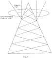
- Nowadays, in the era of network information, the quality of mobile communication networks is extremely important. In GSM-R construction and planning, as shown in
FIG. 1 , an azimuth angle and a downtilt angle of an antenna affect the coverage of signals and the interference between the signals, so the antenna needs to be timely calculated and adjusted strictly to improve the quality of network signals. - There are two traditional methods to measure the antenna downtilt angle: the first one is climbing to an antenna base station manually and using a measuring instrument (a compass, a slope meter, or the like) for measurement; and the second one is installing an angle sensor on the antenna to return data. The antenna is susceptible to wind, snow and other factors, resulting in a change in the downtilt angle, so it needs to be measured regularly. For the first method, as the base station is high and the number of the antennas is larger, the manual safety hazard and workload are larger, and the practicability is low. For the second method, the installation time is long, and the antenna models are different, so the installation cost of the instruments is high and the practicability is not high. Both the two methods consume a lot of manpower and material resources and are not suitable for large-scale measurement today.
- To solve the above problems, the present disclosure aims at providing a method for measuring an antenna downtilt angle based on a multi-scale deep semantic segmentation network. The method for measuring a downtilt angle of a mobile base station antenna by calling a target detection algorithm and a semantic segmentation algorithm and using an unmanned aerial vehicle as a carrier is highly applicable, cost-effective, and safe.
- The technical scheme adopted by the present disclosure to solve the problems is as follows:
An antenna downtilt angle measuring method based on a multi-scale deep semantic segmentation network, including: - collecting image data: base station antenna data is collected by using an unmanned aerial vehicle and antenna images collected are taken as a data set;
- predicting a target bounding box: a target antenna in the data set is positioned, and a bounding box is predicted by logistic regression;
- performing target recognition and semantic segmentation: target features of the target antenna in the data set are extracted, the target features are learned and processed by an activation function, a target image is output for semantic image segmentation, and pixel points of the target image and the background are classified; and
- calculating an antenna downtilt angle: the width and height of an antenna box are obtained according to a border of the target image to calculate the antenna downtilt angle.
- Further, the collecting image data includes:
- locating the unmanned aerial vehicle on the top of a pole of a base station antenna, and
- recording the longitude and latitude (L0, W0 ) of the pole in the vertical direction; causing the unmanned aerial vehicle to fly around a point of the base station antenna, setting a flight radius of the unmanned aerial vehicle, and the unmanned aerial vehicle moving around the pole along the radius on the same horizontal plane to acquire antenna images with different attitudes and angles of a mobile base station antenna as a data set.
- Further, the predicting a target bounding box includes:
positioning a target antenna in the antenna image, predicting a bounding box by logistic regression, first dividing the entire antenna image into N*N grids, predicting the entire antenna image after the antenna image is input, scanning each grid at a time, and starting to predict the target antenna when the center of the grid where the target antenna is located is positioned, wherein 4 coordinate values predicted for each bounding box are tx, ty, tw, and th, respectively, an upper-left offset of each target cell is (cx, cy ), box heights of the bounding boxes are px, py respectively, and the network predicts their values as:


- Further, the performing target recognition and semantic segmentation includes:
performing target recognition by using a network convolutional layer for feature extraction: antenna image pixel 416*416 is input, the channel number is 3, there are 32 layers of convolution kernels, each kernel has a size of 3*3, 32 layers of convolution kernels are used to learn 32 feature maps, and for color differences of the target antenna, features of the target antenna are learned by using different convolution kernels; convolutional layer up-sampling is performed during feature extraction, and a prediction formula for object classes is as follows:
then applying the activation function by logistic regression:
then performing semantic image segmentation on the antenna image by using a deep convolutional network, and classifying the pixel points of the target image and the background:
after the target image is input, it first goes through feature extraction by a dilated convolutional network; and after a feature image is input, dilated convolution is calculated:
after the input image is processed by the convolutional network for output, pixel points of the output target image are classified by a fully connected conditional random field, and the classification is mainly performed for the target image and the background boundary. - Further, the calculating an antenna downtilt angle includes:
obtaining the width x and the height y of the antenna box according to the border of the target image, and calculating a downtilt angle of the base station antenna according to a geometric relation, the downtilt angle of the base station antenna being an angle θ between the base station antenna and a vertical plane:
- The present disclosure has the following beneficial effects: the present disclosure adopts an antenna downtilt angle measuring method based on a multi-scale deep semantic segmentation network. The method for measuring a downtilt angle of a mobile base station antenna by calling a target detection algorithm and a semantic segmentation algorithm and using an unmanned aerial vehicle as a carrier is highly applicable, cost-effective, and safe.
- The present disclosure is further described below with reference to the accompanying drawings and examples.
-
Fig. 1 is a schematic diagram of a downtilt angle of a base station antenna; -
Fig. 2 is a flowchart of an antenna downtilt angle measuring method based on a multi-scale deep semantic segmentation network according to an embodiment of the present disclosure; -
Fig. 3 is a schematic diagram of border prediction for an antenna downtilt angle measuring method based on a multi-scale deep semantic segmentation network according to an embodiment of the present disclosure; -
Fig. 4 is a schematic diagram of a network structure for an antenna downtilt angle measuring method based on a multi-scale deep semantic segmentation network according to an embodiment of the present disclosure; -
Fig. 5 is a schematic diagram of a bottleneck block for an antenna downtilt angle measuring method based on a multi-scale deep semantic segmentation network according to an embodiment of the present disclosure; -
Fig. 6 is a schematic diagram of standard convolution for an antenna downtilt angle measuring method based on a multi-scale deep semantic segmentation network according to an embodiment of the present disclosure; -
Fig. 7 is a schematic diagram of high-resolution feature extraction for an antenna downtilt angle measuring method based on a multi-scale deep semantic segmentation network according to an embodiment of the present disclosure; -
Fig. 8 is a schematic diagram of one-dimensional low-resolution feature extraction for an antenna downtilt angle measuring method based on a multi-scale deep semantic segmentation network according to an embodiment of the present disclosure; -
Fig. 9 is a schematic diagram of dilated convolution for an antenna downtilt angle measuring method based on a multi-scale deep semantic segmentation network according to an embodiment of the present disclosure; and -
Fig. 10 is a view of a random field for an antenna downtilt angle measuring method based on a multi-scale deep semantic segmentation network according to an embodiment of the present disclosure. - Referring to
Fig. 2 , an antenna downtilt angle measuring method based on a multi-scale deep semantic segmentation network is provided in an embodiment of the present disclosure, including: - collecting image data: base station antenna data is collected by using an unmanned aerial vehicle and antenna images collected are taken as a data set;
- predicting a target bounding box: a target antenna in the data set is positioned, and a bounding box is predicted by logistic regression;
- performing target recognition and semantic segmentation: target features of the target antenna in the data set are extracted, the target features are learned and processed by an activation function, a target image is output for semantic image segmentation, and pixel points of the target image and the background are classified; and
- calculating an antenna downtilt angle: the width and height of an antenna box are obtained according to a border of the target image to calculate the antenna downtilt angle.
- In the embodiment, the method for measuring a downtilt angle of a mobile base station antenna by calling a target detection algorithm and a semantic segmentation algorithm and using an unmanned aerial vehicle as a carrier is highly applicable, cost-effective, and safe.
- Further, the step of collecting image data includes:
locating the unmanned aerial vehicle on the top of a pole of a base station antenna, and recording the longitude and latitude (L0, W0 ) of the pole in the vertical direction; causing the unmanned aerial vehicle to fly around a point of the base station antenna, setting a flight radius of the unmanned aerial vehicle, and the unmanned aerial vehicle moving around the pole along the radius on the same horizontal plane to acquire antenna images with different attitudes and angles of a mobile base station antenna as a data set. - Further, the step of predicting a target bounding box includes:
positioning a target antenna in the antenna image, predicting a bounding box by logistic regression, first dividing the entire antenna image into N*N grids, predicting the entire antenna image after the antenna image is input, scanning each grid at a time, and starting to predict the target antenna when the center of the grid where the target antenna is located is positioned, wherein 4 coordinate values predicted for each bounding box are tx, ty, tw, and th, respectively, an upper-left offset of each target cell is (cx, cy ), box heights of the bounding boxes are px, py respectively, box prediction is as shown inFig. 3 , and the network predicts their values as:


- In the accuracy of a target, multi-scale prediction is used. There is no need to fix the size of an input image, so different step sizes can be used to detect feature maps of different sizes. Three different detection layers are used to detect the antenna image for the target antenna, and different detection layers are realized by controlling the step size. The first detection layer is down-sampled with a step size of 32 to reduce the feature dimension. In order to connect with the previous identical feature graph, the layer is up-sampled, and a high resolution can be obtained at this point. The second detection layer with a step size of 16 is used, and the remaining feature processing is consistent with that of the first layer. The step size is set to 8 in the third layer, feature prediction is performed thereon, and finally, the detection accuracy of the target antenna is greater.
- Further, the step of performing target recognition and semantic segmentation includes:
performing target recognition by using a network convolutional layer for feature extraction: antenna image pixel 416*416 is input, the channel number is 3, there are 32 layers of convolution kernels, each kernel has a size of 3*3, 32 layers of convolution kernels are used to learn 32 feature maps, and for color differences of the target antenna, features of the target antenna are learned by using different convolution kernels; convolutional layer up-sampling is performed during feature extraction, and a prediction formula for object classes is as follows:
then applying the activation function by logistic regression:
- a predicted target output range is made between 0 and 1, the antenna image is processed by the activation function after feature extraction, and when the output value is greater than 0.5, the object is determined as an antenna;
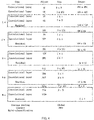
in a network layer structure, there are 53 convolutional layers and 22 residual layers among layers 0-74; layers 75-105 are feature interaction layers of a neural convolutional network, which can be divided into three scales; local feature interaction is realized by means of convolution kernels, and its network structure is as shown inFig. 4 . - In the production of the data set, only the antenna is detected, so the class is 1. Therefore, in the training, the output of the last convolutional layer is 3*(1+4+1)=18.
- Semantic image segmentation is performed on the antenna image by using a deep convolutional network, and the pixel points of the target image and the background are classified.
- After the target image is input, it first goes through feature extraction by a dilated convolutional network. Since the measured boundary precision is not high enough, the pixel of the target image cannot be well separated from the background pixel, and the pixel classification of the image boundary can be improved by combining a fully connected conditional random field, so that the segmentation effect can be better.
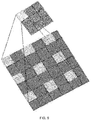
- It is first feature-extracted by using a dilated convolutional network. The feature extraction of the network convolutional layer can be divided into two cases: a low-resolution input image is feature-extracted by a standard convolutional layer, as shown in
Fig. 6 . Dense features of a high-resolution input image are extracted by a detour convolution at a rate of 2, as shown inFig. 7 , and its step size is set to 2 to thus reduce the feature dimension. In the convolutional network layer, the convolution kernel is set to 3, the stride length is 1, and the step size is 1.Fig. 8 is a schematic diagram of one-dimensional low-resolution feature map extraction.Fig. 9 is a schematic diagram of dilated convolution. - In a network structure of a serial module and a spatial pyramid pooling layer module, the convolution with holes can effectively increase a receptive field of a filter and integrate multi-scale information. After a feature image is input, dilated convolution is calculated:

- For a two-dimensional signal, an output corresponding to each position i is y, w is a filter, and the detour rate r is a step size for sampling the input signal. The receptive field of the filter can be improved, and the convolution with holes can enlarge the convolution kernel. A residual module of multi-scale feature learning is used in the feature network extraction, while the bottleneck block is used in the present disclosure. In the bottleneck block, each convolution is processed by normalization and processed by an activation function. Thus, contextual information of the context is enriched, and the bottleneck block is as shown in
Fig. 5 . - After the input image is processed by the convolutional network for output, pixel points of the output target image are classified by a fully connected conditional random field, and the classification is mainly performed for the target image and the background boundary.
- A view of a random field is as shown in
Fig. 10 . Each circle represents a pixel point, xi (white circle) is a labeled pixel point (node), two connected pixel points are edges of the pixel, yi (black circle) is a reference value of xi , and the classification of the labeled pixel points is determined by the reference value yi . According to the Gibbs distribution function,

- An image function output through a dilated convolutional network is a unary potential function: ∑ψ u (yi ). A binary potential function is i

- The function the relationship between pixels and will assign the same symbols to the same prime points. The unary potential function extracts feature vectors of a node in different feature maps, and the binary function connects the nodes extracted by the unitary potential function to learn its edges. All the nodes are connected to form a conditional random field of a fully connected layer, and an image finally output by the function is more accurate.
- Further, the step of calculating an antenna downtilt angle includes:
obtaining the width x and the height y of the antenna box according to the border of the target image, and calculating a downtilt angle of the base station antenna according to a geometric relation, the downtilt angle of the base station antenna being an angle θ between the base station antenna and a vertical plane:
- The above are merely preferred embodiments of the present disclosure. The present disclosure is not limited to the above implementations. As long as the implementations can achieve the technical effect of the present disclosure with the same means, they are all encompassed in the protection scope of the present disclosure.
Claims (5)
- A method for measuring an antenna downtilt angle based on a multi-scale deep semantic segmentation network, comprising:collecting image data: wherein base station antenna data is collected by using an unmanned aerial vehicle, and antenna images collected are taken as a data set;predicting a target bounding box: wherein a target antenna in the data set is positioned, and a bounding box is predicted by logistic regression;performing target recognition and semantic segmentation: wherein target features of the target antenna in the data set are extracted, the target features are learned andprocessed by an activation function, a target image is output for semantic image segmentation, and pixel points of the target image and the background are classified; andcalculating an antenna downtilt angle: wherein the width and height of an antenna box are obtained according to a border of the target image to calculate the antenna downtilt angle.
- The method for measuring an antenna downtilt angle based on a multi-scale deep semantic segmentation network according to claim 1, wherein the step of collecting image data comprises:locating the unmanned aerial vehicle on the top of a pole of a base station antenna, and recording the longitude and latitude (L0, W0 ) of the pole in the vertical direction;causing the unmanned aerial vehicle to fly around a point of the base station antenna, setting a flight radius of the unmanned aerial vehicle, and the unmanned aerial vehicle moving around the pole along the radius on the same horizontal plane to acquire antenna images with different attitudes and angles of a mobile base station antenna as a data set.
- The method for measuring an antenna downtilt angle based on a multi-scale deep semantic segmentation network according to claim 2, wherein the step of predicting a target bounding box comprises:positioning a target antenna in the antenna image, predicting a bounding box by logistic regression, first dividing the entire antenna image into N*N grids, predicting the entire antenna image after the antenna image is input, scanning each grid at a time, and starting to predict the target antenna when the center of the grid where the target antenna is located is positioned, wherein four coordinate values predicted for each bounding box are tx, ty, tw, and th, respectively, an upper-left offset of each target cell is (cx, cy ), box heights of the bounding boxes are px, py respectively, andthe network predicts their values as:


 where the input antenna image is divided into N*N grids, each grid comprises 5 predictors (x, y, w, h, confidence) and a c class, and the output of the network is of a size of S*S*(5*B+C); B is the number of the bounding boxes in each grid, C means the class is only antenna in the present disclosure, and thus is 1, and confidence represents that the predicted grid comprises two pieces of information, i.e., confidence of the target antenna and prediction accuracy of the bounding box:
 a threshold is set to 0.5 when Pr(Object)=1; the target antenna falls in the center of the grid, that is, the bounding box currently predicted coincides with an actual background box object better than before; if the predicted bounding box is not the best currently, the bounding box is not predicted when the threshold is smaller than 0.5, so as to determine that the target antenna does not fall into the grid.
 - The method for measuring an antenna downtilt angle based on a multi-scale deep semantic segmentation network according to claim 3, wherein the step of performing target recognition and semantic segmentation comprises:performing target recognition by using a network convolutional layer for feature extraction: antenna image pixel 416*416 is input, the channel number is 3, there are 32 layers of convolution kernels, each kernel has a size of 3*3, 32 layers of convolution kernels are used to learn 32 feature maps, and for color differences of the target antenna, features of the target antenna are learned by using different convolution kernels; convolutional layer up-sampling is performed during feature extraction, and a prediction formula for object classes is as follows:
 wherein Pr(Classi/object) is an object class probability; then applying the activation function by logistic regression:
 a predicted target output range is made between 0 and 1, the antenna image is processed by the activation function after feature extraction, and when the output value is greater than 0.5, the object is determined as an antenna;then performing semantic image segmentation on the antenna image by using a deep convolutional network, and classifying the pixel points of the target image and the background:
after the target image is input, the feature extraction goes through by a dilated convolutional network; and after a feature image is input, dilated convolution is calculated: for a two-dimensional signal, an output corresponding to each position i is y, w is a filter, and the detour rate r is a step size for sampling the input signal;after the input image is processed by the convolutional network for output, pixel points of the output target image are classified by a fully connected conditional random field, and the classification is mainly performed for the target image and the background boundary.
 - The method for measuring an antenna downtilt angle based on a multi-scale deep semantic segmentation network according to claim 4, wherein the step of calculating an antenna downtilt angle comprises:
obtaining the width x and the height y of the antenna box according to the border of the target image, and calculating a downtilt angle of the base station antenna according to a geometric relation, the downtilt angle of the base station antenna being an angle θ between the base station antenna and a vertical plane:
Applications Claiming Priority (2)
| Application Number | Priority Date | Filing Date | Title |
|---|---|---|---|
| CN201811338415.4A CN109685762A (en) | 2018-11-09 | 2018-11-09 | A kind of Downtilt measurement method based on multiple dimensioned deep semantic segmentation network |
| PCT/CN2019/076718 WO2020093630A1 (en) | 2018-11-09 | 2019-03-01 | Antenna downward inclination angle measurement method based on multi-scale deep semantic segmentation network |
Publications (2)
| Publication Number | Publication Date |
|---|---|
| EP3680609A1 true EP3680609A1 (en) | 2020-07-15 |
| EP3680609A4 EP3680609A4 (en) | 2021-02-24 |
Family
ID=66184673
Family Applications (1)
| Application Number | Title | Priority Date | Filing Date |
|---|---|---|---|
| EP19856443.7A Withdrawn EP3680609A4 (en) | 2018-11-09 | 2019-03-01 | METHOD OF MEASURING THE ANTENNA DOWNLINK ANGLE BASED ON A MULTI-SCALE DEEP SEMANTIC SEGMENTATION NETWORK |
Country Status (4)
| Country | Link |
|---|---|
| US (1) | US11561092B2 (en) |
| EP (1) | EP3680609A4 (en) |
| CN (1) | CN109685762A (en) |
| WO (1) | WO2020093630A1 (en) |
Cited By (1)
| Publication number | Priority date | Publication date | Assignee | Title |
|---|---|---|---|---|
| CN111860297A (en) * | 2020-07-17 | 2020-10-30 | 厦门理工学院 | A SLAM loopback detection method applied to indoor fixed space |
Families Citing this family (40)
| Publication number | Priority date | Publication date | Assignee | Title |
|---|---|---|---|---|
| CN109579774B (en) * | 2018-11-06 | 2021-04-23 | 五邑大学 | An Antenna Downtilt Measurement Method Based on Deep Instance Segmentation Network |
| WO2020194378A1 (en) * | 2019-03-22 | 2020-10-01 | 日本電気株式会社 | Image processing system, image processing device, image processing method, and computer-readable medium |
| CN110647794B (en) * | 2019-07-12 | 2023-01-03 | 五邑大学 | Attention mechanism-based multi-scale SAR image recognition method and device |
| CN110688904A (en) * | 2019-08-30 | 2020-01-14 | 中通服建设有限公司 | Method and device for base station antenna engineering parameter survey based on 5G UAV |
| CN110930417B (en) * | 2019-11-26 | 2023-08-08 | 腾讯科技(深圳)有限公司 | Training method and device for image segmentation model, and image segmentation method and device |
| EP4070238B1 (en) * | 2020-01-08 | 2024-09-11 | Google LLC | Translation of text depicted in images |
| CN111340139B (en) * | 2020-03-27 | 2024-03-05 | 中国科学院微电子研究所 | A method and device for judging the complexity of image content |
| CN111539983B (en) * | 2020-04-15 | 2023-10-20 | 上海交通大学 | Moving object segmentation method and system based on depth image |
| CN111768392B (en) * | 2020-06-30 | 2022-10-14 | 创新奇智(广州)科技有限公司 | Target detection method and device, electronic equipment and storage medium |
| CN112171668A (en) * | 2020-09-21 | 2021-01-05 | 河南颂达信息技术有限公司 | Rail-mounted robot anti-jamming detection method and device based on artificial intelligence |
| CN112329808A (en) * | 2020-09-25 | 2021-02-05 | 武汉光谷信息技术股份有限公司 | A Optimization Method and System of Deeplab Semantic Segmentation Algorithm |
| CN112132965B (en) * | 2020-09-25 | 2024-03-26 | 中国矿业大学 | Multi-scale characterization method for rock-soil body hole-crack structure |
| CN112965369B (en) * | 2021-01-29 | 2022-02-01 | 电子科技大学 | Distributed deployment method of three-dimensional wireless communication network of unmanned aerial vehicle |
| CN112784857B (en) * | 2021-01-29 | 2022-11-04 | 北京三快在线科技有限公司 | Model training and image processing method and device |
| CN113239815B (en) * | 2021-05-17 | 2022-09-06 | 广东工业大学 | Remote sensing image classification method, device and equipment based on real semantic full-network learning |
| CN113450311B (en) * | 2021-06-01 | 2023-01-13 | 国网河南省电力公司漯河供电公司 | Pin screw defect detection method and system based on semantic segmentation and spatial relationship |
| CN113538476B (en) * | 2021-07-20 | 2024-05-28 | 大连民族大学 | A deep learning image segmentation method and system based on edge feature extraction |
| CN114413855B (en) * | 2022-01-25 | 2023-04-07 | 湖南大学 | Method and system for detecting downtilt of mobile base station antenna based on image recognition |
| US12586198B2 (en) * | 2022-02-18 | 2026-03-24 | Techcyte, Inc. | Image analysis for identifying objects and classifying background exclusions |
| CN114549958B (en) * | 2022-02-24 | 2023-08-04 | 四川大学 | Night and camouflage target detection method based on context information perception mechanism |
| CN116758147B (en) * | 2022-03-02 | 2025-11-11 | 上海交通大学 | Plate-shaped antenna downward inclination angle measurement method and system based on mobile phone information fusion |
| CN114322793B (en) * | 2022-03-16 | 2022-07-15 | 科大天工智能装备技术(天津)有限公司 | Workpiece size measuring method and device based on global segmentation network and storage medium |
| CN114638991A (en) * | 2022-03-18 | 2022-06-17 | 聊城大学 | A smart retail settlement method based on YOLOv4-MobileNetv3 and PyQt5 |
| CN114677510B (en) * | 2022-03-22 | 2025-04-15 | 中南大学 | Feature map upsampling method, small target semantic segmentation method and imaging method |
| US12159465B2 (en) * | 2022-04-14 | 2024-12-03 | Toyota Research Institute, Inc. | End-to-end learned lane boundary detection based on a transformer |
| CN114743010B (en) * | 2022-06-13 | 2022-08-26 | 山东科技大学 | Semantic segmentation method of point cloud data of ultra-high voltage transmission line based on deep learning |
| CN115187959B (en) * | 2022-07-14 | 2023-04-14 | 清华大学 | A mountainous landing method and system for flying cars based on binocular vision |
| CN115170667B (en) * | 2022-07-15 | 2025-06-17 | 浙江大学 | A water quality transparency detection method based on deep learning using a waterless Secchi disk |
| CN114993243A (en) * | 2022-08-04 | 2022-09-02 | 深圳粤讯通信科技有限公司 | Antenna attitude monitoring and early warning system based on Internet of things |
| CN115393725B (en) * | 2022-10-26 | 2023-03-07 | 西南科技大学 | A Bridge Crack Identification Method Based on Feature Enhancement and Semantic Segmentation |
| CN116051843A (en) * | 2023-02-07 | 2023-05-02 | 智洋创新科技股份有限公司 | A method and system for quantitative analysis of molten stream tilt |
| CN116052003B (en) * | 2023-02-07 | 2024-05-14 | 中科星图数字地球合肥有限公司 | Method and device for measuring antenna angle information and related equipment |
| CN116258817B (en) * | 2023-02-16 | 2024-01-30 | 浙江大学 | A method and system for constructing autonomous driving digital twin scenes based on multi-view three-dimensional reconstruction |
| CN116612282B (en) * | 2023-05-26 | 2025-09-05 | 东风悦享科技有限公司 | A new fast semantic segmentation method, system and storage medium for unmanned bus systems |
| CN117078760B (en) * | 2023-09-18 | 2025-11-11 | 北方民族大学 | Valve body gravity center positioning method based on image processing |
| CN117994797B (en) * | 2024-04-02 | 2024-06-21 | 杭州海康威视数字技术股份有限公司 | Water gauge reading method and device, storage medium and electronic equipment |
| CN118823551A (en) * | 2024-09-19 | 2024-10-22 | 干将未来科技产业(杭州)有限公司 | An AI algorithm optimization system and method based on deep learning technology |
| CN119741293B (en) * | 2024-12-26 | 2025-09-30 | 中国舰船研究设计中心 | A rapid assessment method for ship corrosion based on image recognition |
| CN120121470B (en) * | 2025-05-15 | 2025-07-08 | 中南大学 | Method and device for identifying slurry fluidity image suitable for non-vertical shooting |
| CN120947588A (en) * | 2025-10-15 | 2025-11-14 | 浙江点创信息科技有限公司 | Methods, devices, computer equipment, and storage media for verifying base station antenna attitude. |
Family Cites Families (34)
| Publication number | Priority date | Publication date | Assignee | Title |
|---|---|---|---|---|
| PE20030995A1 (en) * | 2002-01-24 | 2003-11-29 | Telecom Italia Mobile Spa | METHOD OF REGISTRATION OF GEOGRAPHIC COORDINATES, AZIMUTE AND ANTENNA INCLINATION IN A BASE RADIO STATION FOR MOBILE TELEPHONY |
| US8374979B2 (en) * | 2009-11-18 | 2013-02-12 | Nec Laboratories America, Inc. | Fast image parsing by graph adaptive dynamic programming (GADP) performing classification, detection, and segmentation simultaneously |
| US20110150317A1 (en) * | 2009-12-17 | 2011-06-23 | Electronics And Telecommunications Research Institute | System and method for automatically measuring antenna characteristics |
| US9109889B2 (en) * | 2011-06-24 | 2015-08-18 | Trimble Navigation Limited | Determining tilt angle and tilt direction using image processing |
| AT511191B1 (en) * | 2011-07-01 | 2012-10-15 | Thomas Dr Neubauer | METHOD AND DEVICE FOR DETERMINING AND STORING THE POSITION AND ORIENTATION OF ANTENNA STRUCTURES |
| CN103630107B (en) | 2012-08-23 | 2015-09-16 | 北京交通大学 | A kind of antenna for base station inclination angle measurement method and data processing method |
| US9842274B2 (en) * | 2014-03-28 | 2017-12-12 | Xerox Corporation | Extending data-driven detection to the prediction of object part locations |
| JP6443700B2 (en) * | 2014-05-27 | 2018-12-26 | 華為技術有限公司Huawei Technologies Co.,Ltd. | Method, apparatus, and system for obtaining antenna configuration parameters |
| CN104504381B (en) | 2015-01-09 | 2017-12-26 | 新智认知数据服务有限公司 | Non-rigid object detection method and its system |
| US9855658B2 (en) * | 2015-03-19 | 2018-01-02 | Rahul Babu | Drone assisted adaptive robot control |
| US9596617B2 (en) * | 2015-04-14 | 2017-03-14 | ETAK Systems, LLC | Unmanned aerial vehicle-based systems and methods associated with cell sites and cell towers |
| CN104978580B (en) * | 2015-06-15 | 2018-05-04 | 国网山东省电力公司电力科学研究院 | A kind of insulator recognition methods for unmanned plane inspection transmission line of electricity |
| US9918235B2 (en) | 2015-11-24 | 2018-03-13 | Verizon Patent And Licensing Inc. | Adaptive antenna operation for UAVs using terrestrial cellular networks |
| CN106851665A (en) * | 2015-12-07 | 2017-06-13 | 上海无线通信研究中心 | The downdip adjusting method of antenna and base station |
| CN107664491B (en) * | 2016-07-28 | 2020-06-05 | 中国电信股份有限公司 | Method, device and system for measuring downward inclination angle of base station antenna |
| US10657364B2 (en) * | 2016-09-23 | 2020-05-19 | Samsung Electronics Co., Ltd | System and method for deep network fusion for fast and robust object detection |
| CN115097937B (en) * | 2016-11-15 | 2025-04-29 | 奇跃公司 | Deep learning system for cuboid detection |
| CN106709568B (en) * | 2016-12-16 | 2019-03-22 | 北京工业大学 | The object detection and semantic segmentation method of RGB-D image based on deep layer convolutional network |
| CN106683091B (en) | 2017-01-06 | 2019-09-24 | 北京理工大学 | A kind of target classification and attitude detecting method based on depth convolutional neural networks |
| US10565787B1 (en) * | 2017-01-27 | 2020-02-18 | NHIAE Group, LLC | Systems and methods for enhanced 3D modeling of a complex object |
| WO2018144650A1 (en) * | 2017-01-31 | 2018-08-09 | Focal Systems, Inc. | Automated checkout system through mobile shopping units |
| US10678846B2 (en) * | 2017-03-10 | 2020-06-09 | Xerox Corporation | Instance-level image retrieval with a region proposal network |
| US10402689B1 (en) * | 2017-04-04 | 2019-09-03 | Snap Inc. | Generating an image mask using machine learning |
| US11257198B1 (en) * | 2017-04-28 | 2022-02-22 | Digimarc Corporation | Detection of encoded signals and icons |
| EP3432263B1 (en) * | 2017-07-17 | 2020-09-16 | Siemens Healthcare GmbH | Semantic segmentation for cancer detection in digital breast tomosynthesis |
| US10474988B2 (en) * | 2017-08-07 | 2019-11-12 | Standard Cognition, Corp. | Predicting inventory events using foreground/background processing |
| WO2019066794A1 (en) * | 2017-09-27 | 2019-04-04 | Google Llc | End to end network model for high resolution image segmentation |
| US10872228B1 (en) * | 2017-09-27 | 2020-12-22 | Apple Inc. | Three-dimensional object detection |
| CN107830846B (en) * | 2017-09-30 | 2020-04-10 | 杭州艾航科技有限公司 | Method for measuring angle of communication tower antenna by using unmanned aerial vehicle and convolutional neural network |
| US20190130189A1 (en) * | 2017-10-30 | 2019-05-02 | Qualcomm Incorporated | Suppressing duplicated bounding boxes from object detection in a video analytics system |
| US10878294B2 (en) * | 2018-01-05 | 2020-12-29 | Irobot Corporation | Mobile cleaning robot artificial intelligence for situational awareness |
| US10649459B2 (en) * | 2018-04-26 | 2020-05-12 | Zoox, Inc. | Data segmentation using masks |
| US10720058B2 (en) * | 2018-09-13 | 2020-07-21 | Volvo Car Corporation | System and method for camera or sensor-based parking spot detection and identification |
| US11948362B2 (en) * | 2018-10-31 | 2024-04-02 | Arcus Holding A/S | Object detection using a combination of deep learning and non-deep learning techniques |
-
2018
- 2018-11-09 CN CN201811338415.4A patent/CN109685762A/en active Pending
-
2019
- 2019-03-01 WO PCT/CN2019/076718 patent/WO2020093630A1/en not_active Ceased
- 2019-03-01 EP EP19856443.7A patent/EP3680609A4/en not_active Withdrawn
- 2019-03-01 US US16/652,346 patent/US11561092B2/en active Active
Cited By (1)
| Publication number | Priority date | Publication date | Assignee | Title |
|---|---|---|---|---|
| CN111860297A (en) * | 2020-07-17 | 2020-10-30 | 厦门理工学院 | A SLAM loopback detection method applied to indoor fixed space |
Also Published As
| Publication number | Publication date |
|---|---|
| EP3680609A4 (en) | 2021-02-24 |
| WO2020093630A1 (en) | 2020-05-14 |
| US20210215481A1 (en) | 2021-07-15 |
| US11561092B2 (en) | 2023-01-24 |
| CN109685762A (en) | 2019-04-26 |
Similar Documents
| Publication | Publication Date | Title |
|---|---|---|
| US11561092B2 (en) | Method for measuring antenna downtilt angle based on multi-scale deep semantic segmentation network | |
| CN114488194B (en) | A method for target detection and recognition on structured roads for intelligent driving vehicles | |
| EP3997616B1 (en) | Object-based change detection using a neural network | |
| US12214809B2 (en) | Instance segmentation imaging system | |
| KR102507501B1 (en) | Artificial Intelligence-based Water Quality Contaminant Monitoring System and Method | |
| CN108052940A (en) | SAR remote sensing images waterborne target detection methods based on deep learning | |
| CN115761513B (en) | A semi-supervised deep learning-based intelligent remote sensing identification method for large landslides in mountainous areas | |
| CN114252883B (en) | Target detection method, apparatus, computer device and medium | |
| CN114252884B (en) | Roadside radar positioning monitoring method, device, computer equipment and storage medium | |
| CN114252868A (en) | Lidar calibration method, device, computer equipment and storage medium | |
| CN114898204B (en) | Rail transit peripheral dangerous source detection method based on deep learning | |
| CN116168246A (en) | Method, device, equipment and medium for identifying waste slag field for railway engineering | |
| CN114255264B (en) | Multi-base-station registration method and device, computer equipment and storage medium | |
| CN114252859B (en) | Method, device, computer equipment and storage medium for determining target area | |
| Han et al. | Targets mask U-Net for wind turbines detection in remote sensing images | |
| CN113298042A (en) | Method and device for processing remote sensing image data, storage medium and computer equipment | |
| KR20220071822A (en) | Identification system and method of illegal parking and stopping vehicle numbers using drone images and artificial intelligence technology | |
| HemaMalini et al. | Detection of Potholes on Roads using a Drone | |
| CN106446929A (en) | Vehicle type detection method based on edge gradient potential energy | |
| CN114252869A (en) | Multi-base-station cooperative sensing method and device, computer equipment and storage medium | |
| CN115359493B (en) | Method and device for detecting rotary text | |
| CN114898203B (en) | Rail transit peripheral dangerous source change detection method based on deep learning | |
| Ryan et al. | Evaluation of small unmanned aerial system highway volume and speed‐sensing applications | |
| CN115082786A (en) | Remote sensing image target detection method under condition of small amount of marks | |
| CN115223137A (en) | Ground detection method, device and system |
Legal Events
| Date | Code | Title | Description |
|---|---|---|---|
| STAA | Information on the status of an ep patent application or granted ep patent |
Free format text: STATUS: UNKNOWN |
|
| STAA | Information on the status of an ep patent application or granted ep patent |
Free format text: STATUS: THE INTERNATIONAL PUBLICATION HAS BEEN MADE |
|
| PUAI | Public reference made under article 153(3) epc to a published international application that has entered the european phase |
Free format text: ORIGINAL CODE: 0009012 |
|
| STAA | Information on the status of an ep patent application or granted ep patent |
Free format text: STATUS: REQUEST FOR EXAMINATION WAS MADE |
|
| 17P | Request for examination filed |
Effective date: 20200311 |
|
| AK | Designated contracting states |
Kind code of ref document: A1 Designated state(s): AL AT BE BG CH CY CZ DE DK EE ES FI FR GB GR HR HU IE IS IT LI LT LU LV MC MK MT NL NO PL PT RO RS SE SI SK SM TR |
|
| AX | Request for extension of the european patent |
Extension state: BA ME |
|
| RIN1 | Information on inventor provided before grant (corrected) |
Inventor name: ZENG, JUNYING Inventor name: DENG, WENBO Inventor name: ZHAI, YIKUI Inventor name: GAN, JUNYING Inventor name: XU, YING Inventor name: WU, YUETING Inventor name: KE, QIRUI Inventor name: ZHENG, YU Inventor name: ZHOU, JIHUA |
|
| A4 | Supplementary search report drawn up and despatched |
Effective date: 20210120 |
|
| RIC1 | Information provided on ipc code assigned before grant |
Ipc: G06K 9/32 20060101ALI20210115BHEP Ipc: G01C 9/00 20060101ALI20210115BHEP Ipc: G06K 9/62 20060101ALI20210115BHEP Ipc: G06T 7/73 20170101ALI20210115BHEP Ipc: H01Q 1/12 20060101ALI20210115BHEP Ipc: G01C 1/04 20060101AFI20210115BHEP Ipc: G06K 9/00 20060101ALI20210115BHEP |
|
| DAV | Request for validation of the european patent (deleted) | ||
| DAX | Request for extension of the european patent (deleted) | ||
| REG | Reference to a national code |
Ref country code: DE Ref legal event code: R079 Free format text: PREVIOUS MAIN CLASS: G01C0001040000 Ipc: G06V0020170000 |
|
| GRAP | Despatch of communication of intention to grant a patent |
Free format text: ORIGINAL CODE: EPIDOSNIGR1 |
|
| STAA | Information on the status of an ep patent application or granted ep patent |
Free format text: STATUS: GRANT OF PATENT IS INTENDED |
|
| RIC1 | Information provided on ipc code assigned before grant |
Ipc: G06T 7/73 20170101ALI20221027BHEP Ipc: H01Q 1/12 20060101ALI20221027BHEP Ipc: G01C 9/00 20060101ALI20221027BHEP Ipc: G01C 1/04 20060101ALI20221027BHEP Ipc: G06V 20/70 20220101ALI20221027BHEP Ipc: G06V 10/764 20220101ALI20221027BHEP Ipc: G06V 10/82 20220101ALI20221027BHEP Ipc: G06V 10/25 20220101ALI20221027BHEP Ipc: G06V 20/17 20220101AFI20221027BHEP |
|
| INTG | Intention to grant announced |
Effective date: 20221121 |
|
| GRAS | Grant fee paid |
Free format text: ORIGINAL CODE: EPIDOSNIGR3 |
|
| STAA | Information on the status of an ep patent application or granted ep patent |
Free format text: STATUS: THE APPLICATION IS DEEMED TO BE WITHDRAWN |
|
| 18D | Application deemed to be withdrawn |
Effective date: 20231003 |