EP2425667B1 - Dynamic tag control and fingerprinting event localization - Google Patents
Dynamic tag control and fingerprinting event localization Download PDFInfo
- Publication number
- EP2425667B1 EP2425667B1 EP09788529.7A EP09788529A EP2425667B1 EP 2425667 B1 EP2425667 B1 EP 2425667B1 EP 09788529 A EP09788529 A EP 09788529A EP 2425667 B1 EP2425667 B1 EP 2425667B1
- Authority
- EP
- European Patent Office
- Prior art keywords
- event
- tag
- cluster
- local
- high precision
- Prior art date
- Legal status (The legal status is an assumption and is not a legal conclusion. Google has not performed a legal analysis and makes no representation as to the accuracy of the status listed.)
- Not-in-force
Links
- 230000004807 localization Effects 0.000 title description 4
- 238000005259 measurement Methods 0.000 claims description 82
- 238000000034 method Methods 0.000 claims description 62
- 230000000977 initiatory effect Effects 0.000 claims description 23
- 230000033001 locomotion Effects 0.000 claims description 11
- 230000010267 cellular communication Effects 0.000 claims description 10
- 230000005484 gravity Effects 0.000 claims description 9
- 230000004044 response Effects 0.000 claims description 6
- 238000012544 monitoring process Methods 0.000 claims description 3
- 238000004422 calculation algorithm Methods 0.000 description 26
- 230000001413 cellular effect Effects 0.000 description 14
- 230000000875 corresponding effect Effects 0.000 description 11
- 230000008901 benefit Effects 0.000 description 6
- 230000003044 adaptive effect Effects 0.000 description 5
- 238000001514 detection method Methods 0.000 description 5
- 238000012805 post-processing Methods 0.000 description 5
- 230000008569 process Effects 0.000 description 5
- 239000013598 vector Substances 0.000 description 5
- 230000003190 augmentative effect Effects 0.000 description 4
- 230000000694 effects Effects 0.000 description 4
- 238000012423 maintenance Methods 0.000 description 4
- 239000004165 Methyl ester of fatty acids Substances 0.000 description 3
- 238000004364 calculation method Methods 0.000 description 3
- 230000003068 static effect Effects 0.000 description 3
- 230000009286 beneficial effect Effects 0.000 description 2
- 230000005540 biological transmission Effects 0.000 description 2
- 238000011161 development Methods 0.000 description 2
- 238000010295 mobile communication Methods 0.000 description 2
- 230000000717 retained effect Effects 0.000 description 2
- 230000035945 sensitivity Effects 0.000 description 2
- 102100026278 Cysteine sulfinic acid decarboxylase Human genes 0.000 description 1
- 241000404883 Pisa Species 0.000 description 1
- 108010007100 Pulmonary Surfactant-Associated Protein A Proteins 0.000 description 1
- 102100027773 Pulmonary surfactant-associated protein A2 Human genes 0.000 description 1
- 230000003416 augmentation Effects 0.000 description 1
- 230000015572 biosynthetic process Effects 0.000 description 1
- 238000006243 chemical reaction Methods 0.000 description 1
- 238000004891 communication Methods 0.000 description 1
- 230000001143 conditioned effect Effects 0.000 description 1
- 230000002596 correlated effect Effects 0.000 description 1
- 230000001419 dependent effect Effects 0.000 description 1
- 238000010586 diagram Methods 0.000 description 1
- 238000005516 engineering process Methods 0.000 description 1
- 230000002708 enhancing effect Effects 0.000 description 1
- 238000005562 fading Methods 0.000 description 1
- BJRNKVDFDLYUGJ-RMPHRYRLSA-N hydroquinone O-beta-D-glucopyranoside Chemical compound O[C@@H]1[C@@H](O)[C@H](O)[C@@H](CO)O[C@H]1OC1=CC=C(O)C=C1 BJRNKVDFDLYUGJ-RMPHRYRLSA-N 0.000 description 1
- 230000003993 interaction Effects 0.000 description 1
- 230000007774 longterm Effects 0.000 description 1
- 238000012986 modification Methods 0.000 description 1
- 230000004048 modification Effects 0.000 description 1
- 230000008520 organization Effects 0.000 description 1
- 231100000614 poison Toxicity 0.000 description 1
- 230000007096 poisonous effect Effects 0.000 description 1
- 108010064775 protein C activator peptide Proteins 0.000 description 1
- 238000004088 simulation Methods 0.000 description 1
- 230000001960 triggered effect Effects 0.000 description 1
Images


Classifications
-
- H—ELECTRICITY
- H04—ELECTRIC COMMUNICATION TECHNIQUE
- H04W—WIRELESS COMMUNICATION NETWORKS
- H04W36/00—Hand-off or reselection arrangements
- H04W36/34—Reselection control
- H04W36/38—Reselection control by fixed network equipment
- H04W36/385—Reselection control by fixed network equipment of the core network
Definitions
- the present invention relates to methods and systems for position determination of mobile terminals in a cellular communications network, and in particular to localizing events in such systems.
- All cellular communications systems are divided into cells, where User Equipments (UE) served by one, or when in soft(er) handover several base stations. Each base station may serve UEs in more than one cell.
- UE User Equipments
- Each base station may serve UEs in more than one cell.
- the important point from a positioning and navigation perspective is that the cell where a specific UE is located is known in the cellular system. Hence, after determination of the geographical area covered by a specific cell, it can be stated that the UE is located somewhere within said geographical area, as long as it is connected and the reported cell identity of the serving cell is equal to the cell identity corresponding to the particular geographical area.
- WCDMA Wideband Code Division Multiple Access
- An example of positioning within a Wideband Code Division Multiple Access (WCDMA) cellular system operates briefly as follows, assuming that the positioning operates over the Radio Access Network Application Part (RANAP) interface. The procedures are however similar for e.g. the Global System for Mobile communications (GSM) and Code Division Multiple Access 2000 (CDMA 2000).
- a message requesting a location estimate is received in the Serving Radio Network Controller (SRNC) over the RANAP interface.
- the quality of service parameters of the message is assumed to be such that the Radio Network Controller (RNC) selects the cell identity positioning method.
- the SRNC determines the serving cell identity of the UE to be positioned and retrieves a pre-stored polygon that represents the extension of the serving cell.
- the SRNC sends the resulting cell polygon back to the core network over the RANAP interface, using a cell polygon format in a location report message.
- the cell polygon format is only an approximation of the extension of the true cell.
- the selection of the polygon format is dictated by the need to have a reasonably flexible geographical representation format, taking e.g. computation complexities and reporting bandwidths into account.
- the polygon format approximates the cell extension
- the polygon is normally pre-determined in a cell-planning tool to represent the cell extension with a certain confidence.
- the confidence is intended to represent the probability that the UE is located within the polygon, conditioned on the fact that it is connected to the cell that is represented by the cell polygon.
- the underlying off-line calculation of the cell polygon can e.g. be based on coverage simulations of varying levels of sophistication. However, the end result is normally not very reliable when the confidence of the calculated cell extension is considered.
- the accuracy of the cell identity positioning method is mainly limited by the size of the cell, something that prevents it from being used in more sophisticated navigation applications. Its main advantages include a very low response time as well as the fact that it is widely spread and always available where there is cellular coverage.
- the cell identity method is also straightforward to implement and has no UE impact. The advantages has lead to an interest for the development of Enhanced cell identity (E-cell ID) positioning methods that aim at enhancing the accuracy of the basic cell identity method at the same time as the advantages of the method are retained.
- E-cell ID Enhanced cell identity
- RTT Round Trip Time
- path loss measurements suffers from shadow fading effects, which result in accuracies that are of the order of half the distance to the UE.
- RTT measurement principle the travel time of radio waves from the Radio Base Station (RBS) to the UE and back is measured.
- RBS Radio Base Station
- the RTT method alone defines a circle around the RBS. By combining this information with the cell polygon, left and right angles of the circle can be computed.
- Another idea for enhanced cell identity positioning has been to use pre-calculated maps of the regions where the UE is in soft(er) handover with one or several cells. Such areas are significantly smaller than the whole cell opening up for a better accuracy of the determined position. Normally these maps are pre-calculated in the planning tool, exactly as the ordinary cell polygons.
- the term high precision positioning is used to denote positioning methods that have a potential to meet the North-American E-911 emergency positioning requirements. Methods that meet these requirements are capable of obtaining positioning accuracies of
- A-GPS is an enhancement of the global positioning system (GPS).
- GPS global positioning system
- FIG. 1 An example of an A-GPS positioning method is displayed in FIG. 1 , in this case a WCDMA system.
- the radio network controller acts as the node that collects, refines and distributes assistance data to the terminals (denoted user equipment (UE) in WCDMA).
- the core network CN
- the RNC may use various kinds of A-GPS techniques, all these techniques do however build on assistance data being handled by a node in the cellular communication system.
- the RNC orders positioning measurements to be performed in the UE, measurements that are performed by dedicated A-GPS receiver hardware in the terminals. These receivers detect GPS transmissions from the satellites that are also denoted space vehicles (SVs).
- SVs space vehicles
- the GPS reference receivers attached to e.g. a cellular communication system collect assistance data that, when transmitted to GPS receivers in terminals connected to the cellular communication system, enhance the performance [8] of the GPS terminal receivers.
- A-GPS accuracy can become as good as 10 meters also without differential operation. The accuracy becomes worse in dense urban areas and indoors, where the sensitivity is often not high enough for detection of the very weak signals from the GPS satellites.
- Additional assistance data is collected from the cellular communication system directly, typically to obtain a rough initial estimate of the position of the terminal together with a corresponding uncertainty of the initial estimate.
- This position is often given by a cell identity (cell-ID) positioning step, i.e. the position of the terminal is determined with cell granularity.
- a more accurate position can be obtained by round trip time (RTT) positioning and / or soft(er) handover maps.
- RTT round trip time
- the GPS time is also estimated with as good accuracy as the cellular system allows.
- WO 2007/089182 A1 addresses generating of feasible high precision indoor positioning measurements.
- a positioning server sets up an interface to which ordinary users may connect with their cellular phones. Using this interface the user can select one out of a plurality of indoor locations where the cellular operator wishes to have high precision position reference measurements performed. The user moves to said indoor location and initiates at this location, by interaction with said interface, the reference measurement. By logging an identity of the user or the time of the positioning the selected indoor location can be correlated to a determined tag. The tag together with the indoor location that has been selected by help of the interface towards the positioning server constitutes one tagged high precision position measurement.
- US 2009/0017831 A1 relates to methods and devices for provision of position determination assisting data as well as methods, devices and systems for performing position determinations based on this assisting data.
- the position determination assisting data comprises area definitions, each of which being related at least to a respective quantised path loss measurement index vector.
- the vector is also dependent on relative radio conditions between different cells and/or transmission mode.
- Adaptive Enhanced Cell-ID Fingerprinting Localization by Clustering of Precise Position Measurements relates generally to A-GPS and AECID techniques.
- US2007/161380 A1 relates to methods for approximating a location of an event occurring on a wireless device based upon at least one of a first set of location fix information corresponding to a first set of location fix information corresponding to a first position fix of the wireless device prior to the event and a second set of location fix information corresponding to a second position fix of the wireless device after the event.
- event refers to occurrence of wireless device operational events, such as a call drop event on a cellular telephone.
- the above-mentioned positioning methods are not responsive to geographically distributed events occurring in the cellular system e.g. poor radio quality effects or emergency positioning requests. Therefore, there is a need for solutions that provide that functionality, and other.
- the present invention relates to an improved positioning method.
- An aim of the present invention is to provide a positioning method, according to independent Claim 1 and a corresponding apparatus according to independent Claim 11.
- FIG. 1 For exemplary aspects of the present invention, comprise a method for clustering position determination for providing position determination assisting data in a cellular communications network, includes the steps of detecting S1 an event, e.g. drop in radio quality or emergency positioning request. Thereafter providing a tag S2 for the detected event, said tag comprising event specific information, and providing (S3) high precision position measurements S3 for the detected event. Subsequently, repeating S4 the detecting and providing steps a plurality of times, and obtaining local clusters S5 of high-precision position measurements based on said event specific tag.
- Tracking S6 a movement of each said local event cluster is performed by determining a geographical position by calculating a centre of gravity of each said local event cluster, updating said local event cluster by removing high precision position measurements from said local event cluster when an age of a high precision position measurement is above a predetermined threshold, and redetermine the geographical position by recalculating the centre of gravity of said updated local event cluster.
- further exemplary aspects of the present invention comprise an arrangement 1 for position determination in a cellular communications network.
- the arrangement comprises an event detector 10 for detecting an event, a tagging unit 20 for providing a tag for the detected event, said tag comprising event specific information.
- the arrangement comprises a measurement unit for providing 30 high precision position measurements for said detected event.
- a clustering unit 40 for obtaining local clusters of high-precision position measurements based on said event tag.
- AECID Adaptive Enhanced Cell Identity
- the AECID positioning algorithm is based on a polygon format of and an algorithm for computation of a polygon [1]-[6] from a cluster of tagged high-precision position measurements.
- the high precision measurements are e.g. being provided by A-GPS positioning steps.
- the main steps of the AECID algorithm are according to the schematic flow below (for WCDMA in particular steps 1a-1c, and steps 5ai-5aiii are important)
- the present disclosure relates to positioning in telecommunications systems, especially in WCDMA (LTE) and/or GSM.
- the previously described positioning method has a few specific problems with relation to the step of collecting all high precision measurements with the same tag in high precision measurement clusters.
- the clustering step is not responsive to events occurring in the cellular system. Such events could be the occurrence of poor radio quality effects, or emergency positioning requests.
- the clustering step is geographically static, i.e. it is unable to handle geographical regions the move or vary quickly with time. It is therefore an aim of the present invention to provide an improved positioning method, which negates the two above mentioned problems.
- the focus of the present invention is on improvements of the state of the art algorithm for clustering in AECID.
- the version described here exploits only the cell IDs of the active set in a WCDMA system for tagging. Extensions are described in [1]-[6].
- the clustering algorithm typically operates as follows:
- the algorithm hence generates one cluster of measurement, for each value.
- the present invention aims to solve those problems by providing a dynamic event based tag control of the fingerprinting event localization.
- the present invention discloses new and improved methods for localization of events in cellular systems, using previously disclosed technology for fingerprinting cellular positioning [1]-[6].
- the method is applicable for both GSM and WCDMA.
- This invention relates primarily to the clustering step of the above-mentioned fingerprinting positioning algorithm [1]-[6].
- a general embodiment of an improved clustering positioning determination method according to the present invention will be described.
- the method will be mainly described in the context of a WCDMA (LTE) system, but is equally applicable for a GSM system or similar.
- WCDMA Long Term Evolution
- GSM Global System for Mobile communications
- an event is detected S1 in the system, the event can comprise a predetermined indication such as an incoming call classified as an emergency call according to a set criteria, or a detected drop in radio link quality or corresponding parameter.
- an event specific tag is provided S2 based on the detected event.
- This event specific tag can be used to completely replace an already present tag, or can be used to adapt or update an already available tag with additional event specific information.
- High precision position measurements are subsequently provided S3 for the detected and tagged event. For the case of E-911 calls, the measurements are automatically provided, for other scenarios the step of providing the measurements can comprise performing the actual measurements, initiating measurements or receiving measurements collected by a node in the system.
- the steps of detecting events, tagging detected events and providing high precision position measurements are repeated S4 a plurality of times to obtain local clusters S5 based on the event specific tag.
- One main aspect of the method described above is that it enables replacing or augmenting the tagging of high precision measurements/positioning (e.g. latitude/longitude points) used in order to establish localized clusters of high precision measurements, with information related to specific events .
- the replacement / augmentation enables important applications, in particular for emergency positioning.
- the clusters are e.g. organized by cell IDs, i.e. the fingerprinting algorithm builds cell polygons at the highest level, said cell polygons being geographically static .
- the present invention enables an organization of clusters after geographically and temporally local collections of emergency calls (disregarding cell information for the moment).
- Such collections of emergency calls, occurring closely in time, are likely to occur in disaster situations, e.g. caused by wild fires, unintentional release of poisonous emissions in the atmosphere, nuclear accidents or large terrorist activity.
- the location of the collections of emergency calls are likely to move , e.g. due to the wind. It would therefore be beneficial to provide a clustering method, which enables tracking S6 the movement of a local event-based cluster according to the present invention.
- the geographical position of a local event based cluster of high precision position measurements is determined at a specific moment in time.
- the geographical position can be determined by means of calculating a centre of gravity of the local event based cluster by some known method, updating the local cluster by removing high precision measurements when the age of the measurement reaches a predetermined threshold, and recalculating the geographical position of the updated cluster. Consequently, the movement of the event cluster can be determined and monitored. This provides a powerful tool for managing e.g. fire fighting or other disaster areas.
- the present invention provides maintenance algorithms for local event (emergency) clusters, thus enabling movement of the cluster by removal of high precision points, depending on their age or location. Note that this removal is many orders of magnitude faster than in the maintenance of the static clusters of the previously disclosures [1]-[6].
- the present invention discloses methods and arrangements for dynamic tag control, wherein all new functionality for tagging and clustering would re-use the disclosed techniques for computation of polygons, from the obtained clusters of high precision measurements.
- the emergency tagging and clustering solution can also reside in the emergency center (PSAP) itself - there is no need for it to be located in the positioning node of the cellular system.
- PSAP emergency center
- the present invention provides fingerprinting positioning software for post-processing of emergency positioning, said software for post processing thus exploiting reported emergency positioning.
- the starting point of the methods of the present invention is that the positioning node where the AECID algorithm is implemented monitors certain selected events. This can e.g. be the occurrence of emergency calls, dropped calls, or failed connections. At least two classes of events can be distinguished:
- the dynamic tag control functionality need to work differently in the two cases.
- the dynamic tag control initiates the initiation of a cluster directly, using the triggering event, the associated position (if it exists, otherwise a positioning can be initiated), possibly in connection with other events or information sources.
- the dynamic tag control needs to initiate the initiation of clusters using a tag that is different from the event itself.
- the initiation need to be performed in a larger region, e.g. a cell, since there is no position associated with the triggering event.
- the initiation scheme is also different since a number of connections need to be actively supervised.
- the initiation of the cluster initiation scheme is performed dynamically, in response to events in the cellular network.
- Previously disclosed algorithms are not capable of this - rather they are designed to operate continuously.
- a first case is described for the occurrence of emergency calls.
- A-GPS high precision
- sizeOfCluster is the number of reference positions of the tentative Cluster
- t i is the time tag of the i:th emergency call since the dynamic tag control first triggered the initiation of the cluster
- t threshold ,1 is a threshold setting the maximum duration for the build up of the tentative cluster
- ⁇ r i - r 1 ⁇ is the distance between the position of the i:th emergency call and the first
- d threshold ,1 is the threshold, defining how close positions need to be to qualify for being in the same cluster
- sizeLimit is the required minimum size of a tentative cluster to qualify as a firm cluster (successful initiation)
- localCluster is the initiated cluster, describing the established emergency region.
- many other alternative algorithms can be constructed.
- a second case is described for the situation of dropped calls.
- a first step is then to establish the even specific tag.
- the tag cannot be related to the event "dropped call", since then there will not be any position available. Rather, a tag related to poor radio quality is suitable, i.e. a Boolean isPoorRadioQuality is introduced.
- the initiation then proceeds by monitoring the isPoorRadioQualiy quantity, for all connections in a specified region, e.g. a cell. High precision (A-GPS) reference positions are measured relatively often for each connection.
- Tag 1 isPoorRadioQuality 1 t 1 Tag geographical , where Tag geographical is the part of the tag that may contain additional standard parts of the fingerprint consisting e.g. of cell IDs and quantized RTT measurements as described in [1]-[6]. Note that the Boolean isPoorRadioQuality is superfluous, it is included for clarity only.
- a tentative cluster can then be initiated similarly as described with relation to the first case. Note that contrary to the first case, the cluster will be stationary in this case, this being the reason why additional parts may be introduced in the tag in Equation (7) to increase the resolution of the result. Note that if this is done, the distance check of the previously described algorithm needs to be augmented with a check that the tag is the same as for the first collected high precision measurement.
- the cluster defining said region needs to be updated.
- One of many ways to achieve this, as mentioned previously, is to specify a threshold for the age of points in the corresponding cluster, followed by the steps of Removal of high precision measurements that are older than the specified threshold. Note that this is possible since the time of each high precision measurement is saved in the cluster. Recalculation of the polygon that describes said cluster, see [1]-[6] for details.
- the tracking of local event based clusters can be performed by means of the following schematic algorithm, also with reference to FIG. 4 .
- the calculation can be performed by means of a Kalman filter or similar.
- the determination of the centre of gravities and tracking of the event cluster can also be utilized in order to estimate a predicted movement pattern of the cluster.
- the above calculated motion vectors are used to predict a next location of the cluster, and initiate detection of e.g. emergency call near the predicted location. This enables a rapid response to incoming emergency calls, and provides a valuable tool for coordinating actions from e.g. fire brigade or similar.
- a further possible application would be to utilized the determined movement to estimate a point of origin of the event, e.g. initial start of fire, release of gas etc.
- an arrangement 1 for improved clustering for includes the following entities, units, or functions.
- the arrangement 1 includes an event detector unit 10 for detecting events in a communication system.
- the arrangement comprises a tagging unit 20 providing a tag for each detected event.
- the tag comprises event specific information.
- the arrangements includes a measurement unit for providing 30 high precision position measurements for each detected event.
- a clustering unit 40 for obtaining local clusters of high-precision position measurements based on said event tag.
- the arrangement comprises a tracking unit 50 for tracking the movement of the local event clusters.
Landscapes
- Engineering & Computer Science (AREA)
- Computer Networks & Wireless Communication (AREA)
- Signal Processing (AREA)
- Position Fixing By Use Of Radio Waves (AREA)
- Mobile Radio Communication Systems (AREA)
- Telephone Function (AREA)
- Telephonic Communication Services (AREA)
Description
- The present invention relates to methods and systems for position determination of mobile terminals in a cellular communications network, and in particular to localizing events in such systems.
- All cellular communications systems are divided into cells, where User Equipments (UE) served by one, or when in soft(er) handover several base stations. Each base station may serve UEs in more than one cell. The important point from a positioning and navigation perspective is that the cell where a specific UE is located is known in the cellular system. Hence, after determination of the geographical area covered by a specific cell, it can be stated that the UE is located somewhere within said geographical area, as long as it is connected and the reported cell identity of the serving cell is equal to the cell identity corresponding to the particular geographical area. An example of positioning within a Wideband Code Division Multiple Access (WCDMA) cellular system operates briefly as follows, assuming that the positioning operates over the Radio Access Network Application Part (RANAP) interface. The procedures are however similar for e.g. the Global System for Mobile communications (GSM) and Code Division Multiple Access 2000 (CDMA 2000).
- A message requesting a location estimate is received in the Serving Radio Network Controller (SRNC) over the RANAP interface. The quality of service parameters of the message is assumed to be such that the Radio Network Controller (RNC) selects the cell identity positioning method. The SRNC determines the serving cell identity of the UE to be positioned and retrieves a pre-stored polygon that represents the extension of the serving cell. The SRNC sends the resulting cell polygon back to the core network over the RANAP interface, using a cell polygon format in a location report message.
- It should, however, be noted that due to the complexity of the radio propagation, the cell polygon format is only an approximation of the extension of the true cell. The selection of the polygon format is dictated by the need to have a reasonably flexible geographical representation format, taking e.g. computation complexities and reporting bandwidths into account.
- Since the polygon format approximates the cell extension, the polygon is normally pre-determined in a cell-planning tool to represent the cell extension with a certain confidence. The confidence is intended to represent the probability that the UE is located within the polygon, conditioned on the fact that it is connected to the cell that is represented by the cell polygon. The underlying off-line calculation of the cell polygon can e.g. be based on coverage simulations of varying levels of sophistication. However, the end result is normally not very reliable when the confidence of the calculated cell extension is considered.
- The accuracy of the cell identity positioning method is mainly limited by the size of the cell, something that prevents it from being used in more sophisticated navigation applications. Its main advantages include a very low response time as well as the fact that it is widely spread and always available where there is cellular coverage. The cell identity method is also straightforward to implement and has no UE impact. The advantages has lead to an interest for the development of Enhanced cell identity (E-cell ID) positioning methods that aim at enhancing the accuracy of the basic cell identity method at the same time as the advantages of the method are retained.
- One principle for E-cell ID positioning aims at combining the cell extension model with a distance measure. Two possibilities towards this end are Round Trip Time (RTT) measurements and path loss measurements. The most accurate of these two alternatives is the RTT measurement. The path loss measurement suffers from shadow fading effects, which result in accuracies that are of the order of half the distance to the UE. In the RTT measurement principle, the travel time of radio waves from the Radio Base Station (RBS) to the UE and back is measured. The RTT method alone defines a circle around the RBS. By combining this information with the cell polygon, left and right angles of the circle can be computed.
- Another idea for enhanced cell identity positioning has been to use pre-calculated maps of the regions where the UE is in soft(er) handover with one or several cells. Such areas are significantly smaller than the whole cell opening up for a better accuracy of the determined position. Normally these maps are pre-calculated in the planning tool, exactly as the ordinary cell polygons.
- In the present disclosure, the term high precision positioning is used to denote positioning methods that have a potential to meet the North-American E-911 emergency positioning requirements. Methods that meet these requirements are capable of obtaining positioning accuracies of
- either (terminal based) 50 meters (67%) and 150 m (95%),
- or (network based) 100 meters (67%) and 300 m (95%).
- One well-known positioning method is the so-called Assisted GPS (A-GPS) positioning. A-GPS is an enhancement of the global positioning system (GPS). An example of an A-GPS positioning method is displayed in
FIG. 1 , in this case a WCDMA system. In this system, the radio network controller (RNC) acts as the node that collects, refines and distributes assistance data to the terminals (denoted user equipment (UE) in WCDMA). The core network (CN) requests positioning of a UE over the RANAP interface. In response, the RNC may use various kinds of A-GPS techniques, all these techniques do however build on assistance data being handled by a node in the cellular communication system. The RNC orders positioning measurements to be performed in the UE, measurements that are performed by dedicated A-GPS receiver hardware in the terminals. These receivers detect GPS transmissions from the satellites that are also denoted space vehicles (SVs). - Accordingly, the GPS reference receivers attached to e.g. a cellular communication system collect assistance data that, when transmitted to GPS receivers in terminals connected to the cellular communication system, enhance the performance [8] of the GPS terminal receivers. Typically, A-GPS accuracy can become as good as 10 meters also without differential operation. The accuracy becomes worse in dense urban areas and indoors, where the sensitivity is often not high enough for detection of the very weak signals from the GPS satellites.
- Additional assistance data is collected from the cellular communication system directly, typically to obtain a rough initial estimate of the position of the terminal together with a corresponding uncertainty of the initial estimate. This position is often given by a cell identity (cell-ID) positioning step, i.e. the position of the terminal is determined with cell granularity. Alternatively, a more accurate position can be obtained by round trip time (RTT) positioning and / or soft(er) handover maps. The GPS time is also estimated with as good accuracy as the cellular system allows.
-
WO 2007/089182 A1 addresses generating of feasible high precision indoor positioning measurements. A positioning server sets up an interface to which ordinary users may connect with their cellular phones. Using this interface the user can select one out of a plurality of indoor locations where the cellular operator wishes to have high precision position reference measurements performed. The user moves to said indoor location and initiates at this location, by interaction with said interface, the reference measurement. By logging an identity of the user or the time of the positioning the selected indoor location can be correlated to a determined tag. The tag together with the indoor location that has been selected by help of the interface towards the positioning server constitutes one tagged high precision position measurement. -
US 2009/0017831 A1 relates to methods and devices for provision of position determination assisting data as well as methods, devices and systems for performing position determinations based on this assisting data. The position determination assisting data comprises area definitions, each of which being related at least to a respective quantised path loss measurement index vector. Preferably, the vector is also dependent on relative radio conditions between different cells and/or transmission mode. - "Adaptive Enhanced Cell-ID Fingerprinting Localization by Clustering of Precise Position Measurements", relates generally to A-GPS and AECID techniques.
-
US2007/161380 A1 relates to methods for approximating a location of an event occurring on a wireless device based upon at least one of a first set of location fix information corresponding to a first set of location fix information corresponding to a first position fix of the wireless device prior to the event and a second set of location fix information corresponding to a second position fix of the wireless device after the event. Wherein "event" refers to occurrence of wireless device operational events, such as a call drop event on a cellular telephone. - The above-mentioned positioning methods, are not responsive to geographically distributed events occurring in the cellular system e.g. poor radio quality effects or emergency positioning requests. Therefore, there is a need for solutions that provide that functionality, and other.
- The present invention relates to an improved positioning method. An aim of the present invention is to provide a positioning method, according to
independent Claim 1 and a corresponding apparatus according to independent Claim 11. - Further exemplary aspects of the present invention comprise a method for clustering position determination for providing position determination assisting data in a cellular communications network, includes the steps of detecting S1 an event, e.g. drop in radio quality or emergency positioning request. Thereafter providing a tag S2 for the detected event, said tag comprising event specific information, and providing (S3) high precision position measurements S3 for the detected event. Subsequently, repeating S4 the detecting and providing steps a plurality of times, and obtaining local clusters S5 of high-precision position measurements based on said event specific tag.
- Tracking S6 a movement of each said local event cluster is performed by determining a geographical position by calculating a centre of gravity of each said local event cluster, updating said local event cluster by removing high precision position measurements from said local event cluster when an age of a high precision position measurement is above a predetermined threshold, and redetermine the geographical position by recalculating the centre of gravity of said updated local event cluster.
- In addition, further exemplary aspects of the present invention comprise an
arrangement 1 for position determination in a cellular communications network. The arrangement comprises anevent detector 10 for detecting an event, a taggingunit 20 for providing a tag for the detected event, said tag comprising event specific information. In addition, the arrangement comprises a measurement unit for providing 30 high precision position measurements for said detected event. Finally, aclustering unit 40 for obtaining local clusters of high-precision position measurements based on said event tag. - Advantages of the present invention include:
- Enabling event based local clusters of high precision reference measurements;
- The invention, together with further objects and advantages thereof, may best be understood by referring to the following description taken together with the accompanying drawings, in which:
-
Fig. 1 is an example of a known A-GPS system; -
Fig. 2 is an example of a positioning method in which the present invention can be implemented; -
Fig. 3 illustrates an embodiment of a method according to the present invention; -
Fig. 4 illustrates a further example of the present invention. -
Fig. 5 illustrates an embodiment of an arrangement according to the present invention. -
- AECID
- Adaptive Enhanced Cell IDentity
- A-GPS
- Assisted GPS
- GSM
- Global System for Mobile Communication
- LTE
- Long Term Evolution
- RANAP
- Radio Access Network Application Part
- RBS
- Radio Base Station
- RNC
- Radio Network Controller
- RTT
- Round Trip Time
- SRNC
- Serving RNC
- TA
- Timing Advance
- UE
- User Equipment
- WCDMA
- Wideband Code Division Multiple Access
- A recent development that exploits A-GPS is so-called Adaptive Enhanced Cell Identity (AECID) positioning [1]-[6]. A block diagram of an example of a basic implementation of the AECID positioning method is illustrated in
FIG. 2 . - The AECID positioning algorithm is based on a polygon format of and an algorithm for computation of a polygon [1]-[6] from a cluster of tagged high-precision position measurements. In WCDMA the high precision measurements are e.g. being provided by A-GPS positioning steps. The main steps of the AECID algorithm are according to the schematic flow below (for WCDMA in particular steps 1a-1c, and steps 5ai-5aiii are important)
- 1. Tagging of high precision position measurements (e.g. A-GPS measurements) with at least one of
- a. Cell Ids of detected cells.
- b. Auxiliary connection information (e.g. RAB, time)
- c. Quantized auxiliary measurements (e.g. pathloss, signal strength, RTT, pre-coding indices (in MIMO these carry angular information) or noise rise)
- 2. Collection of all high precision measurements with the same tag in high precision measurement clusters.
- 3. Calculation of a (tagged) polygon that contains a pre-specified fraction of said clustered high precision position measurements in the interior, thereby providing a polygon with known confidence [1]-[6] value. Note: The confidence is the probability that the UE is actually located in the reported region.
- 4. Storage of said tagged polygons in a database of polygons.
- 5. When an AECID positioning is to be performed, the following steps are performed:
- a. Determination of at least one of
- i. Cell Ids of detected cells.
- ii. Auxiliary connection information
- iii. Quantized auxiliary measurements
- b. Formation of the tag, defined by step a.
- c. Retrieval of the polygon, corresponding to said tag.
- d. Reporting of said polygon, over RANAP or PCAP.
- a. Determination of at least one of
- The present disclosure relates to positioning in telecommunications systems, especially in WCDMA (LTE) and/or GSM. The previously described positioning method has a few specific problems with relation to the step of collecting all high precision measurements with the same tag in high precision measurement clusters. Firstly, the clustering step is not responsive to events occurring in the cellular system. Such events could be the occurrence of poor radio quality effects, or emergency positioning requests. Secondly, the clustering step is geographically static, i.e. it is unable to handle geographical regions the move or vary quickly with time. It is therefore an aim of the present invention to provide an improved positioning method, which negates the two above mentioned problems.
- In order to be able to thoroughly describe the benefits of the present invention, clustering according to prior art [1]-[6] will be described.
- The focus of the present invention is on improvements of the state of the art algorithm for clustering in AECID. The version described here exploits only the cell IDs of the active set in a WCDMA system for tagging. Extensions are described in [1]-[6]. The clustering algorithm typically operates as follows:
- High precision measurements are normally obtained expressed in the WGS 84 geographical reference system. The measurements that are available at time t are denoted according to
Equation 1 below:
where latj (tj ) and longj (tj ) denote the measured latitude and longitude, respectively, at the time ti · N(t) denotes the total number of available measurements at time t. - At the same time tj (within some reasonable accuracy in time), the active set is sampled for cell identities. The result is the row vector (or pointer) of
Equation 2 below:
where cIDl (tj ) is the cell identity of the l : th strongest cell in softer handover, for the UE for which high precision positioning was performed at time tj . N(tj ) is the number of cells in the active set at time tj . - An arbitrary possible tag used for clustering of measurements, defined according to (2), is now denoted by Equation 3:

where Indexl (k) is the l : th component of the (fix) tag k, N(k) is the dimension of the pointer k and K is the number of pointers. The corresponding list of high precision position measurements is denoted by Listk . At time t the measurements are denoted according toEquation 4 below:
where M(k,t) denotes the number of high precision measurements of list k at time t. When a new high precision measurement and corresponding active set is obtained at time t N(t)+1 the clustering algorithm operates as follows
- The algorithm hence generates one cluster of measurement, for each value.
- In addition to the already mention problems with the above mentioned clustering algorithm, also the following disadvantages with the prior art fingerprinting/positioning method are present. The previously disclosed functionality of the above-mentioned fingerprinting algorithm [1]-[6] is not capable of dynamical initiation, maintenance, and discontinuation of clusters of high precision measurements, in response to certain events. Further, the previously disclosed functionality does not include post-processing of emergency positioning in emergency center software.
- The present invention aims to solve those problems by providing a dynamic event based tag control of the fingerprinting event localization.
- Specifically, the present invention discloses new and improved methods for localization of events in cellular systems, using previously disclosed technology for fingerprinting cellular positioning [1]-[6]. The method is applicable for both GSM and WCDMA.
- This invention relates primarily to the clustering step of the above-mentioned fingerprinting positioning algorithm [1]-[6].
- With reference to
Fig. 3 , a general embodiment of an improved clustering positioning determination method according to the present invention will be described. The method will be mainly described in the context of a WCDMA (LTE) system, but is equally applicable for a GSM system or similar. - Initially an event is detected S1 in the system, the event can comprise a predetermined indication such as an incoming call classified as an emergency call according to a set criteria, or a detected drop in radio link quality or corresponding parameter. Subsequently an event specific tag is provided S2 based on the detected event. This event specific tag can be used to completely replace an already present tag, or can be used to adapt or update an already available tag with additional event specific information. High precision position measurements are subsequently provided S3 for the detected and tagged event. For the case of E-911 calls, the measurements are automatically provided, for other scenarios the step of providing the measurements can comprise performing the actual measurements, initiating measurements or receiving measurements collected by a node in the system. The steps of detecting events, tagging detected events and providing high precision position measurements are repeated S4 a plurality of times to obtain local clusters S5 based on the event specific tag.
- One main aspect of the method described above is that it enables replacing or augmenting the tagging of high precision measurements/positioning (e.g. latitude/longitude points) used in order to establish localized clusters of high precision measurements, with information related to specific events. The replacement / augmentation enables important applications, in particular for emergency positioning. In [1] the clusters are e.g. organized by cell IDs, i.e. the fingerprinting algorithm builds cell polygons at the highest level, said cell polygons being geographically static.
- It is off course not viable to continuously have the above described local clustering process enabled. It would therefore be beneficial to enable an initiation procedure for the local clustering method of the present invention. This could be enabled by an embodiment of a detection algorithm for initiation of the event based clustering process, local in time and geographical location, according to the following:
- Providing means and methods for storing and determining when a sufficient number of events (e.g. emergency calls) have occurred closely enough in time and space, to trigger the initiation of the local clustering process (of high precision measurements).
- Providing means and methods for determining when a new event (e.g. emergency call) originates closely enough in time and distance, to be associated with the event (emergency) cluster of high precision measurements,
- If so, including said new high precision measurement in said event (emergency) cluster.
- In addition, the present invention enables an organization of clusters after geographically and temporally local collections of emergency calls (disregarding cell information for the moment). Such collections of emergency calls, occurring closely in time, are likely to occur in disaster situations, e.g. caused by wild fires, unintentional release of poisonous emissions in the atmosphere, nuclear accidents or large terrorist activity. It should be noted that the location of the collections of emergency calls are likely to move, e.g. due to the wind. It would therefore be beneficial to provide a clustering method, which enables tracking S6 the movement of a local event-based cluster according to the present invention.
- Accordingly, and with reference to
FIG. 4 , an embodiment of a method for tracking S6 the movement of an event based local cluster will be described. Basically, the geographical position of a local event based cluster of high precision position measurements is determined at a specific moment in time. The geographical position can be determined by means of calculating a centre of gravity of the local event based cluster by some known method, updating the local cluster by removing high precision measurements when the age of the measurement reaches a predetermined threshold, and recalculating the geographical position of the updated cluster. Consequently, the movement of the event cluster can be determined and monitored. This provides a powerful tool for managing e.g. fire fighting or other disaster areas. In short, the present invention provides maintenance algorithms for local event (emergency) clusters, thus enabling movement of the cluster by removal of high precision points, depending on their age or location. Note that this removal is many orders of magnitude faster than in the maintenance of the static clusters of the previously disclosures [1]-[6]. - In case of monitoring of cellular radio connections in certain areas, the maintaining algorithms would be omitted. Further, tagging would be augmented with a radio quality measure. Still further, the original structure of tags of [1], using cells at the top, would probably be retained, i.e. this would be a case where tagging are augmented, not replaced.
- Further, the present invention discloses methods and arrangements for dynamic tag control, wherein all new functionality for tagging and clustering would re-use the disclosed techniques for computation of polygons, from the obtained clusters of high precision measurements. However, the emergency tagging and clustering solution can also reside in the emergency center (PSAP) itself - there is no need for it to be located in the positioning node of the cellular system.
- Finally, the present invention provides fingerprinting positioning software for post-processing of emergency positioning, said software for post processing thus exploiting reported emergency positioning.
- Below follows detailed examples and explanations of the embodiments of the present invention.
- The starting point of the methods of the present invention is that the positioning node where the AECID algorithm is implemented monitors certain selected events. This can e.g. be the occurrence of emergency calls, dropped calls, or failed connections. At least two classes of events can be distinguished:
- Firstly, situations where the event means that the connection is not lost, i.e. where further actions can be initiated for the ongoing connection. The classification of a call as an emergency call is an example.
- Secondly, situations where the event means that the connection is lost, i.e. further actions must be initiated on other connections that are "close" geographically. The occurrence of a dropped call is an example.
- The dynamic tag control functionality need to work differently in the two cases. In the first case, the dynamic tag control initiates the initiation of a cluster directly, using the triggering event, the associated position (if it exists, otherwise a positioning can be initiated), possibly in connection with other events or information sources. In the second case, the dynamic tag control needs to initiate the initiation of clusters using a tag that is different from the event itself. The initiation need to be performed in a larger region, e.g. a cell, since there is no position associated with the triggering event. The initiation scheme is also different since a number of connections need to be actively supervised.
- It is finally noted that the initiation of the cluster initiation scheme is performed dynamically, in response to events in the cellular network. Previously disclosed algorithms are not capable of this - rather they are designed to operate continuously.
- A few examples of implementation of initiation of the dynamic tag control with relation to a positioning system will be described.
- A first case is described for the occurrence of emergency calls. The first step is to establish the event specific tag, see Equation 5, consisting only of emergency
call information 
- Note that the Boolean isEmergencyCall is really superfluous, it is included for clarity only. Note further that no other information related to the cell is included. The reason is that the emergency region may extend over cell borders and that it may move. A tentative cluster is then initiated as Equation 6:

- It can be noted that in case of emergency calls, at least in North-America, a high precision (A-GPS) reference position is typically automatically generated. If A-GPS is not successful, a fall back method with lower accuracy may be automatically applied. If this is not the case, the position needs to be generated as well, by initiation of a new positioning. A search is then initiated, for emergency calls that originate close to the tentative cluster. To describe one possible algorithm the vector pointing to the first point of the cluster (in a selected Cartesian coordinate system) is denoted by r 1, additional points associated with emergency positions are denoted ri . One possible initiation algorithm is then

- Here sizeOfCluster is the number of reference positions of the tentative Cluster, ti is the time tag of the i:th emergency call since the dynamic tag control first triggered the initiation of the cluster, t threshold,1 is a threshold setting the maximum duration for the build up of the tentative cluster, ∥ri - r 1∥ is the distance between the position of the i:th emergency call and the first, d threshold,1 is the threshold, defining how close positions need to be to qualify for being in the same cluster, sizeLimit is the required minimum size of a tentative cluster to qualify as a firm cluster (successful initiation), and localCluster is the initiated cluster, describing the established emergency region. Clearly, many other alternative algorithms can be constructed.
- A second case is described for the situation of dropped calls. A first step is then to establish the even specific tag. In this case, the tag cannot be related to the event "dropped call", since then there will not be any position available. Rather, a tag related to poor radio quality is suitable, i.e. a Boolean isPoorRadioQuality is introduced. The initiation then proceeds by monitoring the isPoorRadioQualiy quantity, for all connections in a specified region, e.g. a cell. High precision (A-GPS) reference positions are measured relatively often for each connection. Then when a first connection reaches a situation where isPoorRadioQuality becomes true, a tag is created according to Equation 7:

where Taggeographical is the part of the tag that may contain additional standard parts of the fingerprint consisting e.g. of cell IDs and quantized RTT measurements as described in [1]-[6]. Note that the Boolean isPoorRadioQuality is superfluous, it is included for clarity only. - Using the latest measured high precision position measurement of the connection a tentative cluster can then be initiated similarly as described with relation to the first case. Note that contrary to the first case, the cluster will be stationary in this case, this being the reason why additional parts may be introduced in the tag in Equation (7) to increase the resolution of the result. Note that if this is done, the distance check of the previously described algorithm needs to be augmented with a check that the tag is the same as for the first collected high precision measurement.
- In order to be able to follow the evolution of an emergency region, the cluster defining said region needs to be updated. One of many ways to achieve this, as mentioned previously, is to specify a threshold for the age of points in the corresponding cluster, followed by the steps of
Removal of high precision measurements that are older than the specified threshold. Note that this is possible since the time of each high precision measurement is saved in the cluster.
Recalculation of the polygon that describes said cluster, see [1]-[6] for details. - The tracking of local event based clusters according to the present invention can be performed by means of the following schematic algorithm, also with reference to
FIG. 4 . The position of the local event cluster at two points in time (t1, t2) is indicated by the two ellipses, each with a respective calculated centre of gravity (x1, y1; x2, y2), and the speed of the cluster is indicated by the arrow v, where the position and velocity of the cluster is determined according to: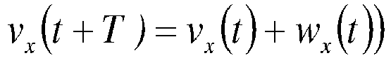


- The calculation can be performed by means of a Kalman filter or similar. The determination of the centre of gravities and tracking of the event cluster can also be utilized in order to estimate a predicted movement pattern of the cluster. In that case the above calculated motion vectors are used to predict a next location of the cluster, and initiate detection of e.g. emergency call near the predicted location. This enables a rapid response to incoming emergency calls, and provides a valuable tool for coordinating actions from e.g. fire brigade or similar. A further possible application would be to utilized the determined movement to estimate a point of origin of the event, e.g. initial start of fire, release of gas etc.
- It should be noted that since the generation of emergency regions or clusters are based solely on the fact that the high precision measurements are related to an emergency call, it is possible to locate the complete AECID algorithm in the emergency centers.
- In summary, the present invention can be presented as
- • Tagging of high precision (A-GPS)
measurements/positioning (lat/long points), with information related to specific events, for example- ∘ The occurrence of emergency E-911 calls, at specific and close times.
- ∘ Radio link quality drops below certain thresholds.
- • Detection algorithms for initiation of a new emergency call based clustering process, local in time and geographical location, said detection algorithms
- ∘ Providing means for storing and determining when a sufficient number of emergency calls have occurred close enough in time and space, to trigger the initiation of a new local clustering process (of high precision (A-GPS) measurements).
- ∘ Providing means for determining when a new emergency call originates closely enough in time and distance, to be associated with the emergency cluster of high precision (A-GPS) measurements,
- ∘ If so, including said new high precision (A-GPS) measurement in said emergency cluster.
- • Maintenance algorithms for said emergency clusters, said algorithms enabling tracking pf moving clusters.
- • Fingerprinting positioning software for post-processing of emergency positioning, said software for post processing thus exploiting reported emergency position
- According to a basic embodiment with reference to
FIG. 5 , anarrangement 1 for improved clustering for includes the following entities, units, or functions. Thearrangement 1 includes anevent detector unit 10 for detecting events in a communication system. In addition, the arrangement comprises atagging unit 20 providing a tag for each detected event. The tag comprises event specific information. Further, the arrangements includes a measurement unit for providing 30 high precision position measurements for each detected event. Finally, aclustering unit 40 for obtaining local clusters of high-precision position measurements based on said event tag. - According to a further embodiment, the arrangement comprises a
tracking unit 50 for tracking the movement of the local event clusters. - The embodiments described above are to be understood as a few illustrative examples of the present invention. It will be understood by those skilled in the art that various modifications, combinations and changes may be made to the embodiments without departing from the scope of the present invention. In particular, different part solutions in the different embodiments can be combined in other configurations, where technically possible. The scope of the present invention is, however, defined by the appended claims.
-
- [1]
PCT/SE2005/001485 - [2]
PCT/SE2006/000132 Jan 30, 2006. - [3]
PCT/SE2006/050068 - [4]
PCT/SE2006/050440 - [5]
PCT/SE2006/050535 - [6]
PCT/SE2007/050189 - [7] 3GPP, TS 23.032, "Universal Geographical Area Description (GAD).
- [8] A. Kangas and T. Wigren, "Location coverage and sensitivity with A-GPS", URSI EMP-S, Pisa, Italy, May, 2004.
Claims (11)
- Method for clustering position determination for providing position determination assisting data in a cellular communications network, comprising the steps of :detecting (S1) an event;providing a tag (S2) for said detected event, said tag comprising event specific information and a time;providing (S3) high precision position measurements (S3) for said detected event;repeating (S4) said detecting and providing steps a plurality of times;obtaining local event clusters (S5) of high-precision position measurements based on said event specific tag; characterized bytracking (S6) a movement of each said local event cluster by determining a geographical position by calculating a centre of gravity of each said local event cluster, updating said local event cluster by removing high precision position measurements from said local event cluster when an age of a high precision position measurement is above a predetermined threshold, and re-determine the geographical position by recalculating the centre of gravity of said updated local event cluster,wherein the local event clusters comprise collections of emergency calls.
- The method according to claim 1, characterized by performing said tag providing step (S2) in response to a detected predetermined event.
- The method according to claim 2, characterized by said predetermined event comprising an emergency call, and said tag comprising emergency call information.
- The method according to any of claims 1-3, characterized by said clustering step (S5) comprising initiating a tentative event cluster including said detected tagged event, and performing a search for identical events originating close to said tentative event cluster, and adding tags and high precision position measurements associated with said identical events to said tentative event cluster.
- The method according to claim 4, characterized by initiating a local event cluster comprising the tentative event cluster when the number of identical events of said tentative event cluster reaches a set threshold.
- The method according to any of claims 1-3, characterized by said event comprising a dropped call, and said tagging step (S2) comprising monitoring a predetermined radio quality parameter, and providing an event tag when said parameter reaches a predetermined minimum threshold.
- The method according to claim 6, characterized by said clustering step (S3) step comprising initiating a tentative event cluster including the provided tag and the corresponding high precision position measurement, and adding tagged vents to said tentative event cluster as they are provided.
- The method according to claim 7, characterized by initiating a local event cluster comprising the tentative event cluster when the number of tagged events of said tentative event cluster reaches a set threshold.
- The method according to claim 1, characterized by said tag providing step comprising replacing an available tag with said event tag comprising said event specific information.
- The method according to claim 1, characterized by said tag providing step comprising adapting an available tag by adding said event specific information.
- An arrangement (1) for position determination in a cellular communications network, said arrangement comprising:an event detector (10) for detecting an event;a tagging unit (20) for providing a tag for said detected event, said tag comprising event specific information and a time;a measurement unit for providing (30) high precision position measurements (S3) for said detected event,a clustering unit (40) for obtaining local event clusters of high-precision position measurements based on said event tag,
characterized bya tracker unit (50) for tracking a movement of each said local event cluster by determining a geographical position by calculating a centre of gravity of each said local event cluster, updating said local event cluster by removing high precision position measurements from said event cluster when an age of a measurement is above a predetermined threshold, and re-determine the geographical position by recalculating the centre of gravity of said updated local event cluster, wherein the local event clusters comprise collections of emergency calls.
Applications Claiming Priority (1)
| Application Number | Priority Date | Filing Date | Title |
|---|---|---|---|
| PCT/SE2009/050436 WO2010126407A1 (en) | 2009-04-27 | 2009-04-27 | Dynamic tag control and fingerprinting event localization |
Publications (2)
| Publication Number | Publication Date |
|---|---|
| EP2425667A1 EP2425667A1 (en) | 2012-03-07 |
| EP2425667B1 true EP2425667B1 (en) | 2015-04-01 |
Family
ID=41581964
Family Applications (1)
| Application Number | Title | Priority Date | Filing Date |
|---|---|---|---|
| EP09788529.7A Not-in-force EP2425667B1 (en) | 2009-04-27 | 2009-04-27 | Dynamic tag control and fingerprinting event localization |
Country Status (4)
| Country | Link |
|---|---|
| US (1) | US9414291B2 (en) |
| EP (1) | EP2425667B1 (en) |
| ES (1) | ES2541321T3 (en) |
| WO (1) | WO2010126407A1 (en) |
Families Citing this family (9)
| Publication number | Priority date | Publication date | Assignee | Title |
|---|---|---|---|---|
| US11238494B1 (en) | 2017-12-11 | 2022-02-01 | Sprint Communications Company L.P. | Adapting content presentation based on mobile viewsheds |
| US10469981B1 (en) * | 2018-04-03 | 2019-11-05 | Sprint Communications Company L.P. | Mobile phone mobile viewshed analysis |
| US11216830B1 (en) | 2019-04-09 | 2022-01-04 | Sprint Communications Company L.P. | Mobile communication device location data analysis supporting build-out decisions |
| US10657806B1 (en) | 2019-04-09 | 2020-05-19 | Sprint Communications Company L.P. | Transformation of point of interest geometries to lists of route segments in mobile communication device traffic analysis |
| US10555130B1 (en) | 2019-04-09 | 2020-02-04 | Sprint Communications Company L.P. | Pre-processing of mobile communication device geolocations according to travel mode in traffic analysis |
| US11067411B1 (en) | 2019-04-09 | 2021-07-20 | Sprint Communications Company L.P. | Route segmentation analysis for points of interest |
| US10694321B1 (en) | 2019-04-09 | 2020-06-23 | Sprint Communications Company L.P. | Pattern matching in point-of-interest (POI) traffic analysis |
| US10715950B1 (en) | 2019-04-29 | 2020-07-14 | Sprint Communications Company L.P. | Point of interest (POI) definition tuning framework |
| US10645531B1 (en) | 2019-04-29 | 2020-05-05 | Sprint Communications Company L.P. | Route building engine tuning framework |
Citations (1)
| Publication number | Priority date | Publication date | Assignee | Title |
|---|---|---|---|---|
| US20070161380A1 (en) * | 2006-01-09 | 2007-07-12 | Qualcomm Incorporated | Apparatus and methods for geographic position approximation of an event occurring on a wireless device |
Family Cites Families (7)
| Publication number | Priority date | Publication date | Assignee | Title |
|---|---|---|---|---|
| US6847892B2 (en) * | 2001-10-29 | 2005-01-25 | Digital Angel Corporation | System for localizing and sensing objects and providing alerts |
| AU2001276992A1 (en) * | 2000-07-20 | 2002-02-05 | Aeptec Microsystems, Inc. | Method, system, and protocol for location-aware mobile devices |
| US20060287831A1 (en) * | 2003-10-07 | 2006-12-21 | Motoi Totiba | Method for visualizing data on correlation between biological events, analysis method, and database |
| US7342497B2 (en) * | 2004-08-26 | 2008-03-11 | Avante International Technology, Inc | Object monitoring, locating, and tracking system employing RFID devices |
| US20070032244A1 (en) * | 2005-08-08 | 2007-02-08 | Microsoft Corporation | Group-centric location tagging for mobile devices |
| WO2007086784A1 (en) * | 2006-01-27 | 2007-08-02 | Telefonaktiebolaget Lm Ericsson (Publ) | Path loss polygon positioning |
| WO2007089182A1 (en) | 2006-02-03 | 2007-08-09 | Telefonaktiebolaget Lm Ericsson (Publ) | Method and arrangement for high precision position reference measurements at indoor locations |
-
2009
- 2009-04-27 US US13/265,865 patent/US9414291B2/en active Active
- 2009-04-27 EP EP09788529.7A patent/EP2425667B1/en not_active Not-in-force
- 2009-04-27 ES ES09788529.7T patent/ES2541321T3/en active Active
- 2009-04-27 WO PCT/SE2009/050436 patent/WO2010126407A1/en not_active Ceased
Patent Citations (1)
| Publication number | Priority date | Publication date | Assignee | Title |
|---|---|---|---|---|
| US20070161380A1 (en) * | 2006-01-09 | 2007-07-12 | Qualcomm Incorporated | Apparatus and methods for geographic position approximation of an event occurring on a wireless device |
Also Published As
| Publication number | Publication date |
|---|---|
| WO2010126407A1 (en) | 2010-11-04 |
| US20120040637A1 (en) | 2012-02-16 |
| US9414291B2 (en) | 2016-08-09 |
| EP2425667A1 (en) | 2012-03-07 |
| ES2541321T3 (en) | 2015-07-17 |
Similar Documents
| Publication | Publication Date | Title |
|---|---|---|
| EP2425667B1 (en) | Dynamic tag control and fingerprinting event localization | |
| US11082944B2 (en) | Determining device location | |
| US9832750B2 (en) | Nodes and methods for positioning | |
| US9019077B2 (en) | System and method for predicting future meetings of wireless users | |
| US9723585B2 (en) | Method and apparatus for position determination in a cellular communications system | |
| US9462482B2 (en) | Geo-location in a wireless communication network | |
| US8208942B2 (en) | Extended clustering for improved positioning | |
| US8626191B2 (en) | Node and method in a node | |
| US8977292B2 (en) | Positioning accuracy estimation | |
| EP2533569A1 (en) | Method for identifying missing neighbors and for updating current neighbors in wireless networks | |
| JP5346214B2 (en) | Method and apparatus for high accuracy position reference measurement indoors | |
| EP2664167B1 (en) | Nodes and methods for positioning | |
| US8565782B2 (en) | Method and arrangement for positioning in a mobile telecommunication network | |
| EP2983003B1 (en) | Techniques for multiple pass geolocation | |
| KR102300416B1 (en) | Base station based positioning method and apparatus | |
| Benikovsky et al. | Localization in real GSM network with fingerprinting utilization |
Legal Events
| Date | Code | Title | Description |
|---|---|---|---|
| PUAI | Public reference made under article 153(3) epc to a published international application that has entered the european phase |
Free format text: ORIGINAL CODE: 0009012 |
|
| 17P | Request for examination filed |
Effective date: 20111014 |
|
| AK | Designated contracting states |
Kind code of ref document: A1 Designated state(s): AT BE BG CH CY CZ DE DK EE ES FI FR GB GR HR HU IE IS IT LI LT LU LV MC MK MT NL NO PL PT RO SE SI SK TR |
|
| DAX | Request for extension of the european patent (deleted) | ||
| 17Q | First examination report despatched |
Effective date: 20120803 |
|
| GRAP | Despatch of communication of intention to grant a patent |
Free format text: ORIGINAL CODE: EPIDOSNIGR1 |
|
| INTG | Intention to grant announced |
Effective date: 20141029 |
|
| GRAS | Grant fee paid |
Free format text: ORIGINAL CODE: EPIDOSNIGR3 |
|
| GRAA | (expected) grant |
Free format text: ORIGINAL CODE: 0009210 |
|
| AK | Designated contracting states |
Kind code of ref document: B1 Designated state(s): AT BE BG CH CY CZ DE DK EE ES FI FR GB GR HR HU IE IS IT LI LT LU LV MC MK MT NL NO PL PT RO SE SI SK TR |
|
| REG | Reference to a national code |
Ref country code: GB Ref legal event code: FG4D |
|
| REG | Reference to a national code |
Ref country code: CH Ref legal event code: EP |
|
| REG | Reference to a national code |
Ref country code: IE Ref legal event code: FG4D |
|
| REG | Reference to a national code |
Ref country code: DE Ref legal event code: R096 Ref document number: 602009030377 Country of ref document: DE Effective date: 20150513 |
|
| REG | Reference to a national code |
Ref country code: AT Ref legal event code: REF Ref document number: 719736 Country of ref document: AT Kind code of ref document: T Effective date: 20150515 |
|
| REG | Reference to a national code |
Ref country code: ES Ref legal event code: FG2A Ref document number: 2541321 Country of ref document: ES Kind code of ref document: T3 Effective date: 20150717 |
|
| REG | Reference to a national code |
Ref country code: NL Ref legal event code: VDEP Effective date: 20150401 |
|
| REG | Reference to a national code |
Ref country code: AT Ref legal event code: MK05 Ref document number: 719736 Country of ref document: AT Kind code of ref document: T Effective date: 20150401 |
|
| REG | Reference to a national code |
Ref country code: LT Ref legal event code: MG4D |
|
| PG25 | Lapsed in a contracting state [announced via postgrant information from national office to epo] |
Ref country code: NL Free format text: LAPSE BECAUSE OF FAILURE TO SUBMIT A TRANSLATION OF THE DESCRIPTION OR TO PAY THE FEE WITHIN THE PRESCRIBED TIME-LIMIT Effective date: 20150401 |
|
| PG25 | Lapsed in a contracting state [announced via postgrant information from national office to epo] |
Ref country code: NO Free format text: LAPSE BECAUSE OF FAILURE TO SUBMIT A TRANSLATION OF THE DESCRIPTION OR TO PAY THE FEE WITHIN THE PRESCRIBED TIME-LIMIT Effective date: 20150701 Ref country code: HR Free format text: LAPSE BECAUSE OF FAILURE TO SUBMIT A TRANSLATION OF THE DESCRIPTION OR TO PAY THE FEE WITHIN THE PRESCRIBED TIME-LIMIT Effective date: 20150401 Ref country code: FI Free format text: LAPSE BECAUSE OF FAILURE TO SUBMIT A TRANSLATION OF THE DESCRIPTION OR TO PAY THE FEE WITHIN THE PRESCRIBED TIME-LIMIT Effective date: 20150401 Ref country code: LT Free format text: LAPSE BECAUSE OF FAILURE TO SUBMIT A TRANSLATION OF THE DESCRIPTION OR TO PAY THE FEE WITHIN THE PRESCRIBED TIME-LIMIT Effective date: 20150401 Ref country code: CZ Free format text: LAPSE BECAUSE OF FAILURE TO SUBMIT A TRANSLATION OF THE DESCRIPTION OR TO PAY THE FEE WITHIN THE PRESCRIBED TIME-LIMIT Effective date: 20150401 Ref country code: PT Free format text: LAPSE BECAUSE OF FAILURE TO SUBMIT A TRANSLATION OF THE DESCRIPTION OR TO PAY THE FEE WITHIN THE PRESCRIBED TIME-LIMIT Effective date: 20150803 |
|
| PG25 | Lapsed in a contracting state [announced via postgrant information from national office to epo] |
Ref country code: LV Free format text: LAPSE BECAUSE OF FAILURE TO SUBMIT A TRANSLATION OF THE DESCRIPTION OR TO PAY THE FEE WITHIN THE PRESCRIBED TIME-LIMIT Effective date: 20150401 Ref country code: AT Free format text: LAPSE BECAUSE OF FAILURE TO SUBMIT A TRANSLATION OF THE DESCRIPTION OR TO PAY THE FEE WITHIN THE PRESCRIBED TIME-LIMIT Effective date: 20150401 Ref country code: GR Free format text: LAPSE BECAUSE OF FAILURE TO SUBMIT A TRANSLATION OF THE DESCRIPTION OR TO PAY THE FEE WITHIN THE PRESCRIBED TIME-LIMIT Effective date: 20150702 Ref country code: IS Free format text: LAPSE BECAUSE OF FAILURE TO SUBMIT A TRANSLATION OF THE DESCRIPTION OR TO PAY THE FEE WITHIN THE PRESCRIBED TIME-LIMIT Effective date: 20150801 |
|
| REG | Reference to a national code |
Ref country code: CH Ref legal event code: PL |
|
| REG | Reference to a national code |
Ref country code: DE Ref legal event code: R097 Ref document number: 602009030377 Country of ref document: DE |
|
| PG25 | Lapsed in a contracting state [announced via postgrant information from national office to epo] |
Ref country code: IT Free format text: LAPSE BECAUSE OF FAILURE TO SUBMIT A TRANSLATION OF THE DESCRIPTION OR TO PAY THE FEE WITHIN THE PRESCRIBED TIME-LIMIT Effective date: 20150401 Ref country code: CH Free format text: LAPSE BECAUSE OF NON-PAYMENT OF DUE FEES Effective date: 20150430 Ref country code: DK Free format text: LAPSE BECAUSE OF FAILURE TO SUBMIT A TRANSLATION OF THE DESCRIPTION OR TO PAY THE FEE WITHIN THE PRESCRIBED TIME-LIMIT Effective date: 20150401 Ref country code: MC Free format text: LAPSE BECAUSE OF FAILURE TO SUBMIT A TRANSLATION OF THE DESCRIPTION OR TO PAY THE FEE WITHIN THE PRESCRIBED TIME-LIMIT Effective date: 20150401 Ref country code: LI Free format text: LAPSE BECAUSE OF NON-PAYMENT OF DUE FEES Effective date: 20150430 Ref country code: EE Free format text: LAPSE BECAUSE OF FAILURE TO SUBMIT A TRANSLATION OF THE DESCRIPTION OR TO PAY THE FEE WITHIN THE PRESCRIBED TIME-LIMIT Effective date: 20150401 |
|
| PLBE | No opposition filed within time limit |
Free format text: ORIGINAL CODE: 0009261 |
|
| STAA | Information on the status of an ep patent application or granted ep patent |
Free format text: STATUS: NO OPPOSITION FILED WITHIN TIME LIMIT |
|
| PG25 | Lapsed in a contracting state [announced via postgrant information from national office to epo] |
Ref country code: SK Free format text: LAPSE BECAUSE OF FAILURE TO SUBMIT A TRANSLATION OF THE DESCRIPTION OR TO PAY THE FEE WITHIN THE PRESCRIBED TIME-LIMIT Effective date: 20150401 Ref country code: RO Free format text: LAPSE BECAUSE OF NON-PAYMENT OF DUE FEES Effective date: 20150401 Ref country code: PL Free format text: LAPSE BECAUSE OF FAILURE TO SUBMIT A TRANSLATION OF THE DESCRIPTION OR TO PAY THE FEE WITHIN THE PRESCRIBED TIME-LIMIT Effective date: 20150401 |
|
| 26N | No opposition filed |
Effective date: 20160105 |
|
| REG | Reference to a national code |
Ref country code: FR Ref legal event code: PLFP Year of fee payment: 8 |
|
| PG25 | Lapsed in a contracting state [announced via postgrant information from national office to epo] |
Ref country code: SI Free format text: LAPSE BECAUSE OF FAILURE TO SUBMIT A TRANSLATION OF THE DESCRIPTION OR TO PAY THE FEE WITHIN THE PRESCRIBED TIME-LIMIT Effective date: 20150401 |
|
| PG25 | Lapsed in a contracting state [announced via postgrant information from national office to epo] |
Ref country code: BE Free format text: LAPSE BECAUSE OF FAILURE TO SUBMIT A TRANSLATION OF THE DESCRIPTION OR TO PAY THE FEE WITHIN THE PRESCRIBED TIME-LIMIT Effective date: 20150401 |
|
| PG25 | Lapsed in a contracting state [announced via postgrant information from national office to epo] |
Ref country code: MT Free format text: LAPSE BECAUSE OF FAILURE TO SUBMIT A TRANSLATION OF THE DESCRIPTION OR TO PAY THE FEE WITHIN THE PRESCRIBED TIME-LIMIT Effective date: 20150401 |
|
| REG | Reference to a national code |
Ref country code: FR Ref legal event code: PLFP Year of fee payment: 9 |
|
| PG25 | Lapsed in a contracting state [announced via postgrant information from national office to epo] |
Ref country code: BG Free format text: LAPSE BECAUSE OF FAILURE TO SUBMIT A TRANSLATION OF THE DESCRIPTION OR TO PAY THE FEE WITHIN THE PRESCRIBED TIME-LIMIT Effective date: 20150401 Ref country code: HU Free format text: LAPSE BECAUSE OF FAILURE TO SUBMIT A TRANSLATION OF THE DESCRIPTION OR TO PAY THE FEE WITHIN THE PRESCRIBED TIME-LIMIT; INVALID AB INITIO Effective date: 20090427 |
|
| PG25 | Lapsed in a contracting state [announced via postgrant information from national office to epo] |
Ref country code: SE Free format text: LAPSE BECAUSE OF FAILURE TO SUBMIT A TRANSLATION OF THE DESCRIPTION OR TO PAY THE FEE WITHIN THE PRESCRIBED TIME-LIMIT Effective date: 20150401 Ref country code: CY Free format text: LAPSE BECAUSE OF FAILURE TO SUBMIT A TRANSLATION OF THE DESCRIPTION OR TO PAY THE FEE WITHIN THE PRESCRIBED TIME-LIMIT Effective date: 20150401 |
|
| PG25 | Lapsed in a contracting state [announced via postgrant information from national office to epo] |
Ref country code: TR Free format text: LAPSE BECAUSE OF FAILURE TO SUBMIT A TRANSLATION OF THE DESCRIPTION OR TO PAY THE FEE WITHIN THE PRESCRIBED TIME-LIMIT Effective date: 20150401 |
|
| PG25 | Lapsed in a contracting state [announced via postgrant information from national office to epo] |
Ref country code: LU Free format text: LAPSE BECAUSE OF NON-PAYMENT OF DUE FEES Effective date: 20150427 |
|
| REG | Reference to a national code |
Ref country code: FR Ref legal event code: PLFP Year of fee payment: 10 |
|
| PG25 | Lapsed in a contracting state [announced via postgrant information from national office to epo] |
Ref country code: MK Free format text: LAPSE BECAUSE OF FAILURE TO SUBMIT A TRANSLATION OF THE DESCRIPTION OR TO PAY THE FEE WITHIN THE PRESCRIBED TIME-LIMIT Effective date: 20150401 |
|
| PGFP | Annual fee paid to national office [announced via postgrant information from national office to epo] |
Ref country code: IT Payment date: 20190625 Year of fee payment: 11 Ref country code: IE Payment date: 20190429 Year of fee payment: 11 |
|
| PG25 | Lapsed in a contracting state [announced via postgrant information from national office to epo] |
Ref country code: IE Free format text: LAPSE BECAUSE OF NON-PAYMENT OF DUE FEES Effective date: 20200427 |
|
| REG | Reference to a national code |
Ref country code: ES Ref legal event code: FD2A Effective date: 20210906 |
|
| PG25 | Lapsed in a contracting state [announced via postgrant information from national office to epo] |
Ref country code: ES Free format text: LAPSE BECAUSE OF NON-PAYMENT OF DUE FEES Effective date: 20200428 |
|
| PGFP | Annual fee paid to national office [announced via postgrant information from national office to epo] |
Ref country code: GB Payment date: 20220427 Year of fee payment: 14 Ref country code: FR Payment date: 20220425 Year of fee payment: 14 Ref country code: DE Payment date: 20220427 Year of fee payment: 14 |
|
| REG | Reference to a national code |
Ref country code: DE Ref legal event code: R119 Ref document number: 602009030377 Country of ref document: DE |
|
| GBPC | Gb: european patent ceased through non-payment of renewal fee |
Effective date: 20230427 |
|
| PG25 | Lapsed in a contracting state [announced via postgrant information from national office to epo] |
Ref country code: GB Free format text: LAPSE BECAUSE OF NON-PAYMENT OF DUE FEES Effective date: 20230427 |
|
| PG25 | Lapsed in a contracting state [announced via postgrant information from national office to epo] |
Ref country code: GB Free format text: LAPSE BECAUSE OF NON-PAYMENT OF DUE FEES Effective date: 20230427 Ref country code: FR Free format text: LAPSE BECAUSE OF NON-PAYMENT OF DUE FEES Effective date: 20230430 Ref country code: DE Free format text: LAPSE BECAUSE OF NON-PAYMENT OF DUE FEES Effective date: 20231103 |