EP0310464A1 - Method for memorizing maps and method for reading the memorized maps - Google Patents
Method for memorizing maps and method for reading the memorized maps Download PDFInfo
- Publication number
- EP0310464A1 EP0310464A1 EP88402051A EP88402051A EP0310464A1 EP 0310464 A1 EP0310464 A1 EP 0310464A1 EP 88402051 A EP88402051 A EP 88402051A EP 88402051 A EP88402051 A EP 88402051A EP 0310464 A1 EP0310464 A1 EP 0310464A1
- Authority
- EP
- European Patent Office
- Prior art keywords
- archiving
- cards
- maps
- map
- card
- Prior art date
- Legal status (The legal status is an assumption and is not a legal conclusion. Google has not performed a legal analysis and makes no representation as to the accuracy of the status listed.)
- Granted
Links
Images


Classifications
-
- G—PHYSICS
- G06—COMPUTING; CALCULATING OR COUNTING
- G06T—IMAGE DATA PROCESSING OR GENERATION, IN GENERAL
- G06T17/00—Three dimensional [3D] modelling, e.g. data description of 3D objects
- G06T17/05—Geographic models
-
- H—ELECTRICITY
- H04—ELECTRIC COMMUNICATION TECHNIQUE
- H04N—PICTORIAL COMMUNICATION, e.g. TELEVISION
- H04N1/00—Scanning, transmission or reproduction of documents or the like, e.g. facsimile transmission; Details thereof
- H04N1/21—Intermediate information storage
- H04N1/2166—Intermediate information storage for mass storage, e.g. in document filing systems
-
- H—ELECTRICITY
- H04—ELECTRIC COMMUNICATION TECHNIQUE
- H04N—PICTORIAL COMMUNICATION, e.g. TELEVISION
- H04N1/00—Scanning, transmission or reproduction of documents or the like, e.g. facsimile transmission; Details thereof
- H04N1/387—Composing, repositioning or otherwise geometrically modifying originals
- H04N1/3876—Recombination of partial images to recreate the original image
-
- H—ELECTRICITY
- H04—ELECTRIC COMMUNICATION TECHNIQUE
- H04N—PICTORIAL COMMUNICATION, e.g. TELEVISION
- H04N2201/00—Indexing scheme relating to scanning, transmission or reproduction of documents or the like, and to details thereof
- H04N2201/04—Scanning arrangements
- H04N2201/0402—Arrangements not specific to a particular one of the scanning methods covered by groups H04N1/04 - H04N1/207
- H04N2201/0414—Scanning an image in a series of overlapping zones
Landscapes
- Engineering & Computer Science (AREA)
- Physics & Mathematics (AREA)
- Software Systems (AREA)
- Signal Processing (AREA)
- Geometry (AREA)
- Multimedia (AREA)
- Remote Sensing (AREA)
- Computer Graphics (AREA)
- General Physics & Mathematics (AREA)
- Theoretical Computer Science (AREA)
- Processing Or Creating Images (AREA)
- Instructional Devices (AREA)
- Automatic Disk Changers (AREA)
- Navigation (AREA)
Abstract
Description
La présente invention concerne tout d'abord l'archivage de cartes géographiques.The present invention firstly relates to the archiving of geographic maps.
L'archivage de cartes géographiques implique d'en avoir au préalable saisi les nombreuses informations - ce sont elles qui sont à archiver - pour, après, pouvoir relire ces informations. Un tel archivage doit être particulièrement utile, notamment dans le domaine de la navigation, aérienne, maritime ou même terrestre, par exemple au moment de la préparation d'une mission, pour appréhender rapidement tout aussi bien un vaste secteur géographique que des parties de ce secteur. L'archivage doit présenter également l'avantage de pouvoir "lire" les informations stockées en combinaison avec d'autres, comme des plans de vol, des trajectoires à suivre, des objectifs à atteindre, superposées aux premières.Archiving maps implies having previously entered the numerous pieces of information - they are the ones to be archived - in order to be able to read this information afterwards. Such archiving must be particularly useful, in particular in the field of navigation, air, sea or even land, for example at the time of the preparation of a mission, to quickly apprehend just as well a vast geographical sector as parts of it. sector. Archiving must also have the advantage of being able to "read" the information stored in combination with others, such as flight plans, trajectories to follow, objectives to achieve, superimposed on the first.
Bref, l'archivage doit présenter l'avantage de pouvoir s'affranchir d'un espace encombrant de stockage de cartes.In short, archiving must have the advantage of being able to overcome a bulky card storage space.
Les moyens actuellement disponibles pour l'archivage de cartes sont essentiellement photographiques, (production de films) et mécaniques (déroulage des films).The means currently available for archiving cards are mainly photographic (film production) and mechanical (film unwinding).
Compte-tenu de la lourdeur de ces moyens, les avantages que devrait procurer l'archivage ne le sont pas.Given the cumbersome nature of these resources, the benefits that archiving should provide are not.
La présente invention vise donc à proposer un procédé d'archivage approprié.The present invention therefore aims to propose an appropriate archiving method.
Avant d'introduire l'invention, quelques explications seront développées.Before introducing the invention, some explanations will be developed.
Considérons un secteur géographique. Ce secteur peut être découpé en zones géographiques appelées zones "échelle", chacune définie par un méridien de référence. Chaque zone échelle recouvre en fait une pluralité de cartes géographiques, à une échelle donnée. Chaque carte, du type par exemple de celles éditées par l'Institut Géographique National, contient des informations inscrites dans un trapèze curviligne à bords latéraux rectilignes (les méridiens) extrêmes mais non parallèles au méridien de référence de la zone échelle, souvent le méridien central d'une des cartes. Juxtaposer ces cartes deux à deux par deux de leurs bords latéraux ou méridiens extrêmes respectifs, c'est-à-dire superposer ces deux bords ou méridiens, exige au préalable d'avoir fait tourner l'une des deux cartes considérées par rapport à l'autre. Si α et β sont respectivement les angles formés entre le méridien extrême gauche et les bords parallèles d'une carte, d'une part, et entre ces bords de carte et de méridien extrême droit, d'autre part, et en affectant l'indice i aux informations de la carte i, l'angle de rotation dont il faut faire tourner la carte i+1 par rapport à la carte i, pour superposer le méridien extrême gauche de la première et le méridien extrême droit de la seconde, est γi+1 = αi+1 + βi.Consider a geographic area. This sector can be divided into geographic areas called "ladder" areas, each defined by a reference meridian. Each scale zone in fact covers a plurality of geographic maps, at a given scale. Each map, of the type for example of those published by the National Geographic Institute, contains information inscribed in a curvilinear trapezoid with rectilinear lateral edges (the meridians) extreme but not parallel to the reference meridian of the scale zone, often the central meridian one of the cards. Juxtaposing these cards two by two by two of their respective lateral edges or meridians, that is to say superimposing these two edges or meridians, requires beforehand to have turned one of the two cards considered with respect to l 'other. If α and β are respectively the angles formed between the extreme left meridian and the parallel edges of a map, on the one hand, and between these edges of map and extreme right meridian, on the other hand, and by affecting the index i to the information on map i, the rotation angle by which map i + 1 must be rotated relative to map i, to superimpose the extreme left meridian of the first and the extreme right meridian of the second, is γ i + 1 = α i + 1 + β i .
γi+1 étant un angle de numérisation possible de la carte i+1.γ i + 1 being a possible digitization angle of the card i + 1.
Les informations d'une carte sont les couleurs des pixels (picture elements, ou éléments d'image) qui la composent. Numériser une carte, c'est former, par balayage à l'aide d'un scanner, la matrice des couples (pixel-couleur), chaque couleur, déterminée par ses coordonnées colorimétriques dans le repère des trois couleurs primaires, étant l'une de celles, en nombre limité, d'une table de couleurs composée préalablement par échantillonnage avec la participation d'un opérateur.The information on a map is the colors of the pixels (picture elements) that make it up. To digitize a map is to form, by scanning with a scanner, the matrix of couples (pixel-color), each color, determined by its colorimetric coordinates in the coordinate system of the three primary colors, being one those, in limited number, of a color table previously composed by sampling with the participation of an operator.
Les cartes constitutives d'une zone échelle contiennent des informations inutiles et qu'il convient donc d'éliminer ou de découper, comme par exemple les bordures blanches des légendes. La numérisation d'un seul encadré rapporté sur une carte revient ainsi à éliminer tout ce qui est à l'extérieur de l'encadré.The maps making up a scale area contain unnecessary information and should therefore be eliminated or cut out, for example the white borders of legends. Digitizing a single box attached to a card thus eliminates everything outside the box.
Pour cela, on associe à chaque pixel à éliminer, manuellement par l'opérateur à l'aide d'un curseur, ou semi-automatiquement, l'information de couleur zéro.For this, we associate with each pixel to be eliminated, manually by the operator using a cursor, or semi-automatically, the color information zero.
Ces explications liminaires étant fournies, l'invention peut maintenant être présentée.These preliminary explanations being provided, the invention can now be presented.
La présente invention concerne donc un procédé d'archivage de cartes géographiques recouvrant au moins une zone échelle déterminée, caractérisé par le fait qu'on ordonne les cartes, on fait tourner chaque carte d'un angle de numérisation, on numérise chaque carte, on découpe, de chaque carte, les portions inutiles, on procède au repérage de chaque carte pour en déterminer la déformation, on stocke sur un support tampon et en les juxtaposant les cartes numérisées, découpées et repérées, et on mémorise sur un support d'archivage les informations du support tampon.The present invention therefore relates to a method of archiving geographic maps covering at least a given scale area, characterized in that the maps are ordered, each map is rotated by a scanning angle, each map is digitized, cutting out, of each card, the useless portions, we proceed to the location of each card to determine the deformation, we store on a buffer support and by juxtaposing the scanned, cut and marked cards, and we memorize on an archiving medium buffer support information.
De préférence, le support d'archivage est un disque optique numérique à lecture laser rapide et de très grande capacité.Preferably, the archiving medium is a digital optical disc with fast laser reading and of very large capacity.
Dans la mise en oeuvre préférée du procédé de l'invention, on stocke et juxtapose chaque carte élémentaire sur le support tampon en superposant un point de la carte élémentaire de latitude L et longitude G déterminées et un point de la portion de la zone échelle déjà stockée de mêmes latitude L et longitude G, les parties de la zone échelle déjà stockées restant prioritaires sur les parties de la carte élémentaire en cours de stockage.In the preferred implementation of the method of the invention, each elementary map is stored and juxtaposed on the buffer support by superimposing a point on the elementary map of latitude L and longitude G determined and a point of the portion of the scale area already stored at the same latitude L and longitude G, the parts of the scale area already stored having priority over the parts of the elementary map during storage.
En d'autres termes, des parties de la carte élémentaire, qui, après superposition des deux points considérés, se seraient superposées à des parties de la zone échelle déjà stockées, sont en fait effacées. On conçoit ainsi l'intérêt du découpage des cartes élémentaires, pour que des parties blanches ou inutiles de cartes ne deviennent pas prioritaires sur des parties utiles d'autres cartes.In other words, parts of the elementary map, which, after superposition of the two points considered, would have been superimposed on parts of the scale zone already stored, are in fact erased. We thus understand the advantage of cutting out elementary cards, so that white or useless parts of cards do not take priority over useful parts of other cards.
De préférence encore, la numérisation des cartes s'effectue par scanner, et les informations numériques du support tampon sont quadrillées et comprimées avant mémorisation sur le support d'archivage.More preferably, the cards are digitized by scanner, and the digital information in the buffer medium is squared and compressed before storage on the archiving medium.
L'invention concerne également le procédé de lecture du support d'archivage enregistré conformément au procédé d'archivage de l'invention, caractérisé par le fait qu'on détermine, par son contour, la carte contenant un point de coordonnées géographiques déterminées à placer au centre d'un écran de visualisation.The invention also relates to the method of reading the archiving medium recorded in accordance with the archiving method of the invention, characterized in that the map containing a point of determined geographic coordinates to be placed is determined by its outline in the center of a display screen.
De préférence, la zone échelle archivée ayant été quadrillée en pavés élémentaires, après avoir déterminé la carte contenant ledit point, on détermine le pavé élémentaire, à afficher au centre de l'écran, et contenant ledit point, on lit le pavé écran au centre duquel se trouve ledit pavé élémentaire, et on l'affiche.Preferably, the archived scale zone having been gridded in elementary blocks, after having determined the map containing said point, the elementary block is determined, to be displayed in the center of the screen, and containing said point, the screen block is read in the center which said elementary block is, and it is displayed.
L'invention sera mieux comprise à l'aide de la description suivante d'une mise en oeuvre préférée du procédé d'archivage et du procédé de lecture de l'invention, en référence aux dessins annexés, sur lesquels,
- - la figure 1 illustre la mise en ordre des cartes élémentaires d'une zone échelle;
- - la figure 2 illustre la rotation d'une carte élémentaire avant sa numérisation;
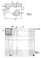
- - la figure 3 illustre le stockage d'une carte élémentaire et sa juxtaposition à une portion de zone échelle;
- - la figure 4 représente la matrice des pavés élémentaires des pixels numérisés des cartes d'une zone échelle;
- - la figure 5 représente l'organigramme des différentes étapes du procédé d'archivage de l'invention, et
- - la figure 6 représente l'organigramme des différentes étapes du procédé de lecture de l'invention.
- - Figure 1 illustrates the ordering of elementary maps of a scale area;
- - Figure 2 illustrates the rotation of an elementary map before its digitization;
- - Figure 3 illustrates the storage of an elementary map and its juxtaposition to a scale area portion;
- FIG. 4 represents the matrix of the elementary blocks of the digitized pixels of the maps of a scale area;
- FIG. 5 represents the flow diagram of the different steps of the archiving method of the invention, and
- - Figure 6 shows the flowchart of the different steps of the reading method of the invention.
Soit donc un fichier de cartes géographiques à archiver, des cartes élémentaires à une même échelle déterminée, et couvrant, à cette échelle une zone particulière dite zone échelle, par exemple la France. L'archivage de ces cartes sur un disque optique numérique revient à les enregistrer, ou les écrire, sur le disque suivant un procédé dont les étapes vont être analysées. D'ores et déjà, il faut noter que l'enregistrement s'effectue zone échelle par zone échelle.Therefore, a file of geographic maps to be archived, elementary maps at the same determined scale, and covering, on this scale a particular area called scale area, for example France. Archiving these cards on a digital optical disc means recording them, or writing them, on the disc according to a process, the steps of which will be analyzed. As of now, it should be noted that the recording takes place zone scale by zone zone.
En référence à la figure 1, on prend la carte centrale 101, au sens géométrique du terme, de la zone échelle 100 et on pose que son méridien central 201 sera le méridien de référence de la zone échelle qui, au moment de la lecture ultérieure sur écran, sera affiché en position verticale. En d'autres termes, l'angle de numérisation de cette carte centrale 101 sera pris égal à zéro. Cette carte centrale 101 est affectée du numéro d'ordre 1. Disposant les cartes élémentaires les unes à côté des autres pour constituer la zone échelle, on affecte à la carte 102 adjacente à la carte n° 1, à l'est de celle-ci le numéro 2; la carte 103 adjacente à la carte n° 1 à l'ouest de celle-ci reçoit le numéro 3; la carte 104 adjacente à la carte centrale, au nord de celle-ci, reçoit le numéro 4, la carte 105 adjacente à la carte centrale, au sud de celle-ci, le numéro 5, et ainsi de suite, d'est en ouest et du nord au sud de la carte centrale n° 1 vers la périphérie de la zone échelle. Quand plusieurs cartes 105, 106 sont adjacentes à une autre, d'un même côté, la numérotation s'effectue dans le sens inverse des aiguilles d'une montre.With reference to FIG. 1, we take the
Ensuite, on procède au maillage de la zone échelle, en latitude et longitude, pour la découper en un certain nombre de mailles, afin de réduire la recherche des cartes à afficher, lors de la lecture ultérieure. A titre d'exemple, on peut choisir des mailles telles qu'elles ne contiennent pas plus de neuf cartes élémentaires chacune.Then, we proceed to the mesh of the scale zone, in latitude and longitude, to cut it into a certain number of meshes, in order to reduce the search for the maps to display, during the subsequent reading. For example, one can choose meshes such that they do not contain more than nine elementary cards each.
La rotation des cartes précède leur numérisation et consiste donc à déterminer leur angle de numérisation ν.The rotation of the cards precedes their digitization and therefore consists in determining their digitization angle ν.
En fait, dans la pratique, et en référence à la figure 2, l'angle de numérisation ν, et non l'angle γ introduit plus haut à titre explicatif seulement, est l'angle formé entre le méridien de référence 201 de la zone échelle et le méridien central des cartes, par exemple le méridien 206 de la carte 106. Dans ces conditions, il est indifférent qu'on considère, pour la juxtapisition des cartes abordée plus loin, des cartes adjacentes par leurs méridiens ou par leurs parallèles.In fact, in practice, and with reference to FIG. 2, the digitization angle ν, and not the angle γ introduced above for explanatory purposes only, is the angle formed between the
L'angle de numérisation ν d'une carte dépend de
. la latitude L et la longitude G du point central de la carte, et par lequel passe son méridien central,
. les caractéristiques de l'ellipsoïde auquel on a assimilé la terre pour l'élaboration de la carte,
. le type de projection adoptée pour l'élaboration de la carte, qui peut être une projection conique, cylindrique ou azimuthale, de Mercator ou de Lambert, par exemple.The scanning angle ν of a map depends on
. the latitude L and the longitude G of the central point of the map, and through which its central meridian passes,
. the characteristics of the ellipsoid with which the earth was assimilated for the elaboration of the map,
. the type of projection adopted for the elaboration of the map, which can be a conical, cylindrical or azimuth projection, of Mercator or Lambert, for example.
L'ouvrage Géodesie classique bidimentionnelle - Tome 2, de Levallois, Eyrolles, 1970, fournit les éléments permettant de déterminer les angles de numérisation ν associés aux cartes de la zone échelle.The book Classical bidirectional geodesy -
Elle s'effectue à l'aide d'un système de balayage du type scanner. Chaque carte est disposée sur le cadre du système, plat ou rotatif, mais inclinée de son angle de numérisation et est éclairé par une source de lumière. La tête de lecture balaye la carte inclinée, pixel par pixel, et ligne de pixels par ligne de pixels, et analyse la lumière réfléchie, qui est décomposée dans les trois couleurs primaires, rouge, vert, bleu, par un dispositif optique. Les informations recueillies sont numérisées et stockées sur tout support approprié, par exemple une bande magnétique.It is carried out using a scanning system of the scanner type. Each card is placed on the system frame, flat or rotating, but inclined at its scanning angle and is lit by a light source. The read head scans the inclined map, pixel by pixel, and line of pixels by line of pixels, and analyzes the reflected light, which is broken down into the three primary colors, red, green, blue, by an optical device. The information collected is digitized and stored on any suitable medium, for example a magnetic tape.
La numérisation des cartes peut être effectuée, par exemple à l'aide d'un scanner de la Société Hell, présenté dans le n° 1150, de décembre 1984, de la revue L'Industrie Textile.The cards can be digitized, for example using a scanner from the Hell Company, presented in No. 1150, of December 1984, of the journal L'Industrie Textile.
Avant l'opération de balayage proprement dite, l'opérateur procède au balayage des portions de la carte de couleurs respectivement différentes (C₁, C₂, ...), dans un ordre déterminé, qu'il veut prendre en compte, pour déterminer les paramètres colorimétriques de ces couleurs, ici au nombre de douze, et former ainsi la table de ces couleurs. C'est l'opération d'échantillonnage évoquée ci-dessus. Les informations numériques de la bande de stockage sont d'une part, les numéros des couleurs de tous les pixels analysés et, d'autre part, pour son traitement ultérieur lors de la lecture du disque optique, la table des couleurs, avec leurs paramètres colorimétriques.Before the actual scanning operation, the operator scans the portions of the color card respectively different (C₁, C₂, ...), in a determined order, which he wants to take into account, to determine the colorimetric parameters of these colors, here twelve in number, and thus form the table of these colors. This is the sampling operation mentioned above. The digital information of the storage tape is on the one hand, the color numbers of all the pixels analyzed and, on the other hand, for its subsequent processing when reading the optical disc, the color table, with their parameters colorimetric.
On a déjà vu qu'il s'agissait pour cela, d'affecter aux pixels à éliminer la couleur zéro (Co). En pratique, cela se traduira par l'association à chaque pixel concerné d'une information selon laquelle, au cours du stockage et de la juxtaposition des cartes, le pixel devra être effacé.We have already seen that for this purpose it was a matter of assigning pixels to eliminate the color zero (C o ). In practice, this will result in the association with each pixel concerned of information according to which, during the storage and the juxtaposition of the cards, the pixel will have to be erased.
Cette étape du procédé s'effectue en ressortant sur un moniteur les informations numérisées du scanner et, à l'aide d'un curseur, suivre sur le moniteur les contours des portions à découper, pour substituer la couleur Co aux couleurs C₁-Cn associées aux pixels contenus à l'intérieur de ces contours.This step of the process is carried out by bringing out the digitized information from the scanner on a monitor and, using a cursor, following the contours of the portions to be cut on the monitor, to replace the color C o for the colors C₁-C n associated with the pixels contained within these contours.
Le repérage d'une carte élémentaire vise, outre à définir les coordonnées des contours à stocker, à s'affranchir des déformations du papier de la carte, dues à la température, la pression, l'humidité, ... etc., et établir une correspondance entre les coordonnées numérisées et les coordonnées géographiques.The identification of an elementary card aims, in addition to defining the coordinates of the contours to be stored, to overcome the deformations of the paper of the card, due to temperature, pressure, humidity, etc., and establish a correspondence between the digital coordinates and the geographic coordinates.
En fait, l'opération de repérage consiste à déterminer la déformation, ou le gondolage, du papier de la carte, par un facteur dit facteur de déformation, pour en tenir compte ultérieurement au moment de la juxtaposition des cartes, et de la lecture du disque d'archivage, alors qu'on procède à la numérisation et à l'archivage de la carte dans son état déformé.In fact, the tracking operation consists in determining the deformation, or the curling, of the paper of the card, by a factor known as deformation factor, to take it into account later at the time of the juxtaposition of the cards, and the reading of the archiving disc, while scanning and archiving the card in its deformed state.
Dans cette étape du procédé d'archivage, on suppose que les cartes ont subi une déformation rectiligne le long d'un premier axe et une autre déformation rectiligne le long d'un deuxième axe perpendiculaire au premier, les deux déformations n'étant toutefois pas correlées entre elles.In this step of the archiving process, it is assumed that the cards have undergone a rectilinear deformation along a first axis and another rectilinear deformation along a second axis perpendicular to the first, the two deformations however not being correlated with each other.
On procède de la manière suivante.We proceed as follows.
On fait ressortir les informations numérisées du support de numérisation sur un moniteur pour afficher la carte à repérer sur l'écran du moniteur. A l'aide d'un curseur, on désigne sur l'écran deux points géodésiques particuliers de la carte, de latitudes et longitudes respectives, connues, L₁, G₁ et L₂, G₂. Ces coordonnées géographiques correspondent à deux pixels numérisés du support de coordonnées matricielles respectives x₁, y₁ et x₂, y₂ dans la matrice des pixels XY associée à la carte considérée.The digitized information is brought out from the scanning medium on a monitor to display the map to be located on the monitor screen. Using a cursor, two particular geodesic points on the map are designated on the screen, of respective known latitudes and longitudes, L₁, G₁ and L₂, G₂. These geographic coordinates correspond to two digitized pixels of the support of respective matrix coordinates x₁, y₁ and x₂, y₂ in the matrix of pixels XY associated with the considered map.
Si on considère par exemple (x₂-x₁), c'est le nombre de colonnes, dans la matrice de pixels associée à la carte, séparant les deux points géodésiques désignés. Du fait de la déformation du papier, ce nombre est faux. Mais connaissant les coordonnées géographiques vraies des deux points, on peut en déduire le décalage de colonnes théorique (X₂-X₁). En fonction de ces deux nombres, l'un faux, l'autre exact et théorique, des coordonnées géographiques des deux points, des caractéristiques de l'ellipsoïde terrestre et du type de projection de la carte et de l'angle de numérisation, l'ouvrage de Levallois abordé ci-dessus, fournit les éléments permettant encore de calculer le facteur de déformation attaché à la carte, et qui est mémorisé en combinaison avec les informations numérisées de celle-ci, sur un support de numérisation et de repérage, avec également les coordonnées géographiques et matricielles des sommets du polygone géométrique contenant les informations géographiques de la carte.If we consider for example (x₂-x₁), this is the number of columns in the pixel matrix associated with the map, separating the two designated geodesic points. Due to the deformation of the paper, this number is wrong. But knowing the true geographic coordinates of the two points, we can deduce the theoretical column shift (X₂-X₁). Based on these two numbers, one false, the other exact and theoretical, the geographic coordinates of the two points, the characteristics of the terrestrial ellipsoid and the type of projection of the map and the angle of digitization, Levallois' work, discussed above, provides the elements which still allow the deformation factor attached to the card to be calculated, and which is memorized in combination with the digitized information thereof, on a digitization and tracking support, also with the geographic and matrix coordinates of the vertices of the geometric polygon containing the geographic information of the map.
Les cartes ayant été numérisées, avec leurs angles de numérisation respectifs, découpées et repérées, on les juxtapose, ou on les "colle" sur un support tampon, pouvant être un disque optique.The cards having been scanned, with their respective scanning angles, cut and marked, they are juxtaposed, or they are "glued" on a buffer support, which can be an optical disc.
Pour cela et en affichant les informations du support de numérisation et de repérage sur l'écran 1 d'un moniteur, en référence à la figure 3, on fait apparaitre l'ensemble des informations déjà juxtaposées de la zone 2 et celles de la carte à lui adjoindre 3, le bord supérieur 4 de la carte 3 devant s'étendre le long de la portion de bord inférieure 5 de la zone 2 et le bord gauche incliné 6 de la carte 3 légèrement en deça de la portion de bord inclinée 7 de la zone 2. L'opérateur, à l'aide d'un curseur, désigne successivement un point 8 de la zone 2 et un point origine 9 de la carte 3, de mêmes coordonnées géographiques que le point 8. Il est ensuite procédé au calcul des différences des coordonnées matricielles des deux points 8, 9 tels qu'ils apparaissent à l'écran, avant que la carte 3 ne soit ensuite déplacée vers, et en partie sous la zone 2. Les portions de la zone 2 sont prioritaires sur celles de la carte 3, si bien que la carte 3 vient se juxtaposer parfaitement à la zone 2, les portions de la carte 3 déjà contenues dans la zone 2 étant purement et simplement effacées.For this and by displaying the information from the digitization and tracking support on the
Dans le cas considéré, on conçoit facilement que si une portion inutile de la carte 3 était restée au-dessus du bord 4, cette portion aurait été effacée. Par contre, une portion inutile de la carte 3, à gauche du bord 6, aurait pu se placer en-dessous de la portion de bord 10 de la zone 2 et devenir ainsi malencontreusement prioritaire sur des informations d'autres cartes à juxtaposer.In the case under consideration, it is easily understood that if an unnecessary portion of the
Une fois une carte juxtaposée, elle perd son identité.Once a card is juxtaposed, it loses its identity.
Les cartes sont juxtaposées dans l'ordre de la numérotation élaborée au cours de l'étape de mise en ordre précédente, le méridien de référence de la zone échelle devant toujours ressortir en position verticale sur un écran de visualisation.The maps are juxtaposed in the order of the numbering developed during the previous ordering step, the reference meridian of the scale area must always stand out in a vertical position on a display screen.
On notera que les zones échelle ne sont pas juxtaposées les unes aux autres. Pour cette raison, on prévoit, pour chaque zone échelle, des bandes périphériques de recouvrement, pour s'assurer qu'il apparaitra toujours sur un écran de lecture une portion d'une zone échelle.Note that the scale zones are not juxtaposed to each other. For this reason, peripheral overlap bands are provided for each scale zone, to ensure that a portion of a scale zone will always appear on a reading screen.
Le carroyage, ou quadrillage, vise à accélérer la lecture ultérieure des informations archivées en les faisant ressortir carreau par carreau, ou pavé par pavé.The grid, or grid, aims to accelerate the later reading of the archived information by bringing it out tile by tile, or paving stone by paving stone.
Une zone échelle étant donc mémorisée, sur le support tampon sous forme d'une matrice de pixels représentés, chacun, par leur information de couleur, c'est-à-dire leur numéro de couleur, soit un nombre de bits dépendant du nombre de couleurs retenu (4 bits pour 12 couleurs), pour tenir compte des capacités des écrans des moniteurs de visualisation, on découpe la matrice de la zone échelle en pavés élémentaires, ici de 256 lignes et 256 colonnes de pixels, qu'on regroupe ici encore 16 par 16 en pavés d'ensemble formés, chacun, de 4 lignes et 4 colonnes de pavés élémentaires, un pavé d'ensemble pouvant couvrir la surface d'un écran de visualisation.A scale area is therefore stored on the buffer medium in the form of a matrix of pixels represented, each by their color information, that is to say their color number, ie a number of bits depending on the number of retained colors (4 bits for 12 colors), to take into account the capacities of the screens of the visualization monitors, the matrix of the scale zone is cut up into elementary blocks, here of 256 lines and 256 columns of pixels, which we group together here again 16 by 16 in overall blocks formed, each, of 4 lines and 4 columns of elementary blocks, an overall block which can cover the surface of a display screen.
On procède ensuite à la numérotation des pavés élémentaires découpés de la manière exposée ci-dessous. Cette numérotation des pavés élémentaires d'un pavé écran 12 d'une zone échelle 13, en référence à la figure 4, s'effectue pavé élémentaire 14 par pavé élémentaire 14 dans l'ordre croissant des colonnes de pavés élémentaires jusqu'à 4, puis dans l'ordre croissant des lignes de pavés élémentaires jusqu'à 4, et pavé écran par pavé écran dans l'ordre croissant des lignes de pavés écran jusqu'à la dernière ligne de la matrice de pixels, puis dans l'ordre croissant des colonnes de pavés écran jusqu'à la dernière colonne de la matrice de pixels.We then proceed to number the elementary blocks cut out in the manner described below. This numbering of the elementary blocks of a
Dans le cas d'une matrice de zone échelle de 256 M lignes et 256 N colonnes de pixels, c'est-à-dire d'une zone échelle découpée en N colonnes de pavés élémentaires et M lignes de pavés élémentaires,la numérotation de la première ligne de pavés élémentaires 12 est
1, 2, 3, 4, 4M + 1, 4M + 2, (N-4)M+3, (N-4)M+4,
de la seconde ligne
5, 6, 7, 8, 4M+5, 4M+6, (N-4)M+7, (N-4)M+8,
de la dernière ligne
4M-3, 4M-2, (N-4)M+4M-1, (N-4)M+4M soit
4M-3, 4M-2, NM-1, NM.In the case of a scale area matrix of 256 M lines and 256 N columns of pixels, that is to say of a scale area divided into N columns of elementary blocks and M lines of elementary blocks, the numbering of the first line of
1, 2, 3, 4, 4M + 1, 4M + 2, (N-4) M + 3, (N-4) M + 4,
of the second line
5, 6, 7, 8, 4M + 5, 4M + 6, (N-4) M + 7, (N-4) M + 8,
from the last line
4M-3, 4M-2, (N-4) M + 4M-1, (N-4) M + 4M either
4M-3, 4M-2, NM-1, NM.
En fait, et avant d'archiver chaque zone échelle sur un disque optique numérique, on procède à une compression des informations, selon un codage qui va maintenant être analysé. On procède pavé élémentaire par pavé élémentaire et, pour chaque pavé élémentaire, quart de pavé élémentaire par quart de pavé élémentaire, c'est-à-dire par groupe de 64 lignes de pixels.In fact, and before archiving each scale zone on a digital optical disk, information is compressed, according to a coding which will now be analyzed. We proceed to elementary block by elementary block and, for each elementary block, quarter of elementary block by quarter of elementary block, that is to say by group of 64 lines of pixels.
On compte, dans chacun de ces groupes, le nombre de pixels Ni associés à chacune Ci des couleurs retenues, douze en l'occurrence, avec
N₁ > N₂ >... > N₁₁ > N₁₂.We count, in each of these groups, the number of pixels Ni associated with each Ci of the colors selected, twelve in this case, with
N₁>N₂>...>N₁₁> N₁₂.
A la couleur la plus fréquente C₁, on affecte un bit de valeur 0.To the most frequent color C₁, a bit of value 0 is assigned.
Selon le codage de Huffman, que l'invention perfectionne comme cela sera exposé plus loin (voir document "Digital Image Processing", de Rafael et al. Addison-Wesley, 1977), on affecte à la deuxième couleur C₂ la plus fréquente, après C₁, un deuxième bit, de poids immédiatement supérieur, de valeur 1, et ainsi de suite. Ainsi, à la couleur Ci de rang i est affecté le code composé de (i-1) bits de valeur 1 et un dernier bit de poids le plus faible de valeur 0.According to the Huffman coding, which the invention perfects as will be explained below (see document "Digital Image Processing", by Rafael et al. Addison-Wesley, 1977), the second most frequent color C affecte is assigned, after C₁, a second bit, of immediately greater weight, of
Le codage de Huffman est toutefois trop dégradant.The Huffman coding is however too degrading.
Selon l'invention, on affecte à la deuxième couleur C₂ la plus fréquente, après C₁, un deuxième bit, de poids immédiatement supérieur, de valeur 1, et un troisième bit, de poids immédiatement inférieur, et donc le plus faible, de valeur x, x étant égal à 1 si le pixel suivant est de la même couleur, comme dans un codage RLC (run length coding).According to the invention, the second most frequent color C₂ is assigned, after C₁, a second bit, of immediately greater weight, of
Pour déjà comparer le codage de Huffman et celui de l'invention, au niveau de cette deuxième couleur, notons que, selon le codage Huffman, l'archivage de deux pixels adjacents de cette même couleur C₂ requiert 4 bits - deux fois 10 -, alors que, selon le codage de l'invention, 3 bits - 101 - sont suffisants.To already compare the Huffman coding and that of the invention, at the level of this second color, let us note that, according to the Huffman coding, the archiving of two adjacent pixels of this same color C₂ requires 4 bits - twice 10 -, whereas, according to the coding of the invention, 3 bits - 101 - are sufficient.
Selon le codage de Huffman, l'archivage de deux pixels adjacents, dont l'un est de couleur C₂, ne requiert que 3 bits, seulement si l'autre pixel est de couleur C₁. Comme la probabilité que deux pixels adjacents soient de même couleur, est supérieure à 0,5, statistiquement, on conçoit donc que le codage de l'invention, au niveau de ces deux couleurs, soit déjà plus performant.According to Huffman coding, the archiving of two adjacent pixels, one of which is of color C₂, requires only 3 bits, only if the other pixel is of color C₁. Since the probability that two adjacent pixels are of the same color is greater than 0.5, statistically, it is therefore understandable that the coding of the invention, at the level of these two colors, is already more efficient.
Un pixel en suit un autre suivant un sens de balayage de la gauche vers la droite de chacune des 64 lignes de 256 pixels de chaque quart de pavé élémentaire.One pixel follows another in a direction of scanning from left to right of each of the 64 lines of 256 pixels in each quarter of the elementary block.
Pour revenir au codage de l'invention, on notera tout d'abord qu'il repose sur le fait que la fréquence d'apparition des trois couleurs suivantes C₃, C₄, C₅ est sensiblement la même et que le codage de ces trois couleurs s'effectue donc avec le même nombre de bits. Il fallait donc, le chiffre décimal 3 s'écrivant 11 en binaire, deux bits de plus que pour la couleur C₂.To return to the coding of the invention, it will first be noted that it is based on the fact that the frequency of appearance of the following three colors C₃, C₄, C₅ is substantially the same and that the coding of these three colors s 'therefore performs with the same number of bits. It was therefore necessary, the
Comme les pixels archivés sont analysés les uns à la suite des autres, sans séparateur entre eux, il fallait également éliminer toute ambiguité au cours de la lecture ultérieure s'effectuant depuis le premier pixel. Et c'est ainsi qu'il est proposé le codage suivant :
On prévoit également un code FIN s'écrivant 1 1 1 1 1 1 1 1.There is also a FIN code written 1 1 1 1 1 1 1 1.
Les bits x de poids le plus faible des couleurs C₃-C₉, tout comme pour C₂, sont égaux à 1 si le pixel suivant est de la même couleur, à 0 dans le cas contraire.The least significant bits x of the colors C₃-C₉, as for C₂, are equal to 1 if the next pixel is of the same color, to 0 otherwise.
On remarquera que trois pixels de même couleur C₂ peuvent être archivés soit 101100, soit 100 101. Selon le codage de l'invention, on a volontairement écarté la deuxième possibilité qu'on a ainsi réservée à la couleur C₆.It will be noted that three pixels of the same color C₂ can be archived, either 101100 or 100101. According to the coding of the invention, the second possibility has been deliberately ruled out, which has thus been reserved for the color C₆.
En définitive, le codage de l'invention est une combinaison du codage de Huffman et du codage RLC, mais, de surcroit, adapté à la statistique des couleurs de l'image.Ultimately, the coding of the invention is a combination of Huffman coding and RLC coding, but, moreover, adapted to the statistics of the colors of the image.
A titre d'exemple, on notera que dans l'exemple considéré, la proportion des pixels de couleur C₁ est d'environ 45 %, des pixels de couleur C₂, d'environ 20 %, des pixels de couleurs C₃, C₄, C₅, d'environ 8 % chacun, des pixels de couleur C₆-C₉, considérés globalement, d'environ 10 %, ces derniers pixels étant codés, selon le codage de l'invention, avec le même nombre de bits.By way of example, it will be noted that in the example considered, the proportion of the pixels of color C₁ is approximately 45%, pixels of color C₂, of approximately 20%, pixels of colors C₃, C₄, C₅, of approximately 8% each, pixels of color C₆-C₉, considered overall, of approximately 10%, the latter pixels being coded, according to the coding of the invention, with the same number of bits.
Avant codage, il fallait donc 4 bits par pixel; après codage, on a constaté que la quantité de bits à archiver était de 2,25 par pixel.Before coding, 4 bits per pixel were therefore required; after coding, it was found that the quantity of bits to be archived was 2.25 per pixel.
L'enregistrement du disque optique numérique s'effectue donc quart de pavé élémentaire par quart de pavé élémentaire et pavé élémentaire par pavé élémentaire, dans l'ordre de numérotation du carroyage.The recording of the digital optical disc is therefore carried out quarter of elementary block by quarter of elementary block and elementary block by elementary block, in the order of numbering of the grid.
On notera que les codes de compression ne sont pas associés aux pixels des quarts de pavé élémentaire sur le support d'archivage mais que ces codes sont mémorisés dans l'équipement de lecture.It will be noted that the compression codes are not associated with the pixels of the elementary quarter-blocks on the archiving medium but that these codes are stored in the reading equipment.
Il ne reste plus ensuite qu'à procéder, de façon classique, à l'enregistrement sur le disque optique numérique des informations obtenues, c'est-à-dire à y inscrire les informations des cartes, d'une ou plusieurs zones échelle, mises en ordre, numérisées, découpées, repérées mais déformées, juxtaposées, quadrillées et comprimées.It then only remains, in a conventional manner, to record the information obtained on the digital optical disc, that is to say to write therein the information of the maps, of one or more scale zones, put in order, digitized, cut out, identified but deformed, juxtaposed, squared and compressed.
Comme le disque optique est découpé en une suite continue de plages, il contient également un tableau de concordance des plages et des pavés des carroyages des zones échelle.As the optical disc is cut into a continuous series of tracks, it also contains a table of concordance of the tracks and the paving stones of the frames of the scale zones.
En combinaison avec les informations de chaque carte élémentaire sont enregistrées les références géographiques de celle-ci, à savoir :
. les coordonnées géographiques (latitude L et longituge G) et les coordonnées matricielles XY du point origine de la carte ayant servi à son repérage,
. les coordonnées géographiques L, G et les coordonnées matricielles X, Y des sommets du polygone contenant la carte,
. l'angle de numérisation,
. le facteur de déformation,
. les caractéristiques de l'éllipsoïde terrestre,
. le type de projection,
. la table des couleurs.In combination with the information on each elementary map, the geographic references of this one, namely:
. the geographic coordinates (latitude L and longituge G) and the XY matrix coordinates of the point of origin of the map used to locate it,
. the geographic coordinates L, G and the matrix coordinates X, Y of the vertices of the polygon containing the map,
. scanning angle,
. the deformation factor,
. the characteristics of the terrestrial ellipsoid,
. the type of projection,
. the color table.
En combinaison avec les informations de chaque zone échelle, sont enregistrées :
. l'échelle,
. le numéro de la plage ou des plages dans lesquelles se trouve la zone échelle numérisée,
. le nombre de cartes élémentaires dans la zone échelle,
. les emplacements des références géographiques des cartes,
. les coordonnées géographiques et les coordonnées matricielles des sommets du polygone contenant la zone échelle,
. les pas, en latitude et longitude, des mailles.In combination with the information for each scale zone, the following are recorded:
. the scale,
. the number of the range or ranges in which the digitized scale zone is located,
. the number of elementary cards in the scale area,
. the locations of the geographic references of the maps,
. the geographic coordinates and the matrix coordinates of the vertices of the polygon containing the scale zone,
. the steps, in latitude and longitude, of the meshes.
Enfin, on enregistre dans les deux premières plages du disque d'archivage, la couverture en latitude et en longitude de la zone archivée, le nombre de zones échelle enregistrées, les emplacements des différentes zones échelle.Finally, in the first two tracks of the archiving disc, the latitude and longitude coverage of the archived area is recorded, the number of scale areas recorded, the locations of the various scale areas.
Le procédé d'enregistrement d'un disque optique numérique d'archivage de cartes géographiques ayant été décrit ci-dessus, abordons maintenant le procédé de lecture de ce disque, c'est-à-dire l'affichage des cartes.The method of recording a digital optical disc for archiving geographic maps having been described above, let us now approach the process of reading this disc, that is to say the display of the maps.
L'affichage consiste à placer, au centre de l'écran d'un moniteur de lecture, un point de latitude L et longitude G déterminées d'une carte élémentaire d'une zone échelle archivée, et qu'on veut regarder.The display consists in placing, at the center of the screen of a reading monitor, a point of latitude L and longitude G determined from an elementary map of an archived scale area, and which one wants to look at.
Le point à centrer sur l'écran étant connu en latitude et longitude, c'est-à-dire par ses coordonnées géographiques, on en déduit la maille de la zone échelle dans laquelle il se trouve, et, par conséquent, les cartes élémentaires se trouvant en tout ou partie dans la maille considérée.The point to center on the screen being known in latitude and longitude, that is to say by its geographic coordinates, we deduce the mesh of the scale area in which it is located, and, therefore, the elementary maps being wholly or partly in the mesh in question.
Les contours des cartes élémentaires étant également connus, par leurs références géographiques, on en déduit la carte qui contient le point en question, le problème d'un éventuel recouvrement ayant été résolu lors de la sélection de la zone échelle.The contours of the elementary maps being also known, by their geographic references, the map which contains the point in question is deduced therefrom, the problem of a possible overlap having been resolved during the selection of the scale area.
Aux coordonnées géographiques (L, G) du point de la carte correspondent ses coordonnées matricielles (X, Y). On en déduit donc le numéro de pavé élémentaire à afficher au centre de l'écran. On en déduit le numéro du pavé élémentaire devant être affiché dans le coin supérieur gauche. Après un court traitement, il ne restera plus qu'à afficher les seize pavés élémentaires du pavé écran à afficher, suivant l'ordre de leur numérotation établi lors du carroyage des zones échelle du procédé d'enregistrement.The geographic coordinates (L, G) of the point on the map correspond to its matrix coordinates (X, Y). We therefore deduce the elementary block number to display in the center of the screen. We deduce the number of the block elementary to be displayed in the upper left corner. After a short processing, all that remains is to display the sixteen elementary blocks of the screen block to be displayed, according to the order of their numbering established during the grid of the scale zones of the recording process.
Dès qu'un pavé écran destiné à être affiché a été isolé, il est lu, décomprimé puis affiché; ce processus se déroule en fait en trois temps, et pendant qu'un pavé écran est décomprimé, le pavé écran suivant est lu et le pavé écran précédent est affiché. L'affichage peut être effectué sur tout dispositif, il peut s'agir, donc, d'un écran de moniteur, mais aussi d'une mosaïque de cristaux liquides, et même d'un support en papier.As soon as a screen block intended to be displayed has been isolated, it is read, decompressed and then displayed; this process actually takes place in three stages, and while a screen pad is decompressed, the next screen pad is read and the previous screen pad is displayed. The display can be performed on any device, it can therefore be a monitor screen, but also a liquid crystal mosaic, and even a paper support.
Une fois un pavé écran affiché, on peut se déplacer sur la zone échelle de la carte affichée et changer de zone échelle, par décalage d'une ligne ou d'une colonne de pavés élémentaires, c'est-à-dire par quart de pavé écran; il est également possible de procéder à des incrustations sur l'écran d'affichage d'une portion de pavé écran, par exemple d'un groupe de quatre pavés élémentaires, pour représenter une portion de la zone précédemment affichée à une autre échelle, si les cartes correspondantes ont bien été archivées.Once a screen block is displayed, you can move on the scale zone of the displayed map and change the scale zone, by shifting a line or a column of elementary blocks, that is to say by quarter of screen pad; it is also possible to carry out inlays on the display screen of a portion of screen block, for example of a group of four elementary blocks, to represent a portion of the area previously displayed on another scale, if the corresponding cards have been archived.
En définitive, l'organigramme de la figure 5 représente les différentes étapes du procédé d'archivage et donc d'enregistrement du disque optique, celui de la figure 6, celle du procédé de lecture du disque optique.Ultimately, the flowchart of Figure 5 shows the different steps of the archiving process and therefore recording the optical disc, that of Figure 6, that of the optical disc reading process.
En ce qui concerne l'enregistrement, disposant d'un fichier de cartes 300, on procède en 301 à leur mise en ordre. Grâce à un premier algorithme, un calculateur 302, par exemple du type HP 1000-A900 de la Société Hewlett Packard, détermine en 303 les angles de numérisation ν des cartes et le maillage. A l'aide d'un scanner 304, on numérise en 305 les cartes. En ressortant, à l'aide du calculateur 302, les informations du scanner 304 sur l'écran d'un moniteur 306, l'opérateur initie en 307 le découpage des portions inutiles des cartes. A l'aide d'un moniteur 308 et d'un deuxième algorithme, le calculateur 302 détermine en 310 les facteurs de déformation des cartes. A l'aide d'un moniteur 311 et du calculateur 302, l'opérateur initie en 313 le stockage et la juxtaposition des cartes sur un disque tampon. On quadrille ensuite, en 314, les zones échelles, puis, en 315, dans un module de compression, on comprime les informations associées aux pixels numérisées selon un algorithme de compression par exemple celui analysé ci-dessus. Puis à l'aide d'un équipment d'enregistrement 316, à laser, ici du type LD 1200 de la Société OSI/CDC, on enregistre en 317 le disque optique numérique d'archivage. L'ensemble des étapes du procédé d'enregistrement peut s'effectuer à l'aide du calculateur HP 1000 A900.As for the recording, having a
En ce qui concerne la lecture du disque 400 obtenu en 317 du procédé d'enregistrement, et après sa lecture dans le même appareil à laser évoqué ci-dessus, on procède d'abord en 401 à la détermination de la zone échelle. Puis on détermine en 402 la maille contenant le point à placer au centre d'un écran de visualisation 408, avant de déterminer en 403 les cartes contenues en tout ou partie dans la maille. On détermine ensuite en 404, par son contour, la carte contenant ce point, on détermine en 405, à l'aide d'un module de préparation d'affichage, le pavé élémentaire contenant ce point et, en 406 le pavé écran correspondant. On le lit à l'aide d'un module 407 de lecture de pavés. On le décomprime ensuite, dans un module 408 de décompression de pavés, suivant l'algorithme de décompression correspondant à l'algorithme de compression, avant, à l'aide d'un module d'affichage 409, de l'afficher sur l'écran. Le démarrage des modules de lecture, de décompression et d'affichage est commandé par un module séquenceur 410. La lecture peut s'effectuer à l'aide d'un calculateur par exemple du type HP 1000 A900 de la Société Hewlett Packard.With regard to the reading of the
Claims (14)
Priority Applications (1)
| Application Number | Priority Date | Filing Date | Title |
|---|---|---|---|
| AT8888402051T ATE105659T1 (en) | 1987-08-07 | 1988-08-05 | METHOD OF STORING MAPS AND METHODS OF READING THE STORED MAPS. |
Applications Claiming Priority (2)
| Application Number | Priority Date | Filing Date | Title |
|---|---|---|---|
| FR8711267A FR2619239A1 (en) | 1987-08-07 | 1987-08-07 | METHOD FOR ARCHIVING GEOGRAPHIC MAPS AND METHOD FOR READING ARCHIVE MAPS |
| FR8711267 | 1987-08-07 |
Publications (2)
| Publication Number | Publication Date |
|---|---|
| EP0310464A1 true EP0310464A1 (en) | 1989-04-05 |
| EP0310464B1 EP0310464B1 (en) | 1994-05-11 |
Family
ID=9354015
Family Applications (1)
| Application Number | Title | Priority Date | Filing Date |
|---|---|---|---|
| EP88402051A Expired - Lifetime EP0310464B1 (en) | 1987-08-07 | 1988-08-05 | Method for memorizing maps and method for reading the memorized maps |
Country Status (7)
| Country | Link |
|---|---|
| US (1) | US4998212A (en) |
| EP (1) | EP0310464B1 (en) |
| AT (1) | ATE105659T1 (en) |
| CA (1) | CA1311050C (en) |
| DE (1) | DE3889513T2 (en) |
| ES (1) | ES2056116T3 (en) |
| FR (1) | FR2619239A1 (en) |
Cited By (1)
| Publication number | Priority date | Publication date | Assignee | Title |
|---|---|---|---|---|
| EP0934561A1 (en) * | 1996-06-20 | 1999-08-11 | Ames Research Laboratories | Method and apparatus for generating digital map images of a uniform format |
Families Citing this family (11)
| Publication number | Priority date | Publication date | Assignee | Title |
|---|---|---|---|---|
| US5473739A (en) * | 1989-09-21 | 1995-12-05 | Hsu; Shin-Yi | Method of preprocessing a map to produce simplified, digitally-stored data for subsequent processing and restoration of same |
| US5317680A (en) * | 1990-06-22 | 1994-05-31 | Broderbund Software, Inc. | Using regular graphic shapes to identify a pointer-selected graphic object |
| US5206660A (en) * | 1991-05-24 | 1993-04-27 | Summit World Trade Corporation | Airborne thermal printer |
| US5453764A (en) * | 1991-08-28 | 1995-09-26 | Matsushita Graphic Communication Systems, Inc. | Video editing apparatus |
| US5396583A (en) * | 1992-10-13 | 1995-03-07 | Apple Computer, Inc. | Cylindrical to planar image mapping using scanline coherence |
| US6757050B1 (en) * | 1992-12-28 | 2004-06-29 | Canon Kabushiki Kaisha | Exposure method and apparatus for detecting an exposure amount and for calculating a correction value based on the detected exposure amount |
| US5774826A (en) * | 1995-11-30 | 1998-06-30 | Trimble Navigation Limited | Optimization of survey coordinate transformations |
| US6721952B1 (en) * | 1996-08-06 | 2004-04-13 | Roxio, Inc. | Method and system for encoding movies, panoramas and large images for on-line interactive viewing and gazing |
| US6199015B1 (en) | 1996-10-10 | 2001-03-06 | Ames Maps, L.L.C. | Map-based navigation system with overlays |
| US7248262B2 (en) * | 2001-02-28 | 2007-07-24 | Arcsoft, Inc. | Process and data structure for providing required resolution of data transmitted through a communications link of given bandwidth |
| US10365804B1 (en) * | 2014-02-20 | 2019-07-30 | Google Llc | Manipulation of maps as documents |
Citations (6)
| Publication number | Priority date | Publication date | Assignee | Title |
|---|---|---|---|---|
| WO1983003516A1 (en) * | 1982-03-29 | 1983-10-13 | Measuronics Corp | Data acquisition system for large format video display |
| EP0106291A2 (en) * | 1982-10-08 | 1984-04-25 | Canon Kabushiki Kaisha | Image processing system |
| EP0109038A2 (en) * | 1982-11-10 | 1984-05-23 | Wang Laboratories Inc. | Communication terminal for an office information system |
| GB2144293A (en) * | 1983-07-29 | 1985-02-27 | Dainippon Screen Mfg | Scanning method and apparatus for reproduction of plural images |
| EP0141508A1 (en) * | 1983-09-12 | 1985-05-15 | BRITISH TELECOMMUNICATIONS public limited company | Video map display |
| EP0177372A1 (en) * | 1984-10-05 | 1986-04-09 | Institute For Scientific Information, Inc. | Method and apparatus for selectively copying images |
Family Cites Families (6)
| Publication number | Priority date | Publication date | Assignee | Title |
|---|---|---|---|---|
| US4742558A (en) * | 1984-02-14 | 1988-05-03 | Nippon Telegraph & Telephone Public Corporation | Image information retrieval/display apparatus |
| US4715005A (en) * | 1984-08-08 | 1987-12-22 | General Electric Company | Terrain/seascape image generator with math model data base |
| US4821212A (en) * | 1984-08-08 | 1989-04-11 | General Electric Company | Three dimensional texture generator for computed terrain images |
| US4694352A (en) * | 1984-09-21 | 1987-09-15 | Canon Kabushiki Kaisha | Image information processing system |
| JPS61208124A (en) * | 1985-03-12 | 1986-09-16 | Oki Electric Ind Co Ltd | Combined arithmetic processing system for decentralized data base control system |
| US4805099A (en) * | 1987-04-17 | 1989-02-14 | Wang Laboratories, Inc. | Retrieval of related records from a relational database |
-
1987
- 1987-08-07 FR FR8711267A patent/FR2619239A1/en active Granted
-
1988
- 1988-08-05 ES ES88402051T patent/ES2056116T3/en not_active Expired - Lifetime
- 1988-08-05 DE DE3889513T patent/DE3889513T2/en not_active Expired - Fee Related
- 1988-08-05 US US07/229,165 patent/US4998212A/en not_active Expired - Lifetime
- 1988-08-05 AT AT8888402051T patent/ATE105659T1/en not_active IP Right Cessation
- 1988-08-05 EP EP88402051A patent/EP0310464B1/en not_active Expired - Lifetime
- 1988-08-08 CA CA000574138A patent/CA1311050C/en not_active Expired - Lifetime
Patent Citations (6)
| Publication number | Priority date | Publication date | Assignee | Title |
|---|---|---|---|---|
| WO1983003516A1 (en) * | 1982-03-29 | 1983-10-13 | Measuronics Corp | Data acquisition system for large format video display |
| EP0106291A2 (en) * | 1982-10-08 | 1984-04-25 | Canon Kabushiki Kaisha | Image processing system |
| EP0109038A2 (en) * | 1982-11-10 | 1984-05-23 | Wang Laboratories Inc. | Communication terminal for an office information system |
| GB2144293A (en) * | 1983-07-29 | 1985-02-27 | Dainippon Screen Mfg | Scanning method and apparatus for reproduction of plural images |
| EP0141508A1 (en) * | 1983-09-12 | 1985-05-15 | BRITISH TELECOMMUNICATIONS public limited company | Video map display |
| EP0177372A1 (en) * | 1984-10-05 | 1986-04-09 | Institute For Scientific Information, Inc. | Method and apparatus for selectively copying images |
Cited By (2)
| Publication number | Priority date | Publication date | Assignee | Title |
|---|---|---|---|---|
| EP0934561A1 (en) * | 1996-06-20 | 1999-08-11 | Ames Research Laboratories | Method and apparatus for generating digital map images of a uniform format |
| EP0934561A4 (en) * | 1996-06-20 | 1999-08-11 |
Also Published As
| Publication number | Publication date |
|---|---|
| DE3889513T2 (en) | 1994-11-24 |
| DE3889513D1 (en) | 1994-06-16 |
| US4998212A (en) | 1991-03-05 |
| FR2619239B1 (en) | 1994-12-09 |
| ATE105659T1 (en) | 1994-05-15 |
| CA1311050C (en) | 1992-12-01 |
| EP0310464B1 (en) | 1994-05-11 |
| ES2056116T3 (en) | 1994-10-01 |
| FR2619239A1 (en) | 1989-02-10 |
Similar Documents
| Publication | Publication Date | Title |
|---|---|---|
| EP0310464B1 (en) | Method for memorizing maps and method for reading the memorized maps | |
| US5844570A (en) | Method and apparatus for generating digital map images of a uniform format | |
| EP0282364B1 (en) | Method for representing a terrain-perspective image and system for carrying it out | |
| EP1494166A2 (en) | Map with indexing for geographical information system and application to a system | |
| FR2580840A1 (en) | VIDEO GRAPHIC DISPLAY STATION AND GRAPHIC DATA PROCESSING SYSTEM FOR COMPUTER-AIDED DESIGN WORKSTATION | |
| US20180108119A1 (en) | Method for sliced inpainting | |
| FR2461305A1 (en) | CARTOGRAPHIC INDICATOR SYSTEM, PARTICULARLY FOR AIR NAVIGATION | |
| EP0500883A1 (en) | Image database incorporating low resolution index image data. | |
| FR2806814A1 (en) | METHOD FOR RECOGNIZING AND INDEXING DOCUMENTS | |
| FR2599873A1 (en) | VIDEO DISPLAY SYSTEM | |
| FR2644263A1 (en) | METHOD AND DEVICE FOR THE ACQUISITION AND DIGITAL STORAGE OF COLORED GEOGRAPHIC MAPS AND FOR RETURNING THESE MAPS | |
| FR2920243A1 (en) | METHODS AND DEVICES FOR REAL-TIME GENERATION OF MAPPING FUNDS | |
| EP0627720B1 (en) | Document with an image or a text thereon provided with an indexing rasterand associated document analysing system | |
| FR2588405A1 (en) | GRAPHICAL DISPLAY DEVICE | |
| Kieffer et al. | Mars' global properties-Maps and applications | |
| WO2003002940A1 (en) | Method for synthesis of chart imagery | |
| EP0697678A1 (en) | Memory image encoding method | |
| JPH02501098A (en) | Storing and retrieving identification information | |
| AU721447B2 (en) | Method and apparatus for generating digital map images of a uniform format | |
| Knox et al. | Multispectral imaging of the Archimedes Palimpsest | |
| EP0507932A1 (en) | Process for using colours on a screen. | |
| Clarke | A comparison of images from Lunar Orbiter IV and Clementine | |
| Nebiker | Spatial raster data management for geo-information systems: a database perspective | |
| WO2009068772A1 (en) | Data recording method for long-term reading of said data | |
| EP1085461B1 (en) | Technics of tree data representation for spatial navigation |
Legal Events
| Date | Code | Title | Description |
|---|---|---|---|
| PUAI | Public reference made under article 153(3) epc to a published international application that has entered the european phase |
Free format text: ORIGINAL CODE: 0009012 |
|
| AK | Designated contracting states |
Kind code of ref document: A1 Designated state(s): AT BE CH DE ES FR GB GR IT LI LU NL SE |
|
| RBV | Designated contracting states (corrected) |
Designated state(s): AT BE CH DE ES FR GB GR IT LI NL |
|
| 17P | Request for examination filed |
Effective date: 19890929 |
|
| 17Q | First examination report despatched |
Effective date: 19920413 |
|
| GRAA | (expected) grant |
Free format text: ORIGINAL CODE: 0009210 |
|
| AK | Designated contracting states |
Kind code of ref document: B1 Designated state(s): AT BE CH DE ES FR GB GR IT LI NL |
|
| REF | Corresponds to: |
Ref document number: 105659 Country of ref document: AT Date of ref document: 19940515 Kind code of ref document: T |
|
| REF | Corresponds to: |
Ref document number: 3889513 Country of ref document: DE Date of ref document: 19940616 |
|
| ITF | It: translation for a ep patent filed |
Owner name: STUDIO TORTA SOCIETA' SEMPLICE |
|
| GBT | Gb: translation of ep patent filed (gb section 77(6)(a)/1977) |
Effective date: 19940817 |
|
| REG | Reference to a national code |
Ref country code: ES Ref legal event code: FG2A Ref document number: 2056116 Country of ref document: ES Kind code of ref document: T3 |
|
| REG | Reference to a national code |
Ref country code: GR Ref legal event code: FG4A Free format text: 3012803 |
|
| PLBE | No opposition filed within time limit |
Free format text: ORIGINAL CODE: 0009261 |
|
| STAA | Information on the status of an ep patent application or granted ep patent |
Free format text: STATUS: NO OPPOSITION FILED WITHIN TIME LIMIT |
|
| 26N | No opposition filed | ||
| REG | Reference to a national code |
Ref country code: GB Ref legal event code: IF02 |
|
| PGFP | Annual fee paid to national office [announced via postgrant information from national office to epo] |
Ref country code: NL Payment date: 20050714 Year of fee payment: 18 |
|
| PGFP | Annual fee paid to national office [announced via postgrant information from national office to epo] |
Ref country code: AT Payment date: 20050715 Year of fee payment: 18 Ref country code: GB Payment date: 20050715 Year of fee payment: 18 |
|
| PGFP | Annual fee paid to national office [announced via postgrant information from national office to epo] |
Ref country code: GR Payment date: 20050726 Year of fee payment: 18 |
|
| PGFP | Annual fee paid to national office [announced via postgrant information from national office to epo] |
Ref country code: DE Payment date: 20050805 Year of fee payment: 18 |
|
| PGFP | Annual fee paid to national office [announced via postgrant information from national office to epo] |
Ref country code: ES Payment date: 20050809 Year of fee payment: 18 Ref country code: CH Payment date: 20050809 Year of fee payment: 18 |
|
| PGFP | Annual fee paid to national office [announced via postgrant information from national office to epo] |
Ref country code: FR Payment date: 20050831 Year of fee payment: 18 |
|
| PGFP | Annual fee paid to national office [announced via postgrant information from national office to epo] |
Ref country code: BE Payment date: 20050913 Year of fee payment: 18 |
|
| PG25 | Lapsed in a contracting state [announced via postgrant information from national office to epo] |
Ref country code: AT Free format text: LAPSE BECAUSE OF NON-PAYMENT OF DUE FEES Effective date: 20060805 |
|
| PG25 | Lapsed in a contracting state [announced via postgrant information from national office to epo] |
Ref country code: LI Free format text: LAPSE BECAUSE OF NON-PAYMENT OF DUE FEES Effective date: 20060831 Ref country code: BE Free format text: LAPSE BECAUSE OF NON-PAYMENT OF DUE FEES Effective date: 20060831 Ref country code: CH Free format text: LAPSE BECAUSE OF NON-PAYMENT OF DUE FEES Effective date: 20060831 |
|
| PGFP | Annual fee paid to national office [announced via postgrant information from national office to epo] |
Ref country code: IT Payment date: 20060831 Year of fee payment: 19 |
|
| PG25 | Lapsed in a contracting state [announced via postgrant information from national office to epo] |
Ref country code: DE Free format text: LAPSE BECAUSE OF NON-PAYMENT OF DUE FEES Effective date: 20070301 Ref country code: NL Free format text: LAPSE BECAUSE OF NON-PAYMENT OF DUE FEES Effective date: 20070301 |
|
| REG | Reference to a national code |
Ref country code: CH Ref legal event code: PL |
|
| GBPC | Gb: european patent ceased through non-payment of renewal fee |
Effective date: 20060805 |
|
| NLV4 | Nl: lapsed or anulled due to non-payment of the annual fee |
Effective date: 20070301 |
|
| REG | Reference to a national code |
Ref country code: FR Ref legal event code: ST Effective date: 20070430 |
|
| REG | Reference to a national code |
Ref country code: ES Ref legal event code: FD2A Effective date: 20060807 |
|
| PG25 | Lapsed in a contracting state [announced via postgrant information from national office to epo] |
Ref country code: GB Free format text: LAPSE BECAUSE OF NON-PAYMENT OF DUE FEES Effective date: 20060805 |
|
| BERE | Be: lapsed |
Owner name: SOC. D'APPLICATIONS GENERALES D'ELECTRICITE ET DE Effective date: 20060831 |
|
| PG25 | Lapsed in a contracting state [announced via postgrant information from national office to epo] |
Ref country code: ES Free format text: LAPSE BECAUSE OF NON-PAYMENT OF DUE FEES Effective date: 20060807 |
|
| PG25 | Lapsed in a contracting state [announced via postgrant information from national office to epo] |
Ref country code: FR Free format text: LAPSE BECAUSE OF NON-PAYMENT OF DUE FEES Effective date: 20060831 |
|
| PG25 | Lapsed in a contracting state [announced via postgrant information from national office to epo] |
Ref country code: GR Free format text: LAPSE BECAUSE OF NON-PAYMENT OF DUE FEES Effective date: 20070302 |
|
| PG25 | Lapsed in a contracting state [announced via postgrant information from national office to epo] |
Ref country code: IT Free format text: LAPSE BECAUSE OF NON-PAYMENT OF DUE FEES Effective date: 20070805 |