CN115053882B - Aerial pesticide application method and device, electronic equipment and storage medium - Google Patents
Aerial pesticide application method and device, electronic equipment and storage medium Download PDFInfo
- Publication number
- CN115053882B CN115053882B CN202210935464.6A CN202210935464A CN115053882B CN 115053882 B CN115053882 B CN 115053882B CN 202210935464 A CN202210935464 A CN 202210935464A CN 115053882 B CN115053882 B CN 115053882B
- Authority
- CN
- China
- Prior art keywords
- point cloud
- point
- coordinate system
- coordinate
- coordinates
- Prior art date
- Legal status (The legal status is an assumption and is not a legal conclusion. Google has not performed a legal analysis and makes no representation as to the accuracy of the status listed.)
- Active
Links
- 239000000575 pesticide Substances 0.000 title claims abstract description 107
- 238000000034 method Methods 0.000 title claims abstract description 87
- 230000008021 deposition Effects 0.000 claims abstract description 110
- 238000005070 sampling Methods 0.000 claims description 74
- 239000007787 solid Substances 0.000 claims description 52
- 238000004364 calculation method Methods 0.000 claims description 23
- 238000010586 diagram Methods 0.000 claims description 18
- 238000006243 chemical reaction Methods 0.000 claims description 17
- 230000007704 transition Effects 0.000 claims description 17
- 238000004590 computer program Methods 0.000 claims description 15
- 239000000126 substance Substances 0.000 claims description 11
- 238000002716 delivery method Methods 0.000 claims description 9
- 238000012377 drug delivery Methods 0.000 claims description 3
- 238000009795 derivation Methods 0.000 claims description 2
- 238000005507 spraying Methods 0.000 abstract description 23
- 239000003814 drug Substances 0.000 abstract description 5
- 239000007788 liquid Substances 0.000 abstract description 4
- 241000196324 Embryophyta Species 0.000 description 91
- 238000012545 processing Methods 0.000 description 21
- 230000008569 process Effects 0.000 description 20
- 238000004891 communication Methods 0.000 description 8
- 239000007921 spray Substances 0.000 description 6
- 238000006073 displacement reaction Methods 0.000 description 5
- 238000004088 simulation Methods 0.000 description 5
- 238000013500 data storage Methods 0.000 description 4
- 238000001514 detection method Methods 0.000 description 4
- 239000003595 mist Substances 0.000 description 4
- 238000012384 transportation and delivery Methods 0.000 description 4
- XLYOFNOQVPJJNP-UHFFFAOYSA-N water Substances O XLYOFNOQVPJJNP-UHFFFAOYSA-N 0.000 description 4
- 238000012544 monitoring process Methods 0.000 description 3
- 241000607479 Yersinia pestis Species 0.000 description 2
- 230000008859 change Effects 0.000 description 2
- 201000010099 disease Diseases 0.000 description 2
- 208000037265 diseases, disorders, signs and symptoms Diseases 0.000 description 2
- 239000000284 extract Substances 0.000 description 2
- 230000033001 locomotion Effects 0.000 description 2
- 230000003287 optical effect Effects 0.000 description 2
- 238000013439 planning Methods 0.000 description 2
- 230000009466 transformation Effects 0.000 description 2
- 241000251468 Actinopterygii Species 0.000 description 1
- 244000105624 Arachis hypogaea Species 0.000 description 1
- 241000287196 Asthenes Species 0.000 description 1
- 241000238557 Decapoda Species 0.000 description 1
- 241000764238 Isis Species 0.000 description 1
- 231100000674 Phytotoxicity Toxicity 0.000 description 1
- 241000209140 Triticum Species 0.000 description 1
- 235000021307 Triticum Nutrition 0.000 description 1
- 240000008042 Zea mays Species 0.000 description 1
- 235000005824 Zea mays ssp. parviglumis Nutrition 0.000 description 1
- 235000002017 Zea mays subsp mays Nutrition 0.000 description 1
- 230000009471 action Effects 0.000 description 1
- 230000006978 adaptation Effects 0.000 description 1
- 238000013459 approach Methods 0.000 description 1
- 230000005540 biological transmission Effects 0.000 description 1
- 235000005822 corn Nutrition 0.000 description 1
- 238000012937 correction Methods 0.000 description 1
- 244000038559 crop plants Species 0.000 description 1
- 230000007547 defect Effects 0.000 description 1
- 230000000694 effects Effects 0.000 description 1
- 230000005611 electricity Effects 0.000 description 1
- 238000005516 engineering process Methods 0.000 description 1
- 230000001815 facial effect Effects 0.000 description 1
- 239000012530 fluid Substances 0.000 description 1
- 244000144972 livestock Species 0.000 description 1
- 238000007726 management method Methods 0.000 description 1
- 239000000463 material Substances 0.000 description 1
- 239000000203 mixture Substances 0.000 description 1
- 238000012986 modification Methods 0.000 description 1
- 230000004048 modification Effects 0.000 description 1
- 235000020232 peanut Nutrition 0.000 description 1
- 230000002688 persistence Effects 0.000 description 1
- 231100000572 poisoning Toxicity 0.000 description 1
- 230000000607 poisoning effect Effects 0.000 description 1
- 230000035945 sensitivity Effects 0.000 description 1
- 238000006467 substitution reaction Methods 0.000 description 1
Images


Classifications
-
- A—HUMAN NECESSITIES
- A01—AGRICULTURE; FORESTRY; ANIMAL HUSBANDRY; HUNTING; TRAPPING; FISHING
- A01M—CATCHING, TRAPPING OR SCARING OF ANIMALS; APPARATUS FOR THE DESTRUCTION OF NOXIOUS ANIMALS OR NOXIOUS PLANTS
- A01M7/00—Special adaptations or arrangements of liquid-spraying apparatus for purposes covered by this subclass
- A01M7/0025—Mechanical sprayers
- A01M7/0032—Pressure sprayers
- A01M7/0042—Field sprayers, e.g. self-propelled, drawn or tractor-mounted
-
- A—HUMAN NECESSITIES
- A01—AGRICULTURE; FORESTRY; ANIMAL HUSBANDRY; HUNTING; TRAPPING; FISHING
- A01M—CATCHING, TRAPPING OR SCARING OF ANIMALS; APPARATUS FOR THE DESTRUCTION OF NOXIOUS ANIMALS OR NOXIOUS PLANTS
- A01M7/00—Special adaptations or arrangements of liquid-spraying apparatus for purposes covered by this subclass
- A01M7/0089—Regulating or controlling systems
-
- B—PERFORMING OPERATIONS; TRANSPORTING
- B64—AIRCRAFT; AVIATION; COSMONAUTICS
- B64C—AEROPLANES; HELICOPTERS
- B64C39/00—Aircraft not otherwise provided for
- B64C39/02—Aircraft not otherwise provided for characterised by special use
- B64C39/024—Aircraft not otherwise provided for characterised by special use of the remote controlled vehicle type, i.e. RPV
-
- B—PERFORMING OPERATIONS; TRANSPORTING
- B64—AIRCRAFT; AVIATION; COSMONAUTICS
- B64D—EQUIPMENT FOR FITTING IN OR TO AIRCRAFT; FLIGHT SUITS; PARACHUTES; ARRANGEMENT OR MOUNTING OF POWER PLANTS OR PROPULSION TRANSMISSIONS IN AIRCRAFT
- B64D1/00—Dropping, ejecting, releasing, or receiving articles, liquids, or the like, in flight
- B64D1/16—Dropping or releasing powdered, liquid, or gaseous matter, e.g. for fire-fighting
- B64D1/18—Dropping or releasing powdered, liquid, or gaseous matter, e.g. for fire-fighting by spraying, e.g. insecticides
-
- G—PHYSICS
- G05—CONTROLLING; REGULATING
- G05D—SYSTEMS FOR CONTROLLING OR REGULATING NON-ELECTRIC VARIABLES
- G05D1/00—Control of position, course, altitude or attitude of land, water, air or space vehicles, e.g. using automatic pilots
- G05D1/10—Simultaneous control of position or course in three dimensions
- G05D1/101—Simultaneous control of position or course in three dimensions specially adapted for aircraft
-
- G—PHYSICS
- G06—COMPUTING; CALCULATING OR COUNTING
- G06T—IMAGE DATA PROCESSING OR GENERATION, IN GENERAL
- G06T2207/00—Indexing scheme for image analysis or image enhancement
- G06T2207/10—Image acquisition modality
- G06T2207/10028—Range image; Depth image; 3D point clouds
-
- G—PHYSICS
- G06—COMPUTING; CALCULATING OR COUNTING
- G06T—IMAGE DATA PROCESSING OR GENERATION, IN GENERAL
- G06T7/00—Image analysis
- G06T7/60—Analysis of geometric attributes
- G06T7/66—Analysis of geometric attributes of image moments or centre of gravity
-
- G—PHYSICS
- G06—COMPUTING; CALCULATING OR COUNTING
- G06T—IMAGE DATA PROCESSING OR GENERATION, IN GENERAL
- G06T7/00—Image analysis
- G06T7/70—Determining position or orientation of objects or cameras
-
- Y—GENERAL TAGGING OF NEW TECHNOLOGICAL DEVELOPMENTS; GENERAL TAGGING OF CROSS-SECTIONAL TECHNOLOGIES SPANNING OVER SEVERAL SECTIONS OF THE IPC; TECHNICAL SUBJECTS COVERED BY FORMER USPC CROSS-REFERENCE ART COLLECTIONS [XRACs] AND DIGESTS
- Y02—TECHNOLOGIES OR APPLICATIONS FOR MITIGATION OR ADAPTATION AGAINST CLIMATE CHANGE
- Y02A—TECHNOLOGIES FOR ADAPTATION TO CLIMATE CHANGE
- Y02A90/00—Technologies having an indirect contribution to adaptation to climate change
- Y02A90/10—Information and communication technologies [ICT] supporting adaptation to climate change, e.g. for weather forecasting or climate simulation
Landscapes
- Engineering & Computer Science (AREA)
- Life Sciences & Earth Sciences (AREA)
- Pest Control & Pesticides (AREA)
- Aviation & Aerospace Engineering (AREA)
- Zoology (AREA)
- Wood Science & Technology (AREA)
- Insects & Arthropods (AREA)
- Environmental Sciences (AREA)
- Radar, Positioning & Navigation (AREA)
- Remote Sensing (AREA)
- Physics & Mathematics (AREA)
- General Physics & Mathematics (AREA)
- Automation & Control Theory (AREA)
- Mechanical Engineering (AREA)
- Optical Radar Systems And Details Thereof (AREA)
Abstract
The invention provides an aerial pesticide application method, an aerial pesticide application device, electronic equipment and a storage medium, which belong to the technical field of agricultural automation and comprise the following steps: resolving the acquired point cloud data into a field coordinate system of the operation area, determining a point cloud center point coordinate and calculating a fog drop density variation coefficient according to the distribution of the point cloud data in the field coordinate system; determining the offset of the droplet deposition area according to the point cloud central point coordinates and the reference central point coordinates; and adjusting the operation parameters of the plant protection unmanned aerial vehicle based on the droplet density variation coefficient and the droplet deposition area offset. Aiming at aerial pesticide application operation in a large spraying range and a large operation area, the method can monitor the deposition quality of the liquid medicine in the operation area in real time, and can guide the quality-protection unmanned aerial vehicle to carry out safe pesticide application operation according to the fact that point cloud data of a laser radar real-time scanning droplet group is matched with the real-time position of the plant protection unmanned aerial vehicle, so that the pesticide application quality is improved, and pesticide drift disaster events are avoided.
Description
Technical Field
The invention relates to the technical field of agricultural automation, in particular to an aerial pesticide application method and device, electronic equipment and a storage medium.
Background
The aerial pesticide application is an important means in the current crop plant protection management link due to the characteristics of high efficiency, strong water and pesticide saving capability, wide terrain adaptation and the like.
In aerial pesticide application, the space between an airplane and crops is large, and after fog drops are sprayed out of a spraying system, the movement of the fog drops in the space below the airplane is greatly influenced by side wind of the environment. Under the action of side wind, fog drops are easy to deviate in flying route, cannot be deposited in a target area, but settle in a non-target pesticide application area to cause the phenomena of re-spraying, wrong spraying, missed spraying and the like, and if the deviated fog drops settle in a fishpond, a water source or a sensitive crop planting area, the secondary disasters of fish and shrimp death, human and livestock poisoning, sensitive crop phytotoxicity and the like are caused. In addition, the fog drops in the pesticide application area are unevenly deposited, the deposition amount cannot meet the control requirement of diseases and pests, and the control effect of the diseases and the pests is influenced. Therefore, droplet deposition monitoring is an indispensable link.
The existing monitoring means mainly uses fog drop receiving materials such as water-sensitive paper, cards and the like to be placed in a target application region and a nearby region, and after application is finished, the water-sensitive paper and the cards are collected and brought back to a laboratory to detect the fog drop density or deposition amount. The monitoring means can only measure the deposition condition of the pesticide application fog drops after a period of pesticide application operation, and cannot reflect the pesticide application quality in time in the pesticide application process, namely, the post-detection has no real-time property, and cannot guide the airplane to carry out safety operation in real time in airplane pesticide application. In the actual aviation pesticide application process, the spraying width and the spraying area are large, and a plurality of sampling points need to be distributed in the conventional fog drop deposition measuring method, so that time and labor are wasted.
The prior art also adopts a method of calculating and simulating aerial pesticide mist drop drift by adopting Computational Fluid Dynamics (CFD) simulation to predict the region of the mist drop deposition drift. However, the class detection approach has significant drawbacks: simulation conditions are too ideal, simulation is mostly carried out under the conditions of fixed wind direction and fixed wind speed, and fog drop input parameters are fixed; in the actual pesticide application process, the ambient wind speed and the ambient wind direction are changed in real time, and the model number, the type of a spray head and the spray pressure of a pesticide application airplane in different operation areas are different, so that the fog drop motion result obtained through simulation calculation is larger in and larger in the actual operation result; secondly, the airplane needs to be adjusted in real time in the airplane operation process, the analog simulation calculation amount is huge, and the unmanned aerial vehicle can not be guided to carry out spraying operation in real time.
Disclosure of Invention
The invention provides an aviation pesticide application method, an aviation pesticide application device, electronic equipment and a storage medium, which are used for solving the defects that a post detection technology adopted by the prior art does not have real-time property, the pesticide application quality cannot be reflected in time in the pesticide application process, and an airplane cannot be guided to perform safe operation in real time in airplane pesticide application.
In a first aspect, the present invention provides an aerial application method comprising: acquiring point cloud data, wherein the point cloud data is fed back by a laser radar distributed in a working area;
resolving the point cloud data into a solid coordinate system of the working area;
determining a point cloud center point coordinate and calculating a fog drop density variation coefficient according to the distribution of the calculated point cloud data in the field coordinate system; the point cloud center point coordinate is the coordinate of the center point of the point cloud data after calculation on the solid coordinate system;
determining the offset of the droplet deposition area according to the point cloud center point coordinates and the reference center point coordinates;
and adjusting the operation parameters of the plant protection unmanned aerial vehicle based on the droplet density variation coefficient and the droplet deposition area offset.
According to the aerial pesticide application method provided by the invention, the field coordinate system is a rectangular coordinate system which is established by taking any vertex of an operation area as an origin of the coordinate system, taking a boundary where the any vertex of the operation area is located as an X axis and taking the flight direction of the plant protection unmanned aerial vehicle as a Y axis respectively;
the calculation formula for resolving the point cloud data into the solid coordinate system of the working area is as follows:

wherein the point cloud data isiThe coordinates of a point in the solid coordinate system are ;
; Is an absolute value of an X-axis coordinate value of the laser radar in the solid coordinate system;
 is an absolute value of a Y-axis coordinate value of the laser radar in the solid coordinate system;
 is the firstiA distance between a point and the laser radar;
 is the firstiA declination angle between a point and the lidar.
According to the aerial pesticide application method provided by the invention, before the point cloud data is resolved into a solid coordinate system of the working area, the method further comprises the following steps:
integrally rotating the ground coordinate system to obtain a due north coordinate system, wherein the Y axis of the due north coordinate system is in the same direction as the due north direction;
vertex coordinates of any mesh in the solid coordinate system And corresponding points in the due north coordinate system acquired after integral rotation
 Is expressed as:

wherein the Y axis of the real coordinate system forms an included angle with the true north direction 。
。
According to the aerial pesticide application method provided by the invention, the fog drop density variation coefficient is calculated according to the distribution of the calculated point cloud data in the solid coordinate system, and the method comprises the following steps:
uniformly dividing the working area into a plurality of grids in the solid coordinate system;
uniformly dividing each grid into a plurality of sub-grids;
determining the number of points distributed in each sub-grid according to the coordinates of each point in the point cloud data;
calculating the point cloud density in each sub-grid according to the number of points distributed in each sub-grid;
determining the fog drop density in each sub-grid according to the point cloud density in each sub-grid based on a pre-constructed point cloud density and fog drop density conversion model;
and determining a fog drop density variation coefficient related to the point cloud data based on the fog drop density in each sub-grid.
According to the aerial pesticide application method provided by the invention, each grid is uniformly divided intoN×NA sub-grid;
the calculation formula for calculating the point cloud density in each sub-grid according to the number of the points distributed in each sub-grid is as follows:

wherein the content of the first and second substances, is as followsqPoint cloud density within the sub-grid;
 is as followsqPoint coordinates of which the X-axis coordinate value and the Y-axis coordinate value are the minimum value in the boundary coordinates of the sub-grids;
 is as followsqPoint coordinates of which the X-axis coordinate value and the Y-axis coordinate value are the maximum values in the boundary coordinates of the sub-grids;
 is distributed at the firstqThe number of points within a sub-grid.
According to the aerial pesticide application method provided by the invention, the expression of the point cloud density and fog drop density conversion model is as follows:

wherein the content of the first and second substances, is as followsqThe density of the droplets within the sub-grid,
 and
and are predetermined model coefficients.
According to the aerial pesticide application method provided by the invention, the calculation formula for determining the fog drop density variation coefficient related to the point cloud data based on the fog drop density in each sub-grid is as follows:

wherein the content of the first and second substances, is the variation coefficient of the fog drop density;
 an arithmetic average of the droplet densities within all the subgrids;
 is composed ofiDroplet density within the subgrid.
According to the aviation pesticide application method provided by the invention, when the current sampling period is the first sampling period after transition, the offset of a droplet deposition area is determined according to the point cloud central point coordinate and the reference central point coordinate, and the method comprises the following steps:
acquiring first longitude and latitude information and first point cloud data of the plant protection unmanned aerial vehicle acquired in a first sampling period;
resolving the first longitude and latitude information into the field coordinate system, and acquiring the coordinates of the plant protection unmanned aerial vehicle in the field coordinate system ;
;
Resolving the first point cloud data into the field coordinate system to determine the first point cloud center point coordinate according to the distribution of the first point cloud data in the field coordinate system ;
;
Obtaining the offset of the fogdrop deposition area, wherein the offset of the fogdrop deposition area is the coordinate of the plant protection unmanned aerial vehicle in the field coordinate system Coordinates of the center point of the first point cloud
 Direction vector between
 。
。
According to the aerial pesticide application method provided by the invention, when the current sampling period is the first sampling period after non-transition, the offset of the droplet deposition area is determined according to the point cloud central point coordinate and the reference central point coordinate, and the method comprises the following steps:
acquisition at the current sampling weekPoint cloud center point coordinates related to point cloud data acquired in time ;
;
Obtaining the offset of the fogdrop deposition area, wherein the offset of the fogdrop deposition area is the coordinate of the center point of the first point cloud With the point cloud center point coordinates
 Direction vector between
 ;
;
The coordinate of the reference central point is the coordinate of the first point cloud central point 。
。
According to the aerial pesticide application method provided by the invention, the current sampling period is the firstnDuring each sampling period, after the offset of the droplet deposition area is obtained, the method further comprises the following steps:
determining the distance absolute value of the deviation amount of the fog drop deposition area on the X axis ;
;
If the absolute value of the distance is smaller than a preset threshold value, updating the coordinate of the reference central point to be the coordinate of the point cloud central point ;
;
If the absolute value of the distance is not less than the preset threshold value, continuing to use the first stepn-1 sample period reference centre point coordinate as the secondnThe reference center point coordinate of +1 sample period.
According to the aerial pesticide application method provided by the invention, the first longitude and latitude information is solved into the field coordinate system, and the obtained coordinates of the plant protection unmanned aerial vehicle in the field coordinate system are determined by reverse derivation based on the following formula:

wherein the content of the first and second substances, is a coordinate
 Corresponding points in the due north coordinate system;
 as a coordinate
 Corresponding latitude and longitude information;
 longitude and latitude information of the coordinate system origin of the due north coordinate system;
 the average value of the distance from the center of the earth to each point on the surface of the earth.
According to the aerial pesticide application method provided by the invention, after the point cloud central point coordinates are determined, the fog drop density variation coefficient is calculated, and the offset of a fog drop deposition area is determined according to the point cloud central point coordinates and the reference central point coordinates, the aerial pesticide application method further comprises the following steps:
displaying the coordinates of the point cloud central point determined in each sampling period to generate a deposited droplet group real-time trajectory diagram;
displaying the coordinates of the plant protection unmanned aerial vehicle in the field coordinate system determined in each sampling period, and generating a real-time trajectory diagram of the plant protection unmanned aerial vehicle;
and the real-time trajectory graph of the deposited droplet group and the real-time trajectory graph of the plant protection unmanned aerial vehicle are displayed on the same interface.
In a second aspect, the present invention also provides an aerial delivery device comprising:
the data acquisition unit is used for acquiring point cloud data, and the point cloud data is fed back by a laser radar distributed in a working area;
the coordinate conversion unit is used for resolving the point cloud data into a solid coordinate system of the working area;
the first operation unit is used for determining the coordinates of the center points of the point clouds and calculating the variation coefficient of the fog drop density according to the distribution of the calculated point cloud data in the field coordinate system; the point cloud center point coordinate is the coordinate of the center point of the point cloud data after calculation on the solid coordinate system;
the second operation unit is used for determining the offset of the droplet deposition area according to the point cloud center point coordinates and the reference center point coordinates;
and the pesticide application control unit is used for adjusting the operation parameters of the plant protection unmanned aerial vehicle based on the fog drop density variation coefficient and the offset of the fog drop deposition area.
In a third aspect, the present invention provides an electronic device comprising a memory, a processor and a computer program stored on the memory and executable on the processor, wherein the processor executes the program to implement the steps of the aerial delivery method as described in any one of the above.
In a fourth aspect, the invention also provides a non-transitory computer readable storage medium having stored thereon a computer program which, when executed by a processor, carries out the steps of the aerial delivery method as described in any of the above.
In a fifth aspect, the present invention also provides a computer program product comprising a computer program which, when executed by a processor, carries out the steps of the method of aerial delivery as described in any one of the above.
According to the aerial pesticide application method, the aerial pesticide application device, the electronic equipment and the storage medium, provided by the invention, aiming at aerial pesticide application operation in a large spraying range and a large operation area, the deposition quality of a liquid medicine in the operation area can be monitored in real time, and the point cloud data of a droplet group is scanned in real time by a laser radar to be matched with the real-time position of a plant protection unmanned aerial vehicle, so that the quality protection unmanned aerial vehicle is guided to carry out safe pesticide application operation, the pesticide application quality is improved, and pesticide drift disaster events are avoided.
Drawings
In order to more clearly illustrate the technical solutions of the present invention or the prior art, the drawings needed for the description of the embodiments or the prior art will be briefly described below, and it is obvious that the drawings in the following description are some embodiments of the present invention, and those skilled in the art can also obtain other drawings according to the drawings without creative efforts.
FIG. 1 is a schematic flow diagram of an aerial application method provided by the present invention;
FIG. 2 is a schematic diagram of the overall structure of an aerial delivery system provided by the present invention;
FIG. 3 is a schematic single-pass flow diagram of an aerial delivery method provided by the present invention;
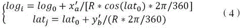
FIG. 4 is a graph of offset displacement compensation for an aerial application provided by the present invention;
FIG. 5 is a graph of aerial delivery mass distribution provided by the present invention;
FIG. 6 is a schematic structural view of an aerial pesticide application device provided by the invention;
fig. 7 is a schematic structural diagram of an electronic device provided by the present invention.
Detailed Description
In order to make the objects, technical solutions and advantages of the present invention clearer, the technical solutions of the present invention will be clearly and completely described below with reference to the accompanying drawings, and it is obvious that the described embodiments are some, but not all embodiments of the present invention. All other embodiments, which can be derived by a person skilled in the art from the embodiments given herein without making any creative effort, shall fall within the protection scope of the present invention.
It should be noted that in the description of the embodiments of the present invention, the terms "comprises," "comprising," or any other variation thereof, are intended to cover a non-exclusive inclusion, such that a process, method, article, or apparatus that comprises a list of elements does not include only those elements but may include other elements not expressly listed or inherent to such process, method, article, or apparatus. Without further limitation, an element defined by the phrase "comprising a … …" does not exclude the presence of another identical element in a process, method, article, or apparatus that comprises the element. The terms "upper", "lower", and the like, indicate orientations or positional relationships that are based on the orientations or positional relationships shown in the drawings, are merely for convenience in describing the present invention and to simplify the description, and do not indicate or imply that the referenced devices or elements must have a particular orientation, be constructed and operated in a particular orientation, and thus, are not to be construed as limiting the present invention. Unless expressly stated or limited otherwise, the terms "mounted," "connected," and "connected" are intended to be inclusive and mean, for example, that they may be fixedly connected, detachably connected, or integrally connected; can be mechanically or electrically connected; they may be connected directly or indirectly through intervening media, or they may be interconnected between two elements. The specific meanings of the above terms in the present invention can be understood by those skilled in the art according to specific situations.
The terms "first," "second," and the like in the description of the invention are used for distinguishing between similar elements and not necessarily for describing a particular sequential or chronological order. It will be appreciated that the data so used may be interchanged under appropriate circumstances such that embodiments of the invention may be practiced other than those illustrated or described herein, and that the objects identified as "first," "second," etc. are generally a class of objects and do not limit the number of objects, e.g., a first object may be one or more. Further, "and/or" indicates at least one of the connected objects, the character "/", generally indicating that the former and latter related objects are in an "or" relationship.
The aerial pesticide application method, the aerial pesticide application device, the electronic equipment and the storage medium provided by the embodiment of the invention are described in the following with reference to fig. 1 to 7.
Fig. 1 is a schematic flow chart of an aerial pesticide application method provided by the present invention, and as shown in fig. 1, a data processing module as an execution main body mainly executes, but is not limited to, the following steps:
step 101: and acquiring point cloud data.
And the point cloud data is fed back by a laser radar distributed in the working area. At least one laser radar is arranged in an operation area in advance before aerial pesticide application operation is carried out, and the laser radar is ensured to have certain sensitivity to sprayed fog drops.
Optionally, the invention provides for the lidar to be height adjustable. For example, for plant height differences of target objects to be applied with pesticide (such as crops like wheat, corn, peanuts and the like), the detection height of the laser radar can be at least adjusted to the height of the canopy, so that the laser radar is prevented from being shielded by the plants and the acquisition precision of point cloud data is prevented from being influenced.
Optionally, the laser radar is in communication connection with a controller for aerial pesticide application, and the acquired point cloud data is sent and stored in the controller in time.
The laser radar emits a pulse laser beam by using a laser, and the deflection of the pulse laser beam emitted by the laser radar is realized by a rotating mirror. Finally, a pulsed laser beam emitted by the laser impinges on the droplet and forms a shot at the surface of the droplet, which shot is received by a receiver of the lidar. Therefore, the laser radar can calculate the distance and the direction between each droplet and each droplet according to the laser ranging principle, and further point cloud data of all droplets in the aerial pesticide application process can be constructed.
Step 102: resolving the point cloud data into a solid coordinate system of the work area.
Because the coordinate system to which the point cloud data belongs, the field coordinate system (rectangular coordinate system) to which the operation area belongs, and the coordinate system to which the plant protection unmanned aerial vehicle for aerial pesticide application belongs are not uniform, when the operation parameters of the plant protection unmanned aerial vehicle are adjusted according to the fog drop distribution condition in the aerial pesticide application process, the three types of coordinate systems are required to be solved into the same rectangular coordinate system.
As an alternative embodiment, in constructing the solid coordinate system of the position of the working area, the present invention may construct a rectangular coordinate system by regarding the entire working area as a rectangular area, using any vertex of the rectangular area as the origin of the solid coordinate system, using a certain side (for example, width) as the X-axis, and using another adjacent side perpendicular to the X-axis as the Y-axis.
And then, the cloud data of the fog drop distribution acquired by the laser radar is calculated to a field coordinate system, so that the distribution condition of the fog drops in the working area can be conveniently and accurately analyzed.
Step 103: and determining the coordinates of the center points of the point clouds and calculating the variation coefficient of the fog drop density according to the distribution of the calculated point cloud data in the field coordinate system.
And the point cloud center point coordinate is the coordinate of the center point of the calculated point cloud data on the solid coordinate system.
In the invention, the data processing module processes the data for T seconds every time, namely the laser radar stores the data for T seconds into the data buffer area of the data processing module, and then the data processing module extracts the stored data and clears the buffer area.
The above-mentioned droplet density variation coefficient (hereinafter, may be abbreviated as CV) is an index for evaluating the uniformity of droplet deposition distribution, and the larger the CV value is, the worse the droplet deposition distribution uniformity is, and the smaller the CV value is, the better the droplet deposition distribution uniformity is.
On one hand, the data processing module can determine a central point from all points according to the specific coordinates of all points in the point cloud data distributed in a field coordinate system, and then acquire the coordinates of the central point, namely the coordinates of the point cloud central point; on the other hand, the mist drop deposition distribution uniformity can be evaluated according to the distribution of the point cloud data in the field coordinate system and quantified as CV.
Step 104: and determining the offset of the droplet deposition area according to the point cloud central point coordinates and the reference central point coordinates.
In the pesticide application process of the plant protection unmanned aerial vehicle, if crosswind occurs, the fogdrop deposition area can deviate, so that the actually sprayed pesticide cannot be sprayed to the target pesticide application area. To avoid this, it is necessary to determine the deviation of the droplet deposition area and then to guide the plant-protection drone to make course adjustments. At the operation in-process that gives medicine to poor free of charge of plant protection unmanned aerial vehicle, the real-time positional information of plant protection unmanned aerial vehicle can give data processing module through 4G module real-time transmission.
In addition, the coordinates of the center point of the point cloud data can be calculated according to the coordinates of each point in the point cloud data of the pesticide application deposition droplet group scanned by the laser radar in real time in a field coordinate system. The invention uses the center point coordinate to represent the position of the actual fogdrop deposition area, and uses the reference center point coordinate to represent the position of the target fogdrop deposition area.
Optionally, the target droplet deposition area is determined according to real-time position information of the plant protection unmanned aerial vehicle, or according to the position of the actual droplet deposition area determined in the previous sampling period.
Step 105: and adjusting the operation parameters of the plant protection unmanned aerial vehicle based on the droplet density variation coefficient and the droplet deposition area offset.
The fog drop density variation coefficient is obtained in step 103, the distribution uniformity of the fog drops in the operation area can be obtained, and the spraying pressure of each spray head in the spraying amplitude can be adjusted by guiding the plant protection unmanned aerial vehicle to set in the next spraying process.
Further, after the offset of the droplet deposition area is obtained in step 104, the course adjustment of the plant protection unmanned aerial vehicle in the next spraying process can be guided.
According to the aerial pesticide application method, aiming at aerial pesticide application operation in a large spraying range and large operation area, the liquid medicine deposition quality in the operation area can be monitored in real time, and the point cloud data of a droplet group scanned by a laser radar in real time is matched with the real-time position of a plant protection unmanned aerial vehicle, so that the quality protection unmanned aerial vehicle is guided to carry out safe pesticide application operation, the pesticide application quality is improved, and pesticide drift disaster events are avoided.
Based on the content of the foregoing embodiment, as an optional embodiment, the solid coordinate system is a rectangular coordinate system that is established with any vertex of a working area as an origin of the coordinate system, with a boundary where the any vertex of the working area is located as an X axis, and with a flight direction of the plant protection unmanned aerial vehicle as Y axes, respectively;
the calculation formula for resolving the point cloud data into the solid coordinate system of the working area is as follows:

wherein the point cloud data isiThe coordinates of a point in the solid coordinate system are ;
; Is an absolute value of an X-axis coordinate value of the laser radar in the solid coordinate system;
 is an absolute value of a Y-axis coordinate value of the laser radar in the solid coordinate system;
 is the firstiA distance between a point and the laser radar;
 is the firstiA declination angle between a point and the lidar.
First, the present invention provides a method of constructing a solid-state coordinate system of a work area, comprising: on the basis that the operation area is regarded as a rectangular area, a certain vertex of the operation area is used as a coordinate origin (the coordinate origin is the default starting point of spraying operation of the plant protection unmanned aerial vehicle), and a rectangular coordinate system established by respectively using two adjacent sides of the rectangular area as an X axis and a Y axis is used as a solid coordinate system of the operation area.
Further, the following division principle may be adopted to divide the whole working area into a plurality of grids:

wherein, the first and the second end of the pipe are connected with each other, spraying the plant protection unmanned aerial vehicle;
 in order to maintain the flight speed of the unmanned aerial vehicle,
 obtaining a time interval of point cloud data for the laser radar;
 is the first on the X axisiThe lines of the bars are divided into lines,
 is the first on the Y axisjAnd (6) dividing lines by bars.
Assume that the length of the working area is Width is
 In practice, since the length and width of the working area cannot be exactly divided into several equal parts, the side length of the small mesh located at the outermost side in the X-axis and Y-axis directions is:

wherein, on the X-axis, are sharedmA dividing line of a strip, common on the Y axisnDividing lines by strips; four vertex seats of the outermost small meshAre marked respectively as 、
、 、
、 And
And 。
。
after the grid division of the operation area in the field coordinate system is realized, in order to compare with the position information (longitude and latitude information) of the plant protection unmanned aerial vehicle, the vertex coordinates of each grid can be converted into the longitude and latitude information to be stored; the position information (latitude and longitude information) of the plant protection unmanned aerial vehicle can also be converted into a rectangular coordinate system in which a real coordinate system is located so as to be compared with the vertex coordinates of each grid.
In the aerial pesticide application method provided by the invention, the correction of the operation parameters of the plant protection unmanned aerial vehicle in the aerial spraying process is realized by converting the position information (longitude and latitude information) of the plant protection unmanned aerial vehicle into the rectangular coordinate system of the field coordinate system, and the method is not considered as the only limitation to the protection scope of the invention.
Since the Y-axis direction of the real coordinate system associated with the created work area may not coincide with the true north direction, in order to facilitate conversion between the vertex coordinates and the latitude and longitude information of each mesh, the real coordinate system may be converted (mainly, rotated as a whole) such that the Y-axis of the converted coordinate system (hereinafter, referred to as a due-north coordinate system) is in the same direction as the true north direction.
As an alternative embodiment, the vertex coordinates of any mesh in the solid coordinate system Corresponding points in the due north coordinate system acquired after the integral rotation
 Is expressed as:

wherein the Y axis of the real coordinate system forms an included angle with the true north direction 。
。
After the conversion of the field coordinate system is completed, the vertex coordinates of each grid can be marked in the obtained true-north coordinate system, then the longitude and latitude information of the coordinate origin is determined according to the actual situation, and the longitude and latitude information of the coordinate origin is set as Then any mesh vertex
 The corresponding latitude and longitude information can be calculated by adopting the following formula:
wherein the content of the first and second substances, is the vertex coordinates of the mesh
 Corresponding points in the due north coordinate system;
 as vertex coordinates
 Corresponding latitude and longitude information;
 longitude and latitude information of the coordinate system origin of the due north coordinate system;
 the average value of the distance from the center of the earth to each point on the surface of the earth.
Further, after the longitude and latitude information of the plant protection unmanned aerial vehicle at the current moment is acquired, the coordinates of the plant protection unmanned aerial vehicle in the field coordinate system at the current moment can be reversely derived according to the formula (3) and the formula (4), and the grid to which the plant protection unmanned aerial vehicle belongs is specifically positioned according to the derived coordinates.
Based on the content of the foregoing embodiment, as an optional embodiment, after constructing a solid coordinate system and implementing a northerly conversion, the point cloud data may be resolved into the solid coordinate system of the working area, and its calculation formula may be:

wherein the point cloud data isiThe coordinates of a point in the solid coordinate system are recorded as ;
; Is an absolute value of an X-axis coordinate value of the laser radar in the solid coordinate system;
 is an absolute value of a Y-axis coordinate value of the laser radar in the solid coordinate system;
 is the firstiA distance between a point and the laser radar;
 is the firstiA declination angle between a point and the lidar.
It should be noted that the point cloud data acquired by the laser radar includes each point (or all points are used together)kPoint) and lidar And the deflection angle between each point and the lidar
 And the like. Wherein the number of points of the point cloud datakValue of (d) and angular resolution ang _ res of the lidar and scanning field angle of the lidar
 The method specifically comprises the following steps:
 。
。
based on the content of the foregoing embodiment, as an optional embodiment, after the point cloud data is solved to the ground coordinate system, the data processing module may calculate a variation Coefficient (CV) of the fog drop density according to a distribution of the solved point cloud data in the ground coordinate system, including but not limited to the following steps:
uniformly dividing the working area into a plurality of grids in the field coordinate system;
uniformly dividing each grid into a plurality of sub-grids;
determining the number of points distributed in each sub-grid according to the coordinates of each point in the point cloud data;
calculating the point cloud density in each sub-grid according to the number of points distributed in each sub-grid;
determining the fog drop density in each sub-grid according to the point cloud density in each sub-grid based on a pre-constructed point cloud density and fog drop density conversion model;
and determining a fog drop density variation coefficient related to the point cloud data based on the fog drop density in each sub-grid.
Specifically, the calculation of the droplet density variation coefficient is mainly to calculate the deposition amount and the deposition distribution uniformity of the droplets.
Suppose thattAt the first momentpDot And if the statistical rule of a certain grid is satisfied, adding 1 to the number of points of the point cloud data distributed in the grid:

wherein, the coordinates of four vertexes of a certain grid are respectively 、
、 、
、 And
And 。
。
as an alternative, based on the pre-constructed deposition amount and radar point number model, the deposition amount of the fogdrop sprayed in each grid can be determined according to the number of points distributed in the grid, and the calculation formula can be:

wherein the content of the first and second substances, the number of points in the certain grid;
 the deposition amount of the fog drops in the grid;
 and
and model parameters of the deposition amount and radar point number model are mainly related to the distance between the droplet group and the laser radar, the angular resolution of the laser radar and the like, and are fitted based on experimental conditions.
Further, in order to calculate the mist drop distribution uniformity in each grid, each grid may be continuously divided intoN*NSub-grids, and counting the number of points of the radar point cloud distributed in each sub-grid And further, calculating the point cloud density in each sub-grid according to the ratio of the number of the points in each sub-grid to the area of the points.
As an alternative embodiment, the above calculation formula for calculating the point cloud density in each sub-grid according to the number of the points distributed in each sub-grid is as follows:

wherein the content of the first and second substances, is as followsqPoint cloud density within the sub-grid;
 is as followsqPoint coordinates of which the X-axis coordinate value and the Y-axis coordinate value are the minimum value in the boundary coordinates of the sub-grids;
 is as followsqThe point coordinate of which the X-axis coordinate value and the Y-axis coordinate value are the maximum value in the boundary coordinates of the sub-grids;
 is distributed at the firstqThe number of points within a sub-grid.
Furthermore, according to the calculated fog drop density in each sub-grid, the fog drop density in each sub-grid can be determined by utilizing a pre-constructed point cloud density and fog drop density conversion model.
As an optional embodiment, the expression of the point cloud density-droplet density conversion model is as follows:

wherein, the first and the second end of the pipe are connected with each other, is as followsqThe density of the droplets within the subgrid,
 and
and  model parameters of a conversion model of the cloud density and the fog drop density are mainly related to the distance between a fog drop group and a laser radar, the angular resolution of the laser radar and the like, and are fitted based on experimental conditions.
Further, after the density of the droplets in each sub-grid is obtained, the density of the droplets in each sub-grid can be determined according to the following formulaN*NDroplet density coefficient of variation for subgrid:

wherein the content of the first and second substances, is the droplet density variation coefficient;
 an arithmetic average of the droplet densities within all the subgrids;
 is composed ofiDroplet density within the subgrid.
Based on the content of the foregoing embodiment, as an optional embodiment, when the current sampling period is the first sampling period after transition, the determining, according to the point cloud center point coordinate and the reference center point coordinate, the offset of the droplet deposition area, which is proposed in step 104, mainly includes:
acquiring first longitude and latitude information and first point cloud data of the plant protection unmanned aerial vehicle acquired in a first sampling period;
resolving the first longitude and latitude information into the field coordinate system, and acquiring the coordinates of the plant protection unmanned aerial vehicle in the field coordinate system ;
;
Resolving the first point cloud data into the field coordinate system to determine the first point cloud center point coordinate according to the distribution of the first point cloud data in the field coordinate system ;
;
Obtaining the offset of the fogdrop deposition area, wherein the offset of the fogdrop deposition area is the coordinate of the plant protection unmanned aerial vehicle in the field coordinate system Coordinates of the center point of the first point cloud
 Direction vector between
 。
。
In the pesticide application process of the plant protection unmanned aerial vehicle, if crosswind occurs, the fogdrop deposition area can deviate, so that the actually sprayed pesticide cannot be sprayed to the target pesticide application area. To avoid this, it is necessary to determine the deviation of the droplet deposition area and then to guide the plant-protection drone to make course adjustments.
In the process of pesticide application operation of the plant protection unmanned aerial vehicle, real-time position information of the plant protection unmanned aerial vehicle can be transmitted to the data processing module through the 4G module in real time, the data processing module can calculate the real-time position information (longitude and latitude information) of the plant protection unmanned aerial vehicle into a field coordinate system related to an operation area according to the above formula (3) and formula (4) in a reverse conversion mode, and therefore the coordinate of the position of the plant protection unmanned aerial vehicle in the field coordinate system is determined 。
。
Further, according to the center points of all the points in the point cloud data determined in step 103, the coordinates of the center point, i.e., the coordinates of the point cloud center point, are determined To coordinate the center point of the point cloud
 As the actual location of the droplet deposition zone.
On one hand, when the plant protection unmanned aerial vehicle starts to operate (or the first sampling period after transition), the data processing module firstly resolves the first longitude and latitude information into the field coordinate system according to the collected longitude and latitude information (here, the first longitude and latitude information) and point cloud data (here, the first point cloud data) of the plant protection unmanned aerial vehicle through coordinate conversion, and determines the position coordinate of the plant protection unmanned aerial vehicle in the field coordinate system (ii) a And resolving the first point cloud data into the ground coordinate system, and determining the central point coordinate of each point in the first point cloud data according to the winning position of each point in the ground coordinate system
 (referred to herein as the first point cloud center point coordinates).
Further, the data processing module will route the points And a central point
 Line segment of the composition
 Direction vector of (2)
 Denotes the amount of deviation of the droplet deposition area, wherein
 。
。
When there is no side wind, the wind is, and
and will be zero or close to zero (less than a preset threshold) when the deposited droplets are not deflected and the flight path does not need to be adjusted.
When the crosswind is perpendicular to the flight direction of the plant protection unmanned aerial vehicle, (ii) a When a certain included angle is formed between the crosswind and the flight direction of the plant protection unmanned aerial vehicle,
 (ii) a In both cases, the deposited droplets are deflected. The offset in the direction perpendicular to the flight direction (X-axis direction) of the plant protection unmanned aerial vehicle is
 The offset in the flight direction (Y-axis direction) of the plant protection unmanned aerial vehicle is
 。
。
It should be noted that, in adjusting the navigation direction in the operation parameters of the plant protection unmanned aerial vehicle based on the offset of the droplet deposition area, the Y-axis direction is the same as the flight direction of the plant protection unmanned aerial vehicle, and the offset is Is not required to be adjusted, and only needs to correspondingly adjust the offset in the X-axis direction
 And (4) finishing.
Based on the content of the foregoing embodiment, as an optional embodiment, when the current sampling period is the first sampling period after the non-transition, the determining, according to the point cloud center point coordinate and the reference center point coordinate, the offset of the droplet deposition area includes:
acquiring point cloud center point coordinates related to point cloud data acquired in the current sampling period ;
;
Obtaining the offset of the fogdrop deposition area, wherein the offset of the fogdrop deposition area is the coordinate of the center point of the first point cloud With the point cloud center point coordinates
 Direction vector therebetween
 ;
;
The coordinate of the reference central point is the coordinate of the first point cloud central point 。
。
The first sampling period after the non-transition comprises one of all other sampling periods except the first period when the operation is started and the first sampling period after the transition.
Specifically, after the data processing module and the first sampling period after transition complete the comparison between the position of the plant protection unmanned aerial vehicle in the on-site coordinate system and the position of the point cloud center point, no matter whether the air route of the plant protection unmanned aerial vehicle is adjusted, the offset of the droplet deposition area is no longer in the direction vector And representing by using a direction vector of a straight line where a point cloud center point of the deposited fog drops and a reference center point are located, wherein the straight line is determined by using the current sampling period.
Assuming the coordinates of the point cloud center point determined from the point cloud data as The coordinates of the center point of the first point cloud determined in the last sampling period
 As the reference center point coordinates of the current sampling period. Thus, the coordinates of the center point of the first point cloud can be obtained
 With the point cloud central point coordinates
 In betweenDirection vector
 And the offset is used as the offset of the droplet deposition area in the current sampling period. Wherein the direction vector
 Can be expressed as
 。
。
Based on the content of the foregoing embodiment, as an alternative embodiment, the current sampling period is the secondnIn each sampling period, after the offset of the droplet deposition area is obtained, the method further comprises the following steps:
determining the distance absolute value of the deviation amount of the fog drop deposition area on the X axis ;
;
If the absolute value of the distance is smaller than a preset threshold value, updating the coordinate of the reference central point to be the coordinate of the point cloud central point ;
;
If the absolute value of the distance is not less than the preset threshold value, continuing to use the first stepn-1 sample period reference centre point coordinate as the secondnThe reference center point coordinate of +1 sample period.
Further, when Absolute value of (2)
 When the spray droplet deposition area is smaller than the preset threshold value, the spray droplet deposition area and the pesticide application target area are overlapped, and the flight route does not need to be adjusted. The point cloud center point coordinates determined by the current sampling period can be used in the next sampling period of the current sampling period
 As new reference center point coordinates. According to this rule, the reference center point coordinates of the next sampling period are determined at the end of each sampling period.
The preset threshold value can be a positive number which is 0 or close to 0, and the smaller the value of the preset threshold value is, the higher the accuracy of the course adjustment is; the larger the value of the preset threshold is, the less the calculation power requirement of frequent adjustment of the light air route on the data processing module and the plant protection unmanned aerial vehicle to a certain extent.
In this specification, if Greater than or equal to a predetermined threshold, as required
 The displacement of the plant protection unmanned aerial vehicle in the X direction is adjusted, and the point cloud central point coordinate determined by the current sampling period cannot be used at the moment
 The new reference center point coordinate in the next sampling period is used, and the reference center point coordinate in the previous sampling period of the current sampling period is required to be used as the new reference center point coordinate in the next sampling period.
Further, when the point cloud center point coordinates of the next sampling period are obtained When the offset is expressed as
 When it comes to
 When the value is less than the preset threshold value, the fog drop deposition area is coincided with the pesticide application target area, the offset compensation is successful, and then the subsequent sampling period can be implemented
 Set as the reference center point.
Wherein when When the offset is greater than or equal to the preset threshold, failure of offset compensation is described, which is required to be determined according to
 Readjust plant protection unmanned aerial vehicle's position, can not refresh benchmark central point in follow-up sampling period this moment, will still be
 And (4) as a reference center point, circulating until the offset compensation is successful, and refreshing the reference center point until the whole spraying task is completed.
Fig. 2 is a schematic diagram of an overall structure of an aerial pesticide application system provided by the present invention, and as shown in fig. 2, the present invention further provides an aerial pesticide application system, which mainly includes a plant protection unmanned aerial vehicle for performing spraying operation, a laser radar disposed at one side of an operation area, an operation computer, and a power supply module for supplying power to the laser radar and the operation computer.
The power module can be by solar panel, two 12V's batteries, controller etc. constitute, and in the operation process, solar panel can generate electricity while giving the system power supply, has promoted the persistence and the stability of system work greatly.
Wherein, the operation computer can be used to receive the operation of flying hand in order to carry out the manual planning of plant protection unmanned aerial vehicle's the airline, plant protection unmanned aerial vehicle's operation parameter's manual adjustment etc..
Optionally, the job computer comprises a data acquisition module, a data processing module and a data storage module.
Plant protection unmanned aerial vehicle facial make-up is equipped with GPS module and communication module (can adopt 4G communication) for fix a position plant protection unmanned aerial vehicle position, and send plant protection unmanned aerial vehicle's positional information for the data acquisition module of operation computer in real time.
And the data acquisition module of the operation computer temporarily stores the acquired data in the data storage module for the data processing module to call.
The data processing module is the core of the whole aviation pesticide application system and is used for processing the laser radar scanning data and the plant protection unmanned aerial vehicle position information acquired by the data acquisition module. And calculating the point cloud data into position coordinates in a field coordinate system, counting the number of points in each divided grid in the operation area and the point cloud density, predicting the actual fog drop deposition density and unit deposition according to a deposition amount and radar point cloud number and fog drop density and radar point cloud density model which are pre-established in a laboratory, and determining the fog drop density variation coefficient.
In addition, real-time position information of the plant protection unmanned aerial vehicle can be matched with an on-site coordinate system in real time, the positions of the plant protection unmanned aerial vehicle and the droplet deposition area are compared in real time, and the offset of the droplet deposition area is determined.
Finally, the data processing module can automatically adjust the operation parameters of the plant protection unmanned aerial vehicle according to the variation coefficient of the fog drop density and the offset of the fog drop deposition area so as to overcome the influence of crosswind on aerial pesticide application.
The transition method provided by the aerial pesticide application method provided by the invention is introduced by combining the flight path planning diagram of the plant protection unmanned aerial vehicle shown in the figure:
when the y coordinate on the field coordinate system after settlement by the position information of the plant protection unmanned aerial vehicle reaches the maximum length L of the operation area, the plant protection unmanned aerial vehicle needs to move two spraying frames towards the positive direction of the X axis, and in the process of the turning field, the offset of the droplet deposition area of the current sampling period and the last sampling period should also be two spraying frames, namely, the two spraying frames Should be in contact with
 In contrast, when
 If the flight path is correct, the adjustment is not needed; if and with
 The difference between them is large, it is necessary to do
 The flight path is adjusted according to the value of the target area, and the coincidence of the pesticide application target areas in the fog drop deposition areas is ensured.
In order to show the aviation pesticide application method provided by the invention more clearly, the method is further simplified and described as follows by combining a specific real-time example:
fig. 3 is a schematic single flow chart of an aerial pesticide application method provided by the invention, and as shown in fig. 3, when the plant protection unmanned aerial vehicle is controlled to start aerial pesticide application, one vertex of the working area is predetermined as an origin of a solid coordinate system.
Then, the flyer needs to input preset operation parameters in a Graphical User Interface (GUI for short) of a display screen of the operation computer, including:
the distances from the laser radar to the X axis and the Y axis in the field coordinate system are respectively set asd 0 Andk 0 the Y axis forms an angle with the true north direction Plant protection unmanned aerial vehicle's spray amplitudehPlant protection unmanned aerial vehicle's flying speedvWidth of working areadLength, length ofLNumber of grids divided in CV calculationNPreset CV thresholdKLaser radar scan intervalTAnd the latitude and longitude of the origin of the coordinate system.
Then, a program for running aerial pesticide application in the operation computer is started, and the laser radar starts scanning. The data scanned by the lidar is stored in a data storage area. When the scanning interval is reachedTAnd after the second, the data processing module extracts and clears the data in the data storage area. Then sitting the extracted dataAnd (4) performing standard transformation, converting the standard transformation into a solid coordinate system, then calculating the position of the pesticide application deposition droplet group, the corresponding deposition amount, the CV value and the like, and displaying the parameters on a display screen.
Simultaneously, data processing module can calculate the point cloud central point coordinate of deposit droplet crowd to compare with plant protection unmanned aerial vehicle's positional information, calculate the offset of deposit droplet crowd and show on the display screen. For the flying hand to adjust plant protection unmanned aerial vehicle flight gesture and air route.
In addition, at plant protection unmanned aerial vehicle operation in-process, data processing module can generate a plant protection unmanned aerial vehicle real-time trajectory chart and the real-time trajectory chart of deposit droplet crowd for the position change that shows both in real time lets the more audio-visual understanding plant protection unmanned aerial vehicle operation condition of flying hand.
Fig. 4 is an offset displacement compensation diagram for aerial pesticide application provided by the invention, and shows two possible position change situations in the pesticide application process of the plant protection unmanned aerial vehicle. As shown in fig. 4, the open circles represent the real-time position of the plant protection drone, and the filled circles represent the position of the center point of the deposited cloud droplet population. According to the content shown in the left half of fig. 4, it can be seen that the position of the plant protection unmanned aerial vehicle in the first case (when the plant protection unmanned aerial vehicle starts working) is close to the position of the center point of the deposited droplet cluster, and no displacement deviation occurs, and when the plant protection unmanned aerial vehicle flies to the point E, the position of the center of the deposited droplet cluster changes from the position at the previous moment. And adjusting the air route of the plant protection unmanned aerial vehicle at the moment to ensure that the fog drop deposition area is recovered to be normal at the F position. Similarly, the displacement shift also occurs at H, and the normal state is recovered at point I.
According to the content shown in the right half of fig. 4, it can be known that in the second case (when the plant protection unmanned aerial vehicle starts to do work), the real-time position of the plant protection unmanned aerial vehicle at the point a is greatly different from the position of the central point of the deposited droplet group, and the route of the plant protection unmanned aerial vehicle is adjusted at this time. The droplet deposition area returns to normal at point B. And D, the central position of the deposited fog drop group is greatly deviated from the position at the previous moment, the route is adjusted, and the normal state is recovered at E.
Based on the content of the above embodiment, as an optional embodiment, after determining the point cloud center point coordinate, calculating the variation coefficient of the droplet density, and determining the offset of the droplet deposition area according to the point cloud center point coordinate and the reference center point coordinate, the method further includes:
displaying the coordinates of the point cloud central point determined in each sampling period to generate a deposited droplet group real-time trajectory diagram;
displaying the coordinates of the plant protection unmanned aerial vehicle in the field coordinate system determined in each sampling period to generate a real-time trajectory diagram of the plant protection unmanned aerial vehicle;
and the real-time trajectory graph of the deposited droplet group and the real-time trajectory graph of the plant protection unmanned aerial vehicle are displayed on the same interface.
Fig. 5 is an aerial pesticide application quality distribution diagram provided by the invention, when the pesticide application operation is finished, an aerial pesticide application quality distribution diagram can be generated according to the deposition amount and the deposition distribution uniformity calculated in each grid in the whole operation area, and the aerial pesticide application fogdrop deposition quality can be judged by combining with a deposited fogdrop group real-time trajectory diagram.
As shown in fig. 5, an aerial pesticide application quality distribution graph is provided, wherein the numbers in fig. 5 represent the deposition amount of the fog drops in the grid area, and the gray grid represents that the CV value in the grid is greater than the preset value and the uniformity of the deposition distribution of the fog drops is poor.
Fig. 6 is a schematic structural diagram of an aerial drug delivery device provided by the invention, as shown in fig. 6, mainly comprising a data acquisition unit 61, a coordinate conversion unit 62, a first arithmetic unit 63, a second arithmetic unit 64 and a drug delivery control unit 65, wherein:
the data acquisition unit 61 is mainly used for acquiring point cloud data, and the point cloud data is fed back by a laser radar distributed in a working area;
a coordinate conversion unit 62, which is mainly used for resolving the point cloud data into a solid coordinate system of the working area;
the first operation unit 63 is mainly used for determining the coordinates of the center points of the point clouds and calculating the variation coefficient of the fog drop density according to the distribution of the calculated point cloud data in the field coordinate system; the point cloud center point coordinate is the coordinate of the center point of the point cloud data after calculation on the solid coordinate system;
the second operation unit 64 is mainly used for determining the offset of the droplet deposition area according to the point cloud central point coordinates and the reference central point coordinates;
and the pesticide application control unit 65 is mainly used for adjusting the operation parameters of the plant protection unmanned aerial vehicle based on the fog drop density variation coefficient and the offset of the fog drop deposition area.
The aerial pesticide application device provided by the invention can monitor the liquid medicine deposition quality in the operation area in real time aiming at aerial pesticide application operation in a large spraying range and large operation area, and the point cloud data of the droplet group scanned in real time by the laser radar is matched with the real-time position of the plant protection unmanned aerial vehicle, so that the quality protection unmanned aerial vehicle is guided to carry out safe pesticide application operation, the pesticide application quality is improved, and pesticide drift disaster events are avoided.
It should be noted that, in specific operation, the aerial pesticide application device provided in the embodiment of the present invention may execute the aerial pesticide application method described in any of the above embodiments, and details of this embodiment are not described herein.
Fig. 7 is a schematic structural diagram of an electronic device provided in the present invention, and as shown in fig. 7, the electronic device may include: a processor (processor) 710, a communication Interface (Communications Interface) 720, a memory (memory) 730, and a communication bus 740, wherein the processor 710, the communication Interface 720, and the memory 730 communicate with each other via the communication bus 740. Processor 710 may invoke logic instructions in memory 730 to perform an aerial delivery method comprising: acquiring point cloud data, wherein the point cloud data is fed back by a laser radar distributed in a working area; resolving the point cloud data into a solid coordinate system of the working area; determining the coordinates of the center points of the point clouds and calculating the variation coefficient of the fog drop density according to the distribution of the calculated point cloud data in the field coordinate system; the point cloud center point coordinate is the coordinate of the center point of the point cloud data after calculation on the solid coordinate system; determining the offset of the droplet deposition area according to the point cloud center point coordinates and the reference center point coordinates; and adjusting the operation parameters of the plant protection unmanned aerial vehicle based on the droplet density variation coefficient and the droplet deposition area offset.
In addition, the logic instructions in the memory 730 can be implemented in the form of software functional units and stored in a computer readable storage medium when the software functional units are sold or used as independent products. Based on such understanding, the technical solution of the present invention may be embodied in the form of a software product, which is stored in a storage medium and includes instructions for causing a computer device (which may be a personal computer, a server, or a network device) to execute all or part of the steps of the method according to the embodiments of the present invention. And the aforementioned storage medium includes: a U-disk, a removable hard disk, a Read-Only Memory (ROM), a Random Access Memory (RAM), a magnetic disk or an optical disk, and other various media capable of storing program codes.
In another aspect, the present invention also provides a computer program product comprising a computer program stored on a non-transitory computer readable storage medium, the computer program comprising program instructions which, when executed by a computer, enable the computer to perform the aerial delivery method provided by the above methods, the method comprising: acquiring point cloud data, wherein the point cloud data is fed back by a laser radar distributed in a working area; resolving the point cloud data into a solid coordinate system of the working area; determining the coordinates of the center points of the point clouds and calculating the variation coefficient of the fog drop density according to the distribution of the calculated point cloud data in the field coordinate system; the point cloud center point coordinate is the coordinate of the center point of the point cloud data after calculation on the solid coordinate system; determining the offset of the droplet deposition area according to the point cloud central point coordinate and the reference central point coordinate; and adjusting the operation parameters of the plant protection unmanned aerial vehicle based on the droplet density variation coefficient and the droplet deposition area offset.
In yet another aspect, the present invention also provides a non-transitory computer readable storage medium having stored thereon a computer program that, when executed by a processor, is implemented to perform the aerial delivery method provided by the above embodiments, the method comprising: acquiring point cloud data, wherein the point cloud data is fed back by a laser radar distributed in a working area; resolving the point cloud data into a solid coordinate system of the working area; determining the coordinates of the center points of the point clouds and calculating the variation coefficient of the fog drop density according to the distribution of the calculated point cloud data in the field coordinate system; the point cloud center point coordinate is the coordinate of the center point of the point cloud data after calculation on the solid coordinate system; determining the offset of the droplet deposition area according to the point cloud central point coordinate and the reference central point coordinate; and adjusting the operation parameters of the plant protection unmanned aerial vehicle based on the droplet density variation coefficient and the droplet deposition area offset.
The above-described embodiments of the apparatus are merely illustrative, and the units described as separate parts may or may not be physically separate, and parts displayed as units may or may not be physical units, may be located in one place, or may be distributed on a plurality of network units. Some or all of the modules may be selected according to actual needs to achieve the purpose of the solution of the present embodiment. One of ordinary skill in the art can understand and implement it without inventive effort.
Through the above description of the embodiments, those skilled in the art will clearly understand that each embodiment can be implemented by software plus a necessary general hardware platform, and certainly can also be implemented by hardware. Based on the understanding, the above technical solutions substantially or otherwise contributing to the prior art may be embodied in the form of a software product, which may be stored in a computer-readable storage medium, such as ROM/RAM, magnetic disk, optical disk, etc., and includes several instructions for causing a computer device (which may be a personal computer, a server, or a network device, etc.) to execute the method according to the various embodiments or some parts of the embodiments.
Finally, it should be noted that: the above examples are only intended to illustrate the technical solution of the present invention, but not to limit it; although the present invention has been described in detail with reference to the foregoing embodiments, it will be understood by those of ordinary skill in the art that: the technical solutions described in the foregoing embodiments may still be modified, or some technical features may be equivalently replaced; and such modifications or substitutions do not depart from the spirit and scope of the corresponding technical solutions of the embodiments of the present invention.
Claims (13)
1. An aerial application method, comprising:
acquiring point cloud data, wherein the point cloud data is fed back by a laser radar distributed in a working area;
resolving the point cloud data into a solid coordinate system of the working area;
determining the coordinates of the center points of the point clouds and calculating the variation coefficient of the fog drop density according to the distribution of the calculated point cloud data in the field coordinate system; the point cloud central point coordinate is the coordinate of the central point of the point cloud data after calculation on the ground coordinate system;
determining the offset of the droplet deposition area according to the point cloud center point coordinates and the reference center point coordinates;
adjusting the operation parameters of the plant protection unmanned aerial vehicle based on the droplet density variation coefficient and the droplet deposition area offset;
when the current sampling period is the first sampling period after transition, according to the point cloud central point coordinate and the reference central point coordinate, determining the offset of the droplet deposition area, including:
acquiring first longitude and latitude information and first point cloud data of the plant protection unmanned aerial vehicle acquired in a first sampling period;
resolving the first longitude and latitude information into the ground coordinate system, and acquiring the coordinate of the plant protection unmanned aerial vehicle in the ground coordinate system ;
;
Resolving the first point cloud data into the solid coordinate system to obtain a first point cloud dataThe distribution of point cloud data in the field coordinate system determines the coordinates of the center point of the first point cloud ;
;
Obtaining the offset of the fogdrop deposition area, wherein the offset of the fogdrop deposition area is the coordinate of the plant protection unmanned aerial vehicle in the field coordinate system Coordinates of the center point of the first point cloud
 Direction vector between
 ;
;
When the current sampling period is the first sampling period after non-transition, determining the offset of the droplet deposition area according to the point cloud central point coordinate and the reference central point coordinate, wherein the step comprises the following steps:
acquiring point cloud center point coordinates related to point cloud data acquired in the current sampling period ;
;
Obtaining the offset of the fogdrop deposition area, wherein the offset of the fogdrop deposition area is the coordinate of the center point of the first point cloud With the point cloud center point coordinates
 Direction vector between
 ;
;
The reference centerThe point coordinate is the coordinate of the center point of the first point cloud ;
;
The first sampling period after the non-transition comprises one of all other sampling periods except the first period when the plant protection unmanned aerial vehicle starts to operate and the first sampling period after the transition;
when the current sampling period is the nth sampling period, after the offset of the droplet deposition area is obtained, the method further comprises the following steps:
determining the distance absolute value of the deviation amount of the fog drop deposition area on the X axis ;
;
If the absolute value of the distance is smaller than a preset threshold value, updating the coordinate of the reference central point to be the coordinate of the point cloud central point ;
;
And if the absolute value of the distance is not less than the preset threshold, continuously taking the reference central point coordinate of the (n-1) th sampling period as the reference central point coordinate of the (n + 1) th sampling period.
2. The aerial pesticide application method according to claim 1, wherein the solid coordinate system is a rectangular coordinate system established by taking any vertex of a working area as a coordinate system origin, taking a boundary of the any vertex of the working area as an X axis, and taking the flight directions of the plant protection unmanned aerial vehicle as Y axes respectively;
the calculation formula for resolving the point cloud data into the solid coordinate system of the working area is as follows:

whereinIn the point cloud data The coordinates of a point in the solid coordinate system are
 ;
; Is an absolute value of an X-axis coordinate value of the laser radar in the solid coordinate system;
 is an absolute value of a Y-axis coordinate value of the laser radar in the solid coordinate system;
 is the first
 A distance between a point and the laser radar;
 is the first
 A declination angle between a point and the lidar.
3. The aerial pesticide application method of claim 1, further comprising, prior to resolving the point cloud data into a solid coordinate system of the work area:
integrally rotating the solid coordinate system to obtain a northerly coordinate system, wherein the Y axis of the northerly coordinate system is in the same direction as the northerly direction;
vertex coordinates of any mesh in the solid coordinate system Corresponding points in the due north coordinate system acquired after the integral rotation
 Expressed as:

wherein the Y axis of the real coordinate system forms an included angle with the true north direction 。
。
4. The aerial pesticide application method of claim 3, wherein calculating the fog drop density variation coefficient according to the distribution of the calculated point cloud data in the field coordinate system comprises:
uniformly dividing the working area into a plurality of grids in the field coordinate system;
uniformly dividing each grid into a plurality of sub-grids;
determining the number of points distributed in each sub-grid according to the coordinates of each point in the point cloud data;
calculating the point cloud density in each sub-grid according to the number of points distributed in each sub-grid;
determining the fog drop density in each sub-grid according to the point cloud density in each sub-grid based on a pre-constructed point cloud density and fog drop density conversion model;
and determining a fog drop density variation coefficient related to the point cloud data based on the fog drop density in each sub-grid.
5. The aerial pesticide application method of claim 4, wherein each of the grids is evenly divided into N x N sub-grids;
the calculation formula for calculating the point cloud density in each sub-grid according to the number of the points distributed in each sub-grid is as follows:

wherein the content of the first and second substances, is as follows
 Point cloud density within the sub-grid;
 is as follows
 Point coordinates of which the X-axis coordinate value and the Y-axis coordinate value are the minimum value in the boundary coordinates of the sub-grids;
 is as follows
 Point coordinates of which the X-axis coordinate value and the Y-axis coordinate value are the maximum values in the boundary coordinates of the sub-grids;
 is distributed at the first
 The number of points within a sub-grid.
6. The aerial pesticide application method of claim 5, wherein the expression of the point cloud density-droplet density conversion model is as follows:

wherein the content of the first and second substances, is a first
 The density of the droplets within the subgrid,
 and
and are predetermined model coefficients.
7. The aerial pesticide application method of claim 6, wherein the calculation formula for determining the cloud data-related droplet density variation coefficient based on the droplet density in each sub-grid is as follows:

wherein CV is the variation coefficient of fog drop density; an arithmetic average of the droplet densities within all the subgrids;
 is composed of
 Droplet density within the subgrid.
8. The aerial application method of claim 1 wherein said method comprisesResolving the first longitude and latitude information into the field coordinate system, and acquiring the coordinates of the plant protection unmanned aerial vehicle in the field coordinate system Is determined based on the following formula by reverse derivation:

wherein the content of the first and second substances, is a coordinate
 Corresponding points in the due north coordinate system;
 as a coordinate
 Corresponding latitude and longitude information;
 longitude and latitude information of the coordinate system origin of the due north coordinate system; r is the average value of the distance from the earth center to each point on the earth surface.
9. The aerial pesticide application method of claim 1, further comprising, after determining point cloud center point coordinates and calculating a droplet density variation coefficient and determining a droplet deposition area offset based on the point cloud center point coordinates and the reference center point coordinates:
displaying the coordinates of the point cloud central point determined in each sampling period to generate a deposited droplet group real-time trajectory diagram;
displaying the coordinates of the plant protection unmanned aerial vehicle in the field coordinate system determined in each sampling period to generate a real-time trajectory diagram of the plant protection unmanned aerial vehicle;
and the real-time trajectory graph of the deposited droplet group and the real-time trajectory graph of the plant protection unmanned aerial vehicle are displayed on the same interface.
10. An aerial drug delivery device, comprising:
the data acquisition unit is used for acquiring point cloud data, and the point cloud data is fed back by a laser radar distributed in the working area;
a coordinate conversion unit for resolving the point cloud data into a solid coordinate system of the working area;
the first operation unit is used for determining the coordinates of the center points of the point clouds and calculating the variation coefficient of the fog drop density according to the distribution of the calculated point cloud data in the field coordinate system; the point cloud center point coordinate is the coordinate of the center point of the point cloud data after calculation on the solid coordinate system;
the second operation unit is used for determining the offset of the droplet deposition area according to the point cloud center point coordinates and the reference center point coordinates;
the pesticide application control unit is used for adjusting the operation parameters of the plant protection unmanned aerial vehicle based on the fog drop density variation coefficient and the offset of the fog drop deposition area;
when the current sampling period is the first sampling period after transition, determining the offset of the droplet deposition area according to the point cloud central point coordinate and the reference central point coordinate, and the method comprises the following steps:
acquiring first longitude and latitude information and first point cloud data of the plant protection unmanned aerial vehicle acquired in a first sampling period;
resolving the first longitude and latitude information into the field coordinate system, and acquiring the coordinates of the plant protection unmanned aerial vehicle in the field coordinate system ;
;
Resolving the first point cloud data into the solid coordinate system to obtain a score of the first point cloud data in the solid coordinate systemDetermining the coordinates of the center point of the first point cloud ;
;
Obtaining the offset of the fogdrop deposition area, wherein the offset of the fogdrop deposition area is the coordinate of the plant protection unmanned aerial vehicle in the field coordinate system Coordinates of the center point of the first point cloud
 Direction vector between
 ;
;
When the current sampling period is the first sampling period after non-transition, determining the offset of the droplet deposition area according to the point cloud central point coordinate and the reference central point coordinate, wherein the step comprises the following steps:
acquiring point cloud center point coordinates related to point cloud data acquired in the current sampling period ;
;
Obtaining the offset of the fogdrop deposition area, wherein the offset of the fogdrop deposition area is the coordinate of the center point of the first point cloud With the point cloud center point coordinates
 Direction vector between
 ;
;
The coordinate of the reference center point is the center of the first point cloudPoint coordinates ;
;
The first sampling period after the non-transition comprises one of all other sampling periods except the first period when the plant protection unmanned aerial vehicle starts to operate and the first sampling period after the transition;
when the current sampling period is the nth sampling period, after the offset of the droplet deposition area is obtained, the method further includes:
determining the distance absolute value of the deviation amount of the fog drop deposition area on the X axis ;
;
If the absolute value of the distance is smaller than a preset threshold value, updating the coordinate of the reference central point to be the coordinate of the point cloud central point ;
;
And if the absolute value of the distance is not less than the preset threshold, continuously taking the reference central point coordinate of the (n-1) th sampling period as the reference central point coordinate of the (n + 1) th sampling period.
11. An electronic device comprising a memory, a processor, and a computer program stored on the memory and executable on the processor, wherein the processor implements the aerial delivery method of any of claims 1 to 9 when executing the computer program.
12. A non-transitory computer readable storage medium having a computer program stored thereon, wherein the computer program, when executed by a processor, implements the aerial delivery method of any of claims 1 to 9.
13. A computer program product comprising a computer program, wherein the computer program when executed by a processor implements the aerial delivery method of any of claims 1 to 9.
Priority Applications (1)
| Application Number | Priority Date | Filing Date | Title |
|---|---|---|---|
| CN202210935464.6A CN115053882B (en) | 2022-08-05 | 2022-08-05 | Aerial pesticide application method and device, electronic equipment and storage medium |
Applications Claiming Priority (1)
| Application Number | Priority Date | Filing Date | Title |
|---|---|---|---|
| CN202210935464.6A CN115053882B (en) | 2022-08-05 | 2022-08-05 | Aerial pesticide application method and device, electronic equipment and storage medium |
Publications (2)
| Publication Number | Publication Date |
|---|---|
| CN115053882A CN115053882A (en) | 2022-09-16 |
| CN115053882B true CN115053882B (en) | 2023-01-31 |
Family
ID=83207529
Family Applications (1)
| Application Number | Title | Priority Date | Filing Date |
|---|---|---|---|
| CN202210935464.6A Active CN115053882B (en) | 2022-08-05 | 2022-08-05 | Aerial pesticide application method and device, electronic equipment and storage medium |
Country Status (1)
| Country | Link |
|---|---|
| CN (1) | CN115053882B (en) |
Citations (2)
| Publication number | Priority date | Publication date | Assignee | Title |
|---|---|---|---|---|
| CN108959173A (en) * | 2018-07-06 | 2018-12-07 | 北京数字绿土科技有限公司 | A kind of calculation method and device of laser radar point cloud data |
| CN110006614A (en) * | 2019-02-01 | 2019-07-12 | 北京农业智能装备技术研究中心 | A kind of monitoring system and method for aerial pesticide medical fluid droplet cloud cluster drift trend in aerial pesticide |
Family Cites Families (8)
| Publication number | Priority date | Publication date | Assignee | Title |
|---|---|---|---|---|
| CN103455661B (en) * | 2013-07-25 | 2016-05-11 | 浙江大学 | A kind of spraying emulation mode based on the simulation of droplet cloud |
| CN106610366B (en) * | 2016-12-27 | 2020-04-10 | 北京农业智能装备技术研究中心 | Aerial pesticide application deposition quality detection system and method |
| CN108596860A (en) * | 2018-05-10 | 2018-09-28 | 芜湖航飞科技股份有限公司 | A kind of ground point cloud dividing method based on three-dimensional laser radar |
| CN109374587B (en) * | 2018-10-23 | 2021-03-16 | 华南农业大学 | Airplane pesticide application effect detection method based on laser-induced fluorescence technology |
| CN111337030B (en) * | 2020-05-19 | 2020-09-08 | 北京数字绿土科技有限公司 | Backpack-based laser radar scanning system and navigation positioning method |
| US20210390284A1 (en) * | 2020-06-11 | 2021-12-16 | Cnh Industrial America Llc | System and method for identifying objects present within a field across which an agricultural vehicle is traveling |
| CN112960117A (en) * | 2021-03-02 | 2021-06-15 | 深圳市蜡米小星电子商务有限公司 | Plant protection unmanned aerial vehicle that droplet deposition rate is high |
| CN113086203A (en) * | 2021-04-13 | 2021-07-09 | 海南大学 | Mooring type agricultural unmanned aerial vehicle rubber tree drifting-reducing pesticide application system and pesticide application method |
-
2022
- 2022-08-05 CN CN202210935464.6A patent/CN115053882B/en active Active
Patent Citations (2)
| Publication number | Priority date | Publication date | Assignee | Title |
|---|---|---|---|---|
| CN108959173A (en) * | 2018-07-06 | 2018-12-07 | 北京数字绿土科技有限公司 | A kind of calculation method and device of laser radar point cloud data |
| CN110006614A (en) * | 2019-02-01 | 2019-07-12 | 北京农业智能装备技术研究中心 | A kind of monitoring system and method for aerial pesticide medical fluid droplet cloud cluster drift trend in aerial pesticide |
Non-Patent Citations (1)
| Title |
|---|
| 农药雾滴漂移沉积规律模拟与试验研究;毛益进;《中国优秀硕士学位论文全文数据库(电子期刊)》;20100531;第28-29页 * |
Also Published As
| Publication number | Publication date |
|---|---|
| CN115053882A (en) | 2022-09-16 |
Similar Documents
| Publication | Publication Date | Title |
|---|---|---|
| CN108519775B (en) | Unmanned aerial vehicle system capable of spraying accurately and control method thereof | |
| CN106020237B (en) | The multimachine operation flight course planning and its spraying operation method and system of plant protection drone | |
| US11703865B2 (en) | Aerial operation support and real-time management | |
| KR102181283B1 (en) | Tree metrology system | |
| EP3932199A1 (en) | Pesticide spraying control method, apparatus, and device, and storage medium | |
| CN107728642B (en) | Unmanned aerial vehicle flight control system and method thereof | |
| CN106716288B (en) | Control method and ground control end of agricultural unmanned aerial vehicle | |
| Shengde et al. | Effect of wind field below unmanned helicopter on droplet deposition distribution of aerial spraying | |
| Li et al. | Vertical distribution and vortex structure of rotor wind field under the influence of rice canopy | |
| CN111522258B (en) | Multi-unmanned aerial vehicle cooperative control simulation system and construction method and simulation method thereof | |
| US10991258B2 (en) | Real-time learning and detection of a border in a flight path | |
| CN109923589A (en) | Building and update hypsographic map | |
| CN111741897A (en) | Control method and device of unmanned aerial vehicle, spraying system, unmanned aerial vehicle and storage medium | |
| Ivić et al. | Autonomous control for multi-agent non-uniform spraying | |
| CN108716919A (en) | Plant protection drone path planning method based on arbitrary polygon clear area | |
| WO2020113447A1 (en) | Spraying operation method and device for unmanned aerial vehicle | |
| CN112015200A (en) | Agricultural unmanned aerial vehicle group cooperative operation system, cooperative operation method and unmanned aerial vehicle | |
| CN110333737A (en) | A kind of high unmanned aerial vehicle control system of spraying efficiency for pesticide spraying and method | |
| CN106483978A (en) | A kind of unmanned machine operation voice guide devices and methods therefor | |
| CN112817331A (en) | Intelligent forestry information monitoring system based on multi-machine cooperation | |
| CN115689795A (en) | Hillside orchard crop growth analysis method and system based on unmanned aerial vehicle remote sensing | |
| Ahmadi et al. | Bonnbot-i: A precise weed management and crop monitoring platform | |
| Tian et al. | Design and validation of a multi-objective waypoint planning algorithm for UAV spraying in orchards based on improved ant colony algorithm | |
| Tso et al. | A human factors testbed for command and control of unmanned air vehicles | |
| CN115053882B (en) | Aerial pesticide application method and device, electronic equipment and storage medium |
Legal Events
| Date | Code | Title | Description |
|---|---|---|---|
| PB01 | Publication | ||
| PB01 | Publication | ||
| SE01 | Entry into force of request for substantive examination | ||
| SE01 | Entry into force of request for substantive examination | ||
| GR01 | Patent grant | ||
| GR01 | Patent grant |