CN112800634A - Rainfall estimation method and system coupling dry-wet state identification and multi-source information fusion - Google Patents
Rainfall estimation method and system coupling dry-wet state identification and multi-source information fusion Download PDFInfo
- Publication number
- CN112800634A CN112800634A CN202110373037.9A CN202110373037A CN112800634A CN 112800634 A CN112800634 A CN 112800634A CN 202110373037 A CN202110373037 A CN 202110373037A CN 112800634 A CN112800634 A CN 112800634A
- Authority
- CN
- China
- Prior art keywords
- precipitation
- grid
- rain
- rainfall
- estimation
- Prior art date
- Legal status (The legal status is an assumption and is not a legal conclusion. Google has not performed a legal analysis and makes no representation as to the accuracy of the status listed.)
- Granted
Links
Images


Classifications
-
- G—PHYSICS
- G06—COMPUTING; CALCULATING OR COUNTING
- G06F—ELECTRIC DIGITAL DATA PROCESSING
- G06F30/00—Computer-aided design [CAD]
- G06F30/20—Design optimisation, verification or simulation
-
- G—PHYSICS
- G06—COMPUTING; CALCULATING OR COUNTING
- G06Q—INFORMATION AND COMMUNICATION TECHNOLOGY [ICT] SPECIALLY ADAPTED FOR ADMINISTRATIVE, COMMERCIAL, FINANCIAL, MANAGERIAL OR SUPERVISORY PURPOSES; SYSTEMS OR METHODS SPECIALLY ADAPTED FOR ADMINISTRATIVE, COMMERCIAL, FINANCIAL, MANAGERIAL OR SUPERVISORY PURPOSES, NOT OTHERWISE PROVIDED FOR
- G06Q10/00—Administration; Management
- G06Q10/04—Forecasting or optimisation specially adapted for administrative or management purposes, e.g. linear programming or "cutting stock problem"
-
- G—PHYSICS
- G06—COMPUTING; CALCULATING OR COUNTING
- G06Q—INFORMATION AND COMMUNICATION TECHNOLOGY [ICT] SPECIALLY ADAPTED FOR ADMINISTRATIVE, COMMERCIAL, FINANCIAL, MANAGERIAL OR SUPERVISORY PURPOSES; SYSTEMS OR METHODS SPECIALLY ADAPTED FOR ADMINISTRATIVE, COMMERCIAL, FINANCIAL, MANAGERIAL OR SUPERVISORY PURPOSES, NOT OTHERWISE PROVIDED FOR
- G06Q10/00—Administration; Management
- G06Q10/06—Resources, workflows, human or project management; Enterprise or organisation planning; Enterprise or organisation modelling
- G06Q10/063—Operations research, analysis or management
- G06Q10/0639—Performance analysis of employees; Performance analysis of enterprise or organisation operations
- G06Q10/06393—Score-carding, benchmarking or key performance indicator [KPI] analysis
-
- G—PHYSICS
- G06—COMPUTING; CALCULATING OR COUNTING
- G06Q—INFORMATION AND COMMUNICATION TECHNOLOGY [ICT] SPECIALLY ADAPTED FOR ADMINISTRATIVE, COMMERCIAL, FINANCIAL, MANAGERIAL OR SUPERVISORY PURPOSES; SYSTEMS OR METHODS SPECIALLY ADAPTED FOR ADMINISTRATIVE, COMMERCIAL, FINANCIAL, MANAGERIAL OR SUPERVISORY PURPOSES, NOT OTHERWISE PROVIDED FOR
- G06Q50/00—Systems or methods specially adapted for specific business sectors, e.g. utilities or tourism
- G06Q50/10—Services
- G06Q50/26—Government or public services
-
- G—PHYSICS
- G06—COMPUTING; CALCULATING OR COUNTING
- G06F—ELECTRIC DIGITAL DATA PROCESSING
- G06F2111/00—Details relating to CAD techniques
- G06F2111/08—Probabilistic or stochastic CAD
-
- G—PHYSICS
- G06—COMPUTING; CALCULATING OR COUNTING
- G06F—ELECTRIC DIGITAL DATA PROCESSING
- G06F2113/00—Details relating to the application field
- G06F2113/08—Fluids
-
- G—PHYSICS
- G06—COMPUTING; CALCULATING OR COUNTING
- G06F—ELECTRIC DIGITAL DATA PROCESSING
- G06F2119/00—Details relating to the type or aim of the analysis or the optimisation
- G06F2119/12—Timing analysis or timing optimisation
-
- Y—GENERAL TAGGING OF NEW TECHNOLOGICAL DEVELOPMENTS; GENERAL TAGGING OF CROSS-SECTIONAL TECHNOLOGIES SPANNING OVER SEVERAL SECTIONS OF THE IPC; TECHNICAL SUBJECTS COVERED BY FORMER USPC CROSS-REFERENCE ART COLLECTIONS [XRACs] AND DIGESTS
- Y02—TECHNOLOGIES OR APPLICATIONS FOR MITIGATION OR ADAPTATION AGAINST CLIMATE CHANGE
- Y02A—TECHNOLOGIES FOR ADAPTATION TO CLIMATE CHANGE
- Y02A90/00—Technologies having an indirect contribution to adaptation to climate change
- Y02A90/10—Information and communication technologies [ICT] supporting adaptation to climate change, e.g. for weather forecasting or climate simulation
Abstract
The invention discloses a precipitation estimation method and system coupling dry-wet state identification and multi-source information fusion, wherein the method comprises the following steps: acquiring various independent rainfall observation information from different sources including ground station observation, remote sensing inversion and reanalysis; extracting station rain/no-rain state values based on ground observation rainfall, selecting a geographical weighted regression model, and estimating the rainfall probability of each station and the grid; optimizing a precipitation probability threshold value, and identifying the rain/no-rain state of each grid; fusing geographical and multi-source precipitation information by adopting a geographical weighted regression method to obtain grid fused precipitation; and correcting the fusion precipitation amount by using the rain/no-rain state identification result of each grid to obtain a precipitation amount estimation result. The method is used for respectively modeling and coupling the rainfall dry-wet state and the rainfall amount, so that the accuracy of identifying the rain areas and the rain-free areas is effectively improved, the obtained rainfall spatial distribution is more consistent with the reality, the false alarm rate and the false alarm error are greatly reduced, and other precision indexes are improved.
Description
Technical Field
The invention relates to the technical field of precipitation quantitative estimation, in particular to a precipitation estimation method and system based on coupling of dry-wet state identification and multi-source information fusion.
Background
Due to the complex influence of multiple factors such as terrain, climate and human activities, precipitation presents complex space-time variability, which makes it the most difficult meteorological variable to estimate accurately. At present, precipitation estimation methods are abundant, and mainly include ground observation stations, meteorological satellite and weather radar remote sensing inversion, numerical model reanalysis and prediction, and the like. The ground observation station can acquire point high-precision rainfall information, but the discrete distribution and the space representativeness of the stations are insufficient, so that the continuous space structure of rainfall cannot be reflected; the remote sensing inversion, reanalysis and numerical prediction precipitation has continuous spatial distribution, the spatial succession characteristics of the precipitation can be dynamically captured to a certain extent, but the quantitative error is relatively prominent, and the variation is complex under the conditions of different climates, terrains, rainfall intensity, rainfall types and the like.
In view of the advantages and short boards of various rainfall estimation information, rainfall information with different sources, spatial resolutions and qualities and other related auxiliary information such as ground observation, remote sensing inversion and reanalysis are fused, the balance complementation of spatial distribution and data precision is realized, and the method becomes a main way for acquiring spatial continuous, high-resolution and high-precision rainfall spatio-temporal information. The existing mainstream multisource information fusion algorithm comprises methods such as weighted average integration, cokriging interpolation, condition fusion, objective analysis, a probability density matching method, optimal interpolation, geographical weighted regression, Bayesian fusion and the like. The algorithms usually directly estimate the size of the precipitation amount of the grid, and when the algorithms are applied to short-duration precipitation (such as day, hour and the like) with the characteristics of obvious dry and wet distribution and spatial discontinuity, due to the lack of identification of the rain/rain state of the grid, different information interferes with each other in the process of integrating various information, so that the ranges and spatial positions of rain and rain areas in an estimation result are deviated, and the precipitation amount estimation accuracy of the rain area is to be further improved.
Disclosure of Invention
The purpose of the invention is as follows: the invention provides a rainfall estimation method coupling dry and wet state identification and multi-source information fusion, which comprises two core links of rainfall dry and wet state identification and fusion rainfall estimation, and organically coupling the results of the two core links.
In order to achieve the purpose, the technical scheme adopted by the invention is as follows:
the rainfall estimation method coupling the dry-wet state identification and the multi-source information fusion is provided, and comprises the following steps:
and 5, correcting the fusion precipitation amount according to the rain/no-rain state result of each grid identified in the step 3, detecting and correcting the grid with unreasonable fusion precipitation amount, and finally obtaining the precipitation amount estimation result.
In a further embodiment, the step 1 is further:
step 12, determining the space-time resolution of the grid precipitation estimation; in the aspect of time, accumulating or decomposing remote sensing inversion and reanalysis rainfall to obtain the grid rainfall with target time resolution; in the aspect of space, carrying out downscaling or upscaling operation on different remote sensing inversions and reanalysis rainfall to obtain the grid rainfall with consistent spatial resolution;
step 13, utilizing the nearest neighbor of ground stationM 1A grid precipitation data ( M 14, 9, 16 and the like) can be taken, a remote sensing inversion is calculated by adopting an inverse distance weighting method, and then the precipitation estimation value of the grid precipitation at the ground station position is analyzed, so that the spatial scale matching of the grid and the ground station precipitation is realized;
and 14, preparing the longitude and latitude of the ground station and the grid, and extracting the geographic information including the elevation, the gradient and the slope direction of the station and the grid from the digital elevation model.
In a further embodiment, the step 2 is further:
step 21, selecting precipitation threshold value for judging whether there is rain or notTIf the ground station observes that the precipitation is more than or equal toTIt means the state variable of rain or precipitationI o =1, otherwise no rain, precipitation state variableI o =0, sequentially judging and obtaining the precipitation state variable of each station;
step 22, constructing a station precipitation probability estimation model GWR-POP:

in the formula: as estimated by the GWR methodiThe probability of precipitation at the site(s),
 the constant term parameters of the model are estimated for the precipitation probability,
 to representiSite onekThe number of the geographic factors is the same as the geographic factor,k=1,2,…,K 1,
 is composed ofiSite onekRegression parameters of the individual geographic factors;
step 23, estimating a regression parameter matrix of the ground station precipitation probability estimation model by adopting a local weighted least square methodβ. Wherein the weight matrixWBy usingGaussianFunction calculation, the spatial neighborhood bandwidth is adaptive bandwidth to fix the number of adjacent sitesq 1Representation, based on cross-validation, toCVS(cross-validation score) minimum is an objective function, and the optimal bandwidth is determined by adopting SCE-UA algorithm optimizationq -best1。

In the formula:Gfor interpreting the matrix of variables, the interpreting variables include geographical co-factors including latitude and longitude, elevation, grade and slope,βin order to be a regression parameter, is a central pointiWithin a spatial neighborhoodq 1Weight matrix of individual ground station (without center point)i),I o Is composed ofq 1A rain/no rain status matrix for individual ground stations.
 To representiThe actual value of the rainfall state is calculated,
 is represented byiAround the siteq 1Individual site information (not including central point)i) Estimated by the established probability modeliThe probability of precipitation at the site.
Step 24, the optimal bandwidth estimated in the step 23q -best1Substituting the data into a local weighted least square method estimator formula, establishing a precipitation probability estimation model of each site and each grid, calculating to obtain precipitation probability estimation values of each site and each grid, and recording the precipitation probability estimation values as precipitation probability estimation valuespop s-gauge 、pop s-grid 。
In a further embodiment, the step 3 is further:

In the formula:I s-gauge the station rain/no-rain state is judged based on the precipitation probability model and the precipitation probability threshold.cnt(. cndot.) represents the number of sites satisfying certain conditions,nthe total number of ground observation stations in the research area;CIRscoring the accuracy;
32, based on the optimal precipitation probability threshold valueC pop-best And determining the rain/no-rain condition of each grid location based on the grid precipitation probabilities calculated in step 24I s-grid 。
In a further embodiment, the step 4 is further:
step 41, constructing a multi-source precipitation information fusion model GWR-P of site positionsm:

In the formula: is composed ofiThe site is fused with the precipitation amount,
 is a constant term parameter;
 to representiAt a point ofkThe number of the geographic factors is the same as the geographic factor,k=1,2,…,K 2,
 regression parameters corresponding to the geographic factors;
 is shown aslThe grid precipitation data (comprising precipitation products such as remote sensing inversion, reanalysis and the like),l=1,2,…,Lin aiAn estimate of the amount of precipitation at a site,
 corresponding regression parameters;
step 42, observing precipitation by using the ground station, performing remote sensing inversion and re-analysis on the precipitation estimated value and relevant geographic information (longitude and latitude, elevation, gradient and the like) of the product on the ground station, and determining the optimal spatial neighborhood bandwidth by adopting a local weighted least square method and an SCE-UA algorithm based on cross validationq -best2;
Step 43, based on the optimal bandwidthq -best2Estimating regression parameters of the multi-source information fusion model aiming at one grid by adopting a local weighted least square method so as to obtain the fusion precipitation of the grids 。
。
In a further embodiment, the step 5 is further:
step 51, for each grid, adopt Correcting the fusion precipitation;
step 52, detecting the corrected fusion precipitationCP m-grid Whether a grid less than 0 is present; if so, for each unreasonable grid, the nearest neighbors are searchedM 2Each satisfyI s-grid =1 andCP m-grid >0 or satisfyI s-grid =0 andCP m-grid grid of condition =0 (c) ((c)) M 24, 9, 16, etc.) are taken as the data of the reasonable grids, and the data are calculated by adopting an inverse distance weighting methodCP m-grid The corrected value of (2) is the final precipitation estimation result.
In a further embodiment, the steps 2 to 5 are repeated to obtain grid precipitation spatial distribution estimation results of each time period of the research area.
Further, a precipitation estimation system coupled with dry-wet state identification and multi-source information fusion is provided, which includes:
the system comprises a first module, a second module and a third module, wherein the first module is used for acquiring rainfall observation information of different sources and independent of each other, matching each rainfall data spatial scale and preparing geographic information required by grid rainfall estimation;
the second module is used for extracting the rain/no-rain state values of the ground stations, constructing a precipitation probability estimation model and calculating the precipitation probability of each ground station and each grid position;
the third module is used for selecting a precipitation probability threshold value by taking the highest correct judgment rate of the rain/no-rain state of the ground station as a target function, and determining the rain/no-rain state identification result of each grid position;
the fourth module is used for constructing a multi-source information fusion model and estimating fusion precipitation of each grid position;
and the fifth module is used for correcting the fusion precipitation according to the rain/no-rain state identification result of each grid, detecting the unreasonable grid of the fusion precipitation and correcting to obtain a precipitation estimation result.
There is provided a computing module comprising a memory, a processor and a computer program stored on the memory and executable on the processor, the processor implementing the steps of the method of any of the above embodiments when executing the computer program.
A storage medium readable by a computing module is provided, on which a computer program is stored, characterized in that the computer program, when being executed by a processor, carries out the steps of the method according to any of the embodiments described above.
The technical scheme of the invention has the following advantages:
the rainfall estimation method mainly comprises 5 steps of rainfall data preprocessing, rainfall probability estimation, rain/no-rain state identification, multi-source information fusion and fusion rainfall correction considering the rain/no-rain state. In the stages of rainfall probability estimation and rain/rain-free state identification, ground stations which are fully utilized observe rain/rain-free state information hidden in rainfall, and a GWR method which can depict space nonstationary features and utilizes the spatial autocorrelation and cross-correlation relationship is adopted to reasonably spread the rainfall state information on the space, so that the range and the spatial position of a rain area and a rain-free area are determined. In the multi-source information fusion step, a GWR-based multi-source information fusion model is provided, the model can be used for registering and integrating various space variables related to rainfall and rainfall estimation information of different sources, the limitation of traditional rainfall station-satellite, rainfall station-radar and other double-source fusion models on the number of information sources is removed, and the expansibility is strong. In the fused precipitation amount correction step considering the rain/no-rain state, the fused precipitation amount in the no-rain area is corrected to 0 by using the precipitation state recognition result of each grid, which contributes to reduction of the quantitative estimation error. More generally, the invention provides a two-stage general rainfall estimation framework comprising rain/no-rain state identification and multi-source information fusion, a specific construction method is not limited to GWR, and more rainfall estimation methods can be evolved by replacing with a generalized additive model, a Krigin method and the like.
Drawings
Fig. 1 is a flowchart of a first embodiment of the present invention.
Fig. 2 is a flowchart of a second embodiment of the present invention.
Fig. 3 shows a third embodiment of the present invention: the distribution map of the catchment area and the meteorological station above the sluice hydrological station of the river mussel.
FIG. 4 is a box diagram of the third embodiment of the present invention and a conventional method for estimating the accuracy of the precipitation timing in 1979-2016 of a catchment area above a sluice hydrological station of the Union of Huaihe river.
FIG. 5 is a box diagram of space accuracy indexes of precipitation in 1979-2016 of a water collection area above a sluice hydrological station of the river mussel according to the third embodiment of the invention and a conventional method.
FIG. 6 shows the spatial distribution of 2016/06/21 days of precipitation in the catchment area above the sluice hydrological station of the river mussel according to the third embodiment of the present invention and the conventional method.
FIG. 7 shows the spatial distribution of 2016/06/30 days of precipitation in the catchment area above the sluice hydrological station of the river mussel according to the third embodiment of the invention and the conventional method.
FIG. 8 shows the spatial distribution of the water collected at 2016/07/14 days above the sluice hydrological station of the river mussel according to the third embodiment of the invention and the conventional method.
Detailed Description
In order to make the objects, technical solutions and advantages of the present invention more apparent, the present invention is further described in detail below with reference to the accompanying drawings. It should be understood that the detailed description and specific examples, while indicating the invention, are intended for purposes of illustration only and are not intended to limit the scope of the invention.
The first embodiment is as follows:
a precipitation estimation method coupling dry-wet state identification and multi-source information fusion comprises the following steps:
acquiring multi-source rainfall observation information with different sources and mutually independent; extracting a rain/no-rain state value of the ground station based on the observation of the ground station, selecting a geographical weighted regression model GWR, and estimating the precipitation probability of the ground station and each grid; optimizing a precipitation probability threshold value, and identifying the rain/no-rain state of the ground station and each grid; fusing geography and multi-source precipitation information by adopting a GWR (global warming potential) method to obtain grid fusion precipitation; and correcting the fusion precipitation amount by using the identification result of the rain/no-rain state of the grid to obtain an estimation result of the precipitation amount.
Example two:
on the basis of the first embodiment, the second embodiment further provides a refinement step of the precipitation estimation method coupling the dry-wet state identification and the multi-source information fusion, which comprises the following steps:
step 11: acquiring multi-source rainfall observation information with different sources and mutually independent;
step 12: determining a spatial-temporal resolution of the grid precipitation estimate; in the time aspect, accumulating or decomposing remote sensing inversion and reanalysis rainfall to obtain the grid rainfall with the target time resolution; in the aspect of space, the scale reduction or scale increase operation is carried out on each remote sensing inversion and reanalysis precipitation by methods such as bilinear interpolation, and the grid precipitation with consistent spatial resolution is obtained;
step 13: calculating to obtain a precipitation amount estimated value of a remote sensing inversion and re-analysis product at the ground station position by using 4 or 9 nearest grid precipitations of the ground station and adopting an inverse distance weighting method, thereby realizing the spatial scale matching of the grids and the ground station precipitations;
step 14: and preparing longitude and latitude of the ground station and the grid, and extracting the geographical information such as elevation, gradient and the like of the ground station and the grid based on 30m resolution DEM data of SRTM V4.1.
step 21: selecting precipitation threshold value for judging whether rain exists or notTAnd sequentially judging the following ground stations: precipitation amount is not less thanTIndicating the presence of rain and recording the state of rainfallI o =1, otherwise no rain, i.e.I o = 0; thereby obtaining the rainfall state variable of each station;
step 22: the GWR-based precipitation probability estimation model GWR-POP is as follows. The dependent variable of the model is a rainfall state variable (0 or 1) of a ground observation station, the interpretation variable can be selected from geographical auxiliary factors such as longitude and latitude, elevation, gradient and slope direction of a station, the geographical auxiliary factors can be selected by methods such as stepwise regression analysis and a rough set, the model can also be established aiming at different factor combinations, and an interpretation variable set is determined according to modeling precision.

In the formula: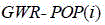 is composed ofiThe probability of precipitation at the site(s),
 the constant term parameters of the model are estimated for the precipitation probability,
 to representiAt a stationkThe geographic factors (coordinates, elevation, etc.,k=1,2,…,K 1),
 is composed ofiAt a stationkRegression parameters of individual geographic factors.
Step 23: method for estimating regression parameter matrix of ground station precipitation probability estimation model by adopting local weighted least square methodβ. Wherein the weight matrixWBy usingGaussianFunction calculation, the spatial neighborhood bandwidth is adaptive bandwidth to fix the number of adjacent sitesq 1Representing, using cross-validation, withCVS(cross-validation score) minimum is an objective function, and the optimal bandwidth is determined by adopting SCE-UA algorithm optimizationq -best1。

In the formula:Gfor interpreting the variable matrix, the interpretation variables include geographical auxiliary factors such as longitude and latitude, elevation, gradient and slope,βin order to be a regression parameter, as a stationiWithin a spatial neighborhoodq 1Weight matrix of individual ground station (without center point)i),I o Is composed ofq 1A rain/no rain status matrix for individual ground stations.
 To representiThe actual precipitation conditions at the site are,
 is represented byiAround the siteq 1Individual site information (not including central point)i) Estimated by the established probability modeliThe probability of precipitation at the site.
Step 24: substituting the station regression parameters estimated in the step 25 into the precipitation probability estimation model to obtain precipitation probability estimation values of all stationspop s-gauge . Applying the optimal bandwidth preferred by step 23q -best1Estimating model parameters of precipitation probability estimation of each grid by adopting a local weighted least square method, and calculating to obtain precipitation probability of each gridpop s-grid 。
step 31: initializing a precipitation probability threshold ofC pop0 And =0.5, and a formula for determining whether each station is in a rainy or no-rain state is as follows. Defining the correct rate score of the rain/rain-free state identification result of all stations asCIR(Correct identification ratio) toCIRTaking the maximum objective function, and adopting SCE-UA algorithm to optimize precipitation probability thresholdC pop-best The optimizing interval is [0,1 ]]。

In the formula:I s-gauge the station rain/no-rain state is judged based on the precipitation probability model and the precipitation probability threshold.cnt(. cndot.) represents the number of sites satisfying certain conditions,nthe total number of ground observation stations in the research area;CIRand scoring the accuracy.
Step 32: applying the optimal precipitation probability threshold determined in step 31C pop-best Determining the rain/no rain condition at each grid locationI s-grid 。

And 4, multi-source information fusion: constructing a multi-source information fusion model integrating ground station observation, remote sensing inversion and reanalysis precipitation and related geographic information based on a GWR method, and estimating fusion precipitation of each grid position;
step 41: GWR-based multi-source precipitation information fusion model GWR-PmThe following formula is shown. The interpretation variables comprise geographic factors such as longitude and latitude, elevation and gradient and variables such as remote sensing inversion and reanalysis precipitation, and the optimal interpretation variable combination is determined mainly through the precision of a model constructed by different factor combinations.

In the formula: is composed ofiThe precipitation amount is fused at the station,
 is a constant term parameter;
 to representiAt a point ofkA geographic factor (k=1,2,…,K 2),
 Regression parameters corresponding to the geographic factors;
 is shown aslThe seed grid precipitation data (remote sensing inversion, reanalysis, etc.),l=1,2,…,Lin aiAn estimate of the amount of precipitation at the site,
 are the corresponding regression parameters.
Step 42: observing precipitation and longitude and latitude by using ground stationDetermining the optimal spatial neighborhood bandwidth by using information such as coordinates and elevations and rainfall information of remote sensing inversion and re-analysis products at ground sites and adopting a local weighted least square method and a cross validation-based SCE-UA algorithmq -best2。
Step 43: applying the preferred optimal bandwidth of step 42q -best2Estimating parameters of a multi-source information fusion model for each grid by adopting a local weighted least square method so as to obtain fusion precipitation 。
。
step 51: for each grid, adopt Correcting the fusion precipitation;
step 52: detecting corrected fusion precipitationCP m-grid If there is a grid smaller than 0. If any, search for the nearest 4 or 9 sations for each unreasonable gridI s-grid =1 andCP m-grid >0 or satisfyI s-grid =0 andCP m-grid a grid of =0, and data of these reasonable grids are calculated by an inverse distance weighting methodCP m-grid The corrected value of (1) is the final precipitation estimator.
And 6, repeating the steps 2 to 5 to obtain grid precipitation spatial distribution estimation results of all periods of the research area.
Example three:
in the embodiment, a precipitation estimation method coupling dry-wet state identification and multi-source information fusion is provided by taking a water collecting area above a mussel port hydraulic station in the river basin as a research area. The river basin of the Huaihe river is between the Yangtze river and the yellow river, and the area is about 27 ten thousandkm2. The mussel port sluice hydrological station is a main control station for the midstream of the Huaihe river, the latitude and longitude ranges of the controlled water collecting area are 111.9-117.5 degrees E, 30.9-34.9 degrees N, and the area is about 11.7 km2. The northwest of the drainage basin is distributed with the Chinese arborvitae and the Funiu mountain, the southwest is the Dabie mountain, the rest is the wide plain, and the hilly area only occupies 15.4 percent of the drainage basin. The average annual precipitation is about 920mm, the total amount is decreased from south to north, and the annual precipitation accounts for 50-80% of the annual precipitation in the flood season (6-9 months). In this embodiment, a high-resolution daily Precipitation quantitative estimation of 0.05 degree by 0.05 degree in a research area is carried out by using a Multi-Source Weighted-Ensemble Precipitation version 2.1 (MSWEP V2.1) product (time range: 1979-2016, spatial resolution: 0.1 degree by 0.1 degree, and time resolution: 3 hours), observed data of 78 weather stations on the ground (time range: 1979-2016, spatial resolution: site, and time resolution: day), longitude and latitude, longitude and elevation information, which are developed by Princeton University. The method mainly comprises the following steps:
s1): data preprocessing: and acquiring the MSWEP V2.1 and the meteorological station observation precipitation data. The MSWEP product with the angle of 0.1 degrees multiplied by 0.1 degrees is reduced to 0.05 degrees multiplied by 0.05 degrees by a bilinear interpolation method, and the time is accumulated and summed to obtain day-by-day rainfall in 1979-2916. And (4) calculating to obtain the daily precipitation estimated value of the MSWEP V2.1 at the position of the weather station by adopting an inverse distance weighting method of the nearest 4 grids. And (3) extracting longitude and latitude coordinates and elevation information of each meteorological station and a grid of 0.05 degrees multiplied by 0.05 degrees in a research area by using 30m DEM data of SRTM V4.1 and adopting geographic information system software.
S2): precipitation estimation probability: to be provided withTAnd (4) taking the value of =0.1mm/d as a rainfall threshold value for judging whether rain exists or not, and extracting rain existence/non-rain state information of the weather station. Aiming at a certain research period, based on daily rainfall states, longitude and latitude and elevation information of 78 weather stations, a GWR method is adopted, two sets of precipitation probability estimation models of GWR-POP (XY) and GWR-POP (XYH) are set according to whether elevation information is utilized or not, and an SCE-UA method based on cross validation is adopted to calibrate the optimal bandwidthq (XY)1Andq (XYH)1solving regression parameters of the precipitation probability models of the meteorological stations and the grids by using a local weighted least square method, and calculating the precipitation probability of the meteorological stations in the periodpop s-gauge (XY)、pop s-gauge (XYH)And the probability of grid precipitationpop s-grid (XY)、pop s-grid (XYH)。
S3): identifying the precipitation state: the accuracy of the identification result of the rain/no-rain status of 78 weather stations in the periodCIRThe highest is an objective function, an SCE-UA algorithm is adopted to calibrate the precipitation probability threshold values of the two sets of modelsT (XY)-pop-best 、T (XYH)-pop-best . Based on the above, the precipitation state of each meteorological station in the time interval is determinedI s-gauge (XY)、I s-gauge (XYH)And the state of the grid falling waterI s-grid (XY)、I s-grid (XYH)。
S4): estimating the fusion precipitation: based on daily observation precipitation of 78 weather stations in the period, precipitation estimation value, longitude and latitude and elevation information of MSWEP V2.1 at station positions, GWR method is adopted, and GWR-P is set according to whether elevation information is utilized or notm(XY) and GWR-Pm(XYH) two sets of multi-source information fusion models are adopted, and an SCE-UA method based on cross validation is adopted to calibrate the optimal bandwidthq (XY)2Andq (XYH)2solving regression parameters of each meteorological station and the grid precipitation fusion model by using a local weighted least square method, and calculating the fusion precipitation amount of each meteorological station in the periodP m-gauge (XY)、P m-gauge (XYH)Precipitation amount fused with gridP m-grid (XY)、P m-grid (XYH)。
S5): and correcting the fusion precipitation amount according to the rain/no-rain state: are respectively in accordance with 、
、 Formula, correction of each grid fusion precipitation amount calculated by the two sets of fusion models in S4). Detecting the presence or absence ofCP m-grid <0, and selecting and satisfying the condition of the wrong gridI s-grid =1 andCP m-grid >0 or satisfyI s-grid =0 andCP m-grid nearest 4 grids of the condition of =0CP m-grid And obtaining the corrected precipitation of the wrong grid by adopting an inverse distance weighting method, thereby obtaining the precipitation estimation values of all grids in the period.
S6): and (3) developing a grid precipitation data set: dividing 78 rainfall stations into 4 groups (namely 4 station network distribution conditions) by adopting a K-means clustering mode, adopting a cross validation mode, namely adopting 3 meteorological stations as modeling stations and the other group as inspection stations in turn, and sequentially repeating S2 to S5 aiming at each time period (day) of 1979 to 2016 to obtain GWR-POP (XY) + GWR-P under the 4 meteorological station distribution conditionsm(XY)、GWR-POP(XYH)+GWR-Pm(XYH) two sets of 0.05 degree x 0.05 degree grids are subjected to precipitation every day in 1979-2016.
S7): and (3) evaluating the precipitation estimation precision: and (4) obtaining the daily precipitation estimated value of the inspection station position under different weather station distribution conditions by using the grid precipitation estimated by the S6) and applying an inverse distance weighting method of the nearest 4 grids. And (3) evaluating the average accuracy of the water estimation under the 4 meteorological station distribution conditions by taking the daily observation precipitation of the meteorological stations as a reference.
The evaluation accuracy index includes a classification index and a quantitative index. The classification index includes a detection ratePOD(Probability of detection), false alarm rateFAR(False alarm ratio), critical success indexCSI(Critical success index); quantitative indicators include gross errorTB(Total bias), hit errorHB(Hit bias), false positive errorFB(False bias), absolute mean errorMAE(Mean absolute error) and correlation coefficientCC(Correlation coefficient). The calculation formula and the optimal value of the index are shown in table 1. Each index can be used for time sequence precision evaluation and space precision evaluation. The time sequence precision refers to a comparison result of the precipitation time sequence estimated by each meteorological station position and the actually measured precipitation time sequence; spatial accuracy of all meteorology in a certain periodAnd comparing the precipitation estimation result of the station position with the data of the actually measured precipitation point of the corresponding position.
TABLE 1 corresponding calculation formula and optimum value of evaluation index

Note:Hrepresenting the number of precipitation events hit by the precipitation estimation result;Mrepresenting the number of the rainfall events which are missed to report in the rainfall estimation result;Fand the number of the precipitation events is indicated by the precipitation estimation result, wherein the threshold value for judging whether the precipitation occurs is 0.1 mm/d.SAn estimate of the precipitation is represented,Ga representation of the observed value of precipitation is shown,S H an estimate of precipitation that represents a hit event,G H precipitation observations that represent a hit event,S F an estimate of precipitation indicative of a false positive event.NRepresenting the number of study periods (timing accuracy) or the number of verification weather stations (spatial accuracy), representing the average of precipitation estimates for all time periods (time sequence accuracy) or for all inspection sites (space accuracy) at a meteorological station,
 and the average value of the measured precipitation of all periods (time sequence precision) of a certain meteorological station or all inspection sites (space precision) of a certain period is represented.
S8): in order to analyze the effectiveness of the method, the first embodiment compares the method with a traditional method for directly fusing meteorological station and MSWEP V2.1 precipitation information based on GWR, and also sets two types of elevation considered and elevation not considered, namely GWR-Pm(XY) and GWR-Pm(XYH)。
Table 2 shows the average value of the precipitation time sequence accuracy indexes estimated by different methods in 1979-2016 of the water collection area above the Unionidae sluice hydrological station. It can be seen that the conventional method can only improve the classification recognition capability compared with MSWEP V2.1PODIndexes, but fail to effectively reduce the false alarm rateFARImproving the critical success indexCSIThe method of the invention can basically maintain the MSWEP V2.1PODOn the basis, the false alarm rate is increasedFARReduced by 75% and simultaneously increasedCSIUp to 25%. In the aspect of quantitative accuracy index, compared with MSWEP V2.1, the method provided by the invention and the traditional method for estimating precipitationCCEssentially identical except for GWR-POP (XY) + GWR-PmOf the (XY) processTBAbsolute value slightly larger than GWR-PmBesides (XY) method (possibly related to uneven distribution of rainfall stations), the quantitative error of the rainfall estimated by the method of the invention is reduced compared with the traditional method, especially in compressionHBAndFBin one aspect, the method of the invention is more conventionalHBA reduction of 87% (not taking into account elevation), 43% (taking into account elevation),FBthe reduction was 69% (not considered elevation), 71% (considered elevation).
TABLE 2 different methods for estimating the average value of the time sequence accuracy indexes of the rainfall in 1979-2016 year in the water collection area above the Unionidae sluice hydrology station

Fig. 4 gives a box plot of the timing accuracy index. It can also be seen that the method of the present invention is capable of efficient compressionFARAnd lift itCSIAnd cutting downFB. In the figure, black points and circles in the box represent medians, the upper boundary and the lower boundary of the box are 75% quantiles and 25% quantiles, and the horizontal lines of the upper end and the lower end of the beard line respectively represent the height of the box added by the 75% quantile and the height of the box subtracted by the 25% quantile.
Table 3 shows the average value of space accuracy indexes of rainfall in 1979-2016 of water collection areas above a sluice hydrological station of the Unionidae river estimated by different methods.
TABLE 3 different methods for estimating average value of space accuracy indexes of rainfall in 1979-2016 year in water collection area above river mussel port gate hydrological station

FIG. 5 is a box plot of spatial accuracy index. For the classification and identification capability, the method of the inventionFARThe reduction amplitude reaches 70 percent (not considering elevation) and 71 percent (considering elevation),CSIand also increases. In the aspect of quantitative accuracy index, exceptGWR-POP (XY)+GWR-Pm(XY)Method ofTBAbsolute value slightly greater thanGWR-Pm(XY)Besides the method (possibly related to uneven distribution of rainfall stations), the quantitative accuracy indexes of the method are improved compared with the traditional method, whereinHBA reduction of 90% (not considered elevation), 43% (considered elevation),FBthe reduction was 70% (not considered elevation), 71% (considered elevation). It can also be seen from FIG. 5 that the method of the present invention is reducingFARWhile being overall horizontal, greatly compressFARThe range of variation of (a).
In fig. 5, the black dots and circles in the box represent the median, the upper and lower boundaries of the box are 75% and 25% quantiles, and the horizontal lines at the upper and lower ends of the beard line represent the 75% quantile plus the height of the box and the 25% quantile minus the height of the box, respectively.
In the embodiment, the factor combination modeling mode is adopted to determine the explanatory variables, and from the aspect of statistical accuracy, the GWR-POP (XY) + GWR-P without elevation considerationmThe (XY) method has better precipitation estimation effect, which is probably related to that most of the research area is plain, and the correlation coefficient of precipitation and elevation is lower.
In addition to the statistical precision, fig. 6 to 8 show the spatial distribution of the daily rainfall in the water collection areas 2016/06/21, 2016/06/30 and 2016/07/14 above the sluice hydrological station of the river mussel port estimated by different methods. The results shown in fig. 6 to 8 are obtained on the basis of modeling using all the weather station data, and are different from the case where only part of the weather stations are used in the precipitation estimation accuracy evaluation stage of S7). As can be seen from the figure, the method has the basically equivalent effect of estimating the rainfall capacity of the rainfall area to the traditional method, can better identify the range and the position of the rainfall area and the rainfall area, and shows stronger rainfall spatial distribution depicting capability.
By adopting the technical scheme disclosed by the invention, the following beneficial effects are obtained: when the traditional multi-source information fusion method directly utilizes data such as rainfall station observation, remote sensing inversion, reanalysis and the like to estimate precipitation,the precipitation state of each grid cannot be effectively distinguished. The method extracts rainfall state variables hidden in the ground station observation data, better identifies the rainfall state/rainless state through the GWR method and the rainfall threshold optimization, and couples the identification result with the rainfall amount estimated by the traditional multi-source information fusion method, thereby obviously improving the accuracy of the range and the position of the rainfall and rainless area, the obtained rainfall spatial distribution is more consistent with the actual situation, and the false alarm rate is greatly reducedFARReduce the error of false alarmFBThe critical success index is improvedCSIMeanwhile, other precision indexes are improved.
The above embodiments relate primarily to geographical information, rain station observation and a kind of grid precipitation MSWEP V2.1 in terms of information utilization. It should be noted that the method has strong expansibility, the quantity of integratable information is not limited to the method, and other remote sensing inversion and reanalysis precipitation can be simultaneously incorporated into the method.
The above is only one embodiment of the present invention, and it should be noted that, for those skilled in the art, it is possible to make several modifications and decorations without departing from the principle of the present invention, and these modifications and decorations should also be considered to be within the scope of the present invention.
Although the preferred embodiments of the present invention have been described in detail, the present invention is not limited to the details of the embodiments, and various equivalent modifications can be made within the technical spirit of the present invention, and the scope of the present invention is also within the scope of the present invention.
Claims (10)
1. The rainfall estimation method based on the coupling of the dry-wet state identification and the multi-source information fusion is characterized by comprising the following steps of:
step 1, acquiring rainfall observation information of different sources and independent of each other, matching the spatio-temporal scale of each rainfall data, and preparing geographic information required by rainfall estimation;
step 2, extracting a rain/no-rain state value of the ground station according to the rainfall observation information and the auxiliary geographic information acquired in the step 1, constructing a rainfall probability estimation model, and calculating the rainfall probability of each ground station and the grid position;
step 3, comparing the precipitation probability of each ground station with a precipitation probability threshold value, judging the rain/no-rain state, constructing a target function according to the highest value of the correct judgment rate of the rain/no-rain state of the station, and determining the optimal precipitation probability threshold value, so as to identify the rain/no-rain state of each grid position;
step 4, constructing a multi-source precipitation information fusion model according to the geographic information and the multi-source precipitation observation information acquired in the step 1, and estimating fusion precipitation of each grid position;
and 5, correcting the fusion precipitation amount according to the rain/no-rain state result of each grid identified in the step 3, detecting and correcting the grid with unreasonable fusion precipitation amount, and finally obtaining the precipitation amount estimation result.
2. The precipitation estimation method of claim 1, wherein said step 1 further comprises:
step 11, obtaining mutually independent multi-source rainfall observation information with different sources, including ground station rainfall observation, remote sensing inversion and grid rainfall reanalysis data;
step 12, determining the space-time resolution of the grid precipitation estimation; in the aspect of time, performing data processing on remote sensing inversion and reanalysis precipitation to obtain the grid precipitation with target time resolution; in the aspect of space, different remote sensing inversions and reanalysis rainfall are subjected to scale ascending/descending operation to obtain the grid rainfall with consistent spatial resolution;
step 13, utilizing the nearest neighbor of ground stationM 1Calculating the precipitation estimated value of the remote sensing inversion and re-analysis product at the ground station position by adopting an inverse distance weighting method for the precipitation data of each grid, thereby realizing the spatial scale matching of the precipitation of the grids and the ground station;
and 14, preparing the longitude and latitude of the ground station and the grid, and extracting the geographic information including the elevation, the gradient and the slope direction of the station and the grid from the digital elevation model.
3. The precipitation estimation method of claim 2, wherein said step 2 further comprises:
step 21, selecting precipitation threshold value for judging whether there is rain or notTIf the ground station observes that the precipitation is more than or equal toTIt means the state variable of rain or precipitationI o=1, otherwise no rain, precipitation state variableI o=0, sequentially judging and obtaining the precipitation state variable of each station;
step 22, taking the rain/no rain state of the ground station as a dependent variable and the geographical information of the station as an explanatory variable, constructing a precipitation probability estimation model of the station position, and optimizing and determining the optimal spatial neighborhood bandwidthq -best1Further estimating a regression parameter matrix of the model;
step 23, utilizing the optimal bandwidth estimated in step 22q -best1Calculating regression parameters of the precipitation probability estimation models of the grids, calculating precipitation probability estimation values of the sites and the grids, and recording the precipitation probability estimation values as precipitation probability estimation valuespop s-gauge 、pop s-grid 。
4. The precipitation estimation method of claim 3, wherein said step 3 further comprises:
step 31, initializing precipitation probability thresholdC pop0 Judging the estimation result of the rain/no-rain state of each station according to the following formula, and judging the correct judgment rate of the rain/no-rain state of all stationsCIRTaking the maximum objective function, and determining the optimal precipitation probability thresholdC pop-best The optimizing interval is [0,1 ]]:

In the formula:I s-gauge judging whether the station is in a rain state or a non-rain state based on the precipitation probability model and the precipitation probability threshold;cnt(. cndot.) represents the number of sites satisfying a predetermined condition,nthe total number of ground observation stations in the research area;CIRscoring the accuracy;pop s-gauge the precipitation probability estimated value of each station is obtained; is a rainfall state variable;
32, based on the optimal precipitation probability threshold valueC pop-best Determining the rain/no-rain state of each grid position by using the rain/no-rain state determination formula in step 31I s-grid 。
5. The precipitation estimation method of claim 4, wherein said step 4 further comprises:
step 41, constructing a multi-source information fusion model of the site position by utilizing the precipitation observed by the ground site, the remote sensing inversion and the precipitation estimated value of the re-analysis product on the ground site and the related geographical auxiliary information, and optimizing the optimal spatial neighborhood bandwidthq -best2Further estimating a regression parameter matrix of the fusion model;
step 43, based on the optimal bandwidthq -best2Estimating regression parameters of the multi-source information fusion model aiming at grids one by one, and further calculating to obtain the fusion precipitation of each grid 。
。
6. The precipitation estimation method of claim 5, wherein said step 5 further comprises:
step 51, for each grid, adopt The fusion precipitation is corrected, wherein in the formula,CP m-grid the corrected fusion precipitation is shown, and the meanings of the rest symbols are the same as above;
step 52, detecting whether there isCP m-grid A grid less than 0; if present, for each unreasonable grid,searching for nearest neighborsM 2Each satisfyI s-grid =1 andCP m-grid >0、I s-grid =0 andCP m-grid the grids of the condition of =0, and the data of these reasonable grids are calculated by an inverse distance weighting methodCP m-grid The corrected value of (2) is the final precipitation estimation result.
7. The precipitation estimation method of any one of claims 1 to 6, wherein steps 2 to 6 are repeated to obtain grid precipitation spatial distribution estimation results for each time period of the study area.
8. Coupled dry and wet state discerns precipitation estimation system with multisource information fusion, its characterized in that includes:
the system comprises a first module, a second module and a third module, wherein the first module is used for acquiring rainfall observation information of different sources and independent of each other, matching each rainfall data spatial scale and preparing geographic information required by grid rainfall estimation;
the second module is used for extracting the rain/no-rain state values of the ground stations, constructing a precipitation probability estimation model and calculating the precipitation probability of each ground station and each grid position;
the third module is used for selecting a precipitation probability threshold value by taking the highest correct judgment rate of the rain/no-rain state of the ground station as a target function, and determining the rain/no-rain state identification result of each grid position;
the fourth module is used for constructing a multi-source information fusion model and estimating fusion precipitation of each grid position;
and the fifth module is used for correcting the fusion precipitation according to the rain/no-rain state identification result of each grid, detecting the unreasonable grid of the fusion precipitation and correcting to obtain a precipitation estimation result.
9. A computing module comprising a memory, a processor and a computer program stored on the memory and executable on the processor, characterized in that the steps of the method according to any of claims 1 to 7 are implemented when the computer program is executed by the processor.
10. A storage medium readable by a computing module, on which a computer program is stored, which, when being executed by a processor, carries out the steps of the method according to any one of claims 1 to 7.
Priority Applications (1)
| Application Number | Priority Date | Filing Date | Title |
|---|---|---|---|
| CN202110373037.9A CN112800634B (en) | 2021-04-07 | 2021-04-07 | Rainfall estimation method and system coupling dry-wet state identification and multi-source information fusion |
Applications Claiming Priority (1)
| Application Number | Priority Date | Filing Date | Title |
|---|---|---|---|
| CN202110373037.9A CN112800634B (en) | 2021-04-07 | 2021-04-07 | Rainfall estimation method and system coupling dry-wet state identification and multi-source information fusion |
Publications (2)
| Publication Number | Publication Date |
|---|---|
| CN112800634A true CN112800634A (en) | 2021-05-14 |
| CN112800634B CN112800634B (en) | 2021-06-25 |
Family
ID=75816406
Family Applications (1)
| Application Number | Title | Priority Date | Filing Date |
|---|---|---|---|
| CN202110373037.9A Active CN112800634B (en) | 2021-04-07 | 2021-04-07 | Rainfall estimation method and system coupling dry-wet state identification and multi-source information fusion |
Country Status (1)
| Country | Link |
|---|---|
| CN (1) | CN112800634B (en) |
Cited By (9)
| Publication number | Priority date | Publication date | Assignee | Title |
|---|---|---|---|---|
| CN113205155A (en) * | 2021-05-27 | 2021-08-03 | 中国水利水电科学研究院 | Multi-source precipitation data fusion method based on partition self-adaptive weight |
| CN113313190A (en) * | 2021-06-11 | 2021-08-27 | 湖北省地震局(中国地震局地震研究所) | Multi-source gravity data fusion method |
| CN114580561A (en) * | 2022-03-15 | 2022-06-03 | 中国海洋大学 | Machine learning fusion method and model for multisource sea surface physical elements |
| CN114677059A (en) * | 2022-05-26 | 2022-06-28 | 水利部交通运输部国家能源局南京水利科学研究院 | Method and system for comprehensively evaluating precision of inversion precipitation product by integrating time-space indexes |
| CN114781501A (en) * | 2022-04-12 | 2022-07-22 | 水利部交通运输部国家能源局南京水利科学研究院 | Multi-source precipitation fusion method based on principal component regression |
| CN115114811A (en) * | 2022-08-30 | 2022-09-27 | 水利部交通运输部国家能源局南京水利科学研究院 | Short-time forecast precipitation classification error and quantitative error double correction method and system |
| CN115357847A (en) * | 2022-08-28 | 2022-11-18 | 水利部交通运输部国家能源局南京水利科学研究院 | Day scale star-ground precipitation fusion method based on error decomposition |
| CN116151474A (en) * | 2022-12-08 | 2023-05-23 | 四川省气象探测数据中心 | Precipitation product downscaling method integrating multisource data |
| CN117349795A (en) * | 2023-12-04 | 2024-01-05 | 水利部交通运输部国家能源局南京水利科学研究院 | Precipitation fusion method and system based on ANN and GWR coupling |
Citations (18)
| Publication number | Priority date | Publication date | Assignee | Title |
|---|---|---|---|---|
| CN103810376A (en) * | 2014-01-17 | 2014-05-21 | 浙江大学 | Ground daily rainfall predicting method based on satellite remote sensing and regression Kriging |
| CN106127242A (en) * | 2016-06-21 | 2016-11-16 | 河海大学 | Year of based on integrated study Extreme Precipitation prognoses system and Forecasting Methodology thereof |
| US20170075034A1 (en) * | 2015-09-10 | 2017-03-16 | The Climate Corporation | Generating probabilistic estimates of rainfall rates from radar reflectivity measurements |
| CN106597575A (en) * | 2016-11-14 | 2017-04-26 | 中国环境科学研究院 | Precipitation spatial interpolation method based on cross validation and two-dimensional Gaussian distribution weighting |
| CN106991278A (en) * | 2017-03-21 | 2017-07-28 | 武汉大学 | It is a kind of to gather precipitation forecast and the coupling process of real-time flood probability forecast |
| US20170351963A1 (en) * | 2016-06-02 | 2017-12-07 | The Climate Corporation | Estimating confidence bounds for rainfall adjustment values |
| CN107918165A (en) * | 2016-10-09 | 2018-04-17 | 清华大学 | More satellites fusion Prediction of Precipitation method and system based on space interpolation |
| CN108761574A (en) * | 2018-05-07 | 2018-11-06 | 中国电建集团北京勘测设计研究院有限公司 | Rainfall evaluation method based on Multi-source Information Fusion |
| CN109946762A (en) * | 2019-03-06 | 2019-06-28 | 重庆邮电大学移通学院 | A kind of method and system based on probability distribution Short-term Forecast precipitation |
| CN110263453A (en) * | 2019-06-25 | 2019-09-20 | 长江水利委员会水文局 | A kind of adaptive barrier lake is gradually burst coupling prediction model |
| CN111078678A (en) * | 2019-12-18 | 2020-04-28 | 中国气象局乌鲁木齐沙漠气象研究所 | Satellite precipitation data correction method based on multi-source information fusion and scale reduction |
| CN111101477A (en) * | 2019-12-30 | 2020-05-05 | 长江大学 | Method for determining low water flow during supplement testing of data-free design basin |
| CN111210082A (en) * | 2020-01-13 | 2020-05-29 | 东南大学 | Optimized BP neural network algorithm-based precipitation prediction method |
| CN111308581A (en) * | 2020-04-10 | 2020-06-19 | 海南省气象科学研究所 | Radar-rain gauge combined rainfall estimation method based on space-time local model |
| US10762588B2 (en) * | 2018-04-17 | 2020-09-01 | One Concern, Inc. | Flood-recovery options tool |
| CN111611541A (en) * | 2020-04-26 | 2020-09-01 | 武汉大学 | Copula function-based method and system for calculating rainfall data of data-free area |
| CN111665575A (en) * | 2020-05-27 | 2020-09-15 | 长江水利委员会水文局 | Medium-and-long-term rainfall grading coupling forecasting method and system based on statistical power |
| KR102225241B1 (en) * | 2019-04-30 | 2021-03-11 | 경북대학교 산학협력단 | Apparatus and method for real-time flooding prediction |
-
2021
- 2021-04-07 CN CN202110373037.9A patent/CN112800634B/en active Active
Patent Citations (18)
| Publication number | Priority date | Publication date | Assignee | Title |
|---|---|---|---|---|
| CN103810376A (en) * | 2014-01-17 | 2014-05-21 | 浙江大学 | Ground daily rainfall predicting method based on satellite remote sensing and regression Kriging |
| US20170075034A1 (en) * | 2015-09-10 | 2017-03-16 | The Climate Corporation | Generating probabilistic estimates of rainfall rates from radar reflectivity measurements |
| US20170351963A1 (en) * | 2016-06-02 | 2017-12-07 | The Climate Corporation | Estimating confidence bounds for rainfall adjustment values |
| CN106127242A (en) * | 2016-06-21 | 2016-11-16 | 河海大学 | Year of based on integrated study Extreme Precipitation prognoses system and Forecasting Methodology thereof |
| CN107918165A (en) * | 2016-10-09 | 2018-04-17 | 清华大学 | More satellites fusion Prediction of Precipitation method and system based on space interpolation |
| CN106597575A (en) * | 2016-11-14 | 2017-04-26 | 中国环境科学研究院 | Precipitation spatial interpolation method based on cross validation and two-dimensional Gaussian distribution weighting |
| CN106991278A (en) * | 2017-03-21 | 2017-07-28 | 武汉大学 | It is a kind of to gather precipitation forecast and the coupling process of real-time flood probability forecast |
| US10762588B2 (en) * | 2018-04-17 | 2020-09-01 | One Concern, Inc. | Flood-recovery options tool |
| CN108761574A (en) * | 2018-05-07 | 2018-11-06 | 中国电建集团北京勘测设计研究院有限公司 | Rainfall evaluation method based on Multi-source Information Fusion |
| CN109946762A (en) * | 2019-03-06 | 2019-06-28 | 重庆邮电大学移通学院 | A kind of method and system based on probability distribution Short-term Forecast precipitation |
| KR102225241B1 (en) * | 2019-04-30 | 2021-03-11 | 경북대학교 산학협력단 | Apparatus and method for real-time flooding prediction |
| CN110263453A (en) * | 2019-06-25 | 2019-09-20 | 长江水利委员会水文局 | A kind of adaptive barrier lake is gradually burst coupling prediction model |
| CN111078678A (en) * | 2019-12-18 | 2020-04-28 | 中国气象局乌鲁木齐沙漠气象研究所 | Satellite precipitation data correction method based on multi-source information fusion and scale reduction |
| CN111101477A (en) * | 2019-12-30 | 2020-05-05 | 长江大学 | Method for determining low water flow during supplement testing of data-free design basin |
| CN111210082A (en) * | 2020-01-13 | 2020-05-29 | 东南大学 | Optimized BP neural network algorithm-based precipitation prediction method |
| CN111308581A (en) * | 2020-04-10 | 2020-06-19 | 海南省气象科学研究所 | Radar-rain gauge combined rainfall estimation method based on space-time local model |
| CN111611541A (en) * | 2020-04-26 | 2020-09-01 | 武汉大学 | Copula function-based method and system for calculating rainfall data of data-free area |
| CN111665575A (en) * | 2020-05-27 | 2020-09-15 | 长江水利委员会水文局 | Medium-and-long-term rainfall grading coupling forecasting method and system based on statistical power |
Non-Patent Citations (4)
| Title |
|---|
| DANGWEI XUAN等: "Precipitation Characteristic Analysis of the Zhoushan Archipelago: From the View of MSWEP and Rainfall Merging", 《WATER》 * |
| QINGFANG HU等: "Rainfall Spatial Estimations: A Review from Spatial Interpolation to Multi-Source Data Merging", 《WATER》 * |
| 王磊之等: "基于广义可加模型的降水空间估算模型", 《水利水运工程学报》 * |
| 胡庆芳: "基于多源信息的降水空间估计及其水文应用研究", 《中国博士学位论文全文数据库 基础科学辑》 * |
Cited By (11)
| Publication number | Priority date | Publication date | Assignee | Title |
|---|---|---|---|---|
| CN113205155A (en) * | 2021-05-27 | 2021-08-03 | 中国水利水电科学研究院 | Multi-source precipitation data fusion method based on partition self-adaptive weight |
| CN113313190A (en) * | 2021-06-11 | 2021-08-27 | 湖北省地震局(中国地震局地震研究所) | Multi-source gravity data fusion method |
| CN114580561A (en) * | 2022-03-15 | 2022-06-03 | 中国海洋大学 | Machine learning fusion method and model for multisource sea surface physical elements |
| CN114781501A (en) * | 2022-04-12 | 2022-07-22 | 水利部交通运输部国家能源局南京水利科学研究院 | Multi-source precipitation fusion method based on principal component regression |
| CN114677059A (en) * | 2022-05-26 | 2022-06-28 | 水利部交通运输部国家能源局南京水利科学研究院 | Method and system for comprehensively evaluating precision of inversion precipitation product by integrating time-space indexes |
| CN115357847A (en) * | 2022-08-28 | 2022-11-18 | 水利部交通运输部国家能源局南京水利科学研究院 | Day scale star-ground precipitation fusion method based on error decomposition |
| CN115357847B (en) * | 2022-08-28 | 2023-09-19 | 水利部交通运输部国家能源局南京水利科学研究院 | Solar scale satellite-ground precipitation fusion method based on error decomposition |
| CN115114811A (en) * | 2022-08-30 | 2022-09-27 | 水利部交通运输部国家能源局南京水利科学研究院 | Short-time forecast precipitation classification error and quantitative error double correction method and system |
| CN116151474A (en) * | 2022-12-08 | 2023-05-23 | 四川省气象探测数据中心 | Precipitation product downscaling method integrating multisource data |
| CN117349795A (en) * | 2023-12-04 | 2024-01-05 | 水利部交通运输部国家能源局南京水利科学研究院 | Precipitation fusion method and system based on ANN and GWR coupling |
| CN117349795B (en) * | 2023-12-04 | 2024-02-02 | 水利部交通运输部国家能源局南京水利科学研究院 | Precipitation fusion method and system based on ANN and GWR coupling |
Also Published As
| Publication number | Publication date |
|---|---|
| CN112800634B (en) | 2021-06-25 |
Similar Documents
| Publication | Publication Date | Title |
|---|---|---|
| CN112800634B (en) | Rainfall estimation method and system coupling dry-wet state identification and multi-source information fusion | |
| Yang et al. | A physical process and machine learning combined hydrological model for daily streamflow simulations of large watersheds with limited observation data | |
| Chao et al. | Geographically weighted regression based methods for merging satellite and gauge precipitation | |
| CN108761574B (en) | Rainfall estimation method based on multi-source information fusion | |
| Szolgay et al. | Comparison of mapping approaches of design annual maximum daily precipitation | |
| CN114201922A (en) | Dynamic landslide sensitivity prediction method and system based on InSAR technology | |
| CN111242404A (en) | Extreme evaluation method and system for heavy rainfall induced flood incident | |
| CN115357847B (en) | Solar scale satellite-ground precipitation fusion method based on error decomposition | |
| CN113591572A (en) | Water and soil loss quantitative monitoring method based on multi-source data and multi-temporal data | |
| CN113567981A (en) | SAR image-based flood risk area automatic extraction method | |
| CN113779113B (en) | Flood dynamic estimation method and system based on rainfall flood space-time process similarity excavation | |
| CN115907574A (en) | Drainage basin type rainstorm flood disaster-bearing body resetting cost remote sensing simulation method | |
| CN114254802B (en) | Prediction method for vegetation coverage space-time change under climate change drive | |
| Bajamgnigni Gbambie et al. | Added value of alternative information in interpolated precipitation datasets for hydrology | |
| CN114936201A (en) | Satellite precipitation data correction method based on adaptive block neural network model | |
| CN113610437A (en) | Disaster-bearing body dynamic exposure degree evaluation method and system | |
| Amodei et al. | Deterministic and fuzzy verification methods for a hierarchy of numerical models | |
| CN109885808B (en) | Near-surface meteorological element calculation method | |
| Azizi Mobaser et al. | Evaluating the performance of Era-5 Re-analysis data in estimating daily and monthly precipitation, Case Study; Ardabil Province | |
| Sharma et al. | NGFS rainfall forecast verification over India using the contiguous rain area (CRA) method | |
| Ayub et al. | Wheat Crop Field and Yield Prediction using Remote Sensing and Machine Learning | |
| Schumann et al. | Evaluating uncertain flood inundation predictions with uncertain remotely sensed water stages | |
| CN112836449B (en) | Method for calibrating hydrologic model | |
| Albalawi | Assessing and predicting the impact of land use and land cover change on groundwater using geospatial techniques: a case study of Tabuk, Saudi Arabia | |
| Brebante | Analyzing the effects of land cover/land use changes on flashflood: a case study of Marikina River Basin (MRB), Philippines |
Legal Events
| Date | Code | Title | Description |
|---|---|---|---|
| PB01 | Publication | ||
| PB01 | Publication | ||
| SE01 | Entry into force of request for substantive examination | ||
| SE01 | Entry into force of request for substantive examination | ||
| GR01 | Patent grant | ||
| GR01 | Patent grant |