EP3404440B1 - Positioning system and method with multipath mitigation - Google Patents
Positioning system and method with multipath mitigation Download PDFInfo
- Publication number
- EP3404440B1 EP3404440B1 EP18157966.5A EP18157966A EP3404440B1 EP 3404440 B1 EP3404440 B1 EP 3404440B1 EP 18157966 A EP18157966 A EP 18157966A EP 3404440 B1 EP3404440 B1 EP 3404440B1
- Authority
- EP
- European Patent Office
- Prior art keywords
- arrival
- gateways
- time
- range
- gateway
- Prior art date
- Legal status (The legal status is an assumption and is not a legal conclusion. Google has not performed a legal analysis and makes no representation as to the accuracy of the status listed.)
- Active
Links
- 238000000034 method Methods 0.000 title claims description 29
- 230000000116 mitigating effect Effects 0.000 title 1
- 230000001419 dependent effect Effects 0.000 claims description 5
- 230000005540 biological transmission Effects 0.000 description 6
- 230000000875 corresponding effect Effects 0.000 description 6
- 230000004807 localization Effects 0.000 description 4
- 230000007423 decrease Effects 0.000 description 2
- 230000002349 favourable effect Effects 0.000 description 2
- 238000005259 measurement Methods 0.000 description 2
- 238000012986 modification Methods 0.000 description 2
- 230000004048 modification Effects 0.000 description 2
- 239000000243 solution Substances 0.000 description 2
- 238000012935 Averaging Methods 0.000 description 1
- 230000015556 catabolic process Effects 0.000 description 1
- QVFWZNCVPCJQOP-UHFFFAOYSA-N chloralodol Chemical compound CC(O)(C)CC(C)OC(O)C(Cl)(Cl)Cl QVFWZNCVPCJQOP-UHFFFAOYSA-N 0.000 description 1
- 238000004891 communication Methods 0.000 description 1
- 238000012937 correction Methods 0.000 description 1
- 230000002596 correlated effect Effects 0.000 description 1
- 230000003247 decreasing effect Effects 0.000 description 1
- 238000006731 degradation reaction Methods 0.000 description 1
- 238000013461 design Methods 0.000 description 1
- 239000012895 dilution Substances 0.000 description 1
- 238000010790 dilution Methods 0.000 description 1
- 238000007670 refining Methods 0.000 description 1
- 238000004088 simulation Methods 0.000 description 1
- 230000001360 synchronised effect Effects 0.000 description 1
Images

Classifications
-
- G—PHYSICS
- G01—MEASURING; TESTING
- G01S—RADIO DIRECTION-FINDING; RADIO NAVIGATION; DETERMINING DISTANCE OR VELOCITY BY USE OF RADIO WAVES; LOCATING OR PRESENCE-DETECTING BY USE OF THE REFLECTION OR RERADIATION OF RADIO WAVES; ANALOGOUS ARRANGEMENTS USING OTHER WAVES
- G01S1/00—Beacons or beacon systems transmitting signals having a characteristic or characteristics capable of being detected by non-directional receivers and defining directions, positions, or position lines fixed relatively to the beacon transmitters; Receivers co-operating therewith
- G01S1/02—Beacons or beacon systems transmitting signals having a characteristic or characteristics capable of being detected by non-directional receivers and defining directions, positions, or position lines fixed relatively to the beacon transmitters; Receivers co-operating therewith using radio waves
- G01S1/08—Systems for determining direction or position line
- G01S1/20—Systems for determining direction or position line using a comparison of transit time of synchronised signals transmitted from non-directional antennas or antenna systems spaced apart, i.e. path-difference systems
- G01S1/24—Systems for determining direction or position line using a comparison of transit time of synchronised signals transmitted from non-directional antennas or antenna systems spaced apart, i.e. path-difference systems the synchronised signals being pulses or equivalent modulations on carrier waves and the transit times being compared by measuring the difference in arrival time of a significant part of the modulations, e.g. LORAN systems
-
- G—PHYSICS
- G01—MEASURING; TESTING
- G01S—RADIO DIRECTION-FINDING; RADIO NAVIGATION; DETERMINING DISTANCE OR VELOCITY BY USE OF RADIO WAVES; LOCATING OR PRESENCE-DETECTING BY USE OF THE REFLECTION OR RERADIATION OF RADIO WAVES; ANALOGOUS ARRANGEMENTS USING OTHER WAVES
- G01S5/00—Position-fixing by co-ordinating two or more direction or position line determinations; Position-fixing by co-ordinating two or more distance determinations
- G01S5/02—Position-fixing by co-ordinating two or more direction or position line determinations; Position-fixing by co-ordinating two or more distance determinations using radio waves
- G01S5/0257—Hybrid positioning
- G01S5/0268—Hybrid positioning by deriving positions from different combinations of signals or of estimated positions in a single positioning system
-
- G—PHYSICS
- G01—MEASURING; TESTING
- G01S—RADIO DIRECTION-FINDING; RADIO NAVIGATION; DETERMINING DISTANCE OR VELOCITY BY USE OF RADIO WAVES; LOCATING OR PRESENCE-DETECTING BY USE OF THE REFLECTION OR RERADIATION OF RADIO WAVES; ANALOGOUS ARRANGEMENTS USING OTHER WAVES
- G01S5/00—Position-fixing by co-ordinating two or more direction or position line determinations; Position-fixing by co-ordinating two or more distance determinations
- G01S5/0009—Transmission of position information to remote stations
- G01S5/0018—Transmission from mobile station to base station
-
- G—PHYSICS
- G01—MEASURING; TESTING
- G01S—RADIO DIRECTION-FINDING; RADIO NAVIGATION; DETERMINING DISTANCE OR VELOCITY BY USE OF RADIO WAVES; LOCATING OR PRESENCE-DETECTING BY USE OF THE REFLECTION OR RERADIATION OF RADIO WAVES; ANALOGOUS ARRANGEMENTS USING OTHER WAVES
- G01S5/00—Position-fixing by co-ordinating two or more direction or position line determinations; Position-fixing by co-ordinating two or more distance determinations
- G01S5/02—Position-fixing by co-ordinating two or more direction or position line determinations; Position-fixing by co-ordinating two or more distance determinations using radio waves
- G01S5/0205—Details
- G01S5/0218—Multipath in signal reception
-
- G—PHYSICS
- G01—MEASURING; TESTING
- G01S—RADIO DIRECTION-FINDING; RADIO NAVIGATION; DETERMINING DISTANCE OR VELOCITY BY USE OF RADIO WAVES; LOCATING OR PRESENCE-DETECTING BY USE OF THE REFLECTION OR RERADIATION OF RADIO WAVES; ANALOGOUS ARRANGEMENTS USING OTHER WAVES
- G01S5/00—Position-fixing by co-ordinating two or more direction or position line determinations; Position-fixing by co-ordinating two or more distance determinations
- G01S5/02—Position-fixing by co-ordinating two or more direction or position line determinations; Position-fixing by co-ordinating two or more distance determinations using radio waves
- G01S5/0205—Details
- G01S5/0244—Accuracy or reliability of position solution or of measurements contributing thereto
-
- H—ELECTRICITY
- H04—ELECTRIC COMMUNICATION TECHNIQUE
- H04W—WIRELESS COMMUNICATION NETWORKS
- H04W4/00—Services specially adapted for wireless communication networks; Facilities therefor
- H04W4/02—Services making use of location information
- H04W4/023—Services making use of location information using mutual or relative location information between multiple location based services [LBS] targets or of distance thresholds
-
- H—ELECTRICITY
- H04—ELECTRIC COMMUNICATION TECHNIQUE
- H04W—WIRELESS COMMUNICATION NETWORKS
- H04W64/00—Locating users or terminals or network equipment for network management purposes, e.g. mobility management
- H04W64/006—Locating users or terminals or network equipment for network management purposes, e.g. mobility management with additional information processing, e.g. for direction or speed determination
-
- G—PHYSICS
- G01—MEASURING; TESTING
- G01S—RADIO DIRECTION-FINDING; RADIO NAVIGATION; DETERMINING DISTANCE OR VELOCITY BY USE OF RADIO WAVES; LOCATING OR PRESENCE-DETECTING BY USE OF THE REFLECTION OR RERADIATION OF RADIO WAVES; ANALOGOUS ARRANGEMENTS USING OTHER WAVES
- G01S2205/00—Position-fixing by co-ordinating two or more direction or position line determinations; Position-fixing by co-ordinating two or more distance determinations
- G01S2205/001—Transmission of position information to remote stations
- G01S2205/008—Transmission of position information to remote stations using a mobile telephone network
-
- G—PHYSICS
- G01—MEASURING; TESTING
- G01S—RADIO DIRECTION-FINDING; RADIO NAVIGATION; DETERMINING DISTANCE OR VELOCITY BY USE OF RADIO WAVES; LOCATING OR PRESENCE-DETECTING BY USE OF THE REFLECTION OR RERADIATION OF RADIO WAVES; ANALOGOUS ARRANGEMENTS USING OTHER WAVES
- G01S5/00—Position-fixing by co-ordinating two or more direction or position line determinations; Position-fixing by co-ordinating two or more distance determinations
- G01S5/02—Position-fixing by co-ordinating two or more direction or position line determinations; Position-fixing by co-ordinating two or more distance determinations using radio waves
- G01S5/06—Position of source determined by co-ordinating a plurality of position lines defined by path-difference measurements
Definitions
- Embodiments of the present invention relate to the field of determining a position of a mobile electronic device.
- This invention proposes a wireless network capable of locating its nodes with good accuracy, and that is largely immune from propagation disturbances, as well as the corresponding method.
- a typical location estimation system there are several reference nodes, or gateways, whose locations are known, and one or several target nodes or motes, whose locations are to be estimated.
- some metrics characterising the positioning information of the target node against the reference nodes such as the distance or angles, needs to be measured through either the radio transmission by the target node and received by the reference nodes, or the other way around.
- the target node makes radio transmissions, which are received by the gateways (reference nodes) around it.
- Radiolocation is used in a number of radio location systems and wireless network, including the above-mentioned GPS, LORAN, radar, radio direction finders, and wireless networks such as cellphone networks, Bluetooth, WiFi, and LoRa.
- Radiolocation methods generally rely on some metric characterising the position of the mobile node with reference to the gateways, or reference nodes, whose positions are known.
- the metric information might include the distance, the bearing, or the signal strength. They can be loosely divided between range-based and range-free methods. In the former, the position is determined geometrically, for example by multilateration, based on the ranges, or distances, between the target node and the gateways, while the latter estimate the position from the metric information by some non-geometric algorithm, for example by fingerprinting or weighting.
- Range-based method can provide excellent precision and cover large areas with a limited number of gateways, as proved by the remarkable performance of GPS and other satellite location systems, but they are better suited for free-space propagation, and their performance rapidly degrades with the onset of multipath, and whenever the communication channel is disturbed and deviates from the ideal model.
- range-based methods tend to lose precision when used indoors, especially when used in narrow bandwidth systems.
- Range-free methods ordinarily use the received signal strength (RSSI) as metric and, although their ultimate precision may be lower, they are relatively immune to propagation anomalies, providing useful position information even in conditions characterized by strong multipath, where range-based method would break down. They may need a finer gateways spacing than range-based ones. Despite the considerable interest raised by range-free location, the design of a simple and robust weighting algorithm with good accuracy remains a major challenge.
- RSSI received signal strength
- WO2015118135 discloses a network-centric localization system in which the measurement report from reference nodes are submitted to a location server based on a measure of relevance.
- US20160033613 a system for location estimation in multipath conditions.
- the present invention proposed a weighted Centroid Localisation (WCL) system with the features of appended claim 1, which does the location estimation based only on the known positions of the gateways and the measurements of the time of arrival (TOA) at the gateways, and a corresponding method with the features of appended claim 7.
- WCL weighted Centroid Localisation
- FIG. 1 illustrates a mobile node 110 in a wireless network transmitting a data packet 135.
- Each of the gateways 160 determines the time of arrival TOA of the packet 135, and the corresponding timestamps are collected (arrow 170) in a solver unit 180.
- the solver unit 180 is represented here as a separate functional entity, and may be physically implemented in a separate server, but it could also, without leaving the invention, be hosted in one of the gateways 160. It would be also conceivable, in the frame of the invention, that the position determination be performed in a plurality of solver units, independently or in collaboration.
- timestamps 170 taken by different gateways must be comparable with each other.
- the time references of the gateways 160 could be synchronized, by any suitable synchronization protocol (arrows 140), or the gateways 160 may rely on a common time reference in the form, for example, of GPS-disciplined clocks.
- the time references of the gateways may be independent from each other, but the solver 180 knows their individual timing errors and can correct them, translating the timestamp 170 into a common time reference.
- the signal 135 is a data packet, either; the invention could function with any signal whose time of arrival can be determined.
- the gateways could make other information accessible to the solver 180, for example an indicator of the received signal strength (RSSI), or the direction of the signal, if it is available.
- RSSI received signal strength
- the gateway could transmit the metric relative to one selected antenna, chosen as the best representative of the diversity set, for example based on the RSSI or the first time of arrival.
- the gateway, or the solver could compute "average" metrics, based on the signal received by all its antennas (see steps 210, 220 in figure 2 ).
- the invention is not limited to the transmission and the reception of a single packet, either. If the transmission 135 is repeated, gateway 160 and/or the solver 180 have access also to the average time of arrival at a particular gateway, and to its variation.
- the range-free location method of the invention proceeds in the solver as follows :
- the TOA are sorted in decreasing order of arrival time, from the first to the last, and each is assigned a numeric rank r i (step 230). For example, the smallest TOA (the first signal to be received) is assigned the highest rank, and the highest the lowest rank. In the case represented, the first gateway to receive the signal could acquire rank 6, and the last one would receive rank 1.
- the solver also computes the time differences of arrival or TDOA, that is the times of arrival of the signal relative to the first reception, ti , and the average distance between all the gateways involved, ⁇ (step 225).
- the weighting factors w i are determined based on the rank and on the value of the TDOA.
- the values of the TDOA may be corrected by a common scale factor ⁇ that is derived from the average distance between the gateways.
- the weights may be calculated by a weight function that is mainly determined by the rank value and, rank being constant, decreases for larger TDOA, such that gateways that are too far away from the target contribute little or nothing to the weighted summation.
- the method described above foresees the transmission of a single packet from the mobile node to the gateways. If more packets are exchanged, the precision can be increased by computing a new location for each packet, as described above, and finally combining the locations in a final estimate.
- the combination may be a simple average, or foresee different options, for example weighting each position in consideration of the number of receiving gateways, the signal received signal strength, etc.
- the weighting factors w i may be partly dependent form the RSSI, if they are available.
- the range-free time position estimate calculated based on the TOA by formula can be combined with position estimates of different nature and origin.
- the combination is made with range-free position estimation based on the RSSI's indication, possibly as described in European application N° EP16196989 in the name of the applicant, which describes a position estimate in which the received gateways are sorted based on their RSSI, and combined with rank-dependent weights. In this manner a completely range-free position estimate is achieved.
- the combination could foresee different options.
- the simplest is the averaging of the two estimates.
- a better accuracy could be obtained by applying weight to the two estimates that account for their different precision or reliability.
- the reliability of the RSSI-based estimate can be deduced by the absolute level of RSSI, and/or by the number of gateway involved.
- a figure of merit of the TOA-based estimation described above, can be judged by the average inter-gateway spacing ⁇ , the number of gateways involved and, when several packets are received, TOA deviations.
- the TOA timestamps will allow also a range-based estimation of the position of the mobile note together with the range-free one.
- This estimation may be obtained by conventional lateration techniques, or possibly by the method described in European patent application EP16180854 in the name of the applicant, which foresees the computation of an extended least median solution, out of a set of three-gateway solutions.
- the solver receives the times of arrival of the packet at the gateways and computes, out of them, both a range-based estimation (x r ,y r ), and, as described above, a range-free estimation (x f ,y f ), which are then combined into one.
- the system of the invention can provide accurate positioning based on ranges when the propagation conditions are optimal or good and, with the onset of multipath, is still capable of positioning the nodes, possibly at the cost of some degradation of precision by using, and giving progressively more weight to, the range-free estimate.
- the range-free and the range-based estimates could be simply averaged, or combined in a weighted average.
- the solver estimates the quality of the range-based estimate, and of the range-free one. These quality parameters are then use to determine their relative weights in the combination, or to select one rather than the other.
- the quality of the range-based estimate can be judged in several ways.
- (x,y) denotes the range-based estimate
- (x i, y i ) the position of the i -th gateway, (x o ,y o ) that the first gateway that received the packet, and t i the i -th TDOA.
- the dilution of precision could also be used.
- the quality of the range-free estimate can be judged, as mentioned above, from the average inter-gateway spacing ⁇ , or also the number of gateways involved and, when several packets are received, TOA deviations.
- the quality parameters are compared with two threshold values. If the TDOA error residue s 2 exceeds the corresponding threshold, the range-based estimation is considered unreliable and is simply discarded; the position is estimated by the range-free method alone. Conversely, if the inter-gateway spacing ⁇ is higher than its corresponding threshold, the range-free estimation is discarded, and the position given by the range-based method only. If, however both estimations appear reliable, from this comparison with the thresholds, then the final estimation of the position will be a weighted average of the two. The relative weights are computed based on the relative quality parameters.
- the position of the mobile node 110 is computed iteratively, with a step in which the time-of arrival timestamps t i are modified after the first position determination, and then a refined position is computed based on the adjusted timestamps.
- the adjustment of the timestamps leads to a better positioning because it is done in order to compensate for multipath propagation.
- the timestamp is corrected toward earlier time of arrival in such a manner that the time-shift introduced by multipath is at least in part eliminated.
- the positioning server 180 includes, or has access to a propagation model 185 ( Figure 1 ) that provides, from a first position estimate, the predicted values of from the first estimated position 310 ( Figure 4 ) to any gateway.
- the model can be setup once and reused as many times as necessary, and requires updates only at major terrain modifications like, in a city, substantial building modification or creation. From this multipath prediction, the timestamps t i can be modified (320) and a refined position 330, closer to the real position of the mobile node, estimated. The cycle of correcting the timestamps and refining the position can be repeated as many times as necessary, until the positioning the position is satisfactory, using a suitable convergence criterion 340.
- the multipath correction is not explicitly based on a prediction, but deduced from indicia of the multipath available to the positioning server.
- P TX denotes the transmitter's power
- G M the antenna gain at the mobile node
- G G the gain of the antenna at the gateway
- rssi the received signal strength
- D distance
- ⁇ the wavelength.
- the loss exponent equals 2 in free-space propagation. Its value will be lower than 2 for guided propagation and, quite often, will be higher than 2.
- L>2 is an indication of an obstruction, the higher the value of L, the larger the obstruction the signal has suffered. Since on average a large obstruction is correlated to higher delay and stronger multipath, high values of L indicate that multipath has taken place, and may prompt a compensation.
- the value of rssi in formula 4 is an aggregated value: a statistic indicator of several rssi determinations. It can be a mean, a median, a maximum value, or a quantile. Favourable results have been obtained taking rssi agg equal to the 80 th percentile of the received rssi values, i.e. a value close to the maximum received signal level.
- the exact function used to compensate the t i may assume different forms, and may be chosen in consideration of the environment around a specific gateway, or mobile node. It has been found advantageous to compensate only those propagation times t i for which the corresponding loss exponent is larger a given exponent, for example compute a compensation only when L ⁇ 4, and zero compensation when L ⁇ 4 .
- the iterative method above foresees at least two, possibly more, estimates of the position. These can be obtained with the rang-free estimate method of the prior embodiments but, in independent aspects of the invention, one all or some position estimates could be obtained otherwise, for example by lateration, based on the times of arrival, or any combination of times of arrival and signal strengths.
Description
- Embodiments of the present invention relate to the field of determining a position of a mobile electronic device.
- In IOT (Internet of Thing) and many other location related applications, It is required that an infrastructure be able to estimate the position of one or several wireless objects or target nodes. Achieving accurate location estimation in a wireless environment at low cost is a considerable challenge. This invention proposes a wireless network capable of locating its nodes with good accuracy, and that is largely immune from propagation disturbances, as well as the corresponding method.
- In a typical location estimation system, there are several reference nodes, or gateways, whose locations are known, and one or several target nodes or motes, whose locations are to be estimated. In order to estimate the location of the target node, some metrics characterising the positioning information of the target node against the reference nodes, such as the distance or angles, needs to be measured through either the radio transmission by the target node and received by the reference nodes, or the other way around. In this invention, we consider the case where the target node makes radio transmissions, which are received by the gateways (reference nodes) around it.
- Radiolocation is used in a number of radio location systems and wireless network, including the above-mentioned GPS, LORAN, radar, radio direction finders, and wireless networks such as cellphone networks, Bluetooth, WiFi, and LoRa.
- Radiolocation methods generally rely on some metric characterising the position of the mobile node with reference to the gateways, or reference nodes, whose positions are known. The metric information might include the distance, the bearing, or the signal strength. They can be loosely divided between range-based and range-free methods. In the former, the position is determined geometrically, for example by multilateration, based on the ranges, or distances, between the target node and the gateways, while the latter estimate the position from the metric information by some non-geometric algorithm, for example by fingerprinting or weighting.
- Range-based method can provide excellent precision and cover large areas with a limited number of gateways, as proved by the remarkable performance of GPS and other satellite location systems, but they are better suited for free-space propagation, and their performance rapidly degrades with the onset of multipath, and whenever the communication channel is disturbed and deviates from the ideal model. In particular, range-based methods tend to lose precision when used indoors, especially when used in narrow bandwidth systems.
- Range-free methods ordinarily use the received signal strength (RSSI) as metric and, although their ultimate precision may be lower, they are relatively immune to propagation anomalies, providing useful position information even in conditions characterized by strong multipath, where range-based method would break down. They may need a finer gateways spacing than range-based ones. Despite the considerable interest raised by range-free location, the design of a simple and robust weighting algorithm with good accuracy remains a major challenge.
- The following description describes examples of the invention in which the position of the mobile node is determined in a 2-dimensional plane. Albeit important, this application is not limiting and the invention includes as well variants in which the mobile nodes are localised in a 3-dimensional space.
WO2015118135 discloses a network-centric localization system in which the measurement report from reference nodes are submitted to a location server based on a measure of relevance.US20160033613 a system for location estimation in multipath conditions. - The present invention proposed a weighted Centroid Localisation (WCL) system with the features of appended claim 1, which does the location estimation based only on the known positions of the gateways and the measurements of the time of arrival (TOA) at the gateways, and a corresponding method with the features of appended claim 7.
-
-
Figure 1 illustrates in schematic simplified manner, a process of localization by which a plurality of gateways receive a localization packet transmitted by a mobile node and determine its location by means of a solver that processes the times of arrival of the packets at each gateway. The invention also proposed enhanced positioning methods that combine a robust range-free estimate with a range-based one. -
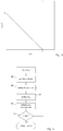
Figure 2 represents, by a flowchart, a possible implementation of the inventive method. -
Figure 3 plots a weight function. -
Figure 4 describes an iterative method of position determination. -
Figure 1 illustrates amobile node 110 in a wireless network transmitting adata packet 135. The wireless network includes a plurality ofgateways 160, whose positions are known. A number N of these, whose locations are (xi,,yi); (i=0,... N-1), are in reception range and receive thepacket 135. Each of thegateways 160 determines the time of arrival TOA of thepacket 135, and the corresponding timestamps are collected (arrow 170) in asolver unit 180. Thesolver unit 180 is represented here as a separate functional entity, and may be physically implemented in a separate server, but it could also, without leaving the invention, be hosted in one of thegateways 160. It would be also conceivable, in the frame of the invention, that the position determination be performed in a plurality of solver units, independently or in collaboration. - Importantly,
timestamps 170 taken by different gateways must be comparable with each other. To this purpose, the time references of thegateways 160 could be synchronized, by any suitable synchronization protocol (arrows 140), or thegateways 160 may rely on a common time reference in the form, for example, of GPS-disciplined clocks. In alternative, the time references of the gateways may be independent from each other, but thesolver 180 knows their individual timing errors and can correct them, translating thetimestamp 170 into a common time reference. It is not an essential feature of the invention that thesignal 135 is a data packet, either; the invention could function with any signal whose time of arrival can be determined. - In addition to the timestamp, the gateways could make other information accessible to the
solver 180, for example an indicator of the received signal strength (RSSI), or the direction of the signal, if it is available. Should the gateway include a plurality of antennas, the metrics of all the antennas could be transmitted or, the gateway could transmit the metric relative to one selected antenna, chosen as the best representative of the diversity set, for example based on the RSSI or the first time of arrival. The gateway, or the solver, could compute "average" metrics, based on the signal received by all its antennas (seesteps figure 2 ). - The invention is not limited to the transmission and the reception of a single packet, either. If the
transmission 135 is repeated,gateway 160 and/or thesolver 180 have access also to the average time of arrival at a particular gateway, and to its variation. - The range-free location method of the invention proceeds in the solver as follows :
- The TOA are sorted in decreasing order of arrival time, from the first to the last, and each is assigned a numeric rank ri (step 230). For example, the smallest TOA (the first signal to be received) is assigned the highest rank, and the highest the lowest rank. In the case represented, the first gateway to receive the signal could acquire rank 6, and the last one would receive rank 1.
- The solver also computes the time differences of arrival or TDOA, that is the times of arrival of the signal relative to the first reception, ti, and the average distance between all the gateways involved, Δ (step 225).
- Assume there are a total of N nodes that have received a signal, the position of the mobile device will be determined by a WCL algorithm (step 250): a weighted (vectorial) sum of the position of the gateways using a set weight factors, which can be expressed as:

- An important feature of the inventive algorithm is the way to determine the weighting factors wi (step 240). According to the invention, the weights are determined based on the rank and on the value of the TDOA. Importantly, the values of the TDOA may be corrected by a common scale factor Δ that is derived from the average distance between the gateways.
- Specifically, the weights may be calculated by a weight function that is mainly determined by the rank value and, rank being constant, decreases for larger TDOA, such that gateways that are too far away from the target contribute little or nothing to the weighted summation. In a favourable implementation, the weight function is represented by

figure 3 shows how the weight factor decreases linearly for increasing ti in such a case. It is understood, however, that the linear dependence is not an essential feature, and other weight functions could be used as well. Preferably, the weights are never negative, which ensures that the position estimate will be contained in the polygon having the participating gateways at vertexes. - The method described above foresees the transmission of a single packet from the mobile node to the gateways. If more packets are exchanged, the precision can be increased by computing a new location for each packet, as described above, and finally combining the locations in a final estimate. The combination may be a simple average, or foresee different options, for example weighting each position in consideration of the number of receiving gateways, the signal received signal strength, etc.
- The invention allows various improvements to enhance its precision and robustness. In a possible variant, the weighting factors wi may be partly dependent form the RSSI, if they are available.
- Advantageously, the range-free time position estimate calculated based on the TOA by formula can be combined with position estimates of different nature and origin. In one variant, the combination is made with range-free position estimation based on the RSSI's indication, possibly as described in
European application N° EP16196989 - The combination could foresee different options. The simplest is the averaging of the two estimates. A better accuracy could be obtained by applying weight to the two estimates that account for their different precision or reliability. The reliability of the RSSI-based estimate can be deduced by the absolute level of RSSI, and/or by the number of gateway involved. A figure of merit of the TOA-based estimation described above, can be judged by the average inter-gateway spacing Δ, the number of gateways involved and, when several packets are received, TOA deviations.
- In general, the TOA timestamps will allow also a range-based estimation of the position of the mobile note together with the range-free one. This estimation may be obtained by conventional lateration techniques, or possibly by the method described in
European patent application EP16180854 - In an embodiment of the invention, the solver receives the times of arrival of the packet at the gateways and computes, out of them, both a range-based estimation (xr,yr), and, as described above, a range-free estimation (xf,yf), which are then combined into one. In this manner, the system of the invention can provide accurate positioning based on ranges when the propagation conditions are optimal or good and, with the onset of multipath, is still capable of positioning the nodes, possibly at the cost of some degradation of precision by using, and giving progressively more weight to, the range-free estimate.
- As per the previous enhancement, the range-free and the range-based estimates could be simply averaged, or combined in a weighted average.
- Preferably, the solver estimates the quality of the range-based estimate, and of the range-free one. These quality parameters are then use to determine their relative weights in the combination, or to select one rather than the other.
- The quality of the range-based estimate can be judged in several ways. A valid possibility involves the least-square error residues of the TDOA,

- The quality of the range-free estimate can be judged, as mentioned above, from the average inter-gateway spacing Δ, or also the number of gateways involved and, when several packets are received, TOA deviations.
- The quality parameters are compared with two threshold values. If the TDOA error residue s 2 exceeds the corresponding threshold, the range-based estimation is considered unreliable and is simply discarded; the position is estimated by the range-free method alone. Conversely, if the inter-gateway spacing Δ is higher than its corresponding threshold, the range-free estimation is discarded, and the position given by the range-based method only. If, however both estimations appear reliable, from this comparison with the thresholds, then the final estimation of the position will be a weighted average of the two. The relative weights are computed based on the relative quality parameters.
- According to another variant not forming part of the invention, the position of the
mobile node 110 is computed iteratively, with a step in which the time-of arrival timestamps ti are modified after the first position determination, and then a refined position is computed based on the adjusted timestamps. The adjustment of the timestamps, leads to a better positioning because it is done in order to compensate for multipath propagation. For each receivinggateway 160, the timestamp is corrected toward earlier time of arrival in such a manner that the time-shift introduced by multipath is at least in part eliminated. - According to a possible variant not forming part of the invention, the
positioning server 180 includes, or has access to a propagation model 185 (Figure 1 ) that provides, from a first position estimate, the predicted values of from the first estimated position 310 (Figure 4 ) to any gateway. The model can be setup once and reused as many times as necessary, and requires updates only at major terrain modifications like, in a city, substantial building modification or creation. From this multipath prediction, the timestamps ti can be modified (320) and arefined position 330, closer to the real position of the mobile node, estimated. The cycle of correcting the timestamps and refining the position can be repeated as many times as necessary, until the positioning the position is satisfactory, using asuitable convergence criterion 340. - In other variants not forming part of the invention, the multipath correction is not explicitly based on a prediction, but deduced from indicia of the multipath available to the positioning server. For example the server can compute, for each gateway, the path loss exponent L, based on the transmission equation:

- Preferably, the value of rssi in formula 4 is an aggregated value: a statistic indicator of several rssi determinations. It can be a mean, a median, a maximum value, or a quantile. Favourable results have been obtained taking rssiagg equal to the 80th percentile of the received rssi values, i.e. a value close to the maximum received signal level.
- The exact function used to compensate the ti may assume different forms, and may be chosen in consideration of the environment around a specific gateway, or mobile node. It has been found advantageous to compensate only those propagation times ti for which the corresponding loss exponent is larger a given exponent, for example compute a compensation only when L≥4, and zero compensation when L<4.
- The iterative method above foresees at least two, possibly more, estimates of the position. These can be obtained with the rang-free estimate method of the prior embodiments but, in independent aspects of the invention, one all or some position estimates could be obtained otherwise, for example by lateration, based on the times of arrival, or any combination of times of arrival and signal strengths.
Claims (13)
- A system comprising at least a mobile device (110) and a plurality of gateways (160) whose positions are known, wherein the gateways are operatively arranged to receive a radio signal from the mobile device and to determine a time of arrival (TOA; ti ) of said signal at the gateway, the system comprising a solver unit (180) operatively arranged to compute the position of the mobile device (110) , based on said times of arrival and to sort the gateways by the received time of arrival, characterised in that the solver unit (180) is arranged to compute for each gateway a weight factor based on the rank of the gateways in the sort, whereby those gateways whose time of arrival is earlier receive a heavier weight, the system being further arranged to compute the position of the mobile device by a weighted sum of the position of the gateways using said weight factors.
- The system of the preceding claim, the solver being arranged to compute the weights based on the rank and the time-difference of arrival of the signal at the gateways.
- The system of the preceding claim, the solver being arranged to divide the time-difference of arrival by a scale factor dependent from the average distance between the gateways that received the signal.
- The system of any one of the preceding claims, wherein the weights are always positive or zero, and/or they are zero when the time-difference of arrival exceeds a determined value.
- The system of any one of the preceding claims, wherein the solver is arranged for computing the weight factors (wi ) of each gateway by:

- The system of any one of the preceding claims, operatively arranged to: compute also a range-based position estimation from said times of arrival; determine a first quality parameter expressing the quality of the range-free position estimate, a second quality parameter expressing the quality of said range-based position estimate; and combine the range-free position estimate and the range-based position estimate using said first and second quality parameters.
- A method of determining the position of a mobile device (110) relative to a plurality of gateways (160) whose positions are known, comprising:• determining for each gateway a time of arrival of the signal (TOA; ti ),• sorting the gateways by their time of arrival, characterised in• computing for each gateway a weight factor dependent from the rank of the gateway in the sort, whereby those gateways whose time of arrival is earlier receive a heavier weight,• computing the position of the mobile device by a weighted sum of the position of the gateways using said weight factors.
- The method of the preceding claim, wherein the weights are computed based on the rank and the time-difference of arrival of the signal at the gateways.
- The method of the preceding claim, wherein the time-difference of arrival is divided by a scale factor dependent from the average distance between the gateways that received the signal.
- The method of any one of claims 7-9, wherein the weights are always positive or zero, and/or they are zero when the time-difference of arrival exceeds a determined value.
- The method of any one of claims 7-10, wherein the weight factors (wi ) of each gateway are calculated by:

- The method of any one of the claims 7-11 comprising: computing also a range-based position estimation from said times of arrival, determining a first quality parameter expressing the quality of the range-free position estimate, and a second quality parameter expressing the quality of said range-based position estimate, and combining the range-free position estimate and the range-based position estimate using said first and second quality parameters.
- The method of claim 12, comprising a step of correcting the times of arrival (ti) towards earlier arrival times, based on an indication of multipath.
Applications Claiming Priority (1)
| Application Number | Priority Date | Filing Date | Title |
|---|---|---|---|
| EP17164423 | 2017-03-31 |
Publications (3)
| Publication Number | Publication Date |
|---|---|
| EP3404440A2 EP3404440A2 (en) | 2018-11-21 |
| EP3404440A3 EP3404440A3 (en) | 2019-03-13 |
| EP3404440B1 true EP3404440B1 (en) | 2021-09-15 |
Family
ID=58671331
Family Applications (1)
| Application Number | Title | Priority Date | Filing Date |
|---|---|---|---|
| EP18157966.5A Active EP3404440B1 (en) | 2017-03-31 | 2018-02-21 | Positioning system and method with multipath mitigation |
Country Status (4)
| Country | Link |
|---|---|
| US (1) | US10871541B2 (en) |
| EP (1) | EP3404440B1 (en) |
| KR (1) | KR102299605B1 (en) |
| CN (1) | CN108693501B (en) |
Families Citing this family (6)
| Publication number | Priority date | Publication date | Assignee | Title |
|---|---|---|---|---|
| EP3685486A1 (en) | 2017-09-18 | 2020-07-29 | Semtech Corporation | System and method for wireless power transmission and communication |
| US11276938B2 (en) | 2018-01-11 | 2022-03-15 | Semtech Corporation | Single layer antenna |
| WO2020237935A1 (en) * | 2019-05-27 | 2020-12-03 | 湖南联智桥隧技术有限公司 | Data transmission system and data transmission method |
| CN111065046B (en) * | 2019-11-21 | 2020-12-11 | 东南大学 | LoRa-based outdoor unmanned aerial vehicle positioning method and system |
| US11310085B2 (en) * | 2019-12-11 | 2022-04-19 | Semtech Corporation | LoRa advanced receiver |
| CN113126026B (en) * | 2019-12-31 | 2024-04-19 | 中移(成都)信息通信科技有限公司 | Positioning system, method and storage medium |
Family Cites Families (16)
| Publication number | Priority date | Publication date | Assignee | Title |
|---|---|---|---|---|
| US6184829B1 (en) * | 1999-01-08 | 2001-02-06 | Trueposition, Inc. | Calibration for wireless location system |
| WO2000040992A1 (en) * | 1999-01-08 | 2000-07-13 | Trueposition, Inc. | Location method for a wireless location system |
| US9813867B2 (en) * | 2005-12-15 | 2017-11-07 | Polte Corporation | Angle of arrival (AOA) positioning method and system for positional finding and tracking objects using reduced attenuation RF technology |
| US9699607B2 (en) * | 2005-12-15 | 2017-07-04 | Polte Corporation | Multi-path mitigation in rangefinding and tracking objects using reduced attenuation RF technology |
| KR100768573B1 (en) * | 2006-06-17 | 2007-10-19 | 한국항공대학교산학협력단 | Method and apparatus for providing automatic location information calibration of mobile terminal |
| CN102239418B (en) * | 2008-12-05 | 2014-10-01 | 皇家飞利浦电子股份有限公司 | Wireless localization techniques in lighting systems |
| CN101715232A (en) * | 2009-11-20 | 2010-05-26 | 西安电子科技大学 | Positioning method of weighted wireless sensor network nodes based on RSSI and LQI |
| IT1401771B1 (en) * | 2010-08-31 | 2013-08-02 | St Microelectronics Srl | SYSTEMS AND METHODS FOR REAL-TIME LOCALIZATION. |
| US8315647B2 (en) * | 2010-12-28 | 2012-11-20 | Trueposition, Inc. | Time and power based wireless location detection system |
| US9392410B2 (en) * | 2013-03-15 | 2016-07-12 | Nextnav, Llc | Systems and methods providing transmit diversity to combat multipath effects in position estimation |
| US10386454B2 (en) * | 2014-02-07 | 2019-08-20 | Signify Holding B.V. | Network centric localization for determining the location of mobile devices |
| US9404993B2 (en) * | 2014-07-30 | 2016-08-02 | Aruba Networks, Inc. | System and methods for information collection and processing for location estimation in MIMO wireless networks |
| US10492022B2 (en) | 2015-11-30 | 2019-11-26 | Semtech Corporation | System and method for robust and accurate RSSI based location estimation |
| EP3173809B1 (en) | 2015-11-30 | 2023-06-28 | Semtech Corporation | System and method for robust and efficient tdoa based location estimation in the presence of various multipath delay |
| CN105828435A (en) * | 2016-05-30 | 2016-08-03 | 天津大学 | Distance correction weighted centroid localization method based on reception signal intensity optimization |
| US10371787B2 (en) * | 2017-01-13 | 2019-08-06 | Raytheon Company | Emitter geolocation using sorted observations |
-
2018
- 2018-02-21 EP EP18157966.5A patent/EP3404440B1/en active Active
- 2018-02-22 US US15/902,720 patent/US10871541B2/en active Active
- 2018-03-27 KR KR1020180035022A patent/KR102299605B1/en active IP Right Grant
- 2018-03-29 CN CN201810271682.8A patent/CN108693501B/en active Active
Also Published As
| Publication number | Publication date |
|---|---|
| US20180284215A1 (en) | 2018-10-04 |
| KR102299605B1 (en) | 2021-09-09 |
| KR20180111574A (en) | 2018-10-11 |
| CN108693501B (en) | 2022-04-01 |
| EP3404440A3 (en) | 2019-03-13 |
| US10871541B2 (en) | 2020-12-22 |
| EP3404440A2 (en) | 2018-11-21 |
| CN108693501A (en) | 2018-10-23 |
Similar Documents
| Publication | Publication Date | Title |
|---|---|---|
| EP3404440B1 (en) | Positioning system and method with multipath mitigation | |
| EP3173807B1 (en) | System and method for robust and accurate rssi based location estimation | |
| US10557919B2 (en) | Observed time difference of arrival angle of arrival discriminator | |
| EP3173809B1 (en) | System and method for robust and efficient tdoa based location estimation in the presence of various multipath delay | |
| US9426619B2 (en) | Handling complex signal parameters by a positioning device, and apparatus | |
| US9817112B2 (en) | Pairwise measurements for improved position determination | |
| EP3544323B1 (en) | Method for determining channel delay, positioning method, and related device | |
| US9467803B2 (en) | Detecting multipath and determining positioning measurement uncertainty | |
| US20220229143A1 (en) | Line of sight detection based on channel impulse response reported | |
| US20160249316A1 (en) | Non-line-of-sight (nlos) and line-of-sight (los) classification techniques for indoor ranging | |
| US20120188938A1 (en) | System and method for providing a location aware wireless network | |
| EP2480908A1 (en) | Estimating user device location in a wireless network | |
| WO2016089266A1 (en) | Improving accuracy when determining positions in a wireless network | |
| US20120184297A1 (en) | Wireless location measurement method | |
| WO2022032638A1 (en) | Methods and systems for positioning of wireless devices | |
| WO2023186299A1 (en) | Methods and apparatuses relating to wireless communications |
Legal Events
| Date | Code | Title | Description |
|---|---|---|---|
| PUAI | Public reference made under article 153(3) epc to a published international application that has entered the european phase |
Free format text: ORIGINAL CODE: 0009012 |
|
| STAA | Information on the status of an ep patent application or granted ep patent |
Free format text: STATUS: THE APPLICATION HAS BEEN PUBLISHED |
|
| AK | Designated contracting states |
Kind code of ref document: A2 Designated state(s): AL AT BE BG CH CY CZ DE DK EE ES FI FR GB GR HR HU IE IS IT LI LT LU LV MC MK MT NL NO PL PT RO RS SE SI SK SM TR |
|
| AX | Request for extension of the european patent |
Extension state: BA ME |
|
| PUAL | Search report despatched |
Free format text: ORIGINAL CODE: 0009013 |
|
| AK | Designated contracting states |
Kind code of ref document: A3 Designated state(s): AL AT BE BG CH CY CZ DE DK EE ES FI FR GB GR HR HU IE IS IT LI LT LU LV MC MK MT NL NO PL PT RO RS SE SI SK SM TR |
|
| AX | Request for extension of the european patent |
Extension state: BA ME |
|
| RIC1 | Information provided on ipc code assigned before grant |
Ipc: G01S 5/14 20060101ALI20190206BHEP Ipc: G01S 5/02 20100101AFI20190206BHEP Ipc: G01S 5/06 20060101ALN20190206BHEP |
|
| STAA | Information on the status of an ep patent application or granted ep patent |
Free format text: STATUS: REQUEST FOR EXAMINATION WAS MADE |
|
| 17P | Request for examination filed |
Effective date: 20190627 |
|
| RBV | Designated contracting states (corrected) |
Designated state(s): AL AT BE BG CH CY CZ DE DK EE ES FI FR GB GR HR HU IE IS IT LI LT LU LV MC MK MT NL NO PL PT RO RS SE SI SK SM TR |
|
| STAA | Information on the status of an ep patent application or granted ep patent |
Free format text: STATUS: EXAMINATION IS IN PROGRESS |
|
| 17Q | First examination report despatched |
Effective date: 20200203 |
|
| STAA | Information on the status of an ep patent application or granted ep patent |
Free format text: STATUS: EXAMINATION IS IN PROGRESS |
|
| REG | Reference to a national code |
Ref country code: DE Ref legal event code: R079 Ref document number: 602018023468 Country of ref document: DE Free format text: PREVIOUS MAIN CLASS: G01S0005140000 Ipc: G01S0005020000 |
|
| RIC1 | Information provided on ipc code assigned before grant |
Ipc: G01S 5/02 20100101AFI20210219BHEP Ipc: G01S 5/14 20060101ALI20210219BHEP Ipc: G01S 5/06 20060101ALN20210219BHEP |
|
| GRAP | Despatch of communication of intention to grant a patent |
Free format text: ORIGINAL CODE: EPIDOSNIGR1 |
|
| STAA | Information on the status of an ep patent application or granted ep patent |
Free format text: STATUS: GRANT OF PATENT IS INTENDED |
|
| RIC1 | Information provided on ipc code assigned before grant |
Ipc: G01S 5/06 20060101ALN20210310BHEP Ipc: G01S 5/14 20060101ALI20210310BHEP Ipc: G01S 5/02 20100101AFI20210310BHEP |
|
| INTG | Intention to grant announced |
Effective date: 20210408 |
|
| GRAS | Grant fee paid |
Free format text: ORIGINAL CODE: EPIDOSNIGR3 |
|
| GRAA | (expected) grant |
Free format text: ORIGINAL CODE: 0009210 |
|
| STAA | Information on the status of an ep patent application or granted ep patent |
Free format text: STATUS: THE PATENT HAS BEEN GRANTED |
|
| AK | Designated contracting states |
Kind code of ref document: B1 Designated state(s): AL AT BE BG CH CY CZ DE DK EE ES FI FR GB GR HR HU IE IS IT LI LT LU LV MC MK MT NL NO PL PT RO RS SE SI SK SM TR |
|
| REG | Reference to a national code |
Ref country code: CH Ref legal event code: EP |
|
| REG | Reference to a national code |
Ref country code: DE Ref legal event code: R096 Ref document number: 602018023468 Country of ref document: DE |
|
| REG | Reference to a national code |
Ref country code: IE Ref legal event code: FG4D |
|
| REG | Reference to a national code |
Ref country code: AT Ref legal event code: REF Ref document number: 1430902 Country of ref document: AT Kind code of ref document: T Effective date: 20211015 |
|
| REG | Reference to a national code |
Ref country code: LT Ref legal event code: MG9D |
|
| REG | Reference to a national code |
Ref country code: NL Ref legal event code: MP Effective date: 20210915 |
|
| PG25 | Lapsed in a contracting state [announced via postgrant information from national office to epo] |
Ref country code: LT Free format text: LAPSE BECAUSE OF FAILURE TO SUBMIT A TRANSLATION OF THE DESCRIPTION OR TO PAY THE FEE WITHIN THE PRESCRIBED TIME-LIMIT Effective date: 20210915 Ref country code: BG Free format text: LAPSE BECAUSE OF FAILURE TO SUBMIT A TRANSLATION OF THE DESCRIPTION OR TO PAY THE FEE WITHIN THE PRESCRIBED TIME-LIMIT Effective date: 20211215 Ref country code: NO Free format text: LAPSE BECAUSE OF FAILURE TO SUBMIT A TRANSLATION OF THE DESCRIPTION OR TO PAY THE FEE WITHIN THE PRESCRIBED TIME-LIMIT Effective date: 20211215 Ref country code: SE Free format text: LAPSE BECAUSE OF FAILURE TO SUBMIT A TRANSLATION OF THE DESCRIPTION OR TO PAY THE FEE WITHIN THE PRESCRIBED TIME-LIMIT Effective date: 20210915 Ref country code: RS Free format text: LAPSE BECAUSE OF FAILURE TO SUBMIT A TRANSLATION OF THE DESCRIPTION OR TO PAY THE FEE WITHIN THE PRESCRIBED TIME-LIMIT Effective date: 20210915 Ref country code: FI Free format text: LAPSE BECAUSE OF FAILURE TO SUBMIT A TRANSLATION OF THE DESCRIPTION OR TO PAY THE FEE WITHIN THE PRESCRIBED TIME-LIMIT Effective date: 20210915 Ref country code: HR Free format text: LAPSE BECAUSE OF FAILURE TO SUBMIT A TRANSLATION OF THE DESCRIPTION OR TO PAY THE FEE WITHIN THE PRESCRIBED TIME-LIMIT Effective date: 20210915 |
|
| REG | Reference to a national code |
Ref country code: AT Ref legal event code: MK05 Ref document number: 1430902 Country of ref document: AT Kind code of ref document: T Effective date: 20210915 |
|
| PG25 | Lapsed in a contracting state [announced via postgrant information from national office to epo] |
Ref country code: LV Free format text: LAPSE BECAUSE OF FAILURE TO SUBMIT A TRANSLATION OF THE DESCRIPTION OR TO PAY THE FEE WITHIN THE PRESCRIBED TIME-LIMIT Effective date: 20210915 Ref country code: GR Free format text: LAPSE BECAUSE OF FAILURE TO SUBMIT A TRANSLATION OF THE DESCRIPTION OR TO PAY THE FEE WITHIN THE PRESCRIBED TIME-LIMIT Effective date: 20211216 |
|
| PG25 | Lapsed in a contracting state [announced via postgrant information from national office to epo] |
Ref country code: AT Free format text: LAPSE BECAUSE OF FAILURE TO SUBMIT A TRANSLATION OF THE DESCRIPTION OR TO PAY THE FEE WITHIN THE PRESCRIBED TIME-LIMIT Effective date: 20210915 |
|
| PG25 | Lapsed in a contracting state [announced via postgrant information from national office to epo] |
Ref country code: IS Free format text: LAPSE BECAUSE OF FAILURE TO SUBMIT A TRANSLATION OF THE DESCRIPTION OR TO PAY THE FEE WITHIN THE PRESCRIBED TIME-LIMIT Effective date: 20220115 Ref country code: SM Free format text: LAPSE BECAUSE OF FAILURE TO SUBMIT A TRANSLATION OF THE DESCRIPTION OR TO PAY THE FEE WITHIN THE PRESCRIBED TIME-LIMIT Effective date: 20210915 Ref country code: SK Free format text: LAPSE BECAUSE OF FAILURE TO SUBMIT A TRANSLATION OF THE DESCRIPTION OR TO PAY THE FEE WITHIN THE PRESCRIBED TIME-LIMIT Effective date: 20210915 Ref country code: RO Free format text: LAPSE BECAUSE OF FAILURE TO SUBMIT A TRANSLATION OF THE DESCRIPTION OR TO PAY THE FEE WITHIN THE PRESCRIBED TIME-LIMIT Effective date: 20210915 Ref country code: PT Free format text: LAPSE BECAUSE OF FAILURE TO SUBMIT A TRANSLATION OF THE DESCRIPTION OR TO PAY THE FEE WITHIN THE PRESCRIBED TIME-LIMIT Effective date: 20220117 Ref country code: PL Free format text: LAPSE BECAUSE OF FAILURE TO SUBMIT A TRANSLATION OF THE DESCRIPTION OR TO PAY THE FEE WITHIN THE PRESCRIBED TIME-LIMIT Effective date: 20210915 Ref country code: NL Free format text: LAPSE BECAUSE OF FAILURE TO SUBMIT A TRANSLATION OF THE DESCRIPTION OR TO PAY THE FEE WITHIN THE PRESCRIBED TIME-LIMIT Effective date: 20210915 Ref country code: ES Free format text: LAPSE BECAUSE OF FAILURE TO SUBMIT A TRANSLATION OF THE DESCRIPTION OR TO PAY THE FEE WITHIN THE PRESCRIBED TIME-LIMIT Effective date: 20210915 Ref country code: EE Free format text: LAPSE BECAUSE OF FAILURE TO SUBMIT A TRANSLATION OF THE DESCRIPTION OR TO PAY THE FEE WITHIN THE PRESCRIBED TIME-LIMIT Effective date: 20210915 Ref country code: CZ Free format text: LAPSE BECAUSE OF FAILURE TO SUBMIT A TRANSLATION OF THE DESCRIPTION OR TO PAY THE FEE WITHIN THE PRESCRIBED TIME-LIMIT Effective date: 20210915 Ref country code: AL Free format text: LAPSE BECAUSE OF FAILURE TO SUBMIT A TRANSLATION OF THE DESCRIPTION OR TO PAY THE FEE WITHIN THE PRESCRIBED TIME-LIMIT Effective date: 20210915 |
|
| REG | Reference to a national code |
Ref country code: DE Ref legal event code: R097 Ref document number: 602018023468 Country of ref document: DE |
|
| PLBE | No opposition filed within time limit |
Free format text: ORIGINAL CODE: 0009261 |
|
| STAA | Information on the status of an ep patent application or granted ep patent |
Free format text: STATUS: NO OPPOSITION FILED WITHIN TIME LIMIT |
|
| PG25 | Lapsed in a contracting state [announced via postgrant information from national office to epo] |
Ref country code: DK Free format text: LAPSE BECAUSE OF FAILURE TO SUBMIT A TRANSLATION OF THE DESCRIPTION OR TO PAY THE FEE WITHIN THE PRESCRIBED TIME-LIMIT Effective date: 20210915 |
|
| 26N | No opposition filed |
Effective date: 20220616 |
|
| PG25 | Lapsed in a contracting state [announced via postgrant information from national office to epo] |
Ref country code: SI Free format text: LAPSE BECAUSE OF FAILURE TO SUBMIT A TRANSLATION OF THE DESCRIPTION OR TO PAY THE FEE WITHIN THE PRESCRIBED TIME-LIMIT Effective date: 20210915 |
|
| PG25 | Lapsed in a contracting state [announced via postgrant information from national office to epo] |
Ref country code: MC Free format text: LAPSE BECAUSE OF FAILURE TO SUBMIT A TRANSLATION OF THE DESCRIPTION OR TO PAY THE FEE WITHIN THE PRESCRIBED TIME-LIMIT Effective date: 20210915 |
|
| REG | Reference to a national code |
Ref country code: CH Ref legal event code: PL |
|
| REG | Reference to a national code |
Ref country code: BE Ref legal event code: MM Effective date: 20220228 |
|
| PG25 | Lapsed in a contracting state [announced via postgrant information from national office to epo] |
Ref country code: LU Free format text: LAPSE BECAUSE OF NON-PAYMENT OF DUE FEES Effective date: 20220221 |
|
| PG25 | Lapsed in a contracting state [announced via postgrant information from national office to epo] |
Ref country code: LI Free format text: LAPSE BECAUSE OF NON-PAYMENT OF DUE FEES Effective date: 20220228 Ref country code: IT Free format text: LAPSE BECAUSE OF FAILURE TO SUBMIT A TRANSLATION OF THE DESCRIPTION OR TO PAY THE FEE WITHIN THE PRESCRIBED TIME-LIMIT Effective date: 20210915 Ref country code: IE Free format text: LAPSE BECAUSE OF NON-PAYMENT OF DUE FEES Effective date: 20220221 Ref country code: CH Free format text: LAPSE BECAUSE OF NON-PAYMENT OF DUE FEES Effective date: 20220228 |
|
| PG25 | Lapsed in a contracting state [announced via postgrant information from national office to epo] |
Ref country code: BE Free format text: LAPSE BECAUSE OF NON-PAYMENT OF DUE FEES Effective date: 20220228 |
|
| PGFP | Annual fee paid to national office [announced via postgrant information from national office to epo] |
Ref country code: FR Payment date: 20230223 Year of fee payment: 6 |
|
| PGFP | Annual fee paid to national office [announced via postgrant information from national office to epo] |
Ref country code: GB Payment date: 20230227 Year of fee payment: 6 Ref country code: DE Payment date: 20230223 Year of fee payment: 6 |
|
| P01 | Opt-out of the competence of the unified patent court (upc) registered |
Effective date: 20230530 |
|
| PG25 | Lapsed in a contracting state [announced via postgrant information from national office to epo] |
Ref country code: HU Free format text: LAPSE BECAUSE OF FAILURE TO SUBMIT A TRANSLATION OF THE DESCRIPTION OR TO PAY THE FEE WITHIN THE PRESCRIBED TIME-LIMIT; INVALID AB INITIO Effective date: 20180221 |