US9784692B2 - Roadway infrastructure monitoring based on aggregated mobile vehicle communication parameters - Google Patents
Roadway infrastructure monitoring based on aggregated mobile vehicle communication parameters Download PDFInfo
- Publication number
- US9784692B2 US9784692B2 US14/372,439 US201414372439A US9784692B2 US 9784692 B2 US9784692 B2 US 9784692B2 US 201414372439 A US201414372439 A US 201414372439A US 9784692 B2 US9784692 B2 US 9784692B2
- Authority
- US
- United States
- Prior art keywords
- mobile communication
- target infrastructure
- signals
- communication devices
- pair
- Prior art date
- Legal status (The legal status is an assumption and is not a legal conclusion. Google has not performed a legal analysis and makes no representation as to the accuracy of the status listed.)
- Expired - Fee Related, expires
Links
Images


Classifications
-
- G—PHYSICS
- G01—MEASURING; TESTING
- G01N—INVESTIGATING OR ANALYSING MATERIALS BY DETERMINING THEIR CHEMICAL OR PHYSICAL PROPERTIES
- G01N22/00—Investigating or analysing materials by the use of microwaves or radio waves, i.e. electromagnetic waves with a wavelength of one millimetre or more
-
- G—PHYSICS
- G01—MEASURING; TESTING
- G01C—MEASURING DISTANCES, LEVELS OR BEARINGS; SURVEYING; NAVIGATION; GYROSCOPIC INSTRUMENTS; PHOTOGRAMMETRY OR VIDEOGRAMMETRY
- G01C21/00—Navigation; Navigational instruments not provided for in groups G01C1/00 - G01C19/00
- G01C21/26—Navigation; Navigational instruments not provided for in groups G01C1/00 - G01C19/00 specially adapted for navigation in a road network
Definitions
- Monitoring and inspection of roadway infrastructure is important in order to detect structural flaws, such as corrosion and degradation, in order to improve and maintain the integrity and safety of the infrastructures.
- Degradation of roadway infrastructures is generally a continuous process, and continuous and increased inspection frequency may be needed to monitor corrosion and material loss as aging accelerates.
- Example infrastructure monitoring may entail an in-person inspection by a qualified technician with advanced and expensive equipment, and may consequently be a costly and time-consuming endeavor.
- the method may include identifying a target infrastructure to monitor, identifying a pair of mobile communication devices approaching the target infrastructure, instructing the pair of mobile communication devices to communicate with each other through one or more signals as the pair of mobile communication devices pass the target infrastructure, instructing at least one of the pair of mobile communication devices to collect information about the one or more signals, receiving the collected information about the one or more signals from the at least one of the pair of mobile communication devices, and/or analyzing the collected information about the one or more signals to determine a structural characteristic of the target infrastructure.
- the present disclosure also describes a controller to monitor roadway infrastructure based on aggregated mobile vehicle communication parameters.
- the controller may include a memory configured to store instructions, a communication module configured to facilitate communications with one or more mobile communication devices and to instruct the mobile communication devices to exchange one or more signals, and a processor coupled to the memory and the communication module, the processor configured to execute a tomography application in conjunction with the instructions stored in the memory.
- the tomography application may be configured to identify a target infrastructure for monitoring, identify a pair of mobile communication devices approaching the target infrastructure via a pairing module of the tomography application, control the communication module to instruct the pair of mobile communication devices to communicate with each other through the one or more signals as the pair of mobile communication devices pass the target infrastructure, control the communication module to instruct at least one of the pair of mobile communication devices to collect information about the one or more signals, receive the information about the one or more signals from the at least one of the pair of mobile communication devices, and/or analyze the collected information about the one or more signals to determine a structural characteristic of the target infrastructure.
- the present disclosure also describes a mobile communication network to monitor roadway infrastructure based on aggregated mobile vehicle communication parameters.
- the mobile communication network may include a plurality of mobile communication devices, and one or more servers to manage communication among the plurality of mobile communication devices, where at least one of the one or more servers may be configured to identify a target infrastructure for monitoring, identify pairs of mobile communication devices approaching the target infrastructure, instruct the pairs of mobile communication devices to communicate with each other through the one or more signals as the pairs of mobile communication devices pass the target infrastructure, instruct one or more of the pairs of mobile communication devices to collect information about the one or more signals, receive the collected information about the one or more signals from the one or more of the pairs of mobile communication devices, aggregate the received information about the one or more signals from the pairs of mobile communication devices that pass the target infrastructure over a period of time, and/or analyze the aggregated information about the one or more signals to determine a structural characteristic of the target infrastructure.
- the present disclosure describes a computer readable storage medium with instructions stored thereon, which when executed on one or more computing devices execute a method to monitor roadway infrastructure based on aggregated mobile vehicle communication parameters.
- FIG. 1 illustrates an example pair of mobile communication devices passing a target infrastructure to be monitored
- FIG. 2 illustrates an example of multiple pairs of mobile communication devices passing a target infrastructure to be monitored
- FIG. 3 illustrates an example schematic to monitor roadway infrastructure based on aggregated mobile vehicle communication parameters
- FIG. 4 illustrates example tomography data points gathered from multiple pairs of communication devices passing a target infrastructure
- FIG. 5 illustrates a general purpose computing device, which may be used to aggregate mobile vehicle communication parameters to monitor roadway infrastructure
- FIG. 6 is a flow diagram illustrating an example method to aggregate mobile vehicle communication parameters to monitor roadway infrastructure that may be performed by a computing device such as the computing device in FIG. 5 ;
- FIG. 7 illustrates a block diagram of an example computer program product, all arranged in accordance with at least some embodiments as described herein.
- This disclosure is generally drawn, among other things, to methods, apparatus, systems, devices, and/or computer program products related to roadway infrastructures monitoring based on aggregated mobile vehicle channel parameters.
- a pair of vehicles with mobile communication devices passing an infrastructure may be identified, and the mobile communication devices may exchange a signal during a mobile communication as the vehicles pass the target infrastructure.
- channel characterization data for the target infrastructure may be collected.
- the channel characterization data may represent propagation conditions of signal waves through the target infrastructure.
- the channel characterization data may be received at a mobile communication network, where a tomographic model of the target infrastructure may be generated based on extraction and analysis of the channel characterization data.
- Physical and structural characteristics of the target infrastructure may be determined based on the generated tomographic image of the target infrastructure to facilitate monitoring for degradation and flaws in the target infrastructures.
- FIG. 1 illustrates an example pair of mobile communication devices passing a target infrastructure to be monitored, arranged in accordance with at least some embodiments described herein.
- a diagram 100 illustrates an example target infrastructure 104 to be monitored for structural integrity, defects, and flaws employing a system according to embodiments.
- Two or more pairs of vehicles may pass the target infrastructure 104 at a given time.
- the pairs of vehicles may communicate with each other by exchanging a signal during a communication via a mobile communication device integrated with each of the vehicles.
- Structural information about a portion 102 of the target infrastructure 104 may be determined based on information and data gathered during the communication and exchanged signal employing radio tomographic imaging.
- the structural information may be determined by one or more computing devices receiving the exchanged signal information, where the computing devices (more specifically application(s) executed on those computing devices) may analyze information about the exchanged signals to obtain the structural information.
- Roadway infrastructures may need to be monitored to detect internal structural flaws, such as material loss, spalling, pop-outs, cracks, honeycombing, corrosion, rusting, and misalignment of bearings and reinforcement structures.
- Some example roadway structures may include a bridge, a pillar, a tunnel, an overpass, a concrete structure, and a steel reinforced structure.
- Manual inspection of the roadway infrastructures, such as the target infrastructure 104 illustrated in the diagram 100 may be costly and time consuming due to necessity of an in-person inspection of each of the many infrastructures that make up a roadway system.
- Radio tomographic imaging is a technology employed to locate and image objects in areas of interest surrounded by simple and inexpensive radios through the exchange of signals. As the signals are exchanged between at least two radios, objects and structures within the area may reflect and/or absorb the signal, preventing some of the power from reaching its destination. An image of where the power is being absorbed can be formed using channel characterizations (for example, power loss measurements), allowing imaging of the objects within the area.
- Example embodiments may leverage radio tomographic imaging technology for generation of valuable infrastructure data to efficiently monitor roadway infrastructures at reduced costs.
- a system may enable passive monitoring of roadway infrastructures, such as the target infrastructure 104 , employing a multitude of mobile communication devices that pass the target infrastructure on a continuous basis over time.
- An example system may enable a mobile communication device network associated with the multitude of mobile communication devices to coordinate vehicle-to-vehicle communications as a pair of vehicles (for example, the first vehicle moving from the first position 124 to the second position 126 paired with the second vehicle moving from the first position 110 to the second position 112 ) including mobile communication devices pass the target infrastructure 104 at a given time.
- the communication devices integrated with the vehicles may exchange a signal, such as a radio frequency signal.
- the signal may be exchanged through the portion 102 of the target infrastructure 104 when the first vehicle is at the first position 123 and the second vehicle is at the first position 110 .
- a subsequent signal may be exchanged through the portion 102 of the target infrastructure 104 when the first and second vehicles travel to subsequent positions, for example, the second position 126 and the second position 112 , respectively.
- Structural information about the portion 102 of the target infrastructure 104 may be determined based on information and data gathered during each of the exchanged signals between the first and second vehicles.
- the mobile communication devices may communicate with each other to exchange the signal through an established audio, a video, a data exchange communication, or another mobile wireless communication between the pair of mobile communication devices.
- the pair of mobile devices may also exchange a signal without an established audio, video, or data exchange communication.
- the mobile communication network may gather channel characterization information from the exchanged signal to enable radio tomographic imaging to be applied to provide structural imaging of the portion of the target infrastructure 104 .
- the radio tomographic imaging of the target infrastructure may provide a detailed three-dimensional (3D) image of a structure of the target infrastructure 104 , and may provide a detailed view of internal flaws of the target infrastructure 104 .
- 3D three-dimensional
- mobile communication devices integrated with vehicles may communicate over a mobile communication network.
- An example mobile communication network may be an Evolved Universal Mobile Telecommunications System Terrestrial Radio Access Network (eUTRAN), a long term evolution (LTE) network, an LTE-Advanced network, a high speed packet access (HSPA) network, an advanced HSPA network, or other wireless network.
- Wireless communication between the mobile communication devices over the mobile communication network may be facilitated through multipath or multiple-input and multiple-output (MIMO) wireless communication, which may be based on channel characterization.
- MIMO multiple-input and multiple-output
- Channel characterization may include extraction of parameters that represent propagation conditions of radio waves between the sender and receiver communication devices.
- Channel characterization output parameters may include effects of multipath, spatial distribution, and conductivity of objects between communication devices, and analysis of the output parameters may reveal structural characteristics of the objects between the communication devices.
- wireless communication between mobile communication devices integrated with the pairs of vehicles may be used to continuously evaluate the target infrastructure 104 by gathering channel characterization information and location information during the exchanged communication.
- the gathered channel characterization information may be aggregated into density and conductance maps of the target infrastructure 104 , which may enable evaluation of structural issues of the target infrastructure 104 .
- a number of techniques may be available to convert channel information exchanged during a communication into physical or structural qualities that represent the channel.
- Example techniques may include, but are not limited to, a stochastic approach, a state space approach, and a scattering approach to convert the gathered channel characterization information into a tomography model of the target infrastructure 104 .
- a sparse sensing approach may allow a high resolution of structural channel data to be extracted from the data exchanged during the communication between the pair of mobile communication devices, which practically involved multiple data exchanges.
- FIG. 2 illustrates an example of multiple pairs of mobile communication devices passing a target infrastructure to be monitored, arranged in accordance with at least some embodiments described herein.
- a diagram 200 illustrates an example target infrastructure 204 to be monitored for structural integrity and flaws employing a system according to embodiments.
- Two or more pairs of vehicles may pass the target infrastructure 204 at a given time.
- the pairs of vehicles may communicate with each other by exchanging a signal during a communication.
- Structural information about one or more portions may be determined based on channel information data gathered during the communication employing radio tomographic imaging.
- mobile communication devices may be integrated with moving vehicles, such as a car, a boat, a train, or other mobile vehicle. As the vehicles, including the mobile communication devices, pass the target infrastructure 204 , the mobile communication devices may communicate with each other to exchange a signal. During the signal exchange, channel characterization information about the first portion 226 and the second portion 228 of the target infrastructure may be gathered, for example, by an RF tomographic data builder as part of a structural information infrastructure as discussed below in conjunction with FIG. 3 . The channel characterization information may be gathered, and communication parameters may be extracted from the channel characterization information at a mobile communication network associated with the mobile communication devices. The communication parameters may represent the propagation conditions of radio waves through the target infrastructure 204 . Based on the extracted communication parameters, a tomography model of the target infrastructure 204 may be generated to model a structure of the target infrastructure to enable analysis of an interior structure of the target infrastructure 204 .
- a server or controller (not shown) of the mobile communication network may monitor multiple sets of exchanged signals and collect channel characterization information from the exchanged signals between multiple pairs of mobile communication devices in order to generate detailed images of the target infrastructure. As more sets of data are collected over time from multiple pairs of mobile communication devices, a more detailed and complete image of the target infrastructure 204 may be generated to enable a thorough analysis of an interior structure of the target infrastructure 204 .
- a second vehicle 218 may travel from right to left from a first position to new positions (for example, a second position 208 and a third position 206 ) concurrently. While the first vehicle 202 and the second vehicle 218 pass the target infrastructure 204 , the first vehicle 202 and the second vehicle 218 may communicate and exchange signals across the target infrastructure 204 .
- channel characterization information about the first portion 226 of the target infrastructure 204 may be exchanged.
- channel characterization information about the first portion 226 of the target infrastructure 204 from a different angle may be exchanged.
- a third vehicle 220 may also travel from right to left to new positions (for example, a second position 222 and a third position 224 ) while the first vehicle 202 travels from left to right.
- the first vehicle 202 and the third vehicle 220 pass the target infrastructure, for example, when the first vehicle 202 is at the second position 212 and the third vehicle 220 is in a first position, the first vehicle 202 and the third vehicle 220 may exchange a signal and channel characterization about a second portion 228 of the target infrastructure 204 .
- first vehicle 202 and the third vehicle 220 travel to new positions (for example, the third position 214 and the fourth position 216 of the first vehicle and the second position 222 and the third position 224 of the third vehicle 220 ).
- new positions for example, the third position 214 and the fourth position 216 of the first vehicle and the second position 222 and the third position 224 of the third vehicle 220
- additional channel characterization about the second portion 228 of the target infrastructure from different angles may be exchanged.
- each vehicle pair may generate multiple sample angles through the target infrastructure.
- Each pair of vehicles may produce a series of sample lines through a portion of the target infrastructure where the two vehicles pass each other, which may provide multiple channel characterization data samples through the portion of the target infrastructure 204 .
- each vehicle pair may generate approximately 500 data angle views as they pass the target infrastructure.
- multiple vehicles per hour may pass many target infrastructure points of interest, and each pair of vehicles may have different transmitter heights and angles with respect to each other, which may enable a wide range of data samples of portions of the target infrastructure to be gathered.
- a vehicle passing over an overpass may pair with another vehicle passing under the overpass, and channel characterization information data about the overpass may be exchanged along a length of the overpass where the vehicles pass.
- the channel characterization information data gathered during the signal exchange between pairs of mobile communication devices integrated with vehicles may be transmitted to the mobile communication network associated with the mobile communication devices. Additionally, the mobile communication devices may also transmit location data to the mobile communication network to enable the location of the target infrastructure 204 to be identified.
- FIG. 3 illustrates an example schematic to monitor roadway infrastructure based on aggregated mobile vehicle communication parameters, arranged in accordance with at least some embodiments described herein.
- a diagram 300 demonstrates a system configured to collect data about a target infrastructure and building a tomography model to image the target infrastructure for structural monitoring, according to some embodiments.
- the system may include a mobile network manager 304 , a database 324 for monitoring targets, a communications manager 302 including a pairs coordinator 322 , a tomographic data builder 320 , and pair(s) of mobile communication devices 316 .
- the tomographic data builder 320 component may be configured to perform several operations. For example, at an operation 306 “RECEIVE CHANNEL DATA AND LOCATION DATA”, the tomographic data builder 320 may receive channel data and location data from pairs of mobile communication devices.
- the tomographic data builder 320 may refine a location of the received data, for example, using GPS or similar location services information or using known locations of features observed within the samples.
- the tomographic data builder 320 may add data to a tomographic model such as metadata associated with the monitored structure.
- the tomographic data builder may generate the tomographic models 308 , and save generated tomographic models to a database of historical models 314 .
- the mobile network manager 304 may be configured to identify pairs of mobile communication devices integrated with vehicles passing a target infrastructure and command the pair(s) of mobile communication devices to communicate with each other to gather and save channel characterization data and location data.
- the mobile network manager 304 may also receive the gathered data and map the data along with received location data, and may aggregate multiple data samples over time. The aggregated data samples may be sorted and analyzed to build a detailed tomography model of the target infrastructure.
- the mobile network manager 304 may be a mobile network or mobile data carrier that provides mobile interconnectivity for mobile communication devices.
- the mobile network manager 304 may also be a specialized service associated with mobile communication devices, such as a OPS system, a traffic update system, or other network configured to communicate with and manage mobile communication devices.
- the database 324 of monitoring targets may store a list of target infrastructures to be monitored.
- the list of target infrastructures may be provided by a municipality or other agency or source, for example, and may be three-dimensional (3D) points or two-dimensional (2D) map points that represent volume pixels (voxels) that a client would like to be monitored by the mobile network manager.
- the communications manager 302 may be in contact with multiple mobile communication devices associated with the mobile network manager 304 .
- the communications manager 302 may consult the database 324 of monitoring targets to identify a target infrastructure that two or more vehicles may be approaching.
- the pairs coordinator 322 , of the communications manager 302 may compose a tomography pair, or a pair or more of mobile communication devices 316 (integrated with the two or more vehicles) that should communicate while passing the identified target infrastructure.
- the communications manager 302 may instruct the pair of mobile communication devices 316 to communicate with each other through communication signals as the pair of mobile communication devices pass the target infrastructure.
- the communications manager 302 may also instruct at least one of the pair of mobile communication devices 316 to collect information about the signals including channel characterization data.
- the tomographic data builder 320 may receive the collected channel characterization data. Additionally, location data from the mobile communication devices may also be received at the tomographic data builder. Location data may be transmitted by each pair of the mobile communication devices 316 . The location data may include location data determined from a UPS, an accelerometer, or other location sensing application integrated with the mobile communication devices 316 . For example, vehicles that use autonomy systems, such as automatic help with lane centering, may have fine resolution location data, and may employ a localization algorithm to estimate a vehicle state, where the state may include a position, altitude, and velocity. The tomographic data builder 320 may further refine the location of the received data at the operation 312 by performing sliding window matches to better align existing data with newly received data, using detected features like endpoints, supports, or signs to reference data and refine precise locations.
- the data may be added to the tomographic models 310 to generate a thorough tomographic model of the target infrastructure.
- the tomographic model of the target infrastructure may be generated by extracting parameters from the channel characterization data that represent propagation conditions of radio waves between the mobile communication devices through the target infrastructure.
- Channel characterization output parameters may include effects of multipath, spatial distribution, dielectric performance, and conductivity of objects between communication devices.
- Some example communication parameters may include an amplitude, a frequency, or a phase of the radio waves as they pass through the target infrastructure.
- the newly received data may be added to the tomographic model to continuously improve and refine the tomographic model of the target infrastructure.
- data may be received at the mobile network manager 304 from multiple pairs of mobile communication devices that pass the target infrastructure over a period of time. The data from the multiple pairs of mobile communication devices may be aggregated to continuously build and improve the tomographic model as more data is received over time.
- the updated tomographic model of the target infrastructure may be stored in the database of historical models 314 as a function of a date and a time to enable a structure of the target infrastructure to be analyzed and monitored at various time periods. Analysis of the tomographic models of a particular target infrastructure over time may enable changes in a structure to be detected, which may enable accurate analysis of degradation or corrosion of a particular structure over time.
- the database of historical models 314 may be provided to clients who specify the monitoring targets, such as municipalities, monitoring agencies, insurance companies, and other similar clients.
- the tomographic models may be employed by the requesting clients to detect target infrastructure flaws including material loss, spalling, pop-outs, cracks, honeycombing, corrosion, rusting, and misalignment of bearings and reinforcement structures, as some examples.
- FIG. 4 illustrates example tomography data points gathered from multiple pairs of communication devices passing a target infrastructure, arranged in accordance with at least some embodiments described herein.
- a diagram 400 illustrates multiple potential mobile communication device pairings and a target portion 420 of an infrastructure 440 to be monitored.
- points 422 - 434 and points 402 - 414 may represent one or more vehicles passing the infrastructure 440 at various times.
- Each vehicle may include a mobile communication device configured to exchange a signal with other mobile communication devices over a mobile communication network.
- the mobile communication network associated with mobile communication devices may employ a pairs coordinator to identify pairs of mobile communication devices passing the infrastructure 440 to collect infrastructure data.
- the pairs coordinator may apply a matching technique and algorithm to determine a timing and position of pairs of mobile communication devices to select an appropriate pair of mobile communication devices for collecting desired data.
- Each vehicle may have a variable velocity and position, and there may likely be a delay between instructions sent to the mobile communication devices to collect a signal, and an establishment of a connection to exchange the signal and collect requested data.
- the pairs coordinator may use location and velocity information of each vehicle to predictively allow for an expected distance of travel during the delay to target a pair of mobile communication devices passing a particular point at a given time.
- a first target pair for a particular monitoring target may be target point 3-E (corresponding to the points 426 and 410 respectively).
- the pairs coordinator may instruct each mobile communication device associated with each vehicle to start a communication a minimum of the displacement offset in advance, but not so far in advance that initial communications will be over and replaced by beacon exchanges.
- the data may be added to the tomographic model for the target infrastructure, and a sparse sensing algorithm may be used to evaluate which additional target points are needed to build a complete tomographic model.
- the result may be a reduced list of potential target points to select from, as the sparse sensing algorithm may not need all the tomographic pairs to be fulfilled.
- the pairs coordinator may employ a similar process to identify additional pairs of mobile communication devices passing through the remaining list of potential target points.
- While the above process for selecting a target point of a target infrastructure and potential pair of mobile communication devices passing the selected target point is described in terms of a single or few target points, the process may be applied to multiple thousands of potential target points, and may reduce to a few actual data pairs after data is gathered and sparse sensing is applied.
- the sparse sensing algorithm may enable pairing between a small number of mobile communication devices to provide rich data for target points of a target infrastructure.
- FIG. 5 illustrates a general purpose computing device, which may be used to aggregate mobile vehicle communication parameters to monitor roadway infrastructure, arranged in accordance with at least some embodiments described herein.
- a computing device 500 may be used as a server, desktop computer, portable computer, smart phone, special purpose computer, or similar device.
- the computing device 500 may include one or more processors 504 and a system memory 506 .
- a memory bus 508 may be used for communicating between the processor 504 and the system memory 506 .
- the basic configuration 502 is illustrated in FIG. 4 by those components within the inner dashed line.
- the processor 504 may be of any type, including but not limited to a microprocessor ( ⁇ P), a microcontroller ( ⁇ C), a digital signal processor (DSP), or any combination thereof.
- the processor 504 may include one or more levels of caching, such as a cache memory 512 , one or more processor cores 514 , and registers 516 .
- the example processor cores 514 may (each) include an arithmetic logic unit (ALU), a floating point unit (FPU), a digital signal processing core (DSP core), or any combination thereof.
- An example memory controller 518 may also be used with the processor 504 , or in some implementations, the memory controller 518 may be an internal part of the processor 504 .
- the system memory 506 may be of any type including but not limited to volatile memory (such as RAM), non-volatile memory (such as ROM, flash memory, etc.) or any combination thereof.
- the system memory 506 may include an operating system 520 , one or more applications 522 , and program data 524 .
- the application 522 may include a pairing module 526 and a tomography module 527 , which may be an integral part of the application 522 or a separate application on its own.
- the pairing module 526 may facilitate identifying a pair of mobile communication devices approaching a target infrastructure, and may coordinate a signal exchange between the pair of mobile communication devices as the mobile communication devices pass the target infrastructure.
- the tomography module 527 may facilitate aggregating information about the exchanged signals from the mobile communication devices and analyzing the aggregated information about the signals to extract channel data to build a tomography model of the target infrastructure in order to determine structural characteristics of the target infrastructure.
- the program data 524 may include, among other data, tomography data 528 for the target infrastructure that represents structural characteristics of the target infrastructure, for example, as described herein.
- the computing device 500 may have additional features or functionality, and additional interfaces to facilitate communications between the basic configuration 502 and any desired devices and interfaces.
- a bus/interface controller 530 may be used to facilitate communications between the basic configuration 502 and one or more data storage devices 532 via a storage interface bus 534 .
- the data storage devices 532 may be one or more removable storage devices 536 , one or more non-removable storage devices 538 , or a combination thereof.
- Examples of the removable storage and the non-removable storage devices include magnetic disk devices such as flexible disk drives and hard-disk drives (HDD), optical disk drives such as compact disk (CD) drives or digital versatile disk (DVD) drives, solid state drives (SSD), and tape drives to name a few.
- Example computer storage media may include volatile and nonvolatile, removable and non-removable media implemented in any method or technology for storage of information, such as computer readable instructions, data structures, program modules, or other data.
- Computer storage media includes, but is not limited to, RAM, ROM, EEPROM, flash memory or other memory technology, CD-ROM, digital versatile disks (DVDs), solid state drives (SSDs), or other optical storage, magnetic cassettes, magnetic tape, magnetic disk storage or other magnetic storage devices, or any other medium which may be used to store the desired information and which may be accessed by the computing device 500 . Any such computer storage media may be part of the computing device 500 .
- the computing device 500 may also include an interface bus 540 for facilitating communication from various interface devices (for example, one or more output devices 542 , one or more peripheral interfaces 544 , and one or more communication devices 546 ) to the basic configuration 502 via the bus/interface controller 530 .
- interface devices for example, one or more output devices 542 , one or more peripheral interfaces 544 , and one or more communication devices 546 .
- Some of the example output devices 542 include a graphics processing unit 548 and an audio processing unit 550 , which may be configured to communicate to various external devices such as a display or speakers via one or more A/V ports 552 .
- One or more example peripheral interfaces 544 may include a serial interface controller 554 or a parallel interface controller 556 , which may be configured to communicate with external devices such as input devices (for example, keyboard, mouse, pen, voice input device, touch input device, etc.) or other peripheral devices (for example, printer, scanner, etc.) via one or more I/O ports 558 .
- An example communication device 546 includes a network controller 560 , which may be arranged to facilitate communications with one or more other computing devices over a network communication link via one or more communication ports 564 .
- the one or more other computing devices 562 may include servers, client devices, smart appliances, and comparable devices.
- the network communication link may be one example of a communication media.
- Communication media may typically be embodied by computer readable instructions, data structures, program modules, or other data in a modulated data signal, such as a carrier wave or other transport mechanism, and may include any information delivery media.
- a “modulated data signal” may be a signal that has one or more of its characteristics set or changed in such a manner as to encode information in the signal.
- communication media may include wired media such as a wired network or direct-wired connection, and wireless media such as acoustic, radio frequency (RF), microwave, infrared (IR) and other wireless media.
- RF radio frequency
- IR infrared
- the term computer readable media as used herein may include both storage media and communication media.
- the computing device 500 may be implemented as a part of a general purpose or specialized server, mainframe, or similar computer that includes any of the above functions.
- the computing device 500 may also be implemented as a personal computer including both laptop computer and non-laptop computer configurations.
- Example embodiments may also include methods to aggregate mobile vehicle communication parameters to monitor roadway infrastructure. These methods can be implemented in any number of ways, including the structures described herein. One such way may be by machine operations, of devices of the type described in the present disclosure. Another optional way may be for one or more of the individual operations of the methods to be performed in conjunction with one or more human operators performing some of the operations while other operations may be performed by machines. These human operators need not be collocated with each other, but each can be only with a machine that performs a portion of the program. In other embodiments, the human interaction can be automated such as by pre-selected criteria that may be machine automated.
- FIG. 6 is a flow diagram illustrating an example method to aggregate mobile vehicle communication parameters to monitor roadway infrastructure that may be performed by a computing device such as the computing device in FIG. 5 , arranged in accordance with at least some embodiments described herein.
- Example methods may include one or more operations, functions or actions as illustrated by one or more of blocks 622 , 624 , 626 , 628 , 630 , and 632 .
- the operations described in the blocks 622 through 632 may also be stored as computer-executable instructions in a computer-readable medium such as a computer-readable medium 620 of a computing device 610 .
- An example process to aggregate mobile vehicle communication parameters to monitor roadway infrastructure may begin with block 622 , “IDENTIFY TARGET INFRASTRUCTURE FOR MONITORING,” where a target infrastructure (for example, the target infrastructure 104 ) such as a bridge, a pillar, a tunnel, an overpass, a concrete structure, or a steel reinforced structure may be identified to monitor structural characteristics of the target infrastructure.
- a target infrastructure for example, the target infrastructure 104
- the target infrastructure may be selected from a database of infrastructures.
- Block 622 may be followed by block 624 , “IDENTIFY PAIR OF MOBILE COMMUNICATION DEVICES PASSING THE TARGET INFRASTRUCTURE,” where two mobile communication devices approaching the target infrastructure at different angles may be identified.
- the mobile communication devices may be channel sensing devices configured to exchange communication signals and to collect channel characterization data during a mobile device communication exchange.
- Block 624 may be followed by block 626 , “INSTRUCT THE PAIR OF MOBILE COMMUNICATION DEVICES TO COMMUNICATE WITH EACH OTHER THROUGH ONE OR MORE SIGNALS AS THE MOBILE COMMUNICATION DEVICES PASS THE TARGET INFRASTRUCTURE,” where the mobile communication devices may communicate with each other through one or more signals, such as radio frequency communication signals, as the pair of mobile communication devices pass the target infrastructure (for example, the target infrastructure 104 ). Additionally, the mobile devices may communicate with each other to exchange a signal through one or more of an established audio, a video, or a data exchange communication between the pair of mobile communication devices. The pair of mobile devices may also exchange a signal without an established audio, video, or data exchange communication.
- signals such as radio frequency communication signals
- Block 626 may be followed by block 628 , “INSTRUCT AT LEAST ONE OF THE PAIR OF MOBILE COMMUNICATION DEVICES TO COLLECT INFORMATION ABOUT THE ONE OR MORE SIGNALS,” where at least one of the communication devices may collect information about the signal(s) exchanged between the pair of communication devices.
- Block 628 may be followed by block 630 , “RECEIVE THE COLLECTED INFORMATION ABOUT THE ONE OR MORE SIGNALS FROM THE AT LEAST ONE OF THE PAIR OF MOBILE COMMUNICATION DEVICES,” where the information about the collected signal(s) may be received at a mobile communication network for analysis of the signals to determine structural characteristic data about the target infrastructure.
- the collected information about the signal data may be received at a tomography builder component (for example, the tomography data builder 320 of FIG. 3 ) of the network.
- Block 630 may be followed by block 632 , “ANALYZE THE INFORMATION ABOUT THE COLLECTED ONE OR MORE SIGNALS TO DETERMINE A CHARACTERISTIC OF THE TARGET INFRASTRUCTURE,” where the tomography builder component (for example, the tomography data builder 320 of FIG. 3 ) of the network may analyze the information about the collected signal(s) by assembling a tomographic model of the target infrastructure based on the analyzed one or more signals.
- the tomography builder component may extract channel state data from the analyzed information from the one or more signals that represent propagation conditions of the one or more signals through the target infrastructure.
- the channel state data may include effects of a multipath and a spatial distribution an/or a conductivity of the target infrastructure.
- the extracted channel state data may be aggregated into a density and conductance map of the target infrastructure to assemble the tomographic model. Based on the tomographic model, structural characteristics of the target infrastructure may be determined, and flaws of the target infrastructure may be detected. Example flaws may include material loss, spalling, pop-outs, cracks, honeycombing, corrosion, rusting, and misalignment of bearings and/or reinforcement structures.
- the blocks included in the above described process are for illustration purposes. Aggregation of mobile vehicle communication parameters to monitor roadway infrastructure may be implemented by similar processes with fewer or additional blocks. In some embodiments, the blocks may be performed in a different order. In some other embodiments, various blocks may be eliminated. In still other embodiments, various blocks may be divided into additional blocks, or combined together into fewer blocks.
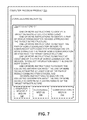
- FIG. 7 illustrates a block diagram of an example computer program product, arranged in accordance with at least some embodiments described herein.
- the computer program product 700 may include a signal bearing medium 702 that may also include one or more machine readable instructions 704 that, when executed by, for example, a processor may provide the functionality described above with respect to FIG. 5 .
- the pairing module 526 and/or the tomography module 527 executed on the processor 504 may undertake one or more of the tasks shown in FIG. 7 in response to the instructions 704 conveyed to the processor 504 by the signal bearing medium 702 to perform actions associated with aggregating mobile vehicle communication parameters to monitor roadway infrastructure as described herein.
- Some of those instructions may include, for example, one or more instructions to identify a target infrastructure for monitoring, identity a pair of mobile communication devices approaching the target infrastructure, instruct the pair of mobile communication devices to communicate with each other through one or more signals as the pair of mobile communication devices pass the target infrastructure, instruct at least one of the pair of mobile communication devices to collect information about the one or more signals, receive the collected information about the one or more signals from the at least one of the pair of mobile communication devices, and analyze the collected information about the one or more signals to determine a characteristic of the target infrastructure, according to some embodiments described herein.
- the signal bearing medium 702 depicted in FIG. 7 may encompass a computer-readable medium 706 , such as, but not limited to, a hard disk drive (HDD), a solid state drive (SSD), a Compact Disc (CD), a Digital Versatile Disk (DVD), a digital tape, memory, etc.
- the signal bearing medium 702 may encompass a recordable medium 708 , such as, but not limited to, memory, read/write (R/W) CDs, R/W DVDs, etc.
- the signal bearing medium 702 may encompass a communications medium 710 , such as, but not limited to, a digital and/or an analog communication medium (for example, a fiber optic cable, a waveguide, a wired communications link, a wireless communication link, etc.).
- a communications medium 710 such as, but not limited to, a digital and/or an analog communication medium (for example, a fiber optic cable, a waveguide, a wired communications link, a wireless communication link, etc.).
- the computer program product 700 may be conveyed to one or more modules of the processor 504 of FIG. 5 by an RF signal bearing medium, where the signal bearing medium 702 may be conveyed by the wireless communications medium 710 (for example, a wireless communication medium conforming with the IEEE 802.11 standard).
- the present disclosure provides a method to monitor roadway infrastructure based on aggregated mobile vehicle communication parameters.
- the method may include identifying a target infrastructure to monitor, identifying a pair of mobile communication devices approaching the target infrastructure, instructing the pair of mobile communication devices to communicate with each other through one or more signals as the pair of mobile communication devices pass the target infrastructure, instructing at least one of the pair of mobile communication devices to collect information about the one or more signals, receiving the collected information about the one or more signals from the at least one of the pair of mobile communication devices, and analyzing the collected information about the one or more signals to determine a structural characteristic of the target infrastructure.
- instructing the pair of mobile communication devices to communicate with each other may include causing the pair of mobile communication devices to exchange radio frequency communication signals.
- analyzing the information about the collected one or more signals may include determining one or more communication parameters including an amplitude, a frequency, or a phase.
- the mobile communication devices may be integrated with a car, a boat, and/or a train.
- the target infrastructure may be a bridge, a pillar, a tunnel, an overpass, a concrete structure, and/or a steel reinforced structure.
- the method may also include receiving location data from each of the pair of mobile communication devices.
- Receiving the location data may include receiving the location data from a GPS and/or an accelerometer integrated with the mobile communication device.
- the method may also include refining locations of the received one or more signals employing the location data.
- instructing the pair of mobile communication devices to communicate with each other may include causing an audio, a video, or a data exchange communication to be established between the pair of mobile communication devices.
- instructing the pair of mobile communication devices to communicate with each other includes causing the pair of mobile communication devices to communicate without an audio, a video, or a data exchange communication to be established between the pair of mobile communication devices.
- the method may also include assembling a tomographic model of the target infrastructure based on the analyzed information about the one or more signals.
- the tomographic model may be a three-dimensional (3D) model.
- Assembling the tomographic model may include extracting channel state data from the analyzed one or more signals that represent propagation conditions of the one or more signals through the target infrastructure.
- the channel state data may include effects of: a multipath, a spatial distribution and/or a conductivity of the target infrastructure.
- assembling the tomographic model may include aggregating the extracted channel state data into a density and conductance map of the target infrastructure. Assembling the tomographic model further may also include employing a sparse sensing approach, a stochastic approach, a state space approach, and/or a scattering approach. The method may further include updating the tomographic model with newly received data from one or more pairs of mobile communication devices.
- the method may also include storing the tomographic model in a historical database as a function of a date and a time for monitoring the target infrastructure at a particular time.
- the method may also include employing the tomographic model to detect target infrastructure flaws including material loss, spalling, pop-outs, cracks, honeycombing, corrosion, rusting, and/or misalignment of bearings and reinforcement structures.
- the method may further include instructing at least one of the mobile communication devices to analyze the collected signals and to provide analysis results to a tomographic data builder to assemble a tomographic model.
- the present disclosure describes a controller to monitor roadway infrastructure based on aggregated mobile vehicle communication parameters.
- the controller may include a memory configured to store instructions, a communication module configured to facilitate communications with one or more mobile communication devices and to instruct the mobile communication devices to exchange one or more signals, and a processor coupled to the memory and the communication module, the processor configured to execute a tomography application in conjunction with the instructions stored in the memory.
- the tomography application may be configured to identify a target infrastructure for monitoring, identify a pair of mobile communication devices approaching the target infrastructure via a pairing module of the tomography application, control the communication module to instruct pair of mobile communication devices to communicate with each other through the one or more signals as the pair of mobile communication devices pass the target infrastructure, control the communication module to instruct at least one of the pair of mobile communication devices to collect information about the one or more signals, receive the collected information about the one or more signals from the at least one of the pair of mobile communication devices, and analyze the collected information about the one or more signals to determine a structural characteristic of the target infrastructure.
- the one or more signals may be radio frequency communication signals and the tomography application may be further configured to analyze an amplitude, a frequency, and/or a phase of the radio frequency communication signals.
- the mobile communication devices include a citizens band radio, a cellular communication device, a wireless data exchange device, and/or a global positioning device.
- the mobile communication devices may be integrated with a car, a boat, or a train.
- the target infrastructure may be a bridge, a pillar, a tunnel, an overpass, a concrete structure, or a steel reinforced structure.
- the tomography application may be configured to instruct the pair of mobile communication devices to communicate with each other by causing an audio, a video, or a data exchange communication to be established between the pair of mobile communication devices.
- the tomography application may be further configured to aggregate the received one or more signals from multiple pairs of mobile communication devices that pass the target infrastructure over a period of time.
- the tomography application may be further configured to assemble a tomographic model of the target infrastructure based on extraction of channel state data from the analyzed one or more signals that represent propagation conditions of the one or more signals through the target infrastructure, wherein the channel state data includes effects of a multipath, a spatial distribution, and/or a conductivity of the target infrastructure between the pair of mobile communication devices, and aggregate the extracted channel state data into a density and conductance map of the target infrastructure.
- the tomography application may be further configured to store the tomographic model in a historical database as a function of a date and a time to monitor the target infrastructure at a particular time, and employ the tomographic model to detect target infrastructure flaw.
- the tomography application may be further configured to provide the tomographic model to a requesting service.
- the present disclosure describes a mobile communication network to monitor roadway infrastructure based on aggregated mobile vehicle communication parameters.
- the mobile communication network may include a plurality of mobile communication devices, and one or more servers to manage communication among the plurality of mobile communication devices, where least one of the one or more servers may be configured to identify a target infrastructure for monitoring, identify pairs of mobile communication devices approaching the target infrastructure, instruct the pairs of mobile communication devices to communicate with each other through the one or more signals as the pairs of mobile communication devices pass the target infrastructure, instruct one or more of the pairs of mobile communication devices to collect information about the one or more signals, receive the collected information about the one or more signals from the one or more of the pairs of mobile communication devices, aggregate the received information about the one or more signals from the pairs of mobile communication devices that pass the target infrastructure over a period of time, and analyze the aggregated information about the one or more signals to determine a structural characteristic of the target infrastructure.
- the mobile communication network may be an Evolved Universal Mobile Telecommunications System Terrestrial Radio Access Network (eUTRAN), a long term evolution (LTE) network, an LTE-Advanced network, a high speed packet access (HSPA) network, or an advanced HSPA network.
- the one or more signals may be radio frequency communication signals and the at least one of the servers may be further configured to analyze an amplitude, a frequency, and/or a phase of the radio frequency communication signals.
- the at least one of the servers may be further configured to receive location data from each of the pairs of mobile communication devices, and refine a location of the received one or more signals employing the location data.
- At least one other of the one or more servers may be configured to facilitate an audio, a video, or a data exchange communication between the pairs of mobile communication devices.
- At least one of the servers may be further configured to instruct the one or more of the pairs of mobile communication devices to collect the one or more signals during the facilitated communication.
- the at least one of the servers may be further configured to assemble a three-dimensional (3D) tomographic model of the target infrastructure based on the analyzed aggregated signals, update the tomographic model with newly received data from other pairs of mobile communication devices, store the tomographic model in a historical database as a function of a date and a time to monitor the target infrastructure at a particular time, and employ the tomographic model to detect target infrastructure flaw.
- 3D three-dimensional
- the present disclosure describes a computer readable storage medium with instructions stored thereon, which when executed on one or more computing devices execute a method to monitor roadway infrastructure based on aggregated mobile vehicle communication parameters.
- a signal bearing medium examples include, but are not limited to, the following: a recordable type medium such as a floppy disk, a hard disk drive (HDD), a Compact Disc (CD), a Digital Versatile Disk (DVD), a digital tape, a computer memory, etc.; and a transmission type medium such as a digital and/or an analog communication medium (for example, a fiber optic cable, a waveguide, a wired communication link, a wireless communication link, etc.).
- a typical data processing system generally includes one or more of a system unit housing, a video display device, a memory such as volatile and non-volatile memory, processors such as microprocessors and digital signal processors, computational entities such as operating systems, drivers, graphical user interfaces, and applications programs, one or more interaction devices, such as a touch pad or screen, and/or control systems including feedback loops.
- a typical data processing system may be implemented utilizing any suitable commercially available components, such as those typically found in data computing/communication and/or network computing/communication systems.
- the herein described subject matter sometimes illustrates different components contained within, or connected with, different other components. It is to be understood that such depicted architectures are merely exemplary, and that in fact many other architectures may be implemented which achieve the same functionality. In a conceptual sense, any arrangement of components to achieve the same functionality is effectively “associated” such that particular functionality is achieved. Hence, any two components herein combined to achieve a particular functionality may be seen as “associated with” each other such that the particular functionality is achieved, irrespective of architectures or intermediate components.
- any two components so associated may also be viewed as being “operably connected”, or “operably coupled”, to each other to achieve the particular functionality, and any two components capable of being so associated may also be viewed as being “operably couplable”, to each other to achieve the particular functionality.
- operably couplable include but are not limited to physically connectable and/or physically interacting components and/or wirelessly interactable and/or wirelessly interacting components and/or logically interacting and/or interactable components.
- a range includes each individual member.
- a group having 1-3 cells refers to groups having 1, 2, or 3 cells.
- a group having 1-5 cells refers to groups having 1, 2, 3, 4, or 5 cells, and so forth.
Landscapes
- Engineering & Computer Science (AREA)
- Radar, Positioning & Navigation (AREA)
- Remote Sensing (AREA)
- Physics & Mathematics (AREA)
- General Physics & Mathematics (AREA)
- Automation & Control Theory (AREA)
- Life Sciences & Earth Sciences (AREA)
- Health & Medical Sciences (AREA)
- Electromagnetism (AREA)
- Chemical & Material Sciences (AREA)
- Analytical Chemistry (AREA)
- Biochemistry (AREA)
- General Health & Medical Sciences (AREA)
- Immunology (AREA)
- Pathology (AREA)
- Traffic Control Systems (AREA)
- Mobile Radio Communication Systems (AREA)
Abstract
Description
Claims (25)
Applications Claiming Priority (1)
| Application Number | Priority Date | Filing Date | Title |
|---|---|---|---|
| PCT/US2014/015322 WO2015119619A1 (en) | 2014-02-07 | 2014-02-07 | Roadway infrastructure monitoring based on aggregated mobile vehicle communication parameters |
Publications (2)
| Publication Number | Publication Date |
|---|---|
| US20160011124A1 US20160011124A1 (en) | 2016-01-14 |
| US9784692B2 true US9784692B2 (en) | 2017-10-10 |
Family
ID=53778302
Family Applications (1)
| Application Number | Title | Priority Date | Filing Date |
|---|---|---|---|
| US14/372,439 Expired - Fee Related US9784692B2 (en) | 2014-02-07 | 2014-02-07 | Roadway infrastructure monitoring based on aggregated mobile vehicle communication parameters |
Country Status (4)
| Country | Link |
|---|---|
| US (1) | US9784692B2 (en) |
| KR (1) | KR101864135B1 (en) |
| CN (1) | CN105980839A (en) |
| WO (1) | WO2015119619A1 (en) |
Cited By (1)
| Publication number | Priority date | Publication date | Assignee | Title |
|---|---|---|---|---|
| US10386449B2 (en) * | 2016-02-10 | 2019-08-20 | United States Of America As Represented By The Secretary Of The Air Force | System and method for radio tomographic image formation |
Families Citing this family (5)
| Publication number | Priority date | Publication date | Assignee | Title |
|---|---|---|---|---|
| DE102015219783B3 (en) * | 2015-10-13 | 2016-12-29 | Volkswagen Aktiengesellschaft | Method and system for controlling data |
| JP6676443B2 (en) * | 2016-04-01 | 2020-04-08 | パナソニック インテレクチュアル プロパティ コーポレーション オブ アメリカPanasonic Intellectual Property Corporation of America | Infrastructure inspection device, infrastructure inspection method, and infrastructure inspection system |
| JP6621363B2 (en) * | 2016-04-01 | 2019-12-18 | パナソニック インテレクチュアル プロパティ コーポレーション オブ アメリカPanasonic Intellectual Property Corporation of America | Vehicle and measuring method |
| CN107879137B (en) * | 2017-10-23 | 2019-07-23 | 中国神华能源股份有限公司 | System, method and readable storage medium storing program for executing for being positioned to railway carriage hook |
| CN108965797A (en) * | 2018-06-25 | 2018-12-07 | 珠海思诺锐创软件有限公司 | A kind of preset point cruise bridge structure Visualized management system |
Citations (10)
| Publication number | Priority date | Publication date | Assignee | Title |
|---|---|---|---|---|
| EP1223567A1 (en) | 2001-01-11 | 2002-07-17 | Siemens Aktiengesellschaft | A method for inter-vehicle communication of individualized vehicle data |
| US20050065711A1 (en) * | 2003-04-07 | 2005-03-24 | Darwin Dahlgren | Centralized facility and intelligent on-board vehicle platform for collecting, analyzing and distributing information relating to transportation infrastructure and conditions |
| US20090021423A1 (en) | 2007-07-19 | 2009-01-22 | Cheng Shirley N | Method and apparatus for three dimensional tomographic image reconstruction of objects |
| WO2011016857A2 (en) | 2009-08-05 | 2011-02-10 | Elliott James C | Equipment and system for structure inspection and monitoring |
| US20110095908A1 (en) | 2009-10-22 | 2011-04-28 | Nadeem Tamer M | Mobile sensing for road safety, traffic management, and road maintenance |
| US20110187702A1 (en) | 2010-01-29 | 2011-08-04 | Northrop Grumman Systems Corporation | Drive-by tomography |
| US20110273321A1 (en) | 2008-09-12 | 2011-11-10 | Sarang Joshi | Method and System for Tracking Objects Using Radio Tomographic Imaging |
| US20130018575A1 (en) | 2010-03-19 | 2013-01-17 | Ralf Birken | Roaming Mobile Sensor Platform For Collecting Geo-Referenced Data and Creating Thematic Maps |
| US20130030687A1 (en) | 2010-04-12 | 2013-01-31 | Toyota Jidosha Kabushiki Kaisha | On-vehicle apparatus, preceding vehicle position determining apparatus, and preceding vehicle position determining method |
| US20130301584A1 (en) | 2011-01-14 | 2013-11-14 | Cisco Technology, Inc. | System and method for enabling a vehicular access network in a vehicular environment |
Family Cites Families (4)
| Publication number | Priority date | Publication date | Assignee | Title |
|---|---|---|---|---|
| KR101278085B1 (en) * | 2006-06-30 | 2013-06-24 | 애보트 바이올로지컬스 비.브이. | Methods and systems for determining lot consistency |
| US7747417B2 (en) * | 2007-08-06 | 2010-06-29 | Arizona Public Service Company | Method and system for transformer dissolved gas harmonic regression analysis |
| US8330605B2 (en) * | 2009-08-14 | 2012-12-11 | Accenture Global Services Limited | System for providing real time locating and gas exposure monitoring |
| CN102592458A (en) * | 2012-02-07 | 2012-07-18 | 福州大学 | Road traffic flow detection method and system based on RFID (Radio Frequency Identification) |
-
2014
- 2014-02-07 WO PCT/US2014/015322 patent/WO2015119619A1/en not_active Ceased
- 2014-02-07 CN CN201480075060.8A patent/CN105980839A/en active Pending
- 2014-02-07 US US14/372,439 patent/US9784692B2/en not_active Expired - Fee Related
- 2014-02-07 KR KR1020167023230A patent/KR101864135B1/en not_active Expired - Fee Related
Patent Citations (10)
| Publication number | Priority date | Publication date | Assignee | Title |
|---|---|---|---|---|
| EP1223567A1 (en) | 2001-01-11 | 2002-07-17 | Siemens Aktiengesellschaft | A method for inter-vehicle communication of individualized vehicle data |
| US20050065711A1 (en) * | 2003-04-07 | 2005-03-24 | Darwin Dahlgren | Centralized facility and intelligent on-board vehicle platform for collecting, analyzing and distributing information relating to transportation infrastructure and conditions |
| US20090021423A1 (en) | 2007-07-19 | 2009-01-22 | Cheng Shirley N | Method and apparatus for three dimensional tomographic image reconstruction of objects |
| US20110273321A1 (en) | 2008-09-12 | 2011-11-10 | Sarang Joshi | Method and System for Tracking Objects Using Radio Tomographic Imaging |
| WO2011016857A2 (en) | 2009-08-05 | 2011-02-10 | Elliott James C | Equipment and system for structure inspection and monitoring |
| US20110095908A1 (en) | 2009-10-22 | 2011-04-28 | Nadeem Tamer M | Mobile sensing for road safety, traffic management, and road maintenance |
| US20110187702A1 (en) | 2010-01-29 | 2011-08-04 | Northrop Grumman Systems Corporation | Drive-by tomography |
| US20130018575A1 (en) | 2010-03-19 | 2013-01-17 | Ralf Birken | Roaming Mobile Sensor Platform For Collecting Geo-Referenced Data and Creating Thematic Maps |
| US20130030687A1 (en) | 2010-04-12 | 2013-01-31 | Toyota Jidosha Kabushiki Kaisha | On-vehicle apparatus, preceding vehicle position determining apparatus, and preceding vehicle position determining method |
| US20130301584A1 (en) | 2011-01-14 | 2013-11-14 | Cisco Technology, Inc. | System and method for enabling a vehicular access network in a vehicular environment |
Non-Patent Citations (29)
| Title |
|---|
| "A Bridge Collapses," published on Aug. 5, 2007, Accessed at http://www.nytimes.com/2007/08/05/opinion/05sun1.html?-r=1&, Accessed on Jul. 9, 2014, pp. 2. |
| "Chapter 4: Inspection Procedures-General Discussion," Accessed at http://web.archive.org/web/20131013011846/http://www.fhwa.dot.gov/bridge/tunnel/inspectman04.cfm, Accessed on Jul. 9, 2014, pp. 24. |
| "I1 MAGIC," Accessed at http://web.archive.org/web/20131221205227/http://users.ece.gatech.edu/˜justin/I1magic/, Accessed on Jul. 9, 2014, pp. 3. |
| "MIMO Performance and Condition Number in LTE Test," Accessed at http://web.archive.org/web/20140709071341/http://cp.literature.agilent.com/litweb/pdf/5990-4759EN.pdf, Accessed on Jul. 9, 2014, pp. 14. |
| "Modern Bridge and Infrastructure Inspection Methods and the Need for Faster, More Frequent and Ore Efficient Inspection," on Mar. 7, 2011, Accessed at http://web.archive.org/web/20130810071823/http://nextbigfuture.com/2011/03/modern-bridge-and-infrastructure.html, Accessed on Jul. 9, 2014, pp. 12. |
| "National Bridge Inventory (NBI)," Accessed at http://web.archive.org/web/20140109110230/http://www.fhwa.dot.gov/bridge/nbi.cfm, Accessed on Jul. 9, 2014, p. 1. |
| "WiMAX MIMO," Accessed at http://web.archive.org/web/20120508101740/http://en.wikipedia.org/wiki/WiMAX-MIMO, Accessed on Jul. 9, 2014, pp. 8. |
| "A Bridge Collapses," published on Aug. 5, 2007, Accessed at http://www.nytimes.com/2007/08/05/opinion/05sun1.html?—r=1&, Accessed on Jul. 9, 2014, pp. 2. |
| "Chapter 4: Inspection Procedures—General Discussion," Accessed at http://web.archive.org/web/20131013011846/http://www.fhwa.dot.gov/bridge/tunnel/inspectman04.cfm, Accessed on Jul. 9, 2014, pp. 24. |
| "WiMAX MIMO," Accessed at http://web.archive.org/web/20120508101740/http://en.wikipedia.org/wiki/WiMAX—MIMO, Accessed on Jul. 9, 2014, pp. 8. |
| Cande's, E. et al., "Robust Uncertainty Principles: Exact Signal Reconstruction from Highly Incomplete Frequency Information," IEEE Trans. Information Theory, vol. 52, No. 2, pp. 489-509, (2006). |
| International Search Report for International Patent Application No. PCT/US2014/015322 mailed May 19, 2014. |
| Karedal, J. et al., "A geometry-based stochastic MIMO model for vehicle-to-vehicle communications," IEEE Transactions on Wireless Communications, vol. 8, No. 7, pp. 3646-3657 (2008). |
| Keel, J., "An Audit Report on the Department of Transportation's Bridge Inspection Program," on Dec. 2009, Accessed at http://web.archive.org/web/20131118142730/http://www.sao.state.tx.us/reports/report.aspx?reportnumber=10-017, Accessed on Jul. 9, 2014, pp. 2. |
| Leber, J., "How Wireless Carriers are Monetizing Your Movements," Accessed at http://www.technologyreview.com/news/513016/how-wireless-carriers-are-monetizing-your-movements/, Accessed on Jul. 9, 2014, pp. 4. |
| Lee, J. et al., "MIMO Technologies in 3GPP LTE and LTE-Advanced," EURASIP Journal on Wireless Communications and Networking, vol. 2009, No. 3, pp. 10 (2009). |
| Luettel, T. et al., "Autonomous Ground Vehicles-Concepts and a Path to the Future," Proceedings of the IEEE 100 (Centennial-Issue), pp. 1831-1839, May 2012. |
| Mandache, C., and Lefebvre, J. H. V., "Electromagnetic enhancement of pulsed eddy current signals", AIP Conference Proceedings, vol. 894, pp. 318-324, (2007). |
| Mostofi, Y., "Cooperative Wireless-Based Obstacle/Object Mapping and See-Through Capabilities in Robotic Networks," IEEE Transactions on Mobile Computing, vol. 12, No. 5, May 2013, pp. 817-829. |
| Murner, C. and Hansen, J. P., "Buried Corrosion Detection in Multi-Layer Airframe Structures Using Pulsed Eddy Current", 17th World Conference on NondestructiveTesting, Shanghai, China, Oct. 25-28, 2008, pp. 7. |
| Pätzold, M. and Hogstad, B. O., "A wideband MIMO channel model derived from the geometric elliptical scattering model," Wireless Communications & Mobile Computing, vol. 8, No. 5, pp. 138-143, Sep. 2006. |
| Reid, R. L., "The Infrastructure Crisis," Accessed at http://www.asce.org/Content.aspx?id=25562, Accessed on Jul. 9, 2014, pp. 27. |
| Salmi, J. et al., "Detection and tracking of MIMO propagation path parameters using state-space approach," IEEE Transactions on Signal Processing, vol. 57, No. 4, pp. 1538-1550 (2009). |
| Thrun, S., "Artificial intelligence for robotics," Accessed at http://web.archive.org/web/20140122074921/https://www.udacity.com/course/cs373, Accessed on Jul. 9, 2014, pp. 3. |
| Washer, G. A., "Developing NDE Technologies for Infrastructure Assessment," Accessed at http://web.archive.org/web/20111022120327/https://www.fhwa.dot.gov/publications/publicroads/00jan/nde.cfm, Accessed on Jul. 9, 2014, pp. 7. |
| Wicks, M.C., "RF Tomography with Application to Ground Penetrating Radar," Proc. Asilomar Conf. Signals, Systems and Computers, Nov. 2007, pp. 2017-2022. |
| Wilson, J., and Patwari, N., "Radio Tomographic Imaging with Wireless Networks," IEEE Transactions on Mobile Computing, vol. 9, No. 5, pp. 621-632 (2010). |
| Xiaoduan, S. et al., "Analysis of Past National Bridge Inventory Ratings for Predicting Bridge System Preservation Needs." Transportation Research Record, vol. 1866, No. 1, Jan. 1, 2004, pp. 36-43. |
| Yu, K. and Ottersten, B., "Models for MIMO propagation channels: a review," Wireless Communications and Mobile Computing, vol. 2, No. 7, pp. 653-666 (2002). |
Cited By (2)
| Publication number | Priority date | Publication date | Assignee | Title |
|---|---|---|---|---|
| US10386449B2 (en) * | 2016-02-10 | 2019-08-20 | United States Of America As Represented By The Secretary Of The Air Force | System and method for radio tomographic image formation |
| US10969460B2 (en) | 2016-02-10 | 2021-04-06 | United States Of America As Represented By The Secretary Of The Air Force | Method for radio tomographic image formation |
Also Published As
| Publication number | Publication date |
|---|---|
| KR101864135B1 (en) | 2018-06-04 |
| US20160011124A1 (en) | 2016-01-14 |
| CN105980839A (en) | 2016-09-28 |
| WO2015119619A1 (en) | 2015-08-13 |
| KR20160113231A (en) | 2016-09-28 |
Similar Documents
| Publication | Publication Date | Title |
|---|---|---|
| US9784692B2 (en) | Roadway infrastructure monitoring based on aggregated mobile vehicle communication parameters | |
| EP3987250B1 (en) | Route planning using crowd-sourced network data | |
| US20190049943A1 (en) | Methods and apparatus for predicting favored wireless service areas for drones | |
| US11304172B2 (en) | Site estimation based on crowd sourced data | |
| Du et al. | Vanet based traffic estimation: A matrix completion approach | |
| US9763105B2 (en) | Determining coverage hole of communication network along road | |
| CN102547579A (en) | Method and system of road test | |
| CN108540931B (en) | A Cooperative Localization Algorithm for Segmented Line-of-Sight Nodes in Downhole Intervals | |
| CN102914799B (en) | Forward modeling method and device for nonequivalent wave field | |
| FI3251300T4 (en) | Procedure and apparatus for carrying out measurements for the management of radio resources | |
| CN106643541A (en) | Method and device for management and analysis of real-time monitoring data of bridge | |
| CA2988634C (en) | System and method for event detection using streaming signals | |
| Gundlegård | Transport analytics based on cellular network signalling data | |
| KR102307401B1 (en) | Apparatus and method for analysing network information in wireless communication system | |
| CN116416804A (en) | Road traffic flow estimation method, device, electronic equipment and storage medium | |
| US11463881B2 (en) | Vehicular integration of enterprise wireless scanning | |
| CN109996281A (en) | Signal strength test method, apparatus, computer equipment and storage medium | |
| US20240393263A1 (en) | Pollution monitoring using integrated sensing and communication | |
| CN119004721A (en) | Pipe network topological relation detection method and device, electronic equipment and storage medium | |
| CN108271203B (en) | A kind of network quality assessment method and equipment | |
| US20250168667A1 (en) | System and method for modeling wireless communication environment for new radio-unlicensed signals | |
| US11937175B2 (en) | Automatic cell range | |
| US12501277B2 (en) | Identification of new growth areas in a telecommunications network by identifying areas with no coverage | |
| CN115843046B (en) | Elevated road data processing method, device, electronic equipment and storage medium | |
| Rahman et al. | Analysis of Energy Efficiency in Wireless Geophone Networks with Adaptive Clustering and Master Node Selection |
Legal Events
| Date | Code | Title | Description |
|---|---|---|---|
| AS | Assignment |
Owner name: ARDENT RESEARCH CORPORATION, CALIFORNIA Free format text: ASSIGNMENT OF ASSIGNORS INTEREST;ASSIGNOR:KRUGLICK, EZEKIEL;REEL/FRAME:032173/0397 Effective date: 20140130 Owner name: EMPIRE TECHNOLOGY DEVELOPMENT, LLC, DELAWARE Free format text: ASSIGNMENT OF ASSIGNORS INTEREST;ASSIGNOR:ARDENT RESEARCH CORPORATION;REEL/FRAME:032173/0432 Effective date: 20140130 |
|
| AS | Assignment |
Owner name: ARDENT RESEARCH CORPORATION, CALIFORNIA Free format text: ASSIGNMENT OF ASSIGNORS INTEREST;ASSIGNOR:KRUGLICK, EZEKIEL;REEL/FRAME:033318/0099 Effective date: 20140130 Owner name: EMPIRE TECHNOLOGY DEVELOPMENT LLC, DELAWARE Free format text: ASSIGNMENT OF ASSIGNORS INTEREST;ASSIGNOR:ARDENT RESEARCH CORPORATION;REEL/FRAME:033318/0106 Effective date: 20140130 |
|
| STCF | Information on status: patent grant |
Free format text: PATENTED CASE |
|
| CC | Certificate of correction | ||
| AS | Assignment |
Owner name: CRESTLINE DIRECT FINANCE, L.P., TEXAS Free format text: SECURITY INTEREST;ASSIGNOR:EMPIRE TECHNOLOGY DEVELOPMENT LLC;REEL/FRAME:048373/0217 Effective date: 20181228 |
|
| AS | Assignment |
Owner name: EMPIRE TECHNOLOGY DEVELOPMENT LLC, WASHINGTON Free format text: RELEASE BY SECURED PARTY;ASSIGNOR:CRESTLINE DIRECT FINANCE, L.P.;REEL/FRAME:051404/0828 Effective date: 20191220 |
|
| AS | Assignment |
Owner name: XINCTEK TECHNOLOGIES LLC, TEXAS Free format text: ASSIGNMENT OF ASSIGNORS INTEREST;ASSIGNOR:EMPIRE TECHNOLOGY DEVELOPMENT LLC;REEL/FRAME:052290/0515 Effective date: 20191220 Owner name: XINCTEC TECHNOLOGIES LLC, TEXAS Free format text: ASSIGNMENT OF ASSIGNORS INTEREST;ASSIGNOR:EMPIRE TECHNOLOGY DEVELOPMENT LLC;REEL/FRAME:052290/0515 Effective date: 20191220 |
|
| AS | Assignment |
Owner name: XINCTEC TECHNOLOGIES LLC, TEXAS Free format text: CORRECTIVE ASSIGNMENT TO CORRECT THE SPELLING IN ASSIGNEE IS INCORRECT, IT SHOULD BE "XINCTEC" NOT "XINCTEK" PREVIOUSLY RECORDED AT REEL: 052290 FRAME: 0515. ASSIGNOR(S) HEREBY CONFIRMS THE ASSIGNMENT;ASSIGNOR:EMPIRE TECHNOLOGY DEVELOPMENT LLC;REEL/FRAME:054542/0311 Effective date: 20191220 |
|
| FEPP | Fee payment procedure |
Free format text: MAINTENANCE FEE REMINDER MAILED (ORIGINAL EVENT CODE: REM.); ENTITY STATUS OF PATENT OWNER: LARGE ENTITY |
|
| LAPS | Lapse for failure to pay maintenance fees |
Free format text: PATENT EXPIRED FOR FAILURE TO PAY MAINTENANCE FEES (ORIGINAL EVENT CODE: EXP.); ENTITY STATUS OF PATENT OWNER: LARGE ENTITY |
|
| STCH | Information on status: patent discontinuation |
Free format text: PATENT EXPIRED DUE TO NONPAYMENT OF MAINTENANCE FEES UNDER 37 CFR 1.362 |
|
| FP | Lapsed due to failure to pay maintenance fee |
Effective date: 20211010 |