US12260590B2 - System and method for online camera to ground alignment - Google Patents
System and method for online camera to ground alignment Download PDFInfo
- Publication number
- US12260590B2 US12260590B2 US17/719,151 US202217719151A US12260590B2 US 12260590 B2 US12260590 B2 US 12260590B2 US 202217719151 A US202217719151 A US 202217719151A US 12260590 B2 US12260590 B2 US 12260590B2
- Authority
- US
- United States
- Prior art keywords
- frame
- image data
- data file
- feature
- vehicle
- Prior art date
- Legal status (The legal status is an assumption and is not a legal conclusion. Google has not performed a legal analysis and makes no representation as to the accuracy of the status listed.)
- Active, expires
Links
Images


Classifications
-
- G—PHYSICS
- G06—COMPUTING OR CALCULATING; COUNTING
- G06T—IMAGE DATA PROCESSING OR GENERATION, IN GENERAL
- G06T7/00—Image analysis
- G06T7/80—Analysis of captured images to determine intrinsic or extrinsic camera parameters, i.e. camera calibration
-
- G—PHYSICS
- G06—COMPUTING OR CALCULATING; COUNTING
- G06T—IMAGE DATA PROCESSING OR GENERATION, IN GENERAL
- G06T7/00—Image analysis
- G06T7/30—Determination of transform parameters for the alignment of images, i.e. image registration
- G06T7/33—Determination of transform parameters for the alignment of images, i.e. image registration using feature-based methods
-
- G—PHYSICS
- G06—COMPUTING OR CALCULATING; COUNTING
- G06V—IMAGE OR VIDEO RECOGNITION OR UNDERSTANDING
- G06V20/00—Scenes; Scene-specific elements
- G06V20/50—Context or environment of the image
- G06V20/56—Context or environment of the image exterior to a vehicle by using sensors mounted on the vehicle
- G06V20/58—Recognition of moving objects or obstacles, e.g. vehicles or pedestrians; Recognition of traffic objects, e.g. traffic signs, traffic lights or roads
-
- B—PERFORMING OPERATIONS; TRANSPORTING
- B60—VEHICLES IN GENERAL
- B60W—CONJOINT CONTROL OF VEHICLE SUB-UNITS OF DIFFERENT TYPE OR DIFFERENT FUNCTION; CONTROL SYSTEMS SPECIALLY ADAPTED FOR HYBRID VEHICLES; ROAD VEHICLE DRIVE CONTROL SYSTEMS FOR PURPOSES NOT RELATED TO THE CONTROL OF A PARTICULAR SUB-UNIT
- B60W40/00—Estimation or calculation of non-directly measurable driving parameters for road vehicle drive control systems not related to the control of a particular sub unit, e.g. by using mathematical models
- B60W40/02—Estimation or calculation of non-directly measurable driving parameters for road vehicle drive control systems not related to the control of a particular sub unit, e.g. by using mathematical models related to ambient conditions
- B60W40/04—Traffic conditions
-
- G—PHYSICS
- G06—COMPUTING OR CALCULATING; COUNTING
- G06T—IMAGE DATA PROCESSING OR GENERATION, IN GENERAL
- G06T7/00—Image analysis
- G06T7/70—Determining position or orientation of objects or cameras
-
- G—PHYSICS
- G06—COMPUTING OR CALCULATING; COUNTING
- G06T—IMAGE DATA PROCESSING OR GENERATION, IN GENERAL
- G06T7/00—Image analysis
- G06T7/70—Determining position or orientation of objects or cameras
- G06T7/73—Determining position or orientation of objects or cameras using feature-based methods
-
- G—PHYSICS
- G06—COMPUTING OR CALCULATING; COUNTING
- G06V—IMAGE OR VIDEO RECOGNITION OR UNDERSTANDING
- G06V10/00—Arrangements for image or video recognition or understanding
- G06V10/40—Extraction of image or video features
-
- G—PHYSICS
- G06—COMPUTING OR CALCULATING; COUNTING
- G06V—IMAGE OR VIDEO RECOGNITION OR UNDERSTANDING
- G06V20/00—Scenes; Scene-specific elements
- G06V20/40—Scenes; Scene-specific elements in video content
- G06V20/46—Extracting features or characteristics from the video content, e.g. video fingerprints, representative shots or key frames
-
- H—ELECTRICITY
- H04—ELECTRIC COMMUNICATION TECHNIQUE
- H04N—PICTORIAL COMMUNICATION, e.g. TELEVISION
- H04N5/00—Details of television systems
- H04N5/222—Studio circuitry; Studio devices; Studio equipment
- H04N5/262—Studio circuits, e.g. for mixing, switching-over, change of character of image, other special effects ; Cameras specially adapted for the electronic generation of special effects
- H04N5/2628—Alteration of picture size, shape, position or orientation, e.g. zooming, rotation, rolling, perspective, translation
-
- B—PERFORMING OPERATIONS; TRANSPORTING
- B60—VEHICLES IN GENERAL
- B60W—CONJOINT CONTROL OF VEHICLE SUB-UNITS OF DIFFERENT TYPE OR DIFFERENT FUNCTION; CONTROL SYSTEMS SPECIALLY ADAPTED FOR HYBRID VEHICLES; ROAD VEHICLE DRIVE CONTROL SYSTEMS FOR PURPOSES NOT RELATED TO THE CONTROL OF A PARTICULAR SUB-UNIT
- B60W2420/00—Indexing codes relating to the type of sensors based on the principle of their operation
- B60W2420/40—Photo, light or radio wave sensitive means, e.g. infrared sensors
- B60W2420/403—Image sensing, e.g. optical camera
-
- G—PHYSICS
- G06—COMPUTING OR CALCULATING; COUNTING
- G06T—IMAGE DATA PROCESSING OR GENERATION, IN GENERAL
- G06T2207/00—Indexing scheme for image analysis or image enhancement
- G06T2207/10—Image acquisition modality
- G06T2207/10016—Video; Image sequence
-
- G—PHYSICS
- G06—COMPUTING OR CALCULATING; COUNTING
- G06T—IMAGE DATA PROCESSING OR GENERATION, IN GENERAL
- G06T2207/00—Indexing scheme for image analysis or image enhancement
- G06T2207/30—Subject of image; Context of image processing
- G06T2207/30244—Camera pose
-
- G—PHYSICS
- G06—COMPUTING OR CALCULATING; COUNTING
- G06T—IMAGE DATA PROCESSING OR GENERATION, IN GENERAL
- G06T2207/00—Indexing scheme for image analysis or image enhancement
- G06T2207/30—Subject of image; Context of image processing
- G06T2207/30248—Vehicle exterior or interior
- G06T2207/30252—Vehicle exterior; Vicinity of vehicle
- G06T2207/30256—Lane; Road marking
Definitions
- the subject disclosure relates to computer imaging in autonomous vehicles and, in particular, to a system and method for determining an alignment between ground and a camera installed on the vehicle.
- Navigation of an autonomous vehicle can involve obtaining an image of a scene, determining the location of objects within the scene, and building a trajectory through the scene that avoids these objects based on the locations of the objects.
- a camera can be installed on the vehicle to obtain the image. The difference between a camera-centered coordinate system and a coordinate system of the ground around the vehicle can introduce errors into the calculations of the locations of the objects. Accordingly, it is desirable to provide a method for determining an alignment between the camera and the ground.
- a method of navigating a vehicle is disclosed.
- An original image data file of an environment is obtained at a camera conveyed by the vehicle.
- the original image data file is reduced to obtain a reduced image data file.
- An alignment between a camera-centered coordinate system and a ground coordinate system is determined using the reduced image data file.
- the original image data file includes a plurality or temporally spaced frames.
- Obtaining the reduced image data file further includes at least one of selecting a first frame and a second frame from the plurality of temporally spaced frames of the original image data file, wherein a temporal spacing between the first frame and the second frame is based on a velocity of the vehicle, removing a pixel from a frame of the original image data file using on a reduction algorithm, and cropping the frame to remove a section of the frame.
- the method further includes forming a feature pair between a first feature of the first frame and a second feature of the second frame and removing the feature pair when a metric of the first feature and the second feature is less than a criterion.
- the method further includes assigning a quality score to the feature pair and removing the feature pair when the quality score is less than a quality threshold.
- the method further includes generating a road mask in an image plane of the camera from the alignment.
- the method further includes determining a weighted average value of the alignment using a confidence level of a moving average of the alignment for a plurality of frames of the reduced image data file.
- a system for navigating a vehicle includes a camera conveyed by the vehicle and a processor.
- the camera is configured to obtain an original image data file of an environment.
- the processor is configured to reduce the original image data file to obtain a reduced image data file and determine an alignment between a camera-centered coordinate system and a ground coordinate system using the reduced image data file.
- the original image data file includes a plurality or temporally spaced frames.
- the processor is further configured to obtain the reduced image data file by performing at least one of selecting a first frame and a second frame from the plurality of temporally spaced frames of the original image data file, wherein a temporal spacing between the first frame and the second frame is based on a velocity of the vehicle, removing a pixel from a frame of the original image data file using on a reduction algorithm, and cropping the frame to remove a section of the frame.
- the processor is further configured to form a feature pair between a first feature of the first frame and a second feature of the second frame and remove the feature pair when a metric of the first feature and the second feature is less than a criterion.
- the processor is further configured to assign a quality score to the feature pair and remove the feature pair when the quality score is less than a quality threshold.
- the processor is further configured to generate a road mask in an image plane of the camera from the alignment.
- the processor is further configured to determine a weighted average value of the alignment using a confidence level of a moving average of the alignment for a plurality of frames of the reduced image data file.
- a vehicle in yet another exemplary embodiment, includes a camera and a processor.
- the camera is configured to obtain an original image data file of an environment.
- the processor is configured to reduce the original image data file to obtain a reduced image data file and determine an alignment between a camera-centered coordinate system and a ground coordinate system using the reduced image data file.
- the original image data file includes a plurality or temporally spaced frames.
- the processor is configured to obtain the reduced image data file by performing at least one of selecting a first frame and a second frame from the plurality of temporally spaced frames of the original image data file, wherein a temporal spacing between the first frame and the second frame is based on a velocity of the vehicle, removing a pixel from a frame of the original image data file using on a reduction algorithm, and cropping the frame to remove a section of the frame.
- the processor is further configured to form a feature pair between a first feature of the first frame and a second feature of the second frame and remove the feature pair when a metric of the first feature and the second feature is less than a criterion.
- the processor is further configured to assign a quality score to the feature pair and remove the feature pair when the quality score is less than a quality threshold.
- the processor is further configured to generate a road mask in an image plane of the camera from the alignment.
- FIG. 1 shows a vehicle in an exemplary embodiment
- FIG. 2 shows a frame of an image data file used in camera ground alignment, in an illustrative embodiment
- FIG. 3 shows a schematic diagram illustrating a method for determining alignment between a camera of the vehicle and a ground coordinate system of the vehicle;
- FIG. 4 shows a schematic representation of an original image data file illustrating the effects of vehicle speed on frame selection
- FIG. 5 shows a flowchart of a method of operation of an image reduction module
- FIG. 6 shows a progression of a frame through the method shown in the flowchart of FIG. 5 ;
- FIG. 7 shows a flowchart of a method for building a set of feature pairs
- FIG. 8 shows a flowchart of a method for feature pair selection
- FIG. 9 illustrates an operation of feature pair reduction
- FIG. 10 shows an image with features remaining after feature pair reduction
- FIG. 11 shows a diagram schematically illustrating a road mask projection
- FIG. 12 shows a superposition of the road mask over an image captured at the camera
- FIG. 13 shows two images demonstrating the scalability of the road mask based on image field of view
- FIG. 14 shows a flowchart of a scaling procedure suitable for scaling a road mask based on image field of view
- FIG. 15 shows a flowchart for determining a confidence level for an alignment, as performed by the confidence generation module of FIG. 3 .
- module refers to processing circuitry that may include an application specific integrated circuit (ASIC), an electronic circuit, a processor (shared, dedicated, or group) and memory that executes one or more software or firmware programs, a combinational logic circuit, and/or other suitable components that provide the described functionality.
- ASIC application specific integrated circuit
- processor shared, dedicated, or group
- memory that executes one or more software or firmware programs, a combinational logic circuit, and/or other suitable components that provide the described functionality.
- FIG. 1 shows a vehicle 10 .
- the vehicle 10 can be an autonomous vehicle or a non-autonomous vehicle, in various embodiments.
- the vehicle 10 is a so-called Level Four or Level Five automation system.
- a Level Four system indicates “high automation,” referring to the driving mode-specific performance by an automated driving system of all aspects of the dynamic driving task, even if a human driver does not respond appropriately to a request to intervene.
- a Level Five system indicates “full automation,” referring to the full-time performance by an automated driving system of all aspects of the dynamic driving task under all roadway and environmental conditions that can be managed by a human driver. It is to be understood that the system and methods disclosed herein can also be used with an autonomous vehicle operating at any of Levels One through Five.
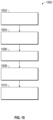
- An autonomous vehicle generally includes at least a navigation system 20 , a propulsion system 22 , a transmission system 24 , a steering system 26 , a brake system 28 , a sensor system 30 , an actuator system 32 , and a controller 34 .
- the navigation system 20 determines a road-level route plan for automated driving of the autonomous vehicle.
- the propulsion system 22 provides power for creating a motive force for the autonomous vehicle and can, in various embodiments, include an internal combustion engine, an electric machine such as a traction motor, and/or a fuel cell propulsion system.
- the transmission system 24 is configured to transmit power from the propulsion system 22 to two or more wheels 16 of the autonomous vehicle according to selectable speed ratios.
- the steering system 26 influences a position of the two or more wheels 16 .
- the steering system 26 may not include a steering wheel 27 .
- the brake system 28 is configured to provide braking torque to the two or more wheels 16 .
- the sensor system 30 includes a camera 40 that captures images of an exterior environment in front of the autonomous vehicle.
- the camera 40 can include a plurality of cameras at various locations around the vehicle.
- the captured images can be stored in an image data file and used for tracking and trajectory planning.
- the controller 34 builds a trajectory for the autonomous vehicle based on the output of sensor system 30 .
- the controller 34 can provide the trajectory to the actuator system 32 to control the propulsion system 22 , transmission system 24 , steering system 26 , and/or brake system 28 in order to navigate the autonomous vehicle with respect to objects in the road.
- the controller 34 includes a processor 36 and a computer readable storage device or computer readable storage medium 38 .
- the storage medium includes programs or instructions 39 that, when executed by the processor 36 , operate the autonomous vehicle based on sensor system outputs.
- the computer readable storage medium 38 may further include programs or instructions 39 that when executed by the processor 36 , determine and alignment between a coordinate system of the camera 40 and a coordinate system of the vehicle or a ground-centered coordinate system. Such alignment is useful for accurately determining the location of objects captured in the image from the camera.
- the alignment value can also be used to display to the driver a bird's eye view of the surrounding environment including objects within the environment. The alignment value is used to accurately place the objects within the bird's eye view.
- the processor For a sensor system 30 that includes a plurality of cameras, the processor provides alignment of the plurality of cameras so that the images from the plurality of cameras can be projected into a same coordinate system for the bird's eye view, thereby aligning the images in the bird's eye view of the surrounding environment.
- FIG. 2 shows a frame 200 of an image data file used in camera ground alignment, in an illustrative embodiment.
- the image data file can include a plurality of frames, each frame being temporally spaced from its adjacent frame to form a video file.
- the frame 200 includes a two-dimensional array of pixels. Each pixel records a point in a region being photographed or filmed by the camera and marks the point using a suitable color, such as a color from a red-green-blue (RGB) color scheme.
- RGB red-green-blue
- the frame 200 provides an image of a scene in front of the vehicle.
- the image includes at least one and generally a plurality of features therein. A feature is a pixel selected within the image.
- the feature can be selected using any suitable feature detection method, such as a Harris Corner Detection Algorithm, Shi-Tomasi Corner Detection, Kaze Detection, Scale Invariant Feature Transform, etc.
- suitable features include objects within the frame, such as a road, an object in the road or alongside the road, an object in the sky, etc.
- frame 200 shows features 202 associated with the cloud 204 and with the road 206 .
- FIG. 3 shows a schematic diagram 300 illustrating a method for determining alignment between a camera of the vehicle and a ground coordinate system of the vehicle.
- the schematic diagram 300 includes a plurality of modules that are performed in sequence to determine the alignment. These modules include an image reduction module 302 , an image preprocessing module 304 , a feature detection module 306 , a feature matching module 308 , a feature selection and reduction module 310 , a transformation module 312 , a 3D point estimation module 314 , a ground points selection module 316 , a confidence generation module 318 and an automatic parameter generation module 320 .
- These modules include an image reduction module 302 , an image preprocessing module 304 , a feature detection module 306 , a feature matching module 308 , a feature selection and reduction module 310 , a transformation module 312 , a 3D point estimation module 314 , a ground points selection module 316 , a confidence generation module 318 and an automatic parameter generation module 320 .
- the image reduction module 302 reduces a size of an original image data file prior to pre-processing the original image data file.
- the image reduction module 302 receives the original image data file from the camera 40 and a vehicle speed from a speedometer. Reducing the size of the original image data file includes one or more of selecting a subset of frames from the image data file, resizing (reducing) a frame, and cropping the frame, thereby generating a reduced image data file.
- the image reduction module 302 selects the subset of frames based on a velocity of the vehicle. Each frame is timestamped. A time interval is calculated between a first frame (a previously selected frame) and a second frame (a current frame) of the image data file. A time interval is determined from the time stamp of the first frame and the time stamp of the second frame. This time interval is multiplied by a speed of the vehicle and the product is compared to a threshold value. If the product is less than the threshold value, the second frame is skipped (i.e., not selected for the inclusion in the subset). If the product is greater than the threshold value, the current frame is selected for inclusion in the subset. The subset can then be used in subsequent processing.
- FIG. 4 shows a schematic representation of an original image data file 400 illustrating the effects of vehicle speed on frame selection.
- Frames are shown represented in temporal succession from left to right.
- Frame 402 is the first frame or previously selected frame.
- a feature shows significant movement between adjacent frames. Therefore, the frames that are selected are relatively close together in the original image data file or have a relatively small temporal spacing.
- a feature shows little movement between frames. Therefore, movement of the feature may not be distinguishable until many frames have elapsed. Therefore, the frames that are selected are further spaced apart than those accepted at high speeds or have a relatively large temporal spacing.
- the frame selection algorithm accepts every third frame.
- the frame selection algorithm accepts every fifth frame.
- Image resizing and reduction can also be performed.
- Image resizing and reduction can include removing pixels from the image using a systematic reduction process or reduction algorithm. For example, every other pixel can be removed from the frame as the frame is traversed following a raster pattern.
- Image cropping can be used to remove a section of the frame or to divide the frame into a plurality of sub-sections. Cropping is generally performed to remove those sections which have a low or insufficient number of features or to remove those sections for which a low of insufficient number of features is expected.
- a section of the frame has an object for which a low density of features is expected (i.e., less than a density threshold)
- the section can be removed from the image data file.
- the sections of the frame that remain are those for which the expected number or density of features is greater than the density threshold.
- FIG. 5 shows a flowchart 500 of a method of operation of the image reduction module 302 .
- the image data file is received and a determination is made whether to skip or remove frames from the image data file based on the speed of the vehicle. If frames are to be skipped the method proceeds to box 504 . In box 504 , the frames are skipped as discussed herein with respect to FIG. 3 . The method then proceeds to box 506 . Returning to box 502 , if frames are not to be skipped the method proceeds directly to box 506 .
- box 506 a determination is made whether the image is to be resized or reduced. If the image is to be resized, the method proceeds to box 508 . In box 508 , the frame is resized as discussed herein. The method then proceeds to box 510 . Returning to box 506 , if frames are not to be resized or reduced, the method proceeds directly to box 510 .
- box 510 a determination is made whether the image is to be cropped. If the image is to be cropped, the method proceeds to box 512 , in which it is cropped as discussed herein. The method then proceeds to box 514 . Returning to box 510 , if frames are not to be cropped, the method proceeds directly to box 514 . At box 514 , features are detected in the frame. The frame is then sent for preprocessing.
- FIG. 6 shows a progression of a frame through the method shown in the flowchart 500 of FIG. 5 .
- Frame 602 is the original frame as received from the camera.
- Frame 604 is a reduced frame based on the original frame.
- Frame 606 shows the reduced frame cropped into a first subsection 608 and a second subsection 610 .
- Frame 612 shows the features placed within the part of the frame that includes the first subsection 608 and the second subsection 610 .
- the image preprocessing module 304 performs various preprocessing algorithms, such as data reduction, data cleansing, etc.
- the feature detection module 306 detects features on the image data file after the preprocessing. Feature detection includes detecting the features in at least a current frame and a previous frame of the subset of frames.
- the feature matching module 308 forms feature pairs from the features detected at the feature detection module 306
- a feature pair includes a feature from a first frame (e.g., a previous frame) and a corresponding feature from a second frame (e.g., the current frame).
- the features can be paired based on their relative proximity to each other or to a same location within their respective frames.
- the feature selection and reduction module 310 either removes or retains a feature pair based on a proximity criterion.
- a metric is determined between the features of each feature pair.
- the metric can be an L2 norm.
- the metric is determined as a difference between a position of a feature in the first frame and a position of a paired feature in the second frame.
- the first position p i of the feature in the first frame is a position at time t and the second position q i of the feature in the second frame is a position at time t+1).
- An acceptance criterion is shown in Eq. (1): ⁇ p i -q i ⁇ 2 ⁇ Eq.(1) wherein ⁇ is a parallax length threshold variable that defines an upper threshold for the distance between features.
- ⁇ is a parallax length threshold variable that defines an upper threshold for the distance between features.
- the metric is determined from a first distance between a first position p i of the first feature and a predicted feature position value c i (which is predicted based on vehicle speed) and a second distance between a second position q i of the second feature and the predicted feature position c i .
- the acceptance criterion is stated in Eq. (2): ⁇ q i -c i ⁇ 2 ⁇ p i -c i ⁇ 2 Eq.(2) where ⁇ is a length threshold variable.
- FIG. 7 shows a flowchart 700 of a method for building a set of feature pairs.
- feature pairs and quality scores are obtained for a pair of frames.
- a quality feature set Q is defined for storing the feature pairs that are acceptable based on their quality.
- the quality feature set is assigned a maximum size or cardinality N.
- feature pairs are added into the set Q using a quality selection method outlined in FIG. 8
- the cardinality of set Q is less than the maximum size N, the method returns to box 706 . Otherwise, the method proceeds to box 710 , in which the method ends.
- FIG. 8 shows a flowchart 800 of a method for feature pair selection.
- the flowchart 800 is an expansion of the details of box 706 in the flowchart 700 .
- a frame is divided into sub-grids.
- the features are sorted into their respective grids.
- a sub-grid is selected for review.
- a feature pair having a highest quality score is selected for inclusion in a feature set S.
- the selection of the highest quality score includes comparing the quality scores to a quality threshold, which can be a preselected value.
- the method determines whether the last grid has been reached. If not, the method proceeds to box 812 .
- next grid is selected by increasing a grid index.
- the method then returns to box 808 to select the highest quality feature pairs from the next grid.
- the method proceeds to box 814 .
- the feature pair set S is merged with the set Q.
- FIG. 9 illustrates the operation of feature pair reduction.
- Frame t image 902
- Frame t+1 image 904
- Features are detected within Frame t as shown in image 906 and within Frame t+1 as shown in image 908 .
- Image 906 and image 908 and are sent through the feature matching module 308 and the feature selection and reduction module 310 , resulting in image 910 .
- Image 910 has a reduced set of features.
- FIG. 10 shows an image 1000 with features remaining after the feature pair reduction.
- the relatively slow features associated with the cloud 204 have been removed.
- a subset of the features 202 associated with the road 206 have been retained.
- the transformation module 312 estimate a transformation matrix using the retained features.
- the transformation matrix defines a transformation between a camera-centered coordinate system for the previous frame of the image data file and the camera-centered coordinate system for the current frame of the image data file.
- the 3D point estimation module 314 performs a triangulation between features of the feature pairs to determine a location of the feature in three dimensions.
- the ground points selection module 316 the ground points are determined and fit to a plane.
- the plane is representative of the road or the driving surface. Once the plane has been determined, an alignment can be determined between the plane and the camera-centered coordinate system.
- the alignment between a plane-centered coordinate system of the plane and camera-centered coordinate system includes relative translations as well as relative rotation angles.
- the x and y values are predefined, while the z-values and the pitch, roll and yaw angles are estimated values.
- the confidence generation module 318 calculates a confidence level for the resulting alignment between camera-centered coordinate system and ground-centered coordinate system and obtains an average of alignment results.
- the automatic parameter generation module 320 generates a road mask for use in the alignment process.
- the road mask can be used at the image preprocessing module 304 and at the ground points selection module 316 . Additionally, the results of the alignment process can also be used as feedback at the automatic parameter generation module 320 to adjust the road mask for subsequent calculations.
- FIG. 11 shows a diagram 1100 schematically illustrating a road mask projection.
- a road mask 1102 is an area in an image plane 1104 of the camera 40 that covers the road upon which the autonomous vehicle is traveling.
- a three-dimensional region of interest 1106 is defined in the vehicle coordinate system.
- the three-dimensional region of interest 1106 is defined by the area of the road and is parameterized by corner points p v .
- the corner points p v are projected into the image plane 1104 of the camera 40 to form mask corner points p c .
- the mask corner points p c can be determined using a transformation such as shown in Eq. (3):
- FIG. 12 shows a superposition 1200 of the road mask 1102 over an image 1202 captured at the camera 40 .
- FIG. 13 shows two images 1300 demonstrating the scalability of the road mask based on image field of view.
- a standard-sized image 1302 and a zoom image 1304 are shown.
- the standard-sized image 1302 has a standard road mask 1306 superimposed on it.
- the standard road mask 1306 is defined by the various parameters, such as the coordinates (c x , c y ) of a center of the standard-sized image 1302 and the vertical boundaries ⁇ y min , y max ⁇ of the standard road mask 1306 .
- the standard road mask 1306 can be rescaled to a zoom road mask 1308 using the method discussed herein with respect to FIG. 14 .
- FIG. 14 shows a flowchart 1400 of a scaling procedure suitable for scaling a road mask based on image field of view.
- the vertical boundaries ⁇ y min , y max ⁇ of the standard road mask 1306 are determined.
- a scaling factor s for the field of view transformation is calculated based on the coordinates (c x , c y ) of the image center, the vertical boundaries, and the expected height h of the transformed road mask.
- the scaling factor s is determined using Eq. (4):
- K scaled K i ⁇ n ⁇ t [ s 0 0 0 s 0 0 1 ] Eq . ( 5 )
- FIG. 15 shows a flowchart 1500 for determining a confidence level for an alignment, as performed by the confidence generation module of 318 of FIG. 3 .
- a plurality of alignment values e.g., 100 alignment values
- a moving average of the alignment values is determined for the alignment values.
- the moving average can include ten of the 100 alignment values.
- a confidence level is determined. The confidence level for a moving average can be based on various conditions during the moving average, such as distance traveled, change in vehicle speed, etc.
- moving averages having confidence level that is less than a selected threshold are removed.
- the remaining moving averages are combined to form a weighted average value of the alignment. This alignment can be used to update the camera-vehicle alignment value, as necessary.
- the vehicle is maneuvered through its environment based on data obtained from the cameras and therefore the accuracy of such data is dependent on the alignment of the camera.
- the accuracy of such data is dependent on the alignment of the camera.
- the alignment method disclosed herein can be performed in situ while the vehicle is in motion on a roadway using objects found in its environment, which allows for instant alignment at any given moment of the driving experience. This is an improvement over alignment performed only in a laboratory or service department setting, since this alignment can be performed at any time.
- the method disclosed herein for reducing the original image data file to obtain a reduced image data file frees computational time for other processes of the vehicle. Therefore, the claimed embodiments effectuate an improvement in the technical field of camera alignment in vehicles.
Landscapes
- Engineering & Computer Science (AREA)
- Physics & Mathematics (AREA)
- General Physics & Mathematics (AREA)
- Theoretical Computer Science (AREA)
- Multimedia (AREA)
- Computer Vision & Pattern Recognition (AREA)
- Automation & Control Theory (AREA)
- Mathematical Physics (AREA)
- Transportation (AREA)
- Mechanical Engineering (AREA)
- Signal Processing (AREA)
- Image Analysis (AREA)
- Image Processing (AREA)
- Traffic Control Systems (AREA)
Abstract
Description
∥pi-qi∥2<ϵ Eq.(1)
wherein ϵ is a parallax length threshold variable that defines an upper threshold for the distance between features. When the metric is less than this threshold, the features are relatively stationary and do not demonstrate enough motion between the frames to be suitable for use in subsequent transformation calculations. These features are therefore removed. When the metric is greater than the threshold, the amount of motion shown by the change in position between features makes the feature pair suitable for subsequent transformation calculation. Therefore, these features are retained.
∥qi-ci∥2<α∥pi-ci∥2 Eq.(2)
where α is a length threshold variable. When Eq. (2) holds for a feature pair, the feature pair is removed and when Eq. (2) does not hold, the feature pair is retained.
where Kint is an intrinsic transformation matrix for the
In
Claims (20)
Priority Applications (3)
| Application Number | Priority Date | Filing Date | Title |
|---|---|---|---|
| US17/719,151 US12260590B2 (en) | 2022-04-12 | 2022-04-12 | System and method for online camera to ground alignment |
| DE102022126641.9A DE102022126641A1 (en) | 2022-04-12 | 2022-10-13 | System and method for online alignment of a camera to the ground |
| CN202211293560.1A CN116912799A (en) | 2022-04-12 | 2022-10-21 | Systems and methods for online camera to ground alignment |
Applications Claiming Priority (1)
| Application Number | Priority Date | Filing Date | Title |
|---|---|---|---|
| US17/719,151 US12260590B2 (en) | 2022-04-12 | 2022-04-12 | System and method for online camera to ground alignment |
Publications (2)
| Publication Number | Publication Date |
|---|---|
| US20230326077A1 US20230326077A1 (en) | 2023-10-12 |
| US12260590B2 true US12260590B2 (en) | 2025-03-25 |
Family
ID=88093982
Family Applications (1)
| Application Number | Title | Priority Date | Filing Date |
|---|---|---|---|
| US17/719,151 Active 2043-06-28 US12260590B2 (en) | 2022-04-12 | 2022-04-12 | System and method for online camera to ground alignment |
Country Status (3)
| Country | Link |
|---|---|
| US (1) | US12260590B2 (en) |
| CN (1) | CN116912799A (en) |
| DE (1) | DE102022126641A1 (en) |
Citations (12)
| Publication number | Priority date | Publication date | Assignee | Title |
|---|---|---|---|---|
| JP2009129001A (en) * | 2007-11-20 | 2009-06-11 | Sanyo Electric Co Ltd | Driving support system, vehicle, solid object region estimation method |
| US20100097457A1 (en) * | 2008-04-24 | 2010-04-22 | Gm Global Technology Opetations, Inc. | Clear path detection with patch smoothing approach |
| US9792683B2 (en) * | 2013-10-01 | 2017-10-17 | Application Solutions (Electronics and Vision) Ltd. | System, vehicle and method for online calibration of a camera on a vehicle |
| US9946264B2 (en) * | 2016-03-22 | 2018-04-17 | Sharp Laboratories Of America, Inc. | Autonomous navigation using visual odometry |
| US10108866B2 (en) * | 2016-05-26 | 2018-10-23 | GM Global Technology Operations LLC | Method and system for robust curb and bump detection from front or rear monocular cameras |
| US20210371260A1 (en) * | 2020-06-02 | 2021-12-02 | Oceaneering International, Inc. | Automatic detection and tracking of pallet pockets for automated pickup |
| KR20220000147A (en) * | 2020-06-25 | 2022-01-03 | 주식회사 엘지유플러스 | Dynamic map automobile image processing machine, cloud server and method of thereof |
| US20220277478A1 (en) * | 2019-08-26 | 2022-09-01 | Huawei Cloud Computing Technologies Co., Ltd. | Positioning Method and Apparatus |
| US20220383529A1 (en) * | 2021-05-28 | 2022-12-01 | Samsung Electronics Co., Ltd. | Method and apparatus with vanishing point estimation |
| US20220414933A1 (en) * | 2021-06-25 | 2022-12-29 | Samsung Electronics Co., Ltd. | Method and apparatus with sensor calibration |
| CN109961522B (en) * | 2019-04-02 | 2023-05-05 | 阿波罗智联(北京)科技有限公司 | Image projection method, device, equipment and storage medium |
| US11887323B2 (en) * | 2020-06-08 | 2024-01-30 | Ford Global Technologies, Llc | Self-supervised estimation of observed vehicle pose |
Family Cites Families (1)
| Publication number | Priority date | Publication date | Assignee | Title |
|---|---|---|---|---|
| CN111311654B (en) * | 2020-02-13 | 2023-11-24 | 北京百度网讯科技有限公司 | A camera position registration method, device, electronic equipment and storage medium |
-
2022
- 2022-04-12 US US17/719,151 patent/US12260590B2/en active Active
- 2022-10-13 DE DE102022126641.9A patent/DE102022126641A1/en active Pending
- 2022-10-21 CN CN202211293560.1A patent/CN116912799A/en active Pending
Patent Citations (12)
| Publication number | Priority date | Publication date | Assignee | Title |
|---|---|---|---|---|
| JP2009129001A (en) * | 2007-11-20 | 2009-06-11 | Sanyo Electric Co Ltd | Driving support system, vehicle, solid object region estimation method |
| US20100097457A1 (en) * | 2008-04-24 | 2010-04-22 | Gm Global Technology Opetations, Inc. | Clear path detection with patch smoothing approach |
| US9792683B2 (en) * | 2013-10-01 | 2017-10-17 | Application Solutions (Electronics and Vision) Ltd. | System, vehicle and method for online calibration of a camera on a vehicle |
| US9946264B2 (en) * | 2016-03-22 | 2018-04-17 | Sharp Laboratories Of America, Inc. | Autonomous navigation using visual odometry |
| US10108866B2 (en) * | 2016-05-26 | 2018-10-23 | GM Global Technology Operations LLC | Method and system for robust curb and bump detection from front or rear monocular cameras |
| CN109961522B (en) * | 2019-04-02 | 2023-05-05 | 阿波罗智联(北京)科技有限公司 | Image projection method, device, equipment and storage medium |
| US20220277478A1 (en) * | 2019-08-26 | 2022-09-01 | Huawei Cloud Computing Technologies Co., Ltd. | Positioning Method and Apparatus |
| US20210371260A1 (en) * | 2020-06-02 | 2021-12-02 | Oceaneering International, Inc. | Automatic detection and tracking of pallet pockets for automated pickup |
| US11887323B2 (en) * | 2020-06-08 | 2024-01-30 | Ford Global Technologies, Llc | Self-supervised estimation of observed vehicle pose |
| KR20220000147A (en) * | 2020-06-25 | 2022-01-03 | 주식회사 엘지유플러스 | Dynamic map automobile image processing machine, cloud server and method of thereof |
| US20220383529A1 (en) * | 2021-05-28 | 2022-12-01 | Samsung Electronics Co., Ltd. | Method and apparatus with vanishing point estimation |
| US20220414933A1 (en) * | 2021-06-25 | 2022-12-29 | Samsung Electronics Co., Ltd. | Method and apparatus with sensor calibration |
Also Published As
| Publication number | Publication date |
|---|---|
| US20230326077A1 (en) | 2023-10-12 |
| DE102022126641A1 (en) | 2023-10-12 |
| CN116912799A (en) | 2023-10-20 |
Similar Documents
| Publication | Publication Date | Title |
|---|---|---|
| US10354151B2 (en) | Method of detecting obstacle around vehicle | |
| US11386567B2 (en) | Systems and methods for weakly supervised training of a model for monocular depth estimation | |
| JP3719095B2 (en) | Behavior detection apparatus and gradient detection method | |
| KR102772870B1 (en) | Electronic device and control method | |
| US5937079A (en) | Method for stereo image object detection | |
| EP1394761B1 (en) | Obstacle detection device and method therefor | |
| CN114217665B (en) | Method and device for synchronizing time of camera and laser radar and storage medium | |
| EP2757527A1 (en) | System and method for distorted camera image correction | |
| EP2960858B1 (en) | Sensor system for determining distance information based on stereoscopic images | |
| US10187630B2 (en) | Egomotion estimation system and method | |
| EP3293700A1 (en) | 3d reconstruction for vehicle | |
| CN113838060A (en) | Perception systems for autonomous vehicles | |
| US12347125B2 (en) | Using histograms for self-supervised depth estimation | |
| CN113763569B (en) | Image annotation method and device used in three-dimensional simulation, and electronic equipment | |
| CN118358570B (en) | Vehicle centered driving method, device, equipment and storage medium | |
| US11461922B2 (en) | Depth estimation in images obtained from an autonomous vehicle camera | |
| US12260590B2 (en) | System and method for online camera to ground alignment | |
| US20240005540A1 (en) | Photometric Cost Volumes For Self-Supervised Depth Estimation | |
| WO2022133986A1 (en) | Accuracy estimation method and system | |
| US12190608B2 (en) | Virtual lane mark generation | |
| Seki et al. | Ego-motion estimation by matching dewarped road regions using stereo images | |
| CN120411915B (en) | A real-time occupancy grid update method for forward-looking assisted driving vehicles | |
| US12549698B2 (en) | Robust stereo camera image processing method and system | |
| JP7564742B2 (en) | Information processing device and information processing method | |
| CN115409873B (en) | Obstacle detection method and system based on optical flow feature fusion and electronic equipment |
Legal Events
| Date | Code | Title | Description |
|---|---|---|---|
| AS | Assignment |
Owner name: GM GLOBAL TECHNOLOGY OPERATIONS LLC, MICHIGAN Free format text: ASSIGNMENT OF ASSIGNORS INTEREST;ASSIGNORS:DU, XINYU;HU, YAO;LI, BINBIN;AND OTHERS;REEL/FRAME:059577/0879 Effective date: 20220407 |
|
| FEPP | Fee payment procedure |
Free format text: ENTITY STATUS SET TO UNDISCOUNTED (ORIGINAL EVENT CODE: BIG.); ENTITY STATUS OF PATENT OWNER: LARGE ENTITY |
|
| STPP | Information on status: patent application and granting procedure in general |
Free format text: DOCKETED NEW CASE - READY FOR EXAMINATION |
|
| STPP | Information on status: patent application and granting procedure in general |
Free format text: NON FINAL ACTION MAILED |
|
| STPP | Information on status: patent application and granting procedure in general |
Free format text: RESPONSE TO NON-FINAL OFFICE ACTION ENTERED AND FORWARDED TO EXAMINER |
|
| STPP | Information on status: patent application and granting procedure in general |
Free format text: NOTICE OF ALLOWANCE MAILED -- APPLICATION RECEIVED IN OFFICE OF PUBLICATIONS |
|
| STPP | Information on status: patent application and granting procedure in general |
Free format text: PUBLICATIONS -- ISSUE FEE PAYMENT RECEIVED |
|
| STPP | Information on status: patent application and granting procedure in general |
Free format text: PUBLICATIONS -- ISSUE FEE PAYMENT VERIFIED |
|
| STCF | Information on status: patent grant |
Free format text: PATENTED CASE |