US11763494B2 - Mobile surveillance apparatus and operation method thereof - Google Patents
Mobile surveillance apparatus and operation method thereof Download PDFInfo
- Publication number
- US11763494B2 US11763494B2 US16/994,783 US202016994783A US11763494B2 US 11763494 B2 US11763494 B2 US 11763494B2 US 202016994783 A US202016994783 A US 202016994783A US 11763494 B2 US11763494 B2 US 11763494B2
- Authority
- US
- United States
- Prior art keywords
- unevenness
- path
- mobile
- driving
- processor
- Prior art date
- Legal status (The legal status is an assumption and is not a legal conclusion. Google has not performed a legal analysis and makes no representation as to the accuracy of the status listed.)
- Active
Links
Images


Classifications
-
- G—PHYSICS
- G06—COMPUTING OR CALCULATING; COUNTING
- G06T—IMAGE DATA PROCESSING OR GENERATION, IN GENERAL
- G06T11/00—Two-dimensional [2D] image generation
-
- G—PHYSICS
- G05—CONTROLLING; REGULATING
- G05D—SYSTEMS FOR CONTROLLING OR REGULATING NON-ELECTRIC VARIABLES
- G05D1/00—Control of position, course, altitude or attitude of land, water, air or space vehicles, e.g. using automatic pilots
- G05D1/20—Control system inputs
- G05D1/24—Arrangements for determining position or orientation
- G05D1/246—Arrangements for determining position or orientation using environment maps, e.g. simultaneous localisation and mapping [SLAM]
- G05D1/2465—Arrangements for determining position or orientation using environment maps, e.g. simultaneous localisation and mapping [SLAM] using a 3D model of the environment
-
- B—PERFORMING OPERATIONS; TRANSPORTING
- B25—HAND TOOLS; PORTABLE POWER-DRIVEN TOOLS; MANIPULATORS
- B25J—MANIPULATORS; CHAMBERS PROVIDED WITH MANIPULATION DEVICES
- B25J19/00—Accessories fitted to manipulators, e.g. for monitoring, for viewing; Safety devices combined with or specially adapted for use in connection with manipulators
- B25J19/02—Sensing devices
- B25J19/021—Optical sensing devices
- B25J19/023—Optical sensing devices including video camera means
-
- G—PHYSICS
- G05—CONTROLLING; REGULATING
- G05D—SYSTEMS FOR CONTROLLING OR REGULATING NON-ELECTRIC VARIABLES
- G05D1/00—Control of position, course, altitude or attitude of land, water, air or space vehicles, e.g. using automatic pilots
- G05D1/02—Control of position or course in two dimensions
- G05D1/021—Control of position or course in two dimensions specially adapted to land vehicles
- G05D1/0231—Control of position or course in two dimensions specially adapted to land vehicles using optical position detecting means
- G05D1/0238—Control of position or course in two dimensions specially adapted to land vehicles using optical position detecting means using obstacle or wall sensors
- G05D1/024—Control of position or course in two dimensions specially adapted to land vehicles using optical position detecting means using obstacle or wall sensors in combination with a laser
-
- G—PHYSICS
- G05—CONTROLLING; REGULATING
- G05D—SYSTEMS FOR CONTROLLING OR REGULATING NON-ELECTRIC VARIABLES
- G05D1/00—Control of position, course, altitude or attitude of land, water, air or space vehicles, e.g. using automatic pilots
- G05D1/02—Control of position or course in two dimensions
- G05D1/021—Control of position or course in two dimensions specially adapted to land vehicles
- G05D1/0231—Control of position or course in two dimensions specially adapted to land vehicles using optical position detecting means
- G05D1/0242—Control of position or course in two dimensions specially adapted to land vehicles using optical position detecting means using non-visible light signals, e.g. IR or UV signals
-
- G—PHYSICS
- G05—CONTROLLING; REGULATING
- G05D—SYSTEMS FOR CONTROLLING OR REGULATING NON-ELECTRIC VARIABLES
- G05D1/00—Control of position, course, altitude or attitude of land, water, air or space vehicles, e.g. using automatic pilots
- G05D1/02—Control of position or course in two dimensions
- G05D1/021—Control of position or course in two dimensions specially adapted to land vehicles
- G05D1/0268—Control of position or course in two dimensions specially adapted to land vehicles using internal positioning means
- G05D1/0274—Control of position or course in two dimensions specially adapted to land vehicles using internal positioning means using mapping information stored in a memory device
-
- G—PHYSICS
- G05—CONTROLLING; REGULATING
- G05D—SYSTEMS FOR CONTROLLING OR REGULATING NON-ELECTRIC VARIABLES
- G05D1/00—Control of position, course, altitude or attitude of land, water, air or space vehicles, e.g. using automatic pilots
- G05D1/60—Intended control result
- G05D1/617—Safety or protection, e.g. defining protection zones around obstacles or avoiding hazards
- G05D1/622—Obstacle avoidance
-
- G—PHYSICS
- G05—CONTROLLING; REGULATING
- G05D—SYSTEMS FOR CONTROLLING OR REGULATING NON-ELECTRIC VARIABLES
- G05D1/00—Control of position, course, altitude or attitude of land, water, air or space vehicles, e.g. using automatic pilots
- G05D1/60—Intended control result
- G05D1/644—Optimisation of travel parameters, e.g. of energy consumption, journey time or distance
-
- G—PHYSICS
- G06—COMPUTING OR CALCULATING; COUNTING
- G06T—IMAGE DATA PROCESSING OR GENERATION, IN GENERAL
- G06T17/00—Three-dimensional [3D] modelling for computer graphics
- G06T17/05—Geographic models
-
- H—ELECTRICITY
- H04—ELECTRIC COMMUNICATION TECHNIQUE
- H04N—PICTORIAL COMMUNICATION, e.g. TELEVISION
- H04N7/00—Television systems
- H04N7/18—Closed-circuit television [CCTV] systems, i.e. systems in which the video signal is not broadcast
- H04N7/183—Closed-circuit television [CCTV] systems, i.e. systems in which the video signal is not broadcast for receiving images from a single remote source
- H04N7/185—Closed-circuit television [CCTV] systems, i.e. systems in which the video signal is not broadcast for receiving images from a single remote source from a mobile camera, e.g. for remote control
-
- G—PHYSICS
- G05—CONTROLLING; REGULATING
- G05D—SYSTEMS FOR CONTROLLING OR REGULATING NON-ELECTRIC VARIABLES
- G05D2101/00—Details of software or hardware architectures used for the control of position
- G05D2101/10—Details of software or hardware architectures used for the control of position using artificial intelligence [AI] techniques
Definitions
- One or more embodiments of the inventive concept relate to a mobile surveillance apparatus providing a stable surveillance image, and an operation method of the mobile surveillance apparatus.
- Indoor areas or maintained outdoor areas may be monitored in real time by using fixed cameras.
- mobile robots While performing autonomous driving, mobile robots may provide surveillance images in real time to enable remote shooting.
- Unevenness and/or obstructions may exist on the ground or in the air where the mobile robots drive, and shaking occurring while driving on the unevenness and/or the obstructions may affect the surveillance images.
- One or more embodiments of the inventive concept provide a mobile surveillance apparatus generating a stable surveillance image and an operation method thereof.
- a mobile surveillance apparatus which may include: a communication interface configured to receive map data of a preset area; and a processor configured to process the map data by reflecting at least one of unevenness and obstruction on a driving surface of a mobile module, and set a path for the mobile module, based on the processed map data.
- the processor may generate a plurality of paths, and select the path having the least unevenness or the least unevenness change on the driving surface from the plurality of paths based on the processed map data.
- the mobile surveillance apparatus may further include: the mobile module configured to perform driving along the path; and a sensor configured to sense at least one of the unevenness and the obstruction on the driving surface.
- the sensor may sense an object that is moving, and the processor may predict a moving path of the object base on a moving direction of the object, generate a plurality of object tracking paths according to the moving path; and selects an object tracking path having the least unevenness or the least unevenness change on the driving surface from the plurality of object tracking paths based on the processed map data.
- the processed map data may form a three-dimensional map.
- a mobile surveillance apparatus which may include: a communication interface configured to receive information about a path of a mobile module, the information comprising unevenness on a driving surface of the path; and a processor configured to perform image processing on an image captured by a photographing module installed on the mobile module, according to a driving direction of the mobile module, wherein the driving direction comprises at least one of an upward direction, a downward direction, a clockwise direction, and a counterclockwise direction according to the unevenness on the driving surface of the path.
- the processor may perform the image processing such that: at least a part of an upper part of the captured image is cut based on the driving direction being the upward direction; and at least a part of a lower part of the captured image is cut based on the driving direction being the downward direction.
- the processor may perform the image processing such that: at least a part of a right side of the captured image is cut based on the driving direction is the clockwise direction; and at least a part of a left side of the captured image is cut based on the driving direction being the counterclockwise direction.
- a mobile surveillance apparatus which may include: a communication interface configured to receive information about a path of a mobile module, the information comprising unevenness on a driving surface of the path; and configured to set an image capturing direction of a photographing module installed on a mobile module to a direction opposite to a driving direction of the mobile module, wherein the driving direction comprises at least one of an upward direction, a downward direction, a clockwise direction, and a counterclockwise direction according to the unevenness on the driving surface of the path.
- the photographing module may perform the image capturing by panning, tilting and/or zooming in the direction opposite to the driving direction of the mobile module set by the processor.
- a method of operating a mobile surveillance apparatus including a communication interface, a mobile module, a sensor, and a processor.
- the method may include: receiving, by the communication interface, map data about a preset area; performing, by the mobile module, driving in the preset area; sensing, by the sensor, at least one of unevenness and obstruction on a driving surface of the mobile module in the preset area; and processing, by the processor, the map data about the preset area by reflecting at least one of unevenness and obstruction on the driving surface of the mobile module, and setting a path for the mobile module, based on the processed map data.
- the method may further include: generating, by the processor, a plurality of paths; and selecting, by the processor, the path having the least unevenness or the least unevenness change on the driving surface from the plurality of paths based on the processed map data.
- the driving surface may include at least one of a ground surface and an imaginary plane in the air
- the unevenness may include at least one of unevenness on the ground surface and unevenness formed by objects protruding from an imaginary plane in the air.
- the method may further include: sensing an object that is moving by the sensor; predicting, by the processor, a moving path of the object based on a moving direction of the object; generating, by the processor, a plurality of object tracking paths according to the moving path; and selecting, by the processor, an object tracking path with the least unevenness or the least unevenness change on the driving surface from the plurality of object tracking paths based on the processed map data.
- a method of operating a mobile surveillance apparatus including a communication interface, a mobile module, a sensor, and a processor.
- the method may include: receiving, by the communication interface, information about a path of the mobile module in a preset area, the information comprising unevenness on a driving surface of the path; performing driving, by the mobile module, along the path, and performing image capturing by a photographing module installed on the mobile module; and performing image processing, by the processor, on an image captured by the photographing module, according to a driving direction of the mobile module, wherein the driving direction comprises at least one of an upward direction, a downward direction, a clockwise direction, and a counterclockwise direction according to the unevenness on the driving surface of the path.
- the performing the image processing may include performing image processing such that: at least a part of an upper part of the captured image is cut based on the driving direction being the upward direction; and at least a part of a lower part of the captured image is cut based on the driving direction being the downward direction.
- the performing the image processing may include performing image processing such that: at least a part of a right side of the captured image is cut based on the driving direction being the clockwise direction; and at least a part of a left side of the captured is cut based on the driving direction being the counterclockwise direction.
- a method of operating a mobile surveillance apparatus including a communication interface, a mobile module, a sensor, and a processor.
- the method may include: receiving, by the communication interface, information about a path of the mobile module in a preset area, the information comprising unevenness on a driving surface of the path; performing driving along the path by the mobile module, and performing image capturing by a photographing module installed on the mobile module; and setting, by the processor, an image capturing direction of the photographing module to a direction opposite to a driving direction of the mobile module, wherein the driving direction comprises at least one of an upward direction, a downward direction, a clockwise direction, and a counterclockwise direction according to the unevenness on the driving surface of the path.
- the image capturing may be performed by the photographing module by panning, tilting and/or zooming in the capturing direction set by the processor.
- FIG. 1 is a block diagram illustrating a structure of a mobile surveillance apparatus according to an embodiment
- FIG. 2 is a flowchart illustrating a method of generating a three-dimensional map of a preset area, performed by a mobile surveillance apparatus, according to an embodiment
- FIGS. 3 A and 3 B are flowcharts illustrating methods of selecting a path from a starting point to an arrival point, performed by a mobile surveillance apparatus, according to an embodiment
- FIGS. 4 A and 4 B are flowcharts illustrating methods of selecting a tracking path of a moving object, performed by a mobile surveillance apparatus, according to an embodiment
- FIGS. 5 and 6 A through 6 D are flowcharts illustrating image processing methods of a mobile surveillance apparatus for acquiring a captured image with the least shaking, according to an embodiment
- FIG. 7 is a flowchart illustrating an image acquisition method of a mobile surveillance apparatus for acquiring a captured image with the least shaking, according to an embodiment.
- the embodiments may be represented by functional block structures and various processing steps or operations. These functional blocks shown in FIG. 1 to be described herein may be implemented in the various numbers of hardware and/or software structures that perform particular functions.
- the embodiments may employ integrated circuit structures, such as memory, processing, logic, look-up tables, etc., which may execute various functions under control of one or more microprocessors or other control devices.
- the embodiments may be implemented in programming or scripting languages such as C, C++, Java, assembler, etc., including various algorithms implemented in combinations of data structures, processes, routines, or other programming structures.
- Functional aspects may be implemented in algorithms executed on one or more processors.
- embodiments may employ the related art for electronic environment setting, signal processing, and/or data processing.
- the terms “mechanisms,” “elements,” “means,” “components,” etc. may be broadly used but is not limited to mechanical and physical structures. The terms may include the meaning of a series of routines of software in conjunction with processors and the like.
- FIG. 1 is a block diagram illustrating a structure of a mobile surveillance apparatus according to an embodiment.
- a mobile surveillance apparatus 100 includes a communication interface 110 , a processor 120 , a mobile module 130 , a sensor 140 , a photographing module 150 , and a memory 160 .
- the communication interface 110 receives information from an external terminal or server, and transmit information to the external terminal or server.
- the communication interface 110 may include any one or any combination of a digital modem, a radio frequency (RF) modem, a WiFi chip, and related software and/or firmware, not being limited thereto.
- RF radio frequency
- the communication interface 110 may receive a two-dimensional map of a preset area or data related to the two-dimensional map.
- the preset area may be an indoor area and/or an outdoor area, but is not limited thereto.
- the two-dimensional map or the data related to the two-dimensional map may include information about topography, buildings, altitude, and the like, but is not limited thereto.
- the communication interface 110 may receive information indicating a starting point and an arrival point of the mobile module 130 in the preset area.
- the information indicating the starting point and the arrival point in the preset area may be generated by an input of a user but is not limited thereto. This information may be received through a user interface such as keyboard, mouse, touch pad, scanner, not being limited thereto, which may be incorporated in the communication interface 110 .
- the information indicating the starting point and the arrival point in the preset area may be global positioning system (GPS) information or the like, but is not limited thereto, which may be received from the external terminal or server.
- GPS global positioning system
- the communication interface 110 may further receive information indicating a path for the mobile module 130 in the preset area in addition to the starting point and the arrival point in the preset area.
- the processor 120 may generate a three-dimensional map of the preset area.
- the processor 120 may control the mobile module 130 to drive in the preset area.
- the mobile module 130 may include one or more wheels, tracks, caterpillars and/or propellers, not being limited thereto, and a driving module driving the wheels, tracks, caterpillars and/or propellers.
- the processor 120 may generate the three-dimensional map of the preset area by reflecting, on the two-dimensional map, at least one of unevenness of and/or obstructions on a driving surface sensed by the sensor 140 according to driving of the mobile module 130 .
- the driving surface may be a surface of the ground, an imaginary plane in the air, or the like, but is not limited thereto.
- the unevenness may be unevenness on the ground surface or unevenness formed by mountains, buildings, or the like protruding from the imaginary plane in the air, but is not limited thereto.
- the processor 120 may generate a plurality of paths for the mobile module 130 from the starting point to the arrival point.
- the processor 120 may generate a plurality of paths from the starting point to the arrival point based on the two-dimensional map and/or the three-dimensional map, but is not limited thereto.
- the processor 120 may select a path having the least unevenness from the plurality of paths for the mobile module 130 based on the three-dimensional map.
- the path having the least unevenness may be a path with the smallest number of unevenness, a path with the smallest size of unevenness, or the like, but is not limited thereto.
- the photographing module 150 may be able to capture an image with less shaking, and thus, the mobile surveillance apparatus 100 may provide a user with a more stable mobile surveillance image.
- the processor 120 may select a path having the least unevenness change from the plurality of paths for the mobile module 130 based on the three-dimensional map.
- the path having the least unevenness change may be a path along which the smallest change in height of continuously existing unevenness occurs, a path along which the smallest change in slope of continuously existing unevenness occurs, a path along which positions of continuously existing obstructions are uniform or consistent, or the like, but is not limited thereto.
- the photographing module 150 may include a surveillance camera having an image sensor such as complementary metal oxide semiconductor (CMOS) sensor or charge coupled device (COD) sensor, not being limited thereto.
- CMOS complementary metal oxide semiconductor
- CDD charge coupled device
- the processor 120 may predict a moving path of an object in the preset area based on a moving direction of the object, and may generate a plurality of tracking paths for the mobile module 130 according to the moving path.
- the processor 120 may generate a path for continuously monitoring the object along the moving path of the object as a tracking path.
- the plurality of tracking paths may be a preset number of paths having the highest continuity of object surveillance, but is not limited thereto.
- the preset number of paths having the highest continuity of object surveillance may be the preset number of paths having the longest object sensing interval, the preset number of paths having the longest total object sensing interval, the preset number of paths having the smallest total number of no object sensing intervals, or the like but is not limited thereto.
- the processor 120 may select a tracking path having the least unevenness from the plurality of tracking paths based on the three-dimensional map.
- the photographing module 150 may capture an object tracking image with less shaking, and thus, the mobile surveillance apparatus 100 may provide the user with a more continuous and stable object tracking image.
- the processor 120 may select a tracking path with the least unevenness change from the plurality of tracking paths based on the three-dimensional map.
- An operation for image processing that will be described below is more simplified for an object tracking image captured by the photographing module 150 when the mobile module 130 drives along the tracking path with the least unevenness change selected by the processor 120 , and thus, the mobile surveillance apparatus 100 may more efficiently provide the user with a continuous and stable object tracking image.
- the processor 120 may perform image processing according to a driving direction of the mobile module 130 on an image captured by the photographing module 150 , based on the three-dimensional map.
- the driving direction may include at least one of an upward direction, a downward direction, a clockwise direction, and a counterclockwise direction according to unevenness of a path along which the mobile module 130 drives.
- the processor 120 may perform image processing that cuts at least a part of an upper part of the captured image.
- the processor 120 may acquire an image in which the object is finally captured in the center, by performing the image processing that cuts at least a part of the upper part of the captured image.
- the position in which the object is captured in the image captured by the photographing module 150 may be changed from the center to the upper part.
- the processor 120 may acquire an image in which the object is finally captured in the center, by performing image processing that cuts at least a part of the lower part of the captured image.
- the position in which the object is captured in the image captured by the photographing module 150 may be changed from the center to a left side.
- the processor 120 may acquire an image in which the object is finally captured in the center by performing image processing that cuts at least a part of a right side of the captured image.
- the processor 120 may acquire an image in which the object is finally captured in the center by performing image processing that cuts at least a part of the left side of the captured image.
- the mobile surveillance apparatus 100 may provide a mobile surveillance image in which shaking caused by unevenness on a driving surface may be corrected while driving on the driving surface having the unevenness, and thus, may provide the user with a stable mobile surveillance image regardless of a path.
- the processor 120 may set the image capturing direction of the photographing module 150 to a direction opposite to the driving direction of the mobile module 130 based on the three-dimensional map.
- the driving direction may include at least one of the upward direction, the downward direction, the clockwise direction, and the counterclockwise direction according to the unevenness of the path along which the mobile module 130 drives.
- the processor 120 may control the image capturing direction of the photographing module 150 in the downward direction so that the object is captured in the center of the image captured by the photographing module 150 .
- the processor 120 may control the image capturing direction of the photographing module 150 in the upward direction so that the object is captured in the center of the image captured by the photographing module 150 .
- the processor 120 may control the image capturing direction of the photographing module 150 in the counterclockwise direction so that the object is captured in the center of the image captured by the photographing module 150 .
- the processor 120 may control the image capturing direction of the photographing module 150 in the clockwise direction so that the object is captured in the center of the image captured by the photographing module 150 .
- the mobile surveillance apparatus 100 may provide a mobile surveillance image in which an object is captured in a center without an additional correction while driving on a driving surface having unevenness, and thus, may more efficiently provide the user with a stable mobile surveillance image regardless of a path.
- the mobile module 130 performs driving in the preset area.
- the mobile module 130 may perform first driving in the preset area in a random direction and/or at a random speed.
- the mobile module 130 may perform driving along a path from the starting point to the arrival point.
- the mobile module 130 may perform second driving in the preset area along a preset path.
- the mobile module 130 may include one or more wheels, tracks, caterpillars and/or propellers, not being limited thereto, of a vehicle and a driving module driving the wheels, tracks, caterpillars and/or propellers.
- the vehicle may include a ground vehicle or an air vehicle, not being limited thereto.
- the mobile module 130 may perform driving on the ground, and/or along a virtual plane in the air.
- the sensor 140 senses at least one of the unevenness and the obstructions on the driving surface in the preset area.
- the sensor 140 may include a distance sensor such as an infrared sensor, a laser sensor, or the like, but is not limited thereto.
- the senor 140 may also sense a moving object.
- the sensor 140 may further include a motion sensor such as an infrared sensor, a laser sensor, a temperature sensor, or the like, but is not limited thereto.
- the photographing module 150 performs image capturing.
- the photographing module 150 may perform image capturing by panning, tilting and/or zooming in the direction opposite to the driving direction of the mobile module 130 set by the processor 120 .
- the memory 160 stores the two-dimensional map and/or the three-dimensional map of the preset area.
- the mobile surveillance apparatus 100 may be embodied as one physical apparatus or a plurality of physical apparatuses combined to constitute the mobile surveillance apparatus 100 according to one or more embodiments.
- part of elements included in the mobile surveillance apparatus may be embodied or installed as one physical apparatus, and the other elements may be embodied or installed as another physical apparatus.
- the one physical apparatus may be embodied as part of a mobile body, and the other physical apparatus may be embodied as part of a server and/or a terminal.
- the processor 120 and/or the communication interface 110 may be embodied in a server or a terminal physically separate from the other elements of the mobile surveillance apparatus 100 .
- FIG. 2 is a flowchart illustrating a method of generating a three-dimensional map of a preset area by a mobile surveillance apparatus, according to an embodiment.
- the communication interface 110 receives a two-dimensional map of a preset area.
- the mobile module 130 performs first driving in the preset area under control of the processor 120 in operation S 203 , and the sensor 140 senses unevenness and/or obstructions on a driving surface in the preset area, in operation S 205 .
- the processor 120 In operation S 207 , the processor 120 generates a three-dimensional map of the preset area by reflecting the unevenness and/or the obstructions on the driving surface sensed by the sensor 140 on the two-dimensional map of the preset area.
- an image that may be continuously monitored without shaking may be provided for a user by generating and using a three-dimensional map on which unevenness and/or obstructions on a driving surface are reflected.
- FIGS. 3 A and 3 B are flowcharts illustrating methods of selecting a path from a starting point to an arrival point by a mobile surveillance apparatus, according to an embodiment.
- the communication interface 110 receives information indicating a starting point and an arrival point of the mobile module 130 in a preset area.
- the processor 120 In operation S 313 , the processor 120 generates a plurality of paths from the starting point to the arrival point for the mobile module 130 .
- the processor 120 selects a path having the least unevenness from the plurality of paths based on a three-dimensional map of the preset area.
- the photographing module 150 may capture a mobile surveillance image with the least shaking.
- the communication interface 110 receives information indicating a starting point and an arrival point of the mobile module 130 in a preset area.
- the processor 120 In operation S 323 , the processor 120 generates a plurality of paths from the starting point to the arrival point for the mobile module 130 .
- the processor 120 selects a path with the least unevenness change from the plurality of paths based on a three-dimensional map of the preset area.
- the processor 120 may correct shaking of an image captured by the photographing module 150 by performing the simplest operation.
- FIGS. 4 A and 4 B are flowcharts illustrating methods of selecting an object tracking path of a mobile surveillance apparatus, according to an embodiment.
- the senor 140 senses an object moving in a preset area.
- the processor 120 predicts a moving path of the object based on a moving direction of the object.
- the processor 120 may predict the moving path of the object based on a current moving direction of the object.
- the processor 120 may predict the moving path of the object based on a moving direction pattern of the object.
- the moving direction pattern of the object may be a pattern in which the moving direction of the object is changed for a preset period of time or the like, but is not limited thereto.
- the processor 120 In operation S 415 , the processor 120 generates a plurality of tracking paths for the mobile module 130 according to the moving path.
- the plurality of tracking paths may be a preset number of paths with the highest continuity of object surveillance, but is not limited thereto.
- the processor 120 selects the tracking path having the least unevenness from the plurality of tracking paths based on a three-dimensional map of the preset area.
- the photographing module 150 may capture an object tracking image with the least shaking.
- the senor 140 senses an object moving in a preset area.
- the processor 120 predicts a moving path of the object based on a moving direction of the object.
- the processor 120 In operation S 425 , the processor 120 generates a plurality of tracking paths according to the moving path.
- the processor 120 selects a tracking path having the least unevenness change from the plurality of tracking paths based on a three-dimensional map of the preset area.
- the photographing module 150 may capture an object tracking image for which an operation for shaking correction is the simplest.
- FIGS. 5 , and 6 A through 6 D are flowcharts illustrating image processing methods of a mobile surveillance apparatus for acquiring a captured image with the least shaking, according to an embodiment.
- the communication interface 110 receives information indicating a starting point, an arrival point and a path of the mobile module 130 in a preset area.
- the mobile module 130 performs second driving along the path from the starting point to the arrival point, and the photographing module 150 performs image capturing.
- the processor 120 performs image processing according to a driving direction of the mobile module 130 on an image captured by the photographing module 150 based on a three-dimensional map of the preset area stored in the memory 160 .
- the driving direction may include at least one of an upward direction, a downward direction, a clockwise direction, and a counterclockwise direction according to unevenness of the path along which the mobile module 130 performs driving.
- the processor 120 when the driving direction of the mobile module 130 is the upward direction in operation S 611 , the processor 120 performs image processing that cuts at least a part of an upper part of a captured image in operation S 613 .
- the processor 120 performs image processing that cuts at least a part of a lower part of the captured image in operation S 623 .
- the processor 120 when the driving direction of the mobile module 130 is the clockwise direction in operation S 631 , the processor 120 performs image processing that cuts at least a part of a right side of the captured image in operation S 633 .
- the processor 120 performs image processing that cuts at least a part of a left side of the captured image in operation S 643 .
- the mobile surveillance apparatus 100 may provide a user with a mobile surveillance image in which shaking is corrected so that an object is positioned in a center while driving on a driving surface with unevenness.
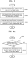
- FIG. 7 is a flowchart illustrating an image acquisition method of a mobile surveillance apparatus for acquiring a captured image with the least shaking, according to an embodiment.
- the communication interface 110 receives information indicating a starting point, an arrival point, and a path in a preset area.
- the mobile module 130 performs second driving along the path from the starting point to the arrival point, and the photographing module 150 performs image capturing.
- the processor 120 sets an image capturing direction of the photographing module 150 to a direction opposite to a driving direction of the mobile module 130 based on a three-dimensional map of the preset area stored in the memory 160 .
- the driving direction includes at least one of an upward direction, a downward direction, a clockwise direction, and a counterclockwise direction according to unevenness of the path along which the mobile module 130 performs driving.
- the photographing module 150 performs image capturing by panning, tilting and/or zooming in the image capturing direction set by the processor 120 .
- the photographing module 150 may perform image capturing by panning, tilting and/or zooming in the direction opposite to the driving direction of the mobile module 130 .
- a panning angle or a tilting angle may be set according to a degree of change in the upward direction, the downward direction, the clockwise direction and/or the counterclockwise direction according to driving, but is not limited thereto.
- the mobile surveillance apparatus 100 may provide a user with a mobile surveillance image captured such that an object is positioned in a center while driving on a driving surface with unevenness.
- a mobile surveillance image with less shaking may be captured, and thus, a more stable mobile surveillance image may be provided for a user.
- shaking of the mobile surveillance image may be corrected by a simpler operation, and thus, a stable mobile surveillance image may be more efficiently provided for the user.
- an object tracking image with less shaking may be captured, and thus, a more continuous and stable object tracking image may be provided for the user.
- shaking of the object tracking image may be corrected by a simpler operation, and thus, a continuous and stable object tracking image may be more efficiently provided for the user.
Landscapes
- Engineering & Computer Science (AREA)
- Physics & Mathematics (AREA)
- General Physics & Mathematics (AREA)
- Remote Sensing (AREA)
- Radar, Positioning & Navigation (AREA)
- Aviation & Aerospace Engineering (AREA)
- Automation & Control Theory (AREA)
- Multimedia (AREA)
- Theoretical Computer Science (AREA)
- Software Systems (AREA)
- Geometry (AREA)
- Electromagnetism (AREA)
- Signal Processing (AREA)
- Computer Graphics (AREA)
- Robotics (AREA)
- Mechanical Engineering (AREA)
- Optics & Photonics (AREA)
- Computer Vision & Pattern Recognition (AREA)
- Control Of Position, Course, Altitude, Or Attitude Of Moving Bodies (AREA)
- Closed-Circuit Television Systems (AREA)
Abstract
Description
Claims (13)
Applications Claiming Priority (2)
| Application Number | Priority Date | Filing Date | Title |
|---|---|---|---|
| KR1020200010488A KR102857593B1 (en) | 2020-01-29 | 2020-01-29 | Mobile surveillance apparatus and operation method thereof |
| KR10-2020-0010488 | 2020-01-29 |
Publications (2)
| Publication Number | Publication Date |
|---|---|
| US20210233285A1 US20210233285A1 (en) | 2021-07-29 |
| US11763494B2 true US11763494B2 (en) | 2023-09-19 |
Family
ID=76971124
Family Applications (1)
| Application Number | Title | Priority Date | Filing Date |
|---|---|---|---|
| US16/994,783 Active US11763494B2 (en) | 2020-01-29 | 2020-08-17 | Mobile surveillance apparatus and operation method thereof |
Country Status (2)
| Country | Link |
|---|---|
| US (1) | US11763494B2 (en) |
| KR (1) | KR102857593B1 (en) |
Citations (11)
| Publication number | Priority date | Publication date | Assignee | Title |
|---|---|---|---|---|
| US20120158178A1 (en) * | 2010-12-20 | 2012-06-21 | Samsung Electronics Co., Ltd. | Robot and method for creating path of the robot |
| US20160188977A1 (en) * | 2014-12-24 | 2016-06-30 | Irobot Corporation | Mobile Security Robot |
| KR101689081B1 (en) | 2015-06-11 | 2016-12-23 | 주식회사 아이비스 | Car Control System and Method |
| KR101903244B1 (en) | 2016-11-09 | 2018-10-01 | 국방과학연구소 | Method and apparatus for estimating air combat situation |
| KR20180105984A (en) | 2017-03-16 | 2018-10-01 | 엘지전자 주식회사 | Method of modifying path using around map and robot implementing thereof |
| US20190021568A1 (en) * | 2017-07-21 | 2019-01-24 | Lg Electronics Inc. | Articial intellgence cleaner and controlling ang metod therof |
| KR102007249B1 (en) | 2017-12-08 | 2019-08-06 | 현대모비스 주식회사 | Apparatus, method and system for autonomous driving |
| US20190286145A1 (en) * | 2018-03-14 | 2019-09-19 | Omron Adept Technologies, Inc. | Method and Apparatus for Dynamic Obstacle Avoidance by Mobile Robots |
| US20200089252A1 (en) * | 2018-01-05 | 2020-03-19 | Lg Electronics Inc. | Guide robot and operating method thereof |
| US20200086491A1 (en) * | 2018-09-14 | 2020-03-19 | Lg Electronics Inc. | Robot, method for operating the same, and server connected thereto |
| US11199853B1 (en) * | 2018-07-11 | 2021-12-14 | AI Incorporated | Versatile mobile platform |
Family Cites Families (4)
| Publication number | Priority date | Publication date | Assignee | Title |
|---|---|---|---|---|
| JP2769972B2 (en) * | 1994-03-10 | 1998-06-25 | 防衛庁技術研究本部長 | Autonomous driving system for mobile robots on uneven terrain |
| JP5188316B2 (en) * | 2008-08-06 | 2013-04-24 | 株式会社Ihi | Mobile robot and traveling speed control method of mobile robot |
| KR20100029613A (en) * | 2008-09-08 | 2010-03-17 | 엘지전자 주식회사 | Mobile vehicle navigation method and apparatus thereof |
| CN112923936B (en) | 2015-02-10 | 2023-04-18 | 御眼视觉技术有限公司 | Navigation system, method, and computer readable medium for vehicle |
-
2020
- 2020-01-29 KR KR1020200010488A patent/KR102857593B1/en active Active
- 2020-08-17 US US16/994,783 patent/US11763494B2/en active Active
Patent Citations (11)
| Publication number | Priority date | Publication date | Assignee | Title |
|---|---|---|---|---|
| US20120158178A1 (en) * | 2010-12-20 | 2012-06-21 | Samsung Electronics Co., Ltd. | Robot and method for creating path of the robot |
| US20160188977A1 (en) * | 2014-12-24 | 2016-06-30 | Irobot Corporation | Mobile Security Robot |
| KR101689081B1 (en) | 2015-06-11 | 2016-12-23 | 주식회사 아이비스 | Car Control System and Method |
| KR101903244B1 (en) | 2016-11-09 | 2018-10-01 | 국방과학연구소 | Method and apparatus for estimating air combat situation |
| KR20180105984A (en) | 2017-03-16 | 2018-10-01 | 엘지전자 주식회사 | Method of modifying path using around map and robot implementing thereof |
| US20190021568A1 (en) * | 2017-07-21 | 2019-01-24 | Lg Electronics Inc. | Articial intellgence cleaner and controlling ang metod therof |
| KR102007249B1 (en) | 2017-12-08 | 2019-08-06 | 현대모비스 주식회사 | Apparatus, method and system for autonomous driving |
| US20200089252A1 (en) * | 2018-01-05 | 2020-03-19 | Lg Electronics Inc. | Guide robot and operating method thereof |
| US20190286145A1 (en) * | 2018-03-14 | 2019-09-19 | Omron Adept Technologies, Inc. | Method and Apparatus for Dynamic Obstacle Avoidance by Mobile Robots |
| US11199853B1 (en) * | 2018-07-11 | 2021-12-14 | AI Incorporated | Versatile mobile platform |
| US20200086491A1 (en) * | 2018-09-14 | 2020-03-19 | Lg Electronics Inc. | Robot, method for operating the same, and server connected thereto |
Also Published As
| Publication number | Publication date |
|---|---|
| US20210233285A1 (en) | 2021-07-29 |
| KR102857593B1 (en) | 2025-09-08 |
| KR20210096886A (en) | 2021-08-06 |
Similar Documents
| Publication | Publication Date | Title |
|---|---|---|
| US11887318B2 (en) | Object tracking | |
| US7385626B2 (en) | Method and system for performing surveillance | |
| CN107710283B (en) | Shooting control method and device and control equipment | |
| US10075651B2 (en) | Methods and apparatus for capturing images using multiple camera modules in an efficient manner | |
| US10250789B2 (en) | Electronic device with modulated light flash operation for rolling shutter image sensor | |
| US9646384B2 (en) | 3D feature descriptors with camera pose information | |
| EP3624063B1 (en) | Electronic device localization based on imagery | |
| US7180050B2 (en) | Object detection device, object detection server, and object detection method | |
| US20100013917A1 (en) | Method and system for performing surveillance | |
| US20180211398A1 (en) | System for 3d image filtering | |
| CN108459597B (en) | Mobile electronic device and method for processing tasks in task area | |
| GB2557465A (en) | Method for calibrating a camera and calibration system | |
| JP6526955B2 (en) | Sensor information integration method and device thereof | |
| CN103051868A (en) | Apparatus and method for storing and searching image using ladar | |
| EP1952367A1 (en) | Methods and systems for operating a video surveillance system | |
| JP6462528B2 (en) | MOBILE BODY TRACKING DEVICE, MOBILE BODY TRACKING METHOD, AND MOBILE BODY TRACKING PROGRAM | |
| KR102619271B1 (en) | Video capturing device including plurality of cameras and video capturing system including the same | |
| JP2019100817A (en) | Position estimation device, position estimation method and terminal device | |
| WO2019163576A1 (en) | Information processing device, information processing method, and program | |
| CN112824994A (en) | Position estimation device, position estimation method, and program | |
| KR20150019230A (en) | Method and apparatus for tracking object using multiple camera | |
| CN111935444A (en) | System and method for generating a field of view for an unmanned aerial vehicle | |
| US11763494B2 (en) | Mobile surveillance apparatus and operation method thereof | |
| CN114693799B (en) | Parameter calibration method, target object tracking method, device and system | |
| JP2012198802A (en) | Intrusion object detection system |
Legal Events
| Date | Code | Title | Description |
|---|---|---|---|
| AS | Assignment |
Owner name: HANWHA DEFENSE CO., LTD., KOREA, REPUBLIC OF Free format text: ASSIGNMENT OF ASSIGNORS INTEREST;ASSIGNORS:CHAE, HEE SEO;PARK, JAE CHAN;REEL/FRAME:053509/0178 Effective date: 20200713 |
|
| FEPP | Fee payment procedure |
Free format text: ENTITY STATUS SET TO UNDISCOUNTED (ORIGINAL EVENT CODE: BIG.); ENTITY STATUS OF PATENT OWNER: LARGE ENTITY |
|
| STPP | Information on status: patent application and granting procedure in general |
Free format text: DOCKETED NEW CASE - READY FOR EXAMINATION |
|
| STPP | Information on status: patent application and granting procedure in general |
Free format text: NON FINAL ACTION MAILED |
|
| STPP | Information on status: patent application and granting procedure in general |
Free format text: RESPONSE TO NON-FINAL OFFICE ACTION ENTERED AND FORWARDED TO EXAMINER |
|
| STPP | Information on status: patent application and granting procedure in general |
Free format text: FINAL REJECTION MAILED |
|
| STPP | Information on status: patent application and granting procedure in general |
Free format text: ADVISORY ACTION MAILED |
|
| STPP | Information on status: patent application and granting procedure in general |
Free format text: DOCKETED NEW CASE - READY FOR EXAMINATION |
|
| STPP | Information on status: patent application and granting procedure in general |
Free format text: NON FINAL ACTION MAILED |
|
| AS | Assignment |
Owner name: HANWHA AEROSPACE CO., LTD., KOREA, REPUBLIC OF Free format text: MERGER;ASSIGNOR:HANWHA DEFENSE CO., LTD.;REEL/FRAME:062213/0912 Effective date: 20221107 |
|
| STPP | Information on status: patent application and granting procedure in general |
Free format text: NOTICE OF ALLOWANCE MAILED -- APPLICATION RECEIVED IN OFFICE OF PUBLICATIONS |
|
| STPP | Information on status: patent application and granting procedure in general |
Free format text: PUBLICATIONS -- ISSUE FEE PAYMENT VERIFIED |
|
| STCF | Information on status: patent grant |
Free format text: PATENTED CASE |