EP4460032A1 - Method for providing a sensing-related service by a sensing edge server - Google Patents
Method for providing a sensing-related service by a sensing edge server Download PDFInfo
- Publication number
- EP4460032A1 EP4460032A1 EP23171869.3A EP23171869A EP4460032A1 EP 4460032 A1 EP4460032 A1 EP 4460032A1 EP 23171869 A EP23171869 A EP 23171869A EP 4460032 A1 EP4460032 A1 EP 4460032A1
- Authority
- EP
- European Patent Office
- Prior art keywords
- sensing
- edge server
- functionality
- enabled
- application server
- Prior art date
- Legal status (The legal status is an assumption and is not a legal conclusion. Google has not performed a legal analysis and makes no representation as to the accuracy of the status listed.)
- Granted
Links
Images

Classifications
-
- H—ELECTRICITY
- H04—ELECTRIC COMMUNICATION TECHNIQUE
- H04W—WIRELESS COMMUNICATION NETWORKS
- H04W4/00—Services specially adapted for wireless communication networks; Facilities therefor
- H04W4/30—Services specially adapted for particular environments, situations or purposes
- H04W4/38—Services specially adapted for particular environments, situations or purposes for collecting sensor information
-
- G—PHYSICS
- G01—MEASURING; TESTING
- G01S—RADIO DIRECTION-FINDING; RADIO NAVIGATION; DETERMINING DISTANCE OR VELOCITY BY USE OF RADIO WAVES; LOCATING OR PRESENCE-DETECTING BY USE OF THE REFLECTION OR RERADIATION OF RADIO WAVES; ANALOGOUS ARRANGEMENTS USING OTHER WAVES
- G01S13/00—Systems using the reflection or reradiation of radio waves, e.g. radar systems; Analogous systems using reflection or reradiation of waves whose nature or wavelength is irrelevant or unspecified
- G01S13/003—Bistatic radar systems; Multistatic radar systems
-
- G—PHYSICS
- G01—MEASURING; TESTING
- G01S—RADIO DIRECTION-FINDING; RADIO NAVIGATION; DETERMINING DISTANCE OR VELOCITY BY USE OF RADIO WAVES; LOCATING OR PRESENCE-DETECTING BY USE OF THE REFLECTION OR RERADIATION OF RADIO WAVES; ANALOGOUS ARRANGEMENTS USING OTHER WAVES
- G01S13/00—Systems using the reflection or reradiation of radio waves, e.g. radar systems; Analogous systems using reflection or reradiation of waves whose nature or wavelength is irrelevant or unspecified
- G01S13/74—Systems using reradiation of radio waves, e.g. secondary radar systems; Analogous systems
- G01S13/76—Systems using reradiation of radio waves, e.g. secondary radar systems; Analogous systems wherein pulse-type signals are transmitted
- G01S13/765—Systems using reradiation of radio waves, e.g. secondary radar systems; Analogous systems wherein pulse-type signals are transmitted with exchange of information between interrogator and responder
-
- G—PHYSICS
- G01—MEASURING; TESTING
- G01S—RADIO DIRECTION-FINDING; RADIO NAVIGATION; DETERMINING DISTANCE OR VELOCITY BY USE OF RADIO WAVES; LOCATING OR PRESENCE-DETECTING BY USE OF THE REFLECTION OR RERADIATION OF RADIO WAVES; ANALOGOUS ARRANGEMENTS USING OTHER WAVES
- G01S7/00—Details of systems according to groups G01S13/00, G01S15/00, G01S17/00
- G01S7/003—Transmission of data between radar, sonar or lidar systems and remote stations
- G01S7/006—Transmission of data between radar, sonar or lidar systems and remote stations using shared front-end circuitry, e.g. antennas
-
- H—ELECTRICITY
- H04—ELECTRIC COMMUNICATION TECHNIQUE
- H04L—TRANSMISSION OF DIGITAL INFORMATION, e.g. TELEGRAPHIC COMMUNICATION
- H04L67/00—Network arrangements or protocols for supporting network services or applications
- H04L67/01—Protocols
- H04L67/12—Protocols specially adapted for proprietary or special-purpose networking environments, e.g. medical networks, sensor networks, networks in vehicles or remote metering networks
-
- H—ELECTRICITY
- H04—ELECTRIC COMMUNICATION TECHNIQUE
- H04W—WIRELESS COMMUNICATION NETWORKS
- H04W4/00—Services specially adapted for wireless communication networks; Facilities therefor
- H04W4/02—Services making use of location information
- H04W4/029—Location-based management or tracking services
Definitions
- the present invention relates a method for providing at least one sensing-related service by means of processing sensing-related data that is generated within or as part of a mobile communication network
- the mobile communication network comprises at least a first sensing-capable or sensing-enabled entity or functionality and a second sensing-capable or sensing-enabled entity or functionality
- the mobile communication network comprises or is associated or assigned to at least one sensing edge server and at least one sensing application server, wherein the at least one sensing-capable or sensing-enabled entity or functionality transmits a radiofrequency sensing signal, wherein, as a result of the radiofrequency sensing signal being transmitted, a radiofrequency sensing reception signal is received by either the first sensing-capable or sensing-enabled entity or functionality or the second sensing-capable or sensing-enabled entity or functionality, wherein by means of the radiofrequency sensing reception signal information about the environment of the first and/or second sensing-capable or sensing-enabled entities or functionalities is
- the present invention relates to a system or a mobile communication network for providing at least one sensing-related service by means of processing sensing-related data that is generated within or as part of a mobile communication network
- the mobile communication network comprises at least a first sensing-capable or sensing-enabled entity or functionality and a second sensing-capable or sensing-enabled entity or functionality
- the mobile communication network comprises or is associated or assigned to at least one sensing edge server and at least one sensing application server, wherein the at least one sensing-capable or sensing-enabled entity or functionality transmits a radiofrequency sensing signal, wherein, as a result of the radiofrequency sensing signal being transmitted, a radiofrequency sensing reception signal is received by either the first sensing-capable or sensing-enabled entity or functionality or the second sensing-capable or sensing-enabled entity or functionality, wherein by means of the radiofrequency sensing reception signal information about the environment of the first and/or second sensing-capable or sensing-
- the present invention relates to a sensing edge server or to a sensing application server or to a sensing-capable or sensing-enabled entity or functionality, especially as part of an inventive system or an inventive mobile communication network, for providing at least one sensing-related service by means of processing sensing-related data that is generated within or as part of a mobile communication network.
- the present invention relates to a program and to a computer-readable medium for providing at least one sensing-related service by means of processing sensing-related data that is generated within or as part of a mobile communication network according to the inventive method.
- Mobile communication networks such as public land mobile networks are typically realized as cellular mobile communication networks, i.e. comprising (or using or being associated or assigned to a radio access network comprising) radio cells.
- Such cellular systems are known conforming to different mobile communication standards or radio access technologies, like 2G/3G/4G/5G/6G radio access technologies (referring to the different generations of radio access technologies) and typically comprise (or consist of) cells (or radio cells) of one or a plurality of the respective radio access technology/radio access technologies, which are typically organized throughout a country (or a part of or a region within a country) in a repeating pattern of (radio) cells (and associated base station entities) which belong to (or are used by or associated or assigned to) a mobile network operator (MNO).
- MNO mobile network operator
- Wireless sensing technologies have originated from the most widely used sensing technology known as radar (radio detection and ranging), where radio waves are exploited to determine distance, angle, or instantaneous velocity of objects.
- radar radio detection and ranging
- lidar light detection and ranging
- a lidar system may be either a stand-alone device or integrated in a mobile device or a vehicle.
- ICaS integrated communication and sensing
- wireless sensing technologies are applied in stand-alone systems that are designed for dedicated applications and use cases, e.g. autonomous driving, and a lot of research and development work has been conducted to develop methods and algorithms for problems arising in connection with these specific applications or use cases.
- sensing in cellular mobile broadband networks typically needs to serve diverse use cases.
- An object of the present invention is to provide a technically simple, effective and cost-effective solution for providing at least one sensing-related service by means of processing sensing-related data that is generated within or as part of a mobile communication network
- the mobile communication network comprises at least a first sensing-capable or sensing-enabled entity or functionality and a second sensing-capable or sensing-enabled entity or functionality
- the mobile communication network comprises or is associated or assigned to at least one sensing edge server and at least one sensing application server, wherein the at least one sensing-capable or sensing-enabled entity or functionality transmits a radiofrequency sensing signal, wherein, as a result of the radiofrequency sensing signal being transmitted, a radiofrequency sensing reception signal is received by either the first sensing-capable or sensing-enabled entity or functionality or the second sensing-capable or sensing-enabled entity or functionality, wherein by means of the radiofrequency sensing reception signal information about the environment of the first and/or second sensing-capable or
- a further object of the present invention is to provide a corresponding system or mobile communication network, a corresponding sensing edge server or a corresponding sensing application server or a corresponding sensing-capable or sensing-enabled entity or functionality, and a corresponding program and computer-readable medium.
- the object of the present invention is achieved by a method for providing at least one sensing-related service by means of processing sensing-related data that is generated within or as part of a mobile communication network,
- sensing-as-a-service is able to be provided, since common resources and network functions are shared between communication and sensing, it cannot be anticipated - or assured - that the requested sensing service(s) is(are) continuously maintained at their highest possible service level in the entire cellular network (as might be known from stand-alone (sensing) applications conventionally known; as sensing-as-a-service in ICaS is rather provided on demand, serving this application demand needs to respect the application requirements as well as the resource consumption in an ICaS-enabled mobile broadband network.
- Integrated communication and sensing, ICaS, base station entities and user equipments i.e. sensing-capable or sensing-enabled entities or functionalities
- ICaS integrated communication and sensing
- base station entities and user equipments i.e. sensing-capable or sensing-enabled entities or functionalities
- sensing-capable or sensing-enabled entities or functionalities Due to the extra processing needs to infer by these sensing features and applications, it is advantageously possible according to the present invention that especially base station entities - but also user equipments - are relaxed from these application-driven tasks. In this sense, it is proposed, according to the present invention, to split the sensing inference accordingly, and to apply, or to provide for, a cascading of data inference from integrated communication and sensing in cellular mobile broadband networks.
- At least one sensing-related service is able to be provided, by means of processing sensing-related data that is generated within a mobile communication network, i.e. wherein at least a part or parts of the mobile communication network help to generate such sensing-related data.
- this is able to be realized by means of at least a first sensing-capable or sensing-enabled entity or functionality and a second sensing-capable or sensing-enabled entity or functionality.
- These sensing-capable or sensing-enabled entities or functionalities are typically base station entities that are used, within or as part of the mobile communication network, for communication purposes, i.e. in order to provide communication services to user equipments.
- the mobile communication network comprises or is associated or assigned to at least one sensing edge server and at least one sensing application server.
- the present invention instead of optimizing and aggregating sensing (raw) data for specific use cases and/or stand-alone applications, it is advantageously possible to provide sensing services in mobile broadband (cellular) networks that provide functions and internal services that serve multiple - and diverse - use cases whilst building on a cellular system architecture. According to the present invention, it is advantageously possible to serve various application demands, which is a benefit due to the large variety of potential sensing use cases.
- cellular mobile broadband
- ICaS integrated communication and sensing
- the sensing targets are not actively involved in the inference process; hence, algorithms defined for positioning cannot be applied to sensing, and - while, in principle, every object in the environment can be a sensing target (i.e. a sensed object) - in case of positioning, targets are defined only by the positioning capabilities of the co-located user equipments.
- a sensing object can be defined by much more features than only the location information (as it is the case of positioning).
- user equipment detection/identification/tracking are inherently part of a positioning solution (since user equipments are "known” to the system); however, in a sensing approach, this information is not given a priori, it is typically needed to be “learned” from the measured data.
- sensing relates to obtaining information regarding the environment of such a sensing-capable or sensing-enabled entity or functionality by means of using (and analyzing) incoming radiofrequency signals (sensing reception signals) that are the result of the interactions (especially reflections) of previously transmitted radiofrequency signals (sensing signals) with the environment (e.g.
- radiofrequency signals objects having the capability to reflect radiofrequency signals of the sensing-capable or sensing-enabled entity or functionality, wherein the previously transmitted radiofrequency signals (sensing signals) could either be radiofrequency signals having been transmitted by the same sensing-capable or sensing-enabled entity or functionality, or radiofrequency signals (sensing signals) having been transmitted by another sensing-capable or sensing-enabled entity or functionality, or both.
- the at least one sensing-capable or sensing-enabled entity or functionality transmits a radiofrequency sensing signal, wherein, as a result of the radiofrequency sensing signal being transmitted, a radiofrequency sensing reception signal is received by either the (same) first sensing-capable or sensing-enabled entity or functionality or the second sensing-capable or sensing-enabled entity or functionality (or by both of them).
- the radiofrequency sensing reception signal (or plurality of such sensing reception signals) - information is able to be gathered (especially by means of at least initially processing such sensing reception signal(s)) about the environment of the first and/or second sensing-capable or sensing-enabled entities or functionalities; in the context of the present invention, such information is referred to as first stage sensing inference data.
- the first stage sensing inference data are provided to the at least one sensing edge server for generating second stage sensing inference data
- the second stage sensing inference data are provided to the at least one sensing application server for providing sensing-related services and/or generating sensing application data.
- the method comprises the steps of:
- the at least one sensing edge server transmits, to the at least one sensing application server, at least one further response message regarding the at least one sensing-related service, wherein the further response message comprises a different response content compared to the response message.
- the request message regarding the at least one sensing-related service, received by the sensing edge server from the at least one sensing application server comprises at least one out of the following:
- the request message regarding the at least one sensing-related service and/or the response message and/or the further response message regarding the at least one sensing-related service relates to or realizes application-driven tasks that are performed by the sensing edge server, especially requested by the sensing application server and/or driven by changes, capabilities or demands in the radio environment and/or in the environment of the sensing-capable or sensing-enabled entities or functionalities, wherein especially the application-driven tasks that are performed by the sensing edge server comprise at least one out of the following:
- the first stage sensing inference data comprise at least one out of the following:
- the second stage sensing inference data are transmitted, by the sensing edge server, and received, by the sensing application server, involving an application programming interface, especially according to at least one out of the following:
- the present invention relates to a system or to a mobile communication network for providing at least one sensing-related service by means of processing sensing-related data that is generated within or as part of a mobile communication network,
- the present invention relates to a sensing edge server or to a sensing application server or to a sensing-capable or sensing-enabled entity or functionality, especially as part of an inventive system or an inventive mobile communication network, for providing at least one sensing-related service by means of processing sensing-related data that is generated within or as part of a mobile communication network, wherein the sensing edge server and/or the sensing application server communicate, at least indirectly, with at least the sensing-capable or sensing-enabled entity or functionality, wherein the sensing-capable or sensing-enabled entity or functionality gathers information about its environment as first stage sensing inference data, wherein, in order to provide at least one sensing-related service, the sensing edge server and/or the sensing application server and/or the sensing-capable or sensing-enabled entity or functionality is configured such that:
- the present invention relates to a sensing edge server or sensing application server or sensing-capable or sensing-enabled entity or functionality, especially as part of an inventive system or an inventive mobile communication network.
- the present invention relates to a program comprising a computer readable program code, which, when executed on a computer and/or on a sensing-capable or sensing-enabled entity or functionality and/or on a sensing edge server and/or on a sensing application server, or in part on a sensing-capable or sensing-enabled entity or functionality and/or in part on a sensing edge server and/or in part on a sensing application server, causes the computer and/or the sensing-capable or sensing-enabled entity or functionality and/or the sensing edge server and/or the sensing application server to perform an inventive method.
- the present invention relates to a computer-readable medium comprising instructions which when executed on a computer and/or on a sensing-capable or sensing-enabled entity or functionality and/or on a sensing edge server and/or on a sensing application server, or in part on a sensing-capable or sensing-enabled entity or functionality and/or in part on a sensing edge server and/or in part on a sensing application server, causes the computer and/or the sensing-capable or sensing-enabled entity or functionality and/or the sensing edge server and/or the sensing application server to perform an inventive method.
- Figures 4 to 6 schematically and exemplarily illustrate different sensing scenarios involving one or more base stations or base station entities as sensing-capable or sensing-enabled entities or functionalities.
- a base station entity as a (first) sensing-capable or sensing-enabled entity or functionality 111 is schematically and exemplarily represented, which (first) sensing-capable or sensing-enabled entity or functionality 111 transmits signals (a radiofrequency sensing signals 410) and receives the reflected signals (a radiofrequency sensing reception signals 420), the echoes, of a target 400 in a mono-static sensing operation scenario.
- a bi-static operation scenario is schematically and exemplarily shown, where a target 400 is illuminated - i.e. radiofrequency sensing signals 410 sent - by a first base station entity as a first sensing-capable or sensing-enabled entity or functionality 111 and radiofrequency sensing reception signals 420 (resulting from the radiofrequency sensing signals 410) detected by a second base station entity as a second sensing-capable or sensing-enabled entity or functionality 112.
- a situation is schematically and exemplarily represented, where a target 400 is illuminated (i.e. radiofrequency sensing signals sent) and (radiofrequency sensing reception signals) detected, respectively, by a first, second and third base station entity as first, second and third sensing-capable or sensing-enabled entities or functionalities 111, 112, 113 (i.e. Figure 6 depicts mono-static sensing of three base stations 111, 112, 113).
- the first sensing-capable or sensing-enabled entity or functionality 111 sends, or transmits, a first radiofrequency sensing signal 410 and receives - as a result thereof - a first radiofrequency sensing reception signal 420.
- the second sensing-capable or sensing-enabled entity or functionality 112 sends, or transmits, a second radiofrequency sensing signal 411 and receives - as a result thereof - a second radiofrequency sensing reception signal 421.
- the third sensing-capable or sensing-enabled entity or functionality 113 sends, or transmits, a third radiofrequency sensing signal 412 and receives - as a result thereof - a third radiofrequency sensing reception signal 422.
- the first radiofrequency sensing reception signal 420 is a result, especially besides the first radiofrequency sensing signal 410, of at least one of the second and third radiofrequency sensing signals 411, 412, and analogously for the other radiofrequency sensing reception signals 421, 422.
- the transmitter of radiofrequency sensing signals 410, 411, 412 and the receiver (of radiofrequency sensing reception signals 420, 421, 422) are co-located in the sensing-capable or sensing-enabled entities or functionalities 111, 112, 113 (i.e., typically base station entities and/or user equipments), respectively, especially with full-duplex capability.
- the measurements of ToA Time-of-Arrival
- AoA Angle-of-Arrival
- AoD Angle-of-Departure
- Doppler of each of the resolved (radiofrequency signal propagation) paths correspond to the detection of a target 400, where the location is relative to the coordinate system of the sensing-capable or sensing-enabled entities or functionalities 111, 112, 113 (i.e., typically base station entities and/or user equipments), respectively.
- the transmitter (of radiofrequency sensing signals 410, 411, 412) and the receiver (of radiofrequency sensing reception signals 420, 421, 422) are located at different sites, i.e. a (radiofrequency sensing) signal between two sensing-capable or sensing-enabled entities or functionalities such as a base station entity and a user equipment, such signal to the user equipment is able to be used to estimate ToA, AoA, AoD, and Doppler of each of the resolved (radiofrequency signal propagation) paths.
- the targets are detected, and their location estimated especially in an absolute joint coordinate system of these base station entities.
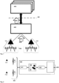
- the method according to the present invention is schematically and exemplarily shown. Furthermore, functional elements involved, namely, besides first and second sensing-capable or sensing-enabled entities or functionalities 111, 112, a sensing edge server 440, processing first stage sensing inference data 430 received from one or more of the sensing-capable or sensing-enabled entities or functionalities 111, 112, 113, and a sensing application server 460 providing sensing-related services and/or generating sensing application data based on second stage sensing inference data 450 received from the sensing edge server 440 or from a plurality of sensing edge servers (a plurality of sensing edge servers is, however, not shown in the exemplary representation of Figure 1 ).
- the functional elements involved according to the present invention comprise:
- Figure 1 shows the functional elements involved and the cascading of sensing data inference, i.e. the sensing-capable or sensing-enabled entities or functionalities 111, 112 generate - from or based on the processing of radiofrequency sensing signals 420, 421, 422 and especially by means of, typically, a plurality transceivers (TRX) or transceiver station illuminating sensing targets and providing raw sensing data towards base stations or base station entities (BSE), the base stations aggregating sensing data from the one or multiple transceivers TRX - first stage sensing inference data 430, and provide these first stage sensing inference data 430 to the sensing edge server 440 (or to the plurality of sensing edge servers).
- TRX transceivers
- BSE base station entities
- the sensing edge server 440 Based on the first stage sensing inference data 430, the sensing edge server 440 generates second stage sensing inference data 450 (i.e. the sensing edge server 440 infers object data from radio sensing information) and provides or transmits those to the sensing application server 460 in order for the sensing application server 460 to be able to provide sensing-related services and/or generate sensing application data (i.e. the sensing application server 460 provides application for the dedicated use case).
- second stage sensing inference data 450 i.e. the sensing edge server 440 infers object data from radio sensing information
- the sensing application server 460 provides or transmits those to the sensing application server 460 in order for the sensing application server 460 to be able to provide sensing-related services and/or generate sensing application data (i.e. the sensing application server 460 provides application for the dedicated use case).
- the sensing application server 460 (or, rather, the plurality of sensing application servers 460) is not part of the mobile broadband network, or mobile communication network 100; in this case, the sensing application server 460 (or the plurality thereof) is typically able to access the sensing-as-a-service functionality via a network application programming interface (API) 461.
- API network application programming interface
- FIG. 2 schematically and exemplarily illustrates inference steps performed in (or at) the sensing edge server 440:
- the sensing edge server 440 receives the first stage sensing inference data 430 (e.g. radar-like images / image streams) from one or multiple sensing base stations 111, 112 - especially periodically, (quasi-)continuously, or at specific points in time or on a subscription basis -, wherein Figure 2 exemplarily depicts the first and second sensing-related or sensing-enabled entities or functionalities 111, 112 providing first stage sensing inference data 430 to the sensing edge server 440.
- the sensing edge server 440 is able to derive results on:
- Figure 3 schematically and exemplarily illustrates an example of the information exchange and the interface between a sensing edge server 440 towards the sensing application server 460.
- Figure 3 shows, in a first processing step 301, the at least one sensing edge server 440 receiving, from the at least one sensing application server 460, a request message regarding the at least one sensing-related service, especially including, or comprising, a sensing area selection and/or a sensing quality indication and/or a selection of the sensing-capable or sensing-enabled entities or functionalities and/or an object notification regarding the sensing object and/or an indication regarding the type (or mode) of notification : continuous mode, periodic mode, one-shot notification.
- the at least one sensing edge server 440 transmits, to the at least one sensing application server 460, a response message (or, rather, a plurality of response messages) regarding the at least one sensing-related service, wherein the response message or response messages comprises, as its response content, an acknowledgement (e.g. in the second processing step 302) or a rejection (e.g. in the third processing step 303) or a modification (e.g. in the fourth processing step 304) of the requested sensing-related service.
- a response message or, rather, a plurality of response messages regarding the at least one sensing-related service
- the response message or response messages comprises, as its response content, an acknowledgement (e.g. in the second processing step 302) or a rejection (e.g. in the third processing step 303) or a modification (e.g. in the fourth processing step 304) of the requested sensing-related service.
- the sensing edge server 440 might transmit, respectively, sensing information or sensing information messages to the sensing application server 460 regarding the results of the sensing operations performed.
- Detected objects are identified by an identifier information - their object ID (objectld) generated by the sensing edge server 440 upon recognition of a new object and maintained as long as the respective object can be tracked:
- sensing edge server 440 towards sensing application server 460 can be realized in various ways.
- the different approaches may vary depending on the operation mode addressed, such as:
- sensing edge server 440 and the sensing application server 460 according to the present invention.
- sensing edge server 440 and the sensing application server 460 according to the present invention.
- sensing application server 460 In order to communicate and process the demand of the individual (sensing) applications in detail the following aspects have to be considered:
- the application i.e. the sensing application server 460
- the application needs to define the area or region served by the ICaS-enabled cellular network.
- Applications may request object sensing data from one or multiple areas.
- Object sensing in ICaS mobile broadband networks may provide different levels of object sensing performance, depending on:
- the sensing edge server 440 does not continuously provide sensing information to an requesting sensing application server 460 (as it is done in continuous mode or periodic mode); instead, sensing application server 460 are notified only when an object was detected according the specifications given in sensing area selection and sensing quality.
- object detection notification allows to realize various use cases addressing aspects of intrusion detection or the like.
- Object sensing results are especially described in a format like exemplarily shown above in relation to the object ID (objectld) - i.e. by means of an identifier information - generated by the sensing edge server 440 upon recognition of a new object and maintained as long as the respective object can be tracked.
- An individual identified object is specified by its objectld.
- This objectld can be used by the sensing application server 460 to request further sensing information regarding this specific object. For instance, the sensing application server 460 may request "more detailed" object sensing information by requesting a higher sensing quality in a one-shot request. Alternatively, object tracking can be requested by requesting continuous sensing for the this particular objectld in continuous mode or periodic mode.
- sensing requests from the sensing application server 460 towards sensing edge server 440 may be re-negotiated and updated at any time. It is up to the sensing edge server 440 to grant or reject application server requests (i.e. a request messages regarding the at least one sensing-related service, according to the first step of the inventive method), considering authorization, resource demand and network capabilities - cf. the response message or response messages as shown in Figure 3 , e.g. acknowledgement (second processing step 302), rejection (third processing step 303) or modification (fourth processing step 304) of the requested sensing-related service. Likewise, the sensing application server 460 and/or the sensing edge server 440 may terminate ongoing object sensing tasks.
- application server 460 and/or the sensing edge server 440 may terminate ongoing object sensing tasks.
- sensing edge server 440 grants, rejects or modifies the request as exemplarily shown in Figure 3 .
- multiple of the described sensing aspects may be combined in a single signaling procedure (e.g. requesting a specific sensing area selection and requesting a specific sensing quality).
- the sensing edge server 440 initiated the signaling procedure.
- sensing edge server 440 Upon request of a sensing application server 460 (see above) or driven by changes in the radio and base station environment, the sensing edge server 440 has to conduct the following tasks. Thereby, the capabilities and demands of one or multiple sensing application servers 460 and one or multiple bases stations (i.e. sensing-capable or sensing-enabled entities or functionalities 111, 112) have to be considered:
- the sensing edge server 440 verifies if the request can be served.
- ICaS-capable base stations i.e. sensing-capable or sensing-enabled entities or functionalities 111, 112
- the sensing edge server 440 serves one or multiple sensing application server 460 with potentially overlapping demands, it is one of the tasks of the sensing edge server 440 to combine these demands towards the ICaS-capable base stations (i.e. sensing-capable or sensing-enabled entities or functionalities 111, 112) involved. In this sense, ICaS-capable base stations provide the sensing information to the sensing application server 460 which collectively can serve multiple application sever requests (cf. Figure 2 ). It is the task of the sensing edge server 440 to extract the requested sensing information from base station sensing data as described above for each sensing application server 460.
- ICaS-capable base stations i.e. sensing-capable or sensing-enabled entities or functionalities 111, 112
- ICaS-capable base stations provide the sensing information to the sensing application server 460 which collectively can serve multiple application sever requests (cf. Figure 2 ). It is the task of the sensing edge server 440
- the sensing edge server 440 When the sensing request of a sensing application server 460 cannot be fulfilled, the sensing edge server 440 either rejects the request or proposes modified object sensing (e.g. in respect of sensing quality or update rate). Thereby, the overall sensing resource demand has to be considered by the sensing edge server 440, internally or in exchange with a dedicated resource function.
- the sensing edge server 440 selects the appropriate base stations (i.e. sensing-capable or sensing-enabled entities or functionalities 111, 112) covering the requested sensing area. Continuous/Periodic/One-Shot sensing information is requested according to the demanded sensing quality.
- the sensing edge server 440 may combine overlapping demands from various sensing application server 460; different algorithms may be applied, e.g.:
- the Sensing Edge Server may need to "re-negotiate” or modify the sensing demand towards the respective Applications Servers.
- the task of the sensing edge server 440 is to negotiate the sensing requests from the sensing application server 460 (or sensing application servers) against the sensing capabilities of the mobile communication network 100. These sensing capabilities are not static, but may change over time.
- One aspect is sharing of resources with communication services in an ICaS system.
- the resources dedicated for sensing may be reduced. For instance, the sensing periodicity may be reduced for dedicated sensing functions, when more communication resources are required.
- the sensing edge server 440 has to manage this by negotiating the resource demand and by informing the affected sensing application server(s) 460 about these modifications; especially, maintenance of a minimum sensing service level is preferably to be ensured; otherwise sensing services may have to be rejected.
Landscapes
- Engineering & Computer Science (AREA)
- Radar, Positioning & Navigation (AREA)
- Remote Sensing (AREA)
- Computer Networks & Wireless Communication (AREA)
- Physics & Mathematics (AREA)
- General Physics & Mathematics (AREA)
- Signal Processing (AREA)
- Health & Medical Sciences (AREA)
- General Health & Medical Sciences (AREA)
- Medical Informatics (AREA)
- Computing Systems (AREA)
- Mobile Radio Communication Systems (AREA)
- Telephonic Communication Services (AREA)
Abstract
wherein the mobile communication network comprises at least a first sensing-capable or sensing-enabled entity or functionality and a second sensing-capable or sensing-enabled entity or functionality, and wherein the mobile communication network comprises or is associated or assigned to at least one sensing edge server and at least one sensing application server,
wherein the at least one sensing-capable or sensing-enabled entity or functionality transmits a radiofrequency sensing signal, wherein, as a result of the radiofrequency sensing signal being transmitted, a radiofrequency sensing reception signal is received by either the first sensing-capable or sensing-enabled entity or functionality or the second sensing-capable or sensing-enabled entity or functionality or both, wherein by means of the radiofrequency sensing reception signal information about the environment of the first and/or second sensing-capable or sensing-enabled entities or functionalities is able to be gathered as first stage sensing inference data, wherein the first stage sensing inference data are provided to the at least one sensing edge server for generating second stage sensing inference data, and wherein the second stage sensing inference data are provided to the at least one sensing application server for providing sensing-related services and/or generating sensing application data,
wherein, in order to provide at least one sensing-related service, the method comprises the following steps:
-- in a first step, the at least one sensing edge server receives, from the at least one sensing application server, a request message regarding the at least one sensing-related service,
-- in a second step, the at least one sensing edge server transmits, to the at least one sensing application server, a response message regarding the at least one sensing-related service, wherein the response message comprises, as its response content, an acknowledgement or a rejection or a modification of the requested sensing-related service.
Description
- The present invention relates a method for providing at least one sensing-related service by means of processing sensing-related data that is generated within or as part of a mobile communication network, wherein the mobile communication network comprises at least a first sensing-capable or sensing-enabled entity or functionality and a second sensing-capable or sensing-enabled entity or functionality, and wherein the mobile communication network comprises or is associated or assigned to at least one sensing edge server and at least one sensing application server, wherein the at least one sensing-capable or sensing-enabled entity or functionality transmits a radiofrequency sensing signal, wherein, as a result of the radiofrequency sensing signal being transmitted, a radiofrequency sensing reception signal is received by either the first sensing-capable or sensing-enabled entity or functionality or the second sensing-capable or sensing-enabled entity or functionality, wherein by means of the radiofrequency sensing reception signal information about the environment of the first and/or second sensing-capable or sensing-enabled entities or functionalities is able to be gathered as first stage sensing inference data.
- Furthermore, the present invention relates to a system or a mobile communication network for providing at least one sensing-related service by means of processing sensing-related data that is generated within or as part of a mobile communication network, wherein the mobile communication network comprises at least a first sensing-capable or sensing-enabled entity or functionality and a second sensing-capable or sensing-enabled entity or functionality, and wherein the mobile communication network comprises or is associated or assigned to at least one sensing edge server and at least one sensing application server, wherein the at least one sensing-capable or sensing-enabled entity or functionality transmits a radiofrequency sensing signal, wherein, as a result of the radiofrequency sensing signal being transmitted, a radiofrequency sensing reception signal is received by either the first sensing-capable or sensing-enabled entity or functionality or the second sensing-capable or sensing-enabled entity or functionality, wherein by means of the radiofrequency sensing reception signal information about the environment of the first and/or second sensing-capable or sensing-enabled entities or functionalities is able to be gathered as first stage sensing inference data.
- Additionally, the present invention relates to a sensing edge server or to a sensing application server or to a sensing-capable or sensing-enabled entity or functionality, especially as part of an inventive system or an inventive mobile communication network, for providing at least one sensing-related service by means of processing sensing-related data that is generated within or as part of a mobile communication network.
- Furthermore, the present invention relates to a program and to a computer-readable medium for providing at least one sensing-related service by means of processing sensing-related data that is generated within or as part of a mobile communication network according to the inventive method.
- Mobile communication networks such as public land mobile networks are typically realized as cellular mobile communication networks, i.e. comprising (or using or being associated or assigned to a radio access network comprising) radio cells. Such cellular systems are known conforming to different mobile communication standards or radio access technologies, like 2G/3G/4G/5G/6G radio access technologies (referring to the different generations of radio access technologies) and typically comprise (or consist of) cells (or radio cells) of one or a plurality of the respective radio access technology/radio access technologies, which are typically organized throughout a country (or a part of or a region within a country) in a repeating pattern of (radio) cells (and associated base station entities) which belong to (or are used by or associated or assigned to) a mobile network operator (MNO).
- Wireless sensing technologies have originated from the most widely used sensing technology known as radar (radio detection and ranging), where radio waves are exploited to determine distance, angle, or instantaneous velocity of objects. Nowadays, this principle is exploited for example by lidar (light detection and ranging) systems that are capable of obtaining an image of the environment around a sensor. A lidar system may be either a stand-alone device or integrated in a mobile device or a vehicle.
- By means of realizing sensing capabilities in or as part of mobile communication networks, primarily by means of one or a plurality of sensing-capable or sensing-enabled entities or functionalities that are generating and transmitting radiofrequency sensing signals, it is possible to obtain information regarding either transmission channel properties between different stations, especially base station entities or user equipments, and/or regarding objects from where such radiofrequency sensing signals are reflected.
- Even though such sensing capabilities are able to procure further information regarding transmission channels and/or objects, especially moving objects, nearby or in the vicinity of the respective sensing-capable or sensing-enabled entities or functionalities, mobile radio technologies (mobile radio access technologies) and radar have developed over decades more or less independently. However, lately the convergence of both technologies is increasing: Future advances in mobile communications (5G Advanced and 6G) anticipate that advanced radio sensing functions will become important services of mobile broadband (radio) networks. Joint communication and sensing (JCaS) will address a combined radio interface serving both, communication and sensing. Sensing in 6G is considered in an even broader range, especially referring to the ability of devices (e.g. base station entities or user equipments) to detect and gather information about the environment around them. This could include using advanced sensor technologies to gather information about the physical world, or using machine learning algorithms to analyze data from one or multiple sensors in real-time. Furthermore, for 6G, integrated communication and sensing (ICaS) is considered that improves the ICaS concept by providing common waveforms and other radio functions. An initial step for the introduction of sensing is currently under preparation for 3GPP Rel-19, providing sensing functionalities on top of 5G radio for identified use cases.
- Typically, wireless sensing technologies are applied in stand-alone systems that are designed for dedicated applications and use cases, e.g. autonomous driving, and a lot of research and development work has been conducted to develop methods and algorithms for problems arising in connection with these specific applications or use cases. In contrast to these rather specific sensing applications, sensing in cellular mobile broadband networks typically needs to serve diverse use cases.
- An object of the present invention is to provide a technically simple, effective and cost-effective solution for providing at least one sensing-related service by means of processing sensing-related data that is generated within or as part of a mobile communication network, wherein the mobile communication network comprises at least a first sensing-capable or sensing-enabled entity or functionality and a second sensing-capable or sensing-enabled entity or functionality, and wherein the mobile communication network comprises or is associated or assigned to at least one sensing edge server and at least one sensing application server, wherein the at least one sensing-capable or sensing-enabled entity or functionality transmits a radiofrequency sensing signal, wherein, as a result of the radiofrequency sensing signal being transmitted, a radiofrequency sensing reception signal is received by either the first sensing-capable or sensing-enabled entity or functionality or the second sensing-capable or sensing-enabled entity or functionality, wherein by means of the radiofrequency sensing reception signal information about the environment of the first and/or second sensing-capable or sensing-enabled entities or functionalities is able to be gathered as first stage sensing inference data, wherein a more general applicability and less use case-specific or application-specific usage of the sensing inference data is possible. A further object of the present invention is to provide a corresponding system or mobile communication network, a corresponding sensing edge server or a corresponding sensing application server or a corresponding sensing-capable or sensing-enabled entity or functionality, and a corresponding program and computer-readable medium.
- The object of the present invention is achieved by a method for providing at least one sensing-related service by means of processing sensing-related data that is generated within or as part of a mobile communication network,
- wherein the mobile communication network comprises at least a first sensing-capable or sensing-enabled entity or functionality and a second sensing-capable or sensing-enabled entity or functionality, and wherein the mobile communication network comprises or is associated or assigned to at least one sensing edge server and at least one sensing application server,
- wherein the at least one sensing-capable or sensing-enabled entity or functionality transmits a radiofrequency sensing signal, wherein, as a result of the radiofrequency sensing signal being transmitted, a radiofrequency sensing reception signal is received by either the first sensing-capable or sensing-enabled entity or functionality or the second sensing-capable or sensing-enabled entity or functionality or both, wherein by means of the radiofrequency sensing reception signal information about the environment of the first and/or second sensing-capable or sensing-enabled entities or functionalities is able to be gathered as first stage sensing inference data, wherein the first stage sensing inference data are provided to the at least one sensing edge server for generating second stage sensing inference data, and wherein the second stage sensing inference data are provided to the at least one sensing application server for providing sensing-related services and/or generating sensing application data,
- wherein, in order to provide at least one sensing-related service, the method comprises the following steps:
- -- in a first step, the at least one sensing edge server receives, from the at least one sensing application server, a request message regarding the at least one sensing-related service,
- -- in a second step, the at least one sensing edge server transmits, to the at least one sensing application server, a response message regarding the at least one sensing-related service, wherein the response message comprises, as its response content, an acknowledgement or a rejection or a modification of the requested sensing-related service.
- It is thereby advantageously possible according to the present invention to be able to more efficiently use the network resources of the mobile communication network: While in ICaS-enabled mobile broadband networks, sensing-as-a-service is able to be provided, since common resources and network functions are shared between communication and sensing, it cannot be anticipated - or assured - that the requested sensing service(s) is(are) continuously maintained at their highest possible service level in the entire cellular network (as might be known from stand-alone (sensing) applications conventionally known; as sensing-as-a-service in ICaS is rather provided on demand, serving this application demand needs to respect the application requirements as well as the resource consumption in an ICaS-enabled mobile broadband network.
- Integrated communication and sensing, ICaS, base station entities and user equipments (i.e. sensing-capable or sensing-enabled entities or functionalities) have to serve both, communication and sensing. Due to the extra processing needs to infer by these sensing features and applications, it is advantageously possible according to the present invention that especially base station entities - but also user equipments - are relaxed from these application-driven tasks. In this sense, it is proposed, according to the present invention, to split the sensing inference accordingly, and to apply, or to provide for, a cascading of data inference from integrated communication and sensing in cellular mobile broadband networks.
- According to the present invention, at least one sensing-related service is able to be provided, by means of processing sensing-related data that is generated within a mobile communication network, i.e. wherein at least a part or parts of the mobile communication network help to generate such sensing-related data.
According to the present invention, this is able to be realized by means of at least a first sensing-capable or sensing-enabled entity or functionality and a second sensing-capable or sensing-enabled entity or functionality. These sensing-capable or sensing-enabled entities or functionalities are typically base station entities that are used, within or as part of the mobile communication network, for communication purposes, i.e. in order to provide communication services to user equipments. However, also user equipments might be used, or participate, according to the present invention, in generating sensing-related data; hence, sensing-capable or sensing-enabled entities or functionalities might also correspond to user equipments.
Furthermore, the mobile communication network comprises or is associated or assigned to at least one sensing edge server and at least one sensing application server. Thereby, it is especially and advantageously possible, according to the present invention, to provide for a cascading of data inference from integrated communication and sensing in cellular mobile broadband networks. Hence, in contrast to the rather specific conventionally known sensing applications, applying sensing in cellular mobile broadband networks according to the present invention advantageously provides the possibility to serve diverse use cases, and, additionally or cumulatively, apply a service-oriented architecture such as used in mobile broadband (cellular) networks. Hence, according to the present invention, instead of optimizing and aggregating sensing (raw) data for specific use cases and/or stand-alone applications, it is advantageously possible to provide sensing services in mobile broadband (cellular) networks that provide functions and internal services that serve multiple - and diverse - use cases whilst building on a cellular system architecture. According to the present invention, it is advantageously possible to serve various application demands, which is a benefit due to the large variety of potential sensing use cases.
With regard to positioning, it is to be understood that in this respect, integrated communication and sensing (ICaS) significantly differs from positioning in mobile broadband networks, as the sensing targets are not actively involved in the inference process; hence, algorithms defined for positioning cannot be applied to sensing, and - while, in principle, every object in the environment can be a sensing target (i.e. a sensed object) - in case of positioning, targets are defined only by the positioning capabilities of the co-located user equipments. Furthermore, a sensing object can be defined by much more features than only the location information (as it is the case of positioning). Furthermore, user equipment detection/identification/tracking are inherently part of a positioning solution (since user equipments are "known" to the system); however, in a sensing approach, this information is not given a priori, it is typically needed to be "learned" from the measured data. - According to the present invention, sensing relates to obtaining information regarding the environment of such a sensing-capable or sensing-enabled entity or functionality by means of using (and analyzing) incoming radiofrequency signals (sensing reception signals) that are the result of the interactions (especially reflections) of previously transmitted radiofrequency signals (sensing signals) with the environment (e.g. objects having the capability to reflect radiofrequency signals) of the sensing-capable or sensing-enabled entity or functionality, wherein the previously transmitted radiofrequency signals (sensing signals) could either be radiofrequency signals having been transmitted by the same sensing-capable or sensing-enabled entity or functionality, or radiofrequency signals (sensing signals) having been transmitted by another sensing-capable or sensing-enabled entity or functionality, or both. Hence, the at least one sensing-capable or sensing-enabled entity or functionality transmits a radiofrequency sensing signal, wherein, as a result of the radiofrequency sensing signal being transmitted, a radiofrequency sensing reception signal is received by either the (same) first sensing-capable or sensing-enabled entity or functionality or the second sensing-capable or sensing-enabled entity or functionality (or by both of them). By means of the radiofrequency sensing reception signal (or plurality of such sensing reception signals) - information is able to be gathered (especially by means of at least initially processing such sensing reception signal(s)) about the environment of the first and/or second sensing-capable or sensing-enabled entities or functionalities; in the context of the present invention, such information is referred to as first stage sensing inference data. The first stage sensing inference data are provided to the at least one sensing edge server for generating second stage sensing inference data, and the second stage sensing inference data are provided to the at least one sensing application server for providing sensing-related services and/or generating sensing application data. Hence, according to the present invention, in order to provide at least one sensing-related service, the method comprises the steps of:
- -- in a first step, the at least one sensing edge server receives, from the at least one sensing application server, a request message regarding the at least one sensing-related service,
- -- in a second step, the at least one sensing edge server transmits, to the at least one sensing application server, a response message regarding the at least one sensing-related service, wherein the response message comprises, as its response content, an acknowledgement or a rejection or a modification of the requested sensing-related service.
- According to the present invention, it is advantageously possible and preferred that - after the response message regarding the at least one sensing-related service has been transmitted, in the second step and by the at least one sensing edge server - the at least one sensing edge server transmits, to the at least one sensing application server, at least one further response message regarding the at least one sensing-related service, wherein the further response message comprises a different response content compared to the response message.
- It is thereby advantageously possible to easily and effectively implement the inventive method.
- According to the present invention, it is furthermore advantageously possible and preferred that the request message regarding the at least one sensing-related service, received by the sensing edge server from the at least one sensing application server, comprises at least one out of the following:
- -- a sensing area selection,
- -- a sensing quality indication,
- -- a selection of the sensing-capable or sensing-enabled entities or functionalities,
- -- an object determination notification,
- -- a tracking indication regarding identified objects,
- -- an update and/or a re-negotiation regarding sensing parameters.
- It is thereby advantageously possible to easily and effectively implement the inventive method.
- According to the present invention, it is furthermore advantageously possible and preferred that the request message regarding the at least one sensing-related service and/or the response message and/or the further response message regarding the at least one sensing-related service relates to or realizes application-driven tasks that are performed by the sensing edge server, especially requested by the sensing application server and/or driven by changes, capabilities or demands in the radio environment and/or in the environment of the sensing-capable or sensing-enabled entities or functionalities, wherein especially the application-driven tasks that are performed by the sensing edge server comprise at least one out of the following:
- -- the sensing edge server maintains an active directory of sensing information with regard to request messages received by the at least one sensing application server, especially relating to at least one out of the following: the selected sensing area selection, the selected sensing quality indication, a selected type of notification, and the selected tracking indication regarding identified objects,
- -- the sensing edge server maintains an active directory of capabilities of the sensing-capable or sensing-enabled entities or functionalities and their sensing environment, especially the covered sensing areas and/or the current sensing capabilities,
- -- the sensing edge server adapts sensing information from related sensing-capable or sensing-enabled entities or functionalities according to agreed demands of sensing application server,
- -- the sensing edge server performs sensing area selection and/or a selection of the sensing-capable or sensing-enabled entities or functionalities and/or a sensing quality selection and/or re-negotiation and update of sensing parameters,
- -- the sensing edge server - or another network node of the mobile communication network to which the sensing edge server is connected or that the sensing edge server is able to access - considers sensing resources demand versus communication resources demand, and especially controls resources of the mobile communication network used for sensing in view of available network resources and in view of communication resources demand.
- It is thereby advantageously possible to easily and effectively implement the inventive method.
- Furthermore, it is advantageously possible and preferred according to the present invention that the first stage sensing inference data comprise at least one out of the following:
- -- radar-like images, especially in a relative coordinate system,
- -- elements with significant sensing information,
- -- further information available during local analysis at the first and second sensing-capable or sensing-enabled entities or functionalities, especially velocity indications, especially inferred from doppler measurements, range resolution, angular resolution, channel observations,
- -- time-sequencing of static images, especially time-stamped image streams, especially of radar-like images,
- -- a vector of features regarding at least a part of the radar-like images, the vector of features especially comprising data regarding
- -- the intensity of the received signal,
- -- the relative velocity derived from doppler measurements and/or
- -- a self-assessment information regarding one or a plurality of the inferred properties based on the respective sensing-capable or sensing-enabled entity or functionality, wherein especially the sensing edge server performs both a first inference step and a second inference step, wherein the second stage sensing inference data correspond to the result of the second inference step,
- wherein especially, the first inference step involves transforming the sensing inference data into a general coordinate system or in an absolute coordinate system, especially transformed from local information into the general coordinate system or into the absolute coordinate system,
- wherein especially, the second inference step involves the sensing edge server identifying objects and providing object information, especially defined data on object level, especially in a defined format, preferably using JavaScript Object Notation, JSON.
- It is thereby advantageously possible to easily and effectively implement the inventive method.
- Furthermore, it is advantageously possible and preferred according to the present invention that the second stage sensing inference data are transmitted, by the sensing edge server, and received, by the sensing application server,
involving an application programming interface, especially according to at least one out of the following: - -- a representational state transfer, REST, application programming interface, especially in case that the sensing edge server requests one-time sensing information from the sensing-capable or sensing-enabled entities or functionalities,
- -- a publication-subscription application programming interface, especially using WebSocket, MQ telemetry transport, MQTT, especially in case that the sensing edge server and the sensing-capable or sensing-enabled entities or functionalities communicate according to the periodic mode operation,
- -- a stream-based application programming interface, especially in case that the sensing edge server and the sensing-capable or sensing-enabled entities or functionalities communicate according to the continuous mode operation.
- It is thereby advantageously possible to easily and effectively implement the inventive method.
- Furthermore, the present invention relates to a system or to a mobile communication network for providing at least one sensing-related service by means of processing sensing-related data that is generated within or as part of a mobile communication network,
- wherein the mobile communication network comprises at least a first sensing-capable or sensing-enabled entity or functionality and a second sensing-capable or sensing-enabled entity or functionality, and wherein the mobile communication network comprises or is associated or assigned to at least one sensing edge server and at least one sensing application server,
- wherein the at least one sensing-capable or sensing-enabled entity or functionality transmits a radiofrequency sensing signal, wherein, as a result of the radiofrequency sensing signal being transmitted, a radiofrequency sensing reception signal is received by either the first sensing-capable or sensing-enabled entity or functionality or the second sensing-capable or sensing-enabled entity or functionality or both, wherein by means of the radiofrequency sensing reception signal information about the environment of the first and/or second sensing-capable or sensing-enabled entities or functionalities is able to be gathered as first stage sensing inference data,
- wherein the first stage sensing inference data are provided to the at least one sensing edge server for generating second stage sensing inference data, and wherein the second stage sensing inference data are provided to the at least one sensing application server for providing sensing-related services and/or generating sensing application data, wherein, in order to provide at least one sensing-related service, the system or mobile communication network is configured such that:
- -- the at least one sensing edge server receives, from the at least one sensing application server, a request message regarding the at least one sensing-related service,
- -- the at least one sensing edge server transmits, to the at least one sensing application server, a response message regarding the at least one sensing-related service, wherein the response message comprises, as its response content, an acknowledgement or a rejection or a modification of the requested sensing-related service.
- Furthermore, the present invention relates to a sensing edge server or to a sensing application server or to a sensing-capable or sensing-enabled entity or functionality, especially as part of an inventive system or an inventive mobile communication network, for providing at least one sensing-related service by means of processing sensing-related data that is generated within or as part of a mobile communication network,
wherein the sensing edge server and/or the sensing application server communicate, at least indirectly, with at least the sensing-capable or sensing-enabled entity or functionality, wherein the sensing-capable or sensing-enabled entity or functionality gathers information about its environment as first stage sensing inference data, wherein, in order to provide at least one sensing-related service, the sensing edge server and/or the sensing application server and/or the sensing-capable or sensing-enabled entity or functionality is configured such that: - -- the at least one sensing edge server receives, from the at least one sensing application server, a request message regarding the at least one sensing-related service,
- -- the at least one sensing edge server transmits, to the at least one sensing application server, a response message regarding the at least one sensing-related service, wherein the response message comprises, as its response content, an acknowledgement or a rejection or a modification of the requested sensing-related service.
- Additionally, the present invention relates to a sensing edge server or sensing application server or sensing-capable or sensing-enabled entity or functionality, especially as part of an inventive system or an inventive mobile communication network.
- Additionally, the present invention relates to a program comprising a computer readable program code, which, when executed on a computer and/or on a sensing-capable or sensing-enabled entity or functionality and/or on a sensing edge server and/or on a sensing application server, or in part on a sensing-capable or sensing-enabled entity or functionality and/or in part on a sensing edge server and/or in part on a sensing application server, causes the computer and/or the sensing-capable or sensing-enabled entity or functionality and/or the sensing edge server and/or the sensing application server to perform an inventive method.
- Additionally, the present invention relates to a computer-readable medium comprising instructions which when executed on a computer and/or on a sensing-capable or sensing-enabled entity or functionality and/or on a sensing edge server and/or on a sensing application server, or in part on a sensing-capable or sensing-enabled entity or functionality and/or in part on a sensing edge server and/or in part on a sensing application server, causes the computer and/or the sensing-capable or sensing-enabled entity or functionality and/or the sensing edge server and/or the sensing application server to perform an inventive method.
- These and other characteristics, features and advantages of the present invention will become apparent from the following detailed description, taken in conjunction with the accompanying drawings, which illustrate, by way of example, the principles of the invention. The description is given for the sake of example only, without limiting the scope of the invention. The reference figures quoted below refer to the attached drawings.
-
-
Figure 1 schematically and exemplarily illustrates the method according to the present invention as well as functional elements involved, namely, besides first and second sensing-capable or sensing-enabled entities or functionalities, a sensing edge server, processing first stage sensing inference data received from one or more of the sensing-capable or sensing-enabled entities or functionalities, and a sensing application server providing sensing-related services and/or generating sensing application data based on second stage sensing inference data received from the sensing edge server or from a plurality of sensing edge servers. -
Figure 2 schematically and exemplarily illustrates inference steps performed in the sensing edge server. -
Figure 3 , schematically and exemplarily illustrates an example of the information exchange and the interface between a sensing edge server towards the sensing application server. -
Figures 4 to 6 schematically and exemplarily illustrate different sensing scenarios involving one or more base stations or base station entities as sensing-capable or sensing-enabled entities or functionalities. - The present invention will be described with respect to particular embodiments and with reference to certain drawings, but the invention is not limited thereto but only by the claims. The drawings described are only schematic and are nonlimiting. In the drawings, the size of some of the elements may be exaggerated and not drawn on scale for illustrative purposes.
- Where an indefinite or definite article is used when referring to a singular noun, e.g. "a", "an", "the", this includes a plural of that noun unless something else is specifically stated.
- Furthermore, the terms first, second, third and the like in the description and in the claims are used for distinguishing between similar elements and not necessarily for describing a sequential or chronological order. It is to be understood that the terms so used are interchangeable under appropriate circumstances and that the embodiments of the invention described herein are capable of operation in other sequences than described or illustrated herein.
-
Figures 4 to 6 schematically and exemplarily illustrate different sensing scenarios involving one or more base stations or base station entities as sensing-capable or sensing-enabled entities or functionalities. InFigure 4 , a base station entity as a (first) sensing-capable or sensing-enabled entity orfunctionality 111 is schematically and exemplarily represented, which (first) sensing-capable or sensing-enabled entity orfunctionality 111 transmits signals (a radiofrequency sensing signals 410) and receives the reflected signals (a radiofrequency sensing reception signals 420), the echoes, of atarget 400 in a mono-static sensing operation scenario. - In
Figure 5 , a bi-static operation scenario is schematically and exemplarily shown, where atarget 400 is illuminated - i.e. radiofrequency sensing signals 410 sent - by a first base station entity as a first sensing-capable or sensing-enabled entity orfunctionality 111 and radiofrequency sensing reception signals 420 (resulting from the radiofrequency sensing signals 410) detected by a second base station entity as a second sensing-capable or sensing-enabled entity orfunctionality 112. - In
Figure 6 , a situation is schematically and exemplarily represented, where atarget 400 is illuminated (i.e. radiofrequency sensing signals sent) and (radiofrequency sensing reception signals) detected, respectively, by a first, second and third base station entity as first, second and third sensing-capable or sensing-enabled entities orfunctionalities Figure 6 depicts mono-static sensing of threebase stations functionality 111 sends, or transmits, a firstradiofrequency sensing signal 410 and receives - as a result thereof - a first radiofrequencysensing reception signal 420. The second sensing-capable or sensing-enabled entity orfunctionality 112 sends, or transmits, a secondradiofrequency sensing signal 411 and receives - as a result thereof - a second radiofrequencysensing reception signal 421. The third sensing-capable or sensing-enabled entity orfunctionality 113 sends, or transmits, a thirdradiofrequency sensing signal 412 and receives - as a result thereof - a third radiofrequencysensing reception signal 422. Furthermore, it is conceivable that, especially depending on the respective timing of the first, second and third radiofrequency sensing signals 410, 411, 412, e.g., the first radiofrequencysensing reception signal 420 is a result, especially besides the firstradiofrequency sensing signal 410, of at least one of the second and third radiofrequency sensing signals 411, 412, and analogously for the other radiofrequency sensing reception signals 421, 422. - Typically, in mono-static operation - cf.
Figure 4 -, the transmitter (of radiofrequency sensing signals 410, 411, 412) and the receiver (of radiofrequency sensing reception signals 420, 421, 422) are co-located in the sensing-capable or sensing-enabled entities orfunctionalities target 400, where the location is relative to the coordinate system of the sensing-capable or sensing-enabled entities orfunctionalities - In contrast to mono-static operation, in bi/multi-static operation - cf.
Figure 5 and alsoFigure 6 -, the transmitter (of radiofrequency sensing signals 410, 411, 412) and the receiver (of radiofrequency sensing reception signals 420, 421, 422) are located at different sites, i.e. a (radiofrequency sensing) signal between two sensing-capable or sensing-enabled entities or functionalities such as a base station entity and a user equipment, such signal to the user equipment is able to be used to estimate ToA, AoA, AoD, and Doppler of each of the resolved (radiofrequency signal propagation) paths. In case the two sensing-capable or sensing-enabled entities or functionalities rather correspond to two base station entities, the targets are detected, and their location estimated especially in an absolute joint coordinate system of these base station entities. - In
Figure 1 , the method according to the present invention is schematically and exemplarily shown. Furthermore, functional elements involved, namely, besides first and second sensing-capable or sensing-enabled entities orfunctionalities sensing edge server 440, processing first stagesensing inference data 430 received from one or more of the sensing-capable or sensing-enabled entities orfunctionalities sensing application server 460 providing sensing-related services and/or generating sensing application data based on second stage sensinginference data 450 received from thesensing edge server 440 or from a plurality of sensing edge servers (a plurality of sensing edge servers is, however, not shown in the exemplary representation ofFigure 1 ).
Hence, the functional elements involved according to the present invention comprise: - -- the sensing-capable or sensing-enabled entities or functionalities (or, sensing base stations) 111, 112, 113 with one or more mono-static sensing capable transmission and/or reception capabilities, TX/RX, especially antenna entities or functionalities and corresponding transmission and reception circuitry, wherein - especially in case of integrated communication and sensing, ICaS, sensing and communication is performed by the same base station HW (i.e. sensing-capable or sensing-enabled entities or
functionalities - -- sensing
edge server 440 processing data from one or moresensing base stations - -- sensing
application server 460 realizing use case(s) based upon sensing detection data (second stage sensing inference data 450) received from thesensing edge server 440 with optional fusion of data from external sources (e.g. provided from dedicated stand-alone sensors - this is, however, not shown inFigure 1 ). - Hence,
Figure 1 shows the functional elements involved and the cascading of sensing data inference, i.e. the sensing-capable or sensing-enabled entities orfunctionalities sensing inference data 430, and provide these first stagesensing inference data 430 to the sensing edge server 440 (or to the plurality of sensing edge servers). Based on the first stagesensing inference data 430, thesensing edge server 440 generates second stage sensing inference data 450 (i.e. thesensing edge server 440 infers object data from radio sensing information) and provides or transmits those to thesensing application server 460 in order for thesensing application server 460 to be able to provide sensing-related services and/or generate sensing application data (i.e. thesensing application server 460 provides application for the dedicated use case). It may be the case that the sensing application server 460 (or, rather, the plurality of sensing application servers 460) is not part of the mobile broadband network, or mobile communication network 100; in this case, the sensing application server 460 (or the plurality thereof) is typically able to access the sensing-as-a-service functionality via a network application programming interface (API) 461.
It is thereby advantageously possible, according to the present invention, to make use of the hierarchical and service-oriented architecture of the cellular mobile broadband network 100. Thereby, for each inference step best-of-breed methods can be applied. According to the present invention, it is especially preferred to use open interfaces - -- between the sensing-capable or sensing-enabled entities or
functionalities - -- between the sensing edge server(s) 440 and the sensing application server (460).
- -- raw data inference can be carried out at the receivers in real time;
- -- deep insights into radio specific functionalities are hidden;
- -- the amount of data to be provided to the next inference step is limited;
- -- cellular data fusion is supported when combining processed sensing data from relevant neighboring receivers;
- -- open architecture allows reuse and optimization of cascading process;
- -- application servers for specific use cases can build on generalized extracted insights provided by application programming interfaces, APIs.
-
Figure 2 schematically and exemplarily illustrates inference steps performed in (or at) the sensing edge server 440: The sensingedge server 440 receives the first stage sensing inference data 430 (e.g. radar-like images / image streams) from one or multiplesensing base stations 111, 112 - especially periodically, (quasi-)continuously, or at specific points in time or on a subscription basis -, whereinFigure 2 exemplarily depicts the first and second sensing-related or sensing-enabled entities orfunctionalities sensing inference data 430 to thesensing edge server 440. Especially by means of data fusion of these images and image streams, respectively, (i.e. of the first stage sensing inference data 430) into an absolute coordinate system and subsequent model- or AI/ML-based inference, thesensing edge server 440 is able to derive results on: - -- object detection;
- -- object identification (e.g., shape, material, body);
- -- object localization (in absolute coordinate system), wherein this typically requires to know in advance the absolute position of base station antennas (i.e. of the sensing-capable or sensing-enabled entities or
functionalities 111, 112) and their orientations; - -- object tracking;
- -- environment information (buildings, plants, etc.).
- -- a continuous mode: sensing base stations (i.e. sensing-capable or sensing-enabled entities or
functionalities 111, 112) can continuously provide streams of sensing images, and thesensing edge server 440 is able to continuously update object information; - -- periodic mode: the sensing edge server periodically updates the sensing information; this periodicity is negotiated between sensing edge server and sensing application server.
- -- one-shot request: the sensing application server requests one-time sensing information from sensing edge server.
-
Figure 3 schematically and exemplarily illustrates an example of the information exchange and the interface between asensing edge server 440 towards thesensing application server 460.
Figure 3 shows, in afirst processing step 301, the at least onesensing edge server 440 receiving, from the at least onesensing application server 460, a request message regarding the at least one sensing-related service, especially including, or comprising, a sensing area selection and/or a sensing quality indication and/or a selection of the sensing-capable or sensing-enabled entities or functionalities and/or an object notification regarding the sensing object and/or an indication regarding the type (or mode) of notification : continuous mode, periodic mode, one-shot notification.
In second, third, and fourth processing steps 302, 303, 304, the at least onesensing edge server 440 transmits, to the at least onesensing application server 460, a response message (or, rather, a plurality of response messages) regarding the at least one sensing-related service, wherein the response message or response messages comprises, as its response content, an acknowledgement (e.g. in the second processing step 302) or a rejection (e.g. in the third processing step 303) or a modification (e.g. in the fourth processing step 304) of the requested sensing-related service. - Additionally, the
sensing edge server 440 might transmit, respectively, sensing information or sensing information messages to thesensing application server 460 regarding the results of the sensing operations performed. - Detected objects are identified by an identifier information - their object ID (objectld) generated by the
sensing edge server 440 upon recognition of a new object and maintained as long as the respective object can be tracked:
The
The
It is especially possible and preferred, according to the present invention, that different operation modes (or transport modes) are applied or used with respective to transport procedures between the sensing-capable or sensing-enabled entities or
The
{
    "objectId": ...
    "timeStamp": ...
    "objectLocation": {
         "coordinateReferenceSystern : ...
         "latitude": ...
         "longitude": ...
         "elevation": ...
         "resolution": ...
         "precision": ...
     },
    "objectProperties": {
         "orientation": ...
         "speed": ...
         "objectShape": ...
         "surfaceType": ...
     },
         "objectEnvironment": {...}
}

{
"areaList": [
         {
         "selectedArea": {...},
         "detectionList": [object1, object2, ... , objectN],
         "timeStamp" : ...
         }, ...
     ]
}
- -- REST API: This is specifically beneficial for applications that use one-shot requests only.
- -- Pub/Sub API: Publication-Subscribe methods may make use of WebSockets, MQTT or similar. This may be best suited for periodic mode operation.
- -- Stream-based API: This may be best for continuous mode.
Typically, it is up to the
- (a) sensing area selection
- (b) sensing quality
- (c) object detection notification
- (d) tracking of identified objects
- (e) re-negotiation and update of sensing parameters.
{
     "selectedArea": {
         "coordinateReferenceSystern : WGS84
         "latitude_1": ...
         "longitude_1": ...
         "latitude_2": ...
         "longitude_2": ...
         },
}

{
     "selectedArea": {
         "coordinateReferenceSystern : cartesian
         "x_1": ...
         "y_1": ...
         "x_2": ...
         "y_2": ...
         },
}
i.e. area rectangles (regarding the selected area) are defined either using geographic of cartesian coordinates, respectively. The first may be used in outdoor environments while the latter in indoor environments applying relative coordinates to an a-priori known location or region.
- -- sensing technology available in the selected area (e.g. defined by the MIMO capability of the serving cellular antennas or given by the frequency range and bandwidth available)
- -- amount of radio resources provided for the sensing task. This determines for instance the angular resolution as well as the update rate of measurements.
Upon request of a sensing application server 460 (see above) or driven by changes in the radio and base station environment, the
- -- maintaining an active directory of the (negotiated) sensing information and the demands of all active
sensing application servers 460, including individual - -- selected sensing areas
- -- selected sensing quality
- -- type of notification: continuous mode, periodic mode, one-shot notification
- -- tracking of objects
- -- maintaining an active directory of base station capabilities and their sensing environment, such as
- -- covered sensing areas in general coordinate system, for instance given by absolute antenna information on location/azimuth(orientation)/elevation/tilt
- -- current sensing capabilities, for instance given by
- -- applied frequency range
- -- MIMO capabilities determining angular coverage and resolution
- -- ranging resolution
- -- relative velocity capabilities from doppler measurements
- -- consideration of sensing resource demand versus communication resource demand:
Upon these continuous directory capabilities, the
- (a) verifying and negotiating sensing areas and sensing capabilities,
- (b) adapting sensing information from related base stations according to agreed demands of sensing application server(s) 460,
- (c) modifying sensing information on
sensing application server 460 request or resulting from changes of base station sensing capabilities.
- -- MaximumPeformance: Considering the most stringent sensing demand from
sensing application server 460; - -- ResourceOptimized: Find the best sensing quality with regard to sensing resource and communication resource demands;
- -- Lowlmpact: In this case sensing is only performed on the spare communication resources of the mobile communication network 100.
Claims (10)
- Method for providing at least one sensing-related service by means of processing sensing-related data that is generated within or as part of a mobile communication network (100),wherein the mobile communication network (100) comprises at least a first sensing-capable or sensing-enabled entity or functionality (111, 20) and a second sensing-capable or sensing-enabled entity or functionality (112, 21), and wherein the mobile communication network (100) comprises or is associated or assigned to at least one sensing edge server (440) and at least one sensing application server (460),wherein the at least one sensing-capable or sensing-enabled entity or functionality (111, 20) transmits a radiofrequency sensing signal (410), wherein, as a result of the radiofrequency sensing signal (410) being transmitted, a radiofrequency sensing reception signal (420) is received by either the first sensing-capable or sensing-enabled entity or functionality (111) or the second sensing-capable or sensing-enabled entity or functionality (112) or both, wherein by means of the radiofrequency sensing reception signal (420) information about the environment of the first and/or second sensing-capable or sensing-enabled entities or functionalities (111, 112) is able to be gathered as first stage sensing inference data (430), wherein the first stage sensing inference data (430) are provided to the at least one sensing edge server (440) for generating second stage sensing inference data (450), and wherein the second stage sensing inference data (450) are provided to the at least one sensing application server (460) for providing sensing-related services and/or generating sensing application data,wherein, in order to provide at least one sensing-related service, the method comprises the following steps:-- in a first step, the at least one sensing edge server (440) receives, from the at least one sensing application server (460), a request message regarding the at least one sensing-related service,-- in a second step, the at least one sensing edge server (440) transmits, to the at least one sensing application server (460), a response message regarding the at least one sensing-related service, wherein the response message comprises, as its response content, an acknowledgement or a rejection or a modification of the requested sensing-related service.
- Method according to claim 1, wherein - after the response message regarding the at least one sensing-related service has been transmitted, in the second step and by the at least one sensing edge server (440) - the at least one sensing edge server (440) transmits, to the at least one sensing application server (460), at least one further response message regarding the at least one sensing-related service, wherein the further response message comprises a different response content compared to the response message.
- Method according to one of the preceding claims, wherein the request message regarding the at least one sensing-related service, received by the sensing edge server (440) from the at least one sensing application server (460), comprises at least one out of the following:-- a sensing area selection,-- a sensing quality indication,-- a selection of the sensing-capable or sensing-enabled entities or functionalities (111, 112, 20, 21),-- an object determination notification,-- a tracking indication regarding identified objects,-- an update and/or a re-negotiation regarding sensing parameters.
- Method according to one of the preceding claims, wherein the request message regarding the at least one sensing-related service and/or the response message and/or the further response message regarding the at least one sensing-related service relates to or realizes application-driven tasks that are performed by the sensing edge server (440), especially requested by the sensing application server (460) and/or driven by changes, capabilities or demands in the radio environment and/or in the environment of the sensing-capable or sensing-enabled entities or functionalities (111, 112, 20, 21), wherein especially the application-driven tasks that are performed by the sensing edge server (440) comprise at least one out of the following:-- the sensing edge server (440) maintains an active directory of sensing information with regard to request messages received by the at least one sensing application server (460), especially relating to at least one out of the following: the selected sensing area selection, the selected sensing quality indication, a selected type of notification, and the selected tracking indication regarding identified objects,-- the sensing edge server (440) maintains an active directory of capabilities of the sensing-capable or sensing-enabled entities or functionalities (111, 112, 20, 21) and their sensing environment, especially the covered sensing areas and/or the current sensing capabilities,-- the sensing edge server (440) adapts sensing information from related sensing-capable or sensing-enabled entities or functionalities (111, 112, 20, 21) according to agreed demands of sensing application server (460),-- the sensing edge server (440) performs sensing area selection and/or a selection of the sensing-capable or sensing-enabled entities or functionalities (111, 112, 20, 21) and/or a sensing quality selection and/or re-negotiation and update of sensing parameters,-- the sensing edge server (440) - or another network node of the mobile communication network (100) to which the sensing edge server (440) is connected or that the sensing edge server (440) is able to access - considers sensing resources demand versus communication resources demand, and especially controls resources of the mobile communication network (100) used for sensing in view of available network resources and in view of communication resources demand.
- Method according to one of the preceding claims, wherein the first stage sensing inference data (430) comprise at least one out of the following:-- radar-like images, especially in a relative coordinate system,-- elements with significant sensing information,-- further information available during local analysis at the first and second sensing-capable or sensing-enabled entities or functionalities (111, 20, 112, 21), especially velocity indications, especially inferred from doppler measurements, range resolution, angular resolution, channel observations,-- time-sequencing of static images, especially time-stamped image streams, especially of radar-like images,-- a vector of features regarding at least a part of the radar-like images, the vector of features especially comprising data regarding-- the intensity of the received signal,-- the relative velocity derived from doppler measurements and/or-- a self-assessment information regarding one or a plurality of the inferred properties based on the respective sensing-capable or sensing-enabled entity or functionality (111, 20, 112, 21),wherein especially the sensing edge server (440) performs both a first inference step (441) and a second inference step (442), wherein the second stage sensing inference data (450) correspond to the result of the second inference step (442),wherein especially, the first inference step (441) involves transforming the sensing inference data (430) into a general coordinate system or in an absolute coordinate system, especially transformed from local information into the general coordinate system or into the absolute coordinate system,wherein especially, the second inference step (442) involves the sensing edge server (440) identifying objects and providing object information, especially defined data on object level, especially in a defined format, preferably using JavaScript Object Notation, JSON.
- Method according to one of the preceding claims, wherein the second stage sensing inference data (450) are transmitted, by the sensing edge server (440), and received, by the sensing application server (460),
involving an application programming interface, especially according to at least one out of the following:-- a representational state transfer, REST, application programming interface, especially in case that the sensing edge server (440) requests one-time sensing information from the sensing-capable or sensing-enabled entities or functionalities (111, 20, 112, 21),-- a publication-subscription application programming interface, especially using WebSocket, MQ telemetry transport, MQTT, especially in case that the sensing edge server (440) and the sensing-capable or sensing-enabled entities or functionalities (111, 20, 112, 21) communicate according to the periodic mode operation,-- a stream-based application programming interface, especially in case that the sensing edge server (440) and the sensing-capable or sensing-enabled entities or functionalities (111, 20, 112, 21) communicate according to the continuous mode operation. - System or mobile communication network (100) for providing at least one sensing-related service by means of processing sensing-related data that is generated within or as part of a mobile communication network (100), wherein the mobile communication network (100) comprises at least a first sensing-capable or sensing-enabled entity or functionality (111, 20) and a second sensing-capable or sensing-enabled entity or functionality (112, 21), and wherein the mobile communication network (100) comprises or is associated or assigned to at least one sensing edge server (440) and at least one sensing application server (460),wherein the at least one sensing-capable or sensing-enabled entity or functionality (111, 20) transmits a radiofrequency sensing signal (410), wherein, as a result of the radiofrequency sensing signal (410) being transmitted, a radiofrequency sensing reception signal (420) is received by either the first sensing-capable or sensing-enabled entity or functionality (111) or the second sensing-capable or sensing-enabled entity or functionality (112) or both, wherein by means of the radiofrequency sensing reception signal (420) information about the environment of the first and/or second sensing-capable or sensing-enabled entities or functionalities (111, 112) is able to be gathered as first stage sensing inference data (430),wherein the first stage sensing inference data (430) are provided to the at least one sensing edge server (440) for generating second stage sensing inference data (450), and wherein the second stage sensing inference data (450) are provided to the at least one sensing application server (460) for providing sensing-related services and/or generating sensing application data, wherein, in order to provide at least one sensing-related service, the system or mobile communication network (100) is configured such that:-- the at least one sensing edge server (440) receives, from the at least one sensing application server (460), a request message regarding the at least one sensing-related service,-- the at least one sensing edge server (440) transmits, to the at least one sensing application server (460), a response message regarding the at least one sensing-related service, wherein the response message comprises, as its response content, an acknowledgement or a rejection or a modification of the requested sensing-related service.
- Sensing edge server (440) or sensing application server (460) or sensing-capable or sensing-enabled entity or functionality (111, 20, 112, 21), especially as part of a system or mobile communication network (100) according to claim 7, for providing at least one sensing-related service by means of processing sensing-related data that is generated within or as part of a mobile communication network (100),
wherein the sensing edge server (440) and/or the sensing application server (460) communicate, at least indirectly, with at least the sensing-capable or sensing-enabled entity or functionality (111, 20, 112, 21), wherein the sensing-capable or sensing-enabled entity or functionality (111, 20, 112, 21) gathers information about its environment as first stage sensing inference data (430), wherein, in order to provide at least one sensing-related service, the sensing edge server (440) and/or the sensing application server (460) and/or the sensing-capable or sensing-enabled entity or functionality (111, 20, 112, 21) is configured such that:-- the at least one sensing edge server (440) receives, from the at least one sensing application server (460), a request message regarding the at least one sensing-related service,-- the at least one sensing edge server (440) transmits, to the at least one sensing application server (460), a response message regarding the at least one sensing-related service, wherein the response message comprises, as its response content, an acknowledgement or a rejection or a modification of the requested sensing-related service. - Program comprising a computer readable program code, which, when executed on a computer and/or on a sensing-capable or sensing-enabled entity or functionality (111, 20, 112, 21) and/or on a sensing edge server (440) and/or on a sensing application server (460), or in part on a sensing-capable or sensing-enabled entity or functionality (111, 20, 112, 21) and/or in part on a sensing edge server (440) and/or in part on a sensing application server (460), causes the computer and/or the sensing-capable or sensing-enabled entity or functionality (111, 20, 112, 21) and/or the sensing edge server (440) and/or the sensing application server (460) to perform a method according one of claims 1 to 6.
- Computer-readable medium comprising instructions which when executed on a computer and/or on a sensing-capable or sensing-enabled entity or functionality (111, 20, 112, 21) and/or on a sensing edge server (440) and/or on a sensing application server (460), or in part on a sensing-capable or sensing-enabled entity or functionality (111, 20, 112, 21) and/or in part on a sensing edge server (440) and/or in part on a sensing application server (460), causes the computer and/or the sensing-capable or sensing-enabled entity or functionality (111, 20, 112, 21) and/or the sensing edge server (440) and/or the sensing application server (460) to perform a method according to one of claims 1 to 6.
Priority Applications (3)
| Application Number | Priority Date | Filing Date | Title |
|---|---|---|---|
| ES23171869T ES3036249T3 (en) | 2023-05-05 | 2023-05-05 | Method for providing a sensing-related service by a sensing edge server |
| EP23171869.3A EP4460032B1 (en) | 2023-05-05 | 2023-05-05 | Method for providing a sensing-related service by a sensing edge server |
| PCT/EP2024/061490 WO2024231133A1 (en) | 2023-05-05 | 2024-04-25 | Method for providing at least one sensing-related service by means of processing sensing-related data that is generated within or as part of a mobile communication network, system of mobile communication network, sensing edge server or sensing application server or sensing-capable or sensing-enabled entity or functionality, program and computer-readable medium |
Applications Claiming Priority (1)
| Application Number | Priority Date | Filing Date | Title |
|---|---|---|---|
| EP23171869.3A EP4460032B1 (en) | 2023-05-05 | 2023-05-05 | Method for providing a sensing-related service by a sensing edge server |
Publications (2)
| Publication Number | Publication Date |
|---|---|
| EP4460032A1 true EP4460032A1 (en) | 2024-11-06 |
| EP4460032B1 EP4460032B1 (en) | 2025-07-02 |
Family
ID=86330425
Family Applications (1)
| Application Number | Title | Priority Date | Filing Date |
|---|---|---|---|
| EP23171869.3A Active EP4460032B1 (en) | 2023-05-05 | 2023-05-05 | Method for providing a sensing-related service by a sensing edge server |
Country Status (3)
| Country | Link |
|---|---|
| EP (1) | EP4460032B1 (en) |
| ES (1) | ES3036249T3 (en) |
| WO (1) | WO2024231133A1 (en) |
Cited By (1)
| Publication number | Priority date | Publication date | Assignee | Title |
|---|---|---|---|---|
| DE102024211015A1 (en) * | 2024-11-15 | 2026-05-21 | Robert Bosch Gesellschaft mit beschränkter Haftung | Methods for providing and receiving requested collection data in a communication network |
Citations (2)
| Publication number | Priority date | Publication date | Assignee | Title |
|---|---|---|---|---|
| WO2022081624A1 (en) * | 2020-10-16 | 2022-04-21 | Qualcomm Incorporated | Radio frequency sensing communication |
| EP4047963A1 (en) * | 2021-02-22 | 2022-08-24 | Nokia Technologies Oy | Managing network sensing capabilities in a wireless network |
-
2023
- 2023-05-05 ES ES23171869T patent/ES3036249T3/en active Active
- 2023-05-05 EP EP23171869.3A patent/EP4460032B1/en active Active
-
2024
- 2024-04-25 WO PCT/EP2024/061490 patent/WO2024231133A1/en not_active Ceased
Patent Citations (2)
| Publication number | Priority date | Publication date | Assignee | Title |
|---|---|---|---|---|
| WO2022081624A1 (en) * | 2020-10-16 | 2022-04-21 | Qualcomm Incorporated | Radio frequency sensing communication |
| EP4047963A1 (en) * | 2021-02-22 | 2022-08-24 | Nokia Technologies Oy | Managing network sensing capabilities in a wireless network |
Non-Patent Citations (1)
| Title |
|---|
| GUANGXU ZHU ET AL: "Pushing AI to Wireless Network Edge: An Overview on Integrated Sensing, Communication, and Computation towards 6G", ARXIV.ORG, CORNELL UNIVERSITY LIBRARY, 201 OLIN LIBRARY CORNELL UNIVERSITY ITHACA, NY 14853, 4 November 2022 (2022-11-04), XP091360709 * |
Cited By (1)
| Publication number | Priority date | Publication date | Assignee | Title |
|---|---|---|---|---|
| DE102024211015A1 (en) * | 2024-11-15 | 2026-05-21 | Robert Bosch Gesellschaft mit beschränkter Haftung | Methods for providing and receiving requested collection data in a communication network |
Also Published As
| Publication number | Publication date |
|---|---|
| WO2024231133A1 (en) | 2024-11-14 |
| ES3036249T3 (en) | 2025-09-18 |
| EP4460032B1 (en) | 2025-07-02 |
Similar Documents
| Publication | Publication Date | Title |
|---|---|---|
| US12146936B2 (en) | Techniques for cooperative passive positioning | |
| EP4391602A1 (en) | Method and apparatus for establishing sensing channel, communication device, storage medium and system | |
| US20260075386A1 (en) | Sensing architecture and procedure in 3gpp-based cellular networks | |
| WO2020064120A1 (en) | Positioning device and method for calculating a position of a mobile device | |
| CN114980220A (en) | Managing network awareness capabilities in a wireless network | |
| US20250168684A1 (en) | Sensing in networks | |
| CN118250712A (en) | Perception fusion method, device and communication equipment | |
| US20250080959A1 (en) | Sensing in a wireless communication system | |
| CN118250709A (en) | Perception fusion method, device and communication equipment | |
| EP4460032B1 (en) | Method for providing a sensing-related service by a sensing edge server | |
| WO2024131761A1 (en) | Sensing collaboration method and apparatus, and communication device | |
| Li et al. | MultiX: Advancing 6G-RAN Through Multi-Technology, Multi-Sensor Fusion, Multi-Band and Multi-Static Perception | |
| US20260110770A1 (en) | Providing at least one sensing-related service via processing sensing-related data that is generated within or as part of a mobile communication network | |
| WO2021037359A1 (en) | Optimizing resource allocation by computer vision | |
| EP4503669B1 (en) | Method for assessing or detecting sensing-related capabilities of a mobile communication network and/or for preparing to provide at least one sensing-related service by using a mobile communication network, system or mobile communication network, sensing-related network function or service, user equipment, program and computer-readable medium | |
| KR20260019470A (en) | Sensing system and method for integrated communication | |
| Jadoon et al. | Dynamic and resource-efficient ISAC operations in sensing-enabled 6G systems | |
| CN117222001A (en) | Starlight node positioning method and related equipment | |
| US20250338162A1 (en) | Devices for performing wireless sensing and methods of operating the same | |
| WO2024131757A1 (en) | Sensing collaboration method and apparatus and communication device | |
| Yersainov | Beyond communication services in future networks: 6G-enabled driving assistance through localization and sensing | |
| WO2026027211A1 (en) | Sensing in a wireless communication system | |
| CN120166372A (en) | Target perception method, electronic device and storage medium | |
| WO2024248766A1 (en) | Reference selection method in the rtls systems | |
| WO2026021466A1 (en) | Position information acquisition method and apparatus, and device |
Legal Events
| Date | Code | Title | Description |
|---|---|---|---|
| PUAI | Public reference made under article 153(3) epc to a published international application that has entered the european phase |
Free format text: ORIGINAL CODE: 0009012 |
|
| STAA | Information on the status of an ep patent application or granted ep patent |
Free format text: STATUS: EXAMINATION IS IN PROGRESS |
|
| 17P | Request for examination filed |
Effective date: 20240417 |
|
| AK | Designated contracting states |
Kind code of ref document: A1 Designated state(s): AL AT BE BG CH CY CZ DE DK EE ES FI FR GB GR HR HU IE IS IT LI LT LU LV MC ME MK MT NL NO PL PT RO RS SE SI SK SM TR |
|
| REG | Reference to a national code |
Ref country code: DE Ref legal event code: R079 Free format text: PREVIOUS MAIN CLASS: H04Q0009000000 Ipc: H04W0004380000 Ref country code: DE Ref legal event code: R079 Ref document number: 602023004416 Country of ref document: DE Free format text: PREVIOUS MAIN CLASS: H04Q0009000000 Ipc: H04W0004380000 |
|
| GRAP | Despatch of communication of intention to grant a patent |
Free format text: ORIGINAL CODE: EPIDOSNIGR1 |
|
| STAA | Information on the status of an ep patent application or granted ep patent |
Free format text: STATUS: GRANT OF PATENT IS INTENDED |
|
| RIC1 | Information provided on ipc code assigned before grant |
Ipc: H04W 4/029 20180101ALN20250227BHEP Ipc: G01S 13/76 20060101ALI20250227BHEP Ipc: G01S 13/00 20060101ALI20250227BHEP Ipc: G01S 7/00 20060101ALI20250227BHEP Ipc: H04L 67/12 20220101ALI20250227BHEP Ipc: H04W 4/38 20180101AFI20250227BHEP |
|
| INTG | Intention to grant announced |
Effective date: 20250320 |
|
| GRAS | Grant fee paid |
Free format text: ORIGINAL CODE: EPIDOSNIGR3 |
|
| GRAA | (expected) grant |
Free format text: ORIGINAL CODE: 0009210 |
|
| STAA | Information on the status of an ep patent application or granted ep patent |
Free format text: STATUS: THE PATENT HAS BEEN GRANTED |
|
| AK | Designated contracting states |
Kind code of ref document: B1 Designated state(s): AL AT BE BG CH CY CZ DE DK EE ES FI FR GB GR HR HU IE IS IT LI LT LU LV MC ME MK MT NL NO PL PT RO RS SE SI SK SM TR |
|
| REG | Reference to a national code |
Ref country code: GB Ref legal event code: FG4D |
|
| REG | Reference to a national code |
Ref country code: CH Ref legal event code: EP |
|
| REG | Reference to a national code |
Ref country code: DE Ref legal event code: R096 Ref document number: 602023004416 Country of ref document: DE |
|
| REG | Reference to a national code |
Ref country code: IE Ref legal event code: FG4D |
|
| REG | Reference to a national code |
Ref country code: ES Ref legal event code: FG2A Ref document number: 3036249 Country of ref document: ES Kind code of ref document: T3 Effective date: 20250918 |
|
| REG | Reference to a national code |
Ref country code: NL Ref legal event code: MP Effective date: 20250702 |
|
| PG25 | Lapsed in a contracting state [announced via postgrant information from national office to epo] |
Ref country code: PT Free format text: LAPSE BECAUSE OF FAILURE TO SUBMIT A TRANSLATION OF THE DESCRIPTION OR TO PAY THE FEE WITHIN THE PRESCRIBED TIME-LIMIT Effective date: 20251103 |
|
| PG25 | Lapsed in a contracting state [announced via postgrant information from national office to epo] |
Ref country code: NL Free format text: LAPSE BECAUSE OF FAILURE TO SUBMIT A TRANSLATION OF THE DESCRIPTION OR TO PAY THE FEE WITHIN THE PRESCRIBED TIME-LIMIT Effective date: 20250702 |
|
| REG | Reference to a national code |
Ref country code: AT Ref legal event code: MK05 Ref document number: 1810690 Country of ref document: AT Kind code of ref document: T Effective date: 20250702 |
|
| PG25 | Lapsed in a contracting state [announced via postgrant information from national office to epo] |
Ref country code: IS Free format text: LAPSE BECAUSE OF FAILURE TO SUBMIT A TRANSLATION OF THE DESCRIPTION OR TO PAY THE FEE WITHIN THE PRESCRIBED TIME-LIMIT Effective date: 20251102 |
|
| PG25 | Lapsed in a contracting state [announced via postgrant information from national office to epo] |
Ref country code: NO Free format text: LAPSE BECAUSE OF FAILURE TO SUBMIT A TRANSLATION OF THE DESCRIPTION OR TO PAY THE FEE WITHIN THE PRESCRIBED TIME-LIMIT Effective date: 20251002 |
|
| REG | Reference to a national code |
Ref country code: LT Ref legal event code: MG9D |
|
| PG25 | Lapsed in a contracting state [announced via postgrant information from national office to epo] |
Ref country code: AT Free format text: LAPSE BECAUSE OF FAILURE TO SUBMIT A TRANSLATION OF THE DESCRIPTION OR TO PAY THE FEE WITHIN THE PRESCRIBED TIME-LIMIT Effective date: 20250702 |
|
| PG25 | Lapsed in a contracting state [announced via postgrant information from national office to epo] |
Ref country code: FI Free format text: LAPSE BECAUSE OF FAILURE TO SUBMIT A TRANSLATION OF THE DESCRIPTION OR TO PAY THE FEE WITHIN THE PRESCRIBED TIME-LIMIT Effective date: 20250702 |
|
| PG25 | Lapsed in a contracting state [announced via postgrant information from national office to epo] |
Ref country code: HR Free format text: LAPSE BECAUSE OF FAILURE TO SUBMIT A TRANSLATION OF THE DESCRIPTION OR TO PAY THE FEE WITHIN THE PRESCRIBED TIME-LIMIT Effective date: 20250702 |
|
| PG25 | Lapsed in a contracting state [announced via postgrant information from national office to epo] |
Ref country code: GR Free format text: LAPSE BECAUSE OF FAILURE TO SUBMIT A TRANSLATION OF THE DESCRIPTION OR TO PAY THE FEE WITHIN THE PRESCRIBED TIME-LIMIT Effective date: 20251003 |
|
| PG25 | Lapsed in a contracting state [announced via postgrant information from national office to epo] |
Ref country code: CZ Free format text: LAPSE BECAUSE OF FAILURE TO SUBMIT A TRANSLATION OF THE DESCRIPTION OR TO PAY THE FEE WITHIN THE PRESCRIBED TIME-LIMIT Effective date: 20250702 Ref country code: SE Free format text: LAPSE BECAUSE OF FAILURE TO SUBMIT A TRANSLATION OF THE DESCRIPTION OR TO PAY THE FEE WITHIN THE PRESCRIBED TIME-LIMIT Effective date: 20250702 |
|
| PG25 | Lapsed in a contracting state [announced via postgrant information from national office to epo] |
Ref country code: LV Free format text: LAPSE BECAUSE OF FAILURE TO SUBMIT A TRANSLATION OF THE DESCRIPTION OR TO PAY THE FEE WITHIN THE PRESCRIBED TIME-LIMIT Effective date: 20250702 |
|
| PG25 | Lapsed in a contracting state [announced via postgrant information from national office to epo] |
Ref country code: BG Free format text: LAPSE BECAUSE OF FAILURE TO SUBMIT A TRANSLATION OF THE DESCRIPTION OR TO PAY THE FEE WITHIN THE PRESCRIBED TIME-LIMIT Effective date: 20250702 Ref country code: PL Free format text: LAPSE BECAUSE OF FAILURE TO SUBMIT A TRANSLATION OF THE DESCRIPTION OR TO PAY THE FEE WITHIN THE PRESCRIBED TIME-LIMIT Effective date: 20250702 |
|
| PG25 | Lapsed in a contracting state [announced via postgrant information from national office to epo] |
Ref country code: RS Free format text: LAPSE BECAUSE OF FAILURE TO SUBMIT A TRANSLATION OF THE DESCRIPTION OR TO PAY THE FEE WITHIN THE PRESCRIBED TIME-LIMIT Effective date: 20251002 |
|
| PG25 | Lapsed in a contracting state [announced via postgrant information from national office to epo] |
Ref country code: SM Free format text: LAPSE BECAUSE OF FAILURE TO SUBMIT A TRANSLATION OF THE DESCRIPTION OR TO PAY THE FEE WITHIN THE PRESCRIBED TIME-LIMIT Effective date: 20250702 |
|
| REG | Reference to a national code |
Ref country code: DE Ref legal event code: R097 Ref document number: 602023004416 Country of ref document: DE |
|
| PG25 | Lapsed in a contracting state [announced via postgrant information from national office to epo] |
Ref country code: DK Free format text: LAPSE BECAUSE OF FAILURE TO SUBMIT A TRANSLATION OF THE DESCRIPTION OR TO PAY THE FEE WITHIN THE PRESCRIBED TIME-LIMIT Effective date: 20250702 |
|
| PG25 | Lapsed in a contracting state [announced via postgrant information from national office to epo] |
Ref country code: SK Free format text: LAPSE BECAUSE OF FAILURE TO SUBMIT A TRANSLATION OF THE DESCRIPTION OR TO PAY THE FEE WITHIN THE PRESCRIBED TIME-LIMIT Effective date: 20250702 Ref country code: EE Free format text: LAPSE BECAUSE OF FAILURE TO SUBMIT A TRANSLATION OF THE DESCRIPTION OR TO PAY THE FEE WITHIN THE PRESCRIBED TIME-LIMIT Effective date: 20250702 |
|
| PLBE | No opposition filed within time limit |
Free format text: ORIGINAL CODE: 0009261 |
|
| STAA | Information on the status of an ep patent application or granted ep patent |
Free format text: STATUS: NO OPPOSITION FILED WITHIN TIME LIMIT |
|
| REG | Reference to a national code |
Ref country code: CH Ref legal event code: L10 Free format text: ST27 STATUS EVENT CODE: U-0-0-L10-L00 (AS PROVIDED BY THE NATIONAL OFFICE) Effective date: 20260518 |
|
| 26N | No opposition filed |
Effective date: 20260407 |
|
| PG25 | Lapsed in a contracting state [announced via postgrant information from national office to epo] |
Ref country code: LT Free format text: LAPSE BECAUSE OF FAILURE TO SUBMIT A TRANSLATION OF THE DESCRIPTION OR TO PAY THE FEE WITHIN THE PRESCRIBED TIME-LIMIT Effective date: 20250702 |
|
| PGFP | Annual fee paid to national office [announced via postgrant information from national office to epo] |
Ref country code: ES Payment date: 20260618 Year of fee payment: 4 |
|
| PGFP | Annual fee paid to national office [announced via postgrant information from national office to epo] |
Ref country code: IT Payment date: 20260601 Year of fee payment: 4 |
|
| PGFP | Annual fee paid to national office [announced via postgrant information from national office to epo] |
Ref country code: DE Payment date: 20260520 Year of fee payment: 4 |
|
| PGFP | Annual fee paid to national office [announced via postgrant information from national office to epo] |
Ref country code: FR Payment date: 20260522 Year of fee payment: 4 |