EP4009232A1 - Image generation method, device, and storage medium - Google Patents
Image generation method, device, and storage medium Download PDFInfo
- Publication number
- EP4009232A1 EP4009232A1 EP20919715.1A EP20919715A EP4009232A1 EP 4009232 A1 EP4009232 A1 EP 4009232A1 EP 20919715 A EP20919715 A EP 20919715A EP 4009232 A1 EP4009232 A1 EP 4009232A1
- Authority
- EP
- European Patent Office
- Prior art keywords
- contour
- target
- image
- information
- target region
- Prior art date
- Legal status (The legal status is an assumption and is not a legal conclusion. Google has not performed a legal analysis and makes no representation as to the accuracy of the status listed.)
- Granted
Links
Images




Classifications
-
- G—PHYSICS
- G06—COMPUTING OR CALCULATING; COUNTING
- G06V—IMAGE OR VIDEO RECOGNITION OR UNDERSTANDING
- G06V10/00—Arrangements for image or video recognition or understanding
- G06V10/70—Arrangements for image or video recognition or understanding using pattern recognition or machine learning
- G06V10/77—Processing image or video features in feature spaces; using data integration or data reduction, e.g. principal component analysis [PCA] or independent component analysis [ICA] or self-organising maps [SOM]; Blind source separation
- G06V10/774—Generating sets of training patterns; Bootstrap methods, e.g. bagging or boosting
-
- G—PHYSICS
- G06—COMPUTING OR CALCULATING; COUNTING
- G06F—ELECTRIC DIGITAL DATA PROCESSING
- G06F18/00—Pattern recognition
- G06F18/20—Analysing
- G06F18/21—Design or setup of recognition systems or techniques; Extraction of features in feature space; Blind source separation
- G06F18/214—Generating training patterns; Bootstrap methods, e.g. bagging or boosting
-
- G—PHYSICS
- G06—COMPUTING OR CALCULATING; COUNTING
- G06F—ELECTRIC DIGITAL DATA PROCESSING
- G06F18/00—Pattern recognition
- G06F18/20—Analysing
- G06F18/24—Classification techniques
-
- G—PHYSICS
- G06—COMPUTING OR CALCULATING; COUNTING
- G06V—IMAGE OR VIDEO RECOGNITION OR UNDERSTANDING
- G06V10/00—Arrangements for image or video recognition or understanding
- G06V10/20—Image preprocessing
- G06V10/26—Segmentation of patterns in the image field; Cutting or merging of image elements to establish the pattern region, e.g. clustering-based techniques; Detection of occlusion
- G06V10/267—Segmentation of patterns in the image field; Cutting or merging of image elements to establish the pattern region, e.g. clustering-based techniques; Detection of occlusion by performing operations on regions, e.g. growing, shrinking or watersheds
-
- G—PHYSICS
- G06—COMPUTING OR CALCULATING; COUNTING
- G06V—IMAGE OR VIDEO RECOGNITION OR UNDERSTANDING
- G06V10/00—Arrangements for image or video recognition or understanding
- G06V10/40—Extraction of image or video features
- G06V10/44—Local feature extraction by analysis of parts of the pattern, e.g. by detecting edges, contours, loops, corners, strokes or intersections; Connectivity analysis, e.g. of connected components
-
- G—PHYSICS
- G06—COMPUTING OR CALCULATING; COUNTING
- G06V—IMAGE OR VIDEO RECOGNITION OR UNDERSTANDING
- G06V10/00—Arrangements for image or video recognition or understanding
- G06V10/40—Extraction of image or video features
- G06V10/46—Descriptors for shape, contour or point-related descriptors, e.g. scale invariant feature transform [SIFT] or bags of words [BoW]; Salient regional features
-
- G—PHYSICS
- G06—COMPUTING OR CALCULATING; COUNTING
- G06V—IMAGE OR VIDEO RECOGNITION OR UNDERSTANDING
- G06V10/00—Arrangements for image or video recognition or understanding
- G06V10/70—Arrangements for image or video recognition or understanding using pattern recognition or machine learning
- G06V10/74—Image or video pattern matching; Proximity measures in feature spaces
- G06V10/75—Organisation of the matching processes, e.g. simultaneous or sequential comparisons of image or video features; Coarse-fine approaches, e.g. multi-scale approaches; using context analysis; Selection of dictionaries
- G06V10/752—Contour matching
-
- G—PHYSICS
- G06—COMPUTING OR CALCULATING; COUNTING
- G06V—IMAGE OR VIDEO RECOGNITION OR UNDERSTANDING
- G06V10/00—Arrangements for image or video recognition or understanding
- G06V10/70—Arrangements for image or video recognition or understanding using pattern recognition or machine learning
- G06V10/764—Arrangements for image or video recognition or understanding using pattern recognition or machine learning using classification, e.g. of video objects
-
- G—PHYSICS
- G06—COMPUTING OR CALCULATING; COUNTING
- G06V—IMAGE OR VIDEO RECOGNITION OR UNDERSTANDING
- G06V20/00—Scenes; Scene-specific elements
- G06V20/60—Type of objects
- G06V20/69—Microscopic objects, e.g. biological cells or cellular parts
-
- G—PHYSICS
- G06—COMPUTING OR CALCULATING; COUNTING
- G06V—IMAGE OR VIDEO RECOGNITION OR UNDERSTANDING
- G06V2201/00—Indexing scheme relating to image or video recognition or understanding
- G06V2201/03—Recognition of patterns in medical or anatomical images
-
- G—PHYSICS
- G06—COMPUTING OR CALCULATING; COUNTING
- G06V—IMAGE OR VIDEO RECOGNITION OR UNDERSTANDING
- G06V2201/00—Indexing scheme relating to image or video recognition or understanding
- G06V2201/07—Target detection
Definitions
- the present disclosure relates to the field of computer technologies, and in particular, to an image generation method, a device, and a storage medium.
- WSIs whole slide images
- a network model needs to be trained by using the WSI and a target image of the WSI, where the target image is an image generated according to location information of a contour in the WSI. Since the size of the target image is relatively large and exceeds the processing range of the current image generation technology, it is necessary to reduce the size of the target image.
- the location information of the contour in the WSI is reduced, and the target image of the WSI is generated according to the reduced location information.
- the two contours may overlap. Consequently, in the generated target image, the two contours are connected to become one contour, thereby obtaining a wrong target image.
- Embodiments of the disclosure provide an image generation method, a device, and a storage medium, which can improve the accuracy of a target image.
- the technical solutions are as follows:
- an image generation method including:
- an image generation apparatus including:
- the first coordinates include horizontal coordinates and vertical coordinates
- the apparatus further includes: an extent obtaining module, configured to: obtain a first minimum horizontal coordinate and a first minimum vertical coordinate according to first location information of the at least one target contour; determine the first minimum horizontal coordinate as a decreasing extent of horizontal coordinates of the plurality of contour points in the at least one target contour; and determine the first minimum vertical coordinate as a decreasing extent of vertical coordinates of the plurality of contour points in the at least one target contour.
- the first coordinates include horizontal coordinates and vertical coordinates
- the extent obtaining module is further configured to: obtain a second minimum horizontal coordinate and a second minimum vertical coordinate of the target region according to the target region information; determine the second minimum horizontal coordinate as a decreasing extent of horizontal coordinates of the plurality of contour points in the at least one target contour; and determine the second minimum vertical coordinate as a decreasing extent of vertical coordinates of the plurality of contour points in the at least one target contour.
- the determining module is further configured to determine, in response to determining that any contour point is located in the target region according to the contour information and the target region information, an original contour to which the any contour point belongs as a target contour.
- the determining module includes:
- the contour information further includes a contour identifier of the at least one original contour
- the first generation unit is configured to generate the first image according to the third location information of the at least one first contour and the contour identifier of the at least one original contour, the first image including the at least one first contour and a contour identifier of the at least one first contour, and a contour identifier of any first contour being a contour identifier of an original contour corresponding to the any first contour.
- the first determining unit is configured to: determine a contour identifier of at least one second contour according to the at least one first contour in the first image, the contour identifier of the at least one first contour, and the first region information, the at least one second contour being a first contour that is wholly or partly located in the reduced target region in the first image; and determine an original contour corresponding to the at least one second contour as a target contour according to the contour identifier of the at least one second contour.
- the first generation unit is configured to set a pixel value in a contour region corresponding to any first contour as the contour identifier of the any first contour; and generate the first image according to the third location information of the at least one first contour and a pixel value in a contour region corresponding to the at least one first contour.
- the generation module includes:
- the generation module includes:
- a computer device including a processor and a memory, the memory storing at least one instruction, the at least one instruction being loaded and executed by the processor to implement the operations performed in the image generation method according to the foregoing aspect.
- a non-transitory computer-readable storage medium storing at least one instruction, the at least one instruction being loaded and executed by a processor to implement the operations performed in the image generation method according to the foregoing aspect.
- a computer program product storing at least one instruction, the at least one instruction being loaded and executed by a processor to implement the operations performed in the image generation method according to the foregoing aspect.
- the technical solutions provided in the embodiments of the disclosure include at least the following beneficial effects:
- the target region is defined, so that the computer device only needs to generate the target image corresponding to the target region, and does not need to generate images corresponding to other regions.
- the coordinates of the plurality of contour points on the target contour are decreased to achieve the effect of cutting off the images corresponding to other regions, thereby reducing the size of the target image.
- the coordinates of the plurality of contour points on the target contour in the disclosure have the same decreasing extent, to ensure that a distance between contours in the target image is the same as a distance between corresponding contours in the original image, thereby avoiding the problem of contour adhesion, and ensuring the accuracy of the generated target image.
- the minimum horizontal coordinate in the at least one target contour may be used as the decreasing extent of the horizontal coordinated of each contour point in the at least one target contour
- the minimum vertical coordinate in the at least one target contour may be used as the decreasing extent of the vertical coordinate of each contour point in the at least one target contour, which is equivalent to using the minimum horizontal coordinate and the minimum vertical coordinate as the origin of the contour coordinate system of the target image, avoiding drawing the region outside the at least one target contour as much as possible, and reducing the size of the target image.
- the minimum horizontal coordinate in the target region information may be used as the decreasing extent of the horizontal coordinated of each contour point in the at least one target contour
- the minimum vertical coordinate in the target region information may be used as the decreasing extent of the vertical coordinate of each contour point in the at least one target contour, which is equivalent to using the minimum horizontal coordinate and the minimum vertical coordinate in the target region information as the origin of the contour coordinate system of the target image, avoiding drawing the region outside the target region as much as possible, and reducing the size of the target image.
- the first location information of at least one original contour is further reduced to generate the first image corresponding to the original image.
- the first image includes the contour identifier of at least one original contour.
- the first image may be regarded as an index image of the original image.
- At least one target contour located in the target region in the original image can be determined according to the target region information of the original image and the first image, which increases the speed of determining at least one target contour located in the target region, and also improves the efficiency of generating the target image.
- first coordinates may be referred to as second coordinates
- second coordinates may be referred to as the first coordinates
- the term "at least one" used in the disclosure includes one or more, and a quantity of at least one is an integer. For example, the at least one is 1, 2, 3, or the like.
- the term "a plurality of” used in the disclosure includes two or more, and a quantity of the plurality is an integer. For example, the plurality is 2, 3, 4, or the like.
- the term "each” used in the disclosure refers to each of a plurality of corresponding ones.
- a plurality of contour points are three contour points, and each of the plurality of contour points refers to each of the three contour points.
- any used in the disclosure refers to any one of a plurality of corresponding ones.
- a plurality of contour points are three contour points, and any one of the plurality of contour points refers to any one of the three contour points.
- any contour point is a first contour point, or a second contour point, or a third contour point.
- the computer device is a terminal such as a mobile phone, a computer, or a tablet computer.
- the terminal may obtain contour information and target region information, and determine at least one target contour according to the contour information and the target region information, any target contour being wholly or partly located in a target region; decrease first coordinates of a plurality of contour points in the at least one target contour to obtain second location information of the at least one target contour; and generate a target image corresponding to the target region according to the second location information of the at least one target contour and the target region information, the target image including a contour located in the target region.
- the computer device is a server.
- the server is one server, a server cluster including a plurality of servers, or a cloud computing service center.
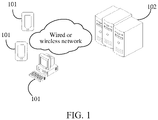
- FIG. 1 is a schematic diagram of an implementation environment according to an embodiment of the disclosure. Referring to FIG. 1 , the implementation environment includes a terminal 101 and a server 102. The terminal 101 and the server 102 establish a communication connection through a wired or wireless network.
- a target application may be installed on the terminal 101, and the target application is an application with an image processing function or an application related to image processing.
- the server 102 is a server that provides services for the target application.
- the server 102 stores contour information, the user sends target region information to the server 102 through the target application of the terminal 101, and the server 102 obtains the target region information.
- the server 102 determines at least one target contour according to the contour information and the target region information, any target contour being wholly or partly located in a target region; decreases first coordinates of a plurality of contour points in the at least one target contour to obtain second location information of the at least one target contour; and generates a target image corresponding to the target region according to the second location information of the at least one target contour and the target region information, the target image including a contour located in the target region.
- the method provided in this embodiment of the disclosure is applicable to an image generation scenario.
- a scenario of generating a target image of a WSI For example, in a scenario of generating a target image of a WSI:
- the WSI includes a target object, and a target image corresponding to the WSI includes a contour of the target object in the WSI.
- the WSI and the target image corresponding to the WSI are used as training data of a network model, thereby training a network model that can recognize the target object in the WSI.
- a relative position of each contour point in the target image is not changed, that is, a relative position relationship between contours in the target image is the same as a relative position relationship between corresponding contours in the original image, thereby avoiding the problem that the two contours in the original image are connected, and ensuring the accuracy of the target image.
- the image generation method provided in the embodiments of the disclosure is applicable to any scenario in which an image is generated, and this is not limited in the embodiments of the disclosure.
- FIG. 2 is a flowchart of an image generation method according to an embodiment of the disclosure.
- the execution entity of the embodiments of the disclosure is a computer device.
- the computer device is a terminal such as a mobile phone, a computer, or a tablet computer, or a server, or a server cluster including a plurality of servers, or a cloud computing service center.
- the image generation process is described in the embodiments of the disclosure.
- the image generation method includes: 201: Obtain contour information, the contour information including first location information of at least one original contour in an original image, and first location information of any original contour including first coordinates of a plurality of contour points in the any original contour.
- the original image is any image including a target object.
- An original contour in the original image is a contour of the target object in the original image.
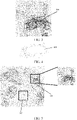
- the original image includes a plurality of target objects 301, and contours of the target objects 301 are original contours in the original image.
- the target object is any object.
- the original image is a pathological WSI
- the target objects are cancerous cells
- the original contours are contours of the cancerous cells
- the target objects are a cell group of cancerous cells
- the original contour is a contour of the cell group
- the cell group is a part including a plurality of cells.
- the at least one original contour refers to all original contours in the original image, or refers to a part of the original contours in the original contour. This is not limited in the embodiments of the disclosure.
- the original image may include target objects, colors, textures, and the like.
- FIG. 4 shows a target image corresponding to the original image shown in FIG. 3 .
- the target image includes no color or texture, and only includes an original contour 401 of the plurality of target objects 301.
- the original image and the target image corresponding to the original image are used as training data of a classification network model, and the classification network model may be used to distinguish target objects.
- the target image is generated according to the first location information of the at least one original contour in the original image. Therefore, the target image corresponding to the original image has the same size as the original image. If the image size of the original image exceeds a first reference size, the size of the generated target image also exceeds the first reference size.
- the first reference size is a maximum size of an image that can be generated by using the current image processing technology. Therefore, when the image size of the original image exceeds the first reference size, the target image corresponding to the original image cannot be generated by using the current image processing technology.
- the maximum size of the image that can be generated by using the current image processing technology is determined by a processing upper limit of a programming language, or an upper limit of data that can be processed by a hardware device.
- the hardware device is a memory or the like.
- the size of the original image is 100,000 ⁇ 100,000
- the maximum size of the image that can be processed by using the current image processing technology is 50,000 ⁇ 50,000. Therefore, the target image corresponding to the original image cannot be generated by using the current image processing technology.
- the original image and the target image of the original image need to be smaller than a second reference size. If the sizes of the original image and the target image exceed the second reference size, the original image and the target image of the original image cannot be used as the training data of the network model.
- the second reference size is a maximum size of a training image used in an artificial intelligence algorithm. In an implementation, the second reference size is 2000 ⁇ 2000.
- the size of the generated target image can be reduced by defining the target region and generating the target image corresponding to the target region, the size of the original image is not limited in the disclosure.
- the first coordinates of the contour points are used to indicate locations of the contour points in the original image.
- the first coordinates of the contour points are coordinates of the contour points in a two-dimensional coordinate system of the original image.
- the two-dimensional coordinate system of the original image is a coordinate system with a vertex of the original image being an origin of the coordinates.
- the vertex of the original image is a vertex of the lower left corner, a vertex of the lower right corner, a vertex of the upper left corner, a vertex of the upper right corner of the original image, or the like, and this is not limited in the embodiments of the disclosure.
- the two-dimensional coordinate system of the original image is a coordinate system used when the original image is generated, and any position point on the original image is determined according to the two-dimensional coordinate system.
- the contour information further includes a contour identifier of the at least one original contour.
- the contour identifier is an identifier that uniquely determines the original contour.
- the contour identifier is a sequence number, an identity (ID), or the like of the original contour, and the contour identifier is not limited in the embodiments of the disclosure.
- the contour identifier of the original contour and the first location information of the original contour are correspondingly stored.
- the first location information of each original contour is stored in a file, and a file name of the file includes the contour identifier of the original contour.
- the contour identifier is added to the first location information of the original contour.
- the first location information includes the first coordinates of the plurality of contour points in the original contour
- the first coordinates of the plurality of contour points are [[x_i_1, y_i_1], [x_i_2, y_i_2], [x_i_3, y_i_3], ..., [x_i_n, y_i_n]], where x is the horizontal coordinate of the first coordinate, y is the vertical coordinate of the first coordinate, i is the contour identifier, and n is the quantity of contour points in the original contour, n being an integer greater than or equal to 3.
- i is the sequence number of the original contour
- the method of obtaining the contour information is: obtaining the contour information of the original image by performing contour analysis processing on the original image; or obtaining the contour information from a local storage space.
- the computer device obtains the contour information of the original image by analyzing and processing the original image.
- the original image includes at least one target object;
- the obtaining the contour information of the original image by analyzing and processing the original image by the computer device includes: determining, by the computer device, a pixel difference between a pixel value of any point and a pixel value of an adjacent point according to a pixel value of each point in the original image; using the any point as a contour point on the original contour in response to the pixel difference being greater than a reference difference; and obtaining location information of the plurality of contour points on the at least one original contour, to obtain the contour information of the original image.
- the original image includes at least one original contour
- the obtaining the contour information of the original image by analyzing and processing the original image by the computer device includes: obtaining, by the computer device in the two-dimensional coordinate system of the original image according to a location of at least one original contour on the original image, first coordinates of a plurality of contour points in the at least one original contour, and obtaining the contour information of the original image according to the first coordinates of the plurality of contour points in the at least one original contour.
- the contour information may be alternatively obtained from the local storage space, and this is not limited in the embodiments of the disclosure.
- the local storage space includes the contour information of the at least one original image, and first location information of at least one original contour in an original image is stored in the same storage location.
- the contour information is obtained by manually drawing the original contour on the computer device by the user, or obtained by performing contour analysis processing on the original image by the computer device, and this is not limited in the embodiments of the disclosure.
- the contour information is obtained by manually drawing the original contour on the computer device by the user.
- the computer device displays the original image, and the user draws on the original image.
- the computer device generates, according to a detected sliding trajectory, an original contour corresponding to the sliding trajectory on the original image, and obtains first coordinates of a plurality of contour points in the original contour, to obtain the contour information.
- the drawing of the user on the original image is a trigger operation on the original image.
- the trigger operation is a click operation, a long-press operation, a drag operation, a double click operation, a sliding operation, or the like.
- the trigger operation is triggered by the user through a mouse, or triggered by the user touching on the display screen.
- the trigger operation on the original image is one or a combination of a plurality of trigger operations, or the like, and this is not limited in the embodiments of the disclosure.
- the contour information is obtained by performing contour analysis processing on the original image by the computer device.
- the original image includes at least one target object
- the obtaining the contour information of the original image by analyzing and processing the original image by the computer device includes: determining, by the computer device according to a pixel value of any point on the original image and a pixel value of an adjacent point, a difference between the pixel value of the any point and the pixel value of the adj acent point; using the any point as a contour point on the original contour in response to the difference being greater than a reference difference to determine the original contour of the target object; and obtaining, according to locations of a plurality of contour points in the original contour in the two-dimensional coordinate system of the original image, first coordinates of the plurality of contour points in the original contour, and obtaining the contour information of the original image according to the first coordinates of the plurality of contour points in the original contour.
- the original image includes a contour line of at least one original contour
- the obtaining the contour information of the original image by analyzing and processing the original image by the computer device includes: obtaining, by the computer device in the two-dimensional coordinate system of the original image according to a location of the contour line of the at least one original contour on the original image, first coordinates of a plurality of contour points in the at least one original contour, and obtaining the contour information of the original image according to the first coordinates of the plurality of contour points in the at least one original contour.
- the manner of obtaining the contour information is only described by taking examples in this embodiment of the disclosure, and is not limited to the foregoing several obtaining manners.
- the contour information may be alternatively obtained in other manners.
- the manner of obtaining the contour information is not limited in the embodiments of the disclosure.
- the target region information is information used for determining the target region.
- the target region information includes coordinates of a plurality of vertices of the target region.
- the target region is a rectangular region, and the target region information is coordinates of four vertices of the target region.
- the target region information includes coordinates of any vertex of the target region, and a shape and a size of the target region.
- the target region information includes that the shape of the target region is a rectangle, the length of the target region is 500, the width is 400, and coordinates of the vertex at the upper left corner of the target region are (18000, 25000). In other words, the shape, the size, and the position of the target region are all determined through the target region information.
- the shape of the target region is fixed.
- the shape of the target region is a rectangle, a circle, or the like
- the target region information includes coordinates of any vertex of the target region and the size of the target region.
- the shape of the target region is default, and the position and size of the target region are determined through the target region information.
- the target region information is inputted by the user, or obtained by analyzing and processing the original image by the computer device.
- the computer device displays a region information obtaining page, and obtains the target region information inputted by the user through the region information obtaining page, the region information obtaining page being used for obtaining the target region information.
- the region information obtaining page includes at least one region information input option.
- the computer device segments the original image into a plurality of region images, performs contour recognition processing on each region image, and in response to a region image including the original contour, uses region information of the region image as the target region information.
- region image including the original contour means that the region image includes a complete original contour; or the region image includes a part of the original contour.
- a manner in which the computer device performs contour recognition processing on the region image to determine whether the original contour is included in the region image is to determine whether the original contour is included in the region image according to a difference between a pixel value of any point on the region image and a pixel value of an adjacent point; or determine whether the original contour is included in the regional image according to whether there are contour lines in the regional image.
- Other manners may be alternatively used to determine whether the original contour is included in the region image, and this is not limited in the embodiments of the disclosure.
- a region 501 of the original image includes a plurality of original contours.
- the computer device uses the region 501 as the target region, and obtains region information of the region 501 as the target region information.
- a region 502 of the original image includes no original contour, and the computer device does not use the region 502 as the target region.
- any target contour being wholly or partly located in a target region means that any target contour is wholly located in the target region or partly located in the target region.
- the target region includes: a closed region corresponding to a complete target contour, or an unclosed region corresponding to an incomplete target contour.
- the target region is a rectangular region, and the target region includes a plurality of target contours.
- a first target contour 601 encloses a closed region, and the first target contour 601 is wholly located in the target region.
- a second target contour 602 also encloses a closed region, and the second target contour 602 is also wholly located in the target region.
- a third target contour 603 does not enclose a closed region, and the third target contour 603 is partially located in the target region.
- the determining at least one target contour according to the contour information and the target region information includes: determining, in response to determining that any contour point is located in the target region according to the contour information and the target region information, an original contour to which the any contour point belongs as a target contour.
- location information of a contour point includes a contour identifier of the original contour to which the contour point belongs
- the computer device may obtain the contour identifier included in the location information of the contour point.
- the original contour to which the contour point belongs is determined, and then the determined original contour is determined as the target contour. That is, by obtaining the contour identifier of the original contour, the original contour is determined as the target contour.
- coordinates of a contour point located in the target region are [x_2_n, y_2_n], where 2 is a contour identifier of the original contour.
- the contour identifier of the original contour to which the contour point belongs may be obtained according to the coordinates of the contour point.
- first location information of the original contour whose contour identifier is 2 may be obtained from the contour information.
- contour points of each original contour need to be searched and compared. If a target contour in each target region needs to be determined according to a plurality of pieces of target region information, contour points of each original contour need to be searched and compared repeatedly.
- At least one target contour in the reduced target region may be further determined in the first image by generating a first image.
- the first image is a target image corresponding to the reduced original image.
- the determining at least one target contour according to the contour information and the target region information includes: reducing the first location information of the at least one original contour to obtain third location information of at least one first contour, any first contour being a contour after a corresponding original contour is reduced, and the first location information of the at least one original contour having a same reduction ratio; generating a first image corresponding to the original image according to the third location information of the at least one first contour, the first image including the at least one first contour; reducing the target region information to obtain first region information, the first region information indicating the reduced target region, and a reduction ratio of the target region information being equal to the reduction ratio of the first location information of the at least one original contour; and determining the at least one target contour according to the first region information and the first image.
- the reducing the first location information of the at least one original contour is to reduce coordinates of a plurality of contour points on each original contour. If the coordinates of the contour points include horizontal coordinates and vertical coordinates, the horizontal coordinates and the vertical coordinates of the contour points need to be reduced, where the horizontal coordinates and the vertical coordinates have the same reduction ratio. For example, the horizontal coordinate of each contour point is reduced by 10 times, and the vertical coordinate of each contour point is reduced by 10 times, to obtain the third location information of at least one first contour.
- the generating a first image corresponding to the original image according to the third location information of the at least one first contour includes: establishing a two-dimensional coordinate system, and determining a location of each contour point in the two-dimensional coordinate system according to the third location information of the at least one first contour; and generating the first image in the two-dimensional coordinate system according to the location of each contour point in the two-dimensional coordinate system. Since the coordinates of each contour point are reduced, the generated first image is also reduced, and a reduction ratio of the first image relative to the original image is equal to the reduction ratio of the coordinates of each contour point.
- the contour information further includes a contour identifier of the at least one original contour; and the generating a first image corresponding to the original image according to the third location information of the at least one first contour includes: generating the first image according to the third location information of the at least one first contour and the contour identifier of the at least one original contour, the first image including the at least one first contour and a contour identifier of the at least one first contour, and a contour identifier of any first contour being a contour identifier of an original contour corresponding to the any first contour.
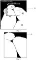
- a region enclosed by a contour 701 in the first image includes a contour identifier 45 of the contour 701
- a region enclosed by a contour 702 includes a contour identifier 47 of the contour 702
- a region enclosed by a contour 703 includes a contour identifier 48 of the contour 703
- a region enclosed by a contour 704 includes a contour identifier 49 of the contour 704.
- the determining the at least one target contour according to the first region information and the first image includes: determining a contour identifier of at least one second contour according to the at least one first contour in the first image, the contour identifier of the at least one first contour, and the first region information, the at least one second contour being a first contour that is wholly or partly located in the reduced target region in the first image; and determining an original contour corresponding to the at least one second contour as a target contour according to the contour identifier of the at least one second contour.
- the target region information includes that: coordinates of a vertex at the upper left corner of the target region are (30000, 36000), the length of the target region is 4000, and the width of the target region is 4000.
- the computer device After reducing the first location information of the original contour by 20 times, the computer device obtains the third location information of the first contour, and generates the first image according to the third location information of the first contour.
- FIG. 8 shows a partial region of the first image. Since the first location information is reduced by 20 times, the target region information needs to be also reduced by 20 times to obtain the first region information. As shown in FIG.
- the first region information includes that: coordinates of a vertex at the top left corner of the first region 801 are (1500, 1800), the length of the first region 801 is 200, and the width of the first region 801 is 200.
- the contour identifier of the at least one first contour, and the first region information it may be determined that contour identifiers of at least one first contour wholly or partly located in the reduced target region in the first image are respectively 45, 47, and 49, that is, it is determined that contour identifiers of at least one second contour are 45, 47, and 49 respectively.
- FIG. 9 shows three contours in the first region 901.
- the generating the first image according to the third location information of the at least one first contour and the contour identifier of the at least one original contour includes: setting a pixel value in a contour region corresponding to any first contour as the contour identifier of the any first contour; and generating the first image according to the third location information of the at least one first contour and a pixel value in a contour region corresponding to the at least one first contour.
- the generated first image includes colors, or includes three colors of black, gray, and white, and this is not limited in the embodiments of the disclosure.
- FIG. 10 shows a partial region of the first image.
- At least one target contour located in the target region can be quickly determined, which improves the speed of determining the at least one target contour, so that the computer device can draw the target image as soon as possible according to the first location information of the target contour, thereby improving the efficiency of generating the target image.
- the computer device obtains the contour identifier of the target contour.
- the computer device may further obtain the first location information of the at least one target contour from the contour information according to the contour identifier of the at least one target contour.
- the target region includes three target contours, and contour identifiers of the three target contours are 45, 47, and 49 respectively.
- the contour information is searched according to 45, 47 and 49, to obtain first location information of the three target contours.
- the first location information of the three target contours is:
- first coordinates of a plurality of contour points in the at least one target contour to obtain second location information of the at least one target contour, second location information of any target contour including second coordinates of a plurality of contour points in the any target contour, and the first coordinates of the plurality of contour points in the at least one target contour having a same decreasing extent.
- the size of the image corresponding to the target contour is a ⁇ b, where a is a maximum horizontal coordinate of the target contour and b is a maximum vertical coordinate of the target contour. Therefore, the size of the image corresponding to the target contour is not only related to the size of the target contour, but also related to the coordinates of the target contour.
- the coordinates of each contour point in the target contour are decreased, to reduce useless regions as much as possible, and also make the size of the generated image smaller, thereby avoiding the phenomenon of a relatively large size of the obtained image when generating the image corresponding to the target contour according to the coordinates of the target contour.
- the decreasing extent is any value greater than zero.
- the first coordinates include horizontal coordinates and vertical coordinates
- the method further includes: obtaining a first minimum horizontal coordinate and a first minimum vertical coordinate according to first location information of the at least one target contour; determining the first minimum horizontal coordinate as a decreasing extent of horizontal coordinates of the plurality of contour points in the at least one target contour; and determining the first minimum vertical coordinate as a decreasing extent of vertical coordinates of the plurality of contour points in the at least one target contour.
- the minimum horizontal coordinate (that is, the first minimum horizontal coordinate) is 5543
- the minimum vertical coordinate (that is, the first minimum vertical coordinate) is 4796.
- (5543, 4796) is used as the decreasing extent, that is, (5543, 4796) is subtracted from the first coordinates of each contour point on the target contour. If first coordinates of a contour point are (6543, 5796), (5543, 4796) is subtracted from (6543, 5796), and the obtained coordinates are updated as the second coordinates of the contour point.
- the decreasing first coordinates of a plurality of contour points in the at least one target contour to obtain second location information of the at least one target contour includes: decreasing horizontal coordinates in the first coordinates of the plurality of contour points in the at least one target contour according to a decreasing extent of the horizontal coordinates; and decreasing vertical coordinates in the first coordinates of the plurality of contour points in the at least one target contour according to a decreasing extent of the vertical coordinates, to obtain the second coordinates of the plurality of contour points in the at least one target contour.
- an origin of a coordinate system of coordinates of contours in the target region is set to [x_min, y_min], and the target image can be generated in the coordinate system based on contour _list_local subsequently.
- the first minimum horizontal coordinate and the first minimum vertical coordinate of the at least one target contour are used as the decreasing extent to decrease the first coordinates of a plurality of contour points in each target contour, which is equivalent to cutting the image corresponding to the target contour, thereby reducing the size of the target image corresponding to the target region.
- the first coordinates include horizontal coordinates and vertical coordinates
- the method further includes: obtaining a second minimum horizontal coordinate and a second minimum vertical coordinate of the target region according to the target region information; determining the second minimum horizontal coordinate as a decreasing extent of horizontal coordinates of the plurality of contour points in the at least one target contour; and determining the second minimum vertical coordinate as a decreasing extent of vertical coordinates of the plurality of contour points in the at least one target contour.
- the horizontal coordinates in the first coordinates of the plurality of contour points in the target contour need to be subtracted from the second minimum horizontal coordinate of the target region
- the vertical coordinates in the first coordinates of the plurality of contour points in the target contour need to be subtracted from the second minimum vertical coordinate of the target region, which is equivalent to using the vertex of the target region as the coordinate origin of the contour coordinate system, and generating the target image with the coordinate origin, thereby reducing the size of the target image.
- the second minimum horizontal coordinate and the first minimum horizontal coordinate may be the same or different, which is related to the actual situation of the first location information of the at least one target contour and the target region information. This is not limited in this embodiment of the disclosure.
- the second minimum vertical coordinate and the first minimum vertical coordinate may be the same or different, which is also related to the actual situation of the first location information of the at least one target contour and the target region information.
- the generating a target image corresponding to the target region according to the second location information of the at least one target contour and the target region information includes: generating a third image according to the second location information of the at least one target contour, the third image comprising the at least one target contour; and cutting the target region in the third image according to the target region information, to obtain the target image corresponding to the target region.
- the cutting the target region in the third image according to the target region information, to obtain the target image corresponding to the target region includes: decreasing the coordinates included in the target region information to obtain the updated target region information; determining the target region in the third image according to the updated target region information; and cutting the target region in the third image to obtain the target image corresponding to the target region.
- the decreasing extent of the coordinates included in the target region information is equal to the decreasing extent of the first coordinates of the plurality of contour points in the at least one target contour.
- reducing the coordinates included in the target region information refers to reducing the coordinates of the plurality of vertices of the target region included in the target region information.
- the decreasing extent of the coordinates of the plurality of vertices of the target region is equal to the decreasing extent of the first coordinates of the plurality of contour points in the at least one target contour.
- reducing the coordinates included in the target region information refers to reducing the coordinates of the any vertex included in the target region information.
- the size of the target region included in the target region information remains unchanged.
- the updated target region information can be obtained, and the updated target region information can indicate the target region in the third image.
- the target region in the third image may be directly determined according to the updated target region information, and then the target image may be obtained by cutting out the target region.
- FIG. 11 includes complete contours of 3 target contours.
- FIG. 11 shows contour images of the three target contours: a contour 1101 with a contour identifier of 45, a contour 1102 with a contour identifier of 47, and a contour 1103 with a contour identifier of 49.
- FIG. 11 further includes a target region 1104. The target region 1104 in FIG. 11 is cut out to obtain a target image 1201 as shown in FIG. 12 .
- the generating a target image corresponding to the target region according to the second location information of the at least one target contour and the target region information includes: determining contour points located in the target region in the at least one target contour according to second coordinates of the plurality of contour points in the at least one target contour and the target region information; and generating the target image according to second coordinates of the contour points located in the target region in the at least one target contour and the target region information.
- the determining contour points located in the target region in the at least one target contour according to second coordinates of the plurality of contour points in the at least one target contour and the target region information includes: decreasing the coordinates included in the target region information to obtain the updated target region information; and determining contour points located in the target region in the at least one target contour according to second coordinates of the plurality of contour points in the at least one target contour and the updated target region information.
- the decreasing extent of the coordinates included in the target region information is equal to the decreasing extent of the first coordinates of the plurality of contour points in the at least one target contour.
- the generating the target image according to second coordinates of the contour points located in the target region in the at least one target contour and the target region information includes: decreasing the coordinates included in the target region information to obtain the updated target region information; and generating the target image according to second coordinates of the contour points located in the target region in the at least one target contour and the updated target region information.
- the decreasing extent of the coordinates included in the target region information is equal to the decreasing extent of the first coordinates of the plurality of contour points in the at least one target contour.
- the target region is defined, so that the computer device only needs to generate the target image corresponding to the target region, and does not need to generate images corresponding to other regions.
- the coordinates of the plurality of contour points on the target contour are decreased to achieve the effect of cutting off the images corresponding to other regions, thereby reducing the size of the target image.
- the coordinates of the plurality of contour points on the target contour in the disclosure have the same decreasing extent, to ensure that a distance between contours in the target image is the same as a distance between corresponding contours in the original image, thereby avoiding the problem of contour adhesion, and ensuring the accuracy of the generated target image.
- the minimum horizontal coordinate in the at least one target contour may be used as the decreasing extent of the horizontal coordinated of each contour point in the at least one target contour
- the minimum vertical coordinate in the at least one target contour may be used as the decreasing extent of the vertical coordinate of each contour point in the at least one target contour, which is equivalent to using the minimum horizontal coordinate and the minimum vertical coordinate as the origin of the contour coordinate system of the target image, avoiding drawing the region outside the at least one target contour as much as possible, and reducing the size of the target image.
- the minimum horizontal coordinate in the target region information may be used as the decreasing extent of the horizontal coordinated of each contour point in the at least one target contour
- the minimum vertical coordinate in the target region information may be used as the decreasing extent of the vertical coordinate of each contour point in the at least one target contour, which is equivalent to using the minimum horizontal coordinate and the minimum vertical coordinate in the target region information as the origin of the contour coordinate system of the target image, avoiding drawing the region outside the target region as much as possible, and reducing the size of the target image.
- the first location information of at least one original contour is further reduced to generate the first image corresponding to the original image.
- the first image may include the contour identifier of at least one original contour.
- the first image may be regarded as an index image of the original image.
- At least one target contour located in the target region in the original image can be determined according to the target region information of the original image and the first image, which increases the speed of determining at least one target contour located in the target region, and also improves the efficiency of generating the target image.
- the image generation method provided in the embodiments of the disclosure is applicable to a process of processing a pathological WSI.
- classification processing of pathological WSIs is increasingly based on classification network models.
- the classification network model needs to be trained first, and then the trained classification network model is used to classify the pathological WSIs.
- the sample pathological WSI includes a target object or target region
- the target image corresponding to the sample pathological WSI includes a contour of the target object or a contour of the target region.
- the sample pathological WSI including a target object is taken as an example for description.
- the sample pathological WSI includes at least one target object, and a target contour corresponding to the sample pathological WSI includes a contour of the at least one target object.
- the sample pathological WSI and the target image are used as training sample data and inputted into the classification network model.
- the classification network model may process the WSI to determine the contour of the target object in the WSI, determine whether a classification result is correct according to the contour in the target image corresponding to the sample pathological WSI, and then adjust parameters of the classification network model according to a difference between an output result of the classification model and location information of the contour in the target image, so that the classification result of the classification network model is more accurate.
- the target object in the WSI may be recognized based on the classification network model.
- the size of the sample pathological WSI is relatively large, and the target image is the same size as the sample pathological WSI. Therefore, at present, the scaled sample pathological WSI and the scaled target image are used as the sample training data. In the scaled image, if two contours are close to each other, the two contours are adhered to form a contour. The error in the target image used to train the classification network model reduces the accuracy of the classification network model.
- the disclosure provides a method for generating a target image of a WSI.
- the method is applied to a computer device.
- the method for generating a target image of a WSI includes the following steps:
- contour information 1301 Obtain contour information, the contour information including first location information of an original contour of at least one target object in a WSI, and first location information of any original contour including first coordinates of a plurality of contour points in the any original contour.
- a WSI is an image including a target object.
- the target object is a cancerous cell, a diseased blood vessel, a non-cancerous cell, a non-diseased blood vessel, or the like.
- the target object is not limited in the embodiments of the disclosure.
- the determining at least one target contour according to the contour information and the target region information includes: determining, in response to determining that any contour point is located in the target region according to the contour information and the target region information, an original contour to which the any contour point belongs as a target contour.
- the determining at least one target contour according to the contour information and the target region information includes: reducing the first location information of the at least one original contour to obtain third location information of at least one first contour, any first contour being a contour after a corresponding original contour is reduced, and the first location information of the at least one original contour having a same reduction ratio; generating a first image corresponding to the WSI according to the third location information of the at least one first contour, the first image including the at least one first contour; reducing the target region information to obtain first region information, the first region information indicating the reduced target region, and a reduction ratio of the target region information being equal to the reduction ratio of the first location information of the at least one original contour; and determining the at least one target contour according to the first region information and the first image.
- the contour information further includes a contour identifier of the at least one original contour; and the generating a first image corresponding to the WSI according to the third location information of the at least one first contour includes: generating the first image according to the third location information of the at least one first contour and the contour identifier of the at least one original contour, the first image including the at least one first contour and a contour identifier of the at least one first contour, and a contour identifier of any first contour being a contour identifier of an original contour corresponding to the any first contour.
- the determining the at least one target contour according to the first region information and the first image includes: determining a contour identifier of at least one second contour according to the at least one first contour in the first image, the contour identifier of the at least one first contour, and the first region information, the at least one second contour being a first contour that is wholly or partly located in the reduced target region in the first image; and determining an original contour corresponding to the at least one second contour as a target contour according to the contour identifier of the at least one second contour.
- the generating the first image according to the third location information of the at least one first contour and the contour identifier of the at least one original contour includes: setting a pixel value in a contour region corresponding to any first contour as the contour identifier of the any first contour; and generating the first image according to the third location information of the at least one first contour and a pixel value in a contour region corresponding to the at least one first contour.
- first coordinates of a plurality of contour points in the at least one target contour to obtain second location information of the at least one target contour, second location information of any target contour including second coordinates of a plurality of contour points in the any target contour, and the first coordinates of the plurality of contour points in the at least one target contour having a same decreasing extent.
- the first coordinates include horizontal coordinates and vertical coordinates
- the method further includes: obtaining a first minimum horizontal coordinate and a first minimum vertical coordinate according to first location information of the at least one target contour; determining the first minimum horizontal coordinate as a decreasing extent of horizontal coordinates of the plurality of contour points in the at least one target contour; and determining the first minimum vertical coordinate as a decreasing extent of vertical coordinates of the plurality of contour points in the at least one target contour.
- the first coordinates include horizontal coordinates and vertical coordinates
- the method further includes: obtaining a second minimum horizontal coordinate and a second minimum vertical coordinate of the target region according to the target region information; determining the second minimum horizontal coordinate as a decreasing extent of horizontal coordinates of the plurality of contour points in the at least one target contour; and determining the second minimum vertical coordinate as a decreasing extent of vertical coordinates of the plurality of contour points in the at least one target contour.
- the generating a target image corresponding to the target region according to the second location information of the at least one target contour and the target region information includes: generating a third image according to the second location information of the at least one target contour, the third image comprising the at least one target contour; and cutting the target region in the third image according to the target region information, to obtain the target image corresponding to the target region.
- the generating a target image corresponding to the target region according to the second location information of the at least one target contour and the target region information includes: determining contour points located in the target region in the at least one target contour according to second coordinates of the plurality of contour points in the at least one target contour and the target region information; and generating the target image according to second coordinates of the contour points located in the target region in the at least one target contour and the target region information.
- the target image corresponding to the target region of the WSI is generated by using the foregoing method, which reduces the size of the generated target image. Subsequently, the image corresponding to the target region may be cut from the WSI according to the target region, and the image and the target image are used as the training data of the classification network model. Since a distance between contours in the target image is the same as a distance between corresponding contours in the WSI, the accuracy of the target image is guaranteed, thereby improving the accuracy of training the classification network model.
- FIG. 14 is a schematic diagram of a comparison between a target image generated by using the related art and a target image generated by using a method provided in the disclosure.
- contour lines in a target image 1401 generated by using the related art are blurred, and the contour lines are adhered.
- the computer device misjudges the adhered contour lines as one contour.
- contour lines in a target image 1402 generated by using the method provided in the disclosure are clear, and boundaries between the contour lines are clear, which avoids misjudgment by the computer device.
- the plurality of target images may be combined according to a position relationship between the target images, and the plurality of target images may be combined into a target image corresponding to the WSI.
- FIG. 15 is a schematic structural diagram of an image generation apparatus according to an embodiment of the disclosure.
- the apparatus includes:
- the target region is defined, so that the computer device only needs to generate the target image corresponding to the target region, and does not need to generate images corresponding to other regions.
- the coordinates of the plurality of contour points on the target contour are decreased to achieve the effect of cutting off the images corresponding to other regions, thereby reducing the size of the target image.
- the coordinates of the plurality of contour points on the target contour in the disclosure have the same decreasing extent, so that a distance between contours in the target image is the same as a distance between corresponding contours in the original image, thereby avoiding the problem of contour adhesion, and ensuring the accuracy of the generated target image.
- the first coordinates include horizontal coordinates and vertical coordinates
- the apparatus further includes: an extent obtaining module 1505, configured to: obtain a first minimum horizontal coordinate and a first minimum vertical coordinate according to first location information of the at least one target contour; determine the first minimum horizontal coordinate as a decreasing extent of horizontal coordinates of the plurality of contour points in the at least one target contour; and determine the first minimum vertical coordinate as a decreasing extent of vertical coordinates of the plurality of contour points in the at least one target contour.
- an extent obtaining module 1505 configured to: obtain a first minimum horizontal coordinate and a first minimum vertical coordinate according to first location information of the at least one target contour; determine the first minimum horizontal coordinate as a decreasing extent of horizontal coordinates of the plurality of contour points in the at least one target contour; and determine the first minimum vertical coordinate as a decreasing extent of vertical coordinates of the plurality of contour points in the at least one target contour.
- the first coordinates include horizontal coordinates and vertical coordinates
- the extent obtaining module 1505 is further configured to: obtain a second minimum horizontal coordinate and a second minimum vertical coordinate of the target region according to the target region information; determine the second minimum horizontal coordinate as a decreasing extent of horizontal coordinates of the plurality of contour points in the at least one target contour; and determine the second minimum vertical coordinate as a decreasing extent of vertical coordinates of the plurality of contour points in the at least one target contour.
- the determining module 1502 is further configured to determine, in response to determining that any contour point is located in the target region according to the contour information and the target region information, an original contour to which the any contour point belongs as a target contour.
- the determining module 1502 includes:
- the contour information further includes a contour identifier of the at least one original contour; and the first generation unit 1522 is configured to generate the first image according to the third location information of the at least one first contour and the contour identifier of the at least one original contour, the first image including the at least one first contour and a contour identifier of the at least one first contour, and a contour identifier of any first contour being a contour identifier of an original contour corresponding to the any first contour.
- the first determining unit 1532 is configured to: determine a contour identifier of at least one second contour according to the at least one first contour in the first image, the contour identifier of the at least one first contour, and the first region information, the at least one second contour being a first contour that is wholly or partly located in the reduced target region in the first image; and determine an original contour corresponding to the at least one second contour as a target contour according to the contour identifier of the at least one second contour.
- the first generation unit 1522 is configured to set a pixel value in a contour region corresponding to any first contour as the contour identifier of the any first contour; and generate the first image according to the third location information of the at least one first contour and a pixel value in a contour region corresponding to the at least one first contour.
- the generation module 1504 includes:
- the generation module 1504 includes:
- FIG. 17 is a structural block diagram of a terminal according to an embodiment of the disclosure.
- the terminal 1700 is configured to perform the steps performed by the terminal or the smart device in the foregoing embodiments.
- the terminal 1700 is a portable mobile terminal.
- the terminal 1700 may also be referred to as user equipment, a portable terminal, a laptop terminal, a desktop terminal, or the like.
- the terminal 1700 includes a processor 1701 and a memory 1702.
- the processor 1701 includes one or more processing cores, for example, a 4-core processor or an 8-core processor.
- the memory 1702 includes one or more computer-readable storage media.
- the computer-readable storage medium is non-transient.
- a non-transitory computer-readable storage medium in the memory 1702 is configured to store at least one instruction, the at least one instruction being configured to be executed by the processor 1701 to implement the image generation method provided in the method embodiments of the disclosure.
- the terminal 1700 may In an implementation include a peripheral interface 1703 and at least one peripheral.
- the processor 1701, the memory 1702, and the peripheral interface 1703 may be connected by a bus or a signal cable.
- Each peripheral may be connected to the peripheral interface 1703 by a bus, a signal cable, or a circuit board.
- the peripheral includes at least one of a radio frequency (RF) circuit 1704, a display screen 1705, a camera component 1706, an audio circuit 1707, a positioning component 1708, or a power supply 1709.
- RF radio frequency
- the peripheral interface 1703 may be configured to connect at least one peripheral related to input/output (I/O) to the processor 1701 and the memory 1702.
- the RF circuit 1704 is configured to receive and transmit an RF signal, also referred to as an electromagnetic signal.
- the display screen 1705 is configured to display a user interface (UI).
- the camera component 1706 is configured to acquire an image or a video.
- the audio circuit 1707 includes a microphone and a speaker.
- the microphone is configured to acquire sound waves of users and surroundings, and convert the sound waves into electrical signals and input the signals to the processor 1701 for processing, or input the signals to the RF circuit 1704 to implement voice communication.
- the speaker is configured to convert electric signals from the processor 1701 or the RF circuit 1704 into sound waves.
- the positioning component 1708 is configured to determine a current geographic location of the terminal 1700, to implement navigation or a location-based service (LBS).
- the power supply 1709 is configured to supply power to assemblies in the terminal 1700.
- FIG. 17 does not constitute a limitation to the terminal 1700, and the terminal 1700 may include more or fewer components than those shown in the figure, or some components may be combined, or a different component arrangement may be used.
- FIG. 18 is a schematic structural diagram of a server according to an embodiment of the disclosure.
- the server 1800 may vary greatly due to different configurations or performance, and may include one or more central processing units (CPUs) 1801 and one or more memories 1802.
- the memory 1802 stores at least one instruction, the at least one instruction being loaded and executed by the processor 1801 to implement the image generation method provided in the foregoing method embodiments.
- the server 1800 may further have a wired or wireless network interface, a keyboard, an input/output interface and other components to facilitate input/output.
- the server 1800 may further include other components for implementing device functions. Details are not described herein.
- the server 1800 may be configured to perform the steps performed by the server in the foregoing image generation method.
- An embodiment of the disclosure further provides a computer device, including a processor and a memory, the memory storing at least one instruction, the at least one instruction being loaded and executed by the processor to perform the operations performed in the image generation method according to the foregoing embodiments.
- An embodiment of the disclosure further provides a non-transitory computer-readable storage medium, storing at least one instruction, the at least one instruction being loaded and executed by a processor to perform the operations performed in the image generation method according to the foregoing embodiments.
- An embodiment of the disclosure further provides a computer program or a computer program product, the computer program or the computer program product storing at least one instruction, the at least one instruction being loaded and executed by a processor to perform the operations performed in the image generation method according to the foregoing embodiments.
- the program may be stored in a non-transitory computer-readable storage medium.
- the non-transitory computer-readable storage medium is a read-only memory (ROM), a magnetic disk, or an optical disc.
Landscapes
- Engineering & Computer Science (AREA)
- Theoretical Computer Science (AREA)
- General Physics & Mathematics (AREA)
- Physics & Mathematics (AREA)
- Multimedia (AREA)
- Computer Vision & Pattern Recognition (AREA)
- Evolutionary Computation (AREA)
- Artificial Intelligence (AREA)
- Health & Medical Sciences (AREA)
- General Health & Medical Sciences (AREA)
- Data Mining & Analysis (AREA)
- Software Systems (AREA)
- Medical Informatics (AREA)
- Databases & Information Systems (AREA)
- Computing Systems (AREA)
- Life Sciences & Earth Sciences (AREA)
- General Engineering & Computer Science (AREA)
- Bioinformatics & Computational Biology (AREA)
- Bioinformatics & Cheminformatics (AREA)
- Evolutionary Biology (AREA)
- Molecular Biology (AREA)
- Biomedical Technology (AREA)
- Image Analysis (AREA)
- Processing Or Creating Images (AREA)
Abstract
Description
- This application claims priority to
Chinese Patent Application No. 202010097623.0, entitled "IMAGE GENERATION METHOD AND APPARATUS, DEVICE, AND STORAGE MEDIUM" and filed on February 17, 2020 - The present disclosure relates to the field of computer technologies, and in particular, to an image generation method, a device, and a storage medium.
- At present, the processing of whole slide images (WSIs) is increasingly based on deep learning network models. For example, before a target object in a WSI is recognized, a network model needs to be trained by using the WSI and a target image of the WSI, where the target image is an image generated according to location information of a contour in the WSI. Since the size of the target image is relatively large and exceeds the processing range of the current image generation technology, it is necessary to reduce the size of the target image.
- In the related art, the location information of the contour in the WSI is reduced, and the target image of the WSI is generated according to the reduced location information. However, if there are two contours in the WSI that are relatively close, after the location information is reduced, the two contours may overlap. Consequently, in the generated target image, the two contours are connected to become one contour, thereby obtaining a wrong target image.
- Embodiments of the disclosure provide an image generation method, a device, and a storage medium, which can improve the accuracy of a target image. The technical solutions are as follows:
- According to an aspect, an image generation method is provided, including:
- obtaining contour information and target region information, the contour information including first location information of at least one original contour in an original image, first location information of any original contour including first coordinates of a plurality of contour points in the any original contour, and the target region information indicating a target region in the original image;
- determining at least one target contour according to the contour information and the target region information, any target contour being wholly or partly located in the target region;
- decreasing first coordinates of a plurality of contour points in the at least one target contour to obtain second location information of the at least one target contour, second location information of any target contour including second coordinates of a plurality of contour points in the any target contour, and the first coordinates of the plurality of contour points in the at least one target contour having a same decreasing extent; and
- generating a target image corresponding to the target region according to the second location information of the at least one target contour and the target region information, the target image including a contour located in the target region.
- According to another aspect, an image generation apparatus is provided, including:
- an information obtaining module, configured to obtain contour information and target region information, the contour information including first location information of at least one original contour in an original image, first location information of any original contour including first coordinates of a plurality of contour points in the any original contour, and the target region information indicating a target region in the original image;
- a determining module, configured to determine at least one target contour according to the contour information and the target region information, any target contour being wholly or partly located in the target region;
- a decreasing module, configured to decrease first coordinates of a plurality of contour points in the at least one target contour to obtain second location information of the at least one target contour, second location information of any target contour including second coordinates of a plurality of contour points in the any target contour, and the first coordinates of the plurality of contour points in the at least one target contour having a same decreasing extent; and
- a generation module, configured to generate a target image corresponding to the target region according to the second location information of the at least one target contour and the target region information, the target image including a contour located in the target region.
- In a possible implementation, the first coordinates include horizontal coordinates and vertical coordinates, and the apparatus further includes:
an extent obtaining module, configured to: obtain a first minimum horizontal coordinate and a first minimum vertical coordinate according to first location information of the at least one target contour; determine the first minimum horizontal coordinate as a decreasing extent of horizontal coordinates of the plurality of contour points in the at least one target contour; and determine the first minimum vertical coordinate as a decreasing extent of vertical coordinates of the plurality of contour points in the at least one target contour. - In a possible implementation, the first coordinates include horizontal coordinates and vertical coordinates, and the extent obtaining module is further configured to: obtain a second minimum horizontal coordinate and a second minimum vertical coordinate of the target region according to the target region information; determine the second minimum horizontal coordinate as a decreasing extent of horizontal coordinates of the plurality of contour points in the at least one target contour; and determine the second minimum vertical coordinate as a decreasing extent of vertical coordinates of the plurality of contour points in the at least one target contour.
- In a possible implementation, the determining module is further configured to determine, in response to determining that any contour point is located in the target region according to the contour information and the target region information, an original contour to which the any contour point belongs as a target contour.
- In a possible implementation, the determining module includes:
- a reduction unit, configured to reduce the first location information of the at least one original contour to obtain third location information of at least one first contour, any first contour being a contour after a corresponding original contour is reduced, and the first location information of the at least one original contour having a same reduction ratio;
- a first generation unit, configured to generate a first image corresponding to the original image according to the third location information of the at least one first contour, the first image including the at least one first contour,
- the reduction unit being further configured to reduce the target region information to obtain first region information, the first region information indicating the reduced target region, and a reduction ratio of the target region information being equal to the reduction ratio of the first location information of the at least one original contour; and
- a first determining unit, configured to determine the at least one target contour according to the first region information and the first image.
- In a possible implementation, the contour information further includes a contour identifier of the at least one original contour; and the first generation unit is configured to generate the first image according to the third location information of the at least one first contour and the contour identifier of the at least one original contour, the first image including the at least one first contour and a contour identifier of the at least one first contour, and a contour identifier of any first contour being a contour identifier of an original contour corresponding to the any first contour.
- In a possible implementation, the first determining unit is configured to: determine a contour identifier of at least one second contour according to the at least one first contour in the first image, the contour identifier of the at least one first contour, and the first region information, the at least one second contour being a first contour that is wholly or partly located in the reduced target region in the first image; and determine an original contour corresponding to the at least one second contour as a target contour according to the contour identifier of the at least one second contour.
- In a possible implementation, the first generation unit is configured to set a pixel value in a contour region corresponding to any first contour as the contour identifier of the any first contour; and generate the first image according to the third location information of the at least one first contour and a pixel value in a contour region corresponding to the at least one first contour.
- In a possible implementation, the generation module includes:
- a second generation unit, configured to generate a third image according to the second location information of the at least one target contour, the third image including the at least one target contour; and
- a cutting unit, configured to cut the target region in the third image according to the target region information, to obtain the target image corresponding to the target region.
- In a possible implementation, the generation module includes:
- a second determining unit, configured to determine contour points located in the target region in the at least one target contour according to second coordinates of the plurality of contour points in the at least one target contour and the target region information,
- the second generation unit being further configured to generate the target image according to second coordinates of the contour points located in the target region in the at least one target contour and the target region information.
- According to still another aspect, a computer device is provided, including a processor and a memory, the memory storing at least one instruction, the at least one instruction being loaded and executed by the processor to implement the operations performed in the image generation method according to the foregoing aspect.
- According to still another aspect, a non-transitory computer-readable storage medium is provided, storing at least one instruction, the at least one instruction being loaded and executed by a processor to implement the operations performed in the image generation method according to the foregoing aspect.
- According to still another aspect, a computer program product is provided, storing at least one instruction, the at least one instruction being loaded and executed by a processor to implement the operations performed in the image generation method according to the foregoing aspect.
- The technical solutions provided in the embodiments of the disclosure include at least the following beneficial effects:
According to the image generation method, the device, and the storage medium provided in the embodiments of the disclosure, the target region is defined, so that the computer device only needs to generate the target image corresponding to the target region, and does not need to generate images corresponding to other regions. According to the disclosure, the coordinates of the plurality of contour points on the target contour are decreased to achieve the effect of cutting off the images corresponding to other regions, thereby reducing the size of the target image. In addition, the coordinates of the plurality of contour points on the target contour in the disclosure have the same decreasing extent, to ensure that a distance between contours in the target image is the same as a distance between corresponding contours in the original image, thereby avoiding the problem of contour adhesion, and ensuring the accuracy of the generated target image. - In addition, the minimum horizontal coordinate in the at least one target contour may be used as the decreasing extent of the horizontal coordinated of each contour point in the at least one target contour, and the minimum vertical coordinate in the at least one target contour may be used as the decreasing extent of the vertical coordinate of each contour point in the at least one target contour, which is equivalent to using the minimum horizontal coordinate and the minimum vertical coordinate as the origin of the contour coordinate system of the target image, avoiding drawing the region outside the at least one target contour as much as possible, and reducing the size of the target image.
- In addition, the minimum horizontal coordinate in the target region information may be used as the decreasing extent of the horizontal coordinated of each contour point in the at least one target contour, and the minimum vertical coordinate in the target region information may be used as the decreasing extent of the vertical coordinate of each contour point in the at least one target contour, which is equivalent to using the minimum horizontal coordinate and the minimum vertical coordinate in the target region information as the origin of the contour coordinate system of the target image, avoiding drawing the region outside the target region as much as possible, and reducing the size of the target image.
- In addition, according to the disclosure, the first location information of at least one original contour is further reduced to generate the first image corresponding to the original image. The first image includes the contour identifier of at least one original contour. The first image may be regarded as an index image of the original image. At least one target contour located in the target region in the original image can be determined according to the target region information of the original image and the first image, which increases the speed of determining at least one target contour located in the target region, and also improves the efficiency of generating the target image.
- To describe the technical solutions in the embodiments of the disclosure more clearly, the accompanying drawings required for describing the embodiments are briefly described hereinafter. Apparently, the accompanying drawings in the following descriptions show merely some embodiments of the disclosure, and a person of ordinary skill in the art may obtain other accompanying drawings according to these accompanying drawings without creative efforts.
-
FIG. 1 is a schematic diagram of an implementation environment according to an embodiment of the disclosure. -
FIG. 2 is a flowchart of an image generation method according to an embodiment of the disclosure. -
FIG. 3 is a schematic diagram of an original image according to an embodiment of the disclosure. -
FIG. 4 is a schematic diagram of a target image according to an embodiment of the disclosure. -
FIG. 5 is a schematic diagram of a target region in an original image according to an embodiment of the disclosure. -
FIG. 6 is a schematic diagram of at least one target contour in a target region according to an embodiment of the disclosure. -
FIG. 7 is a schematic diagram of a first image according to an embodiment of the disclosure. -
FIG. 8 is a schematic diagram of a partial region of a first image according to an embodiment of the disclosure. -
FIG. 9 is a schematic diagram of a contour in a first region according to an embodiment of the disclosure. -
FIG. 10 is a schematic diagram of a partial region of another first image according to an embodiment of the disclosure. -
FIG. 11 is a schematic diagram of a third image according to an embodiment of the disclosure. -
FIG. 12 is a schematic diagram of another target image according to an embodiment of the disclosure. -
FIG. 13 is a flowchart of a method for generating a target image of a WSI according to an embodiment of the disclosure. -
FIG. 14 is a schematic diagram of a comparison between a target image generated by using the related art and a target image generated by using a method provided in the disclosure according to an embodiment of the disclosure. -
FIG. 15 is a schematic structural diagram of an image generation apparatus according to an embodiment of the disclosure. -
FIG. 16 is a schematic structural diagram of another image generation apparatus according to an embodiment of the disclosure. -
FIG. 17 is a structural block diagram of a terminal according to an embodiment of the disclosure. -
FIG. 18 is a schematic structural diagram of a server according to an embodiment of the disclosure. - To make objectives, technical solutions, and advantages of the disclosure clearer, the following further describes implementations of the disclosure in detail with reference to the accompanying drawings.
- It may be understood that, the terms "first", "second", and the like used in the disclosure may be used for describing various concepts in this specification. However, the concepts are not limited by the terms unless otherwise specified. The terms are merely used for distinguishing one concept from another concept. For example, without departing from the scope of the disclosure, first coordinates may be referred to as second coordinates, and similarly, the second coordinates may be referred to as the first coordinates.
- The term "at least one" used in the disclosure includes one or more, and a quantity of at least one is an integer. For example, the at least one is 1, 2, 3, or the like. The term "a plurality of" used in the disclosure includes two or more, and a quantity of the plurality is an integer. For example, the plurality is 2, 3, 4, or the like. The term "each" used in the disclosure refers to each of a plurality of corresponding ones. For example, a plurality of contour points are three contour points, and each of the plurality of contour points refers to each of the three contour points. The term "any" used in the disclosure refers to any one of a plurality of corresponding ones. For example, a plurality of contour points are three contour points, and any one of the plurality of contour points refers to any one of the three contour points. For example, any contour point is a first contour point, or a second contour point, or a third contour point.
- An image generation method provided in embodiments of the disclosure is applicable to a computer device. In a possible implementation, the computer device is a terminal such as a mobile phone, a computer, or a tablet computer. The terminal may obtain contour information and target region information, and determine at least one target contour according to the contour information and the target region information, any target contour being wholly or partly located in a target region; decrease first coordinates of a plurality of contour points in the at least one target contour to obtain second location information of the at least one target contour; and generate a target image corresponding to the target region according to the second location information of the at least one target contour and the target region information, the target image including a contour located in the target region.
- In another possible implementation, the computer device is a server. The server is one server, a server cluster including a plurality of servers, or a cloud computing service center.
FIG. 1 is a schematic diagram of an implementation environment according to an embodiment of the disclosure. Referring toFIG. 1 , the implementation environment includes a terminal 101 and aserver 102. The terminal 101 and theserver 102 establish a communication connection through a wired or wireless network. - A target application may be installed on the terminal 101, and the target application is an application with an image processing function or an application related to image processing. The
server 102 is a server that provides services for the target application. - In a possible implementation, the
server 102 stores contour information, the user sends target region information to theserver 102 through the target application of the terminal 101, and theserver 102 obtains the target region information. Theserver 102 determines at least one target contour according to the contour information and the target region information, any target contour being wholly or partly located in a target region; decreases first coordinates of a plurality of contour points in the at least one target contour to obtain second location information of the at least one target contour; and generates a target image corresponding to the target region according to the second location information of the at least one target contour and the target region information, the target image including a contour located in the target region. - The method provided in this embodiment of the disclosure is applicable to an image generation scenario. For example, in a scenario of generating a target image of a WSI:
- The WSI includes a target object, and a target image corresponding to the WSI includes a contour of the target object in the WSI. In some embodiments, the WSI and the target image corresponding to the WSI are used as training data of a network model, thereby training a network model that can recognize the target object in the WSI. By using the image generation method provided in the embodiments of the disclosure, coordinates of contour points of each target contour can be decreased, thereby reducing the size of the generated target image. In addition, a relative position of each contour point in the target image is not changed, that is, a relative position relationship between contours in the target image is the same as a relative position relationship between corresponding contours in the original image, thereby avoiding the problem that the two contours in the original image are connected, and ensuring the accuracy of the target image.
- The image generation method provided in the embodiments of the disclosure is applicable to any scenario in which an image is generated, and this is not limited in the embodiments of the disclosure.
-
FIG. 2 is a flowchart of an image generation method according to an embodiment of the disclosure. The execution entity of the embodiments of the disclosure is a computer device. The computer device is a terminal such as a mobile phone, a computer, or a tablet computer, or a server, or a server cluster including a plurality of servers, or a cloud computing service center. The image generation process is described in the embodiments of the disclosure. Referring toFIG. 2 , the image generation method includes:
201: Obtain contour information, the contour information including first location information of at least one original contour in an original image, and first location information of any original contour including first coordinates of a plurality of contour points in the any original contour. - In an implementation, the original image is any image including a target object. An original contour in the original image is a contour of the target object in the original image. As shown in
FIG. 3 , the original image includes a plurality of target objects 301, and contours of the target objects 301 are original contours in the original image. In some embodiments, the target object is any object. For example, the original image is a pathological WSI, the target objects are cancerous cells, and the original contours are contours of the cancerous cells; or the target objects are a cell group of cancerous cells, the original contour is a contour of the cell group, and the cell group is a part including a plurality of cells. - In some embodiments, the at least one original contour refers to all original contours in the original image, or refers to a part of the original contours in the original contour. This is not limited in the embodiments of the disclosure.
- As shown in
FIG. 3 , the original image may include target objects, colors, textures, and the like.FIG. 4 shows a target image corresponding to the original image shown inFIG. 3 . As shown inFIG. 4 , the target image includes no color or texture, and only includes anoriginal contour 401 of the plurality of target objects 301. In an implementation, the original image and the target image corresponding to the original image are used as training data of a classification network model, and the classification network model may be used to distinguish target objects. - In some embodiments, the target image is generated according to the first location information of the at least one original contour in the original image. Therefore, the target image corresponding to the original image has the same size as the original image. If the image size of the original image exceeds a first reference size, the size of the generated target image also exceeds the first reference size. For example, the first reference size is a maximum size of an image that can be generated by using the current image processing technology. Therefore, when the image size of the original image exceeds the first reference size, the target image corresponding to the original image cannot be generated by using the current image processing technology. For example, the maximum size of the image that can be generated by using the current image processing technology is determined by a processing upper limit of a programming language, or an upper limit of data that can be processed by a hardware device. The hardware device is a memory or the like.
- For example, the size of the original image is 100,000∗100,000, and the maximum size of the image that can be processed by using the current image processing technology is 50,000∗50,000. Therefore, the target image corresponding to the original image cannot be generated by using the current image processing technology.
- In addition, when the original image and the target image of the original image are used as the training data of the network model, the original image and the target image of the original image need to be smaller than a second reference size. If the sizes of the original image and the target image exceed the second reference size, the original image and the target image of the original image cannot be used as the training data of the network model. For example, the second reference size is a maximum size of a training image used in an artificial intelligence algorithm. In an implementation, the second reference size is 2000∗2000.
- In the disclosure, since the size of the generated target image can be reduced by defining the target region and generating the target image corresponding to the target region, the size of the original image is not limited in the disclosure.
- The first coordinates of the contour points are used to indicate locations of the contour points in the original image. In an implementation, the first coordinates of the contour points are coordinates of the contour points in a two-dimensional coordinate system of the original image. In some embodiments, the two-dimensional coordinate system of the original image is a coordinate system with a vertex of the original image being an origin of the coordinates. For example, the vertex of the original image is a vertex of the lower left corner, a vertex of the lower right corner, a vertex of the upper left corner, a vertex of the upper right corner of the original image, or the like, and this is not limited in the embodiments of the disclosure. In an implementation, the two-dimensional coordinate system of the original image is a coordinate system used when the original image is generated, and any position point on the original image is determined according to the two-dimensional coordinate system.
- In a possible implementation, the contour information further includes a contour identifier of the at least one original contour. The contour identifier is an identifier that uniquely determines the original contour. For example, the contour identifier is a sequence number, an identity (ID), or the like of the original contour, and the contour identifier is not limited in the embodiments of the disclosure. In an implementation, the contour identifier of the original contour and the first location information of the original contour are correspondingly stored. For example, the first location information of each original contour is stored in a file, and a file name of the file includes the contour identifier of the original contour.
- In an implementation, the contour identifier is added to the first location information of the original contour. For example, the first location information includes the first coordinates of the plurality of contour points in the original contour, and the first coordinates of the plurality of contour points are [[x_i_1, y_i_1], [x_i_2, y_i_2], [x_i_3, y_i_3], ..., [x_i_n, y_i_n]], where x is the horizontal coordinate of the first coordinate, y is the vertical coordinate of the first coordinate, i is the contour identifier, and n is the quantity of contour points in the original contour, n being an integer greater than or equal to 3. In an implementation, i is the sequence number of the original contour, i = 1 means that the original contour is a first contour, i = 2 means that the original contour is a second contour, and i = n means that the original contour is an nth contour.
- For example, the method of obtaining the contour information is: obtaining the contour information of the original image by performing contour analysis processing on the original image; or obtaining the contour information from a local storage space.
- In an implementation, the computer device obtains the contour information of the original image by analyzing and processing the original image. In a possible implementation, the original image includes at least one target object; The obtaining the contour information of the original image by analyzing and processing the original image by the computer device includes: determining, by the computer device, a pixel difference between a pixel value of any point and a pixel value of an adjacent point according to a pixel value of each point in the original image; using the any point as a contour point on the original contour in response to the pixel difference being greater than a reference difference; and obtaining location information of the plurality of contour points on the at least one original contour, to obtain the contour information of the original image.
- In another possible implementation, the original image includes at least one original contour, and the obtaining the contour information of the original image by analyzing and processing the original image by the computer device includes: obtaining, by the computer device in the two-dimensional coordinate system of the original image according to a location of at least one original contour on the original image, first coordinates of a plurality of contour points in the at least one original contour, and obtaining the contour information of the original image according to the first coordinates of the plurality of contour points in the at least one original contour.
- In an implementation, the contour information may be alternatively obtained from the local storage space, and this is not limited in the embodiments of the disclosure. In an implementation, the local storage space includes the contour information of the at least one original image, and first location information of at least one original contour in an original image is stored in the same storage location.
- For example, the contour information is obtained by manually drawing the original contour on the computer device by the user, or obtained by performing contour analysis processing on the original image by the computer device, and this is not limited in the embodiments of the disclosure.
- In a possible implementation, the contour information is obtained by manually drawing the original contour on the computer device by the user. The computer device displays the original image, and the user draws on the original image. The computer device generates, according to a detected sliding trajectory, an original contour corresponding to the sliding trajectory on the original image, and obtains first coordinates of a plurality of contour points in the original contour, to obtain the contour information.
- In some embodiments, the drawing of the user on the original image is a trigger operation on the original image. For example, the trigger operation is a click operation, a long-press operation, a drag operation, a double click operation, a sliding operation, or the like. For example, the trigger operation is triggered by the user through a mouse, or triggered by the user touching on the display screen. In an implementation, the trigger operation on the original image is one or a combination of a plurality of trigger operations, or the like, and this is not limited in the embodiments of the disclosure.
- In a possible implementation, the contour information is obtained by performing contour analysis processing on the original image by the computer device. In an implementation, the original image includes at least one target object, and the obtaining the contour information of the original image by analyzing and processing the original image by the computer device includes: determining, by the computer device according to a pixel value of any point on the original image and a pixel value of an adjacent point, a difference between the pixel value of the any point and the pixel value of the adj acent point; using the any point as a contour point on the original contour in response to the difference being greater than a reference difference to determine the original contour of the target object; and obtaining, according to locations of a plurality of contour points in the original contour in the two-dimensional coordinate system of the original image, first coordinates of the plurality of contour points in the original contour, and obtaining the contour information of the original image according to the first coordinates of the plurality of contour points in the original contour.
- In an implementation, the original image includes a contour line of at least one original contour, and the obtaining the contour information of the original image by analyzing and processing the original image by the computer device includes: obtaining, by the computer device in the two-dimensional coordinate system of the original image according to a location of the contour line of the at least one original contour on the original image, first coordinates of a plurality of contour points in the at least one original contour, and obtaining the contour information of the original image according to the first coordinates of the plurality of contour points in the at least one original contour.
- The manner of obtaining the contour information is only described by taking examples in this embodiment of the disclosure, and is not limited to the foregoing several obtaining manners. The contour information may be alternatively obtained in other manners. The manner of obtaining the contour information is not limited in the embodiments of the disclosure.
- 202: Obtain target region information, the target region information indicating a target region in the original image.
- The target region information is information used for determining the target region. In a possible implementation, the target region information includes coordinates of a plurality of vertices of the target region. For example, the target region is a rectangular region, and the target region information is coordinates of four vertices of the target region. In another possible implementation, the target region information includes coordinates of any vertex of the target region, and a shape and a size of the target region. For example, the target region information includes that the shape of the target region is a rectangle, the length of the target region is 500, the width is 400, and coordinates of the vertex at the upper left corner of the target region are (18000, 25000). In other words, the shape, the size, and the position of the target region are all determined through the target region information.
- In an implementation, the shape of the target region is fixed. For example, the shape of the target region is a rectangle, a circle, or the like, and the target region information includes coordinates of any vertex of the target region and the size of the target region. In other words, the shape of the target region is default, and the position and size of the target region are determined through the target region information.
- In an implementation, the target region information is inputted by the user, or obtained by analyzing and processing the original image by the computer device. In a possible implementation, the computer device displays a region information obtaining page, and obtains the target region information inputted by the user through the region information obtaining page, the region information obtaining page being used for obtaining the target region information. For example, the region information obtaining page includes at least one region information input option.
- In a possible implementation, the computer device segments the original image into a plurality of region images, performs contour recognition processing on each region image, and in response to a region image including the original contour, uses region information of the region image as the target region information. For example, the region image including the original contour means that the region image includes a complete original contour; or the region image includes a part of the original contour.
- In some embodiments, A manner in which the computer device performs contour recognition processing on the region image to determine whether the original contour is included in the region image is to determine whether the original contour is included in the region image according to a difference between a pixel value of any point on the region image and a pixel value of an adjacent point; or determine whether the original contour is included in the regional image according to whether there are contour lines in the regional image. Certainly, other manners may be alternatively used to determine whether the original contour is included in the region image, and this is not limited in the embodiments of the disclosure.
- For example, as shown in
FIG. 5 , aregion 501 of the original image includes a plurality of original contours. The computer device uses theregion 501 as the target region, and obtains region information of theregion 501 as the target region information. However, aregion 502 of the original image includes no original contour, and the computer device does not use theregion 502 as the target region. - 203: Determine at least one target contour according to the contour information and the target region information, any target contour being wholly or partly located in a target region.
- That any target contour being wholly or partly located in a target region means that any target contour is wholly located in the target region or partly located in the target region. That is, the target region includes: a closed region corresponding to a complete target contour, or an unclosed region corresponding to an incomplete target contour. For example, as shown in
FIG. 6 , the target region is a rectangular region, and the target region includes a plurality of target contours. Afirst target contour 601 encloses a closed region, and thefirst target contour 601 is wholly located in the target region. Asecond target contour 602 also encloses a closed region, and thesecond target contour 602 is also wholly located in the target region. Athird target contour 603 does not enclose a closed region, and thethird target contour 603 is partially located in the target region. - In a possible implementation, the determining at least one target contour according to the contour information and the target region information includes: determining, in response to determining that any contour point is located in the target region according to the contour information and the target region information, an original contour to which the any contour point belongs as a target contour.
- In an implementation, location information of a contour point includes a contour identifier of the original contour to which the contour point belongs, and the computer device may obtain the contour identifier included in the location information of the contour point. According to the contour identifier included in the location information of the contour point, the original contour to which the contour point belongs is determined, and then the determined original contour is determined as the target contour. That is, by obtaining the contour identifier of the original contour, the original contour is determined as the target contour.
- For example, coordinates of a contour point located in the target region are [x_2_n, y_2_n], where 2 is a contour identifier of the original contour. The contour identifier of the original contour to which the contour point belongs may be obtained according to the coordinates of the contour point. Subsequently, according to the contour identifier, first location information of the original contour whose contour identifier is 2 may be obtained from the contour information.
- In the foregoing manner, each time the target contour in the target region is determined according to the target region information, contour points of each original contour need to be searched and compared. If a target contour in each target region needs to be determined according to a plurality of pieces of target region information, contour points of each original contour need to be searched and compared repeatedly.
- Therefore, in this embodiment of the disclosure, at least one target contour in the reduced target region may be further determined in the first image by generating a first image. The first image is a target image corresponding to the reduced original image.
- In another possible implementation, the determining at least one target contour according to the contour information and the target region information includes: reducing the first location information of the at least one original contour to obtain third location information of at least one first contour, any first contour being a contour after a corresponding original contour is reduced, and the first location information of the at least one original contour having a same reduction ratio; generating a first image corresponding to the original image according to the third location information of the at least one first contour, the first image including the at least one first contour; reducing the target region information to obtain first region information, the first region information indicating the reduced target region, and a reduction ratio of the target region information being equal to the reduction ratio of the first location information of the at least one original contour; and determining the at least one target contour according to the first region information and the first image.
- In some embodiments, the reducing the first location information of the at least one original contour is to reduce coordinates of a plurality of contour points on each original contour. If the coordinates of the contour points include horizontal coordinates and vertical coordinates, the horizontal coordinates and the vertical coordinates of the contour points need to be reduced, where the horizontal coordinates and the vertical coordinates have the same reduction ratio. For example, the horizontal coordinate of each contour point is reduced by 10 times, and the vertical coordinate of each contour point is reduced by 10 times, to obtain the third location information of at least one first contour.
- In an implementation, the generating a first image corresponding to the original image according to the third location information of the at least one first contour includes: establishing a two-dimensional coordinate system, and determining a location of each contour point in the two-dimensional coordinate system according to the third location information of the at least one first contour; and generating the first image in the two-dimensional coordinate system according to the location of each contour point in the two-dimensional coordinate system. Since the coordinates of each contour point are reduced, the generated first image is also reduced, and a reduction ratio of the first image relative to the original image is equal to the reduction ratio of the coordinates of each contour point.
- In an implementation, the contour information further includes a contour identifier of the at least one original contour; and the generating a first image corresponding to the original image according to the third location information of the at least one first contour includes: generating the first image according to the third location information of the at least one first contour and the contour identifier of the at least one original contour, the first image including the at least one first contour and a contour identifier of the at least one first contour, and a contour identifier of any first contour being a contour identifier of an original contour corresponding to the any first contour.
- For example, as shown in
FIG. 7 , a region enclosed by acontour 701 in the first image includes acontour identifier 45 of thecontour 701, a region enclosed by acontour 702 includes acontour identifier 47 of thecontour 702, a region enclosed by acontour 703 includes acontour identifier 48 of thecontour 703, and a region enclosed by acontour 704 includes acontour identifier 49 of thecontour 704. - In an implementation, the determining the at least one target contour according to the first region information and the first image includes: determining a contour identifier of at least one second contour according to the at least one first contour in the first image, the contour identifier of the at least one first contour, and the first region information, the at least one second contour being a first contour that is wholly or partly located in the reduced target region in the first image; and determining an original contour corresponding to the at least one second contour as a target contour according to the contour identifier of the at least one second contour.
- For example, the target region information includes that: coordinates of a vertex at the upper left corner of the target region are (30000, 36000), the length of the target region is 4000, and the width of the target region is 4000. After reducing the first location information of the original contour by 20 times, the computer device obtains the third location information of the first contour, and generates the first image according to the third location information of the first contour.
FIG. 8 shows a partial region of the first image. Since the first location information is reduced by 20 times, the target region information needs to be also reduced by 20 times to obtain the first region information. As shown inFIG. 8 , the first region information includes that: coordinates of a vertex at the top left corner of thefirst region 801 are (1500, 1800), the length of thefirst region 801 is 200, and the width of thefirst region 801 is 200. According to the at least one first contour in the first image, the contour identifier of the at least one first contour, and the first region information, it may be determined that contour identifiers of at least one first contour wholly or partly located in the reduced target region in the first image are respectively 45, 47, and 49, that is, it is determined that contour identifiers of at least one second contour are 45, 47, and 49 respectively.FIG. 9 shows three contours in thefirst region 901. - In an implementation, the generating the first image according to the third location information of the at least one first contour and the contour identifier of the at least one original contour includes: setting a pixel value in a contour region corresponding to any first contour as the contour identifier of the any first contour; and generating the first image according to the third location information of the at least one first contour and a pixel value in a contour region corresponding to the at least one first contour. For example, the generated first image includes colors, or includes three colors of black, gray, and white, and this is not limited in the embodiments of the disclosure.
- For example,
FIG. 10 shows a partial region of the first image.FIG. 10 does not show different pixel values in contour regions corresponding to different contours, but uses the letter i to indicate a pixel value in a contour region, where i = 45 indicates that a pixel value in acontour region 1001 is 45; i = 47 indicates that a pixel value in acontour region 1002 is 47; i = 48 indicates that a pixel value in acontour region 1003 is 48; and i = 49 indicates that a pixel value in acontour region 1004 is 49. By obtaining a pixel value of each contour region, a contour identifier of each target contour is obtained. - Through the first region information and the first image, at least one target contour located in the target region can be quickly determined, which improves the speed of determining the at least one target contour, so that the computer device can draw the target image as soon as possible according to the first location information of the target contour, thereby improving the efficiency of generating the target image.
- In
step 203, the computer device obtains the contour identifier of the target contour. Beforestep 204, the computer device may further obtain the first location information of the at least one target contour from the contour information according to the contour identifier of the at least one target contour. - For example, the target region includes three target contours, and contour identifiers of the three target contours are 45, 47, and 49 respectively. The contour information is searched according to 45, 47 and 49, to obtain first location information of the three target contours. The first location information of the three target contours is:
- [[x_45_1, y_45_1], [x_45_2, y_45_2], [x_45_3, y_45_3], ..., [x_45_n, y_45_n]],
- [[x_47_1, y_47_1], [x_47_2, y_47_2], [x_47_3, y_47_3], ..., [x_47_n, y_47_n]],
- [[x_49_1, y_49_1], [x_49_2, y_49_2], [x_49_3, y_49_3], ..., [x_49_n, y_49_n]].
- 204: Decrease first coordinates of a plurality of contour points in the at least one target contour to obtain second location information of the at least one target contour, second location information of any target contour including second coordinates of a plurality of contour points in the any target contour, and the first coordinates of the plurality of contour points in the at least one target contour having a same decreasing extent.
- When the image corresponding to the target contour is generated according to the coordinates of the target contour, the size of the image corresponding to the target contour is a∗b, where a is a maximum horizontal coordinate of the target contour and b is a maximum vertical coordinate of the target contour. Therefore, the size of the image corresponding to the target contour is not only related to the size of the target contour, but also related to the coordinates of the target contour. The coordinates of each contour point in the target contour are decreased, to reduce useless regions as much as possible, and also make the size of the generated image smaller, thereby avoiding the phenomenon of a relatively large size of the obtained image when generating the image corresponding to the target contour according to the coordinates of the target contour. For example, when the coordinates are decreased, the decreasing extent is any value greater than zero.
- In a possible implementation, the first coordinates include horizontal coordinates and vertical coordinates, and before the decreasing first coordinates of a plurality of contour points in the at least one target contour to obtain second location information of the at least one target contour, the method further includes: obtaining a first minimum horizontal coordinate and a first minimum vertical coordinate according to first location information of the at least one target contour; determining the first minimum horizontal coordinate as a decreasing extent of horizontal coordinates of the plurality of contour points in the at least one target contour; and determining the first minimum vertical coordinate as a decreasing extent of vertical coordinates of the plurality of contour points in the at least one target contour.
- For example, in the first location information of the at least one target contour, the minimum horizontal coordinate (that is, the first minimum horizontal coordinate) is 5543, and the minimum vertical coordinate (that is, the first minimum vertical coordinate) is 4796. (5543, 4796) is used as the decreasing extent, that is, (5543, 4796) is subtracted from the first coordinates of each contour point on the target contour. If first coordinates of a contour point are (6543, 5796), (5543, 4796) is subtracted from (6543, 5796), and the obtained coordinates are updated as the second coordinates of the contour point.
- For example, the first location information of the at least one target contour, the first minimum horizontal coordinate, and the first minimum vertical coordinate meet the following relationship:


where x_min is the first minimum horizontal coordinate, y_min is the first minimum vertical coordinate, i is the contour identifier, and n is a quantity of contour points of any target contour, n being an integer greater than or equal to 3; and MIN[] is a function of taking a minimum value, x is the horizontal coordinate, y is the horizontal coordinate, [x_i_n] is any horizontal coordinate in the first location information of the at least one target contour, and [y_i_n] is any vertical coordinate in the first location information of the at least one target contour. - In some embodiments, the decreasing first coordinates of a plurality of contour points in the at least one target contour to obtain second location information of the at least one target contour includes: decreasing horizontal coordinates in the first coordinates of the plurality of contour points in the at least one target contour according to a decreasing extent of the horizontal coordinates; and decreasing vertical coordinates in the first coordinates of the plurality of contour points in the at least one target contour according to a decreasing extent of the vertical coordinates, to obtain the second coordinates of the plurality of contour points in the at least one target contour.
- In an implementation, the second location information of the at least one target contour, the first location information of the at least one target contour, the first minimum horizontal coordinate, and the first minimum vertical coordinate meet the following relationship:

where contour_list_local is a second coordinate list of the contour points of the at least one target contour, and contour list is a first coordinate list of the contour points of the at least one target contour; and x_min is the first minimum horizontal coordinate, and y_min is the first minimum vertical coordinate. - That is, an origin of a coordinate system of coordinates of contours in the target region is set to [x_min, y_min], and the target image can be generated in the coordinate system based on contour _list_local subsequently.
- The first minimum horizontal coordinate and the first minimum vertical coordinate of the at least one target contour are used as the decreasing extent to decrease the first coordinates of a plurality of contour points in each target contour, which is equivalent to cutting the image corresponding to the target contour, thereby reducing the size of the target image corresponding to the target region.
- In another possible implementation, the first coordinates include horizontal coordinates and vertical coordinates, and before the decreasing first coordinates of a plurality of contour points in the at least one target contour to obtain second location information of the at least one target contour, the method further includes: obtaining a second minimum horizontal coordinate and a second minimum vertical coordinate of the target region according to the target region information; determining the second minimum horizontal coordinate as a decreasing extent of horizontal coordinates of the plurality of contour points in the at least one target contour; and determining the second minimum vertical coordinate as a decreasing extent of vertical coordinates of the plurality of contour points in the at least one target contour. That is, the horizontal coordinates in the first coordinates of the plurality of contour points in the target contour need to be subtracted from the second minimum horizontal coordinate of the target region, and the vertical coordinates in the first coordinates of the plurality of contour points in the target contour need to be subtracted from the second minimum vertical coordinate of the target region, which is equivalent to using the vertex of the target region as the coordinate origin of the contour coordinate system, and generating the target image with the coordinate origin, thereby reducing the size of the target image.
- The second minimum horizontal coordinate and the first minimum horizontal coordinate may be the same or different, which is related to the actual situation of the first location information of the at least one target contour and the target region information. This is not limited in this embodiment of the disclosure. In addition, the second minimum vertical coordinate and the first minimum vertical coordinate may be the same or different, which is also related to the actual situation of the first location information of the at least one target contour and the target region information.
- 205: Generate a target image corresponding to the target region according to the second location information of the at least one target contour and the target region information, the target image including a contour located in the target region.
- In a possible implementation, the generating a target image corresponding to the target region according to the second location information of the at least one target contour and the target region information includes: generating a third image according to the second location information of the at least one target contour, the third image comprising the at least one target contour; and cutting the target region in the third image according to the target region information, to obtain the target image corresponding to the target region.
- In some embodiments, the cutting the target region in the third image according to the target region information, to obtain the target image corresponding to the target region includes: decreasing the coordinates included in the target region information to obtain the updated target region information; determining the target region in the third image according to the updated target region information; and cutting the target region in the third image to obtain the target image corresponding to the target region. The decreasing extent of the coordinates included in the target region information is equal to the decreasing extent of the first coordinates of the plurality of contour points in the at least one target contour.
- For example, for the case that the target region information includes the coordinates of the plurality of vertices of the target region, reducing the coordinates included in the target region information refers to reducing the coordinates of the plurality of vertices of the target region included in the target region information. The decreasing extent of the coordinates of the plurality of vertices of the target region is equal to the decreasing extent of the first coordinates of the plurality of contour points in the at least one target contour.
- For example, for the case that the target region information includes coordinates of any vertex of the target region and the size of the target region, reducing the coordinates included in the target region information refers to reducing the coordinates of the any vertex included in the target region information. In this case, the size of the target region included in the target region information remains unchanged.
- In either case, after the coordinates included in the target region information are reduced, the updated target region information can be obtained, and the updated target region information can indicate the target region in the third image. In other words, the target region in the third image may be directly determined according to the updated target region information, and then the target image may be obtained by cutting out the target region.
- For example, the third image is shown in
FIG. 11. FIG. 11 includes complete contours of 3 target contours.FIG. 11 shows contour images of the three target contours: acontour 1101 with a contour identifier of 45, acontour 1102 with a contour identifier of 47, and acontour 1103 with a contour identifier of 49.FIG. 11 further includes atarget region 1104. Thetarget region 1104 inFIG. 11 is cut out to obtain atarget image 1201 as shown inFIG. 12 . - In a possible implementation, the generating a target image corresponding to the target region according to the second location information of the at least one target contour and the target region information includes: determining contour points located in the target region in the at least one target contour according to second coordinates of the plurality of contour points in the at least one target contour and the target region information; and generating the target image according to second coordinates of the contour points located in the target region in the at least one target contour and the target region information.
- In some embodiments, the determining contour points located in the target region in the at least one target contour according to second coordinates of the plurality of contour points in the at least one target contour and the target region information includes: decreasing the coordinates included in the target region information to obtain the updated target region information; and determining contour points located in the target region in the at least one target contour according to second coordinates of the plurality of contour points in the at least one target contour and the updated target region information. The decreasing extent of the coordinates included in the target region information is equal to the decreasing extent of the first coordinates of the plurality of contour points in the at least one target contour.
- In some embodiments, the generating the target image according to second coordinates of the contour points located in the target region in the at least one target contour and the target region information includes: decreasing the coordinates included in the target region information to obtain the updated target region information; and generating the target image according to second coordinates of the contour points located in the target region in the at least one target contour and the updated target region information. The decreasing extent of the coordinates included in the target region information is equal to the decreasing extent of the first coordinates of the plurality of contour points in the at least one target contour.
- According to the image generation method provided in the embodiments of the disclosure, the target region is defined, so that the computer device only needs to generate the target image corresponding to the target region, and does not need to generate images corresponding to other regions. According to the disclosure, the coordinates of the plurality of contour points on the target contour are decreased to achieve the effect of cutting off the images corresponding to other regions, thereby reducing the size of the target image. In addition, the coordinates of the plurality of contour points on the target contour in the disclosure have the same decreasing extent, to ensure that a distance between contours in the target image is the same as a distance between corresponding contours in the original image, thereby avoiding the problem of contour adhesion, and ensuring the accuracy of the generated target image.
- In addition, the minimum horizontal coordinate in the at least one target contour may be used as the decreasing extent of the horizontal coordinated of each contour point in the at least one target contour, and the minimum vertical coordinate in the at least one target contour may be used as the decreasing extent of the vertical coordinate of each contour point in the at least one target contour, which is equivalent to using the minimum horizontal coordinate and the minimum vertical coordinate as the origin of the contour coordinate system of the target image, avoiding drawing the region outside the at least one target contour as much as possible, and reducing the size of the target image.
- In addition, the minimum horizontal coordinate in the target region information may be used as the decreasing extent of the horizontal coordinated of each contour point in the at least one target contour, and the minimum vertical coordinate in the target region information may be used as the decreasing extent of the vertical coordinate of each contour point in the at least one target contour, which is equivalent to using the minimum horizontal coordinate and the minimum vertical coordinate in the target region information as the origin of the contour coordinate system of the target image, avoiding drawing the region outside the target region as much as possible, and reducing the size of the target image.
- In addition, according to the disclosure, the first location information of at least one original contour is further reduced to generate the first image corresponding to the original image. The first image may include the contour identifier of at least one original contour. The first image may be regarded as an index image of the original image. At least one target contour located in the target region in the original image can be determined according to the target region information of the original image and the first image, which increases the speed of determining at least one target contour located in the target region, and also improves the efficiency of generating the target image.
- The image generation method provided in the embodiments of the disclosure is applicable to a process of processing a pathological WSI. At present, classification processing of pathological WSIs is increasingly based on classification network models. To use a classification network model to classify pathological WSIs, the classification network model needs to be trained first, and then the trained classification network model is used to classify the pathological WSIs.
- When the classification network model is trained, a sample pathological WSI and a target image corresponding to the sample pathological WSI need to be obtained first. For example, the sample pathological WSI includes a target object or target region, and the target image corresponding to the sample pathological WSI includes a contour of the target object or a contour of the target region. In this embodiment, the sample pathological WSI including a target object is taken as an example for description.
- In some embodiments, the sample pathological WSI includes at least one target object, and a target contour corresponding to the sample pathological WSI includes a contour of the at least one target object. The sample pathological WSI and the target image are used as training sample data and inputted into the classification network model. The classification network model may process the WSI to determine the contour of the target object in the WSI, determine whether a classification result is correct according to the contour in the target image corresponding to the sample pathological WSI, and then adjust parameters of the classification network model according to a difference between an output result of the classification model and location information of the contour in the target image, so that the classification result of the classification network model is more accurate. After the training of the classification network model is completed, the target object in the WSI may be recognized based on the classification network model.
- The size of the sample pathological WSI is relatively large, and the target image is the same size as the sample pathological WSI. Therefore, at present, the scaled sample pathological WSI and the scaled target image are used as the sample training data. In the scaled image, if two contours are close to each other, the two contours are adhered to form a contour. The error in the target image used to train the classification network model reduces the accuracy of the classification network model.
- The disclosure provides a method for generating a target image of a WSI. The method is applied to a computer device. As shown in
FIG. 13 , the method for generating a target image of a WSI includes the following steps: - 1301: Obtain contour information, the contour information including first location information of an original contour of at least one target object in a WSI, and first location information of any original contour including first coordinates of a plurality of contour points in the any original contour.
- In some embodiments, a WSI is an image including a target object. For example, the target object is a cancerous cell, a diseased blood vessel, a non-cancerous cell, a non-diseased blood vessel, or the like. The target object is not limited in the embodiments of the disclosure.
- 1302: Obtain target region information, the target region information indicating a target region in the WSI.
- 1303: Determine at least one target contour according to the contour information and the target region information, any target contour being wholly or partly located in a target region.
- In a possible implementation, the determining at least one target contour according to the contour information and the target region information includes: determining, in response to determining that any contour point is located in the target region according to the contour information and the target region information, an original contour to which the any contour point belongs as a target contour.
- In a possible implementation, the determining at least one target contour according to the contour information and the target region information includes: reducing the first location information of the at least one original contour to obtain third location information of at least one first contour, any first contour being a contour after a corresponding original contour is reduced, and the first location information of the at least one original contour having a same reduction ratio; generating a first image corresponding to the WSI according to the third location information of the at least one first contour, the first image including the at least one first contour; reducing the target region information to obtain first region information, the first region information indicating the reduced target region, and a reduction ratio of the target region information being equal to the reduction ratio of the first location information of the at least one original contour; and determining the at least one target contour according to the first region information and the first image.
- In an implementation, the contour information further includes a contour identifier of the at least one original contour; and the generating a first image corresponding to the WSI according to the third location information of the at least one first contour includes: generating the first image according to the third location information of the at least one first contour and the contour identifier of the at least one original contour, the first image including the at least one first contour and a contour identifier of the at least one first contour, and a contour identifier of any first contour being a contour identifier of an original contour corresponding to the any first contour.
- In an implementation, the determining the at least one target contour according to the first region information and the first image includes: determining a contour identifier of at least one second contour according to the at least one first contour in the first image, the contour identifier of the at least one first contour, and the first region information, the at least one second contour being a first contour that is wholly or partly located in the reduced target region in the first image; and determining an original contour corresponding to the at least one second contour as a target contour according to the contour identifier of the at least one second contour.
- In an implementation, the generating the first image according to the third location information of the at least one first contour and the contour identifier of the at least one original contour includes: setting a pixel value in a contour region corresponding to any first contour as the contour identifier of the any first contour; and generating the first image according to the third location information of the at least one first contour and a pixel value in a contour region corresponding to the at least one first contour.
- 1304: Decrease first coordinates of a plurality of contour points in the at least one target contour to obtain second location information of the at least one target contour, second location information of any target contour including second coordinates of a plurality of contour points in the any target contour, and the first coordinates of the plurality of contour points in the at least one target contour having a same decreasing extent.
- In a possible implementation, the first coordinates include horizontal coordinates and vertical coordinates, and before the decreasing first coordinates of a plurality of contour points in the at least one target contour to obtain second location information of the at least one target contour, the method further includes: obtaining a first minimum horizontal coordinate and a first minimum vertical coordinate according to first location information of the at least one target contour; determining the first minimum horizontal coordinate as a decreasing extent of horizontal coordinates of the plurality of contour points in the at least one target contour; and determining the first minimum vertical coordinate as a decreasing extent of vertical coordinates of the plurality of contour points in the at least one target contour.
- In a possible implementation, the first coordinates include horizontal coordinates and vertical coordinates, and before the decreasing first coordinates of a plurality of contour points in the at least one target contour to obtain second location information of the at least one target contour, the method further includes: obtaining a second minimum horizontal coordinate and a second minimum vertical coordinate of the target region according to the target region information; determining the second minimum horizontal coordinate as a decreasing extent of horizontal coordinates of the plurality of contour points in the at least one target contour; and determining the second minimum vertical coordinate as a decreasing extent of vertical coordinates of the plurality of contour points in the at least one target contour.
- 1305: Generate a target image corresponding to the target region according to the second location information of the at least one target contour and the target region information, the target image including a contour located in the target region.
- In a possible implementation, the generating a target image corresponding to the target region according to the second location information of the at least one target contour and the target region information includes: generating a third image according to the second location information of the at least one target contour, the third image comprising the at least one target contour; and cutting the target region in the third image according to the target region information, to obtain the target image corresponding to the target region.
- In a possible implementation, the generating a target image corresponding to the target region according to the second location information of the at least one target contour and the target region information includes: determining contour points located in the target region in the at least one target contour according to second coordinates of the plurality of contour points in the at least one target contour and the target region information; and generating the target image according to second coordinates of the contour points located in the target region in the at least one target contour and the target region information.
- The target image corresponding to the target region of the WSI is generated by using the foregoing method, which reduces the size of the generated target image. Subsequently, the image corresponding to the target region may be cut from the WSI according to the target region, and the image and the target image are used as the training data of the classification network model. Since a distance between contours in the target image is the same as a distance between corresponding contours in the WSI, the accuracy of the target image is guaranteed, thereby improving the accuracy of training the classification network model.
-
FIG. 14 is a schematic diagram of a comparison between a target image generated by using the related art and a target image generated by using a method provided in the disclosure. As shown inFIG. 14 , contour lines in atarget image 1401 generated by using the related art are blurred, and the contour lines are adhered. The computer device misjudges the adhered contour lines as one contour. However, contour lines in atarget image 1402 generated by using the method provided in the disclosure are clear, and boundaries between the contour lines are clear, which avoids misjudgment by the computer device. Moreover, after target images corresponding to a plurality of target regions are generated, the plurality of target images may be combined according to a position relationship between the target images, and the plurality of target images may be combined into a target image corresponding to the WSI. -
FIG. 15 is a schematic structural diagram of an image generation apparatus according to an embodiment of the disclosure. Referring toFIG. 15 , the apparatus includes: - an
information obtaining module 1501, configured to obtain contour information and target region information, the contour information including first location information of at least one original contour in an original image, first location information of any original contour including first coordinates of a plurality of contour points in the any original contour, and the target region information indicating a target region in the original image; - a determining
module 1502, configured to determine at least one target contour according to the contour information and the target region information, any target contour being wholly or partly located in the target region; - a decreasing
module 1503, configured to decrease first coordinates of a plurality of contour points in the at least one target contour to obtain second location information of the at least one target contour, second location information of any target contour including second coordinates of a plurality of contour points in the any target contour, and the first coordinates of the plurality of contour points in the at least one target contour having a same decreasing extent; and - a
generation module 1504, configured to generate a target image corresponding to the target region according to the second location information of the at least one target contour and the target region information, the target image including a contour located in the target region. - According to the image generation apparatus provided in the embodiments of the disclosure, the target region is defined, so that the computer device only needs to generate the target image corresponding to the target region, and does not need to generate images corresponding to other regions. According to the disclosure, the coordinates of the plurality of contour points on the target contour are decreased to achieve the effect of cutting off the images corresponding to other regions, thereby reducing the size of the target image. In addition, the coordinates of the plurality of contour points on the target contour in the disclosure have the same decreasing extent, so that a distance between contours in the target image is the same as a distance between corresponding contours in the original image, thereby avoiding the problem of contour adhesion, and ensuring the accuracy of the generated target image.
- As shown in
FIG. 16 , in a possible implementation, the first coordinates include horizontal coordinates and vertical coordinates, and the apparatus further includes:
anextent obtaining module 1505, configured to: obtain a first minimum horizontal coordinate and a first minimum vertical coordinate according to first location information of the at least one target contour; determine the first minimum horizontal coordinate as a decreasing extent of horizontal coordinates of the plurality of contour points in the at least one target contour; and determine the first minimum vertical coordinate as a decreasing extent of vertical coordinates of the plurality of contour points in the at least one target contour. - In a possible implementation, the first coordinates include horizontal coordinates and vertical coordinates, and the
extent obtaining module 1505 is further configured to: obtain a second minimum horizontal coordinate and a second minimum vertical coordinate of the target region according to the target region information; determine the second minimum horizontal coordinate as a decreasing extent of horizontal coordinates of the plurality of contour points in the at least one target contour; and determine the second minimum vertical coordinate as a decreasing extent of vertical coordinates of the plurality of contour points in the at least one target contour. - In a possible implementation, the determining
module 1502 is further configured to determine, in response to determining that any contour point is located in the target region according to the contour information and the target region information, an original contour to which the any contour point belongs as a target contour. - In a possible implementation, as shown in
FIG. 16 , the determiningmodule 1502 includes: - a
reduction unit 1512, configured to reduce the first location information of the at least one original contour to obtain third location information of at least one first contour, any first contour being a contour after a corresponding original contour is reduced, and the first location information of the at least one original contour having a same reduction ratio; - a
first generation unit 1522, configured to generate a first image corresponding to the original image according to the third location information of the at least one first contour, the first image including the at least one first contour, - the
reduction unit 1512 being further configured to reduce the target region information to obtain first region information, the first region information indicating the reduced target region, and a reduction ratio of the target region information being equal to the reduction ratio of the first location information of the at least one original contour; and - a first determining
unit 1532, configured to determine the at least one target contour according to the first region information and the first image. - In a possible implementation, the contour information further includes a contour identifier of the at least one original contour; and the
first generation unit 1522 is configured to generate the first image according to the third location information of the at least one first contour and the contour identifier of the at least one original contour, the first image including the at least one first contour and a contour identifier of the at least one first contour, and a contour identifier of any first contour being a contour identifier of an original contour corresponding to the any first contour. - In a possible implementation, the first determining
unit 1532 is configured to: determine a contour identifier of at least one second contour according to the at least one first contour in the first image, the contour identifier of the at least one first contour, and the first region information, the at least one second contour being a first contour that is wholly or partly located in the reduced target region in the first image; and determine an original contour corresponding to the at least one second contour as a target contour according to the contour identifier of the at least one second contour. - In a possible implementation, the
first generation unit 1522 is configured to set a pixel value in a contour region corresponding to any first contour as the contour identifier of the any first contour; and generate the first image according to the third location information of the at least one first contour and a pixel value in a contour region corresponding to the at least one first contour. - In a possible implementation, as shown in
FIG. 16 , thegeneration module 1504 includes: - a
second generation unit 1514, configured to generate a third image according to the second location information of the at least one target contour, the third image including the at least one target contour; and - a
cutting unit 1524, configured to cut the target region in the third image according to the target region information, to obtain the target image corresponding to the target region. - In a possible implementation, as shown in
FIG. 16 , thegeneration module 1504 includes: - a second determining
unit 1534, configured to determine contour points located in the target region in the at least one target contour according to second coordinates of the plurality of contour points in the at least one target contour and the target region information, - the
second generation unit 1514 being further configured to generate the target image according to second coordinates of the contour points located in the target region in the at least one target contour and the target region information. -
FIG. 17 is a structural block diagram of a terminal according to an embodiment of the disclosure. The terminal 1700 is configured to perform the steps performed by the terminal or the smart device in the foregoing embodiments. For example, the terminal 1700 is a portable mobile terminal. The terminal 1700 may also be referred to as user equipment, a portable terminal, a laptop terminal, a desktop terminal, or the like. - Generally, the terminal 1700 includes a
processor 1701 and amemory 1702. - The
processor 1701 includes one or more processing cores, for example, a 4-core processor or an 8-core processor. Thememory 1702 includes one or more computer-readable storage media. For example, the computer-readable storage medium is non-transient. In some embodiments, a non-transitory computer-readable storage medium in thememory 1702 is configured to store at least one instruction, the at least one instruction being configured to be executed by theprocessor 1701 to implement the image generation method provided in the method embodiments of the disclosure. - In some embodiments, the terminal 1700 may In an implementation include a
peripheral interface 1703 and at least one peripheral. Theprocessor 1701, thememory 1702, and theperipheral interface 1703 may be connected by a bus or a signal cable. Each peripheral may be connected to theperipheral interface 1703 by a bus, a signal cable, or a circuit board. For example, the peripheral includes at least one of a radio frequency (RF)circuit 1704, adisplay screen 1705, acamera component 1706, anaudio circuit 1707, apositioning component 1708, or apower supply 1709. - The
peripheral interface 1703 may be configured to connect at least one peripheral related to input/output (I/O) to theprocessor 1701 and thememory 1702. TheRF circuit 1704 is configured to receive and transmit an RF signal, also referred to as an electromagnetic signal. Thedisplay screen 1705 is configured to display a user interface (UI). Thecamera component 1706 is configured to acquire an image or a video. Theaudio circuit 1707 includes a microphone and a speaker. The microphone is configured to acquire sound waves of users and surroundings, and convert the sound waves into electrical signals and input the signals to theprocessor 1701 for processing, or input the signals to theRF circuit 1704 to implement voice communication. The speaker is configured to convert electric signals from theprocessor 1701 or theRF circuit 1704 into sound waves. Thepositioning component 1708 is configured to determine a current geographic location of the terminal 1700, to implement navigation or a location-based service (LBS). Thepower supply 1709 is configured to supply power to assemblies in theterminal 1700. - A person skilled in the art can understand that the structure shown in
FIG. 17 does not constitute a limitation to the terminal 1700, and the terminal 1700 may include more or fewer components than those shown in the figure, or some components may be combined, or a different component arrangement may be used. -
FIG. 18 is a schematic structural diagram of a server according to an embodiment of the disclosure. Theserver 1800 may vary greatly due to different configurations or performance, and may include one or more central processing units (CPUs) 1801 and one ormore memories 1802. Thememory 1802 stores at least one instruction, the at least one instruction being loaded and executed by theprocessor 1801 to implement the image generation method provided in the foregoing method embodiments. Certainly, theserver 1800 may further have a wired or wireless network interface, a keyboard, an input/output interface and other components to facilitate input/output. Theserver 1800 may further include other components for implementing device functions. Details are not described herein. Theserver 1800 may be configured to perform the steps performed by the server in the foregoing image generation method. - An embodiment of the disclosure further provides a computer device, including a processor and a memory, the memory storing at least one instruction, the at least one instruction being loaded and executed by the processor to perform the operations performed in the image generation method according to the foregoing embodiments.
- An embodiment of the disclosure further provides a non-transitory computer-readable storage medium, storing at least one instruction, the at least one instruction being loaded and executed by a processor to perform the operations performed in the image generation method according to the foregoing embodiments.
- An embodiment of the disclosure further provides a computer program or a computer program product, the computer program or the computer program product storing at least one instruction, the at least one instruction being loaded and executed by a processor to perform the operations performed in the image generation method according to the foregoing embodiments.
- A person of ordinary skill in the art may understand that all or some of the steps of the foregoing embodiments may be implemented by hardware, or may be implemented a program instructing related hardware. The program may be stored in a non-transitory computer-readable storage medium. The non-transitory computer-readable storage medium is a read-only memory (ROM), a magnetic disk, or an optical disc.
- The foregoing descriptions are merely optional embodiments of the disclosure, but are not intended to limit the disclosure. Any modification, equivalent replacement, or improvement made within the spirit and principle of the disclosure shall fall within the protection scope of the disclosure.
Claims (13)
- An image generation method, applicable to a computer device, the method comprising:obtaining contour information and target region information, the contour information comprising first location information of at least one original contour in an original image, first location information of any original contour comprising first coordinates of a plurality of contour points in the any original contour, and the target region information indicating a target region in the original image;determining at least one target contour according to the contour information and the target region information, any target contour being wholly or partly located in the target region;decreasing first coordinates of a plurality of contour points in the at least one target contour to obtain second location information of the at least one target contour, second location information of any target contour comprising second coordinates of a plurality of contour points in the any target contour, and the first coordinates of the plurality of contour points in the at least one target contour having a same decreasing extent; andgenerating a target image corresponding to the target region according to the second location information of the at least one target contour and the target region information, the target image comprising a contour located in the target region.
- The method according to claim 1, wherein the first coordinates comprise horizontal coordinates and vertical coordinates, and before the decreasing first coordinates of a plurality of contour points in the at least one target contour to obtain second location information of the at least one target contour, the method further comprises:obtaining a first minimum horizontal coordinate and a first minimum vertical coordinate according to first location information of the at least one target contour;determining the first minimum horizontal coordinate as a decreasing extent of horizontal coordinates of the plurality of contour points in the at least one target contour; anddetermining the first minimum vertical coordinate as a decreasing extent of vertical coordinates of the plurality of contour points in the at least one target contour.
- The method according to claim 1, wherein the first coordinates comprise horizontal coordinates and vertical coordinates, and before the decreasing first coordinates of a plurality of contour points in the at least one target contour to obtain second location information of the at least one target contour, the method further comprises:obtaining a second minimum horizontal coordinate and a second minimum vertical coordinate of the target region according to the target region information;determining the second minimum horizontal coordinate as a decreasing extent of horizontal coordinates of the plurality of contour points in the at least one target contour; anddetermining the second minimum vertical coordinate as a decreasing extent of vertical coordinates of the plurality of contour points in the at least one target contour.
- The method according to claim 1, wherein the determining at least one target contour according to the contour information and the target region information comprises:
determining, in response to determining that any contour point is located in the target region according to the contour information and the target region information, an original contour to which the any contour point belongs as a target contour. - The method according to claim 1, wherein the determining at least one target contour according to the contour information and the target region information comprises:reducing the first location information of the at least one original contour to obtain third location information of at least one first contour, any first contour being a contour after a corresponding original contour is reduced, and the first location information of the at least one original contour having a same reduction ratio;generating a first image corresponding to the original image according to the third location information of the at least one first contour, the first image comprising the at least one first contour;reducing the target region information to obtain first region information, the first region information indicating the reduced target region, and a reduction ratio of the target region information being equal to the reduction ratio of the first location information of the at least one original contour; anddetermining the at least one target contour according to the first region information and the first image.
- The method according to claim 5, wherein the contour information further comprises a contour identifier of the at least one original contour; and the generating a first image corresponding to the original image according to the third location information of the at least one first contour comprises:
generating the first image according to the third location information of the at least one first contour and the contour identifier of the at least one original contour, the first image comprising the at least one first contour and a contour identifier of the at least one first contour, and a contour identifier of any first contour being a contour identifier of an original contour corresponding to the any first contour. - The method according to claim 6, wherein the determining the at least one target contour according to the first region information and the first image comprises:determining a contour identifier of at least one second contour according to the at least one first contour in the first image, the contour identifier of the at least one first contour, and the first region information, the at least one second contour being a first contour that is wholly or partly located in the reduced target region in the first image; anddetermining an original contour corresponding to the at least one second contour as a target contour according to the contour identifier of the at least one second contour.
- The method according to claim 6, wherein the generating the first image according to the third location information of the at least one first contour and the contour identifier of the at least one original contour comprises:setting a pixel value in a contour region corresponding to any first contour as the contour identifier of the any first contour; andgenerating the first image according to the third location information of the at least one first contour and a pixel value in a contour region corresponding to the at least one first contour.
- The method according to claim 1, wherein the generating a target image corresponding to the target region according to the second location information of the at least one target contour and the target region information comprises:generating a third image according to the second location information of the at least one target contour, the third image comprising the at least one target contour; andcutting the target region in the third image according to the target region information, to obtain the target image corresponding to the target region.
- The method according to claim 1, wherein the generating a target image corresponding to the target region according to the second location information of the at least one target contour and the target region information comprises:determining contour points located in the target region in the at least one target contour according to second coordinates of the plurality of contour points in the at least one target contour and the target region information; andgenerating the target image according to second coordinates of the contour points located in the target region in the at least one target contour and the target region information.
- A computer device, comprising a processor and a memory, the memory storing at least one instruction, the at least one instruction being loaded and executed by the processor to implement the operations performed in the image generation method according to any one of claims 1 to 10.
- A non-transitory computer-readable storage medium, storing at least one instruction, the at least one instruction being loaded and executed by a processor to implement the operations performed in the image generation method according to any one of claims 1 to 10.
- A computer program product, storing at least one instruction, the at least one instruction being loaded and executed by a processor to implement the operations performed in the image generation method according to any one of claims 1 to 10.
Applications Claiming Priority (2)
| Application Number | Priority Date | Filing Date | Title |
|---|---|---|---|
| CN202010097623.0A CN111325220B (en) | 2020-02-17 | 2020-02-17 | Image generation method, device, equipment and storage medium |
| PCT/CN2020/127065 WO2021164328A1 (en) | 2020-02-17 | 2020-11-06 | Image generation method, device, and storage medium |
Publications (3)
| Publication Number | Publication Date |
|---|---|
| EP4009232A1 true EP4009232A1 (en) | 2022-06-08 |
| EP4009232A4 EP4009232A4 (en) | 2022-12-28 |
| EP4009232B1 EP4009232B1 (en) | 2026-02-18 |
Family
ID=71172800
Family Applications (1)
| Application Number | Title | Priority Date | Filing Date |
|---|---|---|---|
| EP20919715.1A Active EP4009232B1 (en) | 2020-02-17 | 2020-11-06 | Image generation method, device, and storage medium |
Country Status (6)
| Country | Link |
|---|---|
| US (1) | US11847812B2 (en) |
| EP (1) | EP4009232B1 (en) |
| JP (1) | JP7379684B2 (en) |
| KR (1) | KR102924172B1 (en) |
| CN (1) | CN111325220B (en) |
| WO (1) | WO2021164328A1 (en) |
Families Citing this family (5)
| Publication number | Priority date | Publication date | Assignee | Title |
|---|---|---|---|---|
| CN111325220B (en) * | 2020-02-17 | 2023-04-07 | 腾讯科技(深圳)有限公司 | Image generation method, device, equipment and storage medium |
| CN112307978B (en) * | 2020-10-30 | 2022-05-24 | 腾讯科技(深圳)有限公司 | Target detection method and device, electronic equipment and readable storage medium |
| CN112529978B (en) * | 2020-12-07 | 2022-10-14 | 四川大学 | Man-machine interactive abstract picture generation method |
| CN114821107B (en) * | 2022-05-09 | 2025-09-12 | 北京深度搜索科技有限公司 | Method for determining shared contours of adjacent objects in a picture, method for marking contours, and device for marking contours |
| CN115393557A (en) * | 2022-08-26 | 2022-11-25 | 北京有竹居网络技术有限公司 | Method, apparatus, device and medium for identifying region of object in image |
Family Cites Families (17)
| Publication number | Priority date | Publication date | Assignee | Title |
|---|---|---|---|---|
| JP2001028060A (en) * | 1999-07-15 | 2001-01-30 | Toshiba Corp | Fine pattern measuring method, fine pattern measuring apparatus, and computer-readable recording medium storing fine pattern measuring program |
| JP5683888B2 (en) | 2010-09-29 | 2015-03-11 | オリンパス株式会社 | Image processing apparatus, image processing method, and image processing program |
| JP5953842B2 (en) * | 2012-03-14 | 2016-07-20 | オムロン株式会社 | Image inspection method and inspection area setting method |
| ES2481347B1 (en) * | 2012-12-26 | 2015-07-30 | Universidad De Almeria | PROCEDURE FOR AUTOMATIC INTERPRETATION OF IMAGES FOR THE QUANTIFICATION OF NUCLEAR TUMOR MARKERS. |
| CN103500223B (en) * | 2013-10-17 | 2017-12-01 | 宁波工程学院 | A kind of vector map data compression method towards mobile subscriber |
| US9542127B2 (en) | 2014-05-19 | 2017-01-10 | Canon Kabushiki Kaisha | Image processing method and image processing apparatus |
| CN105335976A (en) * | 2015-10-23 | 2016-02-17 | 广州视睿电子科技有限公司 | Image processing method and device |
| CN105740872B (en) * | 2016-01-29 | 2020-05-19 | 徐庆 | Image feature extraction method and device |
| CN106407902A (en) * | 2016-08-31 | 2017-02-15 | 西北工业大学 | Geometric difference-based airplane object identification method |
| JP6602743B2 (en) * | 2016-12-08 | 2019-11-06 | 株式会社ソニー・インタラクティブエンタテインメント | Information processing apparatus and information processing method |
| CN107563384B (en) * | 2017-08-31 | 2020-02-21 | 江苏大学 | Head and tail identification method of sticky pigs based on generalized Hough clustering |
| JP7198577B2 (en) * | 2017-11-17 | 2023-01-04 | シスメックス株式会社 | Image analysis method, device, program, and method for manufacturing trained deep learning algorithm |
| JP6702360B2 (en) | 2018-06-27 | 2020-06-03 | ソニー株式会社 | Information processing method, information processing system, and information processing apparatus |
| CN109378052B (en) * | 2018-08-31 | 2019-07-30 | 透彻影像(北京)科技有限公司 | The preprocess method and system of image labeling |
| KR20220015368A (en) * | 2019-05-29 | 2022-02-08 | 라이카 바이오시스템즈 이미징 인크. | Computer-aided review of tumor and postoperative tumor margin assessment within histological images |
| CN110739051B (en) * | 2019-10-08 | 2022-06-03 | 中山大学附属第三医院 | Method for establishing eosinophilic granulocyte proportion model by using nasal polyp pathological picture |
| CN111325220B (en) * | 2020-02-17 | 2023-04-07 | 腾讯科技(深圳)有限公司 | Image generation method, device, equipment and storage medium |
-
2020
- 2020-02-17 CN CN202010097623.0A patent/CN111325220B/en active Active
- 2020-11-06 WO PCT/CN2020/127065 patent/WO2021164328A1/en not_active Ceased
- 2020-11-06 KR KR1020227017609A patent/KR102924172B1/en active Active
- 2020-11-06 JP JP2022520698A patent/JP7379684B2/en active Active
- 2020-11-06 EP EP20919715.1A patent/EP4009232B1/en active Active
-
2022
- 2022-03-02 US US17/684,608 patent/US11847812B2/en active Active
Also Published As
| Publication number | Publication date |
|---|---|
| JP7379684B2 (en) | 2023-11-14 |
| EP4009232A4 (en) | 2022-12-28 |
| CN111325220B (en) | 2023-04-07 |
| EP4009232B1 (en) | 2026-02-18 |
| CN111325220A (en) | 2020-06-23 |
| JP2022551110A (en) | 2022-12-07 |
| KR20220083831A (en) | 2022-06-20 |
| WO2021164328A1 (en) | 2021-08-26 |
| KR102924172B1 (en) | 2026-02-05 |
| US11847812B2 (en) | 2023-12-19 |
| US20220189136A1 (en) | 2022-06-16 |
Similar Documents
| Publication | Publication Date | Title |
|---|---|---|
| EP4009232B1 (en) | Image generation method, device, and storage medium | |
| US12430782B2 (en) | Item display method, apparatus, and device, and storage medium | |
| CN111476780A (en) | Image detection method and device, electronic equipment and storage medium | |
| CN112052186A (en) | Target detection method, device, equipment and storage medium | |
| US9734591B2 (en) | Image data processing method and electronic device supporting the same | |
| EP3910598A1 (en) | Graphic typesetting method and related device | |
| WO2019095392A1 (en) | Method and device for dynamically displaying icon according to background image | |
| CN108764051B (en) | Image processing method, device and mobile terminal | |
| CN110852332A (en) | Training sample generation method and device, storage medium and electronic equipment | |
| EP4276754A1 (en) | Image processing method and apparatus, device, storage medium, and computer program product | |
| EP4318314A1 (en) | Image acquisition model training method and apparatus, image detection method and apparatus, and device | |
| CN109344762B (en) | Image processing method and device | |
| CN113723164B (en) | Method, device, equipment and storage medium for obtaining edge difference information | |
| CN108960213A (en) | Method for tracking target, device, storage medium and terminal | |
| CN110349161A (en) | Image partition method, device, electronic equipment and storage medium | |
| CN110211195B (en) | Method, device, electronic equipment and computer-readable storage medium for generating image set | |
| CN117743170A (en) | Test case generation method and device, storage medium and terminal equipment | |
| US20230005171A1 (en) | Visual positioning method, related apparatus and computer program product | |
| CN111598025A (en) | Image recognition model training method and device | |
| CN119600386A (en) | Training method and device for image generation model, electronic equipment and storage medium | |
| US20230119741A1 (en) | Picture annotation method, apparatus, electronic device, and storage medium | |
| WO2020124454A1 (en) | Font switching method and related product | |
| CN115063807A (en) | Image processing method and device, readable storage medium and electronic equipment | |
| HK40023656B (en) | Method and device for generating images, apparatus and storage medium | |
| CN113706371A (en) | Special effect checking method and device and electronic equipment |
Legal Events
| Date | Code | Title | Description |
|---|---|---|---|
| STAA | Information on the status of an ep patent application or granted ep patent |
Free format text: STATUS: THE INTERNATIONAL PUBLICATION HAS BEEN MADE |
|
| PUAI | Public reference made under article 153(3) epc to a published international application that has entered the european phase |
Free format text: ORIGINAL CODE: 0009012 |
|
| STAA | Information on the status of an ep patent application or granted ep patent |
Free format text: STATUS: REQUEST FOR EXAMINATION WAS MADE |
|
| 17P | Request for examination filed |
Effective date: 20220303 |
|
| AK | Designated contracting states |
Kind code of ref document: A1 Designated state(s): AL AT BE BG CH CY CZ DE DK EE ES FI FR GB GR HR HU IE IS IT LI LT LU LV MC MK MT NL NO PL PT RO RS SE SI SK SM TR |
|
| RAP3 | Party data changed (applicant data changed or rights of an application transferred) |
Owner name: TENCENT TECHNOLOGY (SHENZHEN) COMPANY LIMITED |
|
| REG | Reference to a national code |
Ref country code: DE Ref legal event code: R079 Ipc: G06K0009620000 Ref country code: DE Ref legal event code: R079 Ref document number: 602020067308 Country of ref document: DE Free format text: PREVIOUS MAIN CLASS: G06K0009460000 Ipc: G06K0009620000 |
|
| A4 | Supplementary search report drawn up and despatched |
Effective date: 20221124 |
|
| RIC1 | Information provided on ipc code assigned before grant |
Ipc: G06V 10/75 20220101ALI20221118BHEP Ipc: G06V 10/44 20220101ALI20221118BHEP Ipc: G06V 20/69 20220101ALI20221118BHEP Ipc: G06K 9/62 20220101AFI20221118BHEP |
|
| DAV | Request for validation of the european patent (deleted) | ||
| DAX | Request for extension of the european patent (deleted) | ||
| STAA | Information on the status of an ep patent application or granted ep patent |
Free format text: STATUS: EXAMINATION IS IN PROGRESS |
|
| 17Q | First examination report despatched |
Effective date: 20241024 |
|
| REG | Reference to a national code |
Ref country code: DE Ref legal event code: R079 Free format text: PREVIOUS MAIN CLASS: G06K0009620000 Ipc: G06V0020690000 Ref document number: 602020067308 Country of ref document: DE |
|
| GRAP | Despatch of communication of intention to grant a patent |
Free format text: ORIGINAL CODE: EPIDOSNIGR1 |
|
| STAA | Information on the status of an ep patent application or granted ep patent |
Free format text: STATUS: GRANT OF PATENT IS INTENDED |
|
| RIC1 | Information provided on ipc code assigned before grant |
Ipc: G06V 20/69 20220101AFI20251114BHEP Ipc: G06V 10/44 20220101ALI20251114BHEP Ipc: G06V 10/75 20220101ALI20251114BHEP |
|
| INTG | Intention to grant announced |
Effective date: 20251126 |
|
| GRAS | Grant fee paid |
Free format text: ORIGINAL CODE: EPIDOSNIGR3 |
|
| GRAA | (expected) grant |
Free format text: ORIGINAL CODE: 0009210 |
|
| STAA | Information on the status of an ep patent application or granted ep patent |
Free format text: STATUS: THE PATENT HAS BEEN GRANTED |
|
| AK | Designated contracting states |
Kind code of ref document: B1 Designated state(s): AL AT BE BG CH CY CZ DE DK EE ES FI FR GB GR HR HU IE IS IT LI LT LU LV MC MK MT NL NO PL PT RO RS SE SI SK SM TR |
|
| REG | Reference to a national code |
Ref country code: CH Ref legal event code: F10 Free format text: ST27 STATUS EVENT CODE: U-0-0-F10-F00 (AS PROVIDED BY THE NATIONAL OFFICE) Effective date: 20260218 Ref country code: GB Ref legal event code: FG4D |
|
| REG | Reference to a national code |
Ref country code: IE Ref legal event code: FG4D |
|
| REG | Reference to a national code |
Ref country code: DE Ref legal event code: R096 Ref document number: 602020067308 Country of ref document: DE |
|
| REG | Reference to a national code |
Ref country code: NL Ref legal event code: FP |
|
| PG25 | Lapsed in a contracting state [announced via postgrant information from national office to epo] |
Ref country code: RS Free format text: LAPSE BECAUSE OF FAILURE TO SUBMIT A TRANSLATION OF THE DESCRIPTION OR TO PAY THE FEE WITHIN THE PRESCRIBED TIME-LIMIT Effective date: 20260518 |
|
| PG25 | Lapsed in a contracting state [announced via postgrant information from national office to epo] |
Ref country code: ES Free format text: LAPSE BECAUSE OF FAILURE TO SUBMIT A TRANSLATION OF THE DESCRIPTION OR TO PAY THE FEE WITHIN THE PRESCRIBED TIME-LIMIT Effective date: 20260218 |
|
| PG25 | Lapsed in a contracting state [announced via postgrant information from national office to epo] |
Ref country code: PL Free format text: LAPSE BECAUSE OF FAILURE TO SUBMIT A TRANSLATION OF THE DESCRIPTION OR TO PAY THE FEE WITHIN THE PRESCRIBED TIME-LIMIT Effective date: 20260218 |
|
| PG25 | Lapsed in a contracting state [announced via postgrant information from national office to epo] |
Ref country code: GR Free format text: LAPSE BECAUSE OF FAILURE TO SUBMIT A TRANSLATION OF THE DESCRIPTION OR TO PAY THE FEE WITHIN THE PRESCRIBED TIME-LIMIT Effective date: 20260519 |
|
| REG | Reference to a national code |
Ref country code: LT Ref legal event code: MG9D |
|
| PG25 | Lapsed in a contracting state [announced via postgrant information from national office to epo] |
Ref country code: LT Free format text: LAPSE BECAUSE OF FAILURE TO SUBMIT A TRANSLATION OF THE DESCRIPTION OR TO PAY THE FEE WITHIN THE PRESCRIBED TIME-LIMIT Effective date: 20260218 |
|
| PG25 | Lapsed in a contracting state [announced via postgrant information from national office to epo] |
Ref country code: NO Free format text: LAPSE BECAUSE OF FAILURE TO SUBMIT A TRANSLATION OF THE DESCRIPTION OR TO PAY THE FEE WITHIN THE PRESCRIBED TIME-LIMIT Effective date: 20260518 |
|
| PG25 | Lapsed in a contracting state [announced via postgrant information from national office to epo] |
Ref country code: SE Free format text: LAPSE BECAUSE OF FAILURE TO SUBMIT A TRANSLATION OF THE DESCRIPTION OR TO PAY THE FEE WITHIN THE PRESCRIBED TIME-LIMIT Effective date: 20260218 Ref country code: AT Free format text: LAPSE BECAUSE OF FAILURE TO SUBMIT A TRANSLATION OF THE DESCRIPTION OR TO PAY THE FEE WITHIN THE PRESCRIBED TIME-LIMIT Effective date: 20260218 Ref country code: FI Free format text: LAPSE BECAUSE OF FAILURE TO SUBMIT A TRANSLATION OF THE DESCRIPTION OR TO PAY THE FEE WITHIN THE PRESCRIBED TIME-LIMIT Effective date: 20260218 |
|
| REG | Reference to a national code |
Ref country code: AT Ref legal event code: MK05 Ref document number: 1889041 Country of ref document: AT Kind code of ref document: T Effective date: 20260218 |
|
| PG25 | Lapsed in a contracting state [announced via postgrant information from national office to epo] |
Ref country code: HR Free format text: LAPSE BECAUSE OF FAILURE TO SUBMIT A TRANSLATION OF THE DESCRIPTION OR TO PAY THE FEE WITHIN THE PRESCRIBED TIME-LIMIT Effective date: 20260218 |
|
| PG25 | Lapsed in a contracting state [announced via postgrant information from national office to epo] |
Ref country code: PT Free format text: LAPSE BECAUSE OF FAILURE TO SUBMIT A TRANSLATION OF THE DESCRIPTION OR TO PAY THE FEE WITHIN THE PRESCRIBED TIME-LIMIT Effective date: 20260618 Ref country code: IS Free format text: LAPSE BECAUSE OF FAILURE TO SUBMIT A TRANSLATION OF THE DESCRIPTION OR TO PAY THE FEE WITHIN THE PRESCRIBED TIME-LIMIT Effective date: 20260618 |
|
| PG25 | Lapsed in a contracting state [announced via postgrant information from national office to epo] |
Ref country code: LV Free format text: LAPSE BECAUSE OF FAILURE TO SUBMIT A TRANSLATION OF THE DESCRIPTION OR TO PAY THE FEE WITHIN THE PRESCRIBED TIME-LIMIT Effective date: 20260218 |
|
| PG25 | Lapsed in a contracting state [announced via postgrant information from national office to epo] |
Ref country code: BG Free format text: LAPSE BECAUSE OF FAILURE TO SUBMIT A TRANSLATION OF THE DESCRIPTION OR TO PAY THE FEE WITHIN THE PRESCRIBED TIME-LIMIT Effective date: 20260218 |