EP3715993B1 - A vehicle comprising a working equipment, and a working equipment, and a method in relation thereto - Google Patents
A vehicle comprising a working equipment, and a working equipment, and a method in relation thereto Download PDFInfo
- Publication number
- EP3715993B1 EP3715993B1 EP19164936.7A EP19164936A EP3715993B1 EP 3715993 B1 EP3715993 B1 EP 3715993B1 EP 19164936 A EP19164936 A EP 19164936A EP 3715993 B1 EP3715993 B1 EP 3715993B1
- Authority
- EP
- European Patent Office
- Prior art keywords
- vehicle
- data
- path
- image data
- working
- Prior art date
- Legal status (The legal status is an assumption and is not a legal conclusion. Google has not performed a legal analysis and makes no representation as to the accuracy of the status listed.)
- Active
Links
Images

Classifications
-
- B—PERFORMING OPERATIONS; TRANSPORTING
- B60—VEHICLES IN GENERAL
- B60W—CONJOINT CONTROL OF VEHICLE SUB-UNITS OF DIFFERENT TYPE OR DIFFERENT FUNCTION; CONTROL SYSTEMS SPECIALLY ADAPTED FOR HYBRID VEHICLES; ROAD VEHICLE DRIVE CONTROL SYSTEMS FOR PURPOSES NOT RELATED TO THE CONTROL OF A PARTICULAR SUB-UNIT
- B60W30/00—Purposes of road vehicle drive control systems not related to the control of a particular sub-unit, e.g. of systems using conjoint control of vehicle sub-units
- B60W30/08—Active safety systems predicting or avoiding probable or impending collision or attempting to minimise its consequences
- B60W30/095—Predicting travel path or likelihood of collision
- B60W30/0956—Predicting travel path or likelihood of collision the prediction being responsive to traffic or environmental parameters
-
- G—PHYSICS
- G05—CONTROLLING; REGULATING
- G05D—SYSTEMS FOR CONTROLLING OR REGULATING NON-ELECTRIC VARIABLES
- G05D1/00—Control of position, course, altitude or attitude of land, water, air or space vehicles, e.g. using automatic pilots
- G05D1/02—Control of position or course in two dimensions
- G05D1/021—Control of position or course in two dimensions specially adapted to land vehicles
- G05D1/0231—Control of position or course in two dimensions specially adapted to land vehicles using optical position detecting means
- G05D1/0246—Control of position or course in two dimensions specially adapted to land vehicles using optical position detecting means using a video camera in combination with image processing means
-
- B—PERFORMING OPERATIONS; TRANSPORTING
- B60—VEHICLES IN GENERAL
- B60W—CONJOINT CONTROL OF VEHICLE SUB-UNITS OF DIFFERENT TYPE OR DIFFERENT FUNCTION; CONTROL SYSTEMS SPECIALLY ADAPTED FOR HYBRID VEHICLES; ROAD VEHICLE DRIVE CONTROL SYSTEMS FOR PURPOSES NOT RELATED TO THE CONTROL OF A PARTICULAR SUB-UNIT
- B60W40/00—Estimation or calculation of non-directly measurable driving parameters for road vehicle drive control systems not related to the control of a particular sub unit, e.g. by using mathematical models
- B60W40/02—Estimation or calculation of non-directly measurable driving parameters for road vehicle drive control systems not related to the control of a particular sub unit, e.g. by using mathematical models related to ambient conditions
- B60W40/06—Road conditions
- B60W40/068—Road friction coefficient
-
- B—PERFORMING OPERATIONS; TRANSPORTING
- B60—VEHICLES IN GENERAL
- B60W—CONJOINT CONTROL OF VEHICLE SUB-UNITS OF DIFFERENT TYPE OR DIFFERENT FUNCTION; CONTROL SYSTEMS SPECIALLY ADAPTED FOR HYBRID VEHICLES; ROAD VEHICLE DRIVE CONTROL SYSTEMS FOR PURPOSES NOT RELATED TO THE CONTROL OF A PARTICULAR SUB-UNIT
- B60W40/00—Estimation or calculation of non-directly measurable driving parameters for road vehicle drive control systems not related to the control of a particular sub unit, e.g. by using mathematical models
- B60W40/12—Estimation or calculation of non-directly measurable driving parameters for road vehicle drive control systems not related to the control of a particular sub unit, e.g. by using mathematical models related to parameters of the vehicle itself, e.g. tyre models
- B60W40/13—Load or weight
-
- B—PERFORMING OPERATIONS; TRANSPORTING
- B66—HOISTING; LIFTING; HAULING
- B66C—CRANES; LOAD-ENGAGING ELEMENTS OR DEVICES FOR CRANES, CAPSTANS, WINCHES, OR TACKLES
- B66C13/00—Other constructional features or details
- B66C13/18—Control systems or devices
- B66C13/46—Position indicators for suspended loads or for crane elements
-
- B—PERFORMING OPERATIONS; TRANSPORTING
- B66—HOISTING; LIFTING; HAULING
- B66C—CRANES; LOAD-ENGAGING ELEMENTS OR DEVICES FOR CRANES, CAPSTANS, WINCHES, OR TACKLES
- B66C13/00—Other constructional features or details
- B66C13/18—Control systems or devices
- B66C13/48—Automatic control of crane drives for producing a single or repeated working cycle; Program control
-
- G—PHYSICS
- G05—CONTROLLING; REGULATING
- G05D—SYSTEMS FOR CONTROLLING OR REGULATING NON-ELECTRIC VARIABLES
- G05D1/00—Control of position, course, altitude or attitude of land, water, air or space vehicles, e.g. using automatic pilots
- G05D1/02—Control of position or course in two dimensions
- G05D1/021—Control of position or course in two dimensions specially adapted to land vehicles
- G05D1/0212—Control of position or course in two dimensions specially adapted to land vehicles with means for defining a desired trajectory
- G05D1/0225—Control of position or course in two dimensions specially adapted to land vehicles with means for defining a desired trajectory involving docking at a fixed facility, e.g. base station or loading bay
-
- B—PERFORMING OPERATIONS; TRANSPORTING
- B60—VEHICLES IN GENERAL
- B60W—CONJOINT CONTROL OF VEHICLE SUB-UNITS OF DIFFERENT TYPE OR DIFFERENT FUNCTION; CONTROL SYSTEMS SPECIALLY ADAPTED FOR HYBRID VEHICLES; ROAD VEHICLE DRIVE CONTROL SYSTEMS FOR PURPOSES NOT RELATED TO THE CONTROL OF A PARTICULAR SUB-UNIT
- B60W40/00—Estimation or calculation of non-directly measurable driving parameters for road vehicle drive control systems not related to the control of a particular sub unit, e.g. by using mathematical models
- B60W40/12—Estimation or calculation of non-directly measurable driving parameters for road vehicle drive control systems not related to the control of a particular sub unit, e.g. by using mathematical models related to parameters of the vehicle itself, e.g. tyre models
- B60W40/13—Load or weight
- B60W2040/1315—Location of the centre of gravity
-
- B—PERFORMING OPERATIONS; TRANSPORTING
- B60—VEHICLES IN GENERAL
- B60W—CONJOINT CONTROL OF VEHICLE SUB-UNITS OF DIFFERENT TYPE OR DIFFERENT FUNCTION; CONTROL SYSTEMS SPECIALLY ADAPTED FOR HYBRID VEHICLES; ROAD VEHICLE DRIVE CONTROL SYSTEMS FOR PURPOSES NOT RELATED TO THE CONTROL OF A PARTICULAR SUB-UNIT
- B60W2420/00—Indexing codes relating to the type of sensors based on the principle of their operation
- B60W2420/40—Photo, light or radio wave sensitive means, e.g. infrared sensors
- B60W2420/403—Image sensing, e.g. optical camera
-
- B—PERFORMING OPERATIONS; TRANSPORTING
- B60—VEHICLES IN GENERAL
- B60W—CONJOINT CONTROL OF VEHICLE SUB-UNITS OF DIFFERENT TYPE OR DIFFERENT FUNCTION; CONTROL SYSTEMS SPECIALLY ADAPTED FOR HYBRID VEHICLES; ROAD VEHICLE DRIVE CONTROL SYSTEMS FOR PURPOSES NOT RELATED TO THE CONTROL OF A PARTICULAR SUB-UNIT
- B60W2420/00—Indexing codes relating to the type of sensors based on the principle of their operation
- B60W2420/40—Photo, light or radio wave sensitive means, e.g. infrared sensors
- B60W2420/408—Radar; Laser, e.g. lidar
-
- B—PERFORMING OPERATIONS; TRANSPORTING
- B60—VEHICLES IN GENERAL
- B60W—CONJOINT CONTROL OF VEHICLE SUB-UNITS OF DIFFERENT TYPE OR DIFFERENT FUNCTION; CONTROL SYSTEMS SPECIALLY ADAPTED FOR HYBRID VEHICLES; ROAD VEHICLE DRIVE CONTROL SYSTEMS FOR PURPOSES NOT RELATED TO THE CONTROL OF A PARTICULAR SUB-UNIT
- B60W2530/00—Input parameters relating to vehicle conditions or values, not covered by groups B60W2510/00 or B60W2520/00
- B60W2530/10—Weight
-
- B—PERFORMING OPERATIONS; TRANSPORTING
- B60—VEHICLES IN GENERAL
- B60W—CONJOINT CONTROL OF VEHICLE SUB-UNITS OF DIFFERENT TYPE OR DIFFERENT FUNCTION; CONTROL SYSTEMS SPECIALLY ADAPTED FOR HYBRID VEHICLES; ROAD VEHICLE DRIVE CONTROL SYSTEMS FOR PURPOSES NOT RELATED TO THE CONTROL OF A PARTICULAR SUB-UNIT
- B60W2530/00—Input parameters relating to vehicle conditions or values, not covered by groups B60W2510/00 or B60W2520/00
- B60W2530/20—Tyre data
-
- B—PERFORMING OPERATIONS; TRANSPORTING
- B60—VEHICLES IN GENERAL
- B60W—CONJOINT CONTROL OF VEHICLE SUB-UNITS OF DIFFERENT TYPE OR DIFFERENT FUNCTION; CONTROL SYSTEMS SPECIALLY ADAPTED FOR HYBRID VEHICLES; ROAD VEHICLE DRIVE CONTROL SYSTEMS FOR PURPOSES NOT RELATED TO THE CONTROL OF A PARTICULAR SUB-UNIT
- B60W2552/00—Input parameters relating to infrastructure
- B60W2552/40—Coefficient of friction
-
- B—PERFORMING OPERATIONS; TRANSPORTING
- B60—VEHICLES IN GENERAL
- B60W—CONJOINT CONTROL OF VEHICLE SUB-UNITS OF DIFFERENT TYPE OR DIFFERENT FUNCTION; CONTROL SYSTEMS SPECIALLY ADAPTED FOR HYBRID VEHICLES; ROAD VEHICLE DRIVE CONTROL SYSTEMS FOR PURPOSES NOT RELATED TO THE CONTROL OF A PARTICULAR SUB-UNIT
- B60W2554/00—Input parameters relating to objects
- B60W2554/20—Static objects
-
- B—PERFORMING OPERATIONS; TRANSPORTING
- B60—VEHICLES IN GENERAL
- B60W—CONJOINT CONTROL OF VEHICLE SUB-UNITS OF DIFFERENT TYPE OR DIFFERENT FUNCTION; CONTROL SYSTEMS SPECIALLY ADAPTED FOR HYBRID VEHICLES; ROAD VEHICLE DRIVE CONTROL SYSTEMS FOR PURPOSES NOT RELATED TO THE CONTROL OF A PARTICULAR SUB-UNIT
- B60W2554/00—Input parameters relating to objects
- B60W2554/80—Spatial relation or speed relative to objects
Definitions
- the present disclosure relates to a vehicle comprising a working equipment, e.g. a loader crane or a hook-lift, and to a working equipment structured to be mounted on a vehicle.
- a working equipment e.g. a loader crane or a hook-lift
- the disclosure also relates to a method in relation to the vehicle, or the working equipment.
- a vehicle may be equipped with different working equipment, such as a loader crane or a hook-lift (also called a demountable), to perform certain working tasks.
- a loader crane or a hook-lift (also called a demountable), to perform certain working tasks.
- a hook-lift also called a demountable
- the vehicle With a hook-lift mounted on a vehicle, such as a truck, the vehicle may load and unload objects like flatbeds, dumpster bodies, and similar containers. Various applications within waste-handling, recycling, scrap and demolition industries are then available.
- a vehicle equipped with a working equipment is a truck with a crane, e.g. a loader crane or a forest crane.
- the position and direction of the working equipment relative the object of the working procedure is depending on the position and sometimes also the direction of the vehicle.
- the vehicle position relative to the object (and also the surrounding) often needs to be adjusted.
- Today this is managed by the driver of the vehicle, and it is the experience and knowledge of the driver that determines the success and safety of the work that is performed by the vehicle and working equipment. Other factors such as the time spent on a working task and the wear and tear of the working equipment is also affected by the driver's choices during a working assignment.
- the present disclosure is focused on how to enable autonomous, or semi-autonomous (the system generates driving instructions to aid the driver), handling of an object by a vehicle using a working equipment, and in particular on how to generate driving instructions towards a target in the surrounding of the object to be handled.
- the truck when loading on a flatbed on a truck, the truck needs to be aligned with the flatbed and in order to get in that position the truck normally needs to move in a straight line towards the flatbed at least at the final distance.
- a target may hence be a position located at a predetermined distance from the attachment means of the flatbed so that the truck may move in a straight line towards the flatbed from the target point.
- a problem with vehicles such as transport vehicles, heavy vehicles etc. is that the reaction of a driving instruction on the vehicle is dependent on the current characteristics of the vehicle and its surrounding environment.
- a truck will e.g. behave differently on a slippery surface compared to a dry road, depending on how many wheels are in contact with the ground, depending on the load on the truck etc. Therefore, it is difficult to generate driving instructions on a general basis.
- US20170369101 discloses a maneuvering system for maneuvering a predetermined part of a vehicle into a target position provided by a target object.
- a first optical sensor arranged at the vehicle captures the target object and a trajectory is calculated.
- a second optical sensor arranged at a different position on the vehicle also captures the target object. The image from the second optical sensor can be used to refine the trajectory or can be used independently if e.g. the first sensor fails.
- US20160378118 discloses a method for autonomously aligning a tow hitch ball on a towing vehicle and a drawbar on a trailer.
- the drawbar is identified as the target and a template pattern around the drawbar is created.
- the method predicts a new location of the target as the vehicle moves and identifies the target in new images as the vehicle moves by comparing the previous template pattern with an image patch around the predicted location.
- US20160075281 discloses a vehicle hitch assistance system to align a tow hitch mounted on the vehicle with a trailer coupling mounted to a trailer.
- the hitch assistance system comprises an imaging system that is provided to generate image data to identify obstructions proximal to the vehicle and/or to the trailer. Further, the imaging system together with a processor is used to capture and analyze image data of the trailer coupling (target) to guide the vehicle towards the trailer coupling by modifying a steering guidance signal, i.e. the steering wheel angle.
- US20160288833 discloses a vehicle with a parking assistance system that detects a garage and a current position of the vehicle relative to the garage.
- the parking process is carried out automatically, steering the vehicle based on data from vehicle-mounted cameras that captures images of the garage and at least one distance sensor.
- DE10350923 discloses a method for reversing a vehicle with a trailer to a position beneath a target object, i.e. a support frame for a container. The path is determined after the target object is detected by a captured image.
- US20180039278 discloses an iterative method for detecting a target and determining the travel path, wherein the target position and the object position are coordinated with one another.
- the iterative method makes it possible to introduce every point in time during the traveling along the travel path, such that parameters can be adapted to varying ambient conditions and/or more accurate knowledge by the camera and/or the vehicle position.
- US20170158227 discloses a vehicle steering arrangement in an autonomous vehicle which vehicle steering arrangement's steering characteristics is adapted to a monitored driving environment.
- US20080024608 discloses a method for visualizing the surroundings of a vehicle to the driver, wherein the image output to the driver is adapted depending on e.g. current weather.
- US20180329425 relates to a method including receiving instructions to pick up an object with one or more lift elements of an autonomous vehicle.
- the vehicle is part of a robotic warehouse fleet.
- US20040193348 relates to method and system for efficiently traversing an area with a work vehicle.
- An object of the present invention is to achieve an improved vehicle, working equipment, and method where the improvement lies in that the safety of the work performed by the vehicle and working equipment is less dependent upon the experience and knowledge of the driver, and in particular to achieve an improved vehicle and method where parameters of the surroundings around the vehicle, and of the vehicle, are taken into account when controlling the vehicle.
- the present invention relates a vehicle (2) comprising a working equipment (4), and further comprising a sensor system (6) configured to capture environmental data reflecting the environment around the vehicle and to determine, based on said data, image data (8) representing an area at least partly surrounding the vehicle (2), a vehicle data unit (12) configured to determine vehicle data (14) representing characteristics of the vehicle (2), and a control unit (16) configured to receive said image data (8), and said vehicle data (14), and to determine and generate control signals (18) for controlling said vehicle (2), wherein said control signals (18) comprise driving instructions.
- the control unit (16) is configured to receive a working task to be performed by the vehicle, wherein said working task includes information of an object (20) for the vehicle (2) to reach when performing said working task.
- the control unit (16) is configured to:
- a vehicle according to the present invention will achieve an improved capability when moving towards an object. Preferably, this is achieved by taken into account numerous external parameters and also internal vehicle related parameters in order to determine a path for the vehicle to follow towards the object, and to control the vehicle to follow the path.
- the present invention provides a technique to safely control the vehicle taken numerous parameters into account, which is particularly advantageous if the vehicle is an autonomous or semi-autonomous vehicle.
- the technique also provides an improved accuracy in the determined driving instructions, which increases the safety of the driving process.
- the sensor system is also configured to determine ambient condition data, and that the control unit is also configured to receive the ambient condition data.
- the control unit is further configured to determine driving instructions such that the vehicle (2) is controlled to follow said at least first path (24), and that the driving instructions are determined in dependence of the image data (8), ambient condition data (10), and vehicle data (14), by applying said set of path following rules.
- the ambient condition data (10) comprises at least a ground surface parameter, e.g. a friction value, of the ground surface at the current position of the vehicle (2), and wherein one path following rule comprises using said ground surface parameter.
- a ground surface parameter e.g. a friction value
- control unit (16) is configured to repeatedly determine the target position (22), calculate at least the first path (24), and determine the driving instructions, until the vehicle (2) has reached the target position (22).
- the vehicle will be arranged to adapt to situations where e.g. the external conditions vary, which may be the case if the ground conditions changes along the path.
- control unit (16) is configured to identify at least one reference point (26) in said image data representation, wherein said reference point (26) represents a fixed object in the environment surrounding the vehicle (2) that is easy to identify, and not being the object (20) for the vehicle (2) to reach, and to apply said at least one reference point (26) when calculating said at least one first path (24), and wherein said at least one reference point (26) is identified and applied during movement along said at least one first path (24) in order to follow said at least one first path (24).
- This embodiment will increase the accuracy when determining the position of the vehicle along the path, and will then enable to fine-tune the movements of the vehicle.
- a working equipment structured to be mounted on a vehicle.
- the working equipment comprises a sensor system (6) configured to capture environmental data reflecting the environment around the working equipment and the vehicle when mounted on the vehicle, and to determine, based on said data, image data (8) representing an area at least partly surrounding the working equipment and the vehicle (2).
- the working equipment further comprises a vehicle data unit (12) configured to determine vehicle data (14) representing characteristics of the vehicle (2), and a control unit (16) configured to receive said image data (8), and said vehicle data (14), and to determine and generate control signals (18) for controlling said vehicle (2), wherein said control signals (18) comprise driving instructions,
- the control unit (16) is configured to receive a working task to be performed by the working equipment when mounted on said vehicle, wherein said working task includes information of an object (20) for the vehicle (2) to reach when performing said working task.
- the control unit (16) is configured to:
- a method in relation to a vehicle comprising a working equipment is provided, or a method in relation to a working equipment structured to be mounted on a vehicle.
- the vehicle or working equipment comprises:
- the method comprises:
- the vehicle When applying a method according to the present invention on a vehicle, or on a working equipment when mounted on a vehicle, the vehicle will achieve an improved capability when moving towards an object as numerous external parameters and also internal vehicle related parameters will be taken into account in order to determine a path for the vehicle to follow towards the object, and to control the vehicle to follow the path.
- the sensor system is further configured to determine ambient condition data, and that the control unit is further configured to receive the ambient condition data.
- the method then further comprises determining driving instructions such that the vehicle is controlled to follow the at least first path, wherein the driving instructions are determined in dependence of the image data, ambient condition data, and vehicle data, by applying said set of path following rules.
- the method comprises that the ambient condition data comprises at least a ground surface parameter, e.g. a friction value, of the ground surface at the current position of the vehicle, and wherein one path following rule comprises using said ground surface parameter.
- a ground surface parameter e.g. a friction value
- the method further comprises repeatedly determining the target position, calculating at least the first path, and determining the driving instructions, until the vehicle has reached the target position.
- the vehicle will be arranged to adapt to situations where e.g. the external conditions vary, which may be the case if the ground conditions changes along the path.
- the method comprises identifying at least one reference point in said image data, wherein said reference point represents a fixed object in the environment surrounding the vehicle that is easy to identify, and not being the object for the vehicle to reach, and applying said at least one reference point when calculating said at least one first path, and wherein said at least one reference point is identified and applied during movement along said at least one first path in order to follow said at least one first path.
- This embodiment will increase the accuracy when determining the position of the vehicle along the path, and will then enable to fine-tune the movements of the vehicle.
- a vehicle 2 comprising a working equipment 4 is provided.
- the vehicle may be equipped with different working equipment, such as a loader crane or a hook-lift (also called a demountable), to perform certain working tasks.
- a loader crane or a hook-lift (also called a demountable)
- a hook-lift also called a demountable
- Another example is a truck equipped with a tail lift backing up to a loading platform.
- the vehicle With a hook-lift mounted on a vehicle, the vehicle may load and unload objects like flatbeds, dumpster bodies, and similar containers. Various applications within waste-handling, recycling, scrap and demolition industries are then available.
- a vehicle equipped with a working equipment is a truck with a crane e.g. a loader crane or a forest crane.
- the vehicle may be an autonomous vehicle, or a semi-autonomous vehicle.
- a semi-autonomous vehicle is a vehicle where an operator to a certain degree is involved in the operation of the vehicle, e.g. the operator receives operating instructions via an interface, e.g. a graphical user interface or via computer generated audial or tactile instructions.
- the vehicle comprises a sensor system 6 configured to capture environmental data reflecting the environment around the vehicle and to determine, based on the data, image data 8 representing an area at least partly surrounding the vehicle 2, and optionally ambient condition data 10.
- the vehicle further comprises a vehicle data unit 12 configured to determine vehicle data 14 representing characteristics of the vehicle 2.
- the vehicle also comprises a control unit 16 configured to receive the image data 8, and the vehicle data 14, and optionally the ambient condition data 10, and to determine and generate control signals 18 for controlling the vehicle 2, wherein the control signals 18 comprise driving instructions.
- the control unit is provided with a communication interface and is connected to a common data bus, e.g. a CAN bus, and is configured to perform bidirectional communication, e.g. comprising sensor signals, to other units.
- a common data bus e.g. a CAN bus
- Further protocols based on CAN may be applied, like application layer protocols such as SAE J1939 for in-vehicle networks for buses and trucks may further be used for the communication.
- various protocols based on Ethernet and similar standards may be used such as Broad R Reach.
- various communication protocols may be used in different parts of the system.
- the control unit is configured to determine control signals 18 for controlling various devices and means required to operate the vehicle, and the control unit disclosed herein comprises the necessary processing capacity to perform its intended task and comprises necessary data storage capabilities, and communication capabilities to support the task.
- the control unit may comprise distributed processing entities, and it is provided with the necessary processing capacity to perform all tasks discussed herein in relation to the vehicle.
- the control unit may be decentralized, i.e. divided into several sub-control units, and is provided with one or many memory units. It is also provided with communication capabilities, both via physical connections and wireless connections.
- the control unit 16 is configured to receive a working task to be performed by the vehicle, wherein the working task includes information of an object 20 for the vehicle 2 to reach when performing said working task.
- the object 20 may be flatbeds, dumpster bodies, and similar containers.
- a working task may include information regarding where a specific object is located, the type of object, what to do with the object, and where to transport the object.
- the control unit 16 is configured to:
- the at least first path is a trajectory along which the vehicle could move to the target position. In the figure only one path is shown. However, it is possible to calculate a number of different paths and present the different paths to an operator that may choose one of the paths.
- the target position may be the position of the object or may be a position located a predetermined distance from the location of the object for the vehicle to reach when performing said working task.
- the target position may be dependent upon the type of working equipment. If e.g. the working equipment is a hook-lift the position of the hook at the vehicle in relation to a connection bar at a container to be handled, may be used to determine the target position.
- a target position may also be a position beside the object which would be the case if the object is a bin and the working equipment is a lifting arrangement such as a crane or another type of lifting arrangement at one side of the vehicle.
- control unit is configured to determine driving instructions such that the vehicle 2 is controlled to follow the at least first path 24, wherein the driving instructions are determined in dependence of the image data 8, ambient condition data 10, and vehicle data 14, by applying a set of path following rules.
- the ambient condition data 10 comprises at least a ground surface parameter, e.g. a friction value, of the ground surface at the current position of the vehicle 2, and wherein one path following rule comprises using said ground surface parameter.
- the ground surface parameter is measured by a dedicated sensor included in the sensor system.
- a contactless friction sensor may be used, in another variation a combination between signals from optical sensors and temperature sensors may be used.
- control unit 16 is configured to repeatedly determine the target position 22, calculate at least the first path 24, and determine the driving instructions, until the vehicle 2 has reached the target position 22.
- a path towards the object may be generated.
- a number of possible paths may guide the vehicle towards the object and one that fits the characteristics of the vehicle, and the object to be loaded may be chosen.
- control unit 16 is configured to identify at least one reference point 26 in the image data representation.
- Figure 2 illustrates an example of an image data representation where three reference points 26 are shown.
- five possible objects are shown where one object 20 is the object intended to be handled. This object is indicated by a dashed square around the object.
- Example objects may be of same type, e.g. flatracks, all identified by the sensor system.
- One object may then be selected by e.g. an operator (which is an example of a working instruction). Or by further identifying a specific object and matching to a working instruction. Any object of an object type may be a working instruction as well as a selection of a specific object.
- the at least one reference point 26 represents a fixed object in the environment surrounding the vehicle 2 that is easy to identify, and not being the object 20 for the vehicle 2 to reach.
- the at least one reference point 26 is applied when calculating the at least one first path 24, and identified and applied during movement along the at least one first path 24 in order to follow the at least one first path 24.
- Using one or many reference points improves the accuracy in following the first path, in that the reference point is used to determine the resulting motion of the driving instructions to be able to fine-tune the next set of driving instructions.
- using one or many reference points not being the target object has the following advantages:
- control unit 16 is configured to determine the location of the object 20 for the vehicle 2 to reach when performing the working task in the image data representation, either as a result of manual input of an operator, or through an image analysis.
- a manual input of an operator may be performed by pointing at an object to be handled on a touch screen showing the image data representation where the object, e.g. among a plurality of objects, is shown.
- control unit is configured to detect candidate objects, and (optionally) further to identify a particular object, and (optionally) using object type information included in the received working task.
- the sensor system 6 comprises one or many of radar, LIDAR, 3D cameras, cameras, lasers, thermal cameras, or any other sensing device capable of capturing information reflecting the surroundings around the vehicle.
- the image data being data organized in a matrix to describe the spatial relationship of the surrounding with respect to what the sensor system 6 is measuring.
- the various sensor units of the sensor system may be used for various applications and may in addition to a sensor component comprise additional hardware and software for analyzing measurements performed or samples gathered by the sensor component.
- the image data 8, may hence comprise measurement values, and results of analysis of measurement values on various complexity levels.
- a 3D camera may for example generate a sensor signal corresponding to an object identified as an object to be loaded and the coordinates of this object, whereas a laser unit may generate a sensor signal corresponding to a distance to an object in a predetermined direction.
- a sensor unit may be a sensor for reading information coded in RFID tags, bar codes, QR-codes or other similar codes or tags.
- An object to be loaded may e.g. be marked with such a tag describing the ID of the object, the weight of the object etc.
- the vehicle data 14 describes the current characteristics of the vehicle and comprises one or many of the number of wheels in contact with the ground, the location of wheels in contact with the ground relative to the vehicle, the weight of the vehicle, which may be the total weight including load, the center of mass of the vehicle, and the type of tires.
- the vehicle data unit comprises various sensors for gathering information about the current state of the vehicle. These various sensors may be temperature sensors, sensors for estimating the weight of the vehicle, the center of mass of the vehicle, etc.
- the set of path following rules comprises rules related to the movement of the vehicle along the path, related to e.g. the steering angle of the steering wheels, and then including steering angle limitations; the vehicle velocity including vehicle velocity limitations, the orientation of the vehicle along the path and in particular when approaching the object, etc.
- the driving instructions may include at least a steering angle to the steering wheels of the vehicle 2 to be applied to the vehicle steering actuators, or instructions to a driver to perform a steering activity.
- the driving instructions may also include a vehicle velocity parameter, including a velocity and also a direction of movement.
- a driving instruction may be an instruction for any type of movement of the vehicle, or sequence of movements. It may be for driving the vehicle in forward direction or in reverse. More particularly, a velocity or direction of the vehicle is achieved by generating driving instructions including turning the steering wheel more/less to the left or right.
- the path following rules are used to get information about how the vehicle should move to reach the target.
- the driving instructions are then about how to make the vehicle move accordingly. So the vehicle characteristics and the ambient conditions affect the driving instructions.
- the driving instructions could be relative, i.e. increase/decrease a steering angle, or absolute i.e. this parameter should be set to that value.
- a driving instruction may be visualized in different ways on a display for an operator in a semi-autonomous mode.
- the driving instruction that is generated to guide the vehicle towards the target comprises at least a steering angle.
- the reaction of a first driving instruction may be deduced from subsequently captured image representations and used as input to adapt a second driving instruction and further, optionally, the path towards the target.
- the relationship may later be used to generate or adapt a third driving instruction.
- This type of data and relationship between the data may hence be used as training data for a neural network.
- the set of path calculation rules comprises calculation rules required to obtain a path for the vehicle to follow from its present position to the object.
- the set of rules may comprise rules related the distance to the object, and various vehicle parameters, e.g. the length, the weight, the steering radius, and the orientation of the vehicle.
- a library of stored paths may be applied based upon previously applied paths. Among the stored paths one may be chosen being one that fits the present situation the best - the chosen path may then be adapted to the present situation.
- the present invention also relates to a working equipment 4 structured to be mounted on a vehicle 2.
- a working equipment 4 structured to be mounted on a vehicle 2.
- Various types of working equipment has been exemplified above.
- the working equipment comprises a sensor system 6 configured to capture environmental data reflecting the environment around the working equipment and vehicle when mounted on the vehicle, and to determine, based on said data, image data 8 representing an area at least partly surrounding the working equipment and the vehicle (2).
- the sensor system comprises one or many sensors which has been exemplified above in relation to the description of the vehicle.
- the one or many sensors may be mounted at the working equipment and/or at the vehicle.
- the working equipment further comprises a vehicle data unit 12 configured to determine vehicle data 14 representing characteristics of the vehicle 2, e.g. by communication with the vehicle control system or sensor systems; a control unit 16 configured to receive the image data 8, and the vehicle data 14, and to determine and generate control signals 18 for controlling the vehicle 2, wherein the control signals 18 comprise driving instructions.
- vehicle data unit 12 configured to determine vehicle data 14 representing characteristics of the vehicle 2, e.g. by communication with the vehicle control system or sensor systems
- a control unit 16 configured to receive the image data 8, and the vehicle data 14, and to determine and generate control signals 18 for controlling the vehicle 2, wherein the control signals 18 comprise driving instructions.
- the control unit 16 is configured to receive a working task to be performed by the working equipment when mounted on the vehicle, and that the working task includes information of an object 20 for the vehicle 2 to reach when performing the working task.
- the control unit 16 is further configured to:
- the present invention relates a working equipment structured to be mounted on a vehicle. It should be noted that all embodiments disclosed above in relation to the vehicle are also applicable in relation to the working equipment. In particular the embodiments that relate to apply ambient condition data when determining driving instructions.
- the present invention also relates to a method in relation to a vehicle comprising a working equipment, or to a method in relation to a working equipment structured to be mounted on a vehicle.
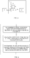
- the method will be discussed below with references to the flow diagram shown in figure 5 .
- the vehicle and working equipment has been described in detail above and it is herein also referred to that description.
- the vehicle, or working equipment further comprises:
- the method comprises:
- the dashed line indicates that the method steps are optionally iterative, and may start again when moving towards an object.
- the sensor system is further configured to determine ambient condition data, and that the control unit is further configured to receive the ambient condition data.
- the method then further comprises determining driving instructions such that said vehicle is controlled to follow said at least first path, wherein the driving instructions are determined in dependence of the image data, ambient condition data, and vehicle data, by applying the set of path following rules.
- the method comprises that said ambient condition data comprises at least a ground surface parameter, e.g. a friction value, of the ground surface at the current position of the vehicle, and wherein one path following rule comprises using the ground surface parameter.
- a ground surface parameter e.g. a friction value
- the method comprises repeatedly determining the target position, calculating at least the first path, and determining the driving instructions, until the vehicle has reached the target position.
- the method comprises identifying at least one reference point in said image data, wherein said reference point represents a fixed object in the environment surrounding the vehicle that is easy to identify, and not being the object for the vehicle to reach, and applying said at least one reference point when calculating said at least one first path, and wherein said at least one reference point is identified and applied during movement along said at least one first path in order to follow said at least one first path.
- the method further comprises determining the location of the object for the vehicle to reach when performing said working task in said image data representation, either as a result of manual input of an operator, or through an image analysis configured to detect candidate objects, and to identify a particular object, using object type information included in said working task.
- the driving instructions include at least a steering angle to be applied to the steering wheels of the vehicle, or instructions to a driver to perform a steering activity.
Landscapes
- Engineering & Computer Science (AREA)
- Automation & Control Theory (AREA)
- Mechanical Engineering (AREA)
- Physics & Mathematics (AREA)
- Transportation (AREA)
- Mathematical Physics (AREA)
- Aviation & Aerospace Engineering (AREA)
- Radar, Positioning & Navigation (AREA)
- Remote Sensing (AREA)
- General Physics & Mathematics (AREA)
- Multimedia (AREA)
- Electromagnetism (AREA)
- Computer Vision & Pattern Recognition (AREA)
- Control Of Position, Course, Altitude, Or Attitude Of Moving Bodies (AREA)
Description
- The present disclosure relates to a vehicle comprising a working equipment, e.g. a loader crane or a hook-lift, and to a working equipment structured to be mounted on a vehicle. The disclosure also relates to a method in relation to the vehicle, or the working equipment.
- A vehicle may be equipped with different working equipment, such as a loader crane or a hook-lift (also called a demountable), to perform certain working tasks.
- With a hook-lift mounted on a vehicle, such as a truck, the vehicle may load and unload objects like flatbeds, dumpster bodies, and similar containers. Various applications within waste-handling, recycling, scrap and demolition industries are then available.
- Another example of a vehicle equipped with a working equipment is a truck with a crane, e.g. a loader crane or a forest crane. As the working equipment is mounted on a movable vehicle, the position and direction of the working equipment relative the object of the working procedure is depending on the position and sometimes also the direction of the vehicle. In order to achieve a viable, or optimal workflow, for the working equipment the vehicle position relative to the object (and also the surrounding) often needs to be adjusted. Today this is managed by the driver of the vehicle, and it is the experience and knowledge of the driver that determines the success and safety of the work that is performed by the vehicle and working equipment. Other factors such as the time spent on a working task and the wear and tear of the working equipment is also affected by the driver's choices during a working assignment.
- The present disclosure is focused on how to enable autonomous, or semi-autonomous (the system generates driving instructions to aid the driver), handling of an object by a vehicle using a working equipment, and in particular on how to generate driving instructions towards a target in the surrounding of the object to be handled. For example; when loading on a flatbed on a truck, the truck needs to be aligned with the flatbed and in order to get in that position the truck normally needs to move in a straight line towards the flatbed at least at the final distance. A target may hence be a position located at a predetermined distance from the attachment means of the flatbed so that the truck may move in a straight line towards the flatbed from the target point.
- A problem with vehicles such as transport vehicles, heavy vehicles etc. is that the reaction of a driving instruction on the vehicle is dependent on the current characteristics of the vehicle and its surrounding environment. A truck will e.g. behave differently on a slippery surface compared to a dry road, depending on how many wheels are in contact with the ground, depending on the load on the truck etc. Therefore, it is difficult to generate driving instructions on a general basis.
- In the following some documents within the same technical field as the present disclosure will be presented and briefly discussed.
-
US20170369101 discloses a maneuvering system for maneuvering a predetermined part of a vehicle into a target position provided by a target object. A first optical sensor arranged at the vehicle captures the target object and a trajectory is calculated. A second optical sensor arranged at a different position on the vehicle also captures the target object. The image from the second optical sensor can be used to refine the trajectory or can be used independently if e.g. the first sensor fails. -
US20160378118 discloses a method for autonomously aligning a tow hitch ball on a towing vehicle and a drawbar on a trailer. The drawbar is identified as the target and a template pattern around the drawbar is created. The method predicts a new location of the target as the vehicle moves and identifies the target in new images as the vehicle moves by comparing the previous template pattern with an image patch around the predicted location. -
US20160075281 discloses a vehicle hitch assistance system to align a tow hitch mounted on the vehicle with a trailer coupling mounted to a trailer. The hitch assistance system comprises an imaging system that is provided to generate image data to identify obstructions proximal to the vehicle and/or to the trailer. Further, the imaging system together with a processor is used to capture and analyze image data of the trailer coupling (target) to guide the vehicle towards the trailer coupling by modifying a steering guidance signal, i.e. the steering wheel angle. -
US20160288833 discloses a vehicle with a parking assistance system that detects a garage and a current position of the vehicle relative to the garage. The parking process is carried out automatically, steering the vehicle based on data from vehicle-mounted cameras that captures images of the garage and at least one distance sensor. -
DE10350923 discloses a method for reversing a vehicle with a trailer to a position beneath a target object, i.e. a support frame for a container. The path is determined after the target object is detected by a captured image. -
US20180039278 discloses an iterative method for detecting a target and determining the travel path, wherein the target position and the object position are coordinated with one another. The iterative method makes it possible to introduce every point in time during the traveling along the travel path, such that parameters can be adapted to varying ambient conditions and/or more accurate knowledge by the camera and/or the vehicle position.US20170158227 discloses a vehicle steering arrangement in an autonomous vehicle which vehicle steering arrangement's steering characteristics is adapted to a monitored driving environment. -
US20080024608 discloses a method for visualizing the surroundings of a vehicle to the driver, wherein the image output to the driver is adapted depending on e.g. current weather. -
US20180329425 relates to a method including receiving instructions to pick up an object with one or more lift elements of an autonomous vehicle. The vehicle is part of a robotic warehouse fleet. -
US20040193348 relates to method and system for efficiently traversing an area with a work vehicle. - An object of the present invention is to achieve an improved vehicle, working equipment, and method where the improvement lies in that the safety of the work performed by the vehicle and working equipment is less dependent upon the experience and knowledge of the driver, and in particular to achieve an improved vehicle and method where parameters of the surroundings around the vehicle, and of the vehicle, are taken into account when controlling the vehicle.
- The above-mentioned object is achieved by the present invention according to the independent claims.
- Preferred embodiments are set forth in the dependent claims.
- According to a first aspect the present invention relates a vehicle (2) comprising a working equipment (4), and further comprising a sensor system (6) configured to capture environmental data reflecting the environment around the vehicle and to determine, based on said data, image data (8) representing an area at least partly surrounding the vehicle (2), a vehicle data unit (12) configured to determine vehicle data (14) representing characteristics of the vehicle (2), and a control unit (16) configured to receive said image data (8), and said vehicle data (14), and to determine and generate control signals (18) for controlling said vehicle (2), wherein said control signals (18) comprise driving instructions. The control unit (16) is configured to receive a working task to be performed by the vehicle, wherein said working task includes information of an object (20) for the vehicle (2) to reach when performing said working task. The control unit (16) is configured to:
- determine a target position (22), being a position based on the location of the object (20) to reach when performing said working task in said image data representation, in relation to said vehicle (2),
- calculate at least a first path (24) from the vehicle (2) to the target position (22) by applying a set of path calculation rules,
- determine driving instructions such that said vehicle (2) is controlled to follow said at least first path (24), wherein said driving instructions are determined in dependence of said image data (8), and vehicle data (14), by applying a set of path following rules.
- A vehicle according to the present invention will achieve an improved capability when moving towards an object. Preferably, this is achieved by taken into account numerous external parameters and also internal vehicle related parameters in order to determine a path for the vehicle to follow towards the object, and to control the vehicle to follow the path. Thus, the present invention provides a technique to safely control the vehicle taken numerous parameters into account, which is particularly advantageous if the vehicle is an autonomous or semi-autonomous vehicle. The technique also provides an improved accuracy in the determined driving instructions, which increases the safety of the driving process.
- According to the invention the sensor system is also configured to determine ambient condition data, and that the control unit is also configured to receive the ambient condition data. The control unit is further configured to determine driving instructions such that the vehicle (2) is controlled to follow said at least first path (24), and that the driving instructions are determined in dependence of the image data (8), ambient condition data (10), and vehicle data (14), by applying said set of path following rules.
- According to the invention the ambient condition data (10) comprises at least a ground surface parameter, e.g. a friction value, of the ground surface at the current position of the vehicle (2), and wherein one path following rule comprises using said ground surface parameter. This is advantageous because the vehicle may then be safely controlled even if moved on a slippery ground.
- According to another embodiment the control unit (16) is configured to repeatedly determine the target position (22), calculate at least the first path (24), and determine the driving instructions, until the vehicle (2) has reached the target position (22). Thereby, the vehicle will be arranged to adapt to situations where e.g. the external conditions vary, which may be the case if the ground conditions changes along the path.
- According to still another embodiment the control unit (16) is configured to identify at least one reference point (26) in said image data representation, wherein said reference point (26) represents a fixed object in the environment surrounding the vehicle (2) that is easy to identify, and not being the object (20) for the vehicle (2) to reach, and to apply said at least one reference point (26) when calculating said at least one first path (24), and wherein said at least one reference point (26) is identified and applied during movement along said at least one first path (24) in order to follow said at least one first path (24).
- This embodiment will increase the accuracy when determining the position of the vehicle along the path, and will then enable to fine-tune the movements of the vehicle.
- According to a second aspect of the present invention a working equipment structured to be mounted on a vehicle is provided. The working equipment comprises a sensor system (6) configured to capture environmental data reflecting the environment around the working equipment and the vehicle when mounted on the vehicle, and to determine, based on said data, image data (8) representing an area at least partly surrounding the working equipment and the vehicle (2). The working equipment further comprises a vehicle data unit (12) configured to determine vehicle data (14) representing characteristics of the vehicle (2), and a control unit (16) configured to receive said image data (8), and said vehicle data (14), and to determine and generate control signals (18) for controlling said vehicle (2), wherein said control signals (18) comprise driving instructions,
- The control unit (16) is configured to receive a working task to be performed by the working equipment when mounted on said vehicle, wherein said working task includes information of an object (20) for the vehicle (2) to reach when performing said working task. The control unit (16) is configured to:
- determine a target position (22), being a position based on the location of the object (20) to reach when performing said working task in said image data representation, in relation to said vehicle (2),
- calculate at least a first path (24) from the vehicle (2) to the target position (22) by applying a set of path calculation rules,
- determine driving instructions such that said vehicle (2) is controlled to follow said at least first path (24), wherein said driving instructions are determined in dependence of said image data (8), and vehicle data (14), by applying a set of path following rules.
- Several embodiments of the second aspects are provided, and it is herein referred to the embodiments discussed above in relation to the vehicle which are applicable also in relation to the working equipment. Further, by having such functionality in the working equipment it implies that a working vehicle may be adapted to a specialized type of working assignments by adding the working equipment for it.
- According to a third aspect of the present invention a method in relation to a vehicle comprising a working equipment is provided, or a method in relation to a working equipment structured to be mounted on a vehicle. The vehicle or working equipment comprises:
- a sensor system configured to capture environmental data reflecting the environment around the vehicle and/or the working equipment and to determine, based on said data, image data representing an area at least partly surrounding the vehicle and/or the working equipment,
- a vehicle data unit configured to determine vehicle data representing characteristics of the vehicle,
- a control unit configured to receive said image data, and said vehicle data, and to determine and generate control signals for controlling said vehicle, wherein said control signals comprise driving instructions,
- the control unit is configured to receive a working task to be performed by the vehicle, wherein said working task includes information of an object for the vehicle to reach when performing said working task.
- The method comprises:
- determining a target position, being a position based on the location of the object to reach when performing said working task in said image data representation, in relation to said vehicle,
- calculating at least a first path from the vehicle to the target position by applying a set of path calculation rules,
- determining driving instructions such that said vehicle is controlled to follow said at least first path, wherein said driving instructions are determined in dependence of said image data, and said vehicle data, by applying a set of path following rules.
- When applying a method according to the present invention on a vehicle, or on a working equipment when mounted on a vehicle, the vehicle will achieve an improved capability when moving towards an object as numerous external parameters and also internal vehicle related parameters will be taken into account in order to determine a path for the vehicle to follow towards the object, and to control the vehicle to follow the path.
- According to the invention the sensor system is further configured to determine ambient condition data, and that the control unit is further configured to receive the ambient condition data. The method then further comprises determining driving instructions such that the vehicle is controlled to follow the at least first path, wherein the driving instructions are determined in dependence of the image data, ambient condition data, and vehicle data, by applying said set of path following rules.
- According to the invention the method comprises that the ambient condition data comprises at least a ground surface parameter, e.g. a friction value, of the ground surface at the current position of the vehicle, and wherein one path following rule comprises using said ground surface parameter. This is advantageous because the vehicle may then be safely controlled even if moved on a slippery ground.
- In another embodiment the method further comprises repeatedly determining the target position, calculating at least the first path, and determining the driving instructions, until the vehicle has reached the target position. Thereby, the vehicle will be arranged to adapt to situations where e.g. the external conditions vary, which may be the case if the ground conditions changes along the path.
- In still another embodiment the method comprises identifying at least one reference point in said image data, wherein said reference point represents a fixed object in the environment surrounding the vehicle that is easy to identify, and not being the object for the vehicle to reach, and applying said at least one reference point when calculating said at least one first path, and wherein said at least one reference point is identified and applied during movement along said at least one first path in order to follow said at least one first path. This embodiment will increase the accuracy when determining the position of the vehicle along the path, and will then enable to fine-tune the movements of the vehicle.
-
-
Figure 1 is an overview illustration schematically illustrating a vehicle according to the present invention. -
Figure 2 is a schematic illustration of a view based on data from the sensor system of an embodiment of the vehicle according to the present invention. -
Figure 3 is block diagram schematically illustrating the vehicle according to the present invention. -
Figure 4 is block diagram schematically illustrating the working equipment according to the present invention. -
Figure 5 is a flow diagram illustrating the method according to the present invention. - The vehicle, the working equipment, and the method in relation to the vehicle/working equipment, will now be described in detail with references to the appended figures. Throughout the figures the same, or similar, items have the same reference signs. Moreover, the items and the figures are not necessarily to scale, emphasis instead being placed upon illustrating the principles of the invention.
- With reference to
figures 1-3 avehicle 2 comprising a workingequipment 4 is provided. The vehicle may be equipped with different working equipment, such as a loader crane or a hook-lift (also called a demountable), to perform certain working tasks. Another example is a truck equipped with a tail lift backing up to a loading platform. - With a hook-lift mounted on a vehicle, the vehicle may load and unload objects like flatbeds, dumpster bodies, and similar containers. Various applications within waste-handling, recycling, scrap and demolition industries are then available. Another example of a vehicle equipped with a working equipment is a truck with a crane e.g. a loader crane or a forest crane. The vehicle may be an autonomous vehicle, or a semi-autonomous vehicle. A semi-autonomous vehicle is a vehicle where an operator to a certain degree is involved in the operation of the vehicle, e.g. the operator receives operating instructions via an interface, e.g. a graphical user interface or via computer generated audial or tactile instructions.
- The vehicle comprises a
sensor system 6 configured to capture environmental data reflecting the environment around the vehicle and to determine, based on the data,image data 8 representing an area at least partly surrounding thevehicle 2, and optionallyambient condition data 10. - The vehicle further comprises a
vehicle data unit 12 configured to determinevehicle data 14 representing characteristics of thevehicle 2. - Furthermore, the vehicle also comprises a
control unit 16 configured to receive theimage data 8, and thevehicle data 14, and optionally theambient condition data 10, and to determine and generatecontrol signals 18 for controlling thevehicle 2, wherein the control signals 18 comprise driving instructions. - The control unit is provided with a communication interface and is connected to a common data bus, e.g. a CAN bus, and is configured to perform bidirectional communication, e.g. comprising sensor signals, to other units. Further protocols based on CAN may be applied, like application layer protocols such as SAE J1939 for in-vehicle networks for buses and trucks may further be used for the communication. As an alternative various protocols based on Ethernet and similar standards may be used such as Broad R Reach. Within a system with working units mounted on a vehicle various communication protocols may be used in different parts of the system.
- The control unit is configured to determine
control signals 18 for controlling various devices and means required to operate the vehicle, and the control unit disclosed herein comprises the necessary processing capacity to perform its intended task and comprises necessary data storage capabilities, and communication capabilities to support the task. The control unit may comprise distributed processing entities, and it is provided with the necessary processing capacity to perform all tasks discussed herein in relation to the vehicle. The control unit may be decentralized, i.e. divided into several sub-control units, and is provided with one or many memory units. It is also provided with communication capabilities, both via physical connections and wireless connections. - The
control unit 16 is configured to receive a working task to be performed by the vehicle, wherein the working task includes information of anobject 20 for thevehicle 2 to reach when performing said working task. As discussed above, theobject 20 may be flatbeds, dumpster bodies, and similar containers. A working task may include information regarding where a specific object is located, the type of object, what to do with the object, and where to transport the object. - The
control unit 16 is configured to: - determine a target position 22 (marked with an X in
figures 1 and 2 ), being a position based on the location of theobject 20 to reach when performing the working task in the image data representation, in relation to thevehicle 2, - calculate at least a
first path 24 from thevehicle 2 to thetarget position 22 by applying a set of path calculation rules, - determine driving instructions such that the
vehicle 2 is controlled to follow the at leastfirst path 24, wherein the driving instructions are determined in dependence of theimage data 8,ambient condition data 10, andvehicle data 14, by applying a set of path following rules. - The at least first path is a trajectory along which the vehicle could move to the target position. In the figure only one path is shown. However, it is possible to calculate a number of different paths and present the different paths to an operator that may choose one of the paths.
- The target position may be the position of the object or may be a position located a predetermined distance from the location of the object for the vehicle to reach when performing said working task. The target position may be dependent upon the type of working equipment. If e.g. the working equipment is a hook-lift the position of the hook at the vehicle in relation to a connection bar at a container to be handled, may be used to determine the target position. A target position may also be a position beside the object which would be the case if the object is a bin and the working equipment is a lifting arrangement such as a crane or another type of lifting arrangement at one side of the vehicle.
- According to one embodiment the control unit is configured to determine driving instructions such that the
vehicle 2 is controlled to follow the at leastfirst path 24, wherein the driving instructions are determined in dependence of theimage data 8,ambient condition data 10, andvehicle data 14, by applying a set of path following rules. - In one embodiment the
ambient condition data 10 comprises at least a ground surface parameter, e.g. a friction value, of the ground surface at the current position of thevehicle 2, and wherein one path following rule comprises using said ground surface parameter. The ground surface parameter is measured by a dedicated sensor included in the sensor system. In one variation a contactless friction sensor may be used, in another variation a combination between signals from optical sensors and temperature sensors may be used. - In a further embodiment the
control unit 16 is configured to repeatedly determine thetarget position 22, calculate at least thefirst path 24, and determine the driving instructions, until thevehicle 2 has reached thetarget position 22. - Based on the location of the object in relation to the current position of the vehicle a path towards the object may be generated. A number of possible paths may guide the vehicle towards the object and one that fits the characteristics of the vehicle, and the object to be loaded may be chosen.
- According to a further embodiment the
control unit 16 is configured to identify at least onereference point 26 in the image data representation. -
Figure 2 illustrates an example of an image data representation where threereference points 26 are shown. In addition five possible objects are shown where oneobject 20 is the object intended to be handled. This object is indicated by a dashed square around the object. Example objects may be of same type, e.g. flatracks, all identified by the sensor system. One object may then be selected by e.g. an operator (which is an example of a working instruction). Or by further identifying a specific object and matching to a working instruction. Any object of an object type may be a working instruction as well as a selection of a specific object. - The at least one
reference point 26 represents a fixed object in the environment surrounding thevehicle 2 that is easy to identify, and not being theobject 20 for thevehicle 2 to reach. The at least onereference point 26 is applied when calculating the at least onefirst path 24, and identified and applied during movement along the at least onefirst path 24 in order to follow the at least onefirst path 24. Using one or many reference points improves the accuracy in following the first path, in that the reference point is used to determine the resulting motion of the driving instructions to be able to fine-tune the next set of driving instructions. In particular, using one or many reference points not being the target object has the following advantages: - Separate reference point(s) will improve the accuracy as an additional point.
- Reference point(s) may be selected as an object that is easily detected and measured distance to, specifically in directions that differ from the moving direction of the vehicle.
- If the reference point(s) is/are located at closer distance accuracy is improved.
- In a further embodiment the
control unit 16 is configured to determine the location of theobject 20 for thevehicle 2 to reach when performing the working task in the image data representation, either as a result of manual input of an operator, or through an image analysis. A manual input of an operator may be performed by pointing at an object to be handled on a touch screen showing the image data representation where the object, e.g. among a plurality of objects, is shown. - If an image analysis is performed the control unit is configured to detect candidate objects, and (optionally) further to identify a particular object, and (optionally) using object type information included in the received working task.
- The
sensor system 6 comprises one or many of radar, LIDAR, 3D cameras, cameras, lasers, thermal cameras, or any other sensing device capable of capturing information reflecting the surroundings around the vehicle. The image data being data organized in a matrix to describe the spatial relationship of the surrounding with respect to what thesensor system 6 is measuring. The various sensor units of the sensor system may be used for various applications and may in addition to a sensor component comprise additional hardware and software for analyzing measurements performed or samples gathered by the sensor component. Theimage data 8, may hence comprise measurement values, and results of analysis of measurement values on various complexity levels. A 3D camera may for example generate a sensor signal corresponding to an object identified as an object to be loaded and the coordinates of this object, whereas a laser unit may generate a sensor signal corresponding to a distance to an object in a predetermined direction. As a further example a sensor unit may be a sensor for reading information coded in RFID tags, bar codes, QR-codes or other similar codes or tags. An object to be loaded may e.g. be marked with such a tag describing the ID of the object, the weight of the object etc. - The
vehicle data 14 describes the current characteristics of the vehicle and comprises one or many of the number of wheels in contact with the ground, the location of wheels in contact with the ground relative to the vehicle, the weight of the vehicle, which may be the total weight including load, the center of mass of the vehicle, and the type of tires. The vehicle data unit comprises various sensors for gathering information about the current state of the vehicle. These various sensors may be temperature sensors, sensors for estimating the weight of the vehicle, the center of mass of the vehicle, etc. - The set of path following rules comprises rules related to the movement of the vehicle along the path, related to e.g. the steering angle of the steering wheels, and then including steering angle limitations; the vehicle velocity including vehicle velocity limitations, the orientation of the vehicle along the path and in particular when approaching the object, etc.
- The driving instructions may include at least a steering angle to the steering wheels of the
vehicle 2 to be applied to the vehicle steering actuators, or instructions to a driver to perform a steering activity. The driving instructions may also include a vehicle velocity parameter, including a velocity and also a direction of movement. Thus, a driving instruction may be an instruction for any type of movement of the vehicle, or sequence of movements. It may be for driving the vehicle in forward direction or in reverse. More particularly, a velocity or direction of the vehicle is achieved by generating driving instructions including turning the steering wheel more/less to the left or right. The path following rules are used to get information about how the vehicle should move to reach the target. The driving instructions are then about how to make the vehicle move accordingly. So the vehicle characteristics and the ambient conditions affect the driving instructions. The driving instructions could be relative, i.e. increase/decrease a steering angle, or absolute i.e. this parameter should be set to that value. - A driving instruction may be visualized in different ways on a display for an operator in a semi-autonomous mode.
- The driving instruction that is generated to guide the vehicle towards the target comprises at least a steering angle. By also identifying reference points in the image data representation the reaction of a first driving instruction may be deduced from subsequently captured image representations and used as input to adapt a second driving instruction and further, optionally, the path towards the target.
- By storing the received vehicle data together with extracted data describing a change in position of the vehicle due to the first driving instruction, the relationship may later be used to generate or adapt a third driving instruction. This type of data and relationship between the data may hence be used as training data for a neural network.
- The set of path calculation rules comprises calculation rules required to obtain a path for the vehicle to follow from its present position to the object. The set of rules may comprise rules related the distance to the object, and various vehicle parameters, e.g. the length, the weight, the steering radius, and the orientation of the vehicle. In order to calculate the at least one path a library of stored paths may be applied based upon previously applied paths. Among the stored paths one may be chosen being one that fits the present situation the best - the chosen path may then be adapted to the present situation.
- With references to the block diagram illustrated in
figure 4 the present invention also relates to a workingequipment 4 structured to be mounted on avehicle 2. Various types of working equipment has been exemplified above. - The working equipment comprises a
sensor system 6 configured to capture environmental data reflecting the environment around the working equipment and vehicle when mounted on the vehicle, and to determine, based on said data,image data 8 representing an area at least partly surrounding the working equipment and the vehicle (2). The sensor system comprises one or many sensors which has been exemplified above in relation to the description of the vehicle. The one or many sensors may be mounted at the working equipment and/or at the vehicle. - The working equipment further comprises a
vehicle data unit 12 configured to determinevehicle data 14 representing characteristics of thevehicle 2, e.g. by communication with the vehicle control system or sensor systems; acontrol unit 16 configured to receive theimage data 8, and thevehicle data 14, and to determine and generatecontrol signals 18 for controlling thevehicle 2, wherein the control signals 18 comprise driving instructions. - The
control unit 16 is configured to receive a working task to be performed by the working equipment when mounted on the vehicle, and that the working task includes information of anobject 20 for thevehicle 2 to reach when performing the working task. Thecontrol unit 16 is further configured to: - determine a
target position 22, being a position based on the location of theobject 20 to reach when performing the working task in the image data representation, in relation to saidvehicle 2, - calculate at least a
first path 24 from thevehicle 2 to thetarget position 22 by applying a set of path calculation rules, and - determine driving instructions such that said
vehicle 2 is controlled to follow said at leastfirst path 24, wherein the driving instructions are determined in dependence of saidimage data 8, andvehicle data 14, by applying a set of path following rules. - Above, the present invention relates a working equipment structured to be mounted on a vehicle. It should be noted that all embodiments disclosed above in relation to the vehicle are also applicable in relation to the working equipment. In particular the embodiments that relate to apply ambient condition data when determining driving instructions.
- The present invention also relates to a method in relation to a vehicle comprising a working equipment, or to a method in relation to a working equipment structured to be mounted on a vehicle. The method will be discussed below with references to the flow diagram shown in
figure 5 . The vehicle and working equipment has been described in detail above and it is herein also referred to that description. Thus, the vehicle, or working equipment, further comprises: - a sensor system configured to capture environmental data reflecting the environment around the vehicle and/or the working equipment, and to determine, based on said data, image data representing an area at least partly surrounding the vehicle/working equipment, and optionally ambient condition data,
- a vehicle data unit configured to determine vehicle data representing characteristics of the vehicle,
- a control unit configured to receive said image data, and said vehicle data, and optionally said ambient condition data, and to determine and generate control signals for controlling said vehicle, wherein said control signals comprise driving instructions,
- the control unit is configured to receive a working task to be performed by the vehicle, wherein said working task includes information of an object for the vehicle to reach when performing said working task.
- With references to
figure 5 , the method comprises: - determining a target position, being a position based on the location of the object to reach when performing said working task in said image data representation, in relation to said vehicle,
- calculating at least a first path from the vehicle to the target position by applying a set of path calculation rules,
- determining driving instructions such that said vehicle is controlled to follow said at least first path, wherein said driving instructions are determined in dependence of said image data, and vehicle data, by applying a set of path following rules.
- The dashed line indicates that the method steps are optionally iterative, and may start again when moving towards an object.
- According to one embodiment the sensor system is further configured to determine ambient condition data, and that the control unit is further configured to receive the ambient condition data. The method then further comprises determining driving instructions such that said vehicle is controlled to follow said at least first path, wherein the driving instructions are determined in dependence of the image data, ambient condition data, and vehicle data, by applying the set of path following rules.
- According to one embodiment the method comprises that said ambient condition data comprises at least a ground surface parameter, e.g. a friction value, of the ground surface at the current position of the vehicle, and wherein one path following rule comprises using the ground surface parameter.
- Preferably, the method comprises repeatedly determining the target position, calculating at least the first path, and determining the driving instructions, until the vehicle has reached the target position.
- In a further embodiment, the method comprises identifying at least one reference point in said image data, wherein said reference point represents a fixed object in the environment surrounding the vehicle that is easy to identify, and not being the object for the vehicle to reach, and applying said at least one reference point when calculating said at least one first path, and wherein said at least one reference point is identified and applied during movement along said at least one first path in order to follow said at least one first path.
- In an another embodiment the method further comprises determining the location of the object for the vehicle to reach when performing said working task in said image data representation, either as a result of manual input of an operator, or through an image analysis configured to detect candidate objects, and to identify a particular object, using object type information included in said working task.
- And in still another embodiment of the method the driving instructions include at least a steering angle to be applied to the steering wheels of the vehicle, or instructions to a driver to perform a steering activity.
Claims (10)
- A vehicle (2) comprising a working equipment (4), said vehicle further comprises:- a sensor system (6) configured to capture environmental data reflecting the environment around the vehicle and to determine, based on said data, image data (8) representing an area at least partly surrounding the vehicle (2), wherein said sensor system is further configured to determine ambient condition data (10), and wherein said ambient condition data (10) comprises at least a ground surface parameter, e.g. a friction value, of the ground surface at the current position of the vehicle (2),- a vehicle data unit (12) configured to determine vehicle data (14) representing characteristics of the vehicle (2),- a control unit (16) configured to receive said image data (8), said ambient condition data (10), and said vehicle data (14), and to determine and generate control signals (18) for controlling said vehicle (2), wherein said control signals (18) comprise driving instructions,- the control unit (16) is configured to receive a working task to be performed by the vehicle, wherein said working task includes information of an object (20) for the vehicle (2) to reach when performing said working task,- determine a target position (22), being a position based on the location of the object (20) to reach when performing said working task in said image data representation, in relation to said vehicle (2),- calculate at least a first path (24) from the vehicle (2) to the target position (22) by applying a set of path calculation rules, characterized in that said control unit (16) is further configured to:- determine driving instructions such that said vehicle (2) is controlled to follow said at least first path (24), wherein said driving instructions are determined in dependence of said image data (8), ambient condition data (10), and vehicle data (14), by applying a set of path following rules, wherein one path following rule comprises using said ground surface parameter.
- The vehicle (2) according to claim 1, wherein said control unit (16) is configured to repeatedly determine the target position (22), calculate at least the first path (24), and determine the driving instructions, until the vehicle (2) has reached the target position (22).
- The vehicle (2) according to any of claims 1-2, wherein said control unit (16) is configured to identify at least one reference point (26) in said image data representation, wherein said reference point (26) represents a fixed object in the environment surrounding the vehicle (2) that is easy to identify, and not being the object (20) for the vehicle (2) to reach, and to apply said at least one reference point (26) when calculating said at least one first path (24), and wherein said at least one reference point (26) is identified and applied during movement along said at least one first path (24) in order to follow said at least one first path (24).
- The vehicle (2) according to any of claims 1-3, wherein said control unit (16) is configured to determine the location of the object (20) for the vehicle (2) to reach when performing said working task in said image data representation, either as a result of manual input of an operator, or through an image analysis configured to detect candidate objects, and to identify a particular object, using object type information included in said working task.
- The vehicle (2) according to any of claims 1-4, wherein said sensor system (6) comprises one or many of radar, LIDAR, 3D cameras, cameras, lasers, thermal cameras, and wherein said image data being data organized in a matrix to describe the spatial relationship of the surrounding with respect to what said sensor system (6) is measuring.
- The vehicle (2) according to any of claims 1-5, wherein said vehicle data (14) comprises one or many of the number of wheels in contact with the ground, the location of wheels in contact with the ground relative to the vehicle, the weight of the vehicle, the center of mass of the vehicle, and the type of tires.
- A working equipment (4) structured to be mounted on a vehicle (2), said working equipment comprises:- a sensor system (6) configured to capture environmental data reflecting the environment around the working equipment and vehicle when mounted on the vehicle, and to determine, based on said data, image data (8) representing an area at least partly surrounding the working equipment and the vehicle (2), wherein said sensor system is further configured to determine ambient condition data (10), and wherein said ambient condition data (10) comprises at least a ground surface parameter, e.g. a friction value, of the ground surface at the current position of the vehicle (2),- a vehicle data unit (12) configured to determine vehicle data (14) representing characteristics of the vehicle (2),- a control unit (16) configured to receive said image data (8), said ambient condition data (10), and said vehicle data (14), and to determine and generate control signals (18) for controlling said vehicle (2), wherein said control signals (18) comprise driving instructions,- the control unit (16) is configured to receive a working task to be performed by the working equipment when mounted on said vehicle, wherein said working task includes information of an object (20) for the vehicle (2) to reach when performing said working task,- determine a target position (22), being a position based on the location of the object (20) to reach when performing said working task in said image data representation, in relation to said vehicle (2),- calculate at least a first path (24) from the vehicle (2) to the target position (22) by applying a set of path calculation rules, characterized in that said control unit (16) is further configured to:- determine driving instructions such that said vehicle (2) is controlled to follow said at least first path (24), wherein said driving instructions are determined in dependence of said image data (8), ambient condition data (10), and vehicle data (14), by applying a set of path following rules, wherein one path following rule comprises using said ground surface parameter.
- A method in relation to a vehicle comprising a working equipment, or a working equipment structured to be mounted on a vehicle, said vehicle or working equipment comprises:- a sensor system configured to capture environmental data reflecting the environment around the vehicle and/or the working equipment, and to determine, based on said data, image data representing an area at least partly surrounding the vehicle and/or the working equipment, wherein the sensor system is further configured to determine ambient condition data, wherein said ambient condition data comprises at least a ground surface parameter, e.g. a friction value, of the ground surface at the current position of the vehicle,- a vehicle data unit configured to determine vehicle data representing characteristics of the vehicle,- a control unit configured to receive said image data, said ambient condition data, and said vehicle data, and to determine and generate control signals for controlling said vehicle, wherein said control signals comprise driving instructions,- the control unit is configured to receive a working task to be performed by the vehicle, wherein said working task includes information of an object for the vehicle to reach when performing said working task,- determining a target position, being a position based on the location of the object to reach when performing said working task in said image data representation, in relation to said vehicle,- calculating at least a first path from the vehicle to the target position by applying a set of path calculation rules, characterized in that said method further comprises the step of:- determining driving instructions such that said vehicle is controlled to follow said at least first path, wherein said driving instructions are determined in dependence of said image data, ambient condition data, and vehicle data, by applying a set of path following rules, wherein one path following rule comprises using said ground surface parameter.
- The method according to claim 8, further comprising repeatedly determining the target position, calculating at least the first path, and determining the driving instructions, until the vehicle has reached the target position.
- The method according to any of claims 8-9, further comprising identifying at least one reference point in said image data, wherein said reference point represents a fixed object in the environment surrounding the vehicle that is easy to identify, and not being the object for the vehicle to reach, and applying said at least one reference point when calculating said at least one first path, and wherein said at least one reference point is identified and applied during movement along said at least one first path in order to follow said at least one first path.
Priority Applications (2)
| Application Number | Priority Date | Filing Date | Title |
|---|---|---|---|
| EP19164936.7A EP3715993B1 (en) | 2019-03-25 | 2019-03-25 | A vehicle comprising a working equipment, and a working equipment, and a method in relation thereto |
| US16/828,272 US20200307575A1 (en) | 2019-03-25 | 2020-03-24 | Vehicle comprising a working equipment, and a working equipment, and a method in relation thereto |
Applications Claiming Priority (1)
| Application Number | Priority Date | Filing Date | Title |
|---|---|---|---|
| EP19164936.7A EP3715993B1 (en) | 2019-03-25 | 2019-03-25 | A vehicle comprising a working equipment, and a working equipment, and a method in relation thereto |
Publications (2)
| Publication Number | Publication Date |
|---|---|
| EP3715993A1 EP3715993A1 (en) | 2020-09-30 |
| EP3715993B1 true EP3715993B1 (en) | 2022-09-14 |
Family
ID=65955104
Family Applications (1)
| Application Number | Title | Priority Date | Filing Date |
|---|---|---|---|
| EP19164936.7A Active EP3715993B1 (en) | 2019-03-25 | 2019-03-25 | A vehicle comprising a working equipment, and a working equipment, and a method in relation thereto |
Country Status (2)
| Country | Link |
|---|---|
| US (1) | US20200307575A1 (en) |
| EP (1) | EP3715993B1 (en) |
Families Citing this family (2)
| Publication number | Priority date | Publication date | Assignee | Title |
|---|---|---|---|---|
| KR102568200B1 (en) | 2022-11-29 | 2023-08-21 | (주)토탈소프트뱅크 | Apparatus for guiding work position of autonomous yard tractor |
| CN116730194B (en) * | 2023-05-16 | 2023-12-22 | 广东光速智能设备有限公司 | Intelligent control system and method for tower crane provided with safety area |
Family Cites Families (17)
| Publication number | Priority date | Publication date | Assignee | Title |
|---|---|---|---|---|
| JP3060863B2 (en) * | 1994-12-14 | 2000-07-10 | トヨタ自動車株式会社 | Vehicle behavior estimation device |
| US6907336B2 (en) * | 2003-03-31 | 2005-06-14 | Deere & Company | Method and system for efficiently traversing an area with a work vehicle |
| DE10350923A1 (en) | 2003-10-31 | 2005-05-25 | Daimlerchrysler Ag | Positioning method for positioning the trailer of an articulated goods vehicle beneath a container supported on a mounting frame, whereby the path to be taken by the trailer is automatically determined up until a target position |
| DE102005006290A1 (en) | 2005-02-11 | 2006-08-24 | Bayerische Motoren Werke Ag | Method and device for visualizing the surroundings of a vehicle by fusion of an infrared and a visual image |
| DE102012022336A1 (en) | 2012-11-14 | 2014-05-15 | Valeo Schalter Und Sensoren Gmbh | Method for carrying out an at least semi-autonomous parking operation of a motor vehicle in a garage, parking assistance system and motor vehicle |
| GB2513393B (en) | 2013-04-26 | 2016-02-03 | Jaguar Land Rover Ltd | Vehicle hitch assistance system |
| US9561941B1 (en) * | 2015-03-30 | 2017-02-07 | X Development Llc | Autonomous approach and object pickup |
| US9696723B2 (en) | 2015-06-23 | 2017-07-04 | GM Global Technology Operations LLC | Smart trailer hitch control using HMI assisted visual servoing |
| EP3178724B1 (en) | 2015-12-08 | 2018-10-24 | Volvo Car Corporation | Vehicle steering arrangement, autonomous vehicle steering arrangement, a vehicle, and a method of steering a vehicle |
| CN107381929A (en) * | 2016-05-16 | 2017-11-24 | 福建双环能源科技股份有限公司 | A kind of vehicle-mounted water processing system |
| DE102016111618B4 (en) | 2016-06-24 | 2019-05-16 | Deutsche Post Ag | Vehicle with maneuvering system |
| DE102016214597B4 (en) | 2016-08-05 | 2023-10-05 | Volkswagen Aktiengesellschaft | Method for supporting a coupling process of a vehicle and support system |
| SE541528C2 (en) * | 2017-03-03 | 2019-10-29 | Cargotec Patenter Ab | A vehicle provided with an arrangement for determining a three dimensional representation of a movable member |
| SE1750308A1 (en) * | 2017-03-15 | 2018-09-16 | Cargotec Patenter Ab | A vehicle with a crane with object detecting device |
| DE102017219389A1 (en) * | 2017-10-27 | 2019-05-02 | Audi Ag | Method for carrying out a fully automatic driving operation of a motor vehicle |
| JP6626523B2 (en) * | 2018-03-28 | 2019-12-25 | 株式会社Subaru | Vehicle control device and vehicle control method |
| US10933528B2 (en) * | 2018-07-06 | 2021-03-02 | International Business Machines Corporation | Autonomous robotic monitor for alerting of hazards |
-
2019
- 2019-03-25 EP EP19164936.7A patent/EP3715993B1/en active Active
-
2020
- 2020-03-24 US US16/828,272 patent/US20200307575A1/en not_active Abandoned
Also Published As
| Publication number | Publication date |
|---|---|
| EP3715993A1 (en) | 2020-09-30 |
| US20200307575A1 (en) | 2020-10-01 |
Similar Documents
| Publication | Publication Date | Title |
|---|---|---|
| US11975955B2 (en) | Autonomous material transport vehicles, and systems and methods of operating thereof | |
| US11400977B2 (en) | Vehicle guidance system | |
| US11879231B2 (en) | System and method of selective automation of loading operation stages for self-propelled work vehicles | |
| CN115387428A (en) | Method and user interface for selectively assisting automation of loading phases of a work vehicle | |
| US20200307575A1 (en) | Vehicle comprising a working equipment, and a working equipment, and a method in relation thereto | |
| US20250291362A1 (en) | System and method for performing interactions with physical objects based on fusion of multiple sensors | |
| EP3718820B1 (en) | A vehicle comprising a working equipment, a working equipment, and a method in relation thereto | |
| WO2020182391A1 (en) | Method, apparatus and system for navigating autonomous vehicles | |
| US20250218025A1 (en) | Object detection and localization from three-dimensional (3d) point clouds using fixed scale (fs) images | |
| US11235692B2 (en) | Working unit, a working equipment, and a method in relation to a working unit | |
| EP4393864B1 (en) | Industrial truck autonomous or assisted driving using marker detection | |
| US11198598B2 (en) | Vehicle provided with a control system, and a method related to the vehicle | |
| CN111665837B (en) | Vehicle comprising a vehicle accessory device and method thereof | |
| US20250326615A1 (en) | Systems and methods for flush placement of pallets by an autonomous forklift | |
| EP4488785B1 (en) | Autonomous or assisted driving of an industrial truck using the detection of a plurality of markers | |
| EP4098407A1 (en) | A system for guiding a vehicle and an associated robotic arm for loading an object onto the vehicle | |
| CN111332226B (en) | Method for controlling at least one vehicle-external service unit by means of a control device of a vehicle | |
| EP4711322A1 (en) | Autonomous or assisted driving of an industrial truck using a camera and a lidar | |
| AU2024200103A1 (en) | Selective capture of work machine productivity factors based on work state estimation | |
| CN118715151A (en) | Intelligent system and configuration system for autonomous freight vehicles, road implement and identification method for freight vehicles | |
| CA3246785A1 (en) | A system for amrs that leverages priors when localizing and manipulating industrial infrastructure |
Legal Events
| Date | Code | Title | Description |
|---|---|---|---|
| PUAI | Public reference made under article 153(3) epc to a published international application that has entered the european phase |
Free format text: ORIGINAL CODE: 0009012 |
|
| STAA | Information on the status of an ep patent application or granted ep patent |
Free format text: STATUS: THE APPLICATION HAS BEEN PUBLISHED |
|
| AK | Designated contracting states |
Kind code of ref document: A1 Designated state(s): AL AT BE BG CH CY CZ DE DK EE ES FI FR GB GR HR HU IE IS IT LI LT LU LV MC MK MT NL NO PL PT RO RS SE SI SK SM TR |
|
| AX | Request for extension of the european patent |
Extension state: BA ME |
|
| STAA | Information on the status of an ep patent application or granted ep patent |
Free format text: STATUS: REQUEST FOR EXAMINATION WAS MADE |
|
| 17P | Request for examination filed |
Effective date: 20210329 |
|
| RBV | Designated contracting states (corrected) |
Designated state(s): AL AT BE BG CH CY CZ DE DK EE ES FI FR GB GR HR HU IE IS IT LI LT LU LV MC MK MT NL NO PL PT RO RS SE SI SK SM TR |
|
| RAP1 | Party data changed (applicant data changed or rights of an application transferred) |
Owner name: HIAB AB |
|
| GRAP | Despatch of communication of intention to grant a patent |
Free format text: ORIGINAL CODE: EPIDOSNIGR1 |
|
| STAA | Information on the status of an ep patent application or granted ep patent |
Free format text: STATUS: GRANT OF PATENT IS INTENDED |
|
| RIC1 | Information provided on ipc code assigned before grant |
Ipc: B66C 13/48 20060101ALI20220509BHEP Ipc: B66C 13/46 20060101ALI20220509BHEP Ipc: G05D 1/02 20200101AFI20220509BHEP |
|
| INTG | Intention to grant announced |
Effective date: 20220602 |
|
| GRAS | Grant fee paid |
Free format text: ORIGINAL CODE: EPIDOSNIGR3 |
|
| GRAA | (expected) grant |
Free format text: ORIGINAL CODE: 0009210 |
|
| STAA | Information on the status of an ep patent application or granted ep patent |
Free format text: STATUS: THE PATENT HAS BEEN GRANTED |
|
| AK | Designated contracting states |
Kind code of ref document: B1 Designated state(s): AL AT BE BG CH CY CZ DE DK EE ES FI FR GB GR HR HU IE IS IT LI LT LU LV MC MK MT NL NO PL PT RO RS SE SI SK SM TR |
|
| REG | Reference to a national code |
Ref country code: GB Ref legal event code: FG4D |
|
| REG | Reference to a national code |
Ref country code: CH Ref legal event code: EP |
|
| REG | Reference to a national code |
Ref country code: DE Ref legal event code: R096 Ref document number: 602019019475 Country of ref document: DE |
|
| REG | Reference to a national code |
Ref country code: IE Ref legal event code: FG4D |
|
| REG | Reference to a national code |
Ref country code: AT Ref legal event code: REF Ref document number: 1519096 Country of ref document: AT Kind code of ref document: T Effective date: 20221015 |
|
| REG | Reference to a national code |
Ref country code: SE Ref legal event code: TRGR |
|
| REG | Reference to a national code |
Ref country code: LT Ref legal event code: MG9D |
|
| REG | Reference to a national code |
Ref country code: NL Ref legal event code: MP Effective date: 20220914 |
|
| PG25 | Lapsed in a contracting state [announced via postgrant information from national office to epo] |
Ref country code: RS Free format text: LAPSE BECAUSE OF FAILURE TO SUBMIT A TRANSLATION OF THE DESCRIPTION OR TO PAY THE FEE WITHIN THE PRESCRIBED TIME-LIMIT Effective date: 20220914 Ref country code: NO Free format text: LAPSE BECAUSE OF FAILURE TO SUBMIT A TRANSLATION OF THE DESCRIPTION OR TO PAY THE FEE WITHIN THE PRESCRIBED TIME-LIMIT Effective date: 20221214 Ref country code: LV Free format text: LAPSE BECAUSE OF FAILURE TO SUBMIT A TRANSLATION OF THE DESCRIPTION OR TO PAY THE FEE WITHIN THE PRESCRIBED TIME-LIMIT Effective date: 20220914 Ref country code: LT Free format text: LAPSE BECAUSE OF FAILURE TO SUBMIT A TRANSLATION OF THE DESCRIPTION OR TO PAY THE FEE WITHIN THE PRESCRIBED TIME-LIMIT Effective date: 20220914 |
|
| PG25 | Lapsed in a contracting state [announced via postgrant information from national office to epo] |
Ref country code: HR Free format text: LAPSE BECAUSE OF FAILURE TO SUBMIT A TRANSLATION OF THE DESCRIPTION OR TO PAY THE FEE WITHIN THE PRESCRIBED TIME-LIMIT Effective date: 20220914 Ref country code: GR Free format text: LAPSE BECAUSE OF FAILURE TO SUBMIT A TRANSLATION OF THE DESCRIPTION OR TO PAY THE FEE WITHIN THE PRESCRIBED TIME-LIMIT Effective date: 20221215 |
|
| PG25 | Lapsed in a contracting state [announced via postgrant information from national office to epo] |
Ref country code: SM Free format text: LAPSE BECAUSE OF FAILURE TO SUBMIT A TRANSLATION OF THE DESCRIPTION OR TO PAY THE FEE WITHIN THE PRESCRIBED TIME-LIMIT Effective date: 20220914 Ref country code: RO Free format text: LAPSE BECAUSE OF FAILURE TO SUBMIT A TRANSLATION OF THE DESCRIPTION OR TO PAY THE FEE WITHIN THE PRESCRIBED TIME-LIMIT Effective date: 20220914 Ref country code: PT Free format text: LAPSE BECAUSE OF FAILURE TO SUBMIT A TRANSLATION OF THE DESCRIPTION OR TO PAY THE FEE WITHIN THE PRESCRIBED TIME-LIMIT Effective date: 20230116 Ref country code: ES Free format text: LAPSE BECAUSE OF FAILURE TO SUBMIT A TRANSLATION OF THE DESCRIPTION OR TO PAY THE FEE WITHIN THE PRESCRIBED TIME-LIMIT Effective date: 20220914 Ref country code: CZ Free format text: LAPSE BECAUSE OF FAILURE TO SUBMIT A TRANSLATION OF THE DESCRIPTION OR TO PAY THE FEE WITHIN THE PRESCRIBED TIME-LIMIT Effective date: 20220914 |
|
| PG25 | Lapsed in a contracting state [announced via postgrant information from national office to epo] |
Ref country code: SK Free format text: LAPSE BECAUSE OF FAILURE TO SUBMIT A TRANSLATION OF THE DESCRIPTION OR TO PAY THE FEE WITHIN THE PRESCRIBED TIME-LIMIT Effective date: 20220914 Ref country code: PL Free format text: LAPSE BECAUSE OF FAILURE TO SUBMIT A TRANSLATION OF THE DESCRIPTION OR TO PAY THE FEE WITHIN THE PRESCRIBED TIME-LIMIT Effective date: 20220914 Ref country code: IS Free format text: LAPSE BECAUSE OF FAILURE TO SUBMIT A TRANSLATION OF THE DESCRIPTION OR TO PAY THE FEE WITHIN THE PRESCRIBED TIME-LIMIT Effective date: 20230114 Ref country code: EE Free format text: LAPSE BECAUSE OF FAILURE TO SUBMIT A TRANSLATION OF THE DESCRIPTION OR TO PAY THE FEE WITHIN THE PRESCRIBED TIME-LIMIT Effective date: 20220914 |
|
| REG | Reference to a national code |
Ref country code: DE Ref legal event code: R097 Ref document number: 602019019475 Country of ref document: DE |
|
| PG25 | Lapsed in a contracting state [announced via postgrant information from national office to epo] |
Ref country code: NL Free format text: LAPSE BECAUSE OF FAILURE TO SUBMIT A TRANSLATION OF THE DESCRIPTION OR TO PAY THE FEE WITHIN THE PRESCRIBED TIME-LIMIT Effective date: 20220914 Ref country code: AL Free format text: LAPSE BECAUSE OF FAILURE TO SUBMIT A TRANSLATION OF THE DESCRIPTION OR TO PAY THE FEE WITHIN THE PRESCRIBED TIME-LIMIT Effective date: 20220914 |
|
| PLBE | No opposition filed within time limit |
Free format text: ORIGINAL CODE: 0009261 |
|
| STAA | Information on the status of an ep patent application or granted ep patent |
Free format text: STATUS: NO OPPOSITION FILED WITHIN TIME LIMIT |
|
| PG25 | Lapsed in a contracting state [announced via postgrant information from national office to epo] |
Ref country code: DK Free format text: LAPSE BECAUSE OF FAILURE TO SUBMIT A TRANSLATION OF THE DESCRIPTION OR TO PAY THE FEE WITHIN THE PRESCRIBED TIME-LIMIT Effective date: 20220914 |
|
| 26N | No opposition filed |
Effective date: 20230615 |
|
| PG25 | Lapsed in a contracting state [announced via postgrant information from national office to epo] |
Ref country code: SI Free format text: LAPSE BECAUSE OF FAILURE TO SUBMIT A TRANSLATION OF THE DESCRIPTION OR TO PAY THE FEE WITHIN THE PRESCRIBED TIME-LIMIT Effective date: 20220914 |
|
| PG25 | Lapsed in a contracting state [announced via postgrant information from national office to epo] |
Ref country code: MC Free format text: LAPSE BECAUSE OF FAILURE TO SUBMIT A TRANSLATION OF THE DESCRIPTION OR TO PAY THE FEE WITHIN THE PRESCRIBED TIME-LIMIT Effective date: 20220914 |
|
| REG | Reference to a national code |
Ref country code: CH Ref legal event code: PL |
|
| REG | Reference to a national code |
Ref country code: DE Ref legal event code: R079 Ref document number: 602019019475 Country of ref document: DE Free format text: PREVIOUS MAIN CLASS: G05D0001020000 Ipc: G05D0001430000 |
|
| GBPC | Gb: european patent ceased through non-payment of renewal fee |
Effective date: 20230325 |
|
| REG | Reference to a national code |
Ref country code: BE Ref legal event code: MM Effective date: 20230331 |
|
| PG25 | Lapsed in a contracting state [announced via postgrant information from national office to epo] |
Ref country code: LU Free format text: LAPSE BECAUSE OF NON-PAYMENT OF DUE FEES Effective date: 20230325 |
|
| REG | Reference to a national code |
Ref country code: IE Ref legal event code: MM4A |
|
| PG25 | Lapsed in a contracting state [announced via postgrant information from national office to epo] |
Ref country code: GB Free format text: LAPSE BECAUSE OF NON-PAYMENT OF DUE FEES Effective date: 20230325 |
|
| PG25 | Lapsed in a contracting state [announced via postgrant information from national office to epo] |
Ref country code: LI Free format text: LAPSE BECAUSE OF NON-PAYMENT OF DUE FEES Effective date: 20230331 Ref country code: IE Free format text: LAPSE BECAUSE OF NON-PAYMENT OF DUE FEES Effective date: 20230325 Ref country code: GB Free format text: LAPSE BECAUSE OF NON-PAYMENT OF DUE FEES Effective date: 20230325 Ref country code: CH Free format text: LAPSE BECAUSE OF NON-PAYMENT OF DUE FEES Effective date: 20230331 |
|
| PG25 | Lapsed in a contracting state [announced via postgrant information from national office to epo] |
Ref country code: BE Free format text: LAPSE BECAUSE OF NON-PAYMENT OF DUE FEES Effective date: 20230331 |
|
| PG25 | Lapsed in a contracting state [announced via postgrant information from national office to epo] |
Ref country code: IT Free format text: LAPSE BECAUSE OF FAILURE TO SUBMIT A TRANSLATION OF THE DESCRIPTION OR TO PAY THE FEE WITHIN THE PRESCRIBED TIME-LIMIT Effective date: 20220914 |
|
| REG | Reference to a national code |
Ref country code: AT Ref legal event code: UEP Ref document number: 1519096 Country of ref document: AT Kind code of ref document: T Effective date: 20220914 |
|
| PG25 | Lapsed in a contracting state [announced via postgrant information from national office to epo] |
Ref country code: BG Free format text: LAPSE BECAUSE OF FAILURE TO SUBMIT A TRANSLATION OF THE DESCRIPTION OR TO PAY THE FEE WITHIN THE PRESCRIBED TIME-LIMIT Effective date: 20220914 |
|
| PG25 | Lapsed in a contracting state [announced via postgrant information from national office to epo] |
Ref country code: BG Free format text: LAPSE BECAUSE OF FAILURE TO SUBMIT A TRANSLATION OF THE DESCRIPTION OR TO PAY THE FEE WITHIN THE PRESCRIBED TIME-LIMIT Effective date: 20220914 |
|
| PG25 | Lapsed in a contracting state [announced via postgrant information from national office to epo] |
Ref country code: CY Free format text: LAPSE BECAUSE OF FAILURE TO SUBMIT A TRANSLATION OF THE DESCRIPTION OR TO PAY THE FEE WITHIN THE PRESCRIBED TIME-LIMIT; INVALID AB INITIO Effective date: 20190325 |
|
| PG25 | Lapsed in a contracting state [announced via postgrant information from national office to epo] |
Ref country code: HU Free format text: LAPSE BECAUSE OF FAILURE TO SUBMIT A TRANSLATION OF THE DESCRIPTION OR TO PAY THE FEE WITHIN THE PRESCRIBED TIME-LIMIT; INVALID AB INITIO Effective date: 20190325 |
|
| PG25 | Lapsed in a contracting state [announced via postgrant information from national office to epo] |
Ref country code: TR Free format text: LAPSE BECAUSE OF FAILURE TO SUBMIT A TRANSLATION OF THE DESCRIPTION OR TO PAY THE FEE WITHIN THE PRESCRIBED TIME-LIMIT Effective date: 20220914 |
|
| PGFP | Annual fee paid to national office [announced via postgrant information from national office to epo] |
Ref country code: SE Payment date: 20260323 Year of fee payment: 8 |
|
| PGFP | Annual fee paid to national office [announced via postgrant information from national office to epo] |
Ref country code: DE Payment date: 20260320 Year of fee payment: 8 |
|
| PGFP | Annual fee paid to national office [announced via postgrant information from national office to epo] |
Ref country code: AT Payment date: 20260318 Year of fee payment: 8 |
|
| PGFP | Annual fee paid to national office [announced via postgrant information from national office to epo] |
Ref country code: FI Payment date: 20260323 Year of fee payment: 8 |
|
| PGFP | Annual fee paid to national office [announced via postgrant information from national office to epo] |
Ref country code: FR Payment date: 20260323 Year of fee payment: 8 |