EP3588467A1 - Satellite automatic identification system (ais) for tracking a plurality of maritime vessels and related methods - Google Patents
Satellite automatic identification system (ais) for tracking a plurality of maritime vessels and related methods Download PDFInfo
- Publication number
- EP3588467A1 EP3588467A1 EP19179652.3A EP19179652A EP3588467A1 EP 3588467 A1 EP3588467 A1 EP 3588467A1 EP 19179652 A EP19179652 A EP 19179652A EP 3588467 A1 EP3588467 A1 EP 3588467A1
- Authority
- EP
- European Patent Office
- Prior art keywords
- ais
- maritime
- satellite
- reported
- maritime vessel
- Prior art date
- Legal status (The legal status is an assumption and is not a legal conclusion. Google has not performed a legal analysis and makes no representation as to the accuracy of the status listed.)
- Granted
Links
Images


Classifications
-
- G—PHYSICS
- G01—MEASURING; TESTING
- G01S—RADIO DIRECTION-FINDING; RADIO NAVIGATION; DETERMINING DISTANCE OR VELOCITY BY USE OF RADIO WAVES; LOCATING OR PRESENCE-DETECTING BY USE OF THE REFLECTION OR RERADIATION OF RADIO WAVES; ANALOGOUS ARRANGEMENTS USING OTHER WAVES
- G01S5/00—Position-fixing by co-ordinating two or more direction or position line determinations; Position-fixing by co-ordinating two or more distance determinations
- G01S5/02—Position-fixing by co-ordinating two or more direction or position line determinations; Position-fixing by co-ordinating two or more distance determinations using radio waves
- G01S5/0205—Details
- G01S5/0221—Receivers
- G01S5/02213—Receivers arranged in a network for determining the position of a transmitter
-
- G—PHYSICS
- G01—MEASURING; TESTING
- G01S—RADIO DIRECTION-FINDING; RADIO NAVIGATION; DETERMINING DISTANCE OR VELOCITY BY USE OF RADIO WAVES; LOCATING OR PRESENCE-DETECTING BY USE OF THE REFLECTION OR RERADIATION OF RADIO WAVES; ANALOGOUS ARRANGEMENTS USING OTHER WAVES
- G01S19/00—Satellite radio beacon positioning systems; Determining position, velocity or attitude using signals transmitted by such systems
- G01S19/38—Determining a navigation solution using signals transmitted by a satellite radio beacon positioning system
- G01S19/39—Determining a navigation solution using signals transmitted by a satellite radio beacon positioning system the satellite radio beacon positioning system transmitting time-stamped messages, e.g. GPS [Global Positioning System], GLONASS [Global Orbiting Navigation Satellite System] or GALILEO
- G01S19/42—Determining position
- G01S19/45—Determining position by combining measurements of signals from the satellite radio beacon positioning system with a supplementary measurement
-
- G—PHYSICS
- G01—MEASURING; TESTING
- G01S—RADIO DIRECTION-FINDING; RADIO NAVIGATION; DETERMINING DISTANCE OR VELOCITY BY USE OF RADIO WAVES; LOCATING OR PRESENCE-DETECTING BY USE OF THE REFLECTION OR RERADIATION OF RADIO WAVES; ANALOGOUS ARRANGEMENTS USING OTHER WAVES
- G01S19/00—Satellite radio beacon positioning systems; Determining position, velocity or attitude using signals transmitted by such systems
- G01S19/01—Satellite radio beacon positioning systems transmitting time-stamped messages, e.g. GPS [Global Positioning System], GLONASS [Global Orbiting Navigation Satellite System] or GALILEO
- G01S19/03—Cooperating elements; Interaction or communication between different cooperating elements or between cooperating elements and receivers
- G01S19/10—Cooperating elements; Interaction or communication between different cooperating elements or between cooperating elements and receivers providing dedicated supplementary positioning signals
-
- G—PHYSICS
- G01—MEASURING; TESTING
- G01S—RADIO DIRECTION-FINDING; RADIO NAVIGATION; DETERMINING DISTANCE OR VELOCITY BY USE OF RADIO WAVES; LOCATING OR PRESENCE-DETECTING BY USE OF THE REFLECTION OR RERADIATION OF RADIO WAVES; ANALOGOUS ARRANGEMENTS USING OTHER WAVES
- G01S19/00—Satellite radio beacon positioning systems; Determining position, velocity or attitude using signals transmitted by such systems
- G01S19/01—Satellite radio beacon positioning systems transmitting time-stamped messages, e.g. GPS [Global Positioning System], GLONASS [Global Orbiting Navigation Satellite System] or GALILEO
- G01S19/13—Receivers
- G01S19/21—Interference related issues ; Issues related to cross-correlation, spoofing or other methods of denial of service
- G01S19/215—Interference related issues ; Issues related to cross-correlation, spoofing or other methods of denial of service issues related to spoofing
-
- G—PHYSICS
- G01—MEASURING; TESTING
- G01S—RADIO DIRECTION-FINDING; RADIO NAVIGATION; DETERMINING DISTANCE OR VELOCITY BY USE OF RADIO WAVES; LOCATING OR PRESENCE-DETECTING BY USE OF THE REFLECTION OR RERADIATION OF RADIO WAVES; ANALOGOUS ARRANGEMENTS USING OTHER WAVES
- G01S5/00—Position-fixing by co-ordinating two or more direction or position line determinations; Position-fixing by co-ordinating two or more distance determinations
- G01S5/02—Position-fixing by co-ordinating two or more direction or position line determinations; Position-fixing by co-ordinating two or more distance determinations using radio waves
- G01S5/0294—Trajectory determination or predictive filtering, e.g. target tracking or Kalman filtering
-
- G—PHYSICS
- G08—SIGNALLING
- G08G—TRAFFIC CONTROL SYSTEMS
- G08G3/00—Traffic control systems for marine craft
Definitions
- the present invention relates to the field of identification systems, and, more particularly, to a satellite-based Automatic Identification System (AIS) for tracking a plurality of maritime vessels and related methods.
- AIS Automatic Identification System
- AIS was originally employed to provide collision avoidance for maritime vessels, its application has been extended into maritime surveillance using terrestrial and space-borne receivers.
- the AIS system is a self-monitored reporting system and misreporting occurs from equipment failures or deliberately by "bad actors.” These "bad actors” may use a number of techniques to "spoof” the reported AIS data to avoid detection from authorities, which may endanger other marine vessels by not correctly reporting their position.
- GPS global positioning system
- vessels there are any number of vessels that may be inadvertently or deliberately misreporting.
- vessels may be "Zero MMSI", meaning that they do not have a registered device.
- vessels may report the same Maritime Mobile Service Identity (MMSI) as other vessels, which may occur when the MMSI is "pirated” or possibly obtained from used equipment. This is often a result of MMSI assignment to a device being permanent or difficult to change as required by the FCC.
- MMSI Maritime Mobile Service Identity
- some vessels may lack GPS information reporting capability because of a broken GPS, GPS interface, or the GPS was disconnected, for example.
- Some vessels may configure their AIS to "flip" the sign of latitude and/or longitude data when reporting to avoid detection. There may be (or soon may be) more refined methods to manipulate the AIS reporting data such as offsetting or walking location reporting, for example.
- a satellite Automatic Identification System (AIS) for tracking maritime vessels may include a constellation of Low-Earth Orbit (LEO) satellites. Each LEO satellite includes an AIS payload for receiving AIS messages from the maritime vessels, and determining therefrom reported vessel position data and satellite-based observation data.
- the system may also include an AIS reporting system configured to obtain the reported maritime vessel position data and satellite-based observation data from the LEO satellites over time.
- the AIS reporting system may be configured to filter the reported maritime vessel position data and satellite-based observation data to recursively produce estimated maritime vessel positions and update the estimated maritime vessel positions for the maritime vessels.
- the AIS reporting system may be configured to filter the reported maritime vessel position data and satellite-based observation data obtained over time using a Kalman filter.
- the AIS reporting system may also be configured to filter the reported maritime vessel position data and satellite-based observation data recursively produce estimated maritime vessel speeds and headings and to update the estimated maritime vessel speeds and headings for the plurality of maritime vessels.
- the AIS reporting system may also be configured to filter the reported maritime vessel position data and satellite-based observation data obtained over time along with associated uncertainties, and refine the estimated maritime vessel positions using respective weighting values based upon the associated uncertainties.
- the AIS reporting system may be configured to identify a position misreporting maritime vessel based upon the updated estimated maritime vessel positions for the plurality of maritime vessels.
- the AIS reporting system may also be configured to assign a unique identification to an identification misreporting maritime vessel.
- the reported maritime vessel position data is based upon GPS
- the AIS reporting system may be configured to determine a plurality of position misreporting maritime vessels in a geographic area indicative of GPS signal jamming.
- the AIS reporting system may be configured to obtain the reported maritime vessel position data and satellite-based observation data from a plurality of LEO satellites of the constellation of LEO satellites.
- the system may include a tracking database, and the AIS reporting system may be configured to store the updated estimated maritime vessel positions for the plurality of maritime vessels in the tracking database and selectively provide access thereto.
- the satellite-based observation data may include at least one of Doppler shift data, time-of-arrival data, and time-difference-of-arrival data.
- a method for tracking a plurality of maritime vessels in cooperation with a constellation of LEO satellites includes an Automatic Identification System (AIS) payload for receiving AIS messages from the plurality of maritime vessels and determining therefrom reported vessel position data and satellite-based observation data.
- the method may include operating an AIS processor and memory cooperating therewith to obtain the reported maritime vessel position data and satellite-based observation data from the constellation of LEO satellites over time.
- the method may include operating the processor to filter the reported maritime vessel position data and satellite-based observation data obtained over time, to recursively produce estimated maritime vessel positions, and to update the estimated maritime vessel positions for the plurality of maritime vessels.
- the present embodiments take a global view of the vessel position awareness and verification problem.
- the present embodiments define a data-driven data fusion and distribution system that may provide continuous validation of the vessel reports of the tens of thousands of vessels around the Earth.
- AIS Satellite Automatic Identification System
- the system 100 illustratively includes a constellation of Low-Earth Orbit (LEO) satellites 102.
- LEO Low-Earth Orbit
- the LEO satellite constellation may be the Iridium NEXT constellation.
- Each LEO satellite 102 includes an AIS payload for receiving AIS messages from the maritime vessels 104 and for determining therefrom reported vessel position data and satellite-based observation data.
- Maritime vessel speeds and headings may also be used.
- the system 100 also includes an AIS reporting system 210 configured to obtain the reported maritime vessel position data and satellite-based observation data from the LEO satellites 102 over time.
- the AIS reporting system 210 illustratively includes a processor and a memory coupled thereto.
- the AIS reporting system 210 is configured to filter the reported maritime vessel position data and satellite-based observation data to recursively produce estimated maritime vessel positions (speeds, headings) and update the estimated maritime vessel positions (speeds, headings) for the maritime vessels 104.
- the maritime vessels 104 may transmit their identity, position data, heading, speed, and other pertinent information (i.e., AIS message content) to the LEO satellites 102 orbiting the earth.
- the transmissions 202 are decoded by at least one LEO satellite 102 that receives the transmissions 202.
- this decoded information and satellite-based observation data is sent by transmissions 204 to ground stations 106.
- the ground stations 106 are in communication with the AIS reporting system 210 via network 212, which processes both the vessel data and satellite-based observation data to validate reported positions of the respective maritime vessels 104 to generate position validation (PV) data.
- the PV data is accessible via the Cloud 214 or other network to users 216.
- the system 100 is configured to specifically combine different types of data, as available, via a (sequential) filter 220 of the AIS reporting system 210 that compares the consistency of reported position and state vector data from the AIS message content with the satellite-based observations of the vessel's intercepted AIS radio transmissions 202.
- the filter 220 (such as a Kalman filter) maintains an estimated position and motion state, along with statistical assessments, to provide continuous surveillance.
- Maritime vessels 104 with a high level of correlation between the AIS message content and the satellite-based observations are flagged as a low level of concern and may be monitored at lower rate while maritime vessels 104 with either no reported positional data or reports inconsistent with the satellite-based observations may be given higher priority of attention and processing.
- the types of satellite-based observation data processed in the filter 220 may include (1) received AIS message Doppler frequency shift, (2) message time of arrival (TOA) from transmission (for ranging), and (3) time and/or frequency difference of arrival (TDOA/FDOA) for interferometric observations when multiple observations are obtained from different receivers in the constellation of LEO satellites 102.
- TOA message time of arrival
- TDOA/FDOA time and/or frequency difference of arrival
- the known tolerances and uncertainties in the various measurements are used in the filter 220 in a statistically rigorous fashion to apportion weighting for updates to the state vector (SV) estimates (or tracks).
- AIS signal receiver payloads are hosted in a LEO constellation with sets of satellites 102 in inertially coplanar orbits, additional ambiguity resolution is accomplished in a number of ways.
- the ambiguity is resolved by the Earth rotational shift over the relatively short time difference between the successive observations. While the symmetry from a single satellite's observations is apparent, the addition of observations from one or more subsequent satellites shifted in ground track allows a solution set to be in clear agreement. This agreement is inherently exploited by the mathematics of the filter 220, such that a single subsequent observation (or set of observations) by the next observing satellite refines the solution, without the need to re-process previous observations. The data already stored in the database from the previous update is a sufficient basis to update the track, processing only the new observations. Similarly, when observations are made by satellites from adjacent planes, the ambiguities are readily resolved using TDOA/FDOA techniques as can be appreciated by those of ordinary skill in the art.
- the present embodiments may also address each of the known "Misreporting" types.
- the system 100 is configured to assign a unique identifier to each track using the spatial filtering of the combined report and observation for track association.
- the system 100 is configured to use the spatial filtering inherent in the processing engine when the GPS attached to the AIS receiver is not connected or not functioning.
- “Flippers” which refers to vessels that reverse the (+/-) numeric sign on the longitude and latitude coordinates to obscure their position, are readily discriminated by sequential filtering of the reports using the system 100.
- GPS jamming which generates a number of misreporting transceivers in a geographic region is readily identified by the system 100 and would be a valuable cautionary report for all maritime vessels 104.
- FIG. 3 an example of position anomaly detection is now described.
- a satellite 300 with its footprint 302 plotted on a latitude and longitude axes.
- the maritime vessel's reported position is indicated at 304.
- the two basic elements of satellite-based observations used to generate the PV data are Doppler and Time of Arrival (TOA). These two basic elements can be used to make an initial assessment of the accuracy of intercepted AIS message content. For example, a Doppler band representing 500Hz 308 and a Doppler band representing -500Hz 310 are plotted in FIG. 3 , with a line of bearing (LOB) 306 therebetween. In addition, ranges of TOA are also plotted with a 94km range 316 and a -94km range 314 with a line of position (LOP) 312 therebetween.
- LOB line of bearing
- the AIS reporting system 210 is configured to calculate as if the reported position and velocity was within the Doppler band and/or computes a level of confidence in the reported position. This single-intercept assessment will likely be sufficient for the majority of the tens of thousands of intercepted AIS messages. Maritime vessels 104 whose data does not comport with the Doppler and/or TOA calculations are flagged for additional processing by the AIS reporting system 210.
- the present embodiments provide a global capability with up-to-date awareness and tracking status information available for dissemination as it is collected.
- the database-driven approach of the AIS reporting system 210 separates the data collection and dissemination segment from the computational segment (i.e., filter 220 ).
- the AIS reporting system 210 is configured to filter the reported maritime vessel position data and satellite-based observation data obtained over time along with associated uncertainties, and update the estimated maritime vessel positions using respective weighting values based upon the associated uncertainties.
- new Doppler, TOA or TDOA observation data is collected at Block 222. That observation data is provided to the executive module 224, which is configured to manage data inputs, outputs, and database interactions as well as computational update rates.
- the executive module 224 provides range and/or Doppler satellite-based observations to the filter 220 for processing. Partial derivative computations from the satellite-based range and/or Doppler satellite-based observations, at Block 226, are used to compute gain, at Block 228.
- the state and covariance estimates are updated at Block 230, using observation data and with input from state and covariance estimates propagated to observation time, at Block 234. The updated state and covariance estimates are then stored in a database 232 as the current state and covariance estimates (or tracks).
- the computational update estimation filter 220 persists for the brief time a processing update occurs as new data is collected.
- the parameters used to resume computation are read from the database 232 and are the current awareness parameters, allowing the filter 220 to make the next update in the same manner as though the filter 220 persisted indefinitely.
- This approach allows a single or small finite number of filters to be running at any given time, with the same effect as though parallel unique filters were running for all maritime vessels 104 all the time. Thus, global awareness is constantly maintained by a relatively small computational array.
- the database 232 is managed separately, inquiries on any maritime vessel 104 may be made at any given time, with assurance that the information represents that which is most currently available. Thus, observational data is processed at receipt time, with an efficient update that is saved to the database 232 in a manner that automatically creates a setup for a new estimation update the next time more observations are received. Estimation filters are created and persist only for the time needed to process the new data.
- Each LEO satellite includes an Automatic Identification System (AIS) payload for receiving AIS messages from the plurality of maritime vessels and determining therefrom reported vessel position data and satellite-based observation data.
- AIS Automatic Identification System
- the method includes, at Block 404, operating an AIS processor and memory cooperating therewith to obtain, at Block 406, the reported maritime vessel position data and satellite-based observation data from the constellation of LEO satellites over time.
- the method includes, at Block 408, to filter the reported maritime vessel position data (speed, heading) and satellite-based observation data obtained over time, to recursively produce estimated maritime vessel positions (speeds, headings), and to update the estimated maritime vessel positions (speeds, headings) for the plurality of maritime vessels.
- Block 410 if a maritime vessel is misreporting its identity, an identification is assigned to the misreporting maritime vessel, at Block 412.
- the method includes identifying a position misreporting maritime vessel, at Block 414, based upon the updated estimated maritime vessel positions (speeds, headings) for the plurality of maritime vessels.
- the method also includes storing, at Block 416, the updated estimated maritime vessel positions (speeds, headings) for the plurality of maritime vessels in the tracking database and selectively provide access thereto, before stopping at Block 418.
Landscapes
- Engineering & Computer Science (AREA)
- Radar, Positioning & Navigation (AREA)
- Remote Sensing (AREA)
- Physics & Mathematics (AREA)
- General Physics & Mathematics (AREA)
- Computer Networks & Wireless Communication (AREA)
- Ocean & Marine Engineering (AREA)
- Position Fixing By Use Of Radio Waves (AREA)
Abstract
Description
- The present invention relates to the field of identification systems, and, more particularly, to a satellite-based Automatic Identification System (AIS) for tracking a plurality of maritime vessels and related methods.
- While AIS was originally employed to provide collision avoidance for maritime vessels, its application has been extended into maritime surveillance using terrestrial and space-borne receivers. The AIS system, however, is a self-monitored reporting system and misreporting occurs from equipment failures or deliberately by "bad actors." These "bad actors" may use a number of techniques to "spoof" the reported AIS data to avoid detection from authorities, which may endanger other marine vessels by not correctly reporting their position. Further, localized global positioning system (GPS) jamming could result in significant misreporting because AIS uses a vessel's GPS to report its position, and thus, reporting incorrect GPS coordinates by the AIS endangers all maritime vessels in a jammed area.
- In addition, there are any number of vessels that may be inadvertently or deliberately misreporting. For example, vessels may be "Zero MMSI", meaning that they do not have a registered device. Alternatively, vessels may report the same Maritime Mobile Service Identity (MMSI) as other vessels, which may occur when the MMSI is "pirated" or possibly obtained from used equipment. This is often a result of MMSI assignment to a device being permanent or difficult to change as required by the FCC. Also, some vessels may lack GPS information reporting capability because of a broken GPS, GPS interface, or the GPS was disconnected, for example. Some vessels may configure their AIS to "flip" the sign of latitude and/or longitude data when reporting to avoid detection. There may be (or soon may be) more refined methods to manipulate the AIS reporting data such as offsetting or walking location reporting, for example.
- Various approaches have been developed for validating AIS reporting data. One such approach is set forth in
U.S. Patent Application No. 2018/0123680 to Stolte et al. As the AIS data is received, the data is tagged with a measured frequency offset from a nominal frequency and a time delay to determine actual signal propagation delay. An expected frequency and time offsets based upon a position report and latest satellite ephemeris are then calculated to determine an expected signal propagation delay. If a comparison of the measured signal propagation delay to the expected signal propagation delay exceeds a threshold, then the AIS data is flagged as suspect. - Despite the advantages provided by such systems, further improvements may be desirable for more efficient and accurate validation of AIS data.
- A satellite Automatic Identification System (AIS) for tracking maritime vessels may include a constellation of Low-Earth Orbit (LEO) satellites. Each LEO satellite includes an AIS payload for receiving AIS messages from the maritime vessels, and determining therefrom reported vessel position data and satellite-based observation data. The system may also include an AIS reporting system configured to obtain the reported maritime vessel position data and satellite-based observation data from the LEO satellites over time. In addition, the AIS reporting system may be configured to filter the reported maritime vessel position data and satellite-based observation data to recursively produce estimated maritime vessel positions and update the estimated maritime vessel positions for the maritime vessels.
- The AIS reporting system may be configured to filter the reported maritime vessel position data and satellite-based observation data obtained over time using a Kalman filter. The AIS reporting system may also be configured to filter the reported maritime vessel position data and satellite-based observation data recursively produce estimated maritime vessel speeds and headings and to update the estimated maritime vessel speeds and headings for the plurality of maritime vessels.
- The AIS reporting system may also be configured to filter the reported maritime vessel position data and satellite-based observation data obtained over time along with associated uncertainties, and refine the estimated maritime vessel positions using respective weighting values based upon the associated uncertainties.
- The AIS reporting system may be configured to identify a position misreporting maritime vessel based upon the updated estimated maritime vessel positions for the plurality of maritime vessels. The AIS reporting system may also be configured to assign a unique identification to an identification misreporting maritime vessel.
- For embodiments where the reported maritime vessel position data is based upon GPS, and the AIS reporting system may be configured to determine a plurality of position misreporting maritime vessels in a geographic area indicative of GPS signal jamming.
- In addition, the AIS reporting system may be configured to obtain the reported maritime vessel position data and satellite-based observation data from a plurality of LEO satellites of the constellation of LEO satellites.
- The system may include a tracking database, and the AIS reporting system may be configured to store the updated estimated maritime vessel positions for the plurality of maritime vessels in the tracking database and selectively provide access thereto. The satellite-based observation data may include at least one of Doppler shift data, time-of-arrival data, and time-difference-of-arrival data.
- In another aspect, a method for tracking a plurality of maritime vessels in cooperation with a constellation of LEO satellites is disclosed. Each LEO satellite includes an Automatic Identification System (AIS) payload for receiving AIS messages from the plurality of maritime vessels and determining therefrom reported vessel position data and satellite-based observation data. The method may include operating an AIS processor and memory cooperating therewith to obtain the reported maritime vessel position data and satellite-based observation data from the constellation of LEO satellites over time. In addition, the method may include operating the processor to filter the reported maritime vessel position data and satellite-based observation data obtained over time, to recursively produce estimated maritime vessel positions, and to update the estimated maritime vessel positions for the plurality of maritime vessels.
-
-
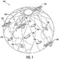
FIG. 1 is a schematic diagram of an exemplary satellite Automatic Identification System (AIS) for tracking a plurality of maritime vessels in accordance with the invention. -
FIG. 2 is a schematic block diagram illustrating an exemplary embodiment of the satellite AIS system ofFIG. 1 in greater detail. -
FIG. 3 is a chart of exemplary Doppler bands and time of arrival (TOA) ranges plotted in accordance with the invention. -
FIG. 4 is a schematic block diagram of the AIS reporting system as shown inFIG. 2 . -
FIG. 5 is a flow diagram illustrating method aspects associated with the system ofFIG. 1 . - The present invention will now be described more fully hereinafter with reference to the accompanying drawings, in which preferred embodiments of the invention are shown. This invention may, however, be embodied in many different forms and should not be construed as limited to the embodiments set forth herein. Rather, these embodiments are provided so that this disclosure will be thorough and complete, and will fully convey the scope of the invention to those skilled in the art. Like numbers refer to like elements throughout.
- The present embodiments take a global view of the vessel position awareness and verification problem. The present embodiments define a data-driven data fusion and distribution system that may provide continuous validation of the vessel reports of the tens of thousands of vessels around the Earth.
- Referring initially to
FIGS. 1 and2 , a satellite Automatic Identification System (AIS) 100 for tracking a plurality ofmaritime vessels 104 is described. In particular, thesystem 100 illustratively includes a constellation of Low-Earth Orbit (LEO)satellites 102. For example, the LEO satellite constellation may be the Iridium NEXT constellation. Each LEOsatellite 102 includes an AIS payload for receiving AIS messages from themaritime vessels 104 and for determining therefrom reported vessel position data and satellite-based observation data. Maritime vessel speeds and headings may also be used. - The
system 100 also includes anAIS reporting system 210 configured to obtain the reported maritime vessel position data and satellite-based observation data from the LEOsatellites 102 over time. The AISreporting system 210 illustratively includes a processor and a memory coupled thereto. In addition, the AISreporting system 210 is configured to filter the reported maritime vessel position data and satellite-based observation data to recursively produce estimated maritime vessel positions (speeds, headings) and update the estimated maritime vessel positions (speeds, headings) for themaritime vessels 104. - In operation, the
maritime vessels 104 may transmit their identity, position data, heading, speed, and other pertinent information (i.e., AIS message content) to the LEOsatellites 102 orbiting the earth. Thetransmissions 202 are decoded by at least one LEOsatellite 102 that receives thetransmissions 202. In turn, this decoded information and satellite-based observation data is sent bytransmissions 204 toground stations 106. Theground stations 106 are in communication with the AISreporting system 210 vianetwork 212, which processes both the vessel data and satellite-based observation data to validate reported positions of the respectivemaritime vessels 104 to generate position validation (PV) data. The PV data is accessible via the Cloud 214 or other network tousers 216. - With additional reference to
FIG. 4 , thesystem 100 is configured to specifically combine different types of data, as available, via a (sequential)filter 220 of theAIS reporting system 210 that compares the consistency of reported position and state vector data from the AIS message content with the satellite-based observations of the vessel's interceptedAIS radio transmissions 202. The filter 220 (such as a Kalman filter) maintains an estimated position and motion state, along with statistical assessments, to provide continuous surveillance. -
Maritime vessels 104 with a high level of correlation between the AIS message content and the satellite-based observations are flagged as a low level of concern and may be monitored at lower rate whilemaritime vessels 104 with either no reported positional data or reports inconsistent with the satellite-based observations may be given higher priority of attention and processing. - The types of satellite-based observation data processed in the
filter 220 may include (1) received AIS message Doppler frequency shift, (2) message time of arrival (TOA) from transmission (for ranging), and (3) time and/or frequency difference of arrival (TDOA/FDOA) for interferometric observations when multiple observations are obtained from different receivers in the constellation ofLEO satellites 102. The known tolerances and uncertainties in the various measurements are used in thefilter 220 in a statistically rigorous fashion to apportion weighting for updates to the state vector (SV) estimates (or tracks). - The use of complementary satellite-based observation types of data provides an inherent ambiguity resolution capability. Although an individual satellite-based observation has a symmetric ambiguity, for the majority of AIS reports (for correctly functioning AIS transceivers) will show the reported position and velocity will lie within the Doppler hyperbolic band, providing confidence that the report is accurate to a certainty that varies as a function of range-rate from the observing platform. If TOA (Range) and Doppler are both available from a single satellite-based observation the uncertainty is further reduced to an ellipse.
- As the AIS signal receiver payloads are hosted in a LEO constellation with sets of
satellites 102 in inertially coplanar orbits, additional ambiguity resolution is accomplished in a number of ways. - For example, when observations are made in tandem between two or
more satellites 102 in the same plane, the ambiguity is resolved by the Earth rotational shift over the relatively short time difference between the successive observations. While the symmetry from a single satellite's observations is apparent, the addition of observations from one or more subsequent satellites shifted in ground track allows a solution set to be in clear agreement. This agreement is inherently exploited by the mathematics of thefilter 220, such that a single subsequent observation (or set of observations) by the next observing satellite refines the solution, without the need to re-process previous observations. The data already stored in the database from the previous update is a sufficient basis to update the track, processing only the new observations. Similarly, when observations are made by satellites from adjacent planes, the ambiguities are readily resolved using TDOA/FDOA techniques as can be appreciated by those of ordinary skill in the art. - The present embodiments may also address each of the known "Misreporting" types. For example, in the case of "Zero MMSI" or "Reused MMSI" reports, the
system 100 is configured to assign a unique identifier to each track using the spatial filtering of the combined report and observation for track association. In response to "181/91" transmissions, which represent an impossible coordinate set of 181 degrees longitude/91 degrees latitude, thesystem 100 is configured to use the spatial filtering inherent in the processing engine when the GPS attached to the AIS receiver is not connected or not functioning. "Flippers", which refers to vessels that reverse the (+/-) numeric sign on the longitude and latitude coordinates to obscure their position, are readily discriminated by sequential filtering of the reports using thesystem 100. GPS jamming, which generates a number of misreporting transceivers in a geographic region is readily identified by thesystem 100 and would be a valuable cautionary report for allmaritime vessels 104. - Referring now to
FIG. 3 , an example of position anomaly detection is now described. For example, at the center is asatellite 300 with itsfootprint 302 plotted on a latitude and longitude axes. The maritime vessel's reported position is indicated at 304. - The two basic elements of satellite-based observations used to generate the PV data are Doppler and Time of Arrival (TOA). These two basic elements can be used to make an initial assessment of the accuracy of intercepted AIS message content. For example, a Doppler
band representing 500Hz 308 and a Doppler band representing -500Hz 310 are plotted inFIG. 3 , with a line of bearing (LOB) 306 therebetween. In addition, ranges of TOA are also plotted with a 94kmrange 316 and a -94km range 314 with a line of position (LOP) 312 therebetween. - If TOA information is not available, the
AIS reporting system 210 is configured to calculate as if the reported position and velocity was within the Doppler band and/or computes a level of confidence in the reported position. This single-intercept assessment will likely be sufficient for the majority of the tens of thousands of intercepted AIS messages.Maritime vessels 104 whose data does not comport with the Doppler and/or TOA calculations are flagged for additional processing by theAIS reporting system 210. - The present embodiments provide a global capability with up-to-date awareness and tracking status information available for dissemination as it is collected. The database-driven approach of the
AIS reporting system 210 separates the data collection and dissemination segment from the computational segment (i.e., filter 220). TheAIS reporting system 210 is configured to filter the reported maritime vessel position data and satellite-based observation data obtained over time along with associated uncertainties, and update the estimated maritime vessel positions using respective weighting values based upon the associated uncertainties. - For example, referring again to
FIG. 4 , new Doppler, TOA or TDOA observation data is collected atBlock 222. That observation data is provided to theexecutive module 224, which is configured to manage data inputs, outputs, and database interactions as well as computational update rates. Theexecutive module 224 provides range and/or Doppler satellite-based observations to thefilter 220 for processing. Partial derivative computations from the satellite-based range and/or Doppler satellite-based observations, atBlock 226, are used to compute gain, atBlock 228. The state and covariance estimates are updated atBlock 230, using observation data and with input from state and covariance estimates propagated to observation time, atBlock 234. The updated state and covariance estimates are then stored in adatabase 232 as the current state and covariance estimates (or tracks). - Due to its sequential nature, the computational
update estimation filter 220 persists for the brief time a processing update occurs as new data is collected. The parameters used to resume computation are read from thedatabase 232 and are the current awareness parameters, allowing thefilter 220 to make the next update in the same manner as though thefilter 220 persisted indefinitely. This approach allows a single or small finite number of filters to be running at any given time, with the same effect as though parallel unique filters were running for allmaritime vessels 104 all the time. Thus, global awareness is constantly maintained by a relatively small computational array. - Because the
database 232 is managed separately, inquiries on anymaritime vessel 104 may be made at any given time, with assurance that the information represents that which is most currently available. Thus, observational data is processed at receipt time, with an efficient update that is saved to thedatabase 232 in a manner that automatically creates a setup for a new estimation update the next time more observations are received. Estimation filters are created and persist only for the time needed to process the new data. - Referring now to the
flowchart 400 ofFIG. 5 , a method for tracking a plurality of maritime vessels in cooperation with a constellation of LEO satellites is now described. Each LEO satellite includes an Automatic Identification System (AIS) payload for receiving AIS messages from the plurality of maritime vessels and determining therefrom reported vessel position data and satellite-based observation data. - After the start (Block 402), the method includes, at
Block 404, operating an AIS processor and memory cooperating therewith to obtain, atBlock 406, the reported maritime vessel position data and satellite-based observation data from the constellation of LEO satellites over time. In addition, the method includes, atBlock 408, to filter the reported maritime vessel position data (speed, heading) and satellite-based observation data obtained over time, to recursively produce estimated maritime vessel positions (speeds, headings), and to update the estimated maritime vessel positions (speeds, headings) for the plurality of maritime vessels. Moving to Block 410, if a maritime vessel is misreporting its identity, an identification is assigned to the misreporting maritime vessel, atBlock 412. In addition, the method includes identifying a position misreporting maritime vessel, atBlock 414, based upon the updated estimated maritime vessel positions (speeds, headings) for the plurality of maritime vessels. The method also includes storing, atBlock 416, the updated estimated maritime vessel positions (speeds, headings) for the plurality of maritime vessels in the tracking database and selectively provide access thereto, before stopping atBlock 418. - Many modifications and other embodiments of the invention will come to the mind of one skilled in the art having the benefit of the teachings presented in the foregoing descriptions and the associated drawings. Therefore, it is understood that the invention is not to be limited to the specific embodiments disclosed, and that modifications and embodiments are intended to be included within the scope of the appended claims.
Claims (10)
- An Automatic Identification System (AIS) reporting system for tracking a plurality of maritime vessels in cooperation with a constellation of Low-Earth Orbit (LEO) satellites, each LEO satellite comprising an AIS payload for receiving AIS messages from the plurality of maritime vessels and determining therefrom reported vessel position data and satellite-based observation data, the AIS reporting system comprising:
an AIS processor and memory cooperating therewith and configured toobtain the reported maritime vessel position data and satellite-based observation data from the constellation of LEO satellites over time, andfilter the reported maritime vessel position data and satellite-based observation data obtained over time, to recursively produce estimated maritime vessel positions and update the estimated maritime vessel positions for the plurality of maritime vessels. - The AIS reporting system according to Claim 1 wherein the AIS processor is configured to filter the reported maritime vessel position data and satellite-based observation data obtained over time using a Kalman filter.
- The AIS reporting system according to Claim 1 wherein the AIS processor is configured to filter the reported maritime vessel position data and satellite-based observation data obtained over time, to recursively produce estimated maritime vessel speeds and headings and update the estimated maritime vessel speeds and headings for the plurality of maritime vessels.
- The AIS reporting system according to Claim 1 wherein the AIS processor is configured to filter the reported maritime vessel position data and satellite-based observation data obtained over time along with associated uncertainties, and update the estimated maritime vessel positions using respective weighting values based upon the associated uncertainties.
- The AIS reporting system according to Claim 1 wherein said AIS processor is configured to identify a position misreporting maritime vessel based upon the updated estimated maritime vessel positions for the plurality of maritime vessels.
- The AIS reporting system according to Claim 1 wherein said AIS processor is configured to assign a unique identification to an identification misreporting maritime vessel.
- The AIS reporting system according to Claim 1 wherein the reported maritime vessel position data is based upon a Global Positioning System (GPS); and wherein said AIS processor is configured to determine a plurality of position misreporting maritime vessels in a geographic area indicative of GPS signal jamming.
- The AIS reporting system according to Claim 1 wherein said AIS processor is configured to obtain the reported maritime vessel position data and satellite-based observation data from a plurality of LEO satellites of the constellation of LEO satellites.
- A method for tracking a plurality of maritime vessels in cooperation with a constellation of Low-Earth Orbit (LEO) satellites, each LEO satellite comprising an Automatic Identification System (AIS) payload for receiving AIS messages from the plurality of maritime vessels and determining therefrom reported vessel position data and satellite-based observation data, the method comprising:
operating an AIS processor and memory cooperating therewith toobtain the reported maritime vessel position data and satellite-based observation data from said constellation of LEO satellites over time, andfilter the reported maritime vessel position data and satellite-based observation data obtained over time, to recursively produce estimated maritime vessel positions and update the estimated maritime vessel positions for the plurality of maritime vessels. - The method according to Claim 9 comprising operating the AIS processor to filter the reported maritime vessel position data and satellite-based observation data obtained over time using a Kalman filter.
Applications Claiming Priority (1)
| Application Number | Priority Date | Filing Date | Title |
|---|---|---|---|
| US16/014,673 US10884138B2 (en) | 2018-06-21 | 2018-06-21 | Satellite automatic identification system (AIS) for tracking a plurality of maritime vessels and related methods |
Publications (2)
| Publication Number | Publication Date |
|---|---|
| EP3588467A1 true EP3588467A1 (en) | 2020-01-01 |
| EP3588467B1 EP3588467B1 (en) | 2023-08-02 |
Family
ID=66826904
Family Applications (1)
| Application Number | Title | Priority Date | Filing Date |
|---|---|---|---|
| EP19179652.3A Active EP3588467B1 (en) | 2018-06-21 | 2019-06-12 | Satellite automatic identification system (ais) for tracking a plurality of maritime vessels and related methods |
Country Status (3)
| Country | Link |
|---|---|
| US (1) | US10884138B2 (en) |
| EP (1) | EP3588467B1 (en) |
| CA (1) | CA3045604C (en) |
Cited By (1)
| Publication number | Priority date | Publication date | Assignee | Title |
|---|---|---|---|---|
| CN113985451A (en) * | 2021-10-25 | 2022-01-28 | 湘潭大学 | Navigation deception detection method and device based on Kalman filtering tracking loop |
Families Citing this family (24)
| Publication number | Priority date | Publication date | Assignee | Title |
|---|---|---|---|---|
| WO2015127540A1 (en) * | 2014-02-25 | 2015-09-03 | Maerospace Corporation | System and method for tracking and forecasting the positions of marine vessels |
| CN109460740B (en) * | 2018-11-15 | 2020-08-11 | 上海埃威航空电子有限公司 | Ship identity recognition method based on AIS and video data fusion |
| CN111624589B (en) * | 2020-04-27 | 2021-11-02 | 中国人民解放军军事科学院国防科技创新研究院 | Marine target data fusion system and method based on space-based radio monitoring |
| CN111914624B (en) * | 2020-06-17 | 2023-08-22 | 交通运输部天津水运工程科学研究所 | A method for identifying ship violations of shutting down AIS using high-resolution satellite imagery |
| US12399274B2 (en) | 2020-07-10 | 2025-08-26 | Skystream LLC | Enhanced LDACS that uses doppler shifts in carrier signals for positioning and navigation |
| CN112182133B (en) * | 2020-09-29 | 2022-02-15 | 南京北斗创新应用科技研究院有限公司 | AIS data-based ship loitering detection method |
| CN113660027B (en) * | 2021-08-05 | 2023-02-28 | 山东星通易航通信科技有限公司 | Dynamic access method of low-orbit satellite in VDES system |
| US12641433B2 (en) * | 2021-11-23 | 2026-05-26 | Windward Ltd. | Identification of replayed maritime voyages |
| CN114500205B (en) * | 2022-01-25 | 2023-08-15 | 新诺北斗航科信息技术(厦门)股份有限公司 | AIS signal decoding method, AIS signal decoding device and storage medium |
| US12352869B2 (en) | 2022-03-17 | 2025-07-08 | Eagle Technology, Llc | Satellite automatic identification system (AIS) for determining actual spoofing maritime vessels and associated geographic spoof sizes and related methods |
| US12270915B2 (en) | 2022-03-17 | 2025-04-08 | Eagle Technology, Llc | Satellite automatic identification system (AIS) for estimating position of potential spoofing maritime vessels and related methods |
| US12061272B2 (en) * | 2022-03-17 | 2024-08-13 | Eagle Technology, Llc | Satellite automatic identification system (AIS) for determining potential spoofing maritime vessels based upon actual frequency of arrival of AIS messages and related methods |
| CN115031837B (en) * | 2022-04-08 | 2023-06-27 | 中国科学院空天信息创新研究院 | Remote sensing load comprehensive calibration method and device |
| CN115065925B (en) * | 2022-04-21 | 2024-10-01 | 广州海晟科技有限公司 | Automatic tracking method for suspicious targets in offshore wind farm based on satellites |
| CN116092272A (en) * | 2022-07-19 | 2023-05-09 | 广西星烁照明工程有限公司 | Intelligent warning system for three-dimensional sea defense |
| CN115662191B (en) * | 2022-09-30 | 2025-05-02 | 广州博进信息技术有限公司 | A method and device for detecting ship positioning signal |
| JP7734880B2 (en) * | 2023-05-22 | 2025-09-05 | 三菱電機株式会社 | Positioning device and positioning method |
| CN118450328B (en) * | 2024-05-23 | 2024-11-29 | 北京云信航天科技有限公司 | AIS navigation guidance method and system based on satellite communication |
| CN118364429B (en) * | 2024-06-19 | 2024-08-30 | 航天东方红卫星有限公司 | Track association method for large-scale constellation unbalanced coverage detection |
| CN118839522B (en) * | 2024-07-25 | 2025-03-18 | 盛航(台州)科技有限公司 | Satellite-borne AIS payload full-link simulation and ship detection probability assessment system |
| CN120998065B (en) * | 2025-07-30 | 2026-07-21 | 亿海蓝(北京)数据技术股份公司 | Method and device for identifying leaning behavior, electronic equipment, readable storage medium and chip |
| CN120993441B (en) * | 2025-10-22 | 2026-01-06 | 自然资源部北海预报减灾中心(自然资源部青岛海洋中心) | A multi-sensor fusion intelligent collision avoidance method and system |
| CN121459205B (en) * | 2025-12-31 | 2026-03-17 | 安徽雷图科技有限公司 | An Optimization Method and System for Moving Ship Tracking Task Based on ADMM Algorithm |
| CN121902302B (en) * | 2026-01-23 | 2026-06-19 | 中国人民解放军军事航天部队航天工程大学 | Large-scale low-orbit satellite constellation system efficiency analysis method facing marine moving target detection task |
Citations (3)
| Publication number | Priority date | Publication date | Assignee | Title |
|---|---|---|---|---|
| US7817079B1 (en) * | 2008-04-17 | 2010-10-19 | The United States Of America As Represented By The Secretary Of The Navy | System and method for collection of global AIS and radar track information |
| US20170102466A1 (en) * | 2015-10-09 | 2017-04-13 | Harris Corporation | Systems and methods for space-based geolocation of vessels using maritime signals transmitted therefrom |
| US20180123680A1 (en) * | 2006-05-30 | 2018-05-03 | Orbcomm Inc | Space based network for detection and monitoring of global maritime shipping using automatic identification system |
Family Cites Families (18)
| Publication number | Priority date | Publication date | Assignee | Title |
|---|---|---|---|---|
| WO1999040692A1 (en) * | 1998-02-06 | 1999-08-12 | The Government Of The United States Of America,_Represented By The Secretary Of The Navy | Orbit/covariance estimation and analysis (ocean) determination for satellites |
| US6496778B1 (en) * | 2000-09-14 | 2002-12-17 | American Gnc Corporation | Real-time integrated vehicle positioning method and system with differential GPS |
| US7667642B1 (en) * | 2005-08-15 | 2010-02-23 | Technaumics | Acquisition, collection and processing system for continuous precision tracking of objects |
| US7372400B2 (en) * | 2005-11-07 | 2008-05-13 | The Boeing Company | Methods and apparatus for a navigation system with reduced susceptibility to interference and jamming |
| US8296051B2 (en) * | 2006-05-18 | 2012-10-23 | The Boeing Company | Generalized high performance navigation system |
| US9057606B2 (en) * | 2009-09-10 | 2015-06-16 | Nextnav, Llc | Wide area positioning system |
| US8831906B1 (en) * | 2011-04-08 | 2014-09-09 | Exelis Inc. | Technique for determining closest point of approach |
| US9176217B2 (en) * | 2011-08-02 | 2015-11-03 | Nextnav, Llc | Cell organization and transmission schemes in a wide area positioning system (WAPS) |
| US10027952B2 (en) * | 2011-08-04 | 2018-07-17 | Trx Systems, Inc. | Mapping and tracking system with features in three-dimensional space |
| US9429437B2 (en) * | 2012-06-08 | 2016-08-30 | Apple Inc. | Determining location and direction of travel using map vector constraints |
| US9880286B2 (en) * | 2012-12-28 | 2018-01-30 | Trimble Inc. | Locally measured movement smoothing of position fixes based on extracted pseudoranges |
| US20140218242A1 (en) | 2013-02-01 | 2014-08-07 | NanoSatisfi Inc. | Computerized nano-satellite platform for large ocean vessel tracking |
| US9110157B2 (en) * | 2013-03-12 | 2015-08-18 | Intel Corporation | Using multiple sources of location-aid data to determine position information |
| KR101854819B1 (en) * | 2013-09-30 | 2018-06-14 | 인텔 아이피 코포레이션 | Filtering for global positioning system (gps) receivers |
| FR3028310A1 (en) * | 2014-11-07 | 2016-05-13 | Thales Sa | METHOD FOR DETERMINING A PROTECTIVE RADIUS ASSOCIATED WITH A NAVIGATION PARAMETER OF A HYBRID INERTIAL NAVIGATION SYSTEM, AND SYSTEM THEREOF |
| IL239103B (en) * | 2015-05-31 | 2020-08-31 | Ben Moshe Boaz | Navigation system interference locator |
| US9786183B2 (en) | 2015-06-30 | 2017-10-10 | Exactearth Ltd. | Systems and methods for vessel position reporting and monitoring |
| US10795029B2 (en) * | 2017-02-14 | 2020-10-06 | United States Of America As Represented By The Secretary Of The Navy | Systems and methods for transmitting ship positions and tracks over multiple communications channels |
-
2018
- 2018-06-21 US US16/014,673 patent/US10884138B2/en active Active
-
2019
- 2019-06-07 CA CA3045604A patent/CA3045604C/en active Active
- 2019-06-12 EP EP19179652.3A patent/EP3588467B1/en active Active
Patent Citations (3)
| Publication number | Priority date | Publication date | Assignee | Title |
|---|---|---|---|---|
| US20180123680A1 (en) * | 2006-05-30 | 2018-05-03 | Orbcomm Inc | Space based network for detection and monitoring of global maritime shipping using automatic identification system |
| US7817079B1 (en) * | 2008-04-17 | 2010-10-19 | The United States Of America As Represented By The Secretary Of The Navy | System and method for collection of global AIS and radar track information |
| US20170102466A1 (en) * | 2015-10-09 | 2017-04-13 | Harris Corporation | Systems and methods for space-based geolocation of vessels using maritime signals transmitted therefrom |
Cited By (2)
| Publication number | Priority date | Publication date | Assignee | Title |
|---|---|---|---|---|
| CN113985451A (en) * | 2021-10-25 | 2022-01-28 | 湘潭大学 | Navigation deception detection method and device based on Kalman filtering tracking loop |
| CN113985451B (en) * | 2021-10-25 | 2022-11-15 | 湘潭大学 | Navigation deception detection method and device based on Kalman filtering tracking loop |
Also Published As
| Publication number | Publication date |
|---|---|
| US10884138B2 (en) | 2021-01-05 |
| EP3588467B1 (en) | 2023-08-02 |
| US20190391277A1 (en) | 2019-12-26 |
| CA3045604A1 (en) | 2019-12-21 |
| CA3045604C (en) | 2021-01-19 |
Similar Documents
| Publication | Publication Date | Title |
|---|---|---|
| CA3045604C (en) | Satellite automatic identification system (ais) for tracking a plurality of maritime vessels and related methods | |
| US20230384462A1 (en) | System and method for tracking and forecasting the positions of marine vessels | |
| US8446310B2 (en) | Method and system for locating signal jammers | |
| EP2801838B1 (en) | Evaluating the position of an aerial vehicle | |
| CA2426954C (en) | System and method for fast acquisition reporting using communication satellite range measurement | |
| JP5329409B2 (en) | A method for fusing multiple GPS measurement types into a weighted least squares solution | |
| CN108693545A (en) | Abnormal target positioning method based on satellite-borne ADS-B | |
| AU2004301199A1 (en) | A method and apparatus for finding a mobile radio terminal | |
| WO2005116682A1 (en) | An arrangement for accurate location of objects | |
| CN104134373A (en) | Device, system and methods using angle of arrival measurements for ADS-B authentication and navigation | |
| WO1998002762A2 (en) | Method and apparatus for precision geolocation | |
| US20180123680A1 (en) | Space based network for detection and monitoring of global maritime shipping using automatic identification system | |
| US11747482B2 (en) | APNT service positioning and integrity monitoring method and system | |
| US12061272B2 (en) | Satellite automatic identification system (AIS) for determining potential spoofing maritime vessels based upon actual frequency of arrival of AIS messages and related methods | |
| US6600444B2 (en) | System and method for computing navigation information in the presence of interference | |
| KR101366819B1 (en) | Method and apparatus for overcoming of gps signal disturbance of system using the data link, and computer readable recording medium thereof | |
| Dolan et al. | Aireon space based aircraft position validation and multilateration solution | |
| WO2018152465A1 (en) | Receiver integrity monitoring using doppler analysis | |
| EP4495635A1 (en) | Detecting spoofing in a global navigation satellite system (gnss) using slant range distance | |
| US12270915B2 (en) | Satellite automatic identification system (AIS) for estimating position of potential spoofing maritime vessels and related methods | |
| US20230296784A1 (en) | Satellite automatic identification system (ais) for determining actual spoofing maritime vessels and associated geographic spoof sizes and related methods | |
| Helfrick | Question: Alternate position, navigation timing, APNT? Answer: ELORAN | |
| US11698461B1 (en) | GPS denial detection and reporting and mitigation | |
| Shevtsov et al. | A Method for Increasing the Capacity of Radio Systems of Short-Range Navigation | |
| WO2023287483A9 (en) | Avionics-free global aviation surveillance systems and processes |
Legal Events
| Date | Code | Title | Description |
|---|---|---|---|
| PUAI | Public reference made under article 153(3) epc to a published international application that has entered the european phase |
Free format text: ORIGINAL CODE: 0009012 |
|
| STAA | Information on the status of an ep patent application or granted ep patent |
Free format text: STATUS: REQUEST FOR EXAMINATION WAS MADE |
|
| 17P | Request for examination filed |
Effective date: 20190612 |
|
| AK | Designated contracting states |
Kind code of ref document: A1 Designated state(s): AL AT BE BG CH CY CZ DE DK EE ES FI FR GB GR HR HU IE IS IT LI LT LU LV MC MK MT NL NO PL PT RO RS SE SI SK SM TR |
|
| AX | Request for extension of the european patent |
Extension state: BA ME |
|
| STAA | Information on the status of an ep patent application or granted ep patent |
Free format text: STATUS: EXAMINATION IS IN PROGRESS |
|
| 17Q | First examination report despatched |
Effective date: 20211124 |
|
| GRAP | Despatch of communication of intention to grant a patent |
Free format text: ORIGINAL CODE: EPIDOSNIGR1 |
|
| STAA | Information on the status of an ep patent application or granted ep patent |
Free format text: STATUS: GRANT OF PATENT IS INTENDED |
|
| INTG | Intention to grant announced |
Effective date: 20230118 |
|
| GRAS | Grant fee paid |
Free format text: ORIGINAL CODE: EPIDOSNIGR3 |
|
| P01 | Opt-out of the competence of the unified patent court (upc) registered |
Effective date: 20230515 |
|
| GRAA | (expected) grant |
Free format text: ORIGINAL CODE: 0009210 |
|
| STAA | Information on the status of an ep patent application or granted ep patent |
Free format text: STATUS: THE PATENT HAS BEEN GRANTED |
|
| AK | Designated contracting states |
Kind code of ref document: B1 Designated state(s): AL AT BE BG CH CY CZ DE DK EE ES FI FR GB GR HR HU IE IS IT LI LT LU LV MC MK MT NL NO PL PT RO RS SE SI SK SM TR |
|
| REG | Reference to a national code |
Ref country code: GB Ref legal event code: FG4D |
|
| REG | Reference to a national code |
Ref country code: CH Ref legal event code: EP |
|
| REG | Reference to a national code |
Ref country code: DE Ref legal event code: R096 Ref document number: 602019033885 Country of ref document: DE |
|
| REG | Reference to a national code |
Ref country code: IE Ref legal event code: FG4D |
|
| REG | Reference to a national code |
Ref country code: LT Ref legal event code: MG9D |
|
| REG | Reference to a national code |
Ref country code: NL Ref legal event code: MP Effective date: 20230802 |
|
| REG | Reference to a national code |
Ref country code: AT Ref legal event code: MK05 Ref document number: 1595703 Country of ref document: AT Kind code of ref document: T Effective date: 20230802 |
|
| PG25 | Lapsed in a contracting state [announced via postgrant information from national office to epo] |
Ref country code: GR Free format text: LAPSE BECAUSE OF FAILURE TO SUBMIT A TRANSLATION OF THE DESCRIPTION OR TO PAY THE FEE WITHIN THE PRESCRIBED TIME-LIMIT Effective date: 20231103 |
|
| PG25 | Lapsed in a contracting state [announced via postgrant information from national office to epo] |
Ref country code: IS Free format text: LAPSE BECAUSE OF FAILURE TO SUBMIT A TRANSLATION OF THE DESCRIPTION OR TO PAY THE FEE WITHIN THE PRESCRIBED TIME-LIMIT Effective date: 20231202 |
|
| PG25 | Lapsed in a contracting state [announced via postgrant information from national office to epo] |
Ref country code: SE Free format text: LAPSE BECAUSE OF FAILURE TO SUBMIT A TRANSLATION OF THE DESCRIPTION OR TO PAY THE FEE WITHIN THE PRESCRIBED TIME-LIMIT Effective date: 20230802 Ref country code: RS Free format text: LAPSE BECAUSE OF FAILURE TO SUBMIT A TRANSLATION OF THE DESCRIPTION OR TO PAY THE FEE WITHIN THE PRESCRIBED TIME-LIMIT Effective date: 20230802 Ref country code: PT Free format text: LAPSE BECAUSE OF FAILURE TO SUBMIT A TRANSLATION OF THE DESCRIPTION OR TO PAY THE FEE WITHIN THE PRESCRIBED TIME-LIMIT Effective date: 20231204 Ref country code: NO Free format text: LAPSE BECAUSE OF FAILURE TO SUBMIT A TRANSLATION OF THE DESCRIPTION OR TO PAY THE FEE WITHIN THE PRESCRIBED TIME-LIMIT Effective date: 20231102 Ref country code: NL Free format text: LAPSE BECAUSE OF FAILURE TO SUBMIT A TRANSLATION OF THE DESCRIPTION OR TO PAY THE FEE WITHIN THE PRESCRIBED TIME-LIMIT Effective date: 20230802 Ref country code: LV Free format text: LAPSE BECAUSE OF FAILURE TO SUBMIT A TRANSLATION OF THE DESCRIPTION OR TO PAY THE FEE WITHIN THE PRESCRIBED TIME-LIMIT Effective date: 20230802 Ref country code: LT Free format text: LAPSE BECAUSE OF FAILURE TO SUBMIT A TRANSLATION OF THE DESCRIPTION OR TO PAY THE FEE WITHIN THE PRESCRIBED TIME-LIMIT Effective date: 20230802 Ref country code: IS Free format text: LAPSE BECAUSE OF FAILURE TO SUBMIT A TRANSLATION OF THE DESCRIPTION OR TO PAY THE FEE WITHIN THE PRESCRIBED TIME-LIMIT Effective date: 20231202 Ref country code: HR Free format text: LAPSE BECAUSE OF FAILURE TO SUBMIT A TRANSLATION OF THE DESCRIPTION OR TO PAY THE FEE WITHIN THE PRESCRIBED TIME-LIMIT Effective date: 20230802 Ref country code: GR Free format text: LAPSE BECAUSE OF FAILURE TO SUBMIT A TRANSLATION OF THE DESCRIPTION OR TO PAY THE FEE WITHIN THE PRESCRIBED TIME-LIMIT Effective date: 20231103 Ref country code: FI Free format text: LAPSE BECAUSE OF FAILURE TO SUBMIT A TRANSLATION OF THE DESCRIPTION OR TO PAY THE FEE WITHIN THE PRESCRIBED TIME-LIMIT Effective date: 20230802 Ref country code: AT Free format text: LAPSE BECAUSE OF FAILURE TO SUBMIT A TRANSLATION OF THE DESCRIPTION OR TO PAY THE FEE WITHIN THE PRESCRIBED TIME-LIMIT Effective date: 20230802 |
|
| PG25 | Lapsed in a contracting state [announced via postgrant information from national office to epo] |
Ref country code: PL Free format text: LAPSE BECAUSE OF FAILURE TO SUBMIT A TRANSLATION OF THE DESCRIPTION OR TO PAY THE FEE WITHIN THE PRESCRIBED TIME-LIMIT Effective date: 20230802 |
|
| PG25 | Lapsed in a contracting state [announced via postgrant information from national office to epo] |
Ref country code: ES Free format text: LAPSE BECAUSE OF FAILURE TO SUBMIT A TRANSLATION OF THE DESCRIPTION OR TO PAY THE FEE WITHIN THE PRESCRIBED TIME-LIMIT Effective date: 20230802 |
|
| PG25 | Lapsed in a contracting state [announced via postgrant information from national office to epo] |
Ref country code: SM Free format text: LAPSE BECAUSE OF FAILURE TO SUBMIT A TRANSLATION OF THE DESCRIPTION OR TO PAY THE FEE WITHIN THE PRESCRIBED TIME-LIMIT Effective date: 20230802 Ref country code: RO Free format text: LAPSE BECAUSE OF FAILURE TO SUBMIT A TRANSLATION OF THE DESCRIPTION OR TO PAY THE FEE WITHIN THE PRESCRIBED TIME-LIMIT Effective date: 20230802 Ref country code: ES Free format text: LAPSE BECAUSE OF FAILURE TO SUBMIT A TRANSLATION OF THE DESCRIPTION OR TO PAY THE FEE WITHIN THE PRESCRIBED TIME-LIMIT Effective date: 20230802 Ref country code: EE Free format text: LAPSE BECAUSE OF FAILURE TO SUBMIT A TRANSLATION OF THE DESCRIPTION OR TO PAY THE FEE WITHIN THE PRESCRIBED TIME-LIMIT Effective date: 20230802 Ref country code: DK Free format text: LAPSE BECAUSE OF FAILURE TO SUBMIT A TRANSLATION OF THE DESCRIPTION OR TO PAY THE FEE WITHIN THE PRESCRIBED TIME-LIMIT Effective date: 20230802 Ref country code: CZ Free format text: LAPSE BECAUSE OF FAILURE TO SUBMIT A TRANSLATION OF THE DESCRIPTION OR TO PAY THE FEE WITHIN THE PRESCRIBED TIME-LIMIT Effective date: 20230802 Ref country code: SK Free format text: LAPSE BECAUSE OF FAILURE TO SUBMIT A TRANSLATION OF THE DESCRIPTION OR TO PAY THE FEE WITHIN THE PRESCRIBED TIME-LIMIT Effective date: 20230802 |
|
| REG | Reference to a national code |
Ref country code: DE Ref legal event code: R097 Ref document number: 602019033885 Country of ref document: DE |
|
| PG25 | Lapsed in a contracting state [announced via postgrant information from national office to epo] |
Ref country code: IT Free format text: LAPSE BECAUSE OF FAILURE TO SUBMIT A TRANSLATION OF THE DESCRIPTION OR TO PAY THE FEE WITHIN THE PRESCRIBED TIME-LIMIT Effective date: 20230802 |
|
| PLBE | No opposition filed within time limit |
Free format text: ORIGINAL CODE: 0009261 |
|
| STAA | Information on the status of an ep patent application or granted ep patent |
Free format text: STATUS: NO OPPOSITION FILED WITHIN TIME LIMIT |
|
| 26N | No opposition filed |
Effective date: 20240503 |
|
| PG25 | Lapsed in a contracting state [announced via postgrant information from national office to epo] |
Ref country code: SI Free format text: LAPSE BECAUSE OF FAILURE TO SUBMIT A TRANSLATION OF THE DESCRIPTION OR TO PAY THE FEE WITHIN THE PRESCRIBED TIME-LIMIT Effective date: 20230802 |
|
| PG25 | Lapsed in a contracting state [announced via postgrant information from national office to epo] |
Ref country code: BG Free format text: LAPSE BECAUSE OF FAILURE TO SUBMIT A TRANSLATION OF THE DESCRIPTION OR TO PAY THE FEE WITHIN THE PRESCRIBED TIME-LIMIT Effective date: 20230802 |
|
| PG25 | Lapsed in a contracting state [announced via postgrant information from national office to epo] |
Ref country code: BG Free format text: LAPSE BECAUSE OF FAILURE TO SUBMIT A TRANSLATION OF THE DESCRIPTION OR TO PAY THE FEE WITHIN THE PRESCRIBED TIME-LIMIT Effective date: 20230802 |
|
| PG25 | Lapsed in a contracting state [announced via postgrant information from national office to epo] |
Ref country code: MC Free format text: LAPSE BECAUSE OF FAILURE TO SUBMIT A TRANSLATION OF THE DESCRIPTION OR TO PAY THE FEE WITHIN THE PRESCRIBED TIME-LIMIT Effective date: 20230802 |
|
| REG | Reference to a national code |
Ref country code: CH Ref legal event code: PL |
|
| PG25 | Lapsed in a contracting state [announced via postgrant information from national office to epo] |
Ref country code: LU Free format text: LAPSE BECAUSE OF NON-PAYMENT OF DUE FEES Effective date: 20240612 |
|
| PG25 | Lapsed in a contracting state [announced via postgrant information from national office to epo] |
Ref country code: IE Free format text: LAPSE BECAUSE OF NON-PAYMENT OF DUE FEES Effective date: 20240612 |
|
| PG25 | Lapsed in a contracting state [announced via postgrant information from national office to epo] |
Ref country code: BE Free format text: LAPSE BECAUSE OF NON-PAYMENT OF DUE FEES Effective date: 20240630 Ref country code: CH Free format text: LAPSE BECAUSE OF NON-PAYMENT OF DUE FEES Effective date: 20240630 |
|
| PG25 | Lapsed in a contracting state [announced via postgrant information from national office to epo] |
Ref country code: FR Free format text: LAPSE BECAUSE OF NON-PAYMENT OF DUE FEES Effective date: 20240630 |
|
| REG | Reference to a national code |
Ref country code: BE Ref legal event code: MM Effective date: 20240630 |
|
| PG25 | Lapsed in a contracting state [announced via postgrant information from national office to epo] |
Ref country code: CY Free format text: LAPSE BECAUSE OF FAILURE TO SUBMIT A TRANSLATION OF THE DESCRIPTION OR TO PAY THE FEE WITHIN THE PRESCRIBED TIME-LIMIT; INVALID AB INITIO Effective date: 20190612 |
|
| PG25 | Lapsed in a contracting state [announced via postgrant information from national office to epo] |
Ref country code: HU Free format text: LAPSE BECAUSE OF FAILURE TO SUBMIT A TRANSLATION OF THE DESCRIPTION OR TO PAY THE FEE WITHIN THE PRESCRIBED TIME-LIMIT; INVALID AB INITIO Effective date: 20190612 |
|
| PG25 | Lapsed in a contracting state [announced via postgrant information from national office to epo] |
Ref country code: TR Free format text: LAPSE BECAUSE OF FAILURE TO SUBMIT A TRANSLATION OF THE DESCRIPTION OR TO PAY THE FEE WITHIN THE PRESCRIBED TIME-LIMIT Effective date: 20230802 |
|
| PGFP | Annual fee paid to national office [announced via postgrant information from national office to epo] |
Ref country code: GB Payment date: 20260629 Year of fee payment: 8 |
|
| PGFP | Annual fee paid to national office [announced via postgrant information from national office to epo] |
Ref country code: DE Payment date: 20260629 Year of fee payment: 8 |